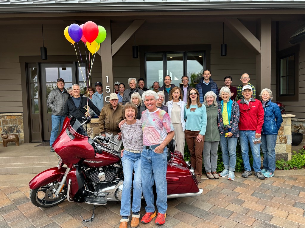
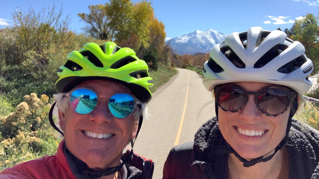
This summer marks 25 years together for me and Sarah.
That gives us a reason to celebrate. Or, at least to take a bike ride.
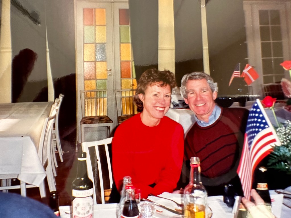
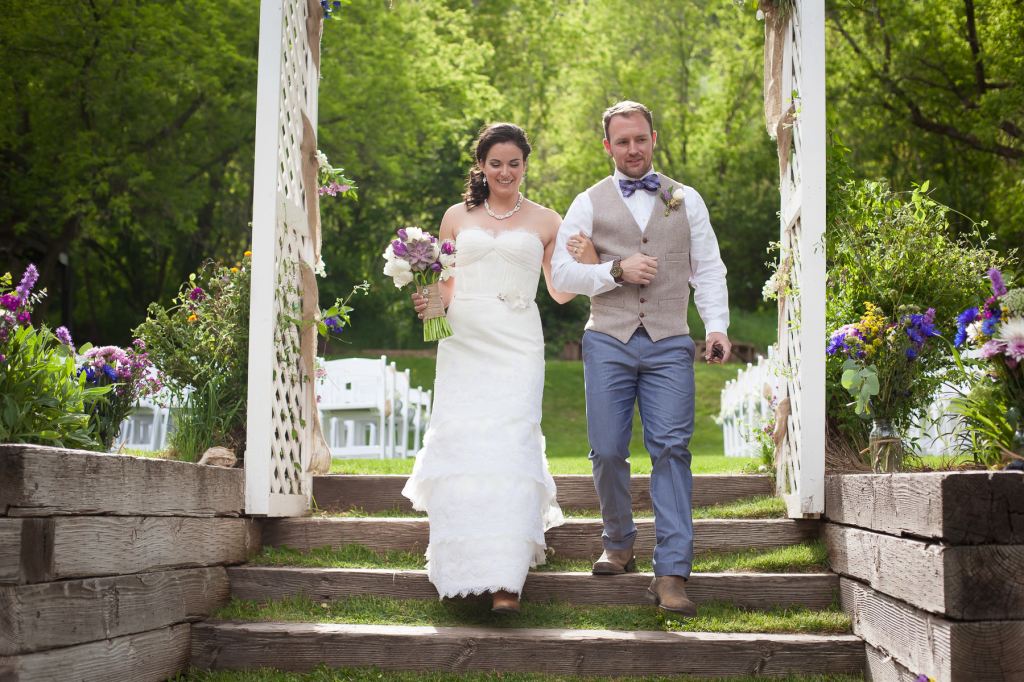
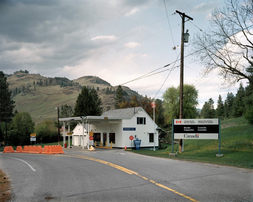
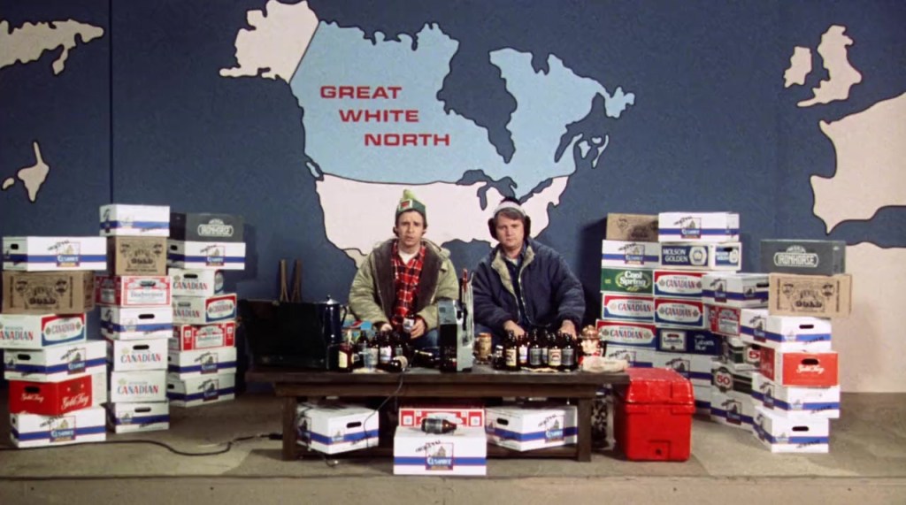
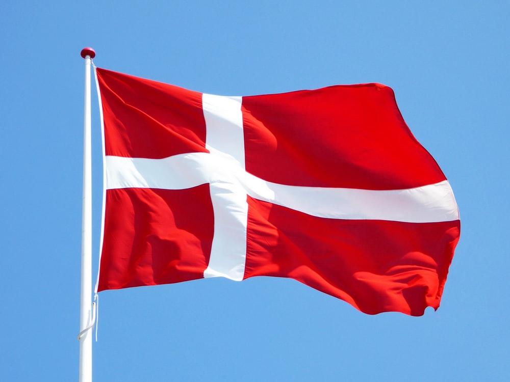
We were married near Copenhagen, Denmark, at the end of the 20th century. So we chose to honor our silver anniversary by visiting yet another country — Canada.
In Dragør, Denmark. Wedding day.
For the next six days, we’ll be riding bicycles in beautiful Nova Scotia, one of Canada’s three maritime provinces. Nova Scotia was one of the four original provinces, along with New Brunswick, Ontario and Quebec, that constituted the Dominion of Canada in 1867.
The province comprises the peninsula of Nova Scotia, Cape Breton Island, and a number of small adjacent islands. Nova Scotia is almost completely surrounded by the North Atlantic Ocean; no point in the province is more than 35 miles from the ocean. Its past and present are tied closely to the maritime life of fishing, shipbuilding, and transatlantic shipping.
During our bike ride, we expect to consume a bountiful harvest of seafood. It may be my first trip in years that doesn’t include a staple of burger-and-fries.
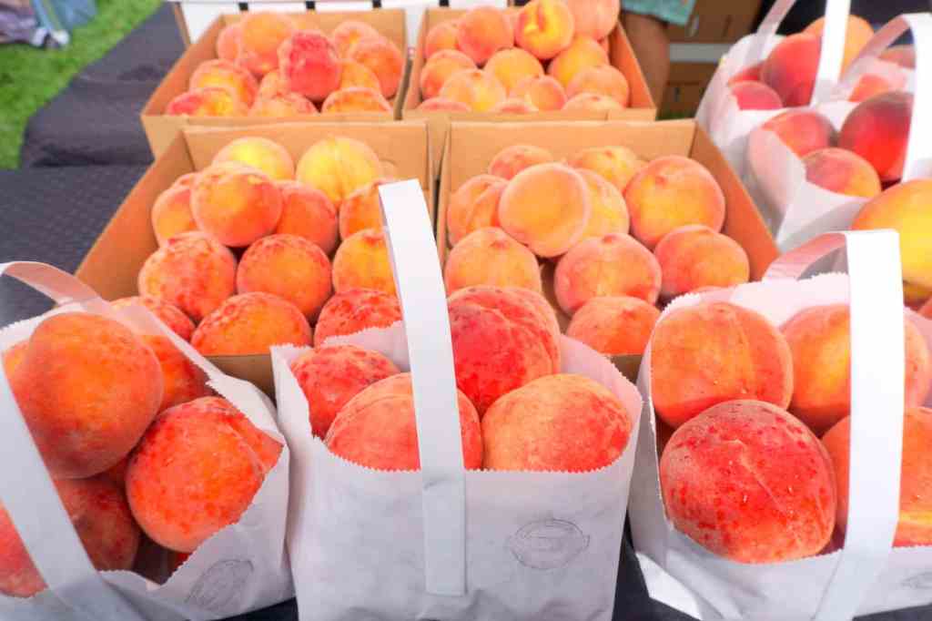
Mussels from nearby Prince Edward Island should be plentiful.
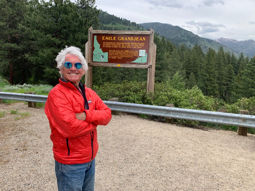
Nova Scotia, which is Latin for “New Scotland,” is about 2,800 miles from Carbondale. The name — Nova Scotia — was the result of brief Scottish claims to the region in the 1620s.
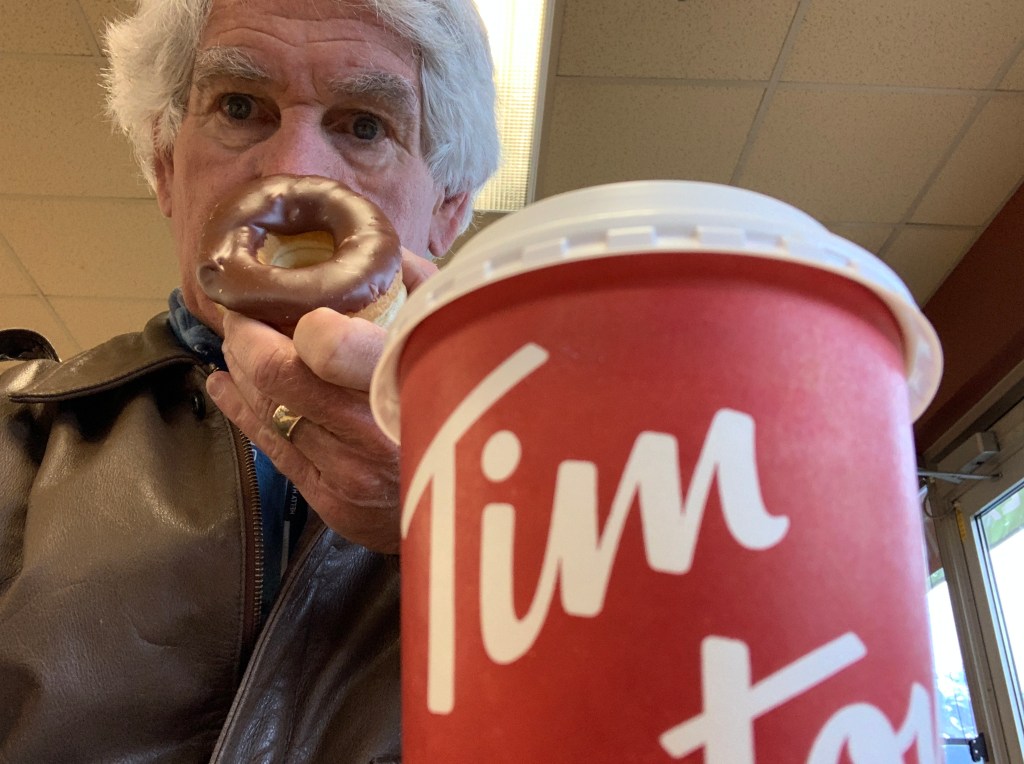
Tonight, on the eve of our ride, we are in the provincial capital of Halifax, the most visited destination in all of Nova Scotia. Halifax is a major international seaport, with a population of about 480,000. A seaport, of course, means seafood, and no food from the North Atlantic is more prized than lobster.
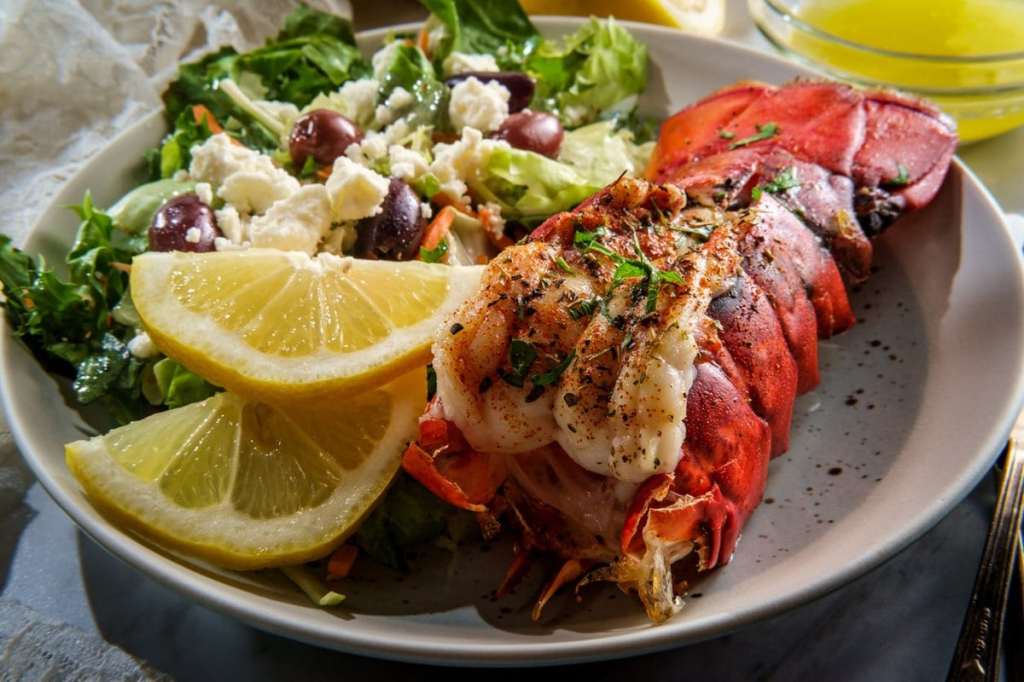
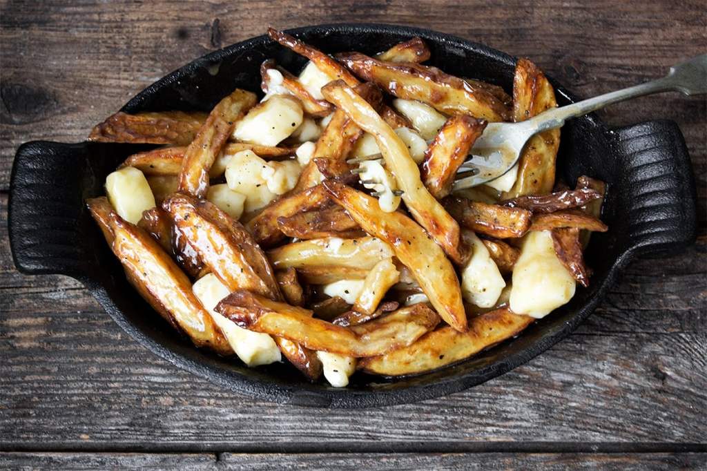
Nova Scotia is world-famous for its lobster. From a traditional lobster dinner to a beach side lobster boil to lobster rolls, creamed lobster, lobster poutine and even lobster beer, we expect some form of lobster on our dinner table every night for the next eight days as we explore the island province.
Pretty sure there’s some lobster in our future over the next week.
Lobster was not initially considered a delicacy in Nova Scotia. It was the children of poorer families who had to bring lobster sandwiches to school because they couldn’t afford the “better” meats that the wealthier families enjoyed.
The tin can deserves credit for the beginnings of the lobster fishing industry in this area. Nova Scotia’s first cannery opened in 1858, allowing residents to ship seafood to other parts of the world. But modern transportation truly changed the lobster industry, as it allowed live lobsters to be transported from rural outposts to large urban centers.
On this trip, we don’t plan to fish. But we certainly will consume it. Lobster, mussels, scallops, haddock, halibut, and oysters will find their way onto our plates — morning, noon and night.
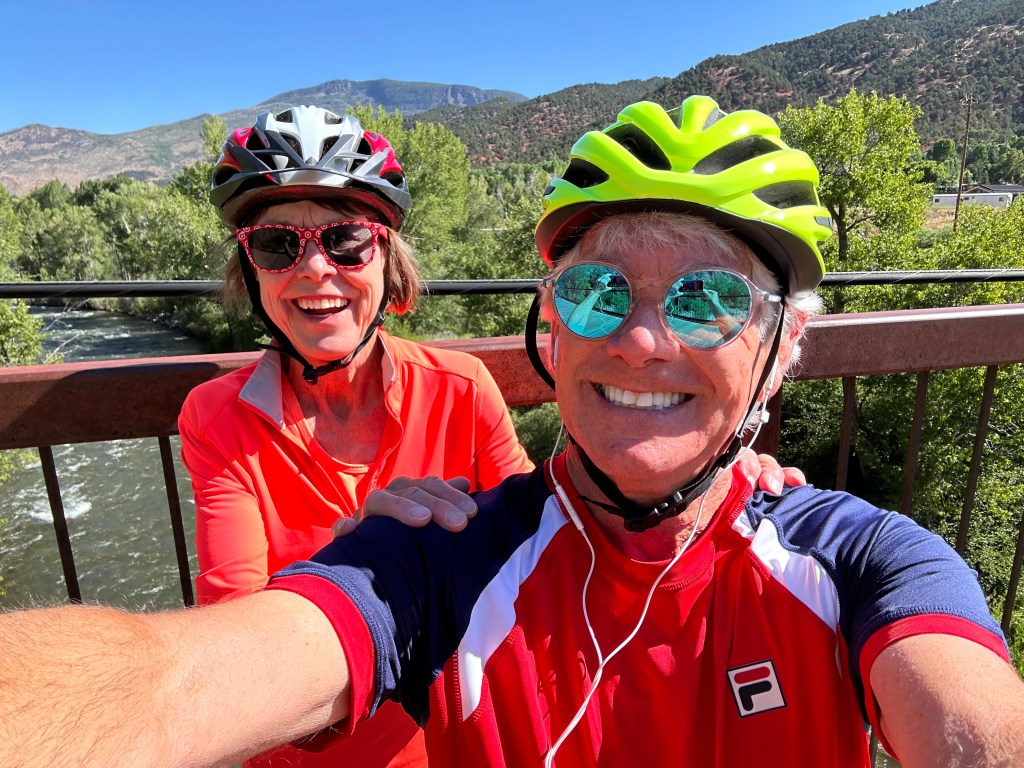
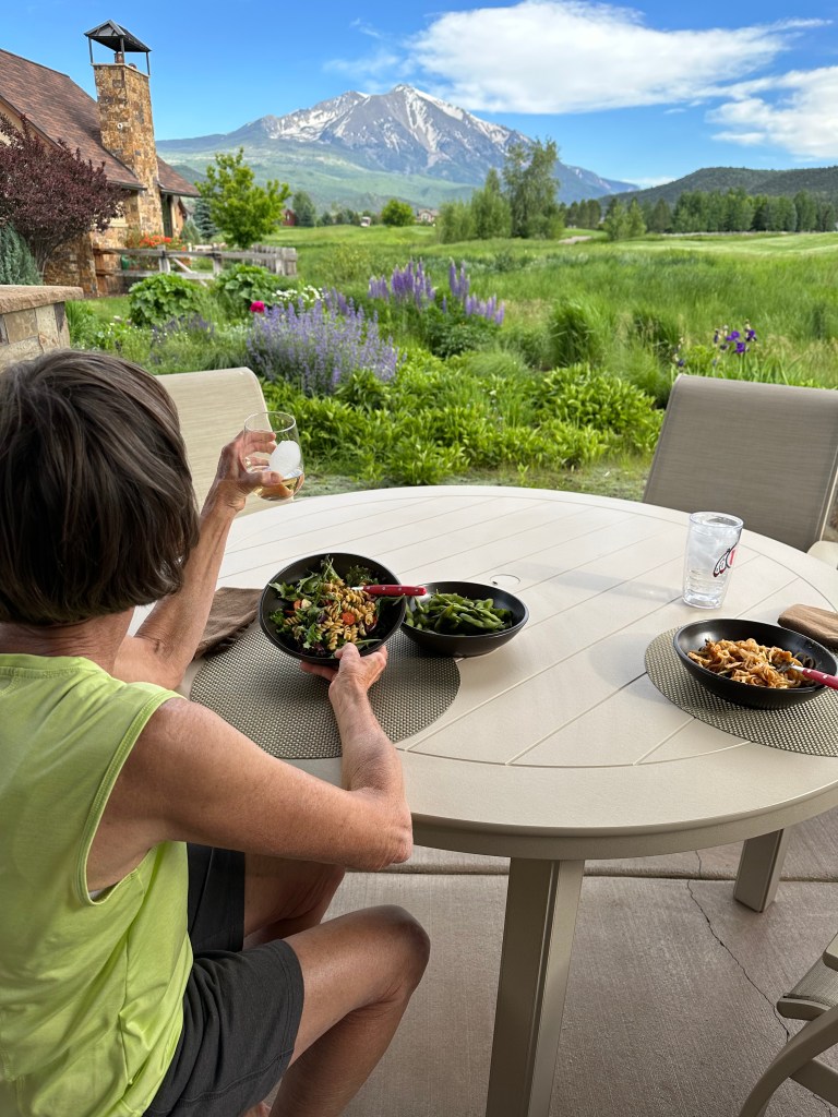
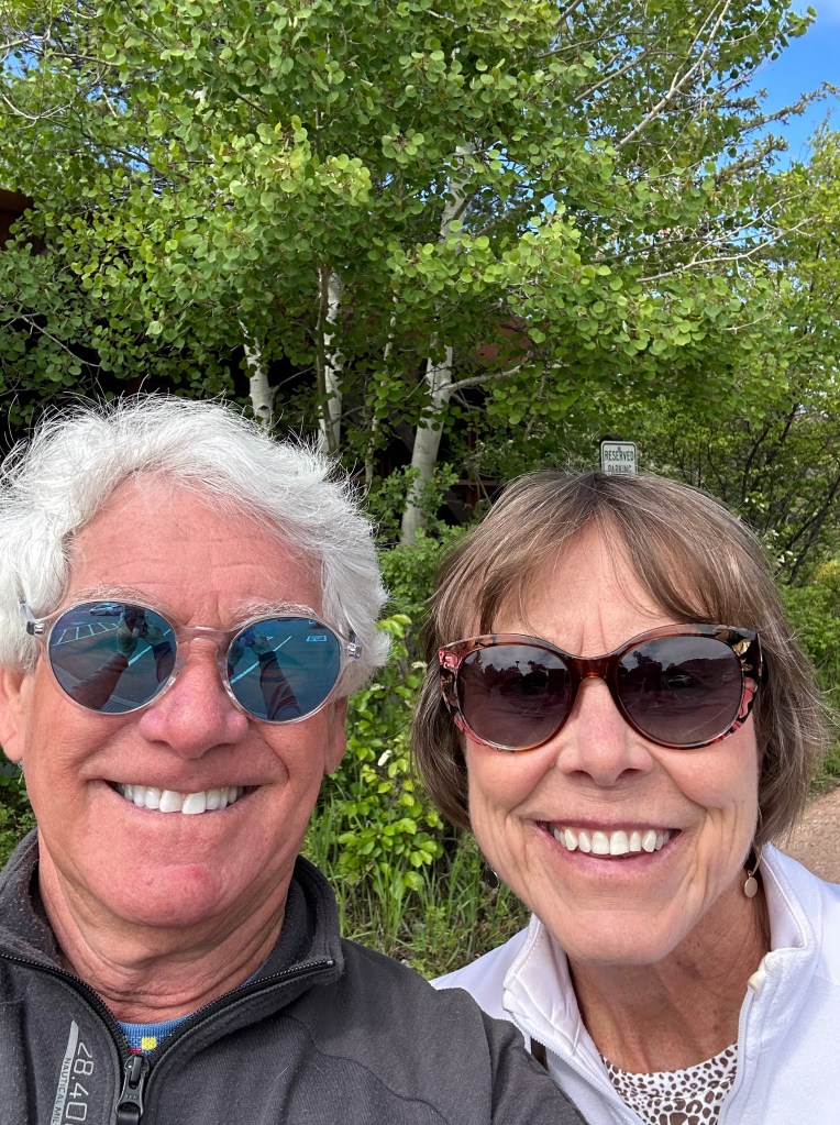
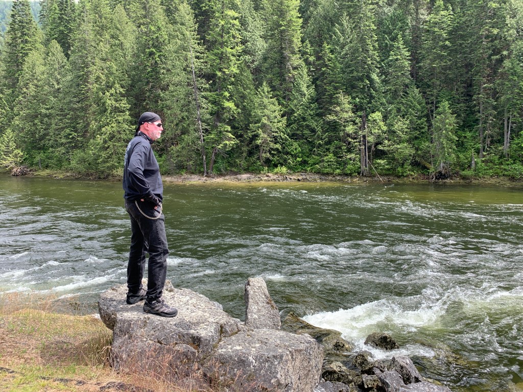
Overlooking the Roaring Fork River, near Basalt, Colorado, on a recent training ride.
Tomorrow, we join 15 other riders and begin pedaling.
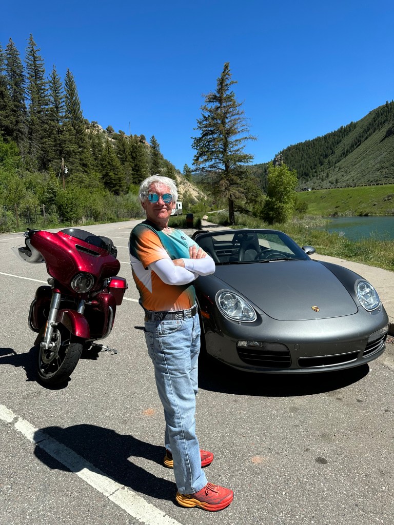
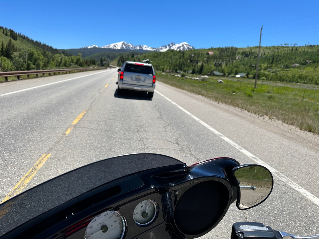
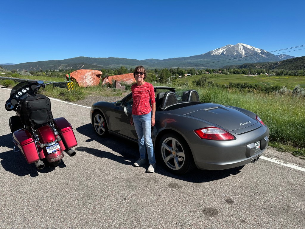
One last day of the vehicle caravan. By tonight, the Harley, Boxster, Sarah and I will all be home.
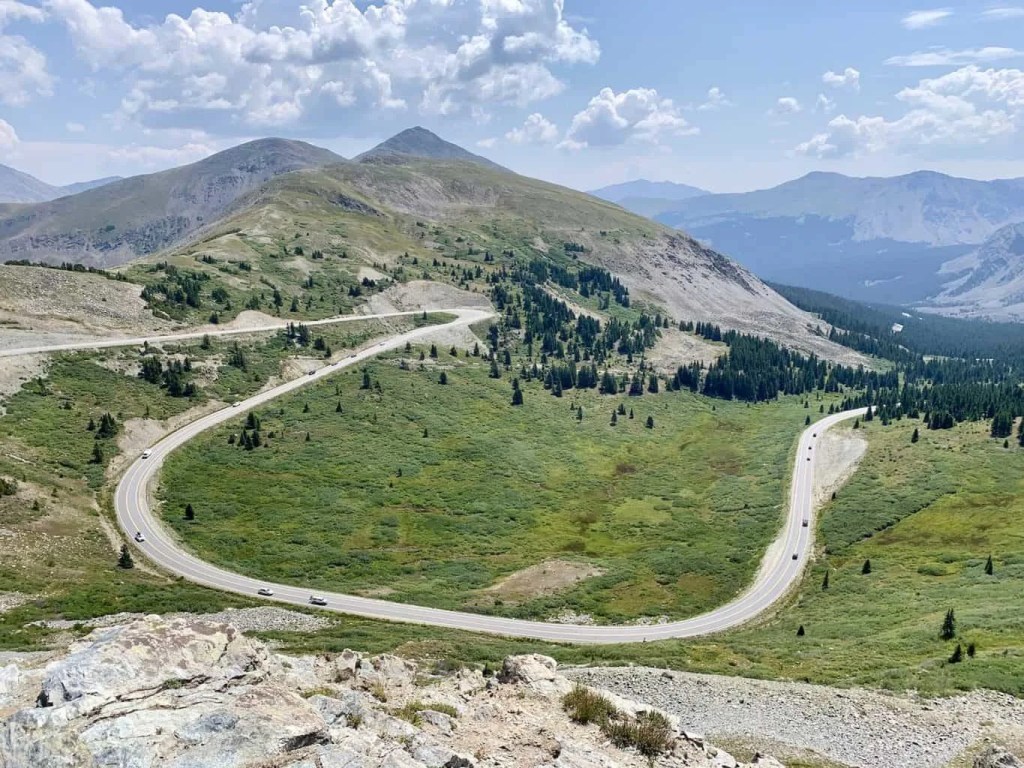
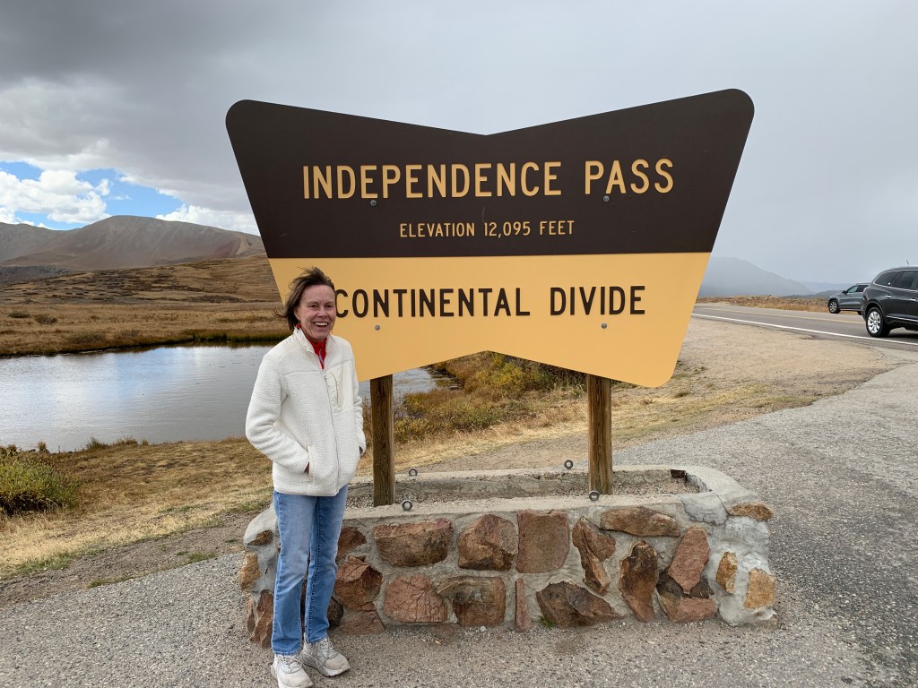
Today, we’ll have a little of everything that’s been notable about this trip. One Scenic Byway. One 10,000-foot pass. One crossing of the Continental Divide. One Colorado mountain ski town.
Our day begins by heading east on US Highway 34, following the Big Thompson River. The 78-mile-long river is a tributary of the South Platte River, originating in Rocky Mountain National Park. It flows into the town of Estes Park, and then through Big Thompson Canyon.
It was a brisk morning. By the end of the day, temps were in the mid-80s. Yay!
The river was named for fur trader and explorer, David Thompson, who helped forge trails for fur trading companies in the early 1800s. Some say he may have been the first white man to set foot in what is now Estes Park.
Highway 34 follows the Big Thompson River all the way to Loveland, 30 miles east of Estes Park. We don’t make it that far.
The Big Thompson River canyon is a spectacular setting for a highway.
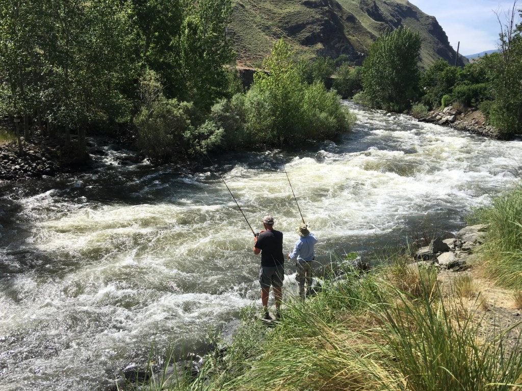
We wind our way through the spectacular canyon, with its steep walls, for about 20 miles. Seems like a nice place to fish, judging by the fishing we see along the way. The trout in the Big Thompson River are largely born in the wild, and range in size from 10 to 12 inches. The river has not been stocked since the mid-1990s. The river is home to brown trout, brook trout, rainbow trout, and cutthroat trout.
Cache la Poudre Scenic Byway
Just a few miles west of Loveland, the easternmost point on our trip, we turn north on Buckhorn Road, a twisty and fun path that takes us to Colorado Highway 14 – also known as the Cache la Poudre Scenic Byway. It’s our eighteenth scenic byway of this trip.
The byway runs along the Cache la Poudre River for 72 miles, all the way to Walden.
The Cache la Poudre River got its name from an incident in the 1820s, when French trappers had to bury some of their gunpowder during a snowstorm in the area. “Hide the powder,” is how it translates.
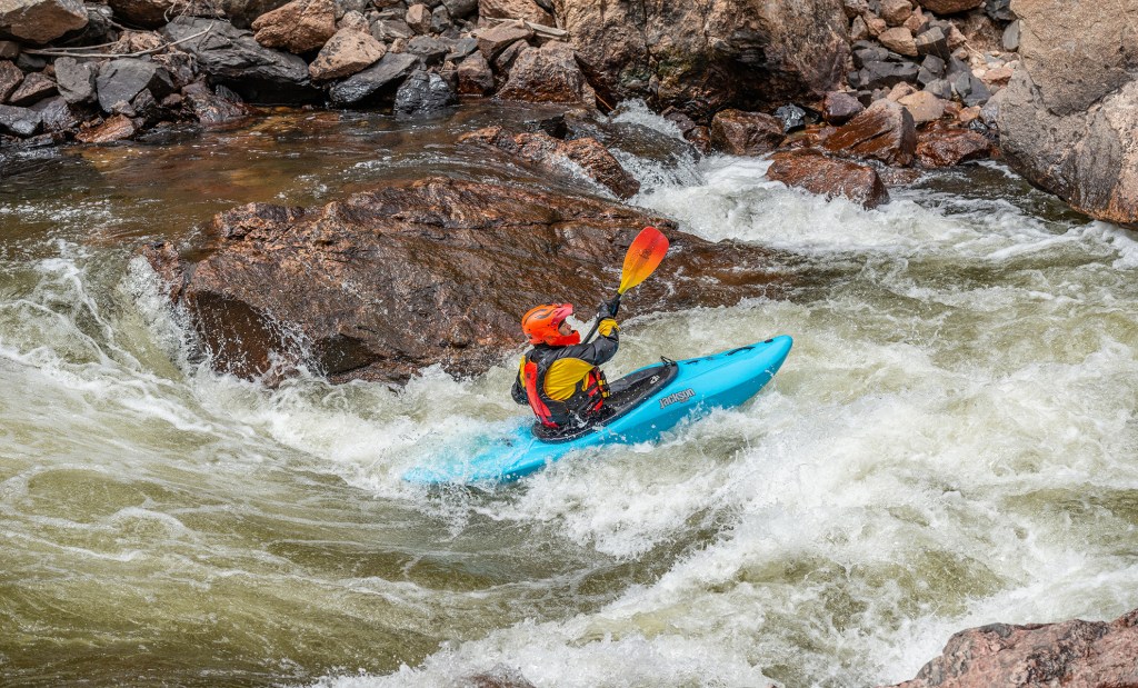
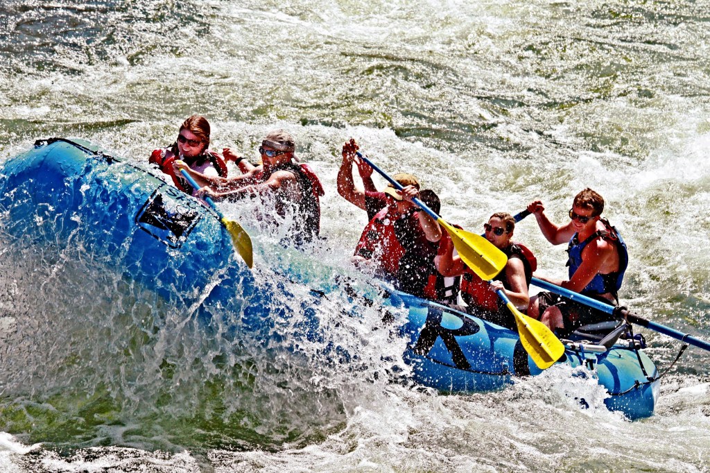
We’re now riding through the Cache la Poudre Wilderness and the Arapaho and Roosevelt National Forest. It’s a narrow canyon, deep and steep, carved by the river over millions of years. The water is high, and running quickly. Very popular place for kayaking. The whitewater swells to a crescendo during the spring runoff. Like many Colorado Rivers, the best waters for rafting and kayaking the Cache la Poudre are in June. Now!
Kayaking on the Cache la Poudre.
On Day One of this trip, we (Sarah and I) rode along the Crystal River, as we left Carbondale and headed south. Many preservationists want the Crystal to be designated as Wild and Scenic.
There’s only one river in Colorado that has the Wild and Scenic designation: the Cache la Poudre. On October 30, 1986, President Ronald Reagan – not known for his support of the environment – signed legislation protecting stretches of the Poudre River and its South Fork upstream from the canyon mouth. (Reagan was famous for saying “Trees cause more pollution than automobiles do. If You’ve one tree, you’ve seen them all.”)
Other rivers had already received that designation as a result of the 1968 Wild and Scenic Rivers Act. The legislation says Wild and Scenic Rivers are so special, that they “shall be preserved in free-flowing condition, and that they and their immediate environments shall be protected for the benefit and enjoyment of present and future generations.”
The act has protected nearly 13,000 miles of 226 rivers in 40 states. Portions of the Cache la Poudre were named Wild and Scenic because of their outstanding recreation, scenic and hydrologic features. Thirty miles of the river are classified as Wild; 45 miles are classified as Recreational. No new dams or diversions can be built within these designated corridors. At 1,219,038 acres, the Cache la Poudre Watershed is one of the largest drainages in northern Colorado.
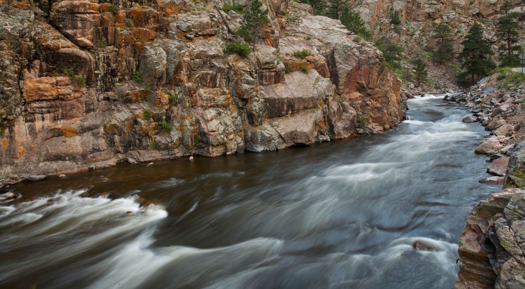
The Cache la Poudre River, as wild and scenic as it gets.
Cameron Pass to Walden
Our ride along the Cache la Poudre Scenic Byway continues, as we climb toward 10,276-foot Cameron Pass, the twenty-eighth 10,000-foot + pass we’ve crossed on this trip. Two more to go.
The pass was named for Robert Cameron, former Union general and founder of the Fort Collins Agricultural Colony. The pass divides the Medicine Bow Mountains to the north, and the Never Summer Range to the south.
Cameron Pass was surveyed several times for railroads, including once by the Union Pacific Railroad as a possible route through the Rockies. But no railroad was ever built over the pass.
From Cameron Pass, we begin the gradual 2,100-foot descent to Walden, 30 miles away. To our left is the Arapaho National Wildlife Refuge, a 23,464-acre site established in 1967, primarily to provide suitable nesting and rearing habitat for migratory birds. The Arapaho refuge provides a habitat for more than 200 species of waterfowl. It’s is one of more than 560 in the National Wildlife Refuge System across the US.
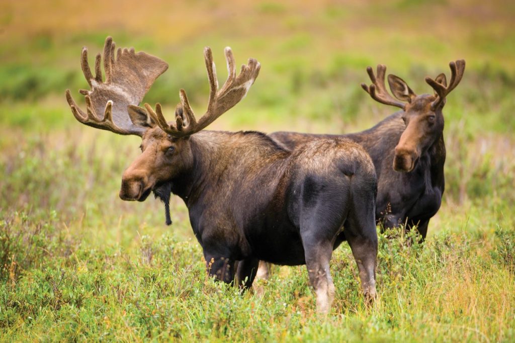
We’re ready for a break, and our timing is perfect. We pull into the town of Walden, population 500. There is no Walden Pond, not that we can discern anyway. We’re on the lookout for moose, as Walden is known as the Moose Viewing Capital of Colorado. More than 600 moose call this area home.
Moose on the loose, near Walden.
On our way into town, we passed the Moose Visitor Center, which is run by Colorado Parks and Wildlife. It’s located near the logging camp of Gould. Outside the center, there’s a seven-foot-tall sculpture of a moose, made of barbed wire.
The thought of seeing a moose along the road is intriguing. Moose are the largest members of the deer family. Colorado’s moose are the Shiras moose; mature males generally weigh from 800 to 1,200 pounds. We’ve read up on the animals, and know that they can act aggressively and charge if they sense a need to defend themselves, or their young.
We leave the Walden area, free of any moose encounters, and press on toward our next waypoint, Rabbit Ears Pass, about 35 miles from Walden.
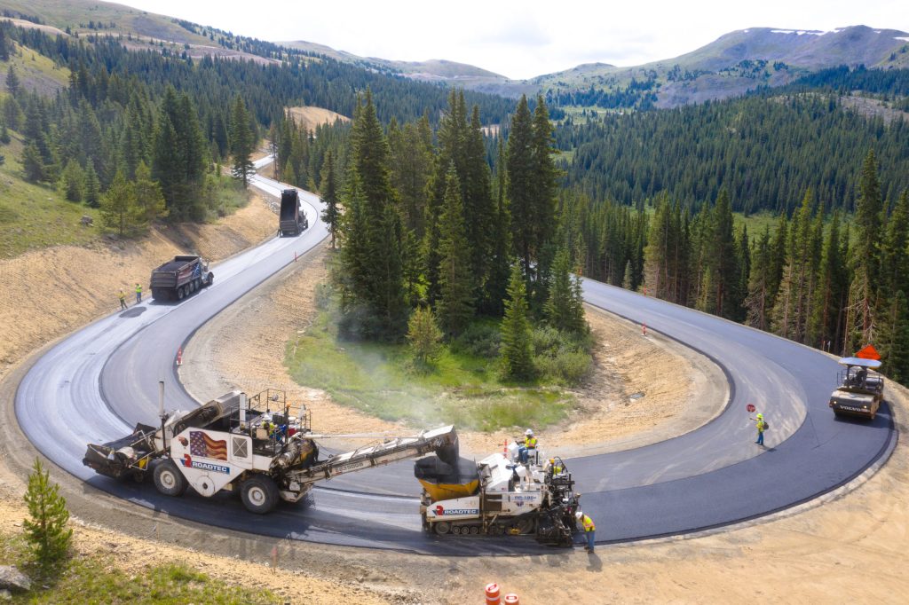
It’s still road construction season, a daily occurrence nearly everywhere we went on this trip.
Nearing Steamboat Springs
Rabbit Ears Pass is our ninth crossing of the Continental Divide. One more to go.
Early trappers gave the pass got its name. They were taken by its rabbit-ear-like appearance. North of the summit is Rabbit Ears Peak, which is said to be shaped like rabbit ears. Every time I’m here, I look for the ears – and don’t find them. The pass is “only” 9,426 feet.
From the pass, it’s a 21-mile descent to the valley below, where we’ll find Steamboat Springs. “The Boat,” as it’s known locally, got on the map for its winter skiing. The town of 13,000 claims to have produced more athletes for the Winter Olympic games than any other city in North America. One hundred athletes with Steamboat connections have won 19 Winter Olympic medals.
Like so many other Colorado towns, the economy of Steamboat Springs was originally based on ranching and mining – and has transitioned today to tourism. The area is home to natural hot springs, which gave the town its name. Upon first hearing a chugging sound, early trappers believed that a steamboat was coming down the Yampa River. When they saw that there was no steamboat, and that the sound was coming from a hot spring, they decided to name the spring Steamboat Spring.
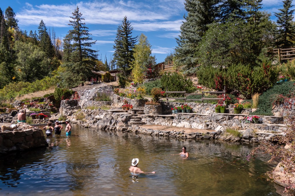
Bathers soaking in Strawberry Park Hot Springs, near Steamboat.
In the winter, Steamboat calls itself Ski Town USA, a name they’ve trademarked. In the summer, it becomes Bike Town USA, another trademarked name, for the area’s many biking trails. Wanna trademark your business before someone else claims the name? Here’s how. I haven’t trademarked this blog. It’s yours, if you want it.
Today, our trail through town is on US Highway 40, which runs through downtown Steamboat Springs.
We leave Steamboat, and ride the remaining 125 miles home to Carbondale.
One final pic of the vehicle caravan, as we roll into Carbondale. You can tell we’re almost home by spotting that big mountain in the background: Mount Sopris, 12,965 feet.
Before you know it, we roll into our driveway, and the trip is officially over.
Thirty mountain passes of 10,000 feet or more. Twenty-two Scenic Byways. Eleven Crossings of the Continental Divide. Eleven visits to national parks.
The past 18 days were memorable. And wonderful.
My summer has begun.
Dinner at home, after 18 days on the road. See you next year!
***
The Day in Review:
Click here to see today’s complete route from Estes Park, Colorado to Carbondale, Colorado – via the Cache la Poudre Scenic Byway.
Today’s Takeaways:
Big Thompson Canyon, deep and steep.
Cache la Poudre. Hide the Gunpowder
Moose Viewing Capital, and Elk Hunting Capital.
Today’s Trivia: Wild and Scenic Rivers
Today, we followed the Cache la Poudre River for 75 miles of its Wild and Scenic ride. It’s the only river in Colorado to achieve the Wild and Scenic designation.
In all, 226 rivers across the US have been classified as Wild and Scenic.
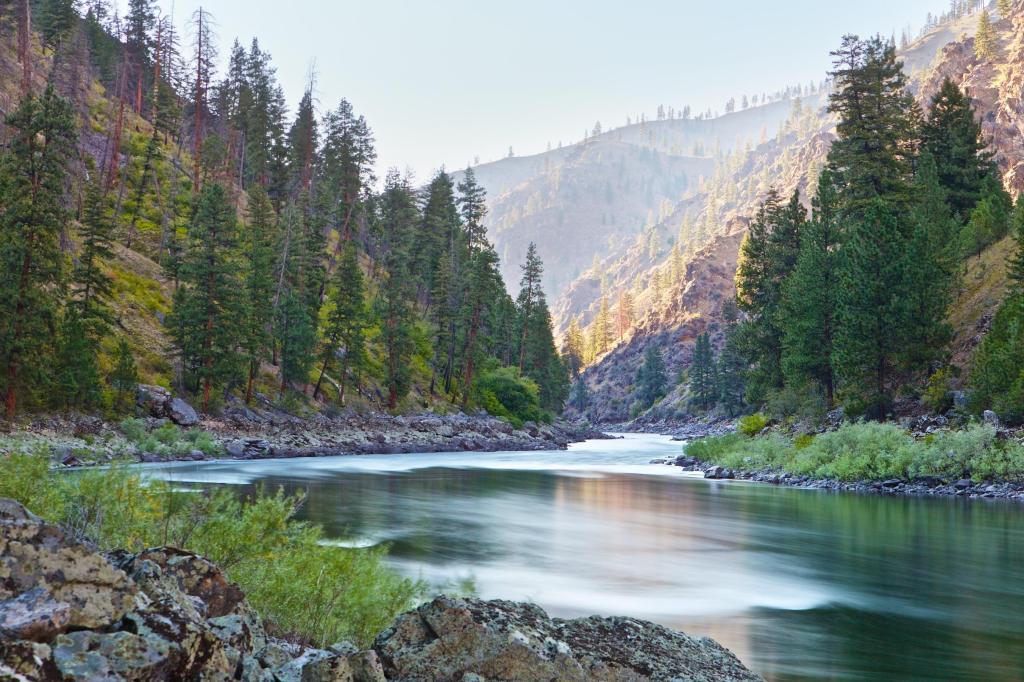
Some of the rivers are well known, like Idaho’s Snake River, the Flathead River in Montana, and the Yellowstone River in Wyoming.
The Snake River. Doesn’t it just look wild and scenic?
Oregon has 81 rivers – or portions of them – designated as Wild and Scenic, way more than any other state. California is next with 37. Alaska has 26.
The congressional act has protected nearly 13,000 miles of 209 rivers in 40 states, and the territory of Puerto Rico. This is less than one quarter of one percent of America’s rivers, which flow for 3.5 million miles.
More than 75,000 large dams across the country have modified at least 600,000 miles of US rivers, and made them ineligible for the Wild and Scenic designation.
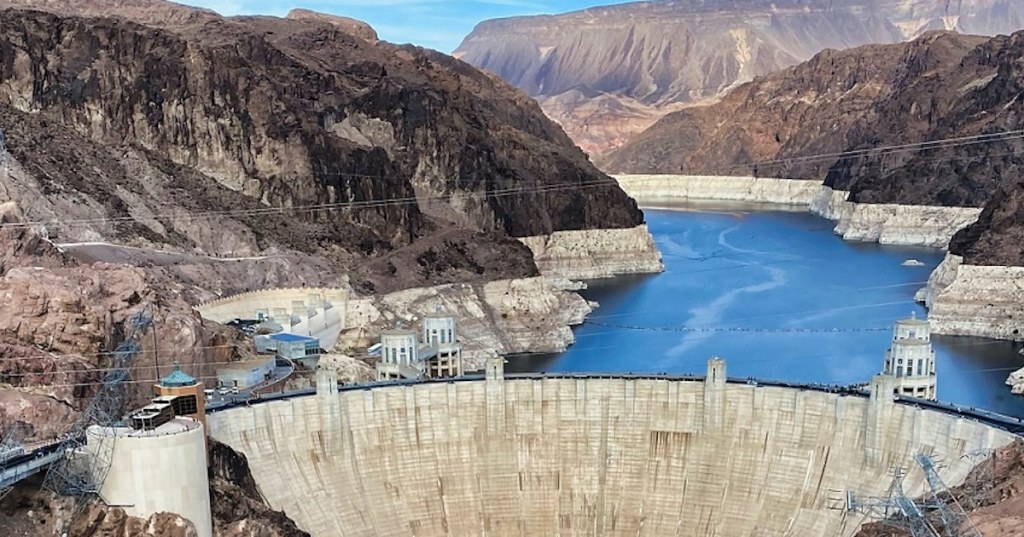
The Hoover Dam, near Las Vegas. This stretch of the Colorado River is anything but wild and scenic.
The Wild and Scenic Rivers Act is administered by four federal land management agencies: the Bureau of Land Management, National Park Service, US Fish and Wildlife Service, and the US Forest Service. Each has a role in making sure the rivers they manage remain in the condition that caused them to be designated as Wild and Scenic in the first place.
The Yellowstone River, wild and scenic.
When President Lyndon Johnson signed the Wild and Scenic Rivers Act into law in 1968, he noted, “An unspoiled river is a very rare thing in this nation today. Their flow and vitality have been harnessed by dams and too often they have been turned into open sewers by communities and by industries.”
Today, 55 years later, his words are just as true. There are even fewer unspoiled rivers than there were then.
The Ohio River, year after year, tops list of America’s most polluted rivers. Here it is flowing through Covington, Kentucky. Not even close to Wild and Scenic.
We’re leaving Estes Park, riding a counter-clockwise loop, and returning this afternoon.
Going in the opposite direction always makes the ride seem like a new road. Half of our 192-mile ride today will be like that.
The Trail Ridge Road Scenic Byway (and All-American Road!) was so much fun yesterday that we’re gonna do it again, but today’s route – on Father’s Day – will be East-to-West.
Oh, yeah. To all you dads, Happy Father’s Day!
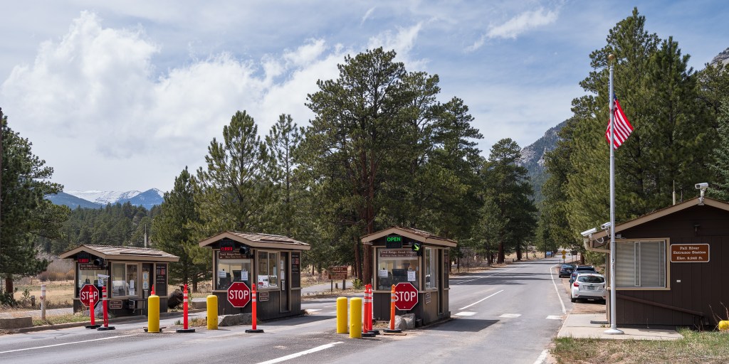
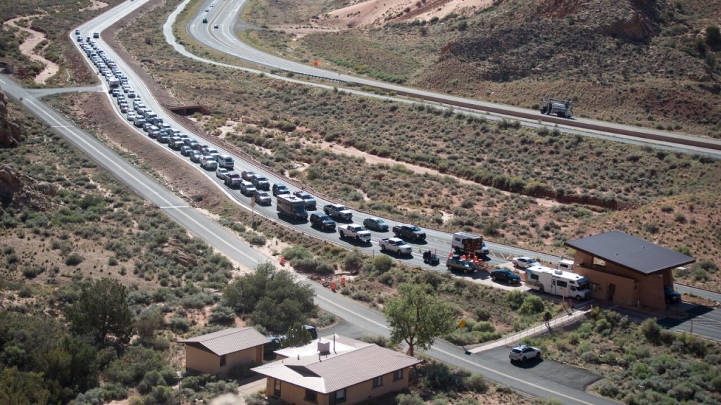
Step one on today’s journey is to enter Rocky Mountain National Park at the Bever Meadows Entrance Station. It’s the eastern entrance to the park. We use our Timed Entry passes, a system that began several years ago in an effort to better manage crowding in national parks that needed it.
The timed entry reservation system has been put into place in a few national parks, where the visitors were on the brink of overwhelming the parks – on heavily-traveled roads. Last year, the timed entry reservations were required at Arches National Park, Glacier National Park, Yosemite National Park, Acadia National Park, Haleakala National Park, Rocky Mountain National Park, Shenandoah National Park, and Zion National Park. The timed entry passes cost $2 per vehicle, and are purchased from Recreation.gov.
The park entrance. You won’t find it this serene very often.
Managers at Rocky Mountain National Park decided they needed a tool to handle crowding at the park, which is the fifth-busiest in the country, after Great Smoky Mountains, Zion, Yellowstone and Grand Canyon national parks. Rocky Mountain National Park receives about 4.5 million visitors per year. This represents a 65 percent increase in visitation over 12 years.
National Park Service leaders say visitor crowding and congestion have led to increased negative impacts to visitor and staff safety, resource protection, visitor experience and operational capacity. At Rocky Mountain National Park, the goal of the timed entry program is to spread visitation out throughout the day.
So, we show up at the gate, with proof of our timed entry reservation, make the rangers happy, and press on. We’re pretty sure we made them happy.
The river runs through it.
We’ll be on Trail Ridge Road for 37 miles, until we arrive in Grand Lake, at the west end of the park. But first, we climb to 12,183 feet – well above the timberline. On our way, we cross 11,827-foot Iceberg Pass, our twenty-seventh 10,000-foot + pass of this trip. Then on our way out of the park, we cross the Continental Divide at Milner Pass, 10,729 feet.
It all seems familiar, in a beautiful and breathtaking way.
We exit the park, arrive in Grand Lake, and take ten. Our concept of take ten is generally more like 30. That’s just how we roll.
Peak-to-Peak Scenic Byway
Leaving Grand Lake, we ride south on US Highway 40, through Granby, Winter Park, and over 11,315-foot Berthoud Pass. Same as yesterday. Just opposite direction.
Soon, we’re on Interstate 70 heading east toward Denver. Many interstates are boring. This one isn’t. We’re riding at elevations between 7,500 feet and 8,500 feet. The Rockies are quite spectacular. This is nothing like Nebraska. No offense, Nebraska. Colorado sets the bar pretty high.
We exit the interstate, just past Idaho Springs, and join the Central City Parkway. This is also the beginning of the Peak-to-Peak Scenic Byway. Established in 1918, the byway is Colorado’s oldest. It stretches 55 miles, from Black Hawk – just ahead of us – to Estes Park, tonight’s destination.
As we ride north on the byway, we’re less than an hour from Denver, and right outside the college town of Boulder. As we begin the byway, Denver is due east.
Central City is our first sign of civilization on the Peak-to-Peak Scenic Byway. It was founded in 1859 by gold miners, and soon called “the richest square mile on earth.” Central City and the adjacent city of Black Hawk form the Central City/Black Hawk Historic District.
Black Hawk has kept many of its historic storefronts.
There’s a lot of history here. By 1860, as many as 10,000 prospectors had flocked to the town, then known as Mountain City. Eventually, gold mining decreased rapidly between 1900 and 1920, as the veins were exhausted. Mining revived for a time in the 1930s, as the price of gold spiked from $20 to $35 an ounce (the numbers seem kind quaint, don’t they?). Mining shut down during World War II, when gold mining was declared non-essential to the war effort. The district was enlivened in the 1950s by efforts to locate uranium deposits, but those proved unsuccessful.
Today, the economies of Central City and Black Hawk are almost entirely based on casino gambling.
Nederland, the Low Lands
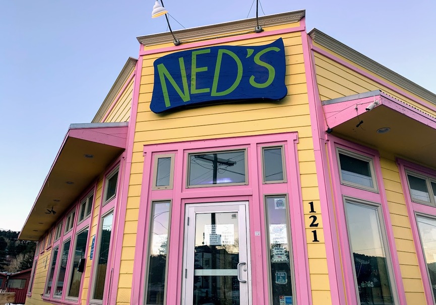
Leaving Black Hawk, we join Colorado Highway 119 and continue our journey northward on the Peak-to-Peak Scenic Byway. Twenty miles of twisty road later, we arrive in the town of Nederland.
When in Nederland, try Ned’s for breakfast or lunch. Or to just hang out. Sadly, you’re too late. After 38 years, Ned’s has served its last meal 😢
The town, with a population today of 1,500, began as a trading post between Ute Indians and European settlers during the 1850s. Nederland’s first economic boom came when minerals such as tungsten, silver and gold were discovered east of town in the late 1850s.
A man named Abel Breed owned the silver-rich Caribou Mine, not far from here. The mine was at roughly 10,000 feet. The high elevation meant fierce winds and deep winter, so when the Mining Company Nederland bought the mine in 1873, it moved the milling to a lower elevation, near where Nederland is today.
The Mining Company Nederland was based in Holland. In the Dutch language, Nederland means “low land,” and based on casual usage by the Dutch miners, the area was soon called “Nederland.” In 1874, when the town was incorporated, the people chose Nederland as its name. The name stuck, and it remains today. Ironically, Nederland sits at 8,236 feet; it’s a stretch to call it low land.
By 1890 there was little ore remaining to be milled, and Nederland became another mountain ghost town. By 1920, its population dwindled to about 200 people. The final boom in Nederlands happened in the 1940s, when demand for tungsten picked up during World War II. But that didn’t last, either.
Today, Nederland has had a bit of a revival, and is the hub of the Peak-to-Peak Scenic Byway. It’s an easy place to visit from nearby Boulder, just 17 miles away. Nederland is known as a gateway to outdoor recreation in the nearby Indian Peaks Wilderness, Rocky Mountain National Park, Roosevelt National Forest and the James Peak Wilderness.
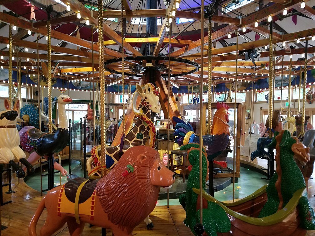
The number one attraction in Nederland is the Carousel of Happiness. It’s one of the last carousels in the US with hand-carved wooden animals. Last summer, the carousel welcomed its one millionth rider since opening in 2010. It has 56 different animals, 35 of which can be ridden. All the colorful creatures are carved by one man, Scott Harrison, who calls himself the Creative Custodian of the Carousel of Happiness. The carousel turns to the music of a restored 1913 Wurlitzer Band Organ. A ride is $3. A small price to pay for a few minutes of happiness.
Scott Harrison’s Carousel of Happiness. Lots of smiles and joy in Nederland.
Returning to Estes Park
Our ride on the Peak-to-Peak Scenic Byway is not quite over. We still have 40 miles to Estes Park.
We pass a number of old mining towns, including Ward, once one of the state’s richest during the Colorado gold rush. The town was named for Calvin Ward, who prospected a claim in 1860 on the site that had been known as Miser’s Dream. Today, Ward has about 150 hearty residents, who brave winters here at its 9,450-foot elevation.
Just 12 miles from Estes Park, we roll through Allenspark, a town of 500. Originally named Allen’s Park, after its founder, Alonzo Nelson Allen, it’s now simply Allenspark. Allen was a miner who built the first cabin in the area. It was called Allen’s Park because, sitting in a meadow, surrounded by towering mountains, it just felt like a park.
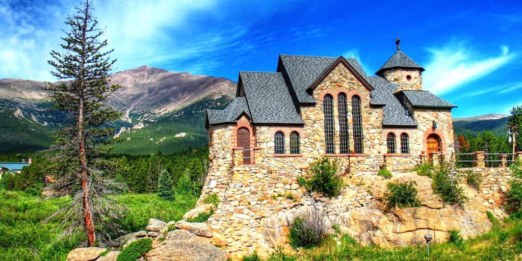
Allenspark’s most notable feature is the Chapel on the Rock at St. Malo, a 100-year-old functioning Catholic church built atop a rock formation. Its official name is St. Catherine of Siena Chapel. The Chapel was first conceived in 1916 by Monsignor Joseph Bosetti, who happened across the rocky area where the church would later be built and was inspired by Matthew 16:19, “Upon this rock I will build my church.”
In 1993, Pope John Paul II visited the Chapel while touring Denver. He prayed inside the church and blessed it afterwards before hiking in the surrounding forest.
St. Catherine of Siena Chapel. “Upon this rock, I will build my church.”
We arrive in Estes Park shortly after 4 pm, having completed our 192-mile loop, half of it a déjà vu-like repeat from the day before.
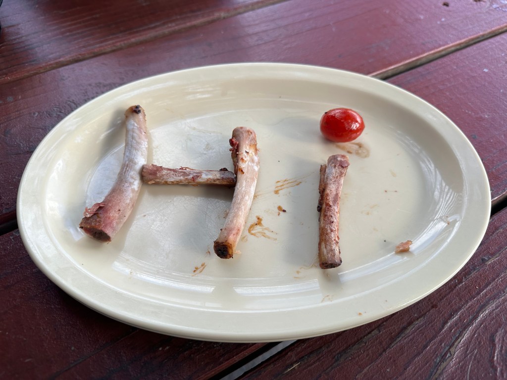
One of my favorite human tricks at BBQ restaurants: spelling a greeting with rib bones.
***
The Day in Review:
Click here to see today’s complete route from Estes Park, Colorado and back to Estes Park – via the Peak-to-Peak Scenic Byway, and the Trail Ridge Road Scenic Byway – an All-American Road.
Today’s Takeaways:
Peak-to-Peak Scenic Byway for peak pleasure.
A low land in Nederland, elevation 8,236 feet.
Allenspark is Allen’s Park.
Today’s Trivia: Black Hawk, a Colorado Gambling Mecca
When we rolled through Black Hawk and Central City today, at the start of the Peak-to-Peak Scenic Highway, it felt like we were in the middle of a tiny gambling mecca. Las Vegas without the neon. Monte Carlo without the luxury. Macau, China — without the Wynn, the MGM Grand, and the Venetian. Atlantic City, without the boardwalk.
There are 18 casinos in Black Hawk, population 128. Adjacent Central City, population 785, has six casinos.
How on earth did that happen?
In the 1980s, the three historic Colorado mining towns of Black Hawk, Central City and Cripple Creek – southwest of Colorado Springs – were facing an economic and existential crisis. Hard-rock mining no longer supported the economies of the towns, tourists were visiting other attractions across the state, and the buildings that gave the communities their historic character were deteriorating.
Like most states, Colorado did not have enough public funds to take on long-term restoration and preservation of the three towns, let alone the thousands of historic sites across the state.
So, Colorado looked to South Dakota, which had passed a state constitutional amendment legalizing gambling in the historic Black Hills town of Deadwood. The South Dakota amendment carried the stipulation that revenues from gaming activities be used to revitalize the economically stagnant community, and provide for the long-term restoration and protection of its historic resources.
Citizens of Central City began pursuing a similar amendment in Colorado, which eventually became Amendment 4 on the 1990 ballot. On November 6, 1990, 57 percent of voters approved it – and the result is what you see when passing through the tiny towns.
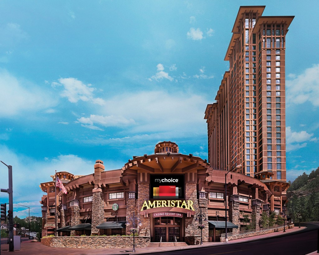
The Ameristar. Las Vegas, without the neon.
Ameristar is the largest of the casinos, with 57,000 square feet of gaming space and a 34-story, 536-room hotel. Some of the casinos in Black Hawk and Central City operate 24/7. Together, the casinos in the three cities benefitting from Amendment 4 bring in an estimated $850 million in revenue every year. Since gambling began thirty years ago, it has generated nearly $20 Billion in Colorado casino revenue.
The state constitution directs the Department of Revenue to deposit 28 percent of gambling tax revenues into a State Historical Fund, managed by the Colorado Historical Society. Since 1992, when gambling revenues were first collected, the State Historical Fund has contributed more than $330 Million in grants to all 64 Colorado counties.
With an area of less than two square miles, Black Hawk claims to hold the distinction of being the least populous city in Colorado, although at any given time, there are more guests in the hotels and casinos than residents of the city. Black Hawk’s town motto: “Preserving the Past, Preparing for the Future, Still Making History.”
When Amendment 4 was approved more than 30 years ago, it limited bets to $5, and allowed only slot machines, poker and blackjack. Since then, the Colorado state legislature approved higher limits, and sports betting became legal in 2020. Today, there’s no limit on your bets. You can lose as much money as you’re willing to risk.
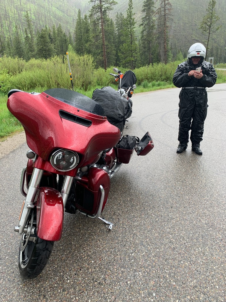
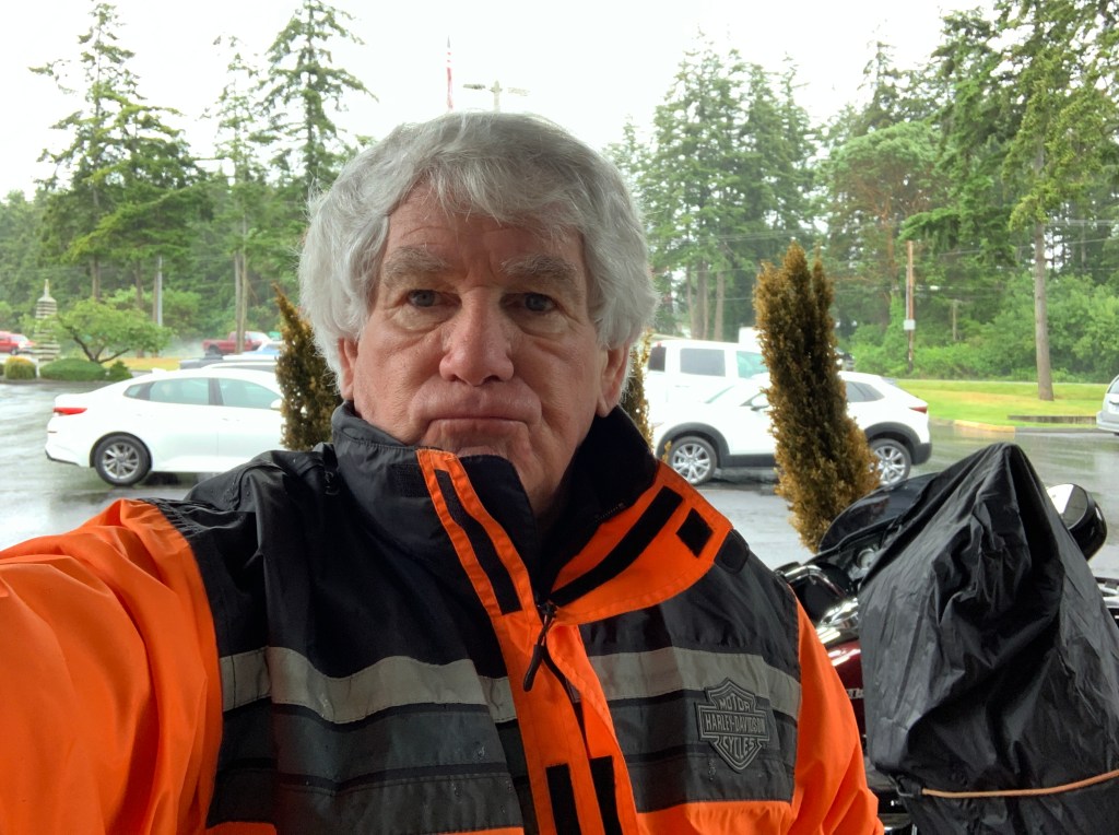
Uh-oh. Another wet one in store. For me, anyway. Sarah’s guaranteed to stay warm and dry in the Boxster.
Our morning begins by laying out all the gear to ascend a Fourteener. We’ll need warm clothes, sun protection, and some nerve. And, fuel in the tank. No ropes, crampons or ice axes are needed.
OK, we’re not exactly climbing a Fourteener. We are riding to the top of one. Still, if you’re keeping score, and we are – it counts.
We leave Georgetown, hop on I-70 for ten miles, and exit in Idaho Springs, when we see the signs for Mount Evans. That’s today’s Fourteener.
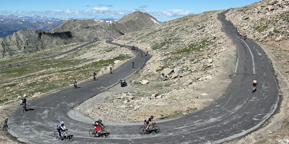
From Idaho Springs, it’s a 13-mile ride to the Mount Evans Welcome Station. Along the winding road – Colorado Highway 103 – we begin our nearly 7,000-foot climb to the summit of Mount Evans. It’s the highest paved road in North America.
This spectacular road is part of the Mount Evans Scenic Byway, which we’ll be on for the next hour, until we reach the summit.
The road to Mount Evans, once thought to be an impossible dream, is the result of a tourism arms race in the early 1900s between the cities of Denver and Colorado Springs. First, the Cascade and Pikes Peak Toll Road Company completed a 16-mile road up the north side of Pikes Peak, just 12 miles from Colorado Springs. The road topped off at 14,115 feet, and established a major tourist attraction that brought visitors from the Denver area.
Not to be outdone, Denver’s Mayor proposed that a road be constructed to the top of Mount Evans, 60 miles west of Denver. In 1917, he procured state funds to build the road. Construction began in 1923. Seven years later, the road was completed and opened to the public.
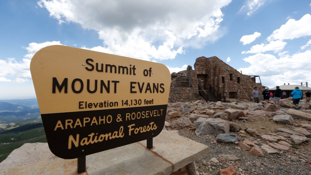
During the summers of 1941 and 1942, Denver’s Mountain Parks department built a structure at the top of Mount Evans, with a restaurant and gift shop. Called the Summit House, the facility was a significant tourist draw until a propane cannister fire burned it down in 1979. The Summit House hasn’t been rebuilt, but its rock foundation and wall remain as an observation platform and windbreak for mountain travelers. The building was once the highest business structure in North America. That honor now apparently belongs to Il Rifugio at Snow Plume, a 12,456-foot high restaurant at the Arapahoe Basin Ski Area.
The Summit House, no longer open for business, but a reminder of what once was.
On our way to the Welcome Station, we pass Echo Lake, a beautiful high alpine lake that sits at 10,600 feet, at the base of Mount Evans. Echo Lake Lodge is right above the lake. It has a general store, restaurant, and gift shop. It’s the last place to stop and take a deep breath before heading up the mountain.
From the Mount Evans Welcome Station, it’s 14 miles to the summit. Well, 14 miles to the summit parking lot, which is at 14,130 feet. If you want to actually summit Mount Evans, you can hike the last 134 vertical feet to the top. The actual summit, for you detail freaks, is at 14,264 feet, making Mount Evans Colorado’s fourteenth highest Fourteener.
Once a year, the road is closed so bicyclists can race to the top.
Journeying to the Mount Evans summit parking lot is a lot like taking a trip through Canada to Nome, Alaska. Every 1,000 feet of elevation gain is equivalent to traveling 600 miles north in latitude. Instead of traveling through vast continental regions, we roll through regions characterized by specific plants and animals known as life zones. It’s usually about 40 degrees colder at the top of Mount Evans than it is in Idaho Springs, where our journey began.
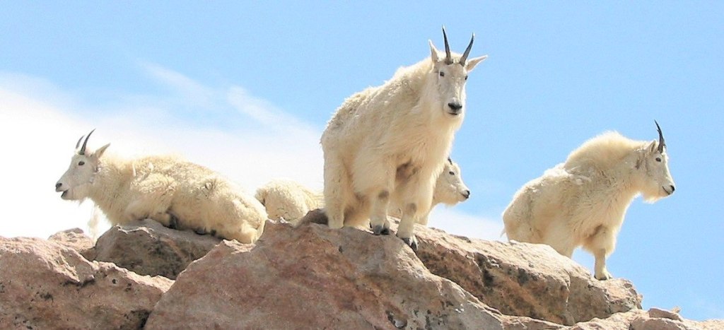
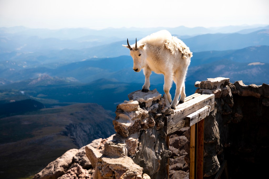
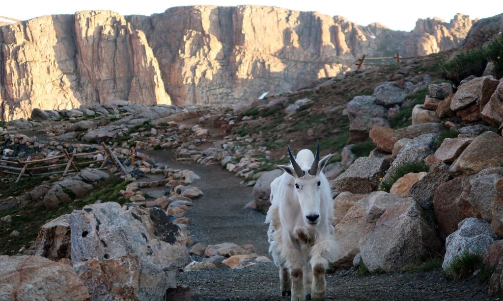
High above the timberline on Mount Evans, mountain goats are a common sight. You’re pretty much guaranteed to see them on your journey to the summit. Except what you’re seeing isn’t really a goat, it’s more closely related to some African antelope species. That’s a technicality though. Everyone calls these sure-footed animals mountain goats, and that’s unlikely to change.
The mountain goats’ hooves are padded to help them grip rocky surfaces and ledges, and they have extra-strong hind legs that allow them to spring up steep slopes with ease. Surprisingly, despite being so well adapted to Colorado’s higher terrain, mountain goats are not native to Colorado. They were brought here from the Northern Rockies as game animals in the mid-twentieth century.
If you want to be comfortable at the top of Mount Evans, you should be a mountain goat. They’re a very common sight.
From the summit, or the summit parking lot – your choice – you can see much of the Continental Divide in Colorado. It’s quite a view.
Because of winter snowfall and the impossible nature of keeping the road cleared, the road to Mount Evans is generally open only from Memorial Day to Labor Day.
Yes, generally open. Except for a late spring snowstorm. That’s what happened yesterday, closing the road to the summit. Fouled again 😢
Can We get Higher?
Mount Evans is undoubtedly a very high road, and the highest paved road in North America, it’s not the world’s highest. Depending on how you define a road – is it paved? Is it designed for vehicles? Is it accessible? – there are other roads that leave Mount Evans in the high-altitude dust.
Ojos del Salado, along the Argentina/Chile border, reaches 21,942 feet. It’s a volcano that some daring drivers try to scale, but it’s not really a road. Still, it might be the highest point anyone’s ever driven. Except the moon.
Umling La Pass in India tops out at 19,024 feet. It’s on the ridgeline between Koyul Lungpa and the Indus River.
Umling la Pass. Looks a bit like a moonscape. At 19,024 feet, it should.
A road to the top of the Uturuncu volcano in Bolivia reaches 18,799 feet. It’s not paved, and not well-maintained. But it is a road.
Semo La in southern Tibet takes you to 18,258 feet. It is paved.
If you’re willing to get out your passport and explore, you can try those roads. Sure, it would be a thrill, but isn’t scaling Mount Evans just a bit more convenient?
Berthoud Pass
After admiring the view, and satisfied with our accomplishment, we begin the 7,000-foot descent from the top of Mount Evans, toward the valley below.
An hour later, we arrive in Idaho City, take a break, and discuss the plan for the rest of the day.
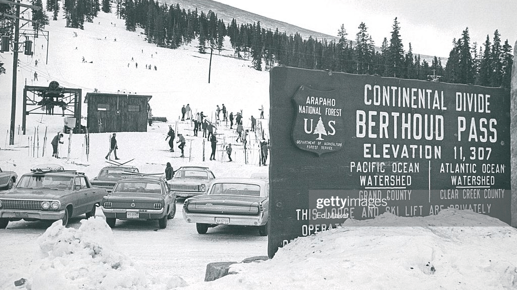
We’ve got two more Scenic Byways to ride, and seven 10,000-foot + summits to cross. So, we find our way to US Highway 40, and head for Berthoud Pass. The 11,315-foot pass is named for Edward L. Berthoud, chief surveyor of the Colorado Central Railroad during its expansion throughout Colorado in the 1870s. He led surveys for railroads to booming mining camps in Georgetown, Leadville and San Juan County.
Accompanied by mountain man Jim Bridger, Berthoud discovered the pass in 1861 while surveying a possible route for the railroad. He concluded the pass was suitable as a wagon road, but not as a railroad.
Berthoud Pass was a great place for a ski area, until it was surpassed by nearby resorts with more financial backing.
Many years later, thanks to easy access to the summit, and its close proximity to Denver, just 50 miles away, Berthoud Pass became an attraction for downhill skiing. Throughout the 1930s and ‘40s, the Berthoud Pass Ski Area attracted thousands of visitors exploring the backcountry.
A group of volunteer ski enthusiasts decided to take matters into their own hands and get a ski area off the ground. They found financing through the May Company and Denver Ford dealers, and in 1937, created Colorado’s first rope tow, giving birth to the state’s first formal ski area.
In 1947, Colorado’s first two-person chairlift further opened the area. Over time, due to competition from larger resorts, like nearby Winter Park, the Berthoud Pass Ski Area permanently shut down operations in 2003.
The road over the pass is well-designed, well-maintained, and fun to ride. Going over Berthoud Pass, we cross the Continental Divide. Again. I’ve almost lost count. OK, it’s seven.
Berthoud Pass, another crossing of the Continental Divide.
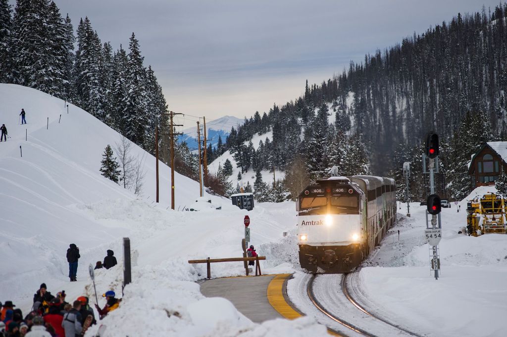
If you live on the Front Range, and driving over Berthoud Pass to go skiing isn’t your thing, you can take the train from Denver directly to Winter Park. The Winter Park Express is a partnership between Amtrak and the Winter Park Resort, dropping skiers at the doorstep of the ski area. The train departs Union Station in Denver at 7 am, and arrives in Winter Park by 9 am. Very convenient. The original Ski Train began running in 1940, and has operated continuously, with a short break following the recession of 2008.
About 1,000 people live in Winter Park. Close to a million people visit here every year. Skiing in the winter, mountain biking and hiking in the summer.
The ski train arriving in Winter Park.
Continuing northwest on Highway 40, we roll through the town of Fraser, on our way to Granby, a town of 2,100. Granby was founded in 1904 along the route of the Denver, Northwestern & Pacific Railway. Unlike so many towns we’ve visited on this trip, mining did not play a role in its history. The town was named after Granby Hillyer, a Denver lawyer who later served as a US Attorney for the area.
Rocky Mountain National Park, Ray’s Favorite
From Granby, we ride north on US Highway 34, following the shoreline of Lake Granby, Colorado’s third-largest body of water. The lake was created when Granby Dam was built in 1950. Lake Granby is home to the Lake Granby Yacht Club. At 8,280 feet, it’s one of the highest-elevation yacht clubs in the world (the Dillon Lake Yacht Club, 9,017 feet, apparently holds that title). This road is part of the Colorado River Headwaters Scenic Byway. Yep, another one.
The highway continues along the western shore of Shadow Mountain Lake and brings us to the town of Grand Lake, which calls itself the snowmobiling capitol of Colorado, and the Western Gateway to Rocky Mountain National Park. Grand Lake is the largest natural body of water in Colorado – natural, in that it wasn’t created by a dam.
Grand Lake is our last civilization before arriving at the entrance to Rocky Mountain National Park, just a mile up the road. Rocky Mountain National Park is the tenth national park we’ve visited on this trip.
We enter the park, and stop by the Kawuneeche Visitor Center to remind ourselves what we want to see in the park. There’s plenty to see; that’s why the park gets more than three million visitors every year.
A much-needed break to warm up and dry out.
Rocky Mountain National Park has five visitor centers. Our target is the Alpine Visitor Center, which sits at 11,796 feet. It’s the highest elevation visitor center in the National Park System.
Rocky Mountain National Park is a busy place. It’s the fourth-most visited of all the national parks. In 2022, it had 4.3 million visitors. Here’s a bit of trivia for you: since 1904, National Parks Services sites across the country have attracted more than 15.7 billion visitors!
We’re now riding on the Trail Ridge Road Scenic Byway. It’s is the fourteenth scenic byway on this trip, and the fifth visit to an All-American Road. Keeping tabs on all this is quite the effort.
Trail Ridge Road snakes roughly 50 miles from Grand Lake to Estes Park on the east end of the park. The road was planned and built from about 1929 through 1938. It was designed to replace Fall River Road, which opened in 1920 as one of the first auto routes in the park. But the narrow, one-way road wasn’t paved, suffered from numerous snow slides, and had only limited access to scenic overlooks. Congress appropriated $450,000 for Trail Ridge Road in 1928, and the Civilian Conservation Corps began working on road construction.
Trail Ridge Road has 11 miles of road above 11,000 feet, and four miles above 12,000 feet. All of this is above the timberline, and looks a bit like a moonscape, or what I think a moonscape would look like.
Relaxing on the road.
Before long, we arrive at Milner Pass, the twenty-second 10,000-foot + pass we’ve scaled on this trip, and the eighth crossing of the Continental Divide. Milner Pass is at 10,759 feet, on our way to more than 12,000 feet on Trail Ridge Road. The pass is named for T.J. Milner, a railroad promoter who surveyed a rail route across the divide from Denver to Salt Lake City. Like many surveyed routes of the 1880s, the railroad line was never built.
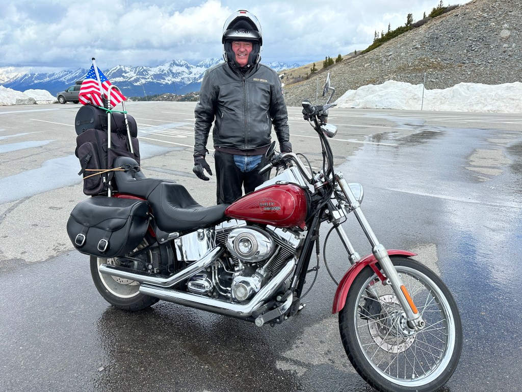
The road has a special significance for me, going back nine years. At the time, my posse consisted of me, and Sarah’s cousin, Ray Sanders. Ray was a long-time rider, with hundreds of thousands of miles under his belt. At the age of 83, then riding a Harley Heritage Softail Classic, Ray knew his riding days were nearing an end. For our 2014 journey, he wanted to go out in style, and ride his favorite road anywhere – Trail Ridge Road. Ray rode nearly 2,000 west from his home in Farragut, Tennessee, and met me near the Hoover Dam in Boulder City, Nevada. He got his wish of riding Trail Ridge Road one last time, and I had the privilege of seeing him do it.
His memory rides with me every time I’m in this park.
With Ray, in Boulder City, Nevada — on our way to the Rockies in 2014.
Eventually, we find our way to the Alpine Visitor Center.
It’s a great place to stop, grab a drink, and enjoy the view.
A 4,000-foot Drop to Estes Park
We leave the visitor center, and have about 400 feet of climbing before we get to the highest point on Trail Ridge Road – 12,183 feet. From here, it’s a 28-mile, 4,600-foot descent to tonight’s destination, Estes Park.
Along the way, we cross Iceberg Pass, the highest of the three mountain passes within Rocky Mountain National Park. Iceberg Pass is at 11,827 feet. Before there were any roads on this pass, the point served as an important pass along routes walked by native people. The Arapaho Indian tribe referred to what is now Trail Ridge Road as “taienbaa,” which translates to “Where the Children Walked.” As the story goes, the route was so steep, that children could not be carried, but rather had to walk on their own.
Our day ends, as we roll into Estes Park. The town of 6,000 residents has a beautiful setting, at the east end of Rocky Mountain National Park. It sits on the scenic Big Thompson River.
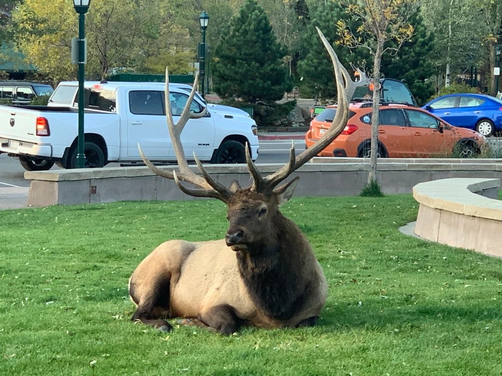
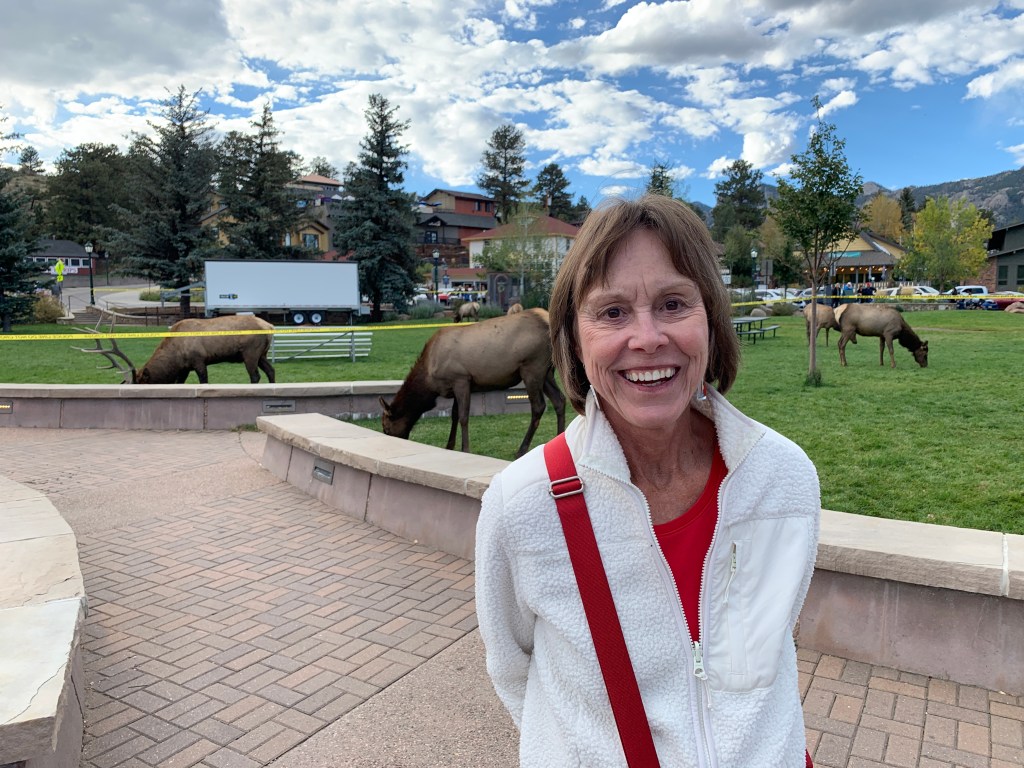
Today, Estes Park’s economy is entirely built around tourism. It’s known for outdoor adventure, natural beauty, and watchable wildlife; you’re likely to see elk in the downtown park.
An elk in downtown Estes Park. Looks tame, but give it some space.
We check into the hotel for the first of two nights in Estes Park.
There’s much to celebrate. Breathing clear, clean, fresh Rocky Mountain air. Riding to the top of a Fourteener. Spending much of the day between 10,000 feet and 14,000 feet. Honoring the memory of my riding mentor, Ray Sanders.
Dinner at Bird & Jim, in Estes Park. Here’s to you, Ray.
***
The Day in Review:
Click here to see today’s complete route from Georgetown, Colorado to Estes Park, Colorado – via the Colorado River Headwaters Scenic Byway, the Mount Evans Scenic Byway, and the Trail Ridge Scenic Byway – an All-American Road.
Today’s Takeaways:
Riding to the top of a Fourteener, Mount Evans.
Crossing the Continental Divide, again and again.
Trail Ridge Road, Ray’s favorite.
Today’s Trivia: The Mountain With an Identity Crisis
The name Mount Evans has been unpopular for a long, long time. Most Coloradans acknowledge the name is inappropriate, believing it’s time to move on, beyond a name with undeniably bad mojo.
There’s been a renaming process underway for years to strip former Governor John Evans’ name from the 14,265-foot peak. Evans, who served as territorial governor from 1862 to 1865, was forced to resign in disgrace for his role in the 1864 Sand Creek Massacre, a deadly attack on Native Americans that led to the deaths of more than 230 Cheyenne and Arapaho people, mostly women, children and older adults.
For some Native American Coloradans, renaming the peak has been a decades-long process that was very nearly resolved earlier this year.
“No name can undo the pain and suffering caused by the Sand Creek Massacre, but removing the name of the man most responsible for the massacre honors the very tribes that Evans sought to destroy. There is no place to honor perpetrators of atrocities on America’s public lands,” Paul Spitler, director of wilderness policy at The Wilderness Society, said in a petition filed supporting the recommended name change, to Mount Blue Sky.
Oblivious to the controversy surrounding the Mount Evans name, a mountain goat yearling explores an abandoned building near the summit.
In November 2022, the Colorado Geographic Naming Advisory Board in November voted unanimously to change the name to Mount Blue Sky, a move supported by officials in Clear Creek County, Governor Jared Polis, and many Native American tribe leaders and members who participated in the renaming process. Polis, in his recommendation to change the mountain’s name, said “each of the 14,000-foot peaks in Colorado deserves a name befitting their majesty.”
After Governor Polis recommended the name change, it was all but certain that the US Board on Geographic Names would accept Mount Blue Sky when it met in early March 2023. Then, out of the blue sky, the federal board deferred a vote that would have forever banished the Mount Evans name to the dustbin of history.
On the day the board was schedule to approve the name change, it said, without naming which one, a “tribal government had requested government-to-government consultation,” and as a result, the Board on Geographic Names punted on making a decision at all.
The road to Mount Evans, or whatever it ends up being called, is otherworldly.
During Colorado’s deliberations on the renaming last year, Northern Arapaho tribe members advocated for Mount Blue Sky, and Northern Cheyenne tribe members supported the name Mount Cheyenne Arapaho. It appears that the Northern Cheyenne believe they weren’t consulted in the renaming process, and Tribal Administrator William Walks Along said the Northern Cheyenne would never go along with Mount Blue Sky.
Three months have passed since the federal government deferred its renaming decision. It’s anyone’s guess when this issue will be finally resolved.
It has taken years of board meetings and 56 naming, or renaming, proposals to get to this point. The iconic peak will keep the Evans name while the decision remains up in the air.
A mountain goat works its way up the trail from Summit Lake to the summit of Mount Evans.
We’ll ride three Scenic Byways, scale six 10,000-foot + passes, make three crossings of the Continental Divide, and have a 100 percent rockin’ time.
That’s a lot to pack into 216 miles. We can do it.
Heading north toward the mountain ski town of Crested Butte, 25 miles away, we begin our day on Colorado Highway 135. But we never make it to Crested Butte.
Ten miles out of Gunnison, we arrive in Almont, a tiny fishing village on the Taylor River. The river is a tributary of the Colorado River. Here, we begin our journey toward Cottonwood Pass, the highest paved crossing of the Continental Divide.
Jim, riding through Almont, on the way to Cottonwood Pass.
We follow the Taylor River for 14 miles, until we reach the Taylor Park Reservoir. The Reservoir, with a surface area of 2,000 acres, is a summer haven for fishing and boating. The reservoir was created when the Bureau of Reclamation built the Taylor Park Dam in 1937.
Turning east at the reservoir, we’re soon on Colorado Highway 306, which will take us to the pass. Building the road over Cottonwood Pass wasn’t easy. It sure wasn’t quick.
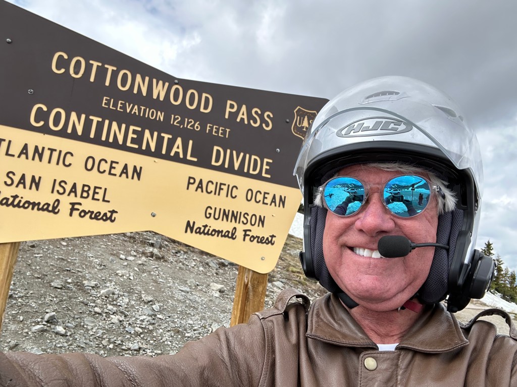
Cottonwood Pass: 12,126 Feet
Cottonwood Pass, near the summit.
The idea for the road over Cottonwood Pass began in 1955, when the US Forest Service needed a way to get timber out of the heavily forested area. The area surrounding the pass is the Gunnison National Forest to the west – where we are now – and the San Isabel National Forest to the east, where we’re headed.
By 1958, a dirt road over the pass was in place. The eastern side of the pass was the first to be paved – from Cottonwood Pass down to Buena Vista. Then, in 2019, the paving on the western side of the pass was completed, all the way up to Cottonwood Pass. For the first time, this opened up the entire roadway, from Almont, over the pass, to Buena Vista.
Construction crews paving the last stretch of Cottonwood Pass, on its west side.
At the top of the pass, 12,126 feet high on the Continental Divide, there are great views of the surrounding Collegiate Peaks, particularly Mount Princeton to the south. More on those peaks, later in today’s blog post.
The road is closed in winter, due to heavy snowfall and avalanches. When open, generally from May through October, the pass is one of the few routes through the Sawatch Range accessible in a standard two-wheel drive passenger vehicle. Or a Harley.
Mark Mark, at the pass. It was a chilly 41 degrees F.
While Cottonwood Pass is the highest paved crossing of the Continental Divide, it’s possible to cross the divide at an even higher elevation. Colorado’s Argentine Pass, 13,207 feet, is the highest vehicle crossing of the Continental Divide, but you’d need a four-wheel drive vehicle with high clearance to do it. That, apparently, leaves us out. Argentine Pass is the highest point on the American Discovery Trail. The road began as a toll road over the pass in 1867, and was known as the highest wagon road in Colorado. If you wanted to try Argentine Pass, you’d access it from Georgetown, tonight’s destination.
Photo op at the pass.
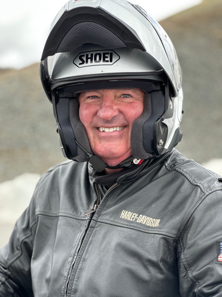
Yay! Made it.
Cold, but smiling.
From Cottonwood Pass, it’s a 4,000-foot descent to Buena Vista, which sits at the eastern end of the spectacular highway. Buena Vista is located in the Arkansas River Valley, home to some of the best whitewater rafting and fishing in the country.
Arriving in Buena Vista, we’ve been on the road about three hours. It’s time for a break.
Cruising by the Collegiate Peaks
From Buena Vista, we cruise north on US Highway 24, with the Collegiate Peaks to our left. We are now on the Collegiate Peaks Scenic Byway, a 57-mile stretch of road that begins in Poncha Springs, and continues to Granite. Buena Vista is about halfway along the byway. It’s where we’ll start, because, well, it’s where we are.
On the Collegiate Peaks Scenic Byway, we pass by Mount Columbia, Mount Harvard, Mount Yale and Mount Oxford. The byway could easily be called the Avenue of the Fourteeners. All these peaks are above 14,000 feet. It’s the highest concentration of 14,000-foot mountains in the US.
Each of the peaks got its name in a different way, but the common thread is that they’re mostly named after colleges.
Mount Harvard was named in 1869 by members of the first Harvard Mining School class, while on an expedition with their professor, Josiah Dwight Whitney. The same group named the peak next to Harvard, Mount Yale, after Whitney’s alma mater.
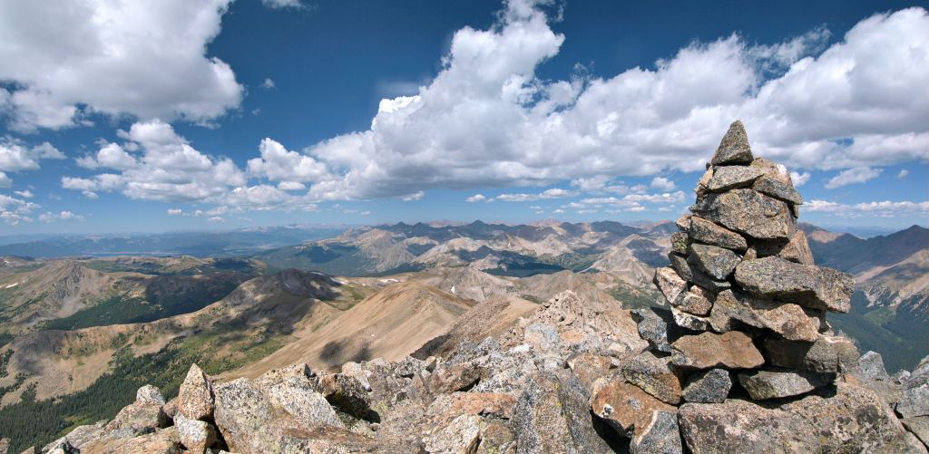
A cairn marking the summit of Mount Yale.
Mount Columbia was named by Roger W. Toll in honor of his alma mater, Columbia University, and in commemoration of its rowing victory at the renowned Henley Royal Regatta in 1878. Mount Oxford is named after the University of Oxford, in England.
We follow Highway 24 for 30 miles until we reach the historic mining town of Leadville. Sitting at an elevation of 10,152 feet, Leadville is the highest incorporated city in the US. The Leadville Historic District has been designated a National Historic Landmark since 1961. Its population today is 2,700. But during the mining boom of the late nineteenth century, it was Colorado’s second most populous city, after Denver.
Mining in the Leadville area began in 1859, when prospectors discovered gold at the mouth of California Gulch. By 1872, placer mining in the area yielded more than $2,500,000, roughly equivalent to $58,000,000 in today’s dollars.
Leadville was founded in 1877 by mine owners Horace Tabor and August Meyer at the start of the Colorado silver boom. Initially, the settlement was called Slabtown, after the quickly built houses that sat on slabs. But when the residents petitioned for a post office, the name Leadville was chosen.
In 1879, Leadville was booming. Its city directory listed 10 dry goods stores, 4 churches, 4 banks, 31 restaurants, 120 saloons, 3 daily newspapers, 19 beer halls, 70 law firms to abate claim jumpers, 35 houses of prostitution, and 118 gambling houses. At the time silver was discovered in Oro Gulch, Leadville had three separate red-light districts.
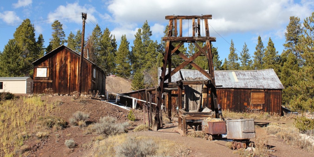
The remains of the Matchless Mine near Leadville.
Today, like so many former Colorado mining towns, Leadville’s economy is based primarily on tourism. The National Mining Museum and Hall of Fame commemorates the work of miners and others who work with natural resources.
Leadville’s altitude and rugged terrain attract a number of challenging racing events, including the Leadville Trail 100 series of races. This year’s Leadville Trail 100 Run will be held on August 19 – at least that’s when it begins. Some runners take more than a day to finish. Matt Carpenter recorded the best time for the event in 2005, when he covered the 100 miles in 15 hours and 42 minutes.
Fun With Molybdenum
The Top of the Rockies Scenic Byway takes us north from Leadville to the Copper Mountain ski area, 25 miles from here.
On my way to Copper Mountain, on Colorado Highway 91, I cross the Continental Divide – again – on 11,318-foot Fremont Pass. The pass is named for John C. Frémont, an explorer who discovered the pass while traversing present-day Colorado during the 1840s.
At the summit of Fremont Pass is the Climax Mine, which at one time supplied 75 percent of the world’s supply of molybdenum. Today, China produces the vast majority of the world’s molybdenum supply, about 130,000 metric tons a year. That’s two and a-half times as much as the US now produces.
Molybdenum is used as an alloying element for stainless steel and other metals. It enhances the resistance of metals to corrosion and builds their strength at high temperatures.
If you like your stainless steel cookware, you have molybdenum to thank for that.
During the Leadville Silver Boom, prospector Charles Senter discovered and claimed the outcropping of molybdenite (molybdenum sulfide) veins in 1879, but he had no idea what the mineral there was. Senter determined that the rock contained no gold or silver, but retained the claims, just to be on the safe side. Each year he performed the assessment work required to maintain his lode claims, convinced that his mystery mineral must be of value. In 1918 Senter received $40,000 for his mining claims and settled into a comfortable retirement in Denver.
In 1895, Senter found a chemist who identified the gray mineral as containing molybdenum. At the time there was virtually no market for the metal. When steelmakers determined the utility of molybdenum as an alloy in producing hard steel, the first ore shipments from the deposit began in 1915, when the Climax mine began full production. The name comes from the Climax railroad station that was built at the top of the Continental Divide as a place to uncouple helper locomotives after the long climb from Denver to the mining town of Leadville. It was the climax of the route.
We descend about 1,600 feet from Fremont Pass on our way to the Copper Mountain Resort, a ski area that sits at the intersection of Colorado Highway 91 and Interstate 70. Because of its location on I-70, and its proximity to Denver – 75 miles away – Copper gets a lot of visitors from the Front Range. We’re not among them.
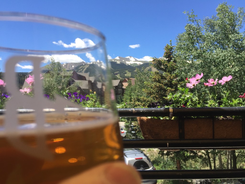
Soon, I see signs for the mountain ski town of Breckenridge. Colorado Highway 9 leads us Breckenridge. We roll past the ski area, and pull in to the Breckenridge Brewery. It’s a tradition. Well, it’s something Dave and I did five years ago, and dropping in to the brewery a second time will make it a tradition.
Beer in Breck.
Hoosier Daddy?
After a nice break in Breck, I head south on Highway 9, following the Blue River. The river is what’s known as a Gold Medal fishery, home to an abundance of rainbow trout. Colorado has 14 Gold Medal fisheries — rivers, streams, lakes and reservoirs. Two of those fisheries are minutes from my house in Carbondale, the Roaring Fork River and Fryingpan River. Too bad I suck at fishing.
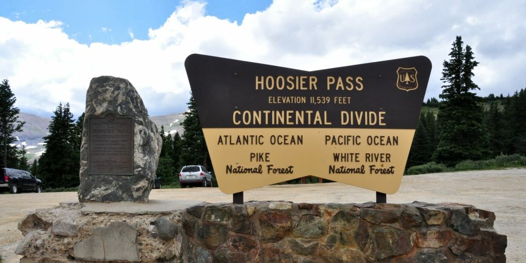
A bunch of twists and hairpin turns later, we arrive at 11,539-foot Hoosier Pass, yet another crossing of the Continental Divide.
Native American Tribes, including the Utes, were the first known users of Hoosier Pass. There’s a historical marker at the pass that commemorates its first crossing in 1844 by the Fremont Expedition.
Hoosier Pass gets its name from the Hoosier State of Indiana, where many of the area’s first mine camp residents came from during the 1860s. Rolling over the pass, I can’t resist getting on my intercom headset, and asking the guys, “Hoosier Daddy?” For the un-hip, when you ask someone, “Who’s your daddy?” you’re not looking for an answer; you’re making a point about how great you are.
There are many theories about where the name Hoosier comes from. They’re all amusing, and it’s hard to know which, if any, are to be believed. In any case, people from Indiana have been referred to as Hoosiers since 1832.
Hoosier Pass is the fourteenth 10,000-foot + pass I’ve ridden on this trip, and my fifth crossing of the Continental Divide.
Hoosier Pass sits on the Continental Divide.
Ahead: Three More 10K Passes
Descending from Hoosier Pass, we roll through the town of Alma, whose claim to fame is that its post office has the highest elevation of any in the country. Alma is at 10,578 feet, the highest incorporated municipality in the US. The town was apparently named for the wife of an early settler. Her name was Alma. Today, 300 people call Alma home.
Only fives miles past Alma, we come to the town of Fairplay, population 725. The town was named by settlers who were upset by the generous mining claims given to the earliest prospectors and promised a more equitable system for its residents. Equitable, you know, more fair.
Fairplay is at 9,953 feet. We don’t have to climb much to get to our next 10,000 foot + pass, Red Hill. Now on US Highway 285, we arrive at 10,051-foot Red Hill Pass, only four miles past Fairplay. The pass gets its name from the red hills that flank both sides of the summit and its inclines.
Our 10,000-foot passes now come in quick succession. Next up: 10,001-foot Kenosha Pass, barely cracking the 10K barrier. Before European settlers, Kenosha Pass was often used by Ute Indians headed towards hunting grounds near modern-day Fairplay. During the gold rush, the pass was traversed by prospectors hoping to find gold in the same area. In 1879, the Colorado Silver Boom began and the trail over Kenosha Pass was widened to accommodate wagons heading west. The pass was named for Kenosha, Wisconsin, by a stage coach driver who was from there.
Kenosha Pass is our seventeenth 10,000-foot pass of the trip. You keeping score?
I have one more 10K pass today, and it’s a doozie.
The Guanella Pass Scenic Byway, while it’s still below the treelike.
To get there, I turn north in the tiny town of Grant on Guanella Pass Road. I’m heading over Guanella Pass. It’s a two-fer: a 10,000-foot+ pass, and a scenic byway. The Guanella Pass Scenic Byway will take me to Georgetown, tonight’s destination. It’ll be the twelfth scenic byway I’ve ridden on this trip.
A brief stop, then onward to Guanella Pass.
The road to the top of Guanella Pass is narrow, steep and windy. It has what seems like 20 hairpin turns, all clearly marked, each with a chance to downshift to first gear. You’d better bring your “A Game” on this road.
The pass is open year-round, weather permitting. From the beginning of the byway until we reach Georgetown, it’s only 22 miles, but will take me an hour. If I’m lucky.
On the Guanella Pass Scenic Byway.
The Guanella Pass Scenic Byway passes through two national forests on its twisting path, the Arapaho National Forest and the Pike National Forest. We reach Guanella Summit, 11,669 feet, well above the timberline. Very close to the summit is the trailhead for Mount Bierstadt, which is off to my right.
If you’re a hiker, Mount Bierstadt, 14,066 feet, is one of the least difficult of all the Colorado Fourteeners. “Least difficult” is not the same as easy. It’s still a considerable hike, almost eight miles, out and back, from the trailhead to Mount Bierstadt. We have dinner plans in Georgetown; bagging a Fourteener today is not in the cards.
The trail to Mount Bierstadt starts gently, in fields near Guanella Pass.
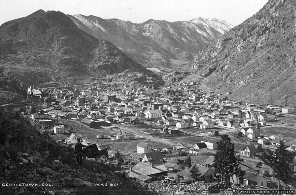
Historic Georgetown
From the Guanella Pass summit, it’s about a 3,000-foot descent to Georgetown, only 10 miles away. It’s steep. And winding. And pretty awesome.
Like so many other towns I’ve seen on this trip, Georgetown is a former mining industry hub that now exists solely on tourism.
In 1858, George and David Griffith arrived in nearby Idaho Springs, a little too late to claim any land to explore for mining. So, they ventured west, and a year later, George found gold. In 1860, the Griffiths formally incorporated the Griffith Mining District, and the town of Georgetown was born.
As it grew and thrived as a silver mining location, Georgetown was once Colorado’s third largest town, behind only Denver and Leadville. Today, it has 1,200 residents and a lot of visitors.
Once called the Silver Queen of Colorado, Georgetown hit its peak of prosperity in 1877. At the time, 5,000 people lived in and around the city, which had two newspapers, a telegraph office, a bank, five churches and several hotels. But when Leadville’s silver boom started in 1878, its production dwarfed Georgetown’s. Soon, Georgetown began to lose its boomtown glow.
Georgetown, when it was a boomtown.
By the late 1930s, Georgetown’s population had dwindled to 300 or so. During World War II, most of the area’s old mining machinery was removed for scrap metal drives.
After the war, automobile tourism revived and transformed Georgetown’s economy, leading to a new focus on historic preservation. Today, Georgetown is a popular destination for tourists driving west on I-70 from Denver. The town also serves as a base for people exploring the Guanella Pass Scenic Byway, or hiking nearby Fourteeners, like Mount Bierstadt or Mount Evans.
Georgetown Lake sits at the edge of town.
One of the town’s landmarks is Georgetown Lake, a 55-acre reservoir created by a dam during Georgetown’s years as the epicenter of the silver boom. The reservoir stores water for town residents, and the dam provides hydroelectric power to Georgetown and nearby areas.
The lake is a scenic location for lodging, so I check into my hotel that’s adjacent to the lake, and begin foraging for food.
Our math-oriented day was quite the adventure. Three scenic byways. Six 10,000-foot+ passes. Three crossings of the Continental Divide.
How could we possibly top that? Tomorrow, we’ll ride to the top of a Fourteener.
Dinner at the Alpine Restaurant in Georgetown. Look who I ran into! She’ll be along the rest of the way, all the way to Carbondale 🙏
***
The Day in Review:
Click here to see today’s complete route from Gunnison, Colorado, to Georgetown, Colorado – via the Top of the Rockies Scenic Byway, the Collegiate Peaks Scenic Byway, and the Guanella Pass Scenic Byway.
Today’s Takeaways:
Cruising the Collegiate Peaks.
Hoosier Pass. Who’s yer Daddy?
Guanella Pass, hairpin turns ahead.
Today’s Trivia: Colorado’s Fabulous Fourteeners
Today, as we rode past the Collegiate Peaks, we caught a glimpse of some 14,000-foot mountains, known as Fourteeners. Colorado is home to 58 of these mountains, far more than any other state. Alaska is second with 29.
There’s a debate about exactly how many Fourteeners there are in Colorado. To qualify, a peak must rise at least 300 feet above the saddle that connects it to the nearest Fourteener peak – if another exists nearby.
Whatever the number, Fourteeners are a thing in Colorado. For some, climbing them is like a religion. An addiction. A competition.
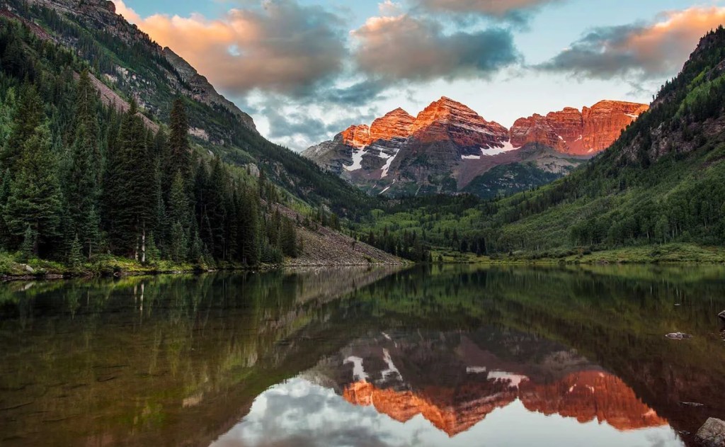
The Maroon Bells. Just minutes from our front door.
A few Fourteeners are not far from our Carbondale home, including North America’s most photographed mountains, the Maroon Bells. Just 10 miles west of Aspen, and 30 miles from my front door. The Bells are actually two peaks. Maroon Peak is 14,163 feet, and North Maroon Peak is 14,019.
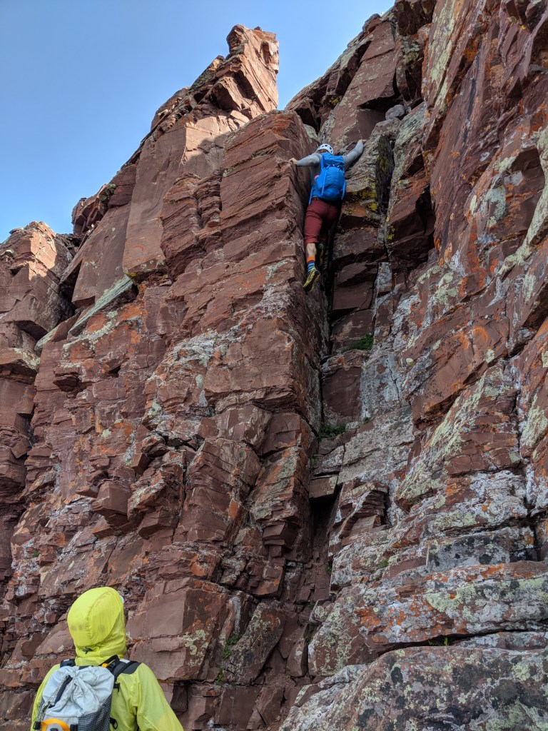
While summiting some Fourteeners can be like a very long hike, getting to the top of the Maroon Bells – both of them – is a technical climb. It’ll involve some form of alpine scrambling, and you’ll need to use a lot of care and caution, as the rock never seems to stop decaying and falling apart, making footing and handholds a challenge. Loose, rotten rock puts the Bells in the dangerous category.
On the Maroon Bells. It’s more than a hike.
The highest of the Fourteeners is Mount Elbert, 14,440 feet. Other than California’s Mount Whitney, Elbert is the tallest mountain in the Lower 48.
The “lowest” of Colorado’s Fourteeners is Sunshine Peak, barely making the list at 14,001 feet. There’s no end to the hiking and climbing thrills you can have in Colorado. If the Fourteeners aren’t enough for you, there are 637 peaks in the state between 13,000 feet and 13,999 feet.
It’s not that uncommon for climbers to summit all 58 of Colorado’s Fourteeners. An estimated 2,500 climbers have done that. If you wanna add that to your bucket list, you should probably know which are the hardest, and which are the easiest. Here’s a ranking of them, by difficulty.
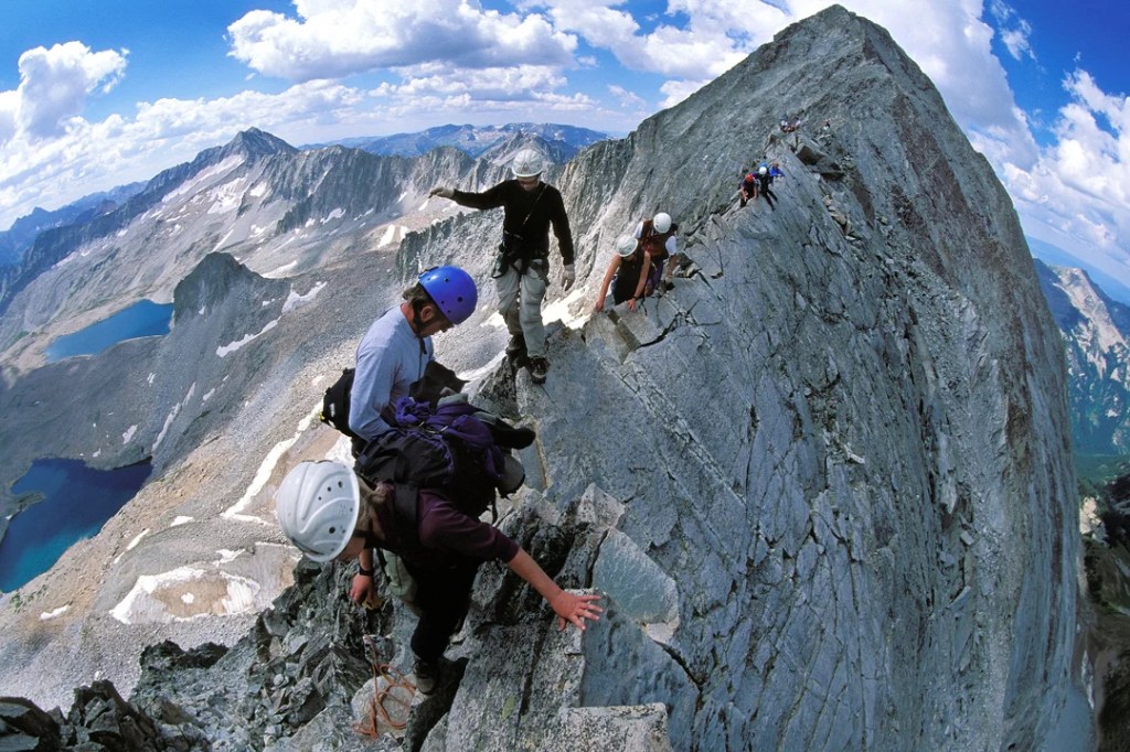
The knife edge on Capitol Peak. Experts only.
Capitol Peak is known as Colorado’s most difficult, dangerous, and deadly Fourteener. Its standard knife-edge route, exposed ridges, steep rock faces, and sharp summit add to its difficulty and even more so when bad weather strikes.
Colorado’s Fourteeners bring about all sorts of extreme behavior. There’s a guy who climbed all of them in a two-week period. You’ve got to be a bit crazy, and a lot motivated, to do that.
Then, there are the people who climb the Fourteeners, and ski down. You’d be surprised at how many people have skied down all 58 of them. OK, about 15 have done it. One of them, an Aspen local named Chris Davenport, skied all the Fourteeners in one year. He’s the first to do that.
Chris Davenport. A living legend on skis.
Fourteeners attract more than just the human race. Dogs find their way up the mountains, too. Three canines have summitted all Colorado Fourteeners, including a Siberian Husky named Loki.
I’m no match for Loki. But I have been to the top of one fourteener, Mount Evans. On a Harley. That’s just how I roll.
I made it to the top of a Fourteener. On my Harley, in 2014.
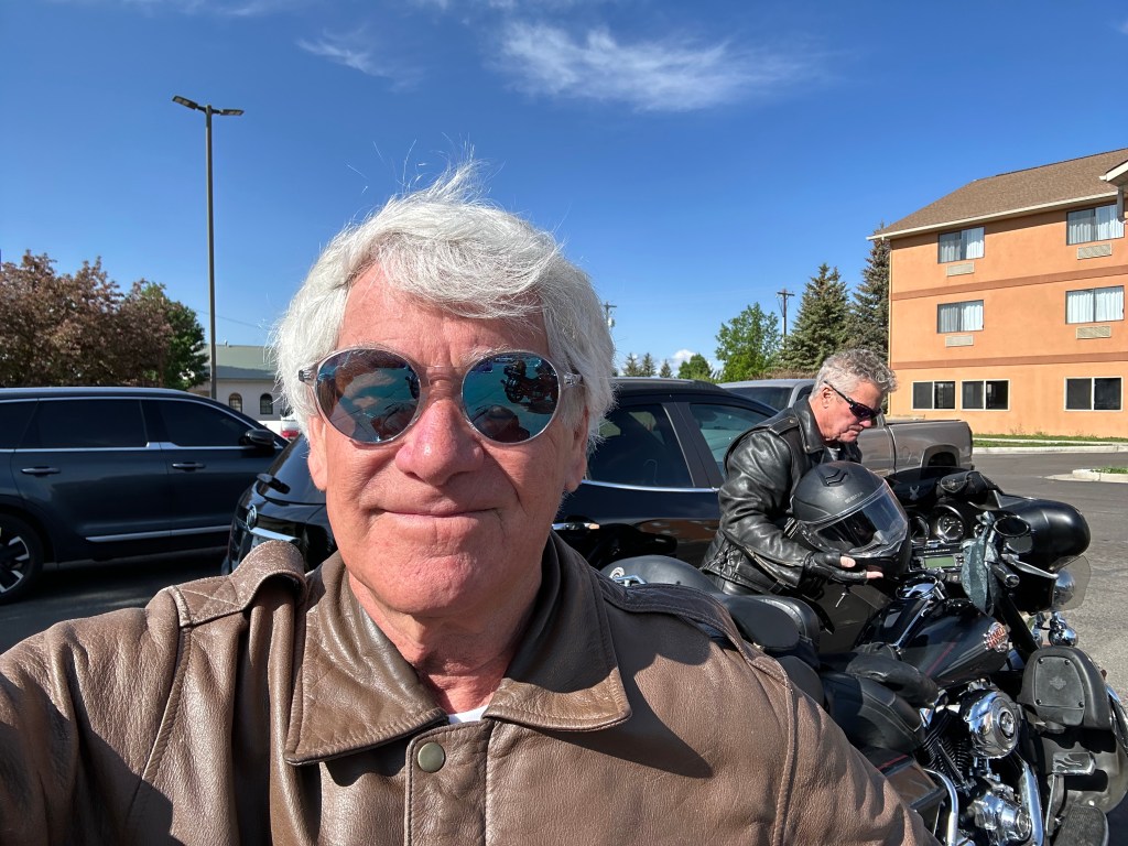
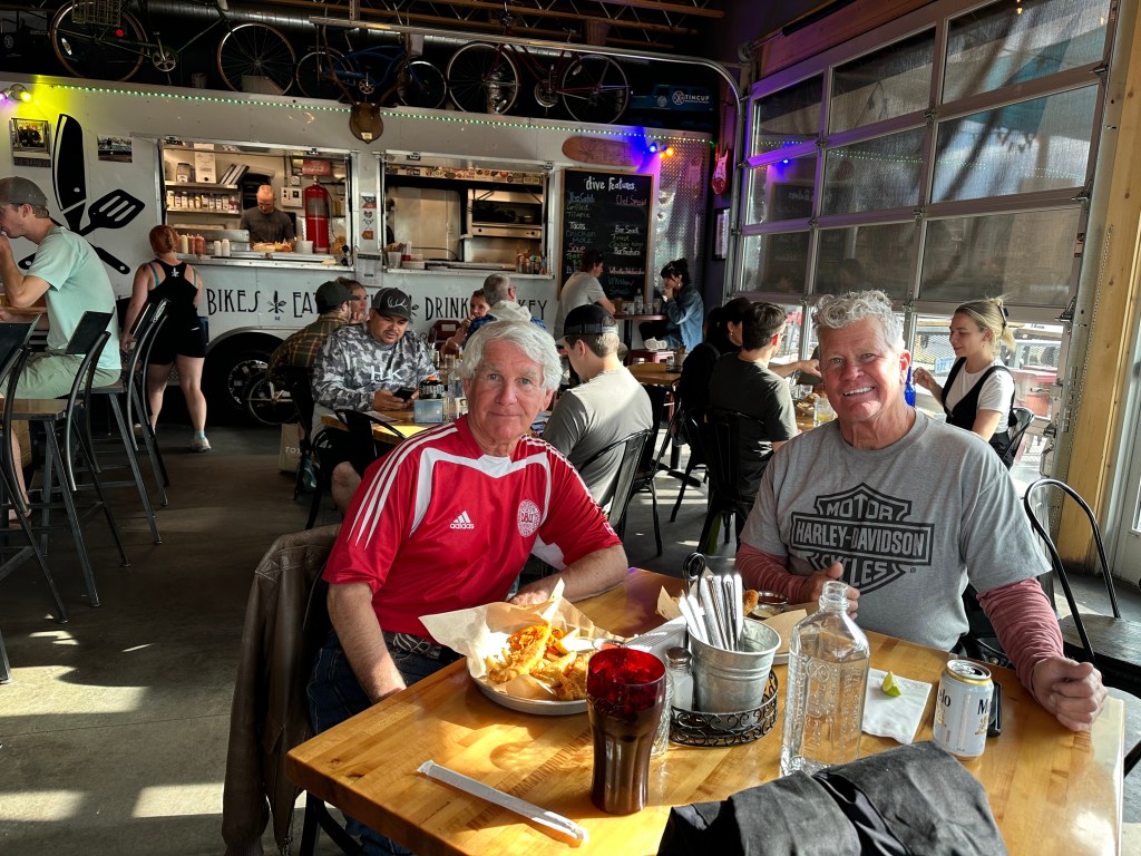
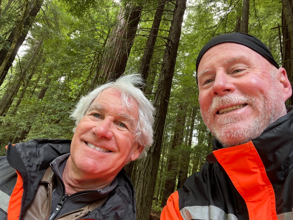
Jim Ingraham, from Glenwood Springs, made a cameo appearance today. He’ll ride with us today and tomorrow, then head home.
Today, we’re giving ourselves a break. It’ll be a simple 210-mile ride.
And we’re giving you a break, too. That’s my intention, anyway. Your reading task should be significantly simplified. Expect to get through this post in no time at all, even if you’re a slow reader. You’re welcome.
Our destination today is Creede, 105 miles from our starting point in Gunnison. We’re riding to Creede, then back to Gunnison for our second night in college town USA. Simple as pie. That’s it.
We begin the day by heading west on US Highway 50, riding along the Gunnison River.
Rain was in the forecast all day, and the skies were dark, so we kept our rain gear on. Just in case. Note Jim’s new rain suit, replacing his old “Michelin Man” balloon-style outfit.
Nine miles out of town, at the Lake City Bridge, we turn south onto Colorado Highway 149. It’s called the Lake City Bridge, because it leads us to Lake City, 45 miles away. We’ll be on this roadway the rest of the day. It’s also known as the Silver Thread Scenic Byway, the ninth scenic byway we’ve ridden on this trip. We’re racking up the numbers!
The Silver Thread Scenic Byway name honors the vast silver industry that once thrived along this road. The byway finds its roots in the rich mining days of the late nineteenth century.
Ahead of us on today’s rise is a vertical rise of nearly 3,200 feet in the San Juan Mountains, before descending into Creede.
This road was once a trail used by the Ute Indians, helping them reach hunting camps and hot springs. In the 1850s, the Utes were overwhelmed by homesteaders and miners, and were relocated to the southwest corner of Colorado. Their ancestral paths were eventually widened and improved to become the Del Norte-to-Antelope Toll Road. It was a pay-to-ride stage line that linked the supply station of Del Norte to the mines in Lake City and Creede – two of our stops today.
In 1990, the Colorado Transportation Commission chose a 75-mile stretch of this highway to become a Scenic and Historic Byway. A Silver Thread Committee set a goal of promoting all the resources on the byway, educating the public about them, and improving safety and comfort along the Silver Thread. The committee also sought designation of the Silver Thread as an All-American Road; that hasn’t happened yet, as there are only two All-American Roads in Colorado – so far. One was the San Juan Skyway Scenic Byway, which we rode yesterday; the other is Trail Ridge Road, which we’ll do on Saturday.
With the discovery of silver in Lake City and Creede in the late 1880s, toll roads and railroads were extended at a breakneck pace, creating a vast transportation network throughout the San Juan Mountains.
Lake City and Creede flourished until the silver panic of 1893. Even after the panic, the mountains were still rich with ore, so miners regrouped and opened again, operating with great success for decades. It was only in the last half of the twentieth century that the silver market completely collapsed, forcing the mines to close. Those mines remain a legacy as rich as the silver veins that still run through the San Juan Mountains.
Lake City
An hour after leaving Gunnison, we roll into the town of Lake City, which sits at 8,660 feet. Lake City is named after nearby Lake San Cristobal (Saint Christopher), Colorado’s second-largest natural lake.
The small mountain community was founded as a mining town when four prospectors illegally set up mines in Ute territory in 1871. After the Ute people ceded the territory in 1874, miners discovered a hotspot for silver and gold in what was then called the Hotchkiss Lode – now known as the Golden Fleece Mine.
The entrance to what was once the Golden Fleece Mine.
With the completion of the first road into the mountains of this region, Lake City served as a supply center for the many miners and prospectors flooding into the area, starting in the 1880s. At its peak, the town boomed to as many as 5,000 settlers. Today, Lake City has shrunk to 430 residents.
By 1905, the mining era was effectively over and Lake City entered a decades-long period of economic decline. Its economic driver today is tourism. The mountains around Lake City provide an array of outdoor recreation opportunities, including fishing, hunting, boating, mountain climbing, off-roading, horseback riding, and hiking. And, motorcycle riding.
The town is on the National Register of Historic Places and has a designated Historic Downtown. It still has many of the original buildings from the mid-1800s. The town’s remote location and decades of economic decline helped conserve the buildings from the mining era, allowing Lake City to avoid many of the modern “improvements” to historic buildings that often happen in more prosperous towns.
In the winter, Lake City hosts a series of winter-themed events called Winter White Out. Starting at the end of January and lasting six weeks, activities like pond hockey on Lake San Cristobal, an ice-climbing competition, and a snowshoe race take over the city.
Before leaving town, here’s a Lake City fun fact: In 1874, Alferd Packer, Lake City’s most notorious resident, was jailed for killing and eating five fellow gold prospectors when their group became trapped in a blizzard atop nearby Slumgullion Pass. Packer became known as the Colorado Cannibal. Great nickname! After his release from prison, he allegedly became a vegetarian. You can visit the massacre site – we don’t – and then go to the Hinsdale County Museum to view the skeletal leftovers from the meal.
Slumgullion Pass
The road out of Lake City climbs steeply, and ten miles later, we find ourselves at 11,530-foot Slumgullion Pass. I love the name. Almost as much as Colorado Cannibal.
It’s believed Slumgullion Pass got its name because the pioneers thought the “yellow” nature of the mud from the earth flow looked like slumgullion stew, a popular dish for miners, with its variety of vegetables and meat. Today, slumgullion stew’s modern version is familiarly known as American Goulash.
Give it a try. Probably tastes better than it sounds.
Slumgullion stew, in a slow cooker. Very tasty on a cold winter night.
Slumgullion Pass is mostly known as part of the Slumgullion Earthflow National Natural Landmark. About 700 years ago, a large chunk of decomposing volcanic rock slid down the mountain to form a natural dam. This blocked the Lake Fork of the Gunnison River and created Lake San Cristobal. The “Slumgullion Slide,” as it is known, is still active today and can move up to 20 feet per year in certain areas.
Slumgullion was popular during Colorado’s mining boom. Miners historically referred to the leftover mud in gold sluices as slumgullion. Slumgullion Pass is said to be the steepest in Colorado, with a nine percent grade.
Creede, Home of the Giant Fork
Creede is quite colorful.
The 40-mile journey from Slumgullion Pass to Creede is spectacular. That’s an over-used descriptor, but I’m running out of words that adequately convey the beauty of the terrain.
First, we cross 10,901-foot Spring Creek Pass. It’s the tenth 10,000-foot pass we’ve crossed on this trip, and our second crossing of the Continental Divide.
The road drops about 2,000 feet over the next 33 miles, as we descend into Creede, a historic former mining town of whose population today is 250. In 1891, at the height of the mining boom, Creede’s population swelled to 10,000. Our last ten miles or so follow the Rio Grande River on its course into Creede.
The last passenger train to Creede ended service in 1935. Since then, cars have dominated the landscape on the Silver Thread Scenic Byway. In 1968, Highway 149 between Lake City and Creede was paved – except for one small portion, which was completed in 1982.
We arrive in Creede, today’s destination, around noon. It’s a perfect time for a cold beverage, a fuel fill-up, and a rest stop.
At a watering hole in Creede.
The Creede Repertory Theatre is a nationally acclaimed theater that has produced a number of plays about Colorado and Creede. The theater, which this year celebrates its fifty-eighth season, is open throughout the summer.
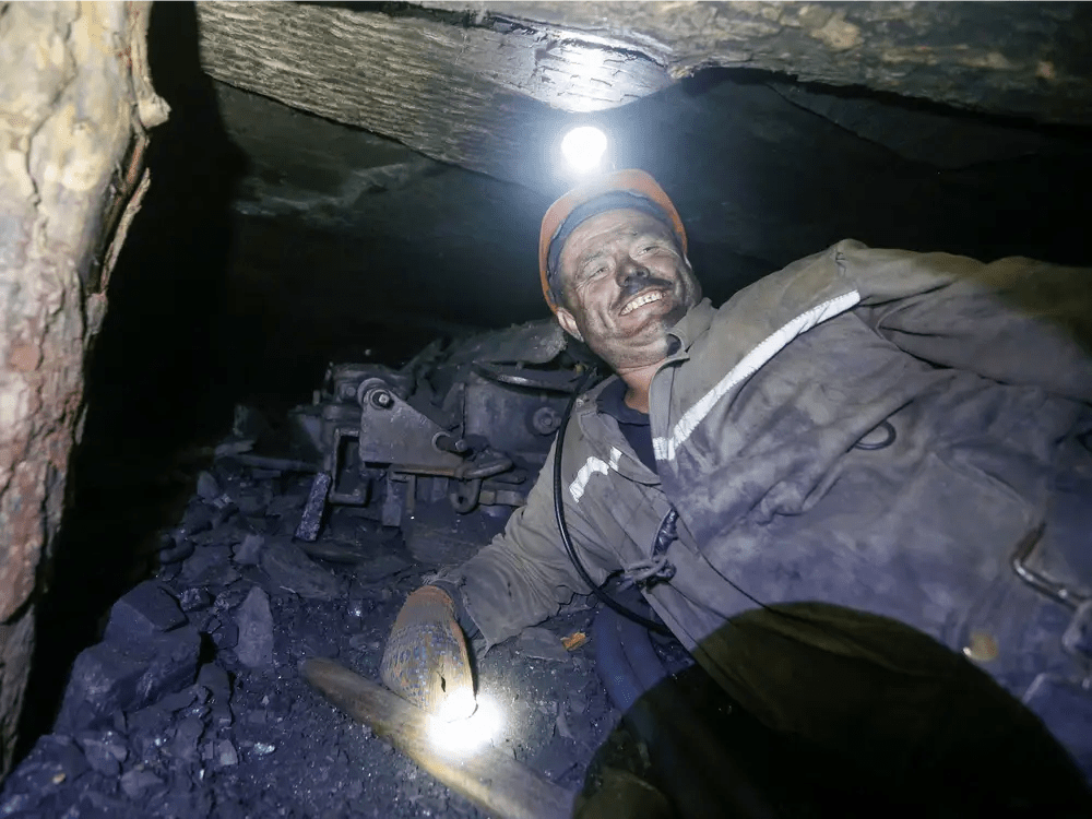
Creede also hosts the Colorado State Mining Championships. Of course, it does. The event, known as the “Days of ’92,” has been held every July 4, since 1892. Competitions include hand steeling, hand mucking, double jacking and single jacking. These methods of working the rock by hand were used by miners before they had electricity to power their tools. About 10,000 people come to Creede every Independence Day weekend to watch these rapidly disappearing historic mining techniques.
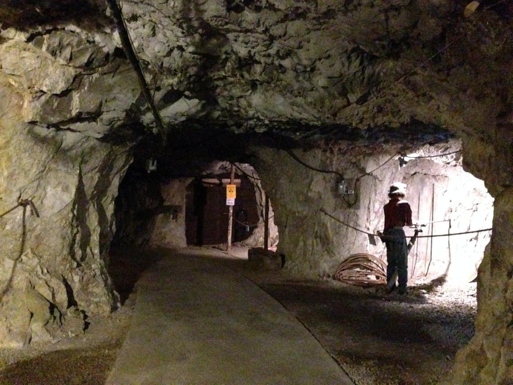
In Creede, that mining heritage is celebrated at the Underground Mining Museum. The museum offers a glimpse into Creede’s rich mining past. To create the museum, workers “mined” the mountainside in the early 1990s, a few years after Creede’s last mine closed. About 45,000 visitors a year experience the underground.
There’s a lot going on here, for a town of 250.
The Underground Mining Museum gives you a sense of what miners experienced.
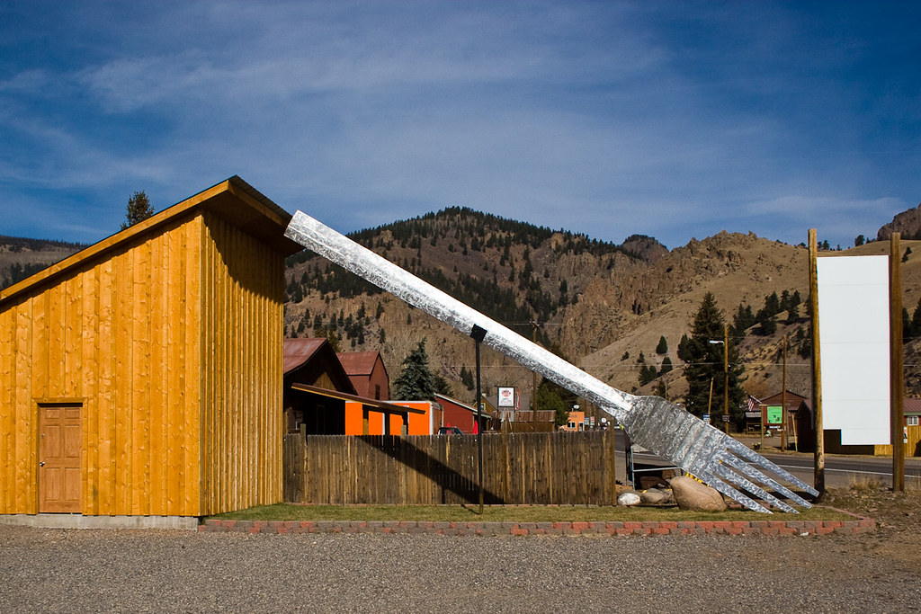
Before we head back to Gunnison, there’s one roadside attraction worth checking out. The Creede Fork, also known as the World’s Largest Fork, is a 40-foot aluminum sculpture built in 2012. Created by artists Chev and Ted Yund, the fork is made of aluminum and weighs more than 600 pounds. The unique piece of art was commissioned by Keith Siddel as a birthday present for his wife, Denise Dutwiler, owner of the local Cascada Bar & Grill, which has since closed.
If you’re compelled to visit the fork, you can find it at 981 La Garita Street.
Yes, it’s a big fork.
Our time in Creede has come to an end.
It’s been a laid-back day, with some fabulous riding, among exquisite scenery.
On Main Street in Creede.
We do a U-turn in Creede, and make our way back to Gunnison, 110 miles away. Over Spring Creek Pass, across the Continental Divide, over Slumgullion Pass, through Lake City, along the Gunnison River. Before you know it, we’re back in Gunnison and it’s time for dinner.
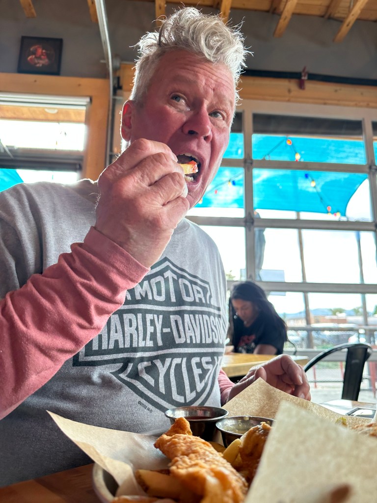
Dinner at The Dive in Gunnison. That’s the name: The Dive.
For dinner: fish and chips.
***
The Day in Review:
Click here to see today’s complete route from Gunnison, Colorado, and back to Gunnison – via the Silver Thread Scenic Byway.
Today’s Takeaways:
Silver Thread Byway, scenic and historic.
Slumgullion, a stew worth trying.
Get forked, in Creede.
Today’s Trivia: Colorado’s Smallest Ski Area
When you think of skiing in Colorado, what often comes to mind is gigantic areas like Snowmass, Vail, and Telluride. Lots of lifts. Tons of vertical rise. Beautiful people. And, they’re quite expensive to visit.
The Colorado ski industry is a huge hunk of the state’s economy, accounting for $5 Billion in annual economic output, attracting more than 12 million visitors, and supporting 45,000 jobs – including mine.
It’s big business.
Yes, big business – except at Lake City, one of Colorado’s smallest ski areas.
Lake City has 14 skiable acres, six trails, and 247 feet of vertical rise. Compare that to Snowmass, where I work in the winter, and you get a sense of scale. Snowmass has 3,362 skiable acres, 94 trails, and 4,406 feet of vertical rise. And, 16 lifts.
With its single lift, the Lake City Ski Hill represents a fading era. It’s what skiing once looked like. Old school.
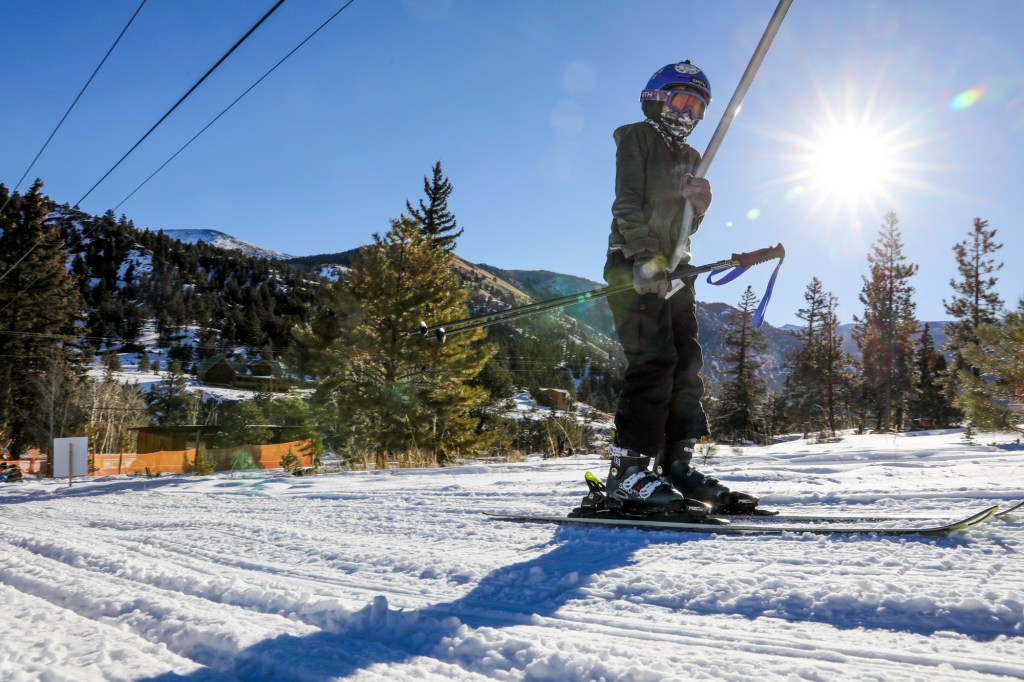
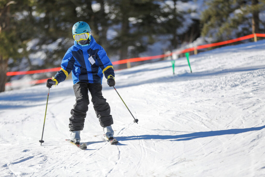
A young skier takes the Poma lift up the Lake City Ski Hill.
Lake City’s Poma lift is Colorado’s oldest operating lift, an A-Basin hand-me-down. The lift ran at Arapahoe Basin in the 1950s before arriving in Lake City in 1966 to open what the town called the “Lake City Winter Wonderland.” The name of the ski area owned and operated by the town has since changed to better fit its modest ambitions. It’s now simply called the Lake City Ski Hill and Terrain Park.
Lift tickets are $25 for a day pass, $10 for children 17 and under. Those rates include equipment, if you need it – skis, boots and poles – free of charge. The ski hill is usually open Saturday, Sunday and Monday, from 10 am to 2 pm. If you need a warm-up during your ski day, stop by the small hut where lift tickets are sold, and grab a cup of hot chocolate.
There’s no artificial snow-making here, but given Lake City’s extreme winters, it isn’t necessary. Lake City Ski Hill is the quintessential, bare-bones, bygone ski experience. It takes “small” to the next level.
Shredding it at Lake City Ski Hill.
Only a few community hills like this have managed to survive in the wake of the mega resort boom across Colorado. Ouray has one, too – Lee’s Ski Hill, with one rope tow and 75 feet of vertical. It’s run by the town of Ouray, just as the Lake City Ski Hill is run by the town of Lake City. Skiing, as it used to be.
If you’re curious about what skiing used to be, try out Lake City. Tell them Gary sent you.
If you aren’t into skiing, Lake City has other pretty cool winter activities.
Brittany celebrates her 36th birthday at Heather’s Savory Pies in Basalt, Colorado — on June 14, 2019. We don’t get to watch her blow out any birthday candles this year, as she turns 40. But this blog is a good way to send birthday greetings, so that’s what we’ll do!
***
Today’s blog post begins with a shout-out to our unofficially adopted daughter, Brittany.
She’s a desert rat, a PR person, like me — and an aspiring motorcycle rider.
Today, she turns 40!
You know you’ve arrived when a blog post becomes your birthday card.
Happy Birthday, Britt.
🎉 🎂🎁🎉 🎂🎁🎉 🎂🎁🎉 🎂🎁
***
We leave Durango, heading west on US Highway 160. Barely out of the hotel parking lot, we’re already riding the beautiful San Juan Skyway Scenic Byway, our eighth scenic byway on this trip. An added bonus: this scenic byway is also an All-American Road, the highest designation offered by the US Department of Transportation.
With Durango eleven miles in our rear-view mirrors, we ride past the Hesperus Ski Area, noted for having the largest night skiing in the southwest. Hesperus, which has operated on and off since opening in 1962, features one double chairlift named Big Horn. A full day adult pass is $46. Very convenient and reasonably priced, if you live in Durango.
Hesperus is noted for its night skiing, convenient for students at Fort Lewis College in Durango, only 14 miles away.
Ahead is the town of Mancos, known as the Gateway to Mesa Verde National Park. Mancos is ten minutes from the entrance to the park, which protects the heritage of 26 Pueblos and Tribes, and offers a window into the past. It’s a World Heritage Site and International Dark Sky Park.
For us, Mancos is a place where we turn west on Colorado Highway 184, and head for Dolores, about 20 miles ahead. You may remember Dolores, Jerry Seinfeld’s lady friend, from Day One of this trip.
In Dolores, named after what’s-her-name.
If you’ve forgotten, Dolores is a town of 900, located in a canyon with the Dolores River on one side, and rock cliffs on the other. Dolores is Spanish for “sorrows.” Nothing to be sad about. It’s a beautiful little place whose economy is based on recreational tourism.
From Dolores, it’s about 50 spectacular miles to 10,222-foot Lizard Head Pass, the ninth 10K + pass we’ve crossed on this trip. As you may recall from Day One of this trip, the name Lizard Head comes from nearby Lizard Head Peak, which reaches to 13,119 feet. The peak is said to look like the head of a lizard. I don’t see it.
This part of the journey, on Colorado Highway 145, along the San Juan Skyway Scenic Byway, is familiar to me. Sarah and I rode it on June 3, on our way to meet the Posse in Page.
A stop along the San Juan Scenic Byway.
A Catalog of Colorado Mountain Towns
From the pass, we descend about 1,500 feet in 15 miles before approaching the mountain ski town of Telluride. We turn west near the Telluride Regional Airport, and miss the town of Telluride altogether. While we don’t have time for a Telluride visit today, it’s absolutely worth seeing. A former silver and mining camp on the San Miguel River, Telluride sits in a deep canyon, surrounded by steep forested mountains and cliffs. Its skiing is world-class.
Along with other Colorado mountain ski towns – including Aspen, Crested Butte, Vail and Steamboat Springs, Telluride is a ridiculously expensive place to live. Housing is all but unaffordable, unless you’re a one-percenter.
We bypass Telluride, and continue our journey on the San Juan Skyway Scenic Byway, which takes us to Placerville, then over the Dallas Divide. The divide is an 8,983-foot pass that serves as a divider for the San Juan Mountains and the Uncompahgre Plateau. It’s a 2,000-foot descent from here until we reach the town of Ridgway, which as you may recall, is known for producing every Grammy in the award’s history – more than 8,000 in all.
En route to Ridgway.
Black Canyon of the Gunnison
Twenty-five miles north of Ridgway, we arrive in Dave’s favorite town, Montrose. The city was incorporated in 1882, and named after Sir Walter Scott’s novel, A Legend of Montrose.
I remain committed to spreading his ashes here, at one of the town’s many stoplights. We currently have no plans for ash-spreading duty in the event I predecease him. Dave and his estate can figure that out.
Hydrating in Montrose. Today’s flavor: pineapple 🍍.
Montrose sits at 5,806 feet above sea level, and is considered a gateway to a variety of spectacular areas in the Rockies. If you have time in Montrose, you can visit the Museum of the Mountain West, the Ute Indian Museum, or any of the stoplights along the Highway 550 – the town’s main street.
You can also head east out of Montrose and visit a nearby national park, the Black Canyon of the Gunnison. That’s what we do.
A roadside Cuban sandwich, leftover from last night’s dinner.
The Black Canyon of the Gunnison National Park is only about 11 miles northeast of Montrose. East on US Highway 50 for six miles, north on Colorado Highway 347 for five miles, and we arrive at the Park’s visitor center.
The park is the ninth national park we’ve visited on this trip. We’ve all been here before, but the views are so spectacular, it’s worth seeing again. With lifetime senior passes to the National Parks, our only cost is the gas to get here. And, of course, the opportunity cost of not being in Montrose.
That’s the Black Canyon of the Gunnison behind me.
Why is the park so dramatic? The Gunnison River drops an average of 34 feet per mile through the entire canyon, making it the fifth-steepest mountain descent of a river in North America. By comparison, the Colorado River in the Grand Canyon drops an average of 7.5 feet per mile.
The Black Canyon is so named due to its steepness, which makes it difficult for sunlight to penetrate the canyon. As a result, it’s often shrouded in shadow, causing the rocky walls to appear black. At its narrowest point, the canyon is only 40 feet wide at the river. The canyon is known for crumbling rock and dizzying heights. It’s a haven for rock climbers. Double Black Diamond. Experts only.
The main attraction in the park is the scenic drive along the canyon’s south rim, which we explore for the next hour.
Selfie time.
One more pic, and it’s time to head for Gunnison.
Heading Toward Gunnison
After staring at the canyon walls, we press on, riding east on US Highway 50 toward Gunnison. In a half-hour, we arrive at the Blue Mesa Reservoir, the largest body of water entirely in Colorado. With 96 miles of shoreline, it’s the biggest lake trout and kokanee salmon fishery in the US. The Blue Mesa was the first of three large dams built along the Gunnison River.
For 15 miles, we ride along the Blue Mesa, seeing just how big – and how low – the reservoir is. About five miles from the town of Gunnison, the Blue Mesa empties into the Gunnison River, which we follow into town. The Blue Mesa is part of the Curecanti National Recreation Area, a series of three reservoirs along the Gunnison River. The Curecanti gets about a million visitors a year, and is best known for salmon and trout fishing
On our way to Gunnison, we ran into a major delay due to highway construction on US Highway 50.
The backup was 1.7 miles! We went nowhere for 40 minutes, and when we finally got moving, it was slow speed over an unpaved road 😢
We reach Gunnison around 5 pm, at the end of a 244-mile day.
Gunnison is a college town of 6,700. It was named in honor of Captain John Gunnison, a US Army officer who surveyed for the transcontinental railroad in 1853. He stayed only three days before traveling west to Utah. Apparently, three days is the minimum stay for having a city named after you.
Western Colorado University in Gunnison.
The city is home to Western Colorado University, originally founded as the Colorado State Normal School for Children in 1901. A normal school is one created to train high school graduates to be teachers; its purpose is to establish teaching standards, or norms – thus the word “normal.”
Western Colorado University, the first college on Colorado’s Western Slope, is home to about 3,000 students – roughly half of Gunnison’s population. With more than 750 miles of singletrack trails surrounding the city, Western’s students love the area’s biking, hiking and other outdoor activities.
Gunnison will be our home for the next two nights. Not long enough to have a town named after us, and yet … it already feels like home.
***
The Day in Review:
Click here to see today’s complete route from Durango, Colorado, to Gunnison, Colorado – via the San Juan Skyway Scenic Byway, an All-American Road.
Today’s Takeaways:
San Juan Skyway Scenic Byway. Again.
Deep, dark walls of the Black Canyon of the Gunnison.
Gunnison. It’s only normal.
Today’s Trivia: Running Low at the Blue Mesa
As Colorado’s largest reservoir, the Blue Mesa has historically been a popular place in the summer for boating and fishing. With 96 miles of shoreline to explore, it offers all sorts of recreational opportunities. When there’s water.
But with record-low water levels in recent years, a continued drought and ongoing climate change, prospects are bleak for the Blue Mesa returning to normal any time soon.
Fishing at the Blue Mesa, in its better days.
Marinas on the Blue Mesa remained closed in 2022, but are open this year, because of record snowpack in the nearby mountains. But, barring a hydrological miracle, the Blue Mesa is expected to return to its glass-half-empty status in years to come. One good winter does not fix a water crisis. The Colorado River Basin is in the midst of its worst drought in about 12 centuries.
Two years ago, the US Department of the Interior ordered the release of eight feet of water from the Blue Mesa, to be sent downstream to Lake Powell. As you may recall from a blog post earlier in this trip, Lake Powell’s water levels are dangerously low, too. The American West’s river systems are interconnected — for good and bad.
That emergency release from Blue Mesa was needed to prop up water levels in Lake Powell, the nation’s second-largest reservoir. The entire Colorado River basin – its rivers and reservoirs – is in trouble. The basin is experiencing the driest 22-year stretch in the past 1,200 years.
In the past two years, water managers have released a total of 661,000 acre feet of water from Upper Basin reservoirs, including 36,000 acre feet from the Blue Mesa. An acre-foot is roughly 326,000 gallons, enough to cover an acre of land with a foot of water. And enough to supply two or three households for a year. It’s about as much water as two typical households use in a year.When full, the Blue Mesa can hold about 306 billion gallons of water. But it’s nowhere near full, so the numbers are misleading and meaningless. The Blue Mesa is 69 feet below the normal high watermark, meaning it’s about half of what’s called “full pool,” or full capacity.
By the end of water year 2023 – at the end of September – the Blue Mesa is expected to be at 82 percent of normal, thanks to a record-setting snowpack this past winter. But climate scientists and water managers in Colorado do not expect this year’s monster snowpack to be a trend.
This is what a water crisis looks like. The Blue Mesa has been incredibly low on water, compared to historical water levels.
Parts of some rivers in the Colorado River basin are running dry for the first time in decades, and some towns are already facing the unimaginable scenario of literally running out of water.
Without significant and aggressive reductions to water demands, it’s a real possibility that federal reservoirs in the Colorado River Basin System could effectively empty in a few years.
Something’s gotta give.
Paddling through a canyon in the Curecanti National Recreation Area. Water required.
Breakfast at the Bent Street Grille, a one-minute walk from our hotel in Taos.
New Mexico was a great diversion, if only for a day.
Thank you, Randy. Excellent idea.
But it’s time to head back to Colorado, where we’ll spend the rest of our trip. So, we head north, completing the final four miles of the Enchanted Circle Scenic Byway that we missed yesterday.
On our way out of town, just past the Millicent Rogers Museum, we turn west on US Highway 64 and roll past the Taos Regional Airport. Commercial service is available by Taos Air, which has non-stop flights from Austin, Dallas, Los Angeles and San Diego.
The Rio Grande Bridge across the gorge is four miles ahead. Today, we cross the bridge seeing no weddings and no movie shoots. Where’s John Travolta and the Wild Hogs when you need them?
Breakfast was so good it’s worth another look at my breakfast burrito: called “Christmas,” meaning it has red AND green sauce on it.
Soon we arrive in Tres Piedras – the three rocks. It’s the place with the railroad water tower. Been there, done that.
Today’s destination is Durango, where we stayed two days ago. But today, we’re taking a slightly different route than what brought us to Taos yesterday. This morning, we’re going a few miles out of our way. It’ll be more scenic, and give us an opportunity to bag another 10,000-foot pass – Wolf Creek.
So, we turn north on US Highway 285, crossing into Colorado. We’re riding in a valley just east of the San Juan Mountains. To our right is the Sangre de Cristo Mountains.
Be sure to stop, cuz the cross traffic won’t.
Antonito: 420 Friendly
An hour after leaving Taos, we arrive in the tiny town of Antonito, population 650. Antonito began as a sheep herding camp, known as San Antonio Junction, referring to its proximity to the Conejos and San Antonio Rivers.
When the Denver & Rio Grande Railroad built its line south from Alamosa, the town was renamed Antonito and became an important town on the railroad line. The town was incorporated in 1889. There are currently no major industries located in Antonito.
Antonito is 420 friendly.
Well, there is one. Antonito is a marijuana-friendly town, with several recreational dispensaries. When Colorado legalized the sale of marijuana in 2000, Antonito took advantage of its location along the New Mexico border, where cannabis was illegal until last year. Antonito became a destination for New Mexico residents seeking to legally purchase weed. The resulting tax revenue has meant a nearly $300,000 annual increase to the town’s budget.
We continue our journey north, rolling past the Monte Vista National Wildlife Refuge. Located in the heart of the San Luis Valley, the wildlife refuge is a birdwatcher’s paradise. Lush wetlands provide year-round habitat for various birds, coyotes, deer and other wildlife. In March and September, 20,000 migrating Sandhill Cranes use the refuge as a stopping point.
Sandhill cranes in the Monte Vista National Wildlife Refuge.
Riding the Rio Grande del Norte
Just past the refuge, we arrive in the town of Monte Vista, population 4,500. In Spanish, Monte Vista means “mountain view.” The town previously served as a watering stop for the Denver & Rio Grande Western Railroad. Today, its economy is primarily centered around agriculture. The valley around Monte Vista is a hub for raising potatoes, alfalfa and carrots. And, it supplies barley to the world’s largest single-site brewery, Miller Coors, in Golden, Colorado – about 200 miles northeast of Monte Vista.
US Highway 150 soon delivers us to the town of Del Norte, population 1,500. It’s time for another break, our last before tackling Wolf Creek pass. Del Norte gets its name from the river Rio Grande del Norte, “large river of the north” in Spanish. The town sits at 7,884 feet, surrounded by the Rio Grande National Forest.
From Del Norte, we follow the Rio Grande to the town of South Fork, about 15 miles upriver. South Fork, population about 400, is the southern terminus of the Silver Thread Scenic Byway. We’ll do that scenic byway later in the trip. Just not today. In South Fork, the South Fork of the Rio Grande begins, giving you some idea where the town’s name comes from.
Roadside bike repair. Special tools required. No knowledge needed.
As we leave South Fork, Highway 160 immediately begins winding. And climbing. We’re about to experience 37 pretty special miles, going up to the summit, and down the other side.
Wolf Creek, Here we Come
One last stop before heading for Wolf Creek Pass.
Wolf Creek Ski Area is just 15 miles ahead. The resort, opened in 1939, claims to get the most snow of any ski area in Colorado – more than 500 inches a year. With all that snow, you’d expect Wolf Creek to open early, and it usually does. Historically, Wolf Creek is one of the first ski areas in Colorado to open each season. For the 2022/23 season, it did not disappoint, opening on November 5, following a 26-inch dump.
Wolf Creek, with a base elevation of 10,300 feet, is one of Colorado’s last family-owned ski areas. It has seven lifts, serving more than 1,600 acres of terrain – topping out at 11,900 feet. For a relatively small ski area, Wolf Creek has an impressive helping of extreme, including a run aptly named 52° Trees. Guess how steep it is. Well, it’s one of the steepest inbounds ski runs in Colorado.
Wolf Creek ski area: steep and deep.
A mile of Highway 160 is all that separates Wolf Creek Ski Area from Wolf Creek Pass. The pass sits at 10,856 feet. It’s the eighth of 31 10,000-foot passes we’ll experience on this trip. And, it’s our first crossing of the Continental Divide. We’ll cross ten more on this journey – all in Colorado.
As anyone who made it through elementary school geography knows, a Continental Divide is a boundary that separates a continent’s river systems. Each river system feeds into a distinct ocean, bay or sea. For Colorado’s Continental Divides, like Wolf Creek Pass, water on one side flows into the Atlantic ocean basin, and on the other side it flows into the Pacific basin.
In 1916, the first-ever road along Wolf Creek Pass finished construction – as a dirt road. The original route was only 12 feet wide, which was doubled in 1930 as more traffic started to move through the area. Twenty years later, the road was paved and began to resemble what we know today as Highway 160.
The pass became nationally known in 1975 when famous country musician C.W. McCall, best known for his song, “Convoy,” released a song about the pass. In McCall’s song “Wolf Creek Pass,” he tells the tale of summiting the Great Divide through “37 Miles of Hell” in his large semi-truck. The song was released on McCall’s Wolf Creek Pass album, which features other odes to Colorado like “Rocky Mountain September” and “Glenwood Canyon.”
I wouldn’t call it 37 miles of Hell, but I’m not driving an 80,000-pound semi. On a Harley, I’d call it 37 miles of Heaven.
Apparently, there’s a difference between riding this road on a motorcycle and sitting in the cab of a huge semi-truck. Even the Colorado Department of Transportation warns truck drivers about the challenges of navigating Wolf Creek Pass, saying 47 semi drivers crashed on the west side of the pass over a four-year period. Most of those crashes happen at the switchback curve near the scenic outlook on the west side of the pass.
Yet another semi-truck bites the dust on Wolf Creek Pass. More than a few bottles of Bud Light beer bit the dust on this unfortunate day.
A footnote about C.W. McCall, who made Wolf Creek Pass famous. McCall was a made-up name.
William Dale Fries was an advertising executive with Bozell & Jacobs, at the time an Omaha-based agency. He was best known for his character C.W. McCall, a truck-driving country singer he originally created for a series of bread commercials. The name McCall was inspired by McCall’s magazine, which Fries had on his desk at the time. He assumed the role of C.W. McCall for a series of albums and songs in collaboration with co-worker and Mannheim Steamroller founder, Chip Davis. Fries wrote the lyrics and sang; Davis, who wrote jingles for Bozell & Jacobs, created the music.
From 1986 to 1992, Fries was mayor of Ouray, Colorado, which we visited two days ago. He died last year, at his home in Ouray, at the age of 93.
Anyone who had a radio in 1975 could remember the words, Breaker one-nine, this here’s the Rubber Duck. “Convoy” was the number-one song on both the country and pop charts, and is ranked number 98 on Rolling Stone magazine’s 100 Greatest Country Songs of All Time.
Thanks for the memories, C.W.
We had to put on rain gear for the first time on this trip. Lucky we did; it rained and was 43 degrees F as we crossed Wolf Creek Pass — 10,856 feet.
Wolf Creek Pass gets its name from the nearby Wolf Creek, a tributary of the San Juan River, which begins near the summit. We follow the creek the next 10 miles or so, then ride along the San Juan River the rest of the way to Pagosa Springs.
We arrive in Pagosa Springs around two o’clock. It’s our last stop of the day before turning toward Durango, tonight’s destination. An hour later, we’re back in Durango, and our day is done.
Dinner at T’s Smokehouse, about 200 feet from our hotel. Ribs and fries. I’ve died and gone to Heaven.
***
The Day in Review:
Click here to see today’s complete route from Taos, New Mexico, to Durango, Colorado – via Wolf Creek Pass.
Today’s Takeaways:
Wild Hogs, nowhere to be found.
Antonito, 420 friendly.
Wolf Creek Pass, 37 miles of awesome.
Today’s Trivia: Abiquiú, Home of Georgia O’Keeffe
Today’s original plan was to ride back to Durango, taking a southern route around the Carson National Forest, named after fur trapper, wilderness guide, and pioneer, Kit Carson. During the Civil War, Carson led a regiment of mostly Hispanic volunteers from New Mexico on the Union side at the Battle of Valverde in what is now New Mexico.
I was looking forward to riding through the town of Abiquiú, New Mexico, along the way.
The mountains and canyons around Abiquiu.
But at the last minute, we called an audible, and rode north instead, to experience Wolf Creek Pass, and its 37 miles of awesomeness.
If we’d taken the southern route, I’d have an excuse to visit Abiquiú, a place I can barely spell, and hardly pronounce.
My day wouldn’t be complete without sharing a little about Abiquiú.
In the 1730s, Abiquiú was the third-largest settlement in the Spanish province of Nuevo Mexico. Today, it has a population of about 250. Abiquiú means “wild choke cherry place” in the native Tewa language. The town sits along the Chama River, the Rio Chama. Abiquiú is best known for being the home of artist Georgia O’Keeffe, who lived there from 1949 until shortly before her death in 1986 at the age of 98.
Georgia O’Keeffe in 1960, displaying her art in Abiquiu. This painting is called “Pelvis Series, Red with Yellow.”
O’Keeffe was a modernist artist, known for her paintings of enlarged flowers, New York skyscrapers, and New Mexico landscapes. She’s been called the “Mother of American modernism.
The O’Keeffe Home and Studio is now a popular museum that attracts visitors to this part of New Mexico. It’s one of the most important artistic sites in the Southwest.
O’Keeffe first traveled to New Mexico in 1929, staying in Taos, with a clear view of the Taos Mountains. She fell in love with the southwestern landscape. In 1934, she visited Ghost Ranch, north of Abiquiú, for the first time – and immediately decided to live there. She purchased the Abiquiú property from the Roman Catholic Archdiocese of Santa Fe in 1945, after eyeing the home and its 12-acre grounds for a decade.
Her Abiquiú home and studio is a 5,000-square-foot, Spanish Colonial era compound that was in total ruin when she found it. She bought the property in 1945 for $500, and completed the purchase with a $2,500 tax-deductible contribution. For the next four years, O’Keeffe supervised its restoration to reflect her interests in nature, Modernism, and Japanese aesthetics.
The O’Keefe Studio, a tranquil place to be artistic.
In 1989, following her death, the Georgia O’Keeffe Foundation became owner and manager of the Abiquiú property. The foundation is a non-profit organization dedicated to perpetuating her artistic legacy. The O’Keeffe Home and Studio was designated a National Historic Landmark in 1998.
She loved painting the colorful canyons and mountains near Abiquiú. Those areas make great film backdrops for westerns, and have been featured in Hollywood movies, including Red Dawn, Lonesome Dove, Wyatt Earp, No Country for Old Men, and City Slickers.
City Slickers. Best line from the movie: “We’re lost, but we’re making really good time.”
Here’s Randy at Canada’s Athabasca Falls in June 2022, pointing the way to … um, the falls.
Today, we’re heading to New Mexico. We have Randy Suhr to thank for that.
Last year, as we were planning this trip, I asked Randy what it would take to get him to come along. After all, he lives in Seattle, about 1,200 miles northwest of Durango, where our day is starting. The upper left-hand corner of the US is a long way from anything.
“Why don’t we go to New Mexico?” Randy said last fall.
“OK,” I replied. “If we do, are you in?”
He said Yes.
So, we added Taos to our itinerary.
Taos, New Mexico, is a historic and artistic community at the end of today’s 277-mile journey. It would have landed Randy just a bit further from home. By tonight, we’ll be almost 1,500 miles from his house in Seattle.
Unfortunately, somewhere between trip planning and trip departure, Randy encountered medical issues that kept him from joining this year’s trip. We miss him every day.
As we leave Durango this morning, we take some solace knowing Randy is along in spirit.
Thank you, Randy. We’ll be in New Mexico for dinner, all because of you.
Pretty sure this was Randy’s idea, too.
Chimney Rock National Monument
From Durango, we begin our day by heading east on US Highway 160.
Thirty miles ahead, we cross the Piedra River, which flows for 40 miles through several box canyons in the San Juan Mountains. The Piedra name stems from the Spanish word meaning “rock.”
It’s feeling like a rocking day. Our next point of interest is Chimney Rock National Monument, just ten miles past the community of Piedra, population 31. The 4,726-acre monument includes a massive rock structure, and an archaeological site that’s been on the National Register of Historic Places since 1970. Former President Barack Obama made it a National Monument on September 21, 2012.
The monument is surrounded by the Southern Ute Reservation. Chimney Rock itself, 315 feet tall, is over 535 million years old.
Chimney Rock, a sacred monument.
The national monument is a sacred place with spiritual significance to two dozen modern-day native tribes. Chimney Rock preserves 200 ancient homes and ceremonial buildings, some of which have been excavated for viewing and exploration.
Pagosa Springs
About 20 miles east of Chimney Rock is the town of Pagosa Springs, population 2,000. The town is named for a system of hot sulfur springs located there, which includes the world’s deepest geothermal hot spring.
The hot springs drive the town’s thriving tourism industry. Pagosa Springs occupies a prominent place on Colorado’s hot springs loop. The town has several resorts with mineral-rich, thermal hot springs, located right on the San Juan River. Water from the “mother” spring is about 144 degrees Fahrenheit. Mix that with some river water and you’ve got yourself a relaxing experience. The tourism marketing people call it “water-based wellness.”
Pagosa Springs has some serious geothermal activity.
Pagosa Springs is experiencing a substantial influx of second home owners. Roughly 60 percent of area private properties are owned by non-residents.
For those visitors, like us, just passing through town, you can get a day pass at several of the resorts to soak your tired bones. At The Springs Resort, $59 gives you access to 20 pools. It’s tempting, but we still have almost four hours of riding before arriving in Taos. The open road beckons.
Entering New Mexico
We turn south on US Highway 84. About 20 minutes later, we transition from Colorado to New Mexico. Are you happy, Randy?
New Mexico is new for all of us. I made a cameo appearance here nine years ago, staying one night in Santa Fe. But other than that, we’re New Mexico virgins.
A New Mexico virgin.
New Mexico is the fifth-largest of all the states, behind only Alaska, Texas, California and Montana. Its state capital, Santa Fe, is the oldest capital in the US. Santa Fe was founded in 1610 as the government seat of Nuevo Mexico in New Spain. It remains the oldest continuously used seat of government in North America.
New Mexico is one of only six majority-minority states, and has the highest percentage of Hispanic and Latino Americans — accounting for more than 40 percent of the state’s population. And, New Mexico has the second-highest percentage of Native Americans after Alaska; about 10 percent of the New Mexican population is Native American.
The area that is New Mexico was claimed by Spain in the 16th century, became part of Mexico in 1821, and was ceded to the United States in 1848, through the Treaty of Guadalupe Hidalgo. The New Mexican flag, which is among the most recognizable in the US, reflects the state’s eclectic origins, bearing the scarlet and gold coloration of the Spanish flag, along with the ancient sun symbol of the Zia, a Puebloan tribe.
The New Mexico flag, one of the most readily identifiable of any state.
The Land of Chile
New Mexico license plates are easy to spot, with their distinctive red and green chiles. “Chile Capital of the World,” proclaims the license plates. The green chile has become the state’s icon. For you spelling fanatics, chile with an “e” refers to a hot pepper. Chili with an “i” is a dish that mixes chile peppers with other ingredients. In British English, the preferred spelling for the pepper is chilli. The various spellings are unique to different geographic locations.
For hundreds of years, New Mexicans have perfected the art of growing chiles. The hot peppers were first introduced in 1598, when the conquistador Don Juan Onate brought crops from Mexico, including chiles, that had never been grown in the region before.
Over time, ancestral Puebloans adopted these new crops and made them an essential part of their diets. Today, New Mexico has roughly 8,400 acres of chile planted; the state’s chile production is said to be worth about $55 million annually. Following a long season of hot days and cool nights, the chiles are harvested from early August until the end of September. The hub of the chile growing takes place along the Rio Grande River, in the Hatch Valley – between Truth or Consequences and Las Cruces.
Hatch chiles. Very colorful.
Chama, New Mexico, population 1,000, seems like a good place for a fuel-and-cool stop. Chama sits at 7,860 feet in the Northern New Mexico Rocky Mountains.
Leaving Chama, we continue south, then east, following the Chama River. Eventually, we wind our way through the Brazos Mountains, a range that’s part of the Tusas Mountains.
Thirty miles from Chama, we arrive at Brazos Summit, the highest paved pass in New Mexico. At 10,528 feet, it’s the seventh 10,000-foot pass we’ve crossed on this trip. Nearby Brazos Peak stretches to 11,294 feet.
It’s about a 25-mile descent, dropping 2,500 feet, from Brazos Summit to the tiny community of Tres Piedras, Spanish for “Three Rocks.” Tres Piedras sits at about 8,000 feet.
You know you’re in Tres Piedras when you see the old railroad water tower, a relic of the days between 1880 and 1941, when the village was a stop on the narrow-gauge Chili Line railroad. The Chili Line was part of the Denver & Rio Grande Western Railroad; it was nicknamed the Chili Line because of its freight, which prominently featured New Mexico chile peppers.
In Tres Piedres, we continue our journey east on US Highway 64, which brings us to a major tourist attraction, the bridge across the Rio Grande Gorge. Known locally as the “Gorge Bridge,” it’s one of the highest in the US Highway system – about 600 feet above the Rio Grande River.
The Rio Grande Gorge Bridge. It’s a long way down.
After its dedication in 1965, the American Institute of Steel Construction (yes, there is such a thing) awarded the bridge “Most Beautiful Steel Bridge” in the “Long Span” category.”
The photogenic bridge has appeared in several films, including Natural Born Killers, Terminator Salvation, and Wild Hogs. In Wild Hogs, John Travolta, Tim Allen, Martin Lawrence and William H. Macy – in a posse much like ours – are heading to a New Mexico chile festival, when they ride across the bridge.
Wild hogs, pretty much like us.
The bridge, rated the number one tourist attraction in the Taos area, is also a good background for a wedding. It’s a great non-traditional, non-churchy location.
From the Gorge Bridge, it’s only 12 miles west of Taos, tonight’s destination.
But we’re not yet ready to call it a day.
Just a few miles north of Taos, we decide to join the Enchanted Circle Scenic Byway, a 60-mile loop around Wheeler Peak and the Taos Ski Valley. The Enchanted Circle Scenic Byway is the seventh byway we’ve ridden on this trip, and certainly not the last. New Mexico has long been known as The Land of Enchantment, a nickname the state came up with to promote tourism. So, it’s only fitting that this designated scenic byway be called the Enchanted Circle.
Enchanted Circle Byway
The byway’s a two-hour detour, but well worth taking. It’s said to be New Mexico’s top motorcycle road. Why not?
We turn north on New Mexico Highway 522, our start of the Enchanted Circle Scenic Byway. On the byway, we’re riding a clockwise loop around Wheeler Peak. The 13,167-foot mountain is the highest peak in New Mexico. It’s just two miles from the ski slopes of Taos Ski Valley, which can only be accessed from the city of Taos.
The plaque honoring the naming of Wheeler Peak.
Formerly named Taos Peak, it was renamed Wheeler Peak in honor of Major George Montague Wheeler. For ten years – mostly in the 1870s – he led a party of surveyors and naturalists, collecting geologic, biologic, planimetric and topographic data in New Mexico and six other southwestern states. Wheeler attended the US Military Academy at West Point, where he graduated sixth in his class in 1866.
The first civilization we come to is Questa, a village of 1,800 that’s near the confluence of the Red River and the Rio Grande. Originally named San Antonio del Rio Colorado, Questa was renamed in 1883 when a US postmaster called it “Questa.” The postmaster mis-spelled the name, as it should have been spelled “Cuesta,” the Spanish name for “ridge.” Despite the error, the village has kept the name. One name the postmaster didn’t change was for the village’s historic church, the San Antonio del Rio Colorado (Saint Anthony of the Colorado River).
Perfect weather for riding in New Mexico.
In Questa, we turn east on New Mexico Highway 38, continuing our circle around Wheeler Peak, in the Sangre de Cristo Mountains. Sangre de Cristo is Spanish for “Blood of Christ.” The name refers to the red-tinted hues observed during sunrise and sunset.
The resort town of Red River, once a mining hotbed, is ahead. The town is home to the Red River Ski & Summer Area, which calls itself “New Mexico’s Real Deal.” It’s a family-owned resort that sits at 8,750 feet. You can buy a season pass for $545, about 20 percent of the cost of a pass at Colorado’s major resorts. Or, in what may be the best deal ever – if you’re over 70, or under 5, you can get a season pass for $20. Seriously, $20!
Apparently the Red River ski school teaches the wedge.
A few miles east of Red River, we cross 9,820-foot Bobcat Pass. It’s named for the frequency of bobcats in the area. Bobcat is a year-round haven for outdoor lovers. Cowboy activities and off-roading in the summer, snowmobiling in the winter.
Just past Bobcat Pass, our circle bends south, and we approach the village of Eagle Nest. With a population of about 300, Eagle Nest is primarily a summer home and resort destination. Once known as Therma, the village adopted the name of Eagle Nest after the completion of the nearby Eagle Nest Dam and Lake in 1920.
As we continue circling Wheeler Peak, the Scenic Byway begins to turn west. Fifteen miles past Eagle Nest, we arrive at Palo Flechado Pass, also called Taos Pass. The 9,109-foot pass has been used historically for travelers making their way from the eastern plains to Taos, by way of the Cimarron River.
Palo Flechado is Spanish, meaning tree pierced with arrows. The name originated from the Flecha de Palo band of Apaches, based on a Taos Indian custom of shooting arrows into a tree at a mountain pass following a successful buffalo hunt.
We’re now following the Fernando de Taos River.
Finally, Taos
The Enchanted Circle Scenic Byway twists and turns, as we begin a gradual 2,000-foot descent into Taos, elevation 6,969 feet. The circle closes in Taos, as we enter town on tree-lined Kit Carson Road.
With a population of about 6,600 – almost identical to Carbondale’s – Taos is known for its art colonies and adobe architecture. The Taos Pueblo is a World Heritage Site. The town’s St. Francisco de Asis church is iconic; its images are seen all over the world.
The St. Francisco de Asis church is often photographed and well-recognized.
Taos was initially founded in 1615, then formally established by Nuevo Mexico Governor Fernando Chacon to act as a fortified plaza and trading outpost for the neighboring Taos Pueblo and Hispano communities. The town was incorporated in 1934.
The name Taos derives from the Taos language, meaning “place of red willows.”
The Taos Pueblo is often celebrated in art that can be found in the town’s museums and art shops.
Taos, population 6,600, is known for its arts scene. There are three museums in town, and several local venues for the performing arts.
We – the four of us on motorcycles – are not known for our interest in arts – at least while on a motorcycle trip. So, we end our journey on the Enchanted Circle, and roll in to the Historic Taos Inn, tonight’s lodging. Good travel planning is when we don’t have to leave the hotel for dinner; it’s a strategy that minimizes DUI opportunities, and just makes the evening go better.
Tonight is one of those nights. We’re eating at Doc Martin’s, inside the hotel, mere steps from our rooms. The food is authentic southwestern cuisine that celebrates New Mexico’s culinary roots.
Mark Mark found a shirt he fell in love with at a roadside garage sale, as we rode into Taos. He offered $5, had the shirt packed up and ready to go, then the hosts decided $40 was a better price. The shirt is still sitting on a rack where we found it 😢
Thomas Paul “Doc” Martin was a doctor who was one of the first American residents of Taos County, and the first practicing physician in Taos. After graduating from medical school in Maryland, he moved to Taos in 1890, and was a major figure in the development of Taos.
Following his death in 1935, Martin’s widow Helen converted his adobe home into the Hotel Martin, which opened a year later. Subsequent owners renamed it the Taos Inn, and following its inclusion on the National Register of Historic Places in 1982, it became the Historic Taos Inn – our home for the night.
Did someone just set a Margarita in front of me? Must be time for dinner. We’re dining at Doc Martin’s.
Ski school reunion, two nights in a row. Tonight, Sandy Sanborn! Dude drove up from his home in Albuquerque.
***
The Day in Review:
Click here to see today’s complete route from Durango, Colorado, to Taos, New Mexico – via the Enchanted Circle Scenic Byway.
Today’s Takeaways:
Chiles, a New Mexico staple.
Cruising the Enchanted Circle.
Doc Martin, a Taos pioneer.
Today’s Trivia: Taos Pueblo
The name Taos was borrowed from a Spanish word meaning “village.”
The most famous sight in Taos is the Taos Pueblo, an ancient village two miles north of town.
This is what 1,000 years old looks like.
The Taos Pueblo is about 1,000 years old, and is home today to 150 people who live in the traditional manner – no electricity or running water. It’s one of the oldest continuously inhabited communities in the US. The Pueblo is owned and administered by the Taos Tribal Council.
Archaeologists have found evidence that the Taos Valley has been inhabited as far back as 3000 B.C. and prehistoric ruins dating from 900 A.D. can be seen throughout the area. However, the Taos Pueblo is thought to have been built between 1000 and 1450 A.D. and appears today much as it did a millennium ago, linking today’s Native Americans with those early inhabitants of years ago.
Taos Pueblo is the only living Native American community designated both a World Heritage Site by UNESCO and a National Historic Landmark.
The Taos Pueblo is considered a remarkable example of a traditional type of architecture, from the pre-European period of the Americas. It sits atop of a list of “10 Homes That Changed America,” recognized for design that has stood the test of time. The building is seen as a model for locally sourced, climate-conscious design and building methods. Most homes in the Taos Pueblo have ladders leaning on a front wall. The ladders were used to enter the homes in the days before they had doors.
The ladders allowed entry to the Pueblo in the days before there were doors.
Two-foot thick, load-bearing adobe walls on the lower levels support the pueblo’s upper floors. This load-bearing building design remained the standard for tall buildings for hundreds of years, even for the earliest tall buildings constructed of brick in cities like New York and Chicago. The roofs of each of the five stories at the Taos Pueblo are supported by vigas – large timbers hauled down from the mountain forests.
The Taos Pueblo’s most prominent architectural feature is a multi-storied residential complex of reddish-brown adobe. Like many ancient dwellings, it is actually many individual homes, built side by side and in layers with common walls but no connecting doorways.
The Taos art colony was founded by artists attracted by the culture of the Taos Pueblo. The Pueblo was the subject of the famed photographer Ansel Adams’ first book. It’s said to be one of the most photographed and painted buildings in North America.
Artist Clark Sheppard painted this depiction of the Taos Pueblo.
This pueblo was one of the first communities in the American Southwest that Spanish explorers visited. It played a central role in the cultural struggles that permeated the Southwest throughout the 16th, 17th and 18th centuries. After the Spanish arrived, the community embraced certain Spanish and Catholic traditions, but remained suspicious and even hostile toward the Spanish colonists themselves.
The pueblo is open daily to visitors most of the year. For $16, you can get a glimpse of how life has been lived for hundreds of years, and still is today. It’s one of the most popular tourist attractions in New Mexico, and throughout all of the Southwest.
The Pueblo, and the Rio Pueblo de Taos that flows in front of it.
In front of the Wine Country Inn, waiting to head into the mountains.
Today, we get serious about a Rocky Mountain High.
For the first week of this trip, we acclimated to elevations that were generally in the 5,000 to 7,000-foot range. High, but not extreme. Beautiful, but not breathtaking.
This morning, we begin our pursuit of bagging 30 10,000-foot highway passes – all of them in Colorado, which has the highest concentration of big mountains in the lower 48 states. Thirty is a lot of roadways over 10K. Very few exist outside of Colorado — a handful in Wyoming and New Mexico, and two in Hawaii – to the 10,023-foot summit of the Haleakala crater on Maui, and the 13,781-foot summit of Mauna Kea on the island of Hawaii.
At 10,000 feet, there’s about 33 percent less effective oxygen in the atmosphere than there is at sea level. Although air contains 20.9 percent oxygen at all altitudes, lower air pressure at high altitude makes it feel like there is a lower percentage of oxygen. Because air molecules at high altitudes are more dispersed, each breath delivers less oxygen to the body. Essentially, everything is more difficult at higher altitudes – breathing, walking, thinking.
Sounds like a plan.
Mark Mark, smelling the roses, before leaving Palisade.
The Grand Mesa
We leave Palisade, briefly point east on I-70, and exit onto Colorado Highway 65 – the Grand Mesa Scenic Byway. The summit of this roadway is 10,839 feet. We’ll be there in an hour.
We’re heading up the Grand Mesa, the world’s largest flat-topped mountain.
A mesa is an isolated hill with steep sides and a flat top. It stands distinctly above a surrounding plain. The term “mesa” was adopted from the Spanish word, meaning “table.” Spanish explorers of the American southwest, home to many mesas, used the word because the tops of mesas look like the tops of tables.
So, think of the Grand Mesa as a gigantic table that sits above Palisade and its valley. The Grand Mesa rises about 6,000 feet above the surrounding river valleys. Much of the mesa is within the Grand Mesa National Forest. It covers about 500 square miles, and stretches for about 40 miles. The Grand Mesa sits between the Colorado River and the Gunnison River – two powerful bodies of water responsible for eroding parts of the formation, giving it its unique shape.
At Mesa Lakes Lodge. The place is for sale. For $2.3 Million, it’s yours.
The Grand Mesa Scenic Byway is a 63-mile road that goes through a canyon, up to the top of the mesa, and down the other side. The byway is open year-round, with occasional closures for snow removal or avalanche control. It starts in a desert canyon, and passes aspen foothills, lakes, alpine forests and meadows along the way.
The Grand Mesa has an endless list of recreational activities, drawing visitors from all over Colorado. Camping, hiking, mountain biking, horseback riding, and fishing are popular in the summer. In the fall and winter, the mesa attracts big game hunters, cross-country skiers, snowmobilers, and skiers.
One of the many alpine lakes on the Grand Mesa.
Great fishing, but we didn’t catch any.
More than 300 stream-fed lakes swarm with rainbow, cutthroat, and brook trout. Mesa Lakes Lodge, which we pass on our way to the summit, is a good place to pick up fishing tips, fishing gear, and fish.
Skiers from the Grand Junction area flock to the Powderhorn Mountain Resort, Colorado’s western-most ski area. It’s about 20 miles from the bottom of the Grand Mesa Scenic Byway. The resort sits on the side of the Grand Mesa, and offers views of the valley below. From a base elevation of 8,200 feet, Powderhorn rises to 9,850 feet. An adult season pass is $699 – one fourth of the cost a season pass at Colorado’s major resorts.
Nice view of the valley below from Powderhorn.
We crest the 10,839-foot Grand Mesa summit, not quite reaching the top of the Grand Mesa. The highest point in the Grand Mesa is 11,237 feet. To get there, you take a side road called the Land’s End Road – partly paved, partly dirt, partly gravel, 100 percent stupid on a Harley.
Grand Mesa is the first of four 10,000-foot + passes we cross today.
Now, we begin the 5,000-foot descent to the valley south of the mesa. It’s about 25 degrees warmer down there. Looking forward to T-shirt weather again.
Heading to Ouray
Hydrating in Delta. You happy, Sarah?
After passing through the agricultural communities of Cedaredge and Orchard City, we arrive in Delta, a town of 9,000 nestled between the Grand Mesa, the West Elk Mountains and the Uncompahgre Plateau. Delta is known as the City of Murals, though we see none as we roll through town.
In Delta, we turn south on US Highway 50.
If the ride for the next hour seems familiar, it’s because we (Sarah and I) were here a week ago.
We roll past Olathe, Colorado’s corn capitol. We pass through Montrose, where I’ll one day spread Dave’s ashes. Then, we arrive in Ridgway, where Grammys are made.
Meanwhile, Sarah was busy “yarn bombing” trees in Snowmass, near the Rodeo Lot. If you don’t know what yarn bombing is, look it up.
Today is international yarn bombing day. Sarah bombed two trees in Snowmass, while we were taking a break in Ridgway.
Here in Ridgway, at Ouray County’s only stoplight, we continue south toward Ouray. This is a different path than what Sarah and I took last week.
Ouray, ten miles ahead, sits at 7,792 feet at the foot of the San Juan Mountains and at the narrow head of a deep canyon. Known as the “Switzerland of America,” it’s one of the most spectacular settings for a mountain town imaginable. With a population of 950, Ouray’s economy is based almost entirely on tourism.
Much of the tourism is focused on ice climbing, mountain biking, hiking, trail running and four-wheel drive off-roading into the San Juan Mountains. Ouray built the world’s first ice climbing park, consisting of frozen waterfalls from 80 to 200 feet high along more than a mile of the Uncompahgre Gorge.
The Ouray Ice Park provides all sorts of fun for thrill seekers..
Riding the Million Dollar Highway
In addition to all that, Ouray is also the starting point for the Million Dollar Highway, part of the San Juan Skyway Scenic Byway. Whatever you call it, the road is one of the top three rides I’ve ever been on – along with Utah’s Highway 12 and California’s Pacific Coast Highway.
The 20-mile section of US Highway 550 known as the Million Dollar Highway starts just south of Ouray, crosses Red Mountain Pass, and ends in Silverton. The twisting two-lane highway is filled with hairpin turns, and exposed sections – steep drop-offs with no shoulder and no guardrails.
This portion of the road from Ouray to Silverton gets me every time.
To me, portions of the road are next-level terrifying. The first few miles from Ouray are particularly frightening. The scenery is beautiful, but I can only look straight ahead, and concentrate on not riding off the narrow road, plunging hundreds of feet to my certain death at the bottom of the Uncompahgre Gorge. How embarrassing would that be?
There are several stories about how the road got its nickname of the “Million Dollar Highway.” One is a legend that the road was made from a million dollars’ worth of gold and silver filled tailings. Another is a tale of a woman who traveled the road saying, “I would not travel that road again for a million dollars.” Yet another is that the view is worth a million dollars.
The truth is that when the three contractors paving the highway in the 1920s – the State of Colorado, the US government and the US Forest Service – compared notes, they realized that the cost of their three projects to upgrade the road to an automobile road totaled $1 million. Someone suggested that “We have ourselves a million-dollar highway,” and the name stuck.
These are first-gear turns on a motorcycle, 10 miles an hour.
Five miles before Red Mountain Pass, we come to the ghost town of Ironton, once a booming mining district. In the 1870s and 1880s, Ironton was the second-largest silver mining district in Colorado. At its peak, Ironton was home to 1,000 people. A June 19, 1884 edition of the Colorado Daily Chieftain said “Ironton is an excellent site for a town with an ample supply of water from the Red Mountain creek for a town of 50,000 people.” Gotta love that kind of optimism.
The town faded into obscurity in the early twentieth century as mining cratered. As we ride past what was once Ironton, buildings from more than 100 years ago are still visible, though long unoccupied.
The S loop. Keep your eyes on the road.
Nearing Red Mountain Pass, we roll through two tight hairpin turns known as the “S Loop.” On a motorcycle – any kind of transportation, really – these turns have an intoxicating rhythm.
We finally arrive at Red Mountain Pass – 11,018 feet – just 12 miles after leaving Ouray. Cresting the summit is exhilarating. The pass is named for nearby Red Mountain, 12,836 feet. The “Red” name is derived from the iron oxide-laden rock that forms their slopes.
On the south side of Red Mountain Pass, we begin the descent toward Silverton, about 10 miles away.
Silver ton has the world’s highest Harley store.
Silverton, population 600, got its start in the 1860s as a mining town. The town boomed from silver mining until the collapse of the silver market in the panic of 1893. Silverton’s last operating mine closed in 1992, and today, the town’s economy is wholly based on tourism. The entire town is a federally designated National Historic Landmark District, paying homage to Silverton’s mining days.
Silverton selfie, x 2.
You’re probably noticing a pattern that distinguishes the early days of many Colorado towns. Just as it was almost redundant in Utah, saying “this town was established by Mormon pioneers,” same goes for Colorado. Except in Colorado, the repetitive line is, “this town got its start during the mining boom of the 1880s.” Mining is to Colorado, as Mormons are to Utah. Something like that.
In Silverton, on Greene Street, the town’s main drag.
From Silverton, it’s about 45 miles to tonight’s destination, Durango. We continue south on the San Juan Skyway Scenic Byway to get there.
There are two more mountain passes to cross before we arrive in Durango. The first of them is Molas Pass, seven miles south of Silverton.
Molas Pass, 10,910 feet, is the second and last mountain pass in the Iron Horse Bicycle Classic, where bikes race a train up the mountain from Durango to Silverton. Every May, over Memorial Day weekend, since 1972 – it’s a big test of man versus machine. In the event, cyclists race over mountain passes to beat the steam engine train – the Durango and Silverton Narrow Gauge Railroad, which runs the same route. To beat the train, cyclists need to cover the 47 miles in less than three and a half hours. Thousands of riders, professional and less so, show up for the event from all over the country. It’s quite the party.
This year’s event was held just two weeks ago, on May 27. Nearly 1,900 riders participated. The winner was pro racer Caleb Classen from Team California. His time for the 47 miles: 2 hours, 7 minutes and 18.6 seconds.
Caleb Classen passes second-place finisher Howard Grotts, as they descend Coal Bank Pass on May 27 in the Iron Horse Bicycle Classic. Classen averaged 22.1 miles an hour in the race, perhaps twice that speed in the downhill portion.
Our ride is somewhat less taxing on the lungs and legs.
Just seven miles from Molas Pass, we arrive at Coal Bank Pass, our final major pass of the day. Coal Bank Pass sits at 10,640 feet. Its name refers to the area’s rich mining history. Coal Bank Pass is the tenth 10,000-foot summit of our trip. It’s getting a bit routine.
We’ll descend 4,000 feet over the next 30 miles before arriving in Durango, tonight’s destination.
Durango, the Water Town
Durango is named after Durango, Mexico – which was named after Durango, Spain. All three Durangos are sister cities. The word Durango originates from the Basque word “Urango,” meaning “water town.” The town of 19,000 sits on the Animas River at an elevation of 6,510 feet.
The Animas River’s official name is El Rio de las Animas Perdidas. Roughly translated, this means, “The River of Lost Souls.” The Spanish explorers named the river after several explorers who traveled on the river and were lost. Their bodies were never found, and last rites could not be administered. Being devout Catholics, they believed the dead men’s souls could not enter heaven and would be relegated to Purgatory.
Durango was founded in 1879 by the Denver & Rio Grande Railway. The railroad arrived in 1881, constructing a narrow-gauge line to haul passengers and freight to Silverton – and to transport silver and gold ore from the San Juan Mountains. The historic train has been in continuous operation since 1882. For $199 plus an 8 percent Historic Preservation Fee, you can board in Durango for the journey to Silverton. The train, which runs year-round, is not a speedy endeavor; it’ll take three and a-half hours for the 45-mile ride. Its top speed is 18 miles an hour. Once in Silverton, you’ll relax for 30 minutes before the return trip begins.
The train runs daily, and is a popular tourist attraction.
Durango is also home to the SnowDown Festival, a historic downtown district, and Fort Lewis College. It’s a beautiful setting for a college, a motorcycle ride, or a movie. Parts of the 1969 film, Butch Cassidy and the Sundance Kid, were filmed north of town along the Animas River, and scenes from the 1991 film City Slickers were shot in Durango. Best line in City Slickers: “We’re lost but we’re making really good time.”
On today’s 206-mile ride, we made really good time, too. Pulled into Durango, on schedule, around 3:30 pm. Time to check in to the hotel, write today’s blog post, walk downtown, and grab dinner.
Tomorrow, we explore a new state. New Mexico. It’s new for us, anyway.
On January 27, 1912, New Mexico became the forty-seventh state admitted to the union — just two weeks ahead of Arizona, and 47 years before Alaska and Hawaii.
We’ll check out the Land of Enchantment in the morning.
Look who I ran into in Durango: Debra Greenblat! Ski school reunion at Carver’s brewpub.
***
The Day in Review:
Click here to see today’s complete route from Palisade, Colorado, to Durango, Colorado – via the Million Dollar Highway.
Today’s Takeaways:
The grandest of mesas
Memories of mining
Million-dollar madness
Today’s Trivia: Origins of the Million-Dollar Highway
The explorer John C. Fremont once described the San Juan Mountains as “the highest, most rugged, most impracticable and inaccessible” in all the Rockies. That’s a lot of superlatives. The mean elevation of the mountain range is 10,000 feet.
There’s only one reason roads were made to ever cross the formidable San Juans: money.
It’s been estimated that a billion dollars’ worth of metals has been produced by the mines scattered between Ouray and Silverton. As costly as ore was to extract, it was even more expensive to ship. Prospectors needed a dependable road to move the ore, and that’s why, in the 1880s, Otto Mears began stitching together various pack trails, stage roads and railroad grades.
Starting in 1883, Mears, an Estonian immigrant, – began blasting a toll road out of the cliffs south of Ouray. The road he built over Red Mountain pass, used by horse and mule drawn wagons, is now known as the Million Dollar Highway. In the 1880s, the road was a private venture by Mears. A railroad man and entrepreneur, Mears was known as the “Pathfinder of the San Juans.” His work, dynamiting solid rock in the Uncompahgre Gorge and over Red Mountain, is still marveled at by engineers today.
Horse-drawn traffic on the road, just south of Ouray, around 1890.
To help pay for this “highway” that finally connected Silverton and Ouray, Mears charged wagon drivers a passage fee, making this one of Colorado’s first toll roads. The tollgate was set up about two miles south of Ouray, at the narrowest point in the road. Mears made sure the road was narrow there, to prevent anyone from circumventing his toll bridge. He originally collected $5 for horse-drawn wagons and $1 per cattle head. (Adjusted for inflation, that’s about $130 and $26 in today’s dollars!)
Local merchants and miners who contributed money and labor toward completing the road soon went sour on Mears. By 1887, San Juan County and the state of Colorado took over maintenance of the road, thus ending his dominance of Red Mountain Pass.
The road was technically completed in 1905, but was extremely rough, especially for automobiles at the time. The first automobile navigated the Red Mountain wagon road to Ouray in 1910 when Ouray doctor L.G. Crosby and some companions made the six-mile journey from Ouray to Ironton in a new Model T on a house call. Yes, house calls used to be a thing.
At the time, the journey was considered miraculous; obviously, no one had four-wheel drive, high clearance, and the kind of power you would expect today on a road with grades up to eight percent. The road was finally paved by the Colorado Department of Transportation in the 1930s.
Archival photos show that large earthen blocks served as guardrails in the road’s early days. Unfortunately, the blocks left snowplow drivers no place to push the 300 inches of snow that annually fall on the San Juans, so the Department of Transportation removed them to aid snow clearing. That’s why today, in the few miles south of Ouray, there are no guardrails.
The Million Dollar Highway is maintained year-round, though driving it in the winter is not for the faint of heart. The road intersects 70 avalanche chutes. Keeping the road clear from snowslides is a monumental task for the Department of Transportation.
Maybe you’re better off just staying home, where it’s cozy and warm by the fire.
Keeping the Million-Dollar Highway clear in the winter is a monumental task.
Today’s first destination, only five miles from Moab, is Arches National Park. It’ll be our eighth national park of this trip.
Arches joins Zion, Canyonlands, Bryce Canyon and Capitol Reef, as the fifth national park in Utah we’ve visited on this trip. Utah calls them the Mighty Five. Yes, “Mighty” it’s a marketing slogan developed by the Utah Office of Tourism. But if these five parks aren’t mighty, what is?
California has nine national parks. Alaska has eight. But those states are so vast, and the parks are so spread out, it would take weeks to visit them all. Utah’s national parks are so concentrated and compressed, geographically and geologically, that we can and will visit all five of them in three days.
On this trip, we’ll visit 10 of the 63 national parks that have been created by acts of Congress, some of them multiple times (We visited the Grand Canyon South Rim and North Rim on separate days; two visits, but one park). Most of the national parks are in the western US. That’s where the bulk of this country’s natural beauty is. Ever been to Iowa?
Yosemite, the epitome of what a national park should be.
The mission of the National Park Service is to “preserve unimpaired the natural and cultural resources and values of the National Park System for the enjoyment, education and inspiration of this and future generations.”
That means national parks should look the same 100 years from now as they do today. That’s why activities that would alter the parks in any way – mining, drilling, logging, for example – are prohibited.
Compare this to national forests, where logging is permitted, hunting is allowed, oil can be drilled, skiing is possible – because national forests are managed under a rule called “multiple use.” They’re managed for both preservation purposes, like national parks, and resource purposes.
Finally, before today’s journey begins, a few national parks fun facts. There are 20 states without any national parks – many in America’s “flyover zone,” so don’t feel alone, Kansas and Oklahoma. The largest national park is Alaska’s Wrangell St. Elias, at 13.2 million acres. The smallest is Gateway Arch in Missouri, 91 acres. The first national park, and the oldest in the world, is Yellowstone.
Every park is unique in its own way. That’s one of the defining characteristics of a national park. Arches National Park is designed to protect extraordinary examples of geologic features including arches, natural bridges, windows, spires, and balanced rocks.
Not every road in Arches is crowded.
Arches National Park
President Herbert Hoover created Arches National Monument in 1929, the beginning of the Great Depression. In 1971, Congress designated the area as the thirty-fifth National Park.
More than 1.8 million visitors come here each year. It’s one of the parks that’s become so popular and so crowded that a “timed entry” pass is required to manage the hordes who want to visit. That’s us.
The timed entry is designed to address roadway congestion, facility overuse, overcrowding at sites and along trails, and competition for parking. Those issues have adversely affected the quality of visitor experience, and the National Park Service decided the timed entry was the best way to manage those conflicts. As the park rangers say, the goal isn’t to reduce visitation, but to more evenly distribute it throughout the day, helping to create a higher-quality visitor experience at Arches.
The backup to get into Arches National Park. This is why the timed entry system was put into place.
So, we arrive at our designated time, and begin to explore. Our preferred method is motorcycle, with a little hiking along the way. Hiking is a very popular activity in the park. If you enjoy hiking, here are some trails at Arches you might want to try. Or if you just want to see the park on a drive-by basis, here are some good tips.
This is not one of the tips.
Arches has more than 2,000 sandstone arches, as well as a variety of unique geological formations. The park has the highest density of natural arches in the world. All of the park’s reddish brown or pale orange arches are Entrada Sandstone. To qualify as an arch, the opening must be at least three feet in one direction, and light must be able to pass through.
The most famous of all the arches in the park is Delicate Arch. You can find it on Utah’s license plates.
Delicate, isn’t it?
The Utah Geological Survey says arches form because the shape is nature’s most effective geometry for holding up overlying strata. The semicircular shape of an arch is actually the most effective load-bearing form in nature, because of the manner in which it distributes the compressional stresses and eliminates the extensional stresses in the surrounding rock. An arch is the shape that most effectively follows nature’s rule of getting the best natural stability with the least amount of effort.
The Natural Arch and Bridge Society defines a natural arch as “a rock exposure that has a hole completely through it formed by the natural, selective erosion of rock, leaving a relatively intact frame.” A natural arch is often defined more loosely as a rock formation composed of a curved or vaulted rock structure that supports its own weight without necessarily being a free-standing bridge.
Working on my tan at Arches NP.
The erosional forces that created Delicate Arch and all the others in the park, are still occurring today. That means these arches are not permanent. An example of a collapse of an arch is the fall of Wall Arch in 2008. Afterward, geologists visited Wall Arch, and noted stress fractures in the remaining formation that may cause further collapses in the future. The arch died of the same natural causes that created it in the first place: gravity and erosion. Probably, nighttime cooling-induced contraction, following a day in the hot sun, was the final straw that caused the fall. You could call it a fallen arch.
Eventually, all the arches in the park will collapse, as Wall Arch did. Just probably not in our lifetimes. By the time that happens, there should be plenty of new arches. Hard to imagine. Who will be left to blog about that?
This is what’s left of Wall Arch, after it collapsed.
Our park exploration ends at Sand Dune Arch, about 16 miles from the visitor center. The arch is only a few hundred yards from the main road. Getting there is like walking on a sandy beach in the middle of the desert. It’s worth the walk.
Time to leave the park, and head for Colorado.
Welcome to Colorful Colorado
We leave the park, briefly return to Moab, and head south on US Highway 191.
Twenty-five miles south of Moab, at the La Sal Junction, we turn east on Utah Highway 46. We’re heading toward Colorado, where we will spend the rest of our trip.
The La Sal Mountains, Utah’s second-highest range, are to our left. La Sal means “The Salt” in Spanish. It’s believed the name comes from the salt that’s common in the soils and valleys surrounding the mountains. The La Sals have nine peaks that rise above 12,000 feet.
The highway takes us through La Sal, a town of a few hundred. There’s little to see, other than an RV park, a cemetery, a general store, and – of course, a Mormon church. Uranium mining was once a big deal here.
Soon, we enter Colorado.
I love seeing the signs that say “Welcome to Colorful Colorado.” Makes me feel like I’m home.
Turns out there are 41 of these signs on roadways, greeting visitors as they enter the state, from east and west, north and south. The signs were first erected in 1950, the year of my birth. That’s when the state’s publicity director decided it was important to warmly welcome all visitors, and the old-west style signs began popping up. The forty-second and final Welcome to Colorful Colorado sign isn’t on a road; it’s in the History Colorado Center in Denver.
Here’s a list of all the signs, and their locations.
It would be quite an adventure to ride around the state, looking for each one. Maybe that’s a future trip? Eleven of the signs are on Colorado’s eastern border with Kansas and Nebraska. That part of Colorado, the high plains 150 miles east of Denver, hardly seems like Colorado to me. It’s really more like, well, Kansas and Nebraska. It’s the antithesis of a Rocky Mountain High.
Thank you for the colorful welcome.
Now that we’re in Colorado, the road gets more interesting. It’s twisty, gradually climbing in elevation until we reach the Paradox Valley Viewpoint. The valley was named in 1875 by a geologist, who noted the Dolores River had a “desire to perform strange and unexpected things in the area.” The seeming paradox is that the river flows perpendicularly across the middle of the valley, instead of the normal route down its length.
About 25 miles past the Paradox Valley Viewpoint, we arrive in Naturita, a town of 500 whose name means “little nature” in Spanish. In the late 1800s, Naturita was a vibrant ranch community along the San Miguel River. The town still sits on the San Miguel River, but is less vibrant today.
In the 1930s and ‘40s, uranium mining was the main economic driver in Naturita, keeping mills busy during World War II. Eventually, market prices fell, mills closed, and people moved out of town in search of the next great thing.
The 133-mile byway offers dramatic views of the San Juan Mountains, as it follows Colorado Highway 141 through the Unaweep Canyon and the desert-like Dolores River Canyon (remember Dolores from a few days ago?). The Unaweep / Tabeguache Scenic Byway is the fourth of our trip. We’re racking ‘em up!
Unaweep and Tabeguache come from Ute languages. Unaweep means “canyon with two mouths.” Tabeguache is “where the snow melts first.”
Soon, we roll past Uravan, or at least what used to be Uravan. It’s an abandoned uranium mining town that’s now a Superfund site. Federally funded Superfund sites allow the Environmental Protection Agency to clean up the contamination. There’s plenty to clean up at a former uranium mine.
Uravan was a company town established by the Vanadium corporation in 1936 to extract the rich vanadium ore in the region. As a byproduct of vanadium extraction, small amounts of uranium were also produced, at the time mostly used as a yellow pigment for ceramics.
During World War II, Uravan provided part of the uranium needed by the Manhattan Project for the first atomic bomb. American military requirements for uranium declined in the 1960s, and in time, the domestic uranium mining industry collapsed.
The name Uravan comes from Uranium (Ura) + Vanadium (van), thus Uravan.
As we follow the Dolores River northward, the Unaweep / Tabeguache Scenic Byway gets twisty. And fun.
The Dolores River Canyon brings us to Gateway, a tiny community that may be best known, in my mind anyway, as the site of one of the best photobombs ever.
At the Gateway General Store in 2016. Best photobomb ever. Photo by Randy.
Another Gateway photobomb, 2023 version.
Gateway has a general store, and a very expensive resort with one of the world’s best car collections. The Gateway Canyons General Store is always a good place to fuel up and cool off. Today is no different.
For the next hour or so, we explore Unaweep Canyon. It’s the only known canyon in the world with a divide that drains water out each end. The East Creek drains east to the Gunnison River; the West Creek, which we’ve been following since Gateway, drains west to the Dolores River. The canyon cuts across the Uncompahgre Plateau.
Palisade, a Peachy Place
As the canyon ends, we turn onto US Highway 50, approaching Grand Junction. I’ve been to Grand Junction many times, often for service on my Harley. Other than the Harley store, I’m not a big fan. Today, we find a good excuse to avoid “Junction,” as the locals call it, and instead head northeast toward tonight’s destination, Palisade, about ten miles away.
Palisade, population 2,600, is named for the scenic cliffs near the town. It’s famous for its peach orchards – Palisade peaches. Every August, the town celebrates the harvest from its 500,000 peach trees with the Palisade Peach Festival, held at Riverbend Park along the Colorado River. Palisade peaches are known for being extra juicy and extra sweet, thanks to the long sunny days and cool summer nights.
Farmers in the early 1880s began to realize how rich and nutrient-filled the soil was, but there wasn’t adequate water to grow peaches and other crops. A man named John Harlow got Palisade peaches underway in 1882, when he spearheaded a canal project to divert water from the Colorado River and irrigate the region, creating a peach paradise. And the rest is sweet history.
Colorado grocery stores feature Palisade peaches in their produce section all summer. Right now.
Palisade peaches, ripe and ready for eating.
In addition to the Peach Festival, another big event in Palisade is the annual Colorado Mountain Winefest, held every September. At the winefest, you can enjoy everything from sampling cabernet francs and chardonnays, to stomping the grapes yourself. Grapes are big in Palisade. The town of 2,600 has a thriving vineyard and winery business. You can visit more than 30 local wineries, and take a variety of wine tours.
We choose our own wine tour, which ends at the Victorian-style Wine Country Inn. It ends there because the Wine Country Inn is where we’re staying tonight. Our rooms come with complimentary afternoon wine tastings.
So, we park the bikes, and get our evening underway.
Meat and potatoes for dinner at Caroline’s. Bon appetite.
***
The Day in Review:
Click here to see today’s complete route from Moab, Utah, to Palisade, Colorado – via Capitol Reef National Park and Canyonlands National Park.
Today’s Takeaways:
Arches National Park, a sandstone masterpiece.
Welcome to Colorful Colorado
Peaches and wine, a healthy combo.
Today’s Trivia: Delicate Arch – a Sandstone Icon
Of Arches National Park’s more than 2,000 natural stone arches, its most famous, and most photographed, is Delicate Arch. It’s 46 feet high and 32 feet wide, and the center of attention on Utah’s license plates. Delicate Arch is also on a postage stamp commemorating Utah’s centennial anniversary of admission to the Union in 1996.
Delicate Arch has become a widely recognized symbol of the state of Utah. It’s one of the most famous geologic features in the world.
Delicate Arch is a sight to behold, from near or far.
The sandstone structure has been called quite a few names over the years, from “Cowboy’s Chaps” to “The Schoolmarm’s Bloomers” to “Salt Wash Arch.” The term “Delicate” first appeared in a January 1934 article about the Arches National Monument Scientific Expedition, which described it as “the most delicately chiseled arch in the entire area.” The name stuck. It just sounds right.
It’s almost impossible to see Delicate Arch from the main park road; you have to get out of your car to see it. Of course, the best way to see Delicate Arch is by hiking to it. Thousands do every year.
Sarah, making her way toward Delicate Arch over a sea of slickrock, in 2014.
The hike is a three-mile out-and-back journey. With an elevation gain of 600 feet, much of it on slickrock, the hike should take an hour or so each way. Perhaps a bit more if you’re traveling with young children. They’ll get tired sooner than you will, and there are a few places approaching the Delicate Arch with steep drop-offs, so you’ll want to hang on to the little munchkins.
The last few hundred feet of the hike to Delicate Arch is along a ledge.
There’s little shade along the way. Bring water.
Delicate Arch is at 4,829 feet in the high desert – but it’s quite hot here in the summer. The hike is challenging, but do-able. It’s what hiking categorizers call “moderately strenuous.” Elevation gain from the trailhead at Wolfe Ranch to the arch at the end of the trail is 480 feet.
Bring the kids, but keep your eye on them.
If you haven’t hiked on slickrock before, don’t be put off by the name. It’s not slick. It’s not slippery. It’s wind-polished sandstone, but the footing is very good, unless there’s snow or ice on top of the slickrock. Which there probably isn’t today.
The trail to Delicate Arch is not marked like your typical hike. Rather than having a clear path, there are piles of rocks called cairns that will guide you over the slickrock to the Delicate Arch.
Navigating is relatively straightforward, as long as you can see where you’re going. Which may be challenging if you hike to Delicate Arch at sunset, which many do. If that’s your plan, bring a headlamp for the return trek to the trailhead.
It’s quite the sight at night. Bring a flashlight, or headlamp, for the return trip.
No discussion of Delicate Arch would be complete without mentioning a comical aside to its celebrated history. In the 1950s, the National Parks Service investigated the possibility of applying a clear plastic coating to the arch to protect it from further erosion and eventual destruction. The crazy idea was ultimately abandoned as impractical and contrary to what the National Parks Service stands for. Duh.
Yesterday, we were in Utah’s Fairyland. Today, we ride through Wonderland.
This is Wonderland? Yep.
Just five minutes east of Torrey, we roll through Capitol Reef National Park. It’s our sixth national park visit of this trip.
National Park Service Director Stephen Mather first visited southwestern Utah in November 1919, and was immediately enthralled with the scenery – and potential – of Zion and Bryce Canyon. In a speech commenting on the vistas, he proclaimed the need for roads, lodges, and publicity. While he hadn’t yet visited the area that is today Capitol Reef National Park, the seed was being planted.
Partially in Wayne County, the area was originally named “Wayne Wonderland” in the 1920s by local boosters Ephraim Pectol and his brother-in-law, Joseph Hickman. Pectol, who operated the Wayne grocery store, and Hickman, the principal of Wayne High School, led the local booster effort to promote their self-designated wonderland.
Together, they established a Wayne Wonderland Club, which raised $150 (at the time, a lot of money) to interest a Salt Lake City photographer in taking a series of promotional photos. For several years, the photographer, J.E. Broaddus, traveled and lectured on Wayne Wonderland. Broaddus helped publicize the beauty of the Utah areas that would later become Bryce Canyon National Park, Zion National Park, and Dinosaur National Monument.
Golden Throne, at Capitol Reef National Park.
In 1933, Pectol, the Wonderland booster, was elected to the Utah state legislature, and almost immediately contacted the White House, asking for the creation of Wayne Wonderland National Monument.
The area was first designated a national monument in 1937 by President Franklin Roosevelt, setting aside nearly 38,000 acres for the new monument. Funds for administration of Capitol Reef National Monument were nonexistent; it would be a long time before the first rangers would arrive. It did not officially open to the public until 1950.
The area now known as Capitol Reef was difficult to get to for many years, but road access was improved in 1962 with the construction of Highway 24 through the Fremont River canyon. We’re now on that road.
Capitol Reef grew in size dramatically as it stepped up from National Monument to National Park status in 1971, when President Richard Nixon signed legislation creating the new national park. Capitol Reef National Park now preserves about 241,000 acres of desert landscape. The story of its establishment, from initial boosterism, to National Monument, to National Park, is quite the saga.
The road through Capitol Reef National Park, Highway 24, is very scenic.
The park was named for its whitish Navajo Sandstone cliffs with dome formations – similar to the white domes often placed on capitol buildings. That explains the “Capitol” … but what about “Reef?” Locally, reef refers to any rocky barrier to land travel, just as ocean reefs are barriers to sea travel.
Like 16 other National Parks that are mostly on major highways, including Washington state’s North Cascades National Park, California’s Redwood National Park, and Great Smoky Mountains National Park – the most visited in the US – there’s no gate to enter Capitol Reef, and no entry fee.
Cruising the Fremont River to Hanksville
In 1866, Mormons began to explore the area looking for suitable areas to settle, and in the 1870s, they moved into the area and settled in what is now known as the Fruita District.
The settlers used the convenience of the Fremont River and quickly established fruit orchards. By the 1920s, Fruita had been nicknamed the “Wayne County Garden of Eden,” referring to the most productive farmland in Wayne County. The primary crops grown here were cherry, apricot, peach, pear, apple, and a few plum, mulberry, almond, and walnuts. Today there are still over 2,700 trees in the Fruita Historic Orchards.
We roll through the Fruita area, as Highway 24 meanders through the canyon carved by the Fremont River. Forty-five minutes later, we arrive in Hanksville, a town of 200 with a few gas stations and little else.
The beauty of the Utah high desert.
Hanksville got its name from an early settler, Ebenezer Hanks, who arrived in the 1880s. The town was not incorporated until 1999. Today, agriculture, mining and tourism are the main drivers of the local economy. Tourism is particularly important, as motorists – and riders like us – pass through, many on their way to Lake Powell. Hanksville was at one time a supply post for Butch Cassidy and the Wild Bunch, who would hide out at Robbers Roost in the desert southeast of town.
Just a few miles from Hanksville, you can visit the Mars Desert Research Station. Or you can try to visit it. The place doesn’t offer tours, and isn’t open to visitors, but is interesting nonetheless. The station is owned and operated by the Mars Society, a non-profit organization dedicated to convincing governments and the public of the benefits of Mars exploration. Its isolation in the Utah desert allows for rigorous field studies, where crews carry out their mission under the constraints of a simulated Mars mission. It’s the longest-running Mars surface research facility in the world.
Hanksville, Utah — as close to Mars as you can get without climbing in a rocket.
During the uranium mining frenzy following World War II, Hanksville became a supply center for the prospectors and miners scouring the deserts of the Colorado Plateau. Many abandoned mines can be found in the deserts surrounding the town.
Travelers, many with boats on trailers, head south from Hanksville toward Lake Powell on Utah Highways 95 and 276. It’s only 67 miles to the Bullfrog Marina, one of six marinas on Lake Powell. While the lake’s low water level has closed a number of marinas, the Bullfrog Marina and boat launch remain open. Bullfrog is the closest to the Salt Lake City metropolitan area, and offers the most amenities outside of Wahweap Marina, near Page, Arizona.
With an early morning departure from Salt Lake, you can be on the water in Lake Powell by lunch.
Boaters in Lake Powell get to enjoy scenery like this.
From Green River to Canyonlands
But our journey doesn’t lead to Lake Powell. Instead, I turn north from Hanksville and ride 55 mostly boring miles on desolate Highway 24 and Interstate 70 to Green River, which sits, as you might imagine, on the Green River.
We arrive in Green River around 11 am, time for gas and a drink. We’re in the Utah desert, and it’s hot.
It’s hot, but he looks cool.
After our break, we press on toward one of today’s highlights, Canyonlands National Park. In about 45 minutes, we arrive at the entrance to Canyonlands, my second national park of the day, and seventh of this trip.
Utah has five national parks. Canyonlands is the largest, stretching across 527 square miles. The park’s endless canyons were formed over millions of years by the currents and tributaries of the Green and Colorado Rivers. Those two rivers divide Canyonlands into four distinct districts; one of them is called “Island in the Sky,” which I’ll visit today.
Island in the Sky attracts about 77 percent of the estimated 400,000 visitors to Canyonlands each year. Its popularity is due to the Island in the Sky scenic drive – a paved road – and its close proximity to Moab, tonight’s destination. The scenic drive is a 34-mile round trip from the park’s northern entrance.
You could take weeks to explore Canyonlands. It’s loaded with four-wheel drive roads that range from intermediate difficulty to extremely technical. Many of these roads, particularly in the Needles district, require high-clearance vehicles. As the National Park Service points out, you should know what you’re doing if you drive these roads; there’s a high risk of vehicle damage, and towing costs usually exceed $1,500.
You won’t see any Harleys off-roading here.
Off-roading on White Rim Road in Canyonlands.
Canyonlands has been a national park since 1964, when President Lyndon Johnson signed legislation establishing it. Author Edward Abbey, a frequent visitor, described the Canyonlands as “the most weird, wonderful, magical place on earth.”
By far the most photographed scene in the park is Mesa Arch, just a quarter-mile walk from the main highway. Mesa Arch sits on the edge of a 500-foot cliff, part of a 1,200-foot drop into Buck Canyon. Photographing it at sunrise is well worth the loss of sleep. We only missed it by about seven hours.
Mesa Arch at sunrise. Nicely framed.
From Mesa Arch, it’s only six miles to the end of the road, the Grand View Point Overlook. The overlook lies at the southernmost end of the Island in the Sky scenic drive. At the overlook, you can see across miles of corrugated canyons and distant mountains.
Dead Horse Point
Since Grand View Point is the end of the road, we turn around and head north, toward the park’s entrance. Soon, we see signs for Dead Horse Point State Park. Sure, why not?
The 22-mile road to the point is called the Dead Horse Mesa Scenic Byway. At the highest viewpoint on a clear day, the La Sal Mountains can be viewed to the east, the Abajo Mountains to the south, The Henry Mountains to the west and the Bookcliffs to the north.
The view from Dead Horse Point is one of the most photographed vistas in Utah, which has a lot of them. Towering 2,000 feet above a gooseneck bend in the Colorado River, the overlook provides an awesome panorama of Canyonlands’ sculpted pinnacles and buttes.
The view from Dead Horse Point is memorable.
If for no other reason, Dead Horse Point is worth visiting, just to get a sense of where the name came from. In the late 1800s, the point was used as a corral for wild mustangs roaming the mesa top. Cowboys herded them across the narrow neck of land and onto the point. One time, for some unknown reason, horses were left on the waterless point, where they subsequently died of thirst.
The 5,362-acre state park is a slender peninsula of land extending off the massive plateau that’s home to Canyonlands’ Island in the Sky district. It has several overlooks, which we might try, and an eight-mile hiking trail, which we won’t.
After snapping hopefully Instagrammable photos – I don’t think either of us has Instagram! – we begin the 45-minute ride to Moab, where we’ll call it a day.
On our way into town, we ride past the entrance to Arches National Park, which we’ll explore tomorrow.
Moab is just moments away from both Canyonlands and Arches National Parks, which makes it a perfect location for outdoor enthusiasts. Moab’s unique combination of small resort town hospitality, beautiful scenery and the cool waters of the Colorado River has made it one of the most sought-after destinations in the Southwest.
The Moab Jeep Safari is quite the event.
Moab’s population of 5,300 swells exponentially in the summer, as tourists like us arrive in search of the Edenic experience. About three million visitors a year explore the town, whose motto is “Discover Moab.” Safe to say, it’s been discovered.
The town’s economy was originally based on agriculture, but gradually shifted to mining, then to tourism, which dominates the landscape today. Moab is a popular base for mountain bikers who ride the area’s extensive network of trails, including the Slickrock Trail, and for off-roaders who come for the annual Moab Jeep Safari. There’s no end to what you can do here for fun.
Bicyclists on Slick Rock Trail.
Sodom, Gomorrah and Moab
Before we call it a day, let’s chew on how Moab got its name.
By 1880, the tiny village had grown into a bustling community in need of a post office. To get a post office, however, the community needed a name. William Pierce, a Mormon settler, farmer, and occasional dentist – interesting combo – suggested the name Moab. In its biblical reference, Moab was a dry, sandy wilderness whose climate mirrored the arid climate of the Utah settlement. Biblically, Moab is just short of the Promised Land. Turns out there are 137 Bible verses that mention Moab.
Pierce, who had the idea for the Moab name, became the first postmaster of the newly named town. Fair to say the name wasn’t wildly popular with the locals; 59 Moab residents immediately complained to the new Grand County Court about it. They argued Moab was “… so unfavorably commemorative of the character of an incestuous and idolatrous community existing 1897 years before the Christian era” that it deserved a better name. The naysayers didn’t like the Biblical reference to the wicked cities of Sodom and Gomorrah.
But every time it was brought to a vote, the name change failed.
So, Moab it is.
Red rock paradise.
***
The Day in Review:
Click here to see today’s complete route from Torrey, Utah to Moab, Utah – via Utah Highway 12, an All-American Road.
Today’s Takeaways:
Wayne Wonderland becomes Capitol Reef.
Mesa Arch at sunrise. Just missed it!
Dead Horse Point, worth a photo.
Today’s Trivia: Thelma and Louise Visit Dead Horse Point
Thirty-two years ago, Louise Sawyer kissed Thelma Dickerson hard on the lips, stomped on the accelerator of her 1966 Ford Thunderbird, and drove straight over the edge of the Grand Canyon, leaving a posse of cops to eat their dust.
The last time they were seen, they were hovering in the wide-open sky above the canyon, forever young and beautiful.
It was an unforgettable end to a memorable movie, a feminist female buddy road crime comedy-drama starring Geena Davis (Thelma) and Susan Sarandon (Louise). Both received Oscar nomination for Best Actress.
Like so many things in Hollywood, there was a bit of artistic license involved.
The scene was not shot at the Grand Canyon. Filmmakers made it at Fossil Point, which is visible from Dead Horse Point, Utah — where we were earlier today.
Thelma and Louise, with law enforcement on their tail.
As a result of that scene, Fossil Point is often referred to as Thelma and Louise Point. Yes, it’s an unofficial name, but if you Google Thelma and Louise Point, it’ll show up just off of Potash Road, not from the Colorado River. It’s south-southeast of the main overlook at Dead Horse Point State Park.
To shoot the scene, the film’s producers needed to send a real car flying off the cliff. Their budget didn’t allow for special effects. They bought three identical Thunderbirds, stripped everything out of the cars so they’d be light enough to slingshot into the air. Dummies were constructed to sit in Thelma and Louise’s seats, with plaster casts of their heads for a more realistic effect.
On the day of the shoot, the first car they flung into the air sunk like a rock. But after a few adjustments, the second sacrificial car soared into a perfect arc, landing about 400 feet below, on a shelf next to the Colorado River. Shooting ended without ever having to use the third T-bird.
One more bit of Thelma and Louise trivia: Michelle Pfeiffer and Jodie Foster were originally chosen for the lead roles. As pre-production of the film dragged on, the two eventually dropped out, with Pfeiffer going on to star in Love Field, and Foster in The Silence of the Lambs. Meryl Streep and Goldie Hawn were next in line, but that didn’t work out either.
For the past 30+ years, Geena Davis and Susan Sarandon have been synonymous with Thelma and Louise. Turned out pretty well for both of them.
For all the descriptions of the film as being a feminist masterpiece, one New York film critic called it “a misogynist tale about unbelievably ditzy women who lose what remains of their reason under pressure and suffer the ultimate punishment.”
Saying goodbye in St. George. Dave is Sarah’s Uber to the airport. Hope she tipped appropriately.
Sarah’s only tip to me: “Ride carefully.”
This morning, as I roll out of St. George, the posse takes on a new look. First, it’s shrinking considerably. And, our co-ed adventure is ending. Boo-hoo.
An ancient proverb dating back to the 1300s said, “All good things must come to an end.” Essentially, the proverb means nothing lasts forever, all things and situations are temporary. It may be used to express regret when something that brings you happiness ends.
That’s how I feel as the Sarah ditches me and heads home.
It was fun while it lasted – riding with Sarah the past five days. But apparently, all good things must come to an end. We have Geoffrey Chaucer to thank for that, articulated in his poem, Troilus and Criseyde.
Today, instead of Sarah climbing aboard my Harley, I watch her ease into an Uber, which takes her to the St. George Regional Airport. For those of you who want to track Sarah’s travels, she’s on UA # 5080, a Skywest Airlines flight departing St. George at 9:45 am.
If you want to track my ride, keep reading.
Dave rarely passes up a photobombing opportunity.
***
Heading Toward Cedar City
The posse that remains – Mark and me – departs St. George early. It’s gonna be a long day. More than 285 miles. Six-hours plus in the saddle.
We begin by jumping on I-15 North. If you’re a faithful blog reader, you know I’m not a big fan of interstate riding. It’s not about danger versus safety; interstates are just inherently boring.
So, let’s plan on 50 miles of boredom as I put my bike on cruise control and head toward Cedar City. Let the apathy begin.
Just before departing I-15 at Exit 567, I tap on the brakes, disconnecting cruise control and returning my ride to some sense of normalcy.
We’ve arrived in rapidly growing Cedar City, population 38,000. Home to Southern Utah University and the Utah Shakespeare Festival, Cedar City sits at an elevation 5,845 feet. The city was originally settled in 1851 by Mormon pioneers, who were sent to build an iron works. The area where the city is today was about ten miles from vast iron deposits, but Cedar City was named for the abundance of local trees, which are actually junipers, not cedar.
Cedar City is our first stop of the day. From here, the riding kicks up a notch. Or two. Or three. Soon, we’ll gain nearly 5,000 of elevation.
Utah Highway 14 takes us east, into Cedar Canyon. We’re riding along the Markagunt Plateau, where we”ll spend much of the morning. Off Highway 14 are the entrances to Brian Head Resort, Cedar Breaks National Monument, the Zion Overlook, Navajo Lake, and the Virgin River Rim.
Cedar Breaks, quite the overlook.
Cedar Breaks National Monument
About 18 miles into the canyon, after passing 9,917-foot Cedar Canyon summit, there are signs for Cedar Breaks National Monument. The rim of the monument sits above 10,580 feet, and looks down into a half-mile deep geologic amphitheater. Cedar Breaks National Monument is rated the number one attraction for Cedar City visitors. Cedar Breaks National Monument is rated the number one attraction for Cedar City visitors.
Millions of years of sedimentation, uplift, and erosion carved out this giant amphitheater, which spans three miles. The rim of the canyon is forested with islands of Englemann spruce, subalpine fir, and aspen, separated by broad meadows of brilliant summertime wildflowers.
Our visit to the area should bring me to the Cedar Breaks National Monument by mid-morning. Many travelers come here at a different time of day, for a different kind of sightseeing.
The night sky is a protected feature of the area. You can experience dark skies at Cedar Breaks, year-round, from any of its overlooks. Every Saturday from May through Labor Day weekend, weather dependent, crowds ranging from 100 to 500 people gather at Cedar Break’s main overlook, Point Supreme. They’re here to gaze up at the region’s amazing dark skies and explore the stars and the planets that make up the solar system. The skies are so dark because Cedar Break is more than 10,500 feet above sea level, far away from any light pollution.
Stargazing at Cedar Breaks. Nice photo, Mike Saemisch.
Unfortunately, daytime or night, we’re unable to get a good look at Cedar Breaks.
Cedar Breaks National Monument has received record amounts of snowfall this winter. It always snows a ton in this area, but this year saw more than double the normal amount of snowpack. Not long ago, the monument had 10 feet of snow with snow drifts up to 40 feet deep covering the main road. As a result, the National Park Service decided to not open the road to Cedar Breaks until possibly July.
How does that help us? Not at all. The road closure causes us to miss Cedar Breaks, and instead, keep heading east on Utah Highway 14, Cedar Canyon Road. It’s the second time this has happened to me. I met the same disappointment in 2016. Apparently, one should plan a trip here a bit later in the summer. Live and learn.
Along the rim of Cedar Breaks National Monument, not long ago. The record-breaking snow is beautiful, but it kept the road to the area closed, and caused us to detour around the national monument. Again.
Red Rock Country
We continue on Highway 14, heading toward Bryce Canyon National Park — one of today’s highlights.
Rolling through Duck Creek Village, we soon arrive at Tod’s Junction, where we turn north on US Highway 89. This gentle roadway takes us through the town of Hatch, named after pioneer Meltier Hatch.
Soon, we turn east onto Utah Highway 12, one of the top five motorcycle rides I’ve been on, even if a portion of it frightens me every time I’m on it. More on the sphincter-tightening hogbacks later. Highway 12 is 122 miles of riding bliss. Except for the hogbacks.
Highway 12 is an All-American Road, Utah’s only byway with that designation. Considering the abundance of next-level awesome riding in Utah, that’s saying something.
At the entrance to Red Canyon. Mark Mark and I are all that’s left of the posse.
Studly!
Heading east on Highway 12, we arrive at the start of Red Canyon. The red color of the rock that characterizes this canyon – and this part of Utah – is due to the combination of iron and oxygen, called iron oxides. Of all the common colorful minerals found in the Earth’s crust, few are as abundant, dynamic, and multi-colored as iron. The beauty of Utah’s Red Rock Country is due to a single element: iron. The process of the iron oxide weathering is what gives the rock its signature red color.
Soon, we’re surrounded by brilliant red sandstone spires and formations. The rocks are largely limestone, built from sediment of a lake that covered the region 35 to 50 million years ago.
Near the beginning of Red Canyon, Highway 12 ducks through two short red rock arch tunnels, originally built in the early 1900s. Since then, the tunnels have served as the unofficial gateway to nearby Bryce Canyon National Park, which we’ll visit shortly. Both tunnels are listed as National Historic Landmarks.
Plenty of room for the Harley to get through the tunnel.
Highway 12 was added to the state highway system in 1914, and it required tunneling through two rock formations. Ceremonies to open the newly authorized Bryce Canyon National Park, occurred in front of one of the tunnel arches almost 100 years ago. On June 1, 1925, a 315-car caravan arrived at the Red Canyon tunnels to celebrate the opening of Utah National Park – later renamed Bryce Canyon National Park. A banner at the ceremony proclaimed, “Welcome to Utah’s Fairyland.”
The tunnels are technically part of the state’s bridge inventory, and are inspected regularly for structural integrity. In 2018, before the busy tourist season got underway, construction crews shored up the tunnels, a $2.5 million rehabilitation project designed to address nearly 100 years of decay and erosion.
Tunnel vision.
Bryce Canyon National Park
Less than ten miles past the tunnels, we take a respite from Highway 12, to check out scenery that’s equally breathtaking: Bryce Canyon National Park. It’s the fifth of 11 national parks we’ll visit on this trip.
Like most of Utah, the area near this canyon was settled by Mormon pioneers in the 1850s, and named after Ebenezer Bryce, who homesteaded here in 1874. Bryce, originally from Scotland, became a ship’s carpenter, converted to Mormonism, and left Scotland for Utah in 1847 at age 17. He was the only member of his family to be a Mormon Church convert; his father was so displeased about the conversion that he disowned young Ebenezer.
Bryce Canyon is a natural amphitheater adorned with hoodoos, irregular pillars of red, white, pink, and orange. Hoodoos exist on every continent, but Bryce Canyon has the largest concentration of them anywhere on earth. Hoodoo shapes are affected by the erosional patterns of alternating hard and softer rock layers.
If you’re into hoodoos, this is the place to be.
Minerals deposited within different rock types can cause hoodoos to have different colors throughout their height. Bryce Canyon’s hoodoos are as small as a human, and as high as 200 feet. Hoodoos are formed over thousands of years of repeated freezing and thawing of water.
The word “hoodoo” means to bewitch. The name is derived from Hoodoo spirituality, where some natural forms are said to possess certain powers. The word’s origins are obscure, but are believed to originate as an alteration of the word “voodoo.”
Despite its name, Bryce Canyon is not a canyon at all, but a collection of giant natural amphitheaters along the eastern side of the Paunsaugunt Plateau. The largest of the amphitheaters is Bryce Amphitheater – 12 miles long, 3 miles wide, and 800 feet deep.
Bryce Amphitheater, seen from Inspiration Point.
The park covers 35,835 acres, making it about one-fourth the size of Zion National Park, which we visited yesterday. Bryce Canyon receives about 2.5 million visitors a year.
The scenic areas in and around what is now the park were first described in magazine articles published in 1916 by Union Pacific and Santa Fe Railroads. The region’s natural beauty sparked interest, but poor access to the remote area and lack of accommodations kept tourism to a minimum.
By the early 1920s, there was talk of rail service expanding into southwestern Utah to accommodate more tourists. At the same time, conservationists became alarmed by the damage unregulated visitation was causing. A movement to have the area protected soon started, and National Park Service Director Stephen Mather proposed that Bryce Canyon be made into a state park.
Utah’s governor and state legislature lobbied for national protection of the area, and in 1923, Bryce Canyon was declared a National Monument. Congress upgraded the monument’s status to a National Park in 1928. Rim Road, which we’ll ride shortly, was completed in 1934 by the Civilian Conservation Corps.
We enter Bryce Canyon National Park, and head south toward Rainbow Point, the highest part of the park, at 9,105 feet. It’s an 18-mile ride to the Rainbow, which is at the end of the road.
At the end of the road, or somewhere near it.
Returning to UT-12, the All-American Road
After exploring the park, my fifth of the trip, we rejoin Utah’s Highway 12 for the 100-mile ride to tonight’s destination, Torrey.
Just ahead is Tropic, the largest of three small ranching communities that make up the Bryce Valley. Tropic was founded in 1892, when 15 Mormon pioneer families came to settle the community. Today, the small town of 500 residents remains a ranching community, and is also part of the valley’s booming tourism industry. Ebenezer Bryce’s historic cabin is now a pioneer museum in Tropic, and you can visit it. The cabin is about two miles south of town, on the east side of the Pahreah River.
The other two ranching communities ahead on Highway 12 are Cannonville and Henrieville. Both started off with a strong Mormon history, and retain the church’s cultural and religious dominance today.
Cannonville, population 150, bears the name of George Q. Cannon, a Mormon leader in the late 1800s. He was the church’s chief political strategist, and an early member of the church’s Quorum of the Twelve Apostles. Cannon was a five-time Utah territorial delegate to the US Congress, from 1873 to 1882 — before Utah became a state in 1896.
Henrieville, with a population of 200, is named after James Henrie, another Mormon leader. Henrie was the first president of the Mormon Panguitch Stake, which was established in 1877.
Grand Staircase is quite picturesque.
Just past Henrieville you’ll see the actual “stairs” in the Grand Staircase-Escalante National Monument, extending across 1.9 million acres of federally owned land. Cannonville, Henrieville, and Escalante – a few miles up the road – sit along the northwest edge of the huge monument. Grand Staircase-Escalante is so large that it borders Bryce Canyon National Park, Capitol Reef National Park, Lake Powell, Glen Canyon National Recreation Area, Vermillion Cliffs National Monument, and stretches almost to the Grand Canyon.
It was established as a National Monument in 1996 by President Bill Clinton, under the authority of the Antiquities Act, which gives presidents the authority to protect land. Establishing the National Monument was a big moment for conservation in the US. In this vast monument, you’ll see everything from Navajo sandstone cliffs to narrow slot canyons and arches. It’s so huge and remote that it was the last part of the lower 48 United States to get mapped.
In 30 miles, we arrive in Escalante, home to 800 residents. Escalante’s been on maps for a long time.
In Escalante, at Nemo’s, having a snack. Yes, Sarah, those are fries.
The town of about 800 is named after Silvestre Vélez de Escalante, a Franciscan missionary and a member of the first European expedition into southern Utah. Escalante was part of a small group that left Santa Fe, New Mexico – and tried to find a route to the missions of California.
The Dominguez–Escalante Expedition followed a route north through western Colorado, west across central Utah, and then southwest through what is now called the Escalante Desert. The expedition finally circled back to the east after reaching what is now Arizona, near the north rim of the Grand Canyon. They returned to Santa Fe having never entered California or the areas near what is today the city of Escalante.
In the 1870s, settlers from Panguitch first visited the area, where they met members of the John Wesley Powell expedition. The settlement was named based on a suggestion of Powell’s group to honor Escalante, even though the expedition had not traveled into the valley. In June 1875, the settlers returned to survey the valley. They staked out 20-acre parcels, liked what they saw, and decided to stay.
Hogbacks Ahead
After a break in Escalante, we press on for the final 64 miles to Torrey. This stretch of road is some of the most awe-inspiring and sphincter-tightening of the day.
Building Highway 12 was no piece of cake. Utah took nearly four decades to complete construction of the byway. It’s an engineering masterpiece, which we’ll soon discover.
Some pretty imaginative civil engineers dreamed up Highway 12.
Sporadically, from the 1940s to the 1980s, construction crews blasted, cut and paved their way through rugged hills and cliffs. Road construction was an engineering marvel, and was the work of the Civilian Conservation Corps.
Soon, we have a startling vista of the Escalante Canyons, a labyrinth of deep channels breaking up the expanse of petrified dunes, appears. There are no guardrails along this section of Highway 12, which local residents have named the Hogsback, or Little Burma Road. With 14 percent grades, it snakes along a ridge with fatal drop offs on either side. It’s only fatal if you go off the road.
Sometimes known as Hell’s Backbone, the road follows the spine of the Aquarius Plateau, skirting the edge of the Box and Death Hollow. Hell’s Backbone was built to connect Escalante with Boulder, a distance of 28 miles.
Highway 12 is one of the top three motorcycle roads I’ve been on.
I’ve ridden the Hogback a handful of times, all with the same feeling of utter terror. As someone who loathes steep drop-offs – on hikes, on skis, and Harley rides – I hate this part of Highway 12. But it’s the only route to Torrey, so we press on.
Sometimes, you just gotta suck it up.
The next town ahead is Boulder, which sits at 6,700 feet at the base of Boulder Mountain – just eight miles past the Hogback.
Boulder, with a population of 230, claims to be the last community in the continental US to have received its mail by mule train. Completion of a year-round dirt road in 1939 opened Boulder to car traffic from the south and west. The mail mules are now retired.
Torrey, tonight’s destination, is just 37 miles north of Boulder on Highway 12, but if the mountain route was closed, you’d have to drive more than 200 miles to get there, by way of Panguitch. In 1977, this stretch of road was the only remaining unpaved section of Highway 12. Before the Boulder Mountain section of Highway 12 was paved, snow and mud closed the dirt road from late November until May. Even in the summer months, traveling the unpaved road over Boulder Mountain could be a bone-rattling adventure.
Paving the road over Boulder Mountain brought change to communities along Highway 12. And, it attracted visitors from around the world to these once-isolated communities, making tourism a central part of local economies. That, along with its designation as an All-American Highway, brought tourism to Boulder.
If you have time – we don’t – stop by Hell’s Backbone Grill for lunch. Travelers will be pleasantly surprised to find this Zagat-rated organic eatery, run on Buddhist principles, with a focus on sustainability. The restaurant serves a style of “Four Corners cuisine,” an updated combination of cowboy classics, Mormon recipes and traditional Southwestern fare. The food is organic and locally produced, matched with the seasons. For a town of 200, Boulder has some other restaurants worth a try, including Sweetwater Kitchen and Burr Trail Grill.
Hell’s Backbone Grill, a rare find in Boulder, Utah.
Boulder Mountain
We leave the town of Boulder, elevation 6,700 feet, and begin our journey up the mountain.
We’ll climb nearly 3,000 feet, twisting and turning, before arriving at the Highway 12 summit of Boulder Mountain. Also known as Bluebell Knoll and Boulder Top, Boulder Mountain reaches 11,317 feet – not the highway, the mountain peak.
When the Tour de Utah bicycle race was held annually, beginning in 2010, it attracted world-class cyclists for a 700-mile, week-long battle. One of the stages ended in Torrey. The 99-mile ride began in Escalante, went over Boulder Mountain, and crossed the finish line in Torrey. During that day’s ride, the peloton gained 9,435 vertical feet, and included a King-of-the-Mountain climb.
The race’s terrain boasted a mix of high-altitude mountains, punchy climbs, testing time trials and rapid sprint finishes. Each year, the field got bigger and stronger, and included well-known cycling names who had Tour de France experience; Levi Leipheimer won the event in 2010 and 2011.
The Tour de Utah is no longer held, primarily due to lack of economic support. Cycling hasn’t caught on in the US, the way it has in Europe. Utah’s isn’t the first race to disappear off the USA bicycle racing calendar; the Tour de California, and the Tour of Colorado have both fallen by the wayside, leaving no major American cycle races.
The peloton on Highway 12.
Whether on bicycle, motorcycle, car or truck, Highway 12 traverses the eastern side of the mountain from Boulder to Torrey. It follows the same route as the peloton did, and as we are today.
Boulder Mountain’s 50,000 acres of trees cover half of the Aquarius Plateau making it the highest wooded plateau in North America. The mountain is filled with a dense forest of pine and aspen trees. As we approach the summit, we’re riding above the tree line. It’s very stark, and a much lower tree line than what we experience in Colorado.
The summit of Highway 12, which sits at 9,591 feet, is nearly flat and covers roughly 70 square miles.
On Boulder Mountain, before the final push to Torrey.
Arriving in Torrey
As you would expect, the summit is about halfway between Boulder and Torrey. We begin our 3,000-foot descent into Torrey, and arrive in the town of 250 fashionably late as a result of today’s longer-than-usual ride.
Torrey marks the end of our Highway 12 fun-fest.
It sits at the intersection of Utah Highways 12 and 24. The town is home to an annual Cowboy Music and Poetry Festival. It also has a Chamber Music Festival, held every summer over a three-day weekend. This year, the festival was held last weekend, June 5-7. Sorry we missed it.
Chamber music in the sandstone.
Torrey, population 250, is probably best known as the gateway to Capitol Reef National Park, which I’ll visit tomorrow. Because of its clear skies and high elevation, Torrey has been designated one of just 115 certified International Dark Sky Places in the world. Of the 115 places, Torrey is one of only 18 communities to earn that distinction. Nearby Capitol Reef National Park is also a designated Dark Sky Park, and was the first national park in the US to become one.
Originally settled by Mormon pioneers in the 1880s and called Youngstown, the town was renamed when it got a US post office. It was named in honor of Wyoming legislator and Rough Rider Colonel Jay L. Torrey. The town of Torrey has always attracted famous visitors, including Major John Wesley Powell, outlaw Butch Cassidy, author Zane Grey and artist Maynard Dixon.
Tonight, it gets two far less-famous visitors, arriving hungry and ready to settle in for the evening.
At the hotel in Torrey, Mark Mark tries out a new riding look.
***
The Day in Review:
Click here to see today’s complete route from St. George, Utah, to Torrey, Utah – via Bryce Canyon National Park and Utah Highway 12, an All-American Road.
Today’s Takeaways:
The posse shrinks.
Bryce Canyon, a hoodoo lover’s dream.
Hogbacks. They never get easier. Or less frightening.
Today’s Trivia: All-American Roads
We spent the last 112 miles of today’s ride on Utah Highway 12. Of course, it’s spectacular, but what makes Highway 12 or any other roadway an All-American Road?
To receive that designation, a road must have multiple intrinsic qualities that are nationally significant and have one-of-a-kind features that do not exist elsewhere. The road or highway must also be considered a “destination unto itself.” That is, the road must provide an exceptional traveling experience so recognized by travelers that they would make a drive along the highway a primary reason for their trip.
All-American Roads are part of the National Scenic Byways Program, administered by the US Department of Transportation. Created in 1991, the program is designed to help recognize, preserve and enhance selected roads throughout the US. The Department of Transportation recognizes certain roads based on one or more archeological, cultural, historic, natural, recreational and scenic qualities. The Scenic Byways and All-American Roads have long been seen as a major part of the nation’s $2.9 trillion tourism industry.
The Las Vegas Strip is an all-American Road.
There are 40 All-American Roads in 36 states. They’re as varied as the Alaska Marine Highway, and the Las Vegas Strip – two very diverse examples.
The Alaska Marine Highway covers 3,500 miles of ferry routes, and connects 35 ports in Alaska, Washington state and Canada – each with a different flavor of Alaskan indigenous and modern culture. The Las Vegas Strip is 4.5 miles long. It’s one of America’s only nighttime byways, and possibly the most concentrated collection of neon and lights in the world.
Over the years in various Harley rides, I’ve been fortunate to ride on 20 of these All-American roads. Here are a few of my favorites. They’re all epic, in their own way.
Volcanic Legacy Scenic Byway. Here, you can take a world-class drive through the geologic wonders of northeastern California and southern Oregon. The 500-mile journey takes you from volcano to volcano throughout the Cascade Mountain range, including Mount Shasta, Mount Lassen, Crater Lake. The byway is home to one Cinder Cone, one Caldera Complex, two Lava Domes, three Shield Volcanoes, and three Composite Volcanoes.
On the Volcanic Legacy Scenic Byway in 2019.
Big Sur Coast Highway. This 72-mile gem runs along the California Coast beginning near San Simeon, and ending in Carmel-by-the Sea, just south of Monterey. The road was described by Australian painter Francis McComas as the “greatest meeting of land and water in the world.” I’ve ridden this road three times.
Jim gets acquainted with the Pacific Ocean, as we rode the Big Sur Coast Highway, in 2022.
Trail Ridge Road / Beaver Meadow Road. It runs through Rocky Mountain National Park, connecting the towns of Grand Lake on the west, and Estes Park on the east. The road reaches an elevation of 12,183 feet. Eleven miles of the 48-mile road are above tree line in the alpine tundra. I’ve been on this road four times, and will do it twice more later on this trip.
Dave, on Trail Ridge Road, in 2017.
Beartooth Highway. This 69-mile beauty is in Montana and Wyoming. The road makes its way across the rugged Beartooth Mountain Range, providing visitors access to Yellowstone National Park’s northeast entrance. The Beartooth Highway is the highest elevation roadway in the Northern Rockies.
Having a slice of roadside pizza, on the Beartooth Highway, in 2021.
Northwest Passage. The Lewis and Clark Expedition journeyed through north-central Idaho 200 years ago in search of the Northwest Passage. This All-American Road includes 134 miles along the Clearwater River, between Kooskia, Idaho and Lolo, Montana. I’ve been on this roadway twice, once in each direction.
In 2022, I watched Dave search for his own passage along the Clearwater River.
Blue Ridge Parkway. I’ve ridden the BRP end-to-end, all 469 miles of it. Twice, in each direction. The road, which runs through North Carolina and Virginia, was primarily built by the Civilian Conservation Corps, in the 1930s and ‘40s. It’s been the most visited unit of the National Park System almost every year since 1946, and it is often referred to as “America’s Favorite Drive.”
On the Blue Ridge Parkway, in 2011.
Scenic Byway 12. Today marked my fifth journey on this 122-mile chunk of riding bliss. The road begins near Panguitch, Utah, and ends in Torrey, Utah – where we’re staying tonight. The sheer diversity of geography makes it a unique ride, going from red rock country to beautiful aspen groves to barren high desert.
On Utah Highway 12, at the western entrance to Red Canyon, in 2017.
The captain of Team F-250 getting ready to blast out of Page.
For the third morning in a row, we leave Page.
This time, we won’t be coming back.
Today’s ride is just a hair over 200 miles. We’ll see some breathtaking sights before arriving in St. George, Utah, this afternoon.
Less than three miles from Page, we cross the Colorado River and immediately make our first stop of the day. We’ve arrived at the Carl Hayden Visitor Center, adjacent to the Glen Canyon Dam. Hayden represented Arizona in the House of Representatives and the US Senate from 1911 to 1969. He was the first Senator, from any state, to serve seven terms.
Team F-250 (plus Mark Mark) checks out the dam at the Visitor Center overlook.
The Glen Canyon Dam is essentially what created Lake Powell. The dam is the only reason Lake Powell exists. Both the dam and the lake are the huge tourist draw in this area. You can’t talk about one without talking about the other.
The Glen Canyon Dam, to the right, created Lake Powell, to the left.
A Water System in Jeopardy
The dam rises 710 feet above bedrock within the steep, rust-colored sandstone walls of Glen Canyon. It was constructed to harness the power of the Colorado River, in order to provide for the water and power needs of millions of people in the West.
Glen Canyon is the second-highest concrete arch dam in the US, almost as big as Hoover Dam, which stands at 726 feet.
Lake Powell has a water storage capacity of 26.2-million-acre feet; an acre foot is about 326,000 gallons, or enough water to cover an acre of land – about the size of a football field – one foot deep. An acre-foot is enough water to supply two or three US households for a year.
Twenty six million acre feet is clearly a lot of water. The Lake Powell water storage capacity, created by the Glen Canyon Dam, serves as a “bank account” of water that’s drawn on in times of drought. That would be now.
Yes, the winter of 2022-23 saw historic snowpack that feeds the Colorado River. As the snowpack melts, the result is higher water levels this spring and summer. Still, we are in a 23-year megadrought, and last winter didn’t solve it.
“Our wet winter was joyous, but this is in no way any kind of solution,” said US Senator John Hickenlooper of Colorado. “It gives us a little bit more time to figure out what the solutions will be.”
This year, Lake Powell will likely end the 2023 water year, which closes on September 30, at about 32 percent of its capacity – according to Bureau of Reclamation forecasts. It’s enough to generate power, but barely.
One last pic at the dam, and it’s time to move on.
***
Hydroelectric power produced by the dam’s eight generators creates around five billion kilowatt-hours of power annually, which is distributed to Wyoming, Utah, Colorado, New Mexico, Arizona, Nevada and Nebraska. The dam generates power for nearly six million homes. It’s part of a Colorado River basin system that provides – or is designed to provide – electric power and water to roughly 40 million people, including the cities of Las Vegas, Phoenix, Los Angeles and San Diego. The system also provides water to irrigate up to five million acres of farmland in the Southwest.
Lake Powell, as vast as the eye can see, but running low on water.
Lake Powell is formed by the waters of the Colorado River, upstream of the dam. Lake Powell has 1,960 miles of winding shoreline when full, which it certainly is not now. Its 186-mile length make it the second largest reservoir in the US. Lake Mead, formed by the Hoover Dam, is the largest.
Construction on the Glen Canyon Dam started on October 20, 1956, when President Dwight Eisenhower pressed a button from the White House, detonating the first powder charge. Construction of the dam cost $155 million. It was formally dedicated by Lady Bird Johnson in 1966.
Following the dam’s completion, Lake Powell began filling on March 13, 1963. It took 17 years for the fill to be completed, a process known as “full pool.” Kind of like filling your swimming pool for the first time. When Lake Powell is full, its elevation is 3,700 feet above sea level. It’s nowhere near that today.
Houseboating on Lake Powell is a prime summer activity.
Lake Powell is named after Major John Wesley Powell, a Civil War veteran who successfully navigated the first expedition down the Colorado River through the Grand Canyon in 1869. The lake offers unparalleled recreational opportunities. The Glen Canyon National Recreation Area, which encompasses Lake Powell, is visited by more than three million people a year.
The lake is under considerable stress.
Lake Powell is so low that federal officials have twice taken emergency measures to use water from upstream reservoirs to boost Lake Powell’s declining levels. Plans are underway for the time when Lake Powell falls too low to generate any hydropower. None.
It’s at high risk of being forced offline if the lake’s level drops below 3,490 feet above sea level. In late 2022, the water level was around 3,525 feet, leaving it only 24 percent full.
The 3,490-foot mark is a critical threshold. There’s significant uncertainty – and concern – about what happens when the water level gets that low.
Navigating Lake Powell is not for beginners.
Complicating matters are ongoing talks on allocation among the seven states on the Colorado River, the source of Lake Powell’s waters. The Colorado river basin is governed by a centuries-old agreement that allocates more water than flows through the river, and the federal Bureau of Reclamation has called on states to reduce water use by two million to four million acre-feet.
Just a few weeks ago, in a deal brokered by the federal government — Arizona, California and Nevada agreed to take less water from the Colorado River. The agreement, announced May 22, calls for the US government to pay about $1.2 billion to irrigation districts, cities and Native American tribes in those three states — if they temporarily use less water. The conservation plan runs through 2026, when negotiations will have to begin all over again.
Last year, the Bureau of Reclamation, which operates the dams, released about 500,000 acre-feet of water from the Flaming Gorge Reservoir, which increased the Lake Powell water level by about 16 feet. Experts say this can’t be a sustainable, long-term solution. Something about robbing Peter to pay Paul, hydrologically.
Since 2001, declining water levels due to climate change and 20 years of drought have reshaped Lake Powell’s shoreline. Low water has closed a number of marinas and boat launch ramps. The huge houseboat tourism industry is in trouble. Miles of Lake Powell are drying mudflats. Houseboats are at risk of being marooned. Closed boat ramps have forced some houseboats off the lake, leaving tourists and businesses scrambling.
Dangling Rope Marina, in its better days. The marina is now closed, due to low water.
What is the future of Lake Powell? It’s complicated.
Time to saddle up and move on.
High-end Hospitality
We leave the dam, and eight miles later, we cross into Utah.
Soon, there’s a barely noticeable turnoff to an other-worldly resort. The Amangiri is tucked away about a half-mile from the highway, un-seen and (for my taste) un-affordable. Opened in 2009, the Amangiri redefines luxury in the Utah desert.
The last three nights, we stayed at the Hyatt Place in Page, a pretty nice place for old guys on Harleys, and their biker babes. But we coulda overnighted at the Amangiri, had we only known it was there.
I checked, and to stay there tonight, the lowest-priced room is $4,000. Per night. That’s not a typo. Apparently, I’m not their target demographic, and neither are the guys (and girls) I’m traveling with. Still, it’s fun to fantasize.
The pool at the Amangiri is quite a spectacle.
Amangiri is part of a Swiss-headquartered multinational hospitality company. Founded by Indonesian hotelier Adrian Zecha in 1988, the company operates 34 properties in 20 countries. Each location has a small number of rooms, usually less than 55. Many of the properties reportedly have a ratio of six staff to every guest.
The CEO, chairman and owner of Aman Resorts is Vladislav Doronin, born in Saint Petersburg, Russia 60 years ago. He renounced his Soviet citizenship in 1986, and is today a Swedish citizen.
If you live in the Roaring Fork Valley – where Carbondale is located – you may recognize that name. That’s because in 2022, his company paid $76.5 million for an acre – one acre – of land in Aspen. It’s believed he plans to build a hotel on that property. The land purchase generated quite a bit of controversy in Aspen. An Aman hotel on that site would give the current big dogs in town, the Little Nell, the St. Regis, and the Hotel Jerome, some serious competition for bragging rights to Aspen’s highest-priced rooms.
Tonight’s lodging is already arranged. We’re gonna stay in St. George, Utah, at a pretty upscale hotel. Upscale for us, anyway. So a visit to the Amangiri seems unnecessarily over the top.
Yes, it’s a little over the top, but a night at the Amangiri would be undeniably unforgettable. For $4,000 or so, this room could be yours.
Next Stop: Kanab
About an hour west is our first stop of the day: Kanab, Utah, which calls itself “Magically Unspoiled.”
On the way to Kanab. This is what 65 mph looks like. Where’s Sarah? She joined Team F-250 today, in search of max comfort.
Kanab, population 5,000, is surrounded by towering sandstone cliffs and vistas of sagebrush. The town was founded in 1870 when ten Mormon families moved into the area. Kanab is named for a Paiute word meaning “place of the willows.”
Locals refer to Kanab as “Little Hollywood,” because of its history as a filming location for movies and television shows, most of them westerns. Films shot there include Stagecoach, El Dorado and Planet of the Apes (not exactly a Western!). TV shows include The Lone Ranger, Death Valley Days, and Gunsmoke.
You can go to the Little Hollywood Museum, and check out Kanab’s Wild West film history through old movie sets and memorabilia.
Or, be like us and stop at the Chevron station for gas and drinks.
Leftover pizza party (from last night’s dinner in Page) at the Chevron station in Kanab.
Heading for Zion
With full tanks, we head northwest on US Highway 89. Seventeen miles later, we arrive in Mount Carmel Junction, the confluence of US Highway 89 and Utah Highway 9. Here, we’re only about 20 minutes from the east entrance to Zion National Park.
From Zion’s earliest days, getting to the park from the east was quite a logistical challenge.
Zion Canyon, a civil engineer’s dream assignment.
In 1919, a Congressional bill designating Zion National Park was signed into law. In 1923 the task of finding a way to open Zion Canyon from the east side of the park began. That’s where we’re coming from today.
After considering four different routes, construction work on the Zion-Mount Carmel Tunnel and Highway began in 1927. The tunnel was considered quite an engineering feat for the time, requiring boring 5,613 feet through solid rock. Building the road, and the tunnel, presented unique logistical, engineering and design challenges.
The most significant challenge was constructing the 1.1-mile tunnel through the heart of the sandstone cliffs, connecting the new road from the east with the switchbacks to the west.
Four different crews began work on opposite ends of the planned road. On the western side, a Nevada construction company began carving a series of seven switchbacks from the canyon floor up to the sandstone cliffs above. On the east side, where we are now, two crews from companies based in Springdale, Utah, began cutting a road toward the canyon from Mount Carmel Junction. They had to continually blast their way through the sea of sandstone slickrock, which covers six miles of the park’s east side.
The East Portal to the tunnel, in 1929. It was ready for a stream of tourists that has been non-stop ever since.
Two years and ten months after the project began, the highway and tunnel were ready for tourists. On July 4, 1930, in the early years of the Great Depression, the tunnel and highway were dedicated, linking Zion Canyon to the land east of the park. At the time, it was the longest non-urban tunnel of its type in the US.
Considering the technology and materials available at the time, it’s an amazing accomplishment. The highway and tunnel are listed in the National Register of Historic Places, and the American Society of Civil Engineers designated the structures as a Historic Civil Engineering Landmark. Other structures on that list include the Brooklyn Bridge, the Cape Hatteras Lighthouse, the Eiffel Tower, the Erie Canal, and Machu Picchu.
Leaving the tunnel offers quite a spectacular view.
Calling it Zion
We enter Zion National Park at its east entrance, our third visit to a National Park in the past three days.
Zion is the third-most visited of all the National Parks. In 2022, it had 4.69 million visitors. Only Great Smoky Mountains National Park and Grand Canyon National Park had more.
We’re getting great value from my senior pass, acquired in 2012 for $10. The pass gives me (and passengers along for the ride) lifetime access to US public lands managed by the National Park Service, Fish and Wildlife Service, Bureau of Land Management, Bureau of Reclamation, US Forest Service, and the US Army Corps of Engineers. It may be the best deal, ever. Getting old, and being old, has its privileges.
For the next 20 miles, we snake our way through Zion Canyon, in the heart of Zion National Park. The canyon is the most prominent, and the most photographed feature in the 229-square mile park. With Navajo sandstone walls up to 2,640 feet high, the canyon stretches for 15 miles. The six-mile road through the canyon is brilliantly designed, allowing us to appreciate nature’s work, millions of years in the making. It’s known as Zion Canyon Scenic Drive; to call it scenic is an understatement. I’ve been here a half dozen times, and it never gets old.
In Zion Canyon.
Like much of Utah, the area we know today as Zion National Park was first visited by Mormon pioneers, missionaries and explorers. They originally established a Southern Utah footing in the Cedar City area, then expanded all the way to the southern desert region near what was eventually called the Virgin River and Zion Canyon.
The early white settlers were astounded at the beauty of the towering cliffs and slot canyons that are now part of the national park. A Mormon pioneer named Nephi Johnson and a Paiute guide ventured into the main canyon to see if the land could be farmed. When Johnson returned with good news, early Mormons established a settlement in the 1850s
Selfie in the canyon.
Naming the area Zion is credited to one of these early settlers, Isaac Behunin. Zion is a Biblical word that is prominent in the Mormon lexicon. It refers to a place of spiritual sanctuary. To the Mormon people, Zion symbolizes an eventual religious utopia and a final gathering place in the last days. Behunin once said of the area, “A man can worship God among these great cathedrals as well as he can in any man-made church; this is Zion.” The word Zion originally comes from the Bible, referring to Mount Zion in ancient Israel.
While the locals latched on to the name Zion, the park’s name was originally Mukuntuweap, meaning “straight canyon,” given by explorer John Wesley Powell as he believed it to be the Paiute name for the area. In the summer of 1909 US President William Taft declared the area as federally protected and officially named it Mukuntuweap National Monument, deciding to go with the Paiute name, rather than the one chosen by Utah’s early pioneers. That didn’t sit well with the locals.
In 1918, after nearly a decade of grievances, the assistant director of the recently-formed National Park Service visited the canyon and proposed changing its name from the locally unpopular Mukuntuweap to Zion. A year later, the word “Monument” was replaced with “Park,” and voila – you have Zion National Park.
Dave points out the sights in Zion National Park.
Glamping on Kolob Terrace Road
It’s around noon, as we roll into Springdale, just outside the western entrance to the park. With little more than 500 residents, Springdale seems much larger than that. More than four million visitors come to Zion National Park every year, and nearly all of them roll through Springdale. The town has restaurants, hotels, and outdoor equipment shops to meet every imaginable price point.
Ten miles after Springdale, we arrive in the town of Virgin, population 600. Virgin is located along the Virgin River, for which it’s named. It’s believed the river was named “La Virgen” by Spanish Catholic missionaries, in honor of the Virgin Mary.
Virgin offers the entry point to our final adventure of the day: exploring the Kolob Terrace.
We turn north on Kolob Terrace Road, and follow it for 20 spectacular miles until arriving at the Kolob Reservoir. The reservoir is a good turn-around spot for many reasons, not the least of which is that the road is not paved beyond the reservoir
The 20-mile journey to the reservoir takes nearly an hour, which should tell you something. It’s steep, and extremely twisty – including a marked five-mile-an-hour hairpin turn.
Along the way, we enter and exit the park several times, but there are no formal park entrances on the road. Kolob Terrace Road seems to be Utah’s glamping capital. Glamping – you know, glamour camping – where nature meets luxury. We pass by quite a few glamping resorts, where you can easily pay $600 a night or more to stay in a tent or tiny home.
There’s Open Sky, whose brand is “Be of Nature … Indulge in Life.” Their Desert Rose Luxury Camp sleeps two, and was available tonight – last time I checked – for a cool $698.35, taxes and resort fee included. For $65 dollars more, you can upgrade to include their Birthday Package – room decorations, candles, flowers, and a greeting card.
Or, you can try Zions Tiny Oasis, a tiny home resort, where you can enjoy the King Solomon Tiny House for $1,103.54 a night, taxes and fees included. If that doesn’t float your boat, three other tiny homes are on site, and each can be rented for about $565 a night.
The King Solomon Tiny House could be yours, for $1,103 a night.
Still shopping around? Try Under Canvas Zion, where your night in a Deluxe Tent will set you back $561, including tax and resort fees, of course. Under Canvas Zion calls it “upscale glamping.” Is there any other kind?
Under Canvas Zion offers some serious glamping.
Finally, there’s the Lazalu Zion Retreat, whose brand is “Hard to Find, Harder to Forget.” You can have a night at Lazalu’s Zion Suite for $640, including taxes, cleaning fee and service fee. Lazalu calls itself “off the grid and green.”
Kolob Terrace Road is loaded with glamping opportunities. And it’s a great hour-long Harley adventure. The road is the least travelled of the main roads through Zion National Park. The elevation on Kolob Terrace Road ranges from 3,550 feet in Virgin, to more than 8,100 feet. It offers spectacular views and vistas. Kolob Terrace Road is the least visited part of the park, and its best-kept secret.
By now, you may have wondered about the word, “Kolob.” It comes from the Book of Mormon and is used to describe the star nearest the throne of God in Abraham 3:3, signifying a high and exalted place. Kolob is the star that governs all the others. Either you believe, or you don’t. That’s how our Mormon friends describe it, anyway,
Last Night with the Girls
Following an R & R break at the Kolob Reservoir, we turn around and head back toward Virgin. Utah Highway 9 takes us through La Verkin and Hurricane on our way to St. George, tonight’s destination.
As we roll into St. George and check in to the Inn on the Cliff, it’s hard to believe today’s ride only covered 206 miles. I check my odometer, and that’s exactly what it was. Two oh six.
Pool time in St. George.
Tonight is a last supper, of sorts, for our co-ed posse. Tomorrow, Sarah catches a flight from St. George to Aspen. Gail and Dave jump in the F-350, and head back to their home in southern Nevada.
Beginning early tomorrow morning, the rest of the trip will be a guys-only, testosterone-fueled journey you can read about for the next two weeks. Hanging with the girls was fun, while it lasted.
One last dinner before Sarah heads home to Colorado. It’s been great having her in the posse, at long last.
***
The Day in Review:
Click here to see today’s complete route from Page, Arizona to St. George, Utah – via Zion National Park.
Today’s Takeaways:
Water crunch in the west.
$4,000 a night? Anything’s possible.
Glamping in Kolob Terrace.
Today’s Trivia: St. George – How to Sustain Growth?
With a 2023 population of about 101,000, St. George is the largest of all the towns founded during the Mormon Church’s Cotton Mission of 1861. When the Civil War broke out, Brigham Young was president of the Mormon church, a position he held for 29 years, beginning in 1847. Young thought it would be necessary to raise cotton, if possible, during the Civil War. His idea was for the church to produce enough cotton to supply its members’ needs for clothing. Church members were told that the Cotton Mission should be considered as important to them as if they were called to preach the gospel.
Many of the early settlers of St. George originally came from the southern states, converts who were familiar with cotton, but not irrigation. They came to the “Cotton Mission” to grow cotton, but they also brought with them a phrase for the area which has become widely adopted – they called the St. George area “Utah’s Dixie.”
Must be getting close to St. George.
Its southern Utah climate was conducive not just for growing cotton, but for agriculture of all sorts. In 1950, St. George was a sleepy little community of about 4,500. By 1990, its population had exploded to more than 28,000. Sunny days, comparatively inexpensive living, and an economic opportunity based around tourism and recreation have helped the area grow like, well, cotton. Oh, and Mormons do reproduce like rabbits. They believe in a commandment to strengthen the family by multiplying and replenishing the earth (Genesis 1:28).
St. George and surrounding Washington County, two hours northeast of Las Vegas in Utah’s hottest and driest corner, was once known mostly as the gateway to Zion National Park. Now, its stunning landscape is drawing droves of retirees and remote workers from northern Utah and beyond. The county’s population of about 180,000 is expected to more than double by 2050 — even though its single water source, the Virgin River basin, is dwindling as the West remains locked in the worst drought in 1,200 years.
According to the US Census, St. George is the fastest-growing metro area in America. The area seems to add, on average, about 10,000 new residents every year.
Which makes one wonder: do you control the growth, or let it continue unabated, and search for more water?
Residential pools are popular in rapidly-growing St. George, but where’s all the water coming from?
St. George Mayor Michele Randall says of all the issues facing her rapidly growing city, it’s water that “keeps me up at night.” Utah has long pushed for a 140-mile pipeline from Lake Powell, the massive Colorado River reservoir, to pump water to the St. George region. But given the lake’s plummeting water levels, Randall said she has no hope for a pipeline in her lifetime (she’s 55).
To help address the water issue, the St. George City Council is being thoughtful and creative. The council has adopted limits on grass at new homes and a ban on ornamental grass at new non-residential buildings. Those measures are expected to save 11 billion gallons over the next decade. Also being considered: fees for high water users and a turf buyback program. Mayor Randall calls these “baby steps,” and says suggestions of limiting growth go nowhere in an economy where 30 percent of it is attached to the building industry.
Sand Hollow golf course is one of many in the St. George area, powering the tourism economy, but will there be enough water to sustain them all?
Oh, the St. George name? The town was named in honor of George A. Smith, an early Mormon Church apostle and first counselor to Brigham Young. Smith was known as the “Potato Saint” because he urged early settlers to eat raw, unpeeled potatoes to cure scurvy. That’s where the “Saint” in St. George comes from. Smith did not participate in the town’s settlement, but in 1861, personally selected many of the pioneers who originally settled the area.
At one of the Grand Canyon’s “other” rims: Horseshoe Bend.
After yesterday’s visit to the Grand Canyon South Rim, today we explore the canyon’s other rims. Yes, there’s another rim that’s part of Grand Canyon National Park – the North Rim.
And unofficially, there’s an East Rim. That’s where our day begins.
Horseshoe Bend: Worth a Look
Five minutes south of our morning gas stop, we see signs for the Horseshoe Bend Overlook Parking Lot. Sounds promising. Not the parking lot. The overlook.
Horseshoe Bend is probably the most photographed location on the Colorado Plateau. About two million visitors come here each year, often in search of the perfect pic. Many time their visits for sunrise or sunset photography.
Sunrise at Horseshoe Bend today was at 5:07 am. We missed it. By a mile. This is a leisurely Harley trip. We’ll get here when we get here. Relax.
We pay our $5 parking fee – motorcycles are half the price of passenger vehicles – put our kickstands down, and begin the 15-minute walk to the Horseshoe Bend overlook. It’s about 1.5 miles round-trip to the overlook – out and back. Mostly flat. Let’s get started.
Scott and Jackie, en route to the Horseshoe Bend overlook.
A geologic masterpiece sculpted by the Colorado River, Horseshoe Bend is an example of what happens when water takes the path of least resistance. Approximately five million years ago – or what a geologist might describe as “just the other day” – the Colorado Plateau abruptly uplifted. The rivers that flowed across this ancient landscape were suddenly trapped in their beds. Seeking a new natural level, with the help of gravity, the Colorado River began cutting through rock layers deep and fast.
For you geology fans, Horseshoe Bend is made up of three rock layers: the bottom is Kaibab Limestone, the middle is Coconino Sandstone, and the top is a layer of Hermit Shale.
Dave and Gail check out Horseshoe Bend.
Here at Horseshoe Bend, an unstoppable force met an immovable object, namely, a sandstone escarpment. Since this rock formation wasn’t going to budge anytime soon, the river did the most logical thing it could: it went around it. The result is a 270-degree bend in the river, called an “incised” or “entrenched meander.” The river bends back on itself, resulting in the characteristic horseshoe shape.
Gail gives Mark Mark his 10 minutes of fame.
Here’s the result.
And here’s what happened when Dave photobombed the portrait studio.
Horseshoe Bend is often referred to as the “eastern rim of the Grand Canyon.” The iconic bend in the river is not part of the Grand Canyon National Park, though the Colorado River that passes through Horseshoe Bend is actually part of the Glen Canyon National Recreation Area.
The overlook is 4,200 feet above sea level, and the Colorado River below sits at 3,200 feet, making it a 1,000-foot drop. Every year, you can expect to hear about selfie-seeking tourists falling to their death. Much of the rim is unprotected, leaving thrill-seeking photographers to discover the fine line between adventure and stupidity.
Sunset at Horseshoe Bend.
Navajo Bridge at Marble Canyon
Leaving Horseshoe Bend, we head south on US Highway 89, as we did yesterday. But today, our destination is the Grand Canyon’s North Rim.
So, at the tiny native village of Bitter Springs, we turn north onto US Highway 89A and begin the three-hour journey to the “other” Grand Canyon. About 15 miles from Bitter Springs, we cross the Colorado River at Marble Canyon on the Navajo Bridge. The bridge is 467 feet above the river.
Navajo Bridge, or both of them, actually. The one on the right is the original, now used for pedestrian traffic.
The original bridge across the Colorado River was built in 1929. Nearly 7,000 people attended the grand opening. It was cause for celebration, because until that time, you had to travel 800 miles around the canyon to reach the other side of the river.
Dave, on the original bridge, gazing at the newer one.
This 18-foot-wide bridge served the area well for 66 years, but as cars and trucks became larger, wider and heaver, the need for a stronger, wider bridge became apparent. Construction on a new, 44-foot-wide bridge began in 1993. Two years later, it was completed, and the new Navajo Bridge was christened with a bucket of Colorado River water.
The historic bridge still remains, and is used for pedestrian traffic only. It even comes with a sign that says, “No Jumping From Bridge.” Seriously?
That’s the original bridge on the left, the new one on the right, and me in the foreground.
The 1929 bridge cost $390,000 to build; the modern bridge came in at $14,700,000. Times change.
Navajo Bridge, seen from the water.
This area is generally acknowledged as the start of the Grand Canyon. Marble Canyon also marks the western boundary of the Navajo Nation. The name Marble Canyon is really a misnomer, as there is no marble here. Although John Wesley Powell knew this when he named the canyon, he thought the polished limestone looked like marble.
Nearing Jacob Lake
As we leave Marble Canyon and continue our journey toward the Grand Canyon North Rim, we ride along the Vermilion Cliffs National Monument. The monument is a 280,000-acre treasure with many diverse landscapes, including the Paria Plateau, Vermilion Cliffs, Coyote Buttes, and Paria Canyon. The monument borders Kaibab National Forest to the west and Glen Canyon National Recreation Area to the east.
Most roads within the National Monument need a high clearance, four-wheel-drive vehicle, due to deep sand. Not much of an attraction for Harleys.
Our next stop is Jacob Lake, the last civilization before approaching the Grand Canyon National Canyon’s North Rim. A steep, winding road bring us to the Jacob Lake Inn, which calls itself the Gateway to the North Rim. It’s known as the gateway because it’s the starting point of Arizona Highway 67, the only paved road leading to the North Rim, about 44 miles to the south.
Jacob Lake was named for Jacob Hamblin, an early Mormon pioneer. He was shown the location in the late 1850s by the Kaibab band of Southern Paiutes, who spent their summers there. Today, Jacob Lake consists of a motel and cabins, a general store, a gas station, and a US Post Office (ZIP code 86022). The complex sits at roughly 8,000 feet, in a large ponderosa pine forest that’s part of Kaibab National Forest.
At Jacob Lake.
After a break at the Jacob Lake Inn, we press on toward the North Rim. We’re now on Highway 67, also known as the Grand Canyon Highway. Thirty miles later, we arrive at the entrance to the park. The actual rim of the Grand Canyon is an additional 14 miles south of the park entrance.
A few miles before entering the park, we pass by Kaibab Lodge, built in 1926 and 1927. It’s somewhat spartan, with old-school cabins, and calls attention to that feature in its marketing: No TVs or phones in the rooms, no WiFi on site, but there is a large selection of board games available. That’s a nice journey back in time.
North Rim: A Quieter Alternative
The South Rim, which we visited yesterday, sees far more tourist traffic than the North Rim. By comparison, the North Rim seems quieter, cooler, less congested, and less discovered. Because of its 8,300-foot elevation, the North Rim’s temperatures are more moderate.
Unlike the South Rim, which is open year-round, the North Rim is closed in the winter. The Road to the North Rim is generally closed from December 1 through May 14. Technically, the park remains open during this time for snowshoers, backpackers, and cross-country skiers, but this requires parking 45 miles away at Jacob Lake, and securing a backcountry permit in advance.
Gail at the North Rim.
Of the five million people who visit the Grand Canyon each year, only about 12 percent ever make a trip to the North Rim. It’s just that much more remote, and difficult to access.
But we’re here. Let’s explore.
At the North Rim.
Nice spot for a selfie.
Nice view.
Whose feet?
Good place to catch up on your reading, tanning, or napping.
We leave the North Rim, relaxed, recharged and invigorated.
It’s about a two and a-half hour ride back to Page. We’ll take the same route as we did earlier today, just in reverse.
About an hour to Jacob Lake. Rest.
An hour and a-half past the Vermillion Cliffs, over the Navajo Bridge, and on to Page. Call it a day.
Tomorrow will be the finale for our co-ed posse. There’s another national park in our future. Should be spectacular.
Last one at the North Rim. Let’s move on to another national park.
***
The Day in Review:
Click here to see today’s complete route from Page to the Grand Canyon North Rim, and back to Page.
Today’s Takeaways:
Meandering into a horseshoe.
Two Navajo Bridges. No jumping, please.
North Rim. Less congested, less discovered, more fun.
Today’s Trivia: Horseshoe Bend Photo Tips
People come from all over the world to see Horseshoe Bend. Many want a photographic keepsake.
The pictures we’ve all seen show Horseshoe Bend in its most beautiful light. But it isn’t easy to capture that one-in-a-million shot.
Want some tips on snapping that best-ever, postcard-worthy photo? You’ve come to the right place. This one’s for you, Tricia.
Time of Day: Serious photographers target sunrise or sunset. If today was your visit, you’d time your arrival for a 5:07 am sunrise. If you want to grab a sunset shot tonight, that’ll happen at 7:43 pm.
Sunrise Tips: It’s far less crowded at sunrise. Golden hour with soft light before sunlight touches the sandstone rocks can be stunning. Once the sunlight hits the distant sandstone, the light is deep red and beautiful. If you’re lucky enough to have clouds in the sky, a rarity here, the clouds can enhance your images. At sunrise, the best light lasts for maybe 30 seconds after the sun hits the back walls of the Vermillion Cliffs. Hey Jack — be nimble.
At sunrise, the best light lasts less than a minute. Be quick.
Sunset Tips: Sunset at Horseshoe Bend is a swarm of activity. You won’t be alone. You’ll be shooting directly west into the sun, giving you a stunning orange and yellow sunset. The colors of sandstone turn from sun-washed yellow to cool and soft oranges. Expect to hear the crowd cheering as the sun sets on the distant horizon. Try to capture the very last rays of the day.
Where to Set Up: There’s a viewing platform, with a protective railing to keep you from plunging 1,000 feet to the Colorado River. The platform takes up only a small amount of the real estate on the rim, and better perspectives of Horseshoe Bend are available – if you don’t restrict yourself to this spot, where 99 percent of the images are taken.
Choice of Lenses: A 14-16 mm wide-angle lens on a full-frame camera will let you capture the whole panorama in a single frame. A fisheye lens can be helpful, as well. If you don’t have a wide lens, or if you want a super high-resolution image, you can stitch together a panorama in Photoshop. If you don’t have a stand-alone camera, the newer iPhone 14s have 24 mm wide-angle lenses.
Use a Tripod: If you’re coming for sunrise/sunset photography, use a sturdy tripod with a quick-release cable, timer, or remote. This will help avoid camera shake.
Remember to secure your tripod. It’s a long way down.
Use a Polarizer: Depending on time of day and the weather, you might get a lot of glare reflecting off the water, so if you have a polarizer, use it. The polarizer can tame the reflection, and make the colors pop.
Use the “Finger Filter.” Try using your finger or hand to block out the brighter parts of your image, so you don’t get crazy lens flare.
Avoid the Crowds: Try visiting in the off-season (winter). You’ll be happy you had fewer people jostling for the best camera positions.
Power to the People: Speaking of people, try to get a human in your shot. It’ll help to provide a sense of scale, and give an idea of how huge Horseshoe Bend really is.
Your photo can be even more dramatic with a human in it. If you’re not living on the edge, you’re taking up too much space.
And, now you know.
*** p.s. here’s what an amateur photo of Horseshoe Bend looks like, shot with my iPhone at 8:12 this morning:
The pickup people. That’s a Ford F-250, for you truck fans.
The newly-formed posse, three boys and three girls, leaves Page and heads south on US Highway 89. Today’s destination: Grand Canyon National Park, South Rim.
It’s about 135 miles to get there, two and a-half hours or so. We should be walking along the edge of the South Rim by late morning. Grand Canyon will be the first of 12 National Parks we’ll visit on this trip.
Here we go!
Antelopes Everywhere
About 20 miles out of Page, the road climbs steeply, gaining 1,000 feet of elevation in three miles of hairpin turns before bringing us to Antelope Pass. The pass sits at 6,194 feet. The road is carved into the side of a sandstone hill. Bouldering is a common activity here.
Antelope Pass is not to be confused with the far-better known Antelope Canyon, a few miles southeast of Page. Antelope Canyon is the number one tourist attraction in the Page area.
Guided tours are required to visit Antelope Canyon. It’s located on private land within the Navajo Nation. Several authorized tour operators in the area lead groups to the canyon and impart their knowledge about the area’s history and geology. Shaped by millions of years of water and wind erosion, the magnificent canyon was named for the herds of pronghorn antelope that once roamed the area.
Nature photographers head to this area of Northern Arizona to capture the natural beauty of Glen Canyon and Lake Powell. But the biggest prize for photographers is Antelope Canyon, one of the most photographed destinations in the Southwest. Professional photographers plan ahead to arrive at the canyon midday March through October. That’s when the position of the sun creates light shafts that reach the canyon floor and illuminates the pink, red, orange and gold patterns on the canyon walls.
Wow.
Tours will take the better part of a half-day, and cost around $100 per person. Or, you can continue south with us, as we head for the Grand Canyon.
Nearing the Grand Canyon
Highway 89 takes us south for nearly 60 miles, past Native American jewelry stands and little else. It’s very desolate. We’re on the Navajo Nation. So is Cameron, our last stop before the Grand Canyon.
Here you’ll find the Cameron Trading Post, established in 1916. Most of Cameron’s economy is based around tourism – food, craft stalls, restaurants and other services for north/south travelers on Highway 89. The area is named after Ralph H. Cameron, Arizona’s first US Senator. He was Arizona Territory’s Delegate to Congress, and then became its Senator when Arizona was granted statehood in 1912, the forty-eighth state admitted to the union.
One truck guy, one Harley guy. In Cameron.
After a break in Cameron, we turn west on Arizona Highway 64 and head for the Grand Canyon, about 55 miles away. Other than a few places where you sneak a peak of the Colorado River gorge, you have no idea you’re approaching the Grand Canyon.
Near the eastern edge of the Grand Canyon, we roll past Desert View, a small settlement run by the National Park Service, with a visitor center and a watchtower at Desert View Point. The watchtower, one of the most iconic structures along the South Rim, can be seen from miles away.
Recognized as a National Historic Landmark, the Watchtower was constructed in 1932. Architect Mary Colter’s design takes its influences from the architecture of the Ancestral Puebloan people of the Colorado Plateau. This particular tower was patterned after those found at Hovenweep and the Round Tower of Mesa Verde. Colter indicated that it was not a copy of any that she had seen, but rather modeled from several.
The view from the Watchtower provides a unique perspective of the eastern portion of Grand Canyon. From here, looking to the northeast offers a distant glimpse of the Colorado River’s transition from the relatively narrow Marble Canyon to the north into the much wider, broader expanse of Grand Canyon.
The Watchtower keeps sentinel over the Grand Canyon.
The Artistic Moran Brothers
Desert View is our last stop before arriving at Grand Canyon Village, about 20 miles away. On our way, we roll past Moran Point, one of the most visited points on the east rim drive. The promontory is reached by a short spur road and was named after the landscape painter Thomas Moran, who came here for the first time in 1873. He helped popularize the canyon with his paintings, leading eventually to its incorporation as a national monument in 1908, and a national park in 1919. That’s what most people think.
The truth is that Moran Point is actually named for his brother, Peter Moran, an accomplished artist in his own right. Peter Moran traveled to the South Rim in 1881 with explorer and Army Captain John Bourke, who probably named the point in his honor. Thomas Moran never saw the South Rim until 1892, when he visited as a guest of the Santa Fe Railway. Either way, the Moran family has a point named after it.
One final tidbit about the Morans. Thomas took two years to paint “The Chasm of the Colorado,” a huge piece of art he completed in 1874, and sold to Congress for $10,000. The seven-foot by twelve-foot, oil-on-canvas masterpiece now is part of the Smithsonian Institution, and resides primarily at the National Gallery of Art in Washington, DC. The painting was based on Moran’s preparatory sketches and photographs during an 1873 visit, then completed upon Moran’s return to his New Jersey studio.
The “Chasm of the Colorado,”a Moran masterpiece.
The “Chasm of the Colorado” was Thomas Moran’s depiction of the Grand Canyon. After four hours on the road, we finally roll into the Grand Canyon Village, so we can see the marvel of nature with our own eyes.
Grand Canyon National Park is the first of 11 national parks we’ll visit on this trip. It encompasses 278 miles of the Colorado River and adjacent uplands. The canyon is one of the most spectacular examples of erosion in the world. At its deepest point, the Grand Canyon has a depth of more than 6,000 feet, from canyon rim to the river below. And it’s 18 miles across at its widest point.
The park receives nearly five million visitors every year. Along with Mount Everest, Victoria Falls, and the Great Barrier Reef, the Grand Canyon is considered one of the Seven Natural Wonders of the World.
Worth mentioning: the so-called seven “New Wonders” of the world get a lot attention, but they’re man-made. You’ve probably visited some of them: Egypt’s Great Pyramids, the Great Wall of China, Rome’s Colosseum, Machu Picchu in Peru, the Taj Mahal. You know, the usual suspects. Honorable mentions include the Eiffel Tower, Statue of Liberty, the Acropolis and Stonehenge. Beautiful, all of them. Unique? Absolutely. But man-made, every one.
Here’s looking at you, real natural wonders, that only God could create.
Billions of Years in the Making
The gigantic Grand Canyon gorge represents nearly two billion years of geological history, as the Colorado River and its tributaries cut their channels through layer after layer of rock while the Colorado Plateau was uplifted.
For thousands of years, the area has been inhabited by Native Americans, who built settlements within the canyon and its many caves. Today, the park is populated by five Native American tribes: the Hopi, Navajo, Havasupai, Paiute, and Hualapai. Many Native Americans consider the Grand Canyon a holy site. They got that right. You take one look, and your first reaction is, “Holy cow!”
Holy cow! Lotsa selfie opportunities at the canyon rim.
How many pairs of glasses do you need, Mark Mark?
In 1869, Major John Wesley Powell set out to explore the Colorado River and the Grand Canyon in the first expedition down the canyon. His party of ten men set out downstream from Green River, Wyoming on May 24. The journey ended in late August. Despite a series of hardships, including losses of boats and supplies, near-drownings, and the eventual departures of several crew members, the voyage produced the first detailed descriptions of much of the previously unexplored canyon.
Selfie nation.
Unlimited selfie opportunities at the canyon.
Everybody’s doing it.
What a view. Maybe we should turn around and see it.
Rafting down the Colorado River, in the heart of the Grand Canyon.
Given the technology of the time – more than 150 years ago – it was amazing anyone survived the expedition. Today, about 22,000 visitors a year float down the canyon, mostly on commercial raft trips. You can pay $346 for a one-day motorized journey, or as much as $7,000 for an 18-day oar trip. Most everyone who rafts the Grand Canyon calls it one of the most memorable and transformative experiences of their life.
Grand Canyon Village
Much of the civilization at the Grand Canyon South Rim is centered around the Grand Canyon Village, where visitors head to admire the canyon. This place gets a lot of visitors. In 2022, Grand Canyon National Park had 4.73 million visits, the second-most of all National Parks (Great Smokey Mountains National Park had the most visitors: 12.94 million!).
Grand Canyon Village includes the historic El Tovar Hotel, with its 78 guest rooms and a dining room with a killer view of the canyon. At the village you’ll also find art studios, gift shops and the Bright Angel Lodge. Near the lodge is the beginning of the Bright Angel Trail, which takes hikers down into the canyon, where they can begin their raft journeys.
Bright Angel Trail begins at 6,850 feet and drops about 3,000 feet to the river below. Most hikers take four to five hours to complete the nine-mile trek. The Park Service says, depending on how prepared you are, the hike can be either a revelation or an ordeal. It generally takes twice as long to hike out from the river floor, as to hike down from the village.
Those who want a short hike – for example, Harley riders from Colorado – can walk along the mostly paved and gently sloping trail that follows the South Rim.
Everyone’s got a camera!
Dave and Gail.
After a few hours exploring the village and South Rim trail, it’s time to saddle up and head back to Page. The return route is a mirror image of how we got to the Grand Canyon. Unlike this morning, we’ll go west to east, and south to north.
On our way into Page, about five miles from town, we pass by a turnoff to Horseshoe Bend, one of the most photographed settings on the Colorado Plateau. Tomorrow, we’ll visit Horseshoe Bend. Consider yourself teased.
***
The Day in Review:
Click here to see today’s complete route from Page to the Grand Canyon South Rim, and back to Page.
Today’s Takeaways:
Antelope Pass or Antelope Canyon? The Pass is free; the Canyon is not.
Thomas and Peter Moran. Two great artists, worthy of a point.
Grand Canyon, a billion years in the making.
Today’s Trivia: Grand Canyon Pulitzer
In 1973, I got my first post-college job, as a writer at the Salt Lake Tribune. At the time, I knew little about the newspaper, except that it paid me $100 a week to represent the male point of view in its brand new “Lifestyle” section, the successor to what had been the “Women’s Department.”
I also was unaware of a significant event in the Tribune’s history 16 years earlier, when it was awarded the prestigious Pulitzer Prize. The newspaper was recognized for its “prompt and efficient coverage of the crash of two airliners over the Grand Canyon.” The Tribune’s coverage was led by Executive Editor Arthur Deck, who hired me in 1973.
A United Airlines DC-7.
At 10:30 a.m. on July 2, 1956, a United Airlines Douglas DC-7 and a TWA Lockheed Super Constellation collided in mid-air. Both were cruising at 21,000 feet, flying over the Grand Canyon, near Chuar Butte. The two airplanes had departed Los Angeles International Airport, three minutes apart, and were on transcontinental routes, flying under Visual Flight Rules (VFR).
See and Be Seen.
A TWA Lockheed Constellation, flying over the Grand Canyon.
United Flight 718, with 58 people aboard, was bound for Chicago. TWA Flight 2, with 70 on board, was en route to Kansas City. At the time, it was the worst air disaster in the history of civil aviation. All 128 people on board the two aircraft were killed.
In 2014, the crash site was designated a National Landmark, meant to serve as a reminder of triumph, tragedy, public service and artistic beauty.
The bronze plaque, solemnly commemorating the site of the Grand Canyon crash.
At the time of the crash, air travel was a shadow of the highly advanced operation it is today. The skies were largely uncontrolled, and pilots outside major US cities relied on sight to avoid catastrophes. It was known as “See and Be Seen.”
The investigative agency, the Civil Aeronautics Board, determined simply that the pilots of the United and TWA airplanes did not see one another. The agency speculated that the pilots were treating passengers to views of the Grand Canyon while flying through scattered cloud buildup. See and Be Seen.
The Grand Canyon crash helped spur Congress to make commercial aviation safer, by improving air traffic control and radar systems, and creating a federal agency to regulate it. In 1958, Congress passed the Federal Aviation Act which created the Federal Aviation Administration as an investigatory and advisory entity. It also modernized air traffic control and implemented stricter flight rules. Today, commercial air travel is far safer than any other form of transportation; your chance of being in a fatal accident is one in seven million.
As a result of the 1956 Grand Canyon crash, air traffic control was dramatically modernized, making air travel far safer than any other way to get around.
Leaving Cortez, we head south on US Highway 491. We’re on the Trail of the Ancients Byway, one of 13 National Scenic Byways in Colorado.
It’s Ancient History
The Trail of the Ancients is a 116-mile route across the arid, cultural terrain of the Ancestral Puebloan people. Along the route, visitors can see clues about the ancient civilization with cliff dwellings and rock art. Attractions along the byway include Hovenweep National Monument and Mesa Verde National Park, which both contain dense clusters of ancestral sites and artifacts. If you like seeing really, really old stuff, this Four Corners region can entertain you for days on end.
Off in the distance, to the west, is the Canyons of the Ancients National Monument, another monument protecting archaeologically significant areas. The monument covers 176,000 acres. It’s part of the National Landscape Conservation System – consisting of 32 million acres set aside by the Bureau of Land Management to conserve, protect and restore nationally significant landscapes. The Canyons of the Ancients has more than 6,000 archaeological sites representing Ancestral Puebloan and other Native American cultures.
Lotsa old stuff and ruins at the Canyons of the Ancients.
On the west end of the Canyons of the Ancients National Monument is Hovenweep National Monument, which includes six groups of Ancestral Puebloan villages. Here, there’s evidence of hunter-gatherers as far back as 8,000 B.C. In 900 A.D., it’s believed that more than 2,500 people lived here.
The International Dark-Sky Association designated Hovenweep an International Dark Sky Park in 2014, making it a good place to stargaze – because there’s not much out here to get between you and the stars. Hovenweep is one of 10 such parks we’ll visit on this trip, all designated International Dark Sky Parks. All are certified by the International Dark Sky Association, and are said to have exceptional starry nights.
Hovenweep means”deserted valley” in the Ute language.
Go Utes!
You can feel the Ute heritage here. We’re not just on a Scenic Byway. We’re also rolling through the Ute Mountain Reservation, home of the Ute Mountain Tribe.
The reservation consists of about 553,000 acres in Colorado’s Montezuma and La Plata Counties, and San Juan County in New Mexico. The Ute Mountain Ute Reservation has about 2,000 residents. Most of the people on the reservation live in the town of Towaoc which is also the site of the Ute Mountain Indian Agency.
The Ute Mountain Ute Tribe are the Weeminuche band of the Ute Nation of Indians. Anyone familiar with my history knows I’m a Ute, meaning I’m a proud graduate of the University of Utah (BS, Journalism, 1973).
With the approval and blessing of the Ute tribe, the Utah athletic teams are known as the Utes, in honor of the tribe for which the state of Utah is named. The tribe says the University nickname raises tribal visibility and community awareness, and generates a source of pride to members of the Ute Indian Tribe.
(Note: When I was in school, Utah’s official athletic nickname was the “Redskins,” a practice that was mercifully discontinued in 1972 when, bowing to NCAA pressure, the school finally realized “Redskin” was an ethnic slur and offensive to most Native Americans.)
Today’s University of Utah sports logo, known as the “Swoop.”
The Ute Mountain Ute Tribe is one of three federally recognized tribes of the Ute Nation, and are mostly descendants of the historic Weeminuche Band, who moved to the Southern Ute reservation in 1897.
As we ride south out of Cortez, we pass within about five miles of Ute Mountain, also known as Ute Peak, or Sleeping Ute Mountain. At 9,984 feet, it’s the highest point on the reservation. Unlike other “sleeping” mountains – Rainier, Shasta and Mount Hood in the Pacific Northwest – the Sleeping Ute is not a dormant volcano. The sleeping aspect refers to its silhouetted image of a reclining Ute Indian Chief, resting on his back, with his arms folded. The formation is about 12 miles long and 5 miles wide. These mountains were valued as a sacred place by the Weeminuche Ute band.
A Monument Worth Skipping
Twenty miles south of Cortez, we turn west on US Highway 160, still within the Ute Mountain Ute Reservation.
We’re just a few miles from the Four Corners Monument – marking the geographically unique location where Arizona, Colorado, New Mexico and Utah meet. The monument is the only point in the US shared by four states, which is why this area is called the Four Corners region.
The Four Corners Monument, which attracts about 250,000 visitors each year, is maintained as a tourist attraction by the Navajo Nation. It’s often mistakenly referred to as the Four Corners “National” Monument, which leads many people to think that it’s free of charge to visit. The monument is actually jointly owned by Native American tribes – the Navajo Nation, which owns the corners of Utah, Arizona, and New Mexico, and the Utes, who own the southwest corner of Colorado.
For a $5 admission fee, you can snap cheesy photos that’ll last a lifetime. The place is little more than a one-minute photo op. When it’s your turn, the hosts annoyingly remind you to take your pic, and move along – so someone else can do the same. No more than three snaps a person, please.
The Four Corners Monument is a popular place for children to explore the wonders of geography.
I stopped at the monument on a scorching hot desert day in 2017. Sarah’s been there before as well. Once you’ve done Four Corners, the experience doesn’t improve with age and time.
We graciously pass on a Four Corners visit, and move on.
Bluff to Mexican Hat
So, we turn north on Colorado Highway 41, crossing into Utah and eventually following the San Juan River to the town of Bluff, population 90. Bluff is nestled between sandstone bluffs and the San Juan River. It sits on the Trail of the Ancients Scenic Byway.
Bluff was settled in 1880 by Mormon pioneers seeking to establish a mission in the Four Corners area. The party, which has since become known as the Hole-In-The-Rock Expedition, had been sent to establish a religious presence among the local Native Americans and open the region to further white settlement.
Members of the expedition discovered they were up against some of the most rugged and forbidding terrain in the western United States. The trail they planned to follow was supposed to be a “short cut” that would take them directly across the Colorado River, and lop almost 500 miles off their trip. Instead, what they encountered was a narrow notch in the canyon wall, nicknamed the Hole-In-The-Rock. It led down to the Colorado River more than 1,000 feet below.
Twenty-five miles southwest of Bluff, we arrive in Mexican Hat, whose population is comfortably in double digits. The town, if you want to call it that, is named for a curiously sombrero-shaped rock outcropping on the northeast edge of town. The Mexican hat is a flattened pancake disk atop a 300-foot-high talus cone. Mexican Hat is frequently noted on lists of unusual place names.
Mexican Hat, rising above the San Juan River canyon.
Mexican Hat was originally known as Goodridge, after E.L. Goodridge, a man who made an oil claim here in 1882. During an early oil boom, the population blossomed to 1,000; the ensuing bust caused the population to plummet to one. During the uranium boom the town once again increased, but soon withered. Today Mexican Hat has several motels, gas stations and restaurants – and a population of about 30.
As we leave Mexican Hat, we cross the Jason R. Workman Memorial Bridge, which spans the San Juan River. Workman, a 1997 graduate of nearby San Juan High School, was a member of US Navy SEAL Team Six, when he was killed in action in Afghanistan. He died, along with 37 others, when a Chinook helicopter was shot down on August 6, 2011, on its way to aid in an intense firefight.
Stark Beauty in Monument Valley
We soon cross into Arizona, and enter Oljato-Monument Valley. It’s the home to a cluster of famously photographed sandstone buttes. The largest reaches 1,000 feet above the valley floor.
Livin’ large in Monument Valley!
At Forrest Gump Point.
Monument Valley is considered a sacred area that lies within the Navajo Nation Reservation. The valley has been featured in a number of Hollywood films, including John Ford’s “Stagecoach” (1939) and Sergio Leone’s “Once Upon a Time in the West” (1967) – the first Spaghetti Western to be filmed outside Europe.
We’re squarely in the middle of the Navajo Nation, a 27,413-square mile Native American territory, mostly in northeastern Arizona and northwestern New Mexico. It’s the largest land area retained by a Native American tribe in the US. By area, the Navajo Nation is larger than 10 states. It’s roughly the same size as Ireland (27,133 square miles), but not nearly as much fun.
The area that’s now the Navajo Nation has a long history going back as far as pre-historic times and the subsequent arrival of Spanish and European settlers. Its desolate desert landscape stretches as far as the eye can see.
Monument Valley is a gigantic photo op.
Tourists come to Monument Valley, looking for Forrest Gump Point. You’ll know it when you see it.
At Forrest Gump Point. I’m pretty tired. I think I’ll go home now.
Not tired. Not going home now.
The well-known viewpoint was used in the movie, Forrest Gump. The title character, played by Tom Hanks, had been running for three years, two months, fourteen days and sixteen hours. Suddenly he decides to stop, leaving his faithful followers astonished. You may remember the scene from the movie; it’s when he says, “I’m pretty tired. I think I’ll go home now.”
This is what Forrest Gump was looking at when he said, “I’ think I’ll go home now.”
There’s a sign by the side of the road with the words, “Forrest Gump finished his run at this point, 1980.” On your next visit to Monument Valley, you can find Forest Gump Point on your GPS at 37°06’09.5″N 109°59’21.1″W. How’s that for precision?
Life is like a box of chocolates.
In Kayenta, we turn southwest on US Highway160, then join Arizona Highway 98, and point toward Page, Arizona – 64 miles away. Page sits near the Glen Canyon Dam and Lake Powell, both huge tourist draws.
The Glen Canyon Dam, as seen downstream from the Colorado River. Lake Powell is on the other side of the dam.
Party Time in Page
In 1957, Page was founded as a housing community for workers and their families during construction of the nearby Glen Canyon Dam. Page is to Glen Canyon Dam as Boulder City, Nevada, is to the Hoover Dam. The city was originally called Government Camp, but was later named for John Page, commissioner of the Bureau of Reclamation from 1936 to 1943.
Page, population 7,400, is considered the gateway to the Glen Canyon National Recreation Area and Lake Powell, which attract more than three million visitors each year.
When we planned this trip last fall, six travelers were expected to arrive in Page this afternoon, coming from La Habra, California; Henderson, Nevada; and Carbondale, Colorado. There would be two riders each, on three separate motorcycles. They would comprise the co-ed posse that will ride the next three days, visiting three National Parks and all sorts of red rock.
Until a month ago, that remained the plan. Then, life happened, plans changed, and the motorcycle crew is now down to two: me and Sarah. But wait, there’s more. In an unexpected twist, Dave and Gail arrive in Page by pickup truck. Yes, a freakin’ Ford F-150!
Whatever their mode of transport, we’re just darn glad to see them. It’s gonna be a great time on the road ahead, just a little different than we anticipated. Interestingly, for you number crunchers, there will still be six wheels – just configured differently.
Dinner at El Tapatio in Page. Nice to have the posse in town!
***
The Day in Review:
Click here to see today’s complete route from Cortez, Colorado, to Page, Arizona.
Today’s Takeaways:
Old is good. In this part of the world, it enhances your chances of National Monument status.
Go Utes!
Four Corners Monument? Meh. Save your $5.
Today’s Trivia: Fun With Quadripoints
Some people actually visit the Four Corners Monument to cross it off their bucket lists. After taking photos and contorting your body to be in four states at once, you’ve done about all there is to do at Four Corners.
As the only “quadripoint” in the US, it’s almost an accident of political geography. But is it in the correct place?You be the judge.
Interestingly, Canada also has a four corners point. It’s where the provinces of Manitoba, Saskatchewan, the Northwest Territories and Nunavut Territories meet. There’s a three-foot high aluminum obelisk marking this extremely remote location. It’s hundreds of miles from any road or railway.
Canada’s four corners. Here’s looking at you, Manitoba.
There’s only one international quadripoint. It’s in the middle of the Zambezi River in southern Africa, where Namibia, Zambia, Zimbabwe, and Botswana all touch. The quadripoint – good luck locating it precisely – is known as the “Four Corners of Africa.”
If that’s too hard to find, you geography geeks can lower your standards and fixate on the confluence of three countries, not four. They’re called tripoints, trijunctions, triple points, or tri-border areas. There are approximately 176 of these international trifectas. Nearly half are situated in rivers, lakes or seas. China has 16 of them. They’re more common than you’d think.
A monument marking the border of Nepal, India and China. Good luck finding it.
First time riding to the top of a Colorado Fourteener.
And, the first Bon Voyage party to kick off the journey.
32 friends and neighbors dropped by to wish us well.
Bon Voyage?
It’s an expression of good wishes when someone leaves on a trip. The term comes from French, literally meaning good journey. English-speakers first began using the expression in the late 1600s.
Bon Voyage sendoffs date back to the earliest days of the Age of Sail, when civilians first undertook ocean voyages as passengers. At the time, the parties often took on an air of a farewell, for sea journeys were difficult and often fatal. Even the Titanic had a Bon Voyage party.
Until the late 1970s, Bon Voyage parties were a standard part of sea travel. They provided a great sales tool for steamship and cruise lines. You invited visitors to your stateroom for a good time that only ended with the call “all ashore who’s going ashore.” Then, all the guests departed, as passengers on the departing vessel threw colorful streamers to their friends on shore.
The parties ended about 45 years ago when shipping lines stopped allowing non-passengers to board their vessels. Something to do with security, liability – and in general, the end of fun.
Let’s get this party started!
Our Bon Voyage party offers little opportunity to get into trouble. Most guests are neighbors, who can easily stumble home after a few mimosas.
With nothing better to do on a Saturday morning, they drop by to wish us well. Bon Voyage!
Several muffins and mimosas later, the party ends. It’s time for the ship to leave port. In the cruise industry, they call it a sail away – the official start of the vacation.
Taking one last pic with Mount Sopris in the background is a tradition.
Leaving Carbondale
Look who’s joining us. It’s Mark Mark Thompson, my ski instructor colleague from Snowmass. He’ll be riding with us for the foreseeable future.
We roll out of our driveway at 8:45 am sharp. On schedule, like a Swiss railway. Destination: Cortez, Colorado.
I love the sound of that. Not the railway part, or the destination. The we and our.
As you learned yesterday, those are words I’ll be using a lot the next five days, because Sarah has turned I into we, me into us, and my into our.
She changed my life, and now she’s improving my vocabulary.
***
As we begin today’s 240-mile journey, we ride past beautiful lawns and blooming trees. Signs of summer are everywhere.
In less than a mile, still in our development called River Valley Ranch, we cross the Crystal River.
The river, which begins in Colorado’s Elk Mountains, flows for 40 miles before reaching the confluence with the Roaring Fork River in Carbondale, about four miles north of where we are right now.
Wild and Scenic?
This morning, we’ll be following the Crystal River south along Colorado Highway 133 for 20 miles, passing beautiful scenic vistas, idyllic riverfront homesites, and turnoffs to the funky towns of Redstone and Marble. More on those later. They’re definitely worth a visit.
Colorado has about 107,403 miles of rivers. Of those, only 76 miles on a single river are designated as “Wild and Scenic.” Wild and Scenic rivers are formally identified and designated by Congress, which created the National Wild and Scenic Rivers System in 1968.
The congressional act is designed to preserve rivers with outstanding natural, cultural and recreational values in a free-flowing condition. That means no dams.
Across the US, more than 75,000 large dams have modified at least 600,000 miles of American rivers. Those rivers, of course, cannot be considered Wild and Scenic.
There are 226 of these Wild and Scenic rivers in the US. Only one of them is in Colorado. It’s the Cache la Poudre River, which we’ll visit it in a few weeks.
The Crystal River, as it flows past the Crystal Mill near Marble. This is one of Colorado’s most photographed and iconic locations.
As beautiful and un-dammed as the Crystal River is, it is not formally considered Wild and Scenic. Some local groups, including the Crystal Wild and Scenic Coalition, want to change that. They believe the Crystal River deserves the designation, which would honor and protect its free-flowing condition from future development, dams and diversions.
Many local residents are passionate about the need to protect the Crystal. A dam proposal on the river in the early 2010s ignited the discussion over the protection of the Crystal.
In 2012, a conservation group called American Rivers deemed the Crystal one of the top 10 most endangered rivers in the US. It said the major threat to the river was dams and water diversions – and fish, wildlife, and recreation were most at risk. The group says proposed reservoirs would substantially degrade the river and its surrounding areas, by diminishing fish, wildlife and the scenic qualities of the Crystal River Valley.
A White River National Forest eligibility study determined the upper 39 miles of the main stem of the Crystal River, from its headwaters in the Maroon Bells-Snowmass Wilderness, to the Sweet Jessup irrigation canal, as eligible for inclusion in the Wild and Scenic River System.
It’s a lot to think about as we cross the Crystal River on our way out of town. The day’s just beginning.
Following the Crystal River
Ten miles from Carbondale is Avalanche Ranch, a secluded hot spring with 18 cabins and gorgeous views of the valley. While staying at Avalanche Ranch, you can fish, hike, bike, and canoe on the Crystal River. In the winter months, snowshoeing, sledding, skiing, and tubing are popular. There’s so much to do here that Tripadvisor rates Avalanche Ranch as the Number 1 thing to do in the area.
Year-round, it’s an in-demand wedding destination.
Laura and Roy, getting married at Avalanche Ranch, six years ago.
Just past Avalanche Ranch is Penny Hot Springs. It’s a low-key, clothing-optional pool used by locals who aren’t interested in spending money on commercial hot springs in nearby Glenwood Springs. Penny Hot Springs is free. Whether you want to or not, you might see some skin there.
The hot springs are named for Dan Penny, who in the 1960s ran a small hotel and bathhouse on the railroad line upstream of Avalanche Creek. Visitors would stay at his hotel, visit the hot springs bathhouse, remove their clothes, and in the free-spirited manner of the ‘60s, soak in the nude.
At Penny Hot Springs, white-hot spring water mixes with the frigid Crystal River and creates varied temperature pools, depending on how much river water is allowed into the rock pools. Penny Hot Springs is a bare-bones, bare-skin, completely natural experience.
Taking a chill pill at Penny Hot Springs.
As the road continues south, Mount Sopris is on the left. You can’t miss it.
The mountain is named for Richard Sopris, former prospector, mayor of Denver (1878-1881), and part of the first European expedition in the Roaring Fork Valley. He surveyed the area around the mountain in 1860 on a mapping and gold exploration trip.
His group traveled only as far as the base of the mountain. The details they collected while exploring the area were used in creating the first maps of what was then the Colorado Territory.
Sopris is a popular summer hike for locals. From the trailhead, it’s a little more than 13 miles to the summit and back, with a vertical rise of about 4,400 feet. The average grade is 12 percent, with a maximum steepness of 34 percent near the top. This is not a leisurely day hike.
On our way to Thomas Lakes, a few years ago. We did not make it to the summit of Sopris that day.
A lot of hikers camp overnight at Thomas Lakes – almost halfway up – then complete the remaining four miles to the peak the next day. From Thomas Lakes, the first mile or so is along a dirt trail, but from there on, beginning at around 11,800 feet, it’s mostly jagged and loose rocks until you reach the top. If you like scree fields and talus, this will be your happy place. The final 1,000 feet is really more of a scramble than a hike.
But getting to the top has a huge payoff. The views are spectacular, including McClure Pass to the south, the Elk Mountains, and classic 14,000-foot peaks like Maroon Bells, Pyramid Peak, Capitol Peak and Snowmass Peak. Can you see our home from the summit of Sopris? Don’t know, but logically, you should be able to — because we can see the summit from our back patio.
I think that’s logical. And reasonable.
Mount Sopris, part of the Elk Mountain Range, is the dominant feature in almost any photo of the Roaring Fork Valley. At 12,965 feet, Sopris is the view everyone in the valley wants to have. Sarah and I are lucky enough to see it, bigger-than-life, every single day.
The view from our back patio. It’s pretty special.
About 15 miles south of Carbondale is Redstone, population about 130. Known as the “Ruby of the Rockies,” Redstone sits at 7,200 feet, on the banks of the Crystal River. It’s an impossibly beautiful setting for a Colorado mountain town. Redstone is on the National Register of Historic Places. We often attend their summer concert series, called “Magical Moments.” Sarah’s favorite is A Band Called Alexis (“Can you give me a yee-haw!”)
Along the Crystal River, about five miles south of Redstone, there’s a turnoff to the town of Marble. Marble is located in a valley of the upper Crystal River, surrounded by the tall peaks of the Maroon Bells-Snowmass and Raggeds Wilderness Areas.
The Town of Marble gets its name from the stone that’s quarried there: Yule Marble. It’s the only place on earth where Yule Marble is found. This beautiful white marble from Marble provided the stone for the exterior of the Lincoln Memorial, and the Tomb of the Unknown Soldier at Arlington National Cemetery.
To most of the world, Marble is famous for its marble.
For me, the best part about Marble is Slow Groovin’, the BBQ restaurant that attracts foodies from all over western Colorado. It’s a little early in the day for ribs. But Slow Groovin’ is in our future; we plan to dine there in a few weeks.
I love Slow Groovin’. They catered my 70th birthday party!
Scenic Byways Abound
The West Elk Loop Scenic Byway connects Redstone with towns to the south, including Paonia and Hotchkiss. It’s one of 26 Scenic Byways in Colorado, established in 1989 by the Colorado Scenic and Historic Byways Commission, in partnership with the Colorado Department of Transportation. These 26 byways were selected to “awe, instruct, delight, inform, physically challenge, soothe, and bolster the physical and spiritual health of the thousands of travelers who traverse Colorado’s chosen trails.”
The West Elk Loop Scenic Byway is awesome, delightful, and whole lot more. It’s the first of 22 Scenic Byways we’ll visit on this trip.
Over the next three weeks, we’ll explore about half of the state’s Scenic Byways. Many of Colorado’s Scenic Byways are also designated National Scenic Byways. Colorado has 11 of these byways, more than any other state. Colorado supports and promotes these byways for their role in economic, recreational and tourism development.
Scenic Byways, both state and national, are selected for their scenic, natural, historic, cultural, archaeological and recreational qualities.
The West Elk Loop Scenic Byway, a big part of today’s ride, is named after the Elk Mountains, which give us a good look at a cluster of 11,000- and 12,000-foot mountains. The highest in the range is 13,042-foot West Elk Peak. It’s in the heart of one of Colorado’s most wild and pristine wilderness areas.
If you ever find yourself in this remote area, you’ll appreciate the prime attraction near West Elk Peak: The Castles. This collection of sculpted, fluted towers eroded from West Elk Peak’s long northeast ridge. Because of their location, far from anything and everything, The Castles are seldom climbed. A ride to them on a Harley is really a stretch.
The Castles. Don’t try this on a Harley.
Heading for McClure Pass
Not far from Marble is the approach to McClure Pass, one of my favorite rides – and only 25 miles from our front door. At 8,763 feet, the pass sits on the boundary between Pitkin and Gunnison Counties.
The views on the twisty road up to McClure Pass, the last few spectacular miles for sure, are breathtaking.
The view from McClure Pass. Sweet.
The approaches on either side of the pass have an eight percent grade, making McClure Pass among the steepest in Colorado. The only Colorado pass that’s steeper is Slumgullion Pass, with a 9.4% grade. Love that name!
Thomas McClure, a local farmer and Irish mining immigrant, is credited with cutting the first road leading from the Crystal River Valley over “McClure’s Pass” to the North Fork of the Gunnison River. He’s also known for developing the “Red McClure” potato in the early 1900s. By the 1930s, the Roaring Fork Valley exported more than 400 rail cars filled with potatoes every year, more than the entire state of Idaho – at the time.
Carbondale still celebrates its spud heritage with the annual Potato Day festival, held every fall at Sopris Park, with a parade and barbecue.
Once over McClure Pass, we begin the descent toward Paonia. Along the way, we pass Paonia State Park and Paonia Reservoir. We’re now following the North Fork of the Gunnison River.
This is coal country, or at least what remains of coal country. We roll by the West Elk mine, east of Somerset. It’s Colorado’s largest. Run by Arch Coal, the underground longwall operation is a shadow of its former self; employment and production have both plummeted precipitously. Still, it produces 4.6 million short tons of low-sulfur, low-mercury, high-powered, jet-black bituminous coal every year. A short ton of coal is 2,000 pounds. I’d call that a ton.
Coal mining, still a dirty business.
Not far from the West Elk coal mine, is the town of Paonia, population 1,500. Paonia is known today for its fruit orchards, which produce peaches, apples, cherries, pears, and plums. There are also wineries galore, including Qutori, Azura Cellars, Black Bridge, and Stone Cottage.
The Paonia area is one of the few regions of Colorado that has successfully cultivated and bottled a pinot noir. Black Bridge Winery offers a Beezley Block Pinot, made entirely from grapes harvested at their peak of flavors. The name “Beezley Block” honors the tough, pioneer farmers who cleared the land where the vineyard prospers today. Ward Beezley, lived his entire life in Paonia, and owned Beezley Orchards. He died in 2009 at the age of 92. Ward was motorcycle enthusiast in his later years.
Don’t know what he rode, but will guess it was a Harley.
Fantasy, or Reality?
I love Paonia. It’s such a quiet, quaint little town. The epitome of charming.
I’ve been there many times. Paonia is a great place to go for a day ride, less than an hour from my front door. Travelers can stop at the Flying Fork Café – “Best Italian outside Italy,” said one enthusiastic reviewer. Afterward, grab a cone at Ollie’s Ice Cream, on Grand Avenue.
You won’t go hungry in Paonia. If only you could get there.
Reminder: This is a travel blog.
I try to give readers ideas for their own travel, along with insights into the history and lore of the places along my route. That’s what I’ve been doing for the past 2,000 words – or 58 miles – from Carbondale to Paonia.
I described the route as it should have been. As I’d planned it. As you’d ride it, or drive it. In a perfect world.
Sadly, my world isn’t perfect. Not today, anyway.
The road to Paonia is closed! You can’t freakin’ get there.
This is why Highway 133 to Paonia is closed. It’s impassible. Shit happens.
On May 2, road damage caused by major flooding closed Highway 133 at Milepost 16.18. The culprit: snowmelt, from a record-setting winter. Rushing spring runoff from nearby Bear Creek overwhelmed a culvert under the highway and caused enough erosion to collapse a section of the road. The Colorado Department of Transportation has awarded a $1.9 Million contract to fix the mess. Ralph L. Wadsworth is on it. A temporary bridge could be installed in the next few weeks, and permanent repairs should begin this fall.
Whenever the re-opening happens, it’s not gonna help me today.
What does that mean? Well, today’s journey, as I depicted it in this blog post, from Carbondale to Paonia, was pure fiction.
The road washout on Highway 133 caused us to take a two-hour detour, and miss all those great sights.
Next time you leave Carbondale and head for Paonia, the road should be re-opened. You’ll love it.
Let me know how your journey turns out.
Olathe, King of Corn
Following our unplanned diversion, we resume our route southward on US Highway 50, near Delta — about 40 miles southeast of Grand Junction. Today’s original route would have brought us here anyway. Just two hours sooner.
Ten miles from Delta, we pass by the town of Olathe, famous for its corn.
Over the years, the annual Olathe Sweet Corn Festival has featured big-name musical groups, including Three Dog Night, Kansas, Styx, LeAnn Rimes, Travis Tritt and Clint Black. This year, after a two-year break for Covid, the event will be held on August 4 and 5, featuring country music artist Collin Raye playing corn-inspired tunes. Music starts at 6 pm. Admission is $25.
Olathe sweet corn. As good as it gets.
Looking for Olathe corn? Most of it is yellow and white, and can be found across the country at Kroger grocery stores (Ralph’s in Southern California; City Market in Colorado; QFC in Washington state). Kroger, America’s largest supermarket chain by revenue, frequently purchases most or all of the Olathe sweet corn stock, which can amount to 30 million ears of corn.
The Olathe corn season kicks off at the end of July to early August and runs through September. It’s as short and sweet as the corn itself.
As with many Colorado towns, the area around Olathe was originally a thriving Ute village. Western expansion, along with the gold and silver rushes, brought settlers to the Uncompahgre Valley in the 1870s. The Denver & Rio Grande Western railroad sent a man from Olathe, Kansas to become the first railroad agent for the section house area there in 1896. Someone suggested the community be named after his thriving hometown. A town meeting was held and the name was officially accepted. Olathe was eventually incorporated in 1906.
Gimme Some Grammium
From Olathe, it’s ten miles south to Montrose, population 20,000. Montrose is named after a character in Sir Walter Scott’s novel, The Legend of Montrose. Today’s Montrose is chock-a-block full of stoplights, and because of that, is my riding pal Dave’s favorite Colorado mountain town.
After a hot summer ride in 2018 that included waits at seemingly every signal, Dave called me on my helmet-mounted intercom system and said Montrose was where he wanted me to spread his ashes – when the time comes.
Got ya covered, Buddy!
After the last light in Montrose, it’s another 30 miles south to Ridgway, home of Ouray (pronounced “you-RAY”) County’s only stoplight. The light is at the intersection of US Highway 550 and Colorado Highway 62.
Ridgway is notable for a Conoco gas station at this nexus, where it’s a tradition to fuel up and hydrate. Today, we honor that tradition.
In Ridgway. Yay, sun!
The town of about 1,200 is also known for its production of Grammy Award trophies, which are manufactured here exclusively by Billings Artworks. The trophies are all hand-made, assembled and plated on site. The Gramophone trophy – Grammy for short – has been awarded more than 8,000 times since the first Grammy Awards ceremony in 1959.
It takes John Billings and his staff of two apprentices about 15 hours to finish each Grammy in his small Ridgway workshop. All told, Billings uses about 6,000 pounds a year of a special metal alloy he calls “grammium,” which is smelted in California. Expensive stuff. But once the statuette has been awarded, its actual value drops to $0, as the Recording Academy reportedly has banned the resale of its awards.
The record for most Grammy awards goes to Beyonce, who has 32, one more than orchestra conductor Georg Solti, who has 31 wins. (An interesting footnote: Beyonce and her husband, Jay-Z, are tied for the most Grammy nominations with 88 each!) Holding the record for most Grammys in a single night is pop icon Michael Jackson, who took home eight of the trophies in 1984, most of them for his groundbreaking album, Thriller. Well, Jackson has good company; Santana also won eight in one night, in 2000. I’ll give Jackson the edge, with the tiebreaker being his ability to moonwalk.
John Billings has made every Grammy, more than 8,000 in all – for the past 45 years.
San Juan Skyway Scenic Byway
Following our rest stop in Ridgway, we head west toward Placerville.
We’re now on the San Juan Skyway Scenic Byway, which we’ll be riding for the next 110 miles. It’ll take us through the San Juan Mountains, known for their million-dollar views. The byway is a 236-mile loop; we’ll do a third of it today, the remainder later in the trip.
In ten miles, we cross the Dallas Divide, an 8,983-foot pass that serves as a divider for the San Juan Mountains and the Uncompahgre Plateau. In 1880, a toll road was first constructed over the divide, linking the towns of Dallas and Telluride. Dallas, which no longer exists, was a town about three miles north of where Ridgway is today – at the confluence of Dallas Creek and the Uncompahgre River.
In 1890, the route became part of the Rio Grande Southern Railroad, connecting Ridgway and Telluride – then known for mining. Today, Telluride is famed for its world-class skiing.
The divide is named for the eleventh Vice President of the US, George M. Dallas, who served under President James Polk from 1845 to 1849. The Texas city of Dallas – Big D – was also named for him. Dude gets around.
The Dallas Divide, a scenic path to Telluride.
The Dallas Divide is about halfway between Ridgway and Placerville, a tiny unincorporated community in San Miguel County. In Placerville, you turn east on Highway 145 to get to Telluride.
Before we turn toward Telluride, Placerville has an interesting history that’s worth sharing. It’s named after the placer gold mines in the area. A placer mine is a mining site where large quantities of streambed are dug up and then washed with river water to separate out the heavier precious metals, such as silver and gold.
Placerville got its start as a mining camp in the late 1800s, and by 1919, there were at least five mines there, producing 30 percent of the world’s vanadium. The mines generated more than three million pounds of the stuff through 1940.
Vanadium is a medium-hard, steel-blue metal. It’s quite valuable in the manufacturing industry due to its malleable, ductile and corrosion-resistant qualities. Vanadium rarely exists as a free element in nature, but can be found in about 65 different minerals, including magnetite, vanadinite, carnotite, and patronite. According to PeriodicTable.com, Vanadium makes up 150 parts per million of the Earth’s core, and comprises 0.019 of the Earth’s crust. Glad you asked?
A colorized image of the Placerville vanadium mill, circa 1920.
Avoid this Airport. You’ll Thank Me Later.
At the intersection of Colorado Highways 62 and 145, we turn southeast onto CO-145, and follow the San Miguel River toward Telluride. Just a few hundred feet south of the Telluride Regional Airport, the road bends south – and we miss the Town of Telluride by about a mile.
The Telluride Regional Airport (airport code: TEX) sits at 9,078 feet atop Dove Creek Mesa. It’s said to be the highest-elevation commercial airport in the US; the only airport at a higher elevation is in Leadville, Colorado – 9,934 feet above sea level. But Leadville doesn’t offer commercial service. Both airports are so high that you might want to do a performance check before you land there; in the summer, there’s a chance you could land there and not have the performance to take off again until next winter. Ouch.
The Telluride airport is noted for its challenging landing, caused by fierce mountain winds during the winter. And, all year round, landings can be white-knuckle affairs, as the runway is surrounded by a thousand-foot cliffs on both ends, with one side dropping to the San Miguel River below. Oof.
Telluride’s high elevation can make takeoffs difficult as well, because the thin air creates less lift, especially for smaller aircraft. The airport’s single runway measures 6,911 feet long by 100 feet wide.
TEX is generally considered to be one of the most dangerous airports in the country. The airport cautions pilots: “Nothing you want to do tomorrow is worth risking your life and the lives of your passengers today.” Good words to live by.
The Telluride airport, not for the faint of heart.
A Rotten Mass of Rock
Over the next 12 miles, as we ride south on Highway 145, we climb about 1,500 feet – until we reach Lizard Head Pass. The pass is at 10,222 feet. It’s named after Lizard Head, a nearby volcanic pinnacle that reaches to 13,119 feet. Lizard Head is about two miles to our right as we cross the pass. It’s surrounded by a group 14,000-foot peaks: Mount Wilson (14,252 feet), Wilson Peak (14,021 feet), and El Diente Peak (14,175 feet).
Lizard Head is only the 556th highest peak in Colorado, but it’s one of the most difficult summits to reach. Said Albert Ellingwood, who made the first ascent of Lizard Head in 1920, “A rottener mass of rock is inconceivable.” At the time, scaling the peak was considered an impossible feat, with the top 500 feet of Lizard Head a near-vertical pillar. There is no non-technical way to its summit.
Even today, it’s said to be the one of the most technically difficult Colorado Thirteeners. Don’t try this at home.
Climbing Lizard Head. Not exactly a walk in the park.
The name Lizard Head? It comes from the peak, a volcanic pinnacle that’s said to look like the head of a lizard. Do you see it?
There’s the Lizard Head.
We continue south, rolling through the town of Rico, whose motto is “A Slice of Paradise.” Rico, with a population of 172, sits at 8,825 feet along the Dolores River, a tributary of the Colorado River.
Mark Mark, warming up in Rico.
There isn’t much here, but it’s hard to imagine a more beautiful setting for a community. Edenic. Like being in paradise.
The Dolores River leads us – of course – to the town of Dolores, population 885. In Spanish, Dolores means “sorrows.”
Hey Jerry, What’s Her Name?
For TV watchers of a certain age, it’s hard to think of Dolores without recalling the sixtieth episode of the ground-breaking sitcom Seinfeld, which aired a little more than 30 years ago – on March 18, 1993. In that episode, titled “The Junior Mint,” Jerry Seinfeld is unable to remember the name of the woman he’s dating. The woman tells Jerry she was relentlessly teased, because her name rhymes with a part of the female anatomy. Jerry, stumped for most of the episode, eventually has an epiphany, and as she leaves his apartment, yells out the window “Dolores!”
From Dolores, the town, it’s only 10 miles to today’s destination, Cortez. With a population of 8,800, Cortez is unique in that it wasn’t originally established to be a mining town, like so many other Colorado towns were. The soil in the Montezuma Valley was believed to be perfect for farming, but the area needed water to make the agriculture thrive.
So, in 1866, Cortez was built to provide housing for the men working on tunnels and irrigation ditches required to divert water out of the Dolores River and into the Montezuma Valley. The town was named for Spanish conquistador Hernán Cortés.
Because of its central location among attractions like nearby Mesa Verde National Park, Monument Valley, and the Four Corners, Cortez is a popular stop for tourists. Like us.
Cortez has a unique claim to fame: a U-2 reconnaissance airplane made an emergency nighttime forced landing here on August 4, 1959, after an engine flameout at 70,000 feet. The airport was the only one in the area with a runway that was illuminated overnight. Known as the “Miracle at Cortez,” the Lockheed U-2 was on a weather reconnaissance flight, piloted by Major His-Chon Hua of the Chinese Air Force. Unable to restart his engine, the well-trained fighter pilot landed the aircraft like a glider. It was his first night flight in a foreign country. Welcome to the USA, Major!
The Miracle at Cortez.
Our arrival in Cortez, planned months in advance, turns out to be much less interesting. We roll into the Holiday Inn Express, during daylight hours, engine operational, needing no guidance or special welcome.
After 292 miles, our day is done.
Well, our day is not quite done. Thai salad, glass of Chardonnay, and now we’ll call it a day. Great Thai food in Cortez. Who knew?
***
The Day in Review:
Click here to see today’s complete route from Carbondale, Colorado, to Cortez, Colorado – via the West Elk Loop Scenic Byway, and the San Juan Skyway Scenic Byway – an All-American Road.
Today’s Takeaways:
Wild and Scenic. Protect the Crystal.
New precious metal: grammium.
Telluride Airport. Danger lurking.
Today’s Trivia: You, Too?
Today, we learned about a U-2 spy plane, and its crash landing 64 years ago in Cortez, Colorado.
U2, that’s an interesting name. For an airplane, or a band. A band? Yep. The name U2 seems to be an odd fit for an Irish rock band known for its pacifism.
The U-2 was a high-altitude US Air Force spy plane, used during the 1950s and ‘60s. It was known as the Dragon Lady. The U-2 crash landed in Cortez, Colorado, just four days before the birth of Bono, the band’s lead singer. Coincidence?
The name U2 is also a play on words, suggesting “you too,” or “you two.” Those may be part of the thinking behind the band’s name, which has always been a bit of a mystery.
There’s another possible origin for U2’s name, and it’s the most likely explanation. A U2 is a form used in Ireland to claim unemployment. Since the band’s early albums focused on poverty, and especially the unrest in Northern Ireland, this reference to the Irish unemployment form may have held the most significance.
Also, since poverty was endemic in parts of Ireland at the time the band was formed, here’s a play on words Bono may have liked. “I’m filling out a U2. Oh, you too?”
It’s been said the band made up a list of ten names and voted, with U2 coming out the favorite. Lead singer Bono is quoted as saying he never cared for the name. Bono’s name is somewhat less mysterious; he was born Paul David Hewson in 1960 and eventually chose to go by Bono, as it means “good voice” in Latin.
Paul David Hewson, otherwise known as Bono, in 2018.
After 15 trips, hundreds of blog posts, thousands of pics, and half-a-million words, you know how I roll. My life is predictable, and I like it that way.
Every year, I go on a big motorcycle trip, terrorizing the American West and occasionally parts of Canada. Five thousand miles, or more. Three weeks, give or take.
I blog. You read.
Departure day, 2019.
A Change in Pronouns
When the spring weather warms up, I pack my saddle bags and get ready to leave town. Generally, within a few weeks of the summer solstice.
I rumble out of the driveway, by myself. With enough clothes and toothpaste and Cinnamon Bears to last a few weeks.
Just me and the 850-pound beast, my 2016 Harley-Davidson Street Glide Special. As I write this, it’s the night before this year’s departure.
From a selfish and honest perspective, it’s me time.
Tomorrow, the pronouns change.
Pronouns. Helpful to know, if you want to sound educated.
She Said Yes!
What?
Tomorrow morning, I head south and begin this year’s epic journey.
But it won’t be just me.
It’ll be us.
Us. As in, me and Sarah.
She Said Yes!
Departure day, 2022. She almost said Yes.
We. Us. Ours.
I’ve always been fortunate that Sarah gives me my space, and plenty of it. This summer marks 25 years together for us. Who knew office romances at aerospace companies could turn out this well?
Sarah allows me, even encourages me, to take these trips. I’m lucky that way. Her patience and tolerance for my annual absences are unconditional. (Well, she does have one condition: I have to come home in one piece, or, she says, she’ll kill me.) These rides are good for my soul, and she knows it.
Starting tomorrow, she won’t have to wonder or worry about where I am or what I’m doing. She’ll be a passenger on my Harley, seeing all I see, doing all I do, feeling all I feel. Being one with the bike. A full participant in the experience.
The pronouns, as of tomorrow: We. Us. Ours. Not I, me, mine.
For you grammar geeks, those six words are subject pronouns (we / I), object pronouns (us / me), and possessive pronouns (ours / mine).
Us. On my 70th birthday.
Grammatically, pronouns function much like nouns. They can be used both as subjects and objects. They refer to people, places, and things. They can be singular or plural. And, they can be modified by adjectives.
Gender pronouns have gotten a lot more confusing in recent years, with the rise of non-binary constructs that go beyond he/she. Guys wanting to be referred to as “they/them,” not “he/him,” for example. It’s complicated. Especially if you’re of the Medicare generation. As I am. Apologies, in advance, if I’ve offended anyone.
The point is – She (Sarah) Said Yes! – and I now have a riding partner for the next five days.
Hopes and Dreams
Sarah has had a somewhat complicated relationship with motorcycles.
When I got my first Harley in 2005 – meant to stave off whatever mid-life crisis I was otherwise entitled to at age 55 – she immediately took a liking to it. She seemed to enjoy riding on the back, with me in the driver’s seat. Until she didn’t.
Unbeknownst to me, Sarah soon began planning her move to the front seat. It was the inevitable next step in her biking evolution. I am woman; hear me roar. Something like that. Vroom!
Within a year, she took a rider safety course, got her motorcycle license, and bought a brand-new Harley-Davidson Sportster 883. It was a beautiful, Sierra Red opportunity for Sarah to show the world she could be one of the guys. Totally badass. The woman had taste in two wheels.
Sarah got herself a Harley in 2006. Notice how the toenails match the bike.
I had such high hopes for our riding time together.
Sadly, her fling with the Harley world was short-lived. Turns out riding safely is considerably harder than it looks. So, the Sportster disappeared from our La Quinta garage, and Sarah pretty much said good-bye to motorcycling.
Sure, every once in a while, she’d join me for a short ride. Around the neighborhood, to the store, but nothing longer than an hour.
She likes to ride. We’re working on “Yes.”
It’s Finally Happening
That almost changed a few years ago, when she was all set to fly to Rapid City, South Dakota. There, she would join me for five days of riding in the Black Hills, then visit the world-famous Sturgis motorcycle rally. But a road closure in Colorado’s Glenwood Canyon caused her to miss the flight from the Eagle airport. As a result, our long-overdue “us” journey didn’t happen. Not that year, anyway.
At that point, I began to think this tandem riding thing, this “Us-on-a-Harley” fantasy, was cursed. Not meant to be. I was destined to be a solo artist.
Until last fall, when, finally, after all these years, She Said Yes! And, meant it.
She said yes, to what exactly? I asked if she’d like to accompany me for the first five days of my 2023 journey. “Yes”was the answer I wanted, but hardly expected. Sometimes, dreams do come true.
As a result, we leave Carbondale tomorrow morning. Together. Us.
For Sarah and me, it’ll be a two-day ride to Page, Arizona, where we had planned to meet up with the posse – including two other wives who also said “Yes!” That was the plan, set in wet concrete, since October 2022. We’d all arrive on motorcycles. That’s how we roll.
Unfortunately, plans change. Life happens. “Yes” is not a permanent condition.
So, instead of four riders from southern California and southern Nevada arriving on two Harleys, a Ford pickup truck will bring the Bowman and Donaldson families to Page.
Gail and Dave at Mount Rushmore, 2017. She said Yes, too! They’re arriving by truck. Long story.
Jackie and Scott in Sturgis, 2017. She also said Yes! The Donaldsons are arriving by truck, as well. Another long story. But one with a happy ending.
Two other riders are along for this year’s journey. Jim Ingraham, from Glenwood Springs, will meet me in Moab, Utah, a week from now. And Mark Mark Thompson, from Woody Creek, will join Sarah and me as we depart Carbondale tomorrow morning, and head toward Page.
I’m a Grammar Geek
From Page, we’ll visit the Grand Canyon (North and South rims on separate days), stay in hotels way nicer than anything the guys ever inhabit on their own, and end up in St. George, Utah – where Sarah will grab a flight home following five days of two-wheeled bliss.
After that, it’s back to the “I, me, mine” pronouns for the rest of the trip (unless referring to the posse, in which case it’s “we, us, ours.”)
As a journalism major and grammar nerd, I’m looking forward to the challenge.
She said Yes. Yay!
If “She Said Yes!” sounds familiar, you may have read the Misty Bernall memoir by that title, or heard the Rhett Atkins song from his 1995 album, A Thousand Memories.
The phrase, idealized in popular culture, refers to the answer men hope for when they “pop the question,” usually regarding a matrimonial lifetime request.
It’s a happy day when they say Yes!
Here are Our Plans. What Are Yours?
Every night for the next three weeks, you can anticipate – or not – my daily blog posts.
I give you the “or not” option, because the posts will happen whether you want them, or not. I’ll write and post, whether you read them, or not. It’s what I do when I’m on the road. You know that by now. I’ll be documenting what promises to be a pretty epic journey. It’s been in the works for nearly a year.
The fun begins tomorrow (Saturday) morning.
Over the next three weeks, I / we will visit 5 states, 11 national parks, and ride 30 major mountain passes, each 10,000 feet or higher. One of them takes me / us to 14,130 feet – a true Colorado Fourteener.
We’ll cross the Continental Divide 11 times, experience 22 Scenic Byways, three All-American Roads and many of the best mountain ski towns in Colorado.
That’s what we will be doing between now and the official start of summer, when I’m scheduled to arrive home in Carbondale.
And you? If you read my next 20 blog posts during that time, I guarantee you will consume a shit-ton of interesting, informative, and occasionally useful stuff about the American west.
As I always say at the end of my trips, if by chance you learn anything along the way during the consumption of my blog … well, you’re welcome.
Did you learn anything? Well then, you’re welcome.
Daily Summary
At the end of each ride over the next 20 days, I’ll include a link to that day’s route, offer the day’s “Takeaways,” and provide a trivial connection to something you should / could / might / may have learned in that day’s blog post. Something like this.
Today’s Takeaways:
It never hurts to ask. She might just say yes.
Pronouns are tricky. Pal up with a grammar nerd.
Riding is hard. Blogging is easy.
Today’s Trivia: I Me Mine.
If “I Me Mine” rings a bell, you’re probably old enough to remember the song of that name by the Beatles. “I Me Mine” was Track 4 on the Beatles’ Let It Be album, and was the last new track recorded by the band before their breakup in April 1970. When George Harrison wrote the song, he was inspired by the teachings of Hindu monk Swami Vivekananda. The lyrics are about his revelations regarding the human ego, discovered through LSD use.
Not too late to score the book. Check out Amazon.
Harrison titled his 1980 semi-autobiographical memoir, I Me Mine, after the song. The book illuminates the inspiration and meaning behind many of his songs, including “Here Comes the Sun”(from the Abbey Road album), “My Sweet Lord”(from his solo All Things Must Pass album), “While My Guitar Gently Weeps”(from the White Album), Taxman (from Revolver), “Within You Without You”(from Sgt. Pepper’s Lonely Hearts Club Band album) and “Something” (from the Abbey Road album).
So simple, even a child could sing it. I Me Mine.
The “I Me Mine” waltz-like recording, produced by George Martin and Phil Spector, included vocals by George Harrison and Paul McCartney – accompanied by 18 violins, four violas, four cellos, three trumpets, three trombones, and a harp. During the recording, the Beatles (minus John Lennon, who had already left the band and was on holiday in Denmark with Yoko Ono), there were 16 takes of the basic track. The song’s verses are in the key of A minor, and its chorus is in A major.
“I Me Mine” lasted two minutes and 26 seconds. Fifty-three years later, we’re still talking about it.
Paul and George in the recording studio, creating “I Me Mine.”
For savvy readers of this blog — and that’s pretty much all of you, am I right? — you know my passion is vrooming’ down the road on my Harley, and writing about it.
But once in a while, I find a good excuse for blog posts about other worthy endeavors.
This week is one of those times.
For the third year in a row, we’re celebrating the start of fall by jumping in the Boxster and taking a Rocky Mountain road trip. We’re also celebrating Sarah’s birthday, which happens to be tomorrow. She seems to have perfected the fine art of turning a birthday dinner into a week-long party. I’m just along for the ride, and happy to be included.
Over the next week, we’ll be checking out parts of Colorado I’ve fallen in love with on various Harley rides, but Sarah has yet to experience.
Party 🎉 girl.
***
Today, we’re headed for Steamboat Springs. It’s a 2.5-hour drive that will take us twice that long, because our travels are all about the journey, not the destination.
And we’re off. Vroom!
***
Of course it took us five hours to get to Steamboat Springs. We took the scenic route.
Tennessee Pass is a must-see detour for my Southern babe.
Eat your heart out, Mike. We made a snack stop at Kirby Cosmos BBQ in Minturn. North Carolina barbecue in Colorado!
Today is my last day in the saddle. On this trip, anyway.
After 24 days, I expect to be home in Carbondale tonight.
I’ve made wrong turns before. We’ll see.
The view from our back patio. This is what awaits me, if I can find my way home.
***
We head south out of Dutch John on US Highway 191 for 35 miles. That makes 275 miles on US-191 in the past two days.
The Highway 191 journey ends in Vernal, Utah.
We’re riding through the Ashley National Forest, which covers 1,384,132 acres in the high Uinta Mountains. Elevations range from 6,000 feet to 13,528-foot Kings Peak, the highest point in Utah. Kings Peak was named for Clarence King, a surveyor in the area and the first director of the US Geological Survey.
On the way there, eight miles before arriving in Vernal, we roll past Moonshine Arch State Park. The arch itself is 85 feet wide, and 40 feet high. It’s tucked among the Weber sandstone formation at the base of Red Mountain. From the arch, there are great vistas of Vernal. You can access the arch by jeep or ATV, neither of which are available to us today. Or, you can hike 1.8 miles out and back.
Nah. Vernal beckons.
Moonshine Arch, looking toward Vernal.
Less than a half-mile down the road from the Moonshine Arch turnoff, we roll past Steinaker Lake State Park, on our way into town. The park is popular this time of year for swimming, fishing, boating and waterskiing. From the Lake’s southern shore, it’s only about three miles to Vernal.
***
Unlike most Utah towns that were settled by Mormon settlers, Vernal was not.
It began in 1878 as Ashley Center, named in honor of William H. Ashley, an early fur trader who entered this area in 1825 by floating down the Green River in a bull boat made of willow branches covered with animal hides.
The town was renamed Vernal in 1893. “Vernal” implies a spring like growth; the vernal equinox marks the beginning of spring. Vernal is bordered on the north by the Uinta Mountains, one of the few mountain ranges in the world that lies in an east-west rather than the usual north-to-south direction.
Despite its non-Mormon origins, the city of about 10,000 today has its own Mormon Temple, the 51st built worldwide (there are now more than 280), and the 10th in the state of Utah. The Vernal Temple, dedicated in 1997, was the first built from a previously existing structure.
Except for the angel Moroni, which all Mormon temples have, the Vernal Temple doesn’t look at all like a Mormon temple. For the curious and non-Mormon among you (pretty much everyone reading this blog), the golden statue of Moroni in flowing robes, with a long horn pressed to his lips, is symbolic of the preaching of the gospel to the world.
The Mormon temple in Vernal. Note the angel Moroni, upper right.
From Vernal, we head east on US Highway 40, soon crossing the Green River in Jensen, population 222. Jensen was first settled in 1877 and named for Lars Jensen, an early prospector and ferryman. With a name like Lars Jensen, he had to be a Danish immigrant. Denmark supplied more immigrants to Utah in the nineteenth century than any other country except Great Britain. Most of these Danes – nearly 17,000 – were converts to Mormon Church.
Danish emigration to Utah began January 31, 1852, when a group of nine Mormons left Copenhagen for Hamburg, continued by steamer to England, and eventually sailed from Liverpool with 19 additional Danes who joined them. It was a long and winding road, but all ended up in Utah, nine months later.
Today, the town of Jensen’s main importance is as the Utah entrance to Dinosaur National Monument.
***
Relics from the past, at Dino National Monument.
Dinosaur National Monument sits on the southeast flank of the Uinta Mountains. The monument, about an hour’s drive from the city of Price, is in both Utah and Colorado. It boasts one of the densest concentrations of Jurassic dinosaur fossils in the world. The bones are just as nature arranged them, 150 million years ago, deposited by an ancient stream.
To pass through Dinosaur National Monument, four-wheel drive is not required, but is useful on steep unpaved roads. Clearly not a place for Harleys on the last day of an otherwise safe and incident-free trip.
We soon cross the Utah-Colorado border and roll through the town of Dinosaur, population 243. The town was originally known as Baxter Springs, owned by Art and Fanny Baxter. It was renamed Artesia for its valued water supply when a town was platted to accommodate the oil boom in the 1940s. The current name was adopted in 1966, to capitalize on the town’s proximity to Dinosaur National Monument.
***
In Rangely, contemplating a home-cooked meal.
Still contemplating.
Past the town of Rangely, we follow the White River for about 35 miles, then turn south on Colorado Highway 13, also known as Government Road. The road leads us toward the town of Rifle, population 10,000. The town took its name from Rifle Creek, which was named for an incident in which a trapper left his rifle along the banks of the creek, where it was found.
A few years ago, as part of a local Harley day ride, I had lunch in Rifle at Shooter’s Grill. The place is famous for its owner: ultra-conservative Congresswoman Lauren Bobert, an embarrassment to many of us in Colorado’s 3rd congressional district, where I live. I felt soiled eating there, where servers pack guns on their hips in holsters. I vowed to never see Rifle again.
So, a few miles before Rifle, we turn north on Highway 325, which takes us to Rifle Gap State Park, a 360-acre lake used for boating, fishing, swimming, RV and tent camping. Unlike recent years, when it was dangerously low, the Rifle Gap Reservoir today has sufficient water to sustain the area’s recreational needs.
At Rifle Gap State Park. It’s a short ride home for me, even shorter for Jim to his home in Glenwood Springs.
The road continues for the next ten miles, through rolling hills and pastures, until we reach New Castle, a town of about 5,500 residents. New Castle is growing rapidly, as it’s still somewhat undiscovered and housing prices haven’t gone through the roof. Yet.
Because of its affordability, New Castle, for some, is a bedroom community for workers in Aspen – 53 miles away.
From New Castle, I can make it home by memory. Twelve miles on I-70 (the last interstate riding of the trip). Highway 82 from Glenwood Springs to Carbondale. South on Highway 133 in Carbondale, and in no time, I’m pulling into my driveway.
***
I’m home!
After 24 days and 5,800 miles, I’m home.
Tonight, I’ll look forward to my first home-cooked meal (in my home, in Carbondale) since May 26.
Sarah doesn’t have a poutine recipe, so I’ll anticipate a healthy dinner on our patio with a view of Mount Sopris. Turns out she’s planned a special meal for the road warriors — surf and turf (salmon and steak). She’s even baking a berry crumble for Dave — his favorite dessert.
Dinner in Carbondale. thank you, Sarah. Dig in big fella!
It’s a tradition – and you know how I love traditions – that I immediately begin a post-ride diet cleanse upon walking in the door. I should lose the five pounds that I gained on this ride in no time.
Finally, 25 days ago, on the first blog post of this trip, I said coverage of this journey would be different than usual. Fewer words, more pictures.
It appears I failed miserably at that. Maybe words are my happy place.
Whether you read my posts or not, I’m glad to have had you along for the journey. Hope you enjoyed the ride.
If, by some chance, you learned anything in the consumption of these blog posts … you’re welcome.
Today, as we continue our journey home, we pause to honor the fathers in our lives.
Happy Father’s Day!
***
We leave Victor, and six miles later, say good-bye to Idaho.
It’s been fun, Idaho, but Wyoming beckons.
Dave’s all dressed up for Father’s Day. He’s rocking the rain suit, and he’ll need it.
As we cross into Wyoming, America’s least populated state, we head east on the Teton Pass Highway. Once we enter Wyoming, it’s only six miles to Teton Pass, famous for its sign that sits on the 8,431-foot summit.
The sign that greets you at Teton Pass.
Teton Pass connects the towns of Victor, Idaho, and Wilson, Wyoming. Wilson is named for Elijah Nicholas Wilson, who lived with the Shoshone Indians as a boy in the 1850s. His book, “The White Indian Boy,” describes his experiences, including his time as a rider for the Pony Express.
Today, Wilson is a quaint community of 1,500, known for its interesting nightlife and tasty breakfasts. It’s rustic and authentically western.
A mile past Wilson, we cross the Snake River, roll through some gentle hills, and approach the town of Jackson, named after David Edward “Davey” Jackson, a beaver trapper in the area in the late 1820s.
There’s more than a little confusion over Jackson, and its neighbor, Jackson Hole.
Both are named after the same guy. But most of the similarities end there.
The famed elk antler arches at Jackson’s town square.
Jackson is a town. It has a population of about 11,000. Jackson is a popular tourist destination, due to its proximity to nearby ski resorts, and Grand Teton National Park, and Yellowstone National Park.
Jackson Hole is a valley. And a ski resort. The ski resort is located in Teton Village, about 10 miles from the town of Jackson.
One thing Jackson and Jackson Hole share: unaffordable living. It’s on a par with Aspen, not far from Carbondale, where I live.
This Jackson gem was for sale two years ago for $35 Million. Nice view of the Tetons.
***
A mile west of the town of Jackson, we turn south on US Highway 191, which we’ll be on for the next 240 miles.
About 15 miles south of Jackson, we arrive at Hoback Junction, the confluence of the Hoback and Snake Rivers. Many whitewater rafting trips head down the Snake River Canyon from Hoback Junction. The river, and the junction, are named after John Hoback, an explorer and guide who traveled with the Astor Expedition in search of animal pelts.
We take a break from the rain, and Jim picks out his next playlist on his phone.
At Hoback Junction, we turn away from the Snake River, and head toward the town of Pinedale, 63 miles away. With a population of about 2,000, Pinedale is the county seat of Sublette County. It’s a hunting outfitting town and a gateway to the Wind River Mountains.
Pinedale is a snowmobiler’s paradise.
In the winter, Pinedale is known for its access to over 300 miles of groomed snowmobile trails through varied terrain, along with its frozen lakes that offer ice fishing, snowshoeing, skating and more. The town’s website calls Pinedale “The Real Wyoming.”
Pinedale is home to the Museum of the Mountain Men, which says it preserves and interprets the history of the Rocky Mountain fur trade. If we hung around until July 7, we could attend the Museum’s Annual Western Art & Wine Auction.
This looks like fun 🤪
***
Highway 191 turns south in Pinedale. It’s exactly 100 miles to Rock Springs. With a population of 38,000, Rock Springs is Wyoming’s fifth largest city. Rock Springs gets its name from a spring that flows through the northern part of town.
It’s known as the “Home of 56 Nationalities” because of the influx of immigrants from all over the world who came to work in the coal mines that supplied the fuel to power the Union Pacific Railroad’s steam engines. The railroad’s conversion to diesel and oil power in the mid-1900s drove out many of the city’s coal mines. But today, Rock Springs thrives with trona mines and a booming oil and gas industry,
Outlaw gangs who roamed the West often passed through Rock Springs or used it as a destination. After a few years of robbery and thefts, and a two-year stay in the Wyoming State Penitentiary, young George Cassidy moved to Rock Springs in the early 1890’s. He got a job working for the William “Walt” Gottsche Butcher Shop located at 432 Front Street in Rock Springs, which is where he got the name “Butch.”
Robert Redford, as Butch Cassidy. It all started in Rock Springs.
***
Dave has his own roadside tailgate party along the highway.
As we continue our journey south, we’re on Highway 191 for another 50 miles, before crossing into Utah.
We roll over the Green River at the Flaming Gorge Dam Visitor Center, where we can learn about the Flaming Gorge National Recreation Area. The recreation area encompasses 207,363 acres of scenic landscape and wilderness. The heart of the area is the Flaming Gorge Reservoir, created by the Flaming Gorge Dam. Highway 191 takes us directly over the dam.
The Flaming Gorge Dam is 502 feet high.
The 502-foot-high dam sits on the Green River at just over 6,000 feet elevation. The town of Green River, about 50 miles north of here, is where the river begins.
Green River is also where the Flaming Gorge name came from. On a spring day in 1869, John Wesley Powell and nine men boarded small wooden boats at Green River to embark on a daring exploration of the Green and Colorado Rivers, culminating in the passage of the Grand Canyon.
Powell and his men slowly worked their way downstream, successfully completing their journey in late summer. It was on May 26, 1869 that Major Powell named the Flaming Gorge, after he and his men saw the sun reflecting off of the red rocks. To them, it looked like rocks on fire.
Flaming Gorge. Yes, it does look like rocks on fire.
The town of Dutch John was constructed in the late 1950s by the Bureau of Reclamation to house workers building the Flaming Gorge Dam. During the peak years of construction activity at the dam, as many as 3,500 people lived there. Today, Dutch John’s population fluctuates between 150 in the winter and 250 in the summer, as temporary residents come to fly-fish the Green River, or see the dam.
Dutch John, where we’re staying tonight, is named after an early resident, John Honselena. He was a horse trader who supplied emigrants and the railroad with horses in the 1860s. People called him Dutch John because of his thick accent. Turns out he was actually German, not Dutch.
The Flaming Gorge Resort at Dutch John offers a range of lodging options, from motel rooms to RV parks to park your rig.
Most who come here are on a fishing trip. After a day on Flaming Gorge Lake or the Green River, they plan to clean, then cook, their Lake Trout, Rainbow Trout, Kokanee Salmon, or Smallmouth Bass.
We have no fish to fry, so we’ll be eating at the Resort’s in-house restaurant. It’s an all-American menu.
On our last night before returning to Carbondale, there will be no poutine on the table.
Dave settles into room 307 at the Flaming Gorge resort. Nice parking spot!
The overnight temperature in Stanley was not record-setting. But it was a bit jarring. Forty-something. In mid-June. Brrrr.
Time to hunt for warmth.
Turns out we find it, only four miles out of town, as we head east on Idaho Highway 75, which follows the Salmon River.
We find our warm-up at Botox Hot Springs, a wooden tub along the Salmon River.
Boat Box (Botox?) Hot Springs.
OK, it’s early. I mis-read the sign.
It’s not Botox Hot Springs. It’s Boat Box Hot Springs. Close enough.
Either way, you can still feel rejuvenated, with whatever Botox-free wrinkles you bring into the tub.
The name, Boat Box, stems from an old wooden box tub that once sat in the same place as the current one. It was a popular spot for rafters, but river flooding swept it away.
Now, cables hold the Boat Box Hot Springs tub in place so anyone can enjoy its waters. A pipe delivering steaming hot water comes from the hillside above the boat box and does not have an adjustable faucet. You simply fill the “box” with the pipe or set it off to the side. The water is incredibly hot, so be careful when you get into the tub. There is a plastic bucket that allows you to regulate the temperature by dumping cold river water into the pool.
The tub only fits about three to four people, so it’s very cozy and can get crowded during peak season. It’s a perfect size for me, Dave, and Jim. Best to visit early morning or early evening, when crowds typically die down. You’ll see it just off the road, on the right-hand side.
***
It was very windy, all day.
We continue east, as the road winds its way through the Sawtooth Mountains, toward Challis, 55 miles away.
There’s little along the way, other than trees, mountains and endless beauty. We’re in the Salmon-Challis National Forest.
The forest, with more than 4.2 million acres, is one of the largest national forests in the lower 48 states. It has most of the land area of the Frank Church River of No Return Wilderness, the largest wilderness area south of Alaska.
The River of No Return.
The Sawtooth Mountain Range, which we’re now in, has a unique look. The mountains are named for their easily recognizable jagged peaks, you know, like a saw.
The Sawtooths (Sawteeth?) cover 678 square miles. There are 57 peaks over 10,000 feet in the Sawtooth Range, about the same number of peaks in Colorado that are over 14,000 feet.
A mile short of Challis, we turn away from the Salmon River, and head south on US Highway 93.
The town of Arco is our next stop, 80 miles away.
Climbing Mount Borah, not for the faint of heart.
Halfway to Arco, on our left, we see Borah Peak, Idaho’s highest mountain. The 12,662-foot mountain is named for William Borah, a US Senator from Idaho who served from 1907 until his death in 1940. Last year, the US Geological Survey officially recognized Mount Borah as Idaho’s only active glacier.
Climbing Mount Borah is a 5,262-vertical-foot slog from the trailhead to the summit, in just over 3.5 miles. It’s just a strenuous hike, until you reach a point just before the main summit crest called “Chickenout Ridge.” Here, many climbers abort the attempt once they see the hazards up close. There are no shortcuts to avoid Chickenout Ridge.
If you’re not living on the edge, you’re taking up too much space.
***
We arrive in Arco around 1 pm.
Arco, population 1,000, was the first community in the world ever to be lit by electricity generated solely by nuclear power. This happened for about an hour on July 17, 1955. The town was powered by Argonne National Laboratory’s BORAX-III reactor at the nearby National Reactor Testing Station.
Six years later, the facility gained additional fame when a reactor was destroyed through an operator maintenance error. The ensuing steam explosion killed three people. It was the world’s first fatal nuclear reactor accident, and the only one in the US. So far.
Wait, what? A submarine in Arco?
Dave, the master of photobombing, steals Jim’s limelight at the USS Hawkbill.
In Arco, you’ll find another relic of the nuclear age: a “sail” from a nuclear submarine, the USS Hawkbill. It’s part of a roadside park in Arco. The Hawkbill was sometimes called the “Devil Boat,” because of her hull number, 666. The “Devil Boat” name is prompted by a quote from Revelations, Chapter 13: “And I stood upon the sand of the sea, and saw a beast rise up out of the sea … Here is wisdom. Let him that hath understanding count the number of the beast: for it is the number of a man; and his number is 666.”
Enjoying Arco, if that’s possible.
The Hawkbill was decommissioned in 2000, the last of the “short-hull” Sturgeon-class attack submarines to exit its service life. It’s now part of the roadside Idaho Science Center, honoring Arco’s long association with the US Navy, and the nuclear fleet, in particular.
***
In Arco, it’s time to fuel up and hydrate, before pushing on toward Idaho Falls – about 65 miles east.
With a population of around 62,000, Idaho Falls is about 10 times as large as Carbondale.
Idaho Falls, in my memory, will always be “Idiot Flats,” as that’s what one of my college roommates called it. He was from Idaho Falls, and must have known what he was talking about.
Maybe things have changed since then. In 2019, livability.com put Idaho Falls on its list of top 100 affordable places to live, with a “liv” score of 617. The quintessential meal in Idaho Falls, according to livability.com: “A big heaping pile of potato pancakes topped with applesauce from Smitty’s Pancake & Steak House.” That, and other attributes, was enough to push Idaho Falls to number 47 on the list.
Mormons make up about 60 percent of the population here. Idaho has a greater percentage of Mormons than any other state, except Utah.
They’re everywhere!
Idaho has six Mormon Temples. The first one was built here in Idaho Falls. There are 282 temples worldwide. You won’t be able to get into any of them without a “temple recommend.” To get the magic slip of paper, you have to successfully answer a series of questions, most of which are baffling to me.
I can honestly say I ace one of the questions: “Do you strive to be honest in all that you do?”
Yes, I do.
The rest of the test … meh.
***
Leaving Idaho Falls, we follow US Highway 26 for the next 43 miles, leading us to Swan Valley.
The last 10 miles are along the South Fork of the Snake River.
Swan Valley is said to be one of the premier tail water dry-fly trout fisheries in North America. Tail water? According to Orvis, tailwater fisheries are those that exist solely due to the influence of a dam at the head of the river, or section of the river, that regulates flow and temperature. In short, tailwater fisheries are there because there’s a dam above them.
The dam here is the 20-mile-long Palisades Reservoir. Palisades Dam has a maximum height of 260 feet above the stream bed; it is one of the largest embankment dams ever built by the Bureau of Reclamation. It took more than 13.5 million yards of earthen dirt, rock, and gravel to build it.
The Palisades Reservoir. More than 13.5 million yards of dirt, rock and gravel made it possible.
From Swan Valley, it’s just 20 miles to tonight’s destination, Victor.
To get there, we ride on Idaho Highway 31, known locally as Pine Creek Road. It takes us through rolling hills, and along Pine Creek. We cross Pine Creek Pass, elevation 6,778 feet, and begin the descent into Victor.
Victor was named in honor of George Victor Sherwood, the mail carrier between the south end of Teton Valley, and Jackson, near the end of the 19th and beginning of the 20th centuries. With mail on his back, Sherwood walked, skied or rode his horse over Teton Pass to make his delivery to Jackson Hole – 34 miles away.
Victor, population 2,000, is the largest city in Teton County. It’s become a bedroom community for the resort towns of Jackson and Jackson Hole – whose housing prices have become prohibitively expensive.
We can afford a room at the Teton Valley Motel, for one night anyway. $244, with tax, for a King Studio.
Our lodging for the night. Note the convenient parking.
The day begins, as we have a final breakfast with Randy before he ends his ride and begins heading home to Poulsbo, Washington.
Breakfast at Cate’s Cattleman’s and Family Cafe. Best breakfast in Riggins. That’s Cate posing with us.
Try Cate’s. You’ll like it.
From Riggins, the Salmon River continues its path east to the town of Salmon, then flows south through Challis, and west to Stanley. It’s a circuitous route we won’t follow, but we will see the Salmon River again when we get to Stanley later in the day.
The Salmon River: Idaho at its best.
The Salmon flows for 425 miles through central Idaho, dropping more than 7,000 feet from its headwaters near Galena Summit in the Sawtooth Mountains to its confluence with the Snake River.
We ride south out of Riggins, leaving the Salmon River behind.
Today’s leisurely ride, all 203 miles of it, will be entirely in Idaho.
Except Randy. His ride will take him to Spokane, where he’ll have dinner with his parents, and siblings. it’ll be an early Father’s Day celebration, before Randy heads home to the Puget Sound area.
We’re on US Highway 95 for 35 miles until we reach New Meadows, a rural city of less than 500, on the Little Salmon River. New Meadows hosts the last surviving Pacific and Idaho Northern Railroad Depot. The depot was built in 1910 and served as the northern end of the railroad.
The last surviving Pacific and Idaho Northern Railroad Depot is in New Meadows, Idaho.
New Meadows sits at the crossroads of US Highway 95 and Idaho Highway 55.
We turn south on Highway 55, and soon find ourselves in McCall, only 10 miles away. McCall, established by Thomas and Louisa McCall in 1889, is an all-season tourist town on the southern shore of Payette Lake. It was originally a logging community whose last sawmill closed in 1977, when I lived in the Boise area, about 100 miles away.
We roll through McCall and continue south on Highway 55, riding past Lake Cascade and the town of Cascade. Lake Cascade is a popular summer-time fishing spot, offering perch, trout, smallmouth bass, Kokanee salmon and Coho salmon. In the winter, it has an active ice fishing crowd.
The town of Cascade, with a population of around 1,000, once had a sizable Boise Cascade sawmill. It closed in 2001.
***
We pass by hundreds of kayakers parked alongside the road. They’re gathering for a three-day whitewater kayaking event, the North Fork Championship. The three-day event is being held on the raging waters of the North Fork of the Payette River.
It’s extreme whitewater kayaking. Fifteen miles of Class V rapids!
Highway 55 takes us past Smiths Ferry to Banks.
With a population of 17, Banks has little to offer. It doesn’t even have a bank. No ATM, either.
The North and South Forks of the Payette River meet in Banks, which makes it a popular destination for people rafting or kayaking on the river. The Payette River is named for Francois Payette, a Canadian fur trapper who was one of the first people of European descent to explore the Payette River Basin in the early 1800s. Before Payette and other Europeans began exploring western Idaho, the river’s watershed was originally settled by the Shoshone, Nez Perce, Paiute, and Bannock Indian tribes.
Taking a break before riding on the Banks Lowman Road. That’s a cinnamon roll I got at Cate’s in Riggins. She told us she got up at 1:30 this morning to bake my sweet treat.
We jump on the Banks Lowman Road, and head east toward the town of Lowman, population about 40. Lowman is notable for having a one-room school, one of only a few hundred still in use in the US. One-room schoolhouses once were a common feature in the Great Plains and un-populated areas, like rural Idaho. One teacher, typically a young, single woman, taught farm children in grades one through eight in a small building. Often the teacher had only an eighth-grade education herself.
It’s about 35 miles from Banks to Lowman, with the Payette River connecting the two tiny towns. About halfway between Banks and Lowman, it becomes the Wildlife Canyon Scenic Byway, as the road twists and turns in concert with the river.
In Lowman, the Banks Lowman Road becomes Idaho Highway 21, also called the Ponderosa Pines Scenic Route. We’re surrounded by Ponderosa Pines.
Taking a break, 30 miles south of Stanley.
I took a break, too.
From Lowman, it’s 58 beautiful miles to tonight’s destination, Stanley. Seven miles before arriving in Stanley, we pass the Park Creek Overlook and Ski Area. The ski area has a groomed Nordic trail system, popular in the winter.
Stanley, Idaho. Nice setting for a town.
Stanley is a western town set on the banks of the Salmon River. It’s the same river where we began our day in Riggins, but here in Stanley, it has a completely different feel.
The Stanley basin was discovered by fur trappers in the 1820s. The town takes its name from Captain John Stanley, a Civil War veteran. He led a party of prospectors who passed through the basin on their way to Idaho City.
The elevation here is 6,253 feet – almost identical to our home in Carbondale, Colorado. But Stanley gets much colder than what we’re used to. In fact, Stanley is continually the coldest place in the continental US. A two-decade long study revealed that Stanley led the nation recording the country’s lowest temperatures 522 times during a 20-year period, the vast majority of them during the summer.
Today, it’s mid-June, so the temperatures in Stanley are relatively mild. At least they are when we arrive in mid-afternoon.
We’ll check for icicles in the morning.
One way to stave off cold is by consuming calories. That’s what Randy and Dave did, opting for a chicken fried steak breakfast at Cate’s in Riggins this morning. ”It’s the best chicken fried steak I’ve ever had,” Dave said. He should know. the big is a CFS connosseur.
Today, he’ll break our hearts by ending his ride with us.
But first, we have 277 miles ahead on some spectacular Montana and Idaho roads.
C’mon, Randy. Let’s saddle up and ride one more time.
***
Much of today’s route is familiar.
Dave, Randy and I rode it last year on our way north toward South Dakota’s Black Hills.
Our day begins by riding south on US Highway 93.
We roll through Pablo, population 2,200. The town takes its name from Michel Pablo, known for his efforts to save the American bison from extinction. Pablo, the town, is home to Salish Kootenai College, a private tribal land-grant community college that serves the Bitterroo Salish, Kootenai, and Pend d’Oreilles tribes.
Twenty miles down the road, on our right, is the 19,000-acre National Bison Range. The range was established in 1908 to provide a sanctuary for bison. Today, the herd here is less than 500 bison. The Bison Range serves as the central point for bison research in the US.
The National Bison Range, a herd less than 500.
Beyond the Bison Range, there’s little civilization for 30 miles until we cross Interstate 90 on the outskirts of Missoula. With a population of about 75,000, Missoula is Montana’s second largest city – after Billings.
Missoula, which sits on the Clark Fork River, is home to the University of Montana. The name Missoula comes from the Salish name for Clark Fork River, which roughly translates to “place of frozen water.” Missoula is known for its blue-ribbon trout fishing and spectacular natural beauty.
At the Harley store in Missoula.
Jim shows off his new front tire at Grizzly H-D. Safety first!
Dave works with his personal shopper, the Parts manager.
Highway 93 skirts the western edges of Missoula, and includes two Walmart Supercenters, only a few miles apart. As we leave Missoula, we follow the Bitterroot River until we reach the town of Lolo, population about 4,000.
Lolo, Montana — home to Travelers’ Rest State Park.
Lolo is home to Travelers’ Rest State Park, where Lewis and Clark camped in 1805 and 1806. The Lewis and Clark expedition party included 27 unmarried soldiers, a French-Indian interpreter, and a contracted boat crew – 45 people in all.
Lewis, Clark, and their fellow expeditioners, found the area that is now Travelers’ Rest State Park a relaxing place to hang out. For them, it was ideal to stop, rest, hunt and repair their gear before tackling the trip over Lolo Pass. Today, the park is distinguished for being the only archaeologically verified campsite of the Lewis and Clark expedition.
***
In Lolo, we head west on US Highway 12, the Lolo Pass Highway. The 132-mile roadway is known among motorcyclists (like us) as one of the top rides in the country.
We begin to climb the 32 miles up to the Lolo Pass summit. The top of the pass is at 5,233 feet in the Bitterroot Mountains, the highest point on the Lolo Trail. The pass sits on the border between Montana and Idaho.
We stop for pizza on Lolo Pass. It’s leftover from last night’s dinner.
The name of the pass is sometimes said to have been Salish version of the French name Laurence or Laurent, but was probably a French nickname. The name Lolo was not used by Lewis and Clark. Its first known mention is in the 1810 journal of David Thompson, who described three fur trappers, probably of French descent, named Michael, Lolo, and Gregoire.
Last year, due to heavy smoke from western wildfires, we saw little of Lolo Pass. This time is different.
Yum.
More yum.
Tasty!
As we slowly descend from the pass, we begin to follow the Lochsa River. Lochsa (pronounced LOCK-saw) is a Nez Perce word meaning rough water. Kayakers and whitewater rafters run the Lochsa, generally between April and June. The waters are turbulent this time of year.
It’s about 13 miles from the pass to Lochsa Lodge, believed to be the only place on the Lolo Pass Highway where you can get something to eat or drink. Their signature dish: blackberry cobbler, a la mode. The lodge was built in 1929 for hunters, well before the Lolo Pass Highway was completed in the early 1960s.
Along the Lochsa River.
Jim is apparently preparing for a game of shirts and skins along the river. It was warm for the first time in two weeks.
He looked like a new man after his wardrobe change.
Highway 12 follows the Lochsa River for 65 twisty miles, until the Lochsa empties into the Middle Fork of the Clearwater River. From here, we continue on Highway 12 along the Clearwater until, 23 miles later, we arrive in Kooskia – the end of the Lolo Pass Highway.
Dave contemplates the meaning of life while studying the Lochsa River.
Kooskia, population 600, sits at the confluence of the South and Middle Forks of the Clearwater. The name Kooskia is believed to come from the Nez Perce word “koos-koos-kia,” which refers to the Clearwater River. Kooskia is within the Nez Perce Indian Reservation, whose tribal lands cover about 1,200 square miles.
***
Getting to Kooskia took about six hours on the road. We still have about 90 minutes to go before arriving in tonight’s destination, Riggins. It’ll be an unusually late arrival for us.
In Kooskia, we turn south on Idaho Highway 13, which follows the South Fork of the Clearwater River. The road takes us through Harpster, which leads to the Harpster Grade Road. Soon we’re in Grangeville, home to the Idaho County Airport, the Idaho County Seat, and Border Days, held every July 4.
The view from Randy’s Kawasaki.
Now on US Highway 95, we roll past a portion of the Nez Perce National Historic Park. This park is actually 38 sites located across the states of Idaho, Montana, Oregon, and Washington, which include traditional aboriginal lands of the Nez Perce people. The 38 sites are linked by the history of the Nez Perce people, rather than by geographic location.
Just south of White Bird, we follow the Salmon River for the rest of the day’s ride. White Bird was the site of the 1877 Battle of White Bird Canyon, which was the first fight of the Nez Perce War and a significant defeat of the US Army. Chief White Bird was a leader of the tribe, and the reason the town got its name.
The Salmon River leads to Riggins, population 400. In June, it’s a very popular place to fish. Steelhead and chinook salmon are a big draw. Drift boat salmon fishing is the way to go.
Fishing on the Salmon River. Wild!
If you’re not into fishing, rafting the Salmon River can be an epic experience. Early June is generally when the river is running highest and fastest. There’s an annual event called the “Big Water Blowout,” a celebration of the river coming to life with its seasonal explosion of water. It’s held on the first Saturday in June, just about two weeks ago.
The Salmon River near Riggins provides 60 miles of easily accessed whitewater set in the bottom of a deep river gorge and filled with thrilling rapids. The Salmon River is the longest un-damned river in the lower 48 states.
The Big Water Blowout. Really wild!
About a mile before arriving in Riggins, we cross the Time Zone Bridge, a 500-foot-long steel tied arch bridge over the Salmon River.
Riggins is the northwestern most town in the Mountain Time zone; the Pacific Time begins just north of the city, across the Salmon River.
The Time Zone Bridge marks the place where we officially reset our watches, before checking into the Riverview Motel. Since nobody wears watches anymore, the bridge is actually the place where our phones automatically reset their time.
Time Zone Bridge. Does anybody really know what time it is?
One last coffee and chocolate creme donut at Tim Horton’s, and it’s time to head south.
Randy’s was equally pleasurable.
It’s been a great six days, Canada.
Thank you for the warm welcome in Osoyoos, the beautiful scenery on the Icefields Parkway, and our final serving of poutine.
The USA is beckoning, so we head for the Rykerts-Porthill Border crossing, one of only two ports of entry along Idaho’s 45-mile border with British Columbia, Canada.
We only need one port of entry today, so this should work just fine.
Rykerts is on the Canadian side of the border. It’s named for John C. Rykert, who established a Canadian customs station immediately north of the boundary in 1883 to intercept steamboats and other river traffic sailing on the Kootenai River from Bonners Ferry to Kootenay Lake. Rykert was a customs officer, immigration inspector, gold commissioner’s agent, and registrar of shipping.
The name Rykerts stuck.
The Rykerts-Porthill entrance to Canada. More like a country inn than international border crossing.
On the US side of border, Porthill is named for miner Charles Plummer Hill. Port (of entry) + Hill = Porthill.
We’re now on Idaho Highway 1, which lasts for only 12 miles, making it perhaps the shortest Highway 1 ever.
We turn south on US Highway 95, and almost immediately roll past the Mountain Mafia Off-Road Park, located on Purcell Trench Ranch. Throughout the year, the 90-acre grounds hosts multiple off-road motorsport and snow sports events. The place is featured on Apple TV.
We just missed Mountain Havoc, which ran June 10-13. Dang. Mountain Havoc was billed as “Pure family-friendly Vehicular Violence.”
If you’re into adrenaline sports, this is your place.
If adrenaline sports aren’t for you, keep moving south on Highway 95.
A few miles north of Bonners Ferry, we turn onto US Highway 2, which follows the Kootenay River into Montana. It’s about 35 miles to the Kootenai Falls Swinging Bridge, which is listed Number 1 on TripAdvisor’s list of things to do in or near Libby, Montana.
Kootenai Falls Swinging Bridge. If little kids can cross it, we should be able to.
The bridge, which sits 100 feet above the Kootenai River, was built by the Civilian Conservation Corps in 1937 to improve access for firefighting. The bridge was destroyed by flooding in 1948, then rebuilt in the 1950s on concrete towers. The current 210-foot bridge was reconstructed on the existing cables and supports in 1993.
***
The swinging bridge is about 10 miles from Libby, population 2,700.
Libby was named after miner Stephen Allen’s daughter, Elizabeth – who went by Libby.
The town’s economy was largely supported in its early years by the use of natural resources, such as logging and mining. Mining and timber mills have since closed down.
In 1919, vermiculite was discovered in the mountains near town. In 1963, W. R. Grace and Company bought the local mine, by which time it was producing 80% of the vermiculite in the world.
Because the local vermiculite contains asbestos, and the mine’s byproducts were used in local buildings and landscaping, the town suffered from an extremely high rate of asbestosis. Nearly 10 percent of the population died from asbestos contamination.
Along the Kootenay River.
It was cold. But not raining!
In Libby, we turn away from the Kootenay River, continuing south and east on Highway 2 toward Kalispell, where we stop for a fuel and hydration break.
The name Kalispell is a Salish word meaning “flat land above the lake.” The lake it’s above is Flathead Lake, about 10 miles south.
We ride along the western shore of Flathead Lake for the next 42 miles, en route to tonight’s destination, Polson.
Flathead Lake is the largest freshwater lake west of the Mississippi river. It has more than 200 square miles of water and 185 miles of shoreline.
Flathead Lake has some nice scenery.
Want a high-end experience on Flathead Lake? You can buy Cromwell Island, a 348-acre charmer. It’s listed at $72 million. The property is said to be the largest private island with a single owner west of the Mississippi River.
The lake is known for its fruit orchards, which are full of Flathead Lake Cherries. There are more than 120 cherry growers in the Flathead Valley – producing some of the best cherries in the USA.
Randy is quite the cherry fan.
Harvest season for Flathead Lake Cherries is generally from the second week of July through the second week in August. Cherries are available at roadside stands along Flathead Lake or at local Farmers Markets. We’re just a little early.
The 2022 Flathead Lake Cherry festival is set for July 30 and 31 on Main Street in Polson.
We’ll miss the festival, but we won’t miss Polson. It’s where we’re staying tonight.
Flathead Lake cherries. We’re just a little early.
The day begins with a shout-out to Brittany, our unofficially adopted daughter. Today’s her birthday.
Sarah and I think she’s almost 40, but have never asked for ID!
Happy Birthday, Britt!
What’s your number?
Brittany and me, on the Rio Grande Trail north of Carbondale, in October 2021. Happy Birthday, Britt!
***
Wet, but ready to ride.
We begin our journey south toward the US-Canada border by following the waters on the western shore of the Columbia River. We’re riding on British Columbia Highway 23.
The river, which has the greatest flow of any North American river entering the Pacific Ocean, begins its 1,243-mile journey in British Columbia before coursing through Oregon and Washington on its way to the Pacific.
South of Revelstoke, the Columbia widens and becomes the Arrow Lakes. There are two Arrow Lakes – Upper and Lower. Clever names.
Upper Arrow Lake is a popular destination in the summer for boating, swimming, camping and fishing.
Thirty miles from Revelstoke, Highway 23 crosses the lake. And so do we. On a ferry.
We arrive at Shelter Bay where we board the Upper Arrow Lake ferry, which is considered a continuation of Highway 23.
The ferry is part of the BC ferry system, the largest passenger ferry line in North America. It operates a fleet of 36 vessels, serving 47 locations on the British Columbia Coast.
But we’re 300 miles inland.
The inland ferries operate under private contract with the British Columbia Ministry of Transportation and Infrastructure. All 14 inland ferries are free of charge to users, as they provide essential transportation links to local communities. These routes cross interior lakes and rivers throughout the province.
Altogether, the BC Ferries freshwater fleet consists of five powered cable ferries, five “reaction” ferries (attached to cables and pulled across by the river’s flow) and five free-running ferries (no cables required).
So, we roll on to the MV Columbia, which can transport 80 vehicles and 250 passengers. It was built at a shipyard in Nakusp, on the eastern shore of Upper Arrow Lake, about 30 miles south of here.
Our ride across Upper Arrow Lake takes 20 minutes.
Cute little ferry, across the Upper Arrow Lake.
We arrive at the Galena Bay Ferry Terminal, and continue our ride south, this time along the east shore of Upper Arrow Lake.
In Nakusp, where the MV Columbia was built by WestBridge Steel at a cost of $26.5 million, we turn southeast on Highway 6. The road soon follows the east shore of Slocan Lake. Slocan is an Okanagan word meaning “pierce or strike on the head,” referring to the salmon-fishing practice of the Okanagan.
We follow the Slocan River through the Slocan Valley until it widens and becomes the Kootenay River, which takes us to Castlegar. Castlegar, home to Selkirk College, sits at the confluence of the Kootenay and Columbia rivers.
Castlegar is the most civilized place we seen since leaving Revelstoke. Seems like a good opportunity to gas up, get a drink, and prepare for the day’s final segment – 74 miles to Creston, British Columbia, tonight’s destination.
***
From Castlegar, we head east on British Columbia Highway 3, which takes us the entire 74 miles to Creston.
The place was formerly known as Fred Little’s ranch. Eventually it was named Creston, a name selected by Fred Little. He liked the name Creston, since he had worked in Creston, Iowa, for the Chicago, Burlington and Quincy Railroad. Thanks, Fred.
Creston is about seven miles north of the US-Canada border crossing.
This is our final night in Canada, eh.
One last serving of poutine, anyone?
Dave finally gets the poutine he’s been Jonesing for. It was worth the wait!
*** OK. Another late-breaking news flash: Like yesterday, we were drenched by record-setting rainfall. Again. Ugh 😢
So we got a bucket-full of lemons, and made sweet lemonade.
The above post is the work of a delusional old fart (me) wanting to describe the ride we would have taken. If only we weren’t in the middle of 100-year floods caused by rain that shut down, for example, all the entrances to Yellowstone National Park.
in the interest of safety, we called yet another audible and sheltered in place. Dave calls it “smart risk management.”
Our day was reduced to walking around in the rain. Jim made good use of his flip-flops.
Randy showed he was a team player, washing his filthy bike to be somewhat on the same level as the rest of the posse.
Even Kawasakis deserve tender loving care.
The bike was clean. Randy was spent.
Tomorrow, with any luck at all (we may need some) we’ll finally be back in the USA. Love ya, Canada, but it’s time to come home 🙏
It’s a wet morning in Canmore, as we forage for food (breakfast).
We begin our day on route transcanadienne, theTrans-Canada Highway. We’re retracing our steps from yesterday afternoon in Banff National Park.
Riding northwest from Canmore, we pass the famed Mount Rundle on our left.
Mount Rundle, 9,675 feet at its summit, overlooks the towns of Banff and Canmore. The mountain was named after Reverend Robert Rundle, a Methodist minister invited by the Hudson’s Bay Company to do missionary work in western Canada in the 1840s.
The wedge-shaped mountain, which extends more than seven miles lengthwise, could easily be considered a small mountain range. There are seven distinct peaks. Rundle 1 is at the far north end of the range; Rundle 7 at the south end. With enough skills and time, you can traverse from Rundle 1 to Rundle 7
Nice view from the top of Mount Rundle.
Mount Rundle, whichever number you pick, is one of the most popular climbs in the Canadian Rockies. For climbers and hikers in the know, Mount Rundle is considered a “scramble.”
Scrambling is a walk up steep terrain involving the use of one’s hands. It’s a somewhat ambiguous term that lies somewhere between hiking, walking, easy mountaineering and rock climbing. It’s a middle ground between hiking and moderate rock climbing.
To fully enjoy scrambling, plan to be free of technical apparatus, like ropes. There’s a lot to learn about scrambling. Be prepared before you try it. Especially in places like Mount Rundle.
***
We pass the Trans-Canada Highway turnoff to Banff – been there, done that – and exit the highway near Silverton Falls, a two-tiered waterfall that empties into the Bow River.
Silverton Falls and its two tiers.
We’re now on Alberta Highway 93, the Banff Windermere Highway. We soon cross the continental divide, where we find ourselves in British Columbia and the road becomes BC Highway 93.
The Continental Divide is the boundary between British Columbia and Alberta. It’s also the boundary between Banff National Park, which we’re leaving, and Kootenay National Park, which we’re entering.
The Kootenay region of British Columbia is huge, covering nearly 19 million acres. The region takes its name from the Kootenay River, which we’ll follow for the next hour or so.
Kootenay gets its name from the Kutenai First Nations people. Note the two different spellings of Kootenay/Kutenai.
In Idaho, Kootenai is the preferred spelling. That’s where you’ll find the city of Kootenai, and Kootenai County, home to the resort city of Coeur d’Alene.
That’s three different spellings in the past two paragraphs.
But wait, there’s more. An 1814 map of North America by Aaron Arrowsmith included the Coo-too-nay River.
Yes, It’s confusing. There are at least 34 ways to spell Co Tinneh, Coutannie, Cottonahou – or whatever you call it, and however you spell it.
***
Many uses for radium.
As we roll through Kootenay National Park – that’s the park’s official spelling – we eventually find ourselves in the town of Radium Hot Springs, at the crossroads of Highways 93 and 95. We’ll turn north on Highway 95.
Radium Hot Springs, population 700, is one of the main attractions in Kootenay National Park. The hot springs pool in town has water temperatures that range from 95 to 117 °F. The town is named for the odorless hot springs that heat the pool.
Development of the hot springs began when a British medical journal suggested, and a 1914 chemical analysis confirmed, the presence of radium within the water. For you geology fans out there, the top five minerals found in the Radium Hot Springs are: Sulphate, Calcium, Bicarbonate, Silica, and Magnesium.
Radium is a highly radioactive element and can be extremely dangerous. However, it was once used in many everyday products, including wristwatches and toothpaste, and thought to have curative properties until its intense radioactivity was found to cause adverse health effects. Radium has an abundance of about one part per trillion in the Earth’s crust.
Radium Hot Springs, nature’s swimming pool.
With Bugaboo Provincial Park on our left, we now follow the Columbia River northwest until we reach the town of Golden, population about 4,000. It’s about 65 miles froom Radium Hot Springs to Golden, which sits at the intersection of British Columbia Highway 95 and the Trans-Canada Highway.
Much of Golden’s history is tied to the Canadian Pacific Railway and the logging industry. Today, the town’s economy still relies on those two influences, but the development of the Kicking Horse Mountain Resort has made tourism a big draw.
Golden is home to the Kicking Horse Pedestrian Bridge, the longest free-standing timber frame bridge in Canada. The bridge spans the Kicking Horse River, which runs through Golden.
In 2001, more than 100 members of the Timber Framers Guild came from the US, Europe, and all over Canada to help construct the bridge. The superstructure weighs approximately 210,000 pounds and was made of 72,000 board feet of Douglas-fir timbers.
The Kicking Horse Pedestrian Bridge is a wooden marvel.
There are a lot of things in this area named after the Kicking Horse River: the Kicking Horse Pedestrian Bridge, the Kicking Horse Mountain Resort, and Kicking Horse Pass among them. The Kicking Horse name has an interesting background.
It began with railway expansions from the prairie provinces – Alberta, Manitoba and Saskatchewan. In 1858, Sir James Hector, a geologist and member of the Palliser Expedition, set out in search of mountain passes that would cross the Continental Divide into a western river valley. At his camp near Wapta Falls, a packhorse bolted, and Hector gave chase. As he rounded up the horse, it kicked him, breaking his ribs and knocking him into unconsciousness.
Both the river and the pass were named Kicking Horse, for Hector’s ornery steed.
***
Rogers Pass.
We follow the Trans-Canada Highway, and 50 miles past Golden arrive at Rogers Pass. The 4,364-foot pass, in in the Selkirk Mountains, in the heart of Glacier National Park. The pass is a Canadian National Historic Site.
In 1881, as Canadian Pacific Railway looked for a route over the unexplored Selkirks, it offered Major Albert Bowman “A.B.” Rogers naming rights and a $5,000 bonus to locate a pass. Apparently, he was successful, as the pass is now named after him. Rogers refused to cash the $5,000 check, and instead framed it upon his wall until Canadian Pacific General Manager William Cornelius Van Horne offered him a gold watch as an incentive to cash it. Folklore has generated many variations of this story.
From Rogers Pass, it’s about 40 miles to tonight’s destination, Revelstoke.
As is tradition – you know I love traditions – we make a brief visit to the Revelstoke Mountain Resort on our way into town. If there’s a ski area on our route, I wanna see it. The Revelstoke Mountain Resort sits on the shoulder of 8,074-foot Mount Mackenzie, named for Scotland-born Alexander Mackenzie, Canada’s second prime minister.
Revelstoke Mountain Resort has the largest vertical rise of any ski area in North America – 5,620 feet. Snowmass, where I work in the winter, has 4,406 feet of vertical rise. Largest vertical drop in the world: 8,982 feet, at Chamonix in France.
Revelstoke. Steep and deep.
Revelstoke’s Master Plan calls for the eventual construction of as many as 25 lifts, and an expansion to 10,000 skiable acres, making it the largest resort in North America. Today, it has 3,120 skiable acres, comparable in size with Snowmass, which has 3,362 skiable acres.
Largest ski area in the world: Les Trois Vallées in France, which has nearly 26,000 skiable acres. That would make it larger than the five biggest US ski resorts combined. Les Trois Vallées integrates three resorts in the Northern French Alps: Val Thorens, Courchevel, and Meribel. I’ve skied there twice. It’s pretty epic.
***
Revelstoke Mountain Resort’s ski season ended on April 19, same as Snowmass.
With no skiing on the horizon until the 2022-23 season begins in November, we call it a day, and settle into Revelstoke for the night.
Late-breaking update: The trip I just described turns out to be the fantasy of a delusion man. Me.
It’s what we would have done, except the weather today was totally shitty. It rained hard, all day, everywhere we were going, from Canmore all the way to Revelstoke. Why would anyone of sound mind ride on a say like that?
So, following a posse team meeting, we erred on the side of safety and comfort, and decided to stay in Canmore one more night. We are at a great hotel, with laundry (in our rooms!!!) and underground bike wash facilities.
We plan to be back on schedule tomorrow And yes, ladies (Sarah, Gail, Terri and Jo) — we will be home on time. Plan on it 😀🙏😀
For the next 145 miles we’ll be riding the Icefields Parkway, from Jasper to Lake Louise.
Here, the journey is the destination.
And we’re off!
***
The story of the Icefields Parkway began 50 million years ago. Fierce tectonic forces pushed the ocean floor and transformed it into the mountains that today make up the Canadian Rockies.
By the end of the 19th century, the Canadian Pacific Railway responded to the growing interest in mountaineering in the Rockies by giving seasonal contracts to Swiss guides. They led mountaineers and tourists in explorations of the area. Meanwhile, to the north, tourism in the region was also gathering momentum with the establishment of Jasper National Park in 1907 and the Grand Trunk (not to be confused with Grand Funk) Pacific Railway reaching Jasper in 1911.
As an economic project during the Depression Era, the Government of Canada decided to transform what was then known as the “Wonder Trail” into a single-track road. In 1931, construction began for the Icefields Highway: a new road that would make the famous mountain path accessible to everyone.
It took 600 men nearly 10 years to complete the project. Workers were paid about $5 a month with a stipend for clothing and tobacco. With only one tractor per crew, most of the work was completed by hand, and with teams of horses.
The Icefield Parkway was the first road in the world that could take people to the “toe” of a glacier. This photo was taken around 1940 and shows the Athabasca Glacier in the background.
At first, the 18-foot-wide road was gravel and dirt, before being paved, realigned, and modernized in 1961.
The road, the first in the world that could take people to the “toe” of a glacier (its lowest end), was completed in 1940. Described as a “wonder trail,” the highway was the brainchild of Arthur Oliver Wheeler, the principal land surveyor in charge of plotting the border between Alberta and British Columbia in the early 1900s.
***
Randy points the way.
We follow the Athabasca River from Jasper, south and east on the Icefields Parkway. The Athabasca River runs some 765 miles from the Columbia Icefield in Jasper National Park northeast to Lake Athabasca in northern Alberta and Saskatchewan.
Four tourists at Athabasca Falls.
Twenty miles out of Jasper, we find Athabasca Falls, just off the parkway. From the roadside parking lot, it’s a short hike to the falls – and well worth the effort. A series of short and easy pathways take visitors along these impressive cascades and up close to the roaring falls themselves.
The Falls provide a nice photo spot.
Athabasca Falls is about 75 feet high, not much compared to other more famous waterfalls, but it’s very powerful. Its power comes from the sheer volume of water flowing into the gorge from the Athabasca River, fed by the massive Columbia Icefield.
It’s definitely worth the two weeks it took to get here.
Only 15 miles past Athabasca Falls, we come to Sunwapta Falls. With a drop of 61 feet, Sunwapta Falls consists of an upper and lower fall with a hike that will get you close enough to feel the mist. It’s a Class 6 waterfall, meaning it’s unrunnable, and you’re likely to die if you try.
To get to Sunwapta Falls, you hike about a mile. It won’t kill you.
Sunwapta Falls: a bit of a hike, but well worth it.
***
The Columbia Icefield, composed of eight glaciers and encompassing an area of about 200 miles, sits near the halfway mark on the Icefields Parkway. This ice mass is one of the largest south of the Arctic Circle and is one of the most reachable in North America. The Athabasca, Snowdome, and Stutfield Glaciers can be seen from the parkway.
Near the glacier, or what’s left of it.
The Athabasca Glacier is a 10,000-year-old sheet of ice, nearly four miles long, and up to 1,000 feet thick. The glacier has lost 60 percent of its volume in the last 170 years. The Athabasca Glacier is receding about 16 feet a year. Experts believe it will be completely gone within 70 years.
Commercial tours are available to irun tourists up the glacier in the summer. The three-hour round-trip costs about $90.
Seeing the Athabasca Glacier up close and personal.
***
At Bow Summit, plotting our next move.
We cross the Saskatchewan River, then arrive at Bow Summit. At 6,840 feet, it’s the highest point on the drive from Banff to Jasper. The summit is the highest elevation crossed by a public road in Canada. Bow Summit, in Banff National Park, provides a stunning overlook of the Bow Valley.
From here, we’re only 20 miles from Lake Louise, world famous for its turquoise lakes, the Victoria Glacier, spectacular mountains, a world-class ski resort and a palatial hotel.
This is the palatial hotel. We are worthy.
We begin our Lake Louise exploration by visiting the Lake Louise Ski Resort. If I’m anywhere near a world-class ski area on a Harley trip, I’ve pretty much got to visit it. Tradition, you know. Lake Louise epitomizes world-class.
The resort is the first stop every year on the FIS Alpine Ski World Cup circuit. In November 2021, Sofia Goggia of Italy won both the women’s downhill and Super-G. Matthias Mayer of Austria won the men’s downhill; the men’s Super-G was cancelled due to heavy snowfall.
Sofia Goggia of Italy had success at the 2021 World Cup at Lake Louise.
So did Mathias Meyer.
This year, the Lake Louise men’s downhill and Super-G will be held November 25-27, and the women’s events will be held December 2-4.
Lake Louise doesn’t get to have all the ski racing fun. Those of us who live in Colorado and love skiing are pretty stoked about the recent announcement that Aspen will host men’s FIS downhill and super-G races in early March, 2023.
***
At Lake Moraine, just outside the Fairmont Chateau Lake Louise.
A well-known tourist poses by the lake.
You can’t say you’ve been to Lake Louise without stopping at the Fairmont Chateau Lake Louise, a historic and elegant hotel sitting square on the lake. Built in 1890 by Canadian Pacific Hotels, a division of the Canadian Pacific Railway Company, it’s considered a grand railway hotel.
We stop at the hotel for a drink. Nice view from our table.
The Fairmont Chateau is not exactly falling down. Its 539 rooms were renovated in 2016. The Chateau is considered a five-star hotel. It should be; the best deal we could find for tonight gets us a basic room for $835, including taxes and fees. For another $85 a night, you can bring a pet. Valet parking is $45 a day. Let’s just round up and call it a cool $1,000 a night. Whether in Canadian or US funds, that’s still a major splurge.
Or, you can spend $100 for drinks and fries. That’s what we chose to do.
Other grand railway hotels in Canada include the Banff Springs Hotel; the Chateau Frontenac in Quebec City; the Chateau Laurier in Ottawa; the Place Viger in Montreal; the Algonquin Resort in New Brunswick, the Empress in Victoria, British Columbia.
You could easily do a grand railway hotel tour, perhaps on a Harley. It would last all summer, and leave you virtually penniless.
In a few minutes, we could begin our Alberta-based version of a grand railway tour, visiting the Fairmont Banff Springs Hotel, 39 miles down the road.
***
The Banff hotel opened in 1888, one of the earliest of Canada’s grand railway hotels. It sits at the southern boundary of Banff, a resort town within Banff National Park. The area was named Banff in 1884 by George Stephen, president of the Canadian Pacific Railway, recalling his birthplace near Banff, Scotland.
Of course, the Fairmont Banff Springs hotel does not disappoint. With 757 guest rooms and suites, the hotel is the epitome of elegance. It’s a wonder they let us in the front door.
***
Wrapping things up at the Fairmont.
Both the Fairmont Chateau Lake Louise and the Fairmont Banff Springs Hotel are a bit more upscale than where we’re staying tonight.
We’re heading for Canmore, about 15 miles east of here on the Trans-Canada Highway. Originally a sleepy mining town, Canmore now has a population of about 15,000, The city grew like crazy after the International Olympic Committee announced that the 1988 Winter Olympics would be held in Calgary, 50 miles to the east.
The Canmore Nordic Centre was developed to host the Nordic events at the Calgary Olympics.
These skiers have the Calgary Winter Games to thank for the Canmore Nordic Centre.
The alpine events for the Calgary Olympics were held in Nakiska, about 30 miles from Canmore. The ski area opened in 1986, in preparation for the 1988 Winter Games.
Nakiska, site of the 1988 Winter Olympic alpine events.
Nakiska is a Cree word meaning “meeting place.”
Tonight, our meeting place in Canmore is at the Blackstone Mountain Lodge.
It’s not five-star, but meets all our requirements: hot shower, clean sheets, free parking.
My number today: $113 (the cost of dinner for one at the Fairmont Chateau Lake Louise, if you have a 22-ounce Bone-In Striploin, Steak Fries, and a Beet Salad; beverages and tip are not included. A bottle of Cabernet will add $250 to your bill.)
Today’s ride is less than 200 miles, the shortest on this trip. What it lacks in length, it makes up for in beauty.
We’re on our way to the Canadian Rockies – Rocheuses canadiennes, to our French-Canadian friends.
The Canadian Rockies contain some of the most famous national parks in Canada, including Banff, the oldest national park in Canada. We’ll visit Banff tomorrow.
But first, we’ve got some climbing to do from Clearwater, which sits at 1,500 feet in the Thompson River Valley.
Leaving Clearwater, Dave is dressed for rain. It was dry all day!
The ride north from Clearwater to Valemount is 122 miles along the Southern Yellowhead Highway, which mostly follows the North Thompson River. The highway is named after an Iroquois fur trader and explorer named Pierre Bostonais. He had yellow streaks in his hair, and was nicknamed “Tête Jaune” (Yellowhead).
A female tête jaune.
Two hours after leaving Clearwater, we roll through Valelmount, a village of about 1,000 residents in the Robson Valley, on our way to the Canadian Rockies. With a motto of “Let the Mountains Move You,” we know we’re on our way to somewhere special.
Valemount, with an annual snowfall of 550 inches, is one of British Columbia’s premier mountain sledding destinations. Snowmobiling is an integral part of Valemount’s economy.
We encountered a lot of slowing, and stopping, for road construction.
For more than 40 years, Valemount has been celebrating Valemountain Days every June – with a parade, a pageant, and a barbecue competition. Valemount loves to have a good time. Its slogan is a good clue: “Come for the Mountains, Stay for the Party.”
Party on, Valemount!
How do you party when you’re stopped for road construction? That’s Jim behind me, searching for ”parties near me.”
***
Dave makes a pit stop at the Tim Hortons in Valemount.
In Valemount, we roll past a Tim Hortons.
In Canada, that’s not unusual. There are more than 4,300 Tim Hortons in Canada, spread over 957 Canadian cities. More than 92 percent of all Canadians, aged 18-34, have visited Tim Hortons.
When in Canada, do as the Canadians do.
What’s up with Tim Hortons? Is it more McDonald’s, Starbucks or Dunkin’ Donuts, eh?
Coffee and a donut. Must be Tim Horton’s.
Tim Hortons is known as the king of Canadian donuts. Founded in 1964, the company became a multi-million-dollar company within less than half a decade. As of today, it’s Canada’s leading restaurant chain, with more than 5,100 establishments worldwide.
The restaurant was named after its founder, the legendary, fiery-tempered hockey player, Tim Horton. Horton played for the Toronto Maple Leafs for close to 20 years, scoring 115 goals with 403 assists in the regular season. He played on the NHL’s All-Star team six times and on was on four winning Stanley Cup teams. Horton was known for his spleen-squeezing bear hug, which he would wield against opponents who were trying to waylay him with erratic haymakers and uppercuts.
In the middle of his career, the hockey pro decided to open a donut shop in Hamilton, Ontario – about an eight-hour drive from where he grew up in Cochrane. Unlike hockey players today, back in the ’60s, these hard-skating athletes didn’t make nearly as much money. Horton always had an interest in the food-service business, so he decided to give it a go.
The concept was simple: delicious donuts and strong, freshly brewed coffee that was affordable, served hot every day and would keep the shift-workers at the local steel factories buzzed on caffeine all day long.
Dave photobombs Randy at Tim Hortons, as Randy snarfs down a smore, to go with his caffeine buzz.
***
From Valemount, it’s just 10 miles to Tête Jaune Cache, which sits at the confluence of the North Thompson and Fraser Rivers. Tête Jaune Cache has a year-round population of about 500.
Here, we turn east onto the Yellowhead Highway, and follow the Fraser River past Rearguard Falls Provincial Park. The 113-acre park has a viewpoint for travelers to witness the end of a long journey by the Chinook, the largest of the Pacific Salmon. These fish have survived several years at sea to return to the river of their birth, the mighty Fraser.
Rearguard Falls, a salmon hot spot.
Now that we’re in the heart of the Canadian Rockies, there are towering peaks everywhere – named and unnamed.
Two directly ahead of us are worth noting: Mount Terry Fox, and Mount Robson.
To our right is Mount Terry Fox, 8,694 feet. In 1981, the previously unnamed mountain was named in honor of Terry Fox, a Canadian athlete, humanitarian and cancer research activist who died that year at the age of 22.
In 1980, with one leg having been amputated due to osteogenic sarcoma just above his right knee, Fox dipped his artificial leg in the Atlantic Ocean in St. John’s, Newfoundland, embarking on an east-to-west run across Canada, to raise money and awareness for cancer research. Although the spread of his cancer eventually forced him to end his quest in Winnipeg after 143 days and 3,339 miles, his efforts resulted in a lasting, worldwide legacy.
Terry Fox was an inspiration to all of Canada.
At the time, I was living 20 miles from the Canadian border, in a market dominated by Canadian events. Terry Fox was front-page news throughout his run. I was moved to tears almost daily by his “Marathon of Hope,” which brought an entire nation together.
Fox was named Canada’s Newsmaker of the Year in both 1980 and 1981. Considered a national hero, he has had many buildings, statues, roads, parks and mountains named in his honor.
Mount Terry Fox Provincial Park, established in 1982, is about a mile from us.
***
That’s Dave, on his trike, approaching Mount Robson. It’s hard to miss.
As we continue along the Yellowhead Highway, we pass a number of places with the Robson name: Mount Robson Rafting Company, Robson River Campground, Mount Robson Visitor Centre, Café Mount Robson, Mount Robson Provincial Park.
The Mount Robson Visitor Center, which we stop at briefly, is the farthest north we’ll be on this trip: 53.0355 degrees North latitude. Each degree of latitude is about 69 miles, so we’re about 276 miles north of the US-Canadian Border, which sits on the 49th parallel.
Mount Robson, a few miles to the north, is the highest peak in Canadian Rockies 12,989 feet. Its south face is clearly visible from the Yellowhead Highway, and is one of Canada’s most photographed scenes. It may be to Canada what the Maroon Bells are to Colorado.
Mount Robson: the Canadian version of Maroon Bells.
Mount Robson is believed to be named for Colin Robertson, a Scotsman who worked for both the North West Company and the Hudson’s Bay Company at various times in the early 19th century.
The Fraser River empties into Moose Lake, the only lake along the course of the 854-mile-long river. The lake is filled with wild native Rainbow Trout, fattened on freshwater shrimp.
Soon, we cross Yellowhead Pass, which marks the Continental Divide, and the provincial boundary between British Columbia and Alberta. The pass, at 3,711 feet, is designated a Canadian National Historic Site.
From Yellowhead Pass, it’s only 17 miles to tonight’s destination, Jasper.
With a population of about 4,700, Jasper sits in the Athabasca River valley and is the commercial center of Jasper National Park, the largest national park in the Canadian Rockies, and home to the Columbia Icefield.
Jasper also marks the beginning of the Icefields Parkway, tomorrow’s journey, and the highlight of this 24-day trip.
The Okanagan Valley has more than 200 vineyards and 120 wineries. Wine production here dates to the 1850s, with the establishment of the Okanagan Mission and the planting of grapevines to supply sacramental wines.
There are more than 60 grape varieties grown in the Okanagan including Merlot, Cabernet Sauvignon, Pinot noir, Pinot gris, Chardonnay, Auxerrois blanc, Marechal Foch and Cabernet Franc.
Grapes, anyone?
Forty miles after leaving Osoyoos, we rumble into Penticton, population about 34,000. The city is situated between two lakes – Okanagan and Shaka. There are more than 170 wineries in the Penticton area, eight craft breweries, two cideries and three distilleries.
No one’s gonna leave this place in a state of thirst.
But you might leave penniless, after a fill-up. The $2.17.9 looks cheap, until you realize that’s for a litre, not a gallon!
***
Okanagan Lake is 85 miles long, and we follow its western shores for the entire length of the lake. We pass by Kelowna, whose metropolitan population is more than 222,000 – making it British Columbia’s third largest after Vancouver and Victoria. The name Kelowna comes from an Okanagan word referring to a male grizzly bear.
Most of Kelowna is on the east side of Okanagan Lake. We continue north on British Columbia Highway 97, through West Kelowna, and avoid the big city on the other side of the lake.
Okanagan Lake is huge. And spectacular.
Enjoying the lake views.
What a difference a day makes. No rain today!
One more, then it’s time to saddle up.
About 40 miles north of Kelowna, the lake ends, and we turn northwest toward Falkland, a small community known for having Canada’s largest flag. The gigantic Canadian flag is located on Gyp Mountain, and can be seen up to four miles away. The flag is 28 feet high by 56 feet wide. It’s made of 2 x 6 lumber framework, has eight 46-foot telephones, 185,000 pounds of cement blocks and metal. Clearly, the flag doesn’t flutter in the wind.
In Falkland, savoring my favorite roadside treat.
We merge onto Canada’s Highway One, the Trans-Canada Highway, and follow it west along the southern shore of the South Thompson River. The Trans-Canada Highway is the world’s longest national road. It extends west to east between the Pacific and Atlantic coasts for 4,999 miles. The highway stretches between Victoria, on British Columbia’s Vancouver Island, to St. John’s, in Newfoundland and Labrador.
(For perspective, the Pan-American Highway is the longest road in the world and it is comprised of a network of roads that starts in Prudhoe Bay in Alaska and stretches all the way to Ushuaia in Argentina covering a distance of 30,000 miles. It crosses a total of 14 countries in North, Central, and South America)
The Trans-Canada is a series of provincial highways that join all 10 Canadian provinces. The journey across the highway covers six time zones, in conditions that vary from congested urban freeways (Ottawa and Montreal) to sparsely populated wilderness. Many Canadians call it la route transcanadienne, especially in Quebec, where French has been the official language since 1974.
La route transcanadienne.
We’re only on the Trans-Canada for 15 miles, because we’re turning north off of it in Kamloops, a city of about 100,000 that sits at the confluence of the South and North Thompson Rivers.
I’ve been to Kamloops once before, in 2015, when Randy and I drove up here from Seattle in his F-150 trash hauler. We rented a couple of Softail Heritage Classics from a Kelowna Harley dealer, and rode around Canada for five days.
A couple of young studs at the beginning of a Canadian road trip.
For Randy and me, this part of the world seems oddly familiar.
Here we are, seven years later. Same place, same youthful look.
We follow British Columbia Highway 5 along the North Thompson River for 75 miles toward tonight’s destination of Clearwater. Fur traders in 1862 named the Clearwater for its distinct clarity, compared to the relatively muddy waters of the North Thompson.
Randy has a thing for ice cream sandwiches, too. This was at our last stop before arriving in Clearwater.
Here, in the town of Clearwater, the Clearwater River empties into the muddy North Thompson.
Meanwhile, we empty into our hotel, and prepare for our second full day in Canada.
By tonight, we’ll be in Canada. We expect to hear eh more than occasionally.
It’ll be our first visit there since 2019, when a pre-Covid trip took us to Victoria, British Columbia for a one-night stand. Dave, Jim and Randy were along for the ride on that trip, too.
This time, we’ll be in Canada six nights, with the highlight coming this weekend, when we visit the Icefields Parkway, in the Canadian Rockies.
But first, we’ve got to find our way to Canada. It’s almost 260 miles from here.
Let’s get started.
***
Another wet day 😢
Dave is so ready for Canada that he’s got his passport out before we leave Oak Harbor!
Let’s get this show on the road.
We roll out of Oak Harbor for the last time, heading north on Washington Highway 20, which we’ll be on for the next 200 miles.
Another crossing of the Deception Pass Bridge brings us to Fidalgo Island, where we follow Highway 20 east, cross the Swinomish Channel and find ourselves back on the mainland.
The Skagit County cities of Burlington and Sedro-Woolley are ahead. Soon, civilization becomes sparse. We’re riding along the Skagit River, which brings us to the town of Concrete, once home to the Washington Portland Cement Company. Concrete was originally named Cement City.
Pouring concrete. Good name for a town.
Along Highway 20, towns seem to be spaced 15 miles apart.
Rockport is 15 miles ahead.
Another 15 miles and we arrive in Marblemount.
In Marblemount, shopping for something warm.
Fifteen more miles and we’re in Newhalem.
These small towns each have populations of less than 50 residents.
Still warming up and drying out.
***
Newhalem sits at 515 feet of elevation. It’s at the beginning of our climb on the North Cascades Highway. In Newhalem, we find the North Cascades Visitor Center at the west end of the North Cascades National Park.
Newhalem is a company town owned by Seattle City Light. It’s populated entirely by employees of the Skagit River Hydroelectric Project, which extends 40 miles along the Skagit River from Newhalem to the Canadian border. Seattle City Light has generated hydroelectric power on the upper Skagit River since 1918.
Are we having fun yet?
The name Newhalem? It comes from a Salish Indian language and roughly means “goat snare.” This apparently relates to the traditional use of snares to capturing mountain goats on nearby slopes, for use in creating goat wool.
***
Leaving Newhalem, it’s five miles to Diablo Lake, a reservoir that’s part of the Skagit River Hydroelectric Project. At one time, the Diablo Dam was the world’s tallest, standing 389 feet high. The dam was completed in 1930, and began generating electricity in 1936.
The Diablo Lake Vista Point provides breathtaking views of the lake.
Ross Lake offers spectacular views.
Two miles ahead, the Ross Lake Overlook offers similarly spectacular views of Ross Lake, a large reservoir that was once called Ruby Dam. Ross Lake is a major recreation destination within the North Cascades, attracting visitors with fishing, canoeing, kayaking and hiking.
A favorite destination for travelers is the Ross Lake Resort, consisting of 15 floating cabins and a marina on Ross Lake. Getting to the resort requires a one-mile hike from State Highway 20. There are no roads to the resort.
The Ross Lake Resort is a relaxing getaway.
We’re in North Cascades National Park, and never had to stop and show our passes for entry. Because Highway 20 is a major east-west route, there’s no fee for entering, and no ranger gate. For various reasons, 14 other national parks have no entry fee, including Kenai Fjords in Alaska, Hot Springs in Arkansas, Congaree in South Carolina, and Redwood in California.
The North Cascades Highway’s path across the Cascade mountains follows one of the oldest roads in Washington, established in 1896 as a wagon route. Even before that, it was originally the corridor used by local Native American tribes as a trading route for more than 8,000 years.
At 5,477 feet, Washington Pass is the highest point on the North Cascades Highway. Winters are brutal here. The highway closes every winter due to heavy snowfall and avalanche danger. It generally takes four to six weeks to clear the road of its winter snow covering, before opening in the spring.
***
It’s been raining like crazy all day, since we left Oak Harbor. The temperature at Washington Pass is 37 degrees. We are soaked to the bone and freezing our asses off 😢
We descend from Washington Pass, and roll through the town of Mazama, at the upper end of the Methow Valley. Mazama boomed in the early 20th century as the departure point for mining towns in the rugged Harts Pass area. Today, with a population of about 160, Mazama has a general store, adventure supply store, gas station, café and two restaurants. It’s home to one of the world’s longest cross-country skiing trails, stretching for 120 miles.
Mazama, home to one of the world’s longest cross-ski trails.
Mazama is only 15 miles from Winthrop, continuing the town-every-15-miles-on-Highway-20 concept.
Randy made it to Winthrop. It’s unknown what he’s doing here.
Winthrop, population 350, is known for its Old West design of all the buildings in town, complete with false-fronts and boardwalk sidewalks. The town theme idea was inspired by Leavenworth, Washington – which is based on a Bavarian mountain town.
One of the western-themed buildings is Three Fingered Jack’s, where you can get a Jack’s Country Breakfast, or a Jack Attack Burger for lunch or dinner. Jack’s is the oldest legal saloon in Washington State.
Dave checks up on his reading in Winthrop.
Eight miles down the road (what happened to 15-mile spacing?) is Twisp, a town of about 900 that sits at the confluence of the Twisp and Methow Rivers. Twisp calls itself a “dynamic center for art, culture and adventure.”
After four hours of rain, it finally stops in Twisp. we’re drenched, but things are looking up.
From Twisp, it’s 30 miles to Okanogan, again shattering the concept of towns 15 miles apart. Okanogan, population about 2,600, means “rendezvous” or “meeting place” in a Native American language.
Randy gets animated while consuming his hot fudge sundae at the McDonald’s in Omak.
Ahead are three more small towns in the next 50 miles of US Highway 97 before we arrive in Canada: Omak (“Heart of the Okanogan”), Tonasket (“All Roads Lead to Tonasket”), and Oroville – which sits at the southern edge of Osoyoos Lake.
Oroville, with a population of about 2,000, is the last US civilization we’ll see for a week.
First settled in the late 1850s, it was named Oro, after the Spanish word for gold. Oro seemed like a fitting name; it was an effort to attract prospectors and merchants to nearby gold mines. But the US Post Office objected to the name “Oro” because a town in Washington was already named “Oso,” so in 1909, the name was changed to Oroville.
The Canada / US Border is just four miles north of Oroville. The Oroville / Osoyoos border crossing is open 24 hours a day, year-round.
We show the Canada Border Services agents our proof of Covid vaccination, and US passports. They let us into the country, anyway.
We’ve arrived in the Great White North!
***
Once in Canada, we suddenly show signs of advanced politeness, like all Canadians. That’s the stereotype anyway.
We’re riding like normal people as we enter the town of Osoyoos, British Columbia, two miles on the northern side of the border, and tonight’s destination. Osoyoos, nestled on the banks of Osoyoos Lake, means “narrowing of the waters” in the local Okanagan language.
Lake Osoyoos straddles the US-Canadian border.
Osoyoos calls itself “Canada’s Warmest Welcome,” a nod to the pleasant summer temperatures there. Its average daytime temperature, year-round, is 62 degrees, making it one of the warmest in Canada. Osoyoos Lake is said to be the warmest freshwater lake in Canada.
The weather is ideal for fruit growing. Osoyoos has commercial orchards growing cherries, apricots, nectarines, peaches, plums, pears and apples. Agriculture is a major component of the local economy, as you can tell from the abundant produce stands along the highway entering town.
We’re relieved to finally be in Canada. It’s taken me nearly two weeks to get here. The Great White North beckoned, and we’ve arrived.
Great White North?
Rick Moranis and Dave Thomas, as Bob and Doug Mackenzie. They made the Great White North famous.
Although it’s unknown who coined the term “Great White North” in reference to Canada, the nickname has been in use for decades. Here’s the basis of the nickname:
Great: Canada is “Great” because the only country larger than it is Russia. Canada’s total area is nearly four million square miles, but nearly 80 percent of Canada’s population lives within 90 miles of the US-Canada border. To go with its Great title, Canada also has the longest coastline in the world.
White: The real-life Great White North, also known as Canada’s Arctic Archipelago, is nearly 580,000 square miles. The population of the entire region is just 14,000 people. Quttinirpaaq National Park in Nunavut receives less than 20 visitors a year. It’s the second most northerly park on Earth, after Greenland National Park. Quttinirpaaq National Park covers 14,585 square miles, making it the second largest park in Canada. The park has extensive glaciers and ice caps, desert-like conditions, and life forms that are uniquely adapted to the extreme polar environment
North: This is a simple explanation. Canada and the US are the two biggest countries in North America. Canada just so happens to be the furthest north, and it’s long been known as America’s “neighbor to the North.”
The term “Great White North” was made famous on the 1980s TV show, SCTV. It featured two fictional Canadian brothers, Bob and Doug McKenzie, who played upon Canadian stereotypes in each episode, which included saying “hoser,” finishing every sentence with “eh?,” eating back bacon, and drinking beer.
We’re in the Great White North for the next six days.
***
Poutine, one of the Canadian basic food groups.
There’s a lot to love about Canada, including poutine, informally known as Canadian comfort food.
Poutine consists of French fries and cheese curds with light brown gravy on the top. Oof. I can feel my arteries hardening just thinking about it.
Poutine is a fast-food dish that’s usually offered in small diners, pubs, roadside chip wagons and hockey arenas. At least that’s how the poutine craze began, before it became popular everywhere in Canada, at every price point and for nearly every palate.
While poutine is now available at fine restaurants and fast-food chains alike, it was completely unknown until the mid-20th century. It first appeared in rural Quebec snack bars in the late 1950s.
The word poutine is commonly believed to have originated from the English word pudding (or its French equivalent, pouding) used to describe a mixture, typically messy, of various foods. In Québec, the term poutine is slang for mess.
While poutine is, for many, an unlikely choice for haute cuisine, the sturdy classic became a chef favorite during the comfort food revolution of the 2000s. Celebrated Montreal chef Martin Picard of Au Pied de Cochon was the first to elevate poutine. In 2002, he introduced his often-imitated foie gras poutine, combining high and low Quebec cuisine on a single plate.
This plate of poutine goes for $70!
Poutine is now a Canadian national staple, even the subject for fantasy foodies. Here’s a list any self-respecting poutineer would want to be part of.
Tonight in Osoyoos, there are all kinds of poutine possibilities: Gnocchi poutine at a wine bar; butterchicken poutine at a family restaurant; pizza poutine at a pizza joint. Even A&W Canada has poutine. Same for Dairy Queen, McDonalds, Burger King, Wendy’s and KFC. It’s everywhere.
My number today: 1,170 (calories in a “regular” helping of poutine at New York Fries, a Canadian-based fast casual restaurant chain specializing in hand-cut fries and authentic poutine).
The Puffin is a seabird. It was also the name of my first sailboat.
In the early 1980s, I lived in Bellingham, Washington – about 50 miles north of Oak Harbor.
I moved there, not for professional opportunity, but to sail the San Juan Islands.
Before buying a home, I bought a sailboat named “Puffin,” and taught myself how to sail in the dead of a northwest winter.
Puffin was a C&C 27, a great little boat that took me to unspoiled inlets and islands in the waters of Washington State and British Columbia. Day sailing after work, and cruising on weekends were special times.
My memories of those voyages from 40 years ago are still vivid.
Today, I’m going to visit those waters again.
***
Ferry good.
From Oak Harbor, it’s a half-hour Harley ride to Anacortes, where we’ll catch the 9:30 a.m. Washington State Ferry to Friday Harbor.
We roll north on Washington Highway 20, crossing over Deception Pass at the north end of Whidbey Island. Deception Pass is a strait separating Whidbey Island from Fidalgo Island, home to the Anacortes Ferry Terminal.
The beautiful Deception Pass Bridge, rising 180 feet above the water, is on the National Register of Historic Places. It’s a commonly photographed sight in the Puget Sound region, along with the Space Needle, Mount Rainier, and Pike Place Market.
Deception Pass Bridge. Well actually, two bridges.
The Deception Pass Bridge is actually two bridges. Pass Island sits between Whidbey Island and Fidalgo Island. One bridge span connects Whidbey Island with Pass Island; the other span connects Pass Island with Fidalgo Island.
A group of sailors led by Joseph Whidbey, part of the Vancouver Expedition, found and mapped Deception Pass on June 7, 1792. George Vancouver gave it the name, “Deception,” because it had misled him into thinking Whidbey Island was a peninsula.
Deception Pass has dramatic tidal flows, with currents reaching more than eight knots (9.2 miles an hour). Four times a day (ebb and flood tides, x 2), the waters of Saratoga Passage and the Strait of Juan de Fuca surge through the narrow opening of Deception Pass. Boats can be seen waiting on either side of the pass for the current to stop or change direction before going through. Slack tide is optimal.
***
On the water.
Crossing Deception Pass, we’re about halfway to the Anacortes Ferry Terminal, where we’ll board the MV Suquamish for our hour-long ride to San Juan Island. The “MV” in MV Suquamish stands for Motor Vessel.
Today, almost every ship is a Motor Vessel, because the alternative, SS (Steam Ship) is rarely used anymore. The Suquamish, built in 2018, holds 144 vehicles. With any luck, four of them will be ours.
The MV Suquamish, our ride to San Juan Island.
At mean high tide, the San Juan Island archipelago comprises over 400 islands and rocks, 128 of which are named. Some of the islands are just big rocks, exposed at low tide. Many of the small and medium-sized islands are privately owned.
At sea.
From my days living in the northwest, I’ve visited many of the islands – not just those reachable by ferry, but smaller islands you can explore if you’re lucky enough to have a boat (I was). Clark, Matia, Sucia, Patos, Stuart, and James are just a few of the islands where I’ve dropped an anchor, or tied to a mooring buoy.
Lovin the open water.
Today, we plan to visit two of the four islands served by the Washington State Ferry system. These ferries connect Orcas, Shaw, Lopez and San Juan Islands.
The Washington State Ferry system is a special way to see the San Juan Islands.
The Washington State Ferry system is the largest ferry operator in the US. With 21 vessels and 20 terminals, the Washington State Ferry system carries about 23 million passengers every year, including the four of us today. The largest ferry, 460 feet long, holds up to 2,500 passengers and 200 vehicles.
It’s how we roll.
The ferry system is operated by the Washington State Department of Transportation, and is considered part of the state’s highway system. Originally, Washington state only intended to run ferry service until cross-sound bridges could be built as a replacement. But those bridges were thankfully never approved, leaving Washington residents and tourists with a wonderful way to be one with nature.
I’ve been coming to the San Juan Islands since moving to western Washington in 1979. My first trip on the ferry was in August 1979, when I rode my 1976 Honda CB550F onto the ferry, which took me to Orcas Island. It was an overnight trip to Rosario Resort, the former Eastsound estate of Seattle shipbuilder and mayor (1888-1890) Robert Moran.
***
Today, we will visit Orcas Island, as well as San Juan Island.
Our first stop is Friday Harbor, an idyllic port that’s the commercial center of the San Juans. The ferry ride to get there is a 19-mile journey across Rosario Strait, through Thatcher Pass, past the northern tip of Lopez Island, through Upright Channel, along the southern reaches of Shaw Island, and into Friday Harbor.
You can rent these things to drive around San Juan Island. We didn’t.
Friday Harbor is the largest town in the San Juans, with about 2,500 year-round residents, and thousands more during the summer tourist season. Friday Harbor was not named after the day of the week. The name originates from Joseph Poalie Friday, a native Hawaiian. He moved to San Juan Island in the 1860s, raising and herding sheep around the area that is today known as Friday Harbor.
Most everything worth seeing in Friday Harbor is within walking distance of the ferry landing. You’ll find a whale museum, art museum, community theater, bed and breakfasts, hotels and inns, restaurants, shops, and a refreshing absence of fast-food chains.
This is not fast food.
We’re not constrained by “walking distance of the ferry landing.” We have motorcycles, and intend to see as much of the island as possible, before catching our departing ferry at 2:20 p.m.
We roll off the ferry, and get onto Roche Harbor Road, which takes us to the Hotel De Haro, part of the Roche Harbor Resort. During my sailing days, I cruised into Roche Harbor many times.
***
At San Juan County Park.
From Roche Harbor, we ride along the western coastline of San Juan Island, passing through San Juan County Park and Lime Kiln Point State Park, a great place to watch orcas and gray whales. It’s considered one of the best whale-watching spots on Earth. If you’re lucky, you can see humpback and minke whales pass through the area every May through September. Peak times depend on salmon runs.
After our 33-mile ride around the island, we arrive back in Friday Harbor and get in line at the Ferry terminal for our next journey – the 2:20 p.m. inter-island eastbound ferry to Orcas Island, the largest of the islands in the San Juan archipelago.
Waiting for the 2:20 ferry to Orcas Island.
Waiting for, um, who knows?
***
We board the MV Tillicum – at 310 feet in length, one of the smallest vessels in the Washington State Ferry system – and say good-bye to Friday Harbor.
Randy catches up on his reading during the ferry ride.
The ferry takes us through Upright Channel, along the west side of Shaw Island, through narrow Wasp Passage, and into the Orcas Island Ferry Terminal. It’s a 50-minute ride that covers 8.6 miles.
Our bikes got the best spots on the ferry.
One of us found time to nap on the boat.
We roll off the MV Tillicum around 3:15 – plenty of time to explore the island, and find dinner, before heading back to Oak Harbor.
At the top of Mount Constitution.
Our first stop is the famed Mount Constitution overlook in 5,252-acre Moran State Park. Mount Constitution was named by Charles Wilkes during the Wilkes Expedition of 1838-1842. The Wilkes Expedition was chartered to explore and survey the Pacific Ocean and surrounding lands. Wilkes named the Orcas Island mountain for the USS Constitution, also known as Old Ironsides.
Nice view.
Riding to Mount Constitution is about 18 miles, a 45-minute journey to the top of the 2,409-mountain. It’s the highest point in the San Juan Islands. A stone observation tower patterned after a medieval watch tower stands at the summit, offering panoramic views of the San Juans, the Cascade Mountains, and nearby Canadian and American cities.
The stone tower is a replica of Russian watchtowers constructed in the Caucasus during the 12th century. In the 1930s, the Civilian Conservation Corps constructed this tower, and the roads and bridges that lead to the summit of Mount Constitution.
Must be the thin air.
From the top of Mount Constitution, it’s about a seven-mile ride down the mountain to the Rosario Resort and Spa, where we plan to have an early dinner before catching our last ferry of the day.
The historic Moran Mansion is the centerpiece for the resort and marina, located on the shores of Cascade Bay. In my sailing days, I often cruised to the Rosario Resort, tied up to a mooring buoy, and rowed in to the resort for dinner.
Today, no rowing is needed to get here.
We rumble into the resort, find prime parking, and forage for food.
Visiting the Rosario Resort on a motorcycle is cool. Arriving in a floatplane is even better.
***
Dinner at the Rosario Resort.
After dinner, we saddle up for the 14-mile ride to the Orcas Island Ferry Terminal. Our reservations are for the 7:50 eastbound sailing to Anacortes aboard the MV Chelan.
We land in Anacortes, 30 minutes late, at 9:10 pm – and arrive back in Oak Harbor with little daylight to spare. The days are long in the Northwest; sunset tonight is upon us.
What a day!
Tomorrow? Canada, eh.
***
To view today’s ferry route in Google Maps, click here.
We leave Ocean Shores, heading north on Washington Highway 109. We roll through Ocean City, Copalis Beach, Seabrook, and Pacific Beach, before arriving in Moclips a half hour later.
These towns all have a history rich in tourism dating back to the early 1900s. Moclips, population 47, and other nearby beach towns were once popular vacation destinations, until they were taken off the map by the US Navy during World War II, to be used as a base for the Navy.
Today, tourism is once again popular in these coastal towns.
Just another tourist, cooling his jets.
According to early-20th century University of Washington history and botany professor, Edmond Meany, Moclips comes from a Quinault Indian word meaning a place where girls were sent as they were approaching puberty. William Bright, a professor of linguistics and anthropology who has written about Native American place names, says the name comes from the Quinault word meaning “large stream.”
You choose.
Moclips: nice views, odd name.
***
We turn northwest in the Moclips Highway, en route to Lake Quinault. The lake is at the southern edge of the Olympic National Park. The historic Lake Quinault Lodge, built in 1926, has a rustic style reminiscent of the Old Faithful Inn at Yellowstone National Park. They’re similar because the two lodges share the same architect: Robert Reamer.
The Lake Quinault Lodge is on the National Register of Historic Places. A fireplace room with a king bed and lake view goes for $546.76 a night, including taxes and fees.
Lake Quinault Lodge, an idyllic setting.
From Moclips, northwest to the Lake Quinault Lodge, and west to Queets – it’s essentially a 53-mile detour around the Quinault Indian Reservation. There are no roads through the 208-thousand-acre reservation, which includes 23 miles of Pacific coastline.
The Quinault say they are among the small number of Americans who can still walk the same beaches, paddle the same waters, and hunt the same lands their ancestors did centuries ago. The Quinault Indian Nation consists of the Quinault and Queets tribes and descendants of five other coastal tribes: Quileute, Hoh, Chehalis, Chinook, and Cowlitz.
The town of Queets, population 174, sits on the northwest corner of the Quinault reservation. Its primary residents are members of the Quinault Indian Nation.
Here, we turn north and follow US Highway 101, first along the coast for 10 miles, where we pass the historic Kalaloch Lodge. The waterfront lodge is part of Olympic National Park, which may explain why rooms top out at $444 a night.
Does this motley crew seem able to afford $444 a night — each?
The highway takes us inland again, through the Hoh Rainforest, to Forks, population about 3,600. Like so many Pacific Northwest towns, Forks had an economy fueled by the local timber industry. As timber fell into a years-long slump, Forks re-thought its economic plan and turned to prisons. Today, Forks relies on the nearby Clallam Bay Corrections Center and Olympic Corrections Center for more than 400 jobs.
Another economic draw: tourism related to Stephenie Meyer’s 2005 novel series Twilight, and films of the same name – set in Forks.
Robert Pattinson and Kristen Stewart dated after meeting on the set of Twilight.
***
We follow the Olympic Highway from Forks for 53 miles to Port Angeles. Along the way, we roll past the southern shore of Lake Crescent. With a maximum depth of 624 feet, it’s the second deepest lake in Washington state. Lake Crescent, known for its brilliant blue waters and exceptional clarity, is inside of Olympic National Park.
Soon, we arrive in Port Angeles, a Clallam County city of 20,000 residents that sits on the Strait of Juan de Fuca. Port Angeles connects to Victoria, British Columbia – Canada! – by a one-hour ride on the MV Coho ferry. The Coho suspended service for 18 months during the Covid pandemic, and has now resumed operations. The ferry infuses an average of more than $5 million a month into the Clallam County economy.
We inject about $150 into the Port Angeles economy, stopping to gas up our four bikes.
***
Leaving Port Angeles, we roll past Sequim Bay and Discovery Bay, small inlets off the Strait of Juan de Fuca. Ahead is the Victorian city of Port Townsend, where scenes from An Officer and a Gentleman were shot. The film celebrates its 40th anniversary this year.
30-year-old Richard Gere was a hunky Zack Mayo in An Officer and a Gentleman.
We’re in Port Townsend, not to catch a movie, but to board a ferry.
Waiting to board the ferry in Port Townsend.
The Washington State Ferry, MV Kennewick, will be our 35-minute ride across the Puget Sound to Whidbey Island, fourth-longest island in the US, though that number is disputed.
Parked on the ferry and heading across Puget Sound.
The 273-foot-long vessel was built in Seattle in 2011. It has room for 64 vehicles, including our four motorcycles.
Aye, captain.
On the water. I was born for this.
Technically, the ferry route is called Port Townsend-to-Coupeville. But we actually land at Fort Casey, a Washington State Park. Fort Casey sits next to the Admiralty Head Lighthouse. Admiralty Inlet was considered so strategic to the defense of Puget Sound in the 1890s that three forts, including Fort Casey, were built with the intention of deterring invading ships.
The guns of Fort Casey. That’s Mount Rainier in the background.
Fort Casey is a 467-acre marine camping park with a lighthouse and sweeping views of Admiralty Inlet and the Strait of Juan de Fuca.
Here, we depart the MV Kennewick, and begin the final leg on today’s journey – 15 miles to Oak Harbor, population 22,000. At 41 miles in length, north to south, Whidbey is said to be the fifth longest island in the continental US, behind only Long Island (New York), Padre Island (Texas), Hatteras Island (Texas), and Isle Royale (Michigan).
Oak Harbor is home to Naval Air Station Whidbey Island, where you’ll find all Navy tactical electronic attack squadrons flying the Boeing-built EA-18G Growler. The based also houses eight Maritime Patrol and Reconnaissance squadrons flying the P-3 Orion, P-8 Poseidon and EP-3E Aries.
The EA-18G Growler at Whidbey Island NAS.
***
Whidbey Island hosts festivals and celebrations throughout the year.
Or in June, you can roll into Oak Harbor with Dave, Jim, Randy and me – and celebrate your arrival on America’s 40th largest island – Whidbey Island (169 square miles).
Oregon’s rugged coastline causes the coastal highway to occasionally sneak inland.
Today that’s just what it does.
Fancy footwear: Jim dresses for success in Lincoln City.
Flip-flops are great riding attire! Whose bike is that, anyway?
Leaving Lincoln City, we turn away from the coast for 25 miles, until Tillamook Bay appears on our left. Tillamook Bay is Oregon’s second largest, encompassing 597 miles of watershed.
Tillamook is a Coast Salish word meaning “Land of Many Waters,” probably referring to the rivers that enter the bay. The rivers emptying into Tillamook Bay include the Kilchis River, the Wilson River, and a bunch of unnamed creeks.
More fancy footwear. Dave’s boot adventures continue.
The Cape Meares Lighthouse, on the west entrance to Tillamook Bay, is Oregon’s shortest. The 38-foot-high lighthouse began operation in 1890 and was decommissioned in 1963.
Cape Meares lighthouse: short but sweet.
On the northern end of Tillamook Bay, the coastal highway again returns to the coast, meandering through Rockaway Beach and Nedonna Beach before skirting Nehalem Bay and the Nehalem River.
The Oregon Coast Highway continues its path northward until we reach the state’s most famous seaside town, Cannon Beach, 85 miles from where our day began. The town is named after a naval cannon that washed ashore after a shipwreck in the 1840s.
Me, my Harley, and Haystack Rock.
Cannon Beach is best known for its iconic Haystack Rock, one of the most famous coastline scenes in Oregon. Haystack Rock rises 235 feet out of the Pacific Ocean. National Geographic has listed it as one of the world’s 100 most beautiful places.
Haystack Rock: one of the world’s most beautiful places.
William Clark, one of the leaders of the Lewis and Clark Expedition, first came to Cannon Beach in 1805. Looking out to the Pacific, he called it “… the grandest and most pleasing prospects which my eyes ever surveyed, in front of a boundless Ocean.”
Every June, Cannon Beach hosts a sand castle building contest. This year, it’ll be held on June 11, next Saturday.
Sand castles at Cannon Beach.
Twenty miles ahead, we arrive in Astoria, as we prepare to cross the mighty Columbia River and enter the state of Washington.
Astoria is the oldest American settlement west of the Rocky Mountains, and the oldest city in the state of Oregon. The city is named for John Jacob Astor, an investor from New York City, whose American Fur Company founded Fort Astoria where the city is today.
Astoria’s economy once centered on fishing, fish processing, and lumber. In 1945, about 30 canneries could be found along the Columbia. Bumble Bee Seafoods closed its last Astoria cannery almost 40 years ago, and today, the city’s economy is built around tourism, a growing art scene, and light manufacturing.
The Astoria-Megler bridge, completed in 1966, is the largest continual truss bridge in North America. To allow ship traffic up the Columbia, the bridge has a clearance of 196 feet at high tide.
The Astoria-Megler bridge crosses the mighty Columbia.
The steel cantilever bridge is slightly more than four miles long, and was the final link in the US highway system between Mexico and Canada. From 1926 until the bridge opened, ferry service was the only way to get across the Columbia north of Astoria.
Normally, only motor vehicles and bicycles are allowed on the bridge. But once a year, usually in October, the bridge hosts the “Great Columbia Crossing,” where participants can run or walk from the Washington side to Astoria. This year’s 10K run/walk event will be held on October 9. Be there, or be square.
The Great Columbia Crossing, an annual tradition.
The bridge has been featured in Hollywood movies, including Kindergarten Cop, Free Willy, and The Goonies.
The Columbia River Bar is a major marine coastal hazard. Since 1792, about 2,000 large ships have sunk, in and around the Columbia Bar. It’s no wonder that the mouth of the Columbia River is known as the Graveyard of the Pacific.
The Columbia River Bar is so challenging to navigate that ship pilots earn an average annual salary of $214,000. That may sound good, but their peers in San Francisco and the Puget Sound earn between $387,000 and $450,000 a year. Nice pay for driving a boat around.
***
We soon find Willapa Bay to our left, and ride most of the way around it. The bay is the second-largest estuary on the Pacific Coast. It’s quite shallow; more than half of its surface area lies in the intertidal zone, and half of the volume of water inside it enters and leaves with every tide.
As we ride along the bay, we cross the water in Raymond, where the Willapa River feeds into Willapa Bay. Raymond was once a booming logging and fishing town. Its business section was built on stilts five or six feet above the tidelands. Its population in the early 1900s was 6,000 – about twice what it is today.
Sweets, anyone?
In Raymond, we turn west on Washington Highway 105, and continue along the northern end of Willapa Bay, until we once again find ourselves along the Pacific. Just south of Westport, we again ride along the shores of a large bay – Gray’s Harbor.
Gray’s Harbor is named for fur trader Robert Gray, who in 1792 crossed the bar into a bay he called Bullfinch Harbor, which was subsequently renamed Chehalis Bay and then Gray’s Harbor. We ride along the southern shore of Gray’s Harbor, then cross the Chelais River into Aberdeen – before cruising through Hoquiam and along the northern shore of the bay.
Hoquiam’s name comes from a Native American word meaning “hungry for wood.” The name originally derived from the great amount of driftwood at the mouth of the Hoquiam River. Later, Hoquiam became a major logging and timber center. From 1880 on, Hoquiam’s growth was largely dependent on the lumber industry. The decline of lumber and logging in the northwest also doomed the Hoquiam economy.
***
There’s no bad time for pastries.
From Hoquiam, it’s about 20 miles to tonight’s destination, Ocean Shores. The route is mostly along the North Bay of Gray’s Harbor. The city of Ocean Shores sits on a narrow peninsula, halfway between North Bay and the Pacific Ocean. Ocean Shores is known for its long Pacific beach and fresh seafood.
Turns out you can drive, or ride, on the beach. Make sure to keep track of the tide levels and only drive on hard-packed sand. The Ocean Shores official city website says if you become stuck, expect towing fees to be at least $100; the city strongly recommends four-wheel drive vehicles for beach cruising.
Which, of course, leaves Harleys out. It’s hard to have four-wheel drive when you only have two wheels.
Beach Riding: watch the tides, and stick to hard-packed sand.
Finding no need to scamper to higher ground for Tsunami survival, we depart Crescent City.
On our way toward the golf mecca of Bandon Dunes, we pass through Denmark.
Denmark, Oregon, actually. That’s notable to me because Sarah and I were married in Dragør, Denmark – just outside Copenhagen – and I speak a little Danish.
Jeg taler om lidt dansk.
Denmark, Oregon, was founded by first-generation Danes who developed a profitable dairy industry in the area. In 1915, the community had a sawmill (savværk), a cheese (ost) factory, a creamery (flødetøj), and a public school (skole).
In 1940, it had a population of nearly 100. But improvements to US Highway 101 bypassed the business district, and the community went into decline.
Today, it has nothing.
I dag, det har ikke noget.
***
Roadside footwear adjustment.
Gold Beach, Oregon.
Fifteen miles north of Denmark is Bandon, a town of about 3,000, mostly known for its golf. Bandon was named by George Bennet, an Irish immigrant, who settled nearby in 1873 and named it after Bandon, Ireland – his hometown.
Burger break in Bandon.
Today, nearby Bandon Dunes is considered one of the top golf resorts in the US, if not the world. It has five seaside courses, all with incredible ocean views. An additional two non-traditional courses include “The Punchbowl,” a 100,000 square-foot putting course, and Bandon Preserve, a 13-hole par 3 course.
Nice setting for a golf course, or anything else.
Twenty-five miles north on Bandon is Coos Bay, a city of about 16,000 with a history in shipbuilding and lumber products. It’s the largest city on the Oregon coast.
We pass through Newport, then the picturesque town of Depoe Bay, site of one of the more memorable scenes from 1975 Academy Award winner, One Flew Over the Cuckoo’s Nest. In this scene, the inmates from the insane asylum escape to go fishing in Depoe Bay. During the movie’s fishing interlude, Randall Patrick McMurphy, played by Jack Nicholson, offers the timeless line: “You’re not nuts; you’re fishermen!”
He’s not nuts. He’s a Harley rider!
Depoe Bay, for some reason, claims to have the world’s smallest navigable harbor, covering about six acres, with a 50-foot-wide channel connecting it to the Pacific Ocean. It’s also known as the Whale Watching Capital of the Oregon Coast.
From Depoe Bay, it’s only 10 miles to tonight’s destination, Lincoln City.
The city was incorporated in 1965, uniting the cities of Delake, Oceanlake and Taft, and the unincorporated communities of Cutler City and Nelscott – all adjacent communities on Highway 101. The name Lincoln City, honoring former president Abraham Lincoln, was chosen from contest entries submitted by local school children.
During the naming contest, the soon-to-be city was almost called “Surfland.” That’s what the majority of school kids in the area wanted. In 1999, a number of locals wanted to rename it “Beach City.” That didn’t stick, either. So, Lincoln City will apparently remain Lincoln City, for the foreseeable future.
A big annual event in Lincoln City is the Oregon Summer Kite Festival. This year the festival will be held on June 25 and 26. It will blow you away.
The Oregon Summer Kite Festival in Lincoln City, a good time to get blown away.
One other event in Lincoln City that could blow you away is the Nelscott Reef Big Wave Classic. Nelscott Reef is named for the former community of Nelscott that’s now part of Lincoln City. The reef is about a half-mile offshore at a depth of about 18 feet. The open ocean swells can reach up to 50 feet in the winter season. Nelscott Reef is Oregon’s big wave claim to fame.
The Big Wave Classic is a one-day event between October 1 and March 31. It’s called on three days’ notice to guarantee optimal conditions. The event is for experts only, a double-black run in the water. If the waves don’t kill you, the sharks might.
The Big Wave Classic.
So much to do in Lincoln City. So little time to do it.
Me and the Queen, in 2019. We were both so young. Stopping at Queenie’s is a tradition.
Lynn Derrick is the Queen. The last time she made breakfast for us was three years ago. Can’t wait to see what she’s cooking up today.
We stop at Queenie’s, but they aren’t yet open, so we power on toward Mendocino. Our royal tradition will have to wait til next time.
Queenie’s is in Elk, home to Greenwood State Beach, Elk Rock, and the Elk Cove Inn and Spa.
Elk is about halfway from Point Arena, where our morning began, to Mendocino, Northern California’s best known artist colony. The town’s name comes from Cape Mendocino, named by early Spanish navigators in honor of Antonio de Mendoza, Viceroy of New Spain. Mendoza means cold mountain.
For two weeks every summer since 1986, the Mendocino Music Festival is held here. Evening concerts feature the Festival orchestra, composed of professional musicians from the San Francisco Symphony, the San Francisco Opera orchestra, the San Francisco Ballet orchestra, the Symphony of the Redwoods and other Bay Area orchestras. This year’s festival begins July 9. We’re a little early.
But we need gas, so we stop in Mendocino for a top off.
Yes, Mendocino has the highest prices in the US. $19.93 for 2.003 gallons of premium. The pump price: $9.94.9 per gallon!
***
Ten miles north of Mendocino is Fort Bragg. The city was founded, before the Civil War, as a military garrison. It was named for Braxton Bragg, who later became a general in the Confederate Army. A graduate of West Point (class of 1837), Bragg earned a reputation for incompetence, for wantonly shooting his own soldiers, and for losing battles. Books have been written about Bragg, calling him the “Most Hated Man of the Confederacy.”
Braxton Bragg, treasonous Confederate general with a California city and North Carolina military base named after him.
There’s no military presence today in Fort Bragg, California. The much better-known Fort Bragg, is in North Carolina. It’s all about the military. Also named for Braxton Bragg, North Carolina’s Fort Bragg is the largest military installation in the world, with more than 50,000 active-duty personnel.
Fort Bragg, North Carolina, may soon have a new name. A congressional naming commission in late May recommended renaming nine military bases originally named for leaders of the Confederacy, including Fort Bragg. The commission recommends changing Fort Bragg to Fort Liberty. It’s the only one of the ten bases to be named after an abstract idea, not an individual — or group of people. The recommendations must be approved by Congress and the Secretary of Defense.
***
We make a brief stop in Leggett. Where’s Dave? Oh, there he is — the speck of orange, off in the distance.
Highway One hugs the coast for another 30 miles, then turns inland for several hours. The coastal highway becomes US Highway 101, as it winds through towering groves of redwood trees.
We turn off of Highway 101, and on to California Highway 254, which parallels Highway 101. Highway 254 is called the Avenue of the Giants.
Dave is one of the giants in the Avenue of the Giants.
The towering Coast Redwoods on both sides of the road are what give the Avenue of the Giants its name. The redwoods found along the Avenue of the Giants – are Coast Redwoods, also called California Redwoods. Sequoia Sempervirens is the official scientific name for the Coast Redwood. The trees grow in a narrow band near the coast of northern California and southern Oregon.
As the tallest trees in the world, Coast Redwoods can grow to be more than 360 feet tall. The big ones have names, like Hyperion – at 379 feet, the tallest known Coast Redwood. That’s higher than the Statue of Liberty, including the pedestal.
The root structure for Coast Redwoods is unusually shallow; their roots grow only 6 to 12 feet deep. But the roots spread out as much as 50 feet around the tree, forming a broad base to hold it steady in high winds, and to gather lots of moisture.
Jim, among the tall trees.
We experience the beauty of the redwoods for 31 exquisite miles, before exiting the Avenue of the Giants at its northern entrance and returning to Highway 101.
Then, we turn inland for several hours. That’s where the really, really big trees are.
Really big guys, among really big trees.
We follow the Eel River, rolling through Fortuna, known as The Friendly City.
At the southern end of Arcata Bay is the port city of Eureka, the largest coastal city between San Francisco and Portland. Eureka is California’s state motto. It means: “I have found it.” Those words were probably intended to refer to the discovery of gold in California.
The appropriately named Redwood Highway leads us north, crossing the Klamath River and pushing toward tonight’s destination, Crescent City.
***
Crescent City, the only incorporated city in Del Norte County, is named for the crescent-shaped stretch of sandy beach south of the city. Its population of about 6,600 includes inmates at Pelican Bay State Prison, a badass place to be. Forty percent of the prison’s 2,700 inmates are serving life sentences and nearly all have histories of violence at other California prisons that resulted in their transfer to Pelican Bay.
A tsunami of bad things can happen there.
Speaking of tsunamis – world’s worst segue! – Crescent City experienced a world-class tsunami in 1964. It started with a 9.2 magnitude earthquake in Alaska that sent huge waves surging toward Crescent City. In less than five hours, during the early morning hours of March 28, three smaller waves pushed into storefronts and businesses, causing little damage and a sense of calm in the people trying to clean up.
Then, a huge wave, cresting at nearly 21 feet, slammed into the downtown, killing 11 people, and devastating 29 city blocks. Nearly 300 buildings and homes were destroyed. Today, you can still see high-water marks posted on buildings that survived the tsunami.
Head for high ground!
Crescent City is still on alert. The city’s website advises residents and visitors – including us – if they feel a sizable earthquake, head north for high ground at 9th Street. Leave your vehicle (Harley?) and walk especially briskly if you hear tsunami sirens.
Hearing none, we check into our motel, and plan a destruction-free dinner.
Our Highway One funfest is just beginning. Strap in.
Yesterday we experienced its most famous section – the 65 miles from San Simeon to Big Sur.
Today, we cross the world’s most famous bridge – the Golden Gate – and follow the California coastline for 206 memorable miles.
***
Navigation, on these rides, can be critical, and often challenging. On the California coast, you’d have to be a moron to get lost.
Simple as this: follow the Highway One signs, and make sure the Pacific Ocean is on your left.
That’s what we do as we leave the Santa Cruz Boardwalk, heading north toward San Francisco.
The Ritz Carlton at Half Moon Bay. Nice digs.
There’s little development and scant civilization until we reach Half Moon Bay, named for its half-moon shape. The area’s largest employer is the Ritz Carlton hotel, a luxury resort with two beachfront golf courses designed by Arthur Hills. The LPGA held its Samsung World Championship here on the Ocean Course in 2008. The winner: American Paula Creamer, who grew up 40 miles away in Pleasanton.
Paula Creamer, the last winner at Half Moon Bay.
This stretch of Highway One is called the Cabrillo Highway. It’s named after Juan Rodríguez Cabrillo, a Spanish explorer known for checking out the west coast. He was the first European to navigate the coast of present-day California, and is best known for exploring the coast for two years, beginning in 1542.
Soon, we see signs of life as we approach the city of Pacifica, which sits between Half Moon Bay and San Francisco. Pacifica, which is Spanish for “peaceful,” is a surfing destination with a renowned skateboard park.
Surfing at Pacifica’s Rockaway Beach is the real deal.
Highway One becomes Interstate 280, which takes into the heart of San Francisco. With a population of more than 870,000, San Francisco is by far the largest city we’ll see on this trip.
Named for Saint Francis, the city has some interesting history.
During the Great Depression, not a single bank in San Francisco failed.
The Beatles gave their last full concert at Candlestick Park on August 29, 1966.
In 1906, three quarters of the city was destroyed by an earthquake and fire.
The US Navy originally planned to paint the Golden Gate Bridge black with yellow stripes. The famed “international orange” color was intended to be a sealant.
The city’s cable cars are the only National Historical Monuments that can move. The cables that pull the cars run at a constant speed of 9.5 miles an hour.
San Francisco’s cable cars are the only National Historical Monuments that are movable.
As we roll through the city, the road quickly becomes Highway One again, or 19th Avenue, as the locals call it. We see block after block of old, overpriced houses and apartments in the Sunset and Golden Gate Heights districts. In San Francisco, the average price of single-family homes is more than $1,200 dollars per square foot. The median price for condos in San Francisco is $1.25 million, and for single family homes it’s $1.75 million.
We pass through Golden Gate Park, a 1,017-acre urban park that’s San Francisco’s version of New York’s Central Park. With 13 million visitors a year, Golden Gate Park is the fifth-most visited city park in the US, after Central Park, Chicago’s Lincoln Park, and two parks in San Diego.
The Presidio had been a fortified location since 1776, when New Spain established the Presidio to gain a foothold in the San Francisco Bay. Today, the park has wooded areas, hills and scenic vistas overlooking the Golden Gate Bridge, San Francisco Bay and the Pacific Ocean.
All of a sudden, out of nowhere, the Golden Gate Bridge appears. One of the most famous and photographed sights in the world, the bridge spans the Golden Gate, a one-mile-wide strait connecting the Pacific Ocean and San Francisco Bay.
With its 746-foot tall towers, Art Deco styling and distinctive international orange color, the bridge draws 10 million visitors annually, not counting the estimated 112,000 vehicles that cross the bridge daily, commuting to and from work in San Francisco.
In 1955, when I first crossed the bridge as a kid – OK, as a passenger in our family car – the toll was 25 cents.
Today, as northbound riders, we won’t be reaching into our pockets for quarters to pay the toll. The toll now is $8.05 for two-axle vehicles; it’s paid electronically at the San Francisco end, for southbound travelers.
There’s no discount for motorcycles. But because we’re crossing the bridge northbound, it’s free today!
Apparently if you’re colorful enough, you can take up all the lanes on the Golden Gate Bridge.
The Golden Gate Bridge has been declared one of the Seven Wonders of the Modern World by the American Society of Civil Engineers. It’s a pretty elite list, including the tunnel under the English Channel, the Empire State Building, and the Panama Canal.
When the Golden Gate Bridge opened in 1937, after four years of construction, it had cost more than $35 million to build. That’s chump change by today’s standards. It was completed ahead of schedule and under budget. At the time of its opening, the bridge was both the longest and tallest suspension bridge in the world.
Making history on the Golden Gate. Don’t try this at home.
On the north side of the Golden Gate, we enter Marin County, home of San Quentin State Prison and my 81-year-old cousin, Rich.
Skirting the Golden Gate National Recreation Area and the Tennessee Valley, we roll through Muir Beach, named after John Muir, an influential Scottish-American naturalist who was an early advocate for the preservation of America’s wilderness.
He co-founded the Sierra Club, and devoted most of his later life to the preservation of western forests. Muir briefly studied natural sciences at the University of Wisconsin but, ultimately, chose to spend his lifetime enrolled in what he called the University of Wilderness.
We’re now on the Shoreline Highway, which Highway One is called locally. We are riding along the southern end of Mount Tamalpais State Park, whose primary feature is 2,571-foot Mount Tamalpais. The park is full of redwood and oak forests. It’s a popular hiking, picnicking and camping destination for Bay Area residents. The western slopes of Mount Tamalpais descend to the Pacific Ocean at Stinson Beach. Mountain biking is said to have been invented on the slopes of Mount Tam, as the locals call it.
Mountain biking was apparently invented here.
Stinson Beach is a popular day trip for San Francisco residents eager to get out of the city.
It’s a great place for beachcombing, especially in the winter, when the crowds are smaller, and during morning low tides. The waters off Stinson Beach are part of the Red Triangle, an area extending from Bodega Bay to Big Sur and including the Farallon Islands. Shark attacks, especially from Great Whites, are occasional within the triangle; but still, quite rare. A surfer at Stinson Beach was attacked by a Great White in 1998; another surfer was attacked in 2002.
Stinson Beach has been the setting for a number of Hollywood movies, including Play It Again, Sam; Basic Instinct; and Shoot the Moon.
Today, Stinson Beach is a good place for lunch, and to catch up with my cousin, who I haven’t seen since Covid.
I was quite surprised to see my cousin. What are the odds of such a chance encounter?
***
After our Stinson Beach lunch, Highway One turns inland. On our way north we pass through Bolinas, Olema, Point Reyes Station, and the appropriately named town of Bivalve.
Bivalve was founded by the Pacific Oyster Company, after it established 450 acres of oyster beds there in 1907. Bivalves, of course, are aquatic mollusks that have a compressed body enclosed within a hinged shell, such as oysters, clams, mussels, and scallops.
We’re nearing Bodega Bay, a marine habitat used for navigation, recreation, and commercial and sport fishing including shellfish harvesting. In the US, a bodega is a small convenience store. In a Spanish-speaking country, a bodega is a wine shop or wine cellar.
Bodega Bay is most famous for its role in the 1963 Alfred Hitchcock film, The Birds, Hitchcock’s first horror/fantasy film. The movie centers on a small California coastal town (Bodega Bay) that is inexplicably attacked and rendered helpless by massive flocks of aggressive birds.
Tippi Hedren, now 92 years old, became instantly famous for her role in The Birds. She was 32 during filming.
The majority of the birds seen in the film are real, although an estimated $200,000 was spent on the creation of mechanical birds for the film. The crow attacks were enhanced by what was then called the special effects department. The special effects shots of the attacking birds were completed at Walt Disney Studios by animator/technician, Ub Iwerks. Iwerks is better known for being the co-creator of Mickey Mouse in 1928. The other co-creator: Walt Disney.
From Bodega Bay, it’s only 62 miles to tonight’s destination, Point Arena. Because we’re on Highway One, it’ll take an hour and 40 minutes to get there. What’s the rush?
Formerly known as Punta Arena, the quaint city, population 450, has long been associated with hippie and counterculture groups. It’s one of the smallest incorporated cities in California.
It’s small, yet big enough for several restaurants, and the charming Wildflower Boutique Motel, our home for the evening.
Today, we’ll be on California Highway 1, the world-famous Pacific Coast Highway. All day long.
Highway One is said to be one of the world’s most scenic and iconic drives. I’ve ridden it a half-dozen times, north and south. Each time it just gets better and better. Today should be no different.
This coastal gem begins 1,300 hundred miles of riding over the next six days, as we work our way up the coast of California, Oregon and Washington.
***
US Highway 101 is our route out of Santa Maria.
“The 101,” as Californians call it, takes us past Pismo Beach, and turns inland for a few miles before arriving in the college town of San Luis Obispo, called “SLO” by those in the know. The school, formally known as California Polytechnic University at San Luis Obispo, is most often referred to as Cal Poly.
SLO is also the International Olympic Committee code for Slovenia, the country of 2 million people located in the Balkans, in Central Europe. Slovenia, once part of the Austro-Hungarian empire, gained its independence from Yugoslavia in 1991, and today is a member of the European Union and NATO, the North Atlantic Treaty Organization.
In southern California SLO, we turn north and west on Highway One. The fun is almost upon us.
Ten more miles and we hit the beach.
Just after passing through Morro Bay, we lock eyes on the Pacific Ocean, which will be our companion until the middle of next week.
Cinnamon roll and coffee at the French Corner Bakery in Cambria, a tradition since 2015. i love traditions!
The artistic haven of Cambria is 20 miles ahead. I’ve stayed in Cambria twice on previous Harley trips. It’s either the finish line marking the end of a southern trip down the coast, or the start line, denoting the beginning of our northward fun-fest.
We arrive in Cambria, take a breather, and get ready for the ride of our lives.
My half-eaten cinnamon roll.
***
The Hearst Castle: when daily journalism was king.
From Cambria, it’s only 10 miles to San Simeon, home of the Hearst Castle, a 90,000-square foot mansion that overlooks the Pacific Ocean. Today, the Hearst Castle is a California state park, and a National Historic Landmark. It’s been closed for the past two years due to the pandemic and severe rainstorm damage that prompted a $14 million renovation. It finally re-opened to the public on May 11.
William Randolph Hearst’s timing was impeccable. He got disgustingly wealthy in the early 1900s, making a fortune in the newspaper business, developing what was at the time the largest newspaper chain in the US. Hearst dreamed big, and lived large.
Between 1919 and 1947, he built La Cuesta Encantada (The Enchanted Hill), known today as the Hearst Castle. It cost $700 million to build; today, the construction bill, adjusted for inflation and current building costs, would run around five billion dollars!
At the height of Hearst’s wealth, the estate around the castle totaled more than 250,000 acres. Hearst, his castle and his lifestyle were satirized by Orson Welles in his 1941 film, Citizen Kane.
Nice views of the Pacific.
The castle has spectacular views of the Pacific Ocean.
So do we.
Ocean view.
***
Riding north from San Simeon, there’s nothing but miles and miles of unparalleled visual beauty.
Highway One is a narrow, twisty roadway with steep drop-offs over cliffs that fall precipitously to the Pacific Ocean. It’s 65 miles from San Simeon to Big Sur.
A photo-worthy view.
Big Sur has been called the longest and most scenic stretch of undeveloped coastline in the lower 48. It’s a popular destination for about seven million people who live within a day’s drive, and visitors from across the world.
Stopped in Big Sur for a frozen strawberry concoction. Yummy!
The region receives about the same number of annual visitors as Yosemite National Park, but offers extremely limited bus service, few restrooms, and a narrow two-lane highway with few places to park alongside the road. Perfect!
Bixby Creek Bridge, a Highway One landmark.
About 10 miles north of Big Sur is the picturesque Bixby Creek Bridge, made famous in more than a few Hollywood movies and TV shows. The 714-foot-long bridge has been featured in Basic Instinct, Play Misty for Me and the HBO series, Big Little Lies.
The Bixby Creek Bridge signals that we’ve almost arrived in Monterey, 10 miles north of the bridge. Monterey is home to the world-famous Monterey Bay Aquarium, Cannery Row, Fisherman’s Wharf, and the annual Monterey Jazz Festival.
***
Dig in, Big Fella. It’s a tradition. (photo shot July 23, 2019)
I love traditions. Sarah’s cheesecake at Thanksgiving. Sunday New York Times crossword puzzles. Hot cookies at Up 4 Pizza at Snowmass with my Aspen Valley Ski Club kids. Seder with family. Harley riding with my good buddies.
Same Dave Different year. Its a tradition (so, apparently, is his jacket). This is today.
Traditions are important because they contribute a sense of comfort and belonging.
Today marks a return to an important tradition on Harley rides that involve the California coast: clam chowder on Monterey’s Fisherman’s Wharf. For the third time, Dave and I are stopping at the Old Fisherman’s Grotto restaurant for yummy chowder, served in a carved-out loaf of French bread.
Tradition.
***
We leave Monterey with full tummies and a renewed sense of tradition.
At Fisherman’s Wharf in Monterey. Heading for Santa Cruz.
Tonight’s destination, Santa Cruz, is only 42 miles away.
We ride along Monterey Bay, continuing our journey north on Highway One. Santa Cruz is situated on the northern edge of Monterey Bay. The bay is huge. It takes us about an hour to cover the 42 miles from Monterey to Santa Cruz.
Santa Cruz is a thriving beach town with a population approaching 65,000. It’s home to the University of California, Santa Cruz (best team name in college sports: the Banana Slugs).
Highway One actually goes through the heart of Santa Cruz, but misses the city’s major attraction: the Santa Cruz Beach Boardwalk. We exit Highway One, cross the San Lorenzo River, and head for tonight’s lodging, right on the Boardwalk.