Oregon’s rugged coastline causes the coastal highway to occasionally sneak inland.
Today that’s just what it does.
Leaving Lincoln City, we turn away from the coast for 25 miles, until Tillamook Bay appears on our left. Tillamook Bay is Oregon’s second largest, encompassing 597 miles of watershed.
Tillamook is a Coast Salish word meaning “Land of Many Waters,” probably referring to the rivers that enter the bay. The rivers emptying into Tillamook Bay include the Kilchis River, the Wilson River, and a bunch of unnamed creeks.
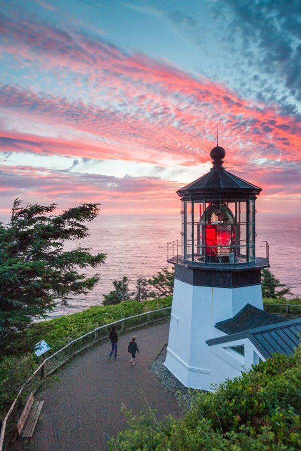
The Cape Meares Lighthouse, on the west entrance to Tillamook Bay, is Oregon’s shortest. The 38-foot-high lighthouse began operation in 1890 and was decommissioned in 1963.
On the northern end of Tillamook Bay, the coastal highway again returns to the coast, meandering through Rockaway Beach and Nedonna Beach before skirting Nehalem Bay and the Nehalem River.
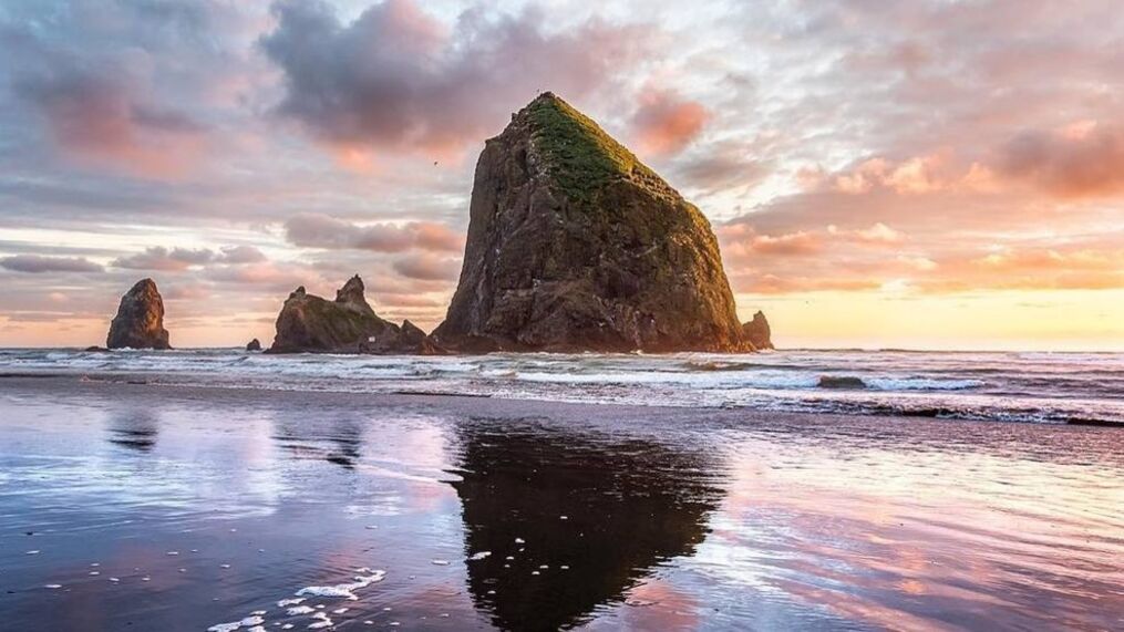
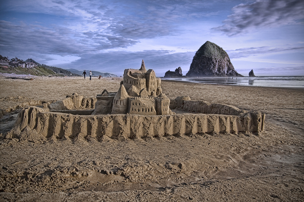
The Oregon Coast Highway continues its path northward until we reach the state’s most famous seaside town, Cannon Beach, 85 miles from where our day began. The town is named after a naval cannon that washed ashore after a shipwreck in the 1840s.
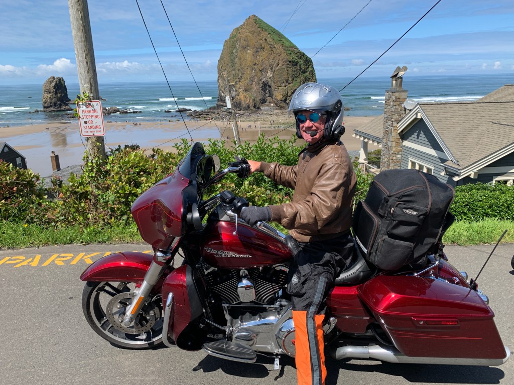
Cannon Beach is best known for its iconic Haystack Rock, one of the most famous coastline scenes in Oregon. Haystack Rock rises 235 feet out of the Pacific Ocean. National Geographic has listed it as one of the world’s 100 most beautiful places.
William Clark, one of the leaders of the Lewis and Clark Expedition, first came to Cannon Beach in 1805. Looking out to the Pacific, he called it “… the grandest and most pleasing prospects which my eyes ever surveyed, in front of a boundless Ocean.”
Every June, Cannon Beach hosts a sand castle building contest. This year, it’ll be held on June 11, next Saturday.
Twenty miles ahead, we arrive in Astoria, as we prepare to cross the mighty Columbia River and enter the state of Washington.
Astoria is the oldest American settlement west of the Rocky Mountains, and the oldest city in the state of Oregon. The city is named for John Jacob Astor, an investor from New York City, whose American Fur Company founded Fort Astoria where the city is today.
Astoria’s economy once centered on fishing, fish processing, and lumber. In 1945, about 30 canneries could be found along the Columbia. Bumble Bee Seafoods closed its last Astoria cannery almost 40 years ago, and today, the city’s economy is built around tourism, a growing art scene, and light manufacturing.
The Astoria-Megler bridge, completed in 1966, is the largest continual truss bridge in North America. To allow ship traffic up the Columbia, the bridge has a clearance of 196 feet at high tide.
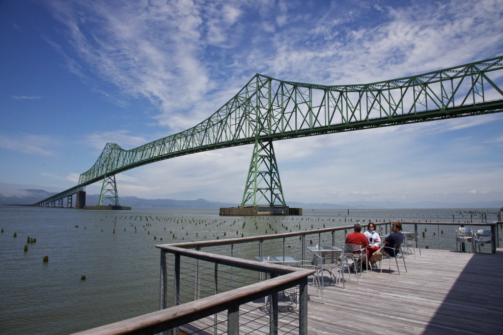
The steel cantilever bridge is slightly more than four miles long, and was the final link in the US highway system between Mexico and Canada. From 1926 until the bridge opened, ferry service was the only way to get across the Columbia north of Astoria.
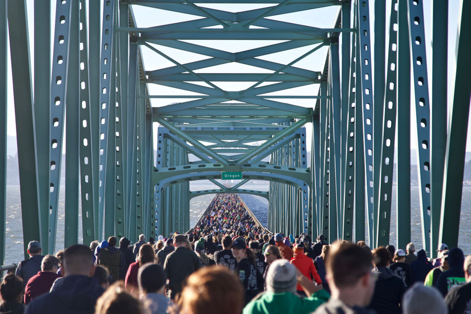
Normally, only motor vehicles and bicycles are allowed on the bridge. But once a year, usually in October, the bridge hosts the “Great Columbia Crossing,” where participants can run or walk from the Washington side to Astoria. This year’s 10K run/walk event will be held on October 9. Be there, or be square.
The bridge has been featured in Hollywood movies, including Kindergarten Cop, Free Willy, and The Goonies.
The Columbia River Bar is a major marine coastal hazard. Since 1792, about 2,000 large ships have sunk, in and around the Columbia Bar. It’s no wonder that the mouth of the Columbia River is known as the Graveyard of the Pacific.
The Columbia River Bar is so challenging to navigate that ship pilots earn an average annual salary of $214,000. That may sound good, but their peers in San Francisco and the Puget Sound earn between $387,000 and $450,000 a year. Nice pay for driving a boat around.
***
We soon find Willapa Bay to our left, and ride most of the way around it. The bay is the second-largest estuary on the Pacific Coast. It’s quite shallow; more than half of its surface area lies in the intertidal zone, and half of the volume of water inside it enters and leaves with every tide.
As we ride along the bay, we cross the water in Raymond, where the Willapa River feeds into Willapa Bay. Raymond was once a booming logging and fishing town. Its business section was built on stilts five or six feet above the tidelands. Its population in the early 1900s was 6,000 – about twice what it is today.
In Raymond, we turn west on Washington Highway 105, and continue along the northern end of Willapa Bay, until we once again find ourselves along the Pacific. Just south of Westport, we again ride along the shores of a large bay – Gray’s Harbor.
Gray’s Harbor is named for fur trader Robert Gray, who in 1792 crossed the bar into a bay he called Bullfinch Harbor, which was subsequently renamed Chehalis Bay and then Gray’s Harbor. We ride along the southern shore of Gray’s Harbor, then cross the Chelais River into Aberdeen – before cruising through Hoquiam and along the northern shore of the bay.
Hoquiam’s name comes from a Native American word meaning “hungry for wood.” The name originally derived from the great amount of driftwood at the mouth of the Hoquiam River. Later, Hoquiam became a major logging and timber center. From 1880 on, Hoquiam’s growth was largely dependent on the lumber industry. The decline of lumber and logging in the northwest also doomed the Hoquiam economy.
***
From Hoquiam, it’s about 20 miles to tonight’s destination, Ocean Shores. The route is mostly along the North Bay of Gray’s Harbor. The city of Ocean Shores sits on a narrow peninsula, halfway between North Bay and the Pacific Ocean. Ocean Shores is known for its long Pacific beach and fresh seafood.
Turns out you can drive, or ride, on the beach. Make sure to keep track of the tide levels and only drive on hard-packed sand. The Ocean Shores official city website says if you become stuck, expect towing fees to be at least $100; the city strongly recommends four-wheel drive vehicles for beach cruising.
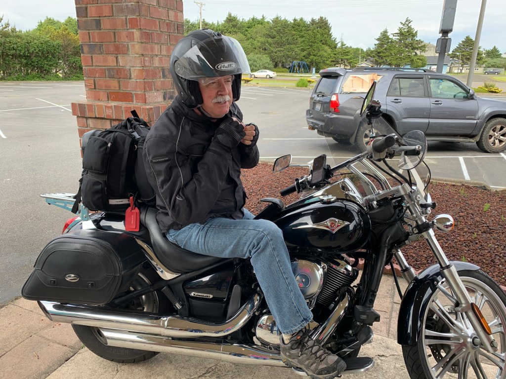
Which, of course, leaves Harleys out. It’s hard to have four-wheel drive when you only have two wheels.
***
To view today’s route in Google Maps, click here.
My number today: 25 (speed limit, in miles per hour, on Ocean Shores beaches)
What’s your number?
***
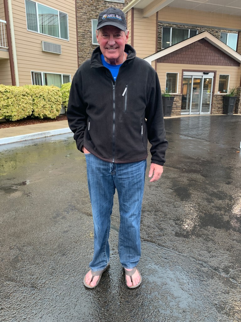
My other number today: 4. That’s now the number of riders in the posse, as of 4:47 pm today.
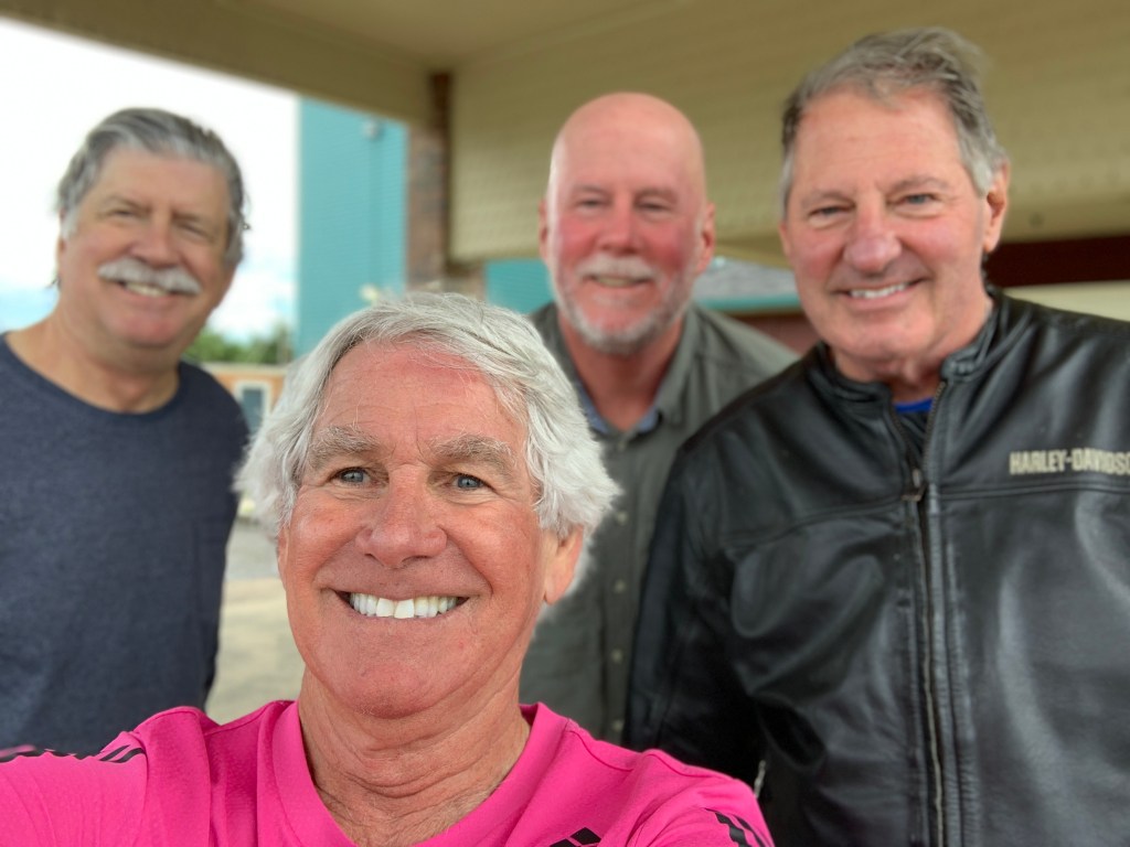

Great ride today and fairly dry for a change. Gorgeous beauty can only be created by God. But the highlight by far is welcoming our good friend Randy as he joins the Posse! Yay!
LikeLike