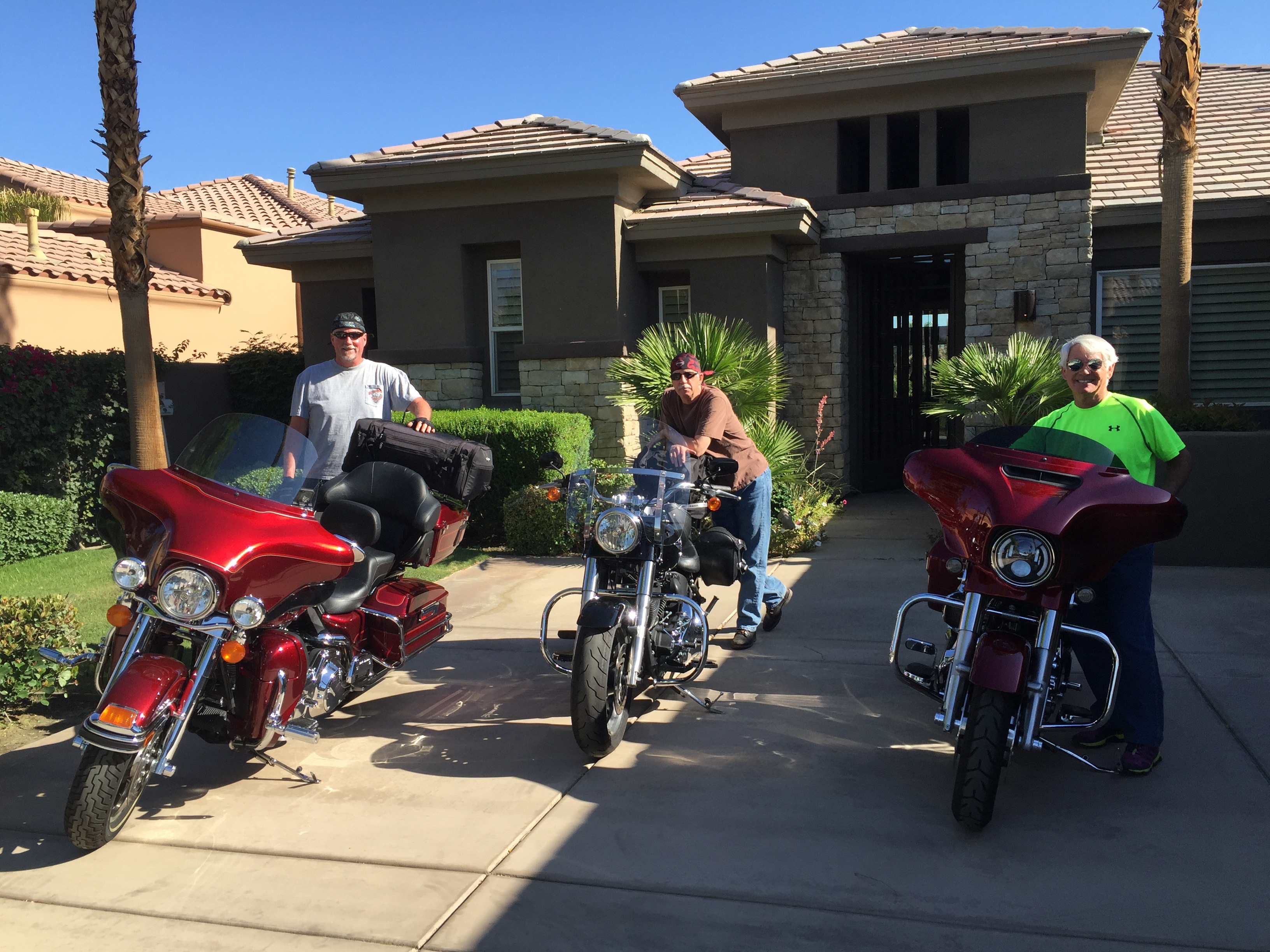
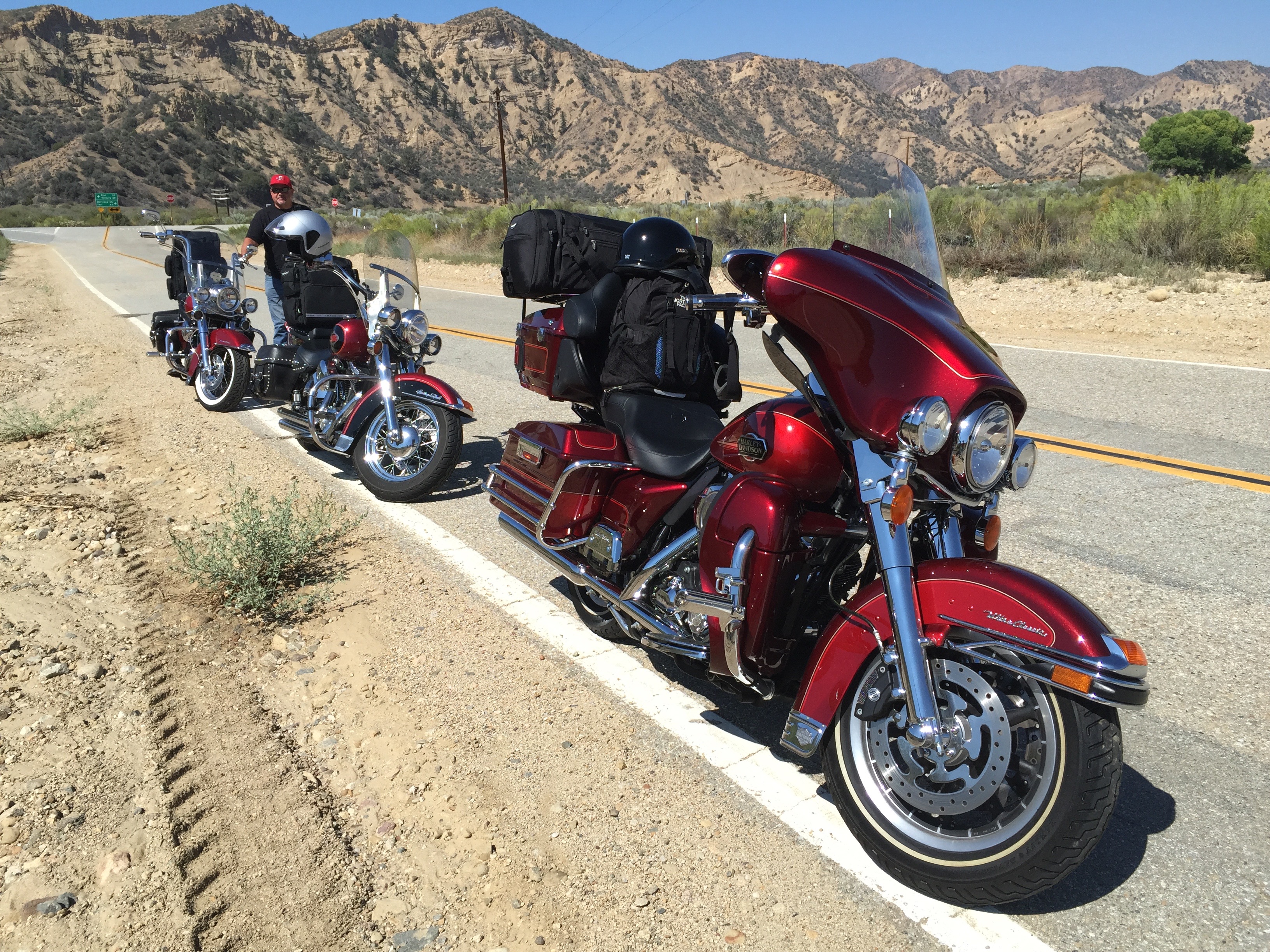
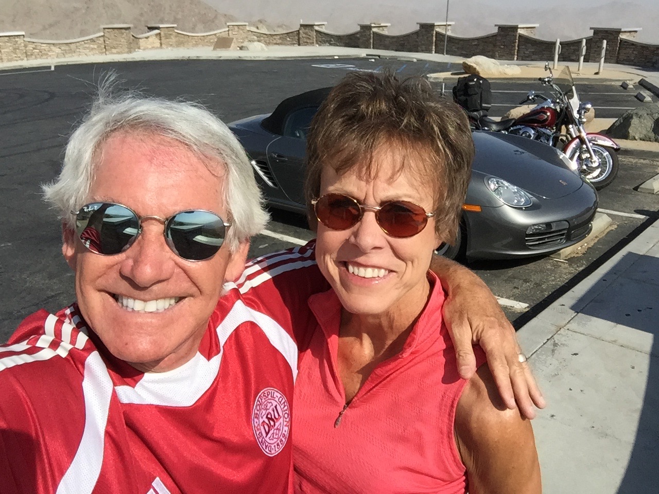
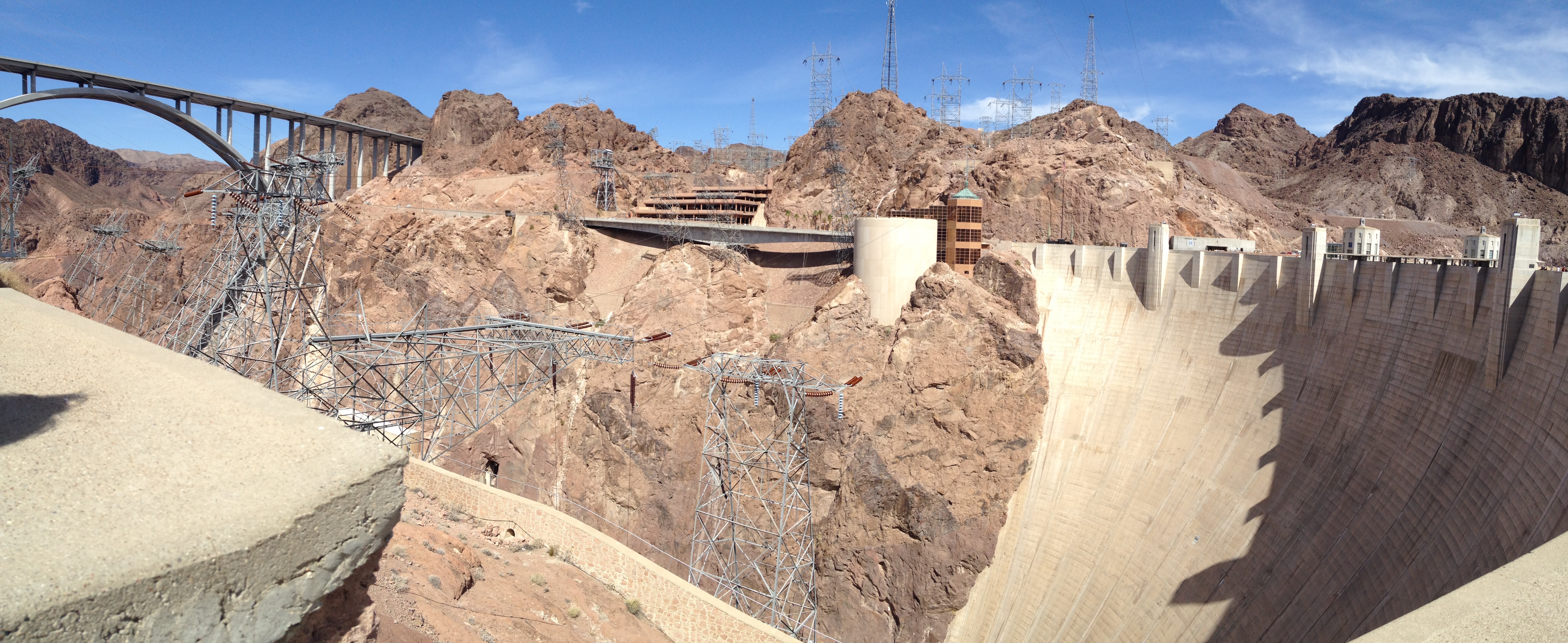
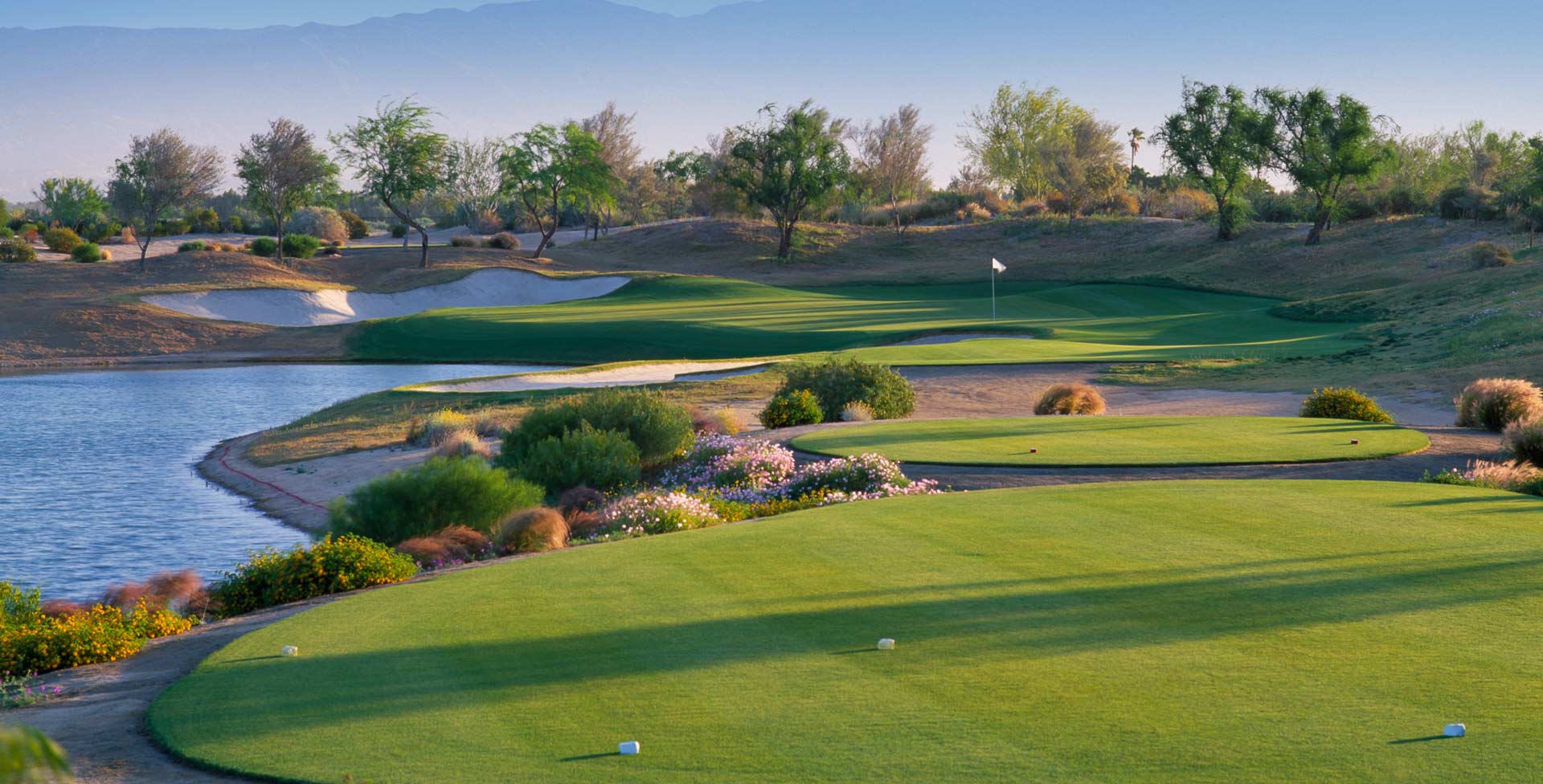
Our 12-day adventure begins this morning as we roll out of La Quinta, en route to Boulder City, Nevada, just southeast of Las Vegas
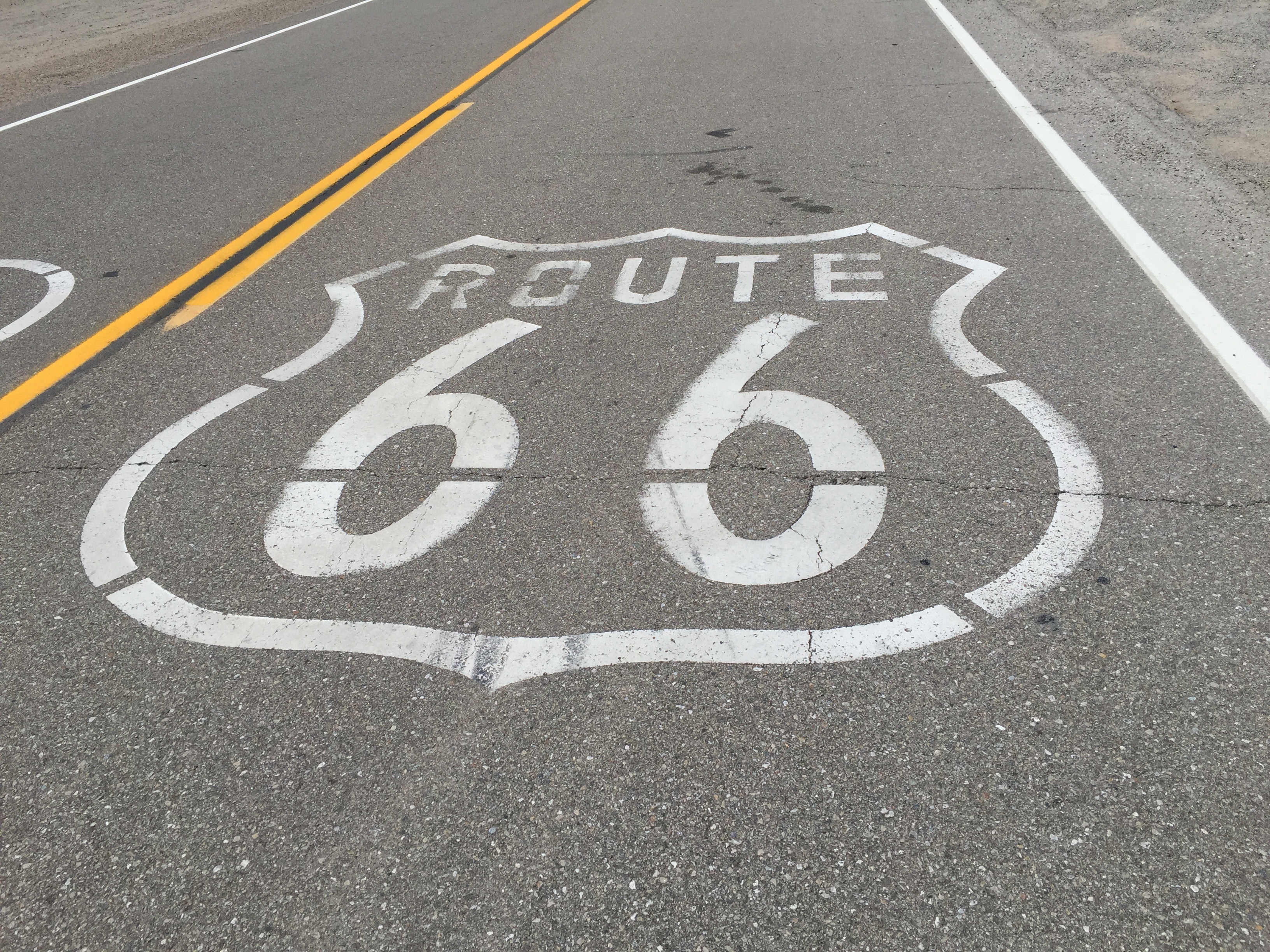
Today, we’ll pass through Joshua Tree National Park, visit the ghost town of Amboy, and get our kicks on what used to be Route 66.
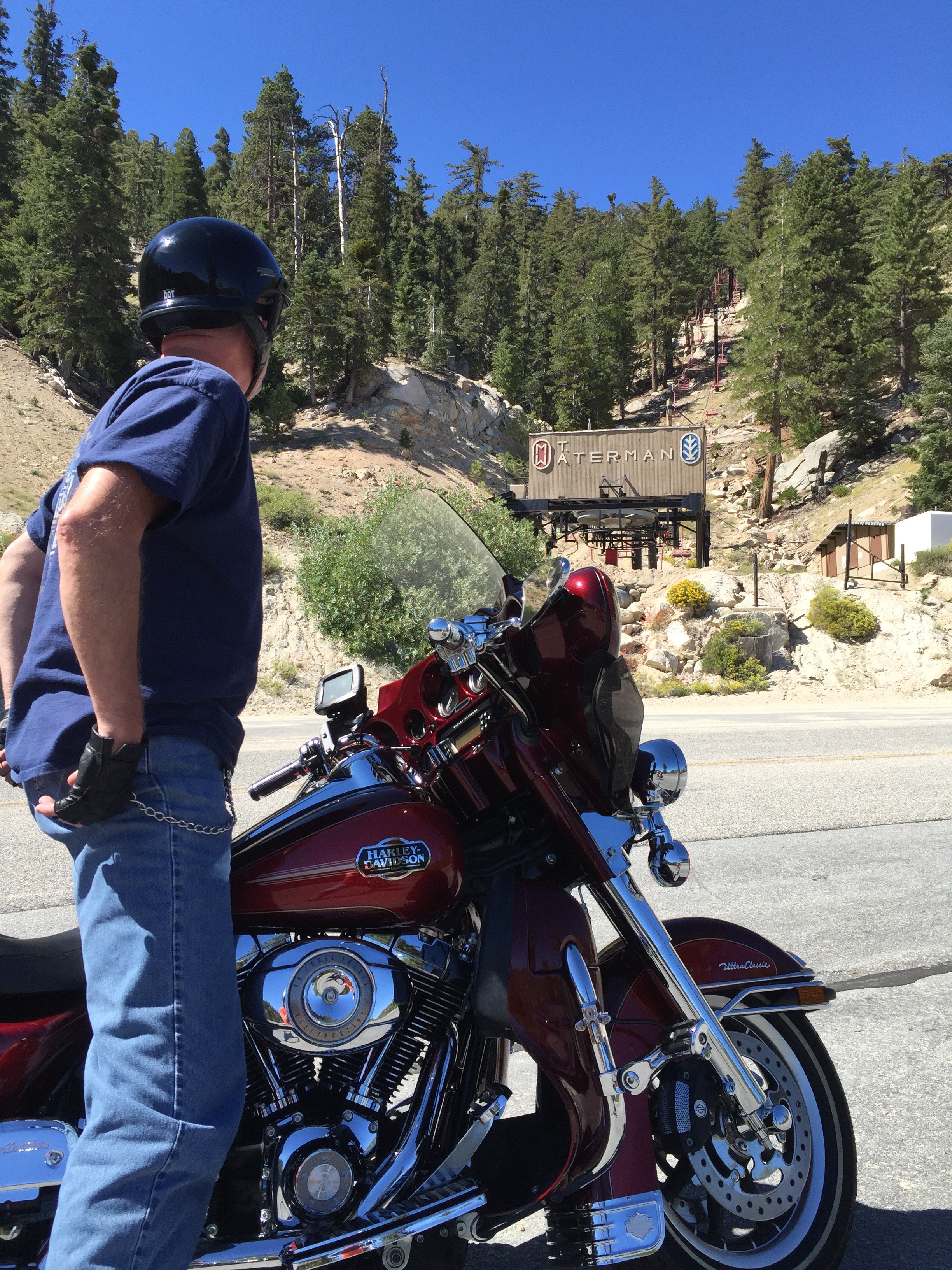
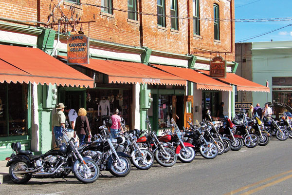
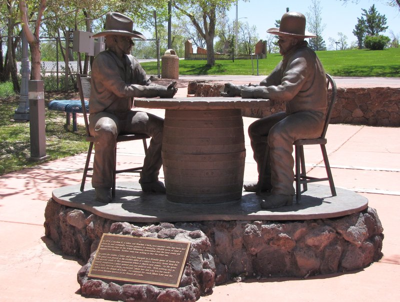
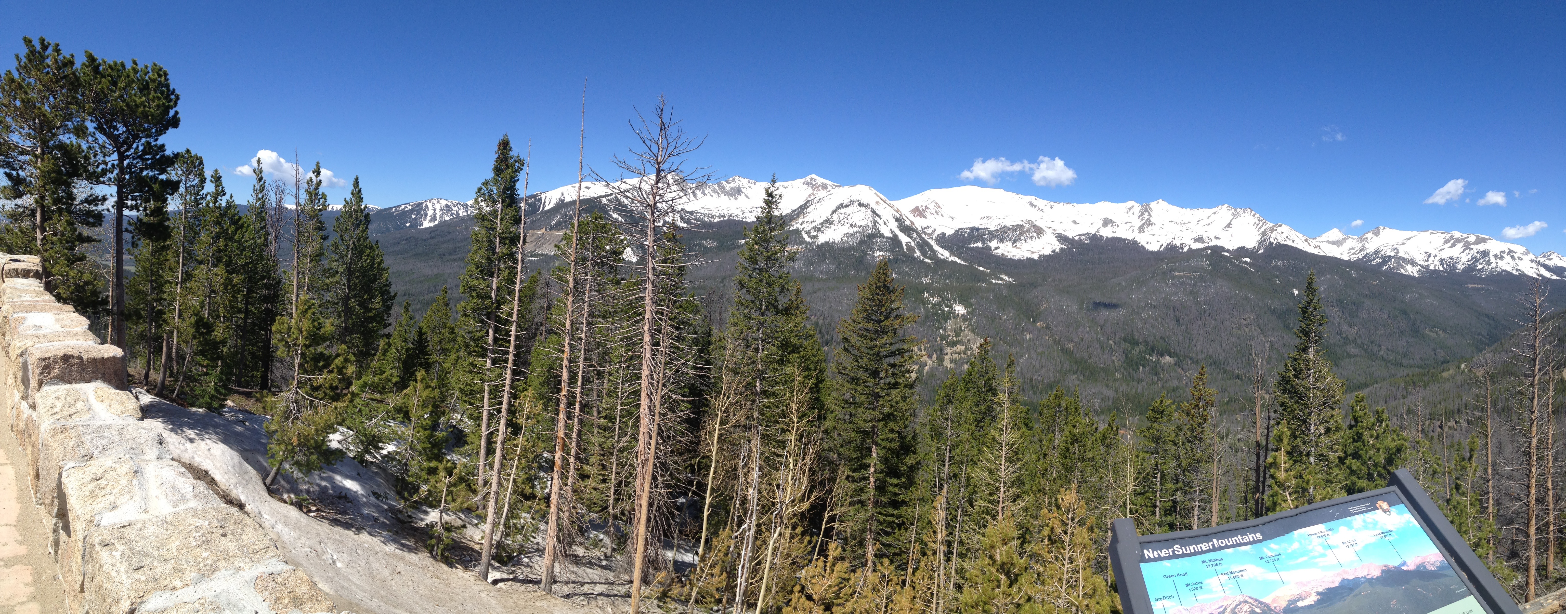
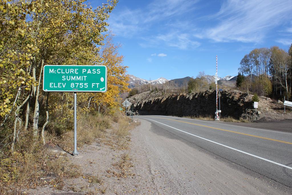
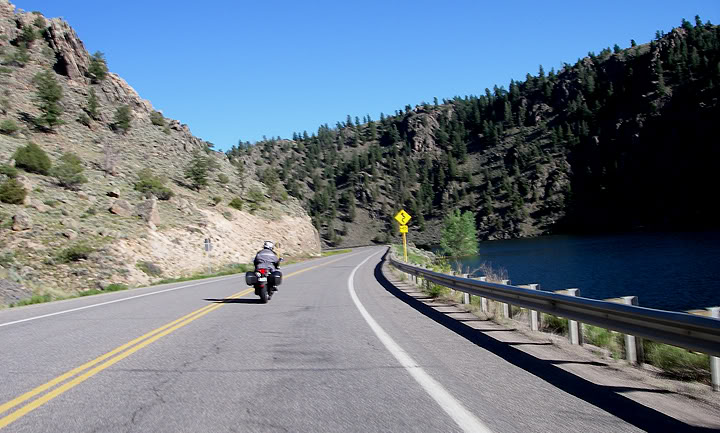
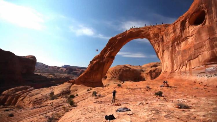
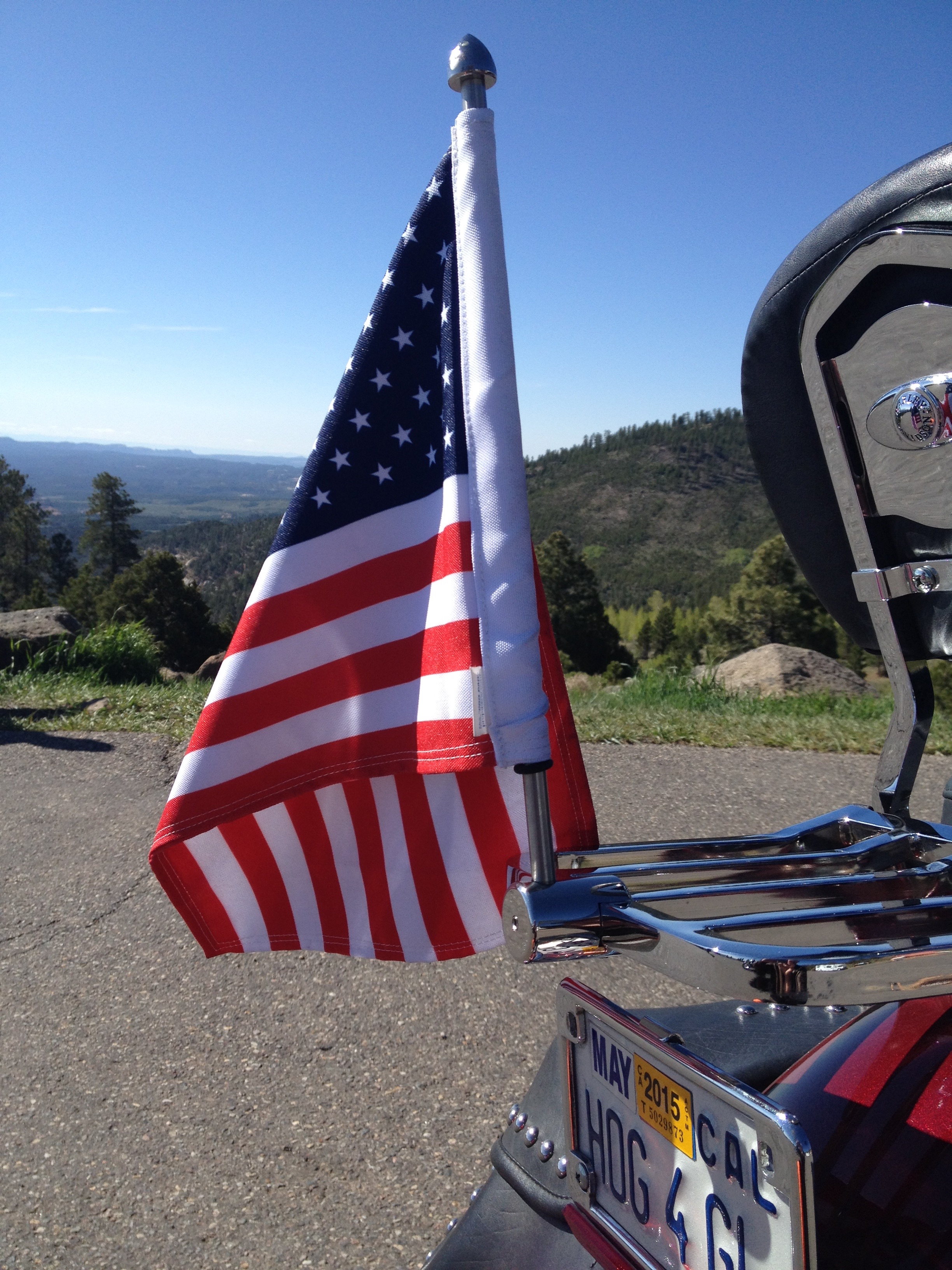
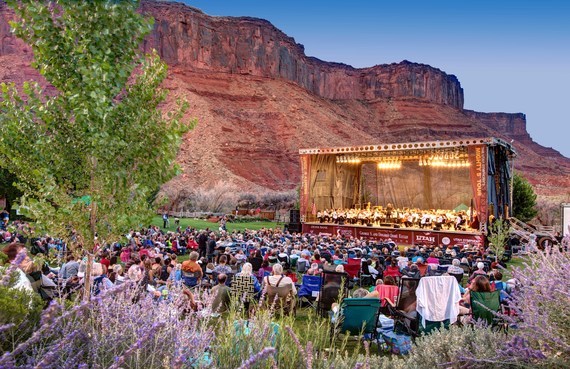
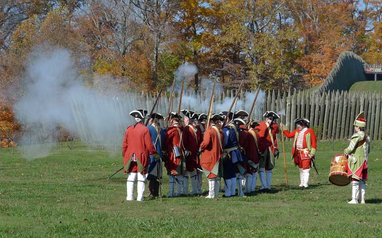
Tracing the old Route 66.
The route from La Quinta to southeast Nevada is similar to one I rode in 2014 with Sarah’s cousin, Ray. If you want to learn more about the legend and lore along the way, scroll down to recall May 22, 2014 (note: the blog posts are in reverse chronological order).
Or, check out today’s Photos-of-the Day (PODs). Remember to read the captions. You might pick up something new. In anticipation of your personal growth from anything you might learn from this year’s blog, you’re welcome.
To see the actual route from today’s ride, using Google Maps, click here.
***
Oh, and here is today’s “Previous Blog Trivia Question:”
Q: What nation’s economy is 1/1000th the size of California’s
A: Cape Verde gross national product is $2 billion, compared to California’s $2 trillion gross state product.
Brittany, Cape Verde’s most important export.
Q: For extra credit, why would anyone care about Cape Verde, an island archipelago 350 miles off of the Western Africa coast?
A: Cape Verde is where, on the island of Fogo, our unofficially adopted daughter, Brittany, served in the Peace Corps from 2006 to 2008 – before becoming a rising star in the Boeing PR machine.
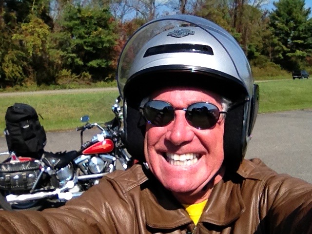
Hi there. Welcome to my blog, Travels With Harley: 2016 National Parks Tour.
Tomorrow, I head out on a 12-day ride to 12 National Parks and Monuments in California, Utah, Arizona and Colorado.
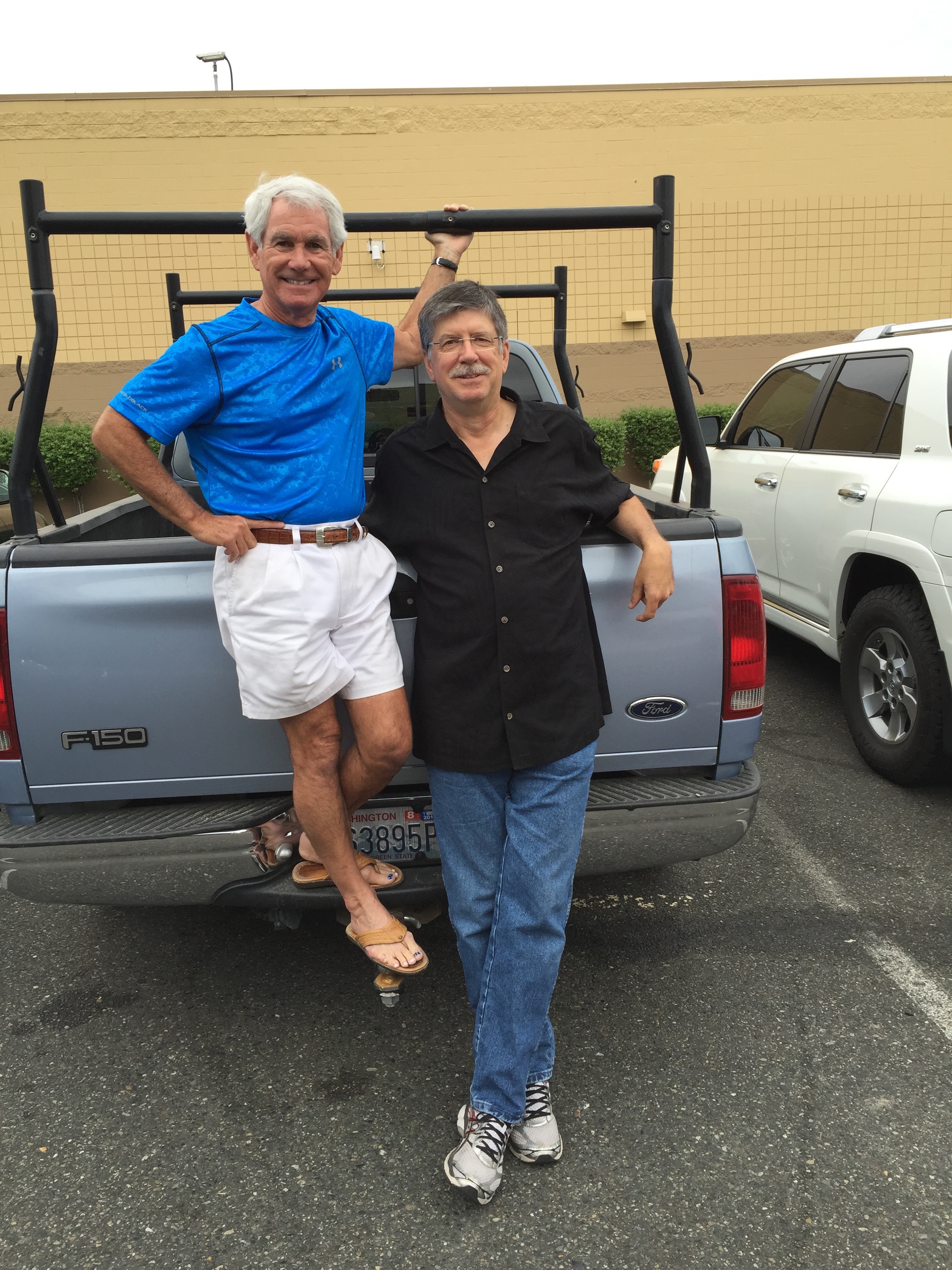
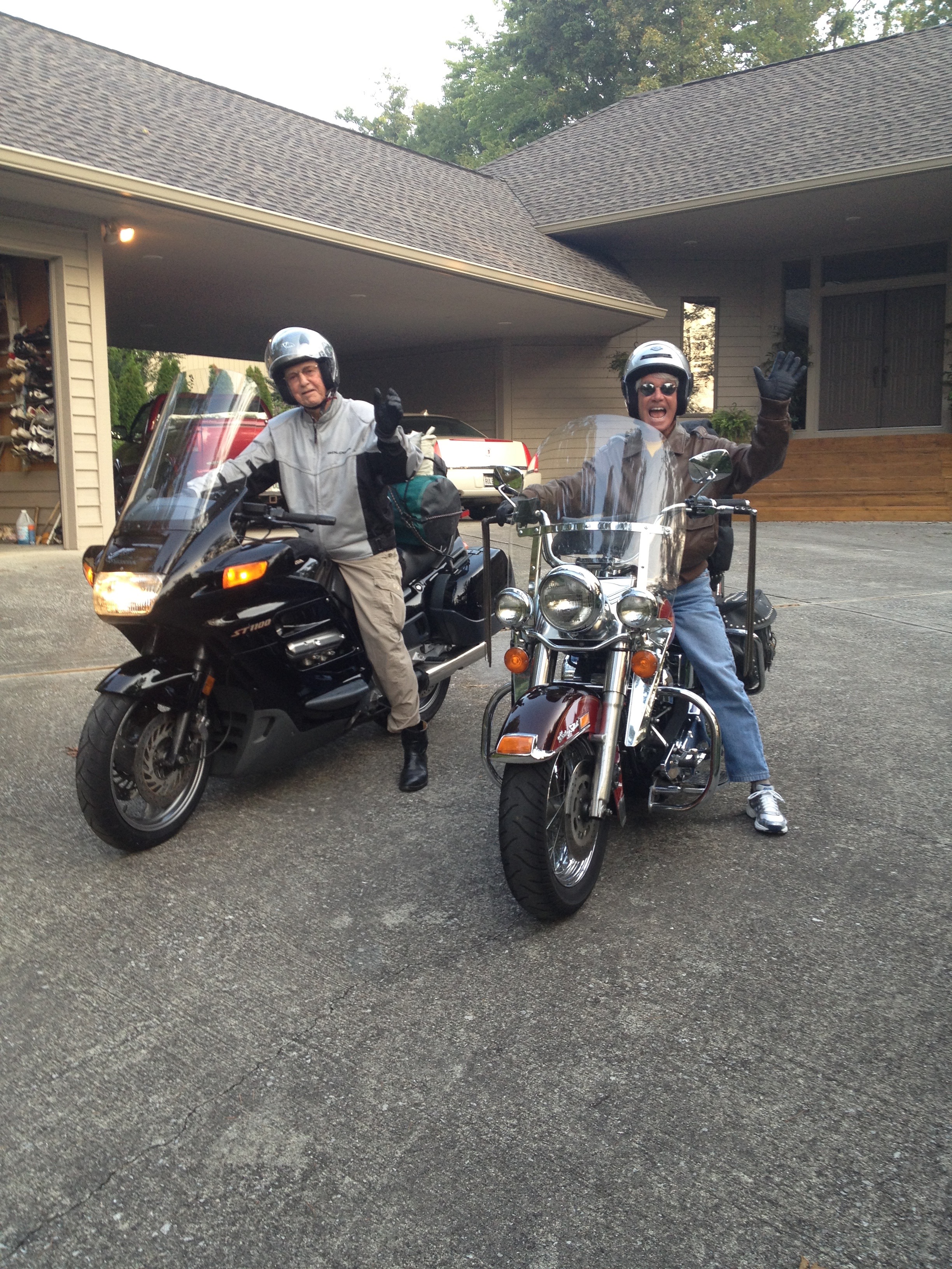
As you may recall, I hit the road on a major motorcycle ride every year – and blog about my travels along the way. Last summer, I went on two journeys – the Canadian Rockies with Randy Suhr in July, and California’s coast and mountains with Dave Bowman and Scott Donaldson in August.
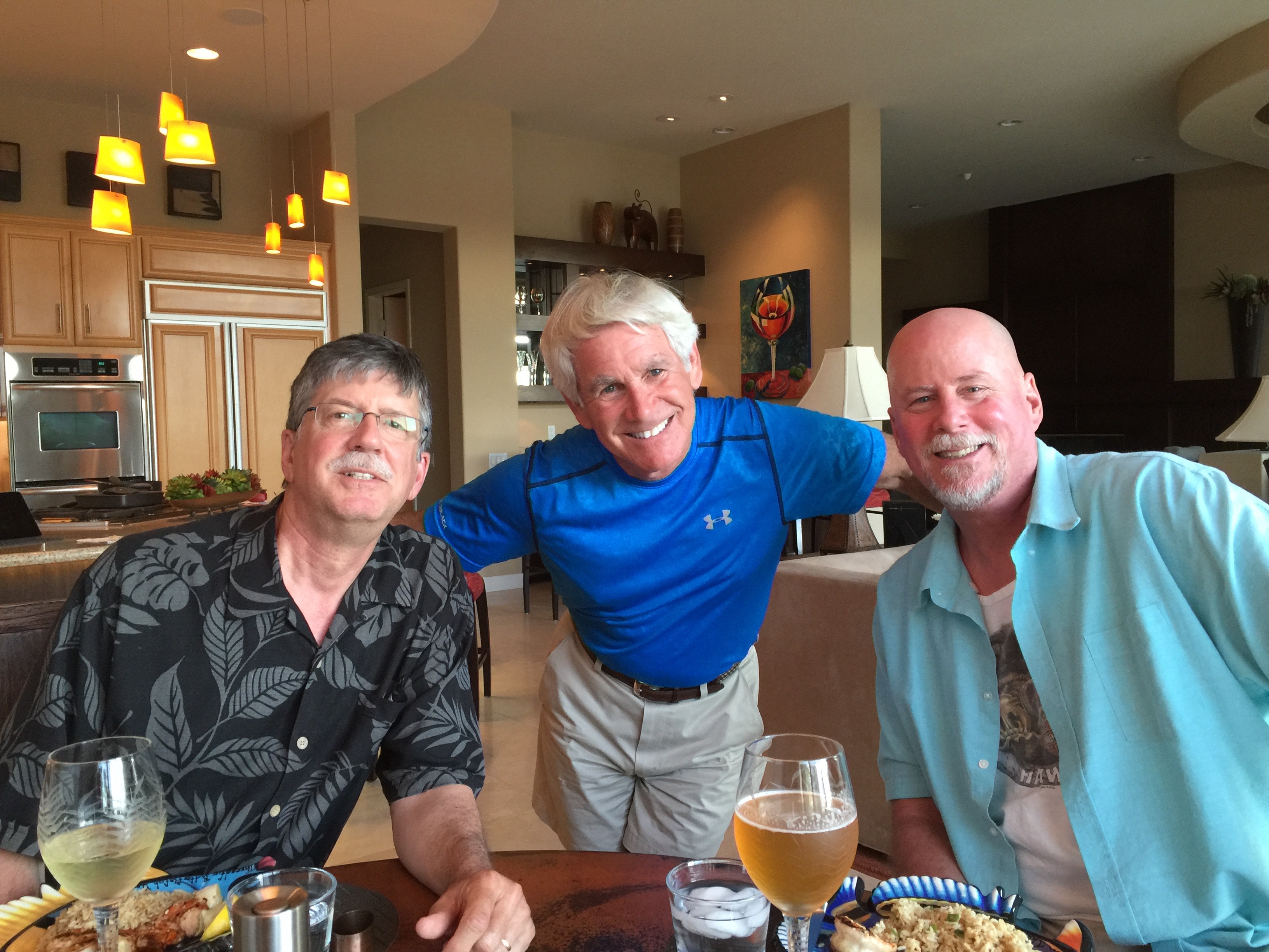
Randy and Dave, who haven’t met until today, will join me for this year’s National Parks tour. Scott had other commitments and couldn’t make this year’s trip, but plans to be on the 2017 ride, wherever it leads us.
The way I see it, you’re all along for the ride. That’s how it feels when I hear from you at the end of a long day in the saddle. When we park our bikes and sit down for dinner, we greatly enjoy reading your comments. Please feel free to send along your thoughts. You can post right here on the blog, and humiliate me publicly. I thrive on your abuse.
To be part of the dialog, click on “Add Comment” at the bottom of any blog entry.
***
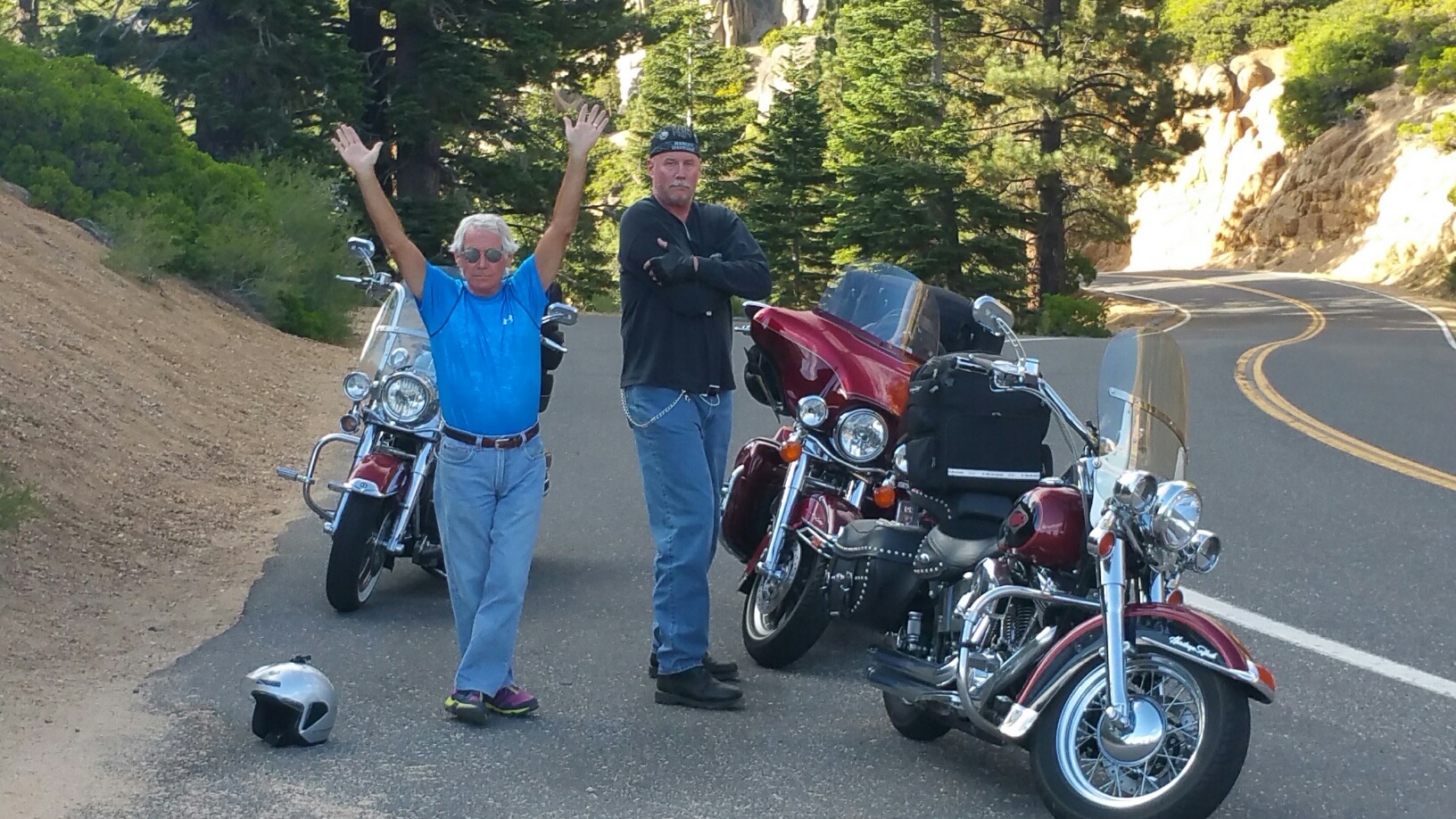
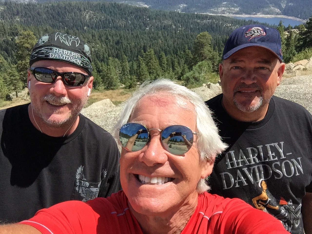
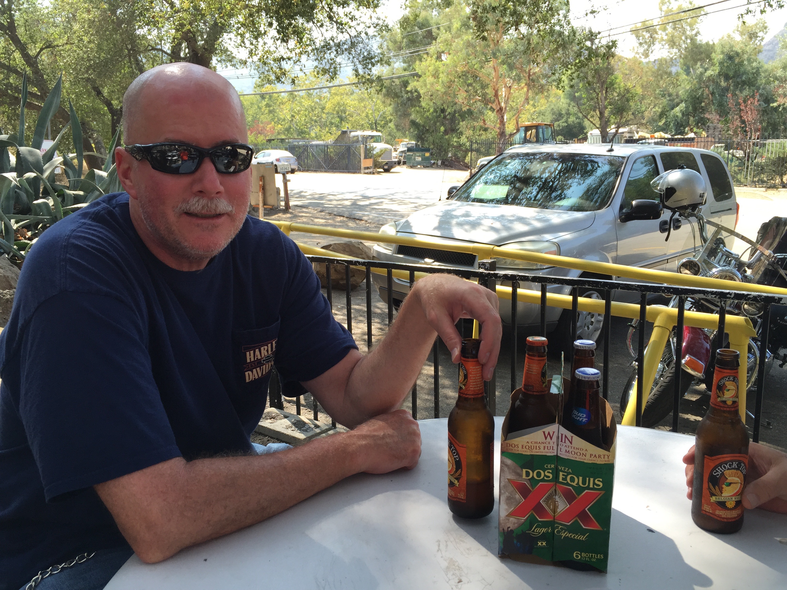
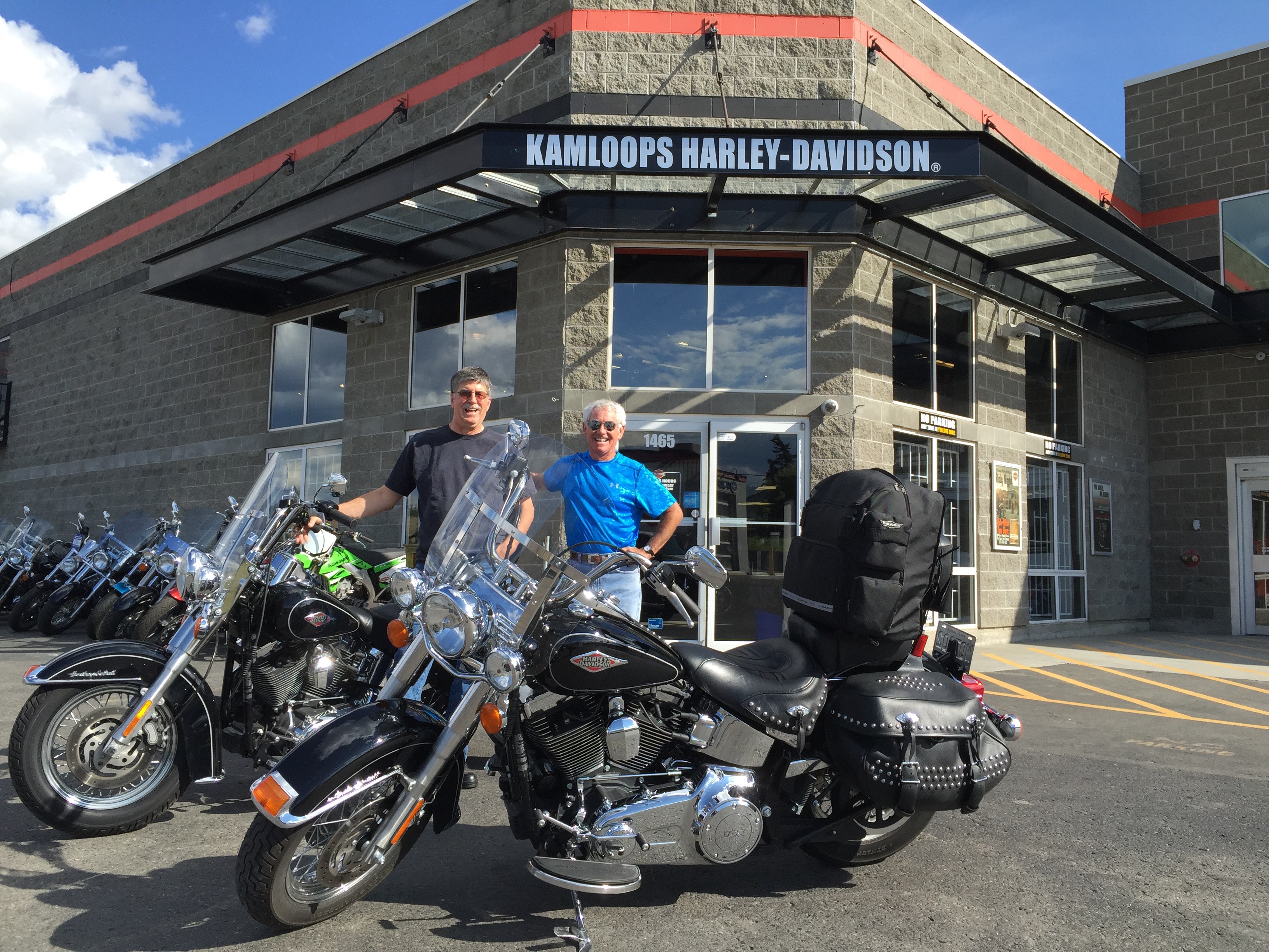
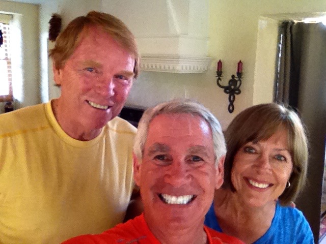
Here’s a quick refresher on the 2016 ride crew, and how we know each other:
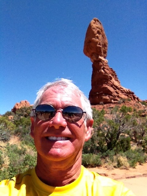
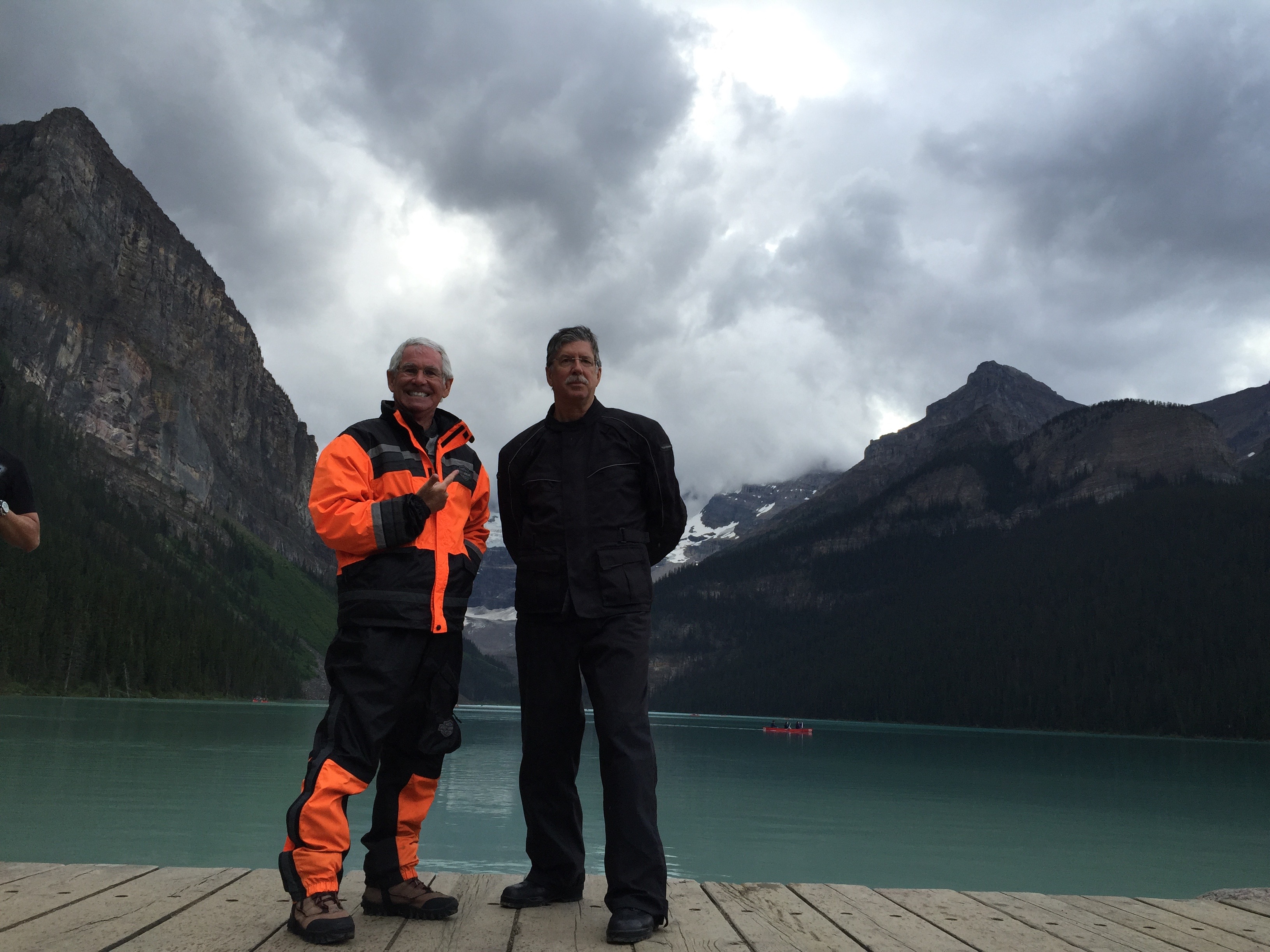
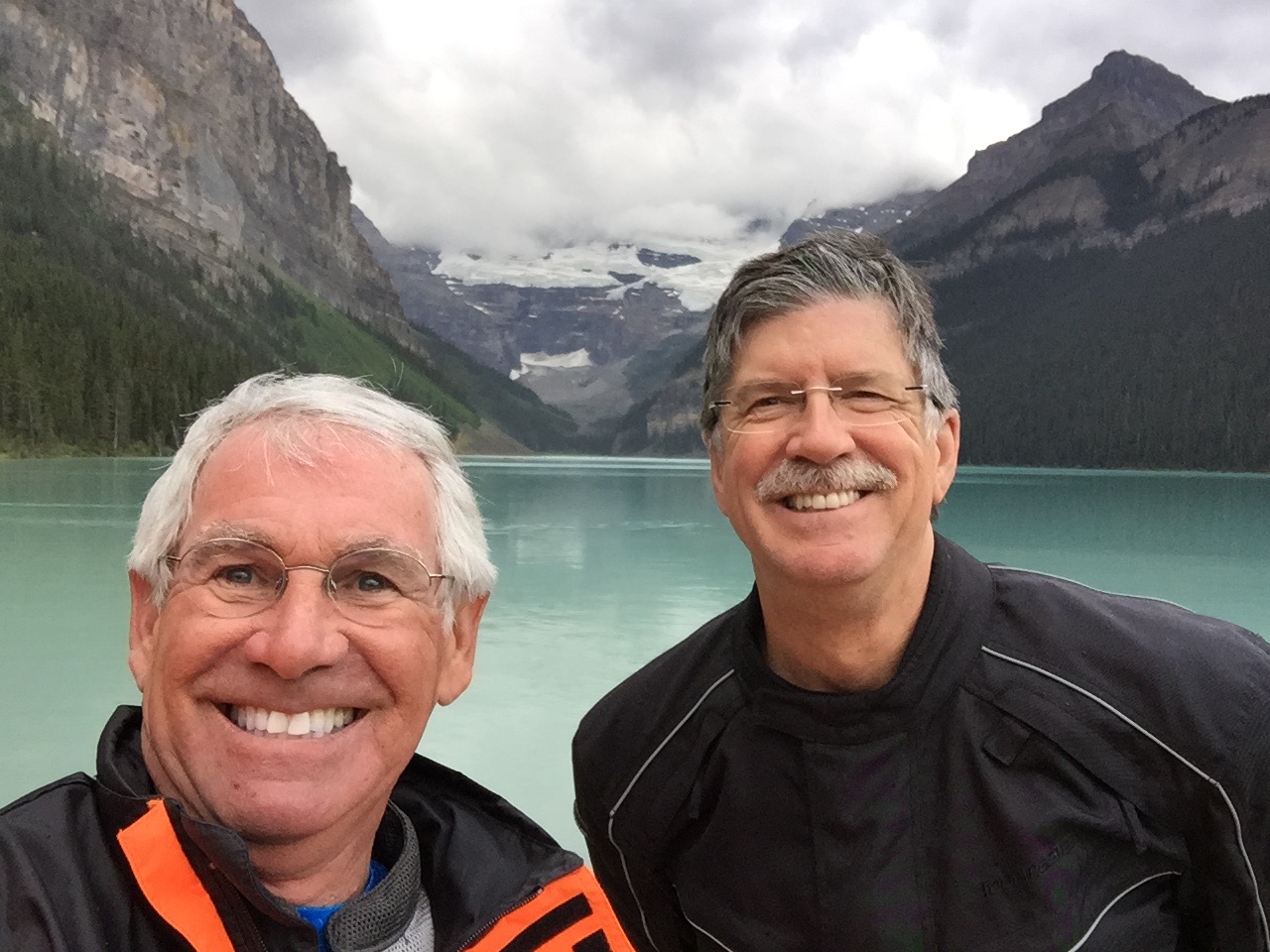
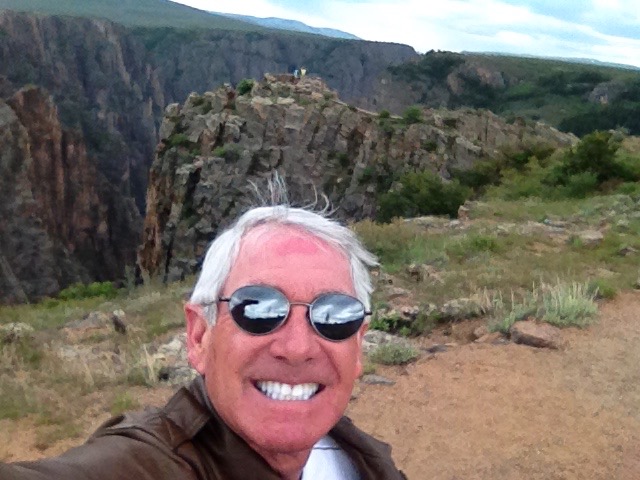
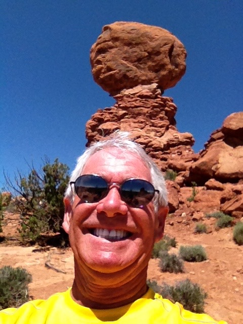
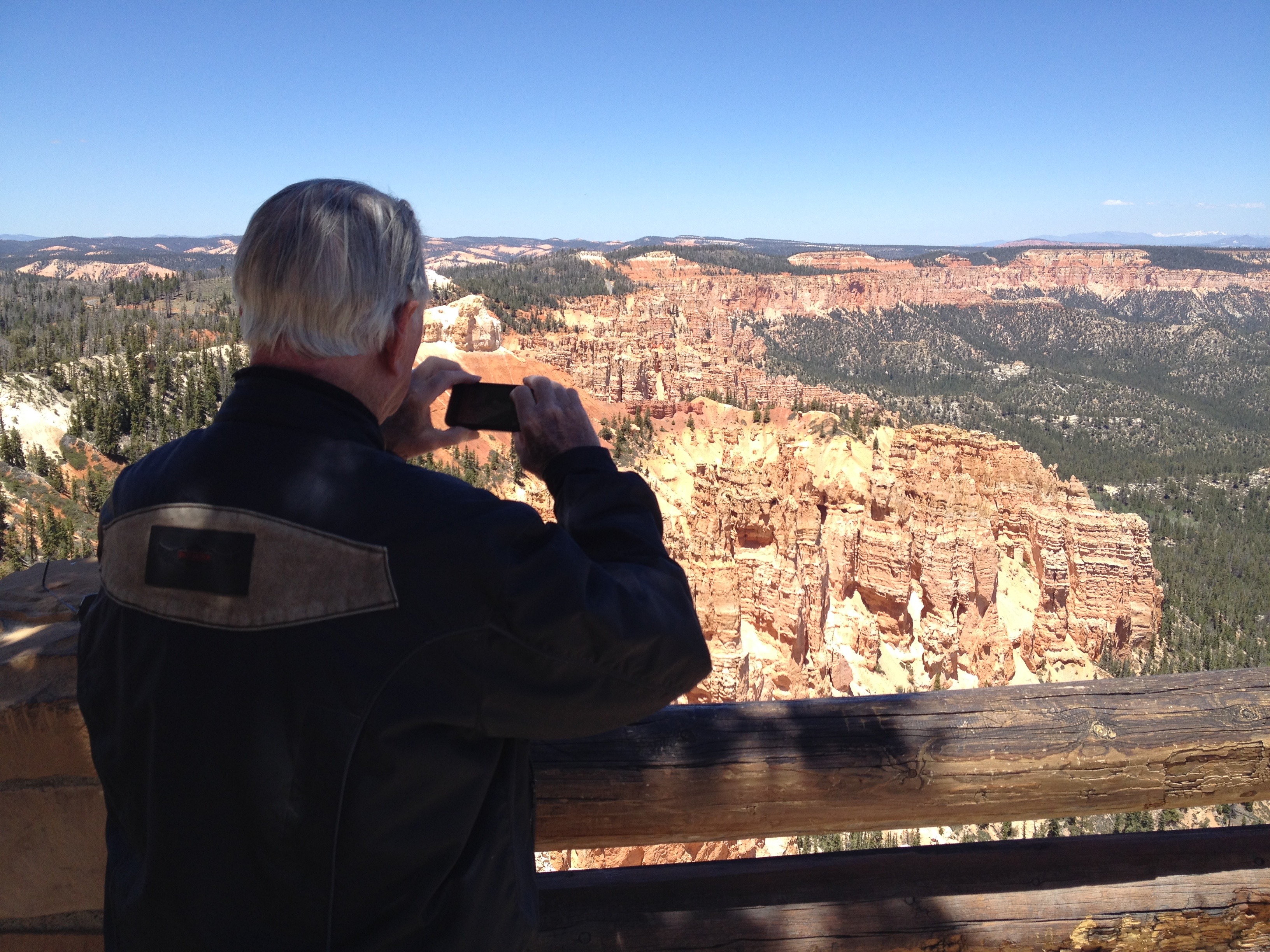
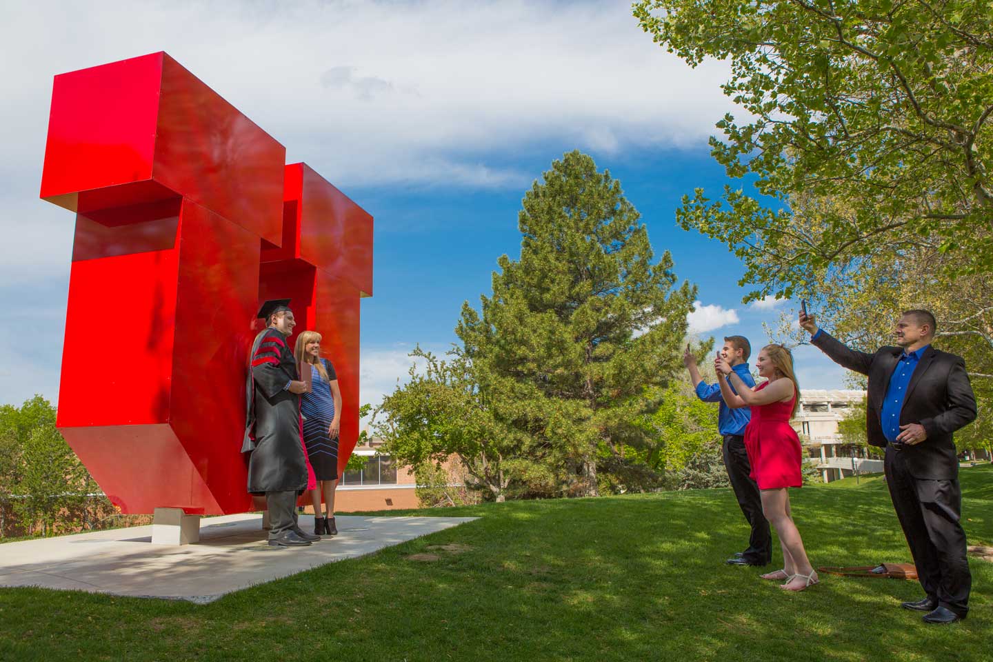
Gary, at Balancing Rock, Arches National Park.
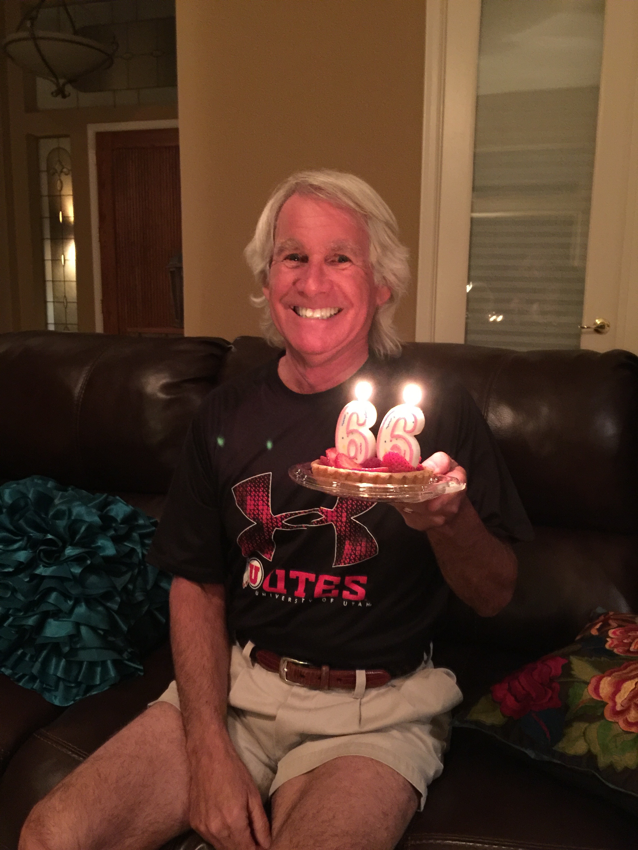
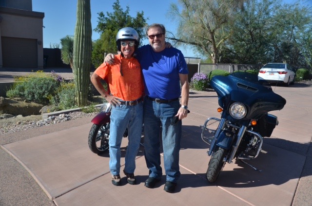
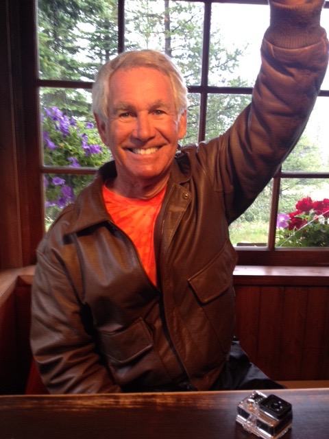
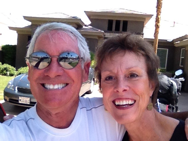
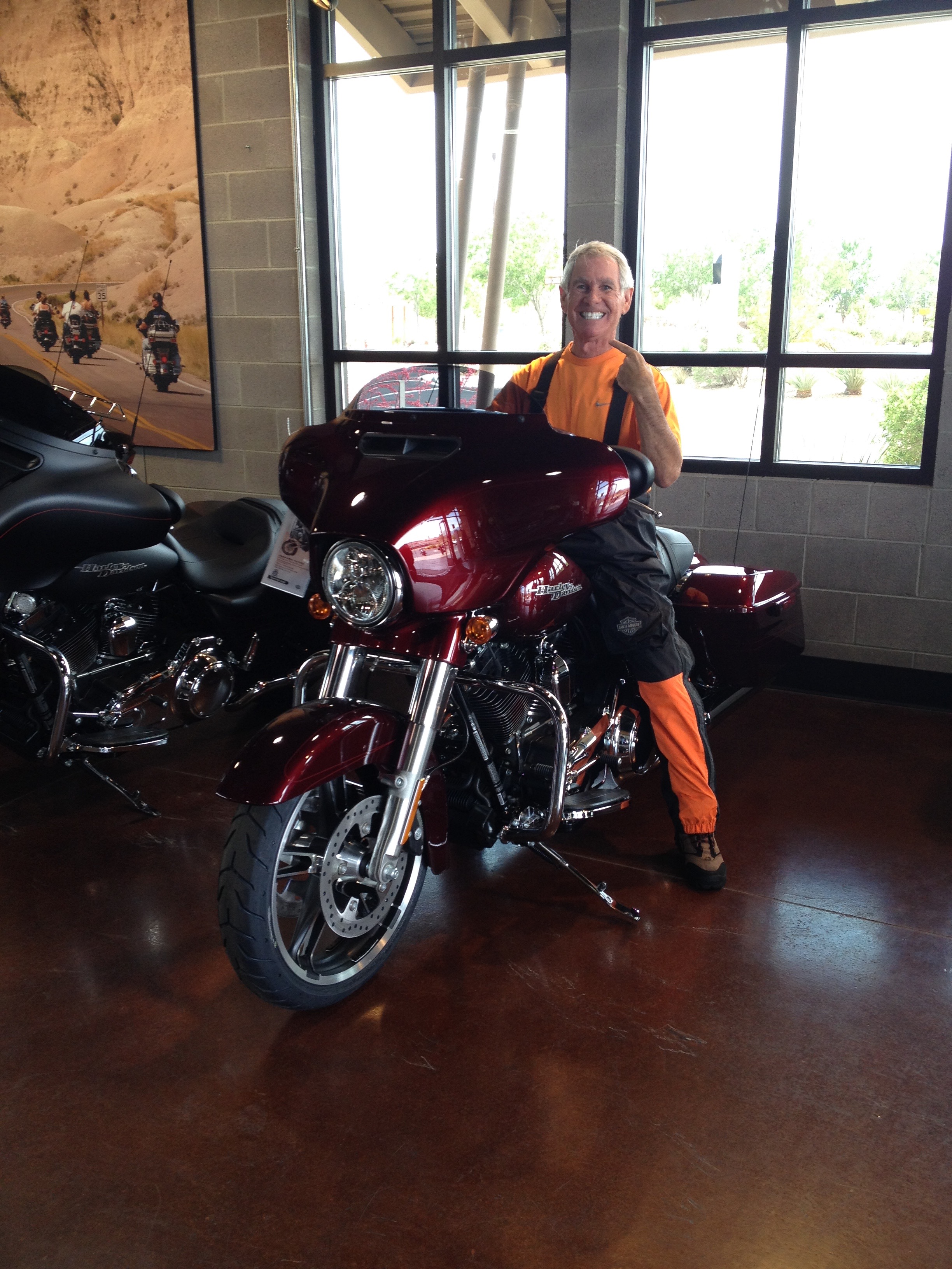
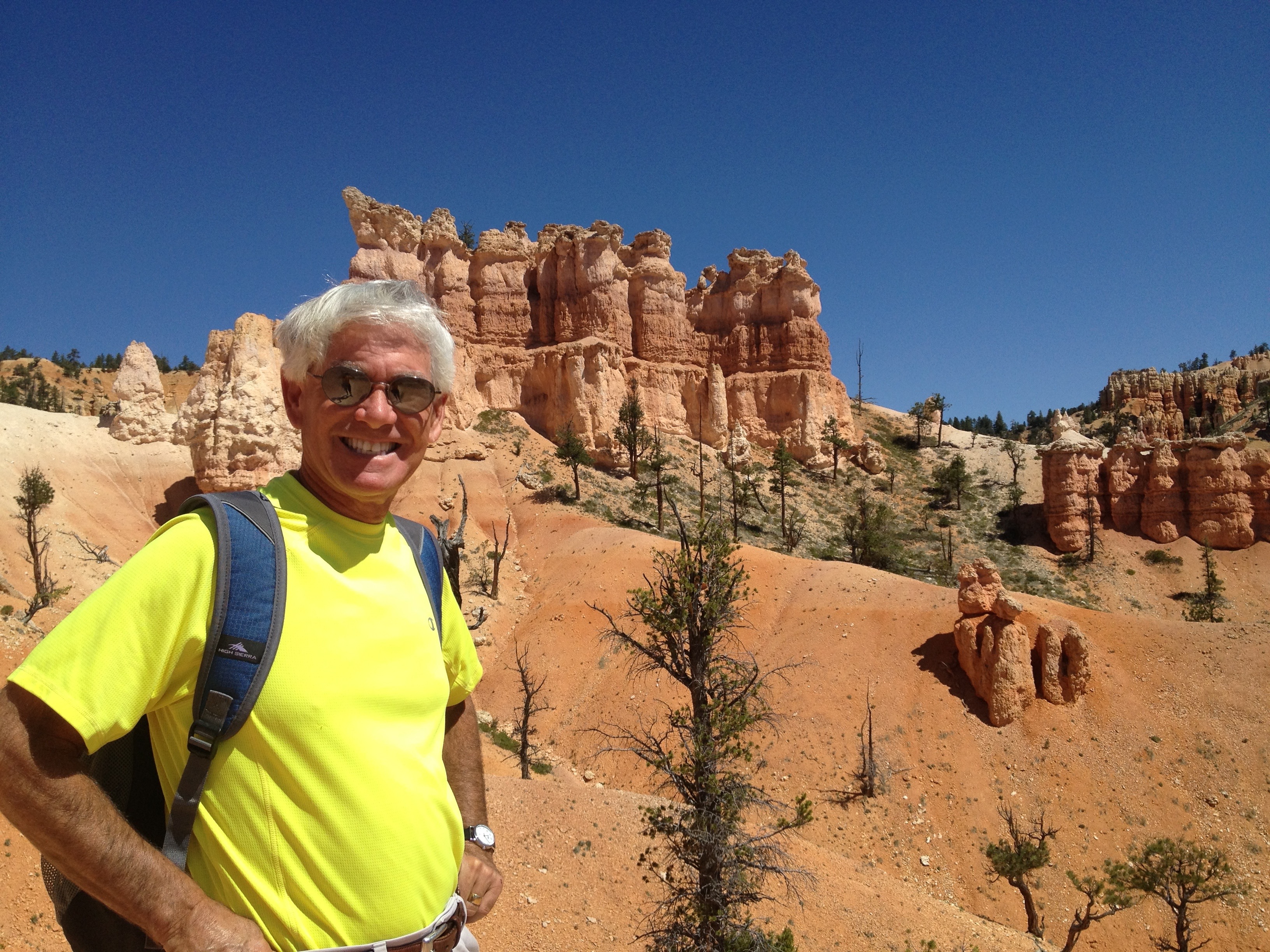
Gary: Originally from Lafayette, Calif., Gary earned a bachelor’s degree from the University of Utah, majoring in Broadcast Journalism (yes, it was kind of like typing school). His first career, in TV news, led Gary to KOMO-TV in Seattle, where he was a news producer in the 1980s. There, he worked alongside Randy, who was then a director. At the time, Gary rode a bright orange 1976 Honda CB550F (earth tones were big in the ’70s!). Eventually, everyone in Seattle with a pulse goes to work at Boeing, so that’s where Gary went in 1988, seeking fame and fortune (he found neither, but walked away with Sarah, the biggest prize of all). He retired from the big ol’ airplane company 20 years later as a public relations and communications guy. In his final Boeing gig in Long Beach, Gary worked for Dave on the C-17 program, stringing together subjects and verbs to tout the C-17’s achievements. Gary rides a 2016 Harley Street Glide Special, which earlier this year he convinced Sarah he should have as his “last bike,” cuz he’s 66 and not getting any younger. Gary and his wife, Sarah Murr, who were married in Dragør, Denmark, recently celebrated their 17th wedding anniversary. Along with their two cats, Lucy and Betsy, they live full time in La Quinta, Calif.
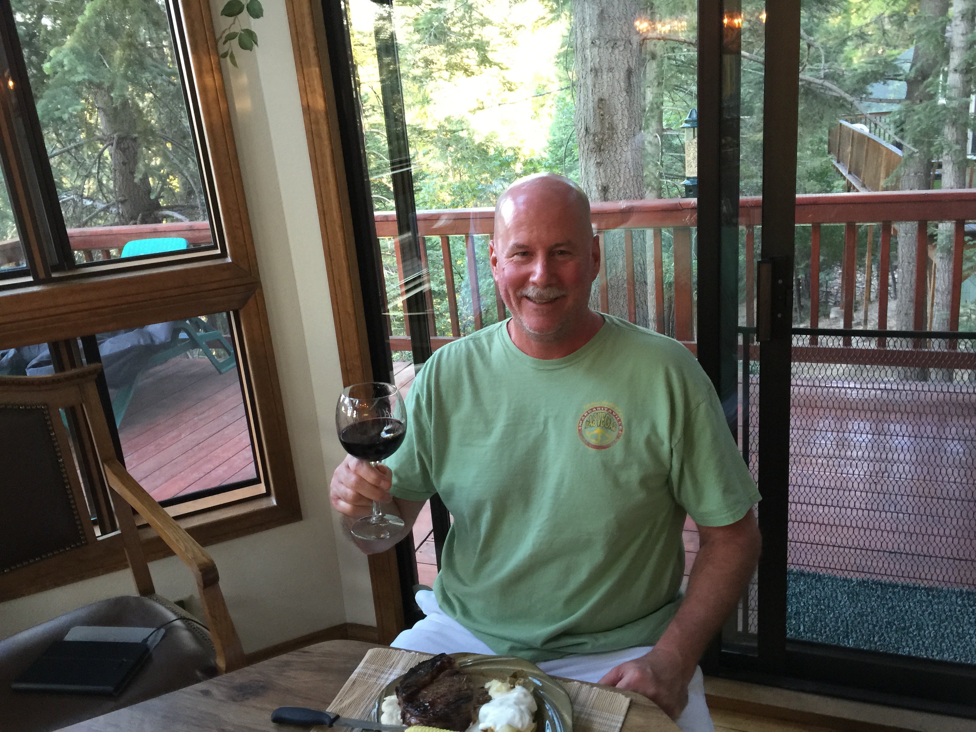
Dave, at his Lake Arrowhead mountain getaway.
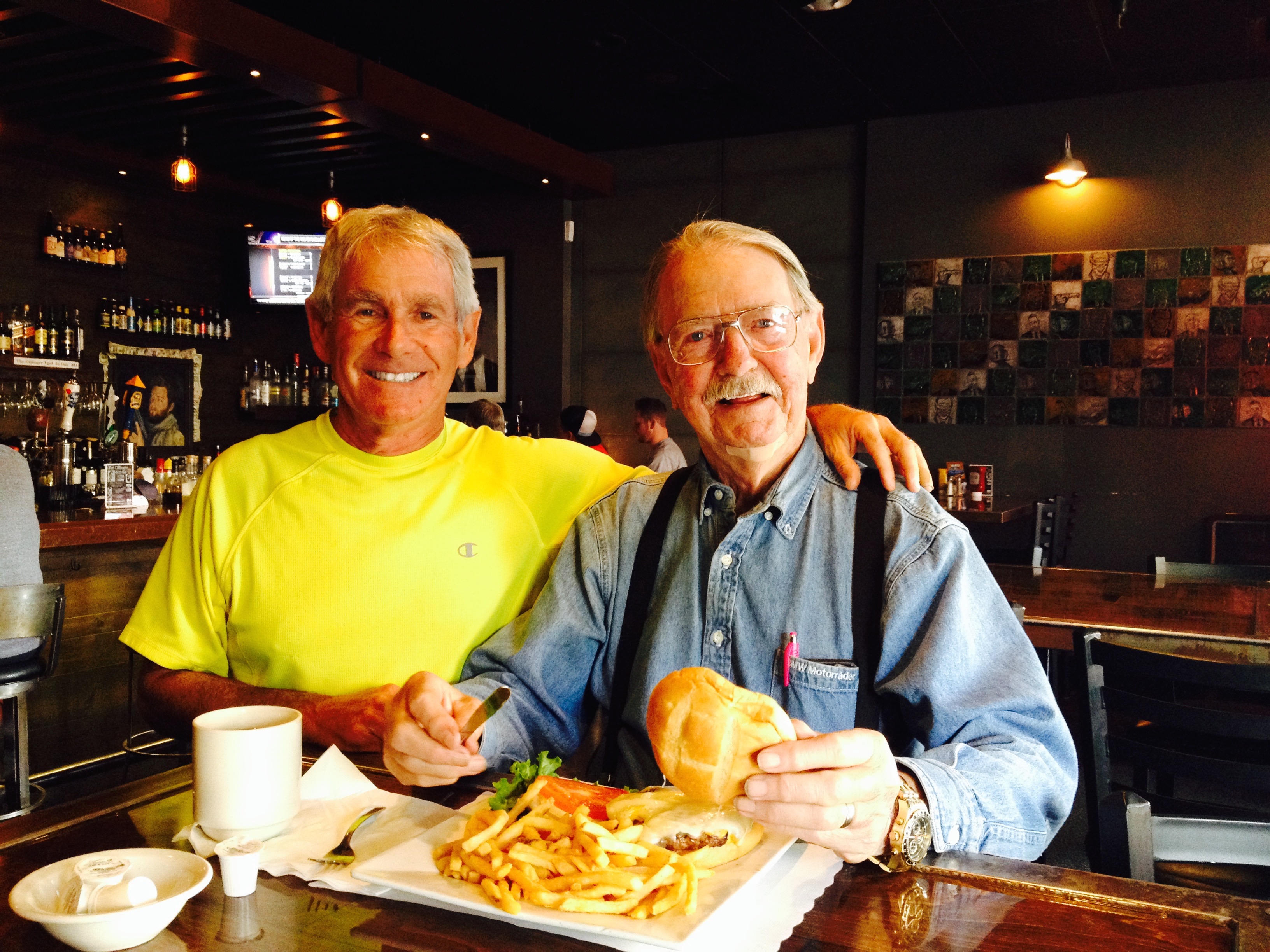
Dave: A native Southern Californian, Dave attended Cal State University Long Beach and earned his bachelor’s degree (summa cum laude!) in Computer Science from National University. In addition, he has a master’s degree in Global Technology Management from Pepperdine. The guy is a degree collector. Dave began his aerospace career as an engineer at McDonnell Douglas in Long Beach, eventually retiring as Vice President and General Manager of Boeing Global Mobility Systems. When he was VP/GM of Boeing’s C-17 program, Dave worked alongside Gary, the two of them clueless that the other had any interest whatsoever in motorcycles (actually, they were clueless about lots of things). Dave left Boeing in 2010 after 30 years, then went to work at Eaton in Cleveland, Ohio, as Senior VP of Program Management. He retired from Eaton in 2015, finally giving him time to ride. Always active in his community, Dave’s served for many years on the board for Special Olympics of Southern California. He and his wife Gail live in Fullerton, Calif., and have a mountain getaway near Lake Arrowhead in the San Bernardino mountains. He rides a 2008 Harley Ultra Glide. Dave, now 56, reconnected with Gary after reading his Harley blog year after year, eventually saying, “Count me in after I retire. Let’s ride!”
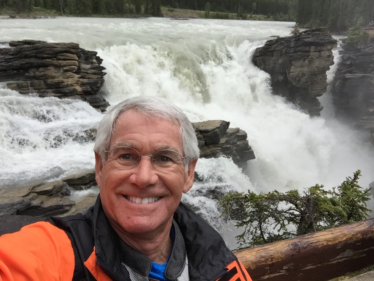
Randy, at Athabasca Falls, on Canada’s Icefields Parkway.
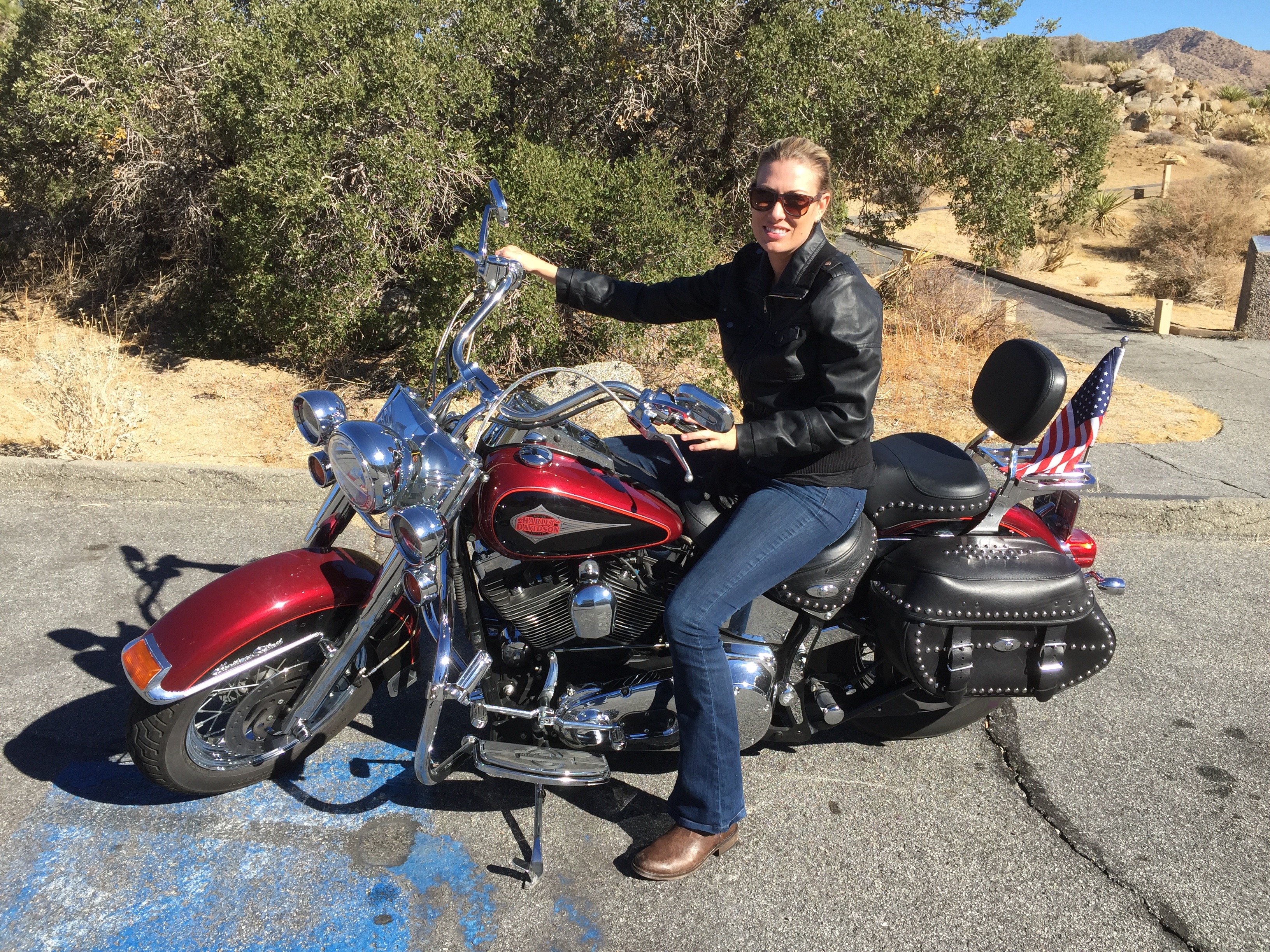
Randy: After growing up in Republic, a tiny town 43 miles west of Kettle Falls, Wash., Randy found his way to Eastern Washington University in Cheney, where he received a bachelor’s degree in Radio and TV Management. Randy says his crowning achievement in Cheney was getting high with Arlo Guthrie, best known for “Alice’s Restaurant.” Seriously. Following graduation, he (Randy, not Arlo) was hired by KOMO-TV in Seattle, in the shadow of the iconic Space Needle. There, he worked in the production department and directed nightly newscasts. When we worked together, Randy sat next to me in the control room and – incredibly – made me look like the genius I clearly wasn’t. Randy left KOMO in the mid-1980s to work at KNBC in Los Angeles, where the proximity to Hollywood allowed him pursue his dream of being a film director. After working on a number of movies, Randy’s last 15 years in the entertainment business were spent primarily as a first assistant director on various TV sitcoms, including Everybody Loves Raymond and The New Adventures of Old Christine. Following his retirement in 2014, Randy and his wife, Jo Shilling, split their time between Phinney Ridge, near Seattle – and Poulsbo. Randy, now 62, rides a 2006 Yamaha V Star at home in Washington state, and is renting a Harley Softail Heritage Classic for this trip. Like Dave, Randy responded to one of Gary’s recent blogs by saying, “Hey, I wanna go next time!”
***
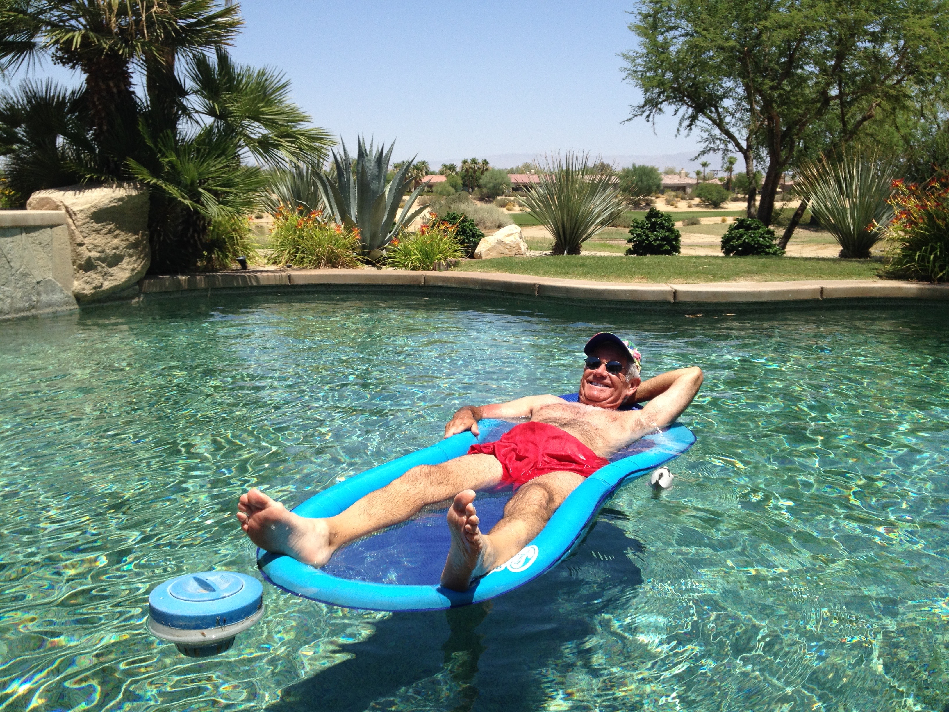
Dinner at the Lesser/Murr Ranch at PGA West. We leave on our journey tomorrow.
And, tomorrow, Randy and Dave join me as we leave La Quinta on a 3,000-mile journey through some of the most spectacular scenery imaginable.
Clearly, there’s a precedent for readers of this blog to sign on for future rides, and become part of Travels With Harley. Who’s next? You know who you are, John Tracy!
Among the lamest of excuses not to join us:
“I have a job.” (Boo-hoo)
“My wife would kill me.” (It’s a risk worth taking)
“I have an aversion to cheap motels.” (Eight hours in the saddle and you won’t care where you sleep, or who’s snoring in the bed next to you)
C’mon, people. Get a life. Travels With Harley 2017 is only a year away.
Finally, a big thanks to Sarah, Gail and Jo for giving the guys an unrestricted two-week kitchen pass. You girls rock!
***
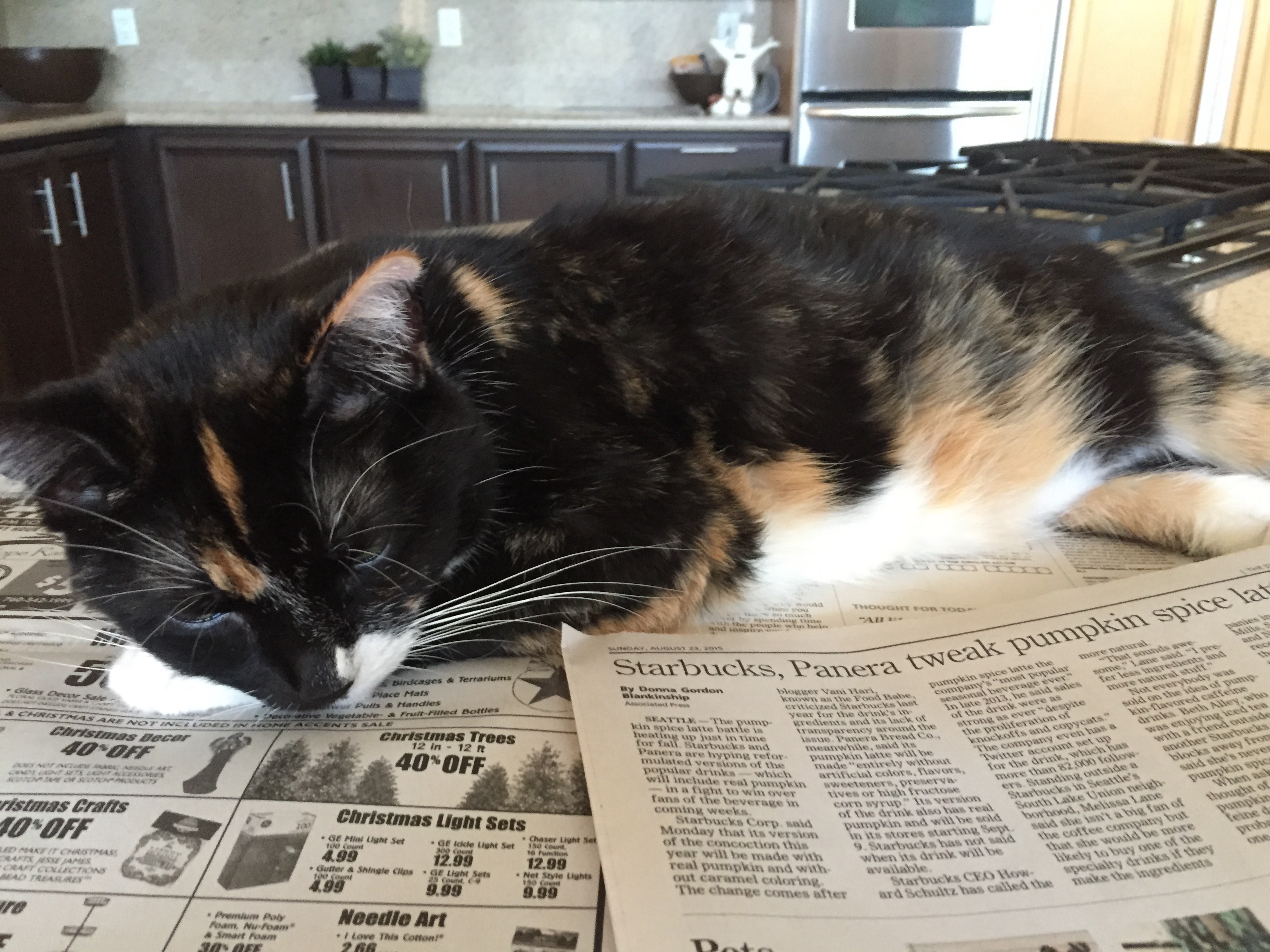
Betsy bones up on ads in the Desert Sun.
That’s about as verbose as I’m gonna get on this year’s blog. Because I’ve previously blogged about many of the places and scenic routes we’ll be riding this year, no point in providing you with déjà vu moments over the next 12 days (how many times do you need to learn about the history and scope of the National Park system?).
That’s why this year’s blog will consist mostly of photos – and captions. Be sure to click on the captions or you’ll miss out on what journalists call “color.”
To see if you were paying attention to my other blogs that already covered the roads we’ll be on this year, I’ll have a “Previous Blog Trivia Question” (PBTQ) each day for you.
There’s no prize for getting the correct answer – other than the knowledge you just might be the smartest person in the room.
Here’s the first Previous Blog Trivia Question (from May 25, 2014).
Q: How many US National Parks are there?
A: 59
Q: For extra credit, what is the largest National Park, and what is the smallest?
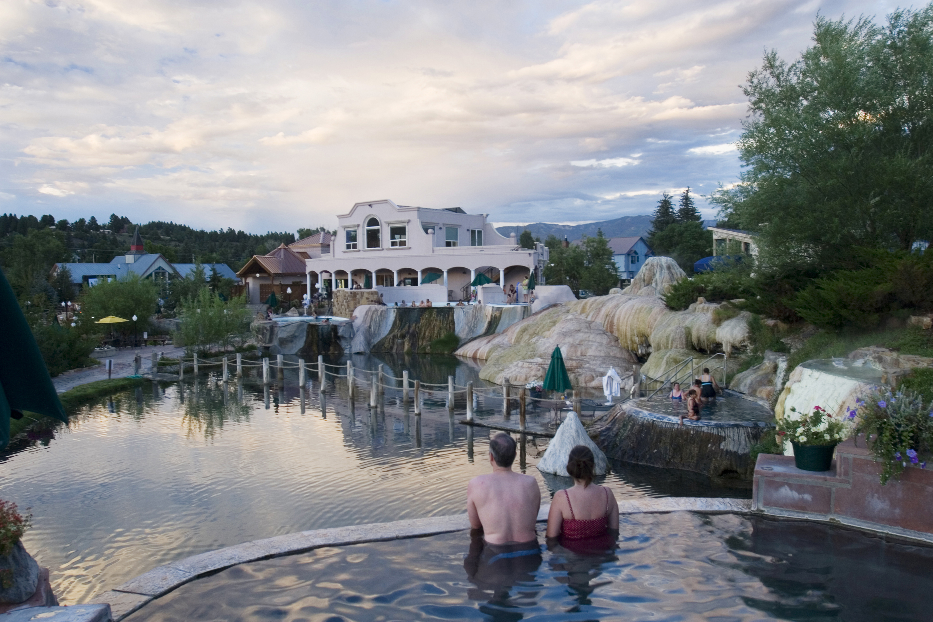
A: Largest (8,323,148 acres) is Wrangell-St. Elias, in Alaska. Smallest (5,550 acres) is Hot Springs, in Arkansas.
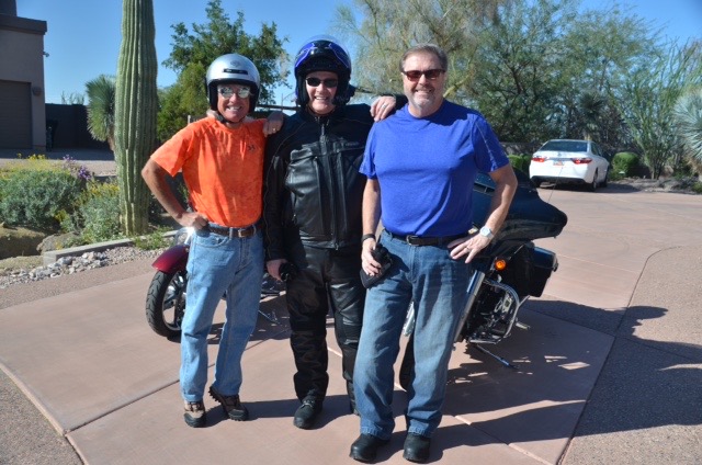
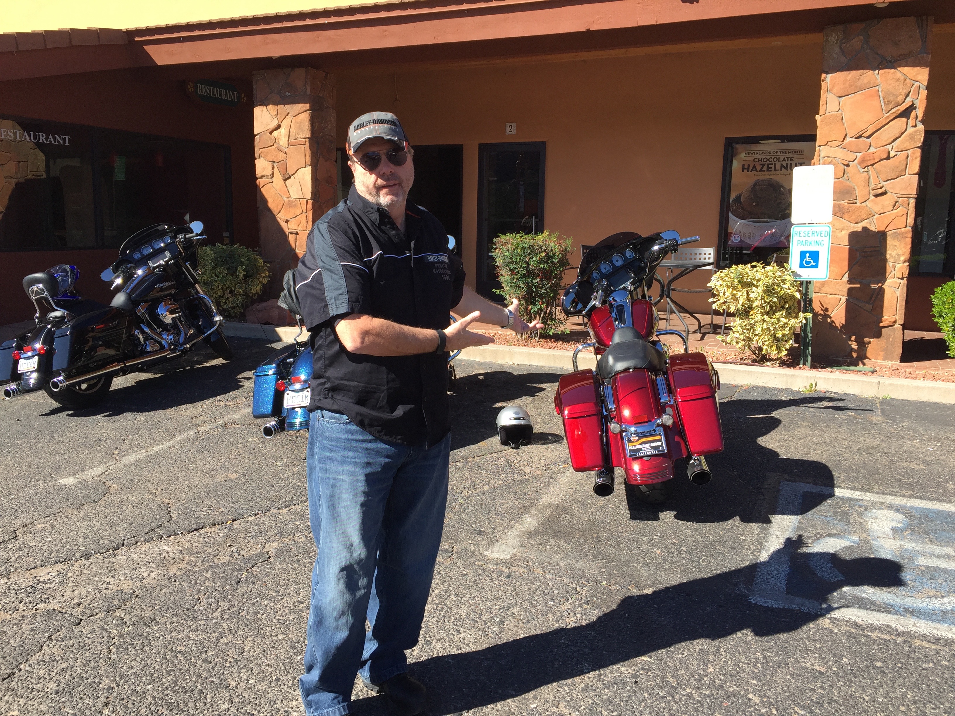
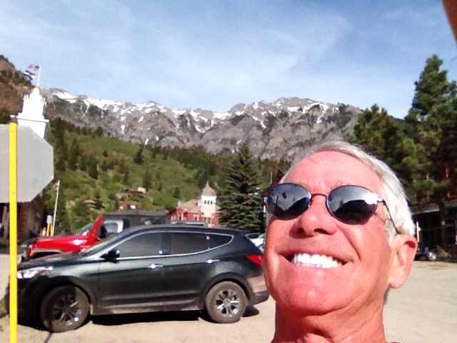
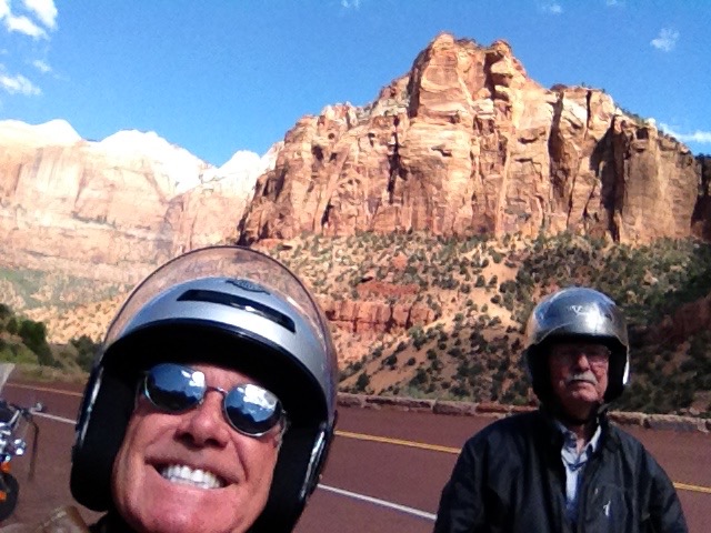
Who better to spend my 66th birthday with than Harley novice and old friend, John Tracy. John and his friend, Pastor John Carpenter, both made the trip from Alaska to Mesa, Arizona — ostensibly to ride with me for four days in Arizona’s mountains and deserts.
To learn more about the John twins, visit the My Posse page of this blog.
Two Alaska guys and one (orange shirt) from California.
I rode from La Quinta and met them in Wickenburg, Arizona. From there, we quickly ascended into the mountain towns of Prescott, Jerome and Sedona.
A serious case of bike envy.
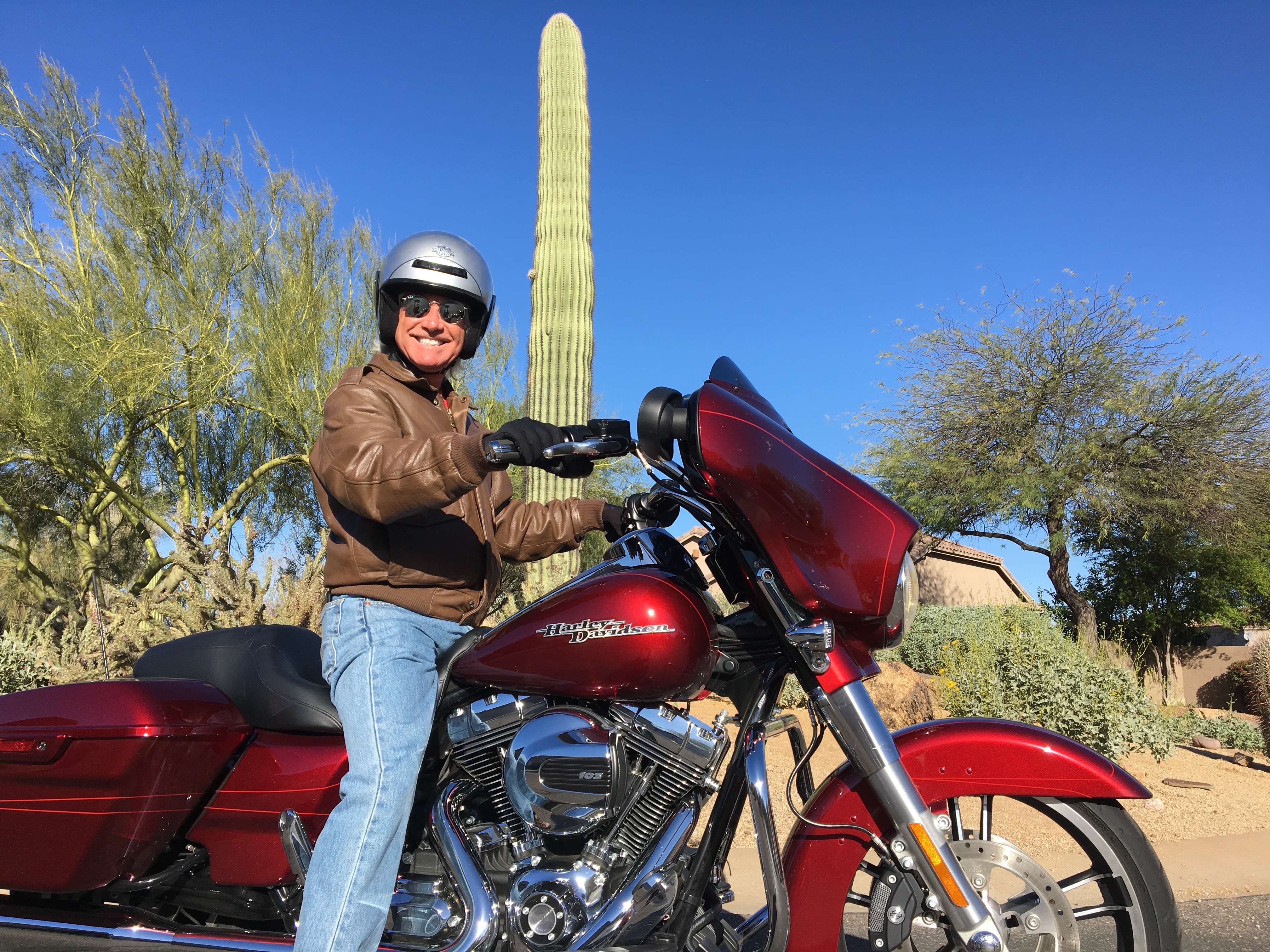
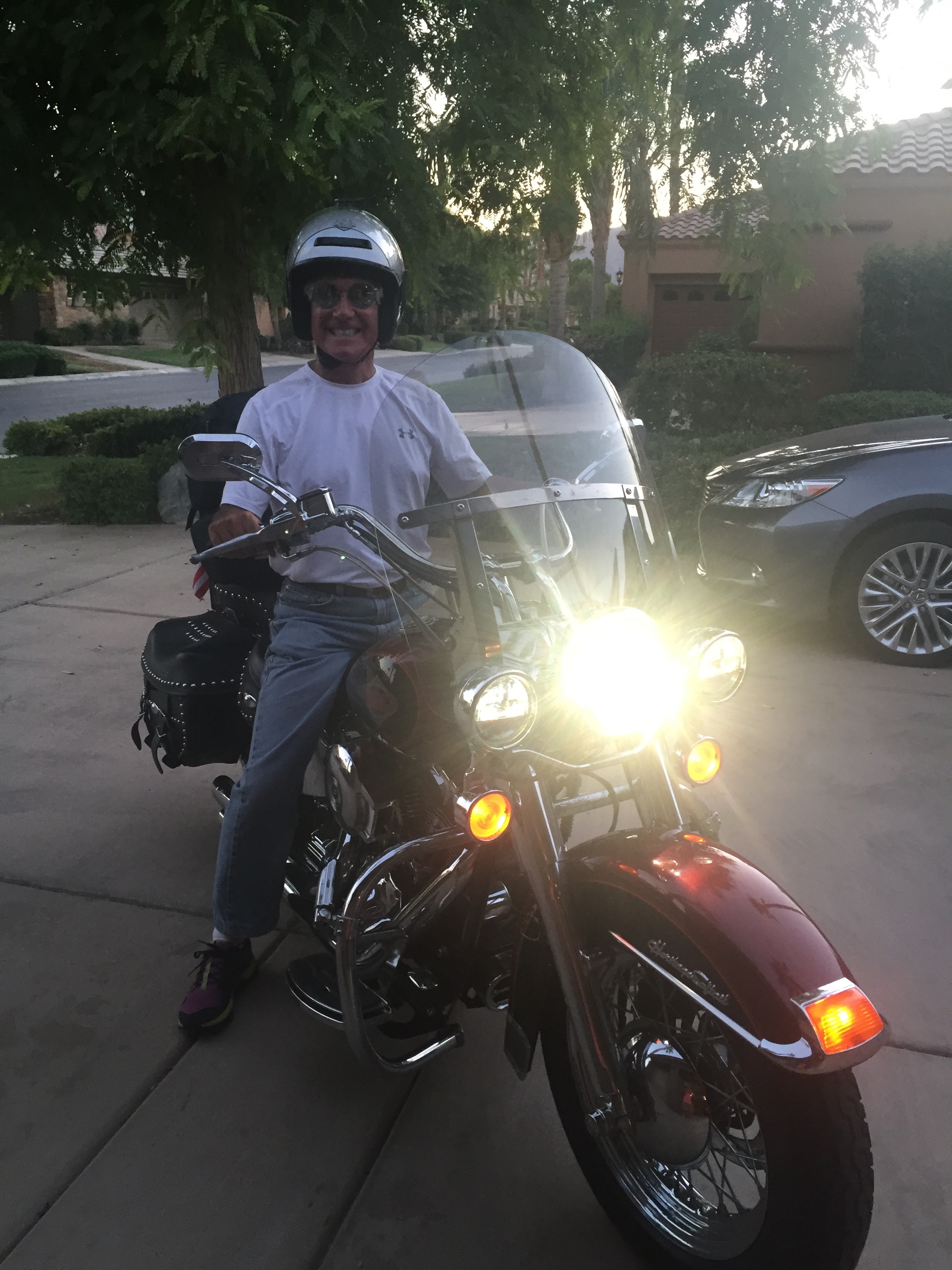
It was the first ride of any significance on my new 2016 Harley Davidson Street Glide Special. The bike performed as advertised.
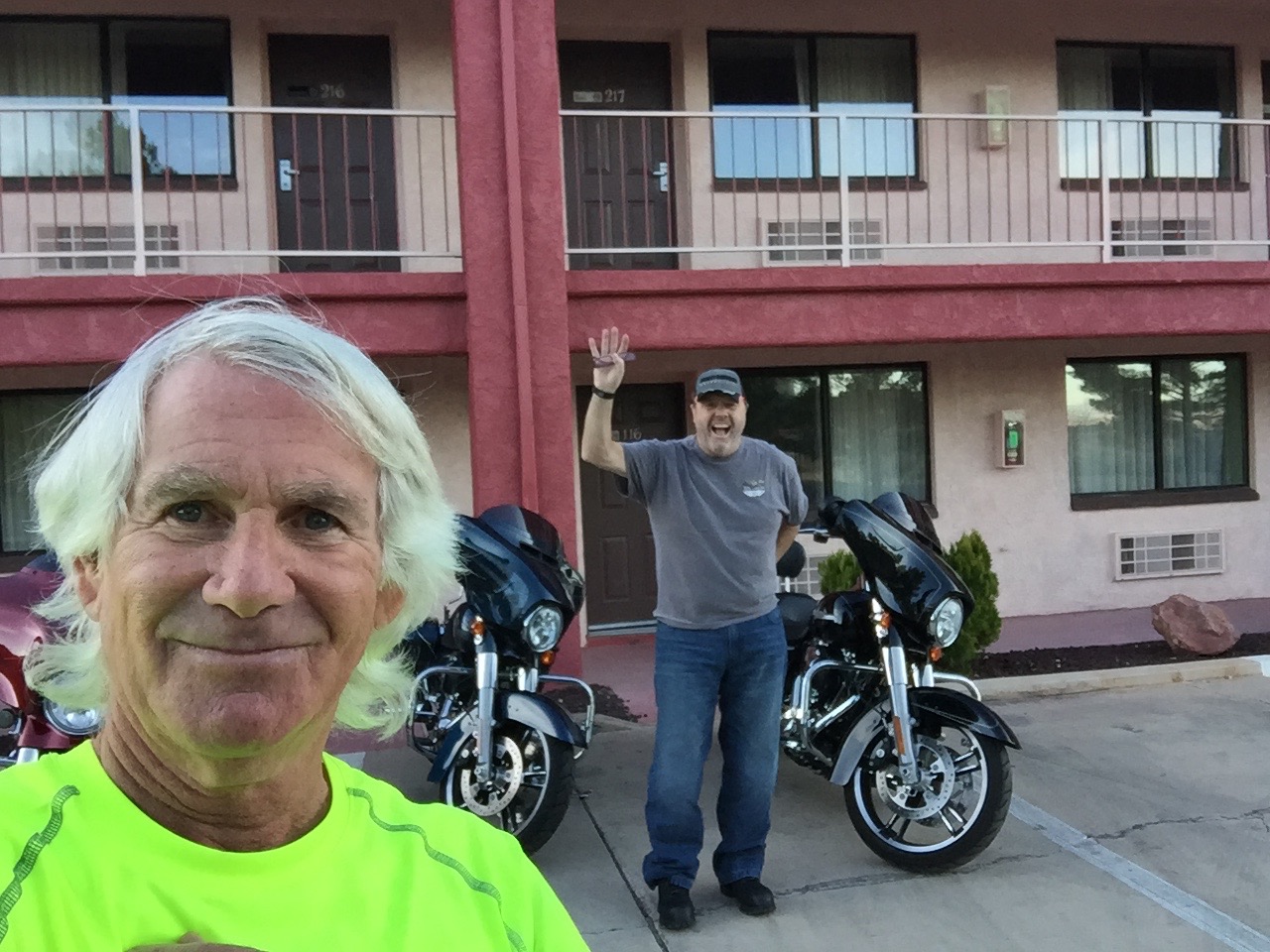
John Tracy says good morning from Cottonwood, Arizona.
The Arizona portion of the ride was short, only three days. But it was enough to hook John Tracy on Harley riding and convince him that he should join me on one of my annual “big” rides.
The two Johns both rented Harley Davidson Street Glides, pretty much like mine, from Desert Wind Harley in Mesa.
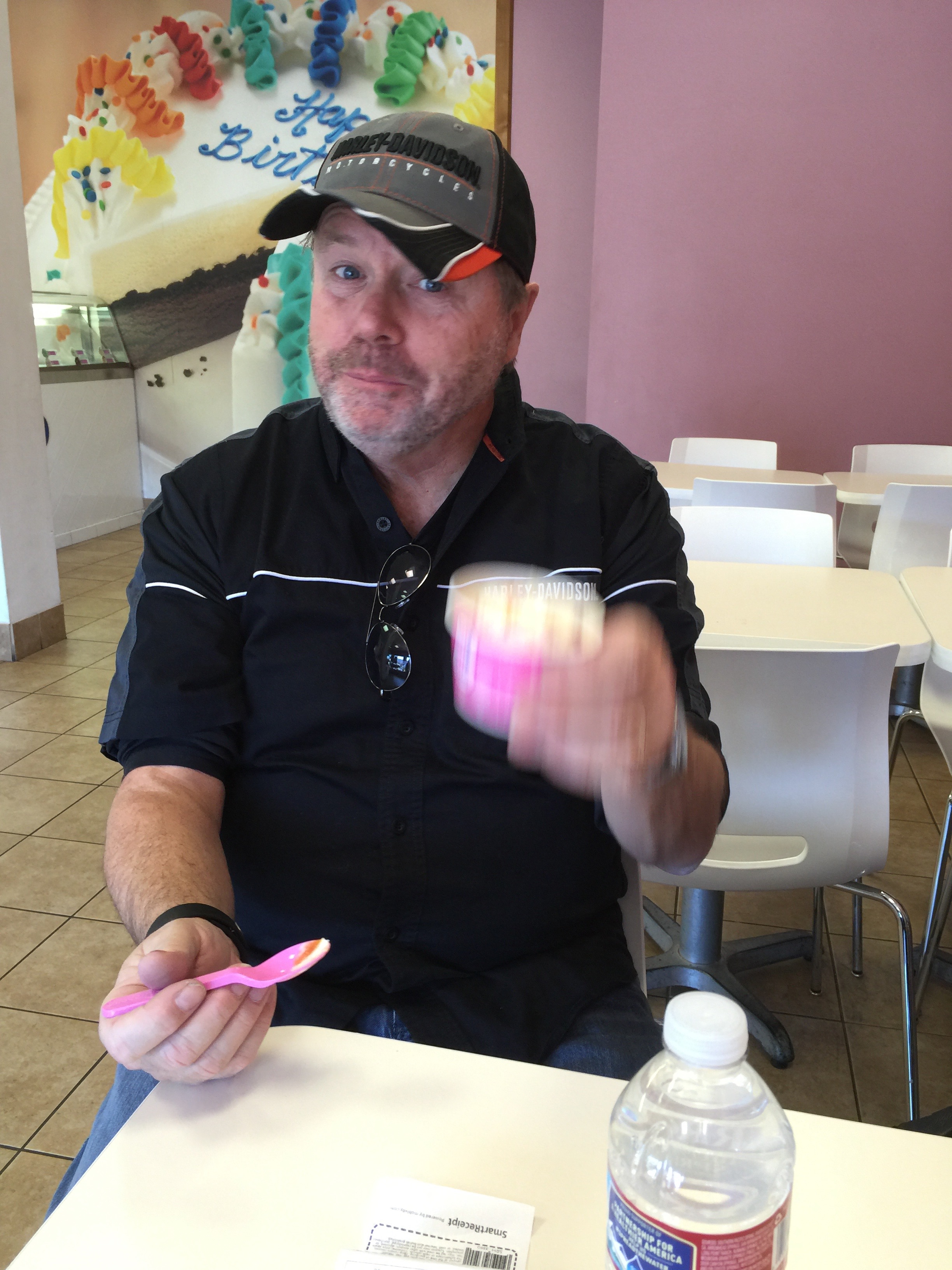
Enjoying a cup of ice cream in Sedona.
Celebrating the big 6-6 at the Tracy house in Mesa.
Today will be our longest ride so far – 300 miles – and it marks our last day on the road as a threesome.
By tonight, we should be back in Lake Arrowhead, ready to return to our own homes – and life as we know it. You knew the party had to end eventually.
After a hearty (not) breakfast at The motel in Three Rivers, we work our way south on Highway 198, riding along the southern shore of Lake Kaweah.
The lake is a reservoir, formed by Terminus Dam on the Kaweah River. Its primary purpose is flood control, so the lake is maintained at a very low – or empty – level most of the year. It generally only fills in May and June. Because of California’s unprecedented drought, the lake is now unusually low, affecting lake recreation and nearby farming.
We follow Highway 198 to the eastern outskirts of Visalia, and turn east onto Yokohl Drive. The road rises gently through rolling hills as we ride thru Yokohl Valley, named after a band of Foothill Yokuts Indians.
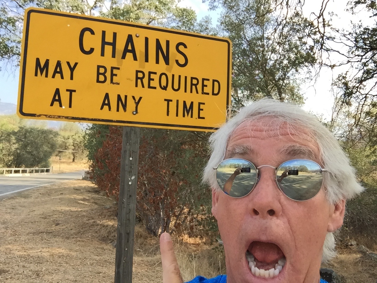
Surprises on a mountain road. Chains, in the summer?
Twenty-two miles later, we rejoin Highway 190 and turn east. For the next 20 miles, the road is extremely twisty, with numerous switchbacks and blind curves. We’re riding at less than 20 miles an hour much of the time.
The Pierpoint Springs Resort is one of the few places along this roller coaster to grab a beverage and a snack. They have great homemade pie, too. And a wi-fi hotspot!
From here, the road continues to be extraordinarily twisty. Eventually, the elevation drops 7,000 feet to the valley floor. Highway 190 becomes Route 107, the Great Western Divide Highway.
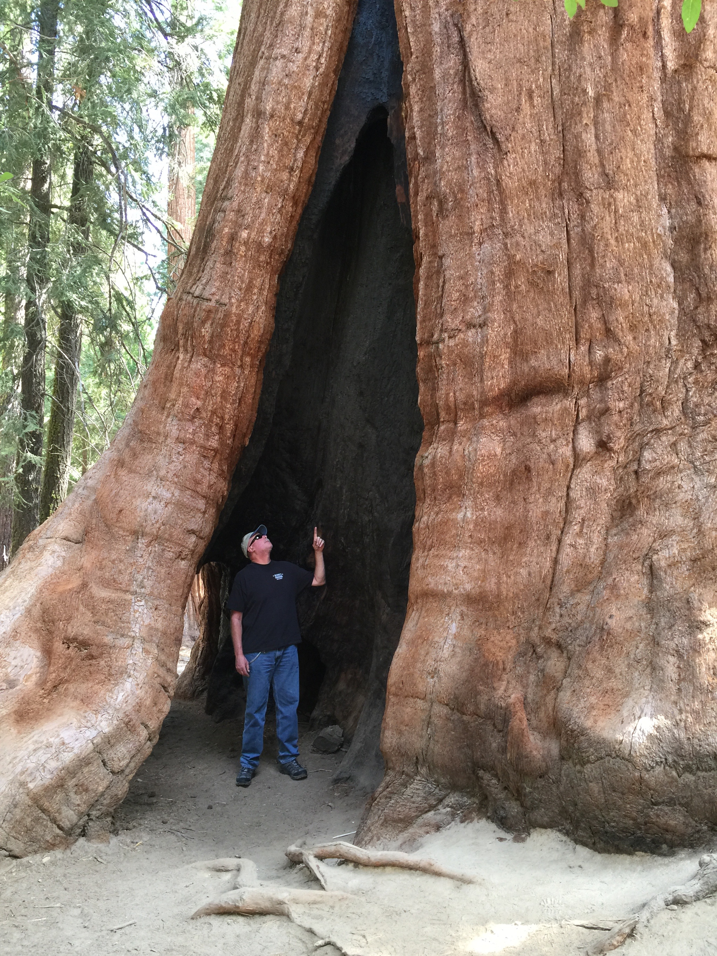
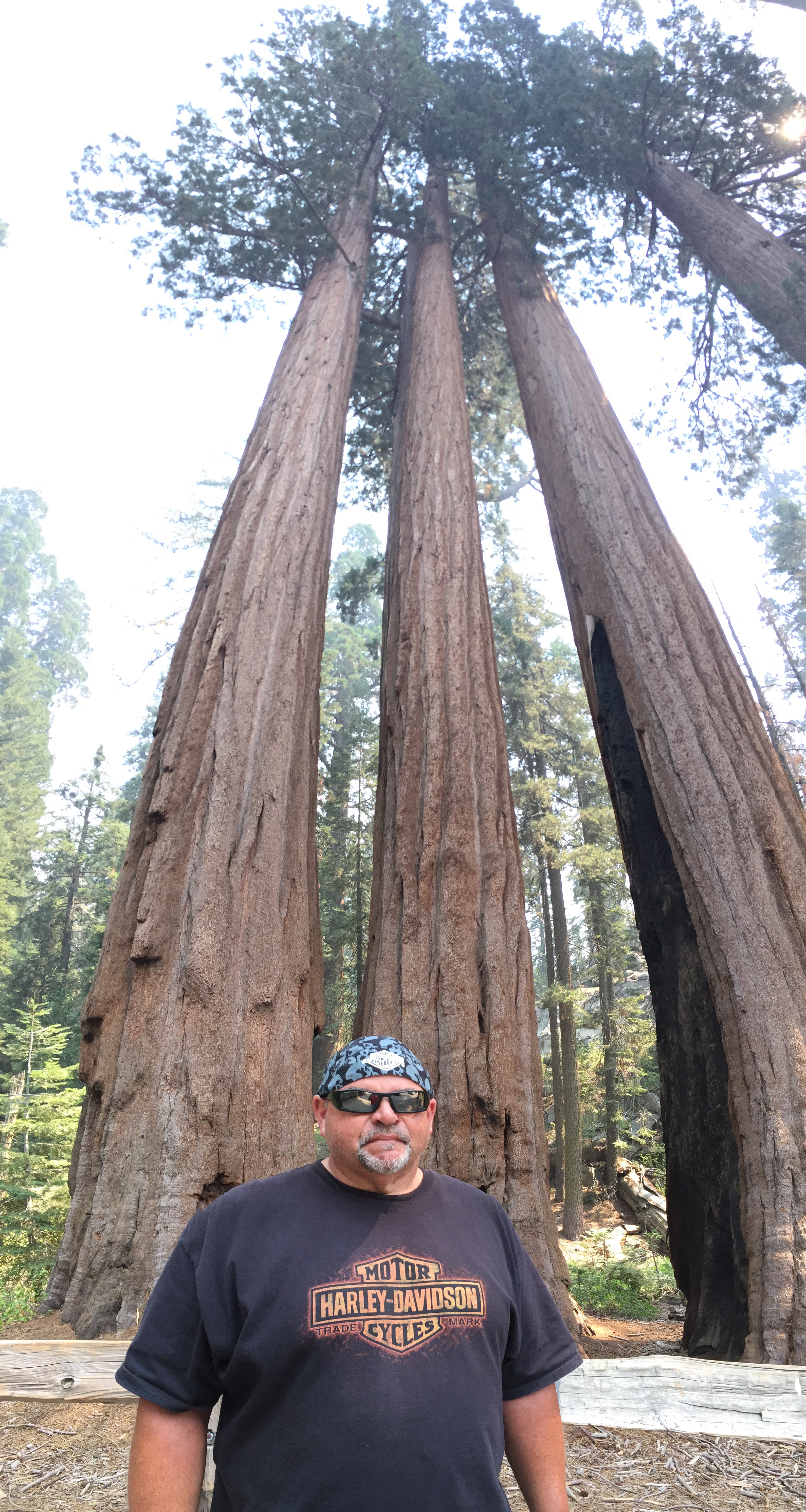
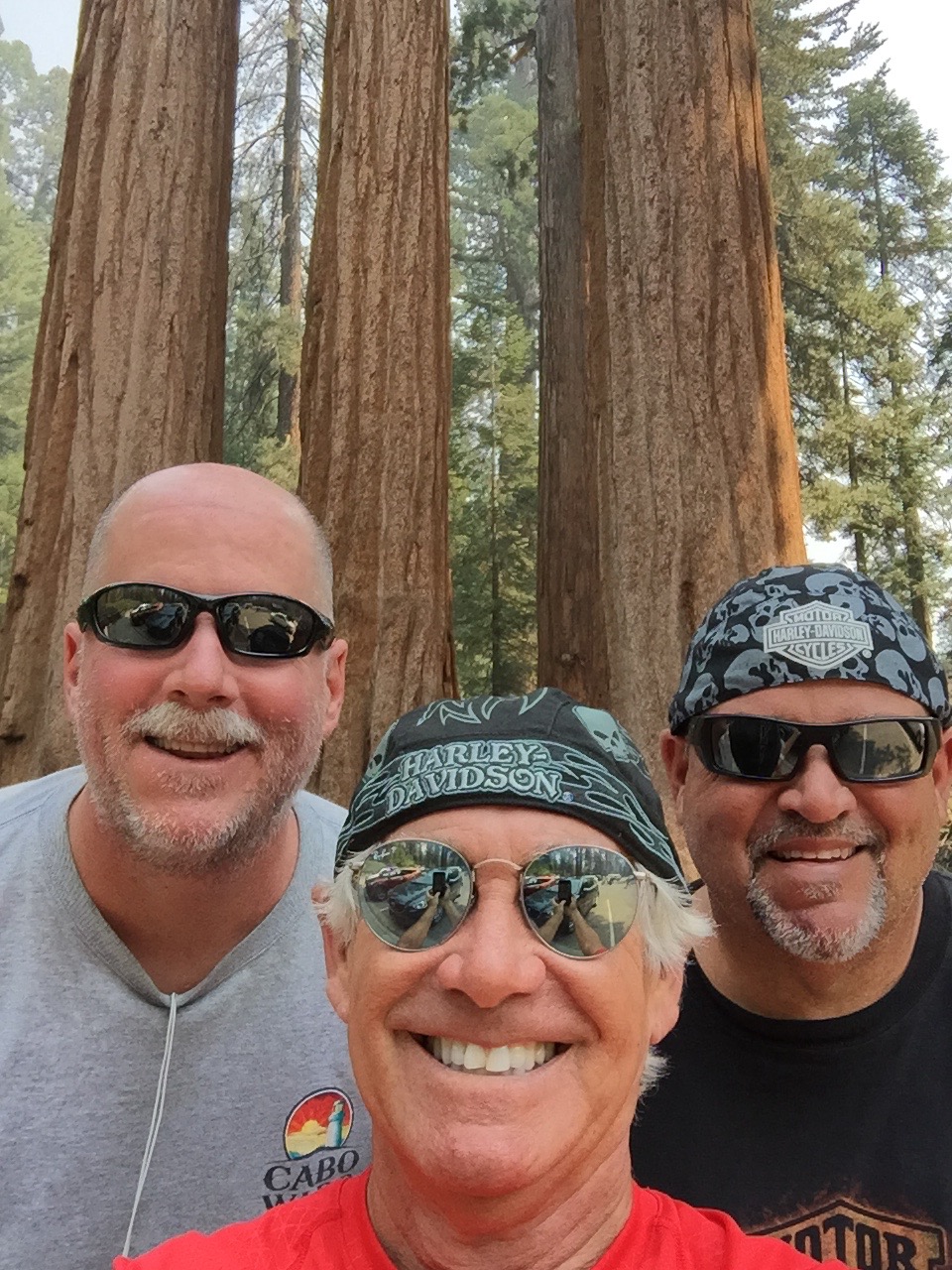
Twenty miles from the Pierpoint Springs pie stop, following a long descent, we arrive in Long Meadow Grove, home of the Trail of 100 Giants. The grove covers about 341 acres of giant sequoias.
On the Trail of 100 Giants.
There’s a unique mile-long interpretive trail, where you can get a close-up look at the grove’s more than 800 sequoias. One hundred twenty-five of them are more than 10 feet in diameter.
This is one of the few sequoia groves with a large number of “twins,” two sequoias growing tightly side-by-side, in order to share resources. This grove even has one twin that rangers call a “sequedar,” a sequoia and a cedar that have grown together.
“These giant sequoias clearly are the work of the ages,” the President said, as he dedicated the National Monument. “They grow taller than the Statue of Liberty, broader than a bus, they are the largest living things on this Earth; so perfectly adapted to their environment that one has never been known to die of old age. They began when America was not even imagined, and Europe was in the Dark Ages.”
100 Giants, and I’m not one of them.
***
Ten miles east, we pass through Johnsondale, elevation 4,711 feet. Now on Mountain Highway 99, we roll south along the Kern River. It’s a 2,000-foot drop and a 45-minute ride to Kernville. The mid-day sun is searing. White water river adventures – rafting and kayaking – are a popular activity on the Kern River, particularly in the spring. Right now, in mid-summer, the river is barely moving. River rafting companies have shut down operations until next year, hoping for greater snowpack and runoff in 2016. Rafting season this year was completely cancelled.
The Kern River was named after artist and topographer Edward Kern, and so, obviously, was the city of Kernville. Kernville’s big annual event is Whiskey Flat Days, the yearly celebration of the historic Wild West days here. The event is held every President’s Day weekend. We weren’t even close.
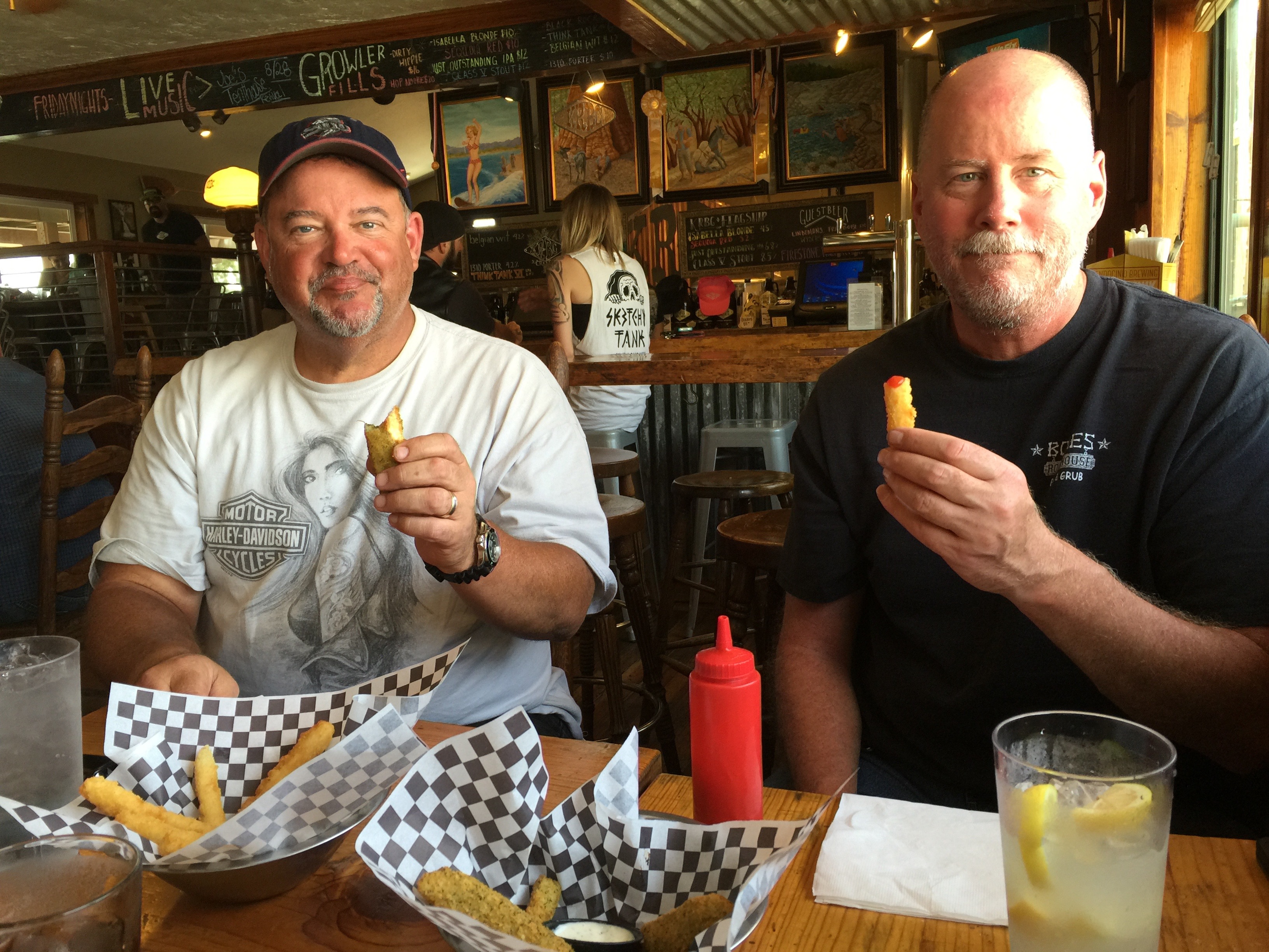
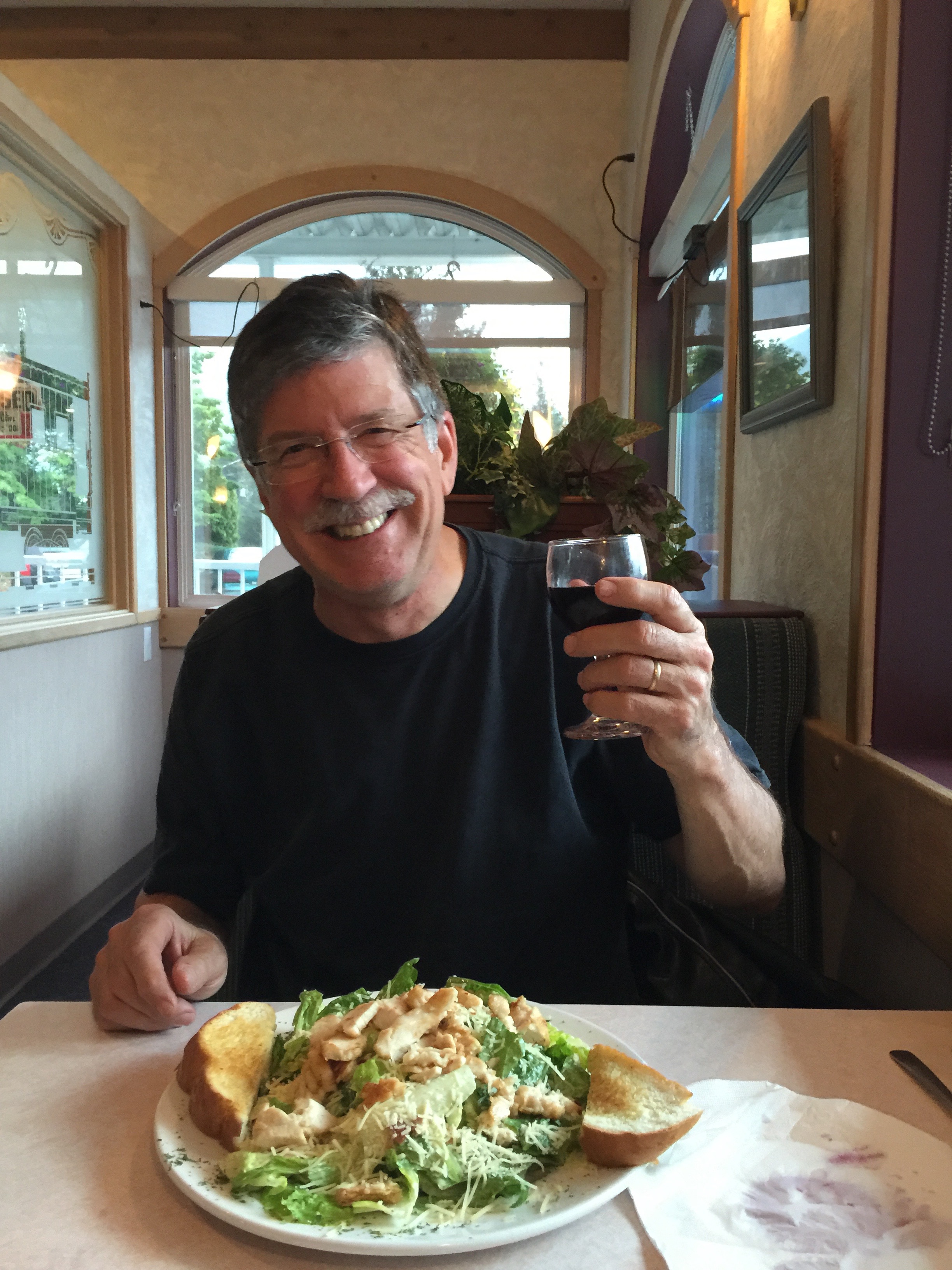
Lunch in Kernville, at the Kern River Brewery.
A few miles south of Kernville, we spot the north shores of Lake Isabella, a reservoir in Kern County created by Isabella Dam. At 11,000 acres, it’s one of the larger reservoirs in California. We pass through the South Fork Wildlife Area, turn east on Highway 178, and quickly pass through Weldon. Highway 178 is also called the Isabella Walker Pass Road.
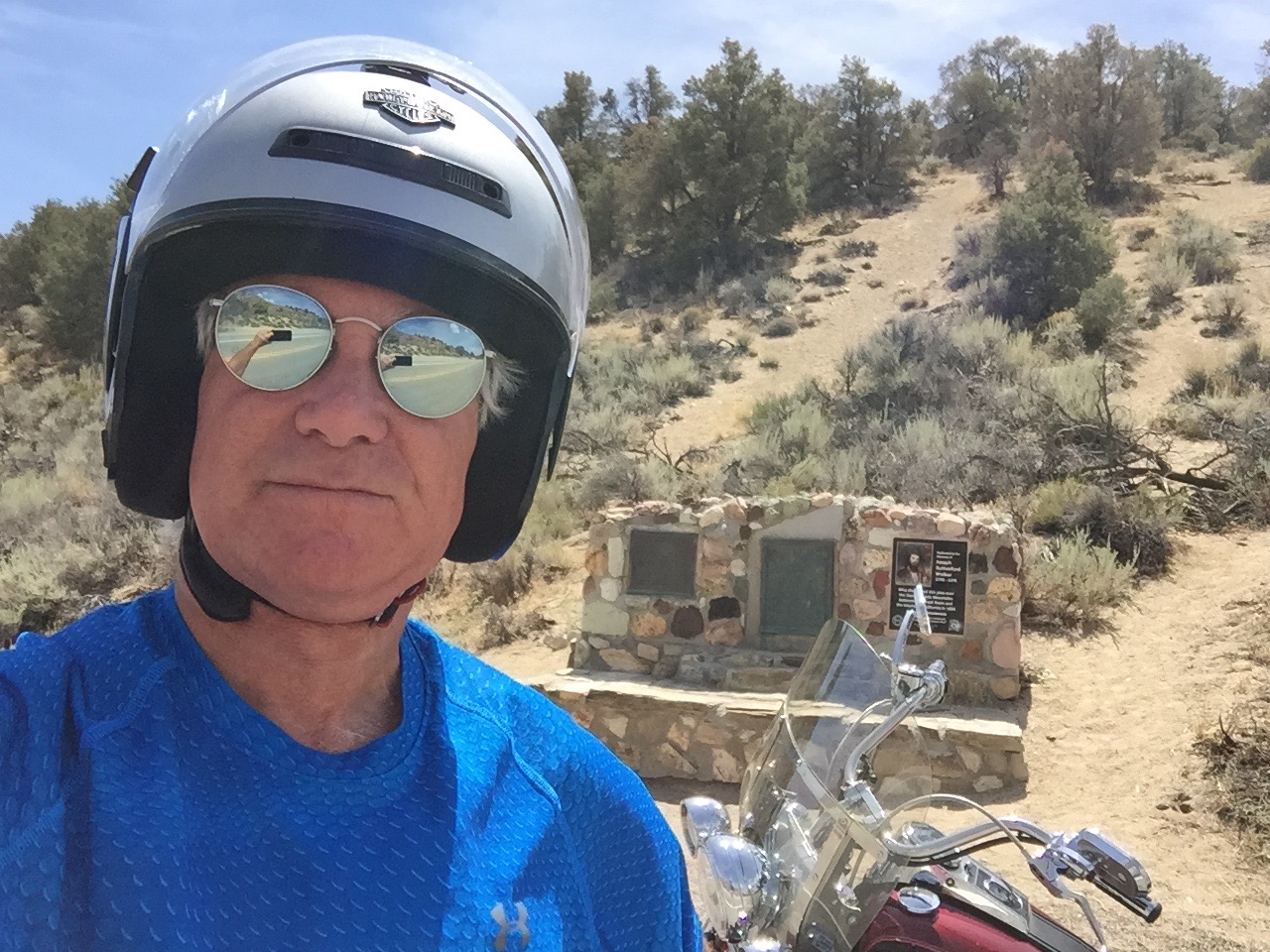
Walker Pass is slightly less than a mile high – 5,250 feet – and is a National Historic Landmark. The highest point on Highway 178, it was charted as a route through the Sierra in 1834 by Joseph R. Walker, a member of the Bonneville Expedition. Walker learned of the route from Native Americans.
The 2,663-mile Pacific Crest Trail, which begins at the US-Mexico border and ends at the US-Canada border, crosses Highway 178 at Walker Pass. Northbound hikers who arrive at Walker Pass can look forward to the longest roadless stretch of the entire trail. The trail crosses many of the areas we’ve been for the past week, including Yosemite National Park, Kings Canyon National Park, Sonora Pass, Ebbetts Pass and Carson Pass.
At Walker Pass.
The Pacific Crest Trail was made famous in the 2014 Hollywood film, Wild, starring Reese Witherspoon as trekker Cheryl Strayed, on a journey of self-discovery and healing. Hey everyone … take a hike.
***
Descending from Walker Pass, in eight miles we come to a T in the road at the junction with Highway 14 – the Aerospace Highway. Faced with our biggest decision of the day – north or south – we counter-intuitively turn north.
With a few jogs in the road, we ride through Inyokern, a hybrid name combining Inyo and Kern Counties. Inyokern is actually in Kern County.
In Inyokern, we turn south on US Highway 395, which we’ll follow for the next 50 miles. While highly scenic in the Sierra Nevada Mountains, Highway 395 from Inyokern south is straight, flat and boring. You’d expect that of the Mojave Desert. The Mojave is a high desert; in Inyokern, we’re at 2,455 feet. But it’s still a desert and in the mid-afternoon sun, it’s blazing hot.
As we approach Kramer Junction, we eye, on our right, a massive solar power generating plant. It’s part of the Solar Energy Generating Systems, whose capacity at several locations in the desert is 354 megawatts. The facility is privately owned and operated by NextEra Energy Resources, which says 354 megawatts is enough to power more than 232,000 homes.
The complex of 936,384 high-tech mirrors is the world’s second largest solar thermal energy generating facility, consisting of nine solar power plants in the Mojave Desert. The solar generation uses parabolic trough, solar thermal technology to make electricity. Mirrors and heat transfer make it all happen.
The Kramer Junction solar facility receives an average of 340 days of sunshine a year. Today is one of them.
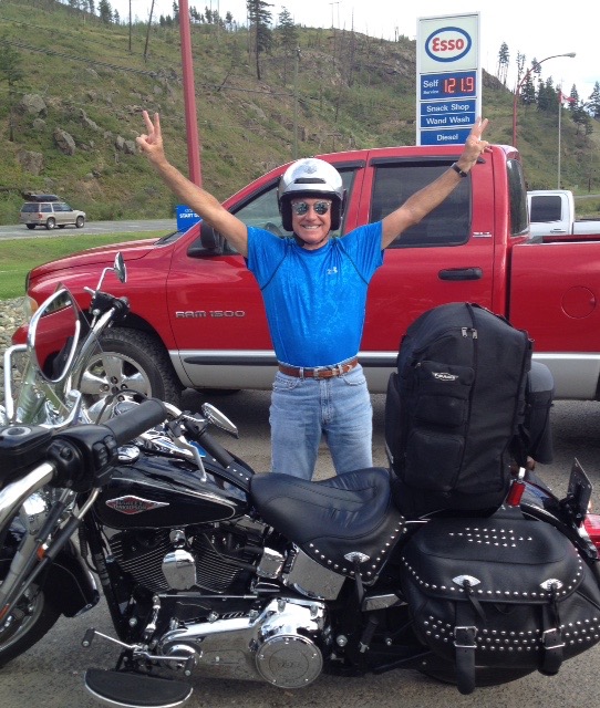
Scott cools off on a 102-degree day at Kramer Junction.
Kramer Junction, also known as Four Corners, sits at the intersection of US Highway 395 and California Highway 58. It has several gas stations, fast food restaurants, a slow food restaurant (The Roadhouse), a population of 2,231, and not much else.
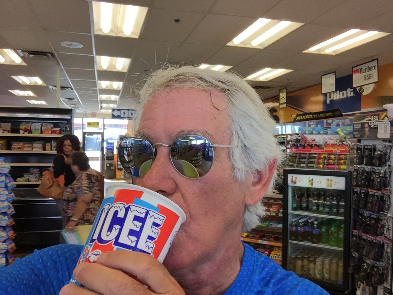
An Icee break at Kramer Junction.
West on Highway 58 takes us to Mojave, home to the Mojave Air and Space Port where the first private space flight, SpaceShipOne, was launched in 2004. East on Highway 58 brings us to Barstow, a transportation hub named after William Barstow Strong, former president of the Atchison, Topeka and Santa Fe Railway.
But we are heading south, so we continue on US-395 for another 40 blah miles.
One of the few interesting sights along the way is just north of Adelanto, where we roll by the Southern California Logistics Airport – a boneyard for retired commercial airplanes. The airport, perhaps more diplomatically and euphemistically, calls itself a “transitional” facility. A halfway house for distressed aluminum.
Formerly George Air Force Base – which closed in 1993 – the logistics airport has a 15,000-foot runway. That’s the longest in the US, other than Denver International Airport. The Southern California Logistics Airport, technically in Victorville, can accommodate all currently flying commercial and military aircraft, 24 hours a day. The facility claims VFR (Visual Flight Rules) weather 360 days a year, meaning there are a lot of clear, sunny days, perfect flying weather. Good for Harley riding, too. Except for the heat.
Because of the dry climate here, it’s a conducive environment for preserving aircraft. To protect airliners during their storage from wind and sun damage, engines and windows are tightly covered with white, reflective materials – allowing the airplane to be stored safely for years until it’s ready to return to active duty, or be salvaged. Airliner boneyards in the western US serve several functions: temporary storage, maintenance, parts reclamation, and scrapping.
***
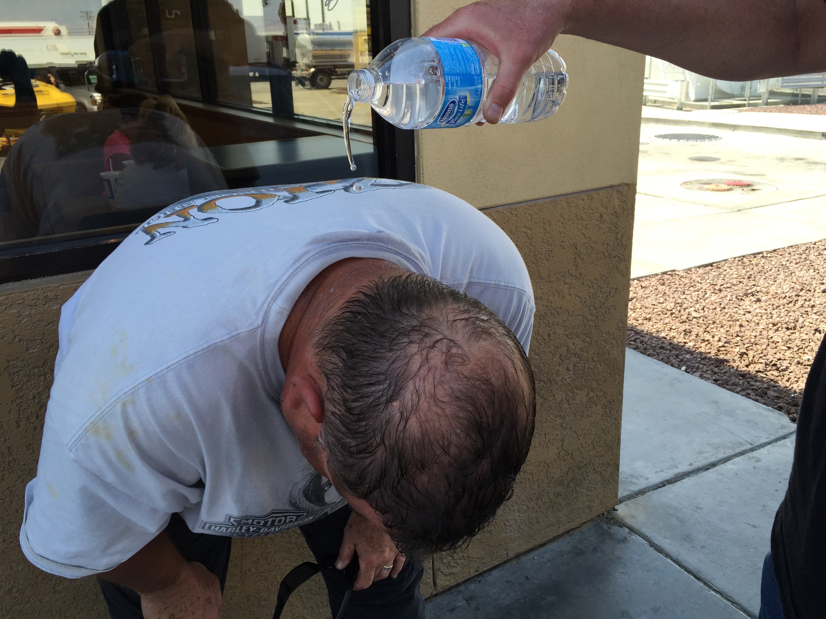
Just before hopping on I-15, I take one last hydration break.
In 13 miles, we merge onto I-15 south and continue our journey to Lake Arrowhead. We’re not big fans of Interstate highway riding, so we fortunately are on I-15 for only eight miles before exiting at Cajon Junction. If that sounds familiar, it’s because we crossed Cajon Junction on Day 1 on our way to the Angeles Crest Highway.
We turn east onto Highway 138 for the 22 mile ride past Silverwood Lake and Crestliine. Three miles on the Rim of the World Highway, and we’re back in Lake Arrowhead, where our journey began eight days ago – and where it now ends.
***
To view today’s route from Three Rivers to Lake Arrowhead, click here.
Cheers! To a safe trip, and looking forward to the next one.
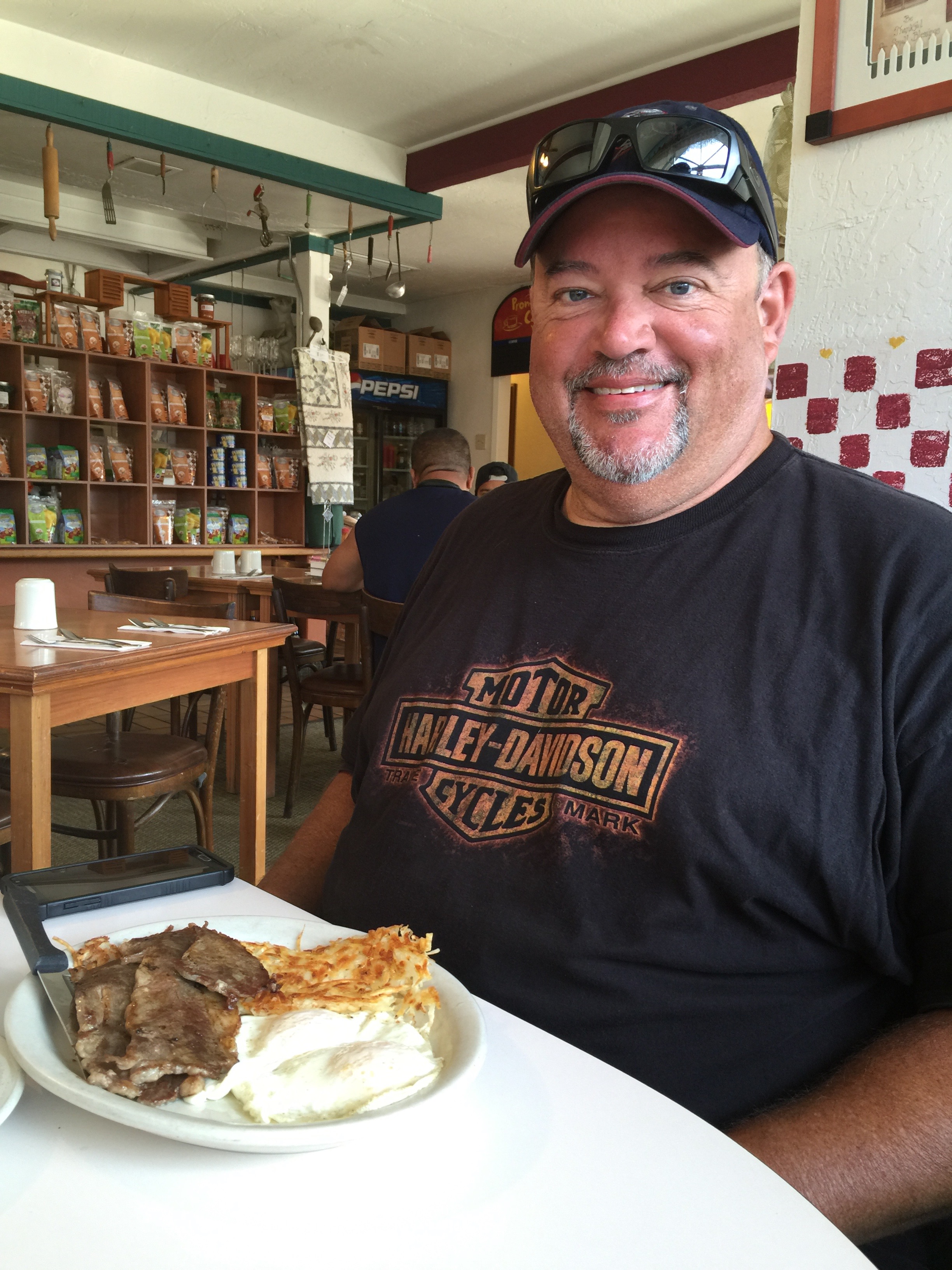
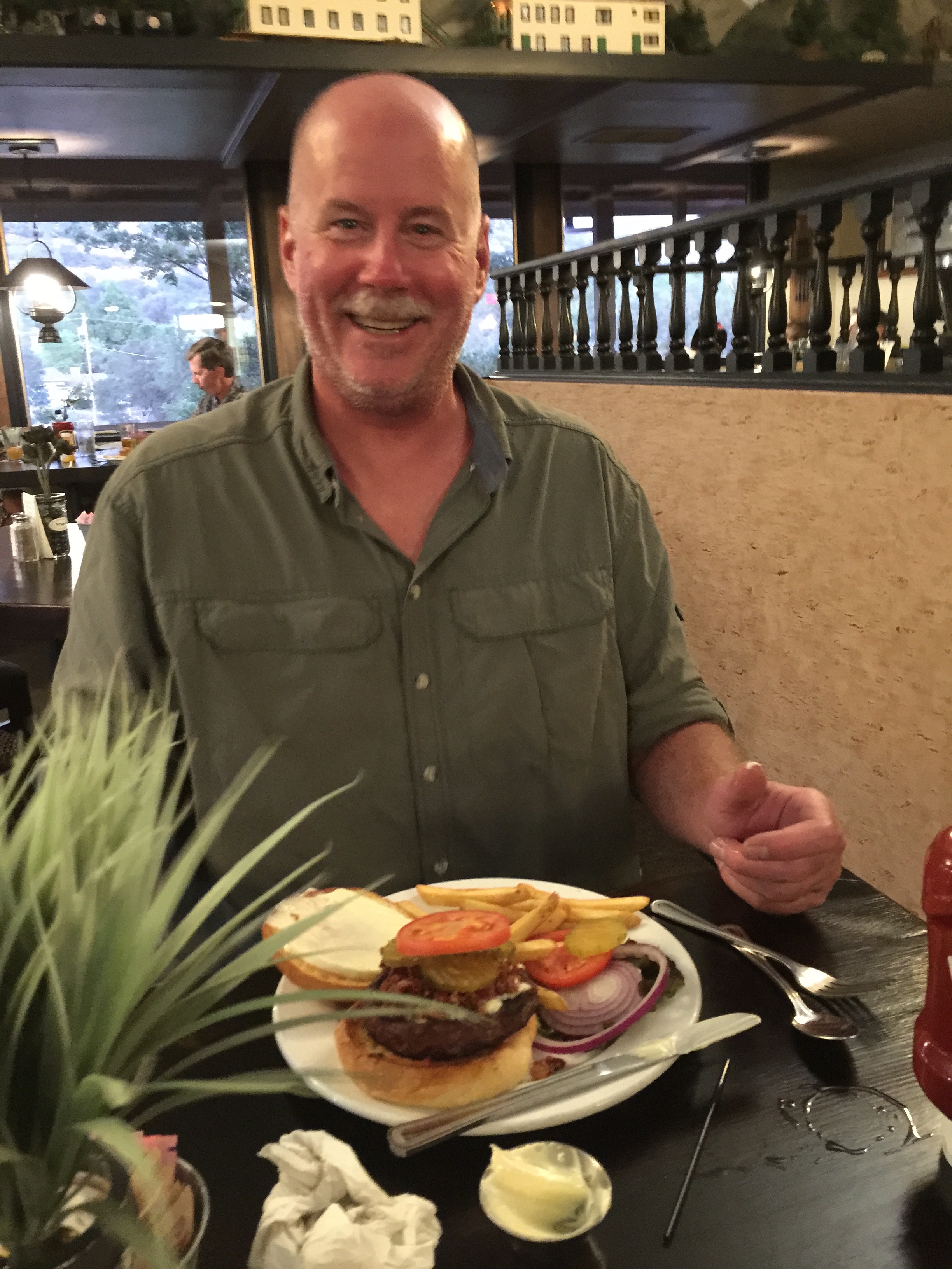
Breakfast at Katie’s Country Kitchen in Oakhurst. A hearty way to start the day!
Man, the big guy can really put away a big breakfast.
Each day on this trip, we seem to do things in twos:
August 21: two notable biker roadhouses – Newcomb’s Ranch, and the Rock Store.
August 22: two cool town nicknames – “Clam Capital of the World,” and “Gibraltar of the Pacific.”
August 23: two monumental structures – the Hearst Castle and Bixby Bridge.
August 24: two bad habits – gold and gambling.
August 25: two major Sierra passes – Ebbetts and Sonora.
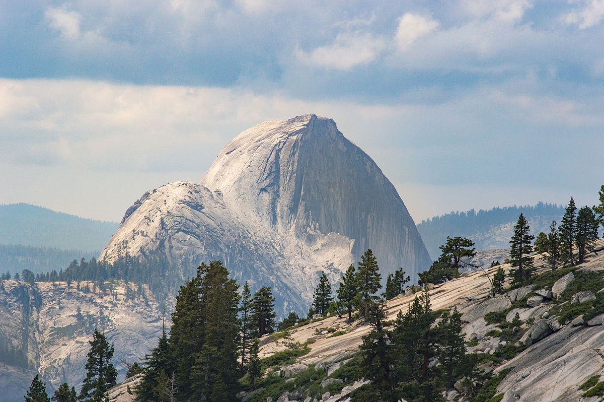
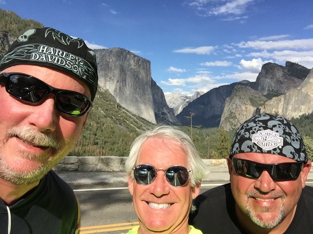
August 26: two hunks of granite – El Capitan and Half Dome.
Today, we’ll continue the streak by visiting two National Parks – Kings Canyon and Sequoia.
***
Smoke gets in your eyes.
We begin our 222-mile journey by heading south through the western foothills of the Sierra Nevada Mountains, mostly on gently curving two-lane roads. We’re in the Sierra National Forest, riding along Bass Lake.
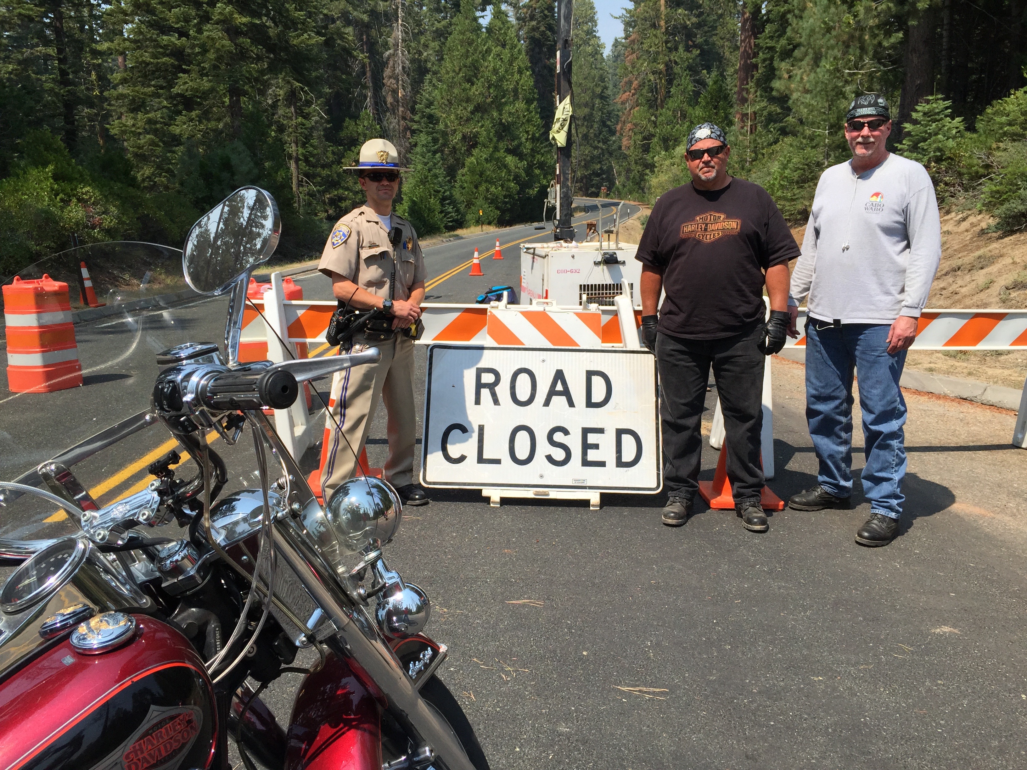
We motor through the teeny communities of North Fork and Auberry. In Auberry, the smoke from the Hume Lake fire is thick, causing us to reassess our ride into King’s a Canyon. We stop at a convenience store, and develop Plans B and C, in case the road is closed or the smoke is so dense we have to skip the National Parks altogether today. Turns out the road into Kings Canyon is closed; the fire has been burning more than a month and is still only 25 percent contained.
We press on, riding east on Highway 180, and 65 miles after leaving Oakhurst, we see a hint of today’s first destination as we turn left onto Highway 180 – Kings Canyon Road. The hint is the road sign. I can take a hint.
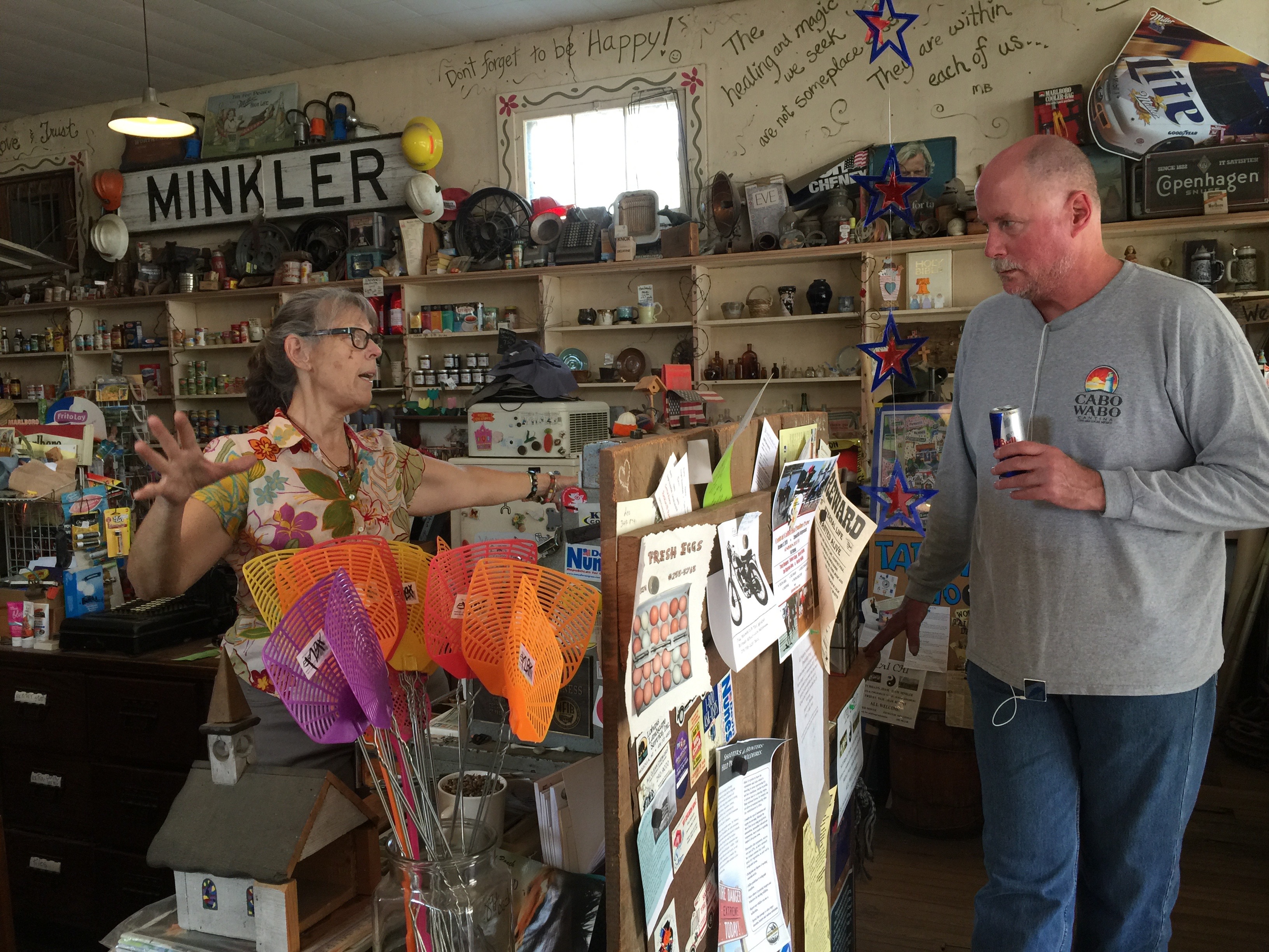
Over the next 40 miles, Highway 180 will gradually climb to 6,600 feet in the Sierras and enter Kings Canyon National Park. We pass through Minkler, Squaw Valley, and Clingan’s Junction Grocery – the last gas station for more than 100 miles.
Dave makes a new friend at the general store in Minkler.
After gassing up, the road rises dramatically. From here, it’s about 18 miles of twisty roads with spectacular views to the south and west. Well, spectacular if you could see them, which we can’t today because of the smoke in the air. And then we arrive at the park entrance, where the ranger gives us the official word about the road closure.
Interestingly, when you enter Kings Canyon National Park, you also enter Sequoia National Park. They share the same entry point and the same National Park Service website. The two parks are separate, but quite closely related. Since the 1940s, both parks have been administered jointly.
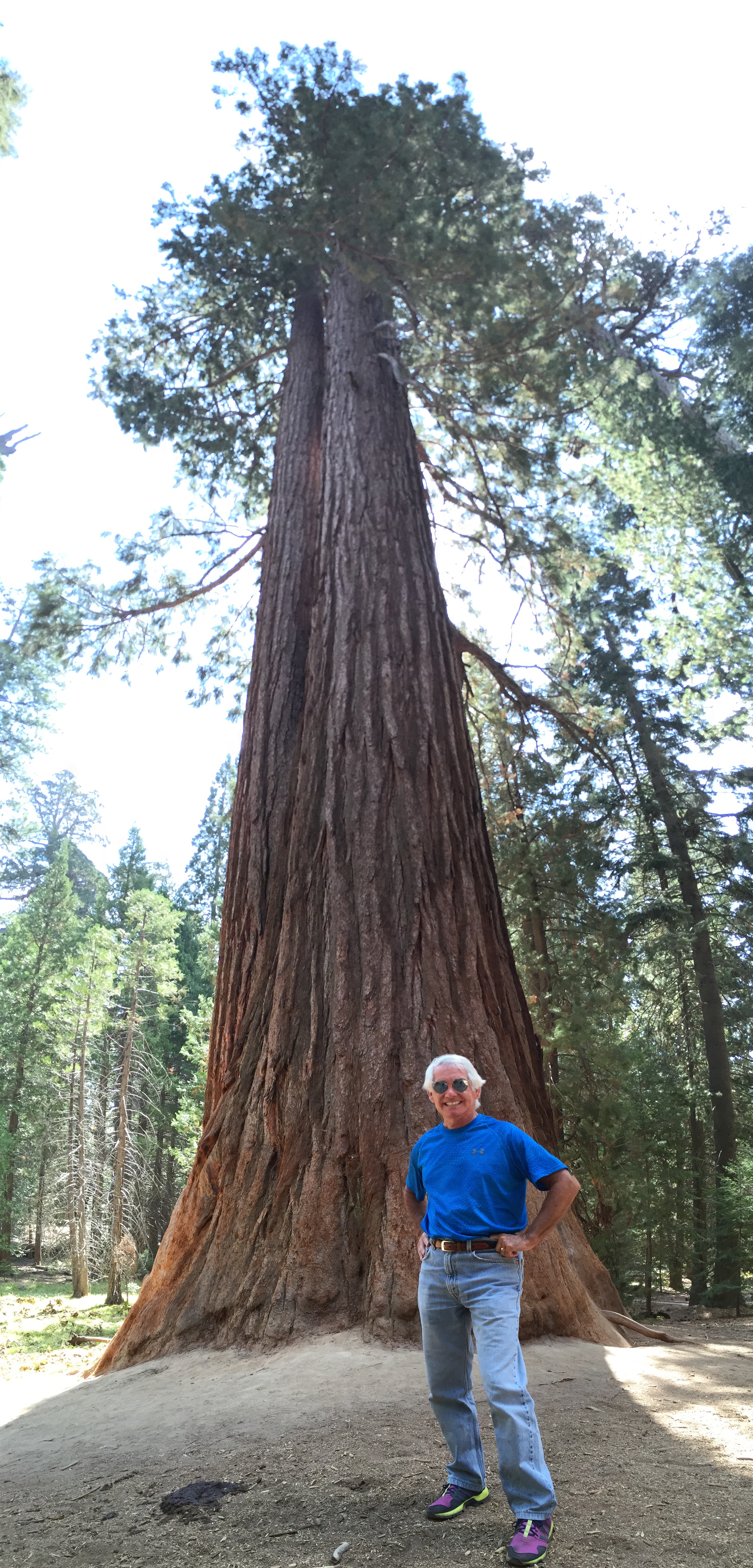
The sequoias at Grant Grove are ginormous.
Rolling past the small community of Wilsonia, we turn into Grant Grove, a stand of sequoia trees, whose centerpiece is the General Grant Tree. At 267 feet tall and a ground circumference of 108 feet, it’s the third largest tree in the world — and is more than 3,000 years old. The tree was named in 1867 after Ulysses S. Grant, Union Army general and the 18th US President.
In 1926, President Calvin Coolidge proclaimed it the “Nation’s Christmas Tree,” perhaps one of his more notable accomplishments while in office. And, in 1956, President Dwight Eisenhower declared the tree a “National Shrine,” a memorial to those who died in war. It’s the only living object with that designation.
Visitors busily snap photos and try to find a way to fit the entire tree in the frame. Good luck with that.
Sequoia selfie.
Time to leave the Sequoiadendron giganteum in the Grant Grove behind, and explore Kings Canyon itself, which we would do if the road is open, but it remains closed due to the Hume Lake fire. Sadly, that’ll have to wait for another trip. We do take the opportunity to snap some pix of the Road Closed sign, a bittersweet memory captured on my iPhone. As we continue along Highway 180, there’s nothing but unbridled beauty for 35 miles until we reach the end of the road at Kanawyer. All you can do there is dismount and begin hiking.
Kings Canyon is named after the Kings River, whose headwaters originate at elevations above 13,000 feet in the Sierra Nevada mountains. The Kings River was named in 1805 by the commander of a Spanish military expedition into California’s Central Valley.
The canyon was carved by glaciers out of granite and closely follows the river. The granite walls of the canyon, in places, tower 4,000 above the canyon floor. It’s one of the deepest canyons in the US.
Bummer. Road through Kings Canyon is closed due to smoke and fire.
At the Road Closed sign, we turn around and reverse our direction, and begin heading back toward Grant Grove, our last vision of Kings Canyon National Park, which this year celebrates its 75th anniversary.
***
With a slight left turn, we are now on Highway 198, entering Sequoia National Park. The two parks are that close.
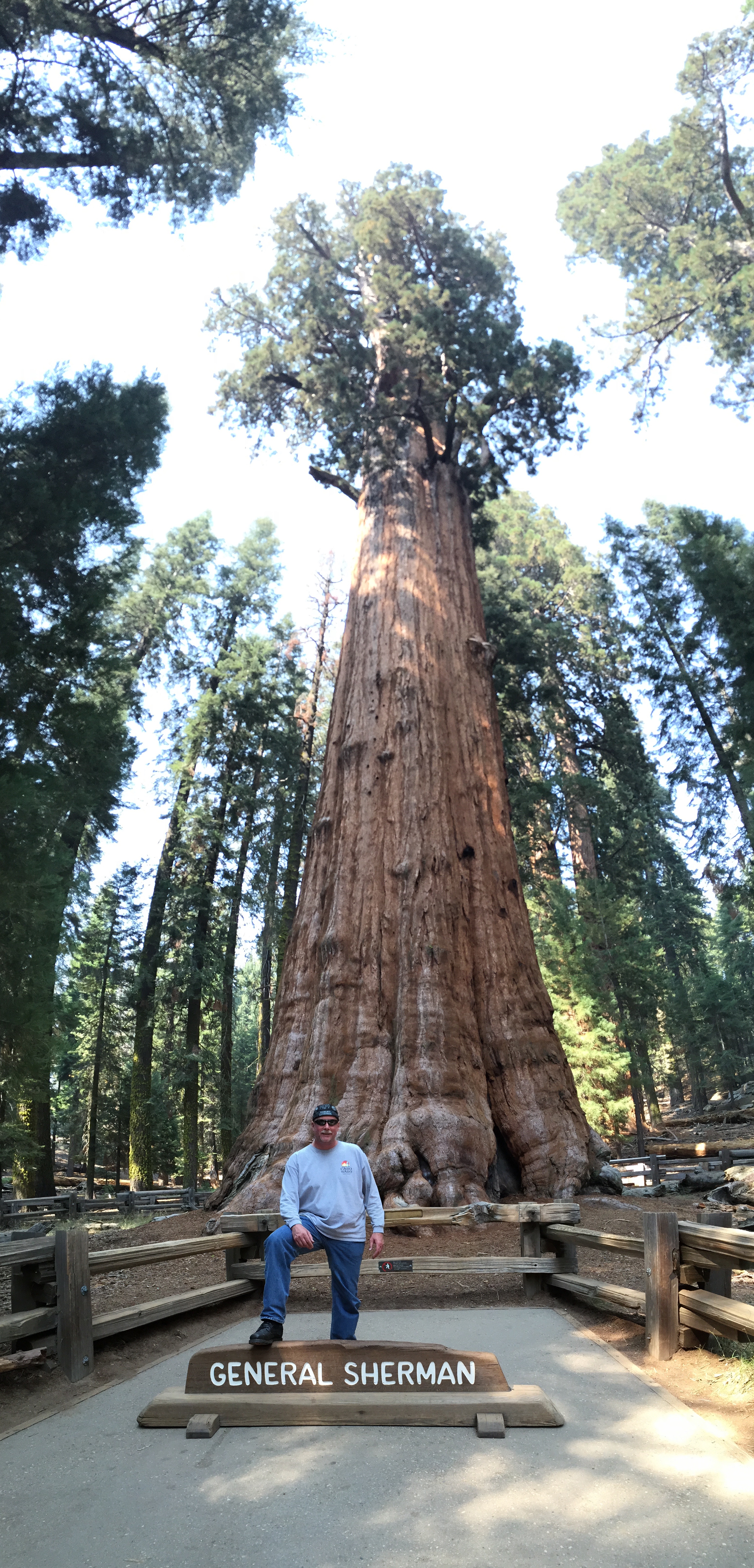
Highway 198 is also called Generals Highway, named after two of the world’s largest and most famous Sequoia trees – the General Grant and the General Sherman. We will visit the General Sherman tree in about 45 minutes.
Dave poses in front of the General Sherman Tree.
The Generals Highway snakes south through Sequoia National Park, twisting and turning amid giant trees. The park is also full of huge redwood trees, often mistakenly confused with sequoias. Both naturally occur only in California, share a distinctive cinnamon-colored bark, and the proclivity for growing to overwhelming heights. Sequoias thrive in higher elevation habitats than redwoods. Redwoods are generally taller. Sequoias weigh more, though where would you find a scale large enough to verify that?
Sequoia National Park was created essentially to protect the giant sequoia trees from logging. It was the first national park formed to protect a living organism.
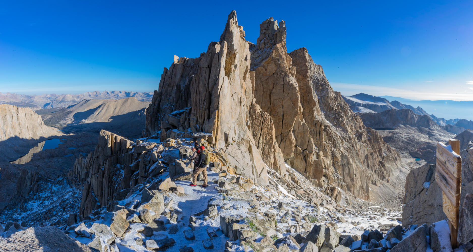
The park contains among its natural resources the highest point in the contiguous 48 United States, 14,505-foot Mount Whitney – named after Josiah Whitney, chief of the California State Geological Survey in the 1860s and ’70s.
My riding partners, Dave and Scott, have both summited Mount Whitney; Scott has done it three times, the Mount Whitney trifecta!. My wife, Sarah, has conquered the mountain, too. All proudly signed their names in the register that sits at the summit. The register is brought down the mountain several times each season by Park rangers, who place it in Mount Whitney’s permanent archives. If you make it to the top, your name has a place in history.
Dave and Scott have hiked Mount Whitney. So has Sarah. Me, I’m a slacker.
Mount Whitney is a 22-mile hike, round trip, with an elevation gain of more than 6,100 feet. About 10,000 people a year successfully complete the journey – a mostly non-technical but uber-grueling ascent. Permits are required, and like the 17-Mile Drive in Carmel, motorcycles are not allowed.
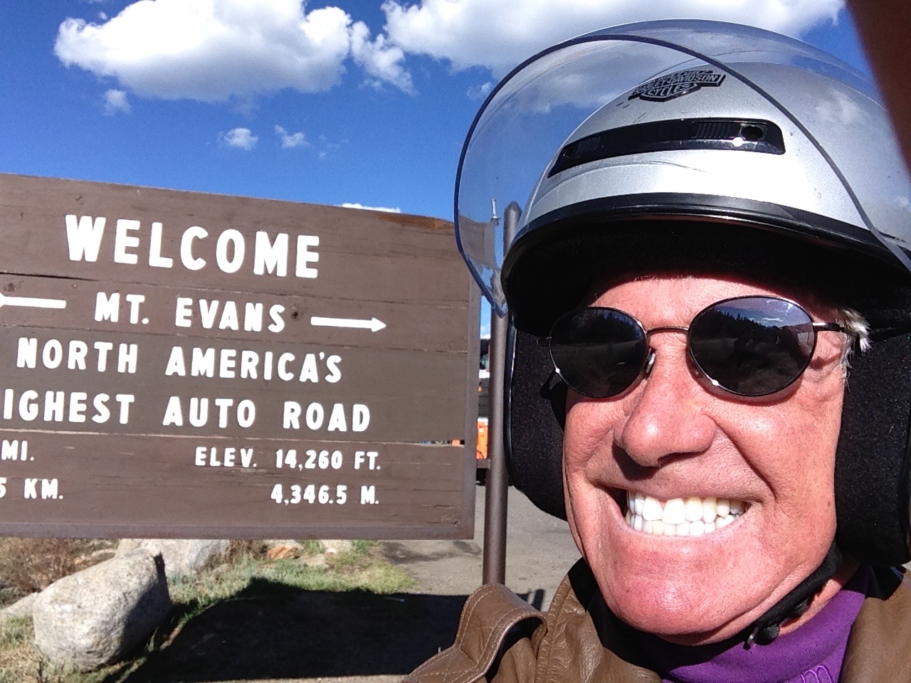
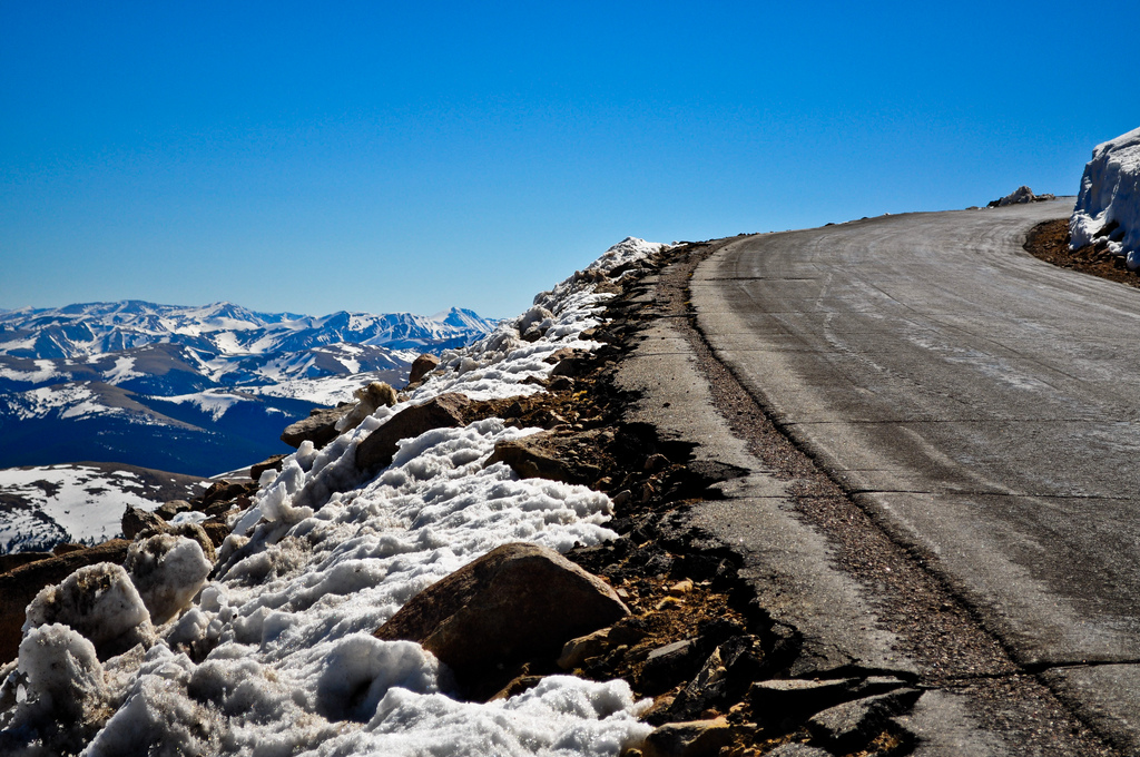
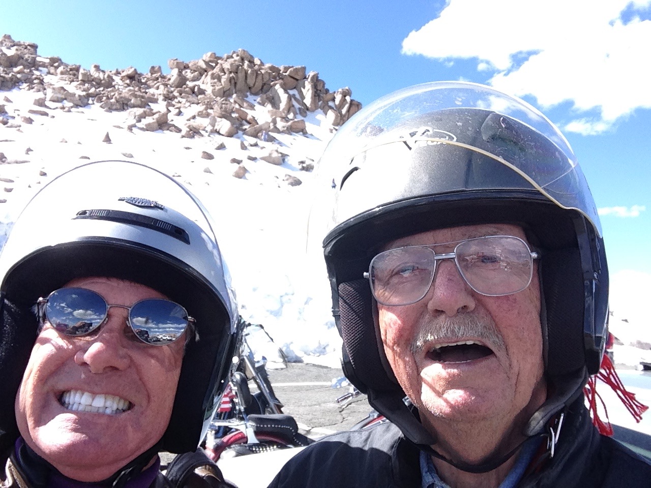
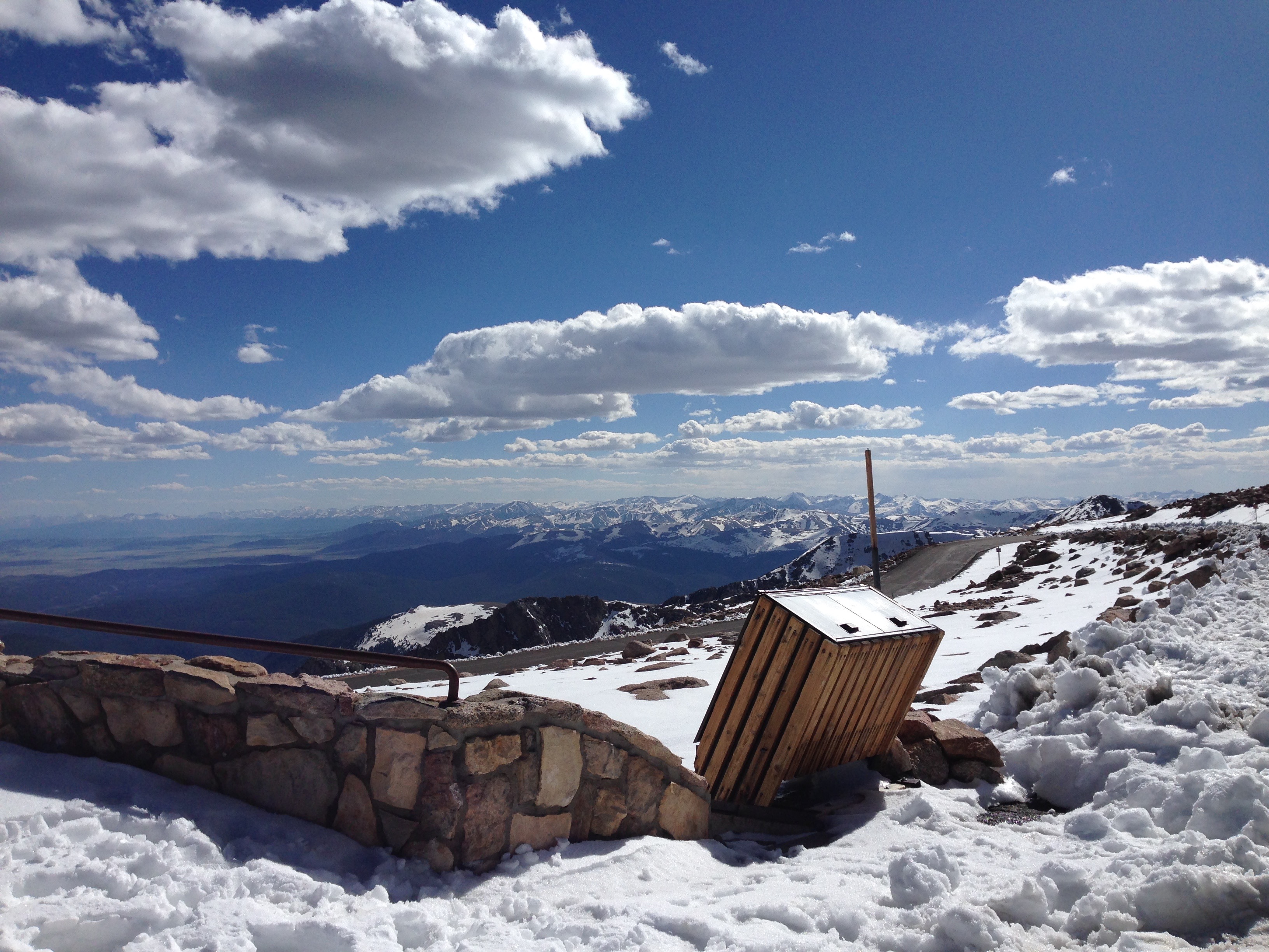
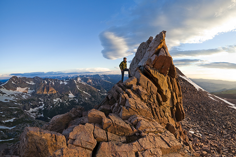
Note: my resume does not include a Mount Whitney climb, but I have summited Colorado’s Mount Evans, 14,130 feet. On a Harley.
We turn off The Generals Highway and into the parking lot to view the General Sherman Tree. By volume, it’s the largest known living single stem tree on earth – estimated at 52,500 cubic feet.
The Sherman Tree is named after the Civil War general William Tecumseh Sherman. The tree was named by naturalist James Wolverton, who had served as a lieutenant under Sherman.
In 1931, following scientific comparisons with the General Grant tree, General Sherman was identified as the world’s largest. Size matters, especially to arborists.
Two miles down the road, we pass the Giant Forest Museum and come to the Moro Rock Trailhead. It’s a spectacular hike that ends with 352 stairs to a vista point on Moro Rock, where you can enjoy panoramic views of the western half of Sequoia National Park and the Great Western Divide.
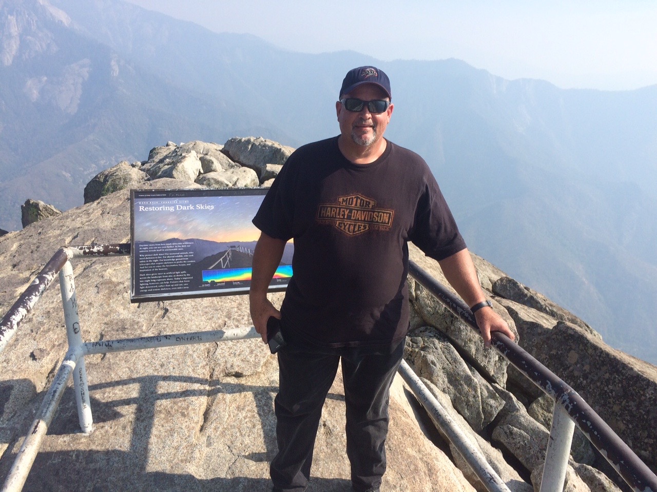
Scott at the top of Moro Rock. The views, sadly, were obscured by smoke.
It’s easily one of the most popular hikes in the park.
Moro Rock rises 6,725 feet above sea level. It is a prominent granite protrusion on the edge of the Giant Forest visible to everyone driving up the Generals Highway into Sequoia National Park from the south.
For the next 10 miles from Moro Rock south, the road is probably the twistiest, baddest, steepest alpine thrill ride I’ve ever been on. There are dozens of well-marked hairpin turns so tight that I get well acquainted with first gear all the way down. This marks my fourth trip on this road and my knuckles are still ashen white.
We descend all the way to 843 feet above sea level, landing in the town of Three Rivers, population 2,182. The town’s name comes from its location near the junction of the North, Middle, and South Forks of the Kaweah River.
Three Rivers bills itself as the gateway to Sequoia National Park. We exit the park and wonder what kind of two-fer tomorrow will bring.
A chipotle burrito for dinner in Three Rivers.
***
To view today’s route from Oakhurst to Three Rivers, click here.
Exactly one year from yesterday – on August 25, 2016 – the US National Park Service will celebrate its centennial. The Park Service was created by an act of Congress, and signed into law by President Woodrow Wilson. The bill mandated the Park Service conserve areas of natural and historic beauty – and leave them unimpaired for the enjoyment of future generations.
The US has 59 National Parks, ranging in size from 5,000 acres (Hot Springs, Arkansas) to 8 million acres (Wrangell – St. Elias, Alaska). Two Alaskan parks in the system (Gates of the Arctic and Lake Clark) host less than 13,000 visitors each year, while Great Smoky Mountains National Park in Tennessee and North Carolina attracts more than 9 million a year.
Joshua Tree National Park is only 30 miles from our front door in La Quinta. American Samoa National Park is 5,000 miles away.
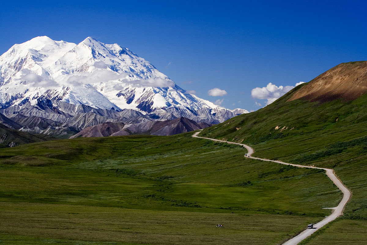
The highest is Denali, in Alaska – 20,268 feet. And the lowest (and toastiest) is in Death Valley, 282 feet below sea level.
Denali National Park, the highest.
The US National Park System is a study in extremes. Extreme isolation. Extreme beauty. Extreme spirituality. Extreme awesomeness.
Perhaps the two most extremely spectacular National parks, with geological features unmatched anywhere in the world, are Grand Canyon, in Arizona – and Yosemite National Park in California. Most of the National Parks are in the western US. We are extremely fortunate to live so close to so many of them.
Yosemite is about 40 miles from Bridgeport, where we spent the night. The highlight of today’s journey will be our visit to Yosemite.
***
There’s much to see on the way to Yosemite.
We leave Bridgeport early – about 7:45 am – on our way to a mammoth family reunion. More on that in a minute.
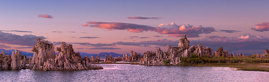
Mono Lake, one of the oldest in the western hemisphere.
In 20 miles, US Highway 395 south takes us to Mono Lake, believed to be one of the oldest lakes in the western hemisphere. Scientists believe it was formed about 750,000 years ago.
Mono Lake, with about 70 square miles of surface area, has life that’s composed of algae, brine shrimp, and alkali flies. It’s one of the most productive ecosystems in the world. The lake is alkaline, with a salt content nearly three times as high as the ocean.
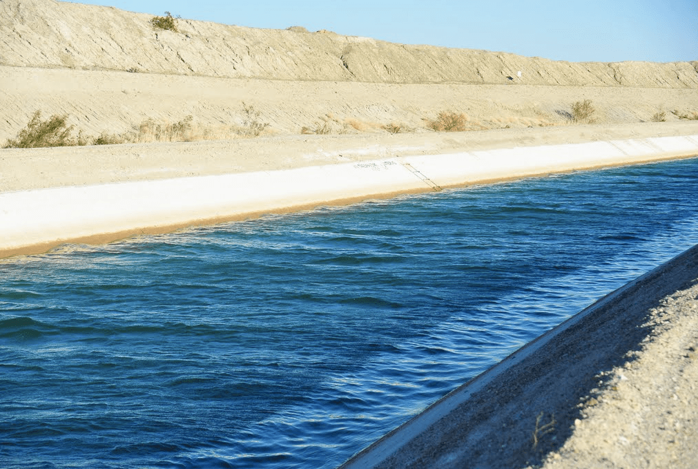
As you may recall from the first day of our ride last week, we traveled on Mulholland Drive, named after civil engineer William Mulholland, who was responsible for building the Los Angeles city water infrastructure. He designed and supervised the building of the Los Angeles Aqueduct, a 233-mile long system to move water from the Owens Valley to the San Fernando Valley.
It turns out his achievement had unintended consequences that have greatly affected Mono Lake. Mulholland’s project diverted Mono Lake’s tributary streams 350 miles south to meet the growing water demands of Los Angeles.
As a result, the volume of Mono Lake has dropped by half, and its salinity has doubled. Click here to learn more about the fragile ecology of Mono Lake and the effort to save it.
***
Ten miles down the road, we arrive in Lee Vining, a tiny community on the southwest shore of Mono Lake. The town was named after Leroy Vining, who founded it in in 1852 as a mining camp.
The economy of Lee Vining relies largely on tourism, since it is the closest town to the east entrance of Yosemite National Park. Tourism here is mostly confined to the summer months, because California Highway 120 through Yosemite is closed the rest of the year due to heavy snowfall. This year, after an unusually warm and dry winter, the highway opened on May 4.
From Lee Vining, we continue south on US-395 past June Lake and Wilson Butte, an 8,405-foot mountain peak that’s the 917th highest in California and the 8,320th highest in the US. No particular significance to Wilson Peak. Some people are just curious about these things.
About 50 miles of Bridgeport, we turn west toward Mammoth Mountain Ski Area, founded in the 1940s by Dave McCoy, a hydrographer for the Los Angeles Department of Water and Power. As a member of the Eastern Sierra Ski Club, McCoy noticed that Mammoth Mountain consistently had more snow than other mountains in the Sierras. He bought a portable rope tow from the club in 1941, usually keeping it at Mammoth. In 1953, the US Forest Service awarded a permit to McCoy to operate the ski area, and he built it into one of the largest in California – comparable to Squaw Valley and Heavenly Valley in the Lake Tahoe area.
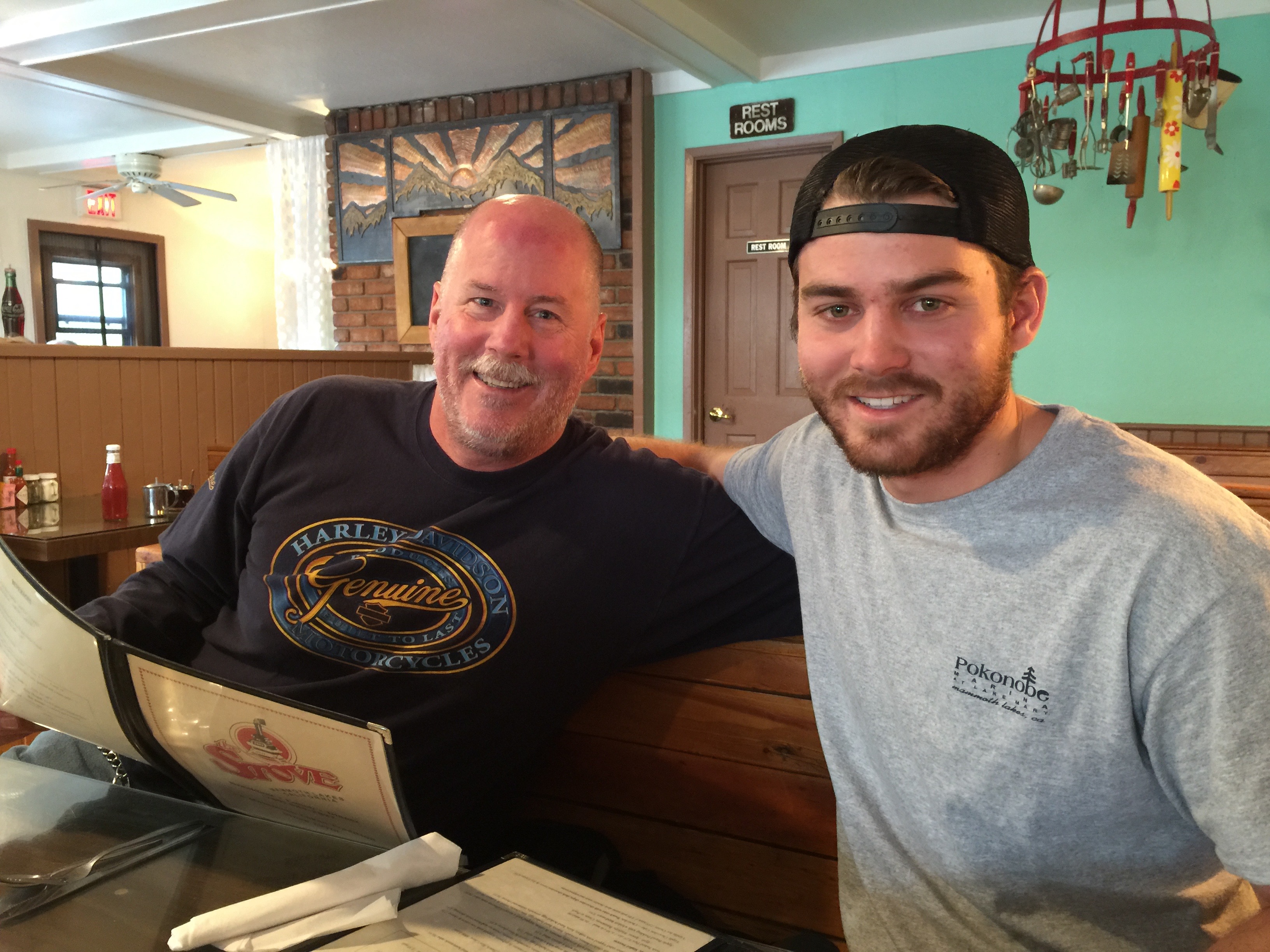
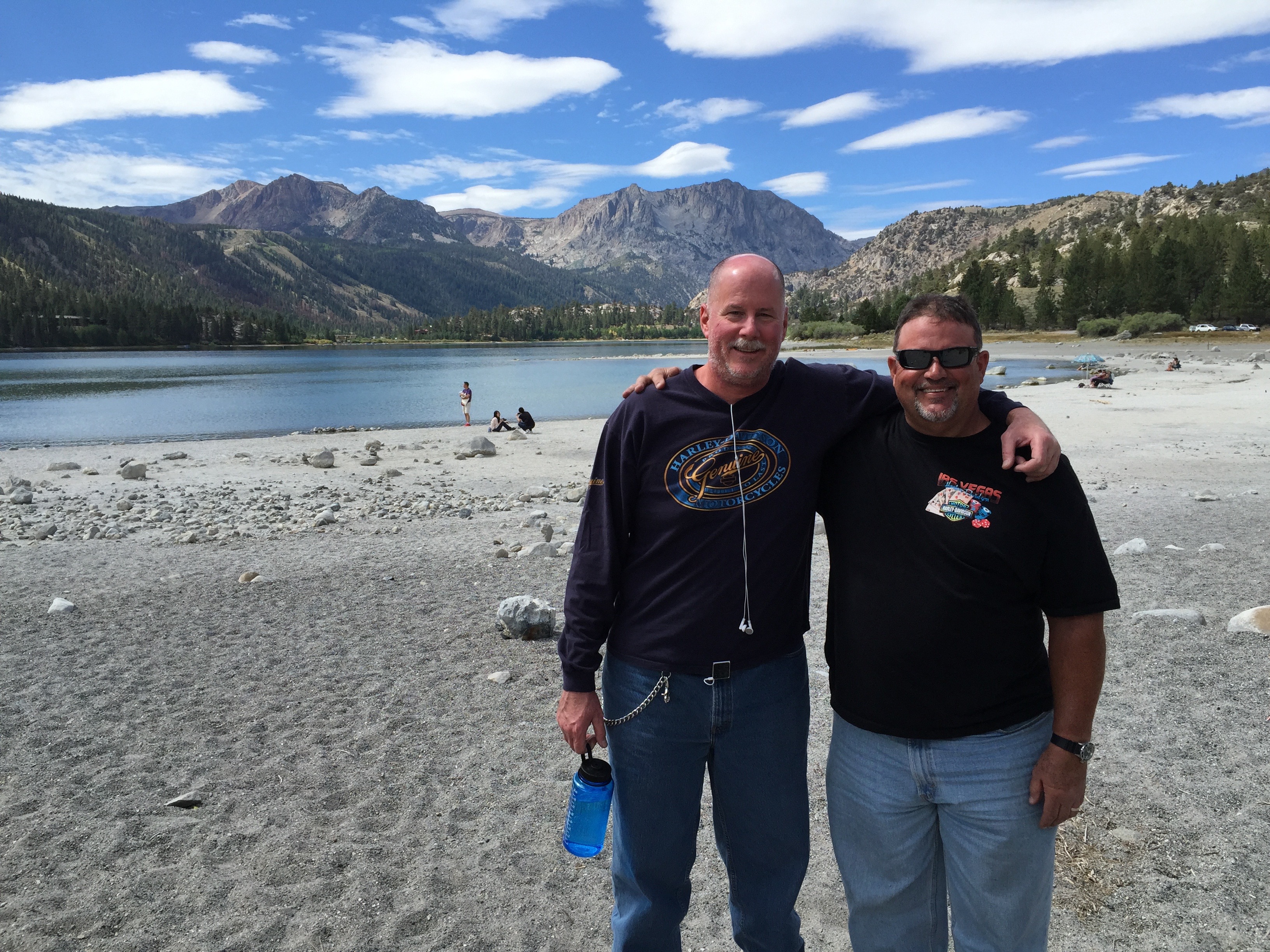
Dave and Nathan meet up for breakfast at the Stove.
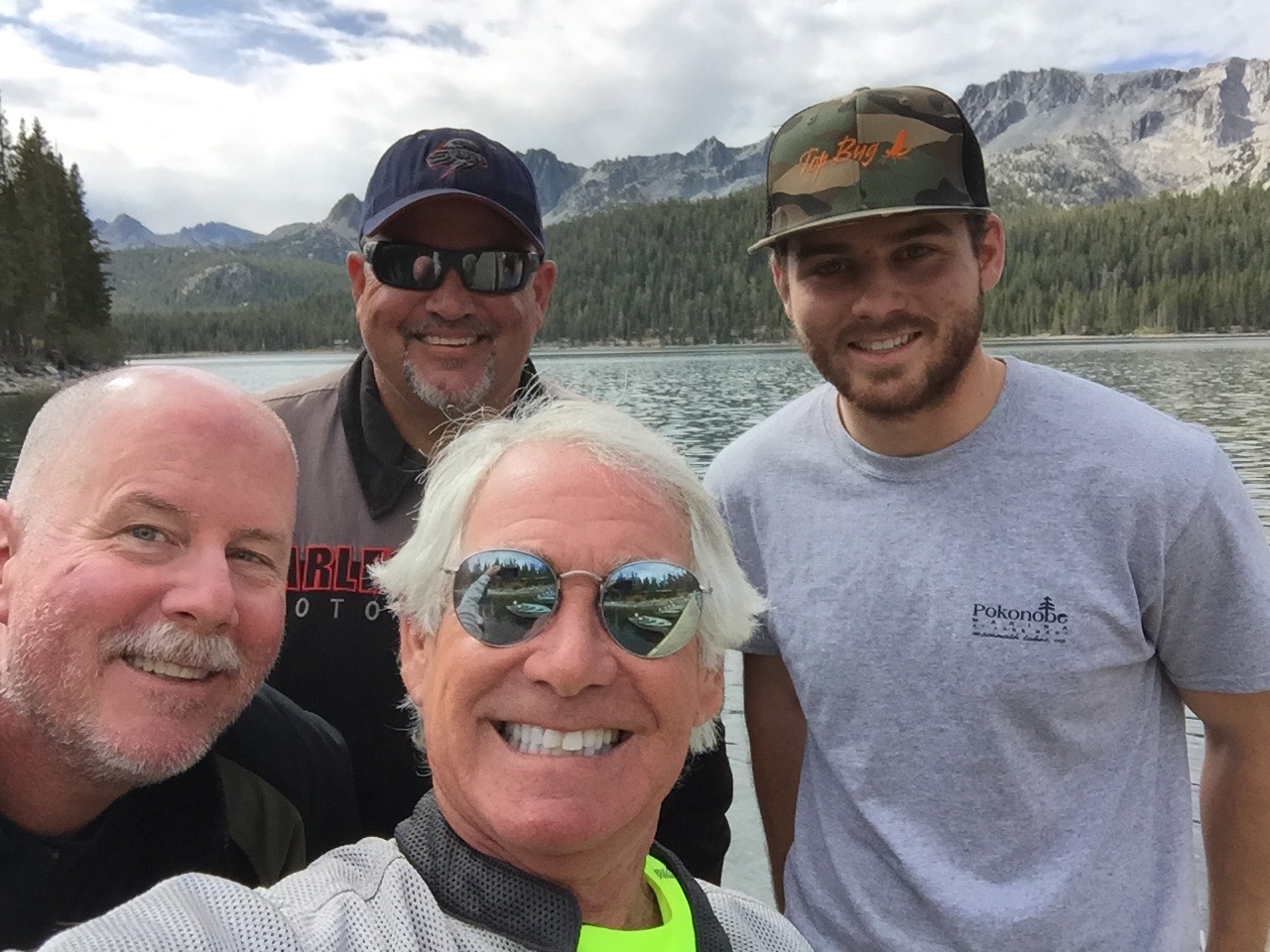
To get to Mammoth Mountain, you pass through Mammoth Lakes, the only incorporated town in Mono County. Mammoth Lakes is the site of today’s family reunion. We’re meeting Dave’s 23-year-old son, Nathan, for breakfast at The Stove, a popular hangout.
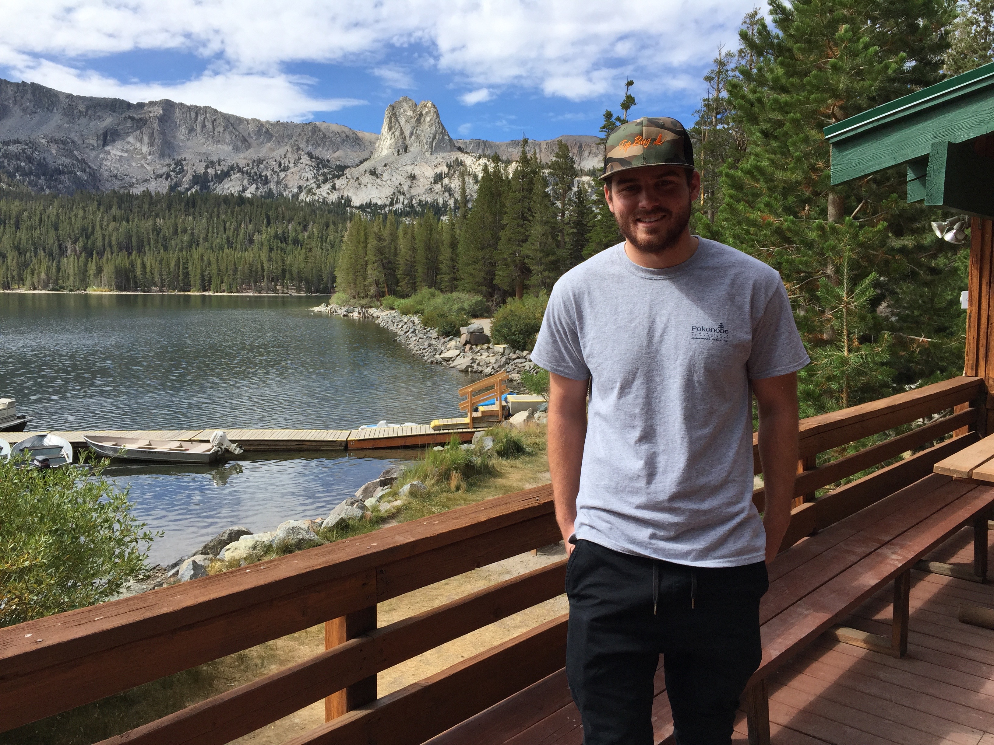
Nathan’s “office” on Lake Mary.
Nathan, an Orange County resident nearly his entire life (spent a couple of years in St. Louis, a million miles from here), is working in Mammoth Lakes for the summer. Lucky kid. Dave and Scott catch up on what Nathan’s been doing: renting and launching boats to summer tourists at the Pokonobe Resort and Marina on Lake Mary, just south of town. Lake Mary is the largest of the alpine lakes in the area; others include Horseshoe Lake, Lake Marnie, Lake George, McCloud Lake, Crystal Lake, TJ Lake and Twin Lakes. All are within a few hundred feet of one another.
It’s a great gig for a college student on summer break. The reunion of father, son and great uncle makes for a nice family moment. A Kodak moment adapted to modern times with an iPhone and GoPro camera.
Good times on Lake Mary.
When summer’s over, Nathan will return home to Fullerton, where he’ll complete his studies in Human Development at Hope International University.
***
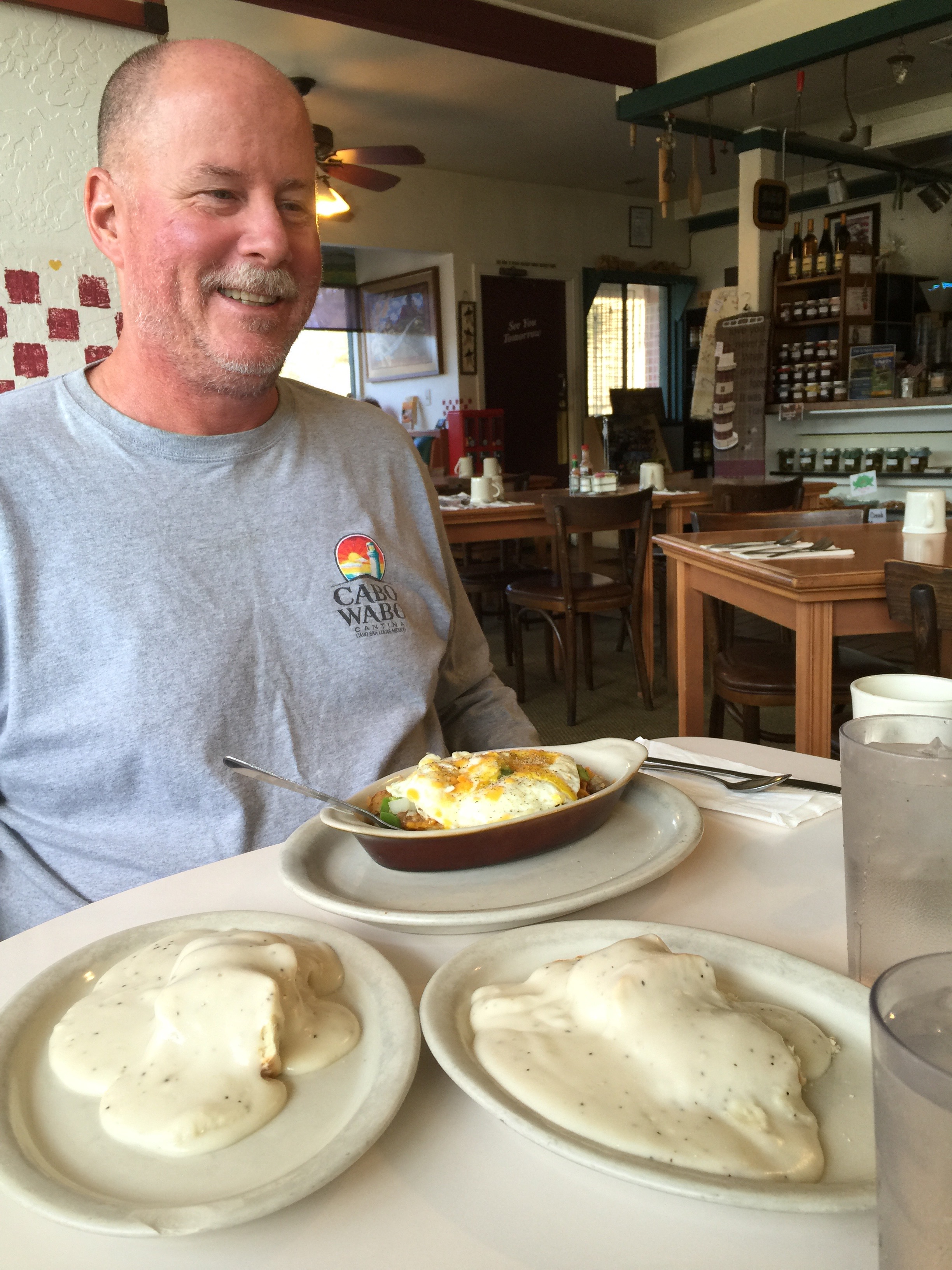
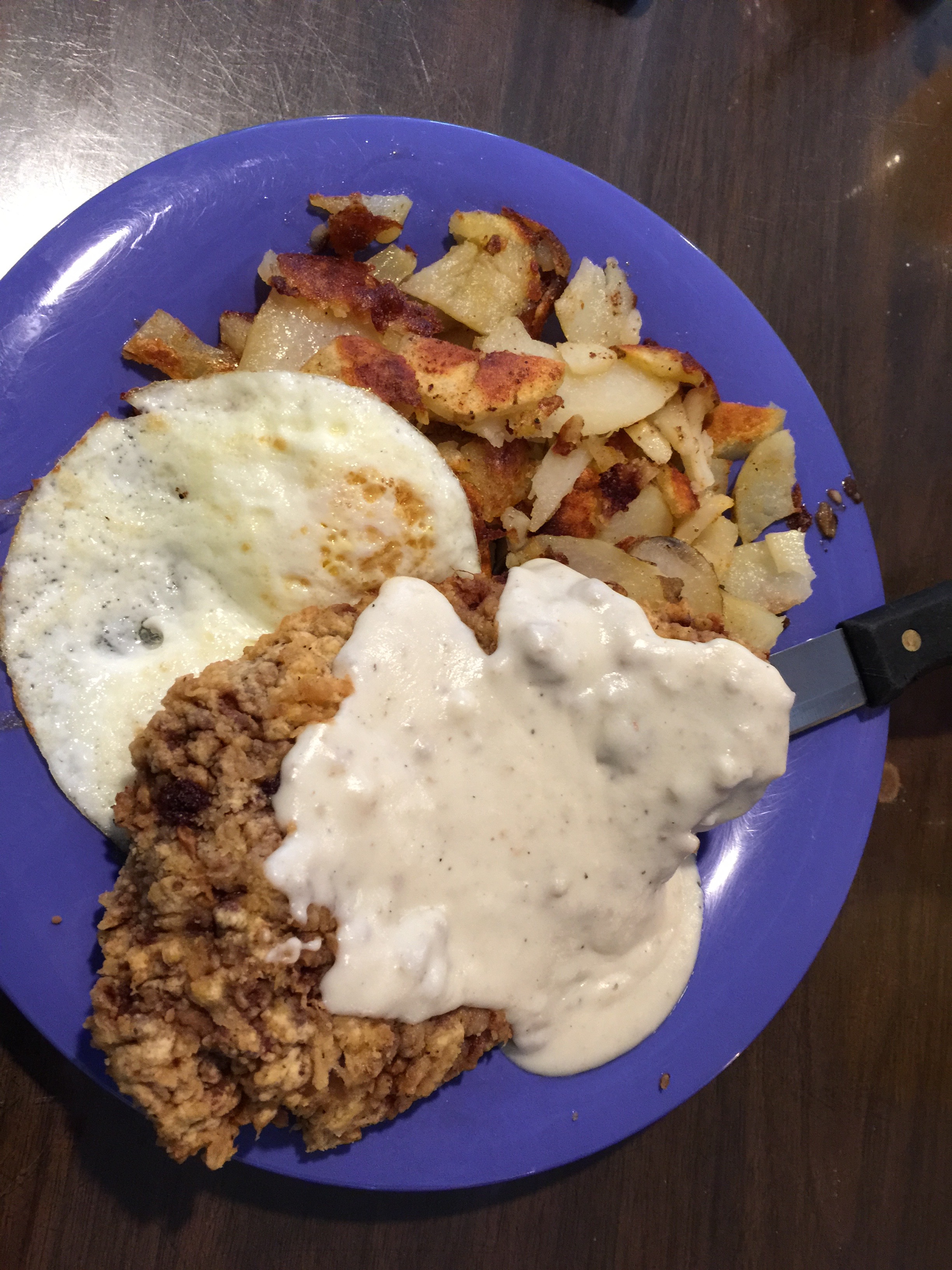
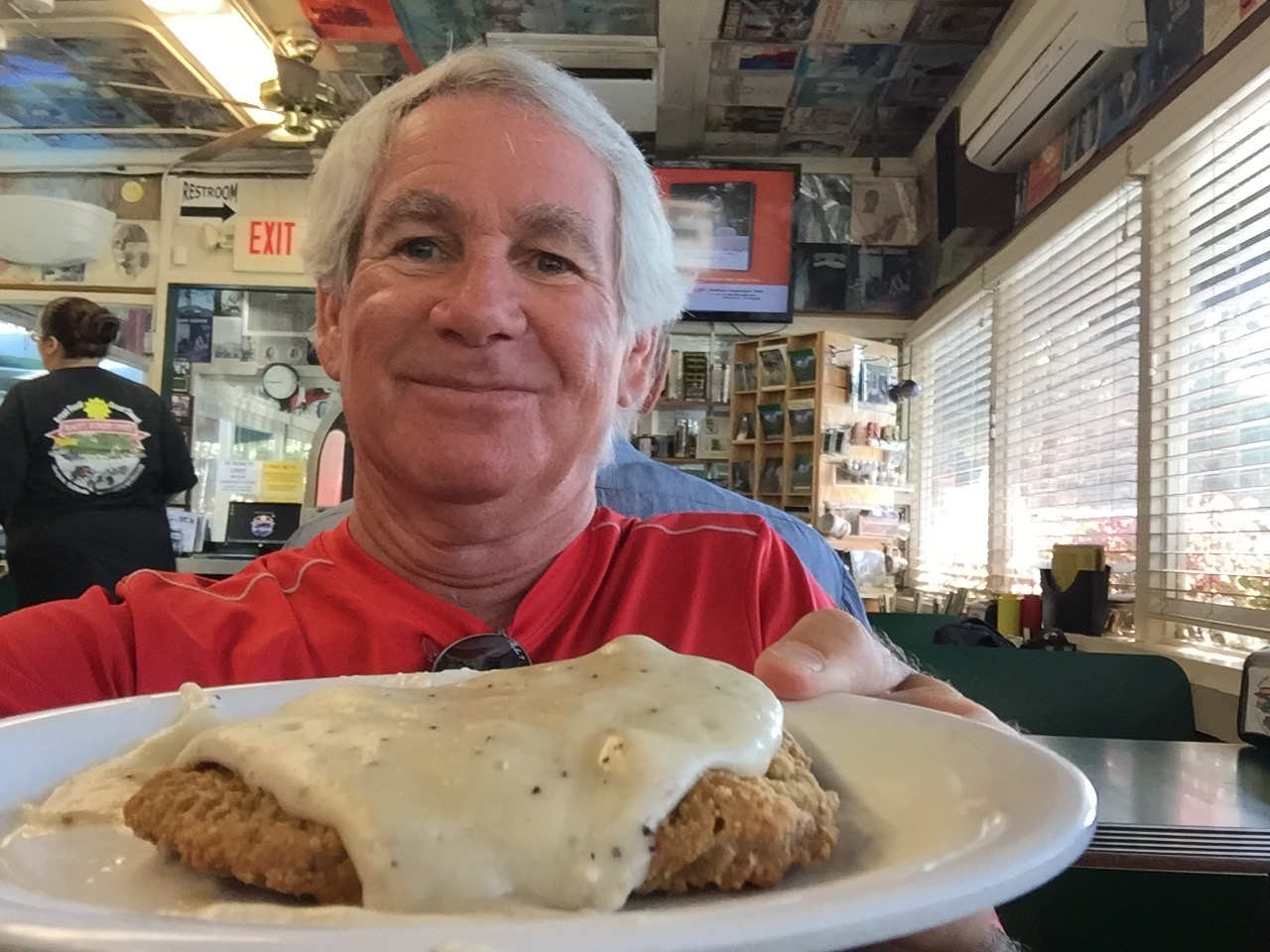
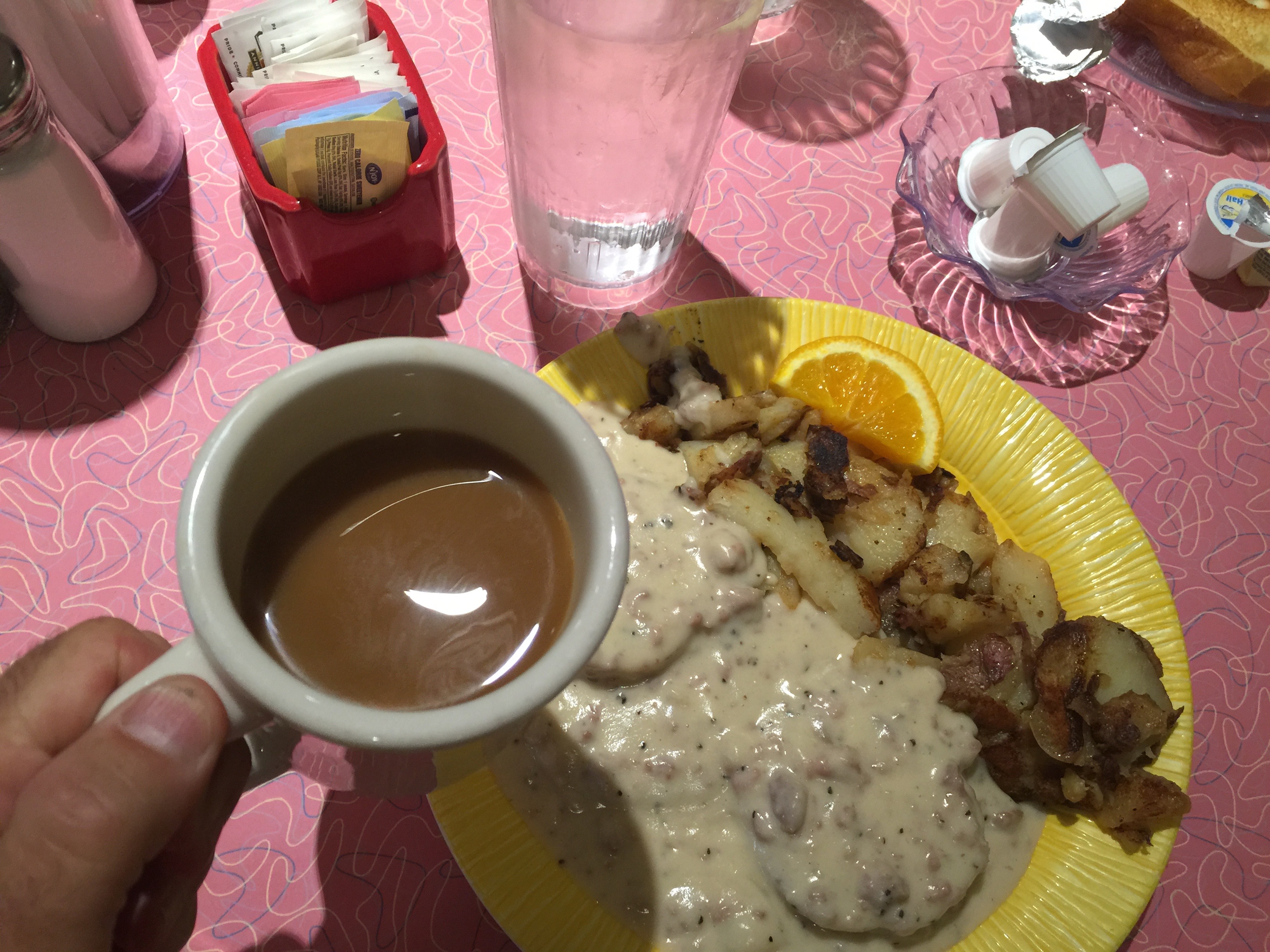
Someone had chicken fried steak for breakfast. Not saying who.
After breakfast, we head north on Highway 395, taking a scenic detour to ride the June Lake Loop, which takes us through the quaint town of June Lake and past the June Lake ski area. We pass by June Lake itself, which holds special meaning for Scott and Dave’s families, as they’ve camped together there many times. It’s a nostalgic visit evoking many good memories. After completing the June Lake Loop, we retrace our steps to Highway 395, and head north to Lee Vining, where we see signs for Yosemite National Park.
Dave and Scott get nostalgic at June Lake.
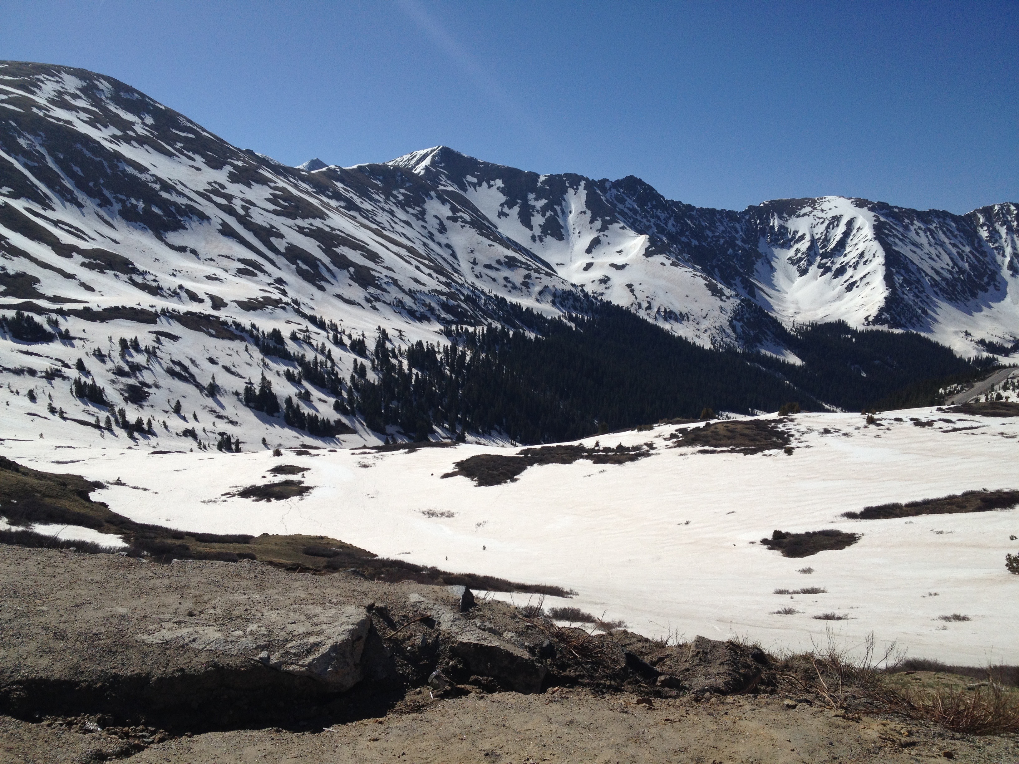
We turn west onto Highway 120, which will take us over Tioga Pass (9,943 feet) and into Yosemite. To our right is Tioga Peak, 11,526 feet. The road climbs steeply and, seemingly in no time, we are at the pass, which just happens to be at the Tioga Pass Entrance Station to the park.
Tioga Pass is named after Tioga Mine, like so many former mining areas in California, now a ghost town. The name “Tioga” originated in New York. It comes from an Iroquois and Mohawk term, meaning “where it forks.”
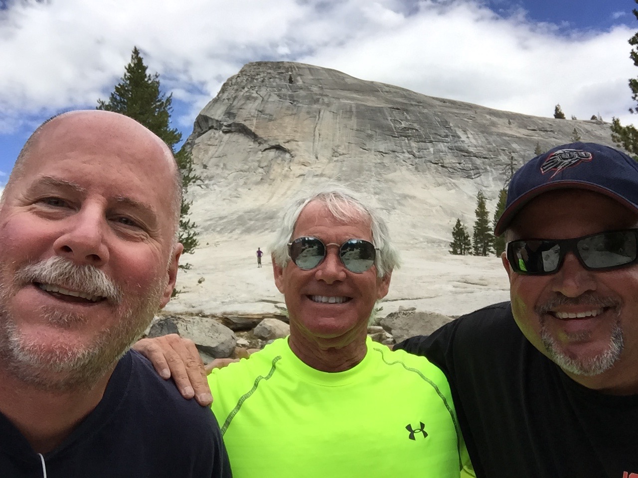
Our first fork in the road brings us to Lembert Dome, where we’ll hike to the top of this granite monolith. Lembert Dome dominates the eastern end of Tuolumne Meadows. It’s nearly three miles round trip, and the hike is the most challenging we’ll have on this trip. Lembert Dome tops out at 9,450 feet. We face a 700-foot vertical rise to get there. But the effort is well worth it, as the top of the dome provides expansive views of Tuolumne Meadows, and surrounding peaks and domes.
At Lembert Dome.
Tuolumne Meadows is studded with granite domes – Pothole Dome, Fairview Dome, Medicott Dome, and Lembert Dome.
***
Yosemite National Park has four visitor centers. Twenty-one miles into the park, we arrive at the easternmost one: Tuolumne Meadows Visitor Center. Here, we could learn about the many activities in the Park, including hikes all along Tioga Pass. There’s more hiking here than in any other part of Yosemite. Today seems to be a great day to combine riding and hiking.
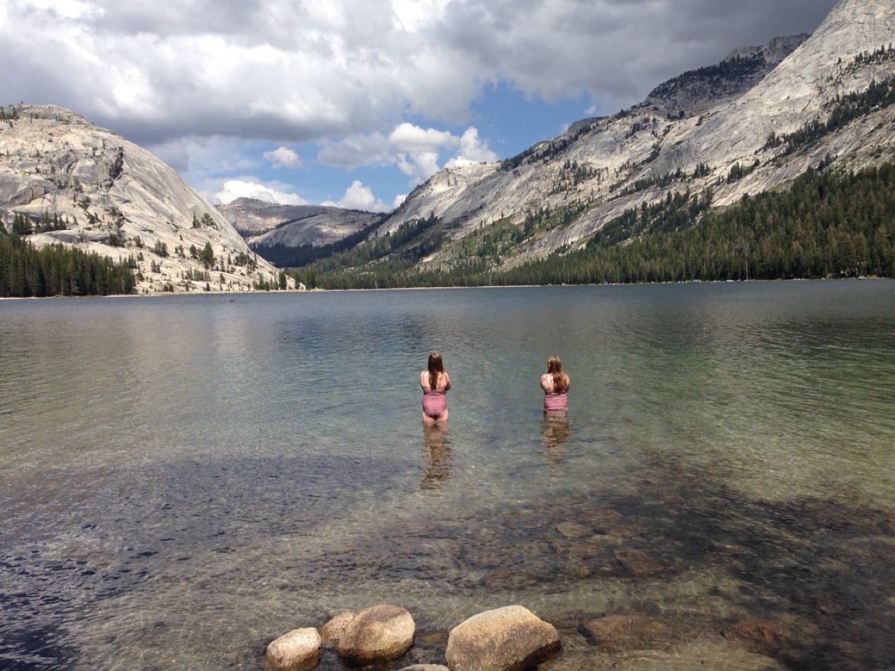
Tanaya Lake. Pretty frigid.
Our next point of interest is Tenaya Lake, at 8,150 feet. Highway 120 runs right along the lake. Tenaya Lake was created by the Tenaya Glacier, which flowed out of the vast Tuolumne Ice Sheet and down to the Yosemite Valey. The lake is named after Chief Tenaya, a Native American chief of the Ahwahnechee people. Hiking, fishing, canoeing and kayaking are all popular summer activities at the lake.
As we ride west, we arrive at Olmsted Point, about 10 miles from Tuolumne Meadows. It’s a viewing area that gives us a glimpse into Tenaya Canyon, and – off in the distance to the southwest – the northern side of Half Dome. The site is named after landscape architects Frederick Law Olmsted and his son, Frederick Law Olmsted, Jr.
The view from Olmsted Point. That’s Half Dome in the distance.
For anyone willing to hike a quarter of a mile up and back on the Olmsted Point Nature Trail, the view gets even better. It’s a 100-foot elevation rise from the 8,300-foot trailhead, and the views are spectacular. We have a clear view of Half Dome. Looking east, we see Tenaya Lake and the granite domes that envelop it. As short as this hike is, it may provide the best bang for the buck – best view for the least effort – along Tioga Pass.
If the Tioga Pass highway opens behind schedule next summer, you can probably blame Olmsted Point. The avalanche risk here makes this one of the most dangerous parts of the road to clear and usually one of the last areas to be passable.
Our 30-mile descent from Olmsted Point takes us to Crane Flat, elevation 6,200 feet. It’s a major campground with 271 campsites, just 16 miles from Yosemite Village, in the heart of Yosemite Valley.
***
At Crane Flat, we turn east onto Big Oak Flat Road for the ride into Yosemite Valley, home to many of the famous cliffs and waterfalls that make Yosemite National Park famous. Yosemite features towering granite faces, dramatic waterfalls, and old-growth forests at a unique intersection of geology and hydrology. Half Dome and El Capitan rise from the park’s centerpiece, the glacier-carved Yosemite Valley. From its vertical walls drop Yosemite North America’s tallest waterfall.
Yosemite’s natural beauty was the impetus for the first implementation of the National Park concept, as we know it today. Yosemite was made a National Park in 1890, and will celebrate its 125th anniversary on October 1.
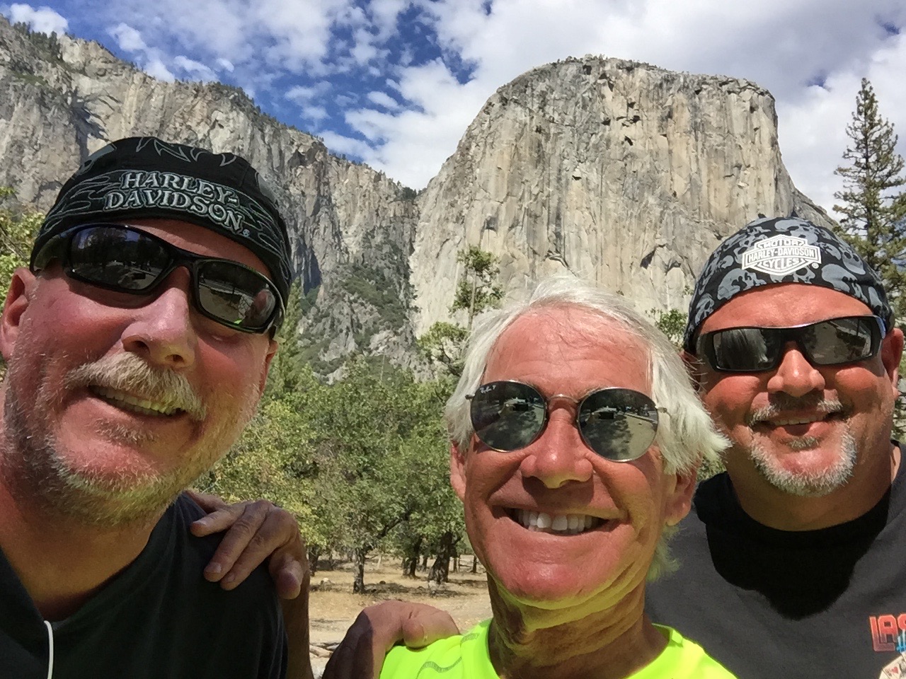
El Capitan in the background.
Riding through Yosemite Valley, we are stunned by the sight of El Capitan, the world’s largest granite monolith, towering more than 3,000 feet above the valley floor. It’s on any serious rock climber’s bucket list.
Once considered impossible to climb, El Capitan is now the standard for big-wall climbing.
Using ropes only for safety and not assistance, Tommy Caldwell and Kevin Jorgensen in January 2015 became the first climbers to successfully ascend The Dawn Wall of El Capitan. It took them 19 days, and their effort attracted worldwide media attention. Wanna watch?
Or better yet, wanna climb? Now, thanks to Google Maps and its Street View technology, you can actually put yourself squarely on El Capitan’s granite face. Armchair climbers can look around in all directions – down to the floor of Yosemite Valley, up the blank face to the top of the cliff, at the broad view of Yosemite’s other granite monoliths, and up close at the pebbled grain and crake of El Capitan itself. Check this out … not for the faint of heart, or for vertigo sufferers.
Another famous Yosemite climb that requires little skill but great nerve is Half Dome, a granite crest that rises more than 4,700 feet from the valley floor. If you’re in reasonably good shape, you can hike from the valley floor and then grab onto cables for the final 400 incredibly steep feet to the top of Half Dome. The hike is in great demand – and there’s limited supply – so you’ll need to get a permit from the Park Service. Think you’re a candidate to hike Half Dome? Click here to find out.
And, for you serious video voyeurs, here’s an absolutely incredible video of climbers scaling, then highlining the Totempole. Don’t try this at home! (guaranteed to be the best video you’ll watch on this blog all week).
Where’s the Totempole? Tasmania. A long way from Yosemite.
***
Cooling off in Yosemite Village.
We arrive in Yosemite Village, the hub of the valley. It’s home to National Park Service staff, and has a variety of facilities, including the park’s main visitor center, museums, art galleries, a fire station, medical clinic, restaurants, gift shops and even a K-8 school. Well-heeled visitors can stay at the Ahwanee Hotel, where rooms go for around $500 a night. Thankfully, there’s no vacancy at the Ahwanee tonight.
Scott needed a bit of a brew break in Yosemite Village, too.
After a bit of sightseeing in the village, we leave the valley floor and head south into the mountains, toward Glacier Point – about an hour’s ride. We turn onto California Highway 41, also called Wawona Road, and immediately arrive at Artist Point. Tourists stop and shoot photos, though few set up easels and a canvas.
In June 1855, 39-year-old artist Thomas Ayres did just that. He stood here and drew a picture of Yosemite Valley, the first ever by a professional artist. It was published in James Mason Hutchings’ California Magazine in 1856 and was a major contributor to the renown Yosemite Valley would soon begin to receive. Sadly, Ayres didn’t get long to enjoy it; he perished at sea in 1858.
The view from Artist Point.
From Artist Point, you have a partial view of Half Dome, and can see Bridalveil Meadow, Royal Arches, partial views of North Dome and Ribbon Falls, plus a few corners of the Merced River. If you’re a serious photographer, you’ll find this spot eminently tripod-worthy.
Another awesome photo op is just a mile up the road at Tunnel View. At this scenic overlook, you have a panoramic view of the valley that has been embraced by artists and photographers since it opened in 1933. The view includes the southwest face of El Capitan, Half Dome, and Bridalveil Falls. It’s the view of the valley you’ll see just before going through the Wawona Tunnel portal as you head south on Wawona Road.
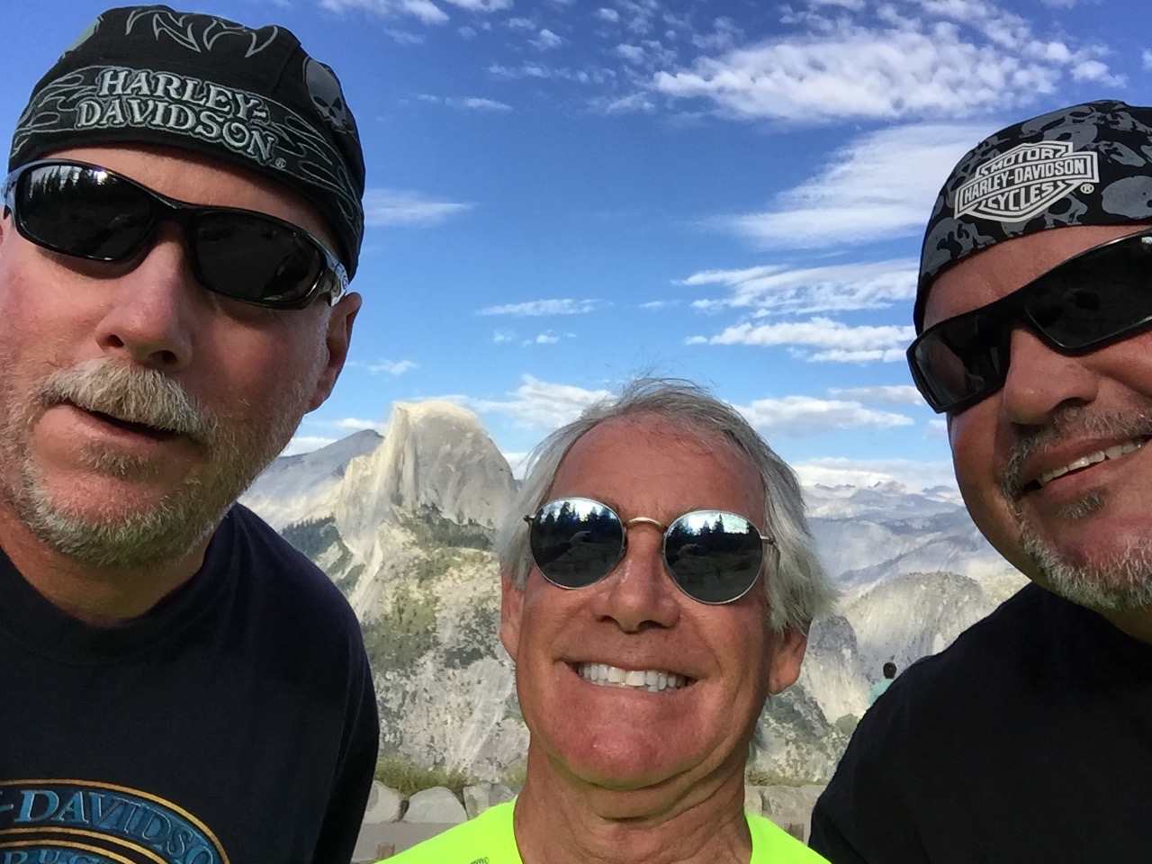
We continue south for seven miles, then turn sharply north on Glacier Point Road. Sixteen twisty miles later, we arrive at Glacier Point, a spectacular overlook at 7,214 feet with a superb view of the Yosemite Valley, including Half Dome.
The road to Glacier Point is usually open from June through October. In winter, Glacier Point Road closes due to snow. This year, Glacier Point Road opened on March 28, the earliest opening on record. Glacier Point’s primary activity: enjoying the view.
The view from Glacier Point. That’s Half Dome in the distance.
We leave Glacier Point, ride 13 miles south, and arrive at the Sentinel Dome parking lot, on the south wall of Yosemite Valley. California Hiking, a book we embraced to discover hikes for this trip, calls the Sentinel Dome hike one of the “Top 10 With a View” in California. Since the book evaluates and describes more than 1,000 hikes across the state, we’ll take that as a solid recommendation to scale Sentinel Dome.
The trail climbs vertically 400 feet to a final elevation of 8,100 feet. From the top of Sentinel Dome, you have a 360-degree view of Yosemite National Park. Looking west, we look down Yosemite Valley and beyond to the Merced River canyon. On exceptionally clear days, you can see all the way to Mt. Diablo in the Coastal Range. To the north, we see Yosemite Valley, including El Capitan and Yosemite Falls. To the east, we see Half Dome and an assortment of High Sierra peaks.
Wow. Just wow.
The hike back down to the trailhead is anti-climactic. We hop back on our bikes for the hour and a half ride to tonight’s destination: Oakhurst.
On our way back to Wawona Road, we notice the turnoff to Badger Pass Ski Area, just a few hundred yards off Glacier Point Road. Badger Pass is a small ski area located within Yosemite National Park, one of only three lift-serviced ski areas operating in a US National Park (Olympic National Park’s Hurricane Ridge is one of the others). From a base at 7,200 feet, Badger Pass offers 800 vertical feet of skiing, and every February, it hosts the annual Yosemite Nordic Holiday, a series of cross-country races.
***
Now back on Wawona Road, we ride south toward the village of Wawona. Wawona sits on the south fork of the Merced River, 27 miles south of Yosemite Village. At 3,999 feet, it has less than 200 residents and is the site of the historic Wawona Hotel, built in 1876. The hotel is designated a National Historic Landmark and is on the National Register of Historic Places.
Wawona feels very much unlike other areas of Yosemite we’ve been for most of the day. Across from the hotel is a nine-hole, par 35 golf course, one of the few within any US National Park. (There’s also a golf course at Furnace Creek Resort in Death Valley National Park.)
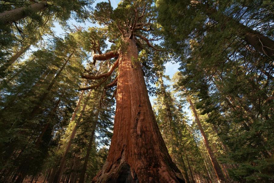
Yosemite is known for its massive Sequoia groves. About five miles south of Wawona, we see the turnoff for Mariposa Grove, which has about 500 mature sequoias, among the rarest, oldest and largest living organisms in the world.
The sequoias are monsters in Mariposa Grove.
The grove includes the Columbia Tree, tallest in Yosemite at 285 feet, and the Grizzly Giant, estimated at 2,400 years old, the most mature in the grove. The Wawona Tree had a tunnel cut through it in the nineteenth century that was wide enough for horse-drawn carriages and early automobiles to drive through. Weakened by the large opening at its base, the tree fell down in a storm in 1969. Its collapse is seen as a turning point in the preservation program in America’s National Parks.
Much to our disappointment, Mariposa Grove closed for restoration in July and won’t re-open until summer 2017. The Park Service says the restoration project will prepare the Grove for its next 150 years of inspiring visitors. The Mariposa Grove restoration project is designed to restore dynamic ecological processes and increase the resiliency of the grove to withstand natural stressors such as climate change and altered fire patterns.
While Mariposa Grove will have to wait, we can look forward to seeing a lot more sequoias tomorrow, when we visit Sequoia National Park.
On the way to tonight’s destination, Oakhurst, we continue south on Highway 41. The road twists and descends past the tiny communities of Fish Camp, Sugar Pine, and Yosemite Forks.
After a 180-mile ride that began on the eastern side of the Sierras, we arrive in Oakhurst, formerly called Fresno Flats.
Oakhurst’s claim to fame: the pioneering computer game developer Sierra On-Line was based here from 1981 to 1999. The company achieved many industry firsts, including the development of the first 3D adventure game (King’s Quest) and one of the first online gaming networks.
Our only game tonight is dinner and writing this blog, which I’m now doing.
***
To view today’s route from Bridgeport to Oakhurst, click here.
Yesterday, we crossed the Sierras once. Today, we’ll double our fun.
The good times begin as we leave California and roll into Stateline, Nevada. It’s not much of a roll, actually. South Lake Tahoe, where we were a minute ago, and Stateline, where we are now – are effectively one town with a dual personality.
Muffins for breakfast at Sugar Pine Bakery in South Lake Tahoe.
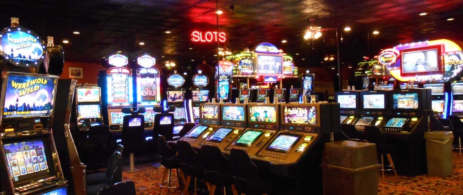
The population of Stateline in the 2010 census was 842. To tell you all you need to know about Stateline, there are nearly 1,600 slot machines at Harrah’s and Harvey’s combined – that’s almost two for every Stateline resident.
Stateline is a single-industry town: gambling. It has five casinos. Most of TripAdvisor’s “Top Things to do in Stateline” revolve around gambling. Number 9: “Boogie Nights at MontBleu, formerly Caesar’s Palace.
We quickly boogie out of Stateline – it’s only 512 acres – and turn east onto Highway 207, which takes us over the Kingsbury Grade. About two miles up the twisty two-lane road, we pass within a few hundred yards of the Heavenly Valley ski resort’s Boulder Carpet chairlift. It’s one of Heavenly’s 30 lifts.
Muffin for Dave, too.
Heavenly Valley straddles California and Nevada, and boasts the highest elevation of all the Lake Tahoe area resorts, with a peak of 10,067 feet. Shopping for a place to carve some turns later this year? Season passes are now available for Heavenly’s 2015-16 season. You can get an adult “Epic Pass” for $769, giving you unlimited access to Heavenly Valley, and the other ski areas operated by Vail Resorts, among them: Vail, Park City, Beaver Creek and Breckenridge.
My fondest memory of Heavenly Valley was in April 1968 when as a ski-racer wannabe, I saw Jean-Claude Killy compete in the World Cup season-ending slalom, where he finished seventh, 1.75 seconds behind American Spider Sabich. Earlier that year, Killy swept all three alpine events at the Grenoble, France, Olympics – and was dominant throughout the season in the slalom, giant slalom and downhill.
Here he is, skiing to gold three times at the 1968 Olympic Games. Has technique changed any since then?
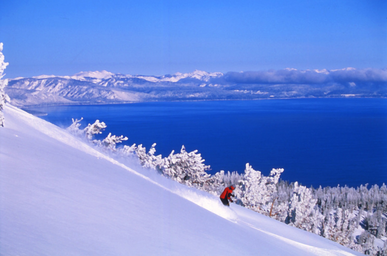
Heavenly Valley has great views of Lake Tahoe.
January 5, 1998, was a dark day in Heavenly Valley history. That’s when when musician and politician Sonny Bono crashed into a tree on “Orion,” an intermediate slope high on Heavenly’s Nevada side. He died instantly. At the time, Bono was a US congressman, representing the Coachella Valley. Before that, he was Palm Springs’ mayor. And long before that, Sonny and Cher sang “I Got You Babe.”
***
On that note, we continue up Kingsbury Grade toward its 7,344-foot summit. It provides a spectacular view of the valley to the east and south.
We descend to the bottom of Kingsbury Grade, into the community of Mottsville. It’s apparently named for Mott the Hoople, a ’70s English rock band best known for the song, “All the Young Dudes.” Who knew?
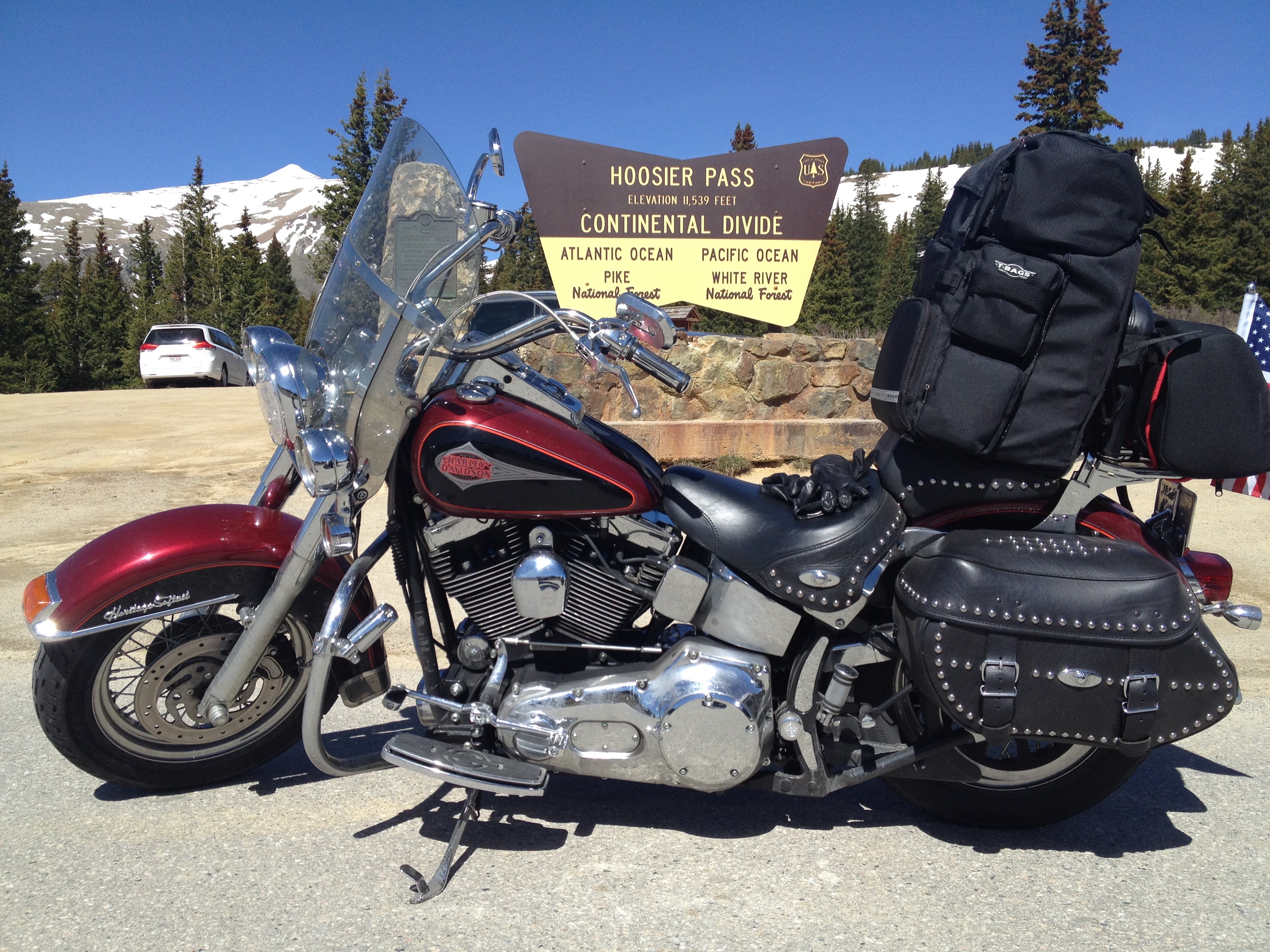
In Mottsville, we turn south on Nevada Highway 206 for a few miles, then south on Highway 88, crossing the state line back into California, where we’ll remain for the rest of our trip.
Pausing in Markleville, before beginning the climb over Ebbetts Pass.
Less than an hour from our start in South Lake Tahoe, we arrive in Markleeville, elevation 5,531 feet. Markleeville is on the map for annually hosting a bicycle race called the Death Ride. The Death Ride attracts more than 3,000 riders, who pedal over five Sierra passes for a total distance of 129 miles and more than 15,000 feet of elevation gain. The winner generally finishes in around eight hours of riding time. Survival is considered a pretty ambitious goal.
This year’s Death Ride, called the “Tour of the California Alps,” was held July 11.
Bicyclists in the Death Ride climb and descend Monitor Pass (8,314 feet) from both directions, Ebbetts Pass (8,730 feet) from both directions and Carson Pass (8,652 feet). Their entry fee is $140.
In a much less painful fashion than what the bicyclists experience, we’ll cross Ebbetts Pass today. For free.
From Markleeville, we continue five miles south and then turn onto California Highway 4, which we’ll ride for the next few hours, taking us across Ebbetts Pass and back to Gold Rush Country.
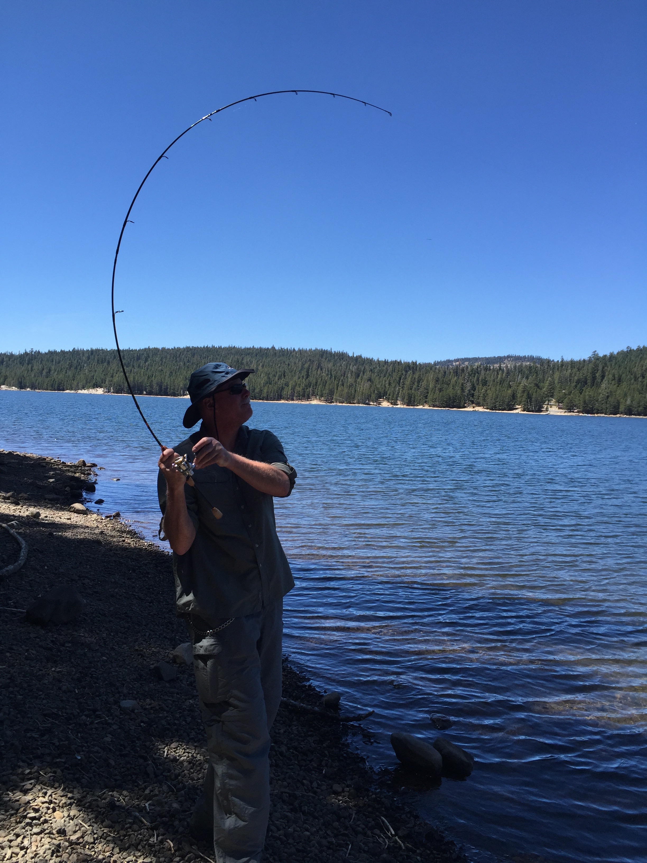
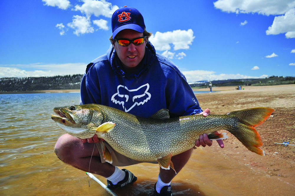
We stop at Alpine Lake after crossing Ebbetts Pass. Dave trained his whole life for this fishing moment.
Highway 4 is also known as the Alpine State Highway. John Ebbetts, a California pioneer, first traversed the pass in April 1851 with a large mule train. He hoped it would make a suitable route for the transcontinental railroad, as he observed little snow at the time. He might have thought differently if he’d been there in the winter, when snow is generally abundant.
Ebbetts Pass is a 61-mile National Scenic Byway that generally closes for the winter in Mid-November, and stays closed until May or June. Today, there’s no snow, and no railroad over Ebbetts Pass.
And there’s been little calorie burn for the three guys on Harleys since leaving Lake Tahoe this morning. In the Lake Alpine area, there are some excellent hikes to get some alpine exercise and take advantage of the views.
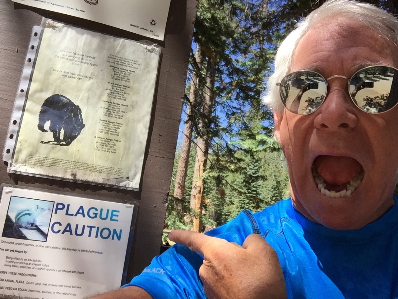
Near Alpine Lake, we see a plague caution. OMG!
We stop at Lake Alpine and ponder tackling Inspiration Point trail, a nearly three-mile hike with a 600-foot elevation gain. From Inspiration Point, there’s a nice view of Lake Alpine. In a few months, the fall colors here will be spectacular, as the aspen trees turn to gold.
Instead, we hike the Lakeshore Trail to Lake Alpine, where Dave fishes for 30 minutes and catches a huge rainbow trout, then tosses it back because it’s not quite big enough for dinner for three. Post-fishing, we climb on our bikes, and descend more than 7,300 feet in an hour, arriving in Angels Camp around 2 pm. We’re back in Gold Rush country again.
Angels Camp is sometimes referred to as “Frogtown,” because it’s where Mark Twain’s short story about the jumping frog took place. The frog-jumping event is commemorated with a Jumping Frog Jubilee each May at the Calaveras County Fairgrounds, just east of the city.
***
If bicyclists can do five Sierra passes in a day, we should be good for at least two. Our next one is Sonora Pass.
To get there, we turn south in Angels Camp and follow Highway 49, the Gold Rush Trail, to Sonora. Sonora is the county seat of Tuolumne County, and the only incorporated community in the county.
Sonora, population 4,900, sits in the Sierra foothills at 1,785 feet. It is is home to museums, art galleries, live theater and the annual Sonora Possum Stew Cookoff. Why not?
Stopping on Highway 108, Sonora Pass.
In Sonora, we turn east onto Highway 108, which will take us over the 9,313-foot pass. It’s the second-highest highway pass in the Sierra Nevada range, 321 feet lower than Tioga Pass to the south, which we’ll do tomorrow – giving us all four Sierra passes in three days.
Like Ebbetts Pass, Sonora Pass is closed throughout the winter and generally re-opens in May or June. This year’s opening was May 22. The highway over the pass is extremely steep, exceeding eight percent most of the way, with up to 26 percent grades in some locations.
The first documented immigrant traverse of Sonora Pass appears to have been in the late summer of 1852 by a wagon train known as the Clark-Skidmore Company. Nearly a century later, in 1943, the location scenes for the mountainous hideout of the Republican Spanish guerilla band in For Whom the Bell Tolls, were filmed here.
Thirteen miles east of Sonora, we climb to 3,648 feet and roll through the town of Twain-Harte. Its motto: “More Trees Than People.” Twain-Harte’s population is 2,200. Number of trees: more than that.
Dave checks out the aptly named Disaster Peak on Highway 108.
The unique hyphenated town name is derived from the last names of two famous authors who lived in California in the 1800s, Mark Twain and Bret Hart.
Twain (1835-1910), born Samuel Langhorne Clemens, is the more famous of the two. The Adventures of Tom Sawyer and its sequel, Adventures of Huckleberry Finn, have been staples in American classrooms for years.
Harte (1836-1902) is best remembered for his short fiction featuring miners, gamblers and other romantic figures of the California Gold Rush. Among his works: The Tales of the Argonauts, The Stolen Cigar Case, and Plain Language from Truthful James.
From Twain-Harte, we steadily climb for 54 miles, gaining more than 5,600 feet of elevation until we reach the summit of Sonora Pass. It’s all downhill from here. Until tomorrow, when we’ll be 321 feet higher.
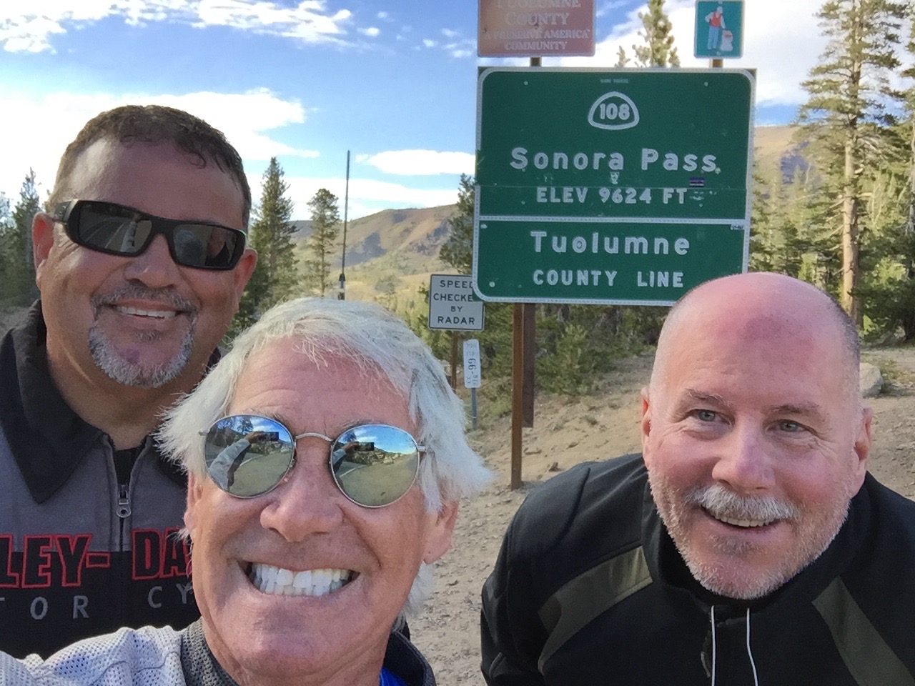
At Sonora Pass: elevation 9,624 feet.
***
We continue on Highway 108, and begin our descent toward tonight’s destination: Bridgeport. Ten miles east of the summit is Pickel Meadow, at 6,762 feet. It’s home to the US Marine Corps Mountain Warfare Training Center.
The MWTC is considered to be the Marine Corps’ premier training site for preparing Marines to serve in mountainous regions, with an emphasis on cold and high altitude confrontations. This training post was first established in 1951 to provide cold weather training for replacement personnel bound for Korea.
During the 1980s, the facility’s focus was on training and preparing Marines and operational units for deployments on NATO’s northern flank, particularly Norway. In recent years, the training center provided pre-deployment training for the war in Afghanistan.
The Mountain Warfare Training Center is just four miles west of the eastern end of Highway 108, which terminates at US Highway 395. We turn east onto US-395, and in 20 miles, we arrive at Bridgeport.
Love the body language, along Highway 108.
At 6,463 feet, Bridgeport is well below the heights we experienced earlier in the day. But it still feels like a mountain village. Bridgeport’s population is 575, though it swells in the summer because of tourism. It is a trout fishing haven.
Bridgeport Reservoir, Twin Lakes, Virginia Lakes, Green Creek, the East Walker River, the West Walker and numerous small tributaries and backcountry lakes offer some of the premier Rainbow, Brown and Cutthroat trout fishing to be found anywhere in the world. The Bridgeport Fish Enhancement Program sponsors fishing tournaments twice per season. Bridgeport’s Trout Tournament is held annually in late June.
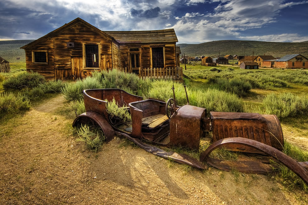
Bridgeport is also notable for its proximity to the well-preserved ghost town of Bodie, about 24 miles east. A gold-mining ghost town that once had a population of nearly 10,000, Bodie is now a State Historic Park. Today, it looks pretty much the same as it did more than 50 years ago when the last residents left. It’s been preserved in what’s called a state of “arrested decay.”
Bodie: a state park ghost town in a state of arrested decay.
After 225 miles, six hours in the saddle, and bagging two major Sierra passes, our hunger is anything but arrested. We’re pooped, and ready to relax.
We settle in to our rooms at the funky Redwood Motel, a relic of the 1950s, look forward to a hot shower and juicy burger, and dream about tomorrow’s visit to one of the most spectacular places on earth.
***
To view today’s route from South Lake Tahoe to Bridgeport, click here.
We’re making history today. At least, we’re following history.
For much of the morning, our route takes us to Mother Lode country, heart of California’s gold rush.
A healthy (chicken fried steak) breakfast at the Happy Burger Diner.
The gold rush began in earnest in 1948 when gold was found at Sutters Mill. The original fleck of gold discovered at the mill is currently on display at the Smithsonian Institution.
California’s Gold Rush brought an estimated 300,000 people to this area. About half arrived by sea from Asia, and half came overland from the eastern US. Because of the year they began arriving in droves (1849), the gold-seekers became known as forty-niners.
Today, we’ll travel Highway 49, known as the Gold Rush Trail. It’s also called the Golden Chain Highway.
The ’49ers established hundreds of instant mining towns along the western foothills of the Sierra Nevada. Many of these historic and picturesque towns still exist, linked by California Highway 49.
We leave Mariposa, home of California State Mining Museum, and head north.
Found gold in China Camp (or was it quartz?)
Highway 49 twists and climbs past panoramic vistas. We pass through the old mining town of Coulterville. Angels Camp is just a few miles to the east, and nearby Murphys has on display the largest crystalline gold nugget in the world. At 44 pounds, it’s worth about $3.5 million. We roll through Chinese Camp – at one time home to an estimated 5,000 miners who emigrated from China to take part in the gold rush.
Sixty miles from Mariposa, we arrive in Copperopolis. Unlike most of the other mining towns in Calaveras County, Copperopolis’ claim to fame is not gold, but copper. Copperopolis is also famous for a shack on Jack Ass Hill, where Mark Twain is believed to have written one of his most famous works, The Celebrated Jumping Frog of Calaveras County.
Beyond Copperopolis, we pass through San Andreas, a California Historical Landmark that’s the county seat of Calaveras County. A few miles past Mokelumne Hill – once one of the richest gold mining towns in California – we arrive in Jackson, our last mining town before we turn east into the Sierra Nevada Mountains.
***
If you haven’t noticed by now, many California place names derive from either Spanish, or from Native American tribes who settled the land long before Europeans arrived.
It’s toasty in Jackson.
Here in Jackson, we turn our focus eastward to the Sierra Nevada mountain range. Sierra Nevada is Spanish for “snowy range.” There’s generally snow in the Sierras during the winter and spring. None now.
The Sierra Nevada range, where we will spend much of the remainder of our journey, runs 400 miles from north-to-south. Notable features include Lake Tahoe, the largest alpine lake in North America – and today’s destination. The Sierras are home to three National Parks – Yosemite, Sequoia, and Kings Canyon – all of which we will visit over the next few days.
In Jackson, temperatures are now in the ‘90s, and we look forward to riding into the Sierra foothills and then the higher elevations to cool off.
California Highway 88 takes us east, as we gradually twist and climb into the El Dorado National Forest. Highway 88 becomes Carson Pass, named for frontiersman Christopher Houston “Kit” Carson. He was a fur trapper, wilderness guide, Indian agent and US Army officer.
Carson Pass, at 8,574 feet, is marked by a California Historical Landmark. There’s a memorial where Carson carved his name into a tree. The historic pass was a point on the Carson Trail during the gold rush.
At Bear River Reservoir vista point, going over Kit Carson Pass.
There are four major passes across the Sierra Nevada range: Carson Pass, Ebbetts Pass, Sonora Pass, and Tioga Pass – all of which we’ll cross later this week.
Unlike the other three, Carson Pass is generally open throughout the winter except during the worst snowstorms.
At Carson Pass, you can pull into the visitor information center parking lot, where you could leave your bikes for an hour while you hike to Frog Lake. It’s about two miles round trip, and not at all difficult. The Frog Lake hike is popular with families and children.
From Frog Lake, there’s a scenic view of Elephant Back, a mountain whose peak is at 9,585 feet. As it turns out, Elephant Back – a pile of volcanic rubble, looks just like its name. You may not be familiar with elephants, but you’ll know an elephant back when you see one.
Silver Lake is a spectacular high alpine lake along Kit Carson Pass.
***
Not far from Carson Pass, we descend to Kirkwood, home of the Kirkwood Mountain Resort – about 30 miles south of Lake Tahoe. With 15 lifts, a base elevation of 7,800 feet, and 2,000 vertical feet of skiing, Kirkwood is one of the region’s larger resorts. It’s owned by Vail Resorts, which also owns Heavenly Valley at South Lake Tahoe, and Northstar, near the north shore of Lake Tahoe.
Near Sorensens, we turn off of Highway 88 and onto Highway 89, which will take us over 7,740-foot Luther Pass and into the Lake Tahoe area, a major tourist destination.
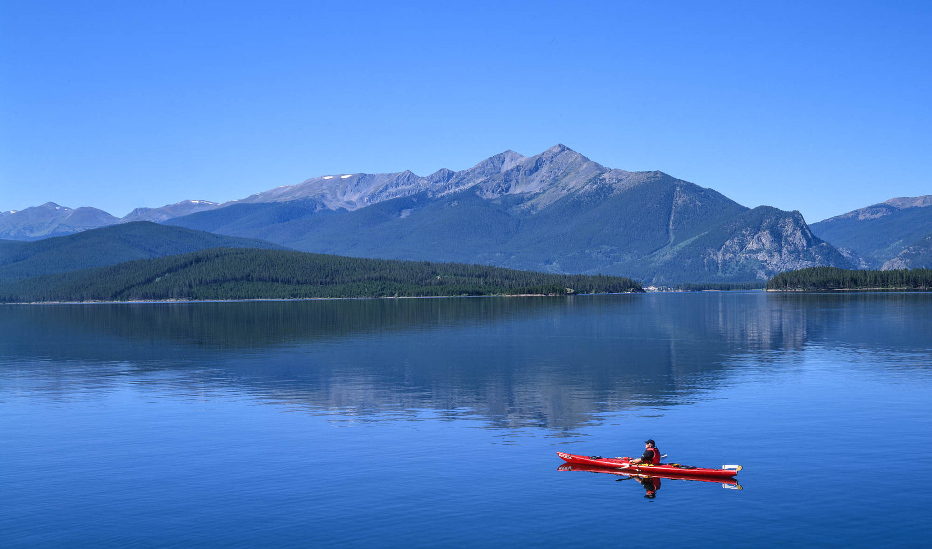
Lake Tahoe’s surface elevation is 6,225 feet. Its maximum depth is more than 1,645 feet. Among US lakes, only Oregon’s Crater Lake is deeper. One more stat: Lake Tahoe is the sixth-largest lake by volume in the US, behind only the five Great Lakes, and it’s the largest alpine lake in North America.
We pass through Meyers, a one-time stagecoach stop, trading post and Pony Express station. It’s now registered as California Historical Landmark #708.
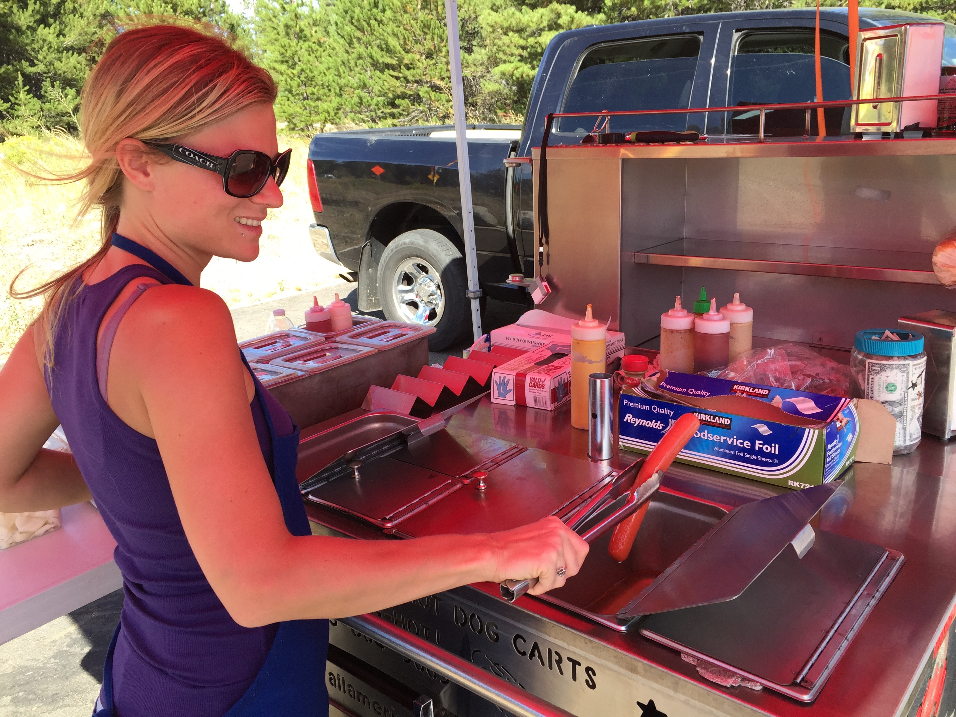
Hot dog lunch in Meyers.
To our right is the Lake Tahoe Airport, a general aviation facility that sits at 6,264 feet. The airport opened in 1959 with a 5,900-foot runway, and at one time had commercial jet service with Pacific Air Lines flying Boeing 727-100s from Los Angeles to San Jose to Lake Tahoe.
Other airlines followed – including Holiday Airlines, Pacific Southwest Airlines, Air California, Aspen Airways and Golden Gate Airlines. Boeing 737s, MD-80s and BAC-111s all showed up. Douglas DC-9s were the last jets to use this airport. Commercial air service has been gone since the end of the 20th century.
***
As a teenager, I often hung out with family and friends at Lake Tahoe, visiting perhaps a hundred times in the 1960s. It was mostly skiing in the winter, and an occasional summer vacation thrown in for good measure.
One thing I never did was travel all the way around the lake, non-stop. Today, we just might.
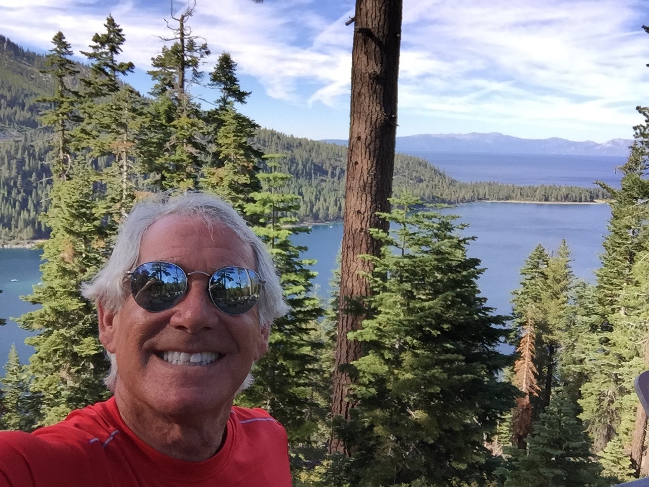
At Inspiration Point, overlooking Emerald Bay.
We begin by following Highway 89 North through Camp Richardson to Emerald Bay, where the views from Inspiration Point are breathtaking (see photos). Then, it’s on to Meeks Bay, and Homewood. Homewood is a small ski area on the west shore of Lake Tahoe. It’s owned by the same company that owns the more famous North Tahoe resorts – Squaw Valley and Alpine Meadows.
Homewood will be both the start and finish next month for the annual Tahoe 200, an ultra endurance race that takes runners on a 202.5-mile tour of Lake Tahoe and surrounding areas. The race starts on September 11 at 9 am, and competitors have until September 15 at 1 pm to complete the event – a 100-hour cut off. With an elevation gain of 39,800 feet, the Tahoe 200 is for serious athletes and true masochists (people who take pleasure in pain).
Entry fee is $950. To qualify, you must have completed at one 100-mile mountain race (defined as having more than 15,000 feet of climbing), or two 100 mile non-mountain races (defined as having less than 15,000 feet of climbing). Or, if like most of you, you haven’t met these requirements and still want to run in the event, the Race Director can approve you as a non-traditional entrant.
Last year’s winner, 36-year-old Ewan Horsburgh of Katoomba, Australia, finished the Tahoe 200 in 61 hours and 32 minutes. He edged out the second-place finisher by two hours and 11 minutes. The top woman in the race finished 14 hours behind the winner. Of the 90 runners, some coming from as far away as Japan, India, and Brooklyn, 30 did not finish. You slackers!
The Tahoe 200: agony of da feet.
With no disrespect to these ultra-jocks, seems like it’s a whole lot simpler, and far less expensive, to just ride around the lake.
***
Soon, we pass by Tahoe City. If we continued on Highway 89, we’d end up at Squaw Valley – where I learned to ski – and which hosted the Winter Olympic Games, both in 1960.
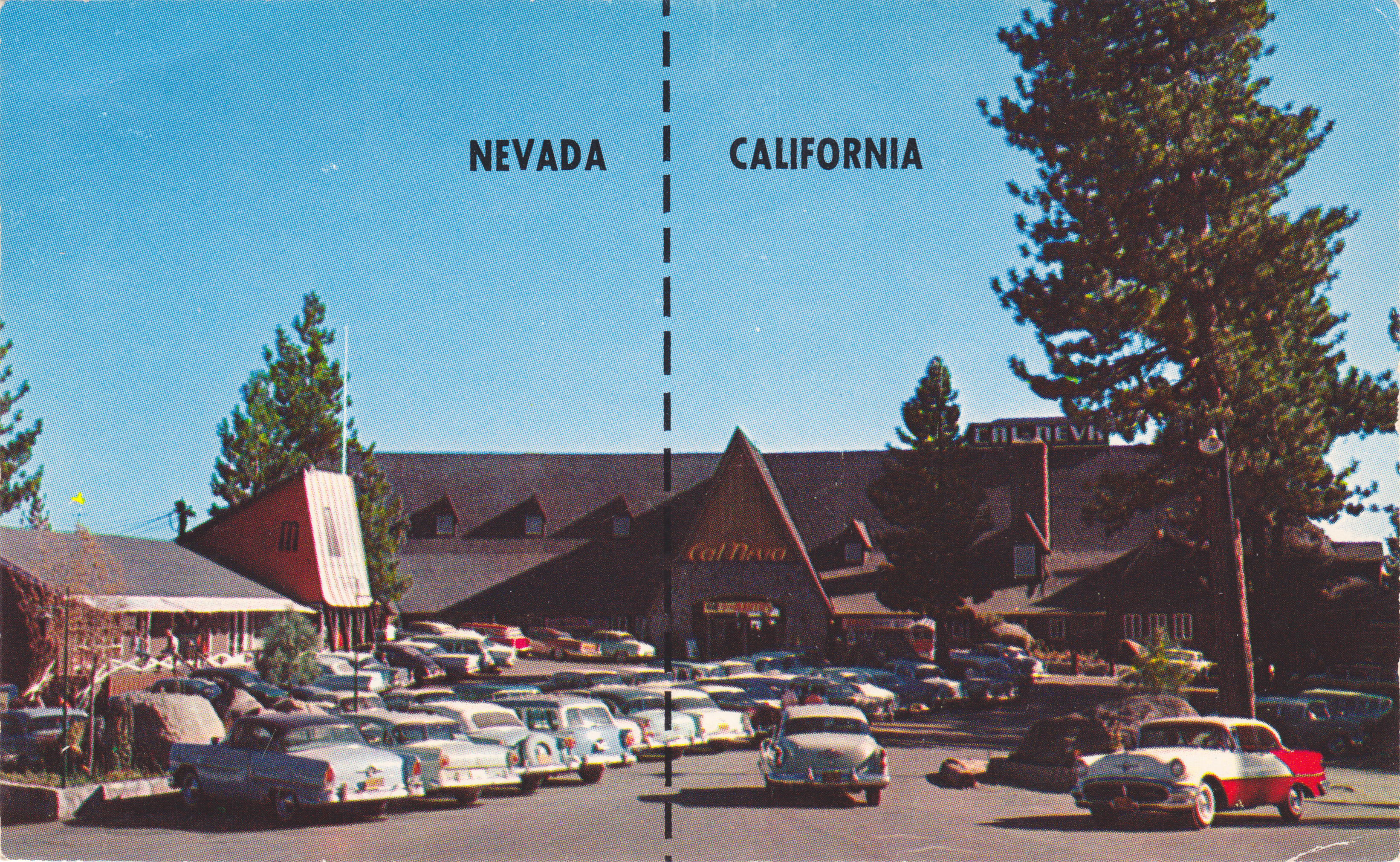
It’s so much fun following the shoreline of the lake that we turn onto Highway 28 and continue along Dollar Point, Carnelian Bay, Kings Beach, and then cross the Nevada state line in Crystal Bay. This is where the famed Cal Neva Resort sits, straddling the border between California and Nevada.
Little-known fun fact: Cal Neva was the first place I ever gambled at a casino. Played roulette for hours in the late 1960s, placing dumb bets on red and black while being served free Harvey Wallbangers all night long. Full disclosure: I was 19 at the time.
I have rarely gambled since. I consider gambling a tax on stupidity.
Cal Neva, built in 1926 by a wealthy San Francisco businessman, attracted big-name entertainers in the 1960s. For a time, Frank Sinatra owned the resort. He built the Celebrity Room theater, which saw performances by Sinatra, Dean Martin, Sammy Davis Jr. and many others. Sinatra’s gambling license was temporarily lifted by the Nevada Gaming Control Board when Chicago mobster Sam Giancana was spotted there.
Cal-Neva: straddling the state line. Those were the days!
The casino/resort has been undergoing major renovations by its new owner for the past two years, and remains closed. Recent news reports at one time indicated the possibility of a December 12, 2015 re-opening date – to coincide with Frank Sinatra’s 100th birthday.
For you Southern Californians who just can’t get enough of all things Sinatra, a Frank Sinatra centennial exhibition will open at the Grammy Museum in downtown Los Angeles October 21. His career included 30 Grammy nominations and 11 wins, among them, “It Was a Very Good Year” and “Strangers in the Night.”
Next point of interest: Incline Village, Nevada. It’s known as a haven for wealthy individuals from California who want to unshackle themselves from California’s burdensome tax system. Incline Village is also home to Diamond Peak, a small ski resort with six chairlifts. In the summer, you can play golf at a Robert Trent Jones-designed course and stay at the nearby Hyatt Regency.
Too sedate? Reno is only a 45-minute drive north over the Mt. Rose Highway.
From here, continue south on Highway 28, which brings us along the eastern shore of Lake Tahoe, where there’s a merge onto US-Highway 50 to complete the circumnavigation of the lake.
Completing the Lake Tahoe circumnavigation.
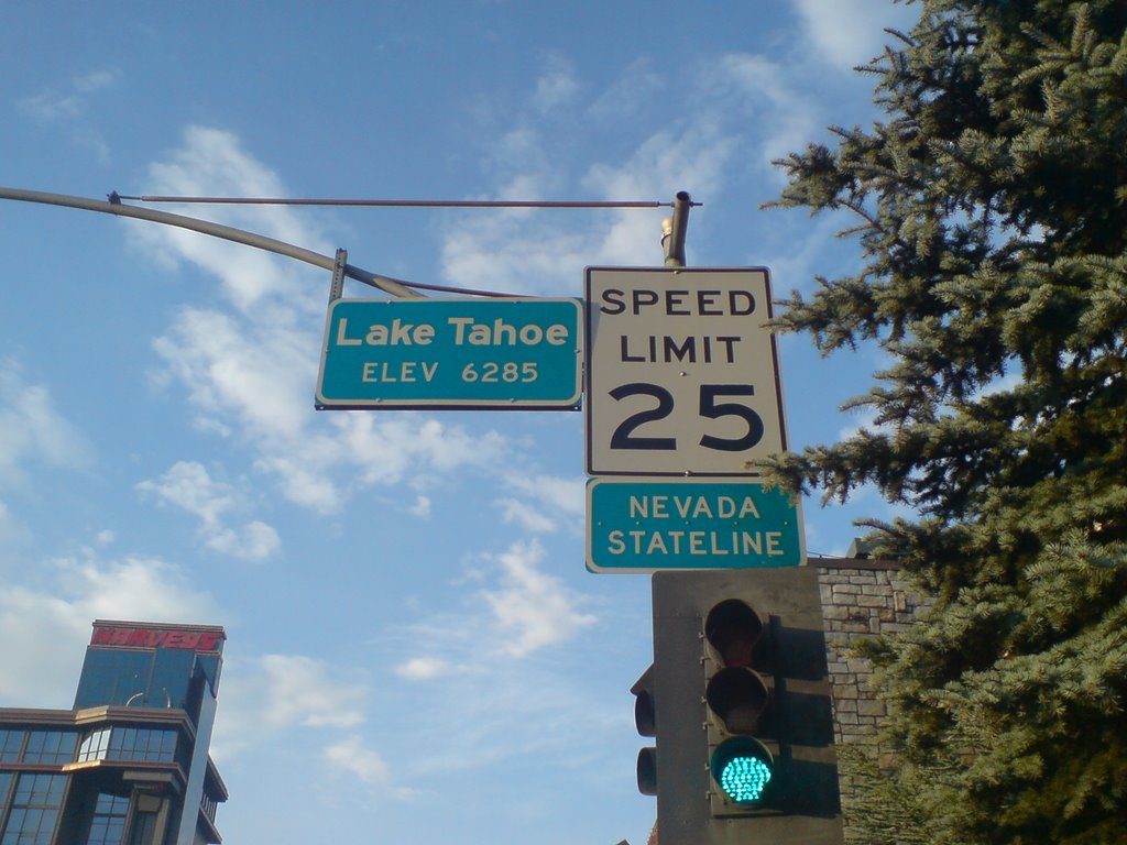
Just across the state line, with Harrah’s Hotel/Casino to our left and Harvey’s to our right, we enter California and arrive at tonight’s destination in South Lake Tahoe. It’s the end of a 250-mile ride that began in gold rush country, brought us over Kit Carson Pass, and evoked memories from a half-century ago.
How could tomorrow be any better?
***
To view today’s route from Mariposa to South Lake Tahoe, click here.
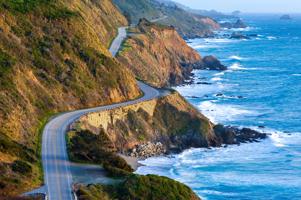
Today, we ride one of the top five motorcycle roads in America: Highway 1 between San Simeon and Carmel. This twisting, cliff-hugging route has been designated an All-American Road. More accurately, it’s all-world! A true bucket-list ride.
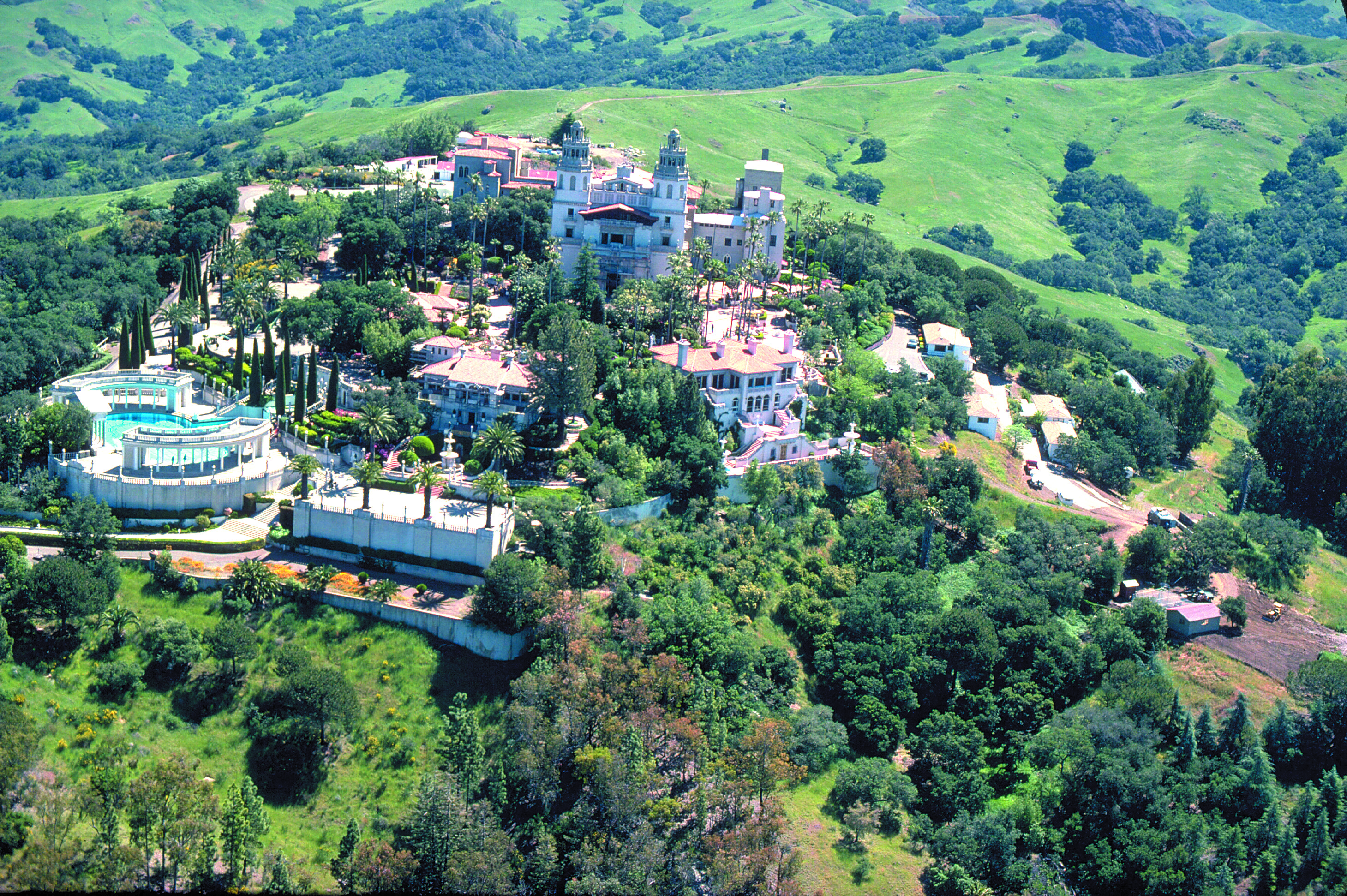
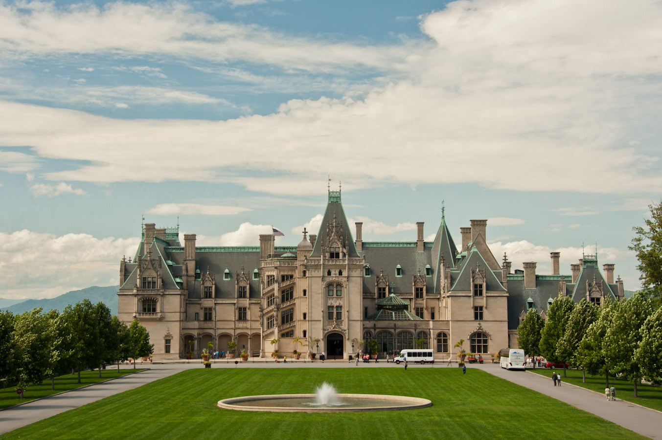
The Hearst Castle, from an era when newspapers actually made money.
After breakfast in Cambria, it’s 10 miles on Highway 1 to San Simeon, best known for the Hearst Castle, an ostentatious reminder of the days when there was big money to be made in newspapers. The castle was the brainchild of newspaperman William Randolph Hearst. It’s now a National and California Historic Landmark, and is part of the California State Park System.
The castle sits atop a hill of the Santa Lucia Range at an elevation of 1,600 feet. Casa Grande, the main building on the castle grounds, is 60,645 square feet. Including several “smaller” buildings on the grounds, the castle features 56 bedrooms, 61 bathrooms, indoor and outdoor swimming pools, a movie theater, an airfield, and the world’s largest private zoo. Nice life.
Here’s a high def video tour of the castle, much cheaper and less time consuming than actually going there.
You could spend all day at the Hearst Castle. Or you could ride a Harley to Big Sur.
We point six wheels northward and opt for Big Sur.
Soon, the road climbs steeply and the views increase dramatically. It’s stunning.
The Pacific Coast Highway is visually stunning, everywhere you look.
We pass the Piedras Blancas Light Station on a point supposedly named in 1542 by Juan Rodriguez Cabrillo for its rocks stained white with bird droppings. Piedras Blancas means white rocks. Early mariners used the large white offshore rocks as navigational landmarks.
In 1875, a light station was established to aid maritime navigation. The lighthouse still sends a white flash every 10 seconds to assure mariners of their location and warn them of the rocky coastline. The light station today is operated by the Bureau of Land Management, and managed as an historic park and wildlife sanctuary.
Continuing north, there’s nothing but mile after mile of breathtaking vistas. It’s hard to focus on the road, and not the view.
Building this highway was no small accomplishment. The state and Federal governments appropriated funds in 1921 and the road from San Simeon to Carmel was completed in 1937, built for around $10 million – in 1930 dollars. Construction was handled by inmates from California’s San Quentin Prison, who were paid 35 cents per day and had their sentences reduced in return.
We are doing this ride pro bono – literally, for the public good. No charge. You’re welcome.
The area’s increasing popularity in the 1950s and ’60s brought the attention of Hollywood celebrities. Orson Welles and his wife at the time, Rita Hayworth, bought a Big Sur cabin on impulse during a trip down the coast in 1944. They never spent a single night there, and the property is now the location of a wildly popular restaurant, Nepenthe.
Thirsty and Hungry? A Nepenthe Bloody Mary is $11, a Castroville Artichoke appetizer $11.50, Nepenthe Steak $41.50, Minestrone Soup $25.50, and a California Artisanal Cheese Plate for dessert $17.00. Add a couple of glasses of wine, and a generous tip — and your dinner bill for one could run you $150 or more.
Nice view from the deck at Nepenthe.
Besides sightseeing from the highway, which is our approach, Big Sur offers hiking, mountain climbing and other outdoor activities. Big Sur’s Cone Peak is the highest coastal mountain in the contiguous 48 states, ascending 5,155 feet above sea level, only three miles from the ocean.
Big Sur is filled with dozens of scenic hiking trails, some climbing into the mountains with expansive views of the Pacific Ocean. For a little variety in today’s ride, we park our bikes at Julia Pfeiffer Burns State Park in Big Sur and hike the shortest trail in the area – the McWay Waterfall trail.
The trail is less than three-quarters of a mile out and back. The view of the 80-foot falls is one of the most popular images of Big Sur. The McWay Waterfall Trail gets its name from McWay Creek, which cascades onto the sandy shore below. For you travelers who enjoy hikes, the McWay Falls hike is certifiably awesome, as noted by Sunset magazine’s list of 50 Best Hikes in the West.
As short as it is, the hike provides a welcome respite from hours in the saddle.
***
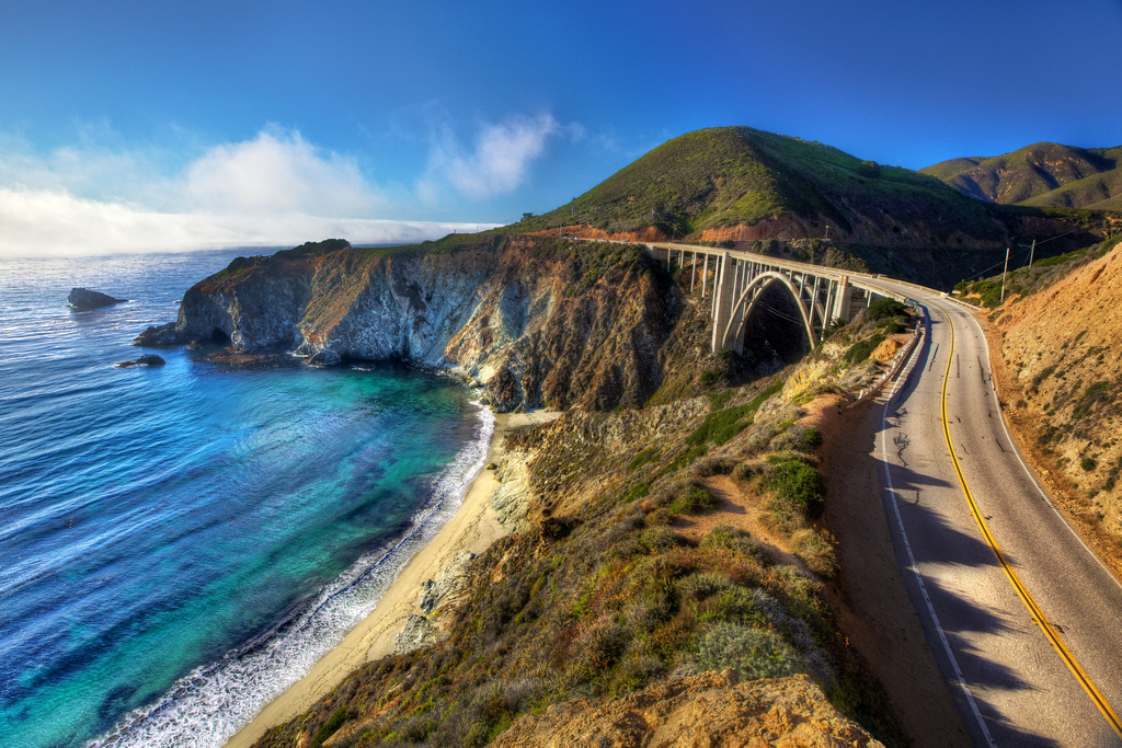
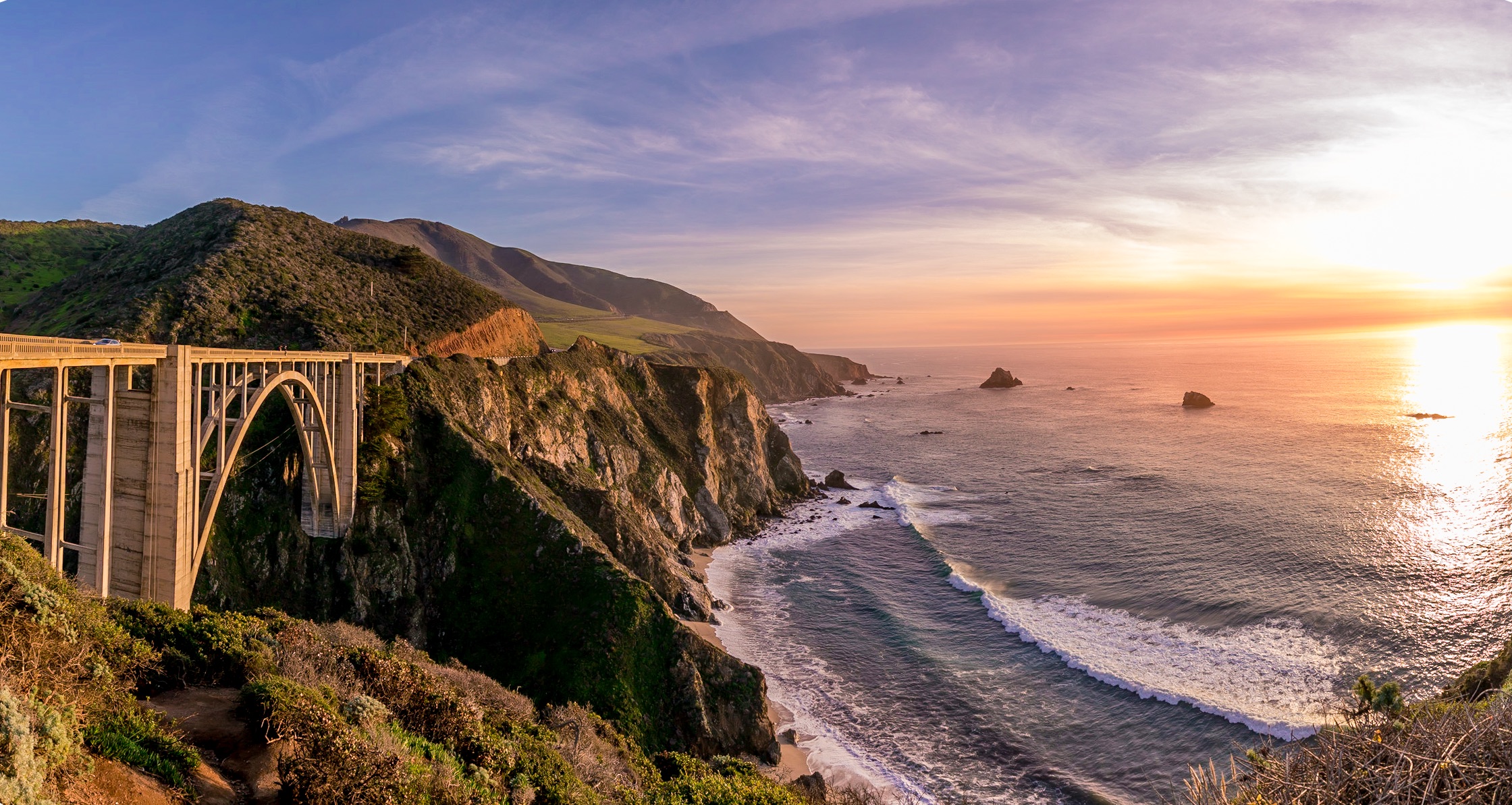
Construction of the San Simeon to Carmel road required 33 bridges, the largest of which was the much-photographed Bixby Creek Bridge, 20 miles past McWay Falls. The bridge is a single-span concrete arch more than 280 feet high and 714 feet long. When completed in 1932, it was the longest concrete arch span on the California State Highway System. Originally built for less than $200,000, it was seismically retrofitted in the late 1990s at a cost of about $20 million.
The Bixby Creek Bridge, about 13 miles south of Carmel, is one of the most photographed features on the California coast, and has been frequently used in automobile commercials and films. It was seen in the opening sequences of Play Misty for Me, and The Sandpiper.
Another view of the Bixby Creek Bridge.
For a drone’s eye view of the bridge, check this out; few people have seen Bixby Bridge from these vantage points!
Carmel, formally known as Carmel-by-the-Sea, is known for its natural scenery and rich artistic history. Actor-director Clint Eastwood, though a rabid-right Republican, served as the nonpartisan mayor of Carmel from 1986 to 1988.
The beach town has bountiful natural charm, enhanced by some local ordinances that keep things just right. There are no fast food restaurants in Carmel. That’s the law. The city’s municipal code also bans wearing shoes that have heels more than two inches in height, unless the wearer has obtained a permit. And, the city once prohibited the sale and consumption of ice cream on public streets. It’s a little like Singapore, which bans chewing gum – but without the tropical humidity.
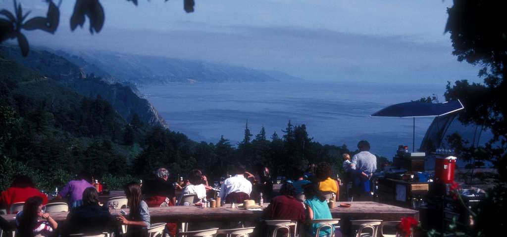
Lunch on the pier in Monterey. Oysters and chowder.
***
Just north of Carmel is an entrance to the world-renowned 17-Mile Drive. If you’ve ever been to Pebble Beach to play golf or have a glass of Chardonnay, you took the 17-Mile Drive to get there.
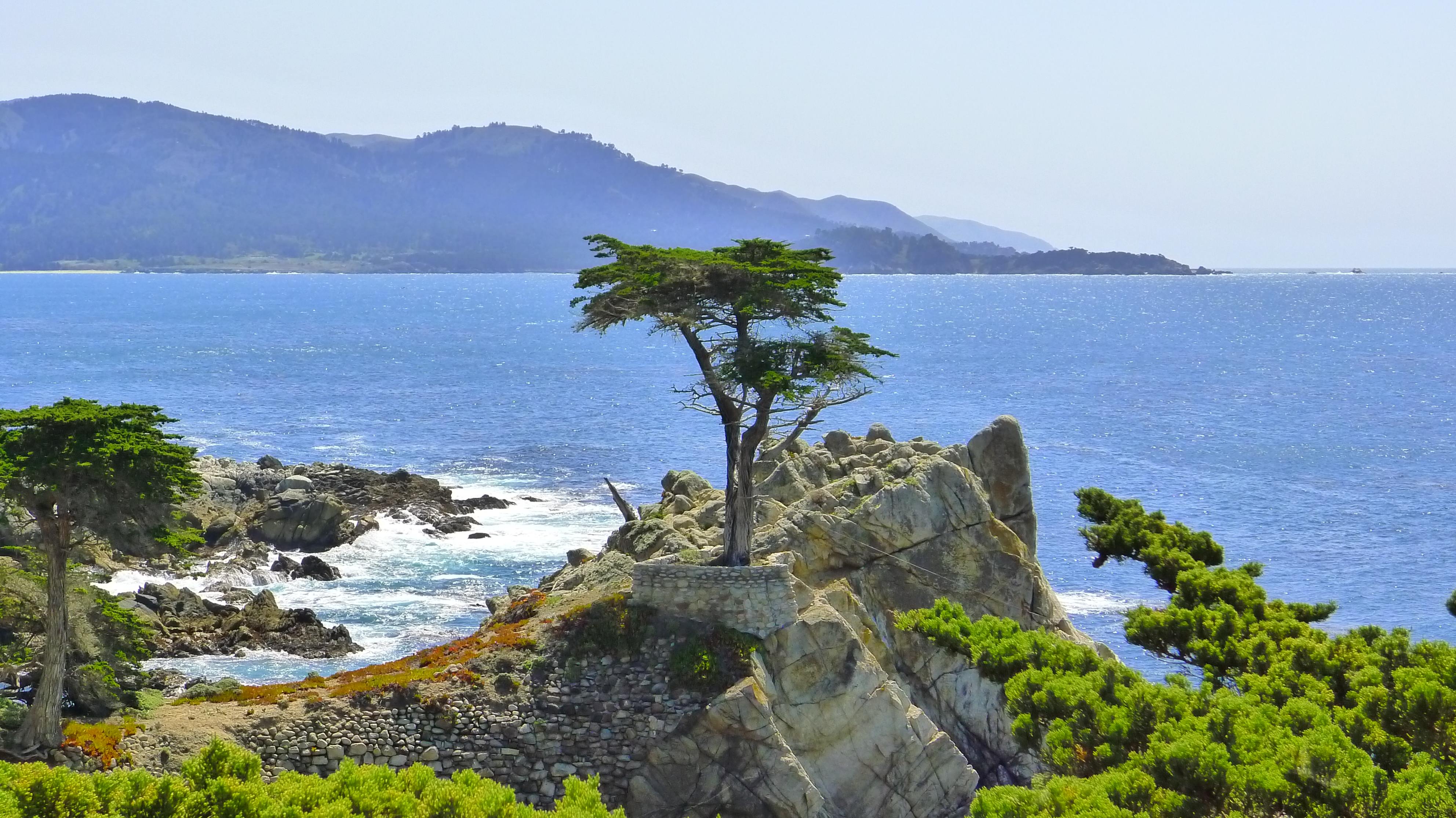
I’ve driven the 17-Mile Drive a half-dozen times over the past 50 years, and couldn’t wait to do it again. How awesome to drive past the much-photographed Lone Cypress tree on our Harleys!
Imagine my disappointment in planning this trip to find out that the 17-Mile Drive doesn’t allow motorcycles. It’s a privately owned forest, and they can allow in (or exclude) whomever they want. Damn rich people. Here’s a video showing what we would have seen on the 17-Mile Drive if we’d been allowed through the gates.
The Lone Cypress, on 17 Mile Drive. No Harleys allowed 😦
We ride on, past Carmel and Monterey, home of the world-famous Monterey Bay Aquarium, located at the site of a former sardine cannery on Cannery Row. Here, we stop for oysters, calamari, and clam chowder served in sourdough bread. After lunch, we continue north. To our left along Highway 1 is Fort Ord, a former Army post on Monterey Bay that closed in 1994. Nearly two million soldiers passed through the gates here, many as part of their infantry training.
The fort was named for Major General Edward Cresap Ord, a Union Army leader during the Civil War. As a young lieutenant, he supervised construction of Fort Ord’s predecessor, Fort Mervine, in the 1840s.
Most of the fort’s land now makes up the Fort Ord Dunes and National Monument, whose 7,200 acres have more than 86 miles of trails that can be explored on foot, bike or horseback. Fort Ord’s former military golf courses, Bayonet and Black Horse, are now public and have hosted PGA tour events.
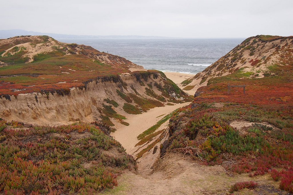
Fort Ord Dunes. Nice to look at. Riding a Harley? No so much.
Castroville is the next city in our sights. It’s known as the “Artichoke Capital of the World.” The annual Artichoke Festival is held at the end of May. Marilyn Monroe was given the honorary title of Artichoke Queen in 1947 during a visit to the Monterey Bay area.
In Moss Landing, our final seaside encounter of the week, we turn inland and head for Gilroy, another food-themed city.
We wind our way over the twisty Hecker Pass, Highway 152, before arriving in Gilroy, the “Garlic Capital of the World.” Gilroy holds its Garlic Festival annually in late July. The event includes a garlic braiding workshop, celebrity cooking demonstrations, and free garlic ice cream.
Amazing what a pungent bulb can do for the local economy.
***
The remainder of today’s ride – the next 100 miles or so – is what you might call transit. Nothing exciting. Just putting ourselves in a place where tomorrow’s ride will be awesome from start to finish.
The rest of the way is hot, flat, mostly straight, and quite boring.
We roll through Los Banos, Spanish for “the baths.” It’s named after a spring that feeds natural wetlands in the western San Joaquin Valley. We are a long way from the ocean, but the elevation here is barely over 100 feet. Might as well be in Kansas. It’s hot.
Next city on our transit is Merced, known as the “Gateway to Yosemite.” We skirt the heart of downtown Merced, which isn’t missing much. Property values here were flattened during the recent Great Recession. Merced suffered one of the greatest property price collapses in the country.
Dinner in Mariposa. We’ll call it a day.
Leaving Merced, we’re riding east on Highway 140, the Central Yosemite Highway. Yosemite – that has a nice ring to it. We’ll soon visit the National Park that is among the most photographed of them all.
The road ever-so-gradually begins to climb, as we near the foothills of the Sierra Nevada mountains. In an hour, we arrive in Mariposa, Spanish for “butterfly.” Notable former residents of Mariposa include William Costello, original voice of Popeye the sailor; and John Fremont, first US Senator from California, first Republican candidate for president and explorer of the West with American frontiersman Kit Carson. More on Kit Carson tomorrow.
Mariposa, elevation 1,950 feet, was founded on the banks of a seasonal stream known as Aqua Fria, and was once known by that name – Aqua Fria – meaning “cool water.”
Aqua Fria or Mariposa – it doesn’t really matter. We have arrived at our destination for the day – 273 miles and seven hours of saddle time later.
Tomorrow, we begin the week by doing two states: Solid and Liquid. Or, California and Nevada.
Won’t that be interesting?
***
To view today’s route from Cambria to Mariposa, click here.
The day begins with a yummy breakfast at Bonnie Lu’s Country Cafe. Biscuits and Gravy for me. Healthier fare for Dave and Scott.
My biscuits-and-gravy breakfast at Bonnie Lu’s Country Cafe.
Best activity after a caloric overload: sit on your butt for the next six hours and enjoy the scenery.
We head north from Ojai on Highway 33, the Maricopa Highway. Designated a National Scenic Highway, it’s a twisty road, following Matilija Canyon through the Santa Ynez Mountains. We climb to Pine Mountain Pass – at 5,080 feet, it’s more than 4,300 feet above Ojai.
From Pine Mountain Pass, we descend comfortably into a flat area that takes us to Lockwood Valley. We are now heading East on Lockwood Valley Road. There’s very little out here of note. Trees and mountains. And Harleys. Lockwood Valley sits at about 4,800 feet.
Highway 33, the Maricopa Highway, is a fun ride.
The only road ahead is the one that takes us to Lake of the Woods, a community of less than 1,000 residents in the Los Padres National Forest. Lake of the Woods was named for a mountain reservoir that has been dry since 1962, when its dam burst. Lake of the Woods is located in Cuddy Canyon of the San Emigdio Mountains.
In Lake of the Woods, we turn west on Cuddy Valley Road, and remain in the mountains. To our left is Mount Pinos, whose 8,847-foot summit is the highest point in Ventura County. We descend along the Bitter Creek National Wildlife Refuge, designed to protect the dwindling California condor foraging and roosting habit.
The Bitter Creek Refuge provides grassland, oak woodland, chaparral, pinion pine/juniper/oak woodland, and wetland habitat for endangered critters. Among those struggling species are San Joaquin kit fox, blunt-nosed leopard lizard, giant kangaroo rat, and species of Federal concern such as western spade foot toad, western horned lizard, and tri-colored blackbird. That’s information you’ll only find on this blog. Or on the Internet, if you care to look for it.
Taking a break along the side of the road.
We reach Highway 166, the Cuyama Highway, and turn west. Cuyama, which lies ahead several miles, is derived from Chumash, meaning “To Rest, to Wait.” We will do neither, as there’s nowhere to rest and little to wait for. Cuyama is surrounded by apricot, peach and plum orchards.
Highway 166 takes us past family farms and fruit orchards before we meet US Highway 101, just north of Santa Maria. Until the Interstate Highway System was built, Highway 101 was the primary north-south route through California. It’s also known as El Camino Real (“The Royal Road”), where its route along the southern and central California coast approximates the old trail that linked the Spanish missions in the 18th and 19th centuries.
El Camino Real (pronounced ree-AL) meets the ocean in Pismo Beach, which was once known as the “Clam Capital of the World.” That moniker has disappeared, thanks to over-harvesting. Pismo clams were once so abundant they were harvested with plows on the beach. Clamming is still legal, but few remain to be found. They are a favorite meal of the protected sea otter, which pretty much wipes out what’s left of the local clam population.
This stretch of Highway 1 is called the Cabrillo Highway, named for Juan Rodriguez Cabrillo, a Portuguese explorer noted for his 16th century exploration of the west coast on behalf of the Spanish Empire. He was the first European explorer to navigate the coast of present-day California.
The Cabrillo Highway brings us to San Luis Obispo, where we turn north onto California Highway 1 – the Pacific Coast Highway. We will stay on this road for the next 155 miles, 32 of them today and the rest tomorrow.
Morro Rock, a distinctive sight along PCH.
Still inland on a coastal highway, we soon reach the coastline in Morro Bay, whose most prominent physical feature is Morro Rock, a 576-foot high volcanic plug. Known to locals as “The Rock,” it was quarried from 1889 until 1969. There’s no public access to the rock, because it’s a reserve for the peregrine falcon. Morro Bay calls itself “The Gibraltar of the Pacific.”
Twenty more miles on Highway 1 and we arrive at Cambria, a seaside village doubling as an art colony. Cambria is roughly halfway between Los Angeles and San Francisco. And it’s 100 percent of the way to today’s destination.
Our ride finishes quietly as we pull into the motel and begin to think about dinner. In our rear-view mirror: a tidy 230 miles of mountain roads, valleys and a hint of ocean.
What’s cookin’?
***
Come to think of it, we’ve been sitting on our butts all day and could use some exercise. Might be nice to burn a few calories before dinner.
We’re very close to the Pacific Ocean. Why not a beach walk?
Moonstone Beach, a great spot for a walk in Cambria.
About a mile north of us is the Moonstone Beach Boardwalk, which runs north and south along the beach for about 1.5 miles. The boardwalk meanders along the Moonstone Beach. There are opportunities to jump off the boardwalk and put footprints in the sand.
If you are curious, a moonstone is not to be confused with a moon rock.
Moonstones, which are seen on this beach in abundance, are gemstones, whose name is derived from a visual effect caused by light diffraction. You probably knew this, but the moonstone is Florida’s state gem. Florida made that selection to commemorate the moon landings nearly a half-century ago, because the rockets to the moon were launched from Florida’s Kennedy Space Center. Here is Apollo 11 lifting off toward the Moon, on July 16, 1969.
Five days later, Neil Armstrong became the first human to step on the surface of the Moon.
Ribs at the Cambria Pub and Steakhouse.
We do our own exploring tonight, successfully foraging for food in Cambria. Dinner at Cambria Pub and Steakhouse.
***
To view today’s route from Ojai to Cambria, click here.
Dave ordered the veggie lasagna, as close to health food as it gets on a road trip.
And then, we’re going to the beach. How California-clichéd is that?
Gail Bowman snapping pix of the bikes before we leave Lake Arrowhead.
Day 1 of our journey begins on the Rim of the World Highway, designated a Scenic Byway because it literally feels like you are on the rim of the world. It’s a 110-mile route that traverses the rim of the San Bernardino Mountains from Cajon Pass to San Gorgonio Pass. We follow this narrow, twisting path for about 22 miles before reaching Cajon Junction, where Highway 138 crosses I-15.
We could turn right onto the Interstate, and in three hours we’d be in Las Vegas. But this trip is about reality, not fantasy, so we continue west toward the San Gabriel Mountains.
All red, and raring to go.
Thirty minutes later, we turn onto Highway 2 and arrive in Wrightwood, a quaint community located in a pine-covered valley at 5,935 feet. Wrightwood is at the east end of the Angeles Crest Highway, which we will follow for the next 60 miles to La Canada Flintridge, just north of Pasadena.
The Angeles Crest Highway is a two-lane thrill ride that corkscrews through the Angeles National Forest – through chaparral and montane forest habitats, along the highest and most scenic ridges of the San Gabriel mountain range. It is considered among the top motorcycle roads in the US.
The road has been used extensively in Hollywood movies, including racing scenes in the 1968 Disney film, The Love Bug, starring Dean Jones, Michelle Lee, and a 1963 VW Beetle named Herbie. The Angeles Crest Highway was also featured in the Love Bug’s 1977 sequel, Herbie Goes to Monte Carlo – where the highway doubles for a mountain road in the French Alps.
Construction of the Angeles Crest Highway began in 1929, when it was originally intended to be a fire access road. Much of it was built by prison labor. Original plans called for Angeles Crest Highway to be upgraded to a freeway in the 1950s, but that idea was later considered geographically improbable and the plans were abandoned.
We’re pretty much on our own out here, off the grid in a sense. Cell phone reception is spotty, and, when available, signal strength and clarity is poor. If you tried to call us today, we’ll have to get back to you.
Stopping in Wrightwood for water, snacks, whatever.
The highest point on the Angeles Crest Highway is 7,903 feet at the Dawson Saddle. Much of the highway is closed in winter due to rockfall and avalanche hazards. Today, the road is clear and the skies are sunny as we press on toward several ski resorts convenient for millions of Southern California snow enthusiasts.
Five minutes west of Wrightwood is the Mountain High Ski Area at Big Pines. It bills itself as “Southern California’s closest ski resort.” From a base at 6,600 feet, Mountain High has 1,600 vertical feet in three distinct areas: West, East and North. It’s one of the oldest ski areas in the US, beginning in 1937 with a single rope tow.
Twenty-two miles west of Mountain High is another ski area – Mount Waterman. From a base elevation of 7,000 feet, Mount Waterman has 1,000 vertical feet of skiing – when it’s open. If Mountain High is Southern California’s closest ski resort, Mount Waterman may be Southern California’s closed-est ski resort. The past four seasons, there hasn’t been enough snow to open for business. In the summer, however, it does have an 18-hole disc golf course.
Dave checks out Mount Waterman. Not much skiing today.
Ten minutes from Mount Waterman is the Chilao Visitors Center, one of two on the Angeles Crest Highway. It offers an introduction to the Angeles National Forest through a variety of exhibits, trails and activities. We get all the introduction we need by continuing our ride west.
Other than visitor centers, one of the few buildings on the Angeles Crest Highway is Newcomb’s Ranch, a biker haven about 10 minutes west of Mount Waterman. Newcomb’s Ranch is the only private property along the Angeles Crest Highway. It’s called the “informal headquarters for riders” by Los Angeles magazine, and “one of Southern California’s most famous Rickey Racer Roadhouses” by Motorcyclist magazine.
The Newcomb family, which also created the Mount Waterman ski area, built the roadhouse in 1939. Since then, it’s variously served as a restaurant, hotel, general store, gas station and brothel. Only one of those descriptions serves our purposes today. We stop, admire the bikes, hydrate, relax – and then continue west.
Cooling off at Newcomb’s Ranch.
From Newcomb’s Ranch, it’s 27 miles to La Canada Flintridge, the western terminus of the Angeles Crest Highway. Hey, that was fun!
If you’re more into pictures than words, click here to watch a time-lapse motorcycle ride from one end of Angeles Crest to the other – 66 miles in 10 GoPro minutes.
***
We’re back in the big city now. Or we’re at least aware of its presence.
Nearly 23 million people call Southern California home, and for the next 50 miles, we’ll be among many of them. On a sunny, pleasant August day, we’re reminded why so many find SoCal such a nice place to live. Just look skyward and you’ll get it.
We continue south on Highway 2, but now it’s a multi-lane freeway with typical mid-day Friday afternoon traffic. Soon, we turn west on the Ventura Freeway, so named because Ventura is where it ends – or begins, depending on your perspective.
Just past the Los Angeles Zoo, we turn onto Forest Lawn Drive and are reminded that show business is still a big deal around here. We ride past the famed Warner Bros. and Universal Studios. A lot of big name movies have been made on their lots, including ET, Jaws, Gravity and American Sniper. And TV shows, too – from 77 Sunset Strip to The Big Bang Theory.
Mulholland Drive, the movie version.
Near Cahuenga Pass, we jump onto Mulholland Drive, a famous road named after pioneering Los Angeles civil engineer William Mulholland. Mulholland was responsible for building the Los Angeles city water infrastructure and providing a water supply that allowed LA to grow into one of the largest cities in the world. He designed and supervised the building of the Los Angeles Aqueduct, a 233-mile long system to move water from the Owens Valley to the San Fernando Valley. In a sense, you have him to thank for Los Angeles being a mass of wall-to-wall humanity. Without the water he brought to the LA basin, the city likely would not resemble what you see today.
Mulholland Drive, which has been featured in movies, songs and novels, is a 21-mile two-lane road that follows the ridgeline of the eastern Santa Monica Mountains and the Hollywood Hills. It provides spectacular views of the Los Angeles Basin, the San Fernando Valley and the Hollywood Sign. There’s a small overlook on Mulholland Drive where you can see the Hollywood Sign, whose letters are 45 feet high. The sign, created in 1923 as an advertisement for local real estate development, sits on Mount Lee, at 1,708 feet, the tallest peak in Los Angeles.
One of the most famous sights in the entire Los Angeles area.
Along Mulholland Drive, you’ll find some of the most exclusive and expensive homes in the world. As this is not a house-hunting trip, we keep our eyes on the road and follow Mulholland Drive to the Skirball Cultural Center, near I-405. The Skirball Center is devoted to exploring the connections between Jewish heritage and American democratic ideals. A five-minute walk from the Skirball Center is the American Jewish University, founded nearly 70 years ago by Rabbi Mordecai Kaplan to create an institution representing the diversity of Judaic expression in the US.
***
I-405 North takes us back to the Ventura Freeway, which leads to Topanga Canyon Boulevard., and on to Topanga itself. Topanga is an artsy community in the Santa Monica Mountains, attracting filmmakers, musicians, actors and other unapologetic liberals. The annual Topanga Film Festival is held every summer.
Lunch at a 7-11 just off the Ventura Freeway. This is what extreme hunger looks like on a Harley trip..
It’s believed that the name Topanga means “Where the Mountain Meets the Sea.” Some millennial parents are actually naming their kids Topanga. It’s among the top 300 names on babynames.com. Hey, it’s California!
In Topanga, we turn northwest onto Mulholland Highway. Not Mulholland Drive. This one is a highway, or at least that’s what it’s called. It feels like anything but a highway. It’s a two-lane zig-zagger that crosses Malibu Canyon Road and takes us to the tiny community of Cornell, in the wine country area of the Santa Monica Mountains.
Cornell, sandwiched between Malibu and Agoura Hills, is mostly surrounded by protected open space and state park land. The Tour de California bicycle race occasionally passes through here, attracting locals who cheer the cyclists on.
The hottest spot in Cornell, the place we have to check out, is The Rock Store, a famed hangout for glitterati motorcyclists including Jay Leno, Harrison Ford, Arnold Schwarzenegger, John Travolta and Peter Fonda. One bike magazine calls it a “wonderful collection of humanity and two wheels where diversity isn’t just tolerated, it’s celebrated.”
Dave hydrates at the Rock Store.
The Rock Store is a nice place to park, ogle, covet, and just compare biker notes. “Mine has more chrome” is the Harley equivalent of “Mine is bigger than yours.”
We see a few motorcycles and a bright yellow Lamborghini, but no signs of the Hollywood elite. While Jay Leno is nowhere to be found, here’s a fun clip of him talking about, then riding one of his 90 bikes, a 1936 Harley Davidson Knucklehead.
***
Refreshed and ready for more, we continue west on Mulholland Highway, then turn south on Latigo Canyon Road, another super-twisty two-lane road. Latigo Canyon Road takes us to Highway 1, also known as the Pacific Coast Highway.
Next stop, Malibu. Or, as they call it locally, “The Boo.” We don’t stop in Malibu; we power through it and enjoy the views of the California coastline.
Except for its extraordinary views and multi-million dollar mansions, Malibu is a small town that holds little interest for tourists. Still, it’s amazing to think that earlier in the day, we were riding above 7,000 feet, and now we are skirting the Pacific Ocean.
Riding PCH. California coastal scenery at its finest.
We follow the Pacific Coast Highway for about 30 miles, past El Matador State Beach, Point Dume State Beach, Lee Carrillo State Park, and Point Mugu State Park, where the road turns inland. The ocean vistas were spectacular, but they’re gone for now. On Sunday, we will jump back onto the Pacific Coast Highway’s most scenic section, one of America’s top motorcycle roads.
From PCH, we jump onto US Highway101, and make a quick stop at the Camarillo Harley store. Arriving five minutes before closing time, Dave buys a new gas cap to replace one that mysteriously “went missing.” It’s a long story, involving a senior moment and lack of a documented checklist. Next time you see Dave, ask him about it.
Dave, buying a new gas cap. You can never have too many.
First, it’s time to head for tonight’s destination, Ojai (pronounced OH-hi).
Ojai is a tourist destination, about 15 miles north of Highway 1. We are three tourists in search of a tasty dinner and a comfortable bed, so it should suit us just fine.
Ojai’s culture revolves around ecology, health and organic agriculture, spirituality, music and art. It’s home in mid-June to the annual Ojai Music Festival, which has had among its performers Igor Stravinsky (stylistic ballet and symphony composer), Esa-Pekka Salonen (principal conductor of the London Philharmonic Orchestra) and Aaron Copland (“Fanfare for the Common Man”).
Copland wrote Fanfare For the Common Man in 1942, inspired in part by a famous speech made earlier in the year, where Vice President Henry Wallace proclaimed the dawning of the “Century of the Common Man.” You will recognize this fanfare, as it’s performed by the New York Philharmonic Orchestra at the 9/11 museum dedication ceremony in May 2014.
***
Lavender in Ojai is quite the thing.
Another popular June event is the Ojai Lavender Festival, a celebration of the color purple held in Libbey Park. It showcases lavender art, as well as lavender-themed crafts, soaps, jewelry and clothing. This year’s lavender fest included music from the Honeysuckle Possums.
Sadly, we seem to be two months late for Ojai’s festival season 😦
In make-believe, the title characters of The Bionic Woman and the The Six Million Dollar Man are described in those 1970s TV series as having been childhood sweethearts in Ojai. Jamie Sommers (Lindsay Wagner) and Steve Austin (Lee Majors) appear in a number of episodes that take place in and around Ojai.
In real-life, notable current and past residents of Ojai include film composer Elmer Bernstein, Oscar-winning actress Julie Christie, jazz musician Maynard Ferguson, and David Zucker, director of Airplane! and The Naked Gun.
As the sun begins to set, our eyes begin to droop and sleep beckons. Dinner, drinks, fade to black.
Today’s 250-mile ride was a perfect start to a week of riding. Let’s do it all over again tomorrow.
***
To view today’s route from Lake Arrowhead to the Rock Store in Cornell, click here.
To view the remainder of today’s route, from Cornell to Ojai, click here.
Some noteworthy things have happened on August 20 over the past 150 years:
In 1866, President Andrew Johnson formally declares the Civil War over.
In 1882, Tchaikovsky’s “1812 Overture” opens in Moscow.
In 1920, the first US commercial radio station, WWJ (Detroit) begins daily broadcasting.
In 1940, British Prime Minister Winston Churchill famously says of the RAF: “Never in the field of human conflict was so much owed by so many to so few.”
In 1965, the Rolling Stones release their single, “Satisfaction,” in the UK.
In 1980, Reinhold Messner of Italy is the first to solo ascent Mt. Everest.
In 1998, the Supreme Court of Canada rules that Quebec cannot legally secede from Canada without the federal government’s approval.
In 2011, celebrity booty model Kim Kardashian marries basketball player Kris Humphries; the marriage lasts 72 days.
And, in 2015, three guys, all set to begin a 2,000-mile Harley excursion, decide to stay in Lake Arrowhead, relax, and leave tomorrow instead.
Keep calm, everyone, and nobody will get hurt.
With yesterday’s blog build-up, you’d think Dave, Scott and I would be in the Sierras by now. Not to worry. We’ll have plenty of time to ride, beginning Friday morning.
Dave cooking his “world- famous” ribeye steaks.
So today, we cool our jets, fill our tanks, explore Lake Arrowhead on the Bowman’s pontoon boat, have our last home-cooked meal (Dave’s “world-famous” ribeye steaks) for 10 days, and give you the day off from reading this blog.
We plan to leave bright and early tomorrow. See you then.
A world-famous meal, waiting to be devoured. Then, in the morning, we hit the road!
Today, I hit the road for my seventh major ride in seven years. If I had any writing ability, I’d call that an annual event.
But this time there’s a big difference: Sarah’s coming along.
That’s right, I’ll have adult supervision. To help kick off my 2015 ride through the Sierras, Sarah will trail in the Boxster – sort of a high-class “sag wagon.” Sag, as you may know, is an acronym for “support and gear,” or “support and grub.”
Either way, it’s awesome to have her on the road with me.
***
Over the past six years, you may recall my riding partner on these mountain excursions has been Ray Sanders. Ray was raised in Kentucky’s coal country, had a distinguished career as an engineer, and now lives in Farragut, Tennessee. Ray, who will be 85 in November, is married to Sarah’s cousin, Tina.
Thanks, Ray. Here’s to you!
Together, Ray and I rode to Lake Tahoe and back twice, along the Blue Ridge Mountains in North Carolina and Virginia, to Civil and Revolutionary War sites, New England in the fall, and scaled the highest paved road in North America – 14,130 feet — just below the summit of Colorado’s Mount Evans.
After 65 years of riding, Ray is moving on to other adventures.
So it’s somewhat bittersweet today as I begin a 2,000-mile ride in search of some of California’s more spectacular sights, knowing Ray won’t be a part of it. I think of all the places we’ve been together – probably 15,000 miles on the road – and it’s hard not to be wistful.
I am deeply appreciative of all Ray taught me during our rides, and I will miss him greatly.
***
8:30 am in La Quinta. Ready to hit the road.
As we pull out of the driveway of our La Quinta home, it’s 8 am and already 90 degrees, with an expected high of 113 by 5 pm. We’ll be stuck in the blistering desert heat most of the day, unless we’re lucky enough to find shade or shelter in the mountains.
It’ll be a blast-furnace-like experience for me; riding at 50 miles an hour, the wind in my face isn’t the least bit refreshing. It feels Saharan and stifling. And poor Sarah: she’ll miss the guilty pleasure of driving topless (the Boxster is a convertible). Motorcycles and ragtops aren’t much fun when the temperatures are, as the Urban Dictionary calls it, “Africa hot.”
Today’s destination is Lake Arrowhead, a mile-high town northwest of here in the San Bernardino Mountains. Lake Arrowhead is only 65 straight-line miles from La Quinta, but our route will be a full 175 road miles. We’ll either be lost, or intentionally in the mountains to avoid the crushing heat.
On El Paseo, not quite ready to shop.
In 20 minutes, we arrive in Palm Desert, home of the El Paseo shopping district. It’s our valley’s version of Rodeo Drive. Bill Gates has a home in Palm Desert. So does Phil Condit, former CEO at Boeing.
No time for retail therapy or breakfast with Phil and Bill, so we head south on Highway 74 into the San Jacinto Mountains. The road immediately becomes steep and twisty – what most self-respecting motorcyclists and their sag wagon drivers live for.
A side note: on my Harley rides for the past six years, I constantly reviewed my rear-view mirror, making sure Ray wasn’t far behind. It’s a little odd this time, as Ray is not there, but instead I see Sarah following me.
About 45 minutes after leaving home, we arrive at the Paradise Valley Café, a favorite biker hangout at the intersection of Highways 74 and 371. If we turned left onto 371, the road would take us to Temecula, in the heart of Southern California wine country.
Sarah and Gary at Highway 74 vista point.
A very cool thing happens our way up Highway 74, something you Harley riders will relate to. A California Highway Patrol motorcycle officer passes me going down the hill. He gives me a “Harley wave,” first time that’s ever happened to me. How neat was that! A peace officer giving peace a good name!
But we continue straight, heading toward Idyllwild, a rustic mountain destination known as one of the “100 Best Small Art Towns in America.” With a population of about 4,000, Idyllwild was once the summer home for bands of Cahuilla Indians who migrated to the area to escape the heat of lower elevation deserts. Their thought process was similar to mine and Sarah’s – except they probably didn’t arrive here on Harleys and Porsches.
Today, Idyllwild is home to artists and musicians, including drummer David Atwood of the 1970s rock group America (“Ventura Highway,” “A Horse With No Name“). Casey Abrams, from American Idol season 10 (2011) is an Idyllwilder, as is PGA Tour golfer Brendan Steele.
Hydrating at “Higher Ground” in Idyllwild.
The biggest event every year in Idyllwild is the two-day Jazz in the Pines festival, which just wrapped up on August 16. Featured bands this year included the Euphoria Brass Band and the Graham Dechter Quartet. For more, visit http://www.idyllwildjazz.com
***
Over the next eight days as you read this blog (“Travels With Harley”), you’ll note links to additional information – film clips, YouTube videos, websites and more. Those links, which look like the one for the Jazz in the Pines festival in the previous paragraph, should be easy to spot. Many are eminently clickworthy; just depends on your hunger for knowledge. Apologies, in advance, if YouTube causes you to watch a few seconds of ads before the video begins; that’s how they pay the bills.
Full disclosure: if you click on all of them, be prepared to waste a considerable amount of your life viewing this blog. Your choice. As I like to say every year – if you happen to learn anything or derive mild entertainment value from reading these blog posts, well, you’re welcome.
I look forward to having you along for the ride over the next nine days – and I welcome your feedback. Feel free to comment on the photos, the route, the writing, the weather, our culinary choices – whatever. You can make your comments directly on the blog. Or keep them to yourself.
***
Sarah cooling off in Idyllwild.
One other thing about communication: over the last month, I have moved up a step on the technology food chain. I now have a Twitter account. Yes, I tweet. I’m a novice at this, so don’t expect hashtag-o-mania right out of the gate.
Every day during my ride, I will tweet some information or photos not available on this blog. You could say I’m saving some special (aka, exclusive) stuff for you Twitter followers, or Twits as I like to call you.
To find me on Twitter, I’m: @LQHarleyBoy
If you don’t have a Twitter account, you can still see my latest tweet by going to twitter.com, and entering @LQHarleyBoy in the search field.
My Twitter coach is @DanLewisNews … so if you don’t like what you see, it’s probably his fault.
***
From Idyllwild, we head north on the Banning-Idyllwild Panoramic Highway, as the road climbs to 6,165 feet, then begins descending into Banning, about 30 miles away. Banning is on I-10, in the San Gorgonio Pass, also known as Banning Pass.
Named after Phineas Banning, a stagecoach line owner, the city has a population of nearly 30,000. Banning sits at about 2,350 feet, but it’s still darn hot. So, to cool off, we head up into the mountains again, this time the San Bernardinos.
We jump on I-10 for a few miles, then exit in Beaumont, French for beautiful mountain. The road takes us through Oak Glen, a charming orchard town with less than 700 residents, but zillions of apples. The Oak Glen apple orchards produce the Vasquez and King David varieties, which are grown exclusively here. For you apple aficionados, antique varieties once grown here – but no longer commercially available – include the Ben Davis, the Gravenstein, and the Pink Pearl.
There’s a wonderful five-mile scenic loop through Oak Glen with more than 30 ranches, farms and businesses, and we enjoy every turn.
At beautiful Big Bear Lake.
Before long, we turn onto Highway 38 and begin climbing toward Big Bear Lake. CA-38 is a terrific, twisty road that rises to Onyx Summit. At 8,443 feet, it’s the highest highway pass in Southern California.
I wouldn’t say the air is frigid, but it’s certainly a welcome departure from what our friends in La Quinta are now experiencing. The air temperature is generally about five degrees cooler per 1,000 feet of elevation gain. So, as we cross Onyx Summit, it’s about 70 instead of the 110 it probably is in La Quinta.
Soon, we arrive at Big Bear Lake, a small mountain town sitting at 6,750 feet. The lake is Southern California’s largest recreation lake, teeming with fishing activity in the summer. It’s quite scenic, and made a nice backdrop for 1960s TV Westerns, including a number of Bonanza episodes. In the winter – if there’s snow – many Southern Californians ski and shred (snowboard) at nearby Snow Summit.
***
Now on Highway 18, we continue west toward Lake Arrowhead, eventually arriving around 1 pm. Lake Arrowhead is a beautiful mountain resort town in the San Bernardino Mountains, set amid pine, cedar and dogwood forests. Its economy is based almost entirely on tourism. Nothing wrong with that. You could say the same for La Quinta, and it works fine for us.
After 175 miles on the road, we’re ready to call it a day.
At his mountain retreat, Dave battles bats with his “Bat Net.”
We arrive at the mountain home of my old Boeing boss and good friend, Dave Bowman. By old, I mean “long ago.” Dave’s actually 10 years younger than I am. And a foot taller.
At Boeing, I supported Dave when he was VP/General Manager of the C-17 Globemaster III program. I strung together subjects and verbs to tout the C-17’s achievements, and Dave had profit-and-loss responsibility for the $3 billion-a-year program. Then, I retired in 2008, Dave left the company in 2010, and it’s been all downhill for the C-17 ever since. Just sayin’ …
After assembling about 270 C-17s for the US Air Force and major international customers over the past 25 years, this fall Boeing is building the final C-17 and shutting down its Long Beach factory forever. It will live on forever in pictures and video.
***
Following a distinguished career at Boeing, Dave recently retired as Senior VP of Program Management at Eaton, a global leader in power management, with $22 billion in annual revenue. Dave worked in Eaton’s Cleveland, Ohio, office, which wasn’t entirely conducive to motorcycle riding – though it is home to Rock-N-Roll City Harley Davidson, named for Cleveland’s Rock and Roll Hall of Fame. In May, the Hall of Fame year celebrated its 10-millionth visitor. Rock on!
Retirement, apparently, means Dave finally has the time to ride his Harley in a meaningful way. He has mostly used his 2008 Ultra Glide for day trips from his Fullerton home. Now, he’s going to join me for the next eight days as we ride through California’s mountain ranges and along its Pacific coast.
It’s great to reconnect with him, after years of communicating primarily through this blog.
Dave and his wife, Gail, are graciously hosting Sarah and me at their Lake Arrowhead retreat before the boys begin their journey.
We have a lot of catching up to do.
***
Dinner at the Bowman home in Lake Arrowhead.
It’s a festive atmosphere at the Bowman Lake Arrowhead home. The setting is perfect for relaxing before we terrorize California’s coastline and mountains.
Sarah and I are catching up with Dave and Gail. We reminisce about the good old days, and look forward to even better ones ahead.
When the Harley ride begins in earnest, Sarah will head back to La Quinta and it will be just the guys. Dave and Gary.
Oh, and Scott, too.
Scott Donaldson will be the third of our riding threesome. He’s with us tonight as we chill at the lake.
Scott is Gail’s uncle. You’d think that would make him an old man. Not so much.
Scott Donaldson is in the house.
He’s Dave’s age (55). Scott and Dave have known each other for more than 40 years, starting when they were students together in Mrs. Fox’s 8th-grade algebra class at Alexander Hamilton Junior High School in Long Beach. You remember algebra: integers, single-variable equations, polynomials and the Pythagorean theorem. Pythagoras was quite the mathematician and philosopher.
Scott and Dave both went on to Cal State University at Long Beach after high school, and have remained best buddies ever since, often riding their Harleys together.
What do you call your wife’s uncle who’s also your good friend? Didn’t know there was a term for that until I looked it up on genealogy.com. Scott is Dave’s “fruncle-in-law.” Seriously.
Scott is a native Southern Californian who lives in La Habra with his wife, Jackie. They’re just a few miles away from the Bowman’s primary residence in Fullerton.
After a career in grocery retail management, Scott is now a Superintendent in vessel operations for SSA Marine – Stevedoring Services of America at Terminal C60 in Long Beach, the second-busiest container port in the US. The facility is dedicated to supporting Matson Navigation, providing service to the Hawaiian Islands, Guam and three ports in China.
Scott rides a 2007 Road King Classic. Dave has a 2008 Ultra Glide. I have a 2001 Softail Heritage Classic. All Harleys. Why ride anything else?
Speaking of riding … let’s fire up the bikes and get moving! Vroom, Vroom.
***
To view today’s route from La Quinta to Lake Arrowhead, click here.
Our day begins with a wonderful morning ride on the Meadows in the Sky Parkway, a 13-mile journey that climbs steeply from downtown Revelstoke to 4,921 feet. After 16 switchbacks through forests of cedar and hemlock, spruce and fir, we arrive at Balsam Lake, 3,400 feet above Revelstoke.
Randy takes five at Balsam Lake.
At the top, the subalpine landscape often explodes with wildflowers. The view from the summit is astounding, with breathtaking vistas of the Columbia River and Revelstoke. For those with patience, you can take a shuttle one kilometer to a second summit, this one at 6,350 feet. (Yes, I mixed metric and English units; it happens a lot in Canada.) Here, you find Mount Revelstoke’s historic firetower, built in 1927 – and declared a Canadian National Historic Site 60 years later.
The Parkway is part of Mount Revelstoke National Park, one of the few in Canada established at the request of local citizens. A Meadows in the Sky fun fact: it’s known as the “Royal Road” because of some of its visitors. The last royal visit was in 1955, when Queen Elizabeth II and Prince Philip visited the city of Revelstoke and the National Park. No word on whether they took the shuttle to the summit.
Wildflowers in bloom at Balsam Lake.
We descend steeply, but carefully, back down to Revelstoke, where we jump on the Trans-Canada Highway and head west. The highway follows the Eagle River. Forty-five minutes from Revelstoke, we pass through Sicamous, a resort town that bills itself as the “Houseboat Capital of Canada.“
Sicamous sits on the eastern shore of Shuswap Lake, which has four arms, forming a shape reminiscent of the letter H. The lake is the centerpiece of Shuswap Lake Provincial Park.
We turn south in Sicamous and follow Highway 97A, the Vernon-Sicamous Highway, along the eastern shore of Mara Lake. After turning west onto Highway 97, we arrive in the small community of Falkland BC, home to one of Canada’s largest Canadian flags.
The view of Revelstoke on the way down from Balsa Lake.
The flag is 500 feet above the valley floor on Gyp Mountain. It’s 28 feet high, 56 feet wide, but isn’t really a flag in the traditional sense – you know, flapping in the wind. No, this flag is made out of wood, telephone poles, cement blocks and metal. Seriously. The colors (colours?) of the maple leaf are heated onto enamel. The flag is designed to withstand 35 tons of wind pressure. Quite the feat of engineering, it resides on the list of Canada’s large roadside attractions.
From Falkland, it’s only 50 miles to Kamloops, where we turn in our Harleys, and discover to our pleasant surprise, that Randy’s F-150 is still in the parking lot where we left it. The trash hauler is ready to take us back to the USA.
Today, our last on two wheels, covered about 200 miles. We have 300 more miles to go in the trash hauler before arriving back in the Seattle area. Long day. Great week.
Now … who among you is ready to ride? Gary and Randy do it.
We leave Banff this morning, beginning our third day of riding the Canadian Rockies.
Retracing our steps from yesterday, we ride west on the Trans-Canada Highway for a few miles, then turn onto Highway 1A, also known as the Bow River Parkway. After 15 easy miles, we arrive in Castle Junction, named for nearby Castle Mountain. Castle Mountain’s highest point is 9,744-foot Television Peak, which gets its name from the TV repeater located on top.
The view from Storm Mountain Lodge. Wet and wild.
In Castle Junction, we turn south and west onto Highway 93, the Kootenay Highway. We are now back in British Columbia, where we’ll remain for the duration of our ride. The skies immediately darken, and rain quickly turns to sleet and, oh no, hail! We duck into the aptly named Storm Mountain Lodge to wait out the ill-tempered weather.
The Kootenay region of southeastern British Columbia derives its name from the Kootenay River. The name is often confused with Kootenai, a county in northern Idaho whose largest city is Coeur d’Alene. Kootenai County, Idaho, is named after the Kootenai Tribe. Actually, different spelling, same river.
Killing time at Storm Mountain Lodge, waiting for the rain to stop.
Whatever. The Kootenay Highway follows the contours of the Kootenay River, through Vermillion Crossing. We are now in Kootenay National Park. There’s a lot of Kootenay going on.
After 65 miles on the Kootenay Highway, we arrive in Radium Hot Springs, named for the hot springs located in nearby Kootenay National Park. The hot springs complex is actually a part of the Canadian National Park System. The complex contains two large pools, one with hot water for soaking – temperatures are usually around 104 degrees – and the other, a more traditional swimming pool kept at around 84 degrees. The pools are open year round. For $6.30, we could have stopped for a dip.
The pool at Radium Hot Springs.
The hot springs were named after the radioactive element, radium. An analysis of the water here showed that it contained small traces of radon, which is a decay product of radium. Turns out the radiation dosage from bathing in the nearby pools is insignificant; about .13 millirem from the water for a half-hour bath. A millirem is one thousandth of a rem. Hey, it’s not exactly like you’re in Chernobyl. Three final radium fun facts: its symbol is Ra, its atomic number is 88, and its discoverers were Marie and Pierre Curie.
***
In Radium Hot Springs, we turn north onto Highway 95, which follows the Columbia River for more than 60 miles. The town of Golden, at the northern terminus of Highway 95, is home to the 150-foot-long Kicking Horse Pedestrian Bridge, the longest freestanding timber frame bridge in Canada. The bridge is named after the nearby Kicking Horse River and Kicking Horse Pass.
The Kicking Horse Pedestrian Bridge.
What up with all the kicking? The river was named in 1858, when explorer James Hector was kicked by his packhorse while exploring the river. Hector survived and named the river as a result of the incident.
The town of Golden brings us back to the Trans-Canada Highway, which we will ride for the next 90 miles, much of it along the Columbia River. We cross Rogers Pass, a 4,360-foot high mountain pass in the Selkirk Mountains. Rogers Pass is named for Albert Bowman Rogers, a surveyor hired by the Canadian Pacific Railway in 1881 to find a pass through the Selkirk Mountains. The railway told Rogers they’d name the pass after him — if he found one — and give him a $5,000 bonus to boot. Incentives do work. Thanks to Rogers’ discovery, Canadian Pacific built the railway through the pass in 1884.
We are now in yet another park, Glacier National Park.
An interesting statue at Rogers Pass in Glacier National Park.
Glacier is one of seven national parks in British Columbia. The park’s history is closely tied to two primary Canadian transportation routes, the Canadian Pacific Railway, completed in 1885, and the Trans-Canada Highway, completed in 1963.
After passing through Canyon Hot Springs, we are now following Illecillewaet River, a tributary of the Columbia. The Illecillewaet (good luck spelling or pronouncing it) flows into the north end of Upper Arrow Lake in Revelstoke, tonight’s destination.
Like so many other towns and communities across Canada, Revelstoke was founded in the 1880s when the Canadian Pacific Railway was built through the area. The city was named in appreciation of Lord Revelstoke, head of a British investment bank that helped save the Canadian Pacific Railway from bankruptcy in the summer of 1885. The Revelstoke Railway Museum celebrates the history and heritage of rail’s impact on Revelstoke.
Today, the area may be best known for the Revelstoke Mountain Resort, a ski area with North America’s greatest vertical rise: 5,620 feet. By comparison, Chamonix, in the French Alps has a vertical rise of 7,326 feet. And, the Cloudmont ski area atop Lookout Mountain in Mentone, Alabama, has 150 feet of vertical. Ya gotta start somewhere.
After 245 miles on the road, we call it a day, grab a bite to eat at The Village Idiot (a hip ski restaurant) and spend our last evening in Canada. Tomorrow, the USA beckons.
Dinner at (with?) the Village Idiot, in Revelstoke.
After a hearty breakfast in Jasper, we ride south along the Athabasca River. Athabasca is a Cree word meaning “grass or reeds here and there.”
Today we will see one of the most spectacular sights in Canada. No grass is involved. Today’s natural high is mountains. And glaciers.
At Athabasca Falls, along the Icefields Parkway.
We turn south on Highway 93, the Icefields Parkway, or as the French call it, Promenade des Glaciers. The Icefields Parkway, whose northern end runs along the Athabasca River, will take us past Athabasca Falls to Lake Louise and Banff.
The Icefields Parkway parallels the Continental Divide through some of the most wild and remote portions of Banff and Jasper National Parks. It is a veritable feast of glaciated peaks, turquoise lakes, waterfalls and the spectacular Athabasca Glacier – part of the Columbia Icefield.
This summer, the Icefields Parkway celebrates its 75th birthday. It now attracts more than 1.2 million visitors every year, and has been recognized as one of the world’s “top drives of a lifetime” by National Geographic Traveler magazine. For a look at some other awesome drives, check out Twisted Sifter’s assessment of “roads to drive before you die“
Randy posing at Athabasca Falls.
Because of its close proximity to the Icefields Parkway, and rather easy accessibility, the Athabasca Glacier is the most visited glacier in North America (take that, Alaska!). It’s one of the few places where you can literally drive right up to a glacier. The Columbia Icefield is the largest collection of ice and snow in the entire Rockies, and second only to the Arctic Circle among Northern Hemisphere ice-and-snow collections.
The glacier is currently receding at a rate of about 15 feet a year; it’s lost more than half of its volume over the past 125 years.
This part of Canada seems to have a superlative around every bend in the road. It’s a three-hour ride from Jasper to Lake Louise, nearly all of it breathtakingly spectacular. Words are wholly inadequate to convey its beauty.
Everyone wants to see the glaciers along the Icefield Parkway.
***
Pictures are clearly the best the best way to express nature’s awesomeness. You may have noticed, in some of the photos posted on this blog, the presence of a GoPro camera or two – sometimes mounted on our helmets, sometimes on our bikes, occasionally in our hands. We even have a 53-inch telescoping GoPro selfie stick! I have a GoPro camera, and Randy has one, too. We brought the high-definition action cameras on this trip with the intention of making a movie about our journey.
Randy and I are GoPro neophytes, but we figured that, with our backgrounds in TV and film – me as a producer, and Randy as a director – we should be able to make a short film that won’t set back our careers or embarrass our families. Highly unlikely that anyone’s gonna fire us if the project flops.
A couple of stud muffins at Lake Louise.
When we get home, our plan is to take the footage from this trip, learn a bit about editing and eventually post our video online. No clue how long this will take us, but when the video is ready, we’ll send you a link to it.
In the meantime, here are some GoPro videos that should give you an idea of what we aspire to.
***
We cross the Saskatchewan River at a berg aptly named Saskatchewan River Crossing. It’s the only place between Jasper and Lake Louise offering basic services like gas, food and lodging.
We arrive in Lake Louise, elevation 5,741 feet, around 6 o’clock. Here, you can max out your credit card staying at the Fairmont Chateau Lake Louise, or you can engage in more pedestrian activities like visiting Moraine Lake, one of the most photographed spots in the Canadian Rockies.
Randy, snapping a pic at Moraine Lake.
Moraine Lake, in Banff National Park, is about 10 miles south of Lake Louise. It’s a very popular spot for tourists. The lake’s water is a distinct shade of blue, nearly turquoise, due to the refraction of light off the rock flour deposited in the lake. Rock flour, sometimes call glacial flour, consists of fine-grained, silt-sized particles of rock, generated by mechanical grinding of bedrock by glacial erosion or by artificial grinding to a similar size. The rock flour is so fine that it doesn’t sink to the bottom of the lake. Instead, it remains suspended throughout the water.
The view of the mountains behind the lake is known as the “twenty-dollar view.” It’s really a million-dollar view, but a twenty will have to do: Moraine Lake was featured on the backside of the 1969 and 1979 issues of the Canadian twenty-dollar bill. Visiting Moraine Lake is Number two on Trip Advisor’s list of things to do in the Lake Louise Area.
In Lake Louise, we turn south on Highway 1, Canada’s Trans-Canada Highway, or as the French call it, Route Transcanadienne. The French have a name for everything in Canada. They should; French is one of two official languages in Canada, and is the mother tongue to about 22 percent of the Canadian population. The other? Um, English. French speakers are much more prevalent in eastern Canada, particularly Quebec.
The Trans-Canada Highway travels through all ten Canadian provinces, between the Pacific and Atlantic Oceans. Along with the Trans-Siberian Highway and Australia’s Highway 1, the Trans-Canada Highway is one of the world’s longest national highways.
In all, about 8,000 miles of road are classified as Trans-Canada Highway. The highway may stitch Canada together, but the Canadian federal government is responsible only for sections of highway that pass through national parks; the provinces look after everything else.
From Lake Louise to Banff – today’s destination, the Trans-Canada Highway follows the Bow River, an important source of water for irrigation, drinking water and hydroelectric power generation, primarily for Calgary’s use. Calgary, known for its Stampede that ended on Sunday, is about 100 miles east of Lake Louise.
At Lake Louise. These guys are already married.
From Lake Louise, it’s less than an hour’s ride to Banff, which sits at 4,600 feet, near the confluence of the Bow and Spray Rivers. Banff was first settled in the 1880s, after the transcontinental railway was built through the Bow Valley. The area was named Banff in 1884 by George Stephen, president of the Canadian Pacific Railway. Stephen was born in Banff, Scotland, and apparently was fond of his birthplace.
Banff, whose skyline is dominated by the peaks of Mount Rundle (9,675 feet) and Mount Cascade (9,839 feet), is yet another United Nations World Heritage Site. A Banff fun fact: the International Astronomical Union officially adopted the name Banff for a crater on Mars. Get out your telescopes: the crater is at latitude 17.7 degrees north and longitude 30.8 degrees west. Those are Mars coordinates.
We arrive in Banff, ending our 225-mile day, and, like explorers of old, begin foraging for food. Our culinary search ends at at a charming pizza restaurant, where we eat al fresco and enjoy the mountain ambience.
***
Number one attraction in Banff on Trip Advisor’s List of “top things to do:” riding the Banff Gondola ($39.95), which rises to 7,486 feet on the shoulder of Sulphur Mountain.
Number eighteen on Trip Advisor’s list: golf at Banff Springs Golf Course, a Stanley Thompson-designed layout, open from May through October. Banff Springs is owned and operated by the ritzy Fairmont Banff Springs Hotel, which overlooks the course. Banff Springs is open to the public, and you can play it for $239, plus tax.
You go, Jordan!
Speaking of open, a shout-out tonight to 21-year-old Jordan Spieth, who tees off tomorrow morning at the British Open in Fife, Scotland, on the third leg of his quest for golf’s Grand Slam. Spieth begins his round at 9:26 Greenwich Mean Time, Scotland’s time zone. ESPN’s TV coverage begins at 9:00 am local time (1:00 am here in Jasper); if you’re a Jordan Spieth fan with insomnia, you can watch his entire round.
In April, Spieth was a runaway winner at the Masters, and on Father’s Day, he won the US Open at Chambers Bay. Last weekend, he won the John Deere Classic, a celebration of green-hued farm equipment. It was his fourth win this year! And now, he takes on the world’s best golfers at the British Open, referred to by golf purists (snobs) simply as, “The Open.” This week’s event marks the 29th time The Open has been held at the Old Course at St. Andrews, a tradition dating back to 1873.
The Grand Slam, which you also can have for free at Denny’s on your birthday, has never been achieved in a single calendar year.
Our day begins with breakfast at the Strawberry Moose Snackery, a three-minute walk from our hotel. The Snackery is full of locals. We appear to be the only tourists who’ve discovered the place. The sun’s out, a good omen after yesterday’s ride in the rain.
So enamored with the story about how the Yellowhead Highway got its name (think of a blond guy), we decide this morning to follow the road north to the entrance of Mount Robson Provincial Park.
A moose on the loose in Clearwater, British Columbia, after breakfast.
The Southern Yellowhead Highway traces the gentle curves of the North Thompson River most of the way to the village of Valemount, a railway station that’s home to 1,000 residents. Ten miles north of Valemount, we arrive in Tête Jaune Cache, which sits on the Fraser River.
Tête Jaune Cache is at the intersection of the Southern Yellowhead Highway, and the Yellowhead Highway – Canada Highway 16. This settlement of 500 residents is also named after fur trader and trapper Pierre Bostonais (remember him from yesterday’s blog post?). Bostonais was nicknamed Tête Jaune by French explorers because of his blond hair; Tête Jaune is French for yellow head. Cache means “hiding place.”
Entering Mount Robson Provincial Park.
And with that, we turn east onto the Yellowhead Highway. We are in Mount Robson Provincial Park, named for Mount Robson, at 12,972, the highest point in the Canadian Rockies (the highest point in Canada is Mount Logan, 19,551 feet high in the Yukon Territory). Mount Robson is one of the most photographed features in the Canadian Rockies. Mount Robson Provincial Park is included within the Canadian Rocky Mountain Parks World Heritage Site, a designation noted by the United Nations.
We will spend the next few days exploring the Canadian Rockies, a mountain range that looks unlike any you’ve ever seen. Unless of course, you’ve been to the Canadian Rockies. First time for me.
The Canadian Rockies span the provinces of British Columbia and Alberta. With jagged, ice-capped peaks, it’s a region of dramatic wilderness, alpine lakes, diverse wildlife and many outdoor recreation sites. National Parks include Yoho, home to Takakkaw waterfall; Jasper, famed for its Athabasca Glacier; and Banff, site of glacier-fed Lake Louise.
This week, we’ll visit all those places, and many other Canadian national and provincial parks.
Randy, checking out his portfolio along the Yellowed Highway.
***
We continue along the Yellowhead Highway, following the Fraser River past Moose Lake and into the province of Alberta. Shortly, we arrive in Jasper, the commercial center of Jasper National Park. Jasper National Park and Robson National Park border each other; it’s a seamless transition between the two.
Jasper, established in 1813, is a Canadian National Historic Site. There’s much to do here in the summer – whitewater rafting, rock climbing, hiking, fishing, golf, bicycling, wildlife viewing. Then, in the winter, Jasper is known for ice climbing, cross-country skiing, ice skating, skiing, snowboarding and other activities taking advantage of the winter whiteness.
Making movies along the Yellowhead Highway.
There are more than 50 hotels, motels, chalets, and bed and breakfast inns in Jasper – among them the famed Jasper Park Lodge and Fairmont Jasper. Jasper is a very popular place for tourists from all over North America – and across the globe. In all, thousands of rooms are available. Except when they aren’t. We thought we may have found the last available room in town, at the Lobstick Lodge.
Join the crowd if you don’t know what a lobstick is. It’s a little-known traditional marker found in the boreal forests of Canada by removing the lower branches of a pine tree. The remaining tuft on the top of the tree makes it conspicuous from a distance. Lobsticks mark trails, portages, sources of food or hunting grounds. Canada loves its lobsticks. At least 18 places across Canada are named after the lobsticks that once stood there – including towns, bays, creeks, islands, lakes and rivers. Woo-hoo, eh!
Historically, Canadians have also used lobsticks as cultural markers, to signify meeting places, burial grounds, ceremonial sites or as personal totems. In 2012, Saskatchewan historian and writer Merle Massie called for the lobstick to be added to Canada’s list of biopolitical symbols. In her words, “I like how the lobstick is both natural (a tree) and culturally modified (shaped, changed, adapted, marred or scarred) – in many ways, a fitting symbol of Canada itself.”
Dinner at Earls in Jasper.
Here’s some late-breaking news: at the last minute, a less expensive room has just opened up at the nearby Maligne (“muh-LEEN”) Lodge, a block from the Lobstick Lodge. As this is a guy trip, we settle for the cheaper room at the Maligne Lodge and cancel our lobstickness, so all the explanation about lobsticks, as it turns out, may have been unnecessary. But the process of the Lobstick Lodge booking taught me a new word. Bottom line: we saved money and increased our vocabulary. What could be better?
Maligne Lodge, by the way, is named after Maligne Lake, not far from here in Jasper National Park. Finally, you need to know where the word maligne comes from. It comes from the French word for malignant, or wicked. The name was used by Father Pierre-Jean de Smet in the mid-1800s to describe the turbulent river that flows from the lake in the spring. The name soon spread to Maligne Lake, Maligne River, Maligne Canyon, Maligne Pass, Maligne Mountain and the Maligne Range. How wicked!
Every year, this blog elicits eager comments from wanna-be riders. The basis for their enthusiasm: Gary Lesser rides a Harley; how hard could it be?
There are a lot of you out there who apparently think the vroom-vroom life on the road is worth trying.
“Hey, I’d like to ride with you,” some blog readers tell me.
Always open to new adventures, I welcome their interest. “Great,” I say. “Do you have a bike?”
One such would-be rider is my old friend, Randy Suhr, who expressed his fanaticism last summer, after I completed an 18-day journey through the Colorado Rockies. Randy’s answer to my do-you-have-a-bike question: “Nope, I sure don’t.”
That took care of that.
Until February of this year, when Randy jumped in with both feet and bought a 2006 Yamaha V Star, a 650cc V-twin. It’s his first motorcycle since the 1970s, when he was young and crazy, as we all were back then. Since February, he’s endured damp, gray Seattle days, getting reacquainted with the mechanics of riding: balance, coordination, safety, judgment, situational awareness, and a little chutzpah thrown in for good measure.
So far, Randy’s specialized in baby steps – day trips of an hour or two.
Now, after a thousand miles of prep work, he’s ready to ride.
***
Gary, Randy, and the F-150 Trash Hauler that will take us to Canada, eh?
Our journey begins this morning at a Starbucks, a block off of I-5 in Lynnwood, Washington, just north of Seattle. In addition to providing caffeinated stimulants for the Millennial Generation, Starbucks is the rendezvous point on our way north from the Puget Sound area. I’m coming from Snohomish. Randy arrives from Poulsbo, a Scandinavian-themed city on the Kitsap Peninsula, where he and his wife, Jo, are remodeling an old family home.
Passports in hand, we head for Canada.
First, let me introduce you to Randy. We’ve known each other since 1983, when I was a TV news producer at KOMO-TV in Seattle, and he was a director. I structured the nightly newscast, selecting what stories appeared in what order, defining the “look” of the show, coordinating with live crews in the field. Randy worked with the technical team, giving birth to my vision.
Restless after rising to the top of his profession in Seattle, Randy headed south for Los Angeles, the second-largest TV market in the US. There, he directed news programming at KNBC – a long, long way from his childhood home in Republic, Washington, population 1,073. In his spare time while working for NBC in Burbank, Randy tried to break into the film business – a long-time dream of his. It’s a tough road, where success is often based more on cronyism than merit.
Randy worked on a number of films, including Star Trek IV: The Voyage Home, Grumpy Old Men, and Smoke Signals. He hung out with such Hollywood luminaries as Jack Lemmon, Walter Matthau, Ann-Margret, William Shatner and Leonard Nimoy. The last 15 years of his career – until his retirement in 2014 – were spent primarily as a first assistant director on various TV sitcoms, including Everybody Loves Raymond (141 episodes) and The New Adventures of Old Christine (88 episodes). Yes, Randy knows Ray Romano and Julia Louis-Dreyfus on a first-name basis.
Randy worked on 141 episodes of what he calls “ELR.”
At one time, Everybody Loves Raymond had 24 million viewers in a week, and The New Adventures of Old Christine 15 million. That’s quite a few more eyeballs than watched the Seattle newscasts Randy and I worked on.
After retiring, Randy and Jo (she also worked at KOMO in the 1980s), sold their house in Van Nuys, California, and moved back to the Seattle area. They now split their time between Poulsbo and a townhouse in Phinney Ridge, near Seattle’s Green Lake and Woodland Park Zoo. They’re remodeling the Phinney Ridge home, too. Randy and Jo should host a do-it-yourself home improvement show on HGTV!
***
I grab my motorcycle gear – helmet, pack, footwear, Garmin navigation unit – and jump in Randy’s 1998 Ford F-150 pickup truck. He says it’s a good solid trash hauler. I don’t take that personally.
Today, the F-150 will haul Randy and me north for the 270-mile drive to Kamloops, British Columbia. There, we will rent a pair of Harley Davidson Softail Heritage Classics – just like mine, only 15 years newer. We plan to ride the Canadian Rockies until Friday. It’ll be Randy’s introduction to Harley life on the road.
Driving the Trash Hauler through Whatcom County, en route to Canada.
As we catch up on things – I haven’t seen Randy for a few years – we drive north on I-5 through Bellingham, and turn east on Highway 542, the Mount Baker Highway. Eventually, we arrive in Sumas (pronounced SUE-mass), Washington, a tiny town in Whatcom County, where we’ll cross the international border into Canada.
A mile north of the border, just south of Abbotsford, British Columbia, we turn east on the Trans-Canada Highway and continue toward Kamloops, about 170 miles away. Our path takes us along Canada’s mighty Fraser River, British Columbia’s longest river. It flows for more than 850 miles, from the Canadian Rockies into the Strait of Georgia in Vancouver.
The river is named after British fur trader and explorer Simon Fraser, who, in the early 1800s, charted much of what is now British Columbia. His exploration was partly responsible for the US-Canadian boundary later being established at the 49th parallel. OK, the War of 1812 played a role, too, but that’s another story for some other Harley rider’s blog.
Once in Kamloops, we fill out paperwork, familiarize ourselves with understanding Canadian and Canadians (they’re a lot like Americans, eh?), and transfer our bike gear from the F-150 onto the Harleys.
By now, it’s nearing 5 pm. And the fun is just beginning.
***
All set to ride. Two identical Harley Heritage Softail Classics.
From Kamloops, we follow Highway 5 north, riding along the North Thompson River. The river is the largest tributary of the Fraser River. The Thompson was named by Simon Fraser in honor of his friend, explorer David Thompson.
We’re on the Southern Yellowhead Highway, which in 75 miles brings us to the town of Clearwater, British Columbia – tonight’s destination. Like most similarly named towns, Clearwater is named for its, um, clear water. The town got its name from explorers who rafted down the North Thompson River in 1862. As they arrived at the mouth of what is now the Clearwater River, they noted its distinct clarity compared to the muddy North Thompson. They called it, simply, Clear Water. Et voilà!
And while we’re doing place name etymology, the Yellowhead highway that brings us into Clearwater is named for the Yellowhead Pass, a mountain pass across the Continental Divide through the Canadian Rockies. We’ll visit Yellowhead Pass tomorrow.
It’s believed that Yellowhead Pass was named for Pierre Bostonais, whose nickname was “Tete Jaune,” French for yellow head. This wouldn’t make much sense at all, except that Bostonais’ yellow head nickname was a result of his blond hair. Bostonais was a trapper who led one of the first expeditions for the Hudson’s Bay Company to what is now the interior of British Columbia. I can only imagine my good friends will now start referring to me as gris jaune. Look it up.
En route to Clearwater, British Columbia.
We arrive in Clearwater, British Columbia, about 7:00 pm. Clearwater sits at nearly 52 degrees north latitude, so the days are quite long here in the Great White North, a term made famous by the Mackenzie brothers of SCTV renown.
We have plenty of daylight, at least enough to find the motel and walk to dinner.
At dinner, we’re still drying out. We rode the last 30 minutes into Clearwater in a steady rain. Not much going on in Clearwater. With a population of 2,331, Clearwater’s workforce is predominantly employed by the forest industry. Those who don’t work with trees are probably in the tourism business. Wells Gray Provincial Park, a 1.3 million-acre wilderness park, is just north of here.
Day One of our journey is a success. A short, but good ride on the Harleys. A long drive in the F-150.
Dinner at the Old Caboose Restaurant in Clearwater. Cheers.
Tomorrow, we explore the Canadian Rockies!
***
I look forward to having you along for the ride over the next four days – and I welcome your feedback on this blog (“Travels With Harley”). Feel free to comment on the photos, the French translations, the writing, the history lessons – whatever. You can make your comments directly on the blog, or if you’re a private person, you can send your thoughts to me by email.
If, as you read the blog between now and Friday, you happen to learn anything, you’re welcome!
I’m so excited to be coming home that I wake up at 3:30 this morning in my Wickenburg hotel room. No alarm clock. It just happens.
I remember that it’s no fun riding on a hot day. Today’s forecast is for temperatures in the low 100s in La Quinta and other desert locales along the way.
So, without hesitation — even at 3:30 a.m. — I jump out of bed, shower, load the bike, and am out of Wickenburg at 4:15. This is great for two reasons. First, I’ll avoid the worst of the heat. And second, by leaving early, I may beat Ray home. He has more than 535 miles to go, and I have “only” 275. Edge in the “who’s-gonna-make-it home-first” contest goes to me.
I’m on US-60, riding west for 50 miles or so, mostly in the dark. It’s a very boring road; not a turn to be had. But I can see forever, thanks in part to a new LED headlight I had installed before I left on this trip. George at Valley V-Twin promised the light would be blinding. He was right.
Super bright headlight helps cut the early morning darkness.
As I approach I-10, I get to watch the sun rise in my rear-view mirror. About 10 miles after getting on the interstate, I roll by Quartzsite, Arizona.
Quartzsite calls itself the Rock Capital of the World. Cleveland, Ohio, calls itself the Rock and Roll Capital of the World. Where would you rather be?
Sometimes referred to as America’s largest parking lot, Quartzsite is at the junction of I-10 and US-95. It’s a popular recreational vehicle camping area for winter visitors. It has 9 major gem and mineral swap meets during the year, as well as 15 general swap meets.
Swapping is quite popular in Quartzsite. The swap meets are said to attract about 1.5 million people each year, primarily in January and February.
In March 2014, with the swap season on hiatus, Quartzsite made big news when it was recognized with a new Guinness World Record. On March 9, 631 people got together and formed the letter “Q” … successfully setting a record for Largest Human Letter. Why Q? It’s the first letter in Quartzsite. You can’t make this stuff up.
631 People form the letter Q in a Quartzite parking lot. Who knew?
At 880 feet elevation, Quartzsite is 18 miles east of the Colorado River.
***
With nothing to swap today, I continue west toward the Arizona-California border, which is formed by the Colorado River.
Blythe is the California town in the Sonoran Desert that sits on the western bank of the Colorado. Blythe, elevation 272 feet, was named after Thomas Blythe, a San Francisco financier who established primary water rights to the Colorado River in 1877.
Blythe is a stopover city for travelers – particularly between Los Angeles and Phoenix. It’s about midway between those two cities.
Its population is nearly 21,000. Not much to do here, other than the Blythe Bluegrass Festival in January, and an opportunity to stop for a cold drink on the way from somewhere to somewhere else.
Also popular in Blythe: dove hunting. The season begins September 1.
***
From Blythe, I head south on CA-78. The road takes me through Ripley, past the Cibola National Wildlife Refuge, Picacho Peak Wilderness Area, and the Imperial Sand Dunes Recreation Area.
The Imperial Sand Dunes Recreation Area, a haven for off-roaders.
The sand dunes are a haven for off-road vehicles. The dunes were used to film parts of many Hollywood films, including Road to Morocco, Flight of the Phoenix, and Return of the Jedi. The area is part of the Algodones Dunes.
The only significant man-made structure in the area is the All-American Canal. It cuts across the southern portion of the Dunes. The All-American Canal is an 80-mile long aqueduct that brings water from the Colorado River into the Imperial Valley and to nine cities. The canal is the Imperial Valley’s only water source for residents and area farmlands.
The canal, which runs parallel to the Mexico-California border for several miles, has been called “The Most Dangerous Body of Water in the U.S.” It has deep, cold water, steep sides that make escape difficult, and swift currents that can reach 5.45 miles an hour. More than 500 people have drowned in the canal since 1997, mostly migrants attempting to cross the US-Mexico border.
The All-American Canal is owned by Bureau of Reclamation, but operated by the Imperial Irrigation District, which supplies power to our home and others in La Quinta and the East Coachella Valley. The All-American Canal feeds water into the Coachella Canal, primarily for agricultural use in the Coachella Valley, which includes La Quinta.
The Coachella Canal, providing water for me and Sarah.
The Coachella Canal is managed by the Coachella Valley Water District, which supplies water to our home, and sends Sarah and me a $10 water bill every month. This canal runs along holes fourteen through seventeen on the Arnold Palmer Course at PGA West, and is full of both fish and golf balls.
The Coachella Canal’s cut through PGA West is featured in Soarin’ Over California, a flight simulator attraction at the Disney’s California Adventure, adjacent to Disneyland. Click here to watch the video, whose PGA West scene is at the 2:30 mark.
All that canal talk reminds me – hope someone’s been paying our Imperial Irrigation District ($300/month) and Coachella Valley Water ($10/month) bills while I’ve been on the road. If not, I’d better get home soon.
***
The Imperial Sand Dunes are not far from the city of Brawley, elevation 112 feet below sea level. Agriculture is Brawley’s primary industry. The city was named after J.H. Braly, who originally owned the land. After Braly refused to permit the use of his name, the name of the city was changed to Brawley.
Notable people from Brawley include:
Helen Fabela Chavez, former labor activist for the United Farm Workers of America, and widow of Cesar Chavez. In the 2014 bio-pic about Cesar Chavez, One Step at a Time, Helen is played by America Ferrera. Click here to watch the trailer.
The Bella Twins, Brie and Nikki, are models and professional wrestlers who work for WWE. They do tag team wrestling, and starred in the 2013 TV reality show, Total Divas. Being pinned by them might not be such a bad thing. Click here to see why.
Sid Monge, a retired Major League baseball relief pitcher, who played professionally from 1975 to 1984 for the California Angels, Cleveland Indians, Detroit Tigers, Philadelphia Phillies and San Diego Padres. Monge, born in Mexico, is in the Mexican Baseball Hall of Fame.
***
Brawley is just 70 miles from home in La Quinta.
Migrating birds at the Sonny Bono Salton Sea National Wildlife Refuge.
I follow the western shore of the Salton Sea on CA-86, riding northwest through Salton City. I pass the Sonny Bono Salton Sea National Wildlife Refuge, named after the former entertainer, one-time Palm Springs Mayor, and U.S. Congressman from California.
The refuge was established in 1930 as a sanctuary and breeding ground for birds and wild animals, then renamed after Bono, who played an active role in trying to save the Salton Sea. I got you, Babe.
Speaking of which, click here to reacquaint yourself with the almost-50-year-old song.
The Salton Sea, 225 feet below sea level, is the largest lake in California – estimated at 362 square miles, and shrinking every day. It was the result of an accident, created by a flood in 1905, when water from the Colorado River flowed into the area.
At one time, in the 1950s, the Salton Sea had resorts on its western and eastern shores. But today, these areas are mostly abandoned and are little more than a tourist’s curiosity and beaches full of dead tilapia.
***
The northwest corner of the Salton Sea is only about 10 miles from home.
In no time at all, I’m in the driveway at 81640 Tiburon Drive, unpacking.
Spoiler alert: I’m home!
After 17 days and 4,255 miles, I’m home.
Sarah documents my arrival at 10:45
I managed to beat the heat.
More importantly, I beat Ray home. He arrives at his Farragut, Tennessee, home at 3:45 pm (12:45 Pacific Time).
If I hadn’t snapped up out of a cold sleep this morning at 3:30, Ray would have made it home first and I’d be eating crow until next year.
For those of you betting on me to get home first, nice going. Do you have any money on California Chrome?
***
Hope you enjoyed being a part of the journey on my Ride Through the Rockies. It was nice having you along for the ride.
In the somewhat unlikely event that you learned anything these past few weeks, you’re welcome.
See you on next year’s ride. You in?
Home at last, and already cooling off.
***
Day Seventeen Summary: Dove hunting in Blythe, wrestling with the Bella Twins, soarin’ over California, coming home!
Click here to view today’s route from Wickenburg to La Quinta.
For the first time in two weeks, I wake up with no one to talk to. Ray’s probably halfway to Tennessee, and I still have two days of riding before arriving home in La Quinta.
Let’s get it started.
I head west on AZ-260, leaving the poker capitol of Arizona on West Deuce of Clubs. I ride through Sitgreaves National Forest, toward the town of Heber-Overgaard, situated atop the Mogollon Rim at about 6,400 feet.
Heber was founded in 1883 by Mormon pioneers; Overgaard was settled in the 1930s and named after the owner of its first sawmill. Someone found a surplus hyphen somewhere and decided to call the place Heber-Overgaard.
Today, Heber-Overgaard exists as a retirement and tourism locale.
***
I’m almost halfway to the mountain town of Payson, which sits at 5,000 feet in the Tonto National Forest at the intersection of AZ-260 and AZ-87. Payson is almost exactly in the geographic center of Arizona. It’s motto: “Arizona’s Cool Mountain Town.”
Payson had its first rodeo 130 years ago, in 1884. Payson considers the event to be the world’s oldest continuous rodeo, as it’s been held every year since.
In 1918, the author Zane Grey made his first trip to the area near Payson. He came back regularly over the next 10 years, purchasing several plots of land and eventually writing numerous books about the area.
Fiddling around at the Old Time Fiddlers Contest in Payson.
Every September, Payson hosts the annual Arizona State Championship Old Time Fiddlers Contest, featuring both local and nationally known players.
I have no time for fiddling around, so I continue northwest on AZ-260, the Zane Grey Highway.
I’m riding toward Camp Verde, home of a 32-foot-tall kokopelli, the world’s largest. A kokopelli is a fertility deity, usually depicted as a humpbacked flute player. The kokopelli is a big deal in many Native American cultures in the southwest. You’ll often see them in tourist shops in Arizona. Camp Verde’s ginormous kokopelli sits in front of the Krazy Kokopelli Trading Post.
Parking in front of the world’s largest kokopelli, in Camp Verde.
Camp Verde, at 3,147 feet, sits on the banks of the Verde River. The city doesn’t have much going on other than its kokopelli-on-steroids, and an occasional festival. It holds Fort Verde Days in October; the Pecan, Wine and Antiques Festival in February; and the Crawdad Festival, scheduled for later this month.
In Camp Verde, it’s noon, and the temperature is already in the 90s. I remember Sarah’s less-than-gentle reminders to hydrate adequately.
So I duck into the Starbucks at the foot of the giant kokopelli for a coffee frapuccino. It is just what I need to stay cool and saturated. That’s my idea of hydration!
Hydrating at the Camp Verde Starbucks, with a cold Frappuicino.
***
I cross I-17, following the Verde River to the town of Cottonwood. Here, I turn west on AZ-89A and head 2,000 feet up the mountain for the steep 5-mile ride to the historic mining town of Jerome.
Jerome, elevation 5,066 feet, was named for Eugene Murray Jerome, a New York investor in the early mining operations on Cleopatra Hill, which dominates Jerome’s horizon. A prominent “J” is still visible on Cleopatra Hill.
Supported in its heyday by rich copper mines, Jerome was once home to 15,000 people. Today, its population is less than 500, but it’s big enough to have its own website, which says Jerome was once known as the wickedest town in the west.
Jerome sits above what was once the largest copper mine in Arizona, producing 3 million pounds of copper every month. As the ore deposits became exhausted in the 1950s, the mines closed and Jerome took on a new persona. It became a National Historic Landmark in 1967, and today is an art community, with coffee houses, wineries, and a local museum devoted to mining history.
Jerome is a great place for art, and motorcycles.
Jerome’s funky, artistic vibe attracts musicians, writers, and plenty of tourists – like me – who walk its narrow, winding streets.
Notable people with a Jerome connection:
Fred Rico, former major league baseball player, born in Jerome on July 4, 1944. He made $6,000 playing for the Kansas City Royals in 1969, hitting .231 in 12 games while playing third base and right field.
Maynard James Keenan, singer, songwriter and musician, best known as the vocalist for Grammy Award-winning progressive metal band Tool. Can’t honestly say I’m familiar with their music. Keenan owns Caduceus Cellars winery in Jerome.
Katie Lee, 94-year-old folk singer who lives in Jerome. Lee, who studied under Burl Ives, had an early folk album called “Life is Just a Bed of Neuroses.” It’s out of print, but six of her CDs are still available. She’s in the Arizona Music Hall of Fame.
***
Again remembering Sarah’s hydration admonition, I stop at the Mile High Grill in Jerome for a large, cold diet Pepsi. It hits the spot, and gets me ready to continue my ride south.
More hydration at the Mile High Grill in Jerome.
After exploring Jerome’s arty side, and filling up on diet Pepsi, I continue south on AZ-89A, alternately called the Prescott-Jerome Waterway. It looks nothing like a waterway to me.
I press on toward Prescott, a mountain town designated in 1864 as the capital of the pre-statehood Arizona Territory. With many Victorian-style homes, Prescott has 809 buildings on the National Register of Historic Places.
Known for its western and cowboy feel, Prescott annually hosts Frontier Days, a rodeo (featured in the 1972 film Junior Bonner), and a Bluegrass Festival. The 2014 Bluegrass Festival, which has free admission, will be held June 21 and 22 at the Yavapai County Courthouse Plaza. This year’s bands include The Sonoran Dogs, The Mars Hillbillies, and Marty Warburton and Home Girls.
Prescott has earned a number of designations and distinctions, including being named Arizona’s Christmas City in 1989 by then Governor Rose Mofford, “A Preserve American Community in 2004 by First Lady Laura Bush, and one of a “Dozen Distinctive Designations” in 2006 by the National Trust for Historic Preservation.
Courthouse Square statue in Prescott.
There’s a great statue in Courthouse Square, of a soldier on a horse. It honors the 1st US Volunteer Cavalry, also known as Roosevelt’s Rough Riders. The statue was sculpted by Solon Hannibal Burglum (1868-1922).
The statue is acclaimed by art critics as one of the finest equestrian monuments anywhere. At least that’s what the plaque on the statue says.
Notable residents of Prescott have included:
Piper Stoeckel, Miss Arizona 2012, born in Prescott and now senior at the University of Arizona, majoring in Broadcast Journalism and Dance. That’s an interesting academic combo. To see Piper Stoeckel remind us what broadcast journalism has become, click here.
Alan Dean Foster, science fiction author, best known for his novels set in the Humanx Commonwealth, an interstellar ethical/political union of species including humankind and the insectoid Thranx.
William Ruger, founder of Sturm, Ruger & Company, a large firearms maker. Their first product was the Ruger Standard, the most popular .22 caliber target pistol ever made in the U.S.
At 5,368 feet, Prescott is the last true mountain town on my 2014 Ride Through the Rockies.
Only way I can prove I was in Prescott is by taking a selfie at Courthouse Square.
***
Leaving Prescott, the ride to La Quinta is all downhill from here.
AZ-89 south from Prescott is a fun, twisty mountain road. Parts of it are known as the White Spar Highway, just south of Yarnell. Yarnell Hill descends 1,300 feet in just four miles and has a very popular scenic lookout point at the top.
You may recall Yarnell as the site of a tragic 2013 forest fire that took the lives of 19 firefighters from nearby Prescott. The Yarnell Hill fire overran the firefighters known as the Granite Mountain Hotshots. Arizona’s Industrial Commission, which oversees workplace safety, blamed the state’s Forestry Division for the deaths, saying state fire officials knowingly put protection of property ahead of firefighter safety.
***
I continue south on AZ-89, through the former gold mining town of Congress, just a short ride from Wickenburg, elevation 2,050.
Wickenburg, another former gold mining town, is my last overnight stop before arriving in La Quinta tomorrow.
An Austrian named Henry Wickenburg was one of the first gold prospectors here, and the town is named after him. Wickenburg – the city, not Henry – once claimed to be the Dude Ranch Capital of the World.
Kung Pao Chicken at the Sizzling Wok in Wickenburg.
Dinner tonight: Asian fare at the Sizzling Wok. Yum. Haven’t had a meal yet on this trip that calls for chopsticks. Tonight’s the night for Chinese.
I have Kung Pao chicken. Scrumptious.
***
Post Script: tonight, Ray is in Conway, Arkansas — not far from Little Rock. He rode 565 miles today and has 537 more to go before pulling in the driveway at his home in Farragut, Tennessee. Ray says he expects to be home tomorrow afternoon. Makes my butt sore just thinking about it.
I, on the other hand, have 275 miles to go before I see Sarah’s smiling face in La Quinta tomorrow.
Note to those of you who are betting Ray will get home first: the smart money is now on the short kid from California. I expect to be home by 1 or 2 tomorrow afternoon.
Mathematically, Ray’s gonna have a tough time edging me out in the “who-gets-home-first sweepstakes.”
Ray actually enjoys the solitude of riding long distances by himself. A large number of his 360,000 miles in the saddle are solo miles.
Some people are cut out for that. Over the past two days of riding — 600 miles over 15 hours — I’ve learned (or rediscovered) that I am NOT one of them.
I simply don’t enjoy the experience of riding alone. In fact, I find it, for me, undesirable.
So, all of you riders and would-be wannabe Harley-ites: who wants to ride with me next year? Yup, that was your invitation.
OK, get off your butt. Stop talking. Start riding. Next year is almost here.
If you have a bike and know how to ride it, great. If not, you’ve got until next summer to figure it out.
***
Day Sixteen Summary: No time for fiddling, a larger-than-life kokopelli, an artsy vibe in Jerome, all ready for the Prescott Bluegrass Festival.
Click here to see today’s complete route from Show Low to Wickenburg.
From Santa Fe, it’s a 730 mile ride to my La Quinta home – and nearly twice as far for Ray to ride to his home in Farragut, Tennessee.
It’ll take me three leisurely days. Ray will probably beat me home. What does that possibly say about me? Be gentle.
After a warm hug, we fire up the big bikes and head our separate ways.
The two amigos say “Adios.”
***
I’m on my own now. Pretty sure I can make it, with the help of some good tunes from playlists I created on my iPod. The music will provide companionship over the next few days through speakers in my helmet.
I head south on I-25 for about 50 miles to Albuquerque, New Mexico’s largest town. Albuquerque, elevation 5,300 feet, straddles the Rio Grande River, and has a population of more than 555,000. It’s home to the University of New Mexico, Kirtland Air Force Base, Sandia National Laboratories, and Petroglyph National Monument.
The city is also home to the Albuquerque International Balloon Fiesta, held annually in October. The nine-day event is one of the city’s largest tourist attractions, drawing more than 700 hot-air balloonists from all over the world.
It’s the world’s largest balloon festival. The event began in 1972 as the highlight of a 50th birthday celebration for local radio station KOB.
Albuquerque hosts the world’s largest balloon festival.
Albuquerque seems to bring out good things in music. Glen Campbell began his career here playing guitar in his uncle’s band in the 1950s. Pop singer Demi Lovato was born here. And, R&B singer Bo Diddley spent many of his later years living in Albuquerque. Click here to watch him sing “Who Do You Love?”
None of those artists has a place on my Harley music collections, so I bypass Albuquerque, turn west onto I-40, and head for Grants, about 75 miles to the west. I-40 here is actually part of the old Route 66, which I talked about on Day 1 of this ride, two weeks ago. Time flies.
***
After a record-setting (for me) 128 miles of Interstate Highway riding, I arrive in Grants. I normally avoid Interstates like the plague, but today, there’s no other way west. My issue with Interstates is not danger; it’s the visual boredom.
Grants, a former logging town, was known as America’s “Carrot Capital” in the mid 20th century. Holtville, California, now claims the same distinction. It’s unclear how that tie will be broken.
Creation of the Bluewater Reservoir helped develop agriculture in the area, and the region’s volcanic soils provided ideal conditions for farming. Beyond its carrot moniker, Grants is also home to a mining museum, which is next to Historic Route 66. The uranium mining boom here lasted until the 1980s, when the collapse of mining nearly ruined the town’s economy.
A panoramic view of the El Malpais National Conservation Area.
In Grants, I turn off I-40 / Route 66, and head south on NM-53 toward El Malpais National Monument and El Malpais National Conservation Area. The name El Malpais is from the Spanish term, malpais, meaning badlands. Malpais describes the extremely barren and dramatic volcanic field that covers much of the park’s area.
The road takes me through incredibly desolate areas. If I ran off the road, nobody would find me for weeks. I pass almost no vehicles for an hour or more.
When there is civilization along the roadside, it’s usually dilapidated Indian housing and commerce. Where there is life, there is poverty.
One such place I ride through is Zuni, on the Zuni Indian Reservation. It’s a dusty, barren town that reminds me of the isolation of so many Indian reservations.
I follow NM-53 west toward the state border, where it becomes AZ-61 when we enter Arizona.
As I cross the state line, it is immediately obvious the roads are far better maintained in Arizona. As I leave New Mexico, my personal impression is that it’s nickname could easily be changed to “Land of DIS-enchantment.” Just my opinion.
***
The road continues south to St. Johns, where I turn west toward Show Low, elevation 6,345 feet – tonight’s destination.
Having a diet coke at TLC’s in St. John’s. Man, am I thirsty!
But first, after several hours of riding in mid-80 degree temperatures, I stop in St. John’s at TLC’s Family Kitchen. I get a large diet coke, my idea of proper hydration on a very hot, dry day.
Contrary to what you might think, riding a Harley on a hot day is not the least bit refreshing. It feels like riding in a blast furnace. Can’t wait to ride into La Quinta Saturday when it’s 110, or whatever!
Forty-five minutes later, I roll into Show Low.
According to the legend, Show Low was named after a marathon poker game between Coryden Cooley and Marion Clark in 1875. The two men decided there was not enough room for both of them in their settlement, so they agreed to let a game of cards decide who was to move.
The game was played in the kitchen of Cooley’s home.
As the tale goes, Clark said, “If you can show low, you win.” Cooley turned up the deuce of clubs (the lowest possible card) and replied, “Show low it is.”
As a result, the ranch became Cooley’s. The poker game is memorialized in a statue that fairly epitomizes the Show Low name.
A monument honoring the manner in which Show Low became Show Low.
A quick aside: I never did gamble. Always called it a “tax on stupidity.”
Show Low’s main street is appropriate to the city’s naming. My hotel is on West Deuce of Clubs. Seriously.
Notable residents of Show Low include:
Mike Furyk, father of PGA Tour golfer Jim Furyk. Mike was a golf pro at several clubs in Pennsylvania, and is credited with teaching golf to his son, Jim, who has won nearly $57 million with a club in his hands. Click here to see the somewhat unorthodox swing Jim perfected under Mike’s guidance.
George Takei, actor from the TV series, Star Trek, where he played Hikaru Sulu, helmsman on the USS Enterprise. Takei lives in Show Low with his husband, Brad. Make it so.
Doug Mathis, major league baseball pitcher who’s struggled to stay relevant in recent years, and was last seen throwing in the Tampa Bay Rays’ minor league system. He attended Show Low High School.
In Show Low, the best restaurants are Mexican. I’m all in for a monster quesadilla.
A monster quesadilla at Jalapeños Cafe in Show Low.
So I go to Show Low’s top-rated Mexican cantina: Jalapeños Cafe. Yum.
Jalapeños is actually the top restaurant, of any kind, in Show Low — according to Yelp. It’s number two on Trip Advisor. It has richly earned all the kudos coming its way.
Owners Brad and DeAnna Crabtree cook my custom quesadilla to order, with tender loving care. All the ingredients are fresh (their slogan: “Keep it Fresh”).
I’ve gotta say: this is by far the best, most original, most creative quesadilla I’ve ever tasted. Sarah, who fancies herself a quesadilla connoisseur, would love this place. Note to self: plan a road trip, non-Harley variety, that includes Jalapeños and Sarah in the same sentence.
Tonight’s dinner turns out to be the best meal I’ve had in 15 days on the road!
I can’t believe I ate the whole thing!
***
Post Script: just heard from Ray. He made it safely to Amarillo, Texas, where he’ll stay tonight. Ray’s ride was 280 miles; mine was 310. Still a toss-up who will get home first. If I were a betting person (you know I am not), I’d put my money on the short kid from California 🙂
***
Day Fifteen Summary: Happy trails Ray, listening to my Harley playlist, the best quesadilla on the planet, a Deuce of Clubs city.
Click here to view today’s route from Santa Fe to Show Low.
Today marks my last day riding with Ray. On this trip.
We begin by turning the Million Dollar Highway into a Two Million Dollar Highway by riding it a second time. Today, we ride the highway south to Durango, in the opposite direction of yesterday’s travel.
We leave Ouray early — about 7:30 — to make sure we clear the under-construction section of the Million Dollar Highway before it closes for the day. If we oversleep, the alternate (detour) route takes us 85 miles out of our way!
As we ride out of Ouray, it’s about 35 degrees, and by the time we reach Red Mountain Pass (11,018 feet), the temperature has dropped to about 20 degrees.
We are freezing our butts off.
Stopping for a warmup at the Brown Bear Cafe in chilly Silverton.
It wasn’t nearly this cold when we summited Mount Evans (14,000 feet+) a few days ago. With frozen hands and teary eyes, we stop in Silverton, about 22 miles from Ouray, for a warm-up at the Brown Bear Cafe.
There are quite a few bikers here, all with the same idea. We finally warm up, and leave Silverton about 9:15, after goofing off next door in the Silverton Harley store, the world’s highest.
It’s 70 miles from Ouray to Durango, where we turn east on US-160 and head for Pagosa Springs, 55 miles from Durango.
Pagosa Springs sits at 7,126 feet, and is about 35 miles north of the New Mexico border. “Downtown Pagosa Springs” was the final destination for two truckers in the 1975 country song, “Wolf Creek Pass,” by C.W. McCall. US-160, which drops about 5,000 from Wolf Creek Pass (elevation 10,857) to the town of Pagosa Springs, is described in the song as “hairpin county and switchback city.”
Chillin’ out at the Pagosa Springs Resort & Spa.
A highlight in Pagosa Springs is the Springs Resort & Spa, an upscale spot to relax along the San Juan River. Its hot spring is listed in the Guiness Book of World Records as the world’s deepest geothermal hot spring, unofficially measured at a depth of more than 1,002 feet. Country Living magazine named the Springs Resort & Spa one of its five relaxing and affordable spa vacations.
The Spa calls itself a destination curative resort, specializing in AquaZen Therapy. Aqua Zen? Stay with me on this one. The Spa says therapeutic soaking in the hot mineral springs uses the combination of salt, sulfur, zinc, magnesium and lithium to pull the toxins from the soft tissues of the body. It’s a bit New Agey for my tastes, but who am I to judge? If it feels good, do it.
***
From Pagosa Springs, we ride south on US-84 toward New Mexico, and in 127 miles, we are in Espanola, New Mexico.
New Mexico calls itself the Land of Enchantment. Congress admitted New Mexico as the 47th state, on January 6, 1912.
A few hours in New Mexico, but it didn’t feel all that enchanting.
The state, with a large Hispanic population and cultural influence, is known, in Spanish, as Nuevo Mexico. Almost half of New Mexicans claim Hispanic origin. But New Mexico did not take its name from the nation of Mexico. New Mexico was given its name in 1563 by Spanish explorers who believed the area contained wealthy Indian cultures similar to those of the Mexica (Aztec) Empire.
Nearly 29 percent of the New Mexico population aged 5 and older speak Spanish at home. Another 4 percent speak Navajo. With 16 million acres, mostly in neighboring Arizona, the reservation of the Navajo Nation is the largest in the U.S.
***
Espanola translates in Spanish to “someone or something from Spain.” Espanola was originally called “La Espanola,” because of the large presence of Spanish women in the area.
We roll through Espanola, mostly unaware of its historic importance. Espanola was originally settled in 1598 by the Spanish, in what was the first permanent European colony in North America. But the area’s more recent history is what really put it on the map.
Espanola’s largest employer is the Los Alamos National Laboratory in Los Alamos, at 7,300 feet above sea level. It employs more than 12 percent of the Espanola population. As we pass through Espanola, the Los Alamos facility is off in the distance to our west. But even though we don’t stop and visit, it’s worth a mention.
The Los Alamos National Laboratory has been a popular, and very secret, spot for decades.
Los Alamos is the largest employer in northern New Mexico, with nearly 10,000 employees. It’s one of the largest science and technology institutions in the world, conducting research in national security, space exploration, renewable energy, nanotechnology and supercomputing.
About one-third of the laboratory’s technical staff members are physicists, one quarter are engineers, and the remainder are chemists, materials scientists, mathematicians and other really, really smart people. The facility’s annual budget is more than $2 billion.
The Los Alamos laboratory was founded during World War II as a secret facility to coordinate the scientific research of the Manhattan Project, the U.S. effort to develop the first nuclear weapons. Another Manhattan Project site was in Oak Ridge, Tennessee, where Ray Sanders later worked.
***
In 1942, Lt. General Leslie Groves was in charge of the Manhattan Project. He was looking for a central laboratory at an isolated location. The remote site would enhance safety, and keep the scientists away from the local populace. Groves, an officer with the U.S. Army Corps of Engineers, previously oversaw construction of the Pentagon. He knew how to get big things done, and now needed an ultra-secret location to develop an atomic bomb.
Meantime, Manhattan Project scientific director J. Robert Oppenheimer had spent much of his youth in the New Mexico area, and suggested the Los Alamos area would make a fine spot. Oppenheimer turned out to be right.
This odd-looking thing was called “Gadget.” It was detonated as part of the 1945 Trinity nuclear testing.
The Manhattan Project, at all its locations, operated under a blanket of tight security and unprecedented secrecy. The Los Alamos location was a total secret. Its only mailing address was Post Office Box 1663 in Santa Fe, the state capitol 35 miles away.
The work of the laboratory culminated in the creation of several atomic devices, one of which was used in the first nuclear test near Alamogordo, New Mexico. The July 1945 test’s code name was “Trinity.”
The other two nuclear weapons produced at Los Alamos were “Little Boy” and “Fat Man,” used in the attacks on Hiroshima and Nagasaki, which ended World War II.
***
From Espanola to Santa Fe, it’s about a 30-minute ride, mostly on US-84.
Santa Fe is the oldest capital city in the US. Santa Fe means “holy faith” in Spanish. Its sister cities include Santa Fe, Spain; Holguin, Cuba; and Livingstone, Zambia.
We arrive in Santa Fe, and it’s 87 scorching degrees — almost 70 degrees warmer than when we crossed Red Mountain Pass this morning. We are baking!
The pueblo style architecture seen in Santa Fe looks right at home in New Mexico.
Santa Fe has a large, artistic community – with thriving colonies for artists and writers. Every August, the city hosts the annual Santa Fe Indian Market, the oldest and largest juried Native American art showcase in the world.
Notable residents of Santa Fe include:
Gene Hackman, 84-year-old actor known for films including The French Connection, Unforgiven, Crimson Tide, and Get Shorty. His wife, Betsy, owns an upscale retail home furnishings store in Santa Fe called Pandora’s.
Randy Travis, country music singer and actor, known for his distinctive baritone vocals. Travis has sold more than 25 million records, had 22 number one hits, six Grammy awards and a star on the Hollywood Walk of Fame.
William Berra, a painter of landscapes and still life. His work is shown at galleries throughout the U.S. He’s been in Santa Fe since 1976, spending much of his time painting Northern New Mexico plein air, a fancy term meaning painting outdoors.
Cormac McCarthy, novelist, playwright and screenwriter who won the Pulitzer Prize for fiction in 2006 for The Road. His 2005 novel, No Country for Old Men was adapted as a 2007 film of the same name, which won four Academy Awards, including Best Picture. Click here to watch the trailer for No Country for Old Men.
Ray and I are residents of Santa Fe for the next 12 hours.
A great ending to a great ride.
Tonight, we celebrate our Ride in the Rockies, which officially ends in Santa Fe, elevation 7,260 feet.
We dine at the Olive Garden, a bookend experience: on the first night of our first trip together in 2009, we ate at the Olive Garden in Victorville, California.
So it seems fitting, at the end of our fifth ride, five years later, we close out our journey together at the Santa Fe Olive Garden.
And, wouldn’t you know it: Ray has the identical meal he had in 2009. He orders spaghetti and a glass of Merlot. We are living large on our final night together!
In the morning it’ll be time for me to head west to La Quinta, and for Ray to turn eastward toward Tennessee.
As usual, Ray orders spaghetti, and devours it.
It’s a bittersweet dinner for Ray and me, knowing we won’t ride together again until next year. We recall fondly the trip’s highlights. As you might expect, Rocky Mountain National Park is at the top of the list. So is Mount Evans.
***
Day Fourteen Summary: A two-million dollar highway, hairpin county and switchback city, smart people by the boatload, no country for old men.
To view today’s route from Ouray to Santa Fe, click here.
Today, we’ll make one final loop through the San Juan Mountains and San Juan National Forest, before returning to Ouray for a second night.
We begin the day by riding 10 miles north to Ridgway, then turning southwest on CO-62 for 23 miles toward Placerville, originally established as a small mining camp. Placerville was named after the placer gold mines located on the San Miguel River and Leopard Creek. For you non-miners out there, placer mining is the mining of alluvial (loose) deposits for minerals.
There’s not much in Placerville these days, though it does have a U.S. Post Office, with an 81430 ZIP code.
In Placerville, we turn east on CO-145, and 15 miles later, we are in the mountain town of Telluride, famous for skiing in the winter and its many festivals in the summer. Telluride sits in a box canyon, at 8,750 feet.
Bicycles on parade in Telluride.
Telluride is a former silver mining camp, founded in 1879 as “Columbia.” But due to confusion with a California town of the same name, it was renamed Telluride in 1887, for the gold telluride minerals found in other parts of Colorado. A telluride mineral has the telluride anion as a main component. Consult someone with a chemistry or mining background for a better explanation.
Gold tellurides include calaverite and krennerite. These telluride minerals were never located near Telluride, causing the town to be named for a mineral that was, um, never mined there.
Mining was Telluride’s only industry until 1972, when the first ski lift was installed by Telluride Ski resort founder Joseph Zoline and his Telluride Ski Corporation. The town of Telluride sits at 8,750 feet in the western San Juan Mountains.
In the 1980s, Telluride became notorious in the drug counterculture for being a drop point for Mexican smugglers and a favorite place for wealthy importers to enjoy some downtime.
Wild West Fest is coming up.
The town was featured in the 1985 NBC-TV hit show Miami Vice, courtesy of Glenn Frey’s song, “Smugglers Blues.” Among its lyrics: “They move it through Miami, sell it in L.A. They hide it up in Telluride, I mean it’s here to stay.” Click here to time travel back to the ’80s and hear/watch Smuggler’s Blues.
Frey, a member of The Eagles rock band, has a home at PGA West, where his mother lived for many years until her death in 2013. He’s also owned high-end properties in Hana, Hawaii; Brentwood, California; and Snowmass, Colorado.
Country singer Tim McGraw in 2001 recorded his song, “Telluride,” which included the lyric: “In Telluride, the snow falling down, I was waking up in that sleepy little town. In her eyes my world came so alive. I never will forget the moment she arrived in Telluride.” To see Tim McGraw’s vision of Telluride, click here.
Local residents and visitors have included Bob Dylan, Daryl Hannah, Jerry Seinfeld, Ed Helms, Sean Penn, Oprah Winfrey and Tom Cruise. All rich and famous. Just like in Aspen.
***
Feeling somewhat rich and famous ourselves, if only by association, we hop on our bikes and continue south on CO-145 for 60 miles, to the town of Dolores. For you etymology fans, Dolores is Spanish for “sorrows” and is named for the river on which it’s located. Dolores is at the southern end of the McPhee Reservoir.
Summer is road construction season, as we found on Highway 145.
In Dolores, we turn east on CO-184, heading for the town of Mancos, whose most notable resident is Luther Elliss, former NFL football player for the Detroit Lions, who once played at the University of Utah (“America’s Team”). Elliss was born in Mancos, attended Mancos High School, and played for the Mancos Blue Jays high school football and basketball teams. The guy has some real Mancos roots.
From Mancos, we turn east on US-160 and 27 miles later we are in Durango, which is named after Durango, Mexico – which was named after Durango, Spain. All three Durangos are sister cities. The word Durango originates from the Basque word “Urango,” meaning “water town.”
Durango sits on the Animas River at an elevation of 6,500 feet. Durango was founded by the Denver & Rio Grande Railway in 1879. The railroad arrived in 1881, constructing a narrow gauge line to haul passengers and freight to Silverton – and to haul silver and gold ore from the San Juan Mountains.
Taking the train from Durango to Silverton offers breathtaking scenery.
The historic train has been in continuous operation since 1882. For $85, you can board in Durango for the 3 ½-hour, 45-mile ride to Silverton. There, you’ll relax for 30 minutes before the return trip begins. The train’s top speed is 18 miles an hour.
Durango is also home to the SnowDown Festival, a historic downtown district, and Fort Lewis College.
My good friend, Curtis Smith, a Shell Oil PR exec originally from Soldotna, Alaska, once attended Fort Lewis College, where he was a walk-on player on the golf team. Curtis, part of the annual Alaska golf invasion to La Quinta, now works for Shell in the Washington DC area.
I exchanged email notes today with Curtis, who is in The Hague, The Netherlands — Shell’s international headquarters. That’s way more cool than Boeing sending me to Chicago. Chicago, however, does have better pizza than whatever Curtis is eating in The Netherlands.
Historic downtown Durango.
Other notable people with a Durango connection include:
Bob Roll, former bicycle racer and one-time Lance Armstrong training partner, who now broadcasts major cycle races, including the Tour de France. You can see how Bob rolls when “le Tour” begins Saturday, July 5, on the Versus and NBC Sports Networks.
Steve Carlton, former Major League baseball pitcher, who won four Cy Young awards for the Philadelphia Phillies before retiring to Durango.
Louis L’Amour, western author who wrote his Sackett Series at the historic Strater Hotel in downtown Durango.
Jack Dempsey, boxer who became the world heavyweight champion in 1919. Dempsey won one of his first fights in a 10-round boxing match at Durango’s Central Hotel.
Parts of the 1991 film, City Slickers, were filmed here. Best line from that movie: “We’re lost, but we’re making good time.” The line was originally attributed to Yogi Berra, long noted for his malapropisms.
***
Leaving Durango, we head north on US-550, which will take us all the way to Ouray, 70 miles to the north.
About 25 miles from Durango, we pass by the Durango Mountain Resort, sometimes known by its former name, Purgatory. The name Purgatory comes from Purgatory Creek, which runs through the area – and from Purgatory Flats, today the location of the ski area’s base. The ski resort’s base is at 8,793 feet; its peak is 10,822 feet.
Durango Mountain Resort: no skiing today.
Legend has it that the Purgatory name comes from miners who were trying to get from Durango to the prosperous mines in the Silverton area. They had to pay 50 cents to use the toll road. Miners who couldn’t afford the toll were stuck in the area, which became known as Purgatory Flats. They couldn’t afford to get up the mountain, but couldn’t see themselves quitting and going down, either. Now that’s purgatory.
We continue north on US-550 to Silverton, a former silver mining camp, now designated a National Historic Landmark District.
Silverton, at 9,308 feet, was the setting for some of snowboarder Shaun White’s 2010 Winter Olympic training. Taking advantage of the secluded locale, terrain and snowfall, Red Bull (one of his sponsors) built White a private halfpipe on the backside of Silverton Mountain. The Flying Tomato went on to win the 2010 halfpipe gold medal at Cypress Mountain, near Vancouver B.C., a repeat of his gold-medal performance at the 2006 Winter games in Turin, Italy.
Click here for a fun look at White’s private halfpipe in Silverton.
***
The world’s highest Harley store, in Silverton, elevation 9,308 feet.
From Silverton, the remaining 25 miles of US-550 are quite a thrill. This road, part of the San Juan Skyway Scenic Byway, is known as the Million Dollar Highway.
Though the entire stretch from Silverton to Ouray earns the Million Dollar designation, it’s really the 12 miles from Ouray through the Uncompahgre Gorge to the summit of Red Mountain Pass where the highway gets its name.
The road has steep cliffs, narrow lanes, hairpin curves, and few guardrails. My sphincter is tightening up just thinking about it.
The Million Dollar Highway goes over three mountain passes: Coal Bank Pass (10,640 feet), Molas Pass (10,970 feet), and Red Mountain Pass (11,018 feet).
It’s unclear exactly where the Million Dollar Highway gets its name. Two popular legends for its name:
It cost a million dollars per mile to build the roadway in the 1920s
Its fill dirt contains a million dollars in gold ore
Pick one, or make up something slightly more creative.
A funny thing happens on our way to Ouray: the road is closed!
Well, this is something new: a signal on the Million Dollar Highway, just a few miles from Ouray.
OMG … The Colorado Department of Transportation has closed a mile-long stretch of the Million Dollar Highway, about three miles from Ouray.
The road is closed to all traffic from 8:30 am to 6:30 pm. The DOT is doing rock scaling and “rockfall mitigation” — cleaning up after a super-sized slide over the winter.
We arrive at the closure point about 6:45 pm, and the closed section of road is now open, one lane at a time — when the signal on your direction turns green.
We wait on the red light a few minutes. Then it turns green, and we ride the last few miles into Ouray as the sun sets over the mountains.
Tomorrow we’ll head south out of Ouray on the Million Dollar Highway. We’ll be setting our alarm clocks tonight, knowing if we oversleep, the road will be closed and we may stay in Ouray until it reopens tomorrow night!
***
Day Thirteen Summary: Smugglers blues in Telluride, a lesson in mining chemistry, we’re lost but we’re making good time, a million dollars for the taking.
To see today’s complete route from Ouray to Durango and back to Ouray on the Million Dollar Highway, click here.
Today, we begin heading home. Or at least riding south.
But there’s still much to see along the way. We’ll spend several more days in the Rockies before we even begin thinking about La Quinta (a few feet below sea level), and Farragut, Tennessee – 883 feet above sea level. Both seem so far away right now.
***
Riding 12,000-foot passes on a Harley is addicting. We got an adrenaline high yesterday on Trail Ridge Road, as we climbed to 12,183 feet near Fall River Pass. So, what the heck, let’s see if we can bag another 12,000-footer this morning.
Loveland Pass, just a shade under 12,000 feet.
Wouldn’t you know it, we’re only 20 minutes from Loveland Pass, which, at 11,990 feet, is certainly close enough to be considered a twelve-er.
So we jump on I-70, head east for 10 miles, then turn south on US-6 – and in 4 miles, we are at Loveland Pass. It’s not far from the Loveland Ski area, where 2014-15 season passes are already on sale. Adults can ski the entire season for $379; Seniors (70 ) can get a season pass for $89, and children 5 and under ski for free. Woo-hoo!
For you bicycle enthusiasts, Loveland Pass is one of three passes used in the annual “Triple Bypass” ride, a supreme challenge to test the ultimate fitness of any cyclist. The event, which will be held this year on July 12 and 13, begins in Bergen Park at the junction of CO-74 and CO-103. From there, bikers first climb to 11,140-foot Juniper Pass, before continuing to Loveland Pass (11,990 feet) and on to Vail Pass (10,560), before finishing the 120-mile ride in Avon, just 10 miles east of Vail. The one-day ride has more than 10,000 feet of elevation gain!
If you’re interested, you may be a bit late to start getting in shape – but it’s not too late to register. Click here to learn more about the Triple Bypass, and see how you can sign up. The event is so popular that Saturday’s west-to-east ride is already full – some 3,500 riders are taking up the challenge. But you can still sign up for Sunday’s ride (July 13), which uses the same route, but rides from east-to-west. Super hearty cyclists with a penchant for pain actually ride both Saturday and Sunday; it’s called the Double Triple Bypass!
To read one rider’s first-person account of his Triple Bypass, which he calls “a fun day of suffering,” click here.
Should you try a Triple Bypass? Consult your cardiologist.
***
The view at Loveland Pass.
Today, Ray and I only have time for a single bypass – Loveland Pass only – so we press on, following US-6 past a number of well-known Colorado ski resorts, including Keystone, Arapaho Basin, and Breckenridge.
Season passes for the 2014-15 season are on sale at all these resorts.
A few days ago, we passed by the Copper Mountain Ski Resort. It’s worth mentioning that 2014-15 season passes are available here, too. For $389, it comes with three free days of skiing at Killington (Vermont), Park City (Utah), Boreal (California) and Mt. Bachelor (Oregon). Sweet! And for another $100, you can buy Copper Mountain’s new “Secret!” pass, which gets you on the mountain 15 minutes before everyone else, and there’s a dedicated lift line so you can bypass any crowds. Sorta like one of those hotshot airport passes for travelers to avoid TSA hassles.
We turn south off of US-6 onto CO-9, which takes us over Hoosier Pass, another Continental Divide crossing.
Hoosier Pass, another crossing of the Continental Divide.
Hoosier Pass, 11,539 feet, is at the northern end of the Mosquito Range. The highway over Hoosier Pass provides an alternate route from Denver to ski areas like Breckenridge and Keystone.
The pass is also the highest point on the TransAmerica Trail, a transcontinental bicycle route that stretches from Yorktown, Virginia, to Astoria, Oregon.
CO-9 leads us to US-285, a scenic road that includes Fairplay, which sits at 10,000 feet. Fairplay is a good place to stop for coffee and a pastry. Not much else going on here.
We continue on US-285, to Poncha Springs, which is at the intersection of US-285 and US-50. Because of its location, Poncha Springs has been dubbed the “Crossroads of the Rockies.”
At this crossroad, we turn west on US-50 and ride about 60 miles to Gunnison, which seems like home now.
The Dillon Reservoir.
Past Gunnison, we ride along the Dillon Reservoir. We stop for a few photos of the Dillon Pinnacles, a unique formation on the south side of the reservoir.
We press on, and ride west on US-50 for another 64 miles, to Montrose, another place we’ve been before on this trip. In Montrose, we turn south on US-550 for the 45-minute ride to Ouray, one of the most spectacular and beautiful mountain towns imaginable.
***
Ouray, which sits at 7,792 feet, is the birthplace of Kathryn McBride, who we stayed with last week in Palisade.
Ouray was originally established by miners chasing silver and gold in the surrounding mountains. Prospectors arrived here in 1875. At the height of mining there, Ouray had more than 30 active mines. It was mining that brought Kathryn’s family to Ouray, where her father sought his fortune.
I love Ouray!
All of Ouray’s Main Street is registered as a National Historic District. Several buildings are listed on the National Register or Historic Places, including the St. Joseph’s Miners’ Hospital, where Kathryn was born. The Hospital now houses the Ouray County Historical Society and Museum.
Today’s Ouray economy is based entirely on tourism. Ouray bills itself as the “Switzerland of America,” because of its setting at the narrow head of a valley, enclosed on three and a half sides by steep mountains. Much of the tourism is focused on ice climbing, mountain biking, hiking and off-roading in the San Juan Mountains.
Ouray is considered the winter ice-climbing capital of the U.S. It has the world’s first ice climbing park, expanding on previously popular natural falls, with dozens of frozen waterfalls from 80 to 200 feet high along more than a mile of the Uncompahgre Gorge. The Ouray Ice Park’s slogan: “Get Your Axe in Gear!”
Click here to check it out – by far, the best video you’ll see in 17 days on this blog.
Ice climbing at Ouray’s Ice Park.
There’s that word again. Uncompahgre. Uncompahgre is a Ute Indian word, which loosely translates to “dirty water” or “red water spring.” It’s believed to be a reference to the many hot springs in the vicinity of Ouray.
The town has inspired literature, film, television and commerce.
In Ayn Rand’s 1957 novel, Atlas Shrugged, the protagonist’s secret hideaway was in a beautiful valley called Galt’s Gulch, which was inspired by Ouray – where Rand completed her novel.
In the TV series MacGyver, Ouray is the home of MacGyver’s grandfather, Harry. The town is used as a backdrop for the first-season episode, “Target MacGyver.”
The opening scene in the movie, Over the Top, with Sylvester Stallone, runs straight through downtown Ouray. The movie was universally panned, but you can still click here to watch the film’s Ouray scene.
And, Coors and Chevrolet have both filmed commercials in the area. Thirsty? Click here to watch the Coors Ouray commercial.
Ouray is also a popular destination for motorcyclists, as it marks the beginning of the Million Dollar Highway, which we will ride tomorrow.
***
Day Twelve Summary: The crossroads of the Rockies, Uncompahgre explained, America’s ice climbing capital, Target MacGyver.
To view today’s route from Silverthorne to Ouray, click here.
As I may have mentioned before, Ray has hundreds of thousands of motorcycle miles in the saddle. He’s ridden 356,000 miles in the U.S. and Canada. He’s been to the Arctic Circle, Europe, Australia. It’s hard to imagine somewhere Ray hasn’t been.
And for years, he’s told me that his favorite place of all is Rocky Mountain National Park, in Colorado. That’s today’s destination. It promises to be the highlight of our trip.
***
We leave Silverthorne and head north on CO-9, riding toward Green Mountain Reservoir, which sits at an elevation of 7,950 feet. The Green Mountain Dam was built between 1938 and 1942 by the Bureau of Reclamation. The dam and reservoir store water to benefit Colorado’s Western Slope, which is pretty much everything in the state west of the Continental Divide.
Green Mountain Reservoir.
The reservoir’s lake is popular with fishermen, who catch rainbow trout, lake trout, brown trout, and kokanee. Green Mountain Reservoir empties into the Blue River, which we follow to the town of Kremmling, just north of the confluence of the Blue River and the Colorado River.
We arrive in Kremmling, elevation 7,313 feet, less than an hour after leaving Silverthorne. Like so many towns in the area, Kremmling was founded during the Colorado silver boom days. The original post office here was called Kinsey City, named after brothers Aaron and Kohn Kinsey, who had a local ranch. The Kinsey City postmaster was Rudolph Kremmling, who ran the town’s general store. In 1895, the town was officially re-named Kremmling.
Kremmling is at the intersection of CO-9 and US-40, once a main east-west route through Colorado. Before the Interstate Highway System, US-40 once traversed the entire country, from San Francisco to New Jersey. Today, US-40’s western terminus is in Utah, not far from Park City. The highway terminates in Atlantic City, two blocks from its famous Boardwalk.
We turn east in Kremmling onto US-40, which follows the Colorado River, running through the towns of Parshall and Hot Sulphur Springs.
Relaxing in a geothermally heated pool in Hot Sulphur Springs.
Hot Sulphur Springs was originally a winter campground for Native Americans who came to use the geothermally heated hot springs for medicinal purposes. If we had more time – and money – we’d stop at the Hot Sulphur Springs Resort & Spa for some soaking and relaxing. Click here to see what we are missing.
After luxuriating in the hot springs, or at least thinking about, we continue east on US-40, toward Granby, a mountain town 7,935 feet above sea level. Granby was founded in 1904, along the route of the Denver, Northwestern & Pacific Railway. It was named after Granby Hillyer, a Denver lawyer who later served as the U.S. Attorney for the area.
Granby might be best known for an incident in 2004, when welder and automobile muffler repair shop owner Marvin Heemeyer went on a rampage through the town in a modified bulldozer and trashed several buildings. Outraged over the outcome of a zoning dispute, Heemeyer armored a Komatsu D355A bulldozer with layers of steel and concrete, and used it to demolish the town hall, the former mayor’s house and other buildings. Afterward, Heemeyer died of a self-inflicted gunshot, ending the bizarre day. Click here to see some news helicopter footage of the Granby carnage.
***
Fishing on Lake Granby is quite good. Above is a Mackinaw. The fish, not the guy.
We turn north in Granby on US-34, and continue riding past Lake Granby, the third-largest body of water in Colorado, and home to the Lake Granby Yacht Club. At 8,280 feet, it’s believed to be one of the world’s highest-elevation yacht clubs.
Not far from Lake Granby is Shadow Mountain Lake and Grand Lake. Grand Lake is Colorado’s largest and deepest natural lake, and is part of the headwaters of the Colorado River. This is where Trail Ridge Road begins.
I should come clean at this point: I hate heights.
For as long as I can remember, I’ve had an overwhelming, irrational fear of heights. For all my seeming bravado about the high places we’re riding on this trip, truth be told – I’m terrified on mountain roads with steep drop-offs. That pretty much describes what’s ahead of us today.
But here we are, so I’ll suck it up and ride on. Or, hope for bad weather, a mechanical breakdown, or some other intervention that keeps me at reasonable elevations.
A panoramic view on Trail Ridge Road.
US-34, also known as Trail Ridge Road, takes us to dizzying heights. With a maximum elevation of 12,183 feet near Fall River Pass, Trail Ridge Road is the highest continuous paved road in the U.S. A continuous paved road is one that doesn’t simply doesn’t end at a summit, resulting in a turnaround to head back down. The road is considered continuous because it, um, continues.
For comparison purposes, the highest continuous paved road in the world is the Karakoram Highway, connecting China and Pakistan through the Khunjerab Pass in the Karakoram mountain range. The highway opened to the public in 1986; it reaches 15,397 feet in elevation. In recent years, the Karakoram Highway has become an adventure tourism destination, providing the pathway to expeditions for almost all peaks in Gilgit-Baltistan, including 28,251 foot K2, the Earth’s second highest mountain.
Because of its high elevation and extremely difficult construction, the Karakoram Highway is sometimes referred to as the Eighth Wonder of the World. The highway took 20 years to complete – and in the process, more than 800 Pakistanis and 200 Chinese workers lost their lives.
***
Let’s get back to the USA, in the state of Colorado, in Grand County, near the town of Grand Lake. That’s where we’re about to arrive at Rocky Mountain National Park’s western entrance.
On Trail Ridge Road.
From the Kawuneeche Visitor Center at the entrance to Rocky Mountain National Park, Trail Ridge Road follows the North Fork of the Colorado River through the Kawuneeche Valley.
Trail Ridge Road runs 48 miles from Grand Lake to Estes Park. The road crosses the Continental Divide at Milner Pass (10,758 feet). As you might guess, it is closed during the winter. Trail Ridge Road usually opens in late May.
A snow plow operator clearing Trail Ridge Road in the spring.
National Park Service plow operators normally begin clearing the snow in mid-April, with crews from the west side of the park and crews from the east side of the park eventually meeting at the Alpine Visitor Center – 11,796 feet above sea level. That Visitor Center is the highest in the National Park System. It’s not easy being a snowplow operator on this road; snowdrifts often are up to 22 feet deep.
My Harley at 12,183 feet on Trail Ridge Road.
The road takes us through Rocky Mountain National Park. The park headquarters, Beaver Meadows Visitor Center, is a National Historic Landmark, designed by the Frank Lloyd Wright School of Architecture at Taliesin West in Scottsdale, Arizona.
We arrive in Estes Park at the eastern end of Rocky Mountain National Park. The town is named after Missouri native Joel Estes, who founded the community in 1859, then moved his family there four years later.
To learn more about Rocky Mountain National Park, click here.
***
From Estes Park, we head south on CO-7 for about 20 miles. To our right, we can see Longs Peak, at 14,255 feet, the highest peak in Rocky Mountain National Park.
We turn south on CO-72, also known as the Peak to Peak Scenic Highway. Established in 1918, it’s Colorado’s oldest Scenic Byway. Its curvy road winds through the Arapaho National Forest, and the Indian Peaks Wilderness Area.
As we ride south, we pass through Nederland, which began as a trading post between Ute Indians and European settlers during the 1850s. Nederland hosts several major events each year, including the NedFest, the historical Miners Day celebration, and the annual Frozen Dead Guy Days festival. Frozen Dead Guy Days commemorates an attempt by Norwegian immigrant Trygve Bauge to practice cryonics on Bredo Morstoel, his deceased grandfather. Uff da!
Frozen Dead Guy Days in Nederland.
From Nederland, it’s only a 15-mile drive east on Boulder Canyon Drive to Boulder, home of the University of Colorado. The last time I was in Boulder, in 1970, I had a burger, fries and a beer at a restaurant called The Sink. At the time, you could drink so-called 3.2 percent (by weight) beer in Colorado at age 18. The Sink is still there. President Obama dropped by in 2012, and noted foodie Anthony Bourdain checked it out in 2013. If you want to visit The Sink, click here.
***
Continuing south on CO-119 to Central City, we turn onto the Central City Parkway, which leads us to I-70. From here, it’s just a few miles on the Interstate to Idaho Springs, elevation 7,526.
Idaho Springs has several Hollywood connections. Scenes from the 2008 film, The Overbrook Brothers, were shot here. And, the 1970 film, Downhill Racer, portrayed an alpine ski racer from Idaho Springs, played by Robert Redford. A brief scene was shot on location here. Other Downhill Racer filming locations included Kitzbuhel, Austria; Wengen, Switzerland; Grenoble, France; and Boulder, Colorado. Click here to see the Downhill Racer trailer, including a much younger Redford, Gene Hackman and Camilla Sparv.
We don’t stay long in Idaho Springs. After just a few miles on I-70, we turn off onto CO-103, which takes us in the direction of one of Colorado’s 14ers – Mount Evans. The mountain is named after John Evans, second governor of the Colorado Territory from 1862 to 1865.
Smiling, but scared stiff.
Mount Evans rises to 14,265 feet, and dominates the Denver metropolitan area skyline, rising more than 9,000 feet above the Mile-High City. Mount Evans is 31 miles west of Denver, as the crow flies. Trip Advisor identifies 135 attractions in the Denver area, and ranks Mount Evans at the very top of the list. Perhaps we should take a closer look.
As we approach the Mount Evans welcome center, I’m secretly hoping it’ll start snowing, or blowing ferociously, or otherwise keeping me down here where it’s safe, comfortable and not the least bit threatening.
We arrive at the welcome center, and the Forest Service ranger discourages us from going up. Yessss! “I’ve been waving off bikers all day,” he tells us. “It’s been blowing 30-40 miles an hour and I don’t recommend riding up the mountain in those conditions.”
All of a sudden, the wind calms and my excuse goes away. The skies are blue, the road is dry, and I no longer have a reasonable excuse for NOT going up Mount Evans.
So we fire up the Harleys and roar up the mountain.
The road up Mount Evans. Buckle up!
Thirteen miles of climbing on CO-103 takes us past Echo Lake Park, where we turn onto CO-5 for another 14 miles, as we appear to be riding directly into the sky.
We are now on the Mount Evans Scenic Byway, riding toward the top of Mount Evans. Our Harleys climb this road to a final elevation of 14,130 feet – the highest paved road in North America! The road takes us within 135 vertical feet of the summit.
I am tense all the way to the summit, but feel a great sense of accomplishment and exhilaration once we reach the parking lot at 14,130 feet. Despite my misgivings, I’ll have to say the ride to the top was worth the stress. Who, among you, can say you’ve ridden to the top of Mount Evans?
Ray and I at the top of Mount Evans, the highest I’ve ever been without being on an airplane.
We’re almost half as high as the summit of 29,029 foot Mount Everest. OK, to be precise, we’re 48.675%25 as high. Still, it feels like we’re at the top of the world. It’s as high as you can get on a Harley, if you’re riding from La Quinta, California.
Interesting aside: while riding a Harley to the top of Mount Everest is out of the question, a 46-year-old New York man two years ago attempted to take his bicycle to the top of the world. It’s a pretty strange idea, even more silly than riding a Harley up Mount Evans. Click here to read Outside magazine’s story of the bicycle-up-Everest journey.
***
As you might expect, the Mount Evans Scenic Byway is strictly a summer time ride. The road generally opens around Memorial Day; the Colorado Department of Transportation closes the top five miles after Labor Day, and shuts down the rest of the road after the first “significant snowfall,” or the first weekend in October – whichever comes first.
You may recall that earlier today, we rode Trail Ridge Road, the highest continuous paved road in the U.S, and now we’re on the absolute highest paved road in North America. That’s a pretty awesome daily double! We are truly as high as you can get without riding on dirt or snow – or being on drugs.
From Mount Evans, the view is breathtaking.
The view from Mount Evans.
And the air is thin. There’s considerably less oxygen up here than most of us are accustomed to. About 20 percent of people will experience symptoms of altitude sickness above 8,000 feet. We are considerably higher than that. There’s a big sign near the summit of Mount Evans, warning of the risks of altitude sickness.
Acute Mountain Sickness is the most common unhealthy response to altitude. It’s a collection of signs that your body is becoming ill and has not adapted successfully to a higher altitude. Symptoms include fatigue, dizziness, loss of appetite, nausea or vomiting, confusion, and difficulty walking. The single most important factor in reducing forms of altitude sickness is descending toward sea level.
On that note, we should consider returning to a lower elevation, which seems rather obvious, since there is no higher possible elevation.
Other than the stress of riding to the summit, I feel fine. No mountain ill effects at all.
If a mountain goat can climb Mount Evans, so can I. On a Harley.
Even though we feel fine, we’ve been on the road since early this morning and we’re ready to call it a day. We head back toward Idaho Springs, 6,600 feet below us. It’s a 27-mile ride down the mountain to Idaho Springs, a one-hour descent. From there, it’s 35 miles to Silverthorne, mostly on I-70.
***
Today was another loop day, but so much more than that. I now understand why Rocky Mountain National Park is Ray’s all-time favorite ride. It takes your breath away, in every possible way.
Day Eleven Summary: Historic US-40, on a rampage in Granby, getting high on a Harley, Robert Redford makes a cameo appearance.
Click here to view today’s route from Silverthorne to Rocky Mountain National Park, Mount Evans, and back.
Leaving Gunnison, we head west on US-50, riding along the Gunnison River and Blue Mesa Reservoir.
Turning onto Colorado Highway 92, an awesome road along the Gunnison River gorge.
At the western end of the reservoir, we turn onto CO-92, a twisty mountain road that winds along the Gunnison River gorge. It is probably the most spectacular road we’ve been on since beginning our ride through the Rockies.
Ray even says it might be one of his favorite rides of all time, which says a lot coming from someone who’s ridden more than 360,000 miles in the past 20 years.
The road has been designated a scenic byway, and is known as part of the West Elk Loop.
The West Elk Loop Scenic Byway is exactly that: scenic.
CO-92 takes us past Gould Reservoir and Crawford Reservoir, before we arrive in the town of Hotchkiss 52 miles later.
About 10 miles south of Hotchkiss is the tiny ranch town of Crawford, best known for its resident rocker, Joe Cocker. Cocker, who turned 70 a week ago, has owned his 240-acre ranch here since the 1990s. Called Mad Dog Ranch, it has a European-style, seven-bedroom, nine-bathroom house with a turret at the entrance. Like many his age, Joe and his wife, Pam, are downsizing. So the ranch is now for sale; it could be yours for $7 million.
One of Cocker’s biggest hits was “With a Little Help From My Friends,” a Lennon-McCartney song originally released on Sgt. Pepper’s Lonely Hearts Club Band in 1967. Click here to see Joe Cocker perform that classic song in concert a few years ago.
We pass by Mad Dog Ranch, named after Cocker’s 1970 album, Mad Dogs and Englishmen, then turn northeast onto CO-133 and head for Carbondale, Colorado. We’re now following the North Fork of the Gunnison River.
We pass the Paonia Reservoir and the town of Paonia, named for the flower, Paeonia mascula. The road begins to climb until we arrive at McClure Pass, which sits on the boundary between Pitkin and Gunnison Counties. The approaches on either side of the pass have an eight percent grade.
McClure Pass.
CO-133 takes us past the town of Redstone, home to the renowned Redstone Inn. Redstone was established in the 19th century as part of a coal mining enterprise by industrialist John Cleveland Osgood. Osgood built 84 cottages and a 40-room inn – for his coal miners. Most of these Craftsman-era Swiss-style cottages are still used as homes.
A dominant feature of Redstone is Redstone Castle, a 42-room Tudor-style mansion that Osgood built for his second wife, Swedish Countess Alma Regina Shelgrem.
***
The Crystal River, a tributary of the Roaring Fork River, is on our right as we roll into Carbondale. Carbondale’s horizon is dominated by Mount Sopris, at the northwest end of the Elk Mountains, several miles south of town.
Mount Sopris is notable for having two summits, East Sopris and West Sopris. The summits are a half-mile apart, and have the identical elevation: 12,965 feet. The mountain is named for Richard Sopris, mayor of Denver from 1878 to 1881, and part of the first European expedition here in the Roaring Fork Valley.
Mount Sopris, 12,965 feet, dominates the skyline near Carbondale.
In Carbondale, we turn east on CO-82 and head for Aspen, elevation 7,945 feet.
When I grew up in Northern California, skiing at Squaw Valley, Alpine Meadows and Heavenly Meadows – in the Sierra Nevada Mountains near Lake Tahoe – I’d always dreamed about skiing in Colorado. Skiing Aspen was at the top of my list.
And yet, after 40 years of skiing – including Alta, where I taught at the Alf Engen Ski School; Sun Valley, where I skied while living in Boise; and five trips to France – I never carved a single turn at Aspen.
So it was somewhat ironic that last summer, I finally saw Aspen for the first time. Then, I arrived by car, with Sarah. Today, I roll in to Aspen on a Harley.
Last year, I rode a bicycle on the Rio Grande Trail from Carbondale to Basalt, about a 20-mile ride. Basalt has some great restaurants, terrific trout fishing in the Frying Pan River, and mountain biking in the Roaring Fork Valley.
Basalt is a charming mountain town halfway between Carbondale and Aspen.
Basalt is also home to some notable residents, including:
Wally Dallenbach Jr, NASCAR driver, who was born here.
Christy Smith, contestant on the CBS TV show, Survivor: The Amazon. She’s best known for being the first deaf contestant on the show.
Torin Yater-Wallace, freestyle skier and the youngest person ever to medal at the Winter X Games. Click here to watch Torin and friends skiing in Park City.
***
Today, I arrive in Basalt powered by 96 cubic inches of hot, throbbing metal, slightly more powerful than the rental bicycle I was on last year. From Basalt, we ride east on CO-82, past Snowmass, Woody Creek (home of the world-famous Wood Creek Tavern) and into Aspen.
About a mile past Buttermilk Mountain, we turn southwest on Maroon Creek Road to see what is believed to be the most photographed mountain scene in all of North America: the Maroon Bells. The Maroon Bells are two fourteeners, just 10 miles from Aspen, and a highly worthwhile side trip. Maroon Creek Road takes us to the Maroon-Snowmass Trailhead, at the foot of Maroon Lake. Once there, all you can say is Wow! My iPhone photos, while visually stunning, don’t do justice to the majesty of the view.
The Maroon Bells as I see them today, shrouded in clouds.
The Maroon Bells are two peaks – Maroon Peak and North Maroon Peak – separated by about a third of a mile. Maroon Peak is 14,156 feet and North Maroon Peak is 14,014 feet. The view of the Maroon Bells to the southwest is one of the most famous scenes in Colorado – which is saying a lot. Of Trip Advisor’s 59 rated attractions in the Aspen area, the Maroon Bells rank Number One; most of the visitor comments describe the view as just short of a religious experience. I’d have to agree.
Unfortunately, the skies are dark and clouds obscure the view of Maroon Bells as we arrive at the vista point. My photos today will not convey the beauty of this place, so I’ll include another one so you’ll know what we missed.
There are a multitude of hikes from the trailhead to the mountain itself. It’s a hugely popular summertime activity. But we have a lot more to see today, so that’ll have to wait for another visit.
And, the Maroon Bells on a clear day. Not today.
So after gazing lovingly at the two mountains, we begin our descent down Maroon Creek Road back into Aspen.
***
The list of part-time Aspen residents reads like a who’s who of Hollywood: Jack Nicholson, Kevin Costner, Mariah Carey, Goldie Hawn and Kurt Russell, David and Victoria Beckham … and the list goes on. One thing’s clear: this skiing Mecca is a magnet for celebrities, who are drawn by the spectacular slopes and chic lifestyle.
Aspen’s sister cities include Chamonix, France; Davos, Switzerland; and Queenstown, New Zealand.
Aspen truly is a haven for the rich and famous. There’s a lot to see, a lot to do, a lot to buy, a lot to envy. Conspicuous consumption everywhere. But this is not a shopping trip, so we saddle up and head east on CO-82, toward Twin Lakes.
CO-82 is another scenic byway, appropriately named “Top of the Rockies.”
About 20 miles east of Aspen, we cross Independence Pass, the road climbing more than 4,000 vertical feet in those 20 miles.
At Independence Pass, crossing the Continental Divide.
At 12,095 feet, it’s the highest paved crossing of the Continental Divide. The road is closed in the winter, but when it reopens annually in late May, it’s a popular tourist destination. The road opened this year on May 22 — just last week.
Independence Pass gets its name from the village named Independence, which was established on July 4, 1879 – and is now a ghost town four miles west of the pass.
Since 2011, the pass has been on the route of the week-long USA Pro Cycling Challenge, held in late August. The bicycle race begins in Aspen and finishes in the streets of downtown Denver. Last year’s winner was American Tejay van Garderen, who rode 573 miles in 22 hours and 38 minutes. Previous winners include Levi Leipheimer and Christian Vande Velde. This year’s race kicks off August 18 in Aspen.
Climbing Independence Pass is challenging enough in a car, or a Harley, or any sort of motorized transportation. It seems well beyond crazy to ride over the pass on a bicycle.
At the top of the world, sort of.
At the pass, we stop at a scenic overlook, which on a clear day, offers views east to Mount Elbert, at 14,440 feet, Colorado’s highest peak. Mount Elbert is the second-highest mountain in the continental U.S. (California’s 14,505-foot Mt. Whitney, which Sarah Murr summited, is the highest).
At Independence Pass, it’s anything but clear and we have no idea where Mount Elbert is. We snap a few photos, and as it starts snowing lightly, we saddle up for the ride down the mountain.
To the west, more Fourteeners stand out – or they would on a clear day. Any other day, we’d be able to see the Maroon Bells, Snowmass Mountain and Capitol Peak. At some point, you become almost numb to these elevations. To put it in perspective, Mount Elbert is just shy of half as high as Mount Everest.
We leave Independence Pass, and begin our descent toward Twin Lakes. In 17 miles, we drop 3,000 feet, before arriving in Twin Lakes, elevation 9,200 feet. The arrival is low-key, to say the least, since there’s very little in Twin Lakes. It has a population of less than 200, and if you don’t eat at the Twin Lakes Inn, you’re not going to eat at all.
Just past Twin Lakes, we turn north on US-24 and 30 minutes later, arrive in the historic town of Leadville. At 10,152 feet, Leadville is the highest incorporated city in the U.S. It’s a former silver mining town, credited with producing 240 million troy ounces of silver and nearly 3 million troy ounces of gold. Fittingly, Leadville opened the National Mining Museum and Hall of Fame in 1987.
Stopping in historic Leadville.
The city annually hosts the Leadville Trail 100 Run, a 100-mile ultramarathon with elevations ranging between 9,200 and 12,620 feet. In most years, fewer than half the starters complete the race within the 30-hour time limit. The course record is 15 hours and 42 minutes, set by Matt Carpenter in 2005. Ann Trason holds the female record: 18 hours and 6 minutes.
Notable residents of Leadville have included:
Harvey Seeley Mudd, famous mining engineer and founder of Cyprus Mines Corporation. Harvey Mudd College is named in his memory. The College is part of the Claremont University consortium in Southern California; it includes Scripps, Pomona, Pitzer, Claremont KcKenna, and Harvey Mudd.
Barry Sadler, U.S. Army Green Beret and songwriter who made famous the song “Ballad of the Green Berets” in 1966. The song was one of the few in the 1960s to cast the military in a positive light.
Alice Ivers Tubbs, frontier gambler known as “Poker Alice.” A 1987 made-for-TV film about Poker Alice, starred Elizabeth Taylor in the title role.
***
After a short rest in Leadville, we turn north on CO-91, riding past Buckeye Peak, Chalk Mountain and Jacque Peak, which sits on the shoulder of the Copper Mountain Ski Resort.
As we near I-70, Copper Mountain is just to our west, and the Breckenridge Ski Resort is to our east.
We jump on I-70, and head north toward Dillon Reservoir, sometimes called Lake Dillon. The reservoir provides water for the city of Denver. It’s bordered by the towns of Frisco, Dillon and Silverthorne, where we’ll stay tonight.
The Dillon Reservoir provides water for the city of Denver.
Silverthorne served as a makeshift camp for workers during the construction of the Dillon Reservoir in the early 1960s. Silverthorne is known as the “gateway to Summit County. At 9,035 feet, it’s the highest lodging we’ll have on our trip.
***
Day Ten Summary: In the land of the rich and famous, contemplating an ultramarathon, in Aspen at long last, the Ballad of the Green Beret.
To view today’s route from Gunnison to Silverthorne, click here.
After a lifetime of being out of the loop, and often not even knowing where the loop is, today is loop day.
We are riding from Gunnison to Gunnison. Call it a Gunny Sack loop. Two hundred sixty-seven miles.
The loop begins by riding west on US-50 out of Gunnison for 10 miles, then turning south at the Blue Mesa Reservoir on CO-149, a twisty route through the San Juan Mountains.
Riding Colorado Highway 149, through the San Juan Mountains.
The San Juan Mountains are Colorado’s largest mountain range. Major towns, every one an old mining camp, include Creede, Lake City, Silverton, Ouray and Telluride – all of which we will visit on this trip. The highest point in the San Juan Mountains is Uncompahgre Peak, at 14,309 feet.
The San Juan Mountains have the distinction of having the highest U.S. airport with scheduled airline service – Telluride Airport, at an elevation of 9,070 feet. You can fly to Telluride on United, Frontier, or Great Lakes Airlines. Or, in your own Gulfstream V, aka G5, if that’s how you roll.
The San Juan and Uncompahgre National Forests cover a large portion of the San Juan Mountains.
***
Visiting old ghost towns in the San Juan Mountains is a popular tourist activity.
In search of ghost towns, we follow CO-149 for 86 miles, passing by Lake City, the Hinsdale County Museum and Lake San Cristobal, a high mountain lake that sits at 9,003 feet.
The road is spectacular, but it’s drizzling and much colder than we expected. So we stop in Lake City to warm up, dry out, and get something hot to drink.
Stopping at Mean Jeans for a hot chocolate on a cold day.
A local auto repair shop recommends Mean Jean’s, a cozy little place that is Lake City’s version of a Starbucks — but even better. Mean Jean’s offers free wi-fi, and makes me a mean cuppa hot chocolate. The barista adds whipped cream, and soon I’m warm again, ready to ride to our highest elevation on our trip so far.
Lake San Cristobal is the second largest natural lake in Colorado. San Cristobal means Saint Christopher, in Spanish. Saint Christopher is a patron saint of travelers. We need all the help we can get. We dressed for 60-degree weather, and it’s in the low 40s. Brrrrr!
From Lake City, the road climbs quickly and steeply. In 10 miles, we ride over Slumgallion Pass — at 11,530 feet, a new high for our ride. The north side of Slumgallion Pass has the steepest grade (9%) of any continuously paved road in Colorado.
The weather clears — a little — and soon we cross the Continental Divide at 10,901-foot Spring Creek Pass.
Near the Rio Grande River, we turn north, staying on CO-149. The Rio Grande flows from southwestern Colorado to the Gulf of Mexico, along the way forming part of the Mexico-U.S. border.
There is no night in Creede.
We follow the Rio Grande on CO-149, passing through Creede, a historic old mining town in appropriately named Mineral County. Creede’s motto: “There is no night in Creede!”
Creede, elevation 8,800 feet, has been featured in a number of Hollywood films, including:
The Shootist in 1976 with John Wayne, about a dying gunfighter who spends his last days looking for a way to die with the least pain and the most dignity.
The final scene in the 2007 drama, The Assassination of Jesse James by the Coward Robert Ford, takes place in a saloon in Creede, where outlaw Robert Ford (played by Casey Affleck) is gunned down by Edward O’Kelley. The scene was shot on a set in Edmonton, Alberta, that recreated much of 19th century Creede. Earlier in the film, Ford had killed Jesse James, played by Brad Pitt.
Scenes from the 2013 western, Lone Ranger, starring Armie Hammer and Johnny Depp, were filmed in and around Creede.
We snap a few photos in Creede, then continue our ride along the Rio Grande. In the town of South Fork, we turn east on US-160. Here in South Fork, the Griswold family spends the night at a campground as part of the 1983 Harold Ramis movie, National Lampoon’s Vacation. The movie starred Chevy Chase as Clark Griswold, and is considered to be one of the 50 greatest comedy films of all time. Number one on many lists: Airplane (“What’s your vector, Victor?”).
After 15 miles on US-160, we roll into Del Norte, named after the river Rio Grande del Norte – “Grand River of the North.” Del Norte, elevation 7,884, is a good place to stop for gas, and a snack at the Three Barrel Brewing Company.
It’s a sleepy little town, home to Patriot Bible University, an independent Baptist correspondence school. The unaccredited school issues religious degrees only, and has been criticized as a “degree mill,” with low graduation requirements and high graduation rates. You can prepay for a degree ($1,899) and walk away with a Doctor of Ministry in a matter of months.
In Del Norte, we skip Bible study, instead gassing up and stopping at Boogie’s Restaurant. Ray has his usual hamburger, and calls this one the best burger he’s has in a long while. For desert, Ray has cherry pie, which he devours.
Ray has the “best burger in ages” at Boogies.
Boogies, like much of Colorado culture, has Denver Broncos paraphernalia throughout the restaurant. The Broncos may have sucked in this year’s Super Bowl, but they rock the house at Boogies.
We turn north on US-285, not far from Monte Vista. With 4,500 residents, it’s the most populous city in Rio Grande County. Unusual for a Rocky Mountain ride, the road is a straight line for 25 miles. No turns, not even a bend in the road.
At the junction of CO-114, we veer west for 62 miles, and enjoy some mountain curves for a change. In the distance, we see Razor Creek Dome (11,530 feet) and Sawtooth Mountain (12,304 feet).
Well, we would see them if the skies hadn’t dramatically darkened and dropped buckets of rain on us for much of the ride back to Gunnison. It is cold, windy, wet and not as much fun as it should be. Good thing we thought to bring our rain suits — and wear them.
At US-50, we turn west and ride the remaining eight miles to Gunnison, which completes our loop.
Gunnison, when it’s not cold and rainy.
We arrive cold and wet — and very glad to be parking the bikes for the night.
***
Day Nine Summary: Living the high life, flying your G5, looking for ghost towns, no night in Creede.
To view today’s route from Gunnison to Gunnison, click here.
Sipping my morning coffee in Palisade, I wish Eldon a happy birthday. Today, he’s a very young 69.
Other notable May 29 birthdays include John F. Kennedy, 35th President of the U.S., who would be 97 years old today; comedian Bob Hope, long-time host of the PGA Tour event in the Palm Springs area bearing his name; singer LaToya Jackson, Michael’s older sister, who is 58 today; and basketball player Carmelo Anthony, who led the NBA in scoring last year, and turns 29 today.
Happy Birthday to all, but especially Eldon.
Happy Birthday. It’s a wrap!
Kathryn presented Eldon with several gifts from REI, which he unwrapped like a child at Christmas. One gift was a hit, the other a miss. Both were presents that went well with an outdoor, active lifestyle — which describes much of the Grand Junction area demographics.
We leave Palisade, so Eldon and Kathryn can celebrate quietly … or as loudly as they want. They’ll just have to party without us, because we’re riding the Rockies today.
Our bikes take us south from Palisade, through Whitewater, on our way to Nucla. We skirt the Dominguez-Escalante National Conservation Area, which has canyons along the Uncompahgre Plateau, along the Gunnison River.
We are on CO-141 for about 90 miles of mountain roads before passing by Nucla. The town’s name comes from its founders’ intent that it serve as a “nucleus” for the surrounding farms and mines. In the early 20th century, uranium mining was big here in Montrose County.
Colorado Highway 141, along the Dolores River gorge.
Colorado is considered to have the third largest uranium reserves of any US state, behind Wyoming and New Mexico. There are apparently no Colorado mines currently producing uranium, a testament to fluctuating mineral prices. That’s a radical departure from the uranium boom that began in the late 1940s.
Nucla became a key supplier of nuclear fuel during the Cold War era. While many places shudder at such a prospect, Nucla would like to see uranium mining and milling come back.
But Nucla may be best known as Colorado’s first and only town mandating gun ownership. I am not kidding.
A Nucla municipal ordinance requiring heads of households to own guns and ammunition was enacted in May 2013. The rationale, according to the Nucla Town Board: to provide for and protect the safety, security and general welfare of the town and its inhabitants.
Nucla Town Board member Richard Craig cleans a shotgun in his home. The town of Nucla has some wacky gun laws.
When Ray rides, he’s packing heat for his and my safety – so I’m pretty sure we’re in compliance with the Nucla way of life.
The most notable resident of Nucla seems to be Bill Symons, a Canadian Football Hall of Famer, who was born here. He was a running back with the Toronto Argonauts, a long way from Nucla.
***
From Nucla, we ride east on CO-145 and then on CO-62, around the Uncompahgre National Forest. At Ridgway, we turn north on US-550.
Ridgway was featured in the John Wayne movie, True Grit, and other western movies including How the West Was Won, and Tribute to a Bad Man. Ridgway has the only stoplight in Ouray County – at the intersection of US-550 and CO-62.
A little-known fun fact about Ridgway: the Grammy Award trophy is manufactured here exclusively by Billings Artworks. The trophies are all hand-made, assembled and plated on site.
Grammy awards put Ridgeway, Colorado, on the map.
The Gramophone trophy – Grammy for short – has been awarded nearly 8,000 times since the first Grammy Awards ceremony in 1959. Hungarian-British conductor Sir Georg Solti has won the most Grammys: 31. Most Grammys won by a female: 27, by Allison Krauss, bluegrass and country singer/songwriter.
There have been as many as 109 categories, some of them quite specialized. One Grammy category, Best Disco Recording, was awarded only once, in 1980. The winner was Gloria Gaynor, for “I Will Survive.”
Other nominees for the disco Grammy that year included “Boogie Wonderland,” “Don’t Stop ’til You Get Enough,” Da Ya Think I’m Sexy?” and “Bad Girls.” Because of a subsequent disco backlash, the category was discontinued after only one year. How can you not love disco? Click here to remind yourself why polyester leisure suits were the bomb.
***
Notable residents of the Ridgway area include:
Charles Ergen, co-founder and CEO of EchoStar Communications, the parent company of Dish Network. His net worth is estimated at more than $12 billion.
Ralph Lauren, fashion designer, who has a 17,000-acre ranch near here. He was born Ralph Lifshitz, but who would wear clothes with that label?
Dennis Weaver, Emmy Award-winning actor, best known for his work as Chester Goode on the TV show Gunsmoke.
Danny Thompson, race car driver, businessman and son of the legendary racer Mickey Thompson. Danny owns a fabrication company and race shop in the area. Click here to watch him drive a 1,300-horsepower Mustang 265 miles an hour on the Bonneville Salt Flats.
***
From Ridgway, we continue north on US-550 to Montrose. The city was incorporated in 1882, and named after Sir Walter Scott’s novel, A Legend of Montrose.
Montrose sits at 5,806 feet above sea level, and is considered a gateway to many spectacular areas in the Rockies. If you have time in Montrose, you can visit the Museum of the Mountain West, the Ute Indian Museum, or the Russell Stover Candy Factory.
You can also head east out of town and visit a nearby National Park, the Black Canyon of the Gunnison. That’s our plan.
At Black Canyon of the Gunnison National Park.
The Black Canyon of the Gunnison National Park is only about 11 miles northeast of Montrose. East on US-50 for 6 miles, North on CO-347 for 5 miles, and we arrive at the Park’s visitor center.
The Gunnison River drops an average of 34 feet per mile through the entire canyon, making it the fifth-steepest mountain descent in North America. By comparison, the Colorado River in the Grand Canyon drops an average of 7.5 feet per mile.
The Black Canyon is so named due to its steepness, which makes it difficult for sunlight to penetrate the canyon. As a result, it’s often shrouded in shadow, causing the rocky walls to appear black. At its narrowest point, the canyon is only 40 feet wide at the river. The canyon is known for crumblng rock and dizzying heights. It’s a haven for rock climbers. Experts only.
Rock climbing the Black Canyon of the Gunnison. Don’t try this at home.
For more on the Black Canyon of the Gunnison, click here.
***
After staring at the canyon walls, we press on, riding south on CO-347, then east on US-50 toward Gunnison.
The ride along the Gunnison River is a keeper, or at least it would have been if it hadn’t rained on us for most of the 65 miles to Gunnison. The skies were black, the roads slick, and the temperatures plunging.
Fortunately, we saw the rain coming, and put on our rain gear before leaving the park. We may have been cold, but we weren’t wet!
We pass the Blue Mesa Reservoir, the largest body of water entirely in Colorado. With 96 miles of shoreline, it’s the largest lake trout and kokanee salmon fishery in the U.S. It was the first large dam built along the Gunnison River.
We follow the Gunnison River, at first on the south side of the River, then crossing to the north side at Lake Fork Arm. We continue along the river’s edge to Gunnison, which sits at 7,700 feet.
Gunnison was named in honor of John Gunnison, a U.S. Army officer who surveyed for the transcontinental railroad in 1853. The city is home to Western State Colorado University, originally founded as the Colorado State Normal School for Children in 1901. A normal school is one created to train high school graduates to be teachers; its purpose is to establish teaching standards, or norms – thus the word “normal.”
Having a cold one before dinner in Gunnison, Colorado.
***
Day Eight Summary: Happy Birthday Eldon, a one-stoplight county, disco fever in Grammy-town, a school for (somewhat) normal children.
Click here to view today’s route from Palisade to Gunnison.
We say goodbye to Moab, and ride northeast on UT-128, along the Colorado River.
The entire length of this highway has been designated the Upper Colorado River Scenic Byway, part of the Utah Scenic Byways program. Residents of Moab often refer to UT-128 as the “river road.”
It’s a spectacular river canyon, pretty much made for a Harley. The road follows the southern bank of the Colorado River. The sheer sandstone walls of the gorge along UT-128 are recommended on vacation guides around the world.
The Colorado River gorge along Utah Highway 128.
The gorge widens where the highway passes by Castle Valley and Professor Valley, where many western films have been shot, including Rio Grande.
Today, the river is a muddy shade of brown, typical of when the river is runny freely.
After about 40 miles, we turn onto US-6, which takes us to I-70. This stretch of road is known as the Grand Army of the Republic Highway, honoring a Civil War veterans association.
We continue on I-70 East for about 35 miles, not exactly my favorite thing to do. I find Interstate riding to be boring, not nearly as exciting as riding a river gorge or mountain road. But sometimes, it’s the only way to get where you’re going, so I suck it up and we roll into Colorado.
***
On Aug. 1, 1876, President Ulysses S. Grant signed a proclamation admitting Colorado to the Union as the 38th state. The name Colorado has a Spanish origin. It refers to red, as in the color of the reddish soil of the plateaus.
Colorado has a reputation for being a state of active and athletic people, reportedly with the lowest obesity rate in the nation. People here are both healthy and happy: Colorado is one of two states to legalize both the medicinal (2000) and recreational (2014) use of marijuana.
A welcoming sign. Nice and subtle.
As we cross the border into Colorado, we see little immediate evidence of its legal marijuana use. No billboards announcing weed for sale, no roadside bake sales, no vending machines. Vending machines? Yep. In the posh resorts of Vail Valley, the nation’s first marijuana vending machines are open for business. Last month, a vending machine spit out its first products, including edibles and pre-rolled joints. The machines are called Zazzz. Great name.
At Fruita, we turn off the Interstate to visit the Western Colorado Dinosaur Museum. We’re in the heart of dinosaur country. We see real bones from dinosaurs such as the Apatosaurus and Allosaurus. There are full-size cast skeletal mounts of the Velociraptor (made famous in the movie Jurrasic Park), Stegosaurus and Mymoorapelta, among others. Click here to see the memorable velociraptor kitchen scene from Jurrasic Park.
Sheer terror with the “Super Slasher” at the Western Colorado Dinosaur Museum.
Leaving the museum, we head south on CO-340 and then Rimrock Drive for a short ride to the Colorado National Monument Visitors Center.
To learn more about Colorado National Monument, click here.
The Colorado National Monument’s feature attraction is Monument Canyon, which we ride on our way to Palisade, Colorado, just east of Grand Junction. Monument Canyon includes rock formations such as Independence Monument, Coke Ovens and the Kissing Couple.
Spectacular views at the Colorado National Monument.
The Kissing Couple is a 400-foot-high needle of sandstone that has a vertical split near the top, separating it into two seemingly intertwined columns, like two giant lovers locked in a timeless embrace. The Kissing Couple, first ascended in 1960, is quite popular among rock climbers.
We’re on Monument Road for about 15 miles, and it is quite spectacular.
The canyon is every bit as awesome as any we’ve seen on this trip. There’s currently a raging debate, locally and in Washington DC, over whether to turn Colorado National Monument into a National Park.
My opinion — and I don’t get a vote — it ought to be a National Park.
More rugged beauty at the Colorado National Monument.
As we leave Colorado National Monument, the road takes us to Grand Junction, whose notable residents include:
Owen Aspinall, former Governor of American Samoa, who was born here. Along with traditionally garbed island chiefs, Aspinall was one of the first to greet and congratulate the crew of Apollo 10 after their return to Earth.
Dalton Trumbo, Academy Award-winning screenwriter (Exodus, Spartacus, Thirty Seconds Over Tokyo). There’s a fountain on Main Street honoring him.
Richard Wank, former TWA pilot, until the airline rudely declared bankruptcy on his 60th birthday, and was taken over by American Airlines. Capt. Wank grew up in Grand Junction, and is my first cousin, once removed. There are no known statues or fountains honoring him.
We slog through Grand Junction, riding in the vicinity of 1345 Chipeta Ave., where Capt. Wank grew up, long before he ever entertained fantasies of flying. Chipeta, or White Singing Bird, was a Native American woman and the second wife of Chief Ouray of the Uncompahgre Ute Tribe. You’ll hear more about Ouray and Uncompahgre over the next few days as we ride the Rockies.
One more note about Grand Junction: the biggest party in town all year long is going on right now. It’s the week-long Junior College Baseball Tournament, the national juco championship. Ten teams began play on May 24, and the title game is this Saturday at 7 pm.
The games are played at Suplizio Field, near Colorado Mesa University (CMU), which plays it’s games there, along with the minor league Grand Junction Rockies, a farm team of Major League Baseball’s Colorado Rockies. My pick in Saturday’s title game: Miami Dade.
***
Meeting old friends, the McBrides, in Palisade.
Eventually, I end up among the fruit orchards of nearby Palisade, elevation 4,728 feet. My old friend from Boeing in Seattle, Eldon McBride, lives here with his wife Kathryn. I’ll be staying with Eldon and Kathryn tonight at their home not far from the Colorado River.
Palisade lives in the shadow of Grand Junction, but has its own vino vibe. It’s known for peaches and vineyards. Among the best uses of grapes here: Canyon Wind Cellars, De Beque Canyon Winery, Varaison Vineyards and Winery, and Talon Winery. There’s even a winery named after Eldon’s wife: St. Kathryn Cellars.
After some R and R at the McBride home, the original plan was to head for the Grand Mesa, known as the world’s largest flat-topped mountain. A mesa is an elevated area of land with a flat top and sides that are usually seep cliffs. Mesa is Spanish for table; mesas get their name from their characteristic table-top shape.
The Grand Mesa is about 500 square miles, and reaches a maximum elevation of 11,333 feet at Crater Peak. The top of the Grand Mesa is a layer of basalt poured by lava about 10 million years ago.
We ride CO-65 to and through the Grand Mesa. It’s also known as the Grand Mesa Scenic and Historic Byway. The road climbs to more than 10,000 feet, and passes by the Powderhorn Ski Resort.
Just past Powderhorn are dozens of small mountain lakes that offer trout fishing, hiking, canoeing and other mountain experiences.
The Grand Mesa is said to be the world’s largest mesa.
All that beauty on the Grand Mesa will have to wait for another day, though. It’s too much fun catching up with Kathryn and Eldon, so we decide to skip the a Grand Mesa, and instead have a drink and a home-cooked meal.
***
Since Riding the Rockies With Gary is the name of this blog, I should take a moment to share some Rocky Mountain basics.
The Rockies stretch more than 3,000 miles from the northernmost part of British Columbia, in western Canada, to New Mexico. On this trip, we plan to go as far north as Rocky Mountain National Park, in Colorado.
We’ll become familiar with the Continental Divide, a natural boundary line separating the watersheds of the Pacific Ocean from those of the Atlantic Ocean. Technically, a continental divide is a drainage divide on a continent where the drainage basin on one side of the divide feeds into one ocean or sea, and the basin on the other side feeds into a different ocean or sea.
Standing atop Long’s Peak, one of the 14ers in Colorado.
The Continental Divide runs north-south from Alaska to Northwestern South America. In the continental U.S., it follows the crest of the Rocky Mountains.
The Rocky Mountains were initially formed as many as 80 million years ago, when a number of geological plates began to slide underneath the North American plate. Since then, further tectonic activity and glacial erosion have sculpted the Rockies into dramatic peaks and valleys.
The northern Rockies were once explored by Lewis and Clark, around 1805. Now it’s time for Ray and Gary, circa 2014.
***
A number of popular songs have been inspired by the Rocky Mountains, among them “Rocky Mountain High” (recorded by John Denver in 1972) and “Rocky Mountain Way” (recorded by Joe Walsh in 1973).
Rocky Mountain High, written after Denver’s move to Aspen, is one of Colorado’s two official state songs; the other is “Where the Columbines Grow.”
Joe Walsh and Brad Paisley performing “Rocky Mountain Way.”
“Rocky Mountain Way” is not among Colorado’s official state songs, but it may be one of the most commonly performed tunes whenever Joe Walsh picks up a guitar in front of a crowd. It’s Number 57 on Ultimate Classic Rock’s list of Classic Rock Songs.
Click here if you want to see Joe Walsh perform his signature song with Brad Paisley on CMT.
The Rockies have the highest peaks in mainland North America. The biggest one is Colorado’s Mount Elbert, at 14,440 feet. Colorado has more than 50 mountain summits that are 14,000 feet or higher. They’re known as the 14ers.
Our first National Park of the day is Capitol Reef, which we enter just eight miles east of our Torrey motel.
Capitol Reef National Park was established in 1971. It has 241,904 acres of colorful canyons, ridges, cliffs, towers, arches, buttes and monoliths. The area is named for a line of white domes and cliffs of Navajo Sandstone, each of which looks a bit like the U.S. Capitol building. The local word “reef” refers to any rocky barrier to travel.
Capitol Reef is a beautiful landscape of multi-hued rock layers. You see geologic formations of the Waterpocket Fold and Cathedral Valley, archeological evidence of the ancient Fremont culture, vestiges of a historic Mormon settlement, and a range of habitats for plants and animals.
Chimney Rock, near the entrance to Capitol Reef National Park.
Because UT-24 is the main east-west road through the park, there’s no toll to ride through much of Capitol Reef – unless you’re traveling on Scenic Drive south of the Fruita Campground. We are just passing through.
We barely notice Fruita, the best-known settlement in Capitol Reef. Fruita, at the confluence of the Fremont River and Sulphur Creek, was established in 1880 under the name Junction. It became known as Fruita around 1902, in large part because of its productive fruit orchards. (In a few days, we’ll visit Fruita, Colorado, too.)
The town was abandoned in 1955 when the National Park Service purchased Fruita to be included in Capitol Reef National Park. Today, few buildings remain, except for a restored one-room schoolhouse. The orchards are still here, now under the ownership of the National Park Service, and have about 3,100 trees – including cherry, apricot, peach, pear, apple, plum, mulberry, almond and walnut. Visitors to the park are welcome to stroll in any unlocked orchard and consume ripe fruit.
Click here to learn more about Capitol Reef National Park:
***
We stay on UT-24 for 92 miles, following the Fremont River as it winds from Torrey toward Hanksville.
No vacancy at the Hanksville Inn.
Hanksville, elevation 4,295 feet, is just south of the confluence of the Fremont River and Muddy Creek. Together, they form the Dirty Devil River, which then flows southeast to the Colorado River. There’s little in Hanksville today, except a few service stations and the Hanksville Inn — which has a “No Vacancy” sign in use.
Hanksville got its name in 1985, named after Ebenezer Hanks, leader of a group of Mormon pioneers who established a small settlement here. It may be best known as a supply post for Butch Cassidy and the Wild Bunch, who would hide out at Robbers Roost in the desert southeast of town. Butch and his bunch were popularized by the 1969 movie, Butch Cassidy and the Sundance Kid, starring Robert Redford, Paul Newman and Katharine Ross. Click here to see the trailer for one of the American West’s original buddy films.
We have no reason to hide from the law, so we continue on UT-24, past Goblin Valley State Park, which has thousands of hoodoos and hoodoo rocks. Hoodoo rocks! Or, grammatically speaking, should I say, hoodoos rock?
***
We continue on UT-24, with barely a curve in the road, until after an hour or so, it meets up with I-70. We jump on the Interstate for 33 miles, crossing the Green River, as well as its namesake city, Green River. The Green River is a tributary of the Colorado River.
And, as a musical aside – “Green River” is yet another John Fogerty song, originally released in 1969. Fogerty’s Green River was in California, and its real name was Putah Creek. Need another musical interlude? Click here to visit the Green River.
***
At the intersection of US-191, we turn south and ride the 31 remaining miles to Moab, Utah.
Canyonlands National Park. Beautiful, and we’ll save it for another day.
En route to Moab, we pass the turnoff to Canyonlands National Park, one of the few National Parks in the Mountain West we skip on this trip. As we near Moab, we also pass by the entrance to Arches National Park.
Moab is a Biblical name, referring to an area of land located on the eastern side of the Jordan River.
There are two schools of thought about how the city of Moab got its name. In one, historians think the city in Utah came to use the name because the postmaster believed that the biblical Moab and this part of Utah were both “the far country.” Others believe the name has Paiute origins, referring to the word “moapa,” meaning mosquito.
Either way, Moab is known for its outdoor recreation opportunities, including four-wheeling, whitewater rafting and kayaking on the Colorado River, canoeing on the Green River, mountain biking, rock climbing, BASE jumping and slacklining. If you can’t find something to do in Moab, you’re not trying very hard.
At 4,026 feet elevation, Moab is considered high desert. It has an arid climate, characterized by hot summers and cool winters.
Even if you haven’t been to Moab, you’ve probably seen it on TV, and in the movies. Here are some of the movies that were shot in or near Moab: Stagecoach, Indiana Jones and the Last Crusade, Thelma and Louise, City Slickers II, and Riders of the Purple Sage.
Corona Arch, home to the world’s largest rope swing.
The world’s largest rope swing isn’t far from here, at the 105-foot Corona Arch. You gotta check it out, as about 23 million other YouTubers have. Click here to take a swing on Corona Arch.
Don’t try this at home.
It’s called “pendulum swinging,” and it can be quite dangerous. A 22-year-old Utah man died last year trying the rope swing, when he miscalculated the length of his rope. He made the rope too long, and when he jumped off Corona Arch, he ended up diving into the ground. Fatal face plant. Ouch.
***
Danger isn’t my thing.
As you may recall from previous blogs, I ride like Grandma, which explains, in part, why I’ve had 40 years of riding experience and tens of thousands of miles – with no mis-haps.
Five miles before Moab, we arrive at the Park entrance. Arches is home to Delicate Arch, the most recognized and photographed Arch in the park – and the artwork for Utah automobile license plates. Delicate Arch, formed of Entrada Sandstone, is a symbol for Utah.
The Visitor’s Center at Arches National Park has a fantastic view.
Noted writer Edward Abbey was a park ranger at Arches National Monument, where he kept journals that became his book, Desert Solitaire. He said of Delicate Arch’s significance: “It lies in the power of the odd and unexpected to startle the senses and surprise the mind out of their ruts of habit, to compel us into a reawakened awareness of the wonderful – that which is full of wonder.”
Arches has the largest concentration of natural stone arches in the world — more than 2,000. To qualify as an official stone arch, a hole must have an opening at least three feet long in any one direction. There is no requirement for width, though. Quite a few of the arches in the park are so skinny you have to look carefully to see any light through them.
The park has arches, windows, bridges, hoodoos, spires and towers, all descriptive names given to sandstone features visible in the park.
Balanced Rock is one of the more photographed formations in Arches National Park.
Among Arches’ many well-known rock features are Balanced Rock, Courthouse Towers, Double Arch, Landscape Arch and Wall Arch, and Skyline Arch. There are viewpoints to see many of these Arches. Ray and I check out as many as time allows.
The park was created as a National Monument in 1929, then re-designated as a National Park in 1971.
Click here to learn more about Arches National Park.
My Harley is dwarfed by the towering sandstone rock formations in Arches National Park.
***
A quick aside about my writing/typing: several of you eagle-eyed blog readers have pointed out an occasional typo or non-sensical word, phrase or sentence construction.
OK, I’ll fess up. Pounding out blog posts and photo captions at the end of a long day is more fraught with error possibilities than I expected.
The ever-vigilant Eldon McBride noticed yesterday’s big boo-boo: “quacking aspens.” What I meant was “quaking aspens.” Who knew?
Apple’s autocorrect function sometimes has a way of out-thinking users like me. Aargh!
So apologies, in advance, for other egregious typographical errors that may pop up over the next 12 days. As some of you pride yourselves in finding these mistakes and notifying me of them, please don’t be shy about correcting me. As Hemingway (or some literary person) said, “every writer needs an editor.”
***
Day Six Summary: Riding in the shadow of Ebenezer Hanks, rope-swinging Corona Arch, Hollywood comes to Moab, rocking out in Arches National Park.
Click here to view today’s route from Torrey to Moab.
It’s Memorial Day, a Federal holiday observed every year on the final Monday of May. Most of you have the day off, either because you don’t work, don’t feel like working, or like me, are simply unemployable.
Memorial Day honors all Americans who have died while serving in the military. More than 1,321,000 U.S. servicemen and women have given their lives so that we all can be free, or at least ride Harleys through the Mountain West.
Many Americans visit cemeteries and memorials today, with volunteers placing a small flag at each grave in national cemeteries. Ray’s service was in the U.S. Air Force in the early 1950s. I, on the other hand, had a high draft lottery number (236) during the Vietnam War and as a result, didn’t wear a uniform. I will honor the sacrifice of others by flying an American flag on my Harley today.
Flying the flag on Memorial Day. It’s a rolling tribute to the sacrifice of others.
***
We begin our ride by heading south on UT-12, reversing the route of yesterday’s ride. We’ll be on this Scenic Byway for nearly 110 miles, before turning south into Bryce Canyon National Park.
UT-12 is designated a Scenic Byway for good reason. It has rolling slickrock, variegated buttes and mesas, snaking canyons, and rock walls varnished with mineral stains.
As we leave Torrey, heading south, we see snow in the nearby mountains. It’s been cold here. Along Highway 12, depending on elevation, you can expect 10-15 inches of precipitation a year, most of it coming in the form of snow in the winter.
We pass by the Homestead Overlook, which has dramatic and panoramic views from a 9,400-foot high vantage point. We stop for photos and to take in the views, which include the five peaks of the Henry Mountains to the east, the magenta wedge of the Waterpocket Fold below, and the striated face of the Kaiparowits Plateau to the west.
As we ride down Boulder Mountain, we pass thick groves of quacking aspen. Eventually, we arrive in the town of Boulder, long known as the “last frontier in Utah.”
Panoramic views of the valley, descending down Highway 12.
Until 1935, Boulder was so isolated that its mail was delivered by horseback rider and fresh milk was delivered to the nearby town of Escalante. Boulder is named for the volcanic boulders scattered across the slopes of nearby Boulder Mountain.
After we leave Boulder in our rear-view mirrors, we ride a famous stretch of the byway known as the “Hogback.” As the asphalt clings to this thin razorback ridge of slickrock, the terrain spills steeply off to each side, toward winding creeks and canyons below. The ride is slow, but the vistas are awesome.
Other than the spectacular displays of nature, there isn’t much along UT-12, at least not much in the way of civilization. Most of the lands surrounding the byway are owned by the public — all of us — and managed by various federal and state agencies, including the Bureau of Land Management, U.S. Forest Service, National Parks Service, and Utah State Parks.
The view from the hogback on Highway 12.
***
One hundred ten miles from Torrey, we arrive in Bryce, exhilarated from the ride on UT-12. Bryce is the gateway to Bryce Canyon National Park.
Bryce Canyon, truth be told, is really not a canyon, but a series of amphitheaters etched into the pink Claron limestone of the Paunsaugunt Plateau.
The multi-color hoodoos, pinnacles, buttresses and columns are visible throughout the park, especially along the scenic drive through the park.
Bryce is distinctive because of geological structures called hoodoos. Yes, hoodoos. They’re formed by frost weathering and stream erosion of the river and lakebed sedimentary rocks. The red, orange and white colors of the rocks make for some spectacular views. And who doesn’t like to say hoodoo?
Hoodoo is a word with many meanings. The rock singer, John Fogerty, recorded what would have been his third solo album in 1976 — titled Hoodoo. It included the song “Hoodoo Man.” The album was never released.
In his legendary song, “Born on the Bayou,” Fogerty’s lyrics include the lines: “… I can still hear my old hound dog barkin’, chasin’ down a hoodoo there.” You’ll have to ask Fogerty what he was thinking.
For a brief escape from the mountains to the bayou, click here (the hoodoo reference is at 1:46).
Hoodoos in Bryce Canyon National Park.
***
Bryce Canyon National Park is about 50 miles northeast and about 1,000 feet higher than Zion National Park, which we visited yesterday.
Once we enter the park, we ride south for 18 miles past Piracy Point, Pink Cliffs, Aqua Canyon, and Ponderosa Canyon, to Rainbow Point, which is as far as the road goes. This is the highest part of the park, at 9,105 feet. From here, you can see the Aquarius Plateau, Bryce Amphitheater, the Henry Mountains, the Vermilion Cliffs and the White Cliffs.
There are more than 50 miles of hiking trails in the park, including routes that wind around hoodoos and majestic pines. Today, Ray and I leave the hiking to others. But to show you what a full-service blog this is, I’m posting a bonus blog photo of hiking in Bryce Canyon: Sarah and me in June 2013. The wonders of scrounging through iPhoto albums on the road! See photos at bottom of blog, please 🙂
The Mormon Church sent Scottish immigrant Ebenezer Bryce and his wife Mary Ann (hooray for monogamy!) to settle land in this valley because they thought his carpentry skills would be useful. The Bryce family, with their 12 children, chose to live right below Bryce Canyon Amphitheater. You can guess how the canyon got its name.
Bryce Canyon became a National Monument in 1923, and a National Park five years later.
Ray at Rainbow Point in Bryce Canyon.
Click here to learn more about Bryce Canyon National Park.
***
With a 7.4 magnitude night sky, Bryce Canyon is a great place to stargaze. The skies are among the darkest in North America. The 7.4 magnitude means you can see roughly 7,500 stars with the naked eye; in many large cities, you can only see a few dozen.
The 7.4 number is on the Bortle Scale, a nine-level numeric scale measuring the night sky’s brightness in a particular location. John Bortle, an astronomer at the Brooks Observatory in Toledo, Ohio, created the scale and published it in the February 2001 edition of Sky & Telescope magazine. He wanted to help amateur astronomers evaluate the darkness of an observing site, and compare the darkness of observing sites. Sadly, my Sky & Telescope subscription lapsed years ago.
Bryce Canyon’s 7.4 magnitude night sky is Class 2 (“Typical truly dark site”), meaning: the zodiacal light is distinctly yellowish and bright enough to cast shadows at dusk and dawn, and the summer Milky Way is highly structured. At the other extreme is Class 9: Inner-city sky.
Bryce Canyon’s night skies are worth a look.
But we are in Bryce Canyon amid blazing late May sunlight and will have to just accept the 7.4 number as a good one.
So we start heading north out of the park on Johns Valley Road, which becomes UT-22. Near Otter Creek Reservoir, popular for rainbow trout fishing, we turn onto UT-62 and continue through Greenwich to UT-24. We follow UT-24 for 33 miles and arrive back in Torrey in time for an early dinner.
***
Day Five Summary: Flying the flag, hoodoos everywhere, a comeback for monogamy, testing out the Bortle Scale.
Click here to view today’s route from Torrey to Bryce Canyon National Park and back to Torrey.
Today, when we arrive in Hurricane from St. George, we continue east on UT-9, rather than turning south on UT-59.
We roll through Springdale, just outside the entrance to Zion National Park. Like so many other towns in Utah, Springdale, elevation 3,900 feet, was originally settled as a Mormon farming community. Today, because of its proximity to Zion National Park, Springdale’s economy is based around tourism.
In no time, we are in Zion National Park, which is at the junction of the Colorado Plateau, Great Basin and Mojave Desert regions. Zion was established as a National Park in 1919, and expanded in 1956 to include the Kolob Canyons area.
Zion National Park. Words cannot do it justice.
With nearly three million visitors a year, Zion is the most heavily used of Utah’s five National Parks. It seems most of the three million visitors have chosen to see the park today. The place is filled to the rafters, though it’s difficult imagining rafters in Zion.
We can’t find a single parking space at the visitors center, and the main road through the park, UT-9, is wall-to-wall cars. Traffic, when it does move, plods along at about 10 MPH.
The crowding is unfortunate, but hey, it’s Memorial Day weekend. I should have seen that one coming. Still, the hordes of tourists do little to diminish the overwhelming beauty of Zion National Park.
Gary and Ray in the land of Zion.
Click here to learn more about Zion National Park.
We leave the park, continuing east on UT-9 to US-89, where we turn north. We’re on US-89 for about 43 miles. Just a few miles south of Panguitch, we turn east on UT-12, considered one of the top motorcycle roads in America. It’s officially a Scenic Byway, an All-American Road that takes us through canyons, plateaus and valleys, ranging from 4,000 to 9,000 feet above sea level.
Highway 12 is often listed as one of the top scenic drives in the U.S., alongside California’s Highway 1 (the Pacific Coast Highway), New Hampshire’s Kancamagus Highway (which Ray and I rode in 2012) and the Blue Ridge Parkway (which Ray and I have ridden twice, once in each direction).
Also on the gotta-go-ride-it lists: Trail Ridge Road and the Million Dollar Highway, both in Colorado’s Rocky Mountains. We’ll ride them next week.
Parts of UT-12 were built by in the 1930s by the Civilian Conservation Corps, a work relief program that operated from 1933 to 1942 as part of FDR’s New Deal. It provided unskilled manual labor jobs related to the conservation and development of natural resources in rural lands owned by federal, state and local governments.
When the Civilian Conservation Corps built UT-12, the new road provided the first year-round access for cars to this once-isolated part of southwestern Utah.
***
A sea of red along Utah Highway 12.
There’s red rock everywhere you look. The colors come from the presence of iron oxide, or hematite. Exposure to the elements caused iron minerals to oxidize, or rust, resulting in red, orange and brown-colored rocks. And voila, you have the Red Canyon area of Dixie National Forest we’re now riding through.
We arrive in Bryce before long and gas up; I’m getting about 50 MPG on the trip. We’re right on the edge of Bryce Canyon National Park, but we’ll skip The park for now and instead return tomorrow.
Our destination is Torrey, just west of the entrance to Capitol Reef National Park. With five national parks, Utah has more than any other state except California (nine) and Alaska (eight). We’ll visit four of Utah’s five National Parks on this trip, and two of the four in Colorado.
One thing you notice in the parks is the absolute absence of typical city noise. Other than an ooh or ah from gobsmacked tourists, these places are eerily silent.
But this summer, all five of Utah’s National Parks will have some special sounds. The Utah Symphony is performing in mid August, at or near all five of the parks during a weeklong tour. It’s part of the orchestra’s 75th anniversary celebration, and a lead-up to the 2016 centennial celebration of the National Park Service. The concerts, which will take place at sunset, will be free.
“The concerts are a way to combine the different energies we are surrounded by,” said Utah Symphony Music Director Thierry Fischer, an outdoor enthusiast. “Nature creates sound, and sounds are nature.”
Utah’s Symphony bringing its sounds to the state’s National Parks.
***
There are 59 National Parks.
The largest, at 8,323,148 acres, is Wrangell-St. Elias, in Alaska; the smallest, at 5,550 acres, is Hot Springs, in Arkansas.
The first National Park, Yellowstone, was created in 1872, and is spread across Wyoming, Montana and Idaho.
The newest National Park, Pinnacles, is in California, about 80 miles south of San Jose. It was upgraded from National Monument to National Park status in 2013.
Some parks are easier and more convenient to visit than others. One that would seldom be visited is the proposed Apollo Lunar Landing Sites National Historical Park – on the moon. A bill introduced into Congress to make these sites a park is designed to preserve and protect the lunar surface. The bill’s sponsor, Rep. Donna Edwards of Maryland, says giving the moon Park status would “ensure that the scientific data and cultural significance of the Apollo artifacts remains unharmed by future lunar landings.” So far, her proposal hasn’t received much support.
To find a park near you, click here to visit the National Park Service’s website.
***
UT-12 connects Bryce Canyon and Capitol Reef National Parks.
On Utah Highway 12, entering Red Canyon.
We continue toward Torrey on UT-12 for 123 miles, passing through, or near, Escalante Grand Staircase National Monument, Carcass Canyon Wilderness Study Area, and Anasazi State Park.
On UT-12, we cross a 9,600-foot pass on our way to Torrey. Clouds hide the sun for much of our ride, and it is really, really cold. Can’t imagine what it’ll be like in Colorado next week when we’re at 14,000 feet!
Torrey, elevation 6,830 feet, was established in the 1880s by, you guessed it, Mormon settlers, and was initially known as Youngtown, after John Willard Young. He’s one of the few individuals to have been an apostle of the LDS Church and a member of the First Presidency without ever having been a member of the Quorum of the Twelve Apostles. Glad you asked?
The town of Torrey was named after one of Theodore Roosevelt’s Rough Riders, Col. Jay Torrey.
Other famous people with connections to Torrey include:
Butch Cassidy, whose real name was Robert Leroy Parker. His boyhood home in Circleville, Utah, was not far from Torrey. He was glamorized in a Hollywood movie as a train robber, bank robber and leader of the Wild Bunch Gang.
Zane Grey, an author best known for his popular adventure novels that presented an idealized image of the American frontier. His best-selling book was Riders of the Purple Sage. Southern Utah was often the focus of his writing.
Wallace Stegner, a historian, novelist, short story writer and environmentalist often called the “Dean of Western Writers.” Like me, Stegner received his Bachelor’s degree at the University of Utah, though I’ve never been called the Dean of anything.
***
Tonight, in an unusual move, we stay at a non-national brand motel – the Red Sands Motel ($105.79 per night, including tax, for two queen beds). There’s little about Torrey that’s franchised. It’s a welcome change. Most of the other lodging on this trip is at national chains, where I can add to my already substantial collection of hotel soap and shampoo.
Day Four Summary: Hanging out in the land of Zion, iron oxide everywhere, an All-American road, Rough Riders in Torrey.
Click here to view today’s route from St. George to Torrey.
We begin the morning by hopping on I-15 North, pointing in the direction of Salt Lake City, where I once attended the University of Utah.
We jump off of I-5 after 7 miles, and head east toward Hurricane. The polygamist communities of Hildale, Utah, and Colorado City, Arizona, are approximately 20 miles east.
Television shined a not-so-flattering light on polygamy recently in the TLC show, Sister Wives, and the HBO series, Big Love. In March 2014, TLC began another polygamy-themed series, My Five Wives. Not surprisingly, these shows are based in Utah.
My Harley, parked near a polygamous haven along the Utah/Arizona border.
We pass by those polygamous havens on UT-59 South, as we cross into Arizona on our way to the Grand Canyon. It’s considered one of the seven natural wonders of the world. Others natural wonders include the Great Barrier Reef (Australia), Mount Everest (Nepal), and Victoria Falls (Zambia/Zimbawbe).
UT-59 becomes AZ-389 when we cross the state border into Arizona. We swing by Pipe Spring National Monument, rich with local history of American Indians and Mormon pioneers.
***
Arizona is the 48th state and the last of the contiguous states to be admitted to the Union. It achieved statehood on Feb. 14, 1912 – a nice constitutional Valentine’s Day gift. Arizona’s population grew tremendously after World War II, in part because of the development of air conditioning, which made the intense summers more comfortable.
Technically, it won’t be summer for another four weeks, but it’s already quite warm as we ride south. We’re only at 3,000 feet or so and it’s likely to be chillier as we gain elevation.
As we climb through 5,000 to 7.000 feet, the temperatures drop dramatically, the skies darken, and we’re soon in for a very unpleasant and unexpected surprise.
In Fredonia, we turn south on US-89A. Fredonia is Arizona’s northernmost town and the gateway to the North Rim of the Grand Canyon, today’s destination.
We are on US-89A for 63 miles, riding through the Kaibab Plateau, which reaches an elevation of 9,241 feet. Eventually, when US-89A turns east, we continue south on AZ-67, which will take us to the Grand Canyon North Rim Visitors Center.
At the Jacob Lake Inn.
Here, at the junction of US-89A and AZ-67, is Jacob Lake Inn, a charming lodge 45 miles from the North Rim attracting visitors from all over the world — including multitudes of bikers like us. It’s especially busy since today marks the start of Memorial Day weekend.
With temperatures now in the low 40s — the elevation is 7,925 feet — we stop at Jacob Lake Inn for hot chocolate and an oatmeal raisin cookie. We’re cold, wet, and in need of a place to wait out a mountain rain shower that quickly soaks us.
So we struggle into our rain gear and discuss the situation with other bikers in a similar predicament. Some are waiting for the weather to clear so they can continue on to the North Rim. Others are returning from the North Rim with horror stories about the roadway they’ve just ridden.
For a 20-mile stretch of AZ-67, there’s snow and slush on the road, sometimes several inches deep. We hear stories about a number of riders who lost control of their bikes and crashed on the slippery roadway, ruining an otherwise good day.
Waiting for the weather to clear, Ray makes a new friend in the parking at the Jacob Lake Inn.
So we wait for the weather to clear, at least a little, so the sun can melt the snow and dry the pavement. We exchange stories with other Harley riders in a similar quandary, and wait more than an hour. New groups of riders arrive from the North Rim, each with vivid reminders of why riding the remaining 45 miles to the North rim might — today — might not be such a good idea.
The weather worsens. It’s now sleeting in the parking lot outside the Jacob Lake Inn. We check the weather radar on our phones and the prospects look dismal.
Reluctantly, we join the other canyon-bound bikers in deciding to turn around and head back to St. George. It’s disappointing, to say the least, to come this far and not get to see one of the most spectacular sights on earth.
But it would have been even more disappointing to crash our bikes in the snow and have to explain to Sarah why my “Ride in the Rockies” never made it to the Rockies.
We’ll just have to try it again, another day, another year.
At the Jacob Lake Inn’s front desk, the receptionist is packing heat.
Because the Grand Canyon was our destination and would have been the highlight of our day, I’m compelled to blog about it anyway. Here goes.
The Grand Canyon has more than five million visitors each year, making it the second-most visited National Park, after Smoky Mountain National Park in Tennessee and North Carolina. Most of the Grand Canyon visitors go to the South Rim.
***
The North Rim, sometimes referred to as the “other” Grand Canyon, is far less populated with visitors and is uniquely different from the South Rim. With an average elevation of 8,000 feet, the North Rim offers views of the canyon from a higher vantage. Point Imperial, the highest point on the North Rim, at 8,803 feet, overlooks the Painted Desert and eastern end of the Grand Canyon.
The canyon itself is 6,000 feet deep at its deepest point, and up to 18 miles across at its widest. Geological historians say it was carved by the Colorado River over a period of six million years. That pretty much blows to shreds the Biblical fairy tale that the Earth is 6,000 years old. Just sayin’ …
The Grand Canyon’s North Rim: millions of years in the making.
The only lodging inside the National Park on the North Rim is at the Grand Canyon Lodge, located at Bright Angel Point. We stop for lunch and soak in the spectacular views before turning around and heading back to St. George.
To learn more about the Grand Canyon National Park, click here.
Famous people with connections to the Grand Canyon include:
John Wesley Powell, geologist who was the first to survey the canyon on the Colorado River. He led the first of the Powell Expeditions, exploring the region and documenting its scientific offerings. Lake Powell, a major vacation spot visited by about 2 million people every year, is named after him.
Emery Kolb and Ellsworth Kolb, brothers who in 1904 built a photographic studio on the South Rim at the trailhead of Bright Angel Trail. They were the first to make a motion picture of a river trip through the canyon. The present-day Kolb Studio is operated by the Grand Canyon Association as a gift shop, art studio, and history center.
John D. Lee, the first person who catered to travelers to the canyon. In 1872, he established a ferry service at the confluence of the Colorado and Paria rivers. Emma, one of Lee’s 19 wives, continued the ferry business after her husband’s death.
Grand Canyon is so much more than a National Park. It’s a spiritual experience, a place of unimaginable beauty.
And, as of last month, part of it has also been designated a National Landmark. The site of a 1956 plane crash in the canyon that killed 128 people is now a National Landmark, one of 2,450 sites across the country with such status.
At 10:30 a.m. on July 2, 1956, a United Airlines Douglas DC-7 and a TWA Lockheed Super Constellation collided in mid-air. Both were cruising at 21,000 feet, flying over the Grand Canyon, near Chuar Butte. The two airplanes had departed Los Angeles International Airport, three minutes apart, and were on transcontinental routes, flying under Visual Flight Rules (VFR).
United Flight 718, with 58 people aboard, was bound for Chicago; TWA Flight 2, with 70 on board, was en route to Kansas City. At the time, it was the worst air disaster in the history of civil aviation. Click here to see some fascinating photographs of the wreckage, many shot 50 years later.
The Salt Lake Tribune, my first employer, won a Pulitzer Prize for its coverage of the 1956 Grand Canyon plane crash that killed 128 people on board two commercial airliners.
National Landmarks are meant to serve as reminders of triumph, tragedy, public service and artistic beauty. The Salt Lake Tribune, my first employer, won its first and only Pulitzer Prize for “prompt and efficient” coverage of the 1956 Grand Canyon plane crash. Click here to view the Tribune’s coverage, led by Executive Editor Arthur Deck – who later hired me in 1973.
The Grand Canyon crash resulted in dramatic improvements to the national airspace, including modernizing the Air Traffic Control system, and creation of the Federal Aviation Administration. Click here to read the FAA’s description of the accident, what it calls “Lessons Learned.” Very interesting reading, for you aviation nuts, and others who just like to learn stuff.
***
On our way back to St. George, we stopped at the local Harley dealer. Just browsing, Sarah.
The return ride to St. George is the same as our route to the North Rim this morning, except this time we’re going south to north. We arrive back in St. George after a 300-mile day. A night at the Motel 6 has seldom felt so restful.
Day Three Summary: A hurricane in Utah, the Earth showing its age, polygamy on display, the grandest of canyons.
Click here to view today’s route from St. George to the Grand Canyon’s North Rim and back.
Today’s major highlight is visiting Hoover Dam, which sits astride the border between Arizona and Nevada.
We leave Boulder City, heading east on US-93 for the 15-minute ride to Hoover Dam. With nearly a million visitors annually, the concrete arch-gravity dam is a major tourist attraction. It’s operated by the U.S. Bureau of Reclamation.
Hoover Dam. An engineering marvel.
On one end of Hoover Dam is Lake Mead, the largest reservoir in the U.S. Downstream from the dam is the Colorado River. The dam’s generators provide 4.2 billion kilowatt hours of hydroelectric power each year for public and private utilities in Nevada, Arizona and California.
Power generation isn’t the dam’s only purpose. It also provides flood control, water storage and recreation.
The art-deco design dam was built during the Great Depression at a cost of $49 million. More than 100 workers died during its construction. Some famous names involved in the dam’s design and construction included Morrison-Knudsen, Henry Kaiser, and the Bechtel Company. At the peak of construction in 1934, more than 5,200 workers swarmed over the site.
It’s easy to feel quite puny in the presence of this construction and engineering marvel. The Hoover Dam, surprisingly, did not make the American Society of Civil Engineers’ list of greatest engineering achievements of the 20th century. Among the higher-rated wonders-of-the-world: The Golden Gate Bridge, the Panama Canal, the Empire State Building and the Chunnel under the English Channel.
The Hoover Dam did, however, make BBC’s list of Seven Wonders of the Industrial World – along with the London sewer system, Brooklyn Bridge and First Transcontinental Railroad. Takes a Brit, apparently, to fully appreciate American ingenuity.
***
Ray admires the Hoover Dam’s engineering.
There are two lanes for automobile traffic across the top of the dam. Until recently, this roadway was the only way to cross the Colorado River on US-93. But following the Sept. 11, 2001 terrorist attacks and concerns about security around the dam, the Hoover Dam Bypass project began. The four-lane composite steel and concrete arch bypass bridge opened in October 2010.
The bridge has 30,000 cubic yards of concrete and 16 million pounds of steel. It’s an engineer’s fantasy. Click here to see how one prominent engineering organization views the bridge.
It’s now known as the Mike O’Callaghan-Pat Tillman Memorial Bridge. The bridge is named for Mike O’Callaghan, Nevada’s Governor from 1971-1979, and Pat Tillman, a football player who left his lucrative career with the Arizona Cardinals to enlist in the U.S. Army. Sgt. Tillman was later killed in Afghanistan, at age 27, by friendly fire.
The bridge is 840 feet above the Colorado River, making it the second-highest bridge in the U.S., and the 13th highest in the world. The highest in the U.S., at 1,053 feet, is the Royal Gorge Bridge in Colorado, spanning the Arkansas River; the highest in the world, at 1,627 feet, is the Sidu River Bridge in Hubei Province, China.
The new bridge spanning the Colorado River. It’s the second-highest bridge in the US.
The new O’Callaghan-Tillman Bridge, with the widest concrete arch in the Western Hemisphere, is one of the main reasons Ray wanted to start our ride in Boulder City – so he could see it, and ride across it. Today, we do both, and then tour the dam.
We leave Hoover Dam for the 150-mile drive to St. George, Utah, where we’ll stay tonight. We follow Lakeshore Road, along the western shoreline of Lake Mead and Las Vegas Bay, and continue on this road for about 56 miles – through Valley of Fire State Park, Overton and Moapa Valley – until we reach I-15.
There, we turn northeast and stay on the Interstate for 67 miles. We pass through Mesquite, Nevada – originally settled by Mormon pioneers in 1880. Mesquite motto: Escape, Momentarily. We did.
From Mesquite, we cross into Utah. Almost feels like home.
Utah was the 45th state admitted to the Union, on Jan. 4, 1896, after the region’s dominant church, the Mormons, discontinued and renounced plural marriage, more commonly known as polygamy. The name “Utah” is derived from the name of the Ute tribe. It means “people of the mountains” in the Ute language.
The “U” is for Utah. Here, a newly minted graduate has his photo taken on graduation day.
I am, of course, a Ute. Meaning, I graduated from the University of Utah, whose nickname is the Utes. In my days at the U, our sports teams were known as the Runnin’ Redskins. That ended in 1972, when some colleges and universities, under political pressure, voluntarily changed their nicknames from what are now considered ethnic slurs.
Among the other universities changing nicknames: the Stanford Indians became the Cardinal; the St. John’s University Redmen became the Red Storm; and Miami University in Ohio went from the Redskins to the Red Hawks.
The term “Redskin” is considered offensive by most Native Americans, a concept about which the National Football League’s Washington Redskins are completely tone deaf. The Ute tribe gave the University explicit permission to use the Ute name for all its athletic teams.
Notable Utah graduates include:
Willard Mariott (A.B., 1926), founder of the Marriott hotel chain.
Stephen Covey (B.S. 1952), author of The Seven Habits of Highly Effective People. Habit #1: Be Proactive (i.e., hop on a Harley and ride the Rockies).
Karl Rove (non-graduate alumnus), senior advisor and deputy chief of staff in the George W. Bush administration.
Thomas S. Monson (B.S., 1948), President of The Church of Jesus Christ of Latter-day Saints. With a worldwide membership of more than 15 million followers, the church is headquartered in Salt Lake City. At 86, he’s nine years older than Pope Francis.
***
Southern Utah has some of the most spectacular scenery anywhere. And yet, in the seven years I lived in Salt Lake City (1968-1975), I never ventured south of Provo. Doh! What was I thinking?
In Bryce Canyon National Park last year, as Sarah and I toured Utah’s National Parks.
Last year, Sarah and I took a driving trip that included several National Parks in Utah. At the time, I vowed to come back someday on a Harley. That someday is today.
I-15 roughly follows the Virgin River, a tributary of the mighty Colorado River. The Virgin was designated Utah’s first wild and scenic river in 2009, during the centennial celebration of Zion National Park – which we will visit tomorrow.
The Virgin is not named for sexually inexperienced Mormons. Its namesake is Thomas Virgin, a member of the first American party to see it, way back in 1826.
***
We arrive in St. George late in the afternoon. It’s 2,860 feet above sea level, but still quite warm. St. George is the second fastest-growing metropolitan area in the U.S., behind only Greeley, Colorado. With a population of around 75,000, St. George is Utah’s most populous city outside of the Wasatch Front, home to Salt Lake City, Ogden and Provo.
Notable people from St George include:
Julius Erving, former professional basketball player known as Dr. J, who at one time had a 6,572-square foot home here. FYI, he’s two days older than I am, and unlike me, can still dunk. Click here to watch him dunk at age 63.
LaVell Edwards, legendary football coach at Brigham Young University. Edwards, who is one month older than my riding partner, Ray Sanders, has 257 college wins and earned a Masters degree at the University of Utah, from which I somehow snagged a Bachelors in Journalism (1973).
Tanya Tucker, country singer, who moved to St. George in her early teens with her family. There, she auditioned for the film, Jeremiah Johnson. Here’s Tanya singing “I Won’t Take Less Than Your Love.”
Asia Carrera, born Jessica Steinhauser, a former adult film star (OK, porn actress). She made more than 400 films over a 10-year period from 1993 to 2003, when she moved to St George. You do the icky math. Oh, she’s pretty good at math – said to be a member of Mensa with an IQ of 156.
St. George has an LDS (Mormon) temple, the only one we’ll be close to on this trip. Except that we won’t see it — at least not the inside. I’ve been to the Visitors Center at Temple Square in Salt Lake City, and that’s more than good enough for me. The Visitors Center should not be confused with the Temple; anyone can go to the Visitors Center. The Temple itself … not so much.
My Harley in Utah, resting comfortably.
If you’re wondering, there are 142 Mormon temples, 14 more under construction, and another 14 announced and on the drawing board. More than likely, you can’t get into any of them. Gotta be pretty holy for a Temple pass; Mormons call it being “worthy.”
The St. George temple, about a mile from where we’re staying tonight, was the LDS Church’s first. It opened in 1877.
And that concludes today’s church lesson.
***
Day Two Summary: Kilowatt hours by the billion, a bridge to somewhere, when Utah became the Utes, escaping momentarily.
Click here to view today’s route from Boulder City to St. George.
I leave the Lesser/Murr Ranch at 81640 Tiburon Drive in La Quinta, California, early this morning – beginning another 4,000-mile, 17-day journey.
This time, it’s a trip through the Mountain West that will take me to eight National Parks, five states, North America’s highest paved road, and some glamorous ski resorts now running low on snow.
Thanks to my blog, Riding the Rockies with Gary, it’ll feel like I have you along for the ride.
***
During my ride, I plan to share with you some legend and lore of America’s West.
Leaving La Quinta. Early this morning. Photo by Jim Wisener.
The history lesson begins in La Quinta, where Sarah and I have lived since 2000. When we bought our first home here, some long-time residents of the area thought we’d gone nuts. Not that long ago, there was little between Palm Springs – once the hub of the Coachella Valley – and La Quinta.
For many years, the La Quinta Resort and Club was pretty much all there was in the valley east of Palm Springs. The historic hotel opened in 1926 as a desert getaway for Hollywood’s elite.
Today, many consider La Quinta the hub of the valley. It’s a great place to be, even if you’re not rich and famous. We are neither.
The Resort, as locals call it, is La Quinta’s biggest employer. Together with PGA West – both are owned by a Government of Singapore sovereign wealth fund – the two sites together employ 2,700 people, according to the City of La Quinta. The city’s fourth-largest employer: Wal-Mart. Sarah does her best to keep that place humming.
If you’ve stayed at the Murr/Lesser Resort, you’ve probably played this course: the Greg Norman. For those who aren’t quite sure, this is the 17th hole, a short par three.
Like the entire Coachella Valley, La Quinta’s primary economic engine is tourism. If you’ve stayed at the Murr/Lesser Resort @ PGA West (“Five-star quality, Zero-star prices!”), you know how important the tourist experience is to us.
Notable residents of La Quinta include:
Arnold Palmer, at age 84, is one year older than my riding buddy Ray, and is generally regarded as one of the greatest players in the history of golf. He has a home at The Tradition, a swanky country club just across Avenue 50 from Arnold Palmer’s Restaurant.
Jack Jones, singer who’s still dreamy looking and capable of carrying a tune at age 76. Jones is widely known for his recordings of “Wives and Lovers,” and the “Love Boat” theme. Here’s Jack performing Wives and Lovers, and the Love Boat theme.
Aubrey O’Day, singer, songwriter, actress, fashion designer, reality television personality, and member of the girl group Danity Kane. She attended La Quinta High School in the early 2000s. Here’s Aubrey singing “Wrecking Ball.”
Sarah Murr, 14-year resident of La Quinta who retired in 2012 after 35 years at Boeing. This morning, I say good-bye to Sarah before heading north on my Harley.
***
From our home in La Quinta, I ride east toward Thermal, 115 feet below sea level, and home of the Jacqueline Cochran Regional Airport. The facility has an 8,500-foot runway, long enough to accommodate a wide-body jetliner.
It’s where the fancy small jets land for East Valley residents who prefer to live large and not fly commercial.
The airport is named for one-time Indio resident Jacqueline Cochran (1906-1980), considered to be one of the most gifted racing pilots of her generation. She was an important contributor to the formation of the Women’s Auxiliary Army Corps in World War II.
The Jacqueline Cochran Regional Airport in Thermal. Get yourself a business jet and you’re good to go.
The annual Jacqueline Cochran Air Show is held here each fall, drawing a mix of retired and active military aircraft, as well as aerobatic acts. This year’s show is scheduled for the first weekend in November. Click here to see highlights from the 2013 Air Show.
The ride southeast from Thermal to Mecca is a short one. These are the last two cities of any size I’ll see for at least five hours. Mecca was a featured location in the 1966 film The Wild Angels, starring Peter Fonda, Nancy Sinatra and Bruce Dern. The film inspired the outlaw biker film genre, and was Fonda’s first appearance as a biker – three years before Easy Rider.
Mecca, California, is home to many large fruit and table grape orchards, and is quite unlike the Mecca in Saudi Arabia most of the world is familiar with. The Saudi Arabian Mecca, birthplace of Muhammad, is regarded as the holiest city in the religion of Islam, and a pilgrimage to it known as the Hajj is obligatory for all able Muslims. More than 15 million Muslims visit Mecca each year; non-Muslims are prohibited from entering the city.
Mecca, California, on the other hand, has no travel restrictions I’m aware of. I’m just passing through on my way to southern Nevada.
The Mecca I’m in sits 180 feet below sea level, on the northwest shores of the Salton Sea. Of all the North American locations below sea level, most are not far from here. One of the few cities in North America of any significance below sea level is New Orleans – the only U.S. city below sea level that’s not in California.
Mecca sits along California’s Salton Sea. Both are below sea level. Above, the Salton Sea is strewn with millions of dead tilapia.
Lowest elevation on earth? The Dead Sea in Jordan and Israel – about 1,401 feet below sea level! The Dead Sea’s salinity content is about 34.2 percent, making it one of the world’s saltiest bodies of water, right up there with Lake Vanda in Antarctica, Lake Assai in Dijbouti. That’s about nine times more salty than the ocean.
After today, I’ll spend most of this trip considerably above sea level. Much of my Ride Through the Rockies will be mountainous, and I will often make reference to places we visit, some with elevations as high as 14,000 feet.
While we’re discussing extremes, I should point out the world’s highest city: La Rinconada, a poverty-riddled gold mining city at 16,728 feet in the Peruvian Andes. Its 30,000 residents have no water, no paved roads, no plumbing, no sanitation system, and significant mercury contamination due to local gold mining practices. On the up side, the city isn’t far from Lake Titicaca – which is certainly a hoot to pronounce.
Right now, I’m in Mecca, nearly 17,000 feet below La Rinconada. It’s fair to say my current elevation of 180 feet below sea level is at the extreme low end of this Ride Through the Rockies.
***
Leaving Mecca, I ride east on 66th Avenue, which becomes Box Canyon Road. Box Canyon Road twists gently toward I-10, and is popular with bikers. I’ve been here at least a dozen times. A box canyon has steep walls on three sides. But you probably knew that, especially if you’re a pilot. Click here for a primer on recommended aviation practices next time you’re in a box canyon.
Ten minutes later, I cross I-10, and enter Joshua Tree National Park.
In Joshua Tree National Park’s Cholla Garden.
Formerly a U.S. National Monument since 1936, Joshua Tree became a National Park in 1994. It’s named for the trees (Yucca brevifolia) native to the park. The park covers nearly 800,000 acres, an area slightly larger than the state of Rhode Island. A famous record album cover photo of The Eagles rock group was shot in Joshua Tree. The Eagles’ debut album with the Joshua Tree cover included “Take It Easy,” “Witchy Woman,” and Peaceful Easy Feeling.”
For more on Joshua Tree National Park, click here.
***
I enjoy the slow speeds and easy turns in the park; the speed limit is generally around 35 miles an hour. The road through the park ends in Twentynine Palms, home of the Twentynine Palms Marine Corps Air Ground Combat Center.
The city of Twentynine Palms is in the high desert, about 2,000 feet above sea level. There’s an oasis on the grounds of the historic 29 Palms Inn, which is adjacent to Joshua Tree National Park Headquarters. Local lore says the name Twentynine Palms was first used by gold miners in the 1870s, because of the 29 palm trees surrounding the oasis.
Two miners actually marked their mining claim by saying it was a certain distance from 29 Palms Springs – as it was then called. A member of an 1858 survey party reported that there were actually 26, not 29, large palm trees at the oasis. Whatever. The number 29 stuck. Which, of course, leaves me squarely in Twentynine Palms.
The historic 29 Palms Inn.
The Marine Corps base has been here since 1949. It’s one of the largest military training areas in the U.S. Most Marine Corps units trained at Twentynine Palms before deploying to Iraq and Afghanistan. The base has a large “Combat Town,” a two-acre fabricated Middle Eastern village, complete with a mosque and an “IED Alley.”
Here’s something you may not know: In season 4, episode 32 of The Andy Griffith Show, the Twentynine Palms Base was used throughout the episode, which introduced the Gomer Pyle character into the U.S. Marine Corps. Shazam, and Semper Fi!
To learn more about the base’s mission, click here.
Leaving Twentynine Palms, I head east on CA-62. Our Palm Springs-based newspaper, The Desert Sun, calls this stretch of road a deadly highway. In a recent long-form series of stories, the newspaper points out that 30 Marines have died in off-duty vehicle accidents since 2007, most of them here on Highway 62.
To read The Desert Sun’s excellently written series, “Desert base, deadly highway,” click here. I rarely endorse anything connected with this newspaper; the writing and the reporting are generally that bad. It’s Gannett.
I ride this stretch of road, the Twentynine Palms Highway, very carefully, before turning north after a few miles. Pleased to escape unscathed, I give myself an air hug for safe riding.
The scenery soon gets quite boring. The mid-day sun is really hot. But I’m all in one piece, and headed for Nevada. Eventually.
***
I head north on Amboy Road, which takes me through the ghost town of Amboy. In 1926, Amboy became a boomtown after the opening of Route 66.
Amboy Road, or Route 66, takes you to Amboy, where you’ll find Roy’s Motel. Plenty of vacancies.
Once known as the Main Street of America, Route 66 was one of the original highways in the U.S. Highway System. It was established in 1926, a 2,448-mile roadway connecting Chicago with Santa Monica, California. It ran through Missouri, Kansas, Oklahoma, Texas, New Mexico and California – inspiring the TV show Route 66 and the song of the same name (“get your kicks on Route 66!”).
One of the great things about Route 66 was its theme song, composed by Nelson Riddle. Watching Martin Milner and George Zaharias drive their Corvette was pretty cool, too. Click here for some Route 66 nostalgia.
Route 66 was once a major path for Americans migrating west. In his Pulitzer Prize-winning 1939 novel, “The Grapes of Wrath,” John Steinbeck called Route 66 the “mother road,” because it beckoned and delivered the refugees from the Dust Bowl exodus to jobs in California.
It’s plenty dusty in Amboy these days, too.
Sadly, Route 66 was formally removed from the U.S. Highway System in 1985, after it was replaced by the Interstate Highway System. Motorcyclists and nostalgia buffs still enjoy riding Historic Route 66, which has been designated a National Scenic Byway.
Roy’s Motel and Café in Amboy is squarely on Route 66. It opened in 1938, and prospered because it was the only gasoline, food and lodging stop for miles around this part of the eastern Mojave.
Roys Motel and Cafe has a gas station, with stupidly high prices.
Currently, the town of Amboy – including Roy’s Motel and Cafe – is owned by Albert Okura, who paid $425,000 for it nearly 10 years ago, with the promise that he would gradually restore the town to a 1950s look. Okura is best known for founding the Juan Pollo (pronounced POY-yo) chicken restaurant chain, based in Southern California. He also owns the very first McDonald’s restaurant, located in San Bernardino. Okura operates it as unofficial McDonald’s and Route 66 museums. The building is also used as the corporate offices of Juan Pollo restaurants (not to be confused with El Pollo Loco; there’s plenty of flame-broiled chicken to go around).
***
Amboy was literally left in the dust when Interstate 40 opened in 1973. The Interstate system bypassed Amboy. Bypassing Amboy now seems like a pretty good idea. But I have no choice, so I go through what is left of it, and then turn northeast toward Essex, which is just a few miles south of I-40.
At one time, Essex was notable along Route 66 for providing free water to travelers, thanks to a well installed by the Automobile Club of Southern California. Today, Essex has a population of less than 100, and is on the verge of becoming a ghost town.
Three miles northeast of Essex, the remains of Camp Essex Army Airfield are still visible. This uniquely configured airfield has two parallel runways and twelve “hardstands,” where aircraft could be parked. In the 1940s, Camp Essex was part of the Desert Training Center, a series of facilities established in the Mojave Desert to train Army and Army Air Corps units to live and fight in the desert.
From Essex, I cross I-40, and turn north on US-95, entering Nevada a few miles west of Laughlin.
***
As I leave California, I think about the state I grew up in, then left in 1968, all but certain I’d never return. Times change though, and after three decades in the Mountain West and Pacific Northwest, I returned to California – in search of sunshine. California’s motto: Eureka (“I have found it”).
With 38 million residents, California is the most populous state in the U.S., and the third largest by area – after Alaska and Texas.
Cape Verde: even more laid back than California.
If California were a nation, it would have the world’s seventh-largest economy – behind only the United States, China, Japan, Germany, France, Brazil and the United Kingdom. California’s economy, or gross state product, is a $2 trillion dollar enterprise. Trillion with a T. That’s a thousand Billion.
For comparison purposes, the African nation of Cape Verde has a gross domestic product of about $2 billion – one thousand times smaller than California’s. Cape Verde is an island country spanning an archipelago of 10 volcanic islands in the central Atlantic Ocean, 350 miles off of the Western Africa coast. It’s also where, on the island of Fogo, our unofficially adopted daughter, Brittany, served in the Peace Corps from 2006 to 2008 – before becoming a rising star in the Boeing PR machine.
Brittany now lives in California, which was admitted as the 31st state on Sept. 9, 1850. Before that, as Alta California, it was a remote northern province of the nation of Mexico.
Brittany, on Highway 74 en route to Idyllwild. It’s a long way from Cape Verde.
Nearly half of California is covered by forests. The center of the state is dominated by the Central Valley, a major agricultural area growing at least half the fresh fruit produced in the U.S., and also leading the country in vegetable production.
California has the third-longest coastline of all states, after Alaska and Florida. Right now, in the mid-afternoon heat, I dream of refreshing coastal breezes. Water is California’s lifeblood. Here in the Mojave desert, there are reminders everywhere of the importance of water. For much of Southern California, the Colorado River provides its water.
US-95 runs parallel to the Colorado River, which forms the border between Nevada and Arizona. At 1,450 miles long, the Colorado is America’s fifth-longest river, behind only the Missouri, Mississippi, Yukon and Rio Grande.
***
There’s nothing special to notice as I ride north toward Boulder City. Just a lot of desert – and signs indicating Las Vegas can’t be far away.
The name “Nevada” comes from the Spanish word meaning “snow covered.” The reference is to the snow-covered Sierra Nevada mountain range.
Nevada became the 36th state on Oct. 31, 1864 – eight days before the Presidential election of 1864 – when Abraham Lincoln was overwhelmingly re-elected. Nevada was the second of two states added to the Union during the Civil War; the first was West Virginia.
Where would Nevada be without gambling?
Tourism is by far Nevada’s largest employer. The establishment of legalized gambling in the 20th century transformed Nevada into a major tourist destination. Another significant sector of Nevada’s economy is gold mining; Nevada is the fourth largest producer of gold in the world.
Gold mining aside, the economy of Nevada has long been tied to vice industries. As noted in the Economist magazine in 2010, “Nevada was founded on mining and re-founded on sin – beginning with prizefighting and easy divorce a century ago, and later extending to gaming and prostitution.” Nevada is the only state where prostitution is legal. It occurs in legalized brothels in eight counties, primarily away from the main population centers in Reno and Las Vegas.
Nevada is also one of seven states with no individual income tax.
***
Eventually, I arrive in Boulder City, Nevada – elevation 2,510 feet. It’s about 25 miles southeast of Las Vegas. Boulder City, once the largest city in Nevada, is one of only two cities in Nevada that prohibit gambling. The other non-gaming city is Panaca, about 150 miles northeast of Las Vegas. Panaca is also Nevada’s only municipality to forbid the sale of alcohol. So un-Nevada-like. Go figure.
Boulder City, now considered Nevada’s safest city, was originally built in 1931 as housing for workers who were building nearby Hoover Dam. Men hoping for work on the dam project had begun settling along the river in tents soon after the site for the dam was chosen by the Bureau of Reclamation in 1930. Their ramshackle villages were known as “Ragtown.”
Dinner with Ray in Boulder City.
The big news in Boulder City these days is its airport, often used as a base to fly tourists over nearby Lake Mead and to the Grand Canyon. Starting this month, the Boulder City airport is one of four Nevada locations gearing up as test sites for the Federal Aviation Administration’s plan to integrate unmanned aerial vehicles – drones – into the national airspace.
If all goes according to the FAA’s plans, drones will be sharing airspace with commercial and general aviation by September 2015. The state of Nevada views this as a huge economic development opportunity, anticipating 15,000 people statewide – about the size of Nevada’s mining industry – will be involved in the drone business.
Notable residents of Boulder City have included:
Desi Arnaz, Jr, who with his wife Amy, owns the Boulder Theatre, a former cinema converted into a live theater, home to the Boulder City Ballet Company. He played in the Dino, Desi & Billy pop band in the 1960s. You may also remember him as Little Ricky Ricardo from the I Love Lucy TV
Deanna Brooks, May 1998 Playboy Playmate, born in Boulder City. She was photographed by celebrity photographer William Shatner in 2004. Dirty old man!
Kathy Evison, actress in Diagnosis Murder, seaQuest DSV, and Beverly Hills 90210, born in Boulder City.
***
Once in Boulder City, I re-connect with Ray. We are two old friends, reunited for two weeks of riding the Rockies.
Day One Summary: Getting my kicks on Route 66, Semper Fi and Shazam, Yucca brevifolia sightings, and ghost towns.
Click here to view today’s complete route from La Quinta to Boulder City. The route is courtesy of Google Maps. You can zoom in and see every bend in the road. Today’s ride was about 280 miles. Six hours in the saddle.
Hi there. Welcome to my blog, Riding the Rockies with Gary.
For those of you who’ve wondered what happened to me since my last blogging extravaganza, I’m still Gary, the retired PR guy, golfer, pro bono communications consultant and Harley rider. You may recall my writing from previous years, as I shared my experiences on the road.
When we last communicated, it was Autumn 2012. I was on a Harley Hillbilly Holiday, riding more than 4,000 miles in 17 days – from Tennessee to Vermont and New Hampshire, in search of brilliant fall colors.
Along with my riding partner, Ray Sanders, I saw 12 states, Scenic Byways, Civil and Revolutionary War sites, lighthouses, islands, the Atlantic Ocean, river valleys and Carolina Lowcountry.
Leaving Tennessee on a Harley Hillbilly Holiday.
We rode ferries, explored historic landmarks, visited National Parks, stayed in cheap motels and consumed all manner of unhealthy food.
We had a splendid time. And now, we’re ready to ride again.
***
As I write this, Ray is heading west from Farragut, Tennessee, riding his 2012 Heritage Softail Classic. If you’re wondering, yes, he’s on a Harley – just like mine, but 11 years newer.
Ray is on a five-day, 1,933-mile journey to meet me in southern Nevada. His route includes overnight stops in Conway, Arkansas (“City of Colleges”); Amarillo, Texas (“The Yellow Rose of Texas”); Albuquerque, New Mexico (“The Q”); and tonight, he’s in Flagstaff, Arizona (“City of Seven Wonders”). Click here to see Ray’s routing.
With Sarah’s blessing, I leave La Quinta tomorrow on my 2001 Heritage Softail Classic to rendezvous with Ray near Las Vegas, Nevada. There, we will begin our latest ride-of-a-lifetime. Think of Thelma and Louise on two wheels, only with more testosterone and a happier ending.
To commemorate our 2012 ride and prepare for my newest adventure, I’ve posted a few highlight photos from the 2012 journey on today’s blog entry. It’s a good reminder of what I have in store the next few weeks, and it helps me make sure the blog is functioning properly.
***
Today is a final rest day before I hit the road.
Since I’ll be spending a great deal of time with him over the next few weeks as we ride some of the most spectacular roads in the Western U.S., I’d like to re-acquaint you with Ray.
Ray enjoying biscuits and gravy at the Tail of the Dragon.
Ray is married to Sarah’s first cousin, Tina. Yes, more than likely, everyone in Tennessee is a cousin of Sarah’s. It’s a good laugh line, and I’m quite certain it’s true.
Tina and Ray live near Knoxville, in Farragut, Tennessee, a short walk from the first tee at Fox Den Country Club.
Ray and I have been on four major rides together.
In 2009 and 2010, we rode from La Quinta to Lake Tahoe and back – through Sequoia and Yosemite National Parks, over high mountain passes and barren deserts. In 2011, we rode the Blue Ridge Parkway, Shenandoah National Park then visited some swanky golf resorts, including The Homestead in Hot Springs, Virginia – and The Greenbrier in White Sulphur Springs, West Virginia.
In 2012, our Harley Hillbilly Holiday took us to the Outer Banks of North Carolina, the Adirondack Mountains, New England ski resorts, Ben and Jerry’s ice cream factory, Hershey’s Chocolate World, and the Harley Davidson assembly plant in York, Pennsylvania. Along the way, we endured 10 straight miserable days of rain.
Riding the ferry across Pamlico Sound to Ocracoke Island, on North Carolina’s Outer Banks.
At 83 years old, Ray is not your typical biker. A career engineer, he was the first in his family to get an education beyond high school. Ray earned Bachelor’s and Master’s degrees at the University of Kentucky’s Lexington campus – in mining and metallurgical engineering.
As a student at Kentucky in the late 1940s, Ray bought his first bike, a James, for $400. Adjusted for inflation, that would be about $3,820 today. The James was built near Birmingham, England, and had a two-cycle, 125 cc engine. With 3.5 horsepower, it went from 0-30 mph in 12.5 seconds! Pretty cool looking bike, for its time; click here to have a look. By comparison, the Harley he’s riding today has a 1,690 cc displacement, and does 0-60 in 4.5 seconds.
Ray has ridden hundreds of thousands of miles on Harleys, BMWs, Yamahas, Kawasakis, and Hondas. He is a certified instructor who has taught Motorcycle Safety Foundation riding courses. He understands the physics of two-wheeling, and approaches riding as you would expect from the mind of an analytical engineer.
Ray takes his aviation seriously. Here he is paying homage to the Wright Brothers at Kitty Hawk.
Ray is a positive, steadying influence on me. Every time we ride together, I learn something new. About riding, about Ray, and about myself.
***
Beginning tomorrow, each evening after we park the bikes for the night, you will receive a short e-mail notification with a highlight or two of the day’s ride, and a reminder to “click here” to visit my blog.
You are reading the first of many entries on this year’s blog. I look forward to having you along for the ride over the next few weeks – and I welcome your feedback. Feel free to comment on the photos, the route, the writing, the weather – whatever.
If, by some chance, you learn something from this blog over the next few weeks … you’re welcome.
What will tomorrow bring?
Dinner in Colchester, Vermont. September 28, 2012. Sarah’s Birthday!
As we leave Asheville, North Carolina, we see the Biltmore Estate off in the distance. You could argue it’s the Eastern version of California’s Hearst Castle. At 175,000 square feet, the Biltmore Estate is the largest privately-owned home in the US. No one has lived there since the 1950s. It has 250 rooms and 75 acres of formal gardens. The Biltmore’s grounds and buildings have appeared in a number of Hollywood films, including “Forest Gump,” “Being There,” and “Patch Adams.”
The French Broad River bisects the estate, which was 125,000 acres (the size of Rhode Island) when completed in 1895. Sadly, the Biltmore is now only 8,000 acres. Bummer.
Biltmore Estate. Nice place for a wedding.
The Biltmore Estate is exactly how you’d spend your money, if only you had the billions to do it. It was how George Washington Vanderbilt II spent his money. He was a grandson of Cornelius Vanderbilt and the youngest child of William Henry Vanderbilt, whose family had amassed a fortune through steamboats, railroads and various business enterprises. George Vanderbilt bilt (sic) the Biltmore Estate with a $12 million inheritance. That was serious money in the late 1800s.
We view the Estate from afar, because we are too cheap to pay the $50 ransom required to enter the grounds. Yes, it’s a bit highbrow for two guys on bikes, eager to head home. But if you want to learn more about the Biltmore Estate, click here.
***
Antique rides at the Wheels of Time museum in Maggie Valley.
We jump back on the Blue Ridge Parkway, heading for its southern terminus in Cherokee, North Carolina. We cross the Great Smoky Mountains Expressway, then take a detour off of the Parkway. We stop in Maggie Valley, North Carolina, to check out the Wheels of Time Museum, a waltz through motorcycle history. To see a slice of what we took in, click here. Or check out my photos; I got a bit carried away.
Speaking of slices, we have lunch at the Maggie Valley Restaurant — which, like everything else around here — is rich in history. Click here to learn more about this place that’s been serving up family fare for 60 years. My final breakfast on the road is full of calories and southern flavor: eggs, taters, biscuits and gravy, ham. I may not need to eat again till I get home.
Breakfast at the Maggie Valley restaurant.
From Maggie Valley, we head for Cherokee, where we stop for gas, and finish our ride on the Blue Ridge Parkway. Remember the 1955 movie, “Davy Crockett, King of the Wild Frontier?” The film starred Fess Parker as Davy Crockett and Buddy Ebsen (better known as Jed in “The Beverly Hills” and as “Barnaby Jones”). I loved that movie. It was shot in Cherokee.
From Cherokee, we ride US-441 for about 8 miles and then turn west on US-74, the Great Smoky Mountain Expressway. The Expressway roughly follows the route of the historic Murphy Branch of the Western North Carolina Railroad (now owned by the Norfolk Southern Railway) and the Great Smoky Mountains Railroad. Much like the railroad before it, the Great Smoky Mountains Expressway connects the mostly rural areas in southwest North Carolina to the rest of the state.
Near Almond, North Carolina, we turn north on NC-28, which, along with NC-143, takes us into Robbinsville, North Carolina. We rode through Robbinsville going the other direction 17 days ago, on Day One of our journey.
On the Cherohala Skyway, nearing Knoxville.
NC-143 soon becomes the Cherohala Skyway, where we spend much of the remainder of our afternoon. The Cherohala, which becomes TN-165 when it crosses into Tennessee, ranks a close second to the Blue Ridge Parkway in awesomeness for a motorcycle ride. It’s a 43-mile long Scenic Byway that connects Tellico Plains, Tennessee, to Robbinsville, North Carolina. Cherohala is a portmanteau of Cherokee and Nantahala, the two national forests through which it passes. Click here to see more on the Cherohala Skyway, which was completed in 1996 at a cost of $100 million. Or try this. To take a ride on the Cherohala, click here for a fun video.
When the Cherohala winds to an end in Tellico Plains, we’re only 52 miles from the Sanders residence in Farragut. We ride through Vonore, which sits at the confluence of the Little Tennessee and Tellico Rivers.
Vonore is near the center of one of the richest archaeological regions in the southeastern United States. Sadly, most of the valley’s archaeological sites were flooded in 1979 when the Tennessee Valley Authority (TVA) completed Tellico Dam at the mouth of the Little Tennessee. The Tellico Dam does not produce any electricity, but the TVA sure does. The TVA — with 29 hydroelectric dams, 3 nuclear power plants, 11 coal-powered plants and a number of other power generation facilities – is the nation’s largest public power provider, serving more than nine million people in Tennessee, Alabama, Georgia, Kentucky, Mississippi, North Carolina and Virginia. That’s a bunch of watts, Bubba!
***
A historical re-enactment at Fort Loudoun, not far from the Sanders home.
We pass by historic Fort Loudoun, a British colonial fort designated a National Historic Landmark in 1965. Loudon County – named for Fort Loudoun — is home to Greenback, Tennessee. Greenback, as everyone knows, is home to Sarah Murr’s family. Life is coming full circle, an indication our trip must be near its end.
We cross the Tennessee River, and ride through Lenoir City, named after the Lenoir family. A 5,000-acre tract of land, including what is now Lenoir City, was deeded to General William Lenoir as payment for his services during the Revolutionary War.
From Lenoir City, we ride on US-11 a few miles and hop on Kingston Pike, once known as the Dixie Lee Highway (not named after former Washington state Governor Dixie Lee Ray). Kingston Pike, originally part of a Native American trail, connects Knoxville with Farragut.
Arriving home at the Sanders residence in Farragut, Tennessee. The journey is officially over.
And then, before you know it, we arrive at Ray and Tina’s house in Farragut. Tonight’s five-star lodging: The Sanders residence ($0 no tax, and minimal tipping).
To view today’s complete route from Asheville, North Carolina, to Farragut, Tennessee, click here.
Today’s miles ridden: 252. Total miles since leaving Farragut on September 21, the start of our trip: 4,011. Incidentally, I rode the last 1,707 miles with out a working speedometer. I am that good. One more stat worth noting: over the past 17 days, we spent about 110 hours in the saddle. And my butt isn’t even sore.
Day Seventeen Summary: The benefits of a silver spoon, Fess Parker as Davy Crockett, riding the Cherohala, the power of TVA, heading for home.
***
This year’s ride is over. With little time yet for reflection, the past few weeks are a blur of memories.
Seventeen days. Four thousand miles. Twelve states. Zero injuries.
From the deep South to (almost) Oh Canada — and back.
Chocolate theme parks, and ice cream factories.
Civil War sites, striped lighthouses, fall colors.
River valleys, mountains, lowlands and the Atlantic
Ferry rides, scenic byways, and an iota of interstates.
Cheap motels with comfortable beds.
More than 25,000 words blogged, and 350 photos posted — enough for a book.
Something for everyone — at least for me, and for Ray.
***
Hope you enjoyed being a part of the journey. It was nice having you along for the ride.
Your warmth, and occasionally derisive comments, made me feel a little less isolated on the road. In the unlikely event that you learned anything these past few weeks, you’re welcome.
What will tomorrow bring?
I’m on my way home to La Quinta. Most famous person there: Sarah Murr.
The origin of town names can be stories in themselves. This morning, we wake up in Fancy Gap Virginia, population 260. Fancy Gap has long been a major passageway between western North Carolina and southwestern Virginia.
Fancy Gap apparently got its name in the mid-1800s. Ira Blair Coltrane, a self-made engineer and a Colonel in the Confederate Army, was 15 years old in 1830 when he helped his grandfather drive loaded wagons up a steep incline. The legend is that he saw a better route up the mountains across the valley, and remarked that it would make a “Fancy Road.” This route soon became Fancy Gap Turnpike. From there, you can easily see how the town became Fancy Gap. You can, right?
A slice of musical history at the Blue Ridge Music Center.
Heading south for another day on the Blue Ridge Parkway, we cross from Virginia into North Carolina. Shortly after that, we arrive at the Blue Ridge Music Center, which has an excellent display, depicting the roots of American music. We arrive just after the doors open at 9 am; too bad we’re so early — live music begins at noon.
But we have miles to go, so we skip the free concert and continue south on the Parkway.
The historic Cumberland Knob Recreational Area is ahead. Cumberland Knob is where construction on the Blue Ridge Parkway began in 1935. It was the first recreation area on the parkway open to the public. From Cumberland Knob, it’s about 100 miles to Grandfather Mountain, site of the Parkway’s completion in 1983. At 5,946 feet, it’s the highest peak on the eastern escarpment of the Blue Ridge Mountains.
Fall foliage on the Blue Ridge Parkway.
Grandfather Mountain is rich with history. It has a mile-high swinging bridge, and views that are beyond compare. The “swinging bridge” gets its name because of the bridge’s tendency to sway in high winds. Yikes. Click here to learn more about Grandfather Mountain.
The famous swinging bridge at Grandfather Mountain.
While at Grandfather Mountain, we could stop at Mildred’s Grill for lunch. I’m pretty sure Mildred would personally take our order and bring our plates out. To see what’s on the menu, click here.
But we skip Mildred’s, because there’s an $18 per person charge to ride up the road to the restaurant, which essentially means our burgers cost $30. Those are Manhattan prices, and in rural North Carolina, that’s hardly palatable.
***
So we continue south on the Parkway for about 30 miles to Little Switzerland, North Carolina, where we have lunch at the Little Switzerland Inn — and spend less than half of what it would have cost to be served by Mildred.
After lunch, we consider jumping off the Blue Ridge Parkway at milepost 334 and taking a side road south on NC-226A. It’s known as the Diamondback — which has 190 turns in 12 miles, a little like the Tail of The Dragon (also in North Carolina), which we rode on Day One of our trip — two weeks ago. Click here to experience the Diamondback — which, of course,, is named for the snake you don’t want to mess with.
Little Glade Mill Pond, along the Blue Ridge Parkway.
We’ll turn west at Buck Creek Campground & Driving Range, and join NC-80. Buck Creek, seemingly in the middle of nowhere, bills itself as having 74 hook-up sites and a state-of-the-art driving range. Seventy-four hookup sites sounds like something you’d find at a big-city singles bar.
Ten miles later, we’re back on the Parkway.
Self portrait at Stack Rock Overlook.
That would have been a fun side trip, but we stick instead to the Parkway. It seems only right that we continue to ride all 469 miles from the northern end to the southern terminus in Cherokee, North Carolina.
***
We pass by Mount Mitchell State Park, North Carolina. Mount Mitchell is the highest peak east of the Mississippi — 6,684 feet. It’s about ten miles from the Parkway, and surrounded by the Pisgah National Forest, but its presence can’t be missed. (Pisgah in Hebrew refers to a “high place” like the top of a mountain). The mountain was named after Elisha Mitchell, a professor at the University of North Carolina, who determined its height in 1835 and fell to his death at nearby Mitchell Falls in 1857, when he returned to verify his earlier measurements. His tomb is at the summit of Mount Mitchell.
I said Mount Mitchell’s presence can’t be missed. Well, we actually couldn’t see the mountain. It was shrouded in clouds and fog, which made the riding on the area quite challenging. We slow to 20 mph or so, barely able to navigate by the center yellow line.
Riding in the fog, on Mount Mitchell.
Mount Mitchell is in the Pisgah National Forest in the Appalachian Mountains. The Pisgah covers nearly 513,000 acres, including parts of the Blue Ridge Mountains and Great Balsam Mountains. The Blue Ridge Parkway takes us along the southern edge of the Pisgah, through Craggy Gardens toward Asheville, North Carolina. Craggy Gardens is covered with purple rhododendrons in mid-June, which would be spectacular if it weren’t early October right now.
We continue along the Parkway for about 40 miles, until we get to Asheville, our stopping point for the day. Asheville is at milepost 385 on the Parkway, meaning we are about 79 miles from where the Parkway ends in Cherokee, North Carolina.
Before the arrival of Europeans 470 years ago, the land where Asheville now exists lay within the boundaries of the Cherokee Nation. Today, Asheville is a happening place. Modern Maturity magazine named Asheville one of the “50 Most Alive Places to Be;” American Style magazine called it one of “America’s Top 25 Arts Destinations;” it’s one of AARP magazine’s “Best Places to Reinvent Your Life;” and Self magazine named it the “Happiest City for Women.” Magazines love Asheville!
The Biltmore Estate in Asheville, North Carolina. We chose to stay at the Motel 6 instead.
Notables with Asheville connections:
Actress Andie MacDowell, who lives in Biltmore Forest, adjacent to Asheville; her film career includes “St Elmo’s Fire” (1985), “Green Card (1990), “Groundhog Day” (1993), “Dinner With Friends” (2001) and “Footloose” (2011)
Singer Roberta Flack (“Killing Me Softly” and “Feel Like Makin’ Love”) was born here
Zelda Fitzgerald, wife of F. Scott Fitzgerald (who called her “the first American flapper”), died at age 48 in a fire with eight other women at an Asheville mental institution.
Lodging tonight at the Motel 6 in Asheville ($71.99 tax). Asheville will be the Happiest City for Ray and me, an alive arts destination that allows us to reinvent ourselves. Which may be a bit of a stretch for a rib dinner and a night at the Motel 6.
Motel 6 in Asheville. Way better room rates than the Biltmore Estate!
***
Oh, almost forgot to mention: this is our third and final college football Saturday on the road. To be perfectly honest, I have no idea who’s playing today. A game earlier in the week effectively ended my interest in college football for the year. On Thursday night, the University of Utah got crushed by USC. Ouch. And to my embarrassment, the game was nationally televised. For me, the season is over, and the annual healing process is underway. There’s always next year (though we did beat BYU on September 15 in the only game all season that really matters).
Utah’s had some strong football teams in recent years, including 2008 when the Utes finished 13-0 and ended up Number 2 nationally in the season’s final poll. The highlight of Utah’s perfect season was humiliating Alabama in the Sugar Bowl, 31-17. Yes, Alabama of the apparently no-so-invincible Southeastern Conference, getting thrashed by a bunch of slow, white kids from the lowly Mountain West Conference. Just sayin’ …
***
Day Sixteen Summary: a Fancy Road, a swinging bridge, a big-time hook-up site, a Hebrew lesson, a great place to reinvent yourself, trashing the SEC. Miles ridden today: 218.
To view today’s complete route from Fancy Gap, Virginia, to Asheville, North Carolina, click here.
For the first time in more than a week, we wake up to brilliant, sunny skies. Woo-hoo!
It’s a long overdue change in the weather. The forecast even looks good for the remainder of our ride to Farragut, Tennessee. So if you see me smiling today, there’s good reason.
Let’s put on our sunglasses and hit the road.
Hooray, the sun’s out. It must be national sunglasses selfie day.
***
Our day begins in Waynesboro, Virginia. As we learned yesterday, Waynesboro was named for US Army general and statesman Anthony Wayne. Wayne’s military exploits and fiery personality quickly earned him the nickname of Mad Anthony.
The Civil War’s Battle of Waynesboro, which lasted only 20 minutes, was fought on March 2, 1865. It was the final battle for Confederate Lt. Gen. Jubal Early, whose force was destroyed there. Losing that battle was the fatal blow for the Confederate Army in the Shenandoah Valley.
***
We spend almost the entire day on the Blue Ridge Parkway. Click here to see a map of the Blue Ridge Parkway. It may be the best place on the planet to ride a motorcycle.
Today, we’re heading South. Must be on our way home.
The Parkway has good road surfaces, great scenery, excellent visibility, gentle curves, a 45 mph speed limit, and no commercial distractions.
Last year, Ray and I rode the Blue Ridge Parkway from south to north, all 469 miles of it. This year, we’ll ride most of it, on our way home to Tennessee, from north to south. It seems like a different road, and is only vaguely familiar from a year ago. Everything that was on the left is now on the right. There’s probably a political metaphor somewhere in that.
The Blue Ridge Parkway runs mostly along the Blue Ridge Mountains, a major mountain chain that’s part of the Appalachian Mountains. The Parkway includes the Great Smoky Mountains, the Balsams, the Pisgahs, the Craggies, and the Black Mountains. This place seems to have been constructed for motorcycles. The Blue Ridge Parkway was actually built to connect Shenandoah National Park (our ride yesterday) to the Great Smoky Mountains National Park.
It began as a Civilian Conservation Corps project in the 1930s, and took more than 52 years to complete. Originally called the Appalachian Scenic Highway, construction began on September 11, 1935. During World War II, Civilian Conservation Corps crews were replaced by conscientious objectors in the Civilian Public Service program.
Hey, we’re having fun now.
The Civilian Conservation Corps ran from 1933 to 1942 as part of FDR’s New Deal. It provided unskilled manual labor jobs related to the conservation and development of natural resources in rural lands owned by federal, state and local governments. The CCC was designed to provide employment for young men who had difficulty finding jobs during the Great Depression. Over the program’s life, some 2.5 million young men participated. Among the Civilian Conservation Corps’ most famous alumni: actors Raymond Burr, Robert Mitchum and Walter Matthau; test pilot Chuck Yeager; and baseball players Stan Musial and Red Schoendienst. One of the most spectacular and enduring legacies of the CCC’s efforts is the Blue Ridge Parkway.
***
The Civilian Conservation Corps did not construct the entire Blue Ridge Parkway. The final stretch of the Parkway was completed around Grandfather Mountain, North Carolina, in 1983. The Parkway is entirely in two states: Virginia (our ride today) and North Carolina (our ride tomorrow). Its highest point is 6,053 feet on Richland Balsam Mountain. The speed limit is never above 45 MPH, which is a good way to guarantee a leisurely and safe ride.
We jump on the Parkway today at Milepost 0, and begin the journey that ends in Cherokee, North Carolina, at Milepost 469. Click here to learn more about the Blue Ridge Parkway, truly one of the best motorcycle rides anywhere.
There are more than 200 overlooks along the Parkway. Some have spectacular scenic vistas; others just are small parking lots looking head-on at trees. The views may have been good when the Parkway was built, but the trees have grown up over the past 70-or-so years, all but destroying some views. But if you’re selective, you can easily find overlooks worth seeing. I’ve tried to find a few, and include them below in today’s photos.
Otter Lake, Virginia: a low point on the Blue Ridge Parkway.
About halfway through the day’s ride, we pass by Roanoke, Virginia, the largest city along the Parkway. A sports fun fact about Roanoke: the 1971–1972 Virginia Squires of the ABA are the only major league sports team to regularly play home games in Roanoke. During the 1971–1972 season, the Squires split home games among Richmond, Norfolk, Hampton Roads, and Roanoke. Julius Erving (who is two days older than I am) played his professional rookie season with the Squires in 1971–1972.
We hop off the Parkway for a few minutes in Roanoke for gas and lunch. Neither is worth mentioning; gas is gas, and our roadside diner experience would rate a poor review on Yelp and Trip Advisor.
***
We pass by Mabry Mill at Milepost 170, where there’s a gristmill, sawmill and blacksmith shop. And a restaurant, which probably would have been a better choice than the disappointing diner in Roanoke. Click here to see what we missed.
Picturesque Mabry Mill, along the Blue Ridge Parkway.
We ride through Rocky Knob Recreational Area, one of the first developed areas built along the Parkway. You may remember that last year, Ray and I stayed at the Rocky Knob Cabins, near Meadows of Dan, Virginia. The cabins were built around 1935 by the Civilian Conservation Corps to house themselves while they built the nearby section of the Blue Ridge Parkway. Click here if you’re feeling the urge to rent a room. Check in time is 3 pm.
Not far from Rocky Knob, we arrive at Meadows of Dan, Virginia. Meadows of Dan is where the Blue Ridge Parkway crosses US-58, the Jeb Stuart Highway. The community’s name comes from the Dan River, which flows through the area. The Meadows of Dan motto: “A simpler place in time.”
Simplicity is what we yearn for on this trip. So it hardly seems right that our next stop is called “Fancy Gap.” Here in Fancy Gap, there are no flights of fancy, no passing fancies. There’s nothing fancy, except the name.
Yes, Fancy Gap, Virginia, may have a gap, but it’s not ornate, showy, elaborate, or chichi.
If you Google “things to do in Fancy Gap,” you will find some interesting activities and locations, including the Fancy Gap Pickin’ Porch. At the Pickin’ Porch, you will enjoy musical events, usually involving a banjo. These are the Blue Ridge Mountains, after all. Pickin’ and Grinnin’ is what people do at bluegrass jam sessions. You pick the strings of the instrument and grin because it makes you happy. If you’re into pickin’ and grinnin’, click here for a slice of Roy Clark. Miles ridden today: 222.
Yay. Made it to Fancy Gap!
Tonight, we’re at the Days Inn in Fancy Gap ($75 tax).
***
Day Fifteen Summary: Back on the Blue Ridge Parkway, Honoring the Civilian Conservation Corps, Saluting Doctor J, a simpler place in time, pickin’ and grinnin’.
For today’s complete route from Waynesboro, Virginia, to Fancy Gap, Virginia, click here.