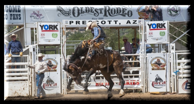
As I wake up this morning in Flagstaff, I think about the day’s ride. Three hundred ten miles, through hot, lonely, windswept, godforsaken deserts – hours and hours of nothingness on our way to the Rocky Mountains, one of the most spectacularly beautiful places on Earth.
Contemplating the ride ahead, I recall my first thoughts about a bucket list motorcycle trip. It began in Homer, Alaska, in July 2011.
Homer is known as the halibut fishing capital of the world, and the home of Tom Bodett – famous for his Motel 6 commercials: “We’ll leave the light on for you.”
It’s also called the “end of the road,” since Homer is where Alaska’s Route 1 comes to an abrupt halt, 538 miles from its beginning in Tok.
This small city on the Kenai Peninsula is where my idea for a bucket list ride began to crystallize six years ago. Walking through town, on a cold, rainy morning, we met three men and a woman on BMW motorcycles with Quebec (Canada) license plates. All were in their 60s, wearing soaked raingear and grinning ear to ear.
Sarah and I stopped to chat with them, curious if they had their bikes shipped out west, or how they otherwise arrived in Homer. They were French-speaking native Quebecois, from Quebec City, about 165 miles northeast of Montreal, and 4,500 miles from Homer.
Their English was very broken, and yet, we had no difficulty understanding why they were in Homer.
Turns out several months earlier, one of the men in the group was diagnosed with some sort of end-stage cancer. Rather than just giving up on life, he decided to live. Really live.
He convinced his friends to join him in a ride from Quebec to the end of the earth, which they considered to be the northern reaches of Alaska. They had been on the road for something like six weeks, having the time of their lives, seemingly cheating death along the way. Hearing their story was an inspiration.
At the time, I had been on several week-long Harley rides, including two trips to Lake Tahoe and back. I thought I was pretty adventurous, but their ride made me realize what a slacker I really was. Hearing about their journey gave me the idea to, one day, ride to Alaska, or in Alaska, or somewhere quite far away.
I often wonder what happened to them.
Was there a miracle cure? Did they reach the Arctic Circle?
***
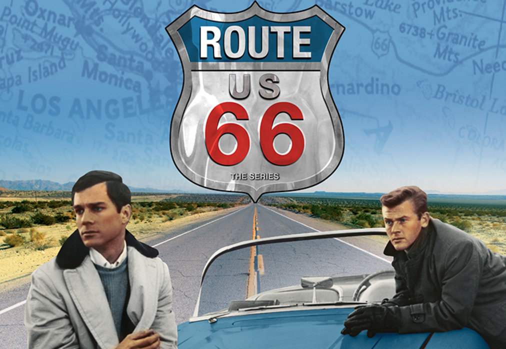
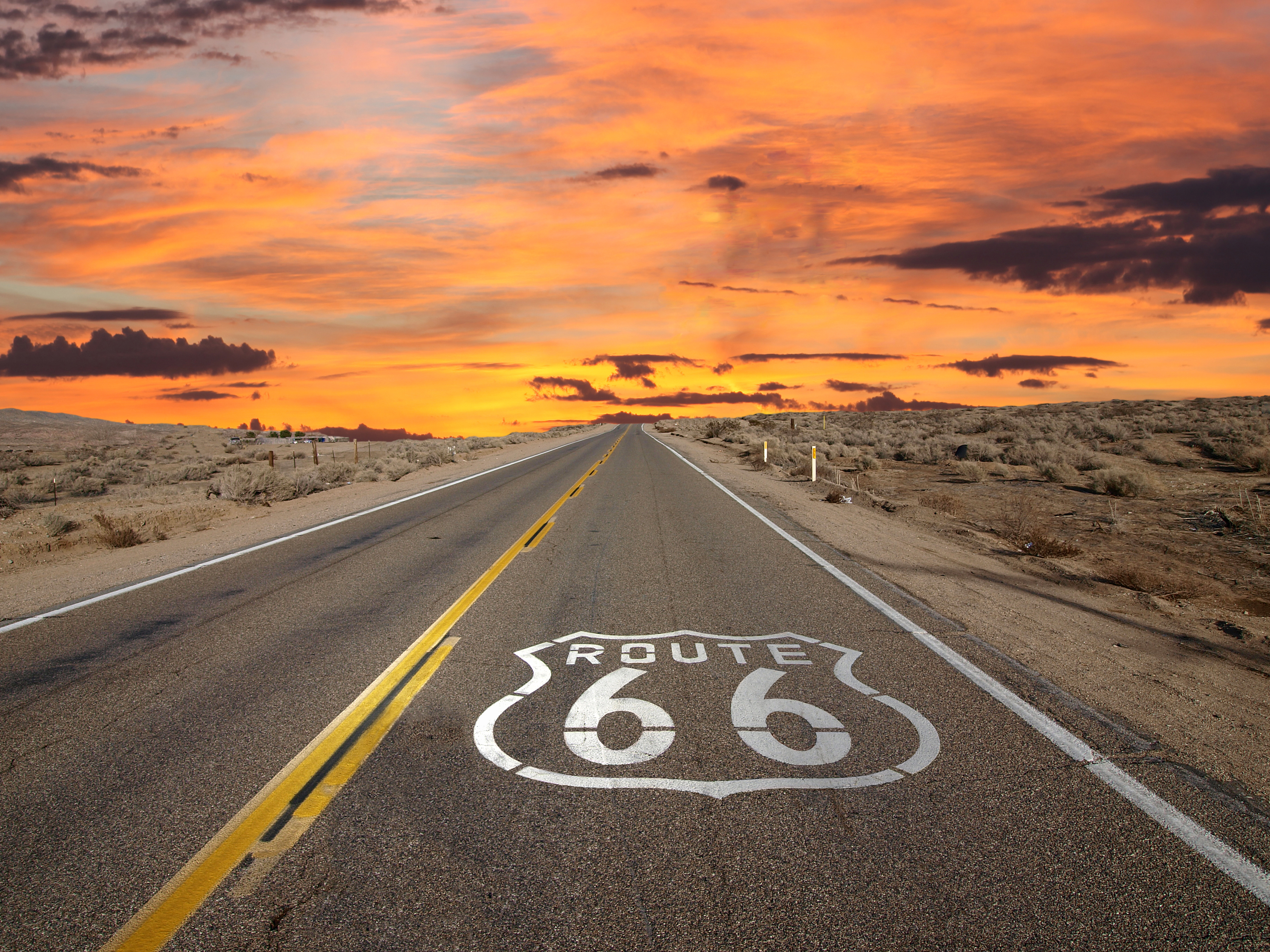
We leave Flagstaff, and the few remaining traces of Route 66 soon fade into oblivion. It’s a sad end to a great highway.
In the absence of Route 66, we’re on US Highway 89 for the next 48 miles. Highway 89 is a major north-south route, stretching for more than 1,250 miles. The southern section begins in Flagstaff and runs nearly 850 miles to the southern entrance of Yellowstone National Park. The northern section runs from the northern entrance of Yellowstone National Park to the US-Canadian border in Montana.
Highway 89 is sometimes called the National Park Highway, as it links seven National Parks across the Mountain West. Sunset magazine calls it the greatest road on earth.
Because we’ll visit so many National Parks and National Monuments on this trip, you may wonder, what’s the difference? It can be quite confusing.
Best I can tell, a National Monument is designated by the sole authority of the President of the United States, using powers conveyed by the Antiquities Act of 1906. The President can set aside for protection “historic landmarks, historic and prehistoric structures, and other objects of historic or scientific interest” by the stroke of his or her pen.
A National Park is designated by an act of Congress. National Parks predominantly feature large expanses of America’s most unique and treasured lands.
The primary difference between National Parks and National Monuments is the reason for preserving the land. National Parks are protected due to their scenic, inspirational, education and recreational value. National Monuments have objects of historical, cultural and/or scientific interest.
That’s pretty much it.
There’s very, very little difference, other than the prestige conferred upon a Park, and the economic benefit to nearby communities because of the significantly higher number of visitors at National Parks, compared to National Monuments.
Still confused? Here, here, here and here are some explanations you may find more enlightening. You choose.
***
Fifteen miles north of Flagstaff, we pass Sunset Crater Volcano National Monument. The Monument was created in 1930 to protect Sunset Crater, the dominant peak in the area.
In 1887, John Wesley Powell was the first modern-day explorer of the area. He named the mountain Sunset Peak because of its distinctive red-brown patches formed by oxidized iron and sulphur. Powell is best known for making the first passage through the Grand Canyon on the Colorado River.
As we pass Sunset Crater, off to the distance to the west is Humphreys Peak. At 12,637 feet, it’s the highest point in Arizona. Humphreys Peak is the highest of a group of extinct volcanic peaks known as the San Francisco Peaks.
A few more miles north, and we ride past Wupatki National Monument, rich in Native American ruins. Here, ancient pueblos (villages) dot red rock outcroppings across miles of prairie. Wupatki is one of several sites preserving pueblos of ancient peoples. The pueblos all have a distinctive red color and were made from thin, flat blocks of the local Moenkopi sandstone.
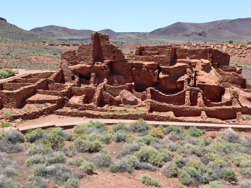
All of the dwellings were built by the Anasazi and Sinagua Indians during the 12th and 13th centuries. You reach Wupatki National Monument on the same loop road that passes Sunset Crater Volcano National Monument.
***
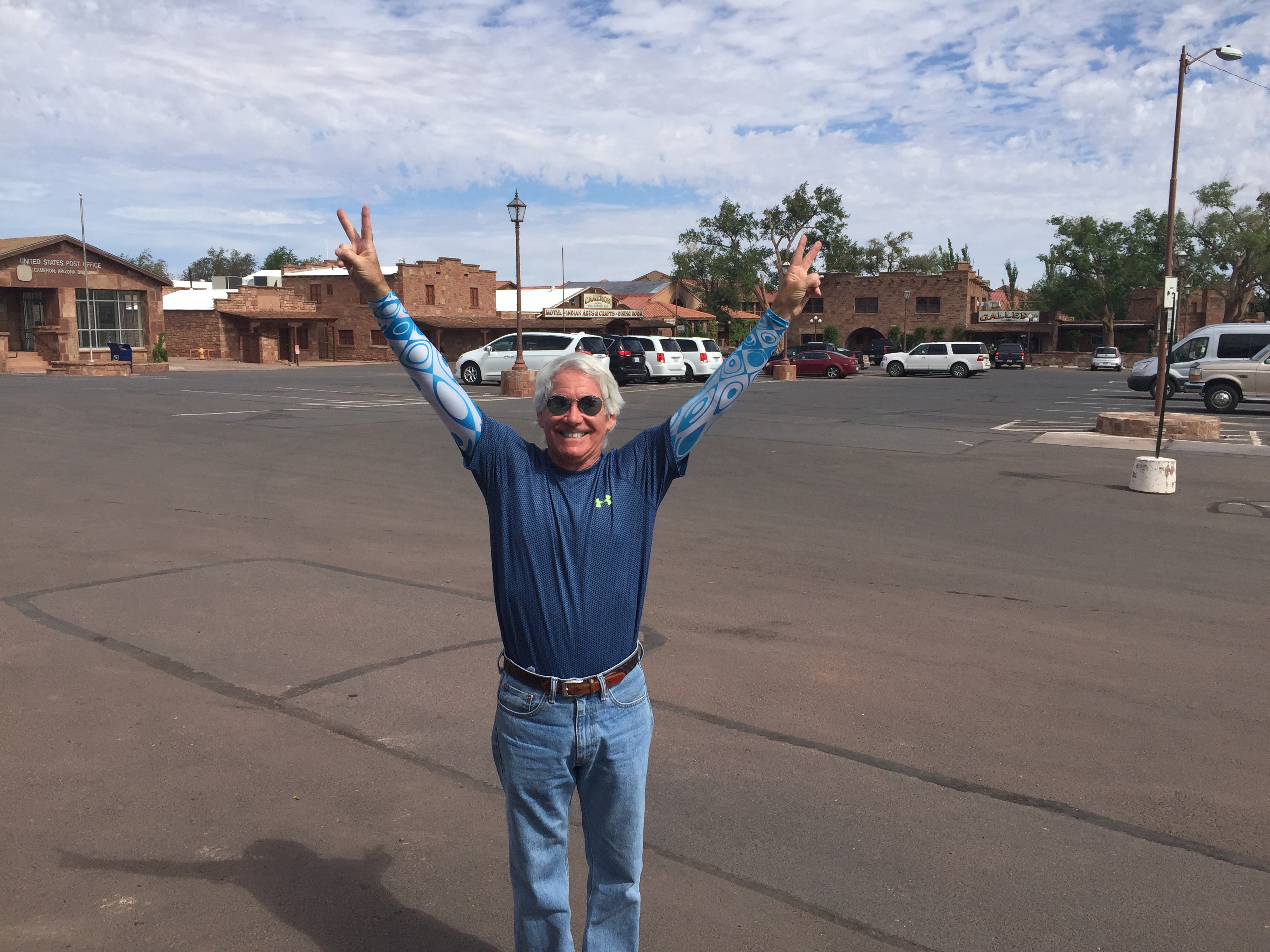
Fifty miles after leaving Flagstaff, we arrive in Cameron, where you’ll find a gas station, restaurants, crafts stalls, and other tourist services for north-south traffic on Highway 89. In our case, the traffic (us) is northbound. Cameron, which sits at 4,200 feet, calls itself a trading post.
After a short hydration break, we continue north, then turn off on US Highway 160 toward Kayenta, 98 miles away. Highway 160 runs through the Navajo Nation, and is often called the Navajo Trail.
About ten miles before Kayenta is the turnoff from Highway 160 to Navajo National Monument, nine miles north on Arizona Highway 564. Navajo National Monument was created to preserve three cliff dwellings of the Ancestral Puebloan people. These villages date from 1250 to 1300. Unlike many US Parks where a drive-by can soak in the view-worthy stuff, it’s a three-to-five-mile hike to the cliff dwellings – a tough slog on a late July day with temperatures well over 100 degrees.
So, we press on to Kayenta, the only municipal-style government within the Navajo Nation. Kayenta has three motels, three gas stations, a handful of fast-food restaurants, an Ace Hardware, and a Navajo Arts and Crafts store.
The Navajo Nation is huge, covering 27,425 square miles, much of it in northeastern Arizona, where we’ve been the past few hours. It’s the largest land area retained by a US Native American tribe, slightly larger than West Virginia.
Still on US Highway 160, 80 miles east of Kayenta, we briefly cross into New Mexico, then turn northwest on New Mexico Highway 597 before the road abruptly ends. The half-mile long highway is the second shortest in New Mexico.
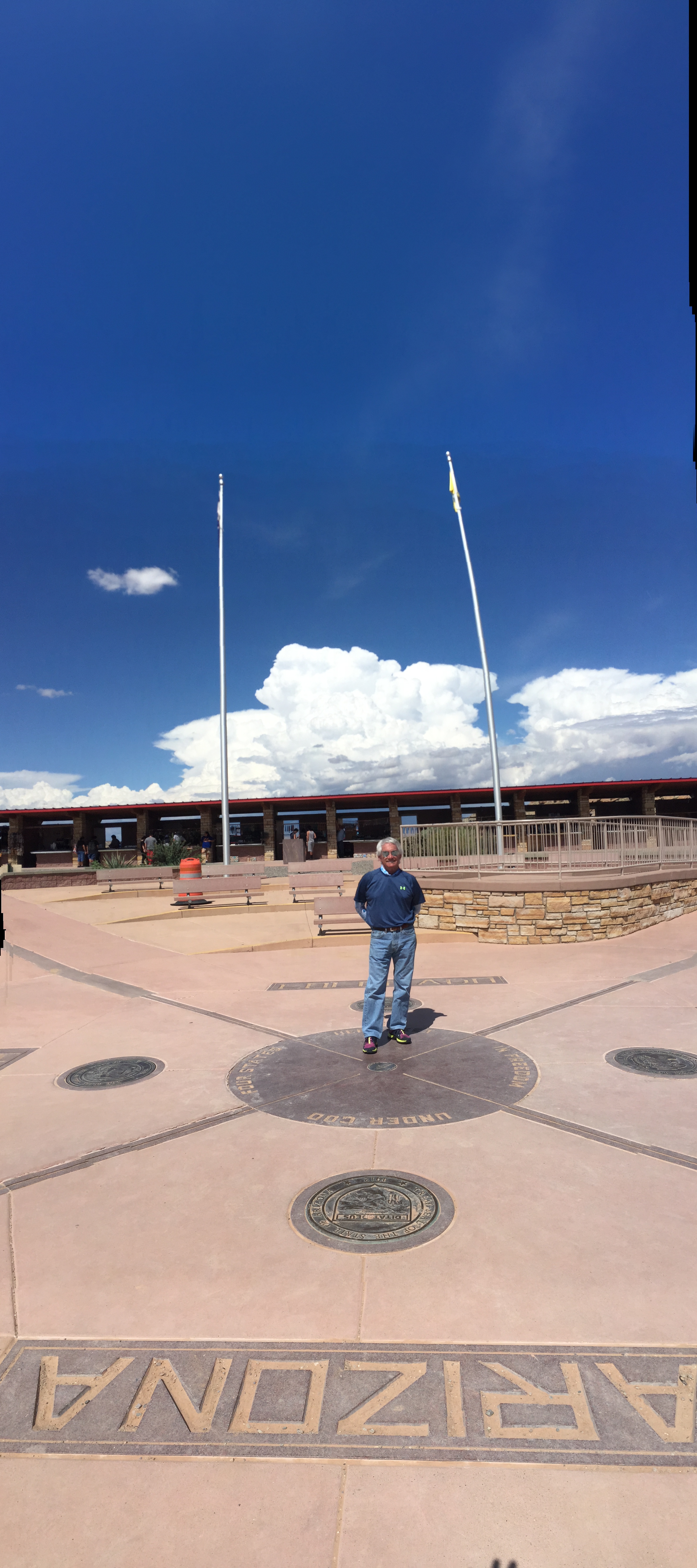
It ends in a good place though, at the Four Corners Monument, marking the point where Arizona, Colorado, New Mexico and Utah meet – the third, fourth and fifth states on this trip. The monument is the only point in the US shared by four states, which is why this area is called the Four Corners region. Doh!
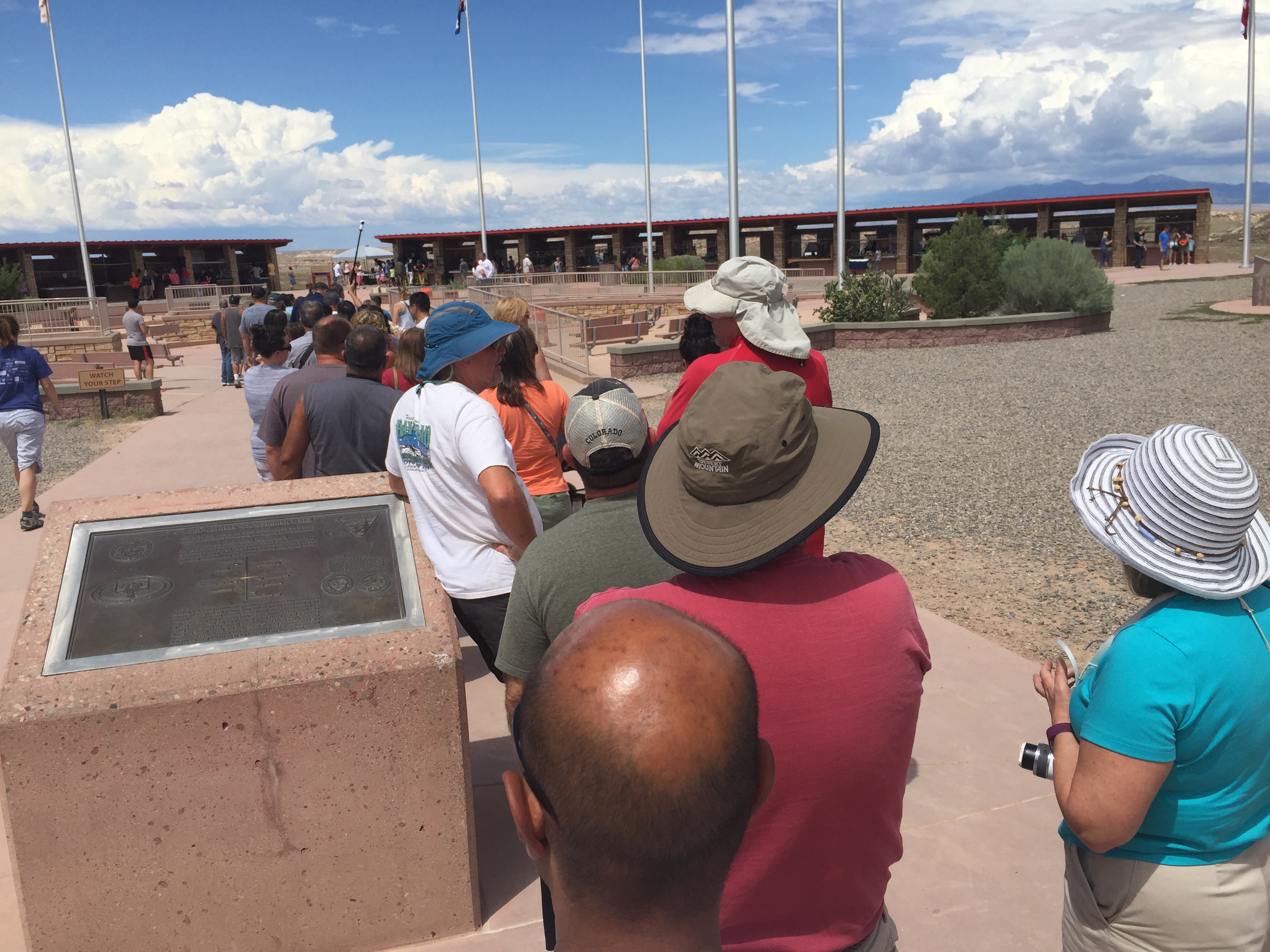
The Four Corners Monument, which attracts about 250,000 visitors each year, is maintained as a tourist attraction by the Navajo Nation. For a $5 admission fee, you can snap cheesy photos that’ll last a lifetime. Honestly, it’s little more than a photo op.
Hard to believe, but some people actually come here to cross it off their bucket lists. After taking photos and contorting your body to be in four states at once, you’ve done about all there is to do at Four Corners.
As the only “quadripoint” in the US, it’s almost an accident of political geography. But is it in the correct place? Some cynics claim the Four Corners Monument is in the wrong spot.
And, this defense of the location, from the National Geodetic Survey.
You be the judge.
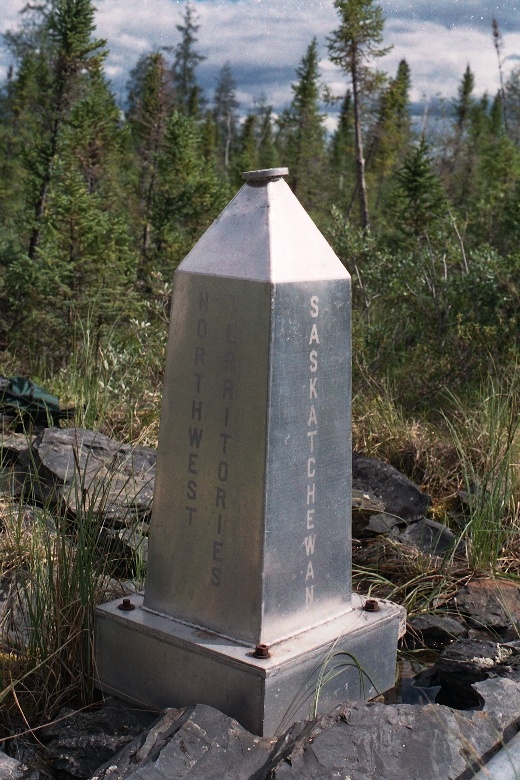
Interestingly, Canada also has a four corners point, too. It’s where the provinces of Manitoba, Saskatchewan, the Northwest Territories and Nunavut Territories meet.
There’s a three-foot high aluminum obelisk marking this extremely remote location. It’s hundreds of miles from any road or railway. Next time you’re there, send me a selfie.
There’s only one international quadripoint. It’s in the middle of the Zambezi River in southern Africa, where Namibia, Zambia, Zimbabwe, and Botswana all touch.
Eagerly awaiting your photographs.
***
After snapping our own photos at the Four Corners Monument in the US, we saddle up and continue east on US Highway 160. We enter Colorado, and cross the San Juan River. In a few miles, we reach Chimney Rock National Monument, an archaeological site that’s been on the National Register of Historic Places since 1970. Former President Obama made it a National Monument on September 21, 2012.
The rock itself is over 535 million years old, and offers a 75-mile panorama of the local area.
At Chimney Rock is the intersection of US Highways 160 and 491. We turn north on 491, which is also a continuation of Highway 160. The numbering is a bit confusing, but there aren’t many roads out here, so it’s pretty obvious we’re on the right track toward our destination: Durango.
We are now on the Ute Mountain Indian Reservation, home to the Ute Mountain tribe. The Ute Mountain Tribe is one of three federally recognized tribes of the Ute Nation. As followers of this blog may recall, I’m a Ute, a proud graduate of the University of Utah (BS, Journalism, 1973). The name Utah is derived from the name of the Ute tribe.
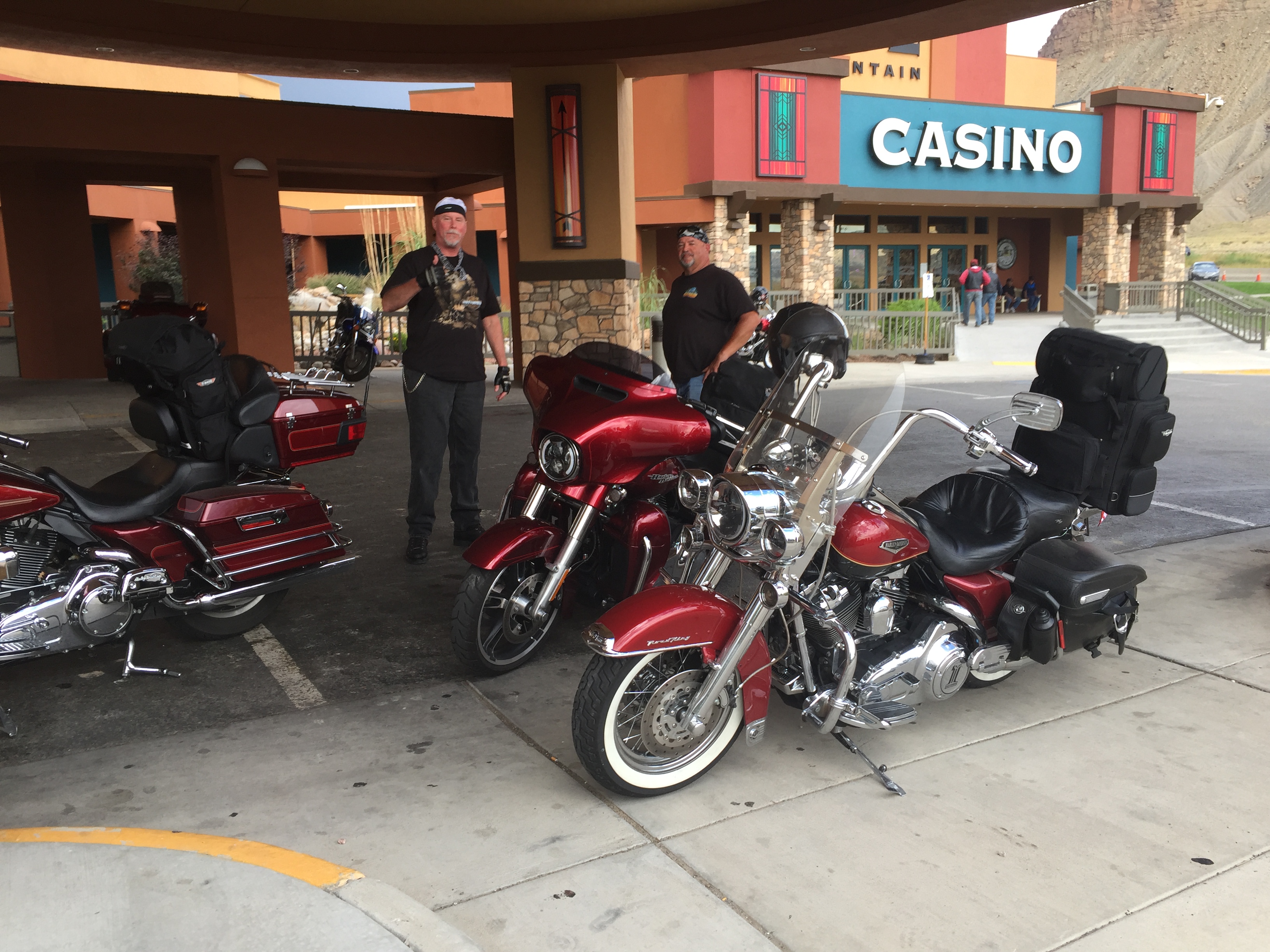
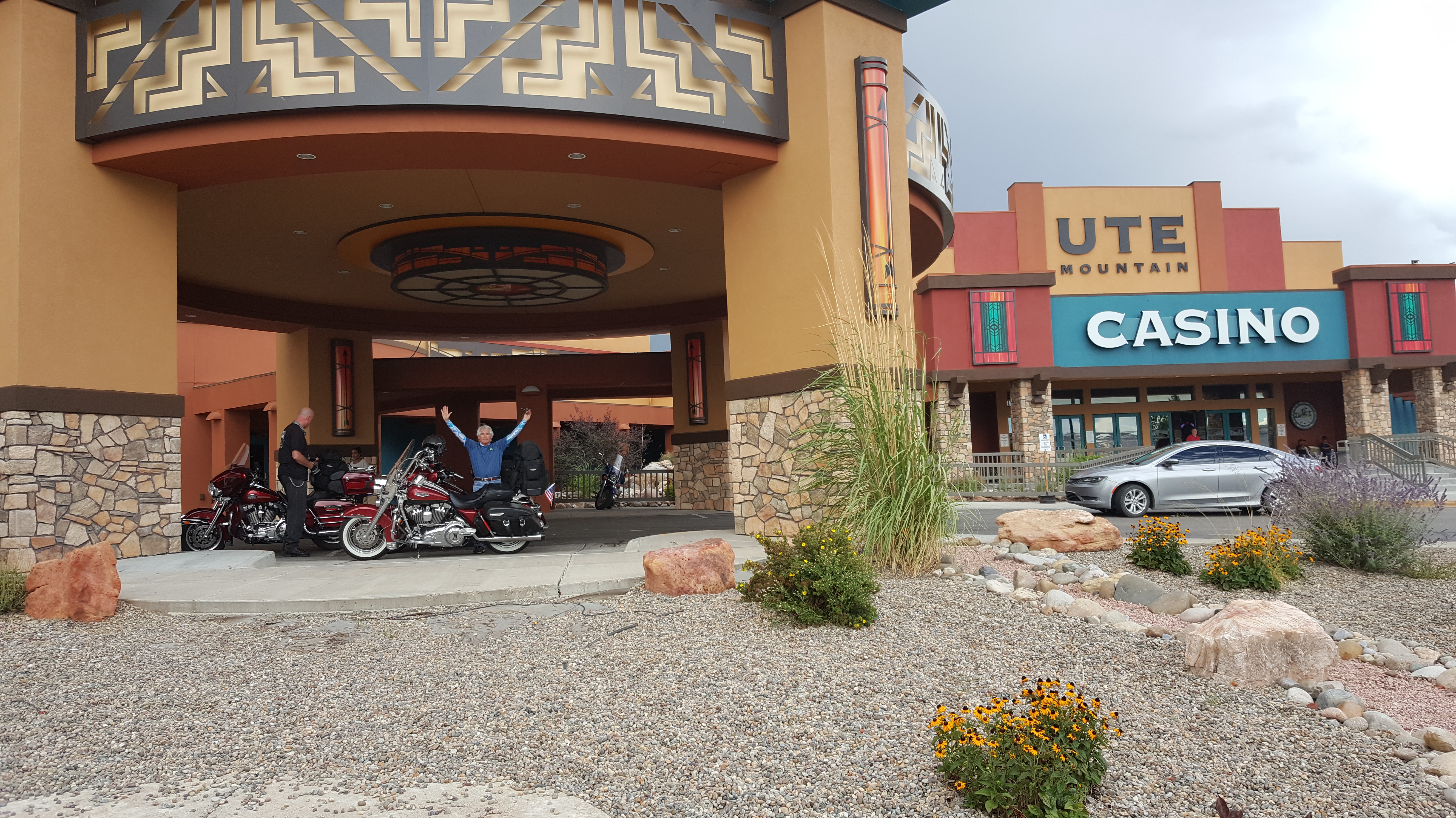
To our left along the roadway is the Ute Mountain Casino, motto: “This is Your Lucky Day!” Among the things to do here, if you can believe their marketing materials – Stay, Play, Eat Meet, Park and Shop. We’re now about 11 miles south of Cortez, Colorado.
Not much in Cortez, but it does have a unique claim to fame: a U-2 reconnaissance airplane made an emergency nighttime forced landing here in 1959 after an engine flameout at 70,000 feet. The airport was the only one in the area with a runway whose lights were on overnight.
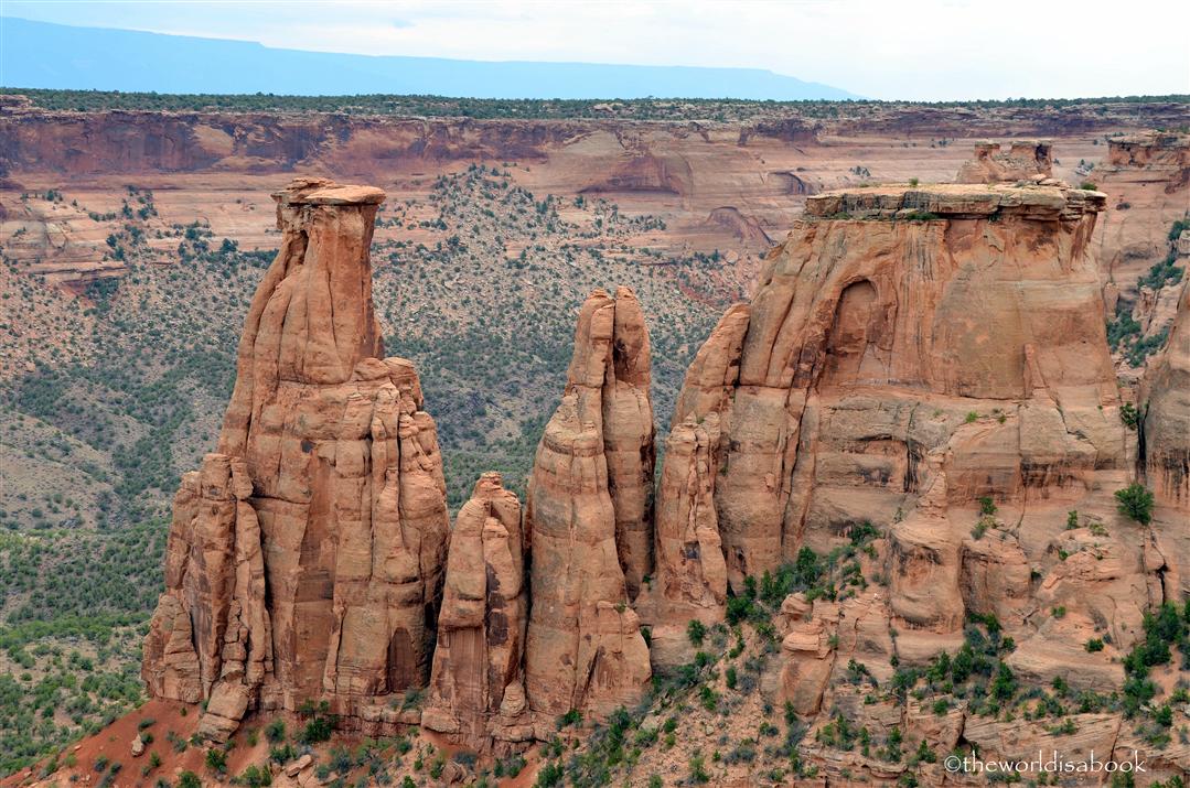
Just west of Cortez is the Canyons of the Ancients National Monument, another monument protecting archaeologically significant areas.
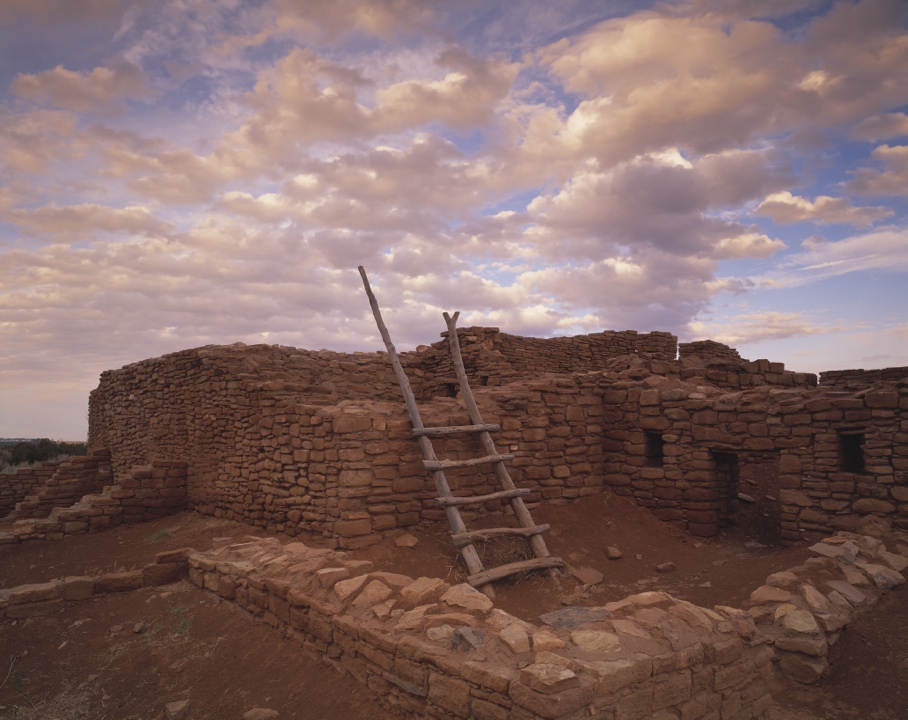
The monument covers 176,000 acres. It’s part of the National Landscape Conservation System – consisting of 32 million acres set aside by the Bureau of Land Management to conserve, protect and restore nationally significant landscapes. The Canyons of the Ancients has more than 6,000 archaeological sites representing Ancestral Puebloan and other Native American cultures.
On the west end of the Canyons of the Ancients National Monument is Hovenweep National Monument, which includes six groups of Ancestral Puebloan villages. Here, there’s evidence of hunter-gatherers as far back as 8,000 B.C. In 900 A.D., it’s believed that more than 2,500 people lived here.
The International Dark-Sky Association designated Hovenweep an International Dark Sky Park in 2014, making it a good place to stargaze – because there’s not much out here to get between you and the stars.
Hovenweep means “deserted valley” in the Ute language.
As you may have noticed, Arizona is a hotbed of National Monuments, primarily focused on archaeological preservation. You could spend weeks here just visiting the sites.
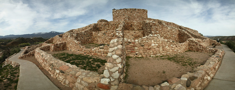
But we’ve been on the road for nearly 300 miles already today, so we push on, riding east on Highway 160. We pass our last National Park of the day, Mesa Verde National Park. It, too, protects some of the best-preserved Ancestral Puebloan archaeological sites in the US, including 5,000 sites and 600 cliff dwellings. One of them, the Cliff Palace, is believed to be the largest cliff dwelling in North America, with more than 150 individual rooms and 20 kivas – rooms for religious rituals.
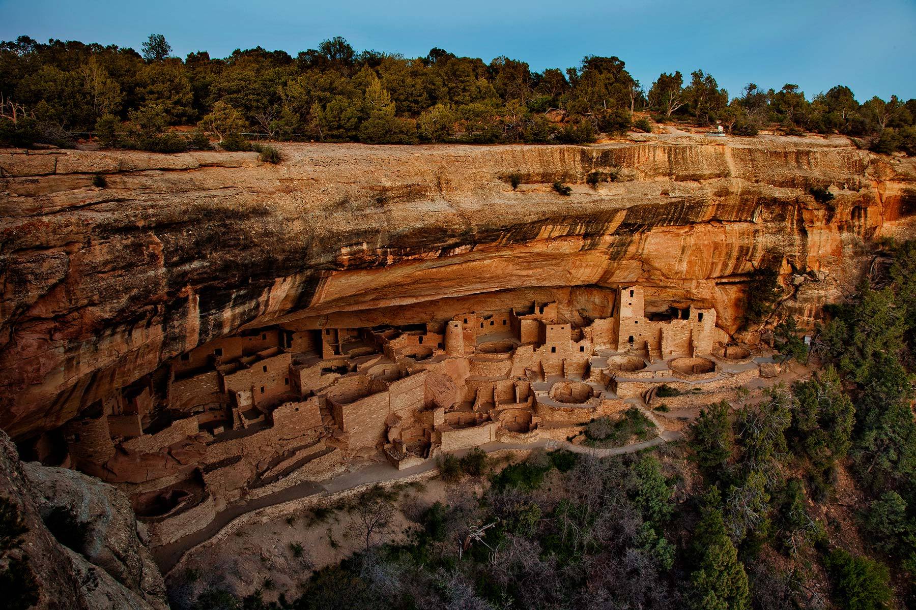
The Ancestral Pueblo people made it their home for more than 700 years, from 600 to 1300 A.D.
Mesa Verde National Park has been a World Heritage Site since 1978, recognized for its exceptional archaeological relevance.
Continuing east on Highway 160, we pass through the towns of Mancos and Hesperus, and before you can say Ancestral Puebloans again, we’re in Durango, today’s destination.
Durango is named after Durango, Mexico – which was named after Durango, Spain. All three Durangos are sister cities. The word Durango originates from the Basque word Urango, meaning “water town.” Durango sits on the Animas River at an elevation of 6,500 feet.
The city was founded in 1879 by the Denver & Rio Grande Railway. The railroad arrived in 1881, constructing a narrow gauge line to haul passengers and freight to Silverton – and to transport silver and gold ore from the San Juan Mountains. The historic train has been in continuous operation since 1882.
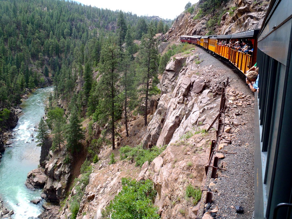
For $85, you can board in Durango for the 3 ½ hour, 45-mile ride to Silverton. There, you’ll relax for 30 minutes before the return trip begins. The train’s top speed is 18 miles an hour.
Durango is also home to the SnowDown Festival, a historic downtown district, and Fort Lewis College. My good friend, Curtis Smith, originally from Soldotna, Alaska, once attended Fort Lewis College, where he was a walk-on player on the golf team. Curtis, originally part of the annual Alaska golf invasion to La Quinta, now works for Shell as a PR executive in the Washington DC area.
It’s a beautiful setting for a college, a motorcycle ride, or a movie. Parts of the 1969 film, Butch Cassidy and the Sundance Kid, were filmed north of town along the Animas River, and scenes from the 1991 film City Slickers were shot in Durango. Best line in City Slickers: “We’re lost but we’re making really good time.”
We made pretty good time today, and now it’s time for dinner, a drink, and a good night’s rest before tomorrow’s ride on one of the most famous motorcycle rides in the US.
***
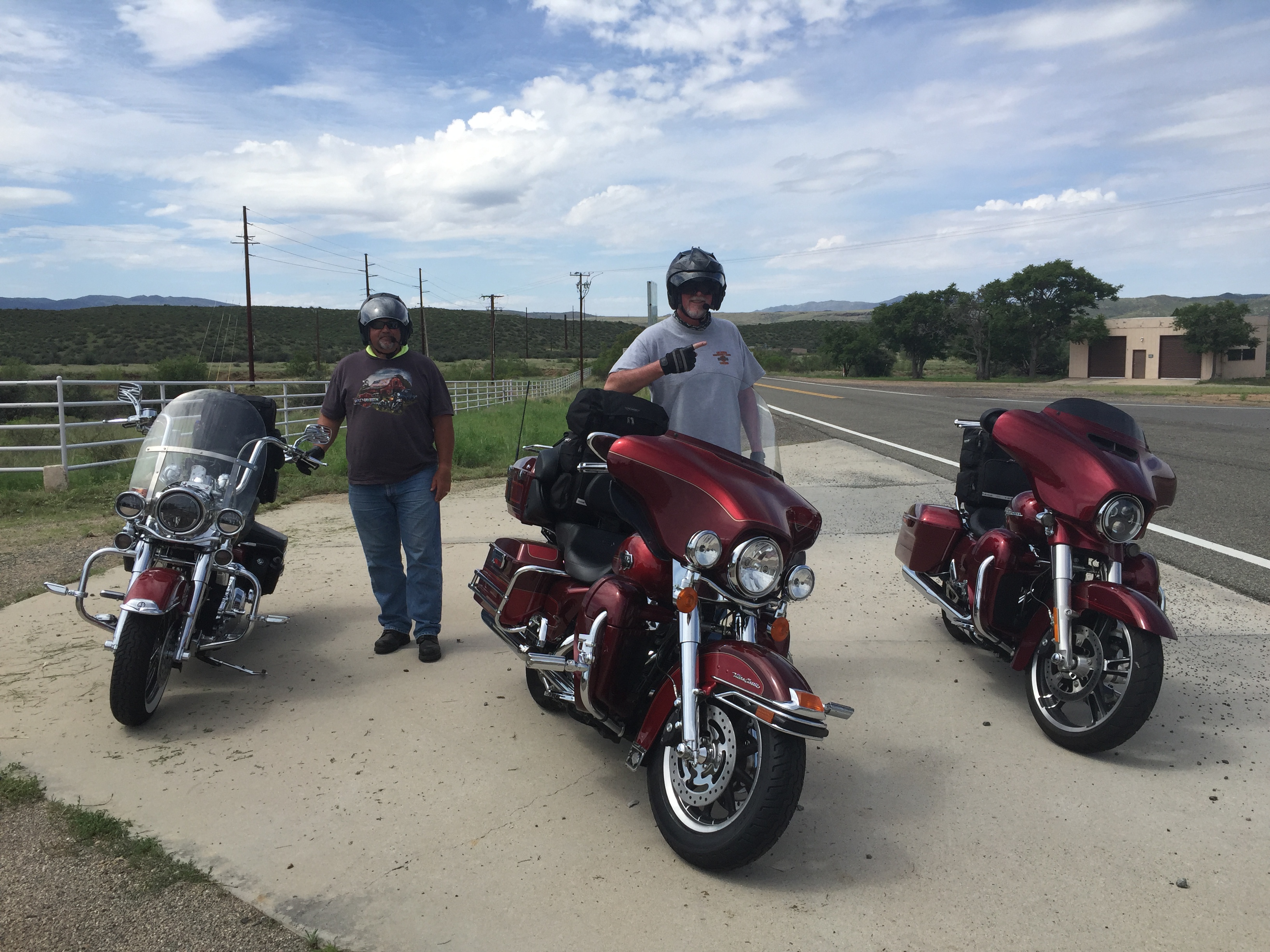
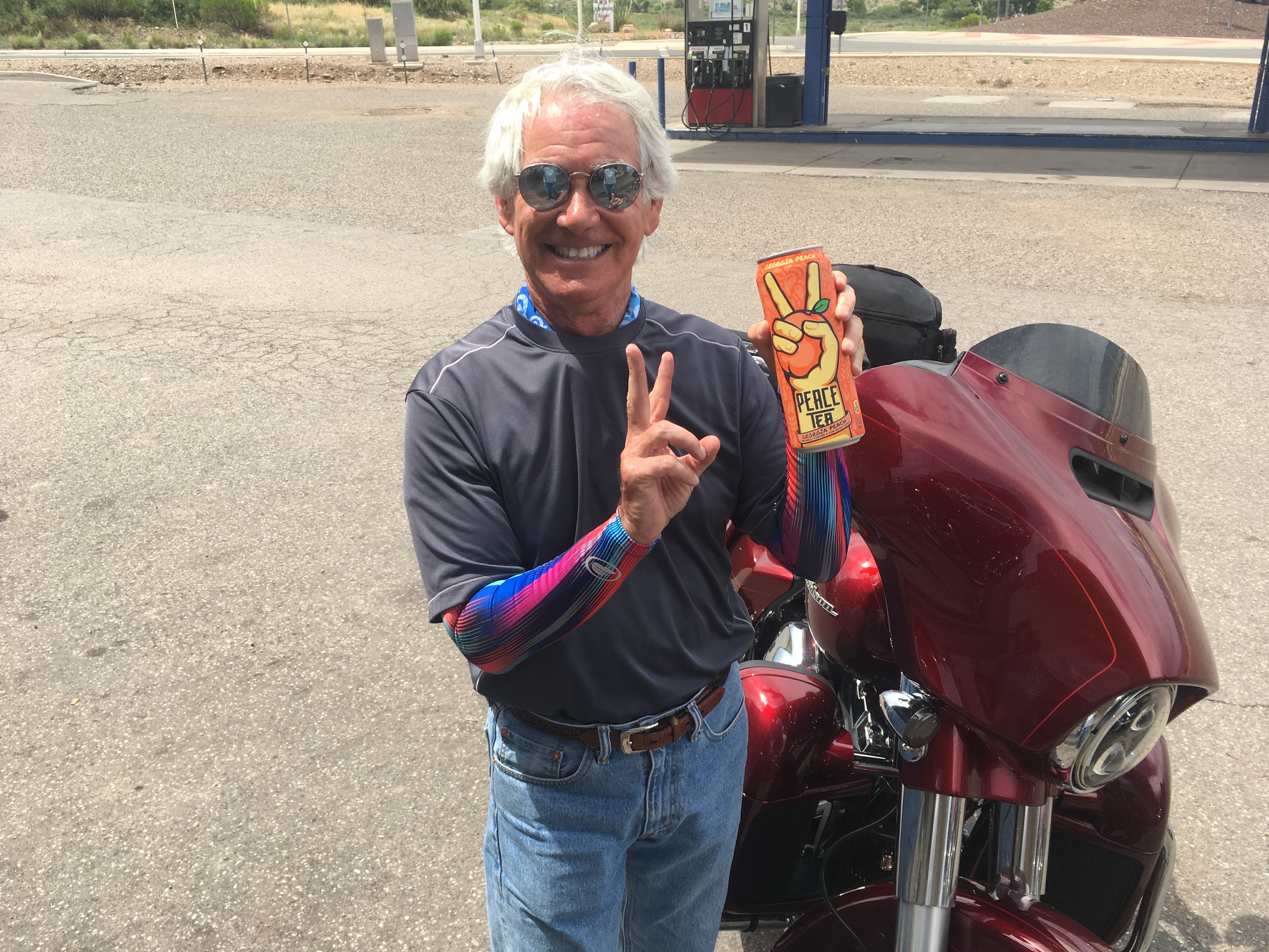
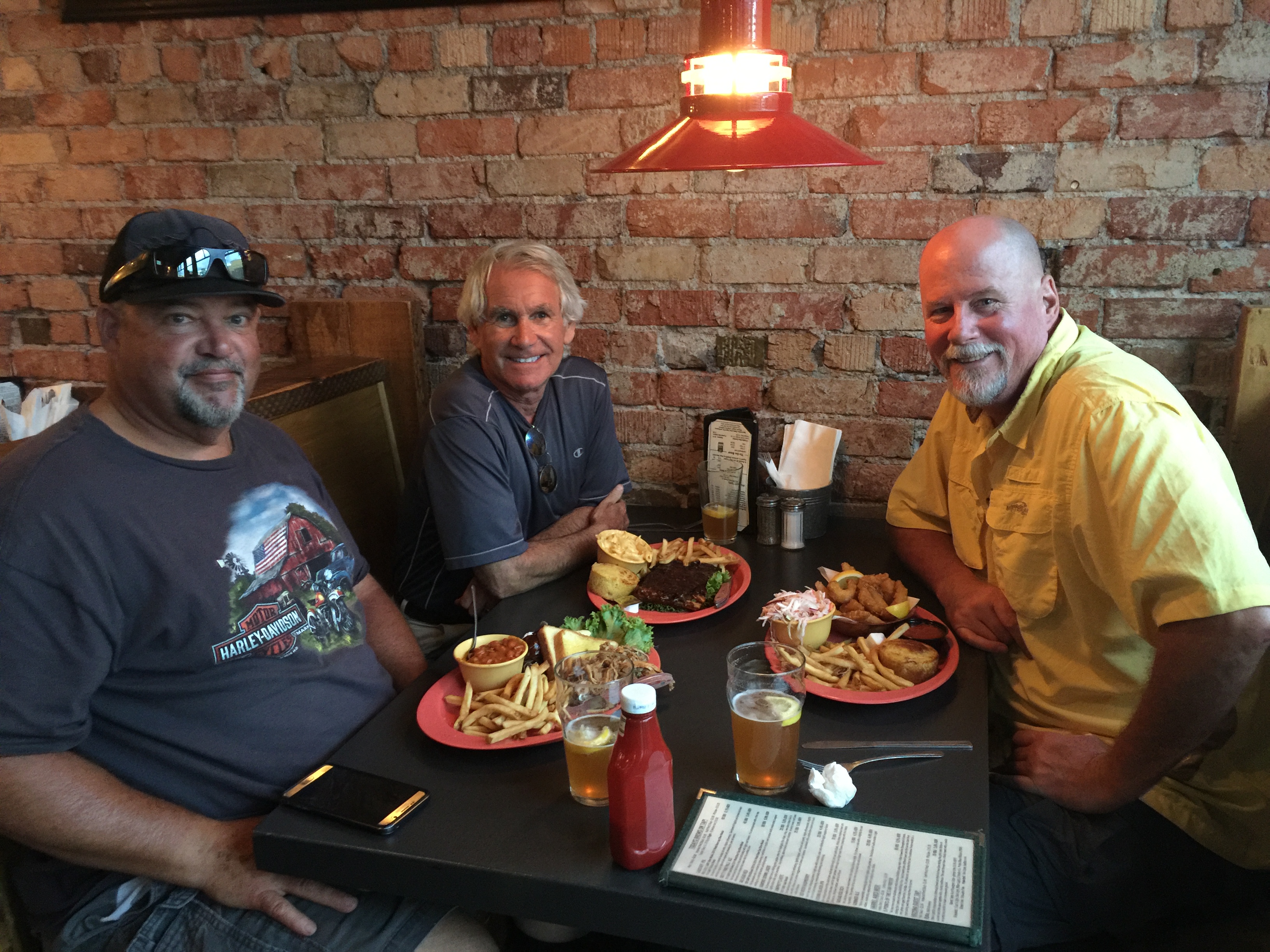
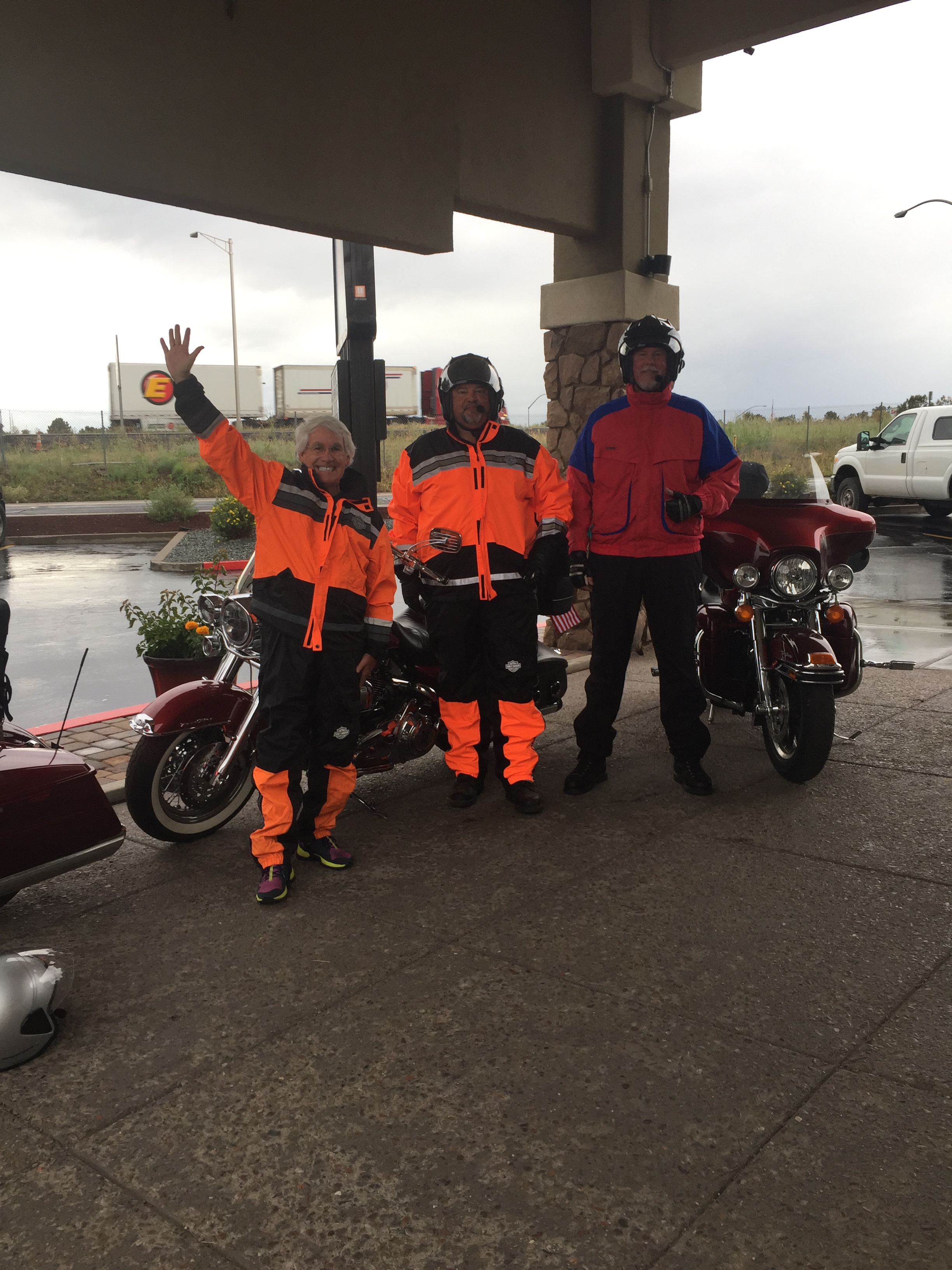
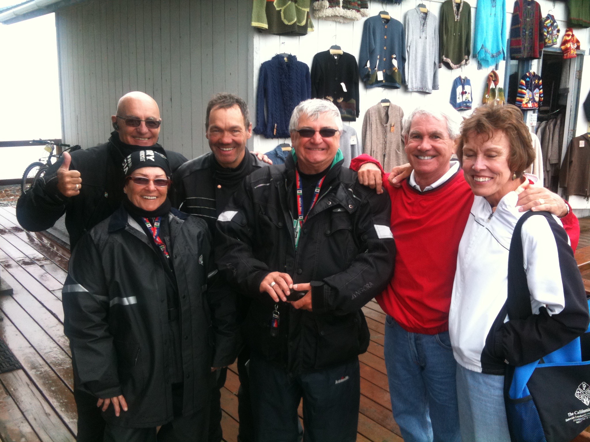
But first, who do we bump into in Durango? My old friend, Randy Suhr. Bumping into old friends before dinner is getting to be a habit.
Followers of this blog will remember that I’ve ridden long-distance twice with Randy: in the Canadian Rockies in 2015, and last year on a tour of Utah’s National Parks. Here’s a little about Randy; if you already know him, feel free to skip ahead a few paragraphs.
Randy: After growing up in Republic, a tiny town 43 miles west of Kettle Falls, Washington., Randy found his way to Eastern Washington University in Cheney, where he received a bachelor’s degree in Radio and TV Management. Randy says his crowning achievement in Cheney was getting high with Arlo Guthrie. Seriously. Following graduation, he was hired by KOMO-TV in Seattle, in the shadow of the Space Needle. There, he worked in the production department and directed nightly newscasts. Randy often sat next to me in the control room and – incredibly – made me look like the genius I clearly wasn’t. Randy left KOMO in the mid-1980s to work at KNBC in Los Angeles, where the proximity to Hollywood allowed him pursue his dream of being a film director. After working on a number of films, Randy’s last 15 years in the entertainment business were spent primarily as a first assistant director on various TV sitcoms, including Everybody Loves Raymond and The New Adventures of Old Christine. Following his retirement in 2014, Randy and his wife, Jo, split their time between Phinney Ridge, near Seattle – and Poulsbo. Randy, who’ll be 64 next week, is riding his Kawasaki Vulcan 900, purchased just in time for this ride.
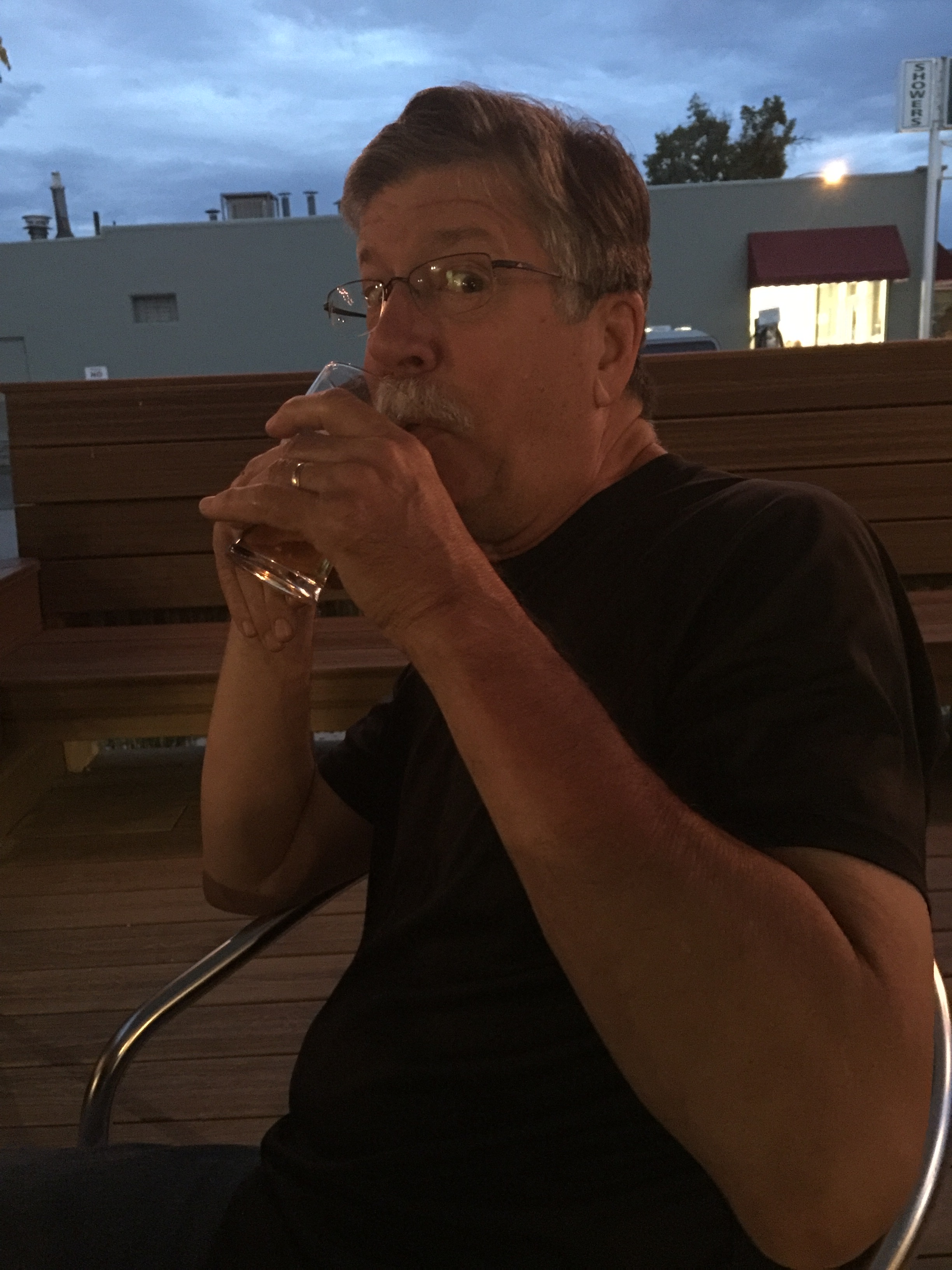
I haven’t seen Randy since we toured Utah’s National Parks last summer. Over dinner, we catch up, eat up, drink up, and talk about the ride ahead. It’s a get acquainted and get re-acquainted dinner. I’ve known Randy since 1983. I’ve known Dave since 2002. Randy and Dave have known each other since last year. And a few minutes ago, Scott and Randy met for the first time.
Team Sturgis is rolling.
***
Day Three Summary: Three hundred ten miles, four states, through desert, past mesas and mountains, archaeological sites, boatloads of national monuments, and all the while, riding with an inspiration that began in Homer, Alaska six years earlier.
Click here to see today’s complete route from Flagstaff to Durango.
We’re on our way to Sturgis!
Vroom, vroom.
***
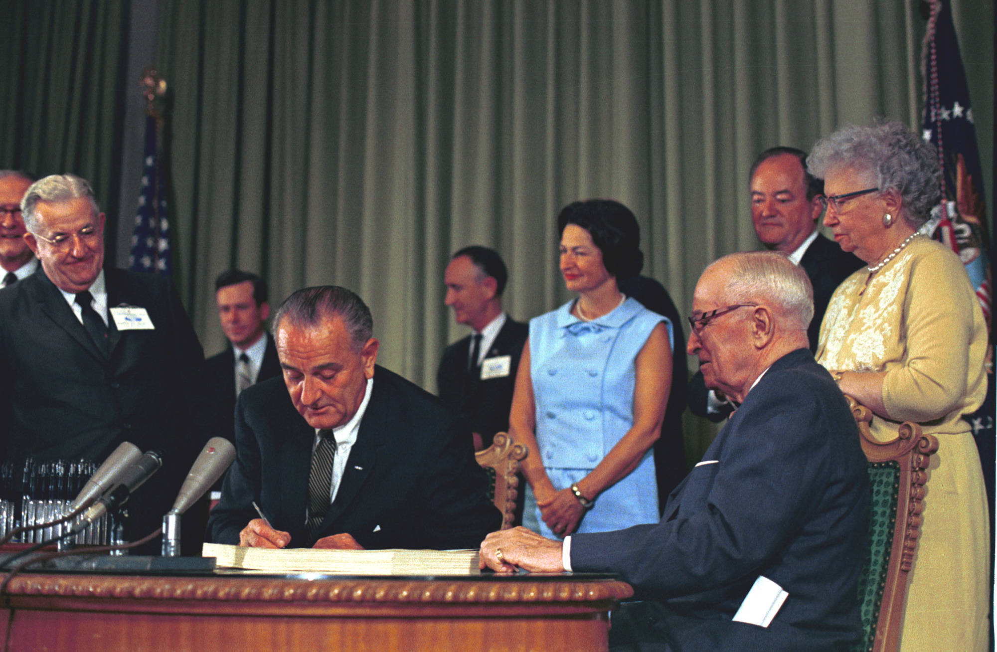
Today in Bucket List History:
Bucket List Goal: “Do Something Great for the Country.”
Goal Achieved: On July 30, 1965, President Lyndon Baines Johnson signs the Medicare bill, which goes into effect in 1966. Today, nearly 54 Americans receive Medicare benefits. (Full disclosure: I love Medicare!)
What’s on your bucket list?