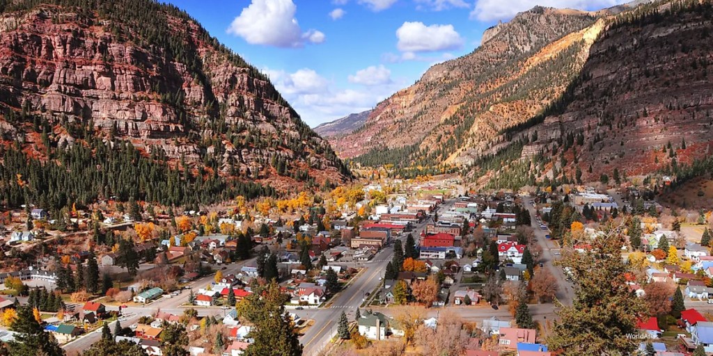
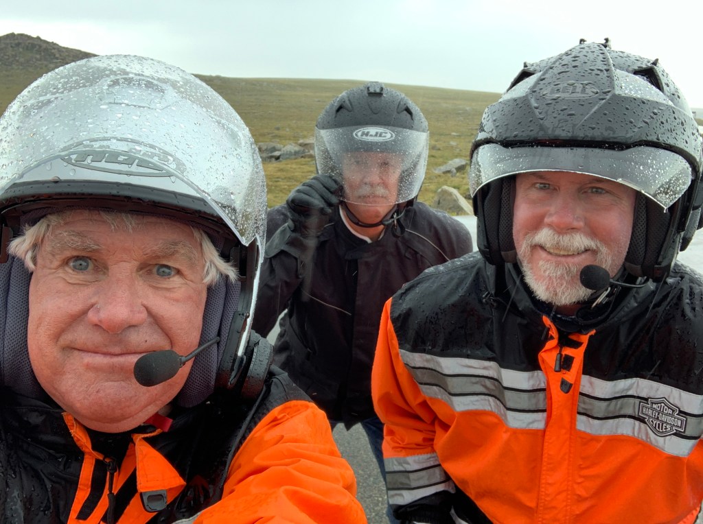
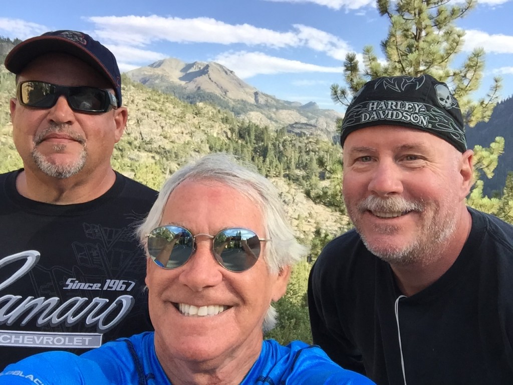
On Day Nine of our trip, today’s ride is the shortest yet. From Billings to Cody, Wyoming — where our day ends, it’s only 174 miles. But along the way, we experience the #2 ride on my Top Ten List — the Beartooth Highway and Chief Joseph Scenic Byway. In Red Lodge, our final Montana stop, we begin the journey up to 10,947-foot Beartooth Pass, described by Charles Kuralt as “the most beautiful drive in America.” Then, we join the Chief Joseph Highway, which takes us through the Absaroka Mountains and into Cody, home of the Buffalo Bill Museum.
Third time I’ve been on the Beartooth Highway. Today was the first time it didn’t rain.
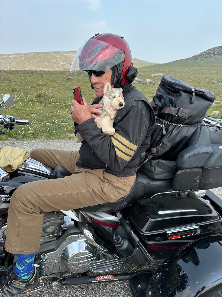
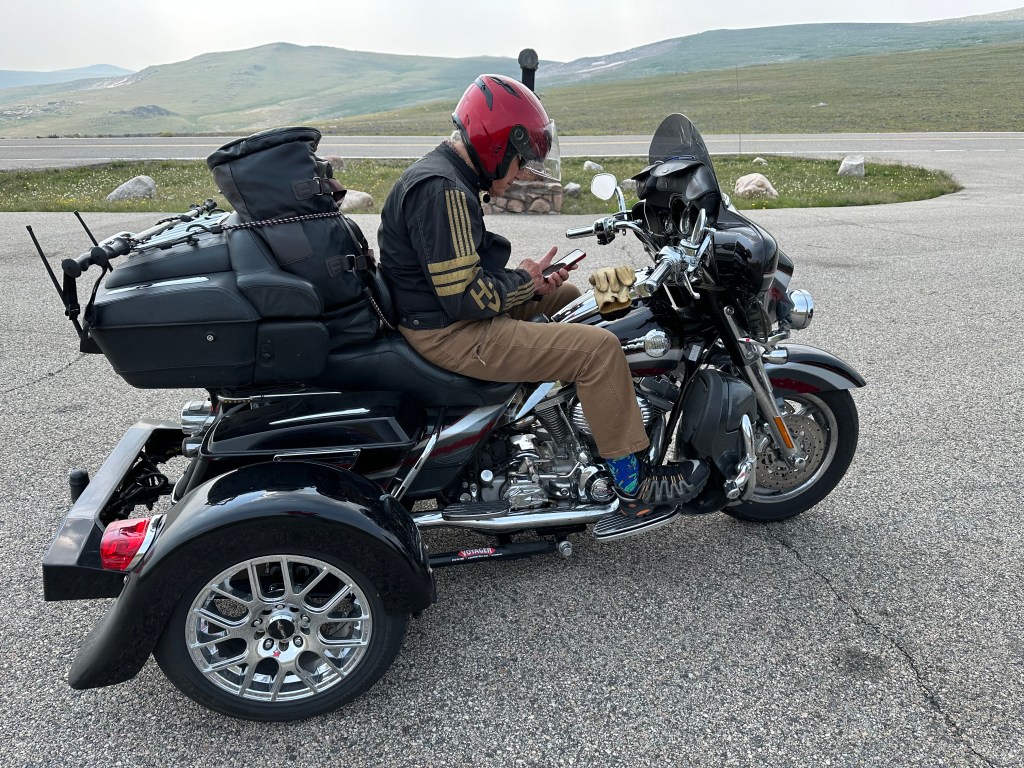
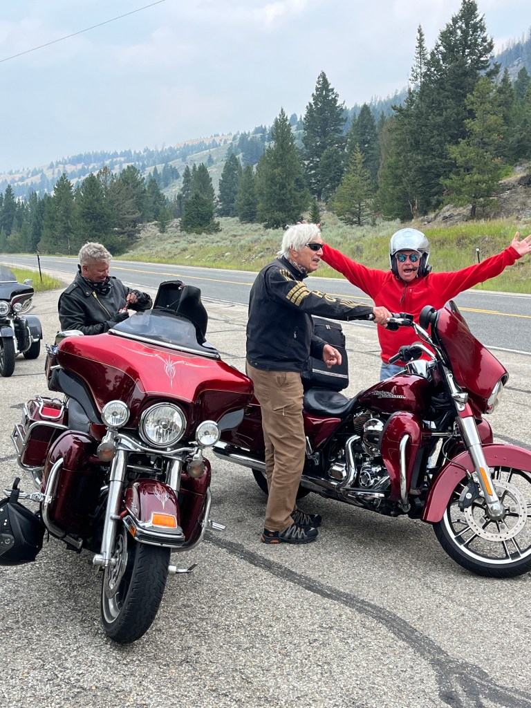
Beartooth Highway is the hardest, most difficult road I’ve ever ridden. On a trike like Clarence’s, it’s a full-on upper body workout. If Clarence wasn’t in shape before, he is now.
WTFO, Mark Mark?
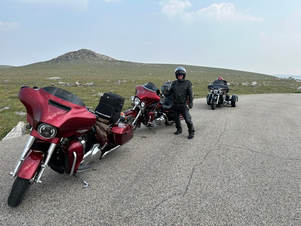
We turned off of the Beartooth Highway onto the Chief Joseph Scenic Highway. The CJSH was awesome, too.
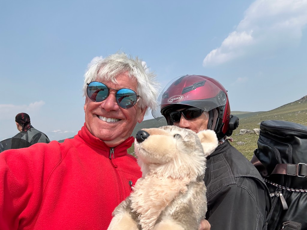
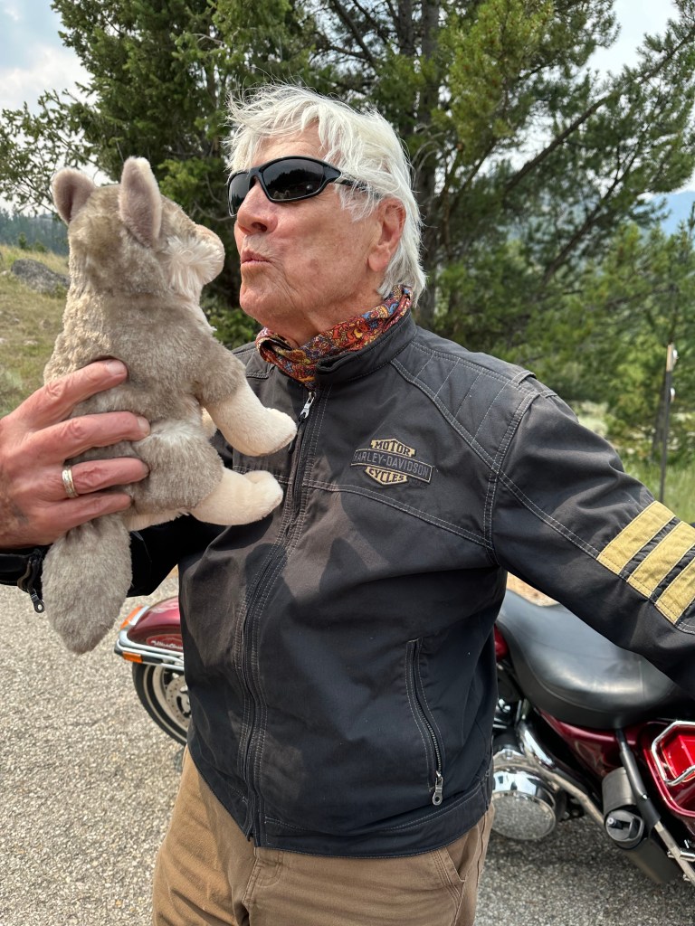
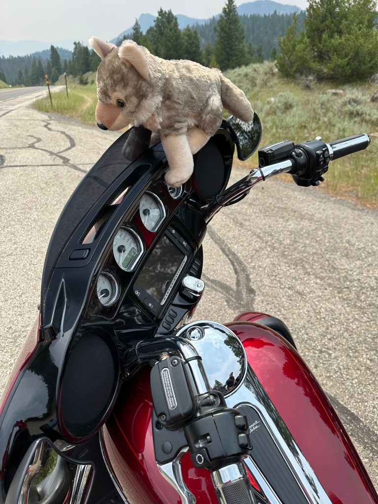
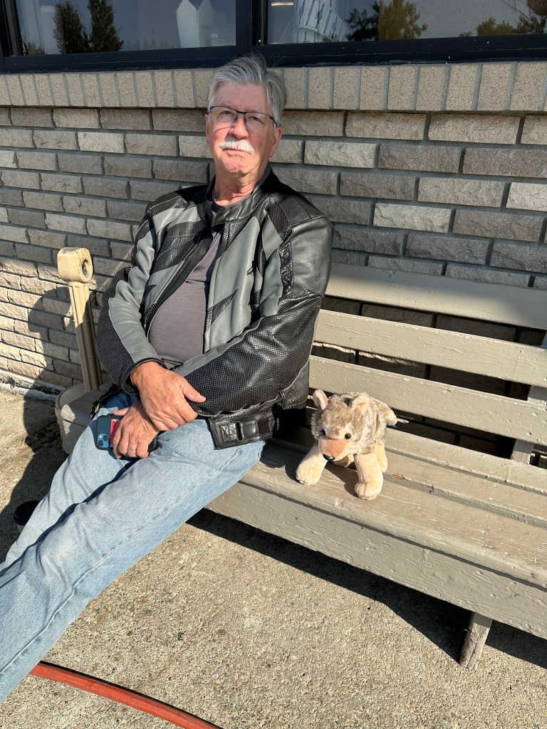
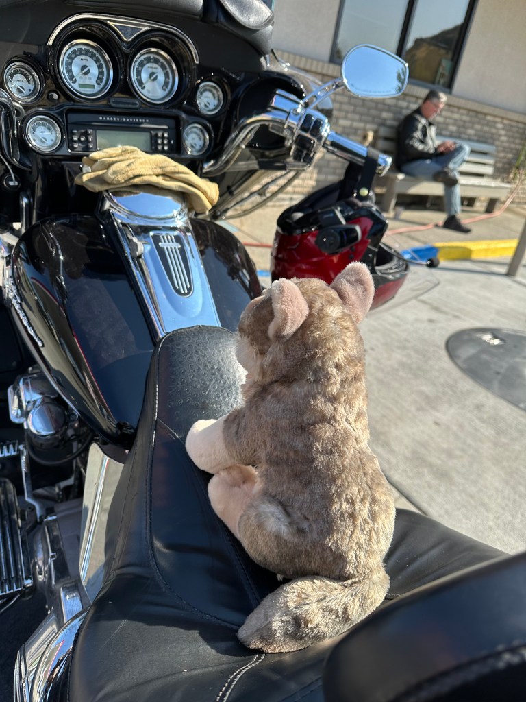
Clarence has become quite fond of Walter Jr.
And yet … Walter Jr feels most at home on my Harley.
While yesterday was this trip’s shortest ride, today will be the longest: 319 miles. On Day Six of this year’s journey, we ride north, within a few miles of Canada, before heading south along Lake Koocanusa and through the Kootenai National Forest. We ride a large counter-clockwise loop, through the towns of Eureka, Plains, and Libby — before ending at tonight’s destination, Polson — located at the south end of Flathead Lake. It’s the largest freshwater lake west of the Mississippi, and a haven for lovers of Montana’s Flathead cherries grown in the area. Fruit stands are everywhere. Cherries, anyone?
In a motel in Riggins, Idaho — after dinner. This is how I write blog posts at the end of a long day on the road. It’s not easy to be verbose with an iPhone. (June 2022)
“I would have written you a short letter, but I didn’t have time, so I wrote you a long one.“
This infamously mis-attributed quote highlights the importance of brevity and editing in writing. I should know. I’m a writer. And I muffed the quote.
The actual quote is, “If I Had More Time, I Would Have Written a Shorter Letter,” and people think it came from Mark Twain. Or Thoreau. Or Churchill. Or Albert Einstein. Even Oscar Wilde.
Nope. It didn’t.
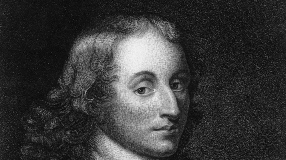
The earliest recorded use of the quote comes from French mathematician and philosopher Blaise Pascal’s work “Lettres Provinciales” in 1657. Written in French, the quote says, “Je n’ai fait celle-ci plus longue que parce que je n’ai pas eu le loisir de la faire plus courte.“
Translated to English, the actual quote is “I have made this longer than usual because I have not had time to make it shorter.”
Blaise Pascal: You want it shorter? Give me more time.
Two hundred years later, in 1857, essayist and philosopher Henry David Thoreau used a variation on the quote in a letter, saying, “Not that the story need be long, but it will take a long while to make it short.”
And, in 1871, writer and humorist Mark Twain included a version of the quote in a letter to a friend. He wrote, “You’ll have to excuse my lengthiness — the reason I dread writing letters is because I am so apt to get to slinging wisdom and forget to let up. Thus, much precious time is lost.”
You get the idea. Good writing is hard.
Why is this even blog-worthy?
Bike is clean, packed, and ready to go.
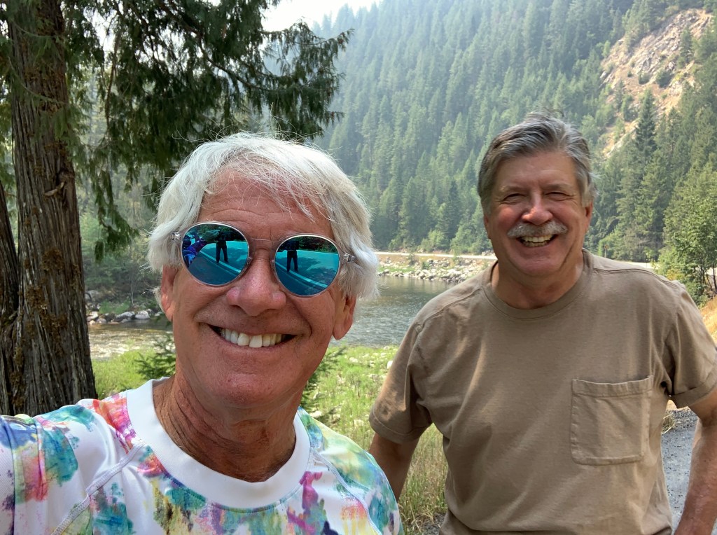
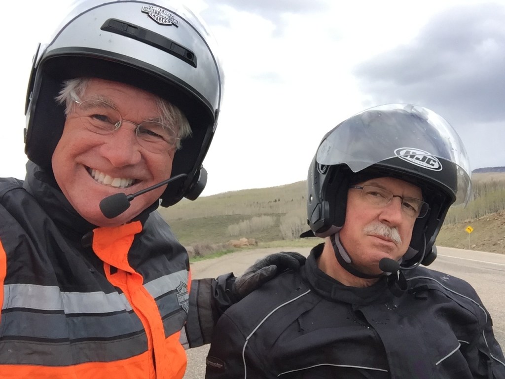
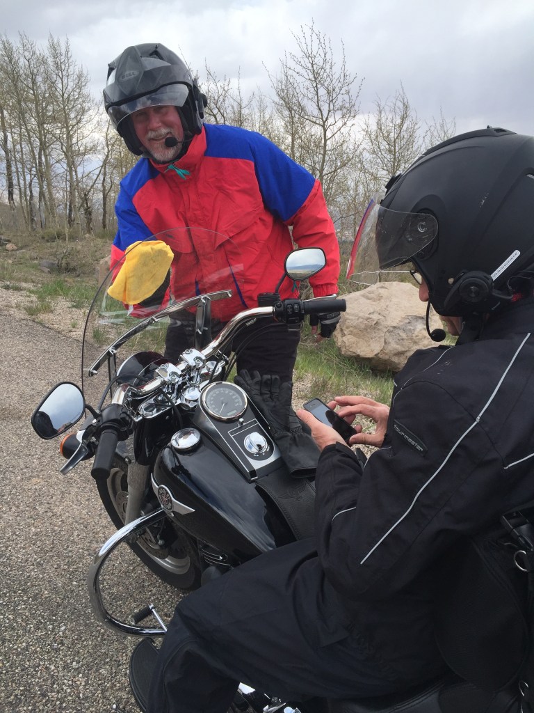
Tomorrow (Sunday), I leave on my annual summer Harley trip. Two friends from the Roaring Fork Valley, Clarence Blackwell and Mark Mark Thompson, will be joining me. (To learn about them, click on “My Posse,” and scroll down til you find their bios.)
This pre-departure missive you’re now reading is my 200th blog post. Two hundred!
That milestone got me to thinking: what kind of blog stats have I amassed since I began this craft in 2009?
So, I did some research, reviewing every post since then. Here’s what I discovered:
I have diarrhea of the keyboard.
Since 2009, I’ve written more than a third of a million words. 340,266 to be exact. Of that total, 31,419 of those words were in photo captions, to support the 2,846 photos I’ve posted.
How do I know all this? Let’s just say I used technology to help with the counting. I assure you the numbers are correct.
(For context, Leo Tolstoy’s War and Peace, which took six years to write, comes in at a whopping 587,287 words. It has 365 chapters, one for every day of the year. So maybe, by comparison, I’m a bit of a keyboard slacker.)
In waltzing down memory lane, and looking at all 199 of my previous posts, I realized a few things. First, it’s been quite a ride. And, as with many things in life, clear favorites emerged. Some rides are better than others. Many border on epic.
I began to notice patterns.
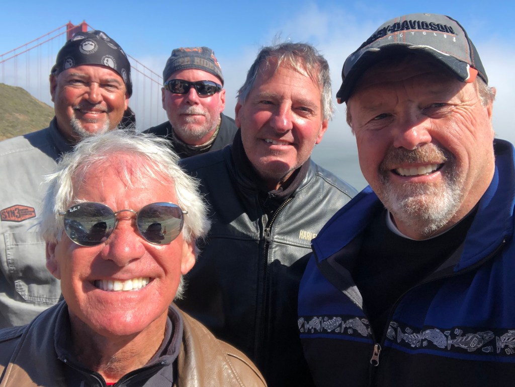
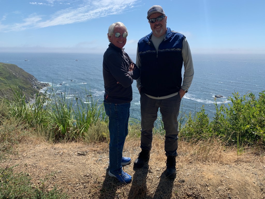
One of the patterns: I smile a lot, because I’m having a good time, hanging with good friends, and riding spectacular routes. Here, I’m with Scott, Dave, Jim and John. That’s the Golden Gate Bridge in the background, part of our ride along the Pacific Coast Highway, from the Canadian Border to Southern California. (July 2019)
Many of my favorite rides coincided with routes universally recognized as “best-ins,” as in Best-in-the-West, Best-in-the US, Best-in Colorado.
This blog post identifies my own Top Ten.
What follows are my Top Ten Best Rides over the past 15 years, based on scenery, ride enjoyment, road quality and other intangible factors.
Pretty subjective stuff, for sure. So, how do you know what a great ride is? Um, you know it when you ride it. (Similar concept to Supreme Court Justice Potter Stewart’s 1964 test for obscenity: “I know it when I see it.”)
That’s me in Spearfish Canyon, in South Dakota’s Black Hills. It’s a beautiful ride that somehow did not make my Top Ten. You know it when you ride it. (August 2017)
If any of this gives you ideas for your own travel, great. Go for it! Or, live vicariously through my riding and writing. Up to you.
This post is a tidy 15,058 words, including photo captions, of course. I just couldn’t forgive myself for leaving out details you might enjoy.
After this post, and for the next few weeks, my challenge will be brevity. But how?
Terse, Tight and Telegraphic, as I learned in journalism school. Trim the fat. Delete words that mean little or nothing. Less is more (thanks, Ludwig Mies van der Rohe!). Replace a phrase with a word. Use the active voice. Write with verbs (rather than saying “make a decision,” just say “decide.”) Use straightforward language. Avoid jargon. Revise ruthlessly. Harshly criticize everything you write, as you write it. Use as few words, sentences and paragraphs as possible. Then stop. Write like a human (no offense, ChatGPT). Be authentic. Be respectful of your readers’ time. Write with economy.
All good ideas.
So, for the next few weeks, I commit to keeping each day’s post to less than 100 words. Starting tomorrow. Hold me accountable. Yes, you heard me correctly. Less than 100 words each day. I can do this!
But until tomorrow, for the rest of this post, I’ll be as verbose as I wanna be.
Now, in the spirit of “If I Had More Time, I Would Have Written a Shorter Letter,” here goes.
***
Gary’s Top 10 Rides!
Honorable Mention:
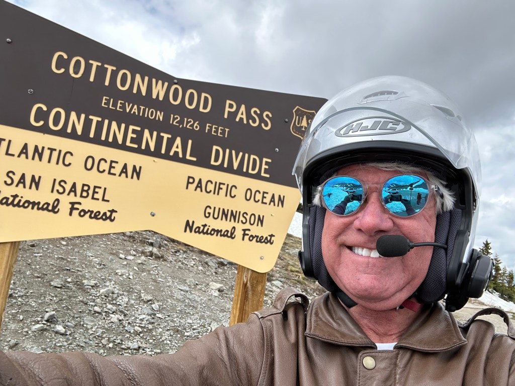
Cottonwood Pass, one of the many Colorado high mountain passes earning Honorable Mention. We’ll call Cottonwood Pass is part of what I call the “Colorado Pass-a-Palooza.” (June 2023)
Colorado Pass-a-Palooza
Cottonwood Pass. 12,126 feet (Gunnison County Road 742 and Colorado Highway 306)
Lizard Head Pass. 10,222 feet (Colorado Highway 145)
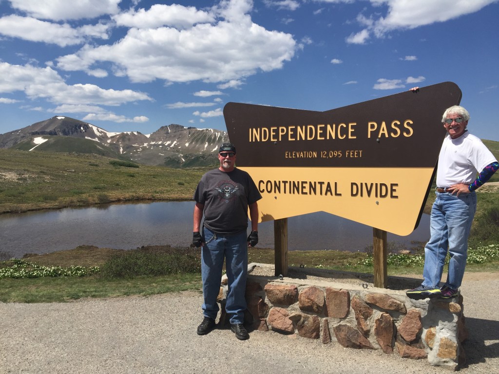
Independence Pass is part of the Colorado Pass-a-Palooza that earned Honorable Mention for my Top Ten best rides. (June 2018)
Also earning Honorable Mention:
Angeles Crest Highway (California Highway 2)
Death Valley National Park (California Highway 190)
Avenue of the Giants (California Highway 254)
Tail of the Dragon (North Carolina, US Highway 129)
Unaweep / Tabeguache Byway (Colorado Highway 141)
Needles Highway (South Dakota Highway 87)
Iron Mountain Road (South Dakota, US Highway 16A)
North Cascades Highway (Washington Highway 20)
Monument Valley (US Highway 163)
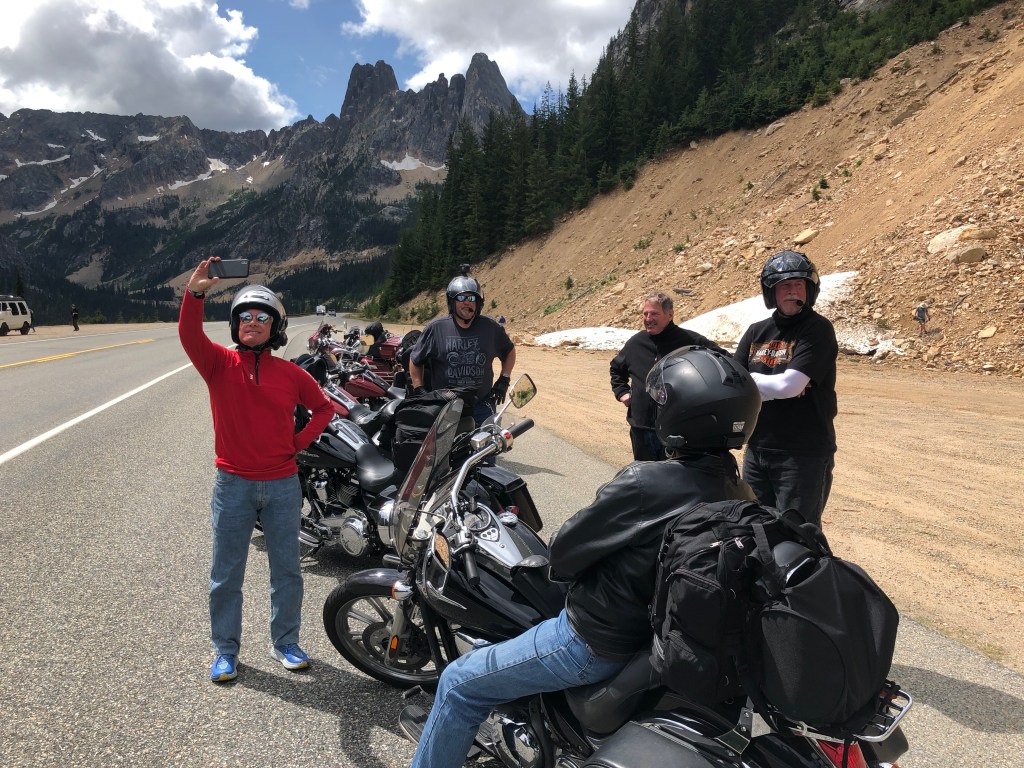
Washington State’s North Cascades Highway, Honorable Mention on my Top Ten. (July 2019)
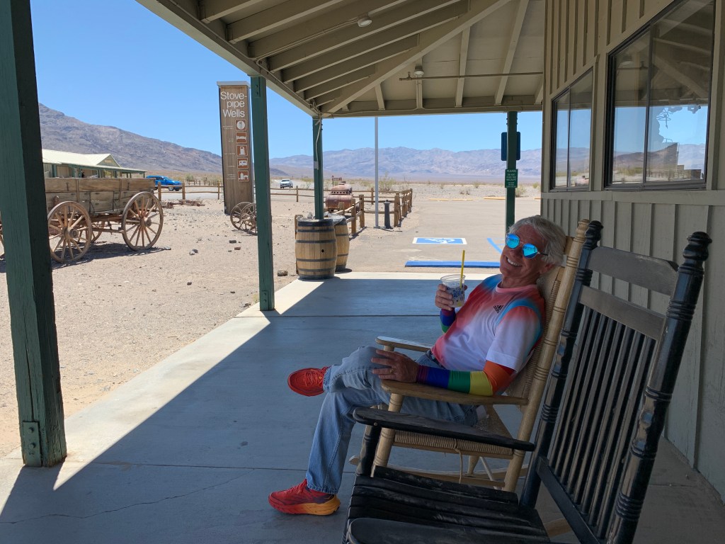
Death Valley National Park, also earning Honorable Mention. It was well over 100 degrees at Stovepipe Wells. (May 2022)
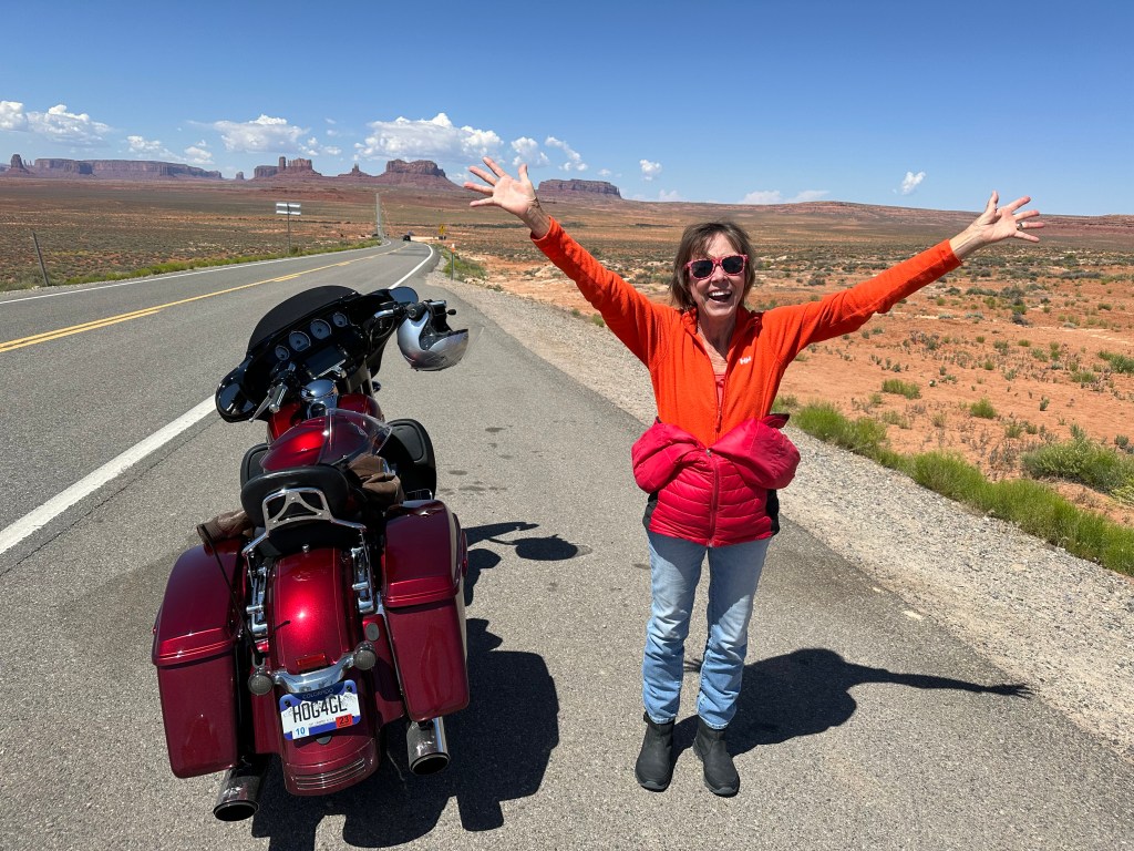
Monument Valley, another Honorable Mention. The road was pretty basic, but the scenery was other-worldly. (May 2023)
***
And now … the Top Ten!
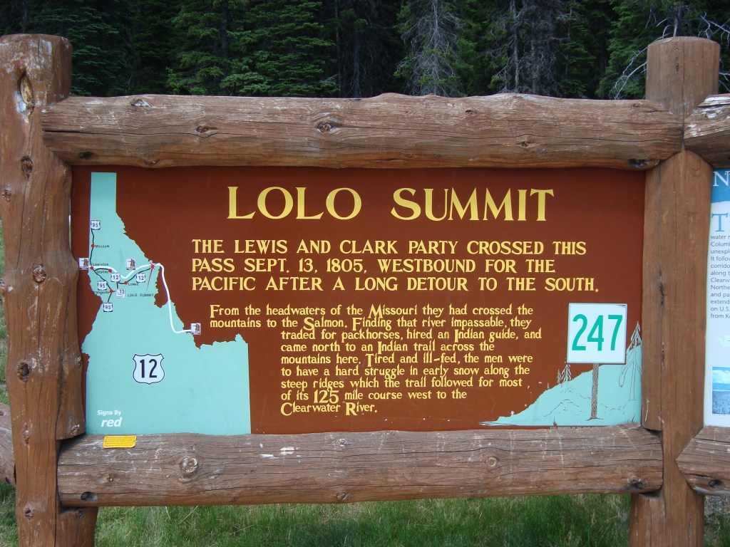
#10. Lolo Pass
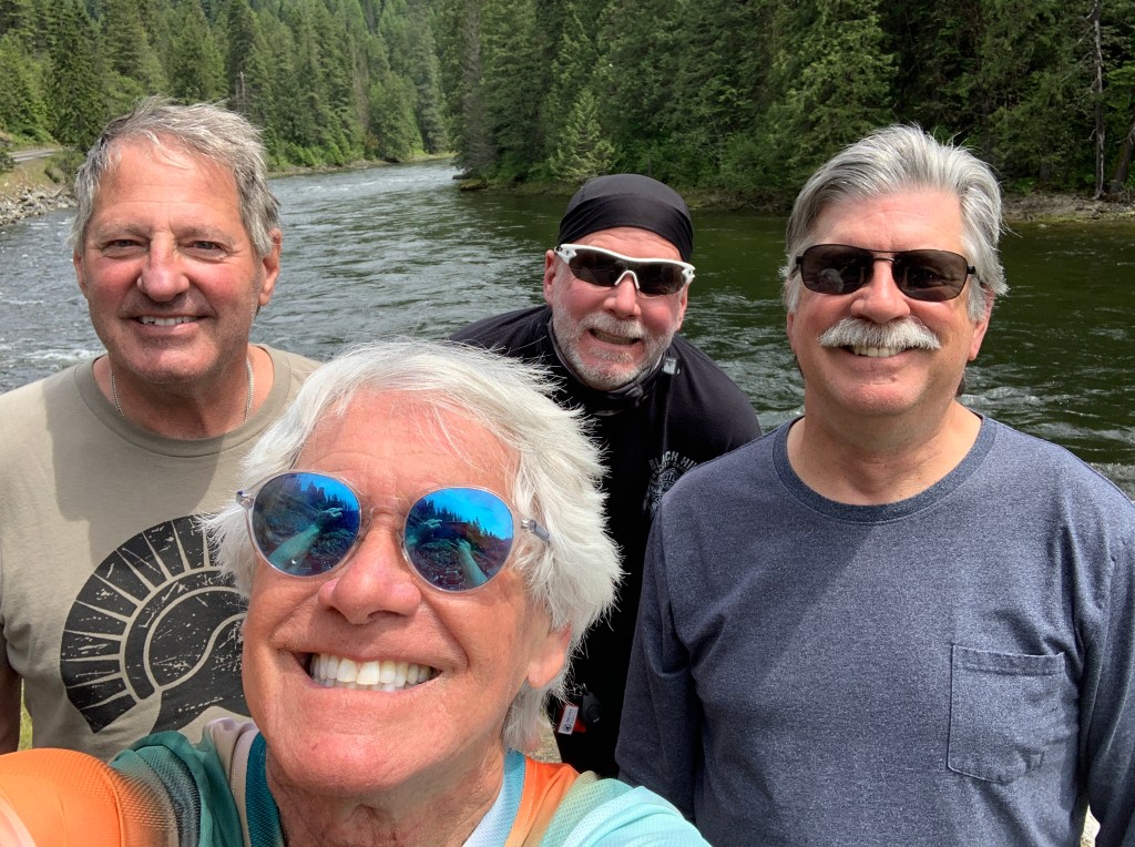
Jim, Dave, Randy and me along the Clearwater River, heading down Lolo Pass. (June 2022)
Beginning in Kooskia, Idaho, the road over Lolo Pass runs for 132 spectacular miles along the Clearwater and Lochsa Rivers, ending of course, in the town of Lolo, Montana. It’s part of the Northwest Passage Scenic Byway.
I’ve ridden this road twice -– in 2021 from West to East, and in 2022, from East to West. Either direction is a motorcyclist’s fantasy.
Kooskia marks the beginning of the Lolo Pass Highway, known among Harley fanboys as one of the top rides in the country. From Kooskia, it’s 100 miles to Lolo Pass, and 32 more to the town of Lolo.
So, you should do what all smart Harley riders do, and turn east on Highway 12, beginning the journey to Lolo Pass. Where the ride begins, the road is Idaho Highway 12 (also known as the Lewis and Clark Highway); it becomes Montana Highway 12 after crossing Lolo Pass into Montana.
You’ll follow Highway 12, and the Clearwater River, east.
Heading east toward Lolo Pass. (July 2021)
Fifteen miles later, you arrive in the tiny town of Syringa, named for the shrub that grows in the area. It’s also the Idaho state flower. Syringa is a woody shrub with clusters of white, fragrant flowers. Native Americans found many uses for syringa; the wood was used to make pipe stems, harpoon shafts, bows, arrows, root digging sticks, and snowshoes. The bark and leaves of syringa were used to make soap.
The town of Syringa is in the Nez Perce – Clearwater National Forest, which you’ll ride through for the next three hours, until you arrive at Lolo. Most of the path of the Lolo Pass Highway runs along the Clearwater and Lochsa Rivers.
Your journey will be much easier than the Lewis and Clark Expedition’s. In 1805, they descended the Clearwater in dugout canoes.
In the town of Lowell, population 30, the Middle Fork of the Clearwater River becomes the Lochsa River. Lochsa (pronounced LOCK-saw) is a Nez Perce word meaning rough water. Kayakers and whitewater rafters run the Lochsa, generally between April and June.
Randy and I enjoy a light moment on our way toward Lolo Pass. (July 2021)
You’re now following Highway 12 along the Lochsa River’s north bank. This roadway, completed in the early 1960s, was one of the last two-lane US highways built.
You won’t see much for the next two hours, until you arrive at Lochsa Lodge, constructed in 1929 for hunters. Sportsmen traveled by trail from Missoula, Montana, and from Kooskia, Idaho, to stay at the lodge, before Highway 12 was built.
Lochsa Lodge is one of the few places on the Lolo Pass Highway where food and beverage is available. Their signature dish: blackberry cobbler, a la mode.
From Locha Lodge, it’s 13 miles to Lolo Summit, sitting on the border between Idaho and Montana at an elevation of 5,233 feet. It’s the highest point on the historic Lolo Trail, which was used by Nez Perce in the 18thcentury, and the Lewis and Clark Expedition, on their westward snowbound journey in September 1805.
Lewis and Clark came here. So can you.
The Lolo Trail is a National Historic Landmark, designated for its importance to the Lewis and Clark Expedition, and its role in the 1877 Nez Perce War.
There are different stories as to where the name Lolo came from. The name Lolo was not used by Lewis and Clark. Its first known mention is in the 1810 journal of David Thompson, who described three fur trappers, probably of French descent: Michael, Lolo and Gregoire.
From Lolo Pass atop the Bitteroot Range, you descend about 3,000 feet over the next 32 miles until arriving in Lolo, Montana. Lolo is home to Travelers’ Rest State Park, where Lewis and Clark camped in 1805 and 1806. The Lewis and Clark expedition party included 27 unmarried soldiers, a French-Indian interpreter, and a contracted boat crew — 45 people in all.
Lewis, Clark, and their fellow expeditioners, found the area that is now Travelers’ Rest State Park a relaxing place to hang out. For them, it was ideal to stop, rest, hunt and repair their gear before tackling the trip over Lolo Pass. Today, the park is distinguished for being the only archaeologically verified campsite of the Lewis and Clark expedition.
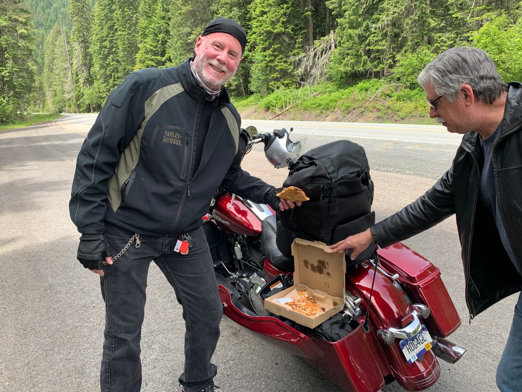
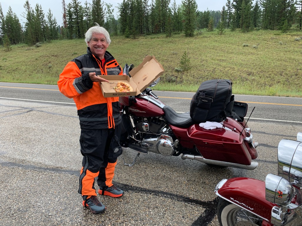
Roadside pizza stop, heading west on Lolo Pass. The pizza was left over from the previous night’s dinner at MacKenzie River Pizza in Polson, Montana. (June 2022)
The road over Lolo Pass, 132 miles in all, ends in Lolo, population 4,000. More than likely, if you’re riding West to East, you’ll continue for ten miles to Missoula, Missoula, and find a place to stay. When I rode Lolo Pass from East to West, in 2022, I kept riding past Kooskia for 66 miles, and overnighted in the fishing town of Riggins, Idaho.
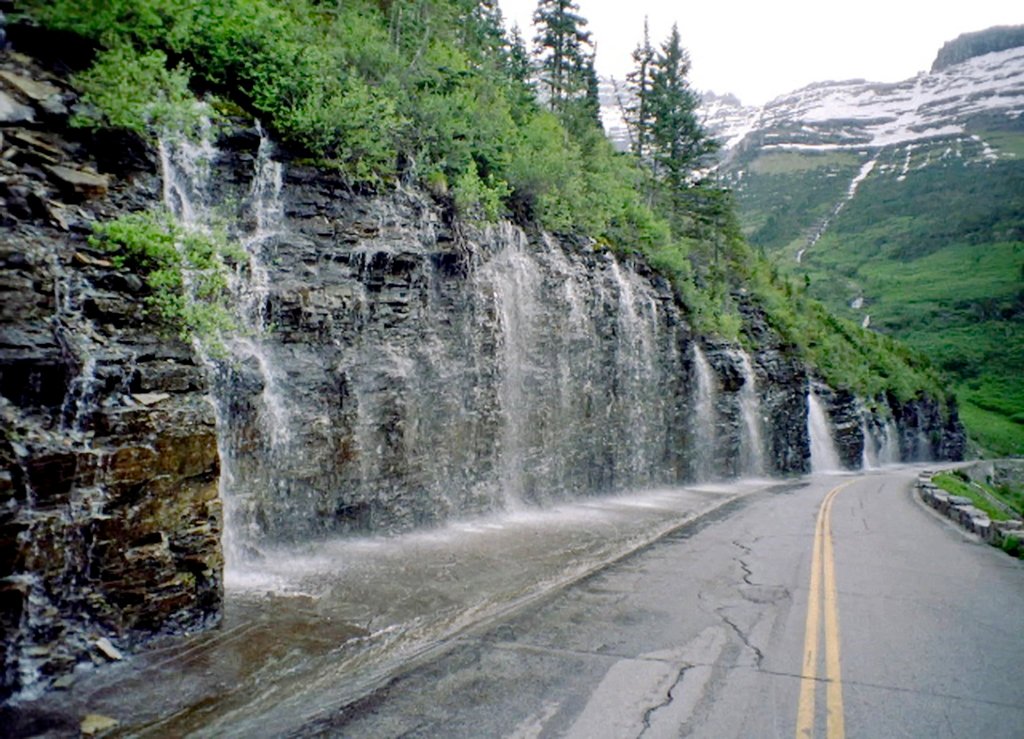
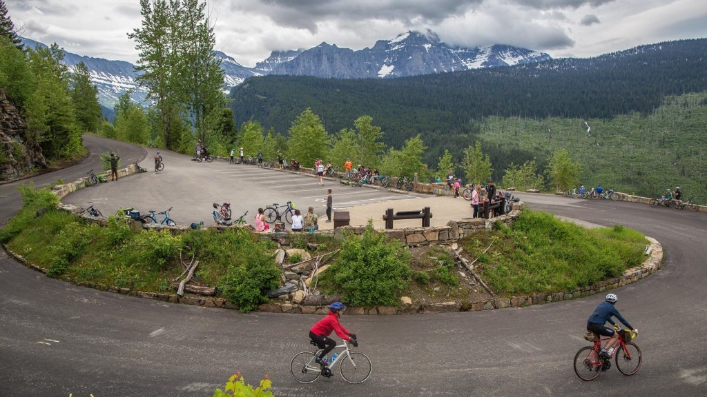
The Going-to-the-Sun Road through Glacier National Park is one of a kind.
If you’re of a certain age, get out your lifetime National Parks pass. You’ll use it to ride the world-famous Going-to-the-Sun Road, which takes you through Glacier National Park.
The 48-mile ride begins in West Glacier, Montana, and ends in St. Mary, Montana.
In West Glacier, you’ll turn off of US Highway 2, onto Glacier Route 1 Road, more commonly known as the Going-to-the-Sun Road.
I rode this route in 2021, West to East. In 2024, I’ll ride it from East to West. Either way you do it, you’re gonna be blown away.
My description below of the road is from a West-to-East perspective.
West Glacier sits at the west entrance to Glacier National Park. You’ll enter the park here and head for the visitor center in Apgar, two miles away, on the southern end of Lake McDonald.
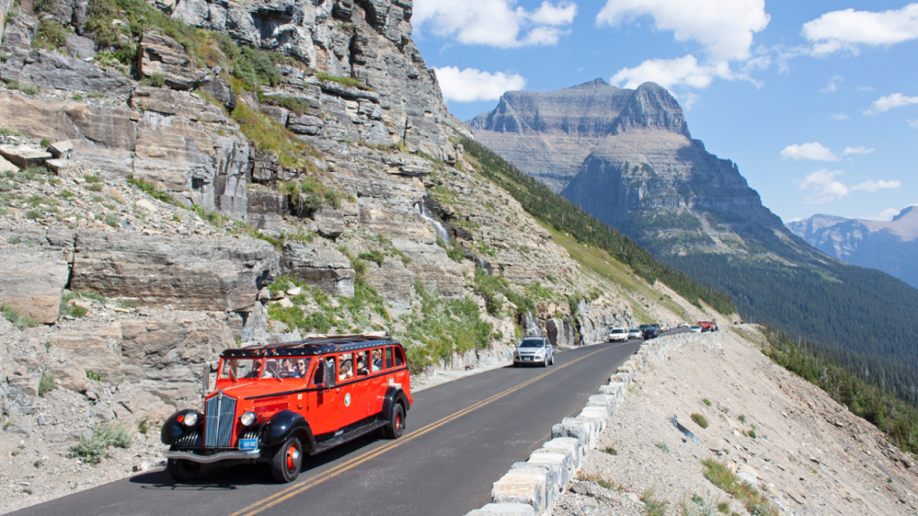
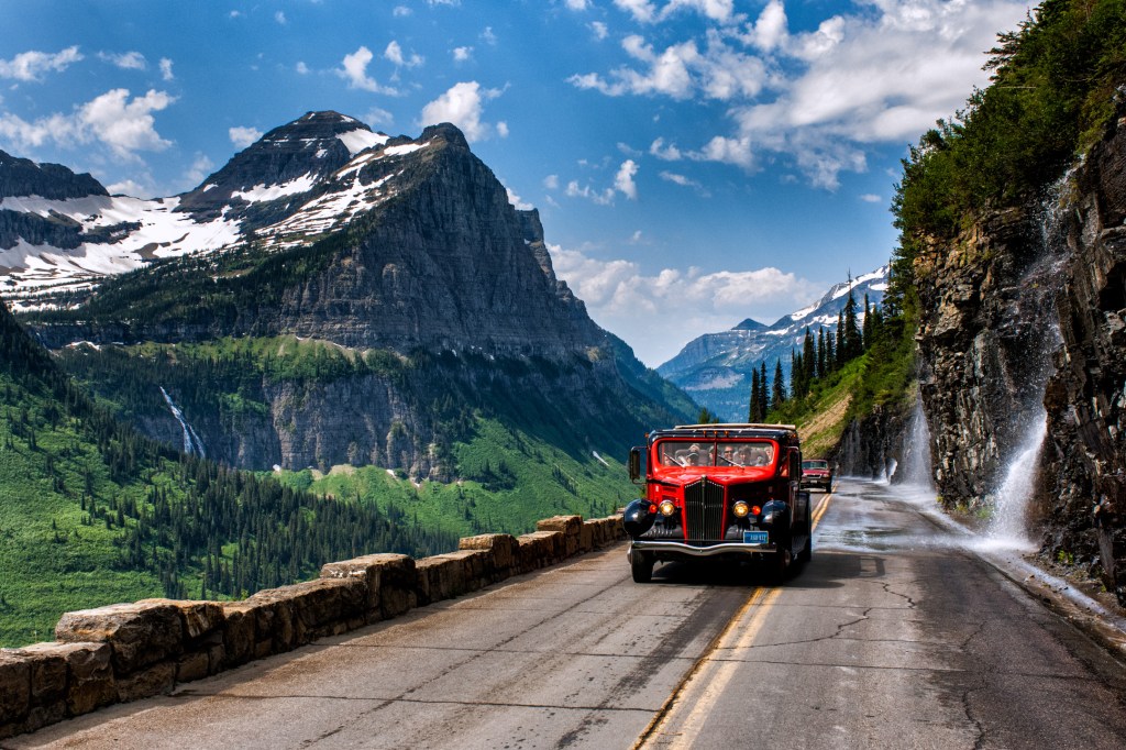
Apgar is one of the main villages in the park. In addition to the visitor center, it has a restaurant, gift shops, boat rentals, and the largest campground in Glacier National Park. Apgar also has a reservation center for Red Bus Tours.
Apgar Village is the starting point for almost all Red Bus Tours. These buses are better known as Red Jammers. The fleet of 33 Red Jammers in Glacier National Park is widely considered to be the oldest touring fleet of vehicles anywhere in the world.
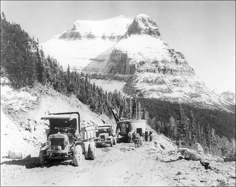
When the park opened in 1910, it had just a few miles of rough wagon roads, and the primary mode of transportation was the railway, which took affluent guests to luxurious chalets. Officials convinced local businesses and Congress to support a trans-mountain road through the park.
Construction on the Going-to-the-Sun Road began more than a century ago.
Construction of the road, now known as the Going-to-the-Sun Road, began in the 1920s and was completed in 1933. While a modern marvel at the time, park officials quickly realized many motorists were terrified of driving on it. They contracted White Motor Company of Cleveland, Ohio to produce a fleet of buses to be piloted by expert drivers.
The buses, with their roll-back convertible tops, leave Apgar and head for the Going-to-the-Sun Road. The Red Jammers are the vintage White Motor Company/Bender Body Company Model 706 buses that have transported park visitors since 1936. They’re called “Reds” for their distinctive livery, painted to match the color of ripe mountain ash berries.
The bus drivers are called “jammers” because of the sound the gears made, back in the day, when the driver shifted on the park’s steep roads. The “jamming” sound came from the unsynchronized transmissions, where double clutching was required to shift gears prior to a 1989 fleet retrofit that added automatic transmissions.
For you Millennials and others too young to remember unsynchronized transmissions (or shifting at all), double clutching involves manually matching the engine speed with the speed of the driveshaft. It’s harder than it looks and sounds, but unless you’re driving Grandpa’s vintage Model T, this is a skill you don’t need these days.
Red Jammers. Double clutch away.
Double clutching is a lost art.
Nearly all transmissions today are automatic, and of those that do call for shifting, nearly all have synchronized gearboxes. Amazing that Millennials look so puzzlingly at that pedal to the left of the brake. Yes, the clutch.
Beginning in 2019, Legacy Classic Trucks, based in Driggs, Idaho, started restoring and updating each bus with a new Ford chassis and Ford 6.2 liter V-8 engine, including a hybrid electrical system — to increase fuel economy and lower emissions.
Vroom!
Red Jammers are a fixture in Glacier National Park.
Leaving Apgar, you begin your journey east on the Going-to-the-Sun Road.
It’s a spectacular ride along the eastern shoreline of Lake McDonald, the largest lake in the park. The high alpine lake is 10 miles long and nearly 500 feet deep. It was once occupied by massive glaciers that carved this area thousands of years ago.
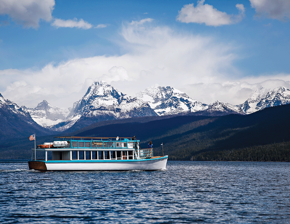
Just as the Red Jammers take tourists through the park on the Going-to-the-Sun Road, a fleet of classic wooden boats is available to explore the park’s major lakes. The boats are part of the Glacier Park Boat Company.
A 57-foot boat, DeSmet, has been cruising Lake McDonald since the 1930s. The DeSmet, a carvel-planked vessel with cedar on an oak frame, can carry up to 70 passengers. The boat, named after Father Pierre DeSmet, a prominent Jesuit missionary in the area, has never left Lake McDonald since being launched here almost a century ago.
The DeSmet, plying the waters of Lake McDonald for nearly a hundred years.
Similar boats ply the waters of the other major lakes in Glacier National Park: The Sinopah on Two Medicine Lake, Little Chief, and Joy II on Saint Mary Lake, the Morning Eagle on Lake Josephine, and Chief Two Gunson Swiftcurrent Lake.
Each fall, the boats are lifted on a cradle-and-track system, and moved into custom boathouses built specifically for each boat. The vessels are closed up, protected against the brutal Glacier Park winters, and then re-launched every spring for the summer tourist season.
The DeSmet begins its tours of Lake McDonald at historic Lake McDonald Lodge. The lodge, built in 1913, sits on the southeast shore of the lake. It’s a National Historic Landmark. Artist Charles Russell was a frequent at the hotel in the 1920s, and is believed to have etched pictographs in the dining room’s original fireplace hearth.
Six miles past the Lake McDonald Lodge is the Trail of the Cedars, a short, easy trail mostly on boardwalks and flat ground. The trail is named after the towering trees you’ll hike beneath. This cedar forest, resembling the ecosystems of the Pacific Northwest, is the only one of its kind in in the park.
There’s nothing like the beauty in Glacier National Park, but you can pretty much say that about all the national parks.
All national parks are distinguished by their unique natural beauty. How do you even begin to compare Grand Canyon, Yosemite, Yellowstone, Zion and Grand Teton? Naturalist John Muir, known as the “Father of the National Parks,” summed up his view of Glacier National Park in a simple thought.
“It is the best care-killing scenery on the continent.”
Care-killing scenery.
Glacier National Park encompasses more than one million acres, and it borders Waterton Lakes National Park in Canada. The two parks are known as the Waterton-Glacier International Peace Park and were designated as the world’s first International Peace Park in 1932.
Glacier is the eighth-most visited of the national parks, with about three million visitors a year. It’s so popular, that you now need a $30 “timed-entry” ticket, an advance reservation you book through recreation.gov, to ride the Going-to-the-Sun Road. At least you need one going West to East. If you ride East to West, no timed pass required; it’s the park service’s way of encouraging you to enter the park at St. Mary, rather than West Glacier.
One of the few remaining glaciers in Glacier National Park. Soon, there will be none left.
In the mid-19th century, about 150 glaciers still existed in the area that is now Glacier National Park. By 1910, only 25 active glaciers remained. Scientists studying the glaciers in the park believe all the active glaciers in the park may disappear over the next ten years. Global warming is real. Glacier National Park’s name will outlive its glaciers.
The first major vista on the 51-mile long Going-to-the-Sun Road is Red Rock Point, a popular pullout on the north side of the road. Eight miles beyond Red Rock Point is The Loop, where the road makes a tight hairpin turn. It’s the lone switchback on the Going-to-the-Sun Road, marking the beginning of the narrow, carved-into-the-mountainside portion of the road.
The Loop, on a peaceful summer day.
At first, the road’s surface was crushed gravel. It wasn’t until 1952, 20 years after opening the Going-to-the-Sun Road, that the entire road was paved.
Building the road was a feat of engineering because the many obstacles faced by engineers and laborers during its construction road. Sheer cliffs, short construction seasons, 60-foot snowdrifts and tons of solid rock made road building across the Continental Divide a unique challenge.
The road is narrow and winding. As a result, vehicles going over the highest portions of the roadway are limited to 21 feet in length and 10 feet in height, due to overhanging rocks. For comparison purposes, 12,095-foot Independence Pass, east of Aspen, restricts vehicles to no more than 35 feet in length.
Because of the intense winters and heavy snowfall, the Going-to-the-Sun Road generally opens in late June or early July, and closes the third Monday of October. It’s a short season, but well worth the wait.
The Going-to-the-Sun Road has been fittingly recognized for its epic nature.
It’s on the National Register of Historic Places. And, it’s a National Historic Civil Engineering Landmark -– joining such structures and accomplishments as the Brooklyn Bridge, Cape Hatteras Lighthouse, Grand Central Terminal and Captain George Vancouver’s Mapping of the West Coast of North America.
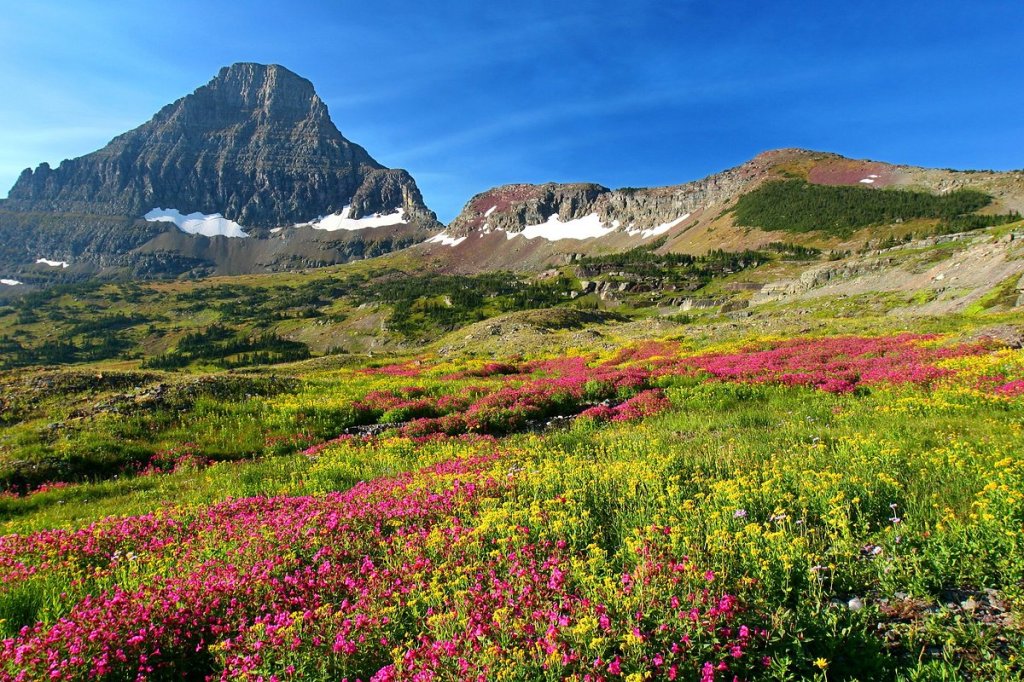
Logan Pass is unmistakable.
A few miles east of The Loop is Logan Pass. At 6,646 feet, it’s the highest point on Going-to-the-Sun Road. The pass is named after William R. Logan, the first superintendent of the park.
Logan Pass offers breathtaking scenery amid what’s called “the backbone of America,” the Continental Divide. As you work our way toward the east end of the park, you’ll approach 9,647-foot Going-to-the-Sun Mountain. It’s just a mile or so from the Logan Pass Visitor Center.
Your descent from Logan Pass takes you toward St. Mary Lake, the second-largest in the park, after Lake McDonald. The Going-to-the-Sun Road runs along the lake’s north shore.
The lake is nearly 10 miles long, and when you reach the eastern end of it, you arrive at the town of St. Mary, home to the St. Mary Visitor Center. Saint Mary marks the end of the Going-to-the-Sun Road.
Remember Father DeSmet, the Jesuit missionary, and the inspiration for naming the Lake McDonald boat, DeSmet. Well, he also had a hand in providing the name for St. Mary.
Once upon a time, Father DeSmet was caught in a heavy fog coming off of Divide Mountain, When the fog cleared, the first thing he saw was the face of Saint Mary. He was able to use this as a landmark to help guide himself down to St. Mary Lake. Divine inspiration? It’s a good story, anyway.
Dave and yours truly, just outside the park. (July 2021)
From St. Mary, you can turn south on US Highway 89 and ride 30 miles to East Glacier Village, home to historic Glacier Park Lodge. It’s a good place to park the bikes, find your room, grab a cold beer, and call it a day.
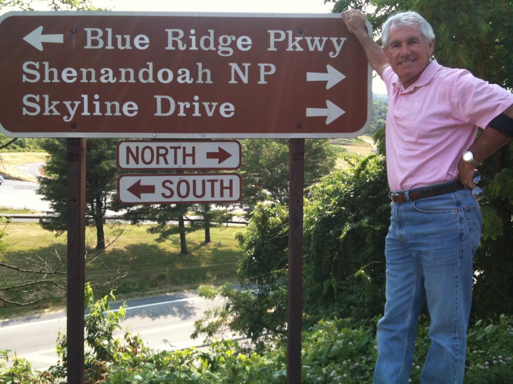
At the end of the Blue Ridge Parkway, and the start of Skyline Drive. (June 2011)
The Blue Ridge Parkway runs 469 miles from Cherokee, North Carolina, to Front Royal, Virginia. If you want to keep riding, and I did, you can continue on Skyline Drive for 105 additional miles through Shenandoah National Park.
I rode this route twice, in 2011 from South to North — and in 2012, from North to South. Both times I was with Ray Sanders, my riding mentor, who lived not far away in Farragut, Tennessee. Ray died in 2022.
The Blue Ridge Parkway, known as “America’s Favorite Drive,” runs mostly along the Blue Ridge Mountains, a major mountain chain that’s part of the Appalachian Mountains. The Parkway includes the Great Smoky Mountains, the Balsams, the Pisgahs, the Craggies, and the Black Mountains. This place seems to have been constructed for motorcycles.
The Blue Ridge Parkway was actually built to connect Shenandoah National Park to the Great Smoky Mountains National Park. The Blue Ridge Parkway was constructed in the 1930’s as part of the New Deal programs President Franklin D. Roosevelt implemented to put Americans back to work following the Great Depression.
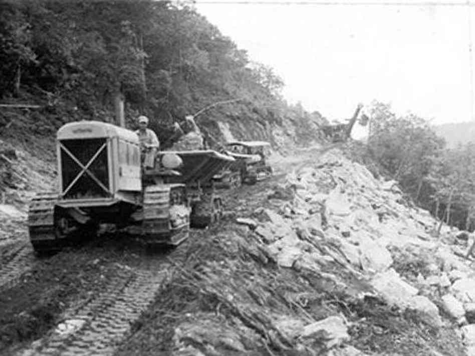
The Civilian Conservation Corps did great things for America, including the Blue Ridge Parkway.
It began as a Civilian Conservation Corps project in the 1930s, and took more than 52 years to complete. Originally called the Appalachian Scenic Highway, construction began on September 11, 1935. During World War II, Civilian Conservation Corps crews were replaced by conscientious objectors in the Civilian Public Service program.
The Civilian Conservation Corps ran from 1933 to 1942 as part of FDR’s New Deal. It provided unskilled manual labor jobs related to the conservation and development of natural resources in rural lands owned by federal, state and local governments. The CCC was designed to provide employment for young men who had difficulty finding jobs during the Great Depression.
Over the program’s life, some 2.5 million young men participated. Among the Civilian Conservation Corps’ most famous alumni: actors Raymond Burr, Robert Mitchum and Walter Matthau; test pilot Chuck Yeager; and baseball players Stan Musial and Red Schoendienst. One of the most spectacular and enduring legacies of the CCC’s efforts is the Blue Ridge Parkway.
The Parkway is the most visited unit in the National Park System. It welcomed 16.7 million people in 2023.
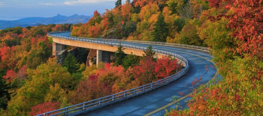
This is one of the last sections built, to complete the parkway — near Grandfather Mountain, North Carolina.
The Civilian Conservation Corps did not construct the entire Blue Ridge Parkway. The final stretch of the Parkway was completed around Grandfather Mountain, North Carolina, in 1983. The Parkway is entirely in two states: Virginia (our ride today) and North Carolina (our ride tomorrow). Its highest point is 6,053 feet on Richland Balsam Mountain. The speed limit is never above 45 MPH, which is a good way to guarantee a leisurely and safe ride.
There are 26 tunnels constructed along the Blue Ridge Parkway. On is in Virginia and the other 25 are in North Carolina.
The Blue Ridge Parkway is a great place to spend time on two wheels.
The Parkway makes its way through 29 counties of Virginia and North Carolina, across streams, railway ravines, and cross roads with six viaducts and 168 bridges.
There are more than 200 overlooks along the Parkway. Some have spectacular scenic vistas; others just are small parking lots looking head-on at trees. The views may have been good when the Parkway was built, but the trees have grown up over the past 70-or-so years, all but destroying some views. But if you’re selective, you can easily find overlooks worth seeing.
The parkway has been the most visited unit of the National Park System nearly every year since 1946. Land on either side of the road is owned and maintained by the National Park Service, and in many places parkway land is bordered by US Forest Service property.
On my rides through the Blue Ridge Parkway, I allowed three days to complete the journey. You could do it in less time, but what’s your hurry?
At Blowing Rock, along the Blue Ridge Parkway. (June 2011)
At a pull-out, just below the highest point on Trail Ridge Road: 12,183 feet. (August 2017)
I’ve ridden Trail Ridge Road four times, and once, continued on to Mount Blue Sky (formerly Mount Evans) in the same day. This ride combined the highest paved road in North America (14,265 feet) with the highest continuously paved road in the US (12,183 feet). Talk about a Rocky Mountain High! It was a 133-mile thrill ride.
Trail Ridge Road, US Highway 34, begins in Grand Lake, Colorado, winds its way for 48 miles through Rocky Mountain National Park, and ends in Estes Park, Colorado.
It took the Civilian Conservation Corps from 1929 to 1932 to build the road, because heavy snows kept them from working more than three months a year.
Trail Ridge Road gets a lot of snow. You don’t need a measuring device to figure that out.
As you might guess, it’s closed during the winter. Trail Ridge Road usually opens in late May, and closes around Columbus Day in October, when the National Park Service gives up fighting the snow and turns the road back to Mother Nature for the winter.
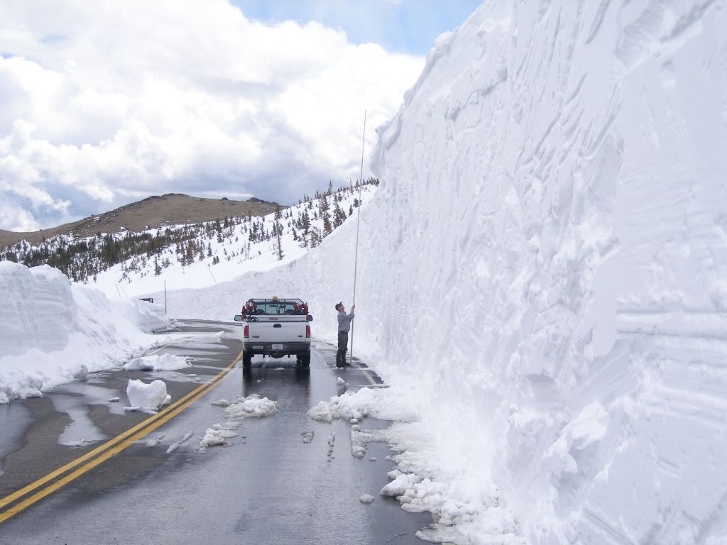
National Park Service plow operators normally begin clearing the snow in mid-April, when crews from the west side of the park and crews from the east side of the park eventually meet at the Alpine Visitor Center — 11,796 feet above sea level. That Visitor Center is the highest in the National Park System. It’s not easy being a snowplow operator on this road; snowdrifts are often up to 22 feet deep.
Rocky Mountain National Park has more than 100 peaks above 10,000 feet. The “10ers” are so common you almost don’t even notice them. The park has nearly 60 peaks above 12,000 feet.
Sixteen miles into the park, after a series of steep switchbacks, you’ll arrive at 10,759-foot Milner Pass. It sits on the Continental Divide.
On Trail Ridge Road, not far from the peak. (August 2017)
I’ve ridden Trail Ridge Road West to East twice, and East to West twice. The day I did Trail Ridge Road and Mount Blue Sky back-to-back, I began in Grand Lake and rode West to East. That ride was with Ray Sanders, who — at age 84 — realized he was nearing the end of his riding days, and believed he had one last journey left in him. Ray wanted to ride Trail Ridge Road one last time, and he rode all the way out from Tennessee just to do it.
With a maximum elevation of 12,183 feet near Fall River Pass, Trail Ridge Road is the highest continuous paved road in the U.S. A continuous paved road is one that doesn’t simply doesn’t end at a summit, resulting in a turnaround to head back down. The road is considered continuous because it, um, continues.
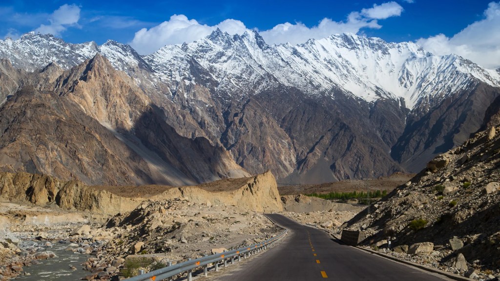
For comparison purposes, the highest continuous paved road in the world is the Karakoram Highway, connecting China and Pakistan through the Khunjerab Pass in the Karakoram mountain range. The highway opened to the public in 1986; it reaches 15,397 feet in elevation. In recent years, the Karakoram Highway has become an adventure tourism destination, providing the pathway to expeditions for almost all peaks in Gilgit-Baltistan, including 28,251-foot K2, the Earth’s second highest mountain.
The Karakoram Highway is even higher and more extreme than Trail Ridge Road.
Because of its high elevation and extremely difficult construction, the Karakoram Highway is sometimes referred to as the Eighth Wonder of the World. The highway took 20 years to complete – and in the process, more than 800 Pakistanis and 200 Chinese workers lost their lives.
From the Kawuneeche Visitor Center at the entrance to Rocky Mountain National Park, Trail Ridge Road follows the North Fork of the Colorado River through the Kawuneeche Valley.
The road takes you through Rocky Mountain National Park. The park headquarters, Beaver Meadows Visitor Center, is a National Historic Landmark, designed by the Frank Lloyd Wright School of Architecture at Taliesin West in Scottsdale, Arizona.
Sarah and I outside the Alpine Visitor Center on Trail Ridge Road, elevation 11,796 feet. I was riding the Harley; she was following in the Boxster. Best sag wagon ever. (June 2023)
You’ll arrive in Estes Park at the eastern end of Rocky Mountain National Park. The town is named after Missouri native Joel Estes, who founded the community in 1859, then moved his family there four years later.
From Estes Park, to get to your next destination — Mount Blue Sky — you head south on Colorado Highway 7 for about 20 miles. To your right, you can see Longs Peak, at 14,255 feet, the highest peak in Rocky Mountain National Park.
You continue on Colorado Highway 72, also known as the Peak to Peak Scenic Highway. Established in 1918, it’s Colorado’s oldest Scenic Byway. Its curvy road winds through the Arapaho National Forest, and the Indian Peaks Wilderness Area.
Eventually, you arrive in Central City, known for being Colorado’s gambling mecca, turn on to I-70 East, and a few miles later exit the interstate in Idaho Springs. From here, you turn onto Colorado Highway 103, which takes you in the direction of one of Colorado’s 58 14ers — Mount Blue Sky.
From here, it’s only 28 miles to the Mount Blue Sky parking lot.
The mountain was originally named Mount Evans after John Evans, second governor of the Colorado Territory from 1862 to 1865. In 2023, it was renamed Mount Blue Sky. There has been a renaming process underway for years to strip former Governor Evans’ name from the peak. Evans, who served as territorial governor from 1862 to 1865, was forced to resign in disgrace for his role in the 1864 Sand Creek Massacre, a deadly attack on Native Americans that led to the deaths of more than 230 Cheyenne and Arapaho people, mostly women, children and older adults.
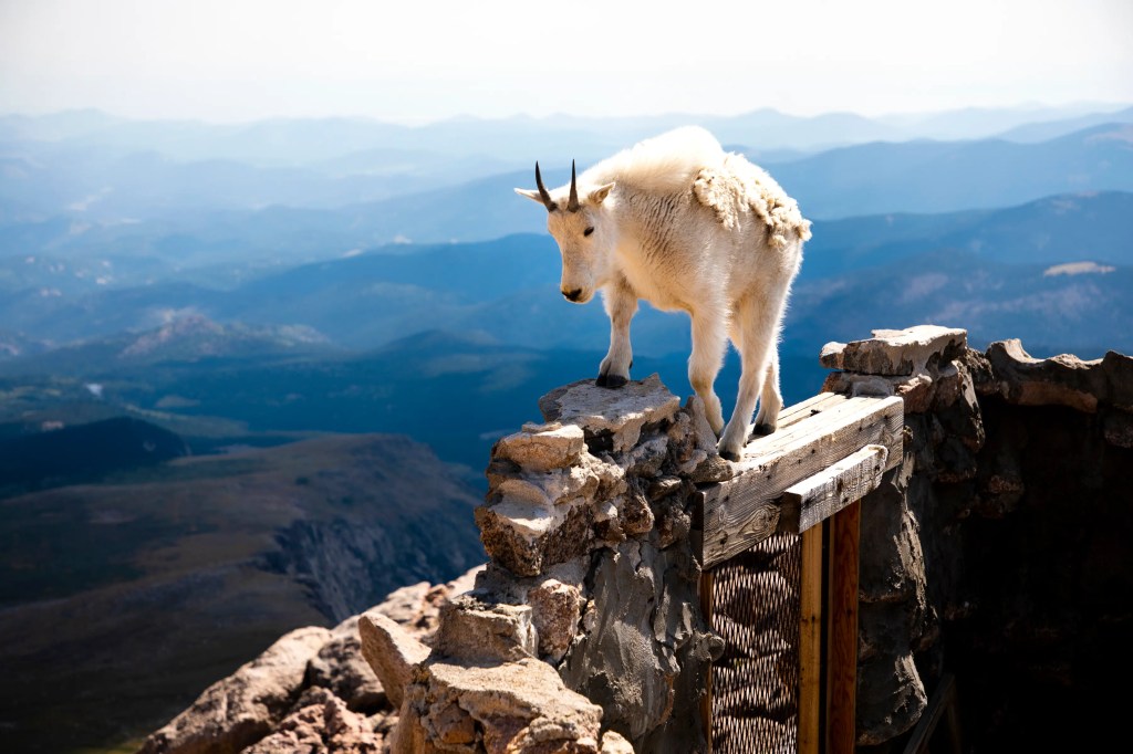
You’ll see a lot of mountain goats up here.
In November 2022, the Colorado Geographic Naming Advisory Board in November voted unanimously to change the name to Mount Blue Sky, a move supported by officials in Clear Creek County, Governor Jared Polis, and many Native American tribe leaders and members who participated in the renaming process. Polis, in his recommendation to change the mountain’s name, said “each of the 14,000-foot peaks in Colorado deserves a name befitting their majesty.”
Mount Blue Sky rises to 14,265 feet, and dominates the Denver metropolitan area skyline, rising 9,000 feet above the Mile-High City. Mount Blue Sky is 31 miles west of Denver, as the crow flies. Trip Advisor identifies 135 attractions in the Denver area, and ranks Mount Blue Sky at the very top of the list.
Thirteen miles of climbing on CO-103 takes you past Echo Lake Park, where you turn onto Colorado Highway 5 for another 14 miles, as you appear to be riding directly into the sky.
You are now on the Mount Blue Sky Scenic Byway, riding toward the top of Mount Blue Sky. The road takes us within 135 vertical feet of the summit. The parking lot is that close to the summit.
Ray and I, in the parking lot at what was then Mount Evans — 14,130 feet. (June 2014)
As you might expect, the Mount Blue Sky Scenic Byway is strictly a summer-time ride. The road generally opens around Memorial Day; the Colorado Department of Transportation closes the top five miles after Labor Day, and shuts down the rest of the road after the first “significant snowfall,” or the first weekend in October — whichever comes first.
From Mount Blue Sky, the view is breathtaking.
And the air is thin. There’s considerably less oxygen up here than most of us are accustomed to. About 20 percent of people will experience symptoms of altitude sickness above 8,000 feet. There’s a big sign near the summit of Mount Blue Sky, warning of the risks of altitude sickness.
Acute Mountain Sickness is the most common unhealthy response to altitude. It’s a collection of signs that your body is becoming ill and has not adapted successfully to a higher altitude. Symptoms include fatigue, dizziness, loss of appetite, nausea or vomiting, confusion, and difficulty walking. The single most important factor in reducing forms of altitude sickness is descending toward sea level.
From the top of Mount Blue Sky, you work your way down Colorado Highways 5 and 103, and back to Idaho Springs, where you’ll re-join I-70. There are any number of towns you can go to from here to overnight — Georgetown, Silverthorne, Frisco. Wherever you end up tonight, it will have been an incredible ride, one only possible in Colorado.
Near the top of the road to Mount Blue Sky’s summit, there are some tight hairpin turns.
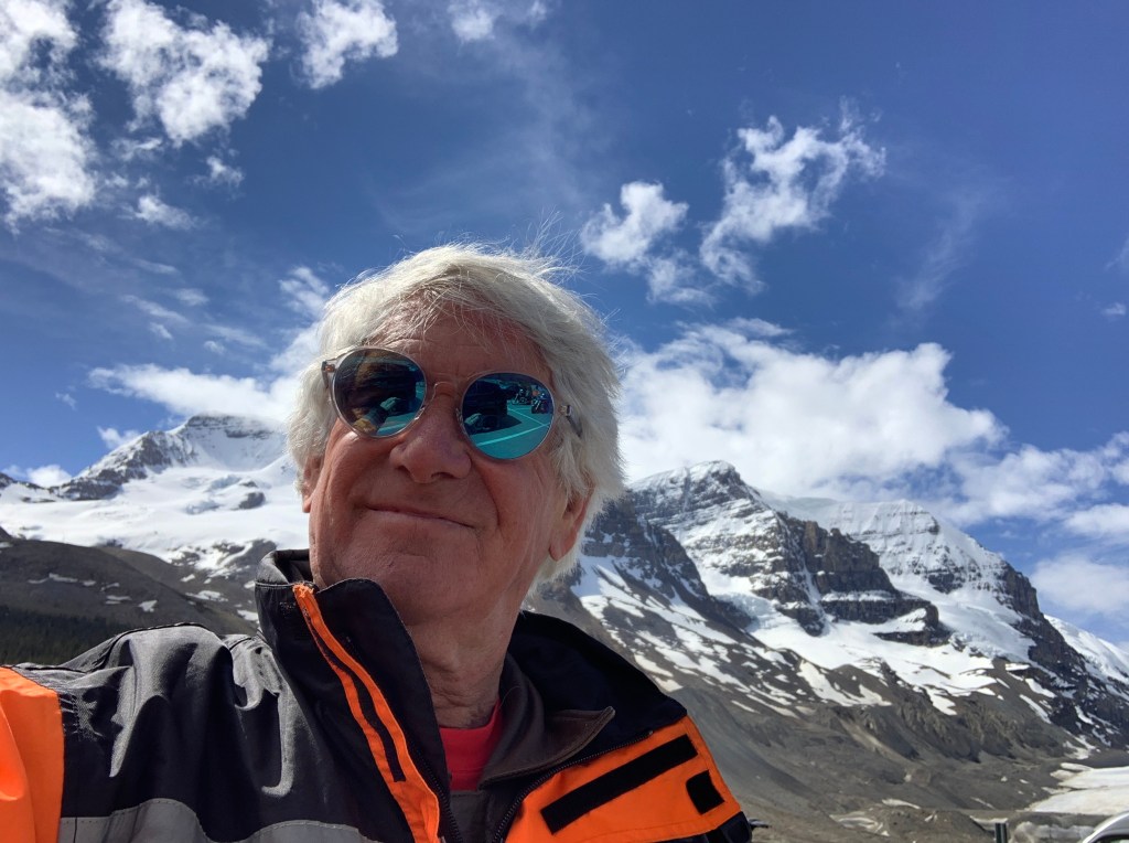
A beautiful day on the Icefields Parkway. (June 2022)
The only ride in my Top 10 not in the US is Canada’s Icefields Parkway. I’ve ridden this beautiful road twice, in 2015 and 2022. My Seattle friend, Randy Suhr, was along for both of those journeys,
The Icefields Parkway is entirely within the Canadian province of Alberta, starting in Jasper and ending in Lake Louise. It’s 145 miles of spectacular.
The story of the Icefields Parkway began 50 million years ago. Fierce tectonic forces pushed the ocean floor and transformed it into the mountains that today make up the Canadian Rockies.
By the end of the 19th century, the Canadian Pacific Railway responded to the growing interest in mountaineering in the Rockies by giving seasonal contracts to Swiss guides. They led mountaineers and tourists in explorations of the area. Meanwhile, to the north, tourism in the region was also gathering momentum with the establishment of Jasper National Park in 1907 and the Grand Trunk Pacific Railway reaching Jasper in 1911.
As an economic project during the Depression Era, the Government of Canada decided to transform what was then known as the “Wonder Trail” into a single-track road. In 1931, construction began for the Icefields Highway: a new road that would make the famous mountain path accessible to everyone.
It took 600 men and nearly 10 years to complete the project. Workers were paid about $5 a month with a stipend for clothing and tobacco. With only one tractor per crew, most of the work was completed by hand, and with teams of horses.
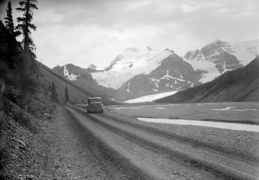
The Icefield Parkway was the first road in the world that could take people to the toe of a glacier. This photo was taken around 1940 and shows the Athabasca Glacier in the background.
At first, the 18-foot-wide road was gravel and dirt, before being paved, realigned, and modernized in 1961.
The road, the first in the world that could take people to the toe of a glacier, was completed in 1940. The highway was the brainchild of Arthur Oliver Wheeler, the principal land surveyor in charge of plotting the border between Alberta and British Columbia in the early 1900s.
You’ll follow the Athabasca River from Jasper, south and east on the Icefields Parkway. The Athabasca River runs some 765 miles from the Columbia Icefield in Jasper National Park, northeast to Lake Athabasca in northern Alberta and Saskatchewan.
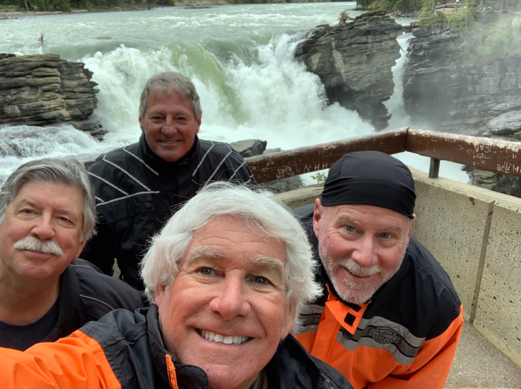
Randy, Jim, Dave and me at Athabasca Falls. (June 2022)
Twenty miles out of Jasper, you’ll find Athabasca Falls, just off the parkway. From the roadside parking lot, it’s a short hike to the falls – and well worth the effort. A series of short and easy pathways take visitors along these impressive cascades and up close to the roaring falls themselves.
Athabasca Falls is about 75 feet high, not much compared to other more famous waterfalls, but it’s very powerful, due to the sheer volume of water flowing into the gorge from the Athabasca River, fed by the massive Columbia Icefield.
Only 15 miles past Athabasca Falls, you come to Sunwapta Falls. With a drop of 61 feet, Sunwapta Falls consists of an upper and lower fall with a hike that will get you close enough to feel the mist. It’s a Class 6 waterfall, meaning it’s unrunnable, and you’re likely to die if you try.
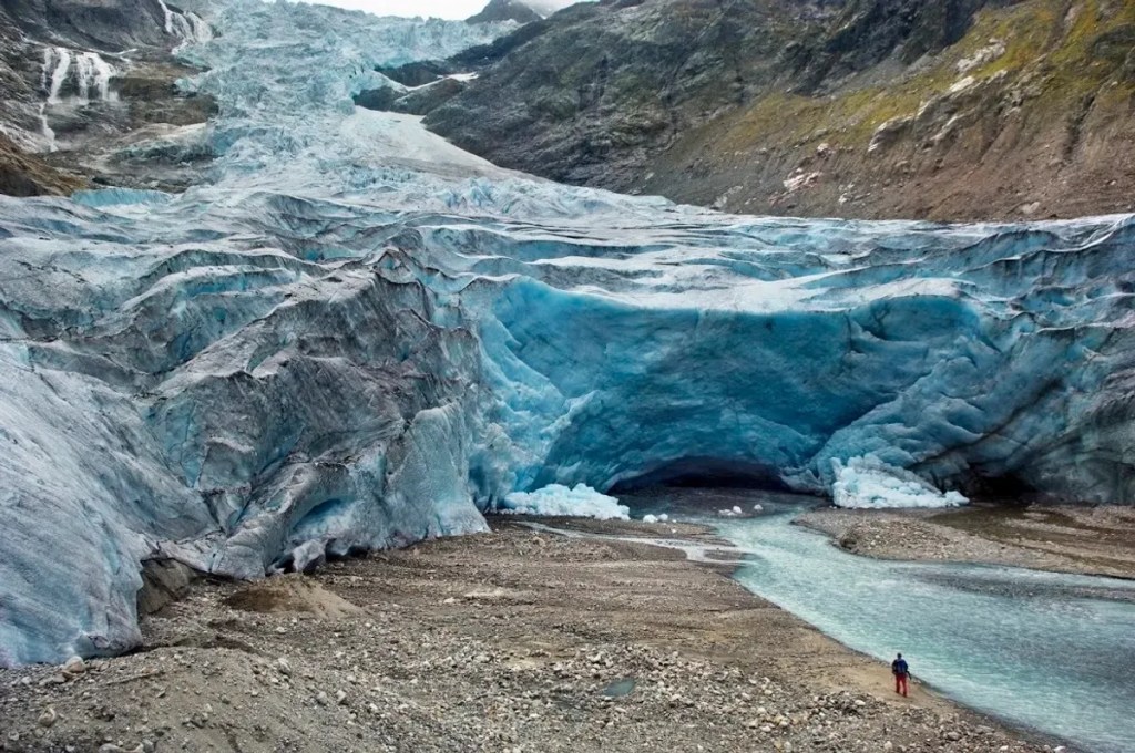
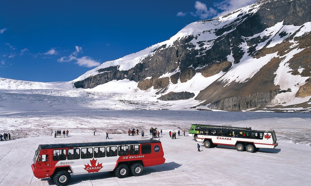
The Columbia Icefield, composed of eight glaciers and encompassing an area of about 125 square miles, sits near the halfway mark on the Icefields Parkway. This ice mass is one of the largest south of the Arctic Circle and is one of the most reachable in North America. The Athabasca, Snowdome, and Stutfield Glaciers can be seen from the parkway.
The Athabasca Glacier is a 10,000-year-old sheet of ice, nearly four miles long, and up top 1,000 feet thick. The glacier has lost 60 percent of its volume in the last 170 years, and experts believe it will be completely gone within 70 years. The Athabasca Glacier is receding about 16 feet a year.
Commercial tours are available to run tourists up the glacier in the summer. The three-hour round-trip costs about $90.
Getting up close and personal on the Columbia Icefield.
You cross the Saskatchewan River, then arrive at Bow Summit, at 6,840 feet. It’s the highest point on the drive from Banff to Jasper and the highest elevation crossed by a public road in Canada. Bow Summit, in Banff National Park, provides a stunning overlook of the Bow Valley.
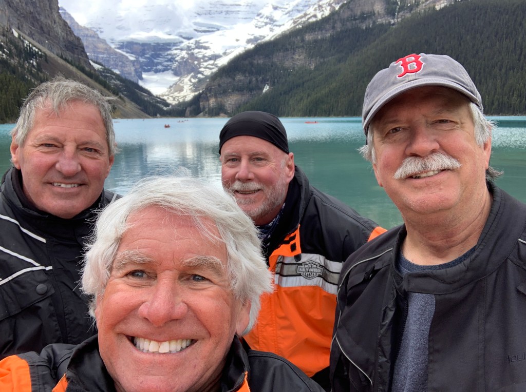
From here, you’re only 20 miles from Lake Louise, world famous for its turquoise lakes, the Victoria Glacier, spectacular mountains, a world-class ski resort and a palatial hotel.
On my 2015 Icefields Parkway ride, Randy and I rode 35 miles past Louise and stayed in Banff. In 2022, Randy, Dave, Jim and I rode 15 miles past Banff to the town of Canmore, and overnighted there.
Both locations have many comfortable places to stay, and to eat. Best yet, you’ll never be far away from a Tim Horton’s, best budget coffee and donuts in Canada.
One of the highlights of riding the Icefields Parkway is checking out Moraine Lake, near Lake Louise. (June 2022)
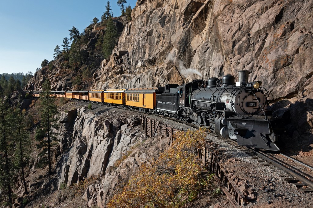
US Highway 550 from Durango, Colorado, to Ouray, is where you’ll find the Million Dollar Highway. I’ve ridden this spectacular road four times, twice from South to North (Durango to Ouray), and twice from North to South.
In all, it’s 70 miles each way, with a nearly mandatory side trip to the historic town of Silverton.
Below, I’ll describe the ride, South to North, beginning in Durango.
Durango is named after Durango, Mexico — which was named after Durango, Spain. All three Durangos are sister cities. The word Durango originates from the Basque word “Urango,” meaning “water town.” Durango sits on the Animas River at an elevation of 6,500 feet.
The city was founded in 1879 by the Denver & Rio Grande Railway. The railroad arrived in 1881, constructing a narrow-gauge line to haul passengers and freight to Silverton — and to transport silver and gold ore from the San Juan Mountains. The historic train has been in continuous operation since 1882. For $85, you can board in Durango for the 3 ½ hour, 45-mile ride to Silverton. There, you’ll relax for 30 minutes before the return trip begins. The train’s top speed is 18 miles an hour.
You can ride the train from Durango to Silverton. Or, hop on your Harley.
Leaving Durango, you head north on US Highway 550, which will take you all the way to Ouray.
You’ll be on the San Juan Skyway, another of Colorado’s designated Scenic Byways. Eleven of Colorado’s 26 byways are designated as “America’s Byways,” giving Colorado more national designations (America’s Byways) than any other state. The Colorado Scenic and Historic Byways Program is a statewide partnership designed to provide recreational, educational and economic benefits to Coloradans and visitors. Sponsors include Colorado’s Departments of Tourism and Transportation.
These byways even have a motorcycle skill rating map, providing a useful tool to help riders decide whether they have the skills needed for these often-challenging roads. The “ride difficulty levels” are rated Easy, Moderate or Difficult.
Easy roads are suitable for beginning riders, with gradual grades and gentle curves. Difficult roads require advanced riding skills, have steep grades and sharp, technical turns.
This road is part of the San Juan Scenic Byway, and it’s considered Difficult. Very Difficult.
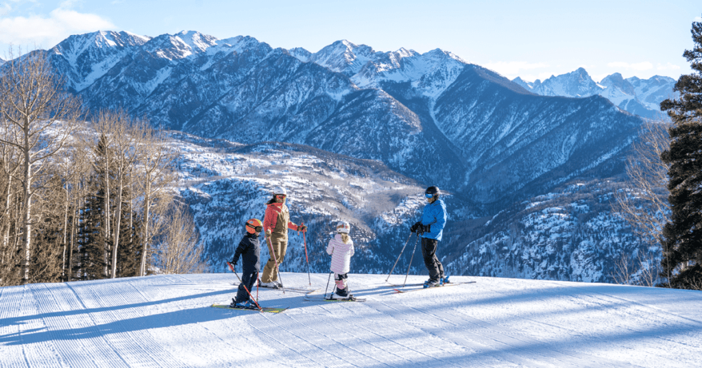
Durango Mountain Resort is family friendly, affordable, and laid back — compared to major Colorado resorts.
About 25 miles from Durango, you’ll pass by the Durango Mountain Resort, sometimes known by its former name, Purgatory. The name Purgatory comes from Purgatory Creek, which runs through the area — and from Purgatory Flats, today the location of the ski area’s base. The ski resort’s base is at 8,793 feet; its peak is 10,822 feet.
Legend has it that the Purgatory name comes from miners who were trying to get from Durango to the prosperous mines in the Silverton area. They had to pay 50 cents to use the toll road. Miners who couldn’t afford the toll were stuck in the area, which became known as Purgatory Flats. They couldn’t afford to get up the mountain, but couldn’t see themselves quitting and going down, either. Now that’s purgatory.
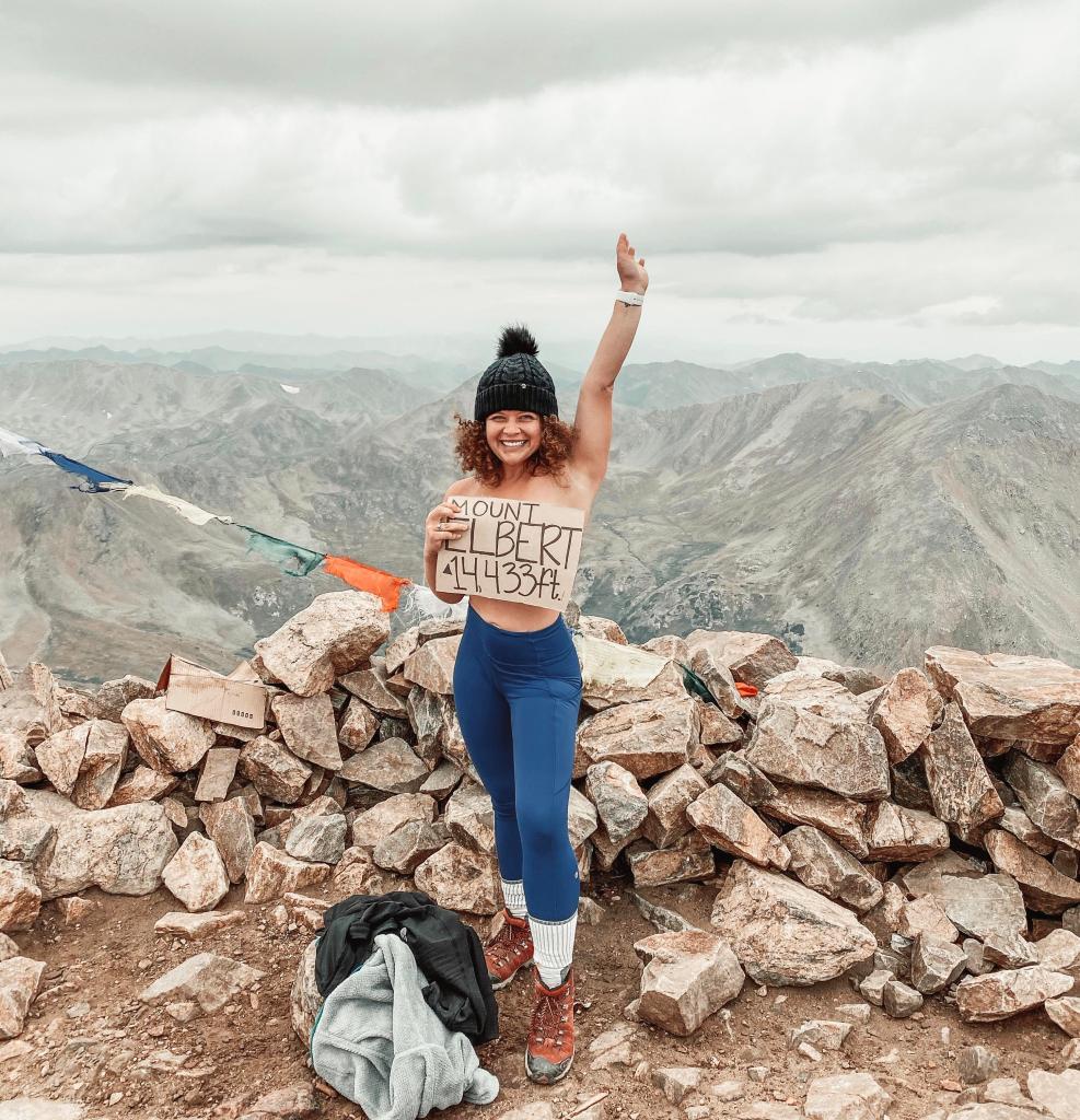
On your way north, you’ll see the spectacular nature of Colorado’s Rockies. With the exception of California’s Mount Whitney (14,505 feet), the Rockies have the tallest peaks in mainland North America, the highest of which is Mount Elbert at 14,433 feet.
This is the view from the top of Mt. Elbert. Interesting fashion statement.
Colorado has 58 mountain summits that are 14,000 feet or higher. They’re known as the 14ers.
A few miles to the east is Mount Eolus, at 14,083 feet – actually the 32nd-highest of the 14ers. Close by are Sunlight Peak (14,059 feet) and Windom Peak (14,082 feet). After a while, you almost become blasé about 13,000-foot peaks. Colorado has 637 of them, way too many to mention, but hugely impressive, nonetheless.
The Rockies are a haven for snow-addicted thrill seekers. Some have climbed all 54 of the 14ers. Chris Davenport thought that wasn’t difficult enough, so he decided to climb up, then ski down all the 14ers. If you’ve got the time, check out his adventure.
About halfway from Durango to Ouray, you’ll ride over Coal Bank Pass, which sits at 10,640 feet. Its name refers to the area’s rich mining history.
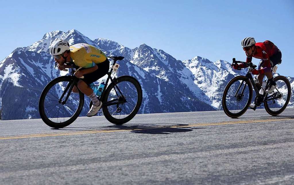
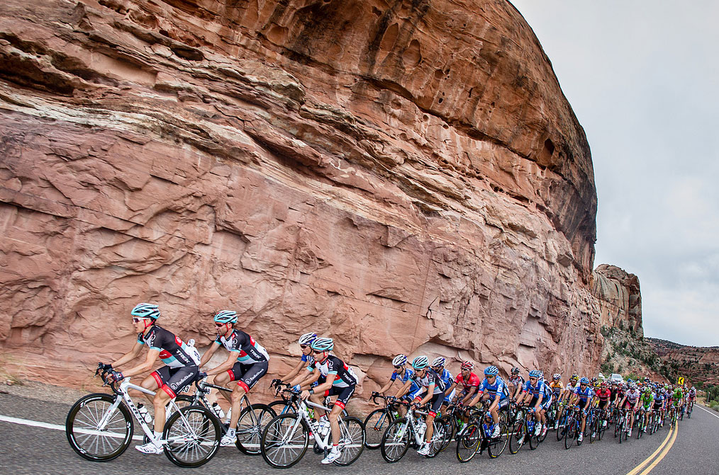
Twenty miles past Coal Bank Pass is Molas Pass, 10,910 feet. Molas Pass is the second and last mountain pass in the Iron Horse Bicycle Classic, where bikes race a train up the mountain from Durango to Silverton. Every May, over Memorial Day weekend, since 1972 — it’s a big test of man versus machine. In the event, cyclists race over mountain passes to beat the steam engine train – the Durango and Silverton Narrow Gauge Railroad, which runs the same route. To beat the train, cyclists need to cover the 47 miles in less than three and a half hours. Thousands of riders, professional and less so, show up for the event from all over the country. It’s quite the party.
The descent in the Iron Horse Bicycle Classic can be quite a speed test. Above, Caleb Classen leads Howard Grotts down Coal Bank Pass in the 2023 event, won by Classen in a time of two hours, seven minutes and 18 seconds. His average speed for the 47 mile ride: 22.1 miles an hour!
From Molas Pass, it’s only seven miles to Silverton, a former silver mining camp, now designated a National Historic Landmark District – and the only incorporated municipality in San Juan County.
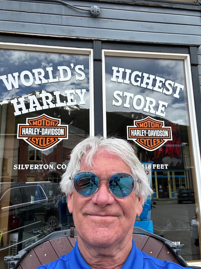
Silverton, at 9,308 feet, is home to the world’s highest Harley Davidson store. The store draws quite a few Harley riders, including us. “They want the T-shirt,” said store owner Jeff Murray, “and the only way they can get it is to come to Silverton.”
I did not buy a t-shirt. (June 2023)
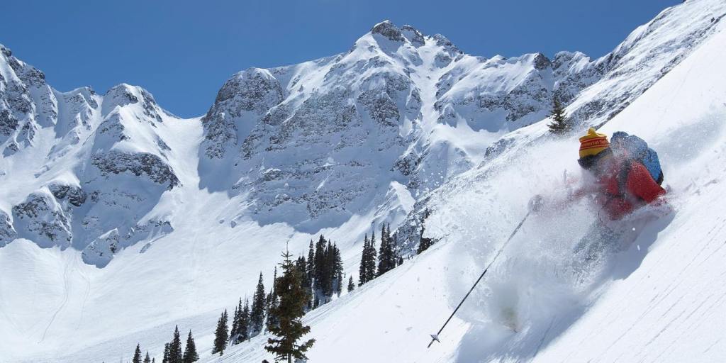
Nearby Silverton Mountain, six miles from downtown Silverton, is Colorado’s highest and steepest ski area, with un-groomed, no-easy-way-down expert terrain only. With more than 400 inches of snow each year, the resort describes itself as “all thrills, no frills … deep and steep.”
It has one chairlift that begins at the base elevation of 10,400 feet, and rises to 12,300 feet. For the truly adventurous, which is pretty much everyone who comes here, the ski area includes skiing all the way up to 13,487 feet. To get there, you can hike. Or, take a helicopter.
Because of the unpatrolled and un-groomed nature of Silverton Mountain, skiers are required to have avalanche gear: a beacon, shovel and probe. The ski resort is open December through April, Thursday through Sunday. Lift tickets are $59 for the day. Or, you can get an all-day heli-skiing pass for $999, which includes six “drops.”
Be sure to bring your “A” game.
Skiing at Silverton Mountain is the real deal.
From Silverton, the remaining 25 miles of US Highway 550 are quite a thrill. This road, part of the San Juan Skyway Scenic Byway, is known as the Million Dollar Highway. It’s one of the most scenic roads in the US — and one of the most perilous, according to dangerousroads.org.
The Million Dollar Highway has steep cliffs, narrow lanes, hairpin curves, and few guardrails. On a motorcycle, it’s a thrill ride and a truly sphincter-tightening experience. I’ve ridden the road four times now, each time like Grandpa would. That’s how I roll. The Million Dollar Highway gets a little less frightening every time you ride it. Or not.
There are several stories about how the road got its nickname of the “Million Dollar Highway.” One is a legend that the road was made from a million dollars’ worth of gold and silver filled tailings. Another is a tale of a woman who traveled the road saying, “I would not travel that road again for a million dollars.” Yet another is that the view is worth a million dollars.
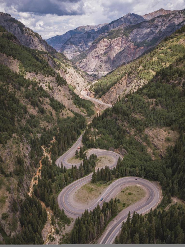
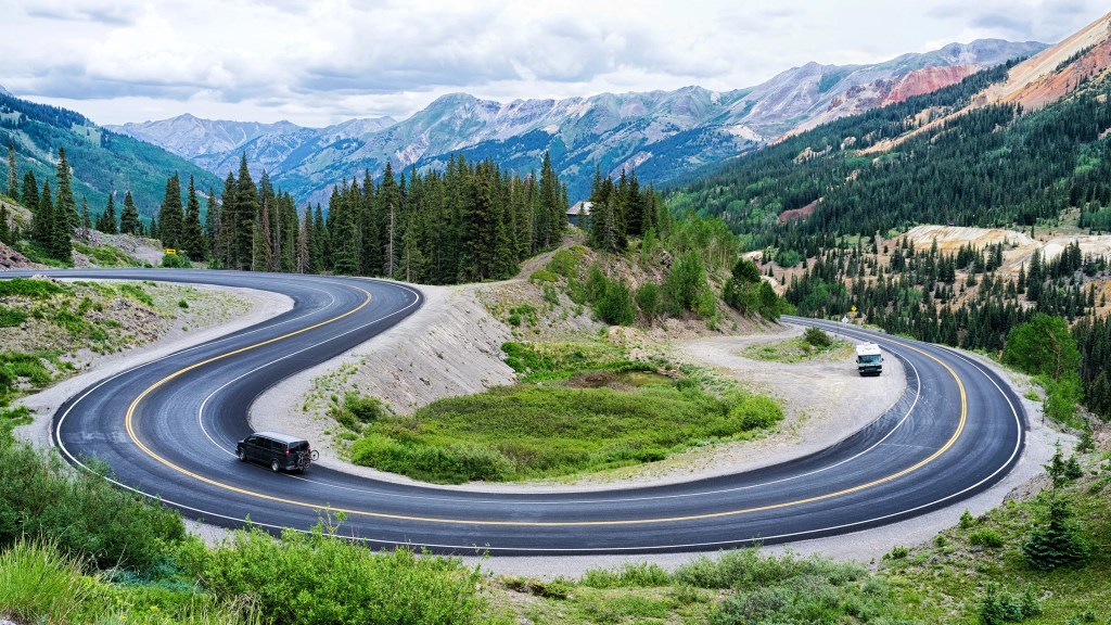
Part of the famed “S Loop.”
The truth is that when the three contractors paving the highway in the 1920s – the State of Colorado, the U.S. government and the U.S. Forest Service — compared notes, they realized that the cost of their three projects to upgrade the road to an automobile road totaled $1 million. Someone suggested that “We have ourselves a million-dollar highway,” and the name stuck.
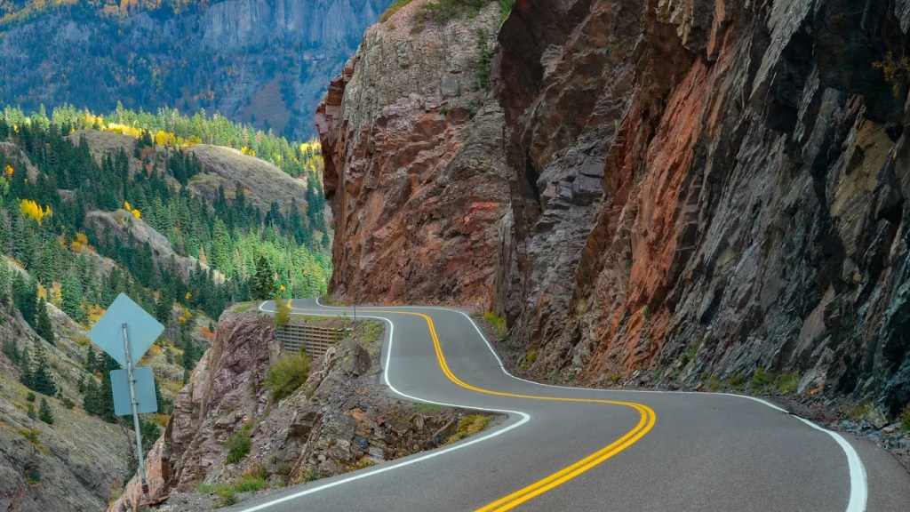
Though the entire stretch from Silverton to Ouray earns the Million Dollar designation, it’s really the 12 miles from the summit of Red Mountain Pass (11,018 feet) through the Uncompahgre Gorge to Ouray, where the highway gets its reputation.
It’s unclear exactly where the Million Dollar Highway gets its name. Locals disagree as to whether it is named for the millions of dollars of gold, silver and other minerals extracted from these mountains, the cost of building the road (reputed to be a million dollars a mile), or for the spectacular views.
Riding north from Silverton, you’ll pass through the ghost town of Ironton. At one time, Ironton was a major transportation junction between Red Mountain and Ouray, in addition to having some of its own mines. Ironton sits at 9,756 feet, and is about two-thirds of the way from Silverton to Ouray.
In the winter, Ironton has cross country ski trails and hiking trails leading to beautiful vistas. In mining’s heyday, it was home to many miners who worked in the mines above town on the slopes of Red Mountain. In the late 1800s, two trains arrived daily in Ironton, coming from Silverton.
Ironton’s mines made their wealth from silver and lead, and eventually from gold. From Ironton, it’s only eight miles on US Highway 550 before you get to Ouray.
Woo-hoo, just a few miles from Ouray.
You arrive in Ouray with a sense of exhilaration and survival.
Ouray, which sits at 7,792 feet, is one of the most breathtakingly beautiful mountain towns imaginable.
Named after Chief Ouray of the Ute Indian Tribe, Ouray was originally established by miners chasing silver and gold in the surrounding mountains. Prospectors arrived here in 1875. At the height of its mining boom, Ouray had more than 30 active mines.
All of Ouray’s Main Street is registered as a National Historic District. Several buildings are listed on the National Register of Historic Places.
It’s a beautiful setting for a town.
Today’s Ouray economy is based entirely on tourism. Ouray bills itself as the “Switzerland of America,” because of its setting at the narrow head of a valley, enclosed on three and a half sides by steep mountains. Much of the tourism is focused on ice climbing, mountain biking, hiking and off-roading in the San Juan Mountains.
There are places to stay overnight in Ouray, or you can continue 35 miles north to Montrose, which has motels, fast-food franchises, and stoplights galore. Or, if you’re lucky enough to live in Carbondale, as I am, ride 100 more miles and sleep in your own bed.
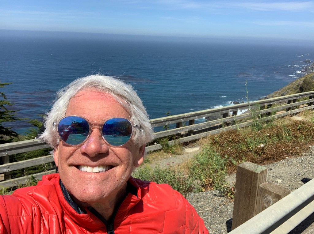
With John Tracy, overlooking the Pacific Ocean along the Pacific Coast Highway. (July 2019)
The Pacific Coast Highway runs more than a thousand miles from Southern California to the Strait of Juan de Fuca in Washington State. I’ve ridden this spectacular coastal highway twice, once each direction, including the Oregon coast and crossings of the Golden Gate Bridge
But by far the best-known, and most beautiful stretch of road is about 100 miles of California coastline, from the seaside city of Monterey to the artistic colony called Cambria.
The route description below will take us from North to South, beginning around Monterey Bay.
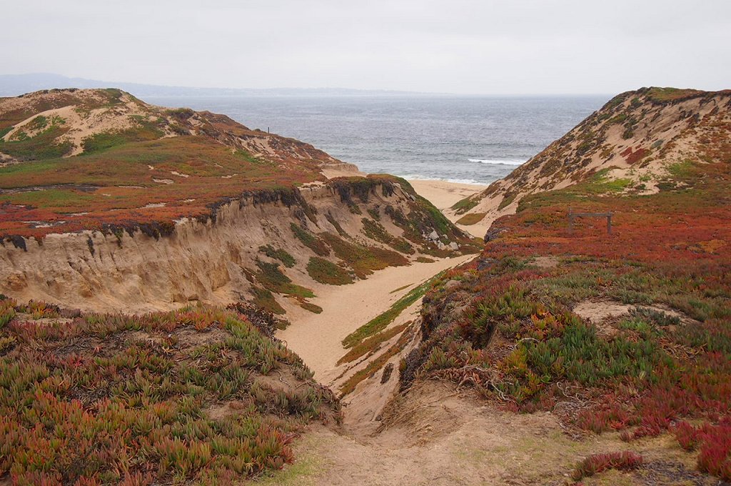
The dunes at Ford Ord Dunes State Park.
Ford Ord Dunes State Park was once the home of the Fort Ord Army training area. The old Army facility closed in 1994, and some of the land was converted into the Fort Ord National Monument.
During its peak, the base hosted as many as 50,000 soldiers — many receiving basic training there, as I would have if I’d been drafted into the Vietnam War. My 1969 draft lottery number was 236, allowing me to skip the Fort Ord and boot camp experience altogether.
The site functioned as a military base for more than 70 years until it was closed down as a result of the 1988 Base Realignment and Closure act, signed by President George H. W. Bush. Fort Ord was the biggest base to be shut down that year by what is commonly known as BRAC.
Base Realignment and Closure is a congressionally-authorized process to increase the Department of Defense efficiency by closing and consolidating military installations. Since the first BRAC in 1988, more than 350 installations have been closed.
Not far from Fort Ord is California State University, Monterey Bay. It’s located on the site where Fort Ord used to be. The university was founded in 1994 with an enrollment of 654 students. Today, it has 10 times that many. Fun fact: 64 percent of the students here are female.
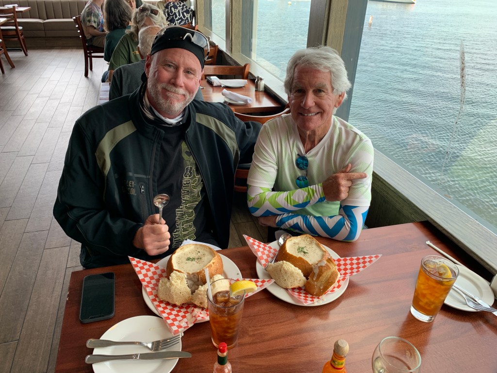
A tradition on these trips is to stop in Monterey for clam chowder along their fishermen’s wharf. It’s a simple concept: clam chowder served out of a hollowed-out piece of French bread.
Chowder on the Monterey pier. Great tradition. (June 2022)
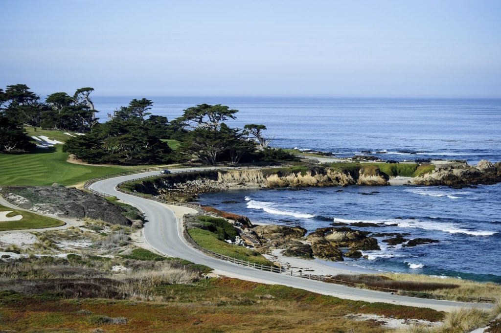
If there was any justice in this world, even a shred of basic fairness, a motorcycle ride in this area would certainly include the famed 17-Mile Drive. It’s one of the most scenic drives anywhere.
The 17-Mile Drive is the main road through the gated community of Pebble Beach. For $12 per vehicle (it’s reimbursed if you spend $35 or more at any Pebble Beach restaurant!), you get the opportunity to visit world-famous golf courses, see the Lone Cypress Tree, and ride past Lovers Point Park.
If you’re on a Harley, you’ll do none of that. The uber-wealthy snobs who own property here in the Del Monte Forest for some reason are not fans of motorcycles, and don’t allow them. No vroomin’ in the ‘hood.
Damn rich people.
This is what we would have seen, if we had left the Harleys at home, or taken an Uber.
Just past the southern gate to the 17-Mile Drive, you pass Carmel, formally known as Carmel-by-the-Sea. Carmel is a small beach town famed for its natural scenery and rich artistic history. Carmel has several unusual laws, including a prohibition on wearing high-heel shoes without a permit. Actor-director Clint Eastwood was elected Mayor of Carmel in 1986, and served a two-year term.
Point Lobos is just south of Carmel. The Point Lobos State Natural Reserve is called the crown jewel of California’s 280 state parks. Point Lobos, with its headlands, coves and rolling meadows, is full of hiking trails. Wildlife here includes seals, sea lions, sea otters and — from December to May — migrating gray whales. The area used to be the home of a thriving whaling and abalone industry.
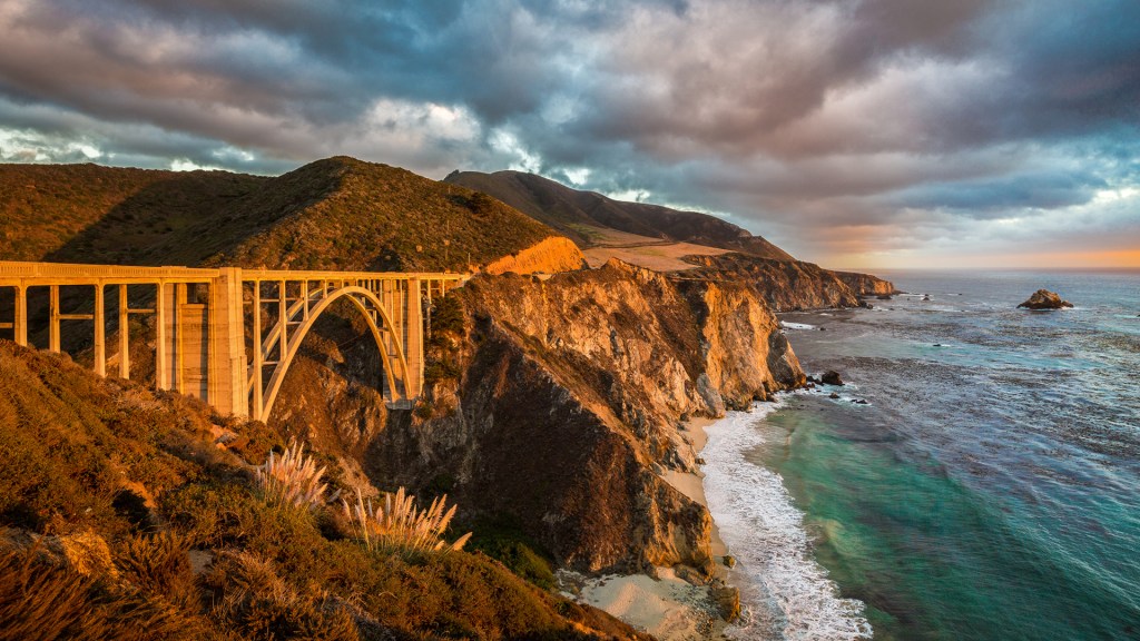
After Point Lobos, you’ll roll through Carmel Highlands, then Garrapata State Park — with its two miles of beachfront and coastal hiking. From here, it’s only a few miles to the picturesque Bixby Creek Bridge, perhaps the most photographed in California — after the Golden Gate.
Before the Bixby Creek Bridge opened in 1932, residents of the Big Sur area were virtually cut off during winter due to blockages on the often-impassable Old Coast Road, which led 11 miles inland.
The Bixby Creek Bridge is as iconic as it gets.
Big Sur has been called the longest and most scenic stretch of undeveloped coastline in the lower 48. It’s a popular destination for about seven million people who live within a day’s drive, and visitors from across the world. The region receives about the same number of annual visitors as Yosemite National Park, but offers extremely limited bus service, few restrooms, and a narrow two-lane highway with few places to park alongside the road.
In Big Sur, you’re about a mile inland, nestled among redwood forests. Leaving Big Sur, you make a beeline to the coast. For the next 80 miles, there’s minimal development and maximal beauty. It’s a narrow, twisty roadway with steep drop-offs over cliffs that drop precipitously to the Pacific Ocean.
Now the fun really begins.
Along the Pacific Coast Highway, near Gorda. (June 2022)
Twelve miles south of Big Sur, you roll through Julia Pfeiffer Burns State Park. The 3,762-acre park is named for Julia Pfeiffer Burns, a respected pioneer and rancher in the Big Sur region in the early 20th century, who lived in the area for much of her life until her death in 1928. The park has fabulous hiking, and even scuba diving in the Julia Pfeiffer Burns Underwater Area.
For the next several hours, until you reach San Simeon, it’s nothing but miles and miles of unparalleled visual allure. There are occasional places, like Lucia, Gorda, and Ragged Point, to pull over and grab a beverage. But the unending rugged beauty and lack of development is what sets this road apart.
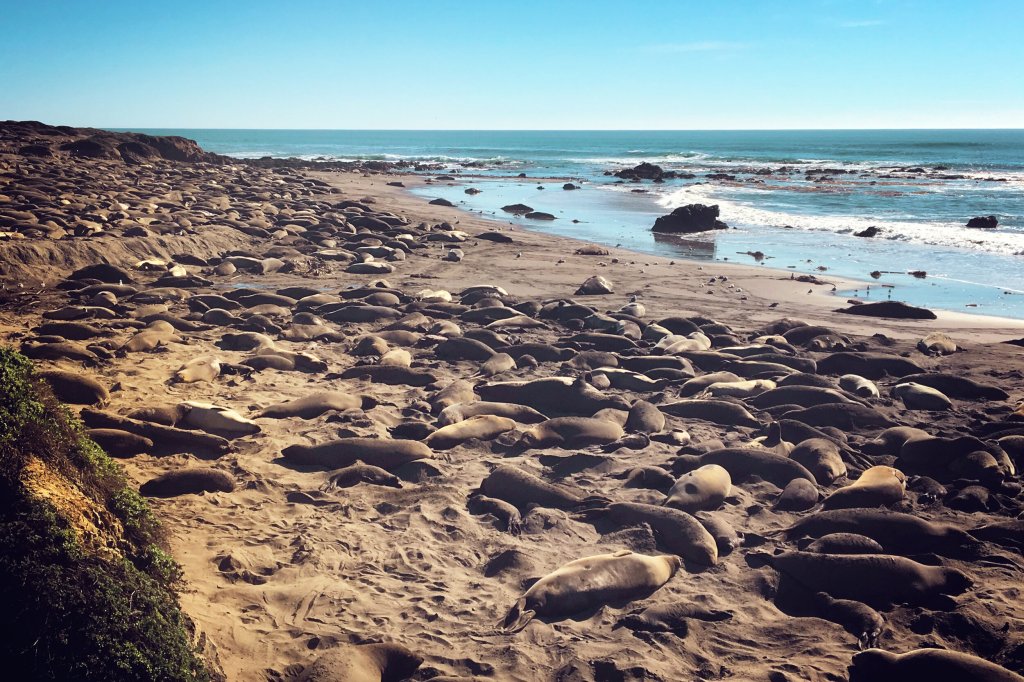
A few miles before San Simeon is the Piedras Blancas State Marine Reserve, a 20-square mile area that protects all marine life within its boundaries, including sea lions, elephant seals, harbor seals, northern fur seals and sea otters. These marine protected areas are designed to conserve and restore ocean biodiversity.
If you like elephant seals — and who doesn’t? — you’ll enjoy Elephant Seal Vista Point, the last place to gawk at nature before San Simeon. Elephant seals are huge, loud, and so ugly they’re cute. On San Simeon State Beach, about 18,000 elephant seals crowd this four-mile stretch of beach.
The peak months for viewing elephant seals here: October through March. Timing is everything.
Elephant seals. Noisy, and plentiful.
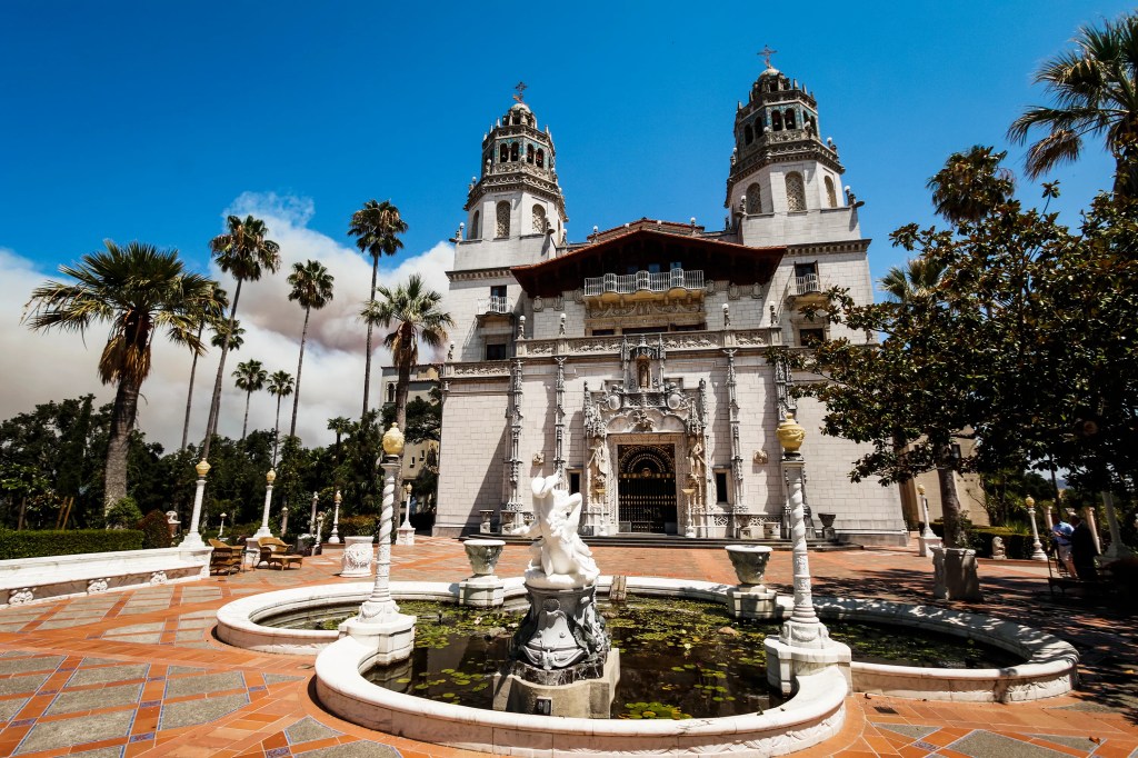
William Randolph Hearst’s timing was impeccable. He got disgustingly wealthy in the early 1900s, making a fortune in the newspaper business, developing what was at the time the largest newspaper chain in the US. Hearst dreamed big, and lived large. Between 1919 and 1947, he built La Cuesta Encantada (The Enchanted Hill), known today as the Hearst Castle.
At the height of Hearst’s wealth, the estate around the castle totaled more than 250,000 acres. Hearst, his castle and his lifestyle were satirized by Orson Welles in his 1941 film, Citizen Kane.
The Hearst Castle, a good reminder of when there was money in daily journalism.
The Hearst Castle is a 90,000-square foot mansion that overlooks the Pacific Ocean. Today, the Hearst Castle is a state park, and a National Historic Landmark.
From San Simeon, it’s only 10 miles to Cambria, a popular overnight destination at the end of the Pacific Coast Highway. What a day. What a ride!
With Randy Suhr, on Utah’s fabulous Highway 12. Wake up, Randy! (May 2016)
Highway 12 begins a few miles south of Panguitch, Utah, and ends in Torrey. I’ve ridden this road, all 124 miles of it, a half dozen times. I absolutely love it. Except the hogbacks. That’s my personal challenge, and they shouldn’t bother you, assuming you’re OK with steep drop-offs on both sides of the roadway, with no guardrails.
This roadway is beyond awesome, and is on everyone’s list of “best motorcycle rides in the US.” It’s all great. Except the hogbacks.
Highway 12 is an All-American Road, Utah’s only byway with that designation. Considering all the next-level awesome riding in Utah, that’s saying something.
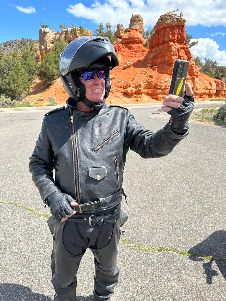
Mark Mark Thompson, at the entrance to Red Canyon. (June 2023)
Heading east on Highway 12, you soon arrive at the start of Red Canyon. The red color of the rock that characterizes this canyon — and this part of Utah — is due to the combination of iron and oxygen, called iron oxides. Of all the common colorful minerals found in Earth’s crust, few are as abundant, dynamic, and multi-colored as iron. The beauty of Utah’s Red Rock Country is due to a single element: iron. The process of the iron oxide weathering is what gives the rock its signature red color.
Soon, you’re surrounded by brilliant red sandstone spires and formations. The rocks are largely limestone, built from sediment of a lake that covered the region 35 to 50 million years ago.
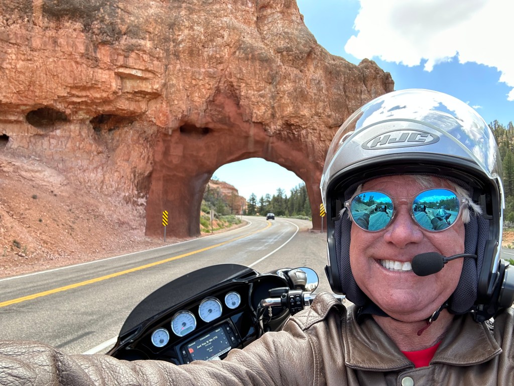
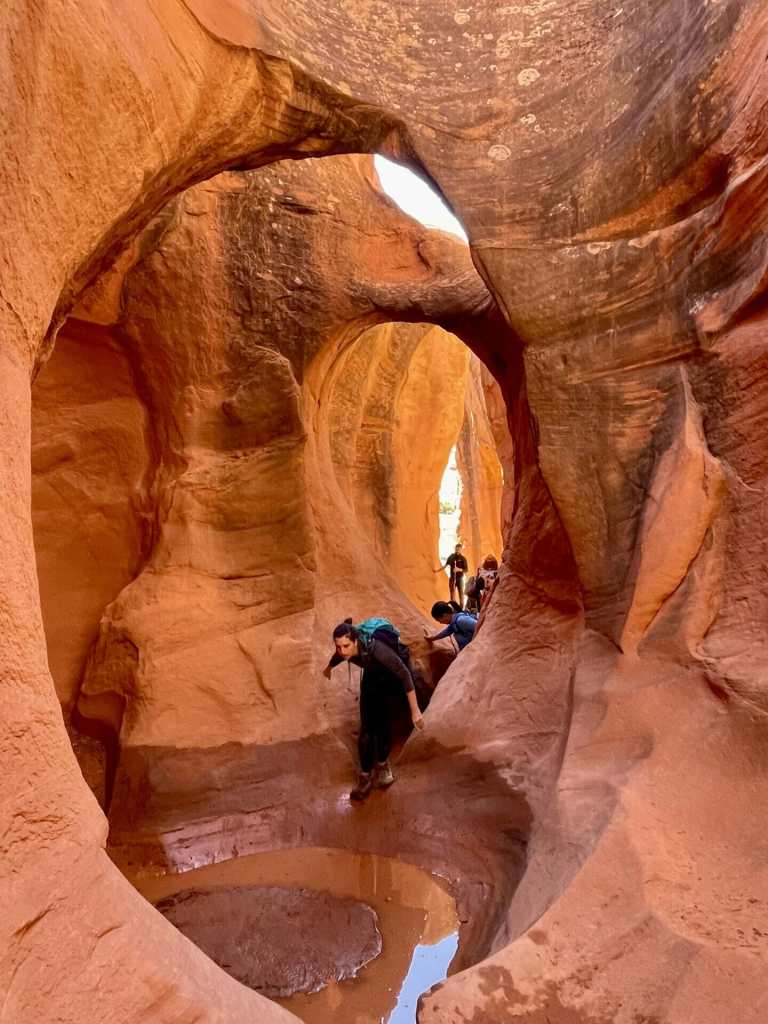
Near the beginning of Red Canyon, Highway 12 ducks through two short red rock arch tunnels, originally built in the early 1900s. Since their original construction, the tunnels have served as the unofficial gateway to nearby Bryce Canyon National Park, which we’ll visit shortly. Both tunnels are listed as National Historic Landmarks.
The tunnels in Red Canyon serve as an unofficial Gateway to nearby Bryce Canyon National Park. (June 2023)
Highway 12 was added to the Utah state highway system in 1914, and it required tunneling through two rock formations. Ceremonies to open the newly authorized Bryce Canyon National Park, occurred in front of one of the tunnel arches in almost 100 years ago. On June 1, 1925, a 315-car caravan arrived at the Red Canyon tunnels to celebrate the opening of Utah National Park — later renamed Bryce Canyon National Park. A banner at the ceremony proclaimed, “Welcome to Utah’s Fairyland.”
The tunnels are technically part of the state’s bridge inventory, and are inspected regularly for structural integrity. In 2018, before the busy tourist season got underway, construction crews shored up the tunnels, a $2.5 million rehabilitation project brought about by nearly 100 years of decay and erosion.
Less than 10 miles past the tunnels, you pass by the turnoff to Bryce Canyon National Park, home of the hoodoo.
Like most of Utah, the area near this canyon was settled by Mormon pioneers in the 1850s, and named after Ebenezer Bryce, who homesteaded here in 1874. Bryce, originally from Scotland, became a ship’s carpenter, converted to Mormonism, and left Scotland for Utah in 1847 at age 17. He was the only member of his family to be a Mormon Church convert; his father was so displeased about the conversion that he disowned young Ebenezer.
Bryce Canyon is a natural amphitheater adorned with hoodoos, irregular pillars of red, white, pink, and orange. Hoodoos exist on every continent, but Bryce Canyon has the largest concentration of them anywhere on earth. Hoodoo shapes are affected by the erosional patterns of alternating hard and softer rock layers.
Bryce Canyon is hoodoo central.
But if you’re truly committed to Highway 12, you skip Bryce Canyon and keep riding northeast.
Just ahead is Tropic, the largest of three small ranching communities that make up the Bryce Valley. Tropic was founded in 1892, when 15 pioneer families came to settle the community. Today, the small town of 500 residents remains a ranching community, and is also part of the valley’s booming tourism industry. Ebenezer Bryce’s historic cabin is now a pioneer museum in Tropic, and you can visit it. The cabin is about two miles south of town, on the east side of the Pahreah River.
The other two ranching communities ahead on Highway 12 are Cannonville and Henrieville. Both started off with a strong Mormon history, and retain the church’s cultural and religious dominance today.
Cannonville, population around 150, bears the name of George Q. Cannon, a Mormon leader in the late 1800s. He was the church’s chief political strategist, and an early member of the church’s Quorum of the Twelve Apostles, a dozen old white men who lead the church. Cannon was a five-time Utah territorial delegate to the US Congress.
Henrieville, with a population is a little more than 200, is named after James Henrie, another Mormon leader. Henrie was the first president of the Mormon Panguitch Stake, which was established in 1877.
You can take guided tours of the Grand Staircase area.
Just past Henrieville you’ll see the actual “stairs” in the Grand Staircase-Escalante National Monument, extending across 1.9 million acres of federally owned land. Cannonville, Henrieville, and Escalante — a few miles up the road — sit along the northwest edge of the huge monument. Grand Staircase-Escalante is so large that it borders Bryce Canyon National Park, Capitol Reef National Park, Lake Powell, Glen Canyon National Recreation Area, Vermillion Cliffs National Monument, and stretches almost to the Grand Canyon.
Grand Staircase-Escalante National Monument was established as a National Monument in 1996 by President Bill Clinton, under the authority of the Antiquities Act, which gives presidents the authority to protect land. Establishing the National Monument was a big moment for conservation in the US. In this vast monument, you’ll see everything from Navajo sandstone cliffs to narrow slot canyons and arches. It’s so huge and remote that it was the last part of the lower 48 United States to get mapped.
In 30 miles, you arrive in Escalante, home to about 800 residents. Escalante’s been on maps for a long time.
The scenery near Escalante. That’s a lot of red.
The town of about 800 is named after Silvestre Vélez de Escalante, a Franciscan missionary and a member of the first European expedition into southern Utah. Escalante was part of a small group that left Santa Fe, New Mexico — and tried to find a route to the missions of California.
The Dominguez–Escalante Expedition followed a route north through western Colorado, west across central Utah, and then southwest through what is now called the Escalante Desert, finally circling back to the east after reaching Arizona near the north rim of the Grand Canyon. They returned to Santa Fe having never entered California or the areas near what is today the city of Escalante.
In the 1870s, settlers from Panguitch first visited the area, where they met members of the John Wesley Powell expedition. The settlement was named based on a suggestion of Powell’s group to honor Escalante, even though the expedition had not traveled into the valley. In June 1875, the settlers returned to survey the valley. They staked out 20-acre parcels, liked what they saw, and decided to stay.
After a break in Escalante, you press on for the final 64 miles to Torrey. This stretch of road is some of the most awe-inspiring of the day.
Building Highway 12 was no piece of cake. Utah took nearly four decades to complete construction of the byway. It’s an engineering masterpiece, which you’ll soon discover.
The hogback on Highway 12 gets your attention, if you’re riding a two-wheeled vehicle.
Sporadically, from the 1940s to the 1980s, construction crews blasted, cut and paved their way through rugged hills and cliffs. Road construction was an engineering marvel, and was the work of the Civilian Conservation Corps.
Soon, you’ll have a startling vista of the Escalante Canyons, a labyrinth of deep channels breaking up the expanse of petrified dunes, appears. There are no guardrails along this section of Highway 12, which local residents have named the Hogsback, or Little Burma Road. With 14 percent grades, it snakes along a ridge with fatal drop offs on either side. It’s only fatal if you go off the road.
Sometimes known as Hell’s Backbone, the road follows the spine of the Aquarius Plateau, skirting the edge of the Box and Death Hollow. Hell’s Backbone was built to connect Escalante with Boulder, a distance of 28 miles.
Building this roadway was quite the feat of civil engineering.
I’ve ridden the hogbacks a half dozen times, all with the same feeling of utter terror. As someone who loathes steep drop-offs — on hikes and Harley rides — I hate this part of Highway 12. But it’s the only route to Torrey, so I just press on, as I’m sure you will, too.
The next town ahead is Boulder, which sits at 6,700 feet at the base of Boulder Mountain – just eight miles past the Hogback.
Boulder claims to be the last community in the continental US to receive its mail by mule train. Completion of a year-round dirt road in 1939 opened Boulder to car traffic from the south and west. The mail mules are now retired.
Torrey, the destination at the end of the Highway 12 ride, is just 37 miles north of Boulder on Highway 12. In 1977, this stretch of road was the only remaining unpaved section of Highway 12. Before the Boulder Mountain section of Highway 12 was paved, snow and mud closed the dirt road from late November until May. Even in the summer months, traveling the unpaved road over Boulder Mountain could be a bone-rattling adventure.
On Highway 12 over Boulder Mountain, Dave attends to Randy’s windshield, as rain approaches. (May 2016)
Paving the Boulder Mountain road brought change to communities along Highway 12. And it attracted visitors from around the world to these once-isolated communities, making tourism a central part of local economies. That, along with its designation as an All-American Highway, brought tourism to Boulder.
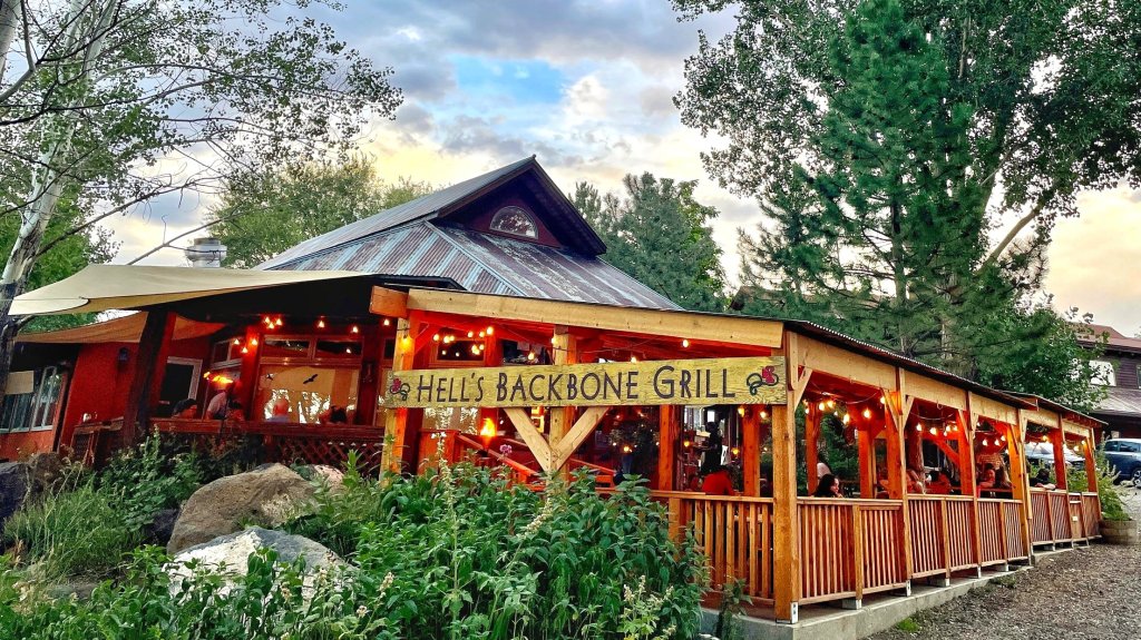
If you have time, stop by Hell’s Backbone Grill for lunch. Travelers will be pleasantly surprised to find this Zagat-rated organic eatery, run on Buddhist principles, with a focus on sustainability. The restaurant serves a style of “Four Corners cuisine,” an updated combination of cowboy classics, Mormon recipes and traditional Southwestern fare. The food is organic and locally produced, matched with the seasons. For a town of 200, Boulder has some other restaurants worth a try, including Sweetwater Kitchen and Burr Trail Grill.
Five-star dining in the middle of nowhere.
Leaving the town of Boulder, elevation 6,700 feet, you’ll begin your journey up the mountain.
You’ll climb nearly 3,000 feet, twisting and turning, before arriving at the Highway 12 summit of Boulder Mountain. Also known as Bluebell Knoll and Boulder Top, Boulder Mountain reaches 11,317 feet – not the highway, the mountain peak.
When the Tour de Utah bicycle race was held annually, beginning in 2010, it attracted world-class cyclists for a 700-mile, week-long battle. One of the stages ended in Torrey. The 99-mile ride began in Escalante, went over Boulder Mountain, and crossed the finish line in Torrey. During that day’s ride, the peloton gained 9,435 vertical feet, and included a King-of-the-Mountain climb.
The race’s terrain boasted a mix of high-altitude mountains, punchy climbs, testing time trials and rapid sprint finishes. Each year, the field got bigger and stronger, and included well-known cycling names who had Tour de France experience; Levi Leipheimer won the event in 2010 and 2011.
The Tour de Utah is no longer held, primarily due to lack of economic support. Cycling hasn’t caught on in the US, the way it has in Europe. Utah’s isn’t the first race to disappear off the USA bicycle racing calendar; the Tour de California, and the Tour of Colorado have both fallen by the wayside, leaving no major American cycle races.
The Tour de Utah took advantage of Utah’s breathtaking scenery along Highway 12.
Whether on bicycle, motorcycle, car or truck, Highway 12 traverses the eastern side of the mountain from Boulder to Torrey. It follows the same route as the peloton did.
Boulder Mountain’s 50,000 acres of trees cover half of the Aquarius Plateau, making it the highest wooded plateau in North America. The mountain is filled with a dense forest of pine and aspen trees. As you approach the summit, you’re riding above the tree line. It’s very stark, and a much lower tree line than what you experience in Colorado.
The summit of Highway 12, which sits at 9,591 feet, is nearly flat and covers roughly 70 square miles.
As you would expect, the summit is about halfway between Boulder and Torrey. Here, you begin the 3,000-foot descent into Torrey, which, for a small town, has several nice places to stay.
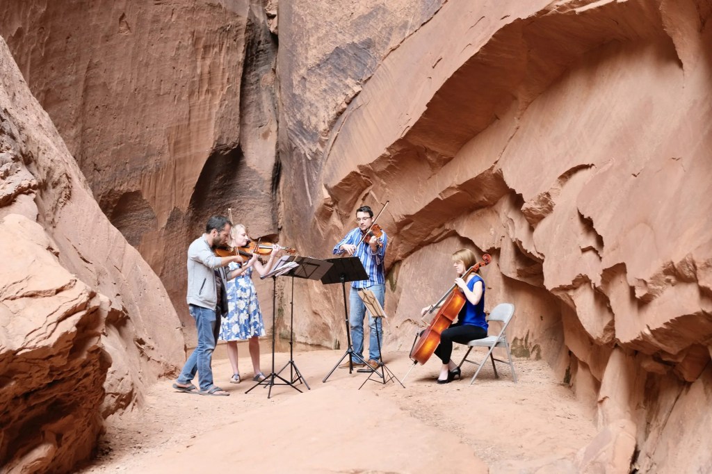
Torrey sits at the intersection of Utah Highways 12 and 24. The town is home to an annual Cowboy Music and Poetry Festival. It also has a Chamber Music Festival, held every summer over a three-day weekend in June.
Chamber music among the red rocks.
Torrey is probably best known as the gateway to Capitol Reef National Park. Because of its clear skies and high elevation, Torrey has been designated one of just 115 certified International Dark Sky Places in the world. Nearby Capitol Reef National Park is also a designated Dark Sky Park, and was the first National Park in the U.S. to become one.
Originally settled by Mormon pioneers in the 1880s and called Youngstown, the town was renamed when it got a US post office. It was named in honor of Wyoming legislator and Rough Rider Colonel Jay L. Torrey. The town of Torrey has always attracted famous visitors, including Major John Wesley Powell, outlaw Butch Cassidy, author Zane Grey and artist Maynard Dixon.
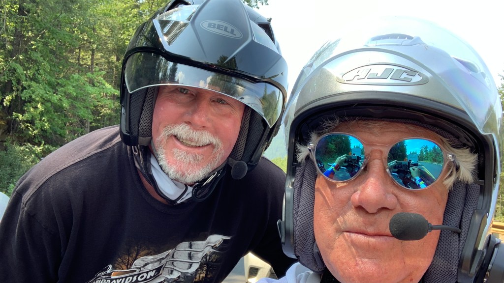
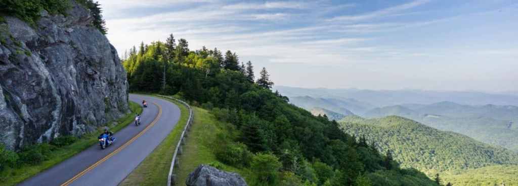
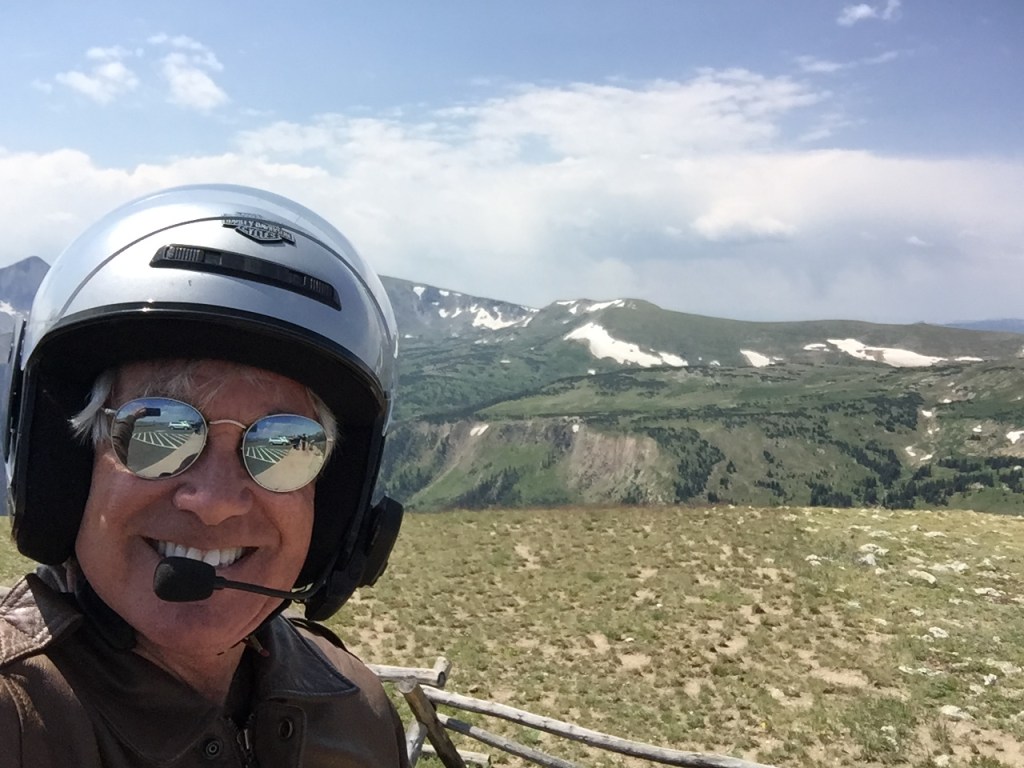
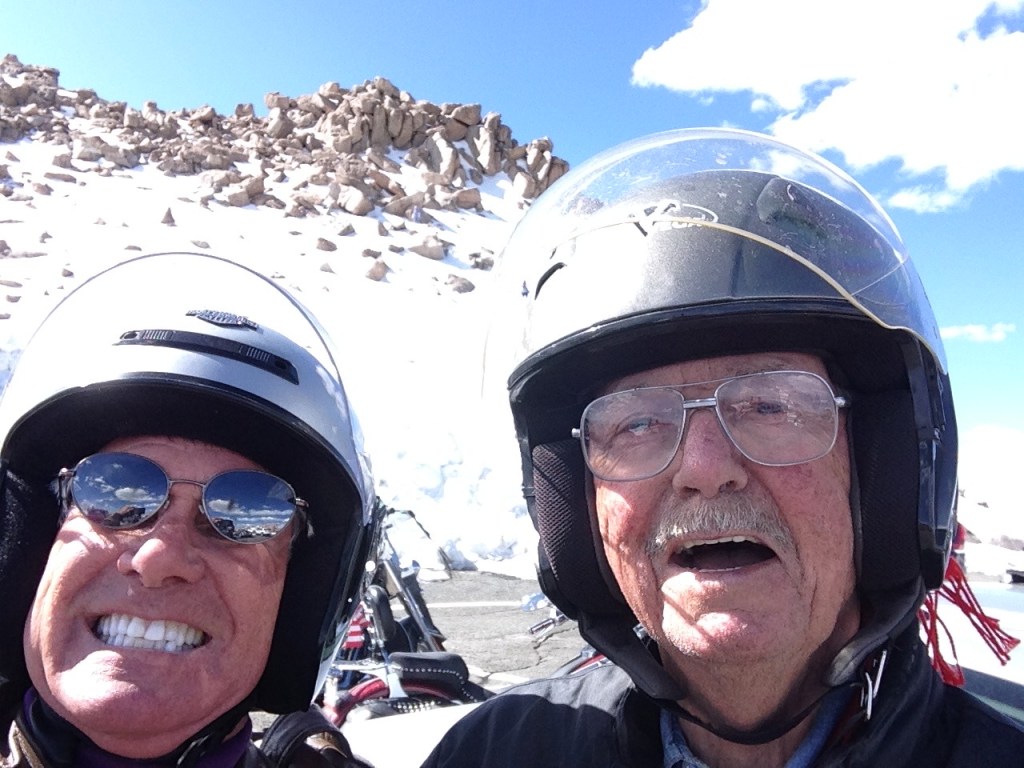
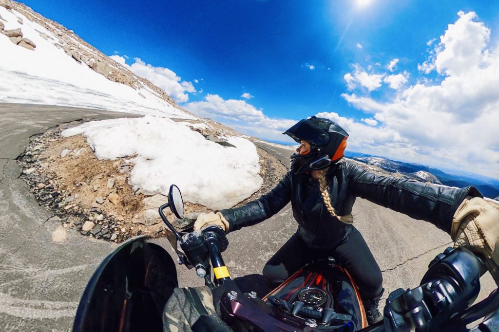
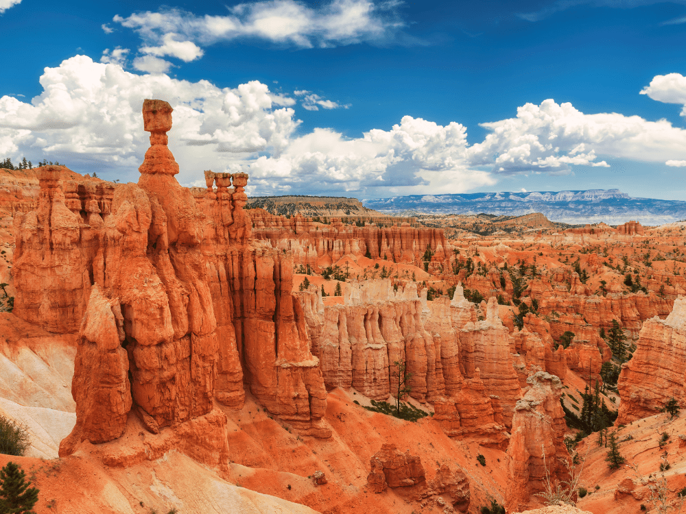
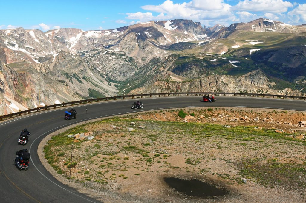
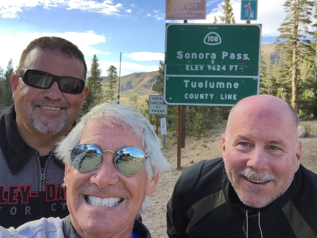
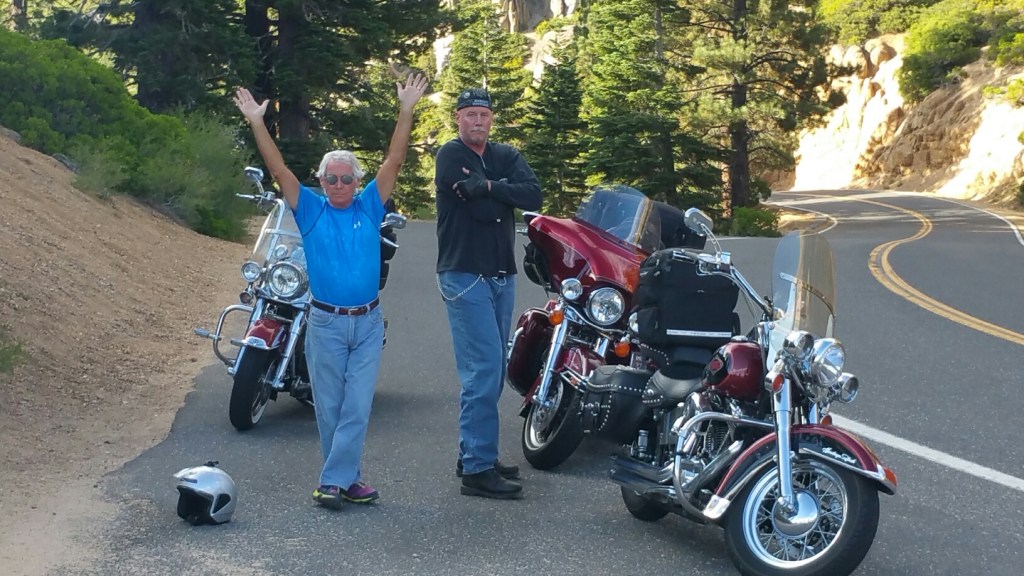
I’ve ridden the Beartooth Pass Scenic Highway twice. Same year, same trip. Two days in a row. Rained like crazy both days. Ugh. And yet, it is Number Two on my Top Ten list. It’s that awesome.
The name “Beartooth” comes from a Crow name, Na Piet Say, meaning “the bear’s tooth” and refers to a sharp spire that juts from the Beartooth plateau. The Beartooths are the location of Granite Peak, which at 12,807 feet, is the highest point in the state of Montana.
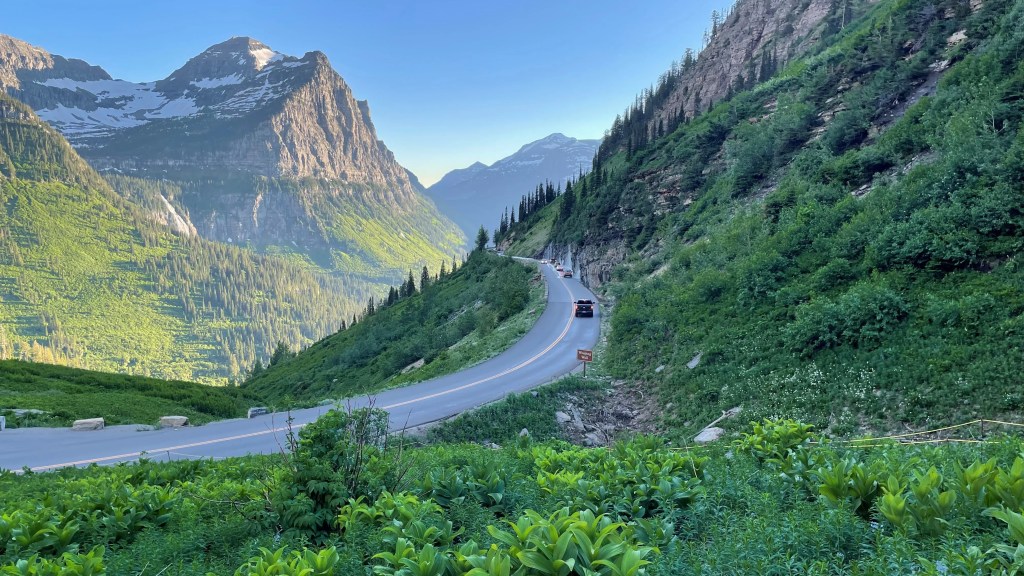
The ride over Beartooth Pass and onto Chief Joseph Scenic Byway begins in Red Lodge, Montana. Elevation here is 5,588 feet.
Red Lodge marks the start of the Beartooth Highway to Chief Joseph Scenic Byway ride.
On September 17, 1851, the United States government signed a treaty with the Crow Nation, ceding the area that now contains Red Lodge, to the Crow Indians. An 1880 treaty between the US government and the Crow allowed the area to be settled, starting April 11, 1882.
For the Crow Indians, Red Lodge was a place of worship and hunting. They painted their council tepee with red clay. Folklore tells us this tradition gave Red Lodge its name.
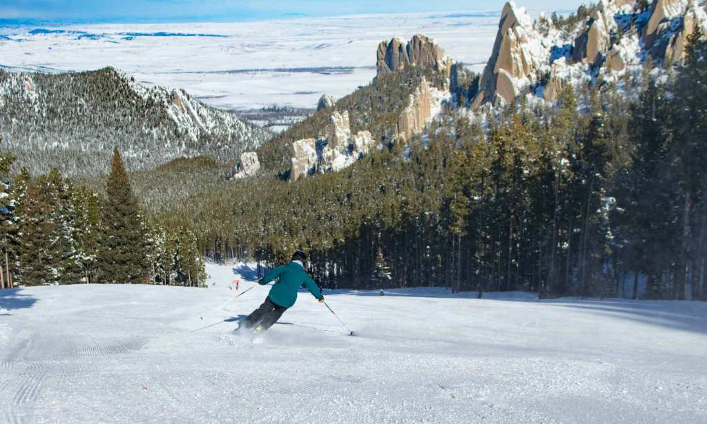
In 2015, Red Lodge was named one of the top 10 ski towns in America (seven of the 10 are in Colorado!). Red Lodge is a great ski town — not because of the Beartooth Basin Summer Racing Camp — more on that below — but because of Red Lodge Mountain, just six miles from town.
Red Lodge Mountain is well known for its friendly, small-town personality and its no-attitude approach to skiing.
Red Lodge Mountain officially opened in 1960 with one chairlift and three runs. It was then called Grizzly Peak. Today, it has six chairlifts and a vertical rise of about 2,000 feet to the summit of Grizzly Peak. You can get a full-day lift ticket for $69. It’s only $29 if you’re a child, between 6 and 12 years old. An all-day pass for Super Seniors (like me!) is $24.
Red Lodge Mountain provides a scenic backdrop for a ski area.
Leaving Red Lodge, the road immediately climbs, and quite steeply. In 5,000 feet, we’ll be at Rock Creek Vista Point. Great spot to fire off some high elevation photos.
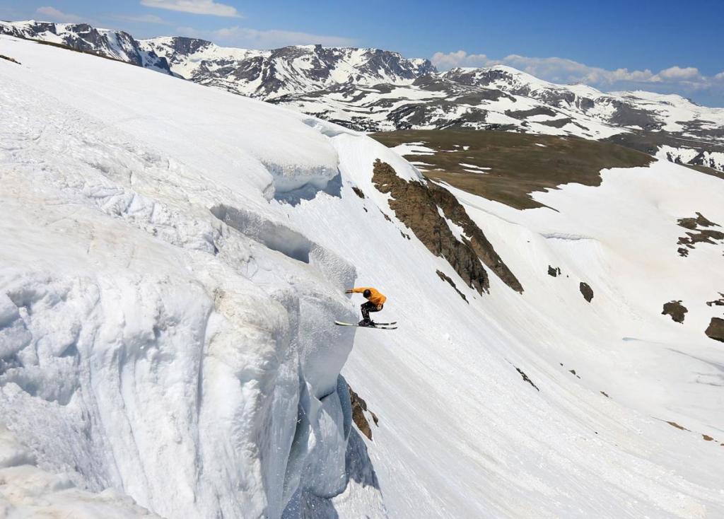
Then, after seven more miles of climbing, you pass the Beartooth Basin Summer Ski Area. Yes, summer ski area. It’s in Wyoming, just a few miles south of the Montana border.
Beartooth Basin is the lone ski area in North America that is open only in the summer. It’s generally skiable from late May through early July — a six-week season, if road conditions cooperate. Because the Bearthooth Highway is closed in the winter, you couldn’t access this ski area in winters, even if you wanted to.
Formerly known as Red Lodge International Summer Racing Camp, Beartooth Basin is one of North America’s oldest alpine ski training areas. Historically the Basin was a summer destination for alpine racing athletes, operated as a private camp.
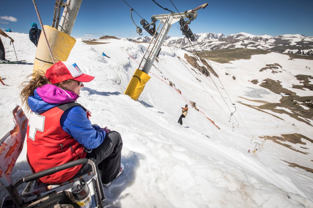
Skiing Beartooth Basin can be an extreme experience.
The summer racing camp was established in the mid-1960s by Austrian ski racing legends Pepi Gramshammer, Erich Sailer and Anderl Molterer. For 25 summers here on the Beartooth Highway, the Austrians coached as many as eight thousand youngsters from all over the United States and around the world.
Ownership changed in 2003, when an adventurous group of locals from nearby Red Lodge invested in the race camp and opened the door to a younger generation of skiing enthusiasts.
Today, the ski area is staffed with professional ski patrol and lift attendants, like many other ski areas. Unlike most other ski areas, there is no lodge. No warming hut. No retail. You could call it backcountry skiing with a lift.
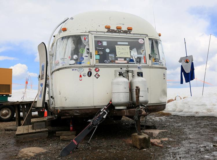
The area’s ticket office. As old-school as it gets.
The summer-only ski area includes 600 acres of terrain that vary in pitch from 15 degrees to 50 degrees. That’s ridiculously steep! Anything over 45 degrees is considered a controlled free fall. Don’t try this at home.
The locally owned and operated Beartooth Basin Summer Ski Area is served by two platter lifts. Its isolation is both a blessing and a curse. The location keeps things local, obscure, and offers up some incredible views. It also causes access issues and creates increased costs.
Beartooth Basin faces steep economic challenges — aging infrastructure, high equipment costs, costly insurance policies, and major engineering inspections on top of the unique challenge of its remote location. To preserve this unique western skiing experience for future generations, the ski area’s owners in 2019 launched a crowdfunding campaign to raise funds in an effort to keep the place alive.
Said the resort management in a Facebook post: “We enjoy being owned and operated by local ski enthusiasts, and not some big corporate entity. We would rather measure success in smiles than the bottom line.” The Kickstarter campaign sought contributions to support lift maintenance, insurance costs, fuel, snow surface maintenance, and terrain expansion.
Sadly, due to lack of snow, the ski area cancelled its 2024 season. It’s the second time in four years this has happened. Beartooth Basin has had a rough go of it in recent years. They experienced significant mechanical issues with their surface lifts in 2021, did not open in 2022 due to low snowfall, and were forced to close early in 2023 due uncooperative weather.
Operators of Beartooth Basin hope to be back in business for the 2025 season. #NeverSummer
Beartooth Basin even has its own ski patrol.
Soon, you’ll see the Top of The World Store, one of the few reminders of civilization along the Beartooth Highway. Here, you can get groceries, gas, and most importantly, a Wyoming fishing license. Never know when you’re gonna have an insatiable desire to drop a line and catch a trout. Even at 9,400 feet above sea level.
Each year, the Wyoming Game and Fish department stocks nearby Beartooth Lake with nearly 6,000 trout – half rainbow and half cutthroat. The lake, which sits at 8,900 feet, is a [popular destination for fishing, boating, camping, hiking and backpacking.
In 2021, we rode the Beartooth Highway twice in two days, both directions, and got rained on each time! (August 2021)
All along the Beartooth Highway, it’s not uncommon for August snowstorms to roll through. In the summer (now!), temperatures can range from the 70s on sunny days to below freezing during sudden snowstorms. Riders should be prepared for just about anything. Fingers crossed.
Thirty-nine miles from Red Lodge, you turn off of the Beartooth Highway and on to Wyoming Highway 296, which soon becomes the Chief Joseph Scenic Byway.
The scenic byway runs a total of 46 miles through magical Sunlight Basin, along the Clark’s Fork of Yellowstone River. The road closely follows the path taken by the Nez Perce as they fled the US Cavalry in 1877. Several historical and interpretative signs along the road provide more information about the flight of the Nez Perce.
The Chief Joseph Scenic Byway is named after the Native American chief of the Nez Perce Tribe. Following the Battle of the Big Hole in Montana in 1877, Chief Joseph fled east through Yellowstone. He and 1,000 members of his tribe ran from the US Cavalry, who were trying to force the tribe onto a reservation so that white ranchers could have their lands. The tribe was stopped only 30 miles from its destination, the Canadian border.
In his speech of surrender, Chief Joseph expressed dignity and defeat with his famous words, “Hear me, my chiefs; I am tired; my heart is sick and sad. From where the sun now stands, I will fight no more forever.”
Roadside pizza on the Chief Joseph Scenic Byway. There are no pizzerias on this byway; it was leftovers from last night’s dinner at the Red Lodge Pizza Co. (August 2021)
Just past a view of 11,300-foot Sugarloaf Mountain, the road makes a series of tight switchbacks and hairpins, culminating at Dead Indian Summit.
Dead Indian Pass, at 8,071 feet, is the highest elevation on the Chief Joseph Highway. From here, the views of the higher peaks of the North Absaroka Mountains are spectacular. You can also see the deep canyon that the Clarks Fork Yellowstone River flows through.
From Dead Indian Pass, it’s 30 miles to Cody, which sits on the banks of the Shoshone River at the western edge of the Bighorn Basin. The city is named after William Frederick Cody — better known as Buffalo Bill — a scout, bison hunter and showman, and one of the most colorful figures of the American Old West.
At one time a 14-year-old rider for the Pony Express, he got the nickname “Buffalo Bill” when he had a contract to supply Kansas Pacific Railroad workers with buffalo meat. He’s purported to have killed 4,282 American bison (commonly known as buffalo) in an 18-month period in the late 1860s. Dude was lethal.
Cody is where the ride ends. From Red Lodge to Cody, the route is 113 miles. The two roads — Beartooth Pass and Chief Joseph Scenic Byway, seamlessly blend together, as if they were a single road.
While in Cody, be sure to visit the Buffalo Bill Center of the West. Here, you’ll find the Buffalo Bill Museum, the Plains Indian Museum, the Cody Firearms Museum, the Draper Natural History Museum, and the Whitney Western Art Museum. All for $22. You may never leave.
One pass down, one more to go. With Dave and Scott. (August 2015)
These two passes in the Sierra Nevada mountains can be ridden back-to-back. I’ve done it twice, in 2015 and 2019. For riding a motorcycle, this is as good as it gets.
The road over Ebbetts Pass, Highway 4, runs 80 miles, beginning in Markleeville and ending in Angels Camp — in the heart of California’s gold country.
To get started, you’ll probably leave South Lake Tahoe, where you overnighted. From here, you head south about 30 miles on California Highway 89 over Luther Pass to Markleeville, population 200. Markleeville is the county seat and largest community in Alpine County. With a population of just over 1,200, it’s the least populous of California’s 58 counties.
Jacob J. Marklee founded a toll bridge crossing the East fork of the Carson River in 1861. He hoped to tap into the traffic from the silver mining boom in the region. After his death in a gunfight in 1863, a post office was opened and named after Marklee.
Markleeville is on the map for annually hosting a bicycle race called the Death Ride Tour of the California Alps. The Death Ride is held every year in mid-July, and costs $209 to enter. The event attracts extreme athletes from all over the US, who pedal over six Sierra passes for a total distance of 103 miles and more than 15,000 feet of elevation gain. The winner generally finishes in around eight hours of riding time. Survival is considered a pretty reasonable goal.
The posse, in Markleeville. John, Jim, Scott, Dave. (July 2019)
In Markleeville, the fun really begins.
Highway 4, the road over Ebbetts Pass, is also known as the Alpine State Highway. John Ebbetts, a California pioneer and Captain of the Knickerbocker Exploring Party of New York, first traversed the pass in April 1851 with a large mule train. Ebbetts hoped it would make a suitable route for the transcontinental railroad to cross the Sierra Nevada range, as he observed little snow there at the time.
He might have thought differently if he’d been around in the winter, when snow is generally abundant. The transcontinental railroad was eventually built in the 1860s to cross the Sierras over Donner Pass, near Truckee, California — where Interstate 80 is today.
Ebbetts Pass summits at 8,730 feet. It’s a 61-mile National Scenic Byway that generally closes for the winter in Mid-November, and stays shut down until May or June. Today, there’s no snow, and still no railroad over Ebbetts Pass.
Traveling Ebbetts Pass on a motorcycle, you really need to bring your “A” game.
Ebbetts Pass narrows, often has barely room for two vehicles to pass, no shoulders, and precipitous drop-offs. The road is quite steep and features countless blind hairpin corners, hitting a 24 percent maximum gradient. An extensive section of the pass has no dividing line, and in some places is basically a one-lane road. Strap in.
About a third of the way from Markleeville to Angels Camp, you’ll ride past Lake Alpine. The lake sits at 7,300 feet and covers 180 acres. Here, you’ll find the Lake Alpine Lodge, which calls itself “Just above the middle of nowhere.”
While taking a short break from riding, Dave hooks a big one at Lake Alpine. (August 2015)
Lake Alpine Lodge was originally built in 1927, but the building collapsed from heavy snowfalls five years later, and was eventually rebuilt. The lake is the first thing you come to after entering the Stanislaus State Forest. Lake Alpine was created in 1892 when a creek was dammed, allowing the valley to fill and providing a steady supply of water to mining operations in Angels Camp, the termination of the Ebbetts Pass road.
Angels Camp sits atop a massive vein of gold. Five mines operated here, producing a total of more than $20 million in gold during the 1880s and 1890s.
From Angels Camp, it’s a 15-mile ride on historic highway 49, to the town of Sonora. The town was founded during the California gold rush by Mexican miners from Sonora, Mexico –- after which the town is named. Sonora is the only incorporated community in Tuolumne County.
Stopping to compare notes along Sonora Pass. (July 2019)
Here, the road over Sonora Pass begins. Known by the California Department of Transportation as Highway 108, it also runs 80 miles. Same as Ebbetts Pass.
The road over Sonora Pass spectacular as well. The grade exceeds 8 percent most of the way, and reaches 26 percent.
At 9,623 feet, it’s the second-highest highway pass in the Sierra Nevadas. Sonora Pass is closed throughout the winter and generally re-opens in May or June. This year’s opening was May 16.
The first documented immigrant traverse of Sonora Pass appears to have been in the late summer of 1852 by a wagon train known as the Clark-Skidmore Company. With the discovery of deposits and development of silver and gold mining east of the Sierra Nevada in the beginning of the 1860s, merchant interests in the counties on both sides of the pass pushed for development of a road that would enable them to improve transportation and trade. Surveying for a road through Sonora Pass began in 1863 and the road was in use by 1865.
Sonora Pass is a fun place to ride, and to pose. (August 2015)
Leaving the town of Sonora, the climbing begins immediately, following the route originally set by surveyors in the 1860s.
Thirteen miles east of Sonora, you climb to 3,648 feet and roll through the town of Twain-Harte. Its motto: “More Trees Than People.” The unique hyphenated town name is derived from the last names of two famous authors who lived in California in the 1800s, Mark Twain and Bret Harte.
From Twain-Harte, you pass Strawberry, named after the wild strawberries that grow there. Then, you continue climbing for 54 miles, gaining more than 5,600 feet of elevation until you reach the summit of Sonora Pass.
Near Strawberry. Where are the strawberries? (July 2015)
As you roll by the summit of Sonora Pass, you’ll pass Pickel Meadow, at 6,762 feet. It’s home to the US Marine Corps Mountain Warfare Training Center.
The MWTC is considered to be the Marine Corps’ premier training site for preparing Marines to serve in mountainous regions, with an emphasis on cold and high-altitude confrontations. This training post was first established in 1951 to provide cold weather training for replacement personnel bound for the Korean War.
During the 1980s, the facility’s focus was on training and preparing Marines and operational units for deployments on NATO’s northern flank, particularly Norway. In recent years, the training center provided pre-deployment training for the war in Afghanistan.
The ride over Sonora Pass ends in Sonora Junction, about five miles east of Pickel Meadow. Here, you can either turn north on US Highway 395 and head back toward Lake Tahoe, or turn south on US-395 and ride 17 miles to your overnight destination -– Bridgeport. As the county seat of Mono County, Bridgeport is known in the summer for its trout streams and backcountry lakes. These waters offer some of the premier Rainbow, Brown and Cutthroat trout fishing found anywhere in the world.
In Bridgeport, at the end of a spectacularly epic ride. (July 2019)
From South Lake Tahoe, over Ebbetts Pass and then Sonora Pass, your ride to Bridgeport is 220 miles. Time in the saddle is about 5 hours and 10 minutes.