Christmas Eve: 18 Holes, AND Riding the Rockies!

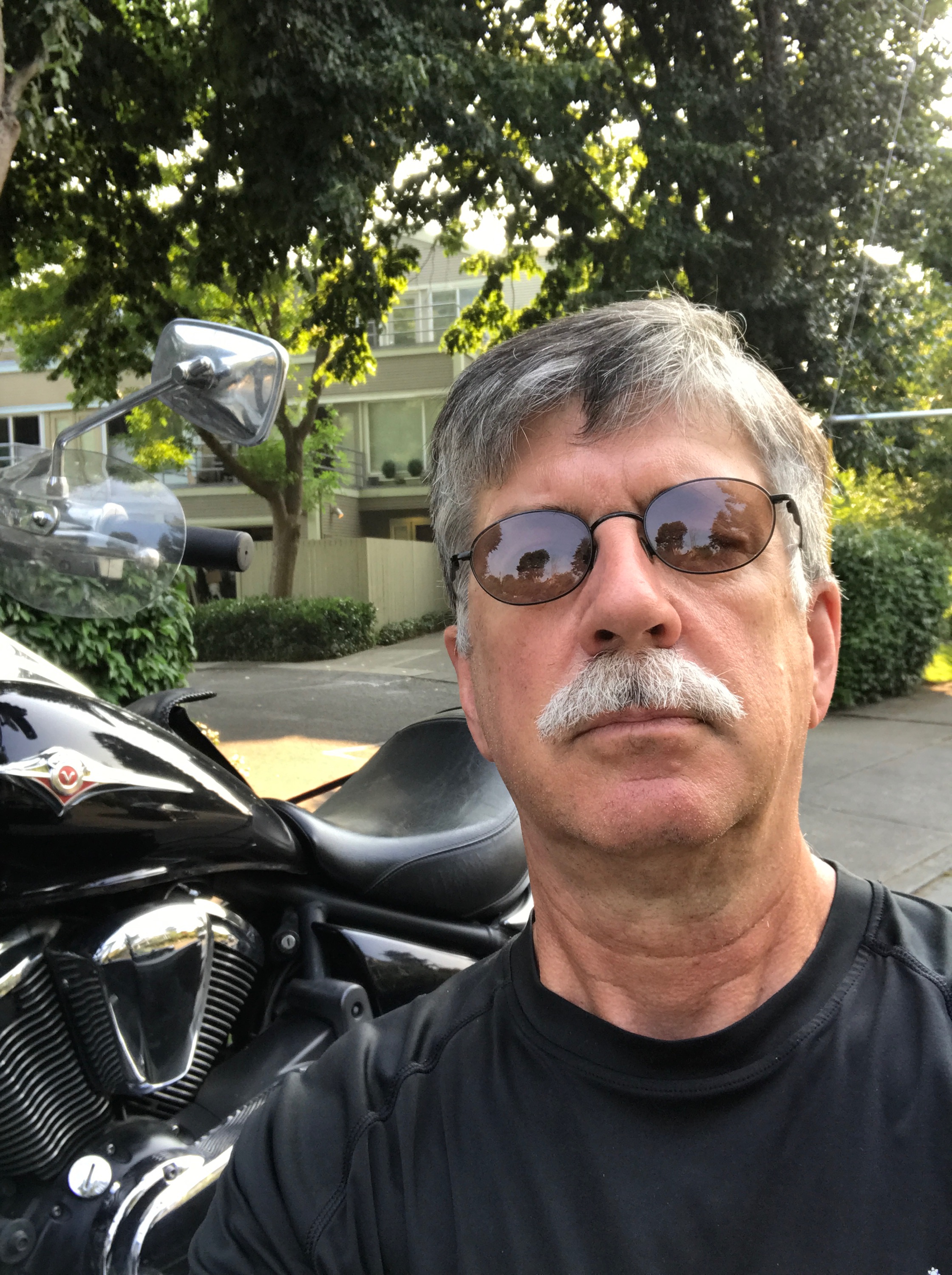
Happy Harley Holidays, everyone!

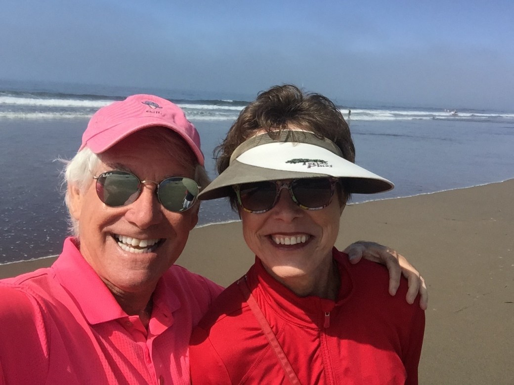
Here’s what my December 24 looked like: Sarah and I got in 18 holes of golf. Then, I went for a pre-Santa ride in the Rockies.

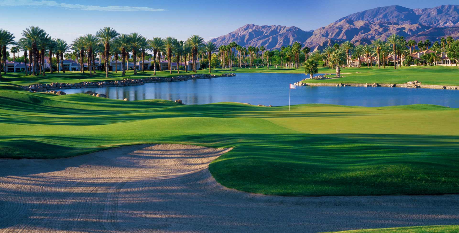
We didn’t play 18 holes, that’s for you sun worshippers in La Quinta. The courses here in Colorado are closed this time of year, but they’re very walkable. So today, we walked the entire Aspen Glen golf course, where we’re living while our house is under construction nearby.  It took us two hours and eight minutes to walk 18 holes; we covered 6.24 miles. Fitbit-worthy.

Walking18

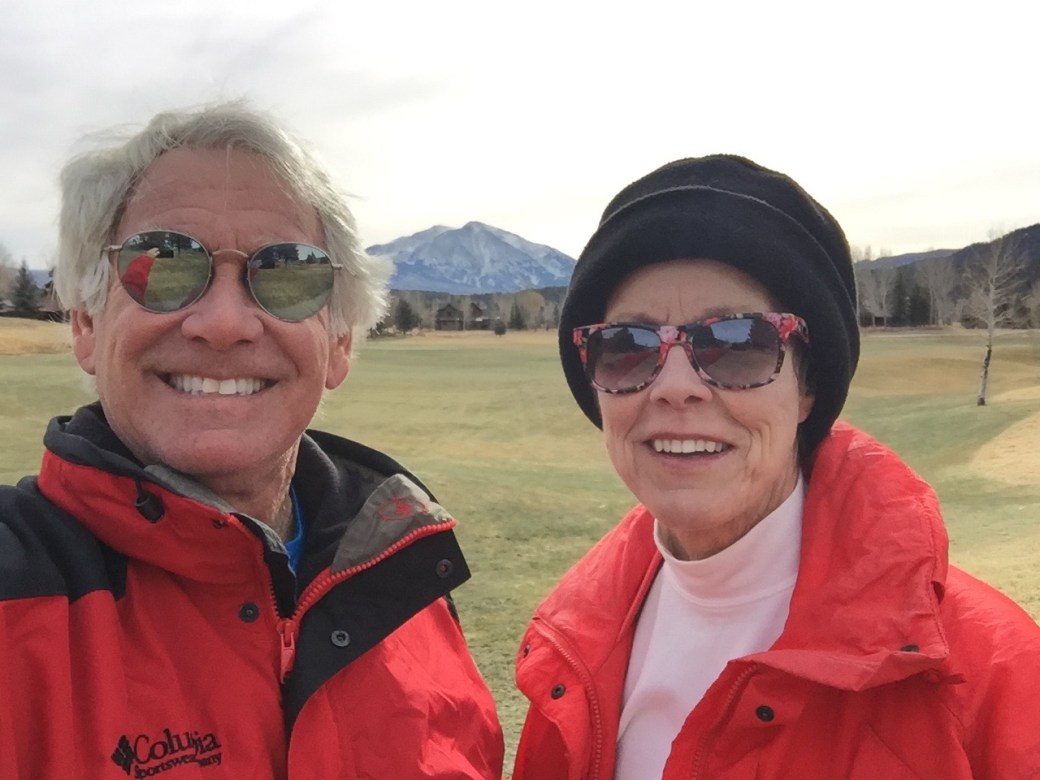
On the back nine at Aspen Glen, on Christmas Eve. That’s Mount Sopris in the background: 12,966 feet. It should be in pretty much every photo, and the view from your back yard, if you can swing it.

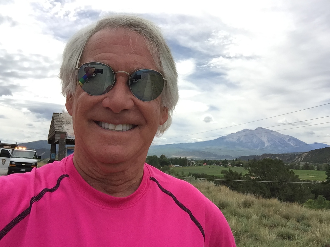
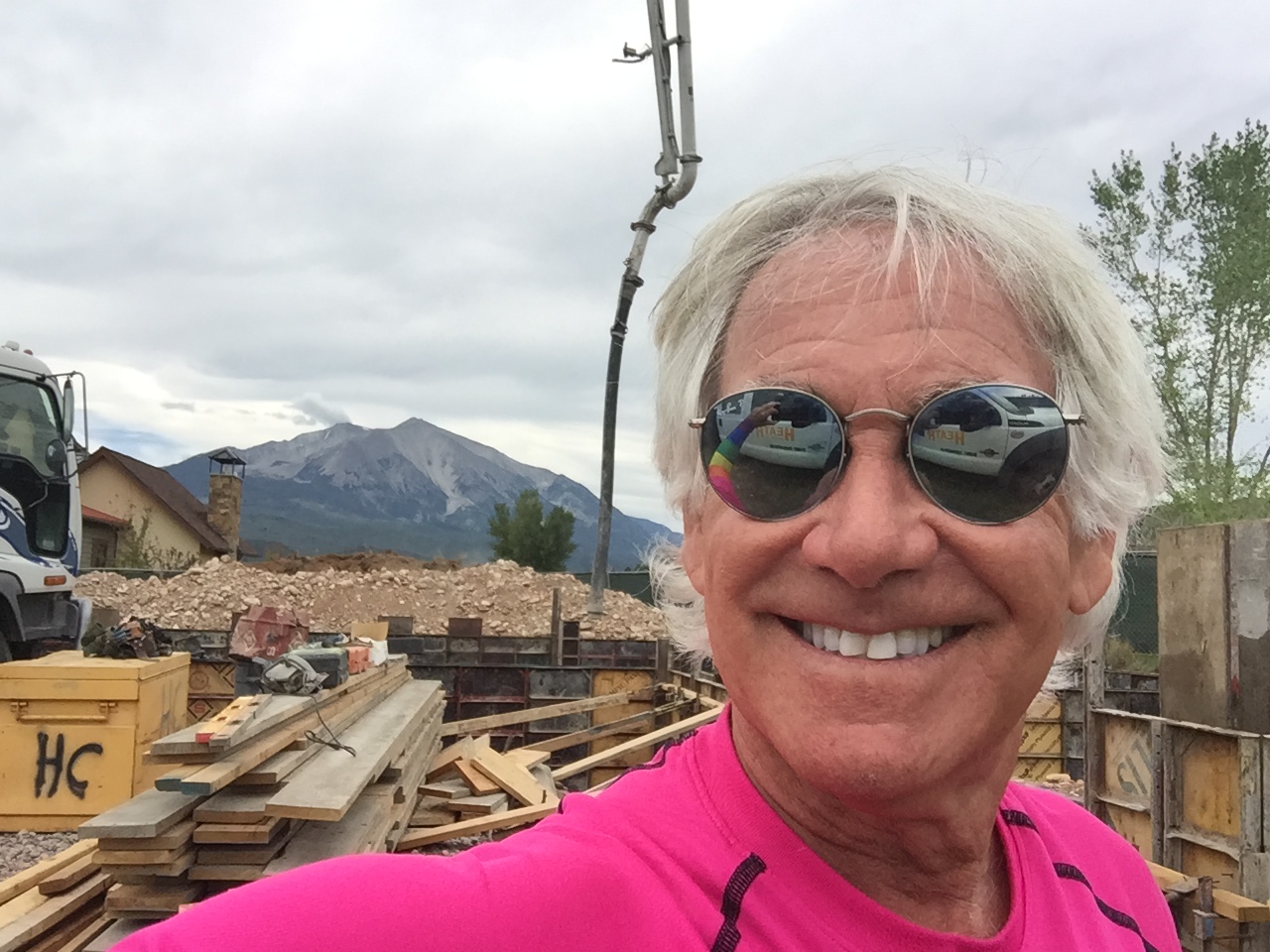
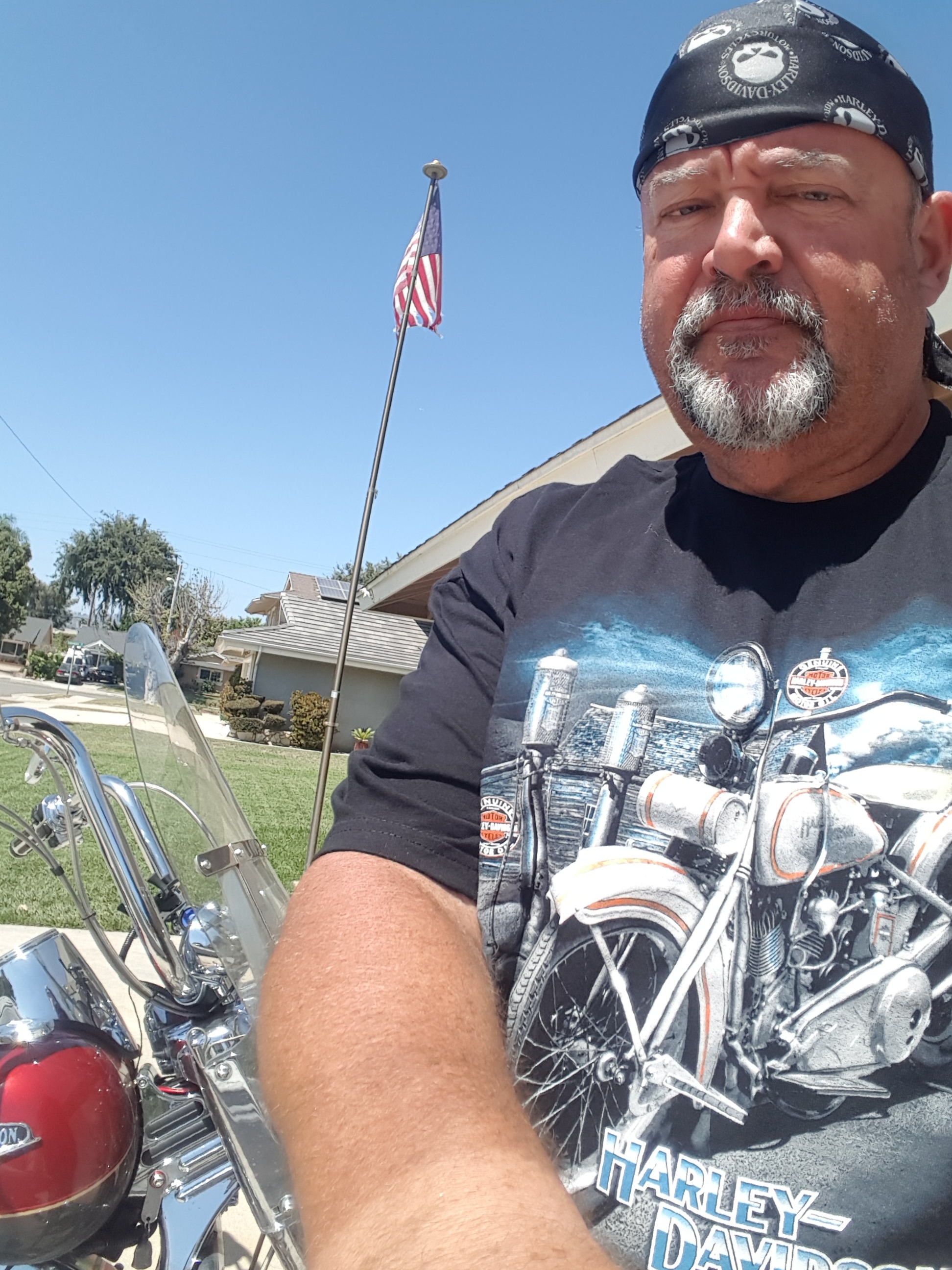
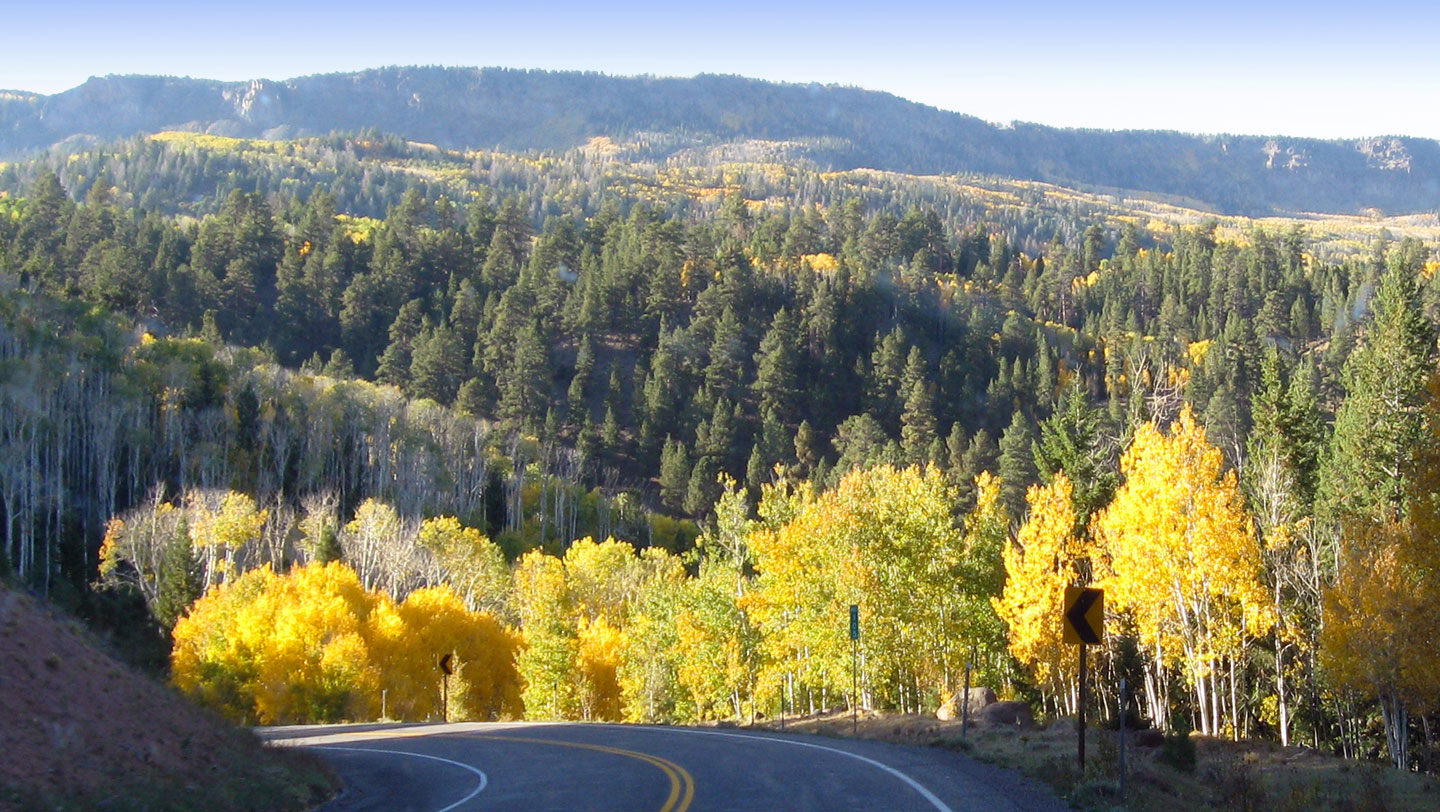
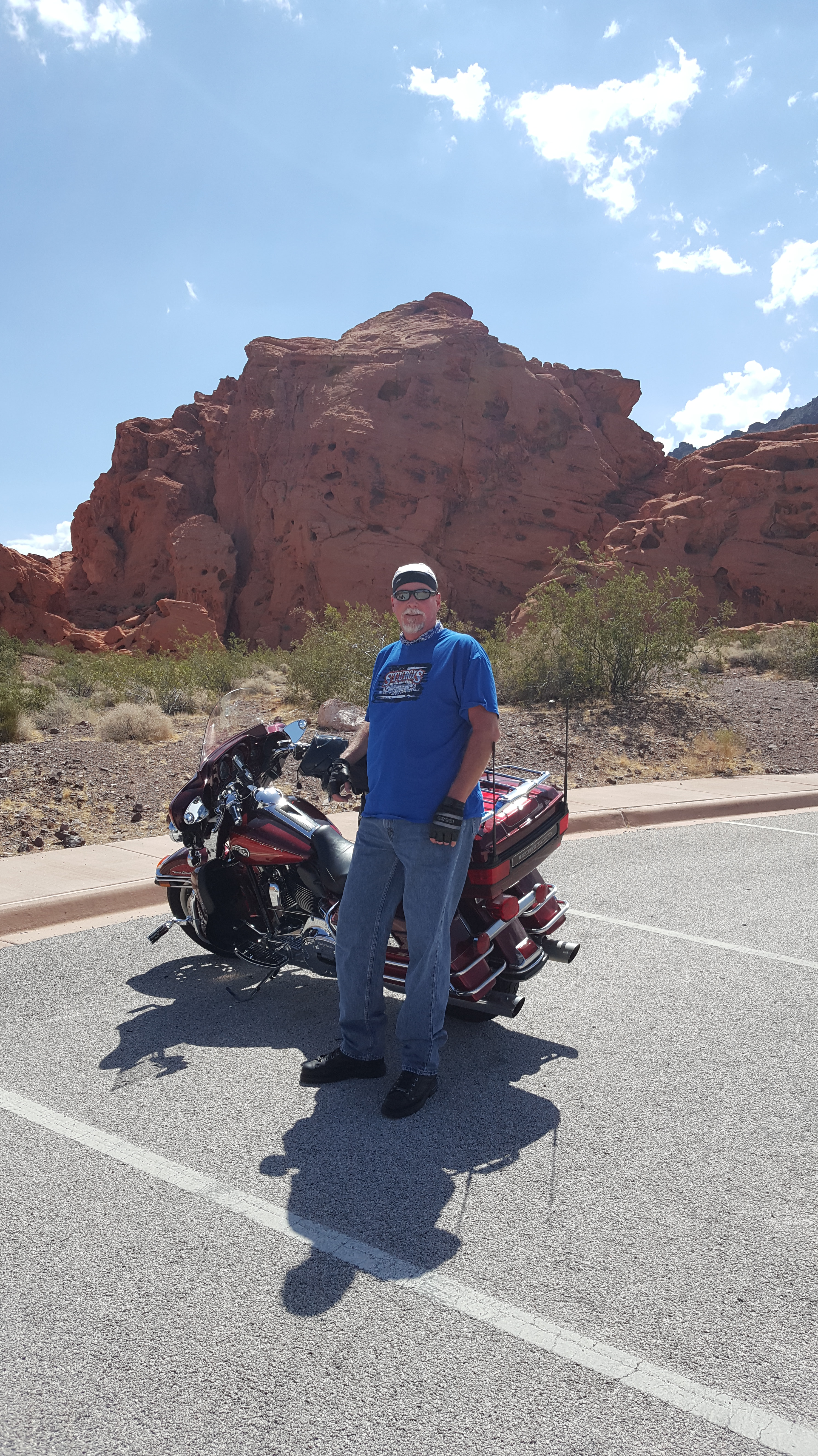
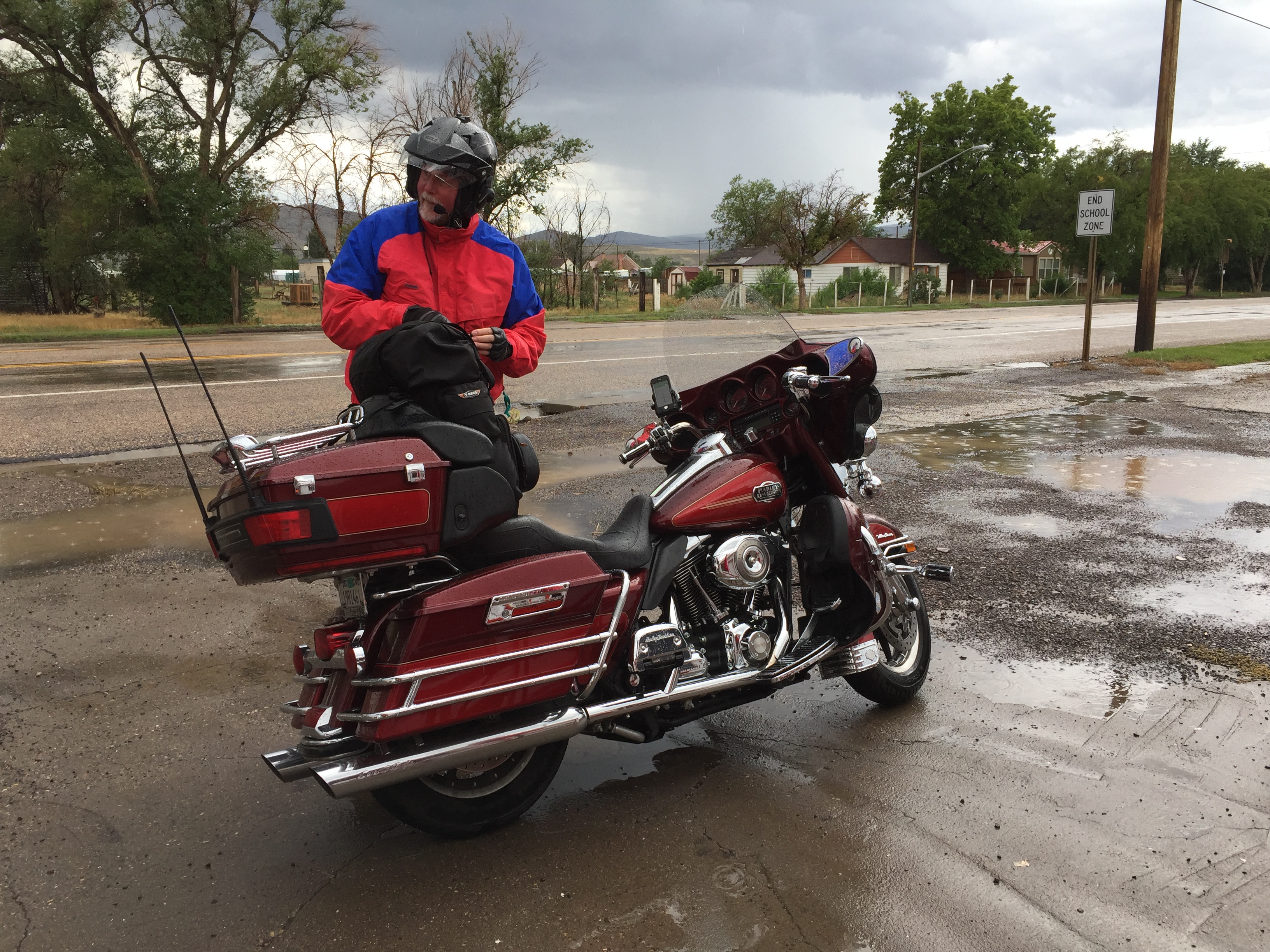
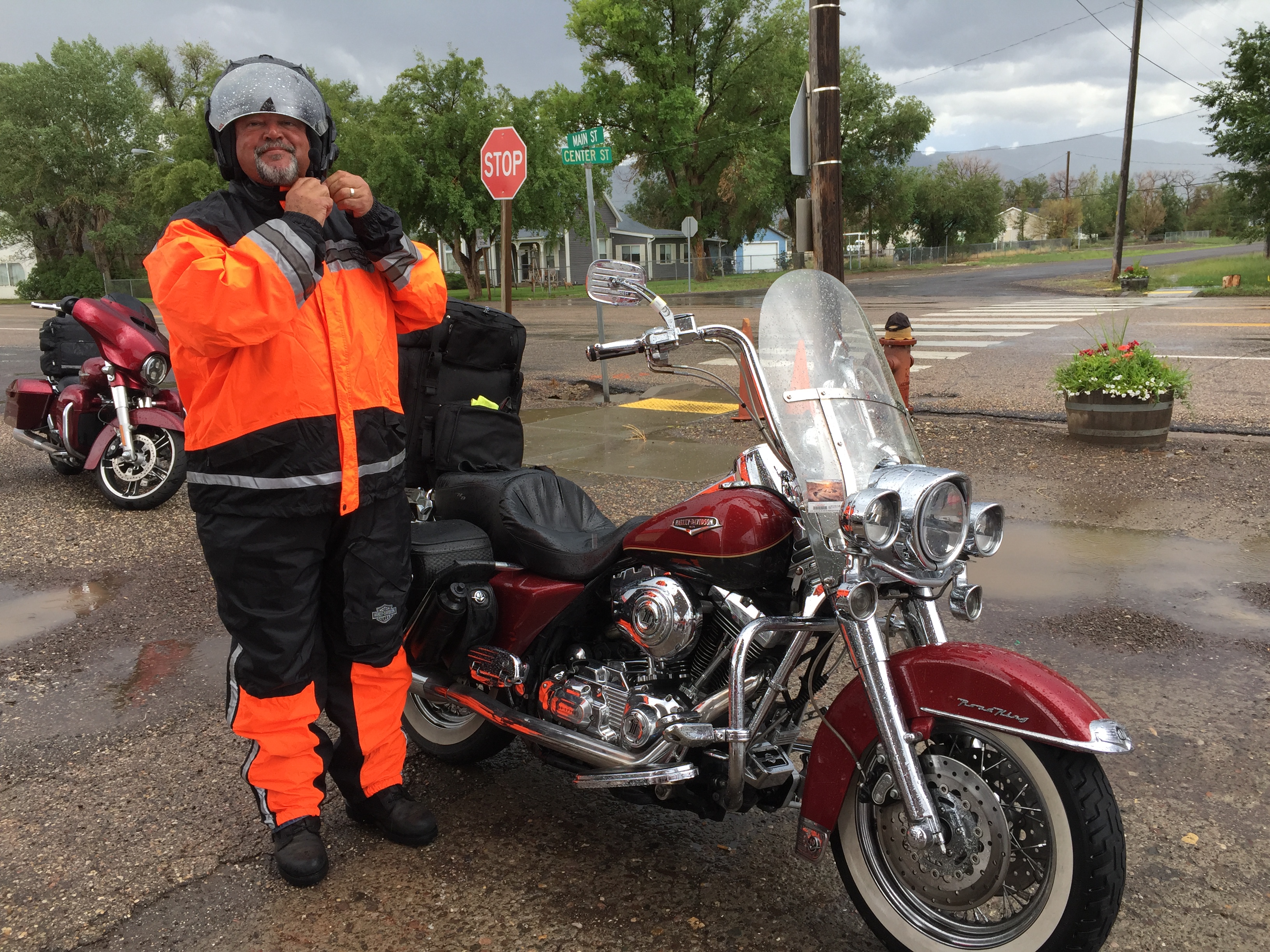
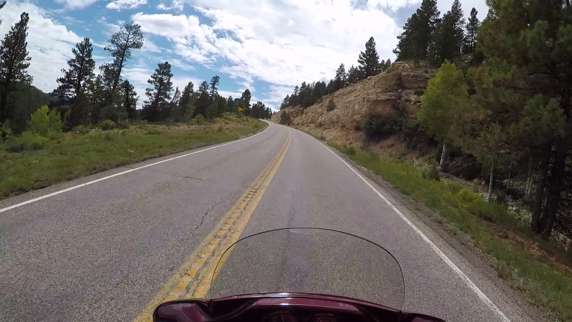
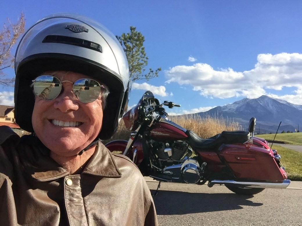
Next, I fired up the Harley and rode into Carbondale. Why? Pretty much so I could say I rode the Rockies on a chilly winter day. My ride covered 12 miles, round trip, in 34-degree weather. Riding the Rockies on Christmas Eve. Yeah, baby!

at Aspen Glen

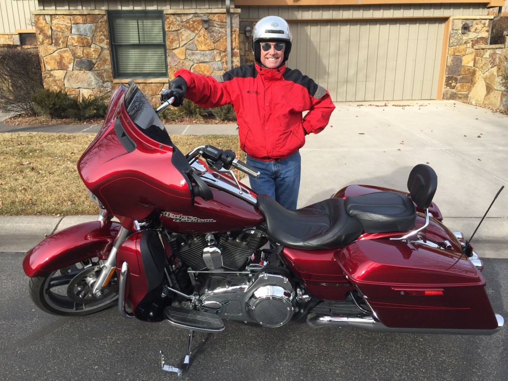
Great day for a ride. Or for finishing your Christmas shopping. Already figured out what I want for Christmas next year: heated grips for the bike. Seriously. #coldhands,warmheart

Riding to RVR

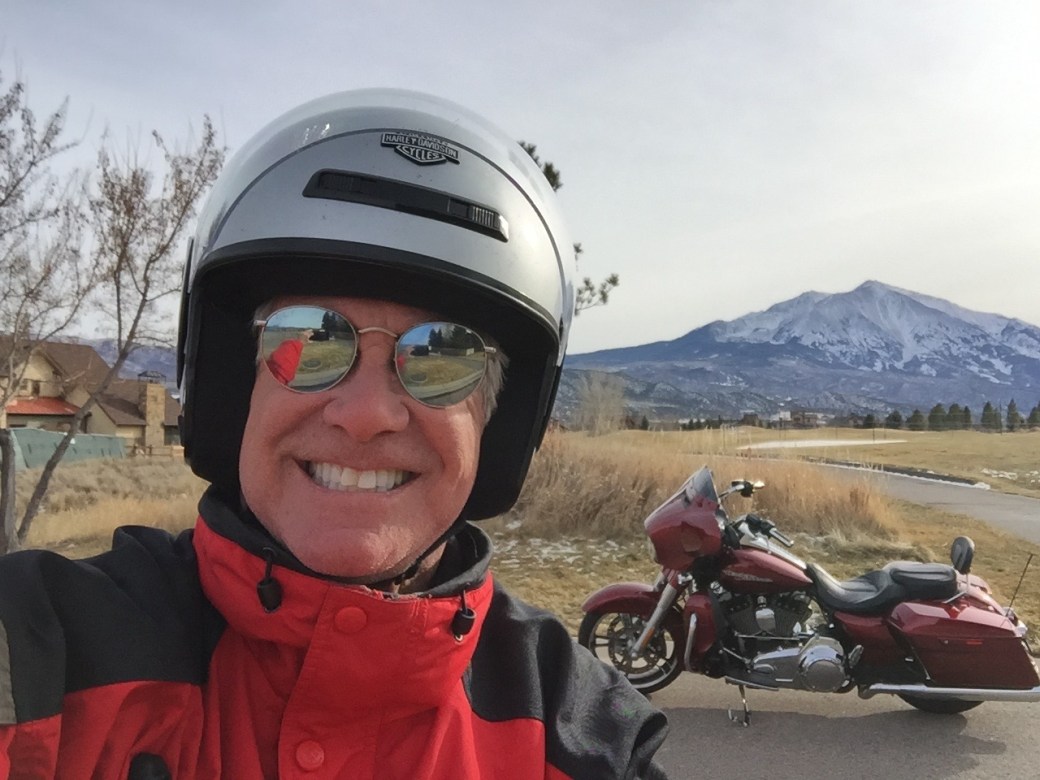
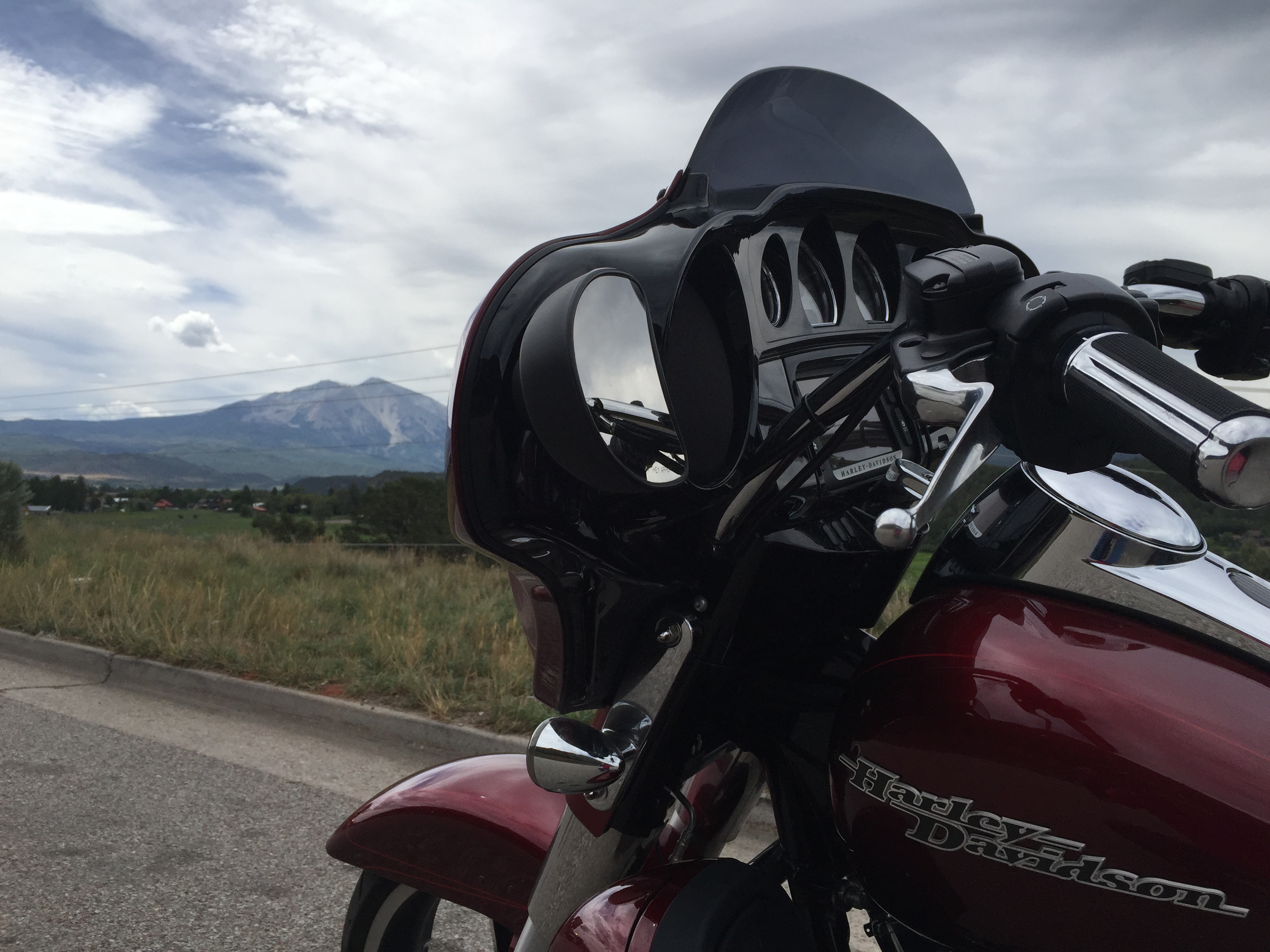
On Christmas Eve, I rode six miles, to River Valley Ranch — in Carbondale. This view is right next to the lot where we’re building our home. Yes, that’s Mount Sopris in the background.

***

So, that’s what happened today, on Christmas Eve.

This blog is normally a description of beautiful roads I’ve ridden and unhealthy food I’ve consumed along the way. Today’s blog post is a bit different.

As you may have noticed, I’ve been on blogging hiatus since ending my last Harley trip in Carbondale on August 15.

Quite a lot has happened since then. We became permanent Colorado residents, making Carbondale our home. We now have Colorado drivers licenses, and Colorado plates on our vehicles. We’ve watched our new home being built, and are looking forward to moving in some time in the spring (no pressure, Kent and George). We’re gradually adjusting to life in the Rockies. We miss our old friends in the desert, but are pretty sure they’ll find Carbondale a fine place to visit.

Today, on Christmas Eve, I thought I’d take you on a trip, metaphorically anyway. It’s just a simple way of bringing you up to date on what’s been happening in our lives since mid-August, the date of my last blog post.

***

Golden Gate

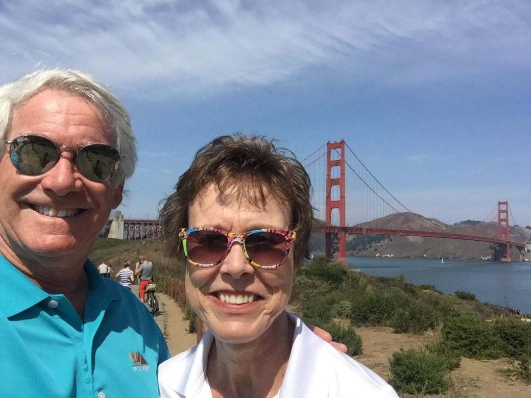
In August, on the San Francisco side of the Golden Gate Bridge. We hiked across the bridge, both directions.

We spent the summer in San Rafael, California, living with my cousin Rich, who was kind enough to open his home to me, Sarah, Lucy and Betsy — until our rental in Carbondale was available. Eleven weeks of unconditional hospitality. We took advantage of the proximity to the Pacific Ocean, knowing it may be some time before we have a chance to get salt in our hair and sand in our toes again.

Stinson Beach

Got sand in our toes at Stinson Beach.

***

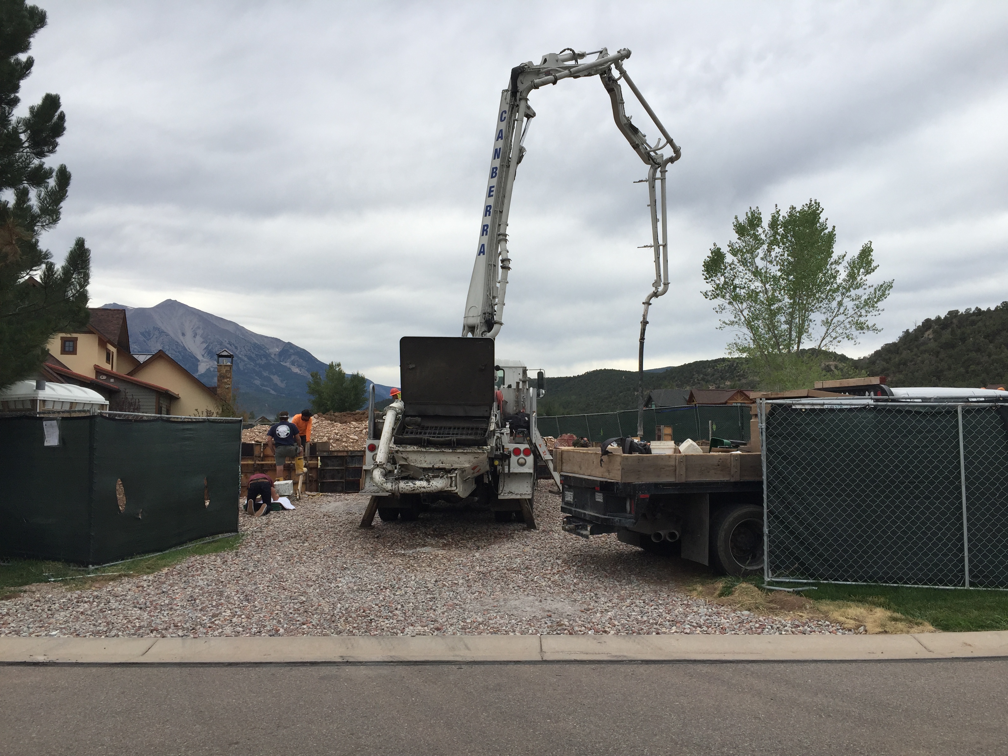
While we were in Northern California, work on our new home in Carbondale continued. Almost every day, our builder (Key Elements Construction) posted photos on a website so we could track the progress. As you may know, we’re calling the house our “Cozy Carbondale Cottage.”

IMG_7924

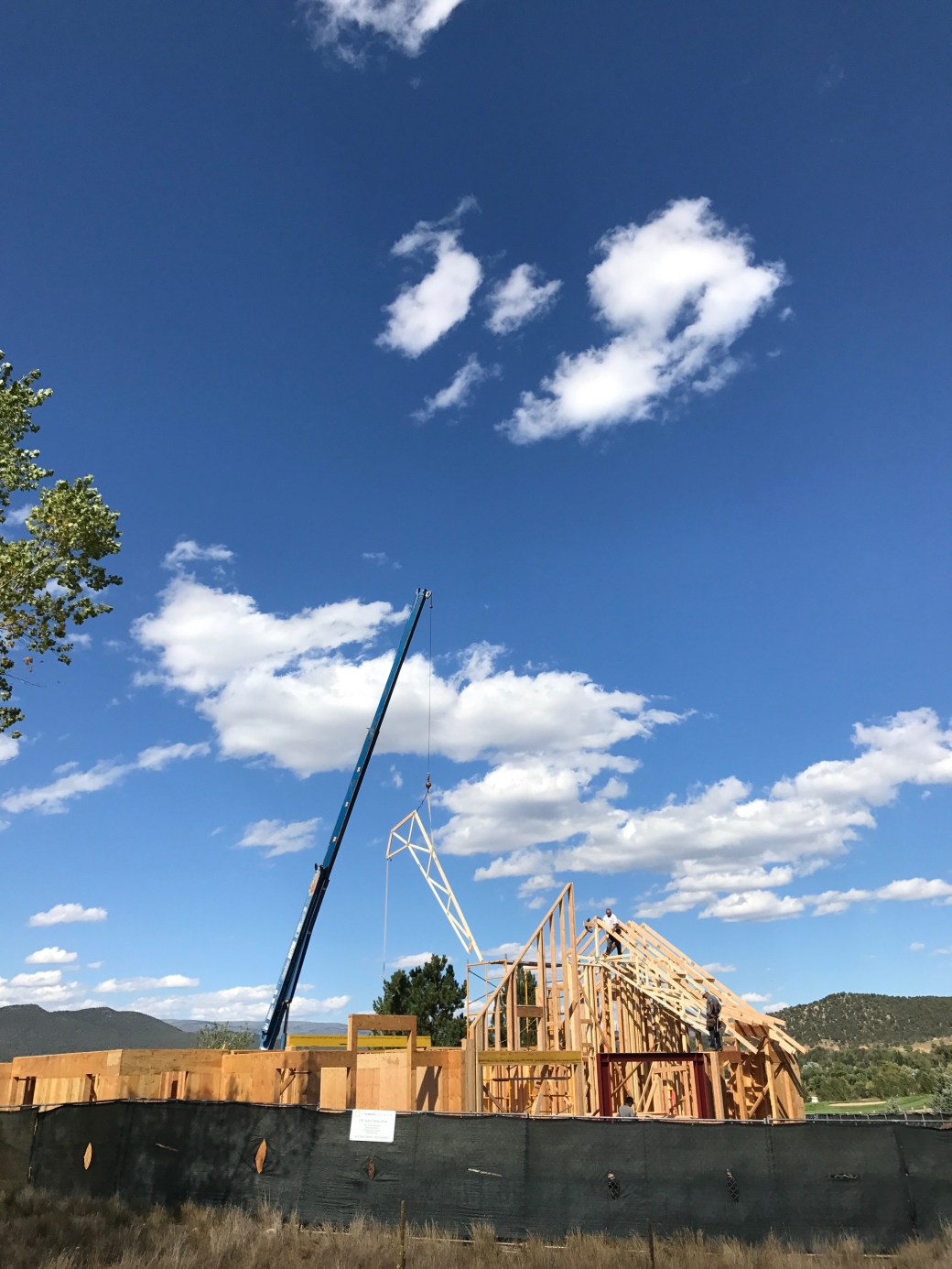
It’s been fun watching the house become a home.

mobile_upload-3

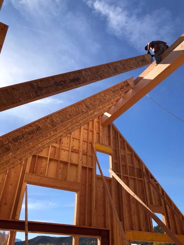
Yes, that’s a ridge beam, and those are rafters. The bluest skies you’ve ever seen are not in Seattle, they’re in Colorado.

mobile_upload-2 (1)

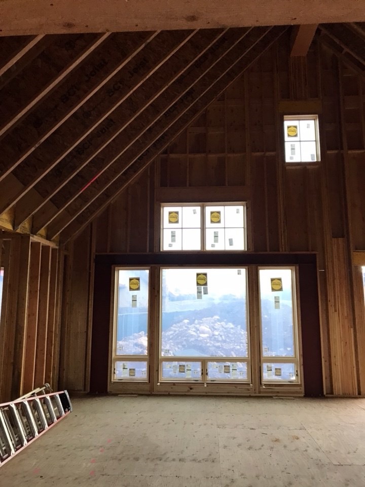
Our great room will be a nice space, with a fantastic view of the mountain.

***

On September 14, we said goodbye to San Rafael, and headed for Colorado. After an overnight in Elko, Nevada, we arrived in Carbondale on a beautiful almost-autumn afternoon.

We immediately checked out the homesite. It looked a lot like our builder’s photos, but we finally got to be in the frame.

Sept 15

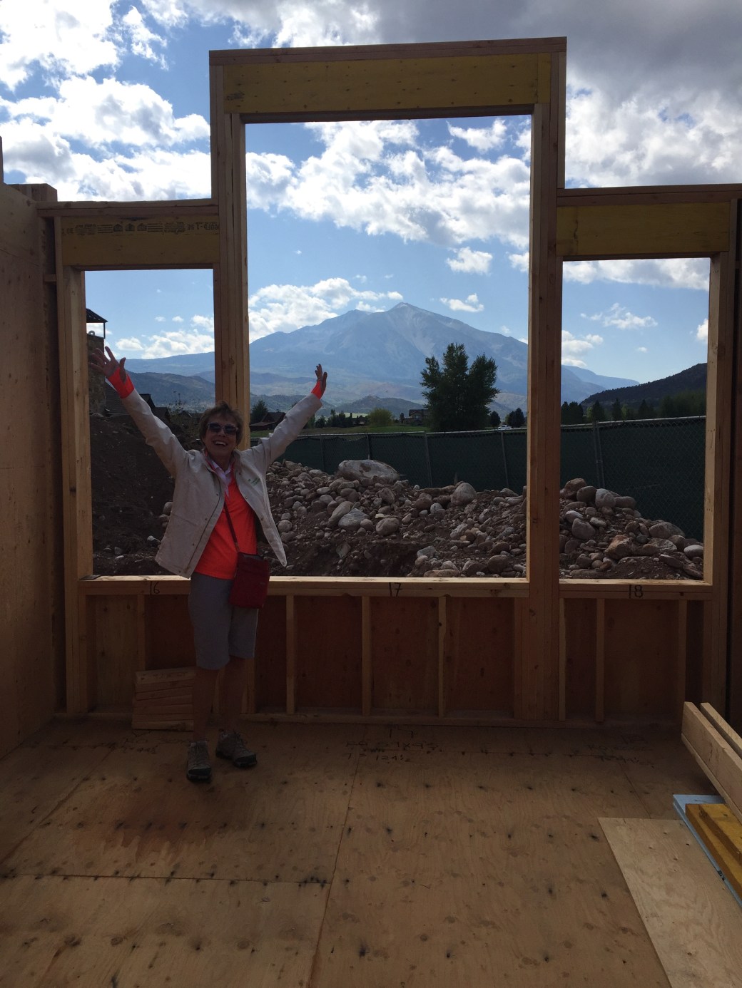
Here’s Sarah, showing off the view from the Guest Bedroom. Best view in the house. Nice mountain in the background. Lucky guests!

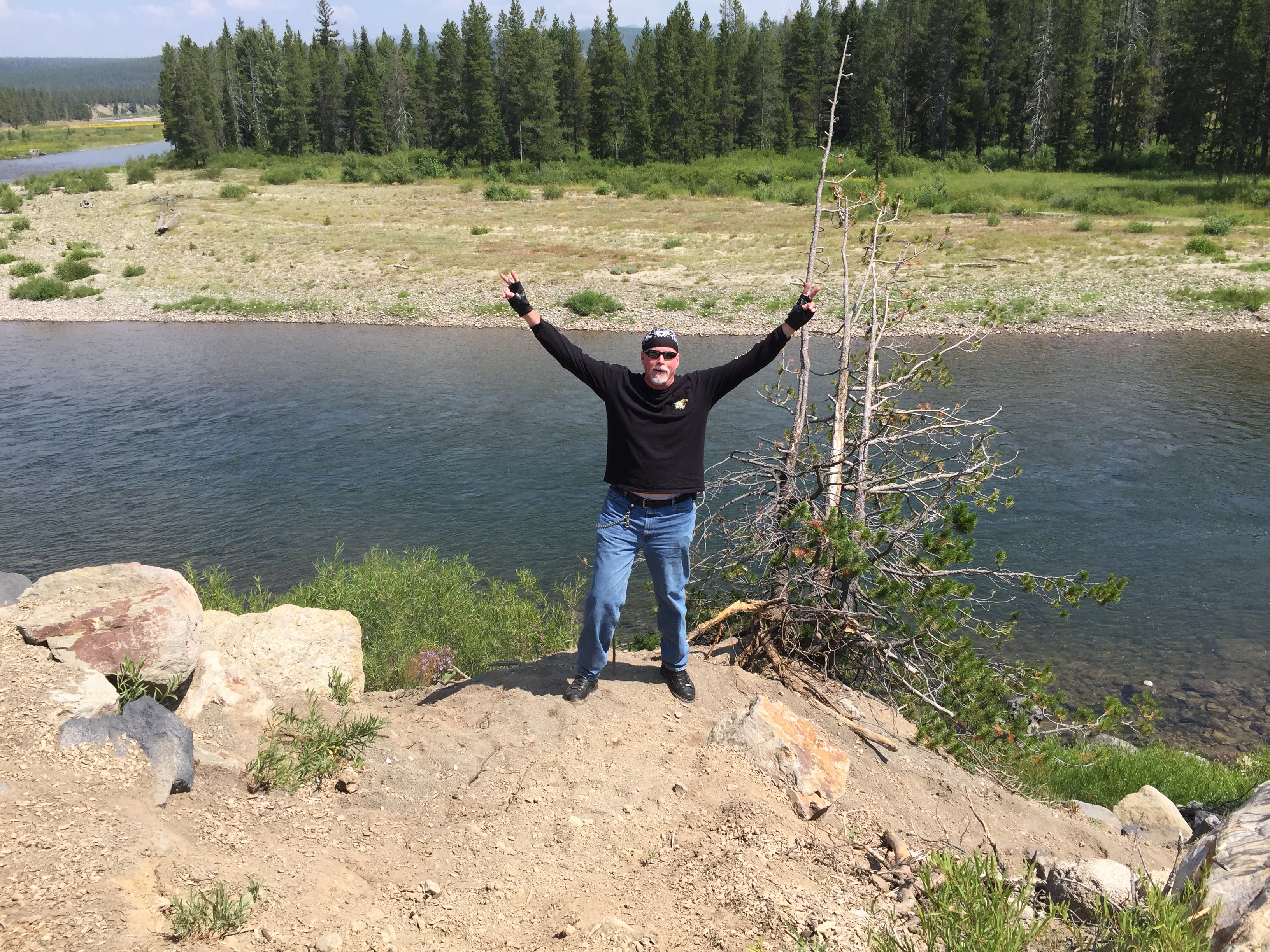
We’ve had a good time exploring the local area — the Roaring Fork Valley. There are breathtaking views around every corner. It’s almost like being on a Harley ride.

Satank #2

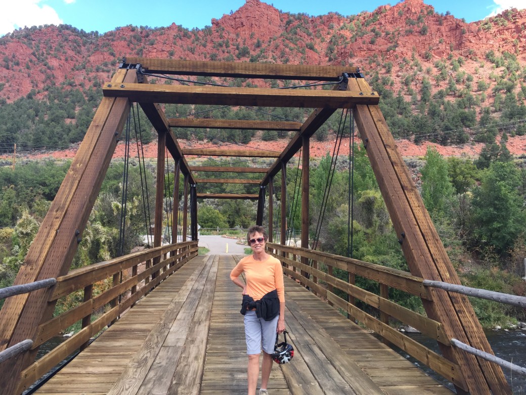
Here’s Sarah, on the famed Satank Bridge, just outside of Carbondale. Love the red mountain in the background.

Satank

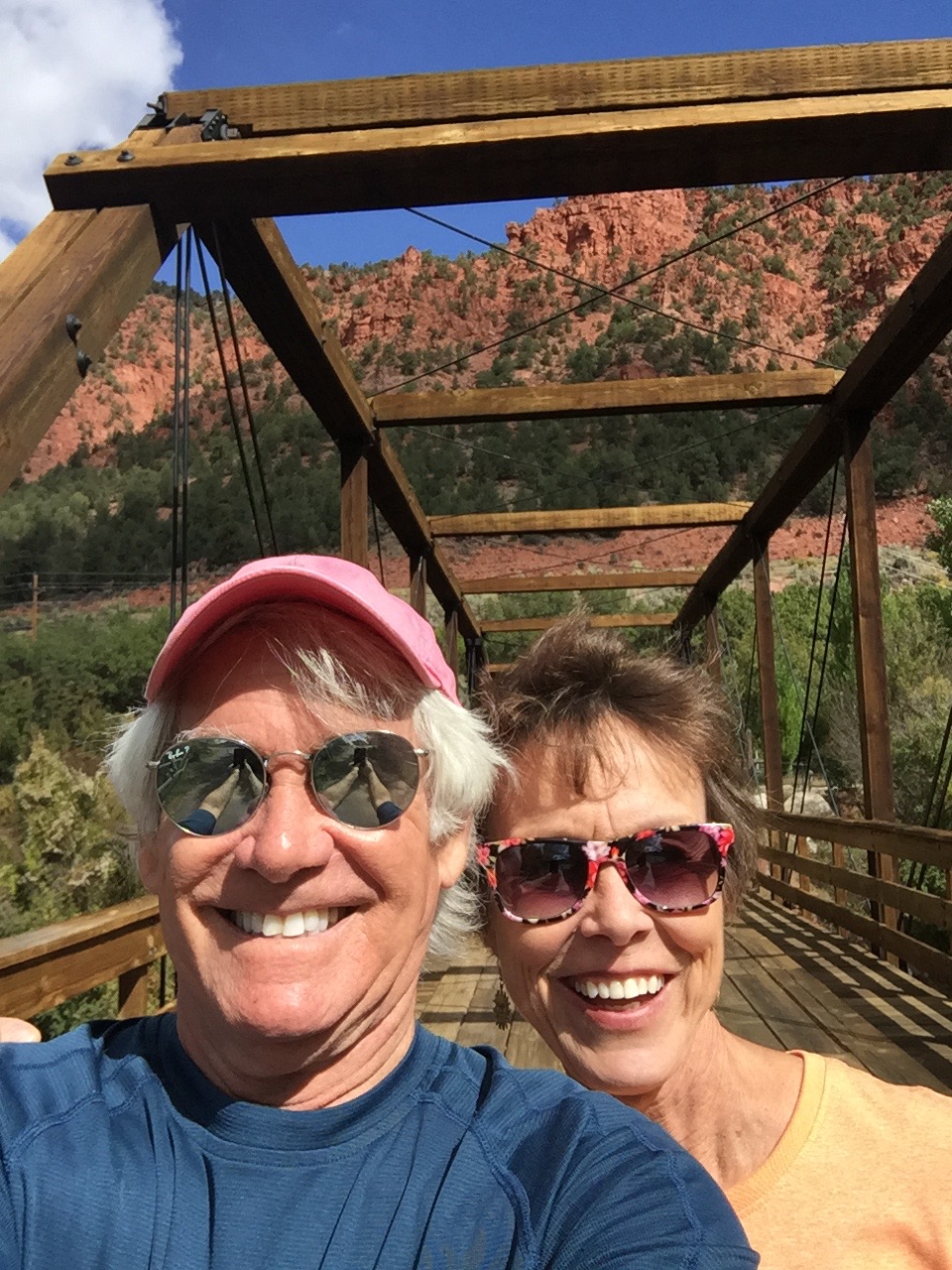
More of the Satank Bridge, which spans the Roaring Fork River.

We hiked up Red Hill, where Colorado Highways 82 and 133 meet, just at the North end of Carbondale.

IMG_1941

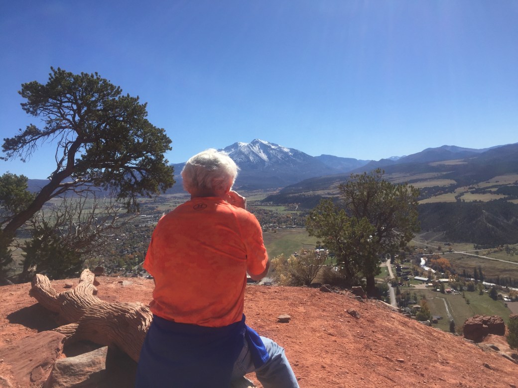
The view from Red Hill, looking south toward Mount Sopris. Quite spectacular.

***

Our cats, Betsy and Lucy, seem to be enjoying life in Colorado. They are fascinated with the view, with the deer in our back yard, and the change of scenery — it’s their first time out of California.

IMG_8005

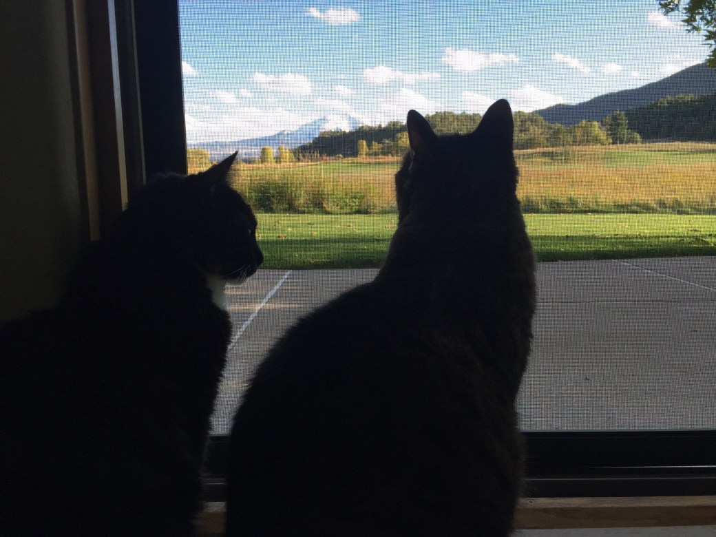
The girls admire the view of Mount Sopris. Who wouldn’t?

IMG_1975

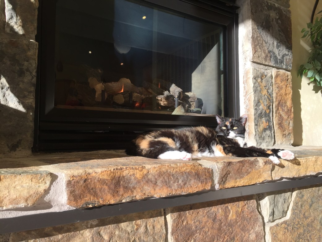
Betsy has decided she likes sitting by the fire, basking in the Colorado sunshine.

Rich and Lucy

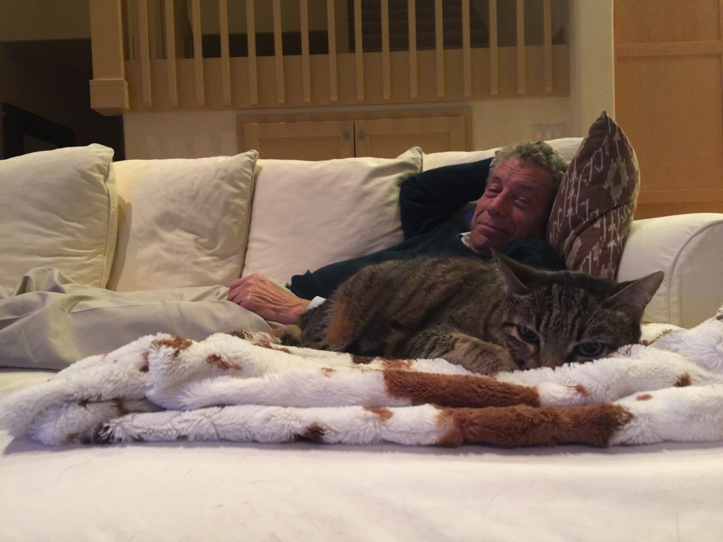
Lucy found her favorite spot, on a faux animal fur throw, from Pier One (it was at the rental house when we moved in). That’s my cousin, Rich, in the background. First cousin, once removed. Anyone know what that is?

***

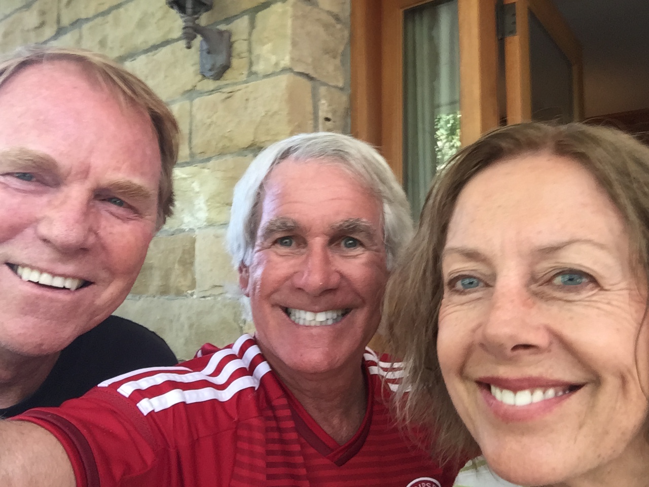
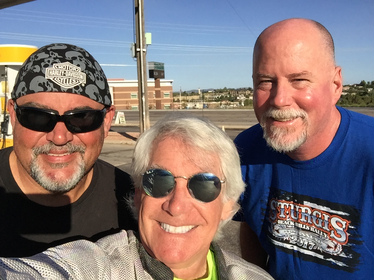
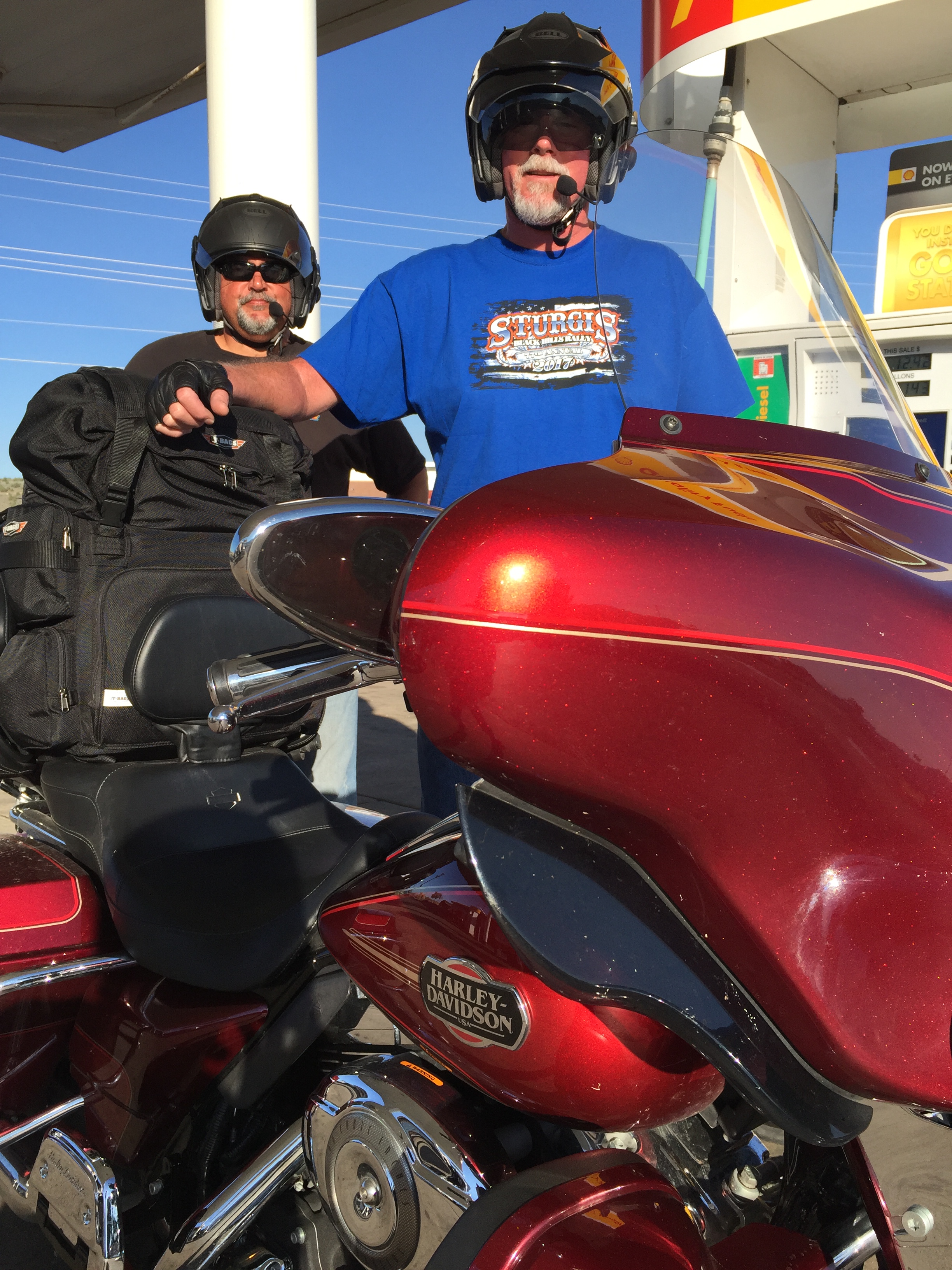
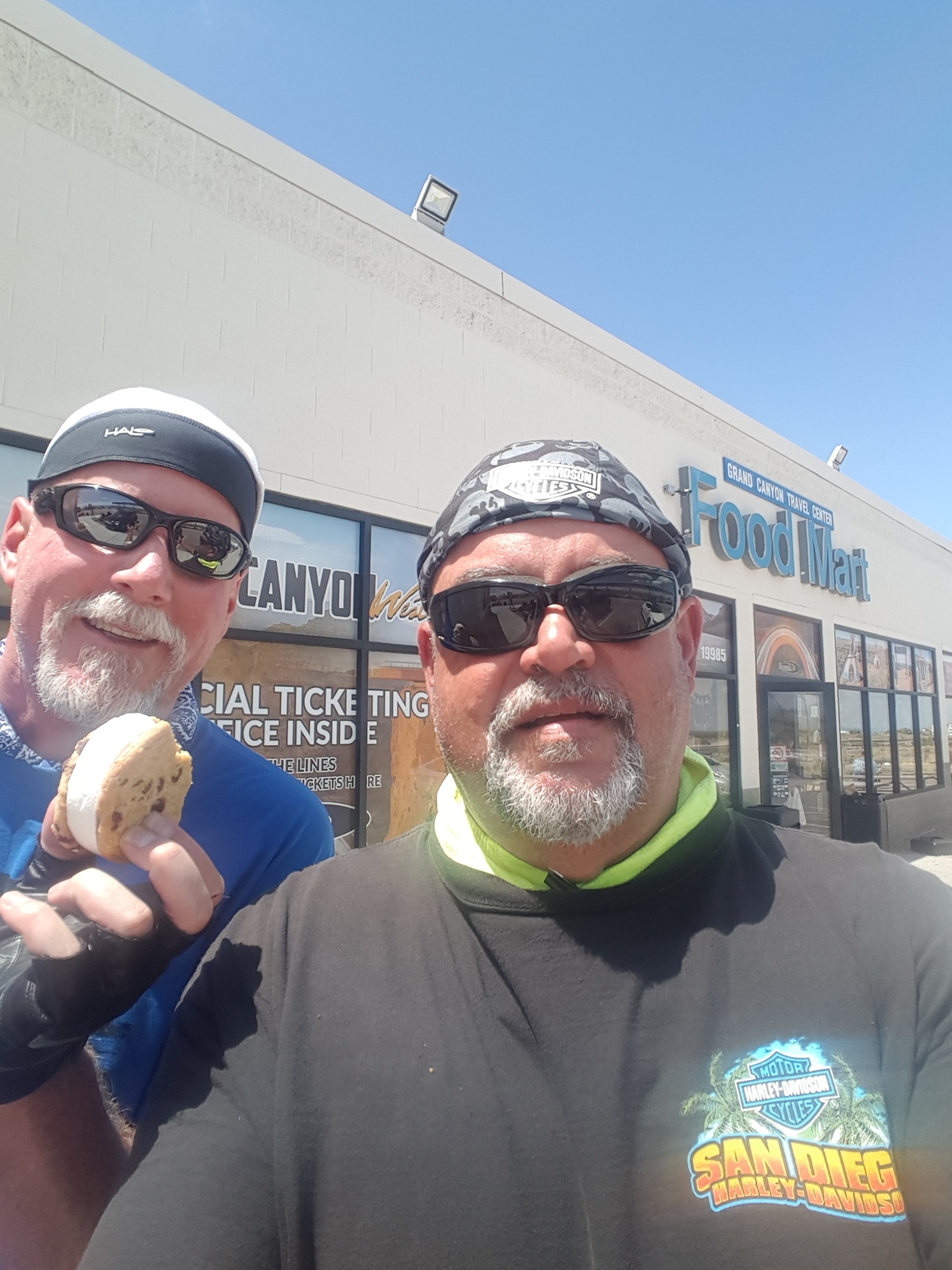
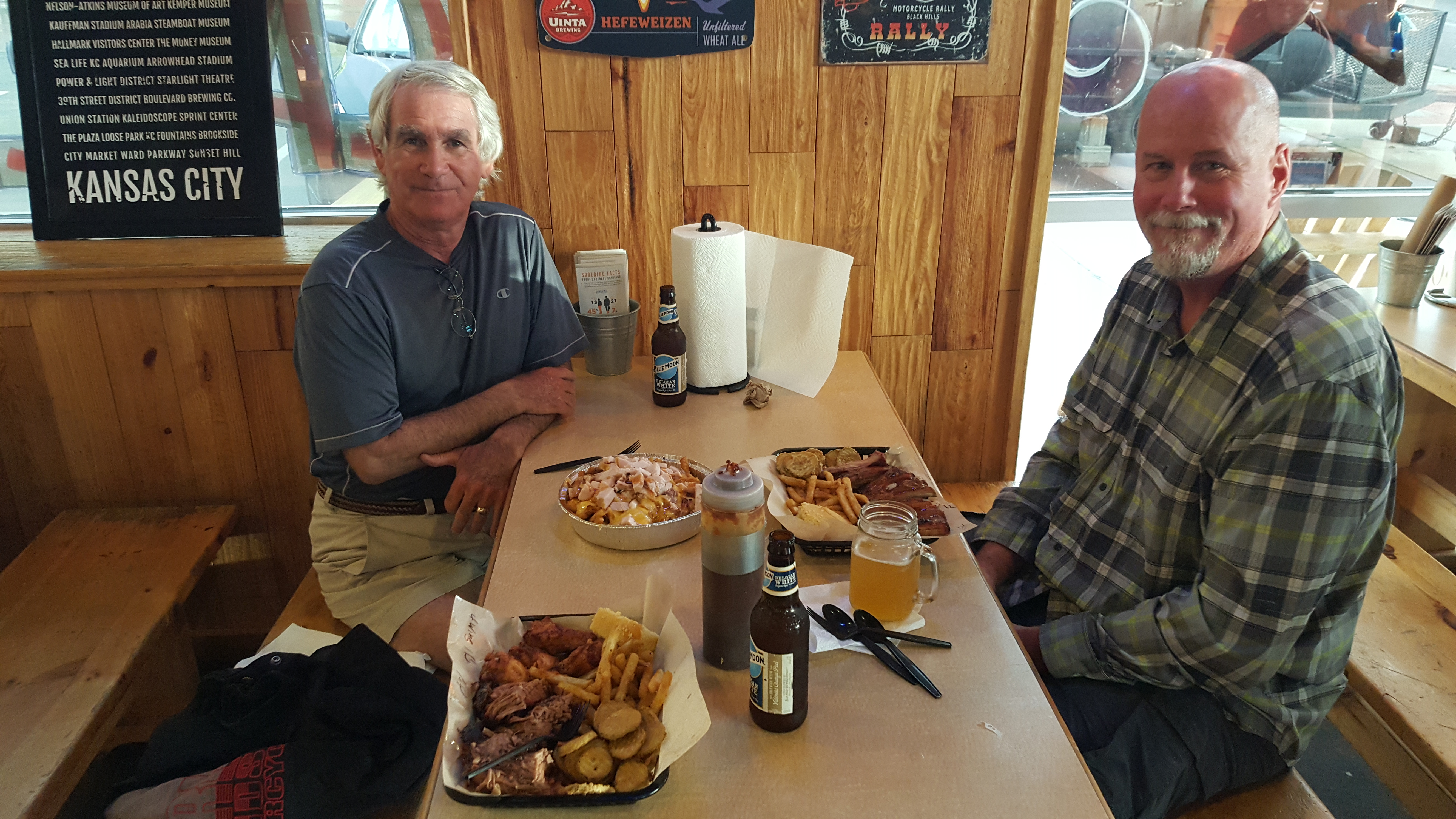
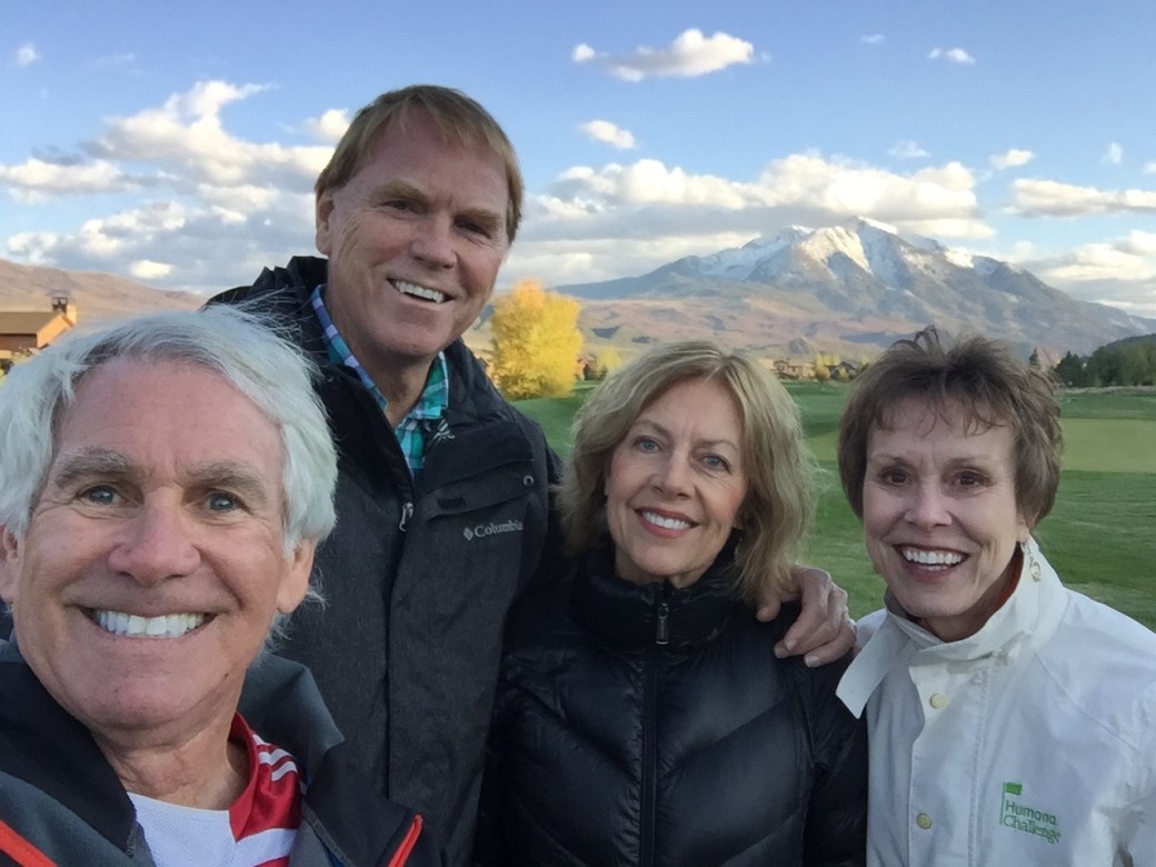
We’ve had a number of visitors here in Carbondale. They can confirm we are actually here. Our hospitality “brand” is the same as it was in La Quinta: Five-star Quality, Zero-star prices.

Rich

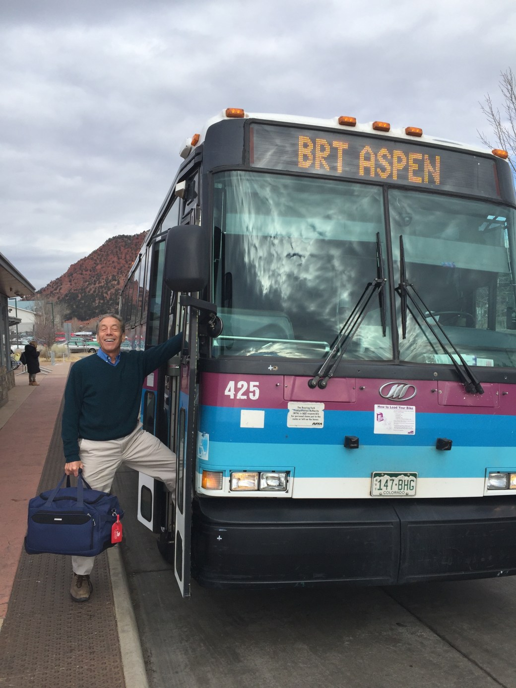
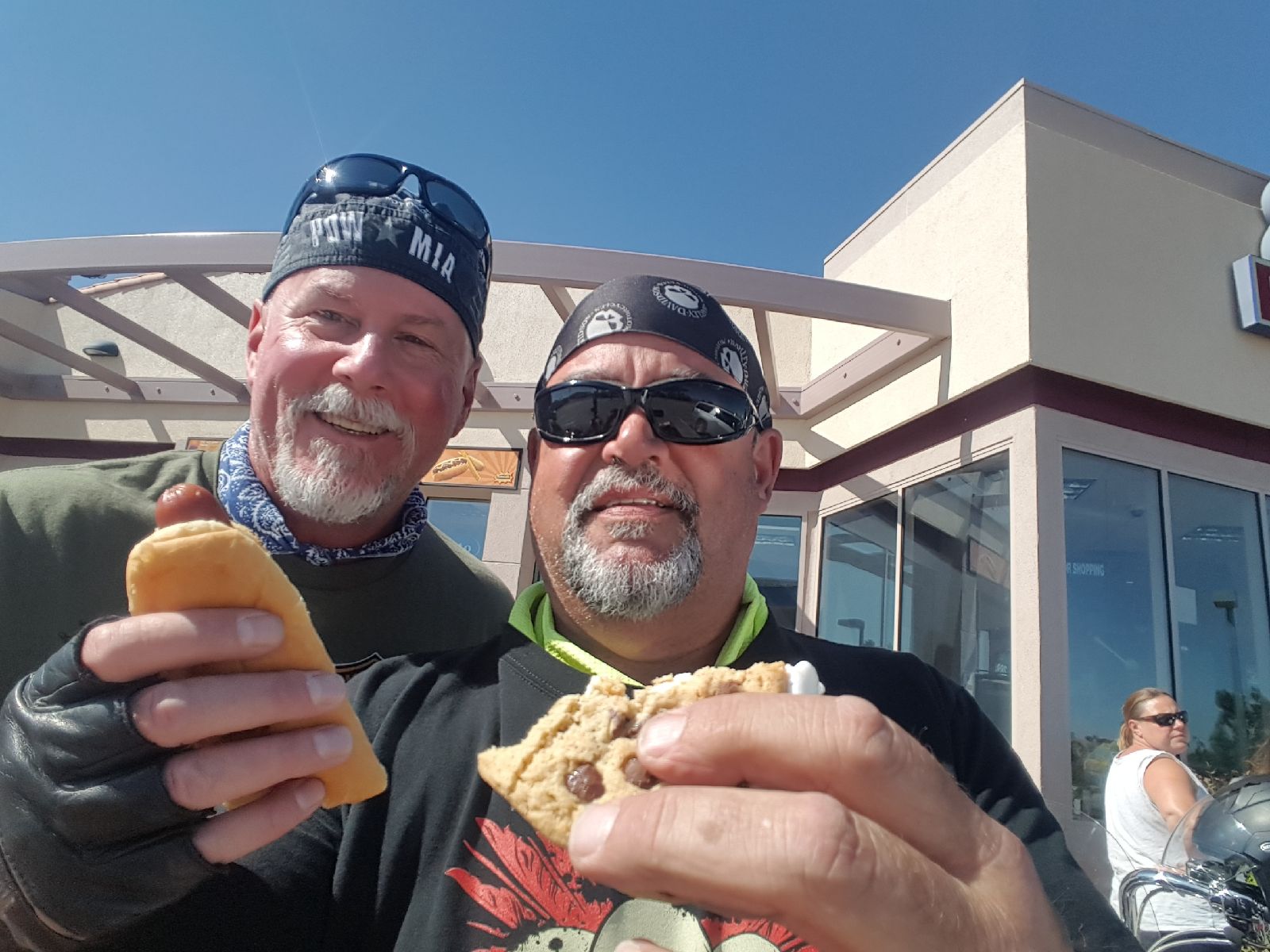
My cousin Rich visited in December. He flew to Aspen, and rode the bus in to Carbondale (and back). Thought it was the best deal on the planet: free plane ride, free bus!

John Tracy

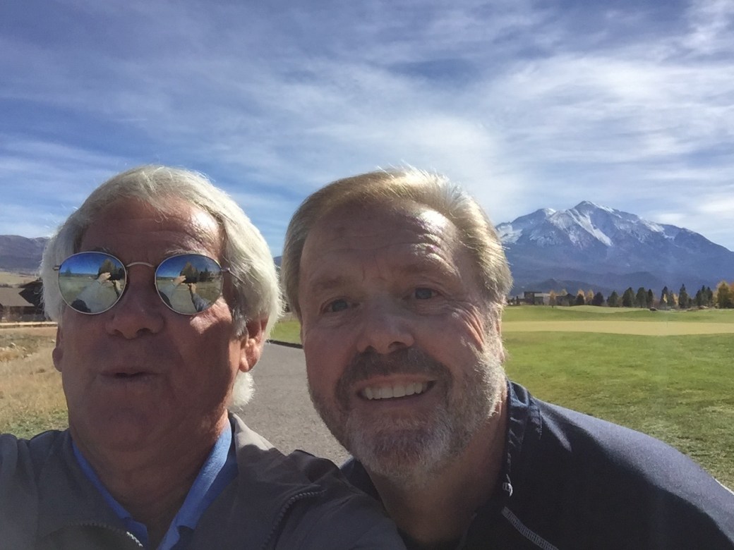
John Tracy visited from Alaska, along with his wife Donna and son, Cole. We think he’ll be back.

McBrides

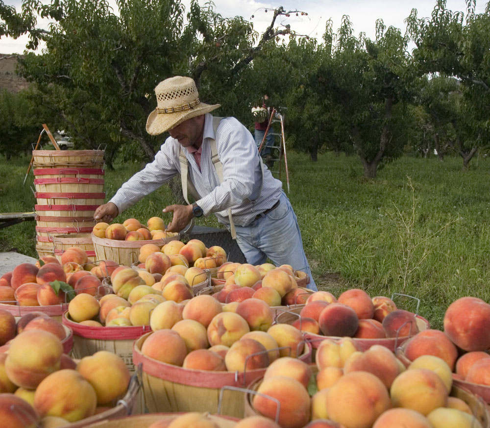
The McBrides visited from Palisade, Colorado’s peach and wine capital.

Sarah Murray

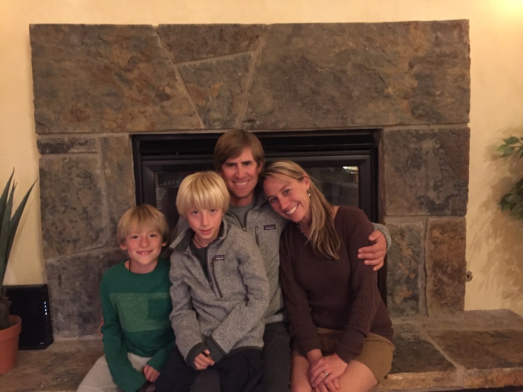
We had a lovely dinner at our house with Sarah Murray (what a name coincidence!), her husband Clay, and their cute twins, Si and Jesse.

***

We’ve been trying to walk most every day. The exercise routine is a bit reduced, compared to what it was in California, but there’s good reason. On November 2, Sarah had rotator cuff surgery at the world-famous Steadman Clinic in Vail.

IMG_7988

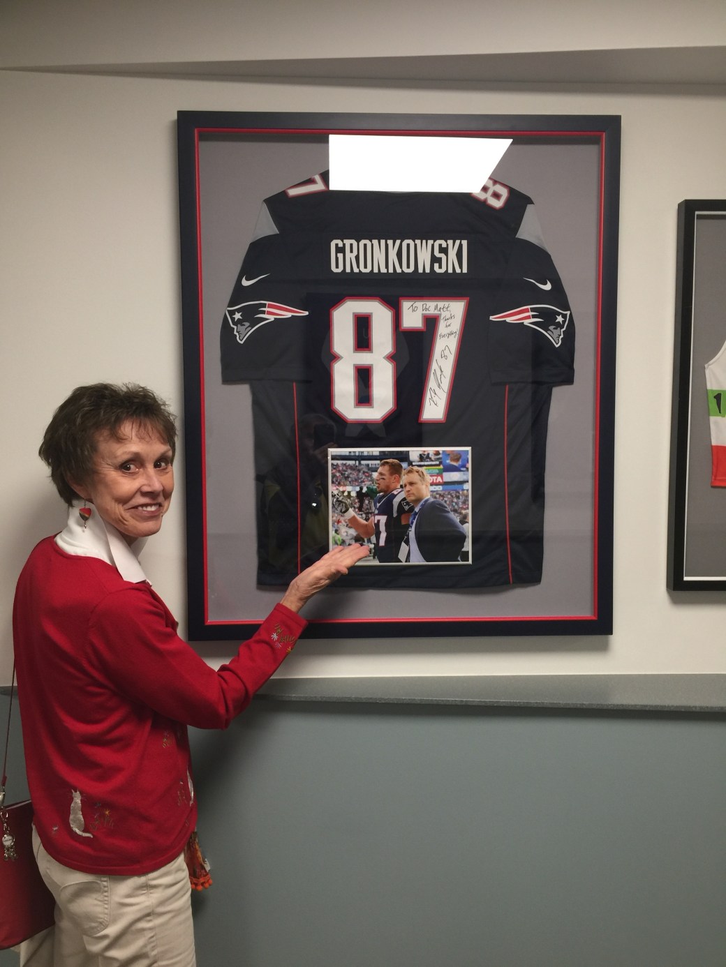
At the Steadman Clinic, pre-surgery. Sarah and Gronk now have something in common. Sarah may sign her golf shirt, and send it to the clinic for framing, to be hung in a conspicuous place.

IMG_8131

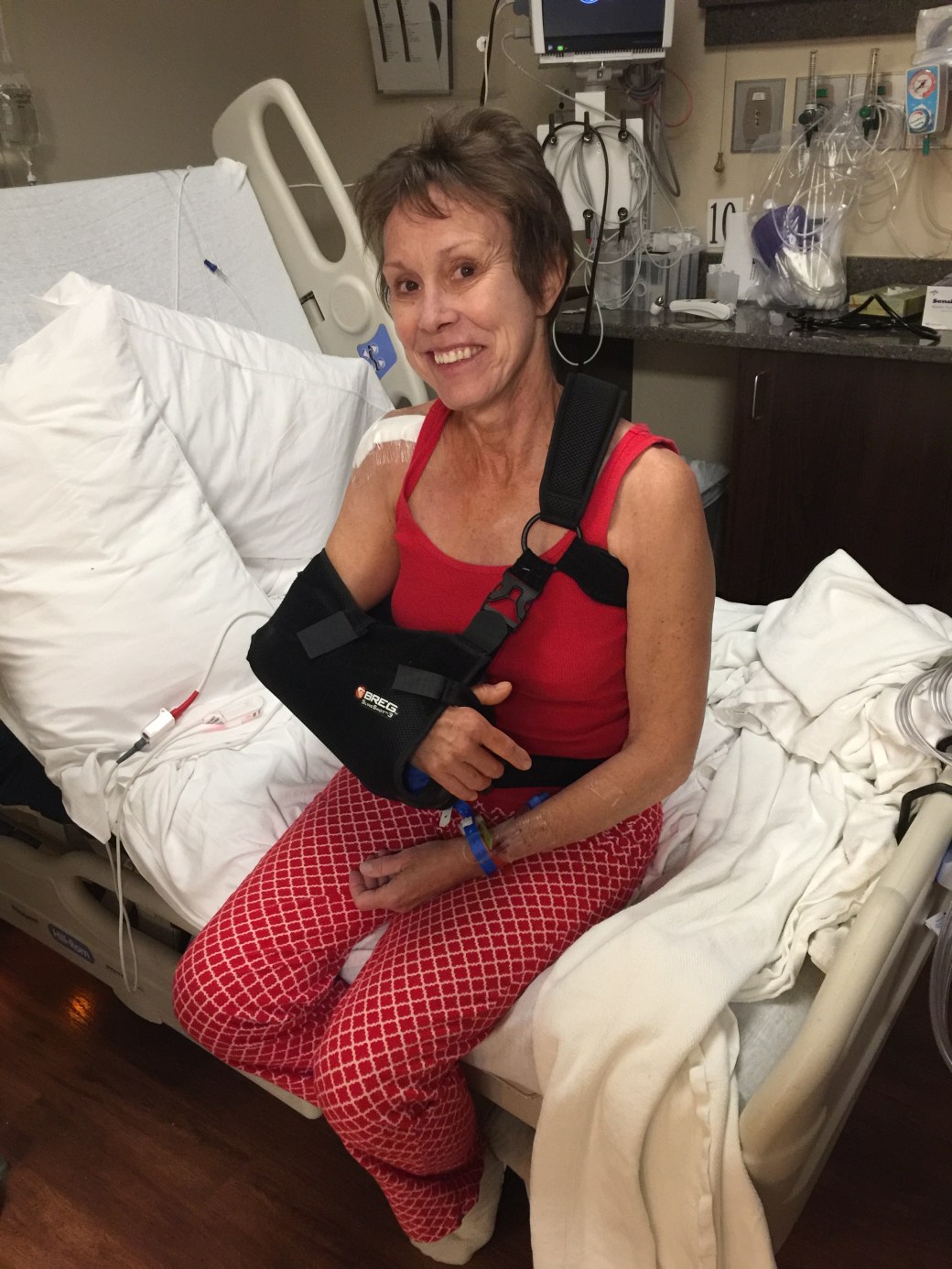
The morning after surgery. Looking good!

Only days before, Sarah and I played our last round of golf for the year. On October 27, we checked out the course at River Valley Ranch, where our new home is being built.

IMG_8113

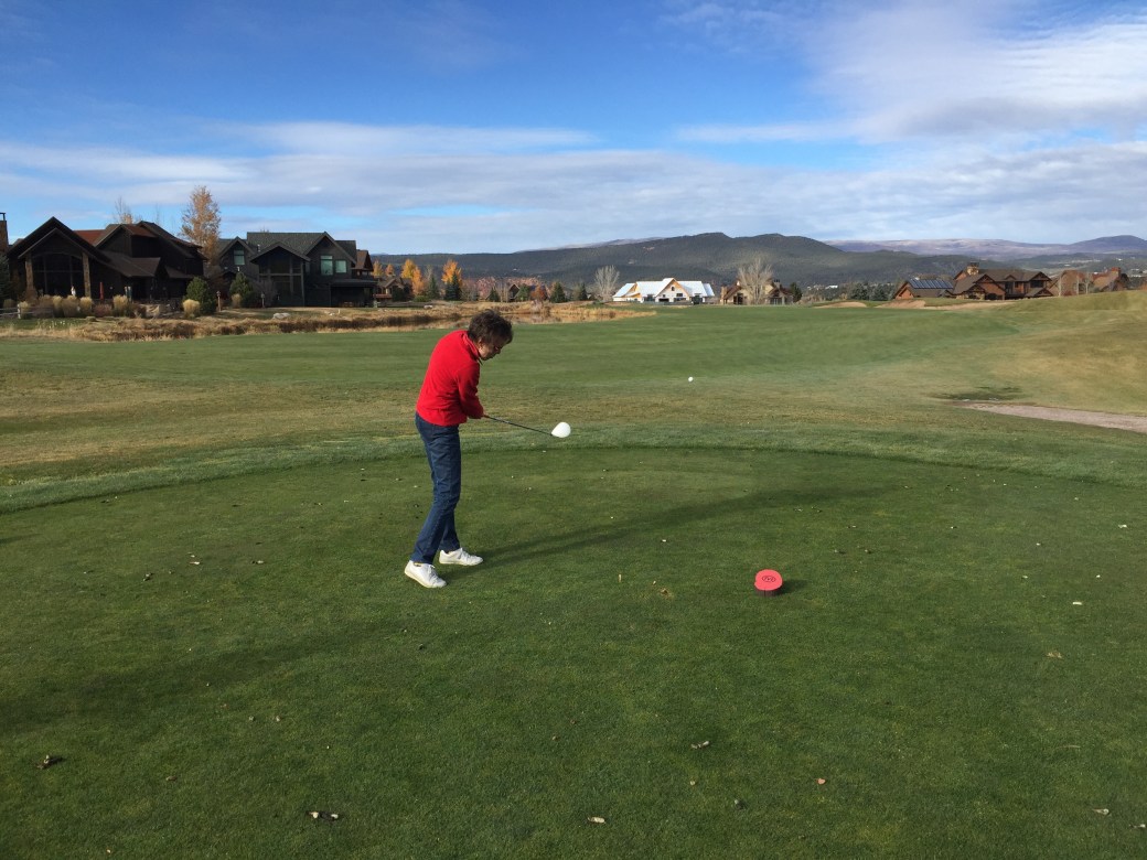
Here’s Sarah, crushing it on the 14th hole. We thought we’d never play golf in anything but shorts and a short-sleeved shirt … but hey, we’re in Colorado now. That’s our house, in white, at the end of the fairway. It’s a good target off the tee, but un-reachable — unless you’re Justin Thomas.

***

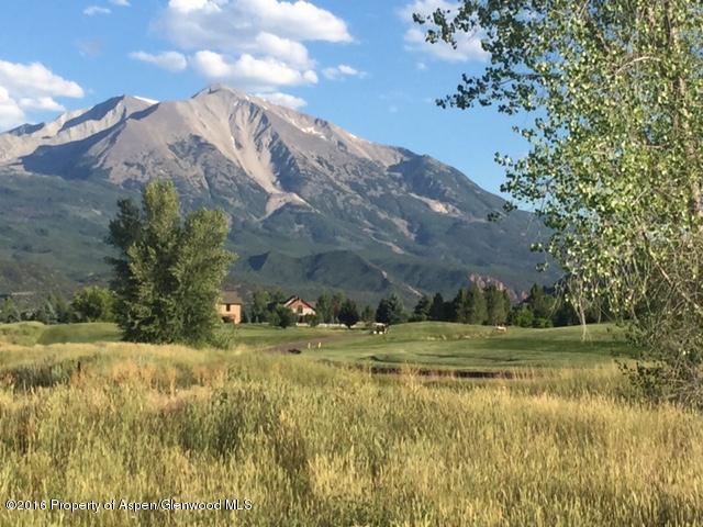
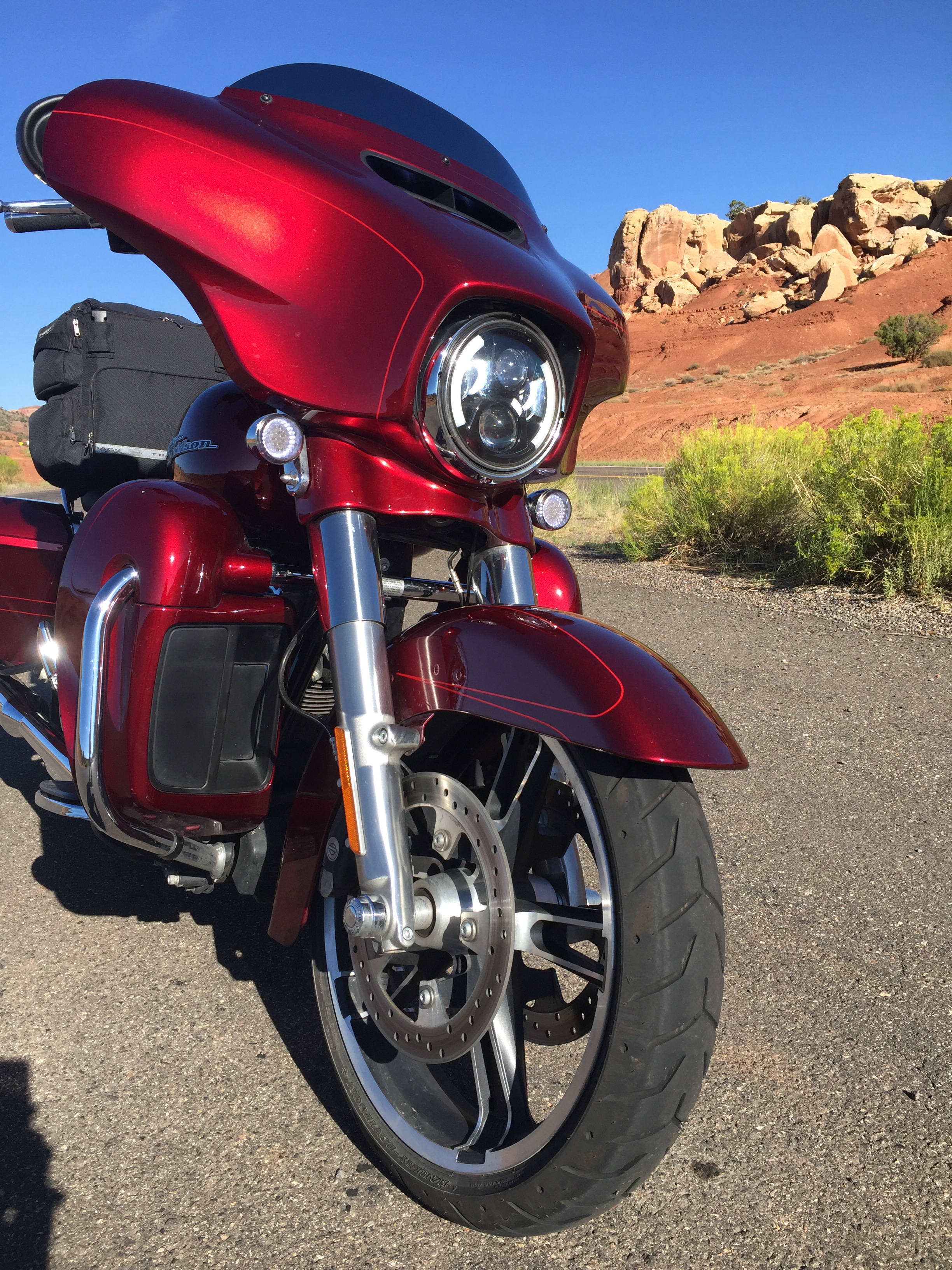
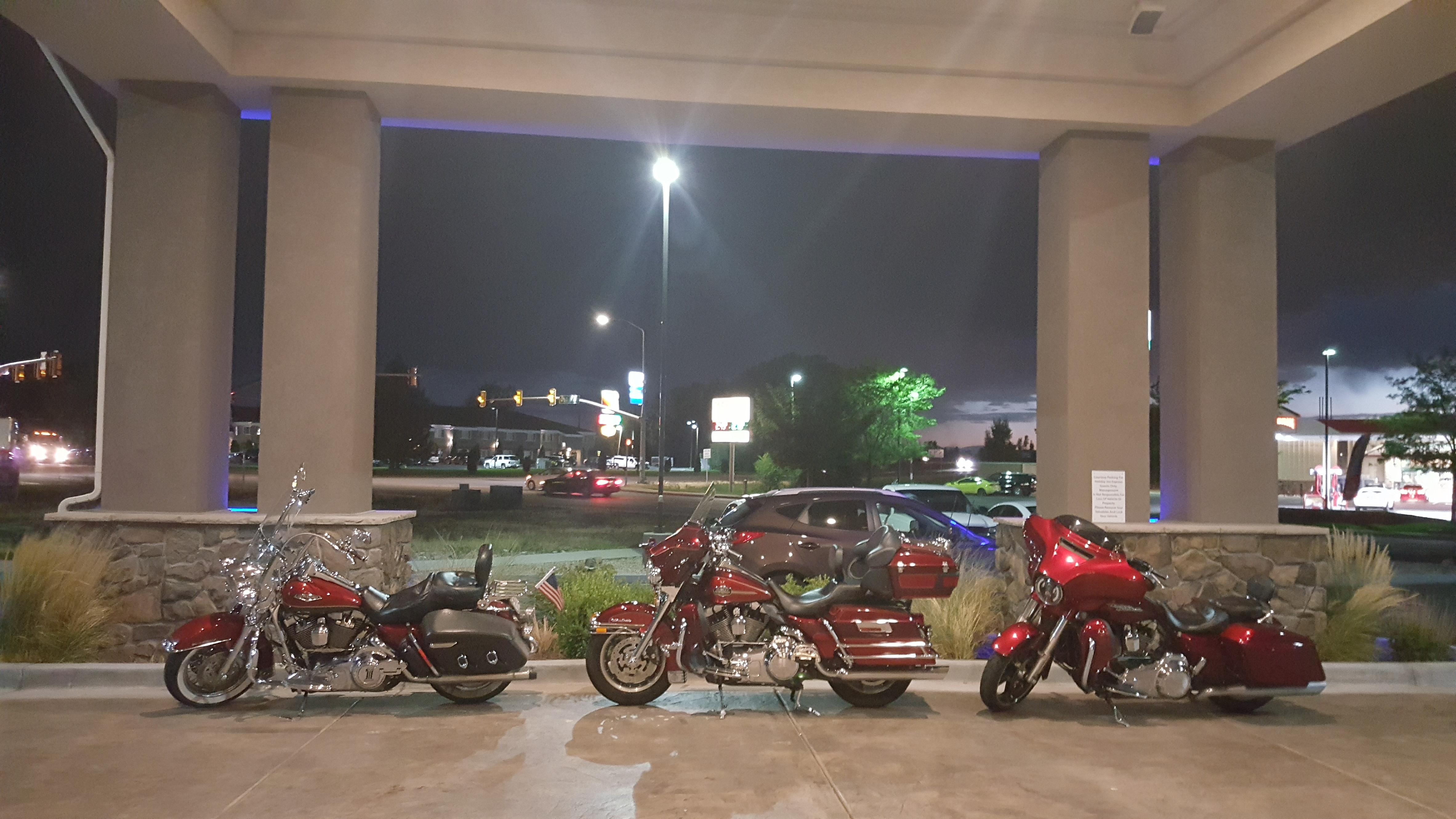
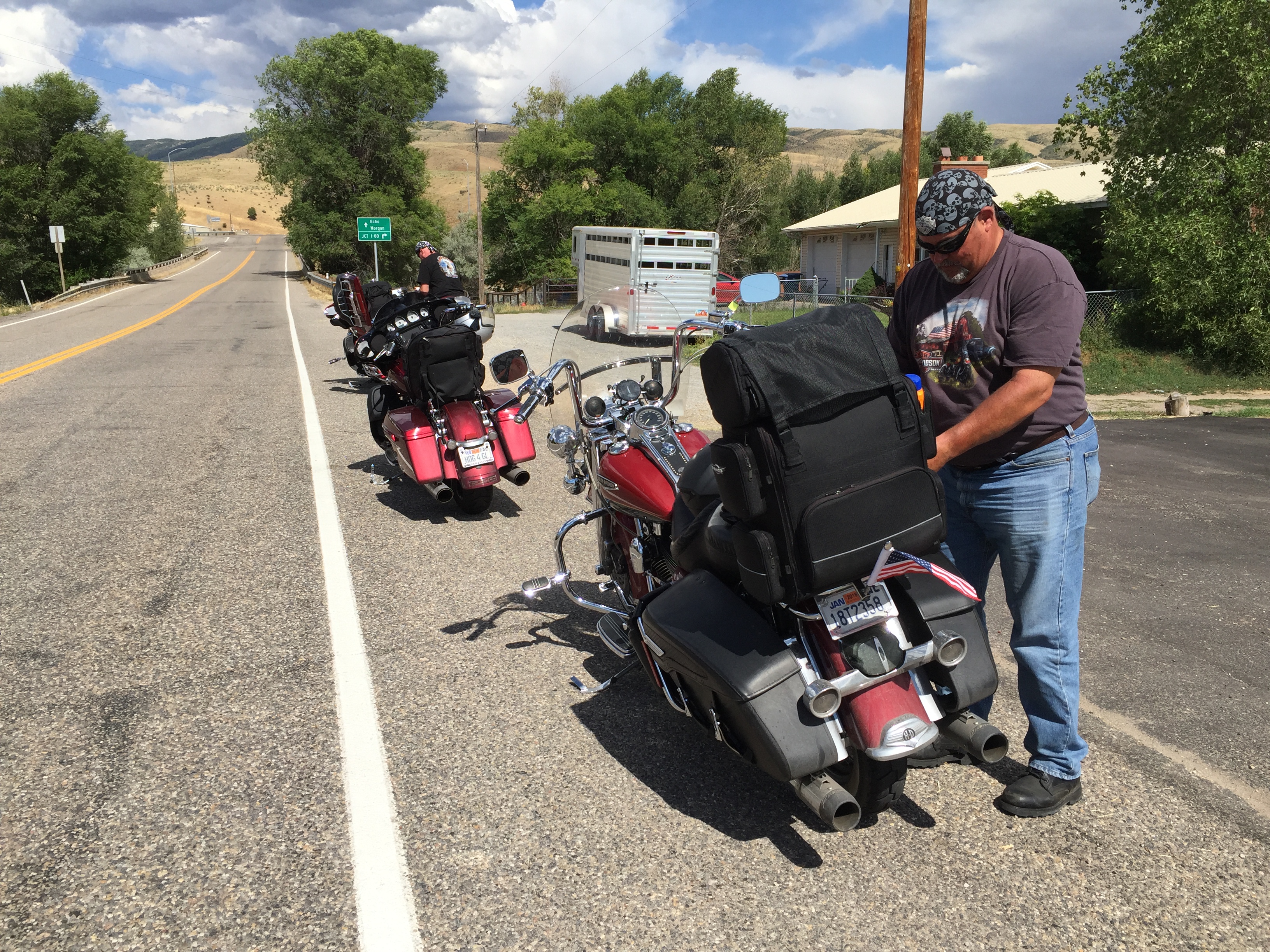
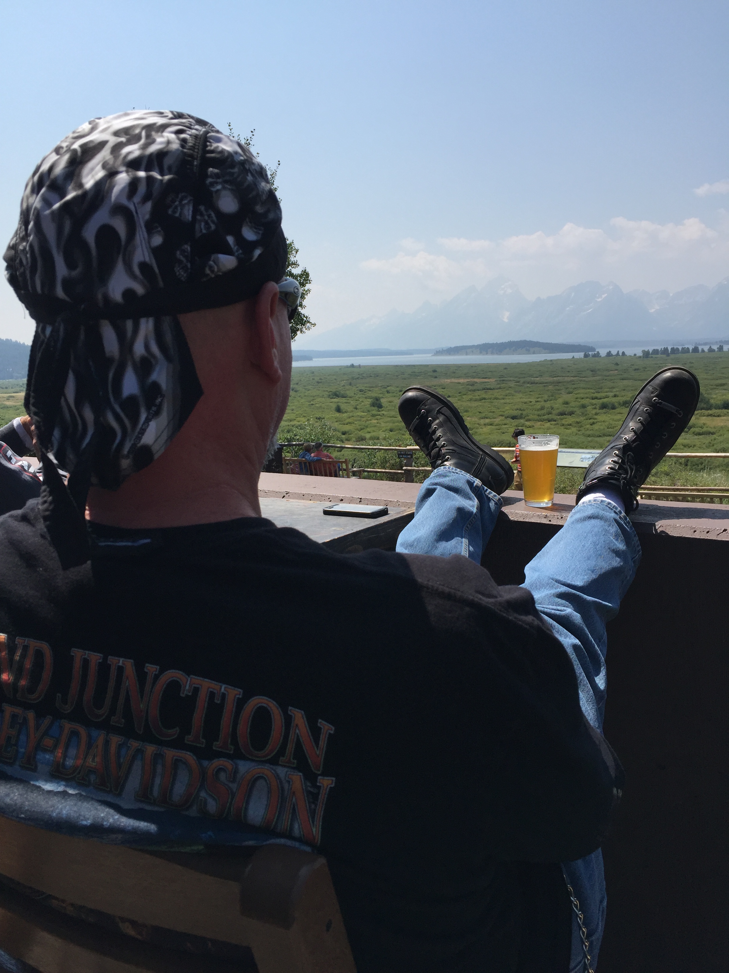
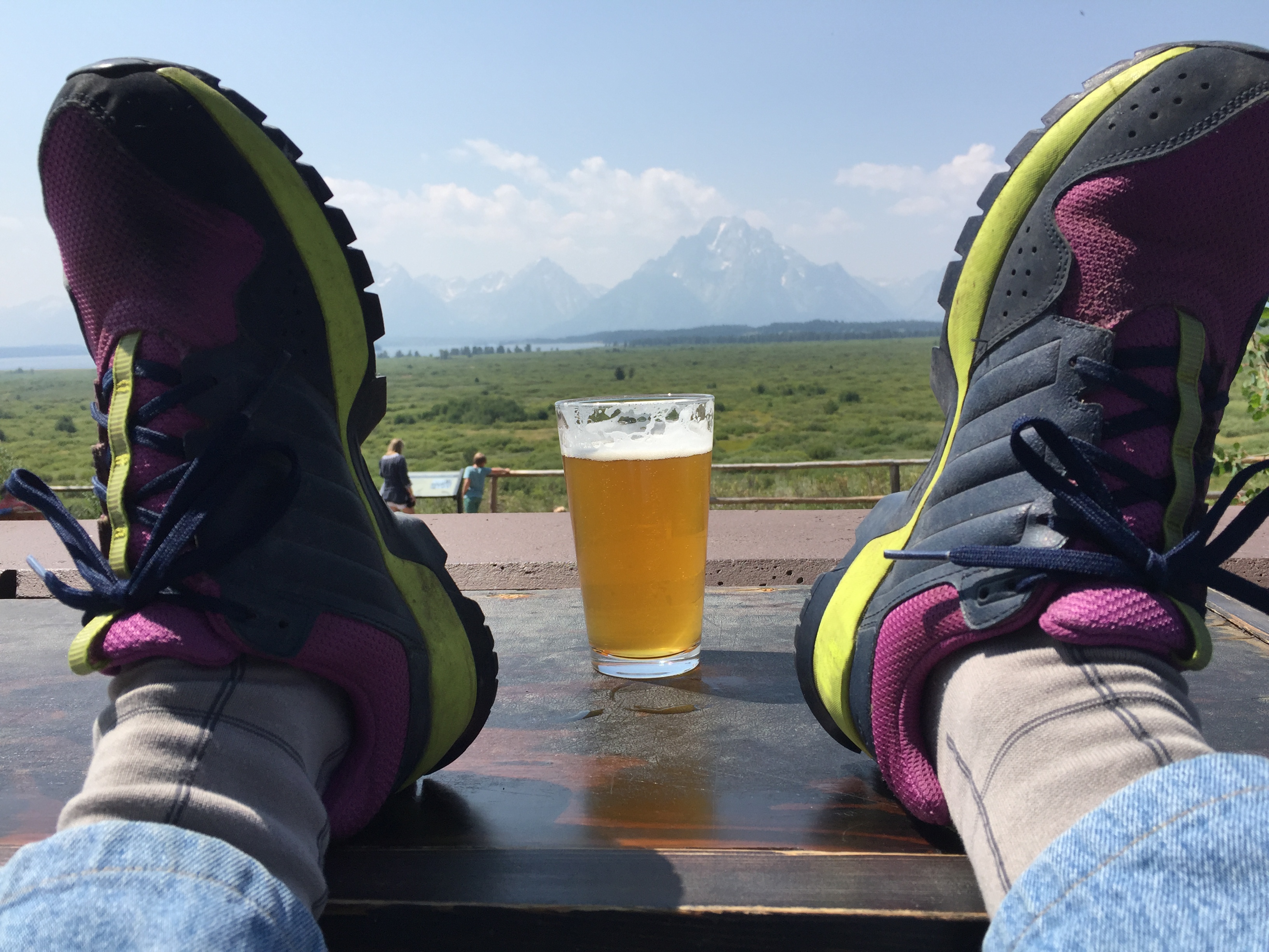
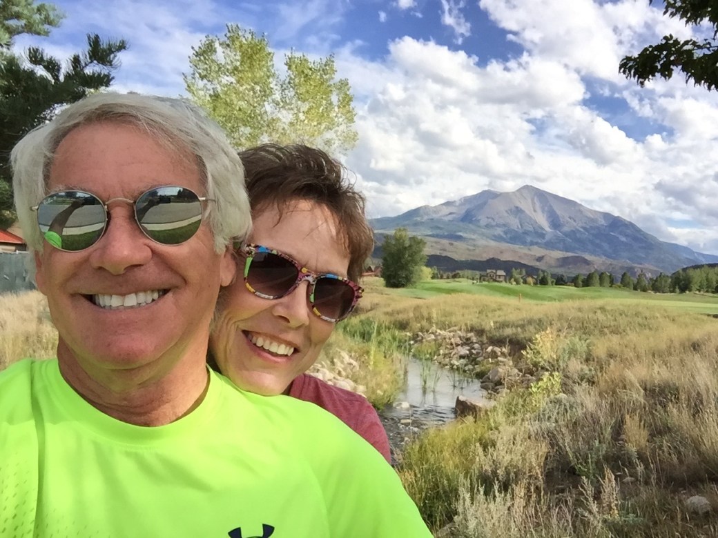
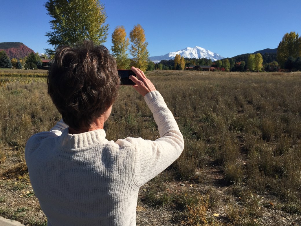
We’ve managed to ride the Harley a few times, and always, stop somewhere with a Mount Sopris view. The mountain is just a few feet shy of 13,000 feet — and very photogenic.

IMG_7912

Back in September, before there was snow on the mountain.

IMG_8004

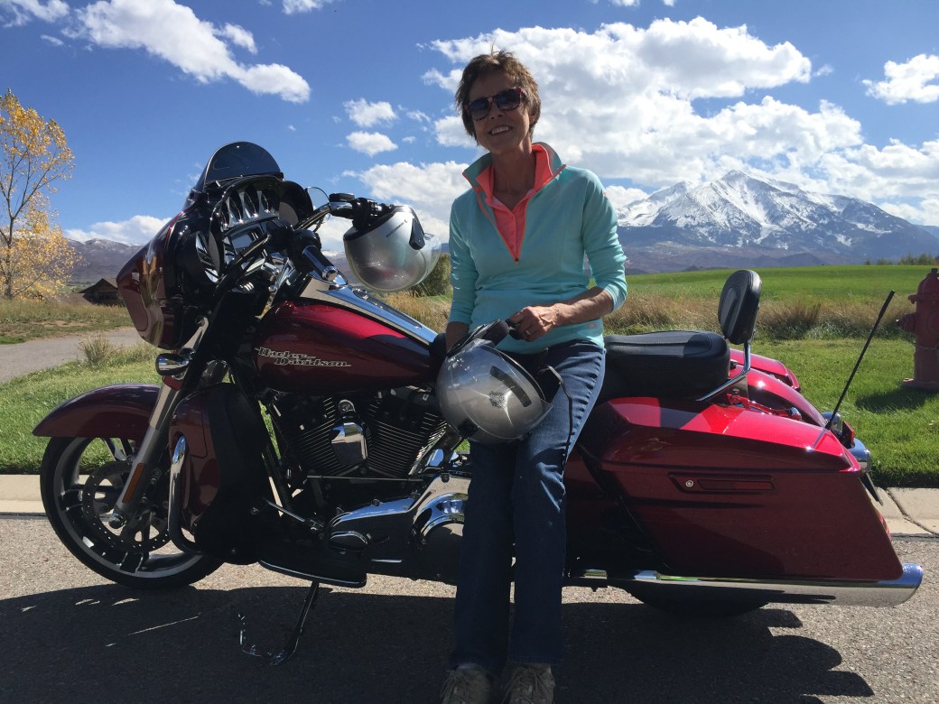
In October, the mountain looks better with snow on it — and with Sarah in front of it.

IMG_8156

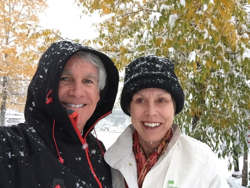
A cool November afternoon.

IMG_7997

The view from Aspen Glen.

IMG_8026

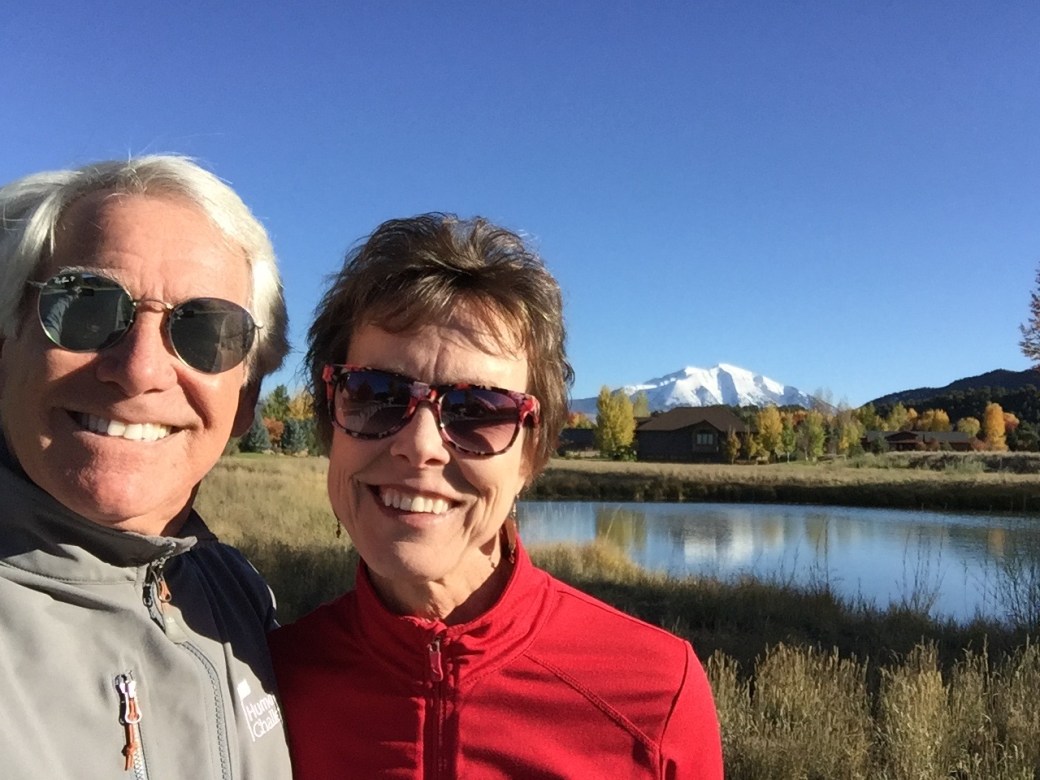
Also from Aspen Glen. Love Sarah’s sunglasses. Walmart!

***

Finally, a few wintry shots, then it’s time to get ready for Santa’s arrival in Carbondale.

Here’s one that has December written all over it:

IMG_8024

Um, yes … looks like December, but it was actually early October in Aspen. That’s pretty much all the snow we’ve had; it’s probably the worst season for skiing in 40 years!

IMG_8199

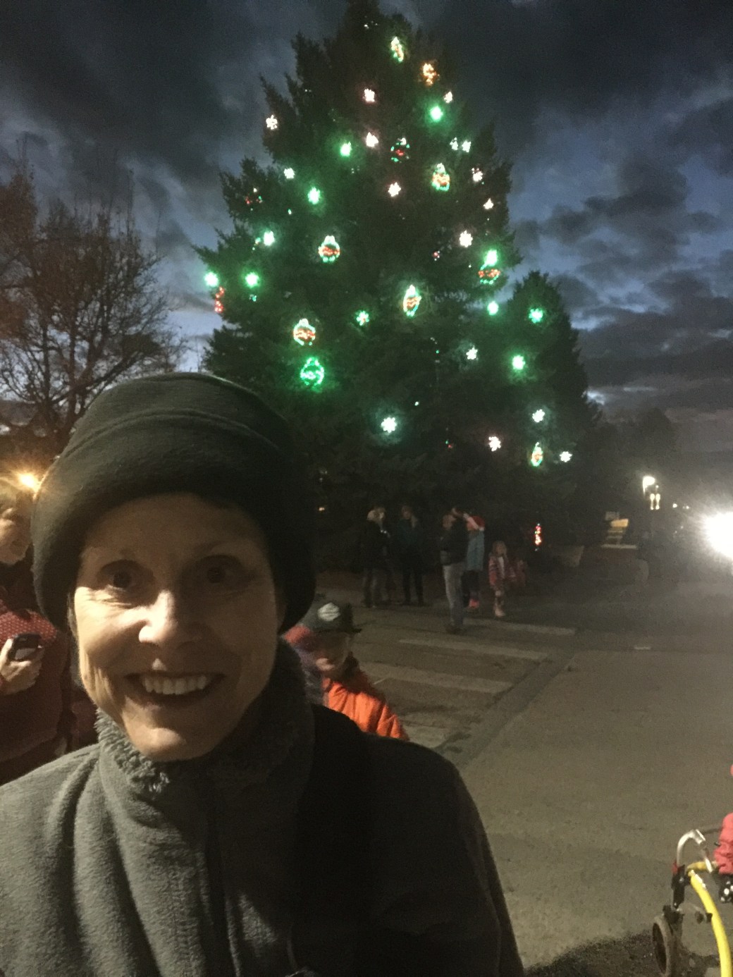
Christmas tree lighting in downtown Carbondale.

IMG_8215

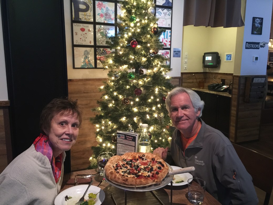
Merry Christmas, from the White House Pizza in Carbondale.

***

Well that’s it. A rather unusual blog post, considering I’m a Harley travel blogger. Never thought I’d do a holiday letter online. Thank you, Al Gore, for making it possible.

Whatever.

Happy Holidays to all and to all a good night. Hope Santa is exceedingly good to you, unless of course, you’re one of my Jewish friends or family — in which case I hope Harry Hanukkah took good care of you earlier this month.

Look forward to seeing you in 2018, here in Carbondale, or wherever you may be.

Let’s ride. Vroom, vroom!


Gary

P.S. We woke up to a White Christmas! Every little child’s dream. Here’s the view from our patio at 7:45 on Christmas morning.

White Christmas

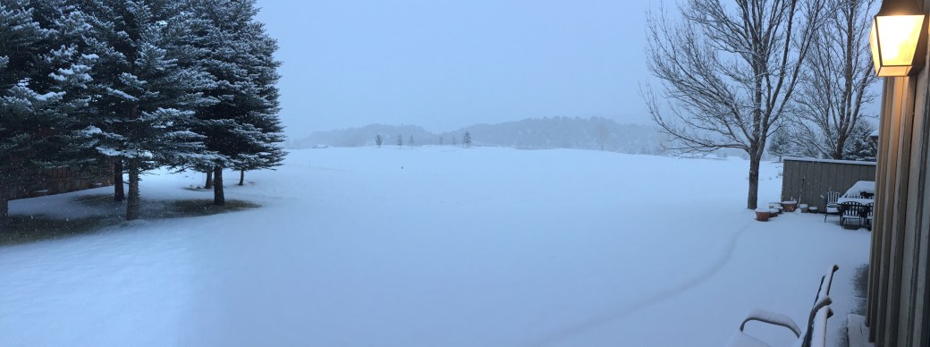
A White Christmas at 59 Primrose Road in Carbondale!

Home at Last!

The Carbondale homestead beckons.

So, I say goodbye to the McBrides, and roll out of Palisade on the last leg of my journey home.

The route is quite simple. I can probably do it without the nav system engaged, just listening to spirited ’70s rock and enjoying the scenery and fresh Colorado mountain air.

East on I-70 for 72 miles, take a right, blow through Glenwood Springs, and 10 minutes later, when you see Mount Sopris towering in the distance, you’ve arrived at the Lesser/Murr homestead.

There are several interesting sights to see along the way. A few miles after leaving Palisade, I ride past past De Beque, population 500, perhaps best known for becoming the first incorporated town in Mesa County to approve the retail sale of recreational marijuana. In De Beque, you can stop at Kush Gardens and be helped by some of the best budtenders (yes, that’s what they’re called) in Colorado.

091715_1a_pottax_600x400
Budtender Delplena Silas helps a customer smell the aroma of cannabis buds at De Beque’s Kush Gardens. Business is booming.

Truth be told, Sarah is a fan. We’ve done some retail at Kush Gardens. She has a lot of back and neck pain; it’s what kept her from joining me in South Dakota’s Black Hills on this trip. It turns out that a drop of sublingual marijuana under the tongue occasionally helps her sleep at night.

Those of you reading this blog with your chardonnay or vodka tonic in hand should immediately re-consider your judging of her choice. Medical marijuana is now legal in at least 29 states and the District of Columbia; recreational use is legal in eight states, including Colorado.

While the national discourse clearly favors legalizing marijuana, federal law still considers cannabis a dangerous illegal drug with no acceptable medicinal value. Federal law still treats marijuana like every other controlled substance, including cocaine and heroin. There is a clear conflict between federal and state laws when it comes to marijuana use.

Someday, we’ll look back on this time in America and wonder what took us so damn long to legalize what has been criminalized for eons. Remember how well Prohibition worked?

Pot in Colorado is such a thing that the state’s leading newspaper, the Denver Post, has its own marijuana critic, Jake Browne. He works alongside the newspaper’s wine critic, theater critic and movie critic. Jake’s paid to smoke marijuana – and then write about the high.

Marijuana has truly gone mainstream.

research-supports-marijuana-benefits-fb
OK folks, put down your glass of chardonnay and let’s talk about it.

***

From DeBeque, I roll northeast past the town of Parachute, which is about halfway between Palisade and Glenwood Springs. Next up: the towns of Rifle, Silt, and New Castle. I love Colorado place names.

If I continued another 150 miles east on the interstate, I’d be in Denver, Colorado’s biggest city.

But really, what would be the point of that? I’m heading home, and my exit from I-70 is in Glenwood Springs, directly ahead of me.

Glenwood Springs is the county seat of Garfield County, where we’ll soon go for fun DMV activities like registering our cars and acquiring Colorado driver’s licenses. Glenwood Springs is also home to Doc Holliday Harley Davidson, named after the Wild West gunfighter, pal of Wyatt Earp, and participant in the Gunfight at the O.K.Corral.

In the 1957 movie about the famous 30-second shootout, Holliday, who was grazed by a bullet, is played by Kirk Douglas.

gunfight-at-the-corral-doing-the-walk1
That’s Kirk Douglas on the far left, as Doc Holliday, on his way to the shootout at the O.K. Corral. Holliday is buried at a cemetery in Glenwood Springs, about 10 miles from Carbondale.

Best line from Doc Holliday, referring to his ability with guns: “I do handle them pretty well. The only trouble is, those best able to testify to my aim aren’t around for comment.”

Doc Holliday was also a gambler and dentist, receiving his DDS from the Pennsylvania College of Dental Surgery – now part of the University of Pennsylvania School of Dental Surgery. He died here in Glenwood Springs in 1887 at the age of 36, not in a gunfight, but of tuberculosis. You can visit his resting place at the Pioneer Cemetery in Glenwood Springs.

cdf1b674a700d74c2599d40fe066a4a0
Doc Holliday’s final resting place, in Glenwood Springs.

***

Minutes later, under beautiful blue Rocky Mountain skies, my 19-day, 4,100-mile adventure comes to an end, as I arrive in Carbondale.

IMG_7761
Carbondale. Home at last
IMG_7760
Harley, too. That’s Mt. Sopris in the background.

I enjoyed having you along for the ride.

It took nearly 35,000 words to describe the journey in this blog.

But I can sum it up in two words: I’m home.

Our new address is 150 Sopris Mesa Drive. Hope you’ll come visit.

150 Sopris Mesa
The view from your guest room at 150 Sopris Mesa Drive in Carbondale. It should be ready for you in May 2018. Just bring your toothbrush and pajamas. And fly fishing gear. Or skis. Or golf clubs. There’s a lot to do here.

The house, which we’re calling our Cozy Carbondale Cottage, should be complete in May 2018.

Home at last!

Vroom, vroom.

To be continued … next year.

IMG_7767
They’re pouring the concrete foundation walls today. The new Murr/Lesser home is really happening.
IMG_7765
Woo-hoo! Only nine months (ish) and we’ll be moving in.

***

Day Nineteen Summary: Retail cannabis at Kush Gardens, the sure aim of Doc Holliday, home at last!

Click here to see today’s complete route from Palisade to Carbondale.

***

Today in Bucket List History:

Bucket List Goal: “Throw a Big Party That No One Will Ever Forget.”

Goal Achieved: On August 15, 1969, the Woodstock Music & Art Fair opens in New York State on Max Yasgur’s 600-acre dairy farm in the Catskills. The festival, billed as “Three Days of Peace and Music,” attracts an audience of more than 400,000. Opening act on August 15, at 5:07 pm: Richie Havens, singing Freedom. Closing act, on Monday, August 18 at 9 am: Jimi Hendrix, the Purple Haze guy. Far out, man!

richie_havens_small
Richie Havens opens the Woodstock Music Festival on August 15, 1969.

What’s on your bucket list?

Peaches are Not the Pits

IMG_7745
Washed my Harley before leaving Torrey this morning. Here, it sits cleanly and proudly near the entrance to Capitol Reef National Park, on Utah Highway 24.

The day begins by riding east, into the rising sun, on Utah Highway 24.

From Torrey, it’s just a few miles to the west entrance to Capitol Reef National Park. Entrance may not be the right word.

Because State Highway 24 is the main east-west road through the park, there’s no toll to ride through much of Capitol Reef – unless you’re traveling on Scenic Drive south of the Fruita Campground. I’m just passing through.

red-sands-hotel-imageLinkroad-in-captiol-reef1
Immediately after leaving Torrey, the red rocks of Capitol Reef National Park dominate the view.

Capitol Reef National Park was established in 1971. It has 241,904 acres of colorful canyons, ridges, cliffs, towers, arches, buttes and monoliths.  The area is named for a line of white domes and cliffs of Navajo Sandstone, each of which looks a bit like the U.S. Capitol building. The local word “reef” refers to any rocky barrier to travel.

Soon, I roll through Fruita, the best-known settlement in Capitol Reef. Fruita was named for its productive fruit orchards.

The town had been long abandoned in 1955, when the National Park Service purchased Fruita to be included in Capitol Reef National Park. Today, few buildings remain, except for a restored one-room schoolhouse.

The orchards are still here, now under the ownership of the National Park Service, and have about 3,100 trees – including cherry, apricot, peach, pear, apple, plum, mulberry, almond and walnut. The trees were originally planted in the 1880s when Mormons settled the area. Visitors to the park are welcome to stroll in any unlocked orchard and consume ripe fruit. The orchards have an honor system; you pick fruit in season, then settle up at self-pay stations.

Capitol-Reef-Orchard-barn-Fruita_DP_680
The Fruita orchard and barn in Capitol Reef National Park.

***

Past Fruita, I continue on UT-24 for another 38 miles, following the Fremont River as it winds from Torrey toward Hanksville, which calls itself “An Oasis in the Desert.”

In 1985, the town was named after Ebenezer Hanks, leader of a group of Mormon pioneers who established a small settlement here. It may be best known as a supply post for Butch Cassidy and the Wild Bunch, who would hide out at Robbers Roost in the desert southeast of town.

***

There are few choices to be made in Hanksville: What to have for breakfast. Which bib overalls to wear for the day. And whether to turn south on Highway 95 toward Hite, a ghost town at the north end of Lake Powell along the Colorado River – or turn left and continue north on Highway 24.

lake_powell_utah
In Hanksville, you can turn south toward beautiful Lake Powell. Or, you can turn left and head toward Colorado. My choice: left.

I turn left and continue on Highway 24, with barely a curve in the road, until after 45 minutes, it meets up with I-70. Then, I jump on the Interstate for what seems like an eternity — 123 miles.

Soon, I roll past the Green River, as well as its namesake city, Green River. The Green River is a tributary of the Colorado River.

IMG_7749
At a convenience store in Green River, having a mid-day snack. In Utah, this is considered health food.

The next turnoff of any consequence is Crescent Junction, where most people turn right on US Highway 191 for the short drive to Moab, Arches National Park, and Canyonlands National Park.

Today, my destination is Colorado, not Utah. So I continue east, eventually seeing the “Welcome to Colorful Colorado” signs.

super-bike-states-012
Crossing into Colorful Colorado. Almost home!

It’s feeling like home.

Colorado has a reputation for being a state of active and athletic people, reportedly with the lowest obesity rate in the nation. People here are both healthy and happy: Colorado was one of the first states to legalize both the medicinal (2000) and recreational (2014) use of marijuana.

I roll past by Fruita, home of the Western Colorado Dinosaur Museum, then past Grand Junction. Ten miles east of Grand Junction, I take the turnoff for Palisade – which grows the best peaches humanly possible.

Palisade is also Colorado’s wine nivrana, with both vineyards and wineries. The small town has more than two dozen wineries.

The Grand Valley’s microclimate of sunny days, dry air and cool nights work together to produce plump grapes for the area wineries.

Palisade, today’s destination, was named for its nearby cliffs. Yes, but why stop in Palisade?

First, did I mention peaches and wineries? Second, my friends Kathryn and Eldon McBride live here, in the middle of a peach orchard, in an 1800s-era farmhouse a short walk away from the Colorado River.

palisadepeaches
Palisade peaches. Yum!

It’s a great place to call it a day before the final push tomorrow, when I’ll roll on to our new home in Carbondale.

***

Day Eighteen Summary: Fruit orchards in Utah and Colorado, a hideout for Butch Cassidy, and a warm welcome home to Colorado.

Click here to see today’s complete route from Torrey to Palisade.

Home at last. Almost.

Vroom, vroom.

IMG_7754
With the McBrides in Palisade, Colorado.

***

Today in Bucket List History:

Bucket List Goal: “Take a Deeply Principled Stand, No Matter the Consequences.”

Goal Achieved: On August 14, 1846, philosopher Henry David Thoreau is jailed for tax resistance, the result of an act of civil disobedience. Thoreau spends one night in jail for not paying his poll tax. For Thoreau, it is an act of protest against slavery. His philosophy of civil disobedience later influences the political thoughts and actions of notable figures including Leo Tolstoy, Mahatma Gandhi, and Martin Luther King, Jr. Thoreau is best known for his book Walden, a reflection on simple living in natural surroundings.

live-the-life-you-have-imagined-henry-david-thoreau-quote-poster
A man ahead of his time.

What’s on your bucket list?

***

And, as a postscript, here’s an update on Scott and Dave’s ride home to Southern California: both arrived home in Orange County this afternoon. Of the six of us who were riding the Black Hills in South Dakota together recently (Dave, Gail, Scott, Jackie and Randy), that makes me the only one still on the road.

IMG_7750
On their way home, Dave (hot dog) and Scott (cookie) stop for nourishment near Barstow, California. That’s considered health food in Barstow. Have you been to Barstow?
20170814_143029
Scott arrives home safely in La Habra.
IMG_0302
Dave at home in Fullerton. Didn’t take him long to begin catching up on the news. He drinks a much better brand of beer when on the road! (photo by Dave)

On My Way Home

IMG_7726
One last group photo before heading separate ways at the end of an epic journey.

After 16 days and 3,457 miles riding with Dave and Scott (and Randy, too), I’m on my own.

And, I’m on my way home.

The first sentence makes me sad. The second makes me happy.

***

IMG_7728
Dave and Scott, tanks full of gas, moments before heading toward Kingman, Arizona, on their way home to Southern California.

As Dave and Scott head west toward Orange County, California, I leave Cedar City, too – beginning the 500-mile ride to the new Lesser/Murr homestead in Carbondale, Colorado.

My rear-view mirror is full of memories — and in front of me lies unbridled excitement about a new life in the Rockies.

Who leaves paradise (La Quinta) after 16 years of the good life at PGA West?

hp_slide-5
Sixteen years of the good life at PGA West. It’s been a wonderful experience, but now it’s time for something new. Hey … let’s try Carbondale, Colorado. Why not? For the curious among you, the hole pictured above is number 10 on the Arnold Palmer Private Course.

Who says goodbye to their friends and relocates to a place whose beauty is breathtaking, but so much about it is foreign?

Sarah and I do.

If you have to ask us why, well, you probably wouldn’t understand.

***

Utah Highway 14 leads me eastward from Cedar City into Cedar Canyon, a scenic drive that crests at nearly 10,000 feet.

For the next 35 miles, the road twists and turns, past Navajo Lake, through Duck Creek Village, and eventually to the intersection with US Highway 89. The road through Cedar Canyon offers epic views of the Dixie National Forest, before giving way to massive meadows on both sides of the highway.

IMG_7744
Cedar Canyon.

At the gas station that marks the junction of Utah Highway 14 and US Highway 89, I turn north and begin making my way toward Bryce Canyon National Park.

I roll through the town of Hatch, population 133, home of the Bryce Zion Inn – where identity confusion apparently caused it to be named after both National Parks. An unconfirmed report suggests Hatch is named after 84-year-old US Senator Orrin Hatch, now serving his seventh term. The ultra-conservative Hatch hasn’t decided whether he’ll seek an eighth Senate term in 2018, but says he might be willing to step aside if Mitt Romney decides to give elective office another try. In a recent Salt Lake Tribune poll, 58 percent of Utahns said Hatch “definitely” should not seek re-election.

***

About 10 miles north of Hatch is the turnoff to Utah Highway 12, a Scenic Byway that’s Utah’s first All-American Road.

201008-w-coasts-utah-rt-12
Utah Highway 12, one of the most spectacular roads imaginable.

Known as “A Journey Through Time Scenic Byway,” it’s considered one of the top five motorcycle roads in the US.

I’ve ridden Highway 12 three times in each direction (east to west, west to east), and it does not disappoint. It’s 123 miles of unparalleled beauty, alternatingly breathtaking and terrifying.

Parts of Highway 12 were built by in the 1930s by the Civilian Conservation Corps, a work relief program that operated from 1933 to 1942 as part of FDR’s New Deal. It provided unskilled manual labor jobs related to the conservation and development of natural resources in rural lands owned by federal, state and local governments.

When the Civilian Conservation Corps built Highway 12, the new road provided the first year-round access for cars to this once-isolated part of southwestern Utah.

Highway 12 has been voted the second-most beautiful highway in the world, and for good reason.

crup-070800-utah-05-hr-web
Red Canyon road trip. What could be better? Not much.

A few miles after turning onto Highway 12, I immediately enter Red Canyon, home of Red Canyon State Park and Red Canyon Scenic Drive. All red, all the time. There’s red rock everywhere you look. The colors come from the presence of iron oxide, or hematite. Exposure to the elements caused iron minerals to oxidize, or rust, resulting in red, orange and brown-colored rocks.

IMG_7729
The author’s Harley, at the entrance to Red Canyon.
IMG_7731
Loving the red rocks.

Highway 12 approaches Bryce Canyon National Park from the west via Red Canyon, a relatively shallow valley in the side of the Paunsaugunt Plateau surrounded by exposed orange red limestone.

The rocks are eroded into the familiar pinnacles, spires, columns and hoodoos also found in the national park about 10 miles to the east. The formations line Highway 12 for about 4 miles, starting quite abruptly at the edge of the plateau, then fading away as the road reaches the flat grasslands on top, and extend several miles north, including two other large valleys of Losee and Casto Canyons.

IMG_7735
Red Canyon has several tunnels carved from the red rocks.

And before you know it, I arrive at the turnoff to Bryce Canyon National Park, home of hoodos.

USA_10654_Bryce_Canyon_Luca_Galuzzi_2007
Bryce Canyon’s hoodoos are geological marvels. But today, I’ll skip them and continue riding.

But today is not a park visitation day. I’ll smell enough roses, metaphorically speaking, just by enjoying this spectacular road.

***

Shortly after the Bryce Canyon turnoff, I roll through the towns of Tropic, Cannonville and Henrieville, all established in the late 1800s by Mormon settlers.

Thirty miles northeast of Henrieville is Escalante, a small ranching town with about 800 full-time residents. It’s named after Silvestre Velez de Escalante, a Franciscan missionary and a member of the first European expedition into southern Utah. In 1776, Escalante left Santa Fe, New Mexico, trying to find a route to the missions of California. His expedition took him through western Colorado and west across central Utah before eventually arriving in what is today called the Escalante Desert.

Once you pass through Escalante, the road becomes exhilarating, and in places, sphincter-tightening. It has scary switchbacks and steep drop-offs. That sound you just heard was me, praying for a safe passage.

utah-byway-12-940x519
A hogback warning of what’s ahead. Signs and words don’t come even close to the terror I feel.

There’s a “hogback” section that pretty much brings me to tears every time I’m on it – today included.

A hogback is a long narrow ridge or series of hills with a narrow crest and steep slopes with nearly equal inclines on both sides. As you might guess, the name refers to its resemblance to the back of a hog. Apologies to my Jewish friends and family for riding on a non-kosher geological formation. I’ll try to pick my routes more carefully next time.

***

From the hogback, you head toward Boulder, a town of just over 200 residents. Boulder has the best food along Highway, at either Hell’s Backbone Grill or the Burr Trail Grill.

From Boulder, the road begins climbing steeply. Coincidentally, so do I.

IMG_7737
Near the top of Boulder Mountain, a thunderstorm comes out of nowhere and soaks me. Thunder, lightning, and hail. The works!

The 30-mile long portion of the highway that ascends and descends Boulder Mountain is known as the Boulder Mountain Highway. It climbs to an elevation of more than 9,600 feet, through a huge aspen grove, before descending into the town of Torrey – gateway to Capitol Reef National Park.

UH12_Boulder_Mountain_Aspens_4_rtp
Boulder Mountain Highway’s aspen groves are spectacular, especially in the fall. This photo was not shot today.

Building Highway 12 took nearly four decades, as construction crews sporadically blasted, cut and paved their way through rugged hills cliffs from the 1940s to the 1980s. The road was initially built to move cattle, supplies and mail for the people in five small towns in southern Utah. But when the last stretch over heavily forested Boulder Mountain was finally paved in 1985, it didn’t take travelers long to discover that this road was the best tour of Utah’s red-rock desert that can be made in a single day.

IMG_7739
The weather may have sucked, but my bike took it all in stride.

If you enjoyed the ride on Utah Highway 12 as much as I did, here’s a chance to revisit it, this time from East to West – the entire 125 miles in time-lapse video.

***

At the northeastern terminus of Highway 12 is Torrey, elevation 6,830 feet. Torrey was established in the 1880s by Mormon settlers, and was initially known as Youngtown, after John Willard Young. He’s one of the few individuals to have been an apostle of the LDS Church and a member of the First Presidency without ever having been a member of the Quorum of the Twelve Apostles. Gotta love Mormon trivia!

The town of Torrey was named after one of Theodore Roosevelt’s Rough Riders, Col. Jay Torrey.

Torrey is tonight’s destination. After a thrilling 123-mile ride on Highway 12, arriving here is almost anticlimactic.

1-Scenic-Byway-12-View-5
The view descending Highway 12 toward Torrey. Photo also not taken today.

The biggest excitement here is conjuring up the past, thinking of Butch Cassidy, whose boyhood home was not far from here, and Zane Grey, author best known for adventure novels like Riders of the Purple Sage, who often visited Torrey.

Me, I’m parking the bike at the Red Sands Hotel, grabbing a quick bite, and preparing to press on tomorrow toward the Lesser/Murr homestead in Colorado.

***

Day Seventeen Summary: One of America’s top five motorcycle roads, the second-most beautiful highway in the world. Life’s good.

Click here to see today’s complete route from Cedar City to Torrey.

I’m on my way home.

Vroom, vroom.

***

Today in Bucket List History:

Bucket List Goal: Build a Monument to Paranoia.”

Goal Achieved: On August 13, 1961, construction begins on the Berlin Wall in East Germany. The Wall falls 28 years later, on Nov. 9, 1989. East Germany officially referred to the Wall as the “Anti-Fascist Protective Wall,” implying that the NATO countries and West Germany in particular were considered fascists by German Democratic Republic propaganda.

http---a.amz.mshcdn.com-wp-content-uploads-2014-11-Berlin-construction-final-land-9
Building the Berlin Wall in 1961.

What’s on your bucket list?

***

A postscript: Dave and Scott are in Kingman, Arizona, tonight, cooling off before riding through a blast furnace tomorrow on their way home to Orange County. Here are a few photos, showing their day on the road.

20170813_104225
Dave found some red rocks, too. These were in Nevada. (photo by Scott)
20170813_123656
Dave and Scott cool off at a convenience store en route to Kingman, Arizona. Dave’s method of cooling off: an ice cream sandwich.

The Harley Word of Wisdom, Avoiding the Garn Scale

20170812_165022
The Red Brigade, three beautiful Harleys, resting comfortably overnight at the Holiday Inn Express in Springville, Utah, where we spent the night Friday. (photo by Scott)

Mormons who live by the “Word of Wisdom” don’t smoke, don’t drink coke, alcohol, or coffee – and eat meat in moderation. Apparently, this sort of lifestyle modification is good for you.

Some years ago, a study of 10,000 LDS Church members in California concluded that those who follow the Word of Wisdom have death rates from cancer and cardiovascular diseases about half that of the general population.

We should begin our last full day in Utah the way bikers usually do: a strong cup of coffee, chicken fried steak, eggs and hash browns piled high on our breakfast plates.

cfs
Breakfast, according to the Harley Word of Wisdom.

Let’s call it the Harley Word of Wisdom.

Leaving Springville, US Highway 89 takes us south through Thistle and Birdseye, skirting the west side of the Manti-La Sal National Forest. Soon we roll through Ephraim, home of Snow College, one of the oldest junior colleges west of the Mississippi.

Next stop on US-89: Gunnison, named in honor of John Gunnison, a US Army officer who surveyed the area for the transcontinental railroad in 1853. Gunnison is also where you’ll find the Central Utah Correctional Facility, a maximum-security prison that houses up to 1,125 felons.

IMG_7690
In Salina, at Holly’s Pantry.
IMG_7674.JPG
Gassing up in Salina. Another 50 mpg tankful on the author’s Harley.
IMG_7692
Salina had a quaint War Memorial, honoring those men and women from the area who served in major wars.

The last city of note before joining Interstate 70 is Salina. Salina’s first permanent settlers moved into the area in 1864 at the direction of LDS church leadership. The settlers – about 30 families – found abundant salt deposits nearby, so they named the area Salina.

IMG_7694
In Marysvale, along US-89, stopping for a break and refreshments.
IMG_7695
Ice cream sandwich in Marysville.
20170812_122231
Same ice cream sandwich. Still yummy. (photo by Scott)
IMG_7697
Found a cool covered wagon in Marysvale.
IMG_7703
One more at the covered wagon.

We pass by Richfield, birthplace of Jake Garn, former Salt Lake City Mayor who was later elected to three terms in the US Senate. Garn is a Mormon who graduated from the University of Utah (yay!) and became the first member of Congress to fly in space.

3853_640
The space shuttle Discovery on one of its 39 missions. In 1985, Jake Garn flew on one of those missions, experiencing severe space sickness.

In 1985, he flew on a five-day mission on the space shuttle Discovery. Garn experienced severe space sickness, whose symptoms range from mild nausea and disorientation to vomiting and intense discomfort. He became so sick in space that NASA jokingly referred to the “Garn Scale” to measure reactions to space sickness; a “One Garn” is the highest possible level of sickness. Apparently, most astronauts get perhaps “one-tenth Garn,” if that. Garn turns 85 in October.

***

After 33 miles of interstate riding, we exit I-70 in Sevier and climb back onto US Highway 89 for another 60 miles, passing Piute State Park and Piute Reservoir. The park and reservoir are named for the Native Americans who once dominated this area. The Utah state legislature changed the original spelling from Paiute to Piute.

IMG_7706
Ugh! Rain on the way, so we put on rain gear on US Hwy 89.
IMG_7708
All set for riding in the rain!
IMG_7709
Let’s ride!

Soon we arrive in the city of Panguitch, population 1,500. Panguitch is a Paiute Native American word meaning “Big Fish.” The city is named for the plentiful fish found in nearby lakes, filled with some of the larges rainbow trout in Utah. Major events in Panguitch include the Annual Quilt Walk Festival, held in the spring, and the Panguitch Valley Balloon Rally, held in June.

Not much happening in Panguitch at the moment, though its proximity to Utah’s red rock country and Bryce Canyon National Park brings tourists to Panguitch and gives the city life.

IMG_7711
Panguitch selfie.

In Panguitch, we turn west on Utah Highway 143 and head toward Cedar Breaks National Monument. We’re riding through Dixie National Forest, past Panguitch Lake, a high alpine lake sitting at 8,400 feet.

We follow UT-143 until it runs into the tiny town of Brian Head, elevation 9,800 feet. Brian Head calls itself the “Highest Resort Town in America.”

image6
Mountain biking is one of many summer activities at Brian Head Ski Resort.

Here, we find the Brian Head Ski Resort, the largest in Southern Utah. Day passes are only $45. In the summer, Brian Head offers mountain biking, zip lining, avalanche tubing, disc golf, and family-friendly hiking trails.

From Brian Head, we descend south and turn on to Utah Highway 148, which takes us to Cedar Breaks National Monument.

Its rock formations are similar to nearby Bryce Canyon National Park. Cedar Breaks includes a natural geologic amphitheater that’s a half-mile deep. Elevation along the rim of the amphitheater is above 10,000 feet. In fact, the road reaches 10,626 feet above sea level, and is Utah’s second-highest paved road. Cedar Breaks, which has been a national monument since 1933, receives nearly 800,000 visitors each year.

***

Leaving Cedar Breaks, we turn west and follow beautiful Cedar Canyon for 18 miles til reaching tonight’s destination: Cedar City, elevation 5,846 feet, located on the western edge of the Markagunt Plateau. Cedar City was settled in 1851 by Mormon pioneers, sent there to build an iron works, because of the vast iron and coal resources only ten miles from town.

Cedar Canyon 1
Riding Cedar Canyon, as seen from Dave’s bike.

Cedar City is a tourism gateway to nearby Bryce Canyon National Park, Zion National Park, Grand Canyon National Park, and of course, Cedar Breaks National Monument – which we visited less than an hour ago.

It’s a charming city where you’ll find Southern Utah University, the Utah Shakespeare Festival, the Utah Midsummer Renaissance Faire, the Utah Summer Games, the Neil Simon Theatre Festival, the Frontier Folk Festival, and the Groovefest Music Festival. No wonder it’s called “Festival City.”

la-tr-shakespeare-festival-cedar-city-utah-20140808
The Utah Shakespeare Festival is one of many reasons Cedar City is called “Festival City.”

The city of nearly 30,000 is named after the abundant local trees, which are actually junipers, not cedar. Easy mistake to make.

Scott Donaldson, a third of what remains of Team Sturgis, is quite familiar with Cedar City. His son, Kyle, played football here for Southern Utah University. Kyle was the starting strong side tackle for the Thunderbirds in 2013 when they won the Big Sky Conference title and advanced to the Football Championship Subdivision (FCS) playoffs. In his playing days, Kyle was a 6’4”, 323-pound monster, bench pressing 440 pounds and squatting 650 – and also scoring several scholar-athlete awards. “He’s not just a football bonehead,” says his proud Dad.

FB_IMG_1502579644297
That’s Kyle, in the middle, red jersey,, blocking #94 .

Clearly a product of good genes, Kyle received his bachelor’s degree in Criminal Justice – and today is an operator at Kittyhawk Products, a Southern California company that specializes in heat treating parts for applications ranging from aerospace to racing engine blocks.

Term of the day, and fancy name for heat treating: Hot Isostatic Pressing.

You’re welcome.

Oh … some great new about Kyle: he’ll soon be putting his Criminal Justice degree to good use. He’s been hired by the Santa Ana Police Department, and will begin his training to become a police officer in September. A Milennial doing good for the ‘hood 👍👍👍

***

Day Sixteen Summary: Following the Word of Wisdom (sort of), barfing with Senator Garn, confusion with trees.

Click here to see today’s complete route from Springville to Cedar City.

We’re on our way home.

Vroom, vroom.

***

20170812_185011
It was pouring rain when we were ready to ride to dinner, so we got smart (and safe) and took a cab. (photo by Scott)
20170812_195132
Dinner at Charlie’s Southern BBQ in Cedar City. (photo by Scott)
20170812_195140
Yum! (photo by Scott)

***

Today in Bucket List History:

Bucket List Goal: “Make a Lot of People Happy.”

Goal Achieved: On August 12, 1955, President Eisenhower raises the minimum wage from 75 cents to $1 an hour. When the US set its first minimum wage in 1938, it was 25 cents an hour. Today minimum wage proponents argue for $15 an hour.

Dwight_D_Eisenhower-H
President Eisenhower is the first president to raise the minimum wage to $1 an hour.

What’s on your bucket list?

***

A fun activity toward the end of each trip is the receipt party, where we figure out who owes who for the trip. It’s an exercise in elementary arithmetic, and three grown men with college degrees barely could figure it out.

IMG_7717
Receipt party. Woo-hoo! A computer, Excel, a pile of receipts, and someone ends up with a pile of money.
IMG_7715
Receipts!!!

Three States. Two Temples. One Fine Day.

With elk antlers dancing in our rear view mirrors, we head south toward Bear Lake. Soon we cross into Idaho, the ninth and final state on our trip. Would have made it an even ten, but didn’t have time for Oregon. Or Florida.

Montpelier, Idaho, is the Gem State’s first city we see. Montpelier was settled in 1863 by Mormon pioneers. Montpelier received its name from Brigham Young, who named it after the capital of his birth state of Vermont.

Before long, we’re clearly in bear country. We roll past Bear Lake Wildlife Refuge, Bear Lake and Bear Lake State Park. A natural freshwater lake, Bear Lake is split pretty much equally between Idaho and Utah.

c58472e4-c6e2-4b3b-ffea-55f7270aac66
Bear Lake: the Caribbean of the Rockies.

It’s been called the “Caribbean of the Rockies” for its unique turquoise-blue color, which is due to the reflection of calcium carbonate (limestone) deposits in the lake. The lake has two state parks, each named Bear Lake State Park – one in Idaho and one in Utah. Bear Lake sits at an elevation of 5,924 feet.

We cross into Utah with little fanfare, at the mid-point of the lake.

IMG_7661
Breakfast in Garden City at the Bear Trapper restaurant.  We wanted to go to the Crepes and Coffee restaurant, but the wait was 30 minutes — and no crepes is that good. (photo by our server)

In the town of Garden City, we turn west away from Bear Lake and begin riding the beautiful Logan Canyon Scenic Byway. This byway climbs through the diverse terrain of the Wasatch-Cache National Forest, whose mountains soar to 9,000 feet.

We pass several small lakes, popular with fishermen. These lakes are all that remain of the ancient Lake Bonneville. Some 30,000 years ago, Lake Bonneville covered more than 20,000 square miles, expanding into Idaho’s Red Rock Pass and the Snake River. As the lake eventually flooded, the water weakened the soil, causing the lake to almost completely drain. The lake’s many islands became the mountain peaks that now dot Utah’s landscape.

Soon we cross 7,800-foot Bear Pass, which offers a spectacular view of Bear Lake. To our left is Temple Peak. At 9,026 feet it’s the 534th highest mountain in Utah, and the 6,479th highest in the US. You know the name has to be connected to the LDS Church in some way, and you’re right.

Let’s go back in time, say 150 years ago. That’s when Maughns Fork, near Logan Canyon, was named for Peter Maughn, who ran a sawmill there. Well, the sawmill name was changed when the LDS (Mormon) Church decided to harvest the timber in Logan canyon for building the Logan LDS temple. Thus, Maughns Fork became Temple Fork, and the nearby mountain became Temple Peak. Temple Peak is at the head of Temple Fork up Logan Canyon. That’s information you just can’t get anywhere else. You’re welcome.

***

logan-mormon-temple105
The Logan LDS Temple. Most readers of this blog do not qualify to go inside.

If we follow US Highway 89 another 10 miles or so into Logan, we’ll end up at the Logan LDS Temple, the fourth one built by the Mormon Church, and today, their sixth-largest. The place is so large it took 25,000 people to build it over a seven-year period, culminating in the Temple’s dedication in 1884.

Logan was founded in 1859 by settlers sent by Brigham Young to survey for the site of a fort near the banks of the Logan River. They named their new community for Ephraim Logan, an early fur trapper in the area.

IMG_7663
At Saddleback HD in Logan, Dave adds to his T-shirt collection.
IMG_7666
Outside Saddleback Harley Davidson in Logan.

Today, Logan is home to Utah State University, founded in 1888 as the Agriculture College of Utah. Could be why the athletic teams are called the Aggies. Those of us (me) who instead went to school at the University of Utah (BS, Journalism, 1973), generally view Utah State derogatorily, thinking of it as a cow college whose alumni include former US Senate Majority Leader Harry Reid, and Merlin Olsen of NFL and Little House on the Prairie Fame.

Merlin-Olsen-Little-House-on-the-Prairie
Merlin Olsen (Little House on the Prairie), one of Utah State University’s more famous alums.

Considered one of America’s safest cities, Logan is actually a nice place to visit, and to live. It’s been variously praised as one of the best places to retire young (CNN Money), one of the best small places for business and careers (Forbes), the most walkable community in Utah (The Monday Report), and the number one city in America to be a kid on Christmas (The Daily Beast).

As a student at the University of Utah in the late 1960s, I had a girlfriend (Toni Potter) in Logan, and visited regularly. We went our separate ways after nearly getting married in 1970, and like so many Mormon girls, she now probably has 12 children and 100 grandchildren.

Old joke … Q: you know the difference between a Mormon housewife and an orca? A: About 100 pounds, except the orca doesn’t have a bowling jacket.

Maybe you had to spend time in LDS culture to see the humor in that. I did, and I do.

***

With the Logan Temple in sight, we turn south on Main Street, which soon becomes Utah Highway 165. The area is mostly agricultural, including a dollop of dairy farms.

Highway 165 becomes Highway 162 with no notice. We continue south, and just north of the town of Liberty, we pass the Powder Mountain ski area, which sells day passes to the first 2,000 people who show up – then closes the mountain to everyone else (except season pass holders). Powder Mountain gets about 350 inches of snow each year, richly earning its name.

A few miles down the road, we roll past Nordic Valley Ski Resort, which bills itself as a boutique resort, where 100 percent of its runs are ski-able at night under the lights. Nordic Valley claims to be Northern Utah’s most affordable winter resort, with adult day passes mid-week selling for $45. For context, my freshman year at the University of Utah, a day pass at Alta was $5.50, seven days a week!

The road takes us along the eastern shores of Pineview Reservoir, developed to provide reliable irrigation to 25,000 acres of land between the Wasatch Mountains and the Great Salt Lake. We pass through the town of Huntsville, then turn south on Utah Highway 167, where we quickly roll past Snowbasin Resort, which hosted alpine skiing events for Salt Lake City’s 2002 Winter Olympic Games. Snowbasin was the site for downhilll, combined and super-G races.

SONY DSC
Steep and deep, at Snowbasin Resort.

Clearly, we are in the heart of Utah’s ski country, and we’re heading for more. We jump on Interstate 84 for 6 miles, then turn south on Utah Highway 66 toward East Canyon State Park and East Canyon Reservoir, which sits at 5,700 feet in the Wasatch Mountains.

East Canyon has a rich history, including an 1846 visit by the Donner Party, later made famous by its misfortune in California. The Donner Party was a group of farmers from Iowa and Illinois rolling west in a wagon train to find fertile land for their crops.

As history buffs will recall, the Donner Party passed through Utah and Nevada, before becoming stranded in California’s Sierra Nevada mountains. Trapped by a heavy snowfall near Truckee, California, they ran out of food, froze to death, and in some cases, resorted to cannibalism to survive.

A year later, Mormon pioneers followed the same route through Utah, but had a considerably happier ending. Four days after rolling their wagons through East Canyon, Brigham Young and his group of pioneers continued on to the Salt Lake Valley, where he famously said, “This is the place.”

Mormons, then, and now, don’t eat one another.

***

IMG_7667
On the side of the road, heading for Park City.

We arrive at Mountain Dell Golf Course, one of seven owned and operated by Salt Lake City. I often played this course when I lived in Utah from 1968 to 1975.

At Mountain Dell, we merge onto Interstate 80 and ride east 11 miles to Kimball Junction, the exit to Park City. Moments later, now on Utah Highway 224, we roll past Canyons Ski Resort, one of three alpine ski resorts located in Park City. During my time in Utah, the area was called Park City West, then ParkWest. Today, following years of dramatic expansion, the area has 182 runs, 21 lifts, and is owned by Vail Resorts.

Vail Resorts, which also owns neighboring Park City Mountain Resort, connected the two ski areas with a gondola, and they now operate as a single, huge entity that’s a ski lover’s paradise.

One mile up the road, we arrive in the chi-chi mountain town of Park City, once dominated by mining and now a haven for tourism. The city brings in more than $500 million every year to the Utah economy, $80 million of which comes from the Sundance Film Festival.

Park City, which sits at 7,000 feet, has two major ski resorts: the uber-posh Deer Valley Resort, and Park City Mountain Resort.

fresh_tracks_deer_valley_ski_resort_2_99955
Perfectly groomed at Deer Valley.

Both areas were major locations for ski and snowboarding events at the 2002 Salt Lake City Winter Olympics. Park City is also the site for Utah Olympic Park, a winter sports park built for the 2002 Winter Olympics. During the 2002 games, the park hosted the bobsled, skeleton, luge, ski jumping and Nordic combined events. It still serves as a training center for US Olympic athletes.

In the 1860s, a mining boom brought large crowds of prospectors to Park City. By 1892, the Silver King Mine had become the largest silver mine in the US, and one of the most famous silver mines in the world. The town flourished with crowds of miners, but Park City nearly became a ghost town by the end of the 1950s because of a precipitous drop in the price of silver.

***

IMG_7670
At Park City Harley. First time I’ve been to Park City since the 1970s.
IMG_7672
Park City selfie.

Park City Harley Davidson is on Main Street, so of course we stop, shop, and hydrate before moving on to Deer Valley Resort. Deer Valley didn’t exist during my years in Utah, but since opening in 1981, it has set the standard for customer service at North American ski resorts. When you ski at Deer Valley, you are totally pampered. Deer Valley is one of three remaining American ski resorts that still prohibit snowboarders.

Leaving Deer Valley, we begin the long, steep, winding descent out of the Wasatch Mountains on Pine Canyon Drive. The route, with a series of dramatic switchbacks, soon takes us through an Aspen forest to Deer Creek Reservoir and Deer Creek State Park, located in the beautiful Heber Valley.

We’re now only about 15 miles from Provo, next-door neighbor to today’s destination. We follow US Highway 189 into Provo, and prepare to call it a day. With a population of 116,000, Provo is Utah’s third-largest city.

The city, of course, is best known as the home of Brigham Young University, named for the founder of the Mormon Church. BYU is the largest religious university in the US. It has nearly 30,000 on-campus students.

BYU_Utah_LasVegasBowl_2015_getty_0
Yet another win for the Utes over BYU, 2015 Las Vegas Bowl. #GoUtes

Historically, BYU has been the University of Utah’s biggest athletic rival; for us Ute alumni, the only game all year that matters is Utah v BYU, known as the “Holy War.” For those of you keeping score, Utah leads the series, winning 59 of 97 games – including the last six in a row. The next game in the rivalry is September 9, four weeks from tomorrow. It’ll be played at LaVell Edwards Stadium, on the BYU campus. Go Utes!

Across the US, slightly more than two percent of the population identifies as Mormon. About 61 percent of Utahns are Mormon, and in Provo, more than 93 percent of the population is LDS. The LDS population reaches 100 percent at the church’s Provo Missionary Training Center.

The MTC is a place where 19-year-old Mormons go to learn missionary skills. The training center was made famous by the Tony award-winning musical, “Book of Mormon.”

Mormon Missionaries
Forget Broadway … this is what real Mormon missionaries look like. White shirts, K-mart ties, magic underwear, and name badges that say, for example, “Elder Lesser” (as if).

The Broadway show begins at the Missionary Training Center, where Elder Price demonstrates how to convert people to Mormonism. Elder Price ends up on a mission to northern Uganda, where language skills in English and Swahili both come in handy. The Missionary Training Center teaches more than 62 languages – including Swahili – and has more than 1,000 instructors.

Across the street from the Missionary Training Center, you’ll find the LDS Provo Temple. It’s one of 15 in Utah, and 155 around the world, including Afton, Wyoming – where our day began – Aba, Nigeria and Nuku’alofa, Tonga. There’s an LDS Temple under construction in Cedar City, Utah – tomorrow’s destination. It’s slated for completion later this year.

But I digress. Let’s get back to Provo, a hop, skip and a jump from today’s destination, Springville. Provo’s largest employer is BYU, followed closely by Nu Skin Enterprises, a multi-level marketing company (pyramid selling) that develops and sells personal care products and dietary supplements. If you’ve mastered selling religion door-to-door, how difficult can selling Nu Skin be?

maxresdefault
Donny and Marie: getting better with age.

One of Provo’s most famous families is the Osmonds, who raised all nine of their children here – including Donny and Marie. Who didn’t love Paper Roses?

Hard to believe – Donny Osmond turns 60 in December!

***

Day Fifteen Summary: In the heart of Mormon country, cannibalism takes a vacation, ski resorts by the boatload, searching for Donnie and Marie.

Click here to see today’s complete route from Afton to Springville.

We’re on our way home.

Vroom, vroom.

***

Today in Bucket List History:

Bucket List Goal: “Say Whatever You Want. Who Cares?”

Goal Achieved: On August 11, 1984 during a radio voice test, President Ronald Reagan jokes he “signed legislation that would outlaw Russia forever. We begin bombing in five minutes.” Regan makes the joke to radio technicians; his words are not broadcast over the air, but leak later to the public.

BL_radio081809_80919a_8col
A joke that wasn’t that funny.

What’s on your bucket list?

Faithful and Reliable, Erupting on Cue

IMG_7605
Breakfast in West Yellowstone. Guess who ordered (and ate) this?
IMG_7607
The third person at the table had this sorry looking breakfast. Guess who?
IMG_7608
Does this help answer your questions?

We leave West Yellowstone, just ahead of busloads of tourists doing the same thing we are today: visiting Old Faithful.

The west entrance to Yellowstone National Park is on the outskirts of town. Soon, Yellowstone Avenue transitions to US Highway 191, and we are in the park, riding east toward the Wyoming state line.

Within a mile, we cross into Wyoming. Ninety-six percent of Yellowstone National Park is in Wyoming. The rest is in Montana (three percent) and Idaho (one percent).

We cruse eastward along the banks of the Madison River. The river, which is a fly-fishing mecca, was named in 1805 by Meriwether Lewis of Lewis-and-Clark fame. He named the river after then-Secretary of State James Madison, who four years later succeeded Thomas Jefferson as President.

Madison River, YNP, gl-3-Edit
Fly fishing in the Madison River.

The Madison River has great fishing for rainbow and brown trout. Within Yellowstone National Park, the river is fly fishing only. All fishing in the park is catch-and-release. Fishing is a hugely popular activity within the park. More than 50,000 park fishing permits are issued annually. Yellowstone has hundreds of miles of fishable creeks, streams, rivers and lakes. The cutthroat trout is Wyoming’s state fish.

Soon we pass Mount Haynes, 8,218 feet up in the Gallatin Mountain Range. Mount Haynes is named in honor of Frank Haynes, the first official park photographer.

The next mountain of note is 7,549-foot National Park Mountain, at the confluence of the Madison River and the Firehole River. National Park Mountain is just west of Madison Junction, where we turn south and follow the Firehole River for the next 15 minutes. Temperatures in the river have been measured as high as 86 degrees F, with elevated levels of boron and arsenic. Despite the seemingly hostile environment, brown and rainbow trout live and spawn in the Firehole River.

1200px-Firehole_river_at_Upper_Geyser_Basin-2008-june
Firehole River: it’s smokin’ hot!

Early trappers named it the Firehole for the steam that makes it appear to be smoking, as if on fire. The steam, of course, is a result of the river flowing through several significant geyser basins in the park.

IMG_7609
Scott waits patiently for Old Faithful to erupt.
IMG_7613
He’s not the only one waiting for the show to begin.

One of those geyser basins is the Upper Geyser Basin, which contains the world-famous Old Faithful – the first geyser in the park to receive a name. It’s faithful, for sure, erupting every 44 to 125 minutes, 365 days a year. The reliability of Old Faithful can be attributed to the fact that it’s not connected to any other thermal features of the Upper Geyser Basin.

Each eruption shoots up to 8,400 gallons of boiling water to a height of up to 185 feet. The eruptions generally last from a minute and a-half to five minutes.

IMG_7618
Finally, the eruption begins. Those are the author’s shoes at bottom.
IMG_7619
Yours truly, as the eruption is underway.
IMG_0293
Ka-boom!

Before leaving West Yellowstone this morning, we checked a geyser timetable to reduce the chances of disappointment. We get to Old Faithful, and sure enough, it erupts, almost on cue.

Since you can’t be with us, the next best thing is to check the Old Faithful live webcam. You’re welcome.

People from all over the world come to Yellowstone to watch Old Faithful erupt. The park’s wildlife and scenery are well known today, but it was the unique thermal features that inspired Yellowstone to become the world’s first national park in 1872.

Old Faithful is one of nearly 500 geysers in Yellowstone – the greatest concentration of geysers in the world. Old Faithful is one of six geysers that park rangers can predict; its eruption pattern is so reliable that early developers built special viewing areas, lodging and concessions for visitors to watch eruptions.

Here, you can learn more about geysers at the Old Faithful Visitor Education Center, you can stay at the Old Faithful Inn, shop at the Old Faithful General Store, eat at the Old Faithful Lodge Cafeteria, or gas up at the Old Faithful Service Station.

***

We leave Old Faithful and continue east on Grand Loop Road, one of the park’s main thoroughfares. The road takes us over the Continental Divide, past Duck Lake, and to West Thumb, an arm of Yellowstone Lake. West Thumb is home to the West Thumb Geyser Basin, formed by a large volcanic explosion about 150,000 years ago.

The resulting collapsed volcano, called a caldera (“boiling pot” or cauldron), later filled with water, forming an extension of Yellowstone Lake. That extension is known as the West Thumb, which is about the same size as another famous volcanic caldera, Crater Lake in Oregon.

At West Thumb, the road turns south, and we soon pass Lewis Lake, named for Meriweather Lewis, commander of the Lewis and Clark Expedition. The Lewis River and the Snake River meet just north of the park’s South Entrance.

IMG_7634
At Yellowstone National Park’s South Entrance.
IMG_7631
Park entrance signs are popular photo spots.
IMG_7639
Dave poses by the park entrance along the Snake River.

We leave Yellowstone National Park and follow the Snake River, soon crossing it as we head toward yet another National Park – Grand Teton.

The scenic road that connects Yellowstone to Grand Teton National Park is called John D. Rockefeller Memorial Parkway.

rockefellers
John D. Rockefeller and his wife, Abbey, on a boat in Jenny Lake in Grand Teton National Park — in 1931.

The 24,000-acre Rockefeller Memorial parkway was originally part of Teton National Forest, but was transferred to the National Park Service in the 1970s to create an unbroken connection between the two national parks.

Rockefeller was a conservationist and fabulously wealthy philanthropist who was instrumental in the creation and enlargement of a number of national parks, including Grand Teton. By the time Rockefeller died in 1937, his assets equaled 1.5 percent of America’s total economic output. To control an equivalent share today would require a net worth of more than $350 billion. He’s considered the wealthiest person in modern history. Rockefeller founded Standard Oil, which at its peak, had about 90 percent of the market for refined oil (kerosene) in the US. You gotta love a monopoly!

I’ll say this for Rockefeller: despite his great wealth, or perhaps because of it, he helped make the world a better place through his philanthropy – including purchasing and donating thousands of acres of land to the US National Parks system. Rockefeller serves as a shining example that becoming astonishingly rich doesn’t automatically make you a flaming a_ _ hole.

***

IMG_7644
We take a break at the beautiful Jackson Lake Lodge, an awesome view of the Tetons in the distance.
IMG_7647
My beverage had a nice view, too.
IMG_7646
Even the beer had a nice view.

It’s not long before we find ourselves riding along the eastern shore of Jackson Lake, at 6,772 feet, one of the largest high-altitude lakes in the US. The lake is named after the Jackson Five, early mountain pioneers who later in life perfected their Motown sound. That’s a much better story than the truth, which is that it was named after David Edward “Davey” Jackson, a beaver trapper in the area in the late 1820s.

Seems everything around here is named after Davey – including the towns of Jackson and Jackson Hole, and Jackson Lake Lodge, which we pass, then turn east on Teton Park Road to take the extraordinarily scenic route to Jackson Hole.

Near the unincorporated town of Moose, we turn onto Moose Wilson Road, another breathtaking detour, and continue toward Jackson Hole. The road is lined with chokecherry and hawthorn bushes.

IMG_7648
Scott, in front of the Harley store in Jackson.

Just outside of the town of Jackson Hole, we arrive at Teton Village, home to the Jackson Hole Mountain Resort.

Jackson Hole, with a peak elevation of 10,450 feet, is known for its steep terrain and a vertical drop of 4,139 feet. With the Teton Range’s uniquely shaped peaks, it’s a spectacular setting for a ski area.

6842686629_1bd0766de4_b
The Million Dollar Cowboy Bar in Jackson, Wyoming. Saddle up!

If you’ve ever been to Jackson Hole, you probably stopped at the Million Dollar Cowboy Bar, which has been around for more than 125 years. Over the years, its stage has hosted – among others – Waylon Jennings, Glen Campbell, Tanya Tucker and Willie Nelson. The Million Dollar Cowboy Bar’s saddle barstools have been a signature item since 1973, the year I first visited the place. It’s a good place to grab a cold one on a hot day.

From Jackson Hole, it’s 70 miles to today’s destination: Afton, Wyoming.

We follow the Snake River south to Alpine Junction, and continue until we see the world’s largest arch made of elk antlers. The arch is made up of 3,011 elk antlers, spanning 75 feet across Afton’s Main Street.

afton-wy-antler-arch
Fifteen tons of elk antlers. Woo-hoo!
IMG_7654
Elk antlers everywhere.

Good place to call it a day. How can you possibly improve on 15 tons of antlers?

***

Day Fourteen Summary: Two National Parks in one day, the predictability of Old Faithful, using your wealth to do good for the neighborhood.

Click here to see today’s complete route from West Yellowstone to Afton.

We’re on our way home.

Vroom, vroom.

IMG_7652
We stayed at the Kodak Mountain Resort, Cabins 22 and 23, in Afton. Awesome accommodations … best kept lodging secret ever.
IMG_7656
Chinese food tonight in Afton. Here, Dave eats healthy with a bowl of edamame.
IMG_7657
Scott had the dinner special. Also a healthy treat.

***

Today in Bucket List History:

Bucket List Goal: “Rename Your Company So Nobody Knows Who You Are or What You Do.”

Goal Achieved: On August 10, 2015, Google restructures itself, placing its search business and its research ventures into a holding company called “Alphabet.” Want to learn more about that? Just Google it.

ct-google-new-logo-alphabet-20150901
With all due respect, what the Hell is Alphabet?

What’s on your bucket list?

***

As a postscript, Randy and his Kawasaki arrived at the bike’s parking spot in Poulsbo. Here in the photo below, he unloads it from his F-150. Don’t try this at home.

IMG_7658
Clearly a feat of derring. (photo by Jo)

Meadowlark Lemon, Buffalo Bill and Yellowstone

IMG_7601
Photo of the day. Guess where?

Still trying to figure out why Buffalo is called Buffalo.

So we leave, full of breakfast and confusion, and head west on US Highway 16, through Bighorn National Forest, riding the Cloud Peak Skyway.

We roll past beautiful Meadowlark Lake – population 8 and elevation 8,199. The lake is named for former Harlem Globetrotter Meadowlark Lemon, who’s in the Naismith Memorial Basketball Hall of Fame.

Half of that preceding sentence is true – the HOF part. Wyoming’s state bird is the Western Meadowlark. Seriously. Somewhere it is written that all states must have a city or town named after their state bird.

IMG_7566
Scott and Dave relax in Ten Sleep, after a spectacular ride over the Cloud Peak Skyway between Buffalo and Ten Sleep.

As we descend out of the mountains, we arrive in the town of Ten Sleep, population 260. We’ve ridden about 60 miles since leaving Buffalo. Ten Sleep was an American Indian rest stop that got its name because it was ten days travel, or “Ten Sleeps,” from Fort Laramie, from Yellowstone National Park, and from the Stillwater River. Ten Sleep is home to Ten Sleep Brewing Company, a microbrewery whose tagline is “Good Beer for Good People.”

store-shot
Ten Sleep Brewing Company: good beer for good people.

It’s a bit early in the day for beer, no matter how good it is for us, so we press on toward Worland, where we turn north on US Highway 20 toward Manderson. That’s where you’ll find the Hi Way Bar & Café.

IMG_7569
Checking out tourist info in Greybull.
IMG_7571
This one’s for you, Sarah! The author puts on SPF 50 sunscreen in Greybull. (photo by Scott)

In the town of Greybull, home to actor Wilford Brimley, we head west on US Highway 14.

Fifty miles later, we arrive in Cody, on the banks of the Shoshone River at the western edge of the Bighorn Basin. The city is named after William Frederick Cody – better known as Buffalo Bill – a scout, bison hunter and showman – and one of the most colorful figures of the American Old West.

At one time a rider for the Pony Express at age 14, he got the nickname “Buffalo Bill” when he had a contract to supply Kansas Pacific Railroad workers with buffalo meat. He’s purported to have killed 4,282 American bison (commonly known as buffalo) in an 18-month period in the late 1860s.

buffalo-bill-cody-9252268-2-raw
Buffalo Bill Cody. A legend in Cody, Wyoming.

The city of Cody’s primary industry is tourism, and the big deal in town is the Buffalo Bill Center of the West, a celebration of Buffalo Bill’s influence on western culture. The Buffalo Bill Center has five museums, including the Cody Firearms Museum, the Whitney Western Art Museum, the Draper Natural History Museum, the Plains Indian Museum, and the Buffalo Bill Museum, which chronicles the life of William F. Cody, for whom it’s named.

IMG_7573
In Cody, the forecast is for rain for the next hour or two, so we put on our rain gear.
IMG_7579
In Cody, ready for rain. We rode in the rain continuously from Cody to Yellowstone National Park. (photo by Dave)

***

Leaving Cody, we continue west on US Highway 14, passing Cedar Mountain, Buffalo Bill Reservoir and State Park, before rolling into Wapiti, 20 miles past Cody. Wapiti is named for the Cree Indian word for elk.

Thirty-two miles later, we arrive at the East Entrance to Yellowstone National Park.

Yellowstone was the world’s first national park, established by Congress and signed into law by President Ulysses S Grant in 1872. The park is known for its wildlife and geothermal features, especially the Old Faithful Geyser, which we will visit tomorrow.

Grizzly bears, wolves and free-ranging herds of bison and elk live in the park. The Yellowstone Park bison herd is the oldest and largest public bison herd in the US. More than 6,000 bison roam inside the park’s boundaries.

Yellowstone-Wildlife-Buffalo-79
Bison in Yellowstone National Park: largest public bison herd in the US.

The bison’s resurgence in the park is a success story for nature lovers. After a mass slaughter of tens of millions of bison on the Great Plains in the late 1800s, conservationists brought about the nation’s first efforts to successfully recover a species teetering on the brink of extinction. While only 23 bison were left in Yellowstone in 1916, the herd today is thriving. In May 2016, the bison became America’s official national mammal, so named because of its historic, ecological, economical and cultural value.

With 4.5 million visitors in 2016, Yellowstone is the fourth-most visited National Park. Only Great Smoky Mountains, Grand Canyon, and Yosemite have more visitors. Yellowstone is huge – more than 2.2 million acres. You could spend weeks here exploring its natural beauty.

We have today and tomorrow. We’ll do a drive-by and hope for the best.

IMG_7581.JPG
It’s cold and raining, and we’re still having a great time.
IMG_7585
The Red Brigade pauses in Yellowstone.

From the park’s entrance, we continue west for 25 miles, riding along the shoreline of Yellowstone Lake. We turn north, hugging the Yellowstone River, at 678 miles, the longest undammed river in the continental US. Fifteen miles later, we arrive in Canyon Village, the civilized hub of the Park.

IMG_7590
Warming up with chicken noodle soup at the Fishing Bridge General Store. It was a relief getting out of the rain — and the cold.
IMG_0277
No ribs, no fries, no ice cream. Just a nice cup of chili🌶 . (photo by Dave)

Canyon Village gets its name from the nearby Grand Canyon of the Yellowstone, which is about 20 miles long, 4,000 feet wide, and up to 1,200 feet deep. Artist Point, Lookout Point, Grand View, and Inspiration Point all provide breathtaking views of the canyon.

IMG_7597.JPG
At the Grand Canyon of the Yellowstone. (photo by Dave)
IMG_7603
Scott at the Grand Canyon of the Yellowstone.

After snapping photos and selfies galore, we turn west onto Norris Canyon Road, which takes us to the Norris Geyser Basin, the hottest and most changeable geyser basin in the park. The tallest active geyser in the world, reaching more than 300 feet, is Steamboat Geyser, located here in Norris Basin.

22323583532_82fa4a1f2f_b
The Steamboat Geyser, in its “steam” phase.

Unlike the slightly smaller but much more famous Old Faithful Geyser, which we’ll visit tomorrow, Steamboat has an erratic and lengthy timetable between major eruptions. Sometimes, Steamboat Geyser goes more than a year between major eruptions. Since you couldn’t be here with us, the next best thing may be an online tour offered by the National Park Service.

The online tour is much quieter and less stinky than actually being here. The Norris Geyser Basin is one of the most thermally extreme environments on the planet, with temperatures measured as high as 459 F, 1,000 feet below the surface.

Throughout Yellowstone National Park, there are more than 10,000 hot springs and geysers. Tomorrow, we’ll visit the most famous – and predictable – of them all. Old Faithful.

But first, we’re tired and hungry, so we jump on US Highway 89 (sometimes called Grand Loop Road), then US Highway 191, and head for tonight’s destination, West Yellowstone, Montana – just outside the Park’s western entrance. Montana is the eighth of nine states we’ll visit on this trip.

West Yellowstone is home to the Grizzly & Wolf Discovery Center, a non-profit wildlife park that provides a safe way to observe these creatures up close and personal. Wanna see what the bears are up to? Check out a live view, known as the Bear Habitat Webcam.

There are no panda bears here, but that would be an interesting tourist draw. Turns out more than half the tourists coming through West Yellowstone are from China. The tourism surge is being fueled by looser visa rules, rising middle class salaries, and a growing desire among the younger generation to explore the world.

Chinese visitors to Yellowstone have increased so dramatically in recent years that the park has hired three Mandarin-speaking interpretive rangers to help with communication. This trio of rangers tries to help with language and cultural barriers. In the 2016 summer season, a tourist from China was fined $1,000 for walking off a boardwalk in the park and collecting thermal water, apparently for medicinal purposes.

188_1
Stay on the boardwalk, to avoid hefty fines!

For many Chinese, the attraction to Yellowstone has to do with it being a natural place, without the severe pollution and big crowds found in larger Chinese cities. And, they get to see old American guys on Harleys pursuing their bucket list dreams.

IMG_7602
Like a bad penny, Randy’s back.  Here, he arrives home in Seattle after a two-day drive from a Rapid City, South Dakota. Randy made it home about the same time as Dave, Scott and Gary arrived in West Yellowstone.

***

Day Thirteen Summary: Channeling Meadowlark Lemon, honoring Buffalo Bill, seeing Yellowstone’s Grand Canyon, smelling the Park’s odiferous geothermal features.

Click here to see today’s complete route from Buffalo to West Yellowstone.

We’re on our way home.

Vroom, vroom.

***

Today in Bucket List History:

Bucket List item: “Do Something To Restore Faith in the Country.”

Goal Achieved: On August 9, 1974, Richard Nixon resigns the presidency, and Vice President Gerald Ford becomes the 38th president. Nixon’s final words to the White House staff: “You are here to say goodbye to us, and we don’t have a good word for it in English – the best is au revoir.  We’ll see you again.”

Ford
It wasn’t easy, but Gerald Ford restored faith in the presidency after Richard Nixon’s self-destruction.

What’s on your bucket list?