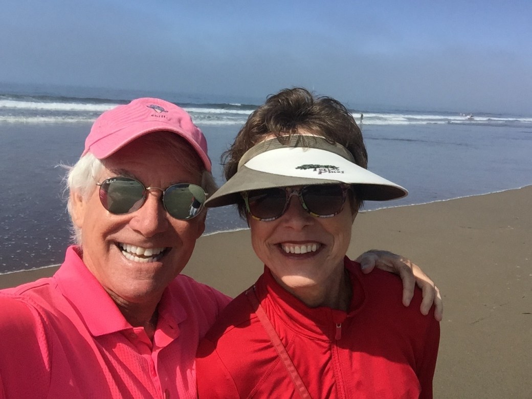
Here’s what my December 24 looked like: Sarah and I got in 18 holes of golf. Then, I went for a pre-Santa ride in the Rockies.
We didn’t play 18 holes, that’s for you sun worshippers in La Quinta. The courses here in Colorado are closed this time of year, but they’re very walkable. So today, we walked the entire Aspen Glen golf course, where we’re living while our house is under construction nearby. It took us two hours and eight minutes to walk 18 holes; we covered 6.24 miles. Fitbit-worthy.
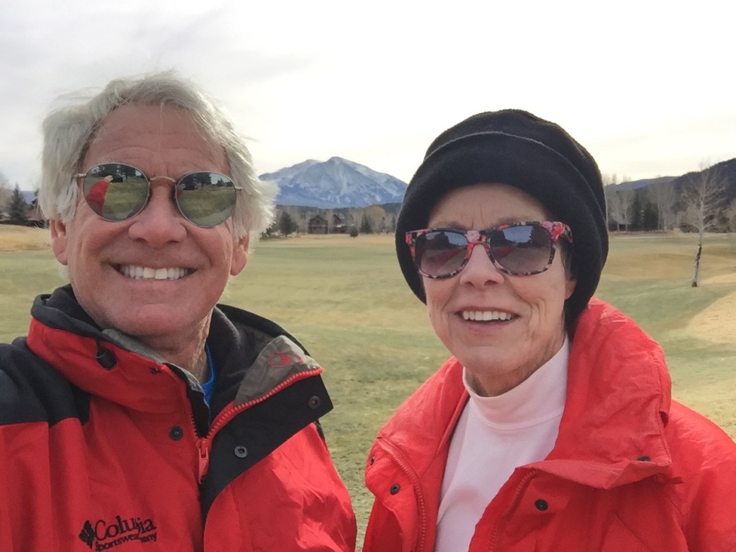
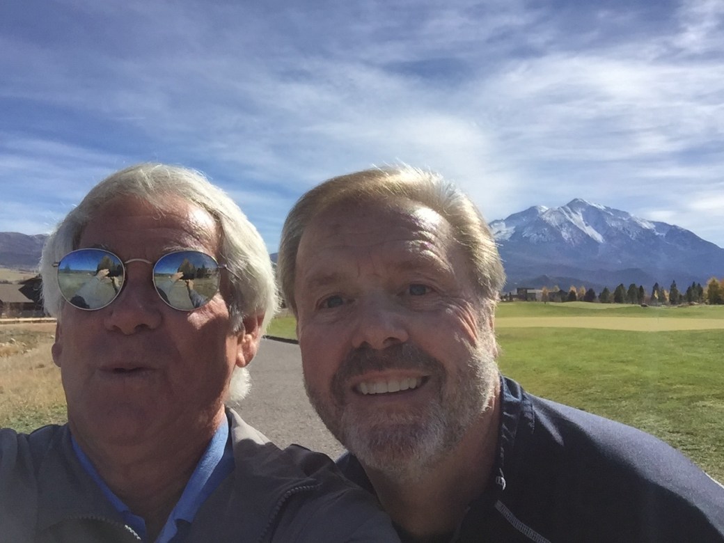
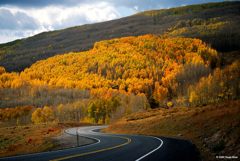
On the back nine at Aspen Glen, on Christmas Eve. That’s Mount Sopris in the background: 12,966 feet. It should be in pretty much every photo, and the view from your back yard, if you can swing it.
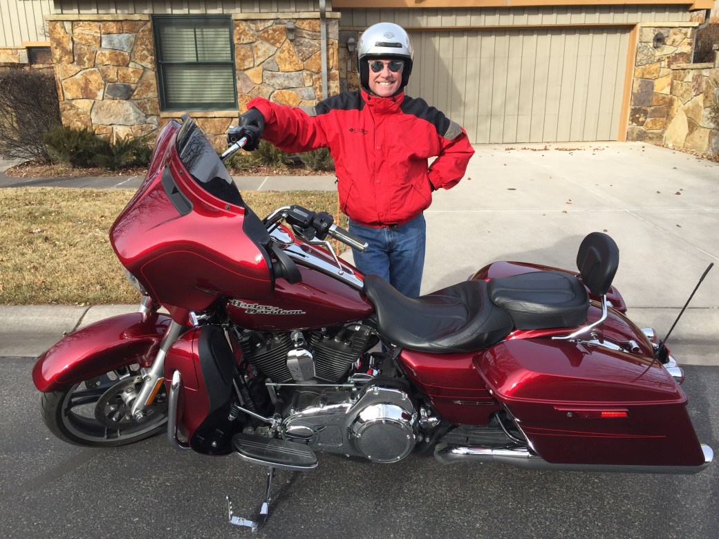
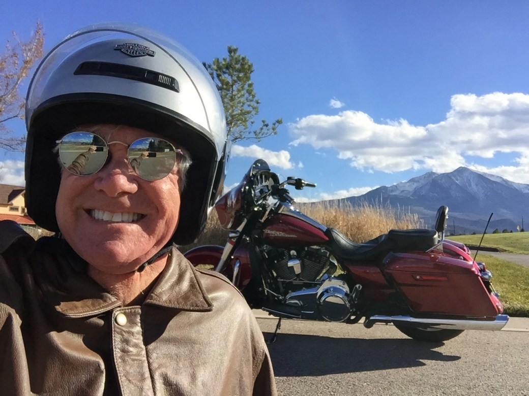
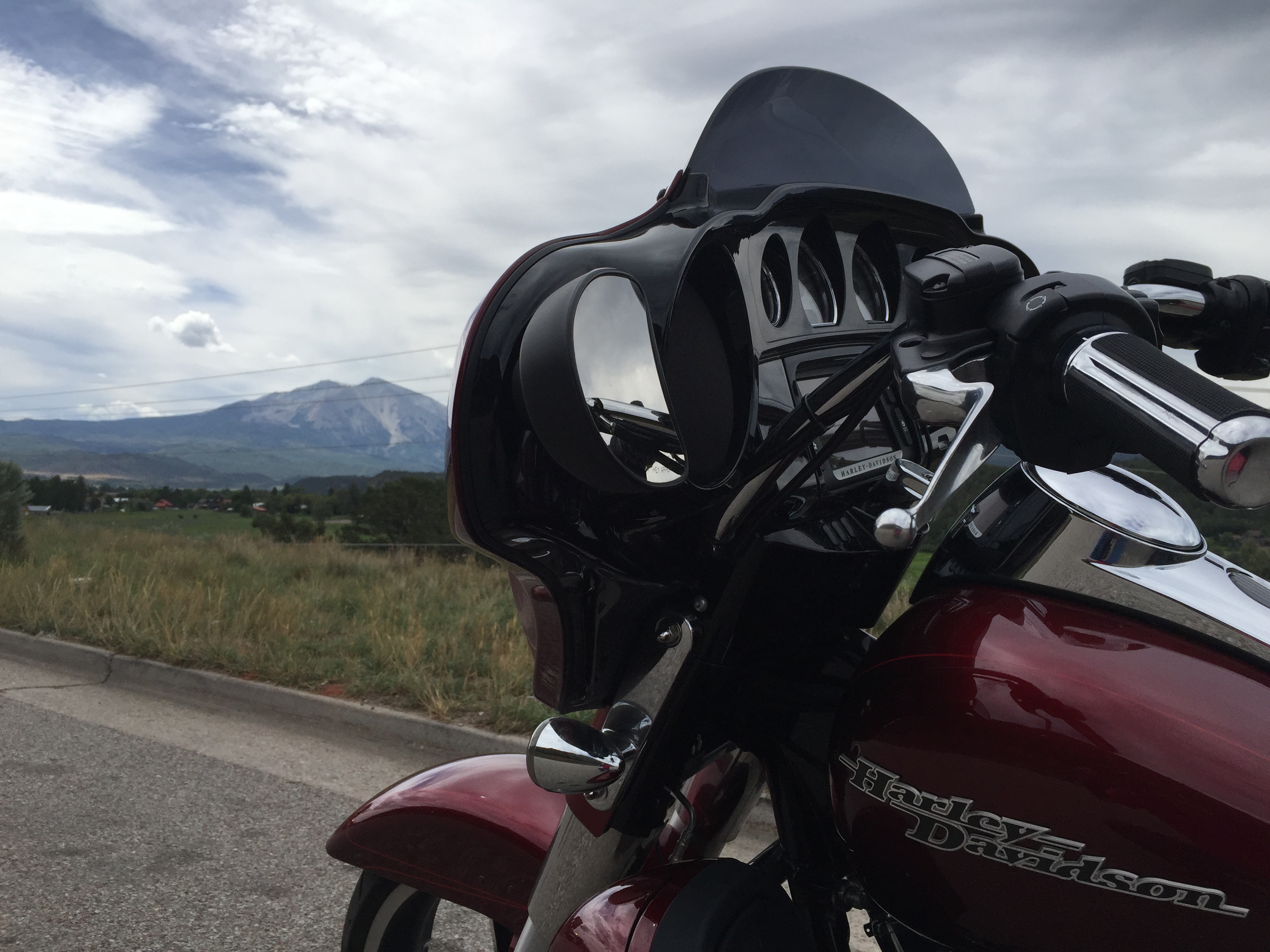
Next, I fired up the Harley and rode into Carbondale. Why? Pretty much so I could say I rode the Rockies on a chilly winter day. My ride covered 12 miles, round trip, in 34-degree weather. Riding the Rockies on Christmas Eve. Yeah, baby!
Great day for a ride. Or for finishing your Christmas shopping. Already figured out what I want for Christmas next year: heated grips for the bike. Seriously. #coldhands,warmheart
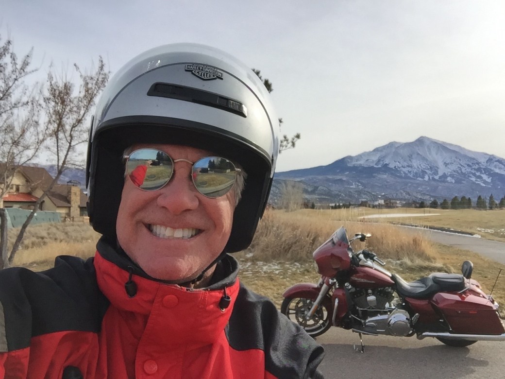
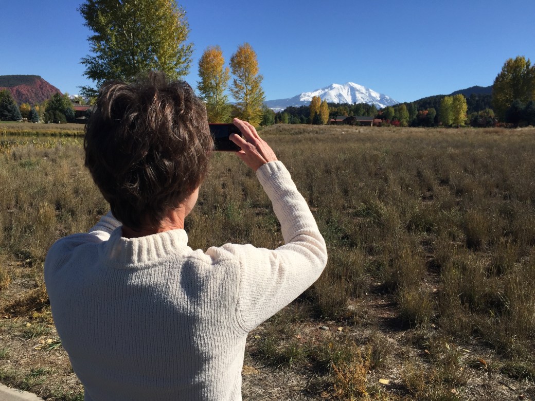
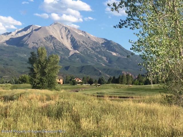
On Christmas Eve, I rode six miles, to River Valley Ranch — in Carbondale. This view is right next to the lot where we’re building our home. Yes, that’s Mount Sopris in the background.
***
So, that’s what happened today, on Christmas Eve.
This blog is normally a description of beautiful roads I’ve ridden and unhealthy food I’ve consumed along the way. Today’s blog post is a bit different.
As you may have noticed, I’ve been on blogging hiatus since ending my last Harley trip in Carbondale on August 15.
Quite a lot has happened since then. We became permanent Colorado residents, making Carbondale our home. We now have Colorado drivers licenses, and Colorado plates on our vehicles. We’ve watched our new home being built, and are looking forward to moving in some time in the spring (no pressure, Kent and George). We’re gradually adjusting to life in the Rockies. We miss our old friends in the desert, but are pretty sure they’ll find Carbondale a fine place to visit.
Today, on Christmas Eve, I thought I’d take you on a trip, metaphorically anyway. It’s just a simple way of bringing you up to date on what’s been happening in our lives since mid-August, the date of my last blog post.
***
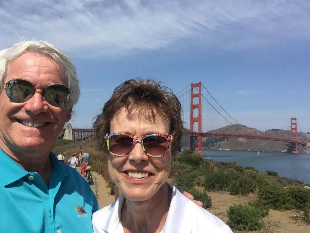
In August, on the San Francisco side of the Golden Gate Bridge. We hiked across the bridge, both directions.
We spent the summer in San Rafael, California, living with my cousin Rich, who was kind enough to open his home to me, Sarah, Lucy and Betsy — until our rental in Carbondale was available. Eleven weeks of unconditional hospitality. We took advantage of the proximity to the Pacific Ocean, knowing it may be some time before we have a chance to get salt in our hair and sand in our toes again.
Got sand in our toes at Stinson Beach.
***
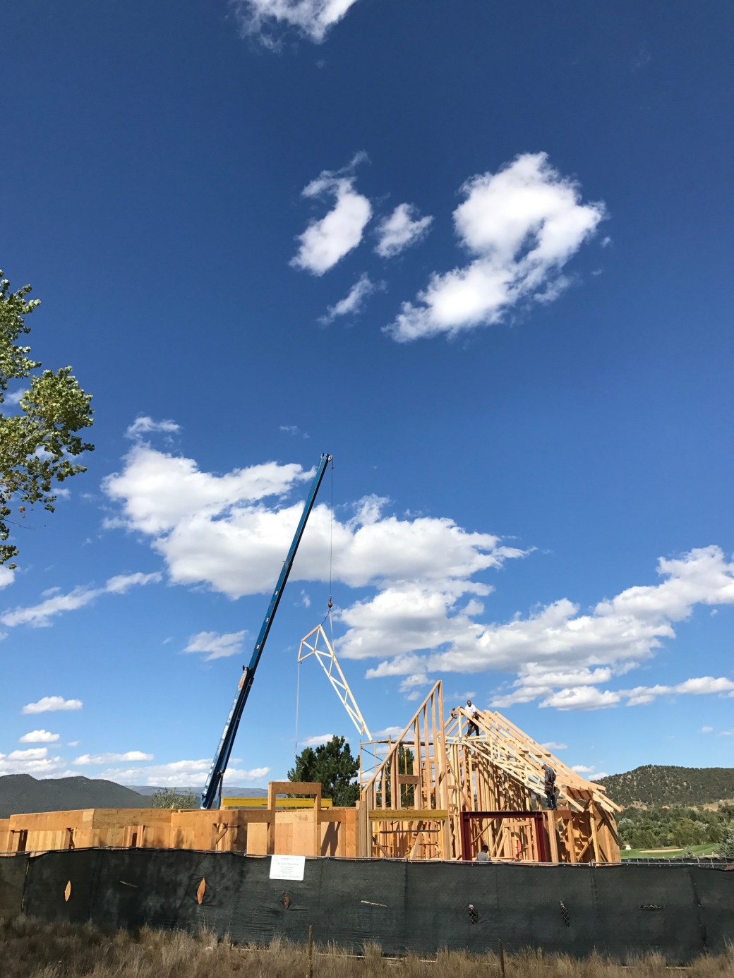
While we were in Northern California, work on our new home in Carbondale continued. Almost every day, our builder (Key Elements Construction) posted photos on a website so we could track the progress. As you may know, we’re calling the house our “Cozy Carbondale Cottage.”
It’s been fun watching the house become a home.
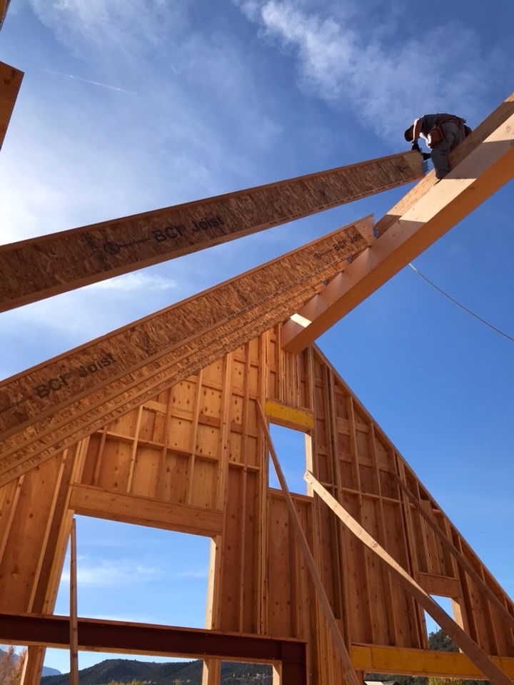
Yes, that’s a ridge beam, and those are rafters. The bluest skies you’ve ever seen are not in Seattle, they’re in Colorado.
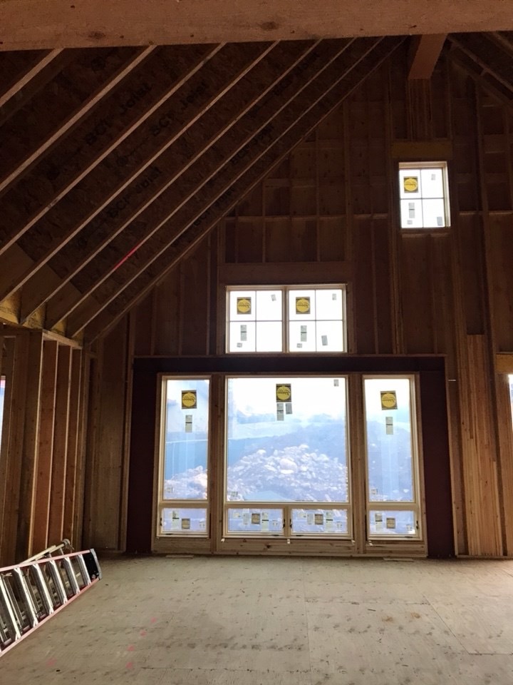
Our great room will be a nice space, with a fantastic view of the mountain.
***
On September 14, we said goodbye to San Rafael, and headed for Colorado. After an overnight in Elko, Nevada, we arrived in Carbondale on a beautiful almost-autumn afternoon.
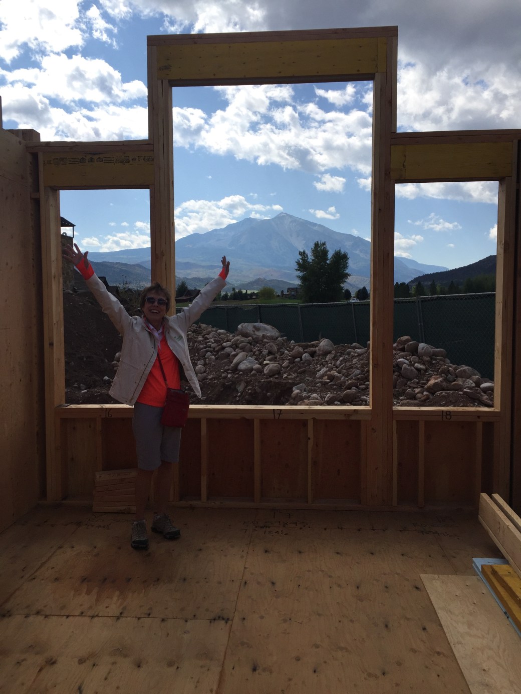
We immediately checked out the homesite. It looked a lot like our builder’s photos, but we finally got to be in the frame.
Here’s Sarah, showing off the view from the Guest Bedroom. Best view in the house. Nice mountain in the background. Lucky guests!
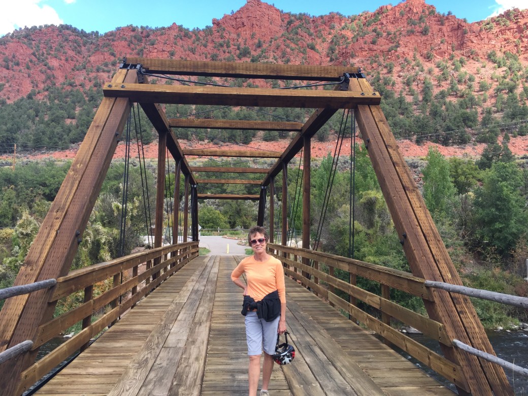
We’ve had a good time exploring the local area — the Roaring Fork Valley. There are breathtaking views around every corner. It’s almost like being on a Harley ride.
Here’s Sarah, on the famed Satank Bridge, just outside of Carbondale. Love the red mountain in the background.
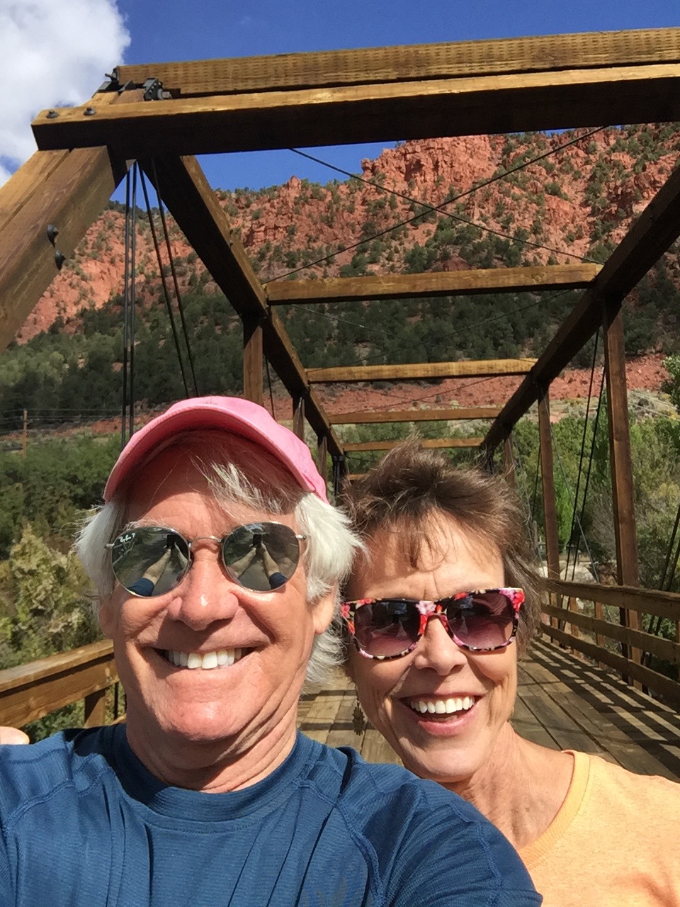
More of the Satank Bridge, which spans the Roaring Fork River.
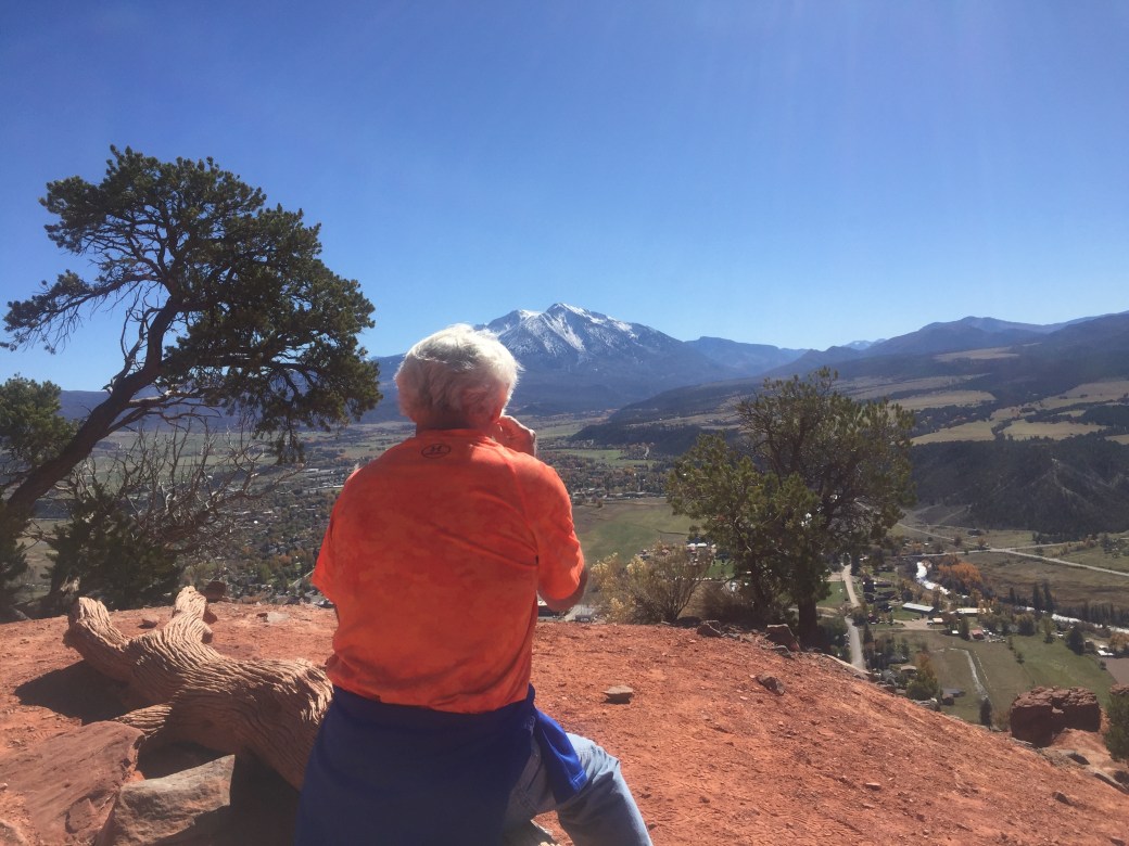
We hiked up Red Hill, where Colorado Highways 82 and 133 meet, just at the North end of Carbondale.
The view from Red Hill, looking south toward Mount Sopris. Quite spectacular.
***
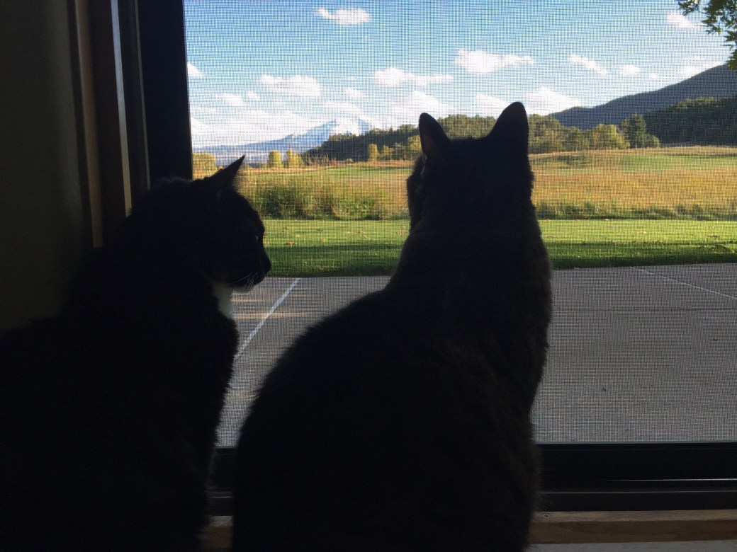
Our cats, Betsy and Lucy, seem to be enjoying life in Colorado. They are fascinated with the view, with the deer in our back yard, and the change of scenery — it’s their first time out of California.
The girls admire the view of Mount Sopris. Who wouldn’t?
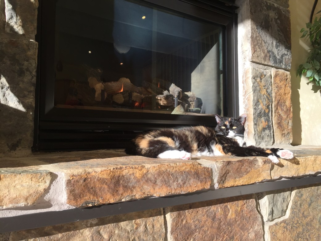
Betsy has decided she likes sitting by the fire, basking in the Colorado sunshine.
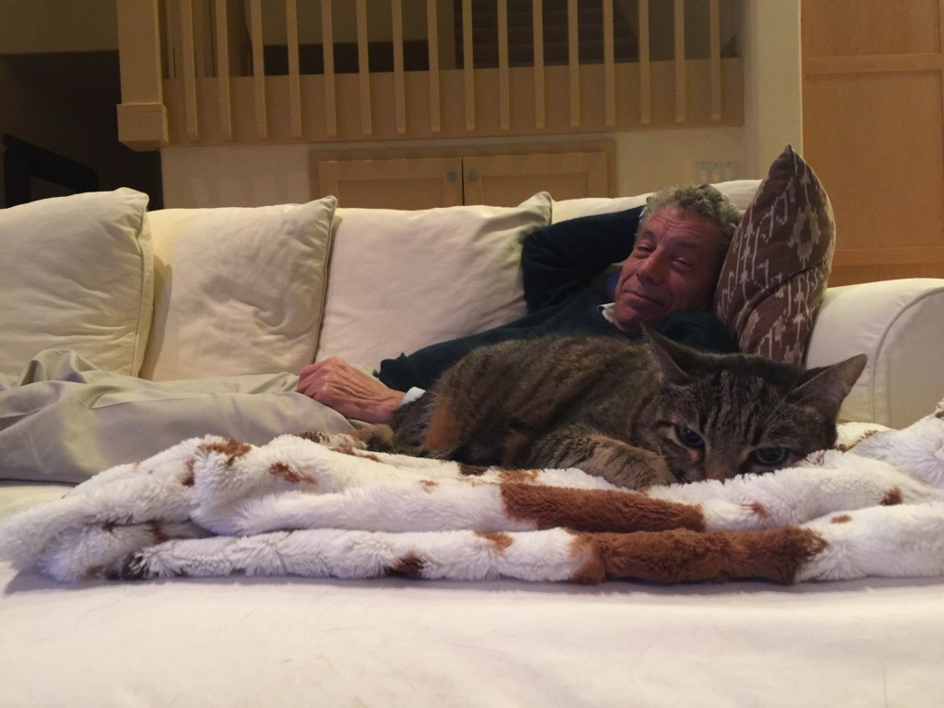
Lucy found her favorite spot, on a faux animal fur throw, from Pier One (it was at the rental house when we moved in). That’s my cousin, Rich, in the background. First cousin, once removed. Anyone know what that is?
***
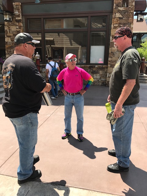
We’ve had a number of visitors here in Carbondale. They can confirm we are actually here. Our hospitality “brand” is the same as it was in La Quinta: Five-star Quality, Zero-star prices.
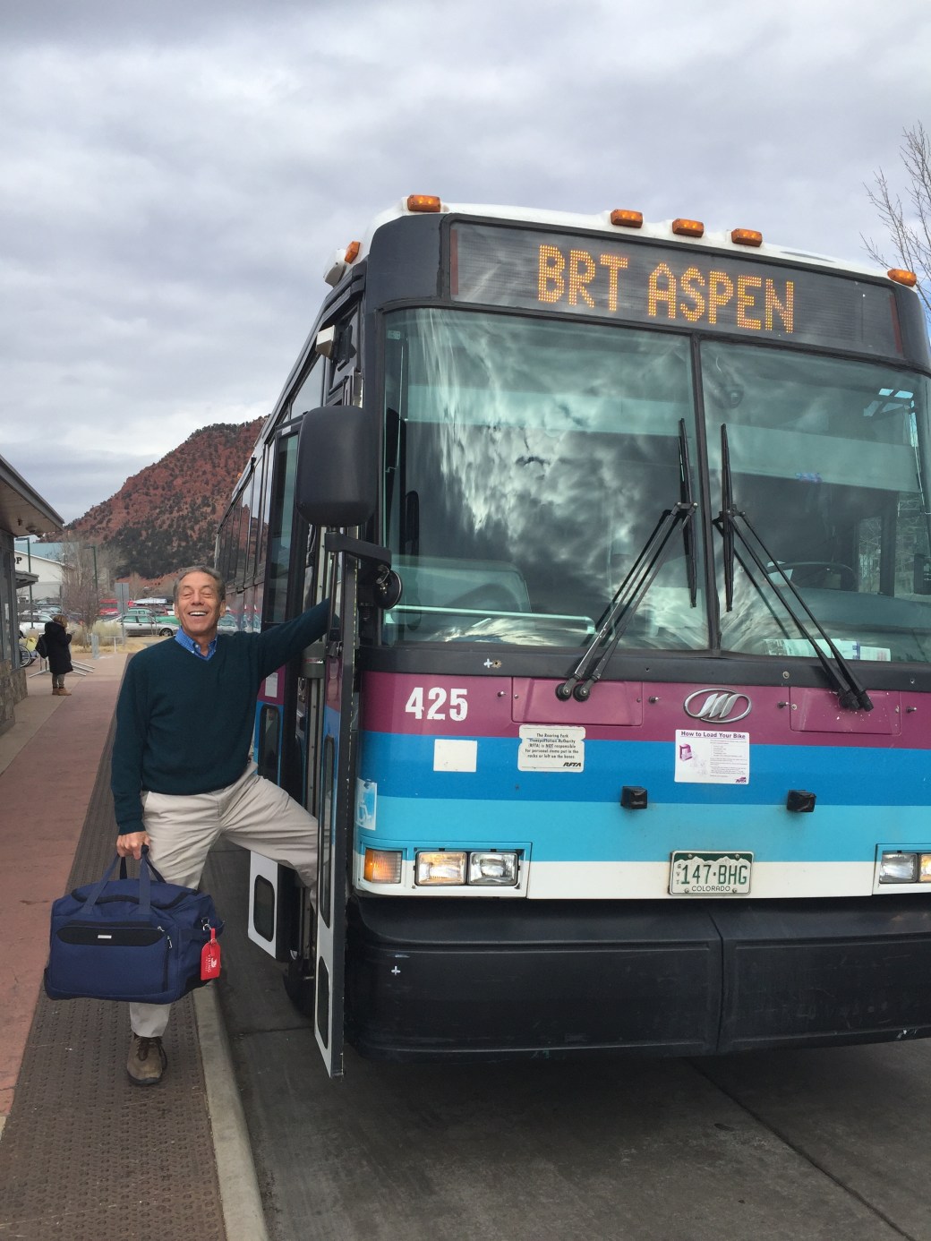
My cousin Rich visited in December. He flew to Aspen, and rode the bus in to Carbondale (and back). Thought it was the best deal on the planet: free plane ride, free bus!
John Tracy visited from Alaska, along with his wife Donna and son, Cole. We think he’ll be back.
The McBrides visited from Palisade, Colorado’s peach and wine capital.
We had a lovely dinner at our house with Sarah Murray (what a name coincidence!), her husband Clay, and their cute twins, Si and Jesse.
***
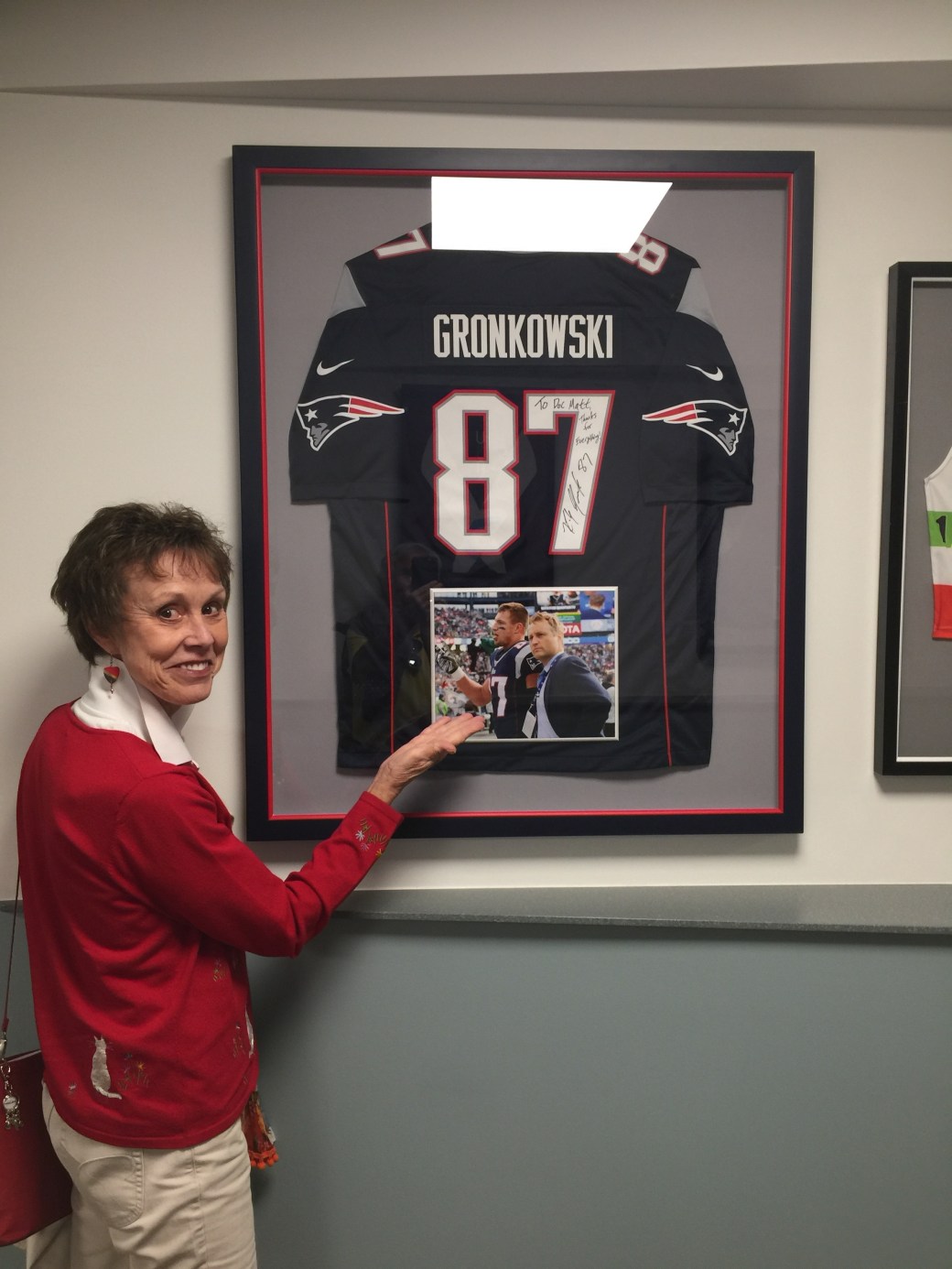
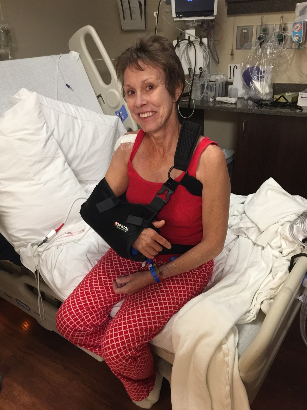
We’ve been trying to walk most every day. The exercise routine is a bit reduced, compared to what it was in California, but there’s good reason. On November 2, Sarah had rotator cuff surgery at the world-famous Steadman Clinic in Vail.
At the Steadman Clinic, pre-surgery. Sarah and Gronk now have something in common. Sarah may sign her golf shirt, and send it to the clinic for framing, to be hung in a conspicuous place.
The morning after surgery. Looking good!
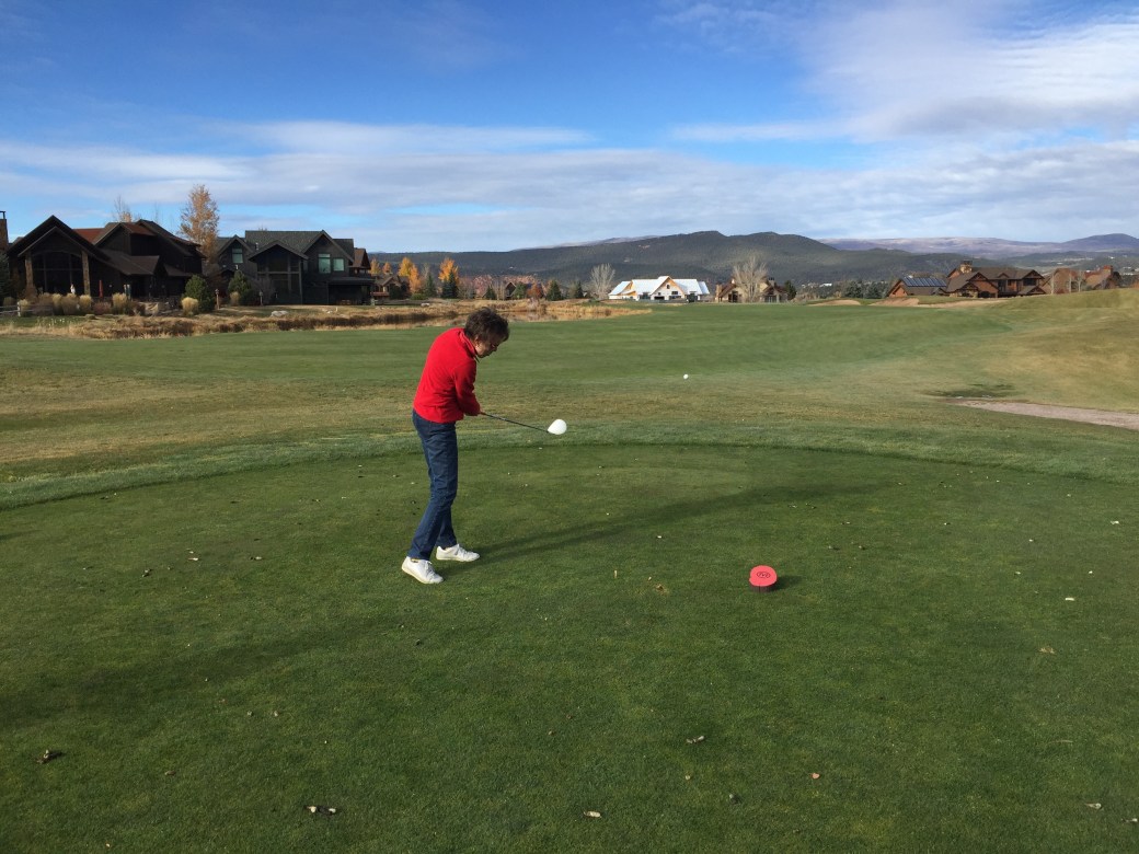
Only days before, Sarah and I played our last round of golf for the year. On October 27, we checked out the course at River Valley Ranch, where our new home is being built.
Here’s Sarah, crushing it on the 14th hole. We thought we’d never play golf in anything but shorts and a short-sleeved shirt … but hey, we’re in Colorado now. That’s our house, in white, at the end of the fairway. It’s a good target off the tee, but un-reachable — unless you’re Justin Thomas.
***
We’ve managed to ride the Harley a few times, and always, stop somewhere with a Mount Sopris view. The mountain is just a few feet shy of 13,000 feet — and very photogenic.
Back in September, before there was snow on the mountain.
In October, the mountain looks better with snow on it — and with Sarah in front of it.
A cool November afternoon.
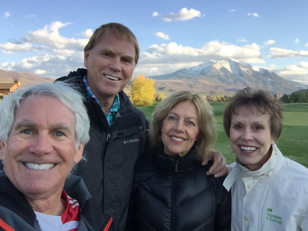
The view from Aspen Glen.
Also from Aspen Glen. Love Sarah’s sunglasses. Walmart!
***
Finally, a few wintry shots, then it’s time to get ready for Santa’s arrival in Carbondale.
Here’s one that has December written all over it:
Um, yes … looks like December, but it was actually early October in Aspen. That’s pretty much all the snow we’ve had; it’s probably the worst season for skiing in 40 years!
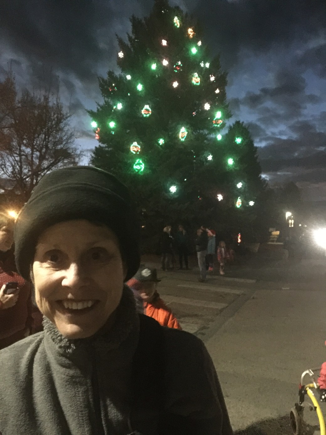
Christmas tree lighting in downtown Carbondale.
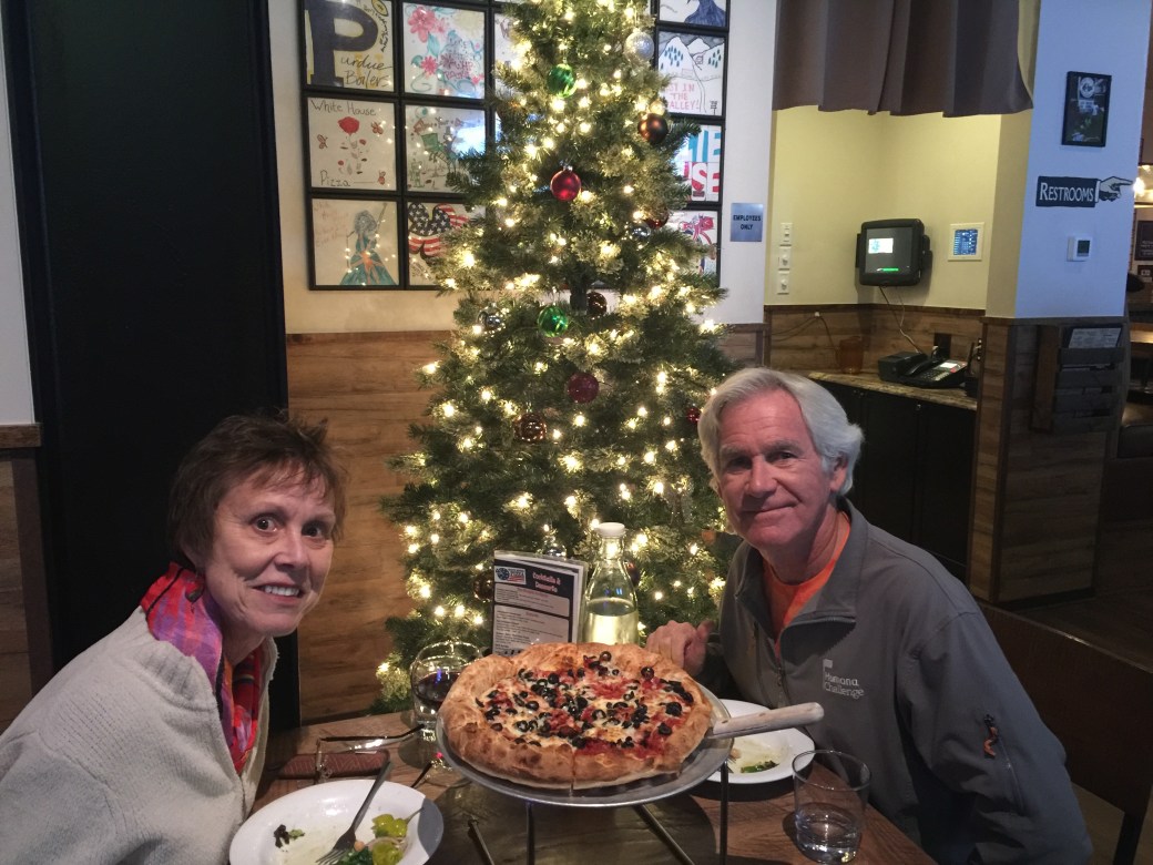
Merry Christmas, from the White House Pizza in Carbondale.
***
Well that’s it. A rather unusual blog post, considering I’m a Harley travel blogger. Never thought I’d do a holiday letter online. Thank you, Al Gore, for making it possible.
Whatever.
Happy Holidays to all and to all a good night. Hope Santa is exceedingly good to you, unless of course, you’re one of my Jewish friends or family — in which case I hope Harry Hanukkah took good care of you earlier this month.
Look forward to seeing you in 2018, here in Carbondale, or wherever you may be.
Let’s ride. Vroom, vroom!
Gary
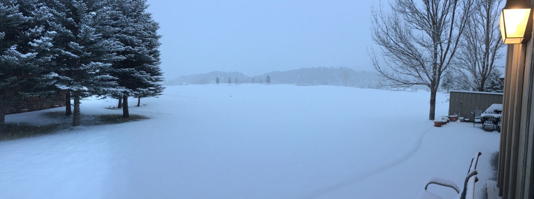
P.S. We woke up to a White Christmas! Every little child’s dream. Here’s the view from our patio at 7:45 on Christmas morning.
A White Christmas at 59 Primrose Road in Carbondale!
So, I say goodbye to the McBrides, and roll out of Palisade on the last leg of my journey home.
The route is quite simple. I can probably do it without the nav system engaged, just listening to spirited ’70s rock and enjoying the scenery and fresh Colorado mountain air.
East on I-70 for 72 miles, take a right, blow through Glenwood Springs, and 10 minutes later, when you see Mount Sopris towering in the distance, you’ve arrived at the Lesser/Murr homestead.
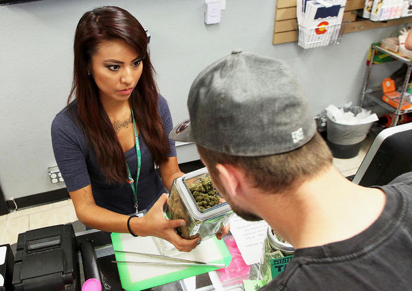
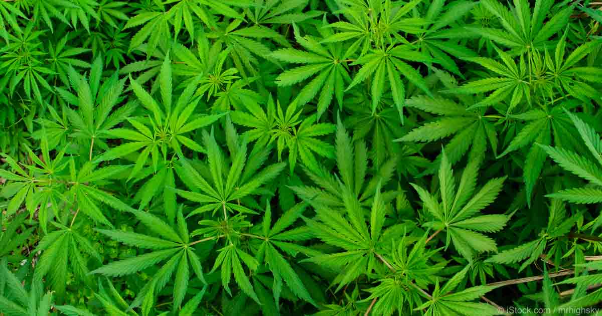
There are several interesting sights to see along the way. A few miles after leaving Palisade, I ride past past De Beque, population 500, perhaps best known for becoming the first incorporated town in Mesa County to approve the retail sale of recreational marijuana. In De Beque, you can stop at Kush Gardens and be helped by some of the best budtenders (yes, that’s what they’re called) in Colorado.
Budtender Delplena Silas helps a customer smell the aroma of cannabis buds at De Beque’s Kush Gardens. Business is booming.
Truth be told, Sarah is a fan. We’ve done some retail at Kush Gardens. She has a lot of back and neck pain; it’s what kept her from joining me in South Dakota’s Black Hills on this trip. It turns out that a drop of sublingual marijuana under the tongue occasionally helps her sleep at night.
Those of you reading this blog with your chardonnay or vodka tonic in hand should immediately re-consider your judging of her choice. Medical marijuana is now legal in at least 29 states and the District of Columbia; recreational use is legal in eight states, including Colorado.
While the national discourse clearly favors legalizing marijuana, federal law still considers cannabis a dangerous illegal drug with no acceptable medicinal value. Federal law still treats marijuana like every other controlled substance, including cocaine and heroin. There is a clear conflict between federal and state laws when it comes to marijuana use.
Someday, we’ll look back on this time in America and wonder what took us so damn long to legalize what has been criminalized for eons. Remember how well Prohibition worked?
Pot in Colorado is such a thing that the state’s leading newspaper, the Denver Post, has its own marijuana critic, Jake Browne. He works alongside the newspaper’s wine critic, theater critic and movie critic. Jake’s paid to smoke marijuana – and then write about the high.
OK folks, put down your glass of chardonnay and let’s talk about it.
***
From DeBeque, I roll northeast past the town of Parachute, which is about halfway between Palisade and Glenwood Springs. Next up: the towns of Rifle, Silt, and New Castle. I love Colorado place names.
If I continued another 150 miles east on the interstate, I’d be in Denver, Colorado’s biggest city.
But really, what would be the point of that? I’m heading home, and my exit from I-70 is in Glenwood Springs, directly ahead of me.
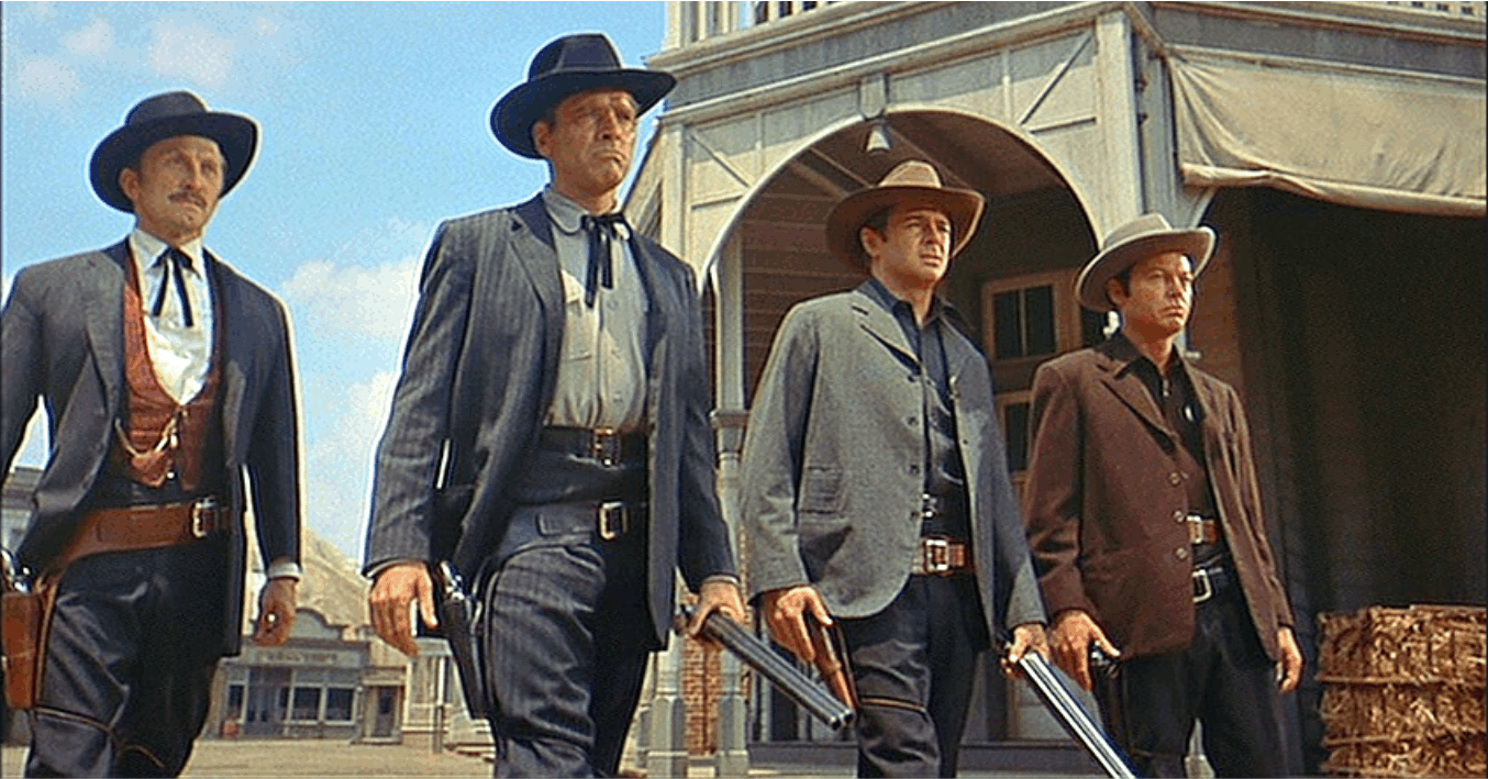
Glenwood Springs is the county seat of Garfield County, where we’ll soon go for fun DMV activities like registering our cars and acquiring Colorado driver’s licenses. Glenwood Springs is also home to Doc Holliday Harley Davidson, named after the Wild West gunfighter, pal of Wyatt Earp, and participant in the Gunfight at the O.K.Corral.
In the 1957 movie about the famous 30-second shootout, Holliday, who was grazed by a bullet, is played by Kirk Douglas.
That’s Kirk Douglas on the far left, as Doc Holliday, on his way to the shootout at the O.K. Corral. Holliday is buried at a cemetery in Glenwood Springs, about 10 miles from Carbondale.
Best line from Doc Holliday, referring to his ability with guns: “I do handle them pretty well. The only trouble is, those best able to testify to my aim aren’t around for comment.”
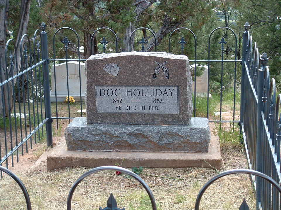
Doc Holliday was also a gambler and dentist, receiving his DDS from the Pennsylvania College of Dental Surgery – now part of the University of Pennsylvania School of Dental Surgery. He died here in Glenwood Springs in 1887 at the age of 36, not in a gunfight, but of tuberculosis. You can visit his resting place at the Pioneer Cemetery in Glenwood Springs.
Doc Holliday’s final resting place, in Glenwood Springs.
***
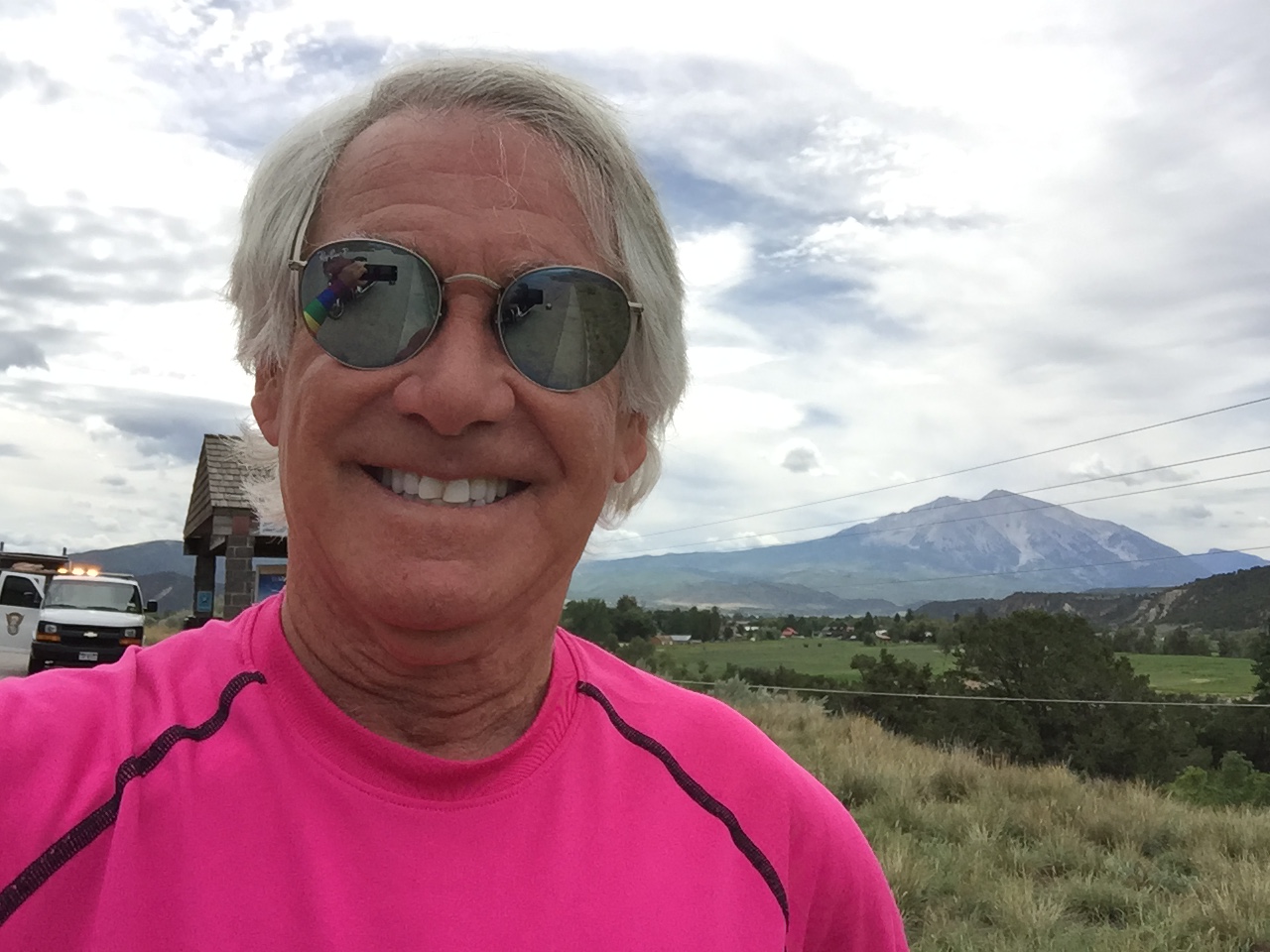
Minutes later, under beautiful blue Rocky Mountain skies, my 19-day, 4,100-mile adventure comes to an end, as I arrive in Carbondale.
Carbondale. Home at last
Harley, too. That’s Mt. Sopris in the background.
I enjoyed having you along for the ride.
It took nearly 35,000 words to describe the journey in this blog.
But I can sum it up in two words: I’m home.
Our new address is 150 Sopris Mesa Drive. Hope you’ll come visit.
The view from your guest room at 150 Sopris Mesa Drive in Carbondale. It should be ready for you in May 2018. Just bring your toothbrush and pajamas. And fly fishing gear. Or skis. Or golf clubs. There’s a lot to do here.
The house, which we’re calling our Cozy Carbondale Cottage, should be complete in May 2018.
Home at last!
Vroom, vroom.
To be continued … next year.
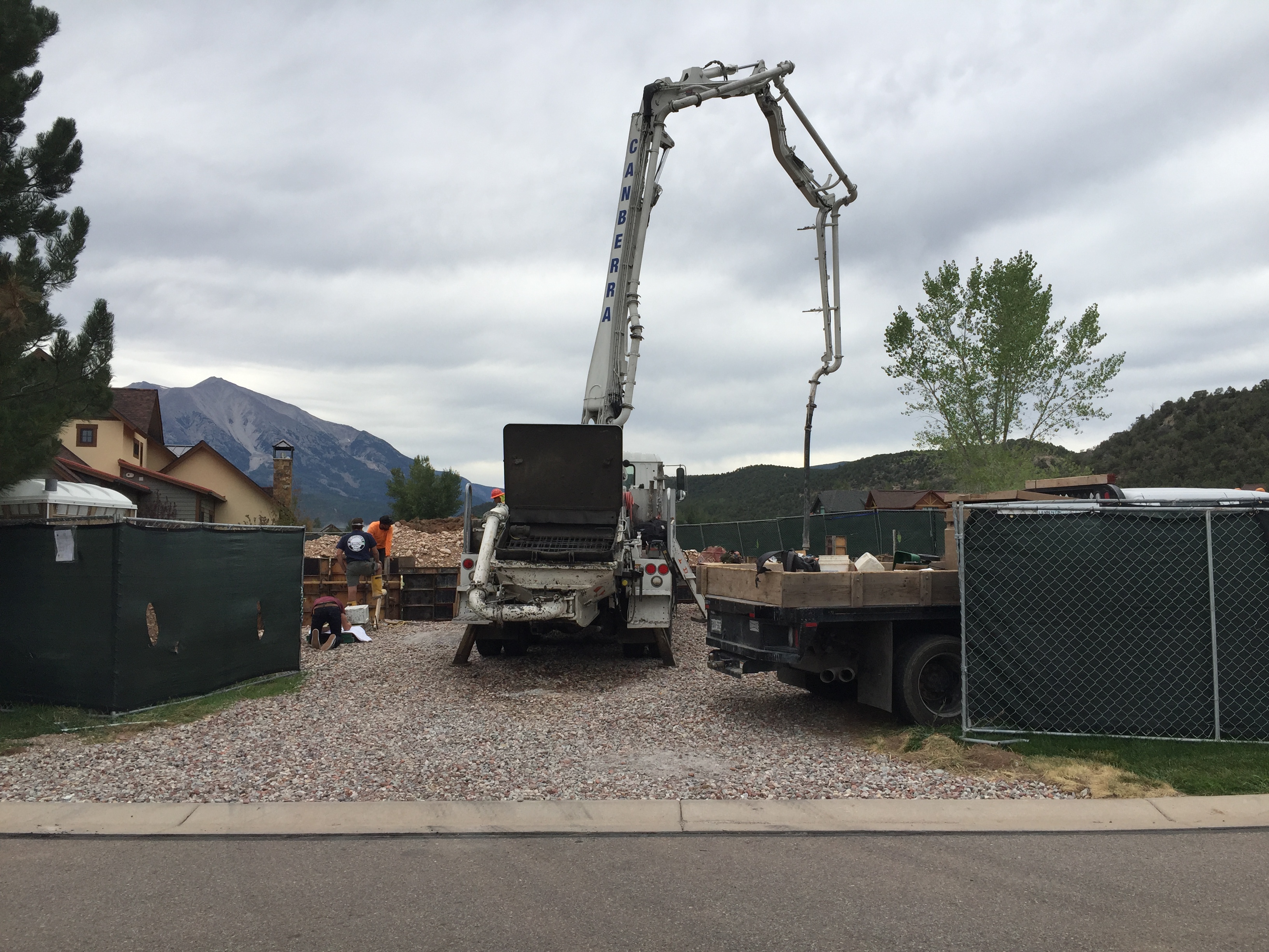
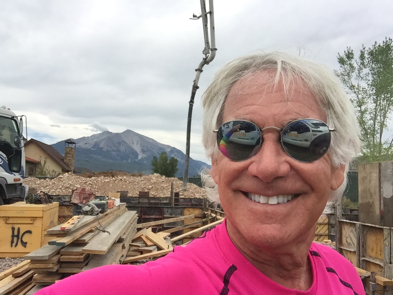
They’re pouring the concrete foundation walls today. The new Murr/Lesser home is really happening.
Woo-hoo! Only nine months (ish) and we’ll be moving in.
***
Day Nineteen Summary: Retail cannabis at Kush Gardens, the sure aim of Doc Holliday, home at last!
Click here to see today’s complete route from Palisade to Carbondale.
***
Today in Bucket List History:
Bucket List Goal: “Throw a Big Party That No One Will Ever Forget.”
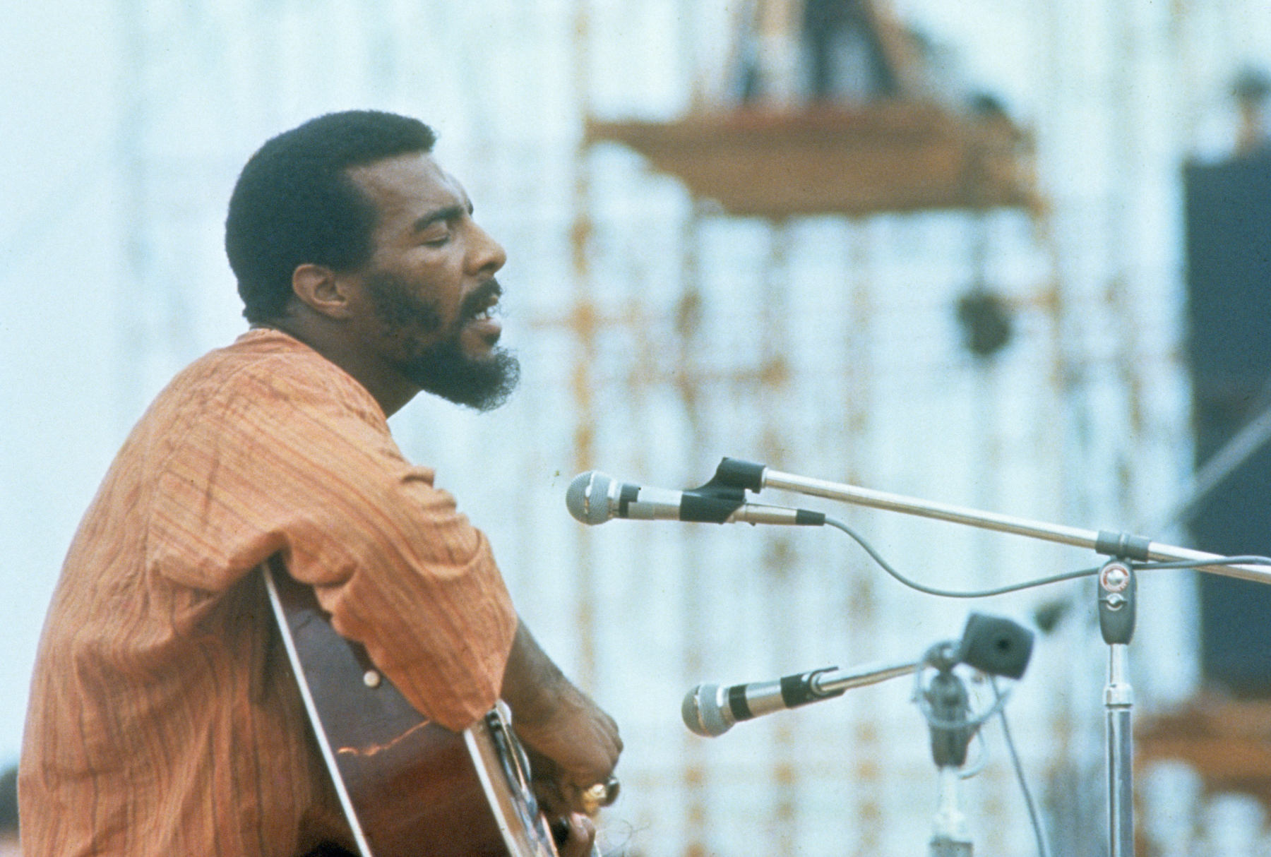
Goal Achieved: On August 15, 1969, the Woodstock Music & Art Fair opens in New York State on Max Yasgur’s 600-acre dairy farm in the Catskills. The festival, billed as “Three Days of Peace and Music,” attracts an audience of more than 400,000. Opening act on August 15, at 5:07 pm: Richie Havens, singing Freedom. Closing act, on Monday, August 18 at 9 am: Jimi Hendrix, the Purple Haze guy. Far out, man!
Richie Havens opens the Woodstock Music Festival on August 15, 1969.
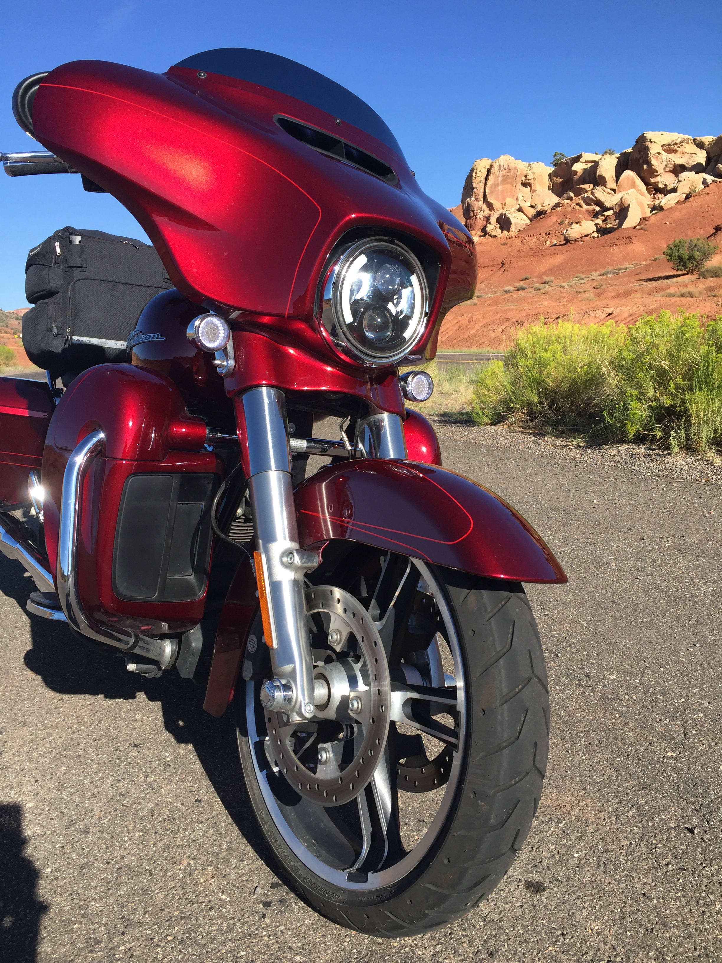
Washed my Harley before leaving Torrey this morning. Here, it sits cleanly and proudly near the entrance to Capitol Reef National Park, on Utah Highway 24.
The day begins by riding east, into the rising sun, on Utah Highway 24.
From Torrey, it’s just a few miles to the west entrance to Capitol Reef National Park. Entrance may not be the right word.
Because State Highway 24 is the main east-west road through the park, there’s no toll to ride through much of Capitol Reef – unless you’re traveling on Scenic Drive south of the Fruita Campground. I’m just passing through.
Immediately after leaving Torrey, the red rocks of Capitol Reef National Park dominate the view.
Capitol Reef National Park was established in 1971. It has 241,904 acres of colorful canyons, ridges, cliffs, towers, arches, buttes and monoliths. The area is named for a line of white domes and cliffs of Navajo Sandstone, each of which looks a bit like the U.S. Capitol building. The local word “reef” refers to any rocky barrier to travel.
Soon, I roll through Fruita, the best-known settlement in Capitol Reef. Fruita was named for its productive fruit orchards.
The town had been long abandoned in 1955, when the National Park Service purchased Fruita to be included in Capitol Reef National Park. Today, few buildings remain, except for a restored one-room schoolhouse.
The orchards are still here, now under the ownership of the National Park Service, and have about 3,100 trees – including cherry, apricot, peach, pear, apple, plum, mulberry, almond and walnut. The trees were originally planted in the 1880s when Mormons settled the area. Visitors to the park are welcome to stroll in any unlocked orchard and consume ripe fruit. The orchards have an honor system; you pick fruit in season, then settle up at self-pay stations.
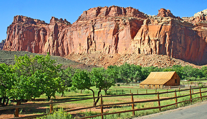
The Fruita orchard and barn in Capitol Reef National Park.
***
Past Fruita, I continue on UT-24 for another 38 miles, following the Fremont River as it winds from Torrey toward Hanksville, which calls itself “An Oasis in the Desert.”
In 1985, the town was named after Ebenezer Hanks, leader of a group of Mormon pioneers who established a small settlement here. It may be best known as a supply post for Butch Cassidy and the Wild Bunch, who would hide out at Robbers Roost in the desert southeast of town.
***
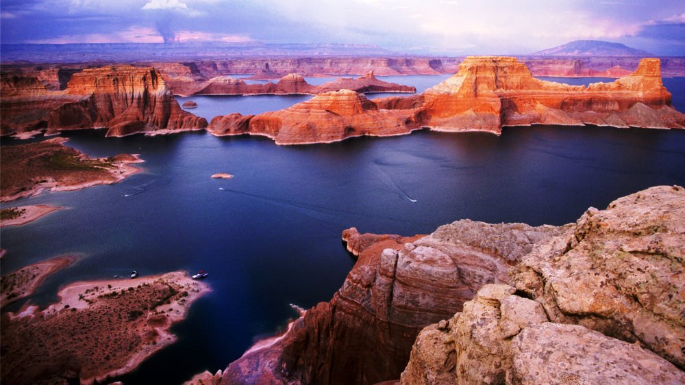
There are few choices to be made in Hanksville: What to have for breakfast. Which bib overalls to wear for the day. And whether to turn south on Highway 95 toward Hite, a ghost town at the north end of Lake Powell along the Colorado River – or turn left and continue north on Highway 24.
In Hanksville, you can turn south toward beautiful Lake Powell. Or, you can turn left and head toward Colorado. My choice: left.
I turn left and continue on Highway 24, with barely a curve in the road, until after 45 minutes, it meets up with I-70. Then, I jump on the Interstate for what seems like an eternity — 123 miles.
Soon, I roll past the Green River, as well as its namesake city, Green River. The Green River is a tributary of the Colorado River.
At a convenience store in Green River, having a mid-day snack. In Utah, this is considered health food.
The next turnoff of any consequence is Crescent Junction, where most people turn right on US Highway 191 for the short drive to Moab, Arches National Park, and Canyonlands National Park.
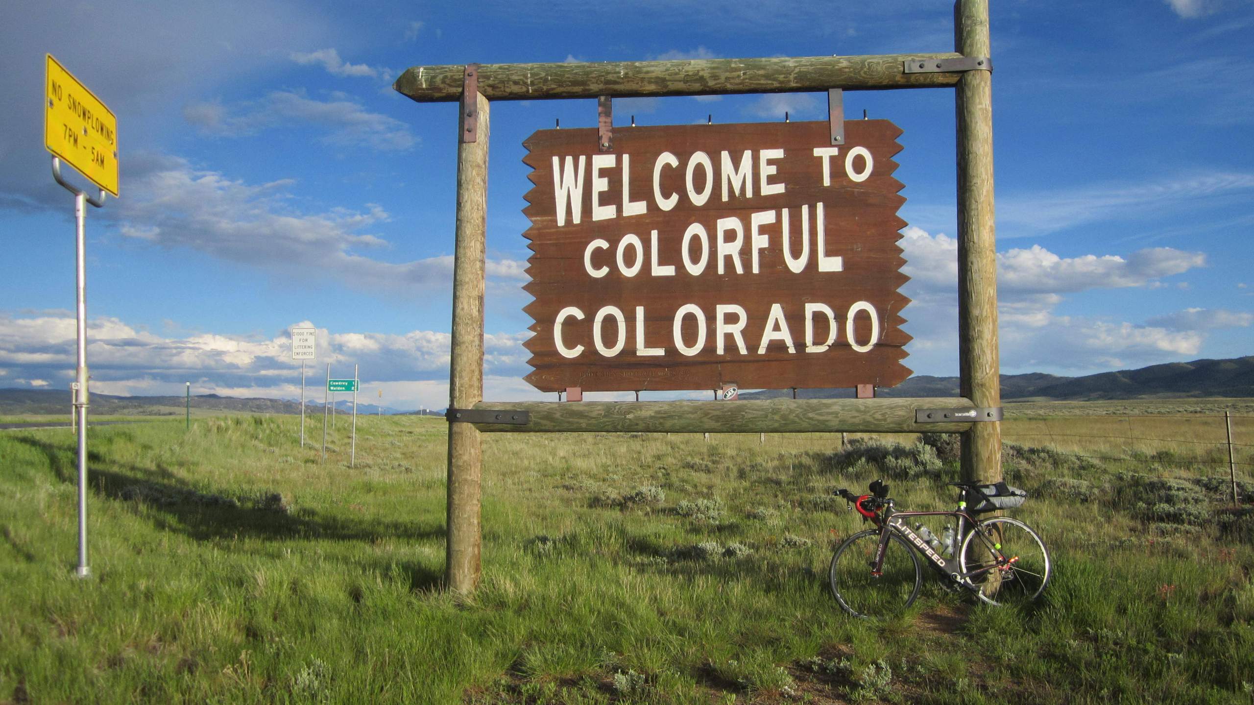
Today, my destination is Colorado, not Utah. So I continue east, eventually seeing the “Welcome to Colorful Colorado” signs.
Crossing into Colorful Colorado. Almost home!
It’s feeling like home.
Colorado has a reputation for being a state of active and athletic people, reportedly with the lowest obesity rate in the nation. People here are both healthy and happy: Colorado was one of the first states to legalize both the medicinal (2000) and recreational (2014) use of marijuana.
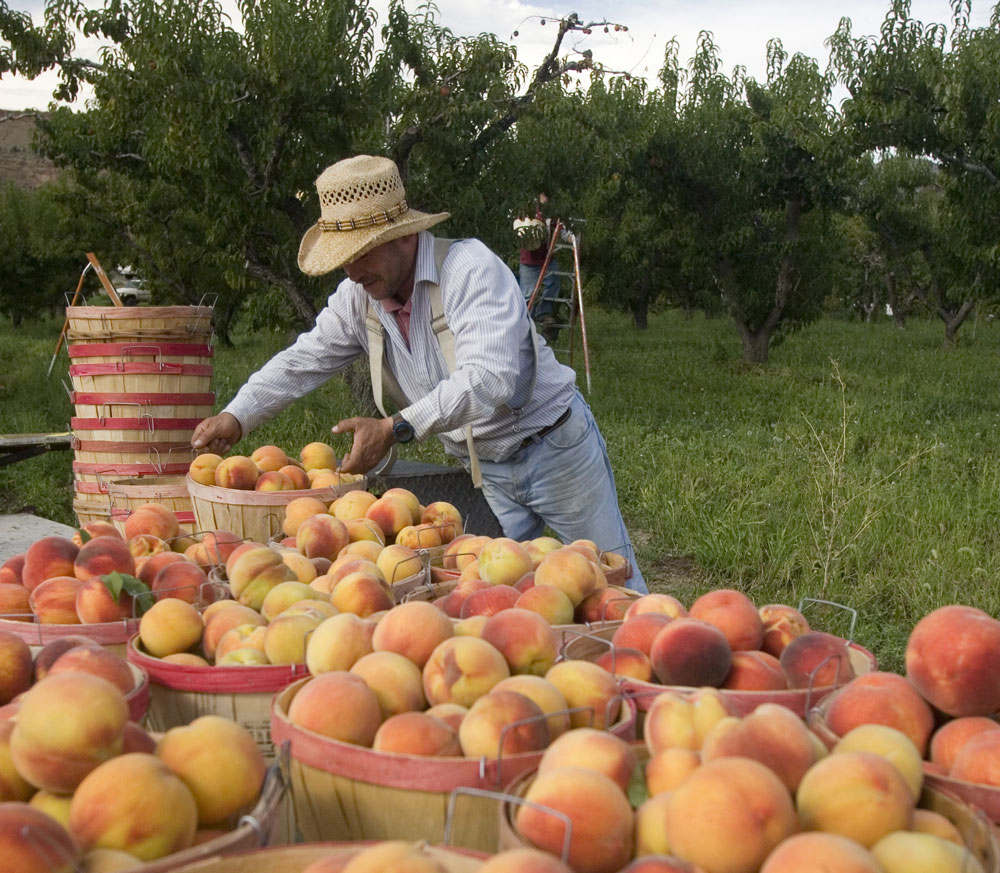
I roll past by Fruita, home of the Western Colorado Dinosaur Museum, then past Grand Junction. Ten miles east of Grand Junction, I take the turnoff for Palisade – which grows the best peaches humanly possible.
Palisade is also Colorado’s wine nivrana, with both vineyards and wineries. The small town has more than two dozen wineries.
The Grand Valley’s microclimate of sunny days, dry air and cool nights work together to produce plump grapes for the area wineries.
Palisade, today’s destination, was named for its nearby cliffs. Yes, but why stop in Palisade?
First, did I mention peaches and wineries? Second, my friends Kathryn and Eldon McBride live here, in the middle of a peach orchard, in an 1800s-era farmhouse a short walk away from the Colorado River.
Palisade peaches. Yum!
It’s a great place to call it a day before the final push tomorrow, when I’ll roll on to our new home in Carbondale.
***
Day Eighteen Summary: Fruit orchards in Utah and Colorado, a hideout for Butch Cassidy, and a warm welcome home to Colorado.
Click here to see today’s complete route from Torrey to Palisade.
Home at last. Almost.
Vroom, vroom.
With the McBrides in Palisade, Colorado.
***
Today in Bucket List History:
Bucket List Goal: “Take a Deeply Principled Stand, No Matter the Consequences.”
Goal Achieved: On August 14, 1846, philosopher Henry David Thoreau is jailed for tax resistance, the result of an act of civil disobedience. Thoreau spends one night in jail for not paying his poll tax. For Thoreau, it is an act of protest against slavery. His philosophy of civil disobedience later influences the political thoughts and actions of notable figures including Leo Tolstoy, Mahatma Gandhi, and Martin Luther King, Jr. Thoreau is best known for his book Walden, a reflection on simple living in natural surroundings.
A man ahead of his time.
What’s on your bucket list?
***
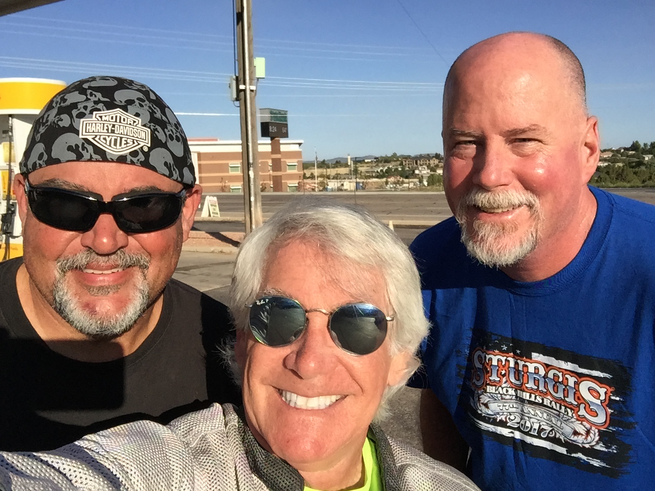
And, as a postscript, here’s an update on Scott and Dave’s ride home to Southern California: both arrived home in Orange County this afternoon. Of the six of us who were riding the Black Hills in South Dakota together recently (Dave, Gail, Scott, Jackie and Randy), that makes me the only one still on the road.
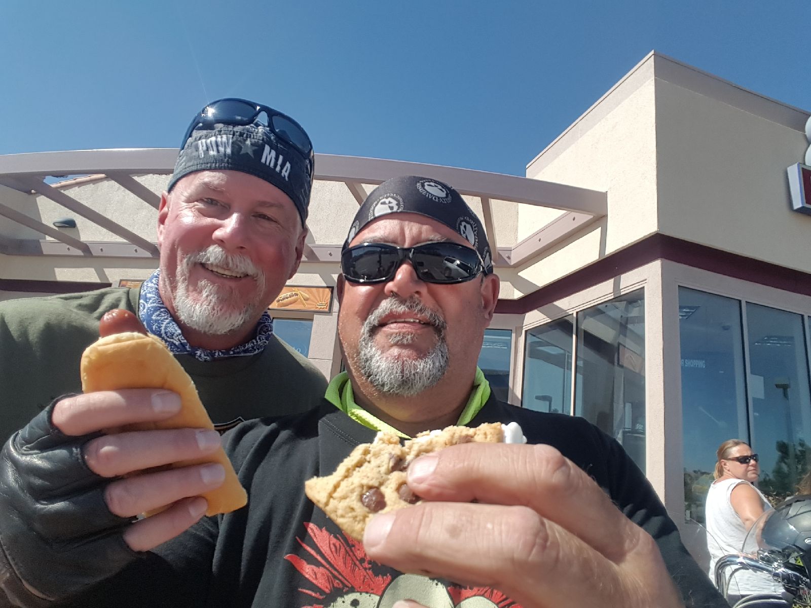
On their way home, Dave (hot dog) and Scott (cookie) stop for nourishment near Barstow, California. That’s considered health food in Barstow. Have you been to Barstow?
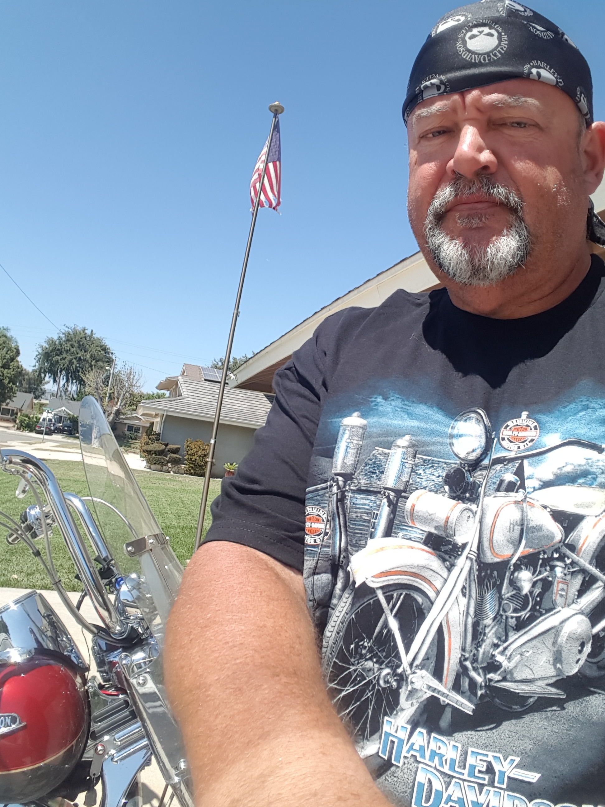
Scott arrives home safely in La Habra.
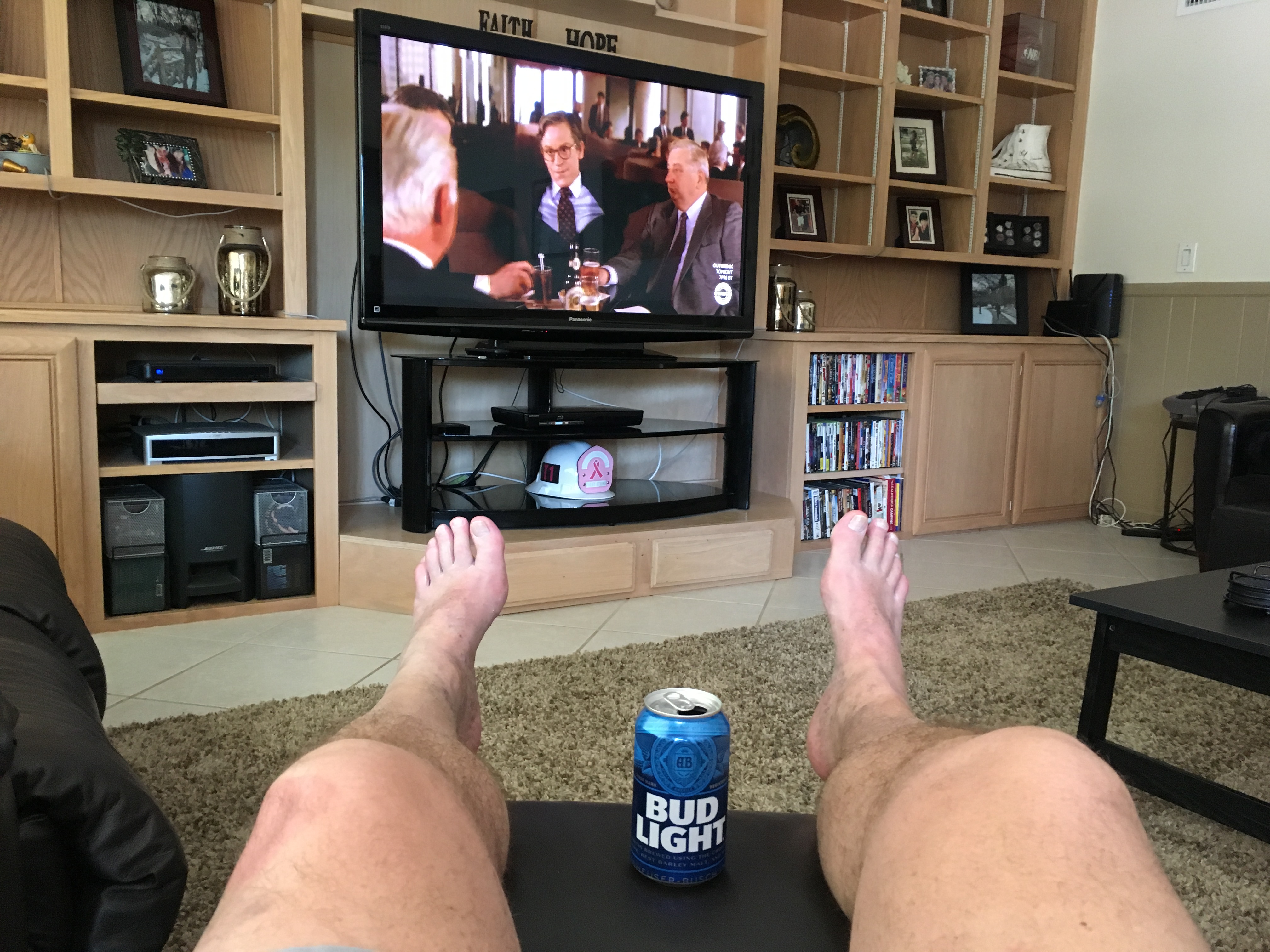
Dave at home in Fullerton. Didn’t take him long to begin catching up on the news. He drinks a much better brand of beer when on the road! (photo by Dave)
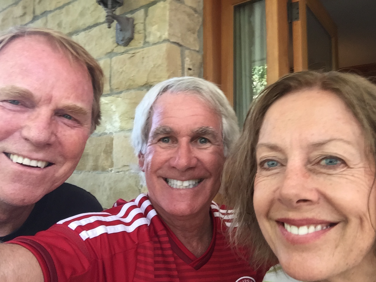
One last group photo before heading separate ways at the end of an epic journey.
After 16 days and 3,457 miles riding with Dave and Scott (and Randy, too), I’m on my own.
And, I’m on my way home.
The first sentence makes me sad. The second makes me happy.
***
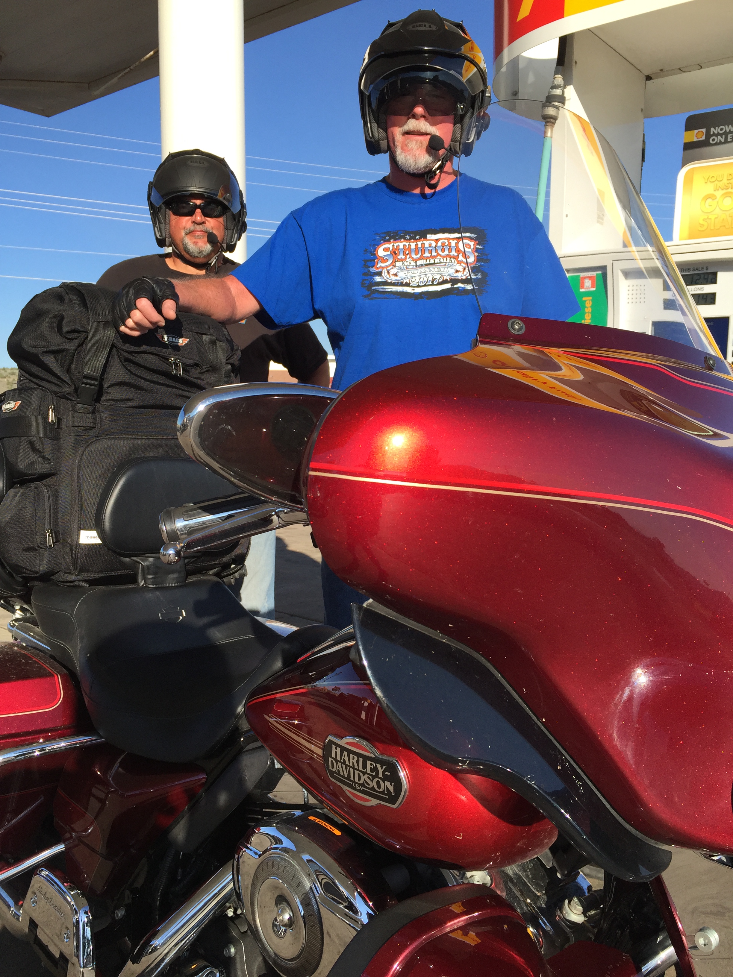
Dave and Scott, tanks full of gas, moments before heading toward Kingman, Arizona, on their way home to Southern California.
As Dave and Scott head west toward Orange County, California, I leave Cedar City, too – beginning the 500-mile ride to the new Lesser/Murr homestead in Carbondale, Colorado.
My rear-view mirror is full of memories — and in front of me lies unbridled excitement about a new life in the Rockies.
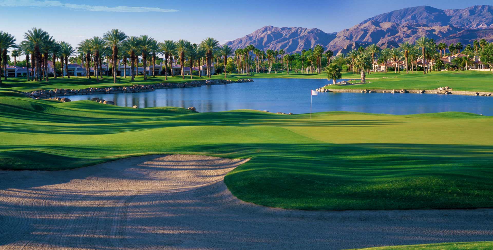
Who leaves paradise (La Quinta) after 16 years of the good life at PGA West?
Sixteen years of the good life at PGA West. It’s been a wonderful experience, but now it’s time for something new. Hey … let’s try Carbondale, Colorado. Why not? For the curious among you, the hole pictured above is number 10 on the Arnold Palmer Private Course.
Who says goodbye to their friends and relocates to a place whose beauty is breathtaking, but so much about it is foreign?
Sarah and I do.
If you have to ask us why, well, you probably wouldn’t understand.
***
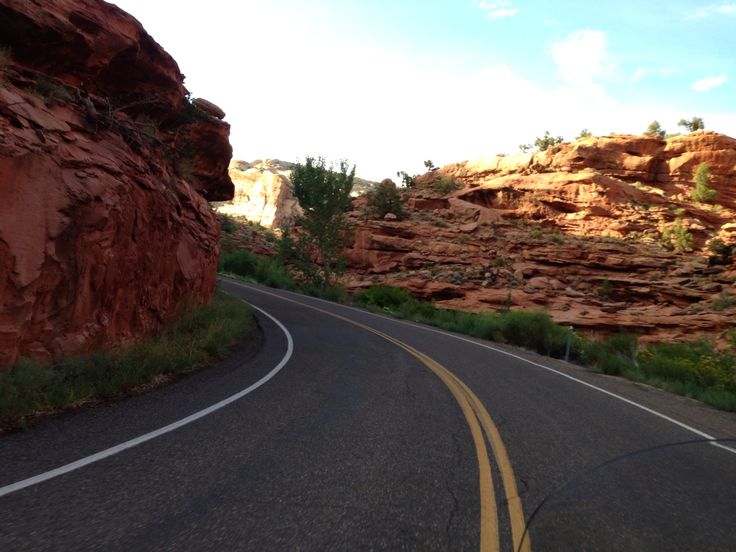
Utah Highway 14 leads me eastward from Cedar City into Cedar Canyon, a scenic drive that crests at nearly 10,000 feet.
For the next 35 miles, the road twists and turns, past Navajo Lake, through Duck Creek Village, and eventually to the intersection with US Highway 89. The road through Cedar Canyon offers epic views of the Dixie National Forest, before giving way to massive meadows on both sides of the highway.
Cedar Canyon.
At the gas station that marks the junction of Utah Highway 14 and US Highway 89, I turn north and begin making my way toward Bryce Canyon National Park.
I roll through the town of Hatch, population 133, home of the Bryce Zion Inn – where identity confusion apparently caused it to be named after both National Parks. An unconfirmed report suggests Hatch is named after 84-year-old US Senator Orrin Hatch, now serving his seventh term. The ultra-conservative Hatch hasn’t decided whether he’ll seek an eighth Senate term in 2018, but says he might be willing to step aside if Mitt Romney decides to give elective office another try. In a recent Salt Lake Tribune poll, 58 percent of Utahns said Hatch “definitely” should not seek re-election.
***
About 10 miles north of Hatch is the turnoff to Utah Highway 12, a Scenic Byway that’s Utah’s first All-American Road.
Utah Highway 12, one of the most spectacular roads imaginable.
Known as “A Journey Through Time Scenic Byway,” it’s considered one of the top five motorcycle roads in the US.
I’ve ridden Highway 12 three times in each direction (east to west, west to east), and it does not disappoint. It’s 123 miles of unparalleled beauty, alternatingly breathtaking and terrifying.
Parts of Highway 12 were built by in the 1930s by the Civilian Conservation Corps, a work relief program that operated from 1933 to 1942 as part of FDR’s New Deal. It provided unskilled manual labor jobs related to the conservation and development of natural resources in rural lands owned by federal, state and local governments.
When the Civilian Conservation Corps built Highway 12, the new road provided the first year-round access for cars to this once-isolated part of southwestern Utah.
Highway 12 has been voted the second-most beautiful highway in the world, and for good reason.
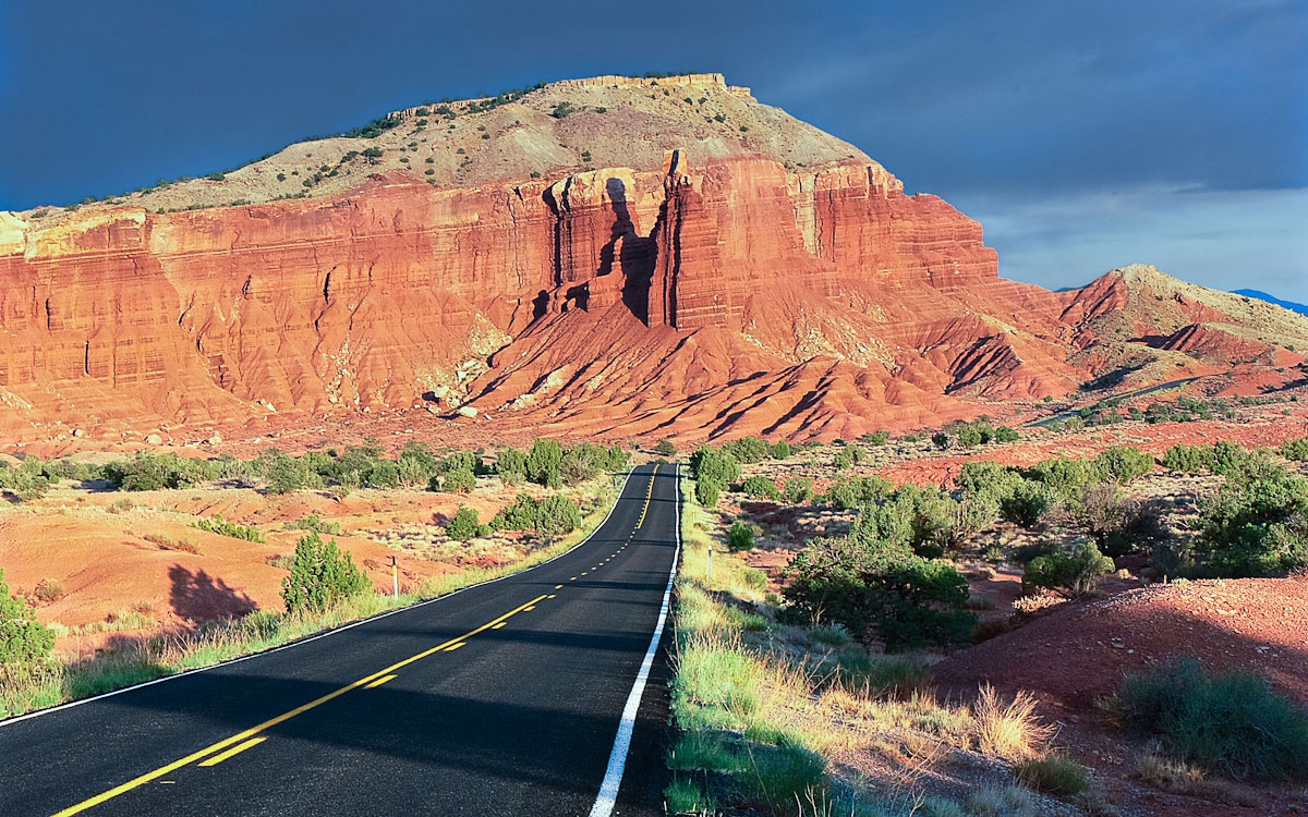
Red Canyon road trip. What could be better? Not much.
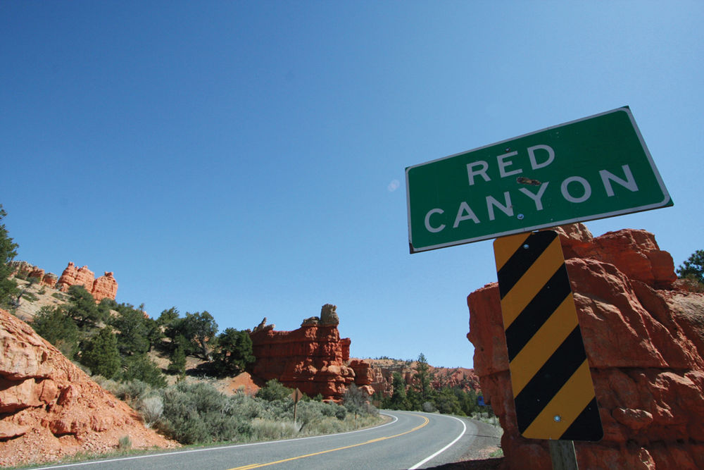
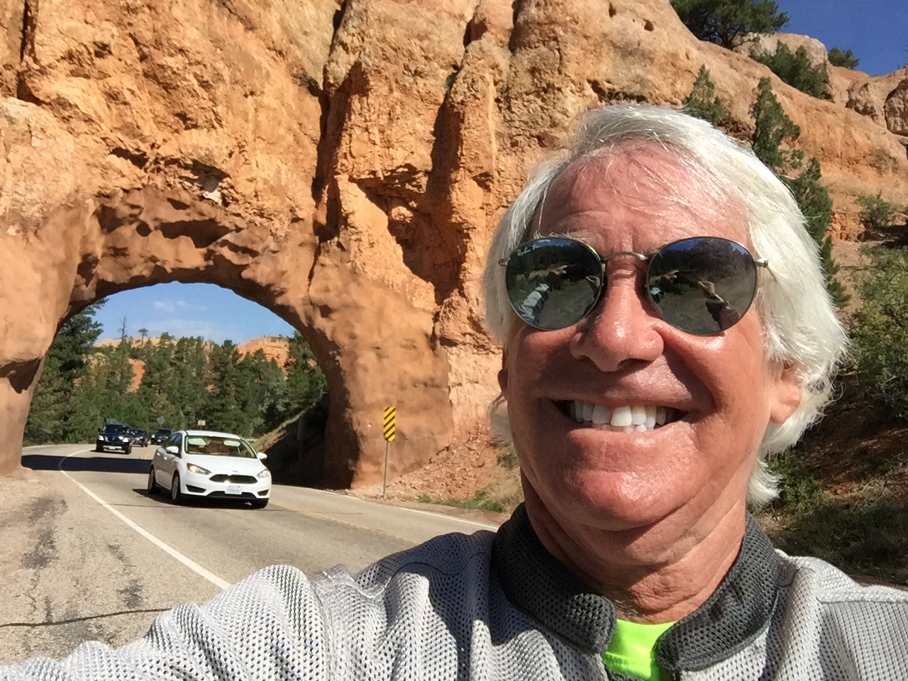
A few miles after turning onto Highway 12, I immediately enter Red Canyon, home of Red Canyon State Park and Red Canyon Scenic Drive. All red, all the time. There’s red rock everywhere you look. The colors come from the presence of iron oxide, or hematite. Exposure to the elements caused iron minerals to oxidize, or rust, resulting in red, orange and brown-colored rocks.
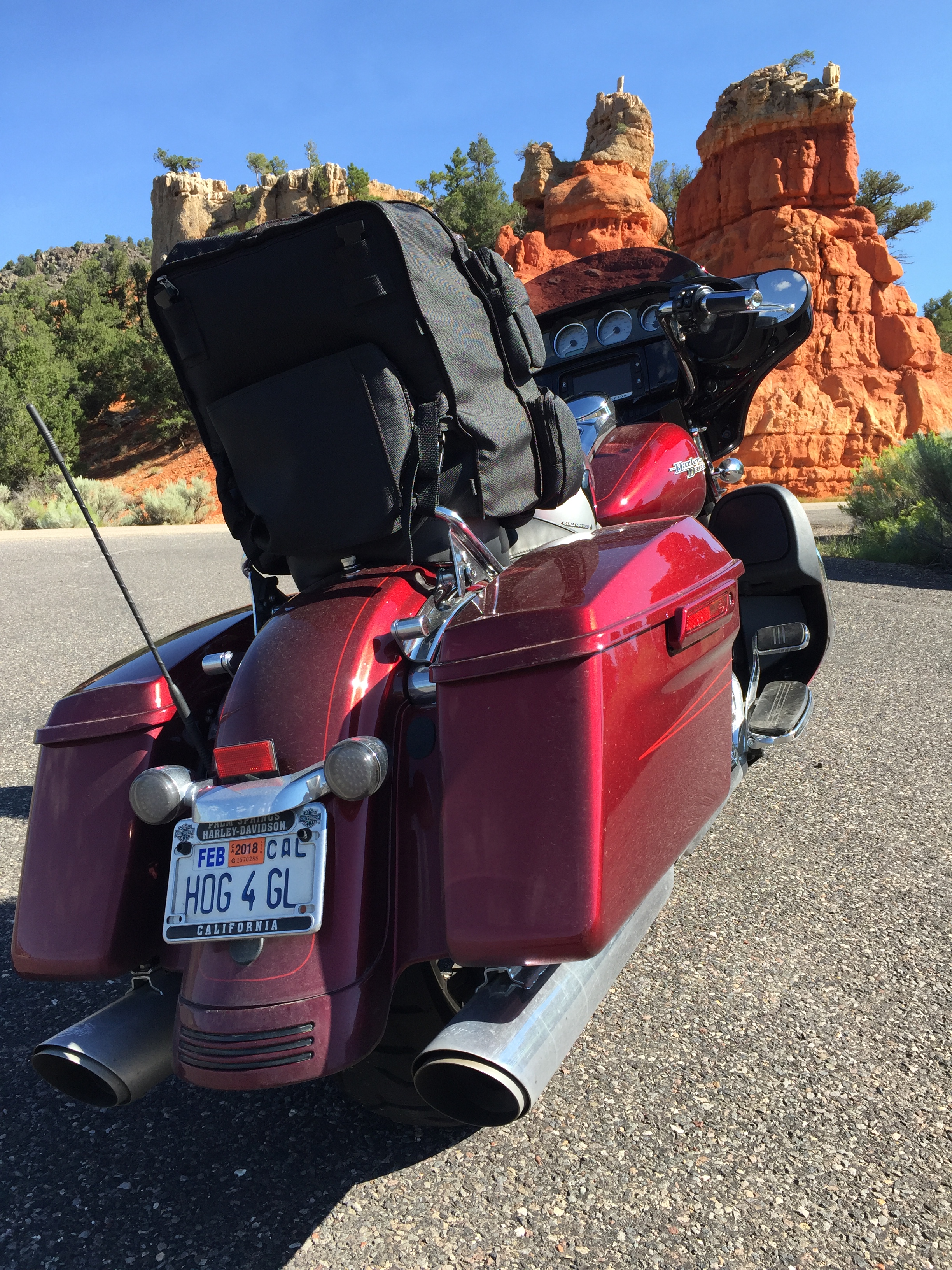
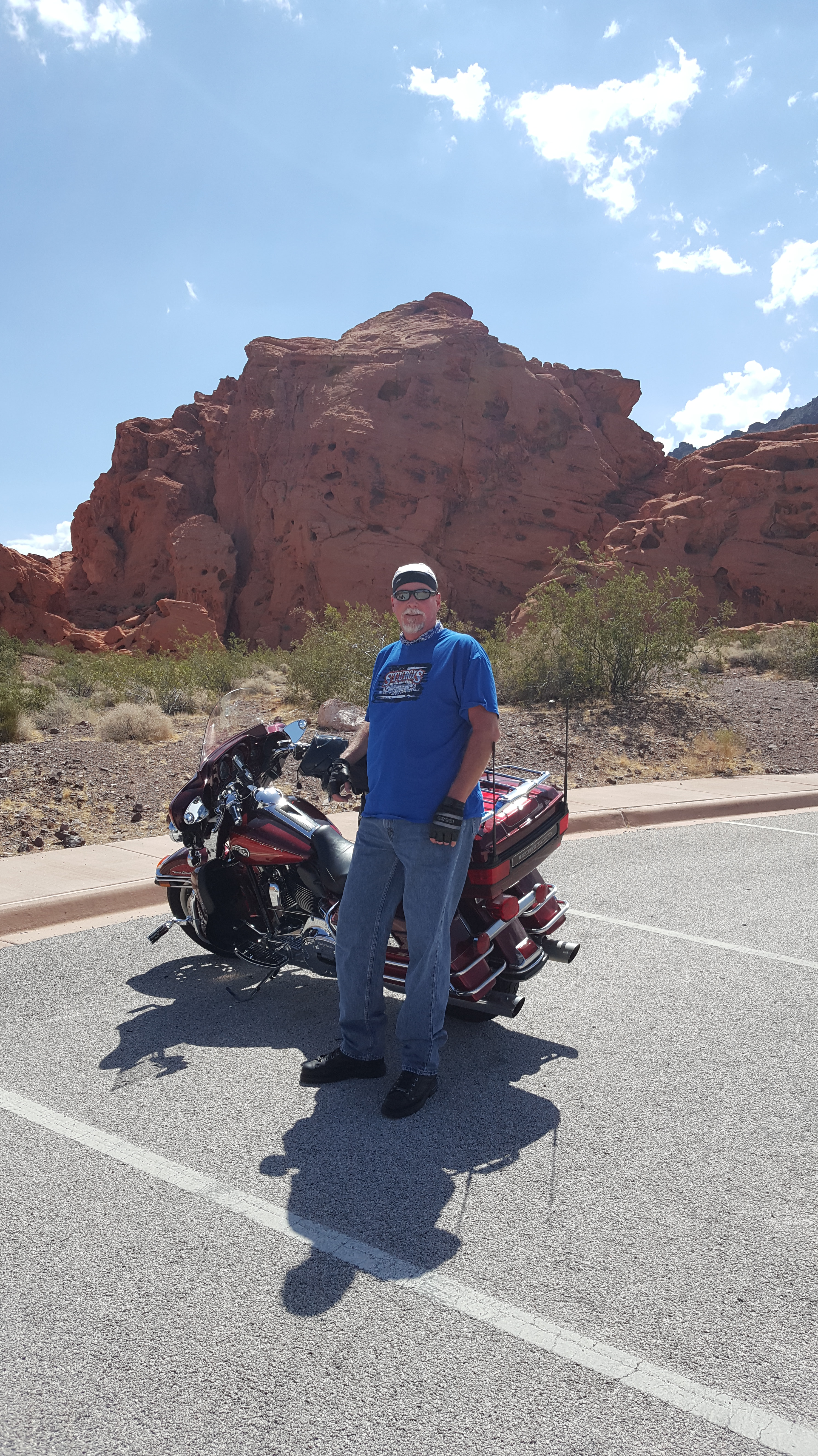
The author’s Harley, at the entrance to Red Canyon.
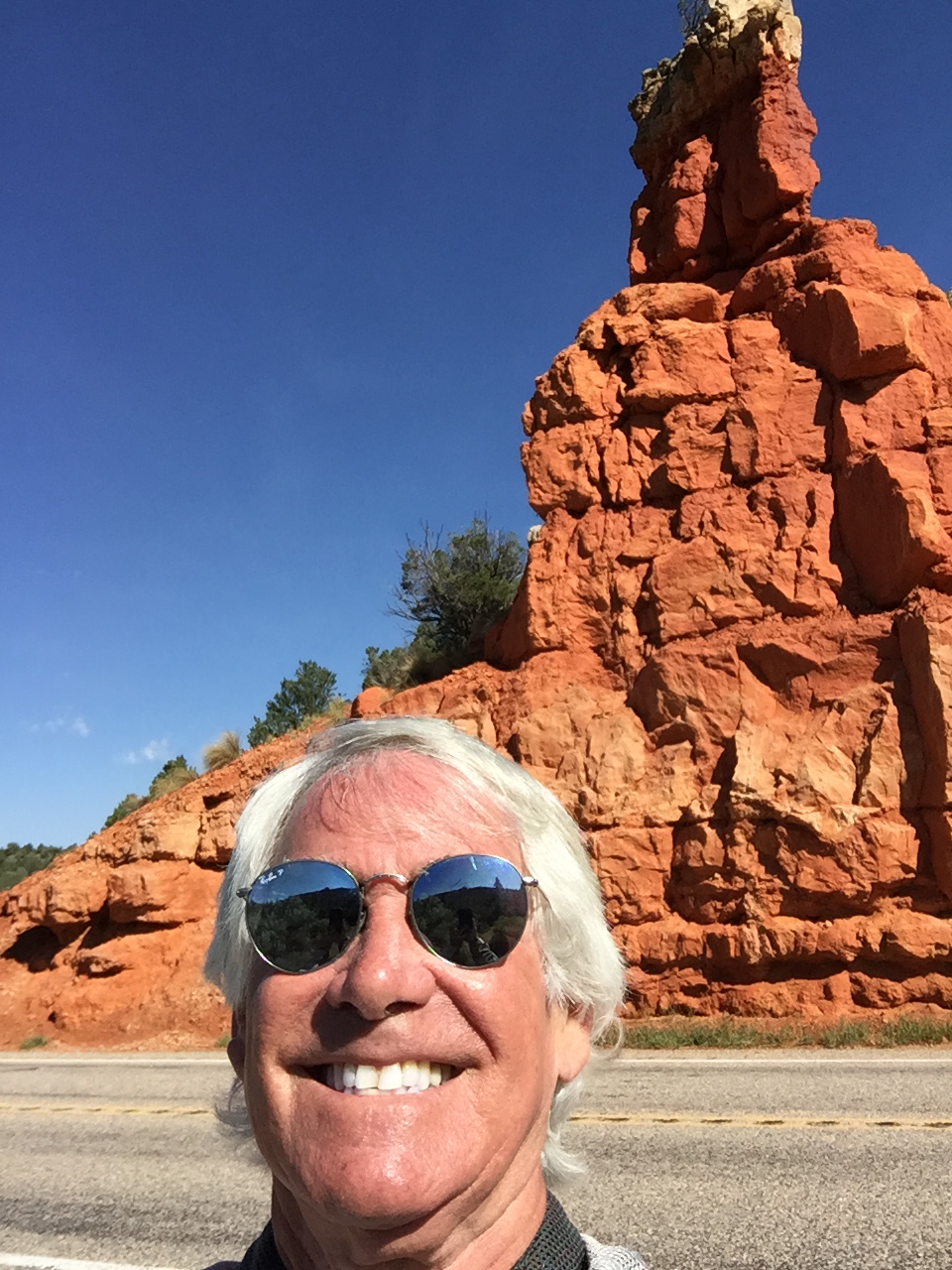
Loving the red rocks.
Highway 12 approaches Bryce Canyon National Park from the west via Red Canyon, a relatively shallow valley in the side of the Paunsaugunt Plateau surrounded by exposed orange red limestone.
The rocks are eroded into the familiar pinnacles, spires, columns and hoodoos also found in the national park about 10 miles to the east. The formations line Highway 12 for about 4 miles, starting quite abruptly at the edge of the plateau, then fading away as the road reaches the flat grasslands on top, and extend several miles north, including two other large valleys of Losee and Casto Canyons.
Red Canyon has several tunnels carved from the red rocks.
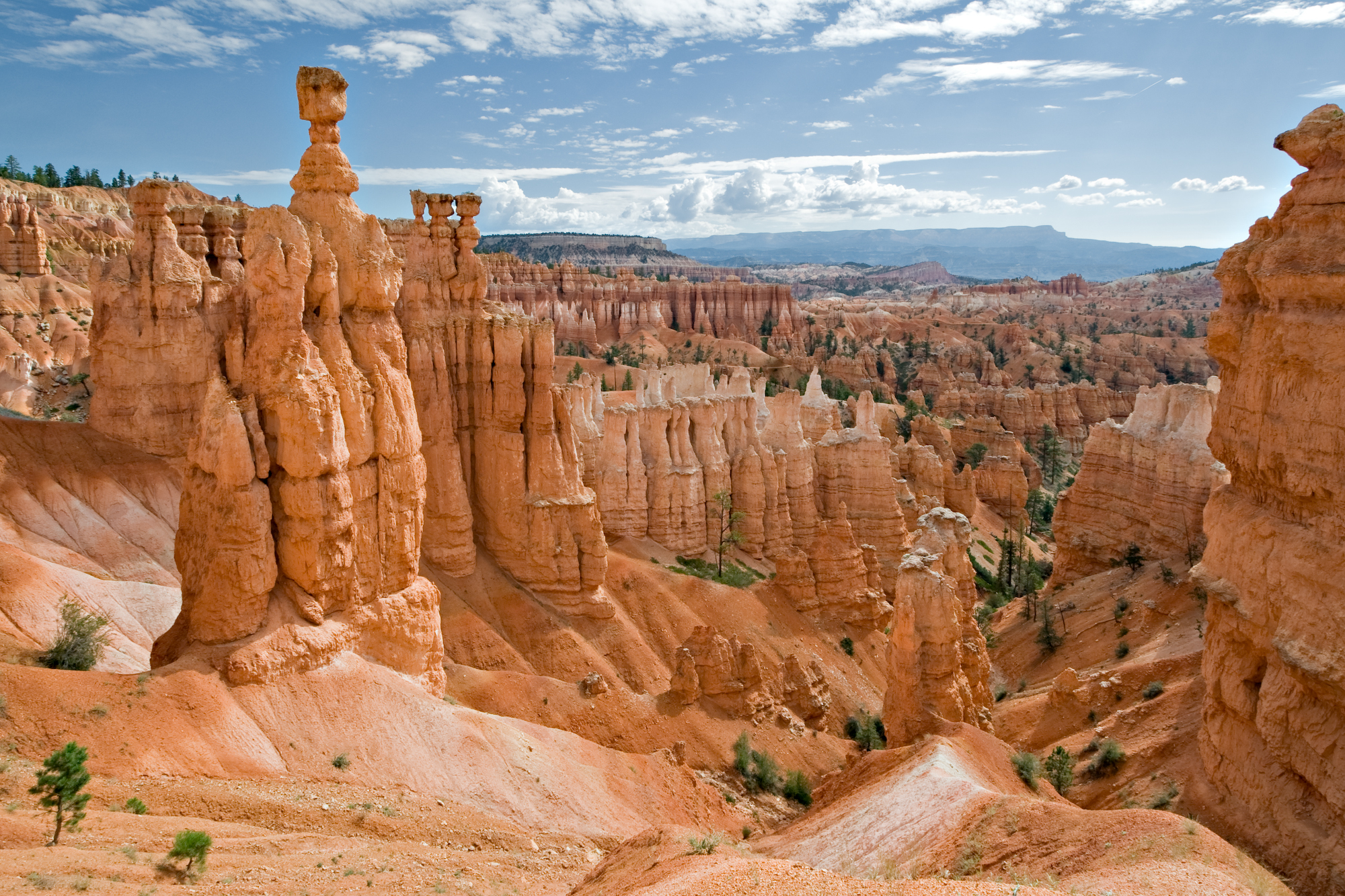
And before you know it, I arrive at the turnoff to Bryce Canyon National Park, home of hoodos.
Bryce Canyon’s hoodoos are geological marvels. But today, I’ll skip them and continue riding.
But today is not a park visitation day. I’ll smell enough roses, metaphorically speaking, just by enjoying this spectacular road.
***
Shortly after the Bryce Canyon turnoff, I roll through the towns of Tropic, Cannonville and Henrieville, all established in the late 1800s by Mormon settlers.
Thirty miles northeast of Henrieville is Escalante, a small ranching town with about 800 full-time residents. It’s named after Silvestre Velez de Escalante, a Franciscan missionary and a member of the first European expedition into southern Utah. In 1776, Escalante left Santa Fe, New Mexico, trying to find a route to the missions of California. His expedition took him through western Colorado and west across central Utah before eventually arriving in what is today called the Escalante Desert.
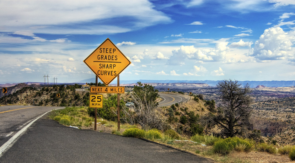
Once you pass through Escalante, the road becomes exhilarating, and in places, sphincter-tightening. It has scary switchbacks and steep drop-offs. That sound you just heard was me, praying for a safe passage.
A hogback warning of what’s ahead. Signs and words don’t come even close to the terror I feel.
There’s a “hogback” section that pretty much brings me to tears every time I’m on it – today included.
A hogback is a long narrow ridge or series of hills with a narrow crest and steep slopes with nearly equal inclines on both sides. As you might guess, the name refers to its resemblance to the back of a hog. Apologies to my Jewish friends and family for riding on a non-kosher geological formation. I’ll try to pick my routes more carefully next time.
***
From the hogback, you head toward Boulder, a town of just over 200 residents. Boulder has the best food along Highway, at either Hell’s Backbone Grill or the Burr Trail Grill.
From Boulder, the road begins climbing steeply. Coincidentally, so do I.
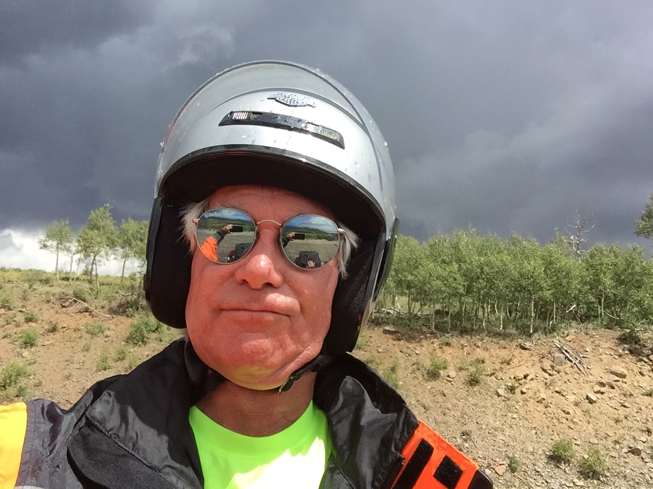
Near the top of Boulder Mountain, a thunderstorm comes out of nowhere and soaks me. Thunder, lightning, and hail. The works!
The 30-mile long portion of the highway that ascends and descends Boulder Mountain is known as the Boulder Mountain Highway. It climbs to an elevation of more than 9,600 feet, through a huge aspen grove, before descending into the town of Torrey – gateway to Capitol Reef National Park.
Boulder Mountain Highway’s aspen groves are spectacular, especially in the fall. This photo was not shot today.
Building Highway 12 took nearly four decades, as construction crews sporadically blasted, cut and paved their way through rugged hills cliffs from the 1940s to the 1980s. The road was initially built to move cattle, supplies and mail for the people in five small towns in southern Utah. But when the last stretch over heavily forested Boulder Mountain was finally paved in 1985, it didn’t take travelers long to discover that this road was the best tour of Utah’s red-rock desert that can be made in a single day.
The weather may have sucked, but my bike took it all in stride.
If you enjoyed the ride on Utah Highway 12 as much as I did, here’s a chance to revisit it, this time from East to West – the entire 125 miles in time-lapse video.
***
At the northeastern terminus of Highway 12 is Torrey, elevation 6,830 feet. Torrey was established in the 1880s by Mormon settlers, and was initially known as Youngtown, after John Willard Young. He’s one of the few individuals to have been an apostle of the LDS Church and a member of the First Presidency without ever having been a member of the Quorum of the Twelve Apostles. Gotta love Mormon trivia!
The town of Torrey was named after one of Theodore Roosevelt’s Rough Riders, Col. Jay Torrey.
Torrey is tonight’s destination. After a thrilling 123-mile ride on Highway 12, arriving here is almost anticlimactic.
The view descending Highway 12 toward Torrey. Photo also not taken today.
The biggest excitement here is conjuring up the past, thinking of Butch Cassidy, whose boyhood home was not far from here, and Zane Grey, author best known for adventure novels like Riders of the Purple Sage, who often visited Torrey.
Me, I’m parking the bike at the Red Sands Hotel, grabbing a quick bite, and preparing to press on tomorrow toward the Lesser/Murr homestead in Colorado.
***
Day Seventeen Summary: One of America’s top five motorcycle roads, the second-most beautiful highway in the world. Life’s good.
Click here to see today’s complete route from Cedar City to Torrey.
I’m on my way home.
Vroom, vroom.
***
Today in Bucket List History:
Bucket List Goal: “Build a Monument to Paranoia.”
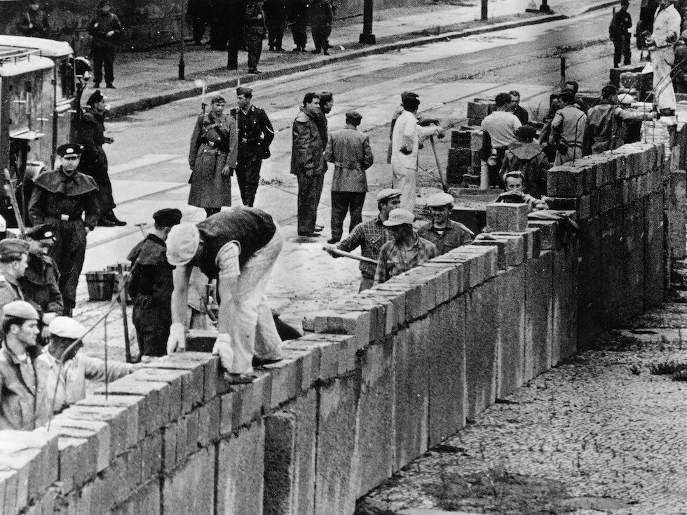
Goal Achieved: On August 13, 1961, construction begins on the Berlin Wall in East Germany. The Wall falls 28 years later, on Nov. 9, 1989. East Germany officially referred to the Wall as the “Anti-Fascist Protective Wall,” implying that the NATO countries and West Germany in particular were considered fascists by German Democratic Republic propaganda.
Building the Berlin Wall in 1961.
What’s on your bucket list?
***
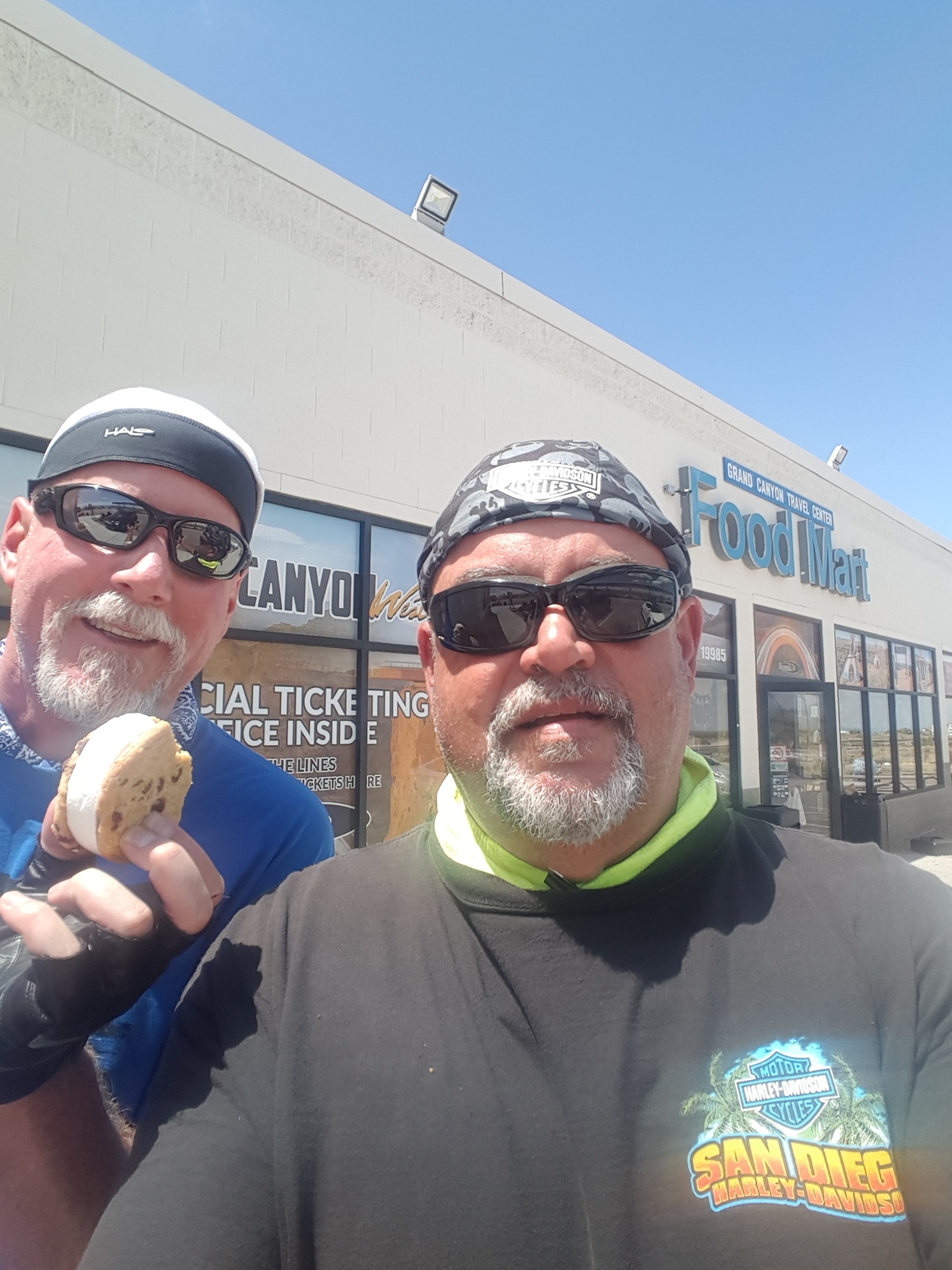
A postscript: Dave and Scott are in Kingman, Arizona, tonight, cooling off before riding through a blast furnace tomorrow on their way home to Orange County. Here are a few photos, showing their day on the road.
Dave found some red rocks, too. These were in Nevada. (photo by Scott)
Dave and Scott cool off at a convenience store en route to Kingman, Arizona. Dave’s method of cooling off: an ice cream sandwich.
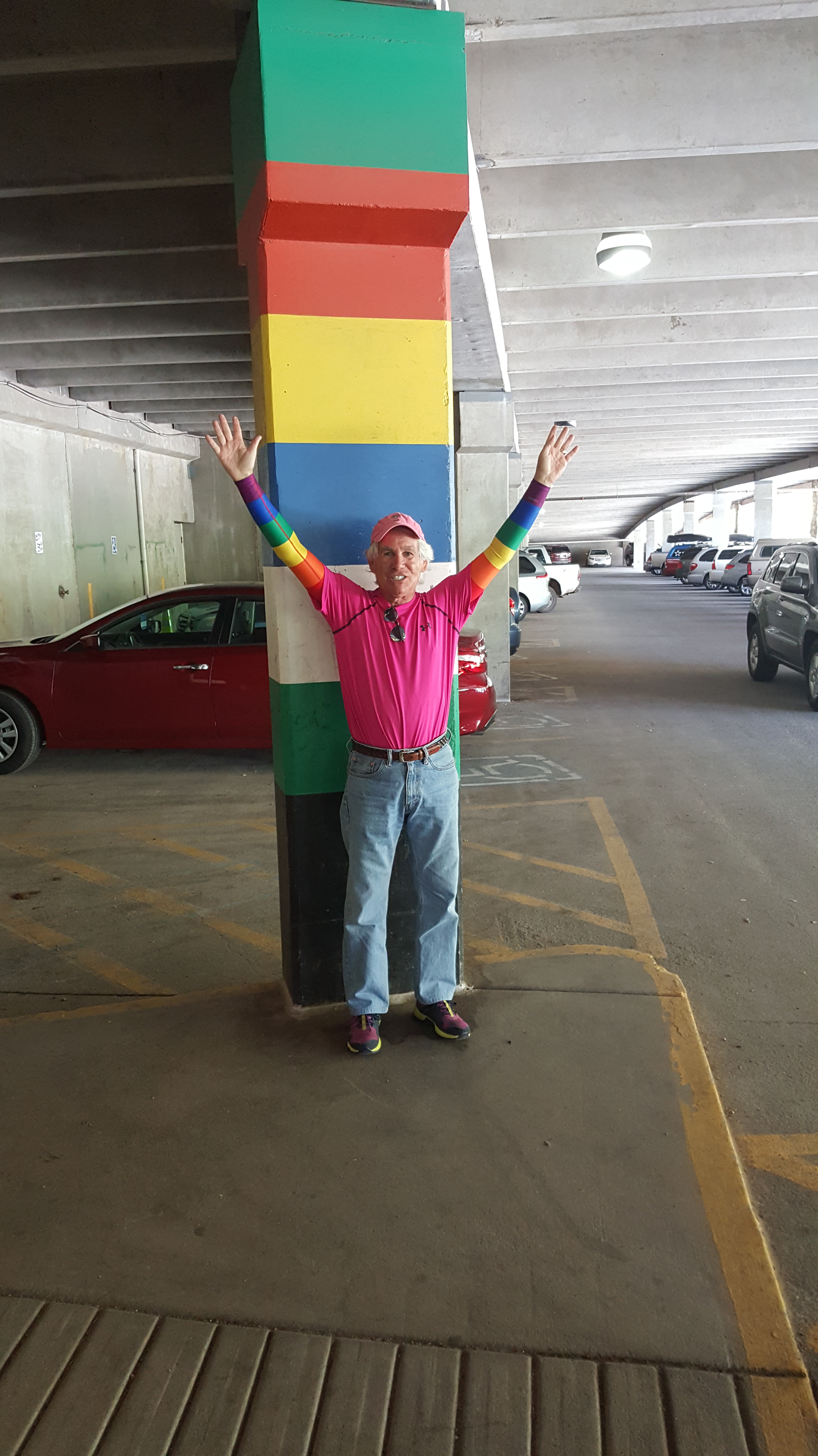
My own personal Rainbow Coalition 🌈 , in an undisclosed parking garage. Sarah: note the SPF 50 sun sleeves! (photo by Scott)
Today we ride yet another Scenic Byway, another All-American Road. And we cross the Continental Divide at more than 12,000 feet. Ho, hum.
We leave Hotchkiss and turn east on Colorado Highway 133, following the North Fork of the Gunnison River.
In ten miles, we pass through the town of Paonia, named for the flower, Paeonia mascula – and we begin climbing.
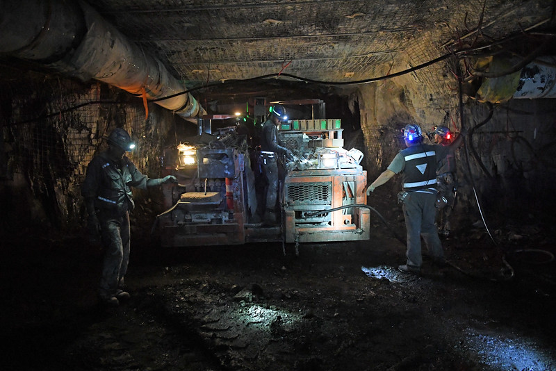
Like many other areas on Colorado’s Western Slope, Paonia once had a thriving coal mining business. In 2016, depressed coal prices caused one of the mines – Bowie Number 2 – to shut down, idling more than 100 full-time workers. Only two active coal mines remain in the area, whose coal industry employment has dropped from 1,200 to less than 400 in the past four years.
The West Elk Mine near Paonia is barely hanging on.
Pressured by cheap and abundant natural gas, coal is in a precipitous decline, now making up just a third of electricity generation in the United States. Renewables are fast becoming competitive with coal on price. Electricity sales are trending downward, and coal exports are falling. Paonia is in trouble. Nice place to ride through. Raise a family here? Not so much.
From Paonia, we ride past the Paonia Reservoir and Paonia State Park, as the road begins to climb toward McClure Pass, 16 miles away. McClure Pass, at 8,763 feet, sits on the boundary between Pitkin and Gunnison Counties. The approaches on either side of the pass have an eight percent grade, making McClure Pass among the steepest in Colorado.
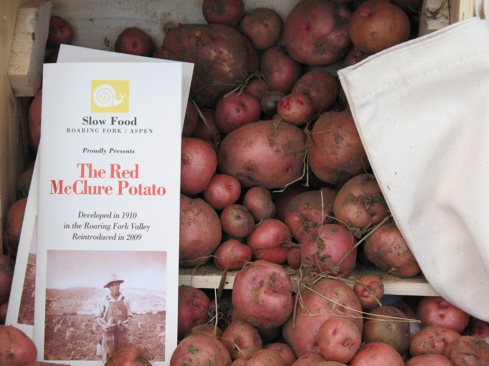
McClure Pass is named for Thomas McClure, an Irish immigrant known as the developer of the Red McClure potato. His variety was introduced around 1910, and by the 1930s, the valley exported more than 400 rail cars filled with potatoes every year, more than the entire state of Idaho. Take that, JR Simplot!
During the 1940s, the potato fields here in the Roaring Fork valley vanished, and so did the McClure potato. But it’s making a bit of a comeback these days. Slow Food USA has added the Red McClure to its “Ark of Taste,” a list of 200 foods from across the country deemed delicious, endangered and worth fighting to protect.
The McClure potato: first developed in 1910, and reintroduced less than a decade ago.
***
Following the steep descent from McClure Pass, the road flattens out and we soon roll by the turnoff to Marble, a rustic little town five miles away. If we were hungry, we’d make a sharp turn on to Gunnison County Road 3, and head for Slow Groovin’, a hidden gem where you’ll find the best barbecue imaginable.
Maybe even better than Rebel BBQ in Blythe.
As Slow Groovin’ likes to say, it’s “ridiculously good BBQ,” and that may be an understatement. It’s tragic and heartbreaking that we don’t have time or the appetite for ribs today (ribs, fries and slaw at 9 am?). But lucky me: it’s likely that Sarah and I will soon become regulars at Slow Groovin’, which is exactly 27.6 miles away from our new home.
The town of Marble, home to Slow Groovin’, got its name from the stone that is quarried there: marble. In 1873, a prospector named George Yule was looking for silver and gold – and discovered marble, which is 99.5 percent pure calcite. The only place on earth where this type of marble is found is in what is now called the Yule Creek Valley, about three miles southeast of the town of Marble.
Because the marble is quarried inside a mountain at 9,500 feet above sea level, Yule Marble can be quite expensive – difficult to extract and even harder to transport. Steep slopes, deep snow, and winter snowslides make the quarry environment quite hostile. But the Yule Marble quarry eventually became successful after a tram was built to bring the marble down the mountain, where it could be loaded onto a train.
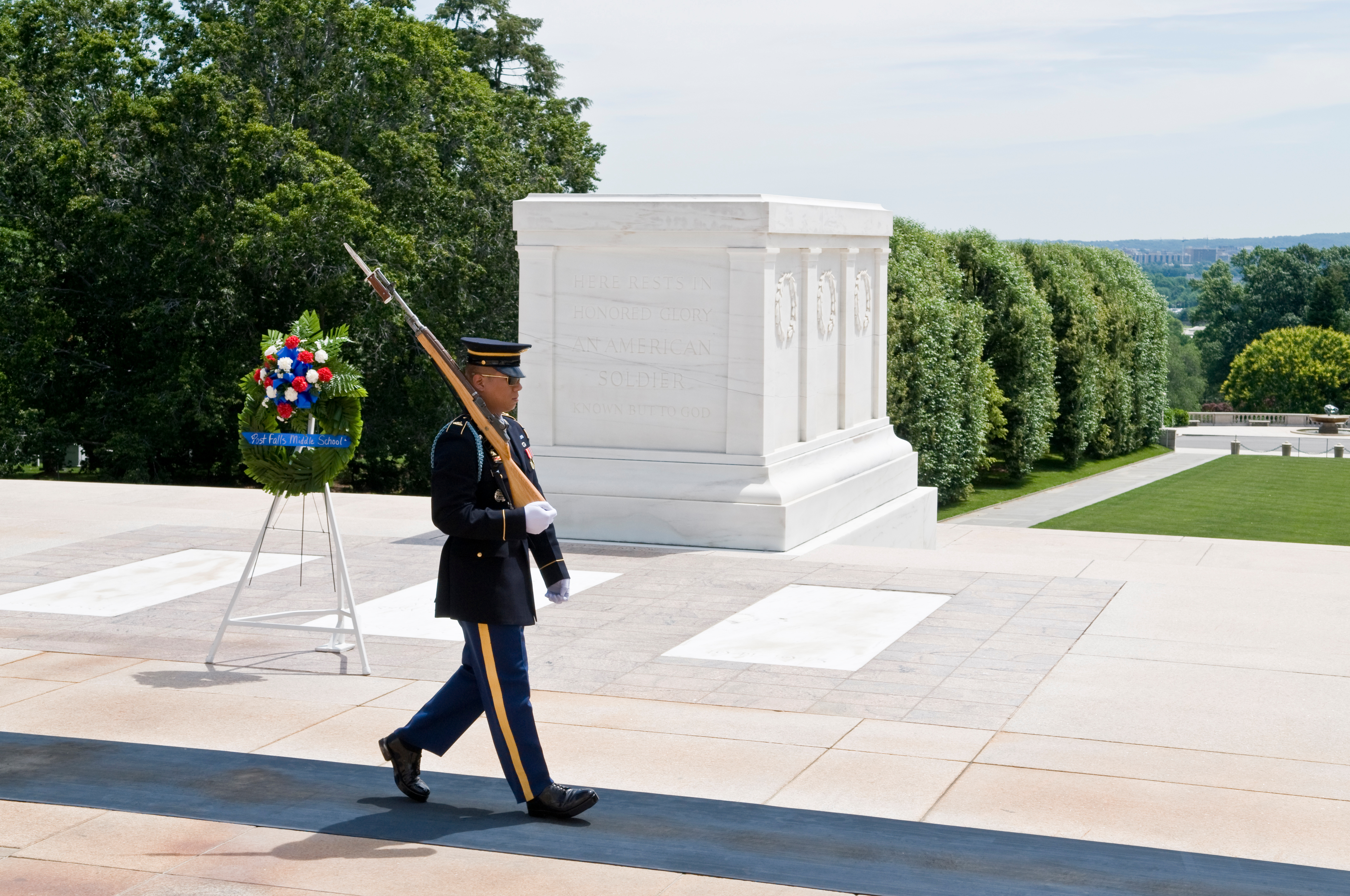
Marble for the Tomb of the Unknown Soldier came from Marble, Colorado.
The beautiful white marble from Marble soon became a part of the American fabric. The Yule Marble quarry provided the stone for the exterior of the Lincoln Memorial, and the Tomb of the Unknown Soldier at Arlington National Cemetery. At the time, the 56-ton block of marble for the Tomb of the Unknown Soldier was the largest single piece of marble ever quarried.
Today, there are about 100 full-time residents of Marble. Fifteen to twenty of them work at the quarry. It’s believed that the remaining operational quarry has enough marble to last for several hundred years.
We continue riding north on Colorado Highway 133. To our right is the town of Redstone, home to the renowned Redstone Inn. Redstone was established in the 19th century as part of a coal mining enterprise by industrialist John Clevenholm Osgood. Osgood built 84 cottages and a 40-room inn — for his coal miners. Most of these Craftsman-era Swiss-style cottages are still used today as homes.
A dominant feature of Redstone is Redstone Castle, a 42-room Tudor-style mansion that Osgood built for his second wife, Swedish Countess Alma Regina Shelgrem. It’s for sale, or at least it was a few years ago. It could have been yours for $7.5 Million.
About ten miles east of Redstone, obscured by other mountains, are Capitol Peak (14,131 feet) and Snowmass Mountain (14,098 feet), two more 14ers. We’re now following the path of the Crystal River, through a narrow canyon with tall blue spruce trees flourishing along the river. The blue spruce is Colorado’s state tree.
As we approach Carbondale, the dominant feature to our east is Mount Sopris. At a puny 12,953 feet, it’s not quite a 13er. Still, Sopris dominates the skyline of Carbondale and the lower Roaring Fork Valley.
Carbondale, a haven for outdoor-minded Coloradans, sits at the confluence of the Roaring Fork and Crystal Rivers.
At Carbondale’s River Valley Ranch golf course, slightly northeast of the 14th green, there’s a 13,000-square-foot lot with a view of Mount Sopris that, last year, called out to Sarah and me: this is the place!
We bought that lot, and are now beginning construction of a house on it.
At the Lesser/Murr homestead. Should be ready to move in next May. (photo by Dave)
A few of you have asked, what was so wrong about PGA West that caused us to leave? Nothing was wrong. We loved it. But after 16 years, it was simply time for a new adventure.
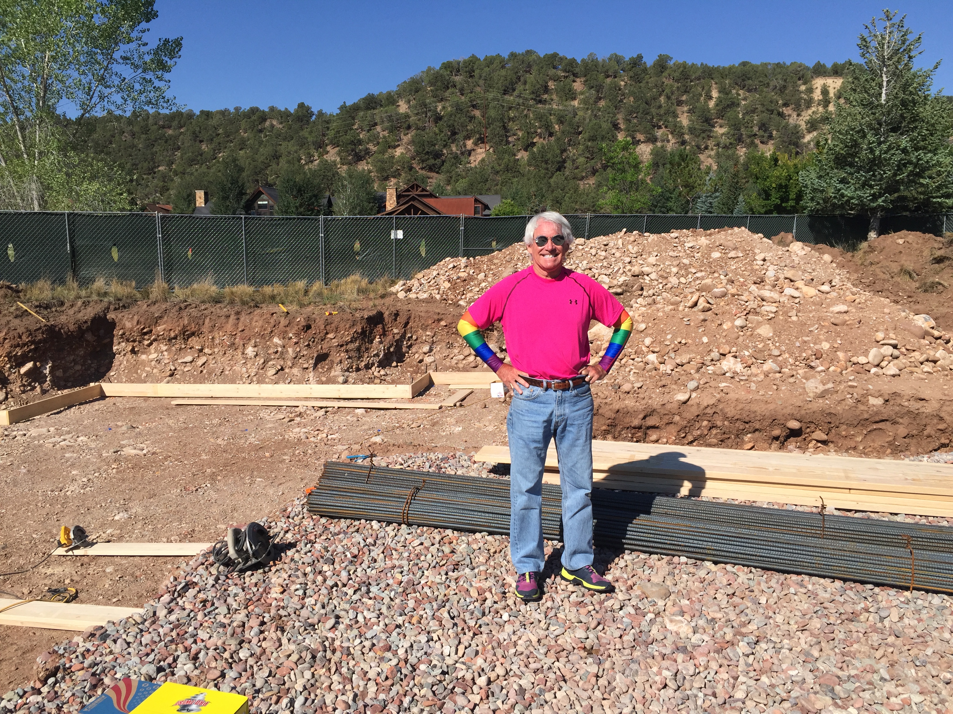
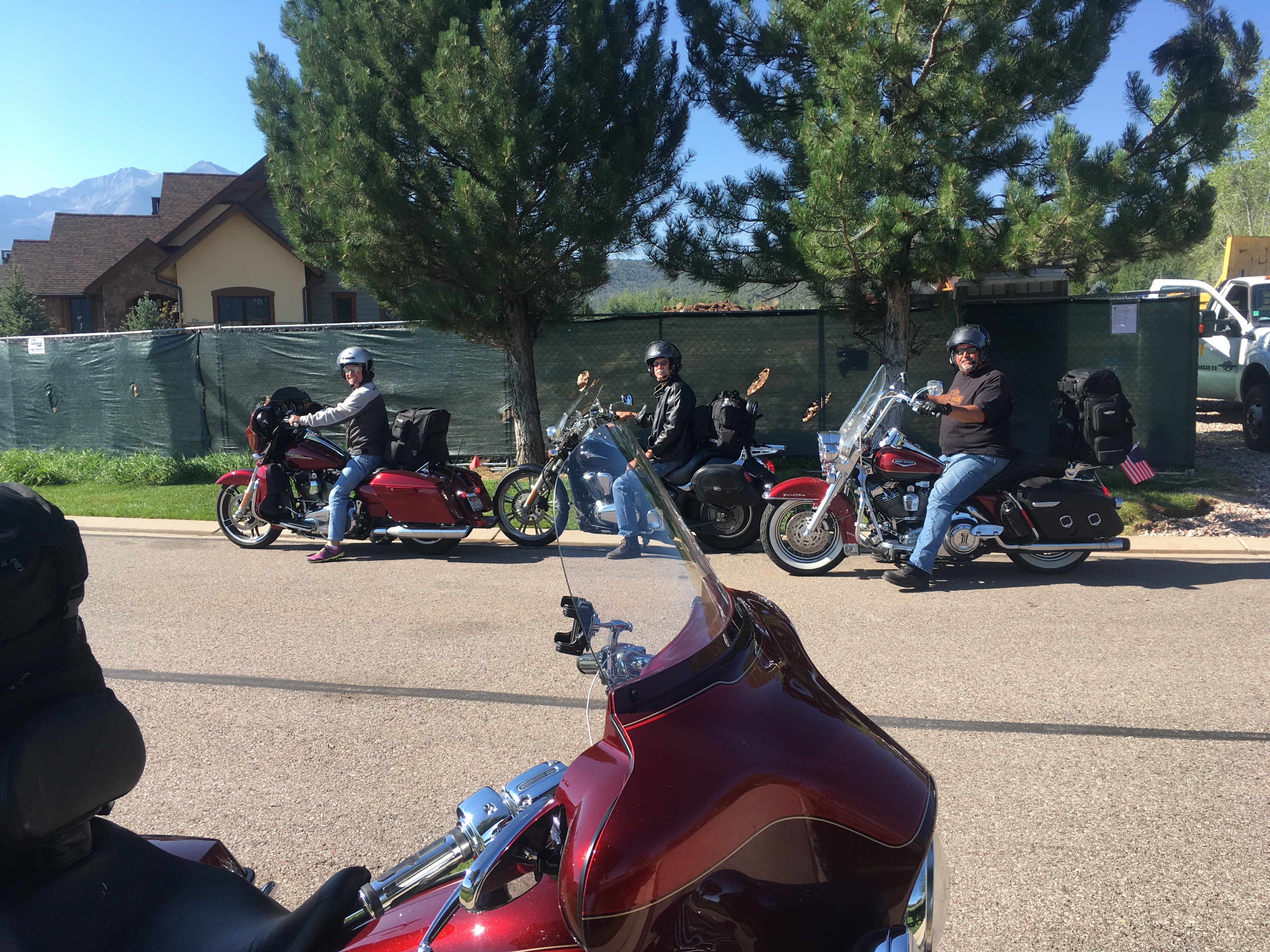
The posse, still on their bikes, at 150 Sopris Mesa Drive. Photo by Dave (which explains why he’s not in the shot).
Today, the Sturgis posse rolls by the future Lesser/Murr homestead for a brief visit. We park the bikes in front of what will be the driveway – elevation: 6,388 feet above sea level. It’ll be a great place to store the Harley; the garage even has a special spot for a motorcycle.
For now, it’s all imaginary. Next year, with thanks to the team at Key Elements Construction, our dream will turn to reality. No pressure, Kent.
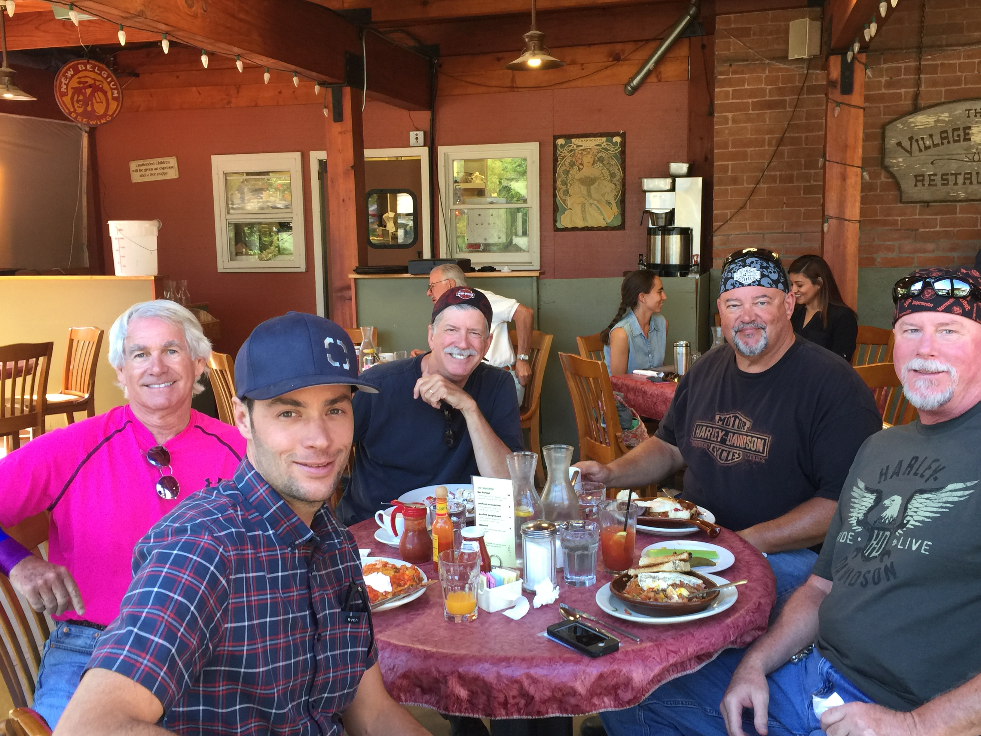
After leaving the homestead, we stopped at the Village Smithy for breakfast, and ran into George Nettles, the project superintendent for our home.
That’s George, our honorary biker, closest to the camera. (photo by our server)
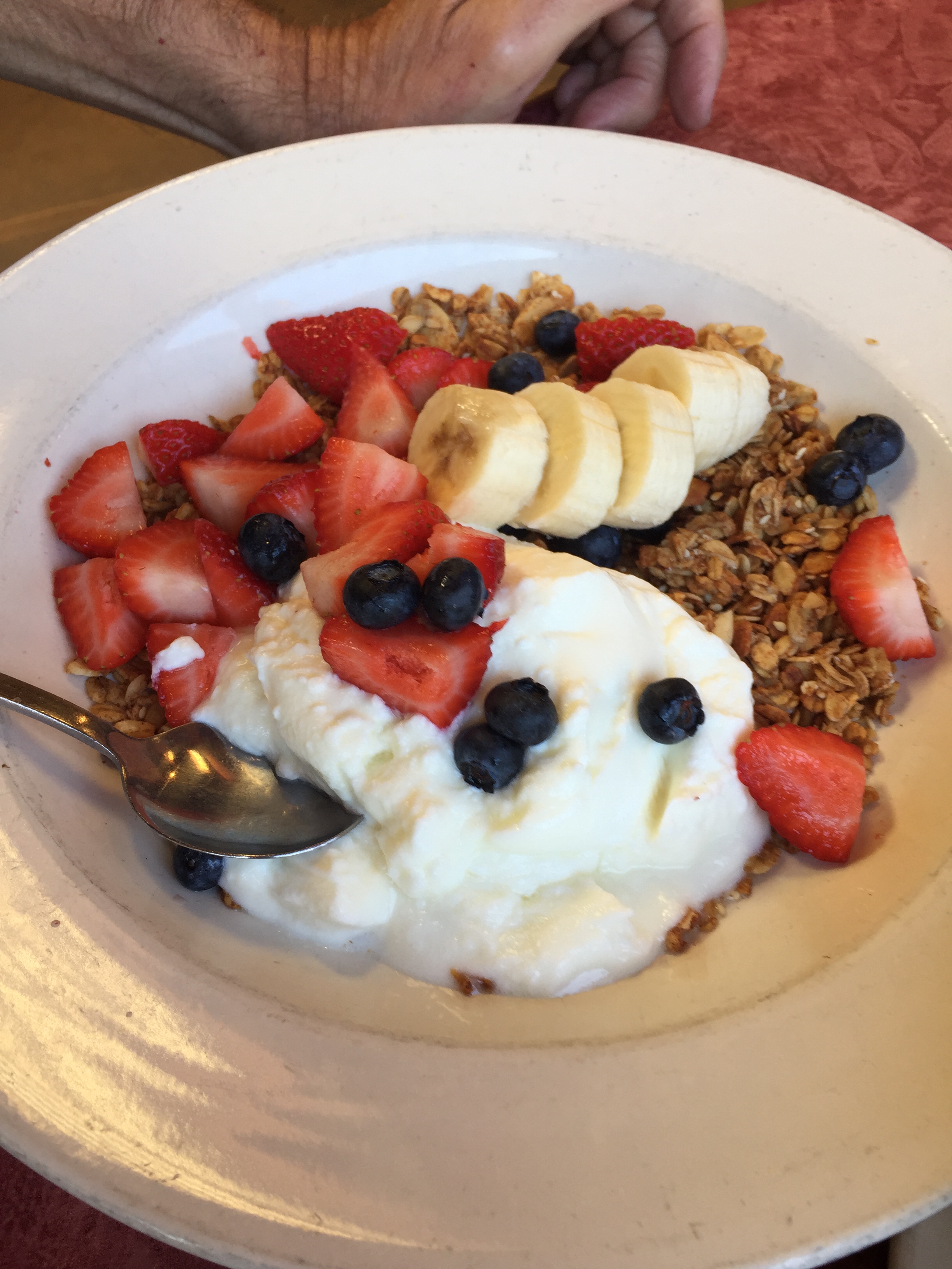
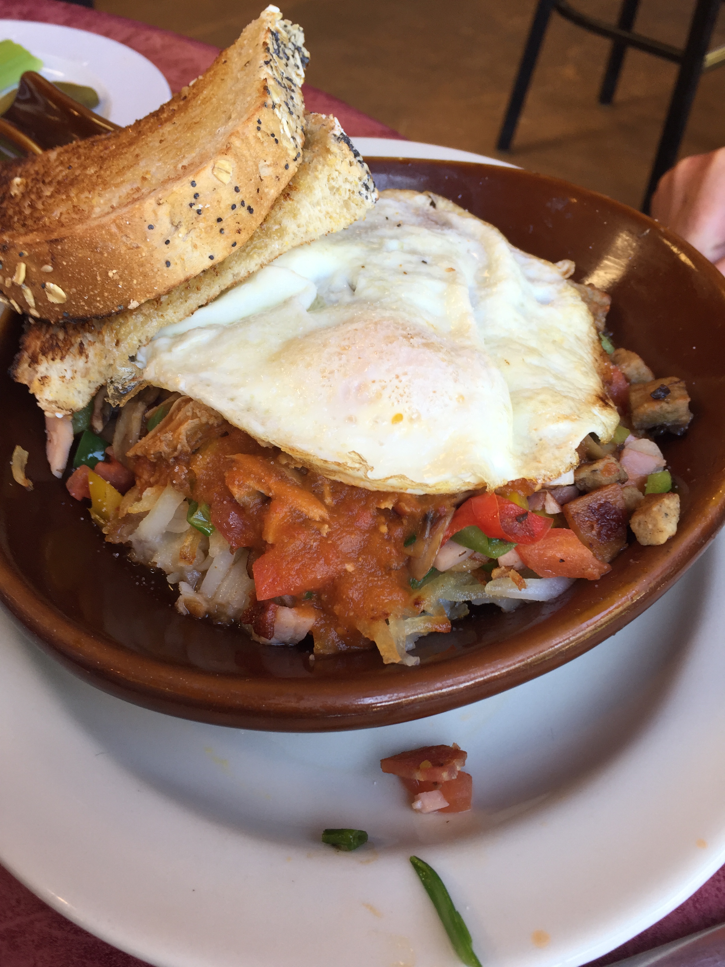
Breakfast pic #1. Guess who ordered this?
Breakfast pic #2 Guess who ordered this?
***
In Carbondale, we turn east on Colorado Highway 82 and head toward Aspen.
En route, we pass by El Jebel, Basalt, and Woody Creek, home of the world-famous Woody Creek Tavern.
In a flash, we are in the heart of Colorado ski country. To our right is Snowmass, then Aspen Highlands, Buttermilk, and finally Aspen itself.
About a mile past Buttermilk Mountain, you can turn southwest on Maroon Creek Road to see what is believed to be the most photographed mountain scene in all of North America: the Maroon Bells. The Maroon Bells are two 14ers, just 10 miles from Aspen. Visiting them is a highly worthwhile side trip. Maroon Creek Road takes us to the Maroon-Snowmass Trailhead, at the foot of Maroon Lake.
At the parking lot, waiting for the bus to Maroon Bells.
They’re called the Maroon Bells because of their shape (bell-like), and their color (maroon-like, when the light is right). The Bells are maroon because the rock that forms most of their mountains is soft red shale and a paler siltstone, called the “Maroon Formation.” The red color comes from tiny iron particles that have been oxidized, or rusted. Because the shale is very soft, hiking on this type of rock can be quite dangerous. Consider that both a geology lesson and a friendly warning.
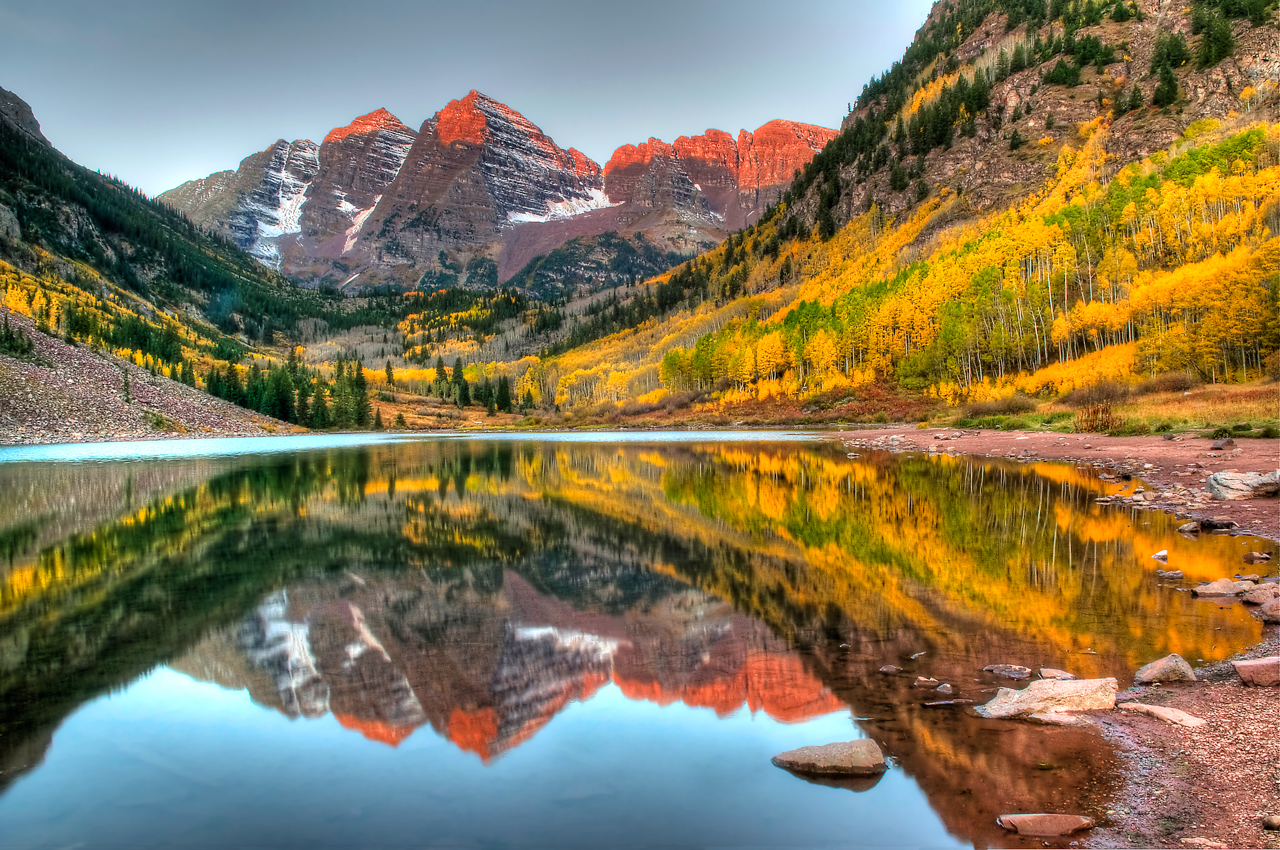
The Maroon Bells, reflected in Maroon Lake.
The view of the Maroon Bells to the southwest is one of the most famous scenes in Colorado – which is saying a lot. Of Trip Advisor’s 59 rated attractions in the Aspen area, the Maroon Bells rank Number One; many of the visitor comments describe the view as just short of a religious experience.
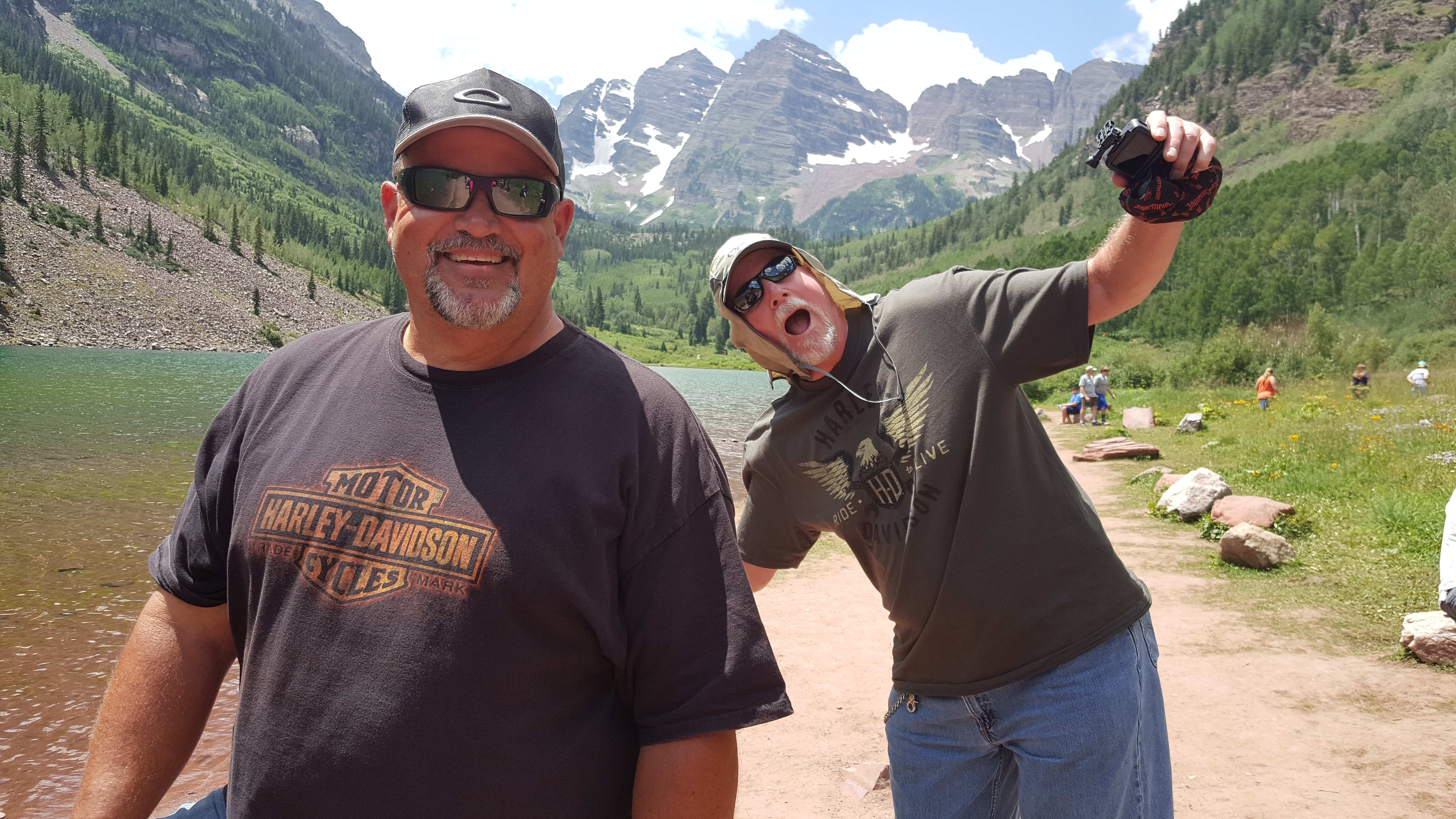
Dave sharpens his photobombing skills at Maroon Lake.
It’s so popular that in the summer, the only way to get there is to climb on a bus operated by the Roaring Fork Transportation Authority for the 30-minute ride to the Maroon Bells parking lot.
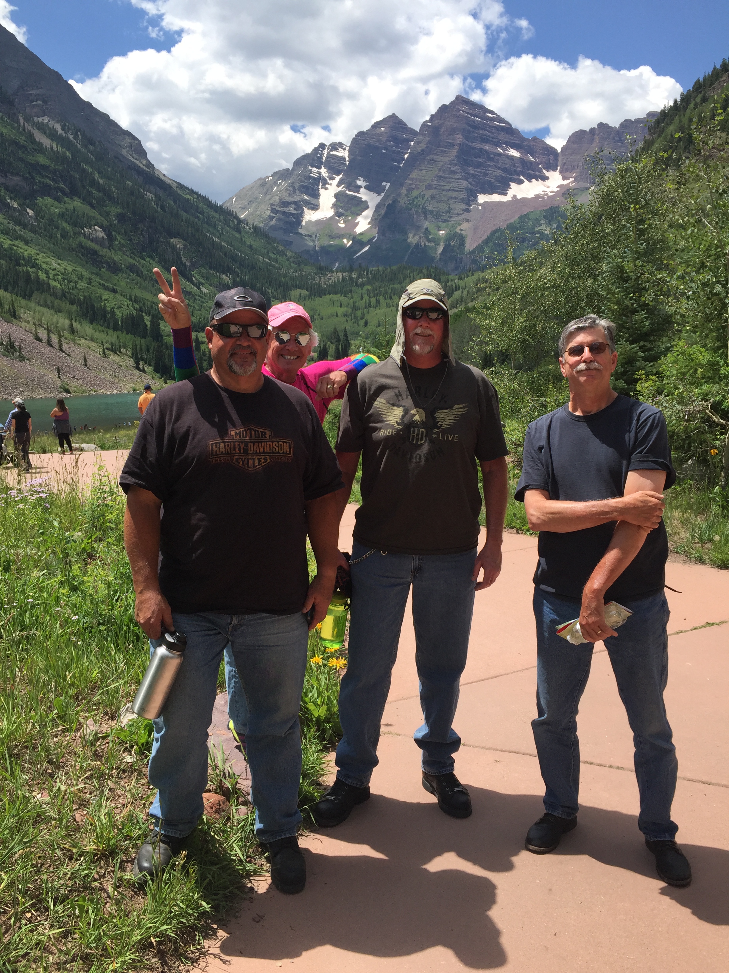
Randy, with Maroon Bells in the background.
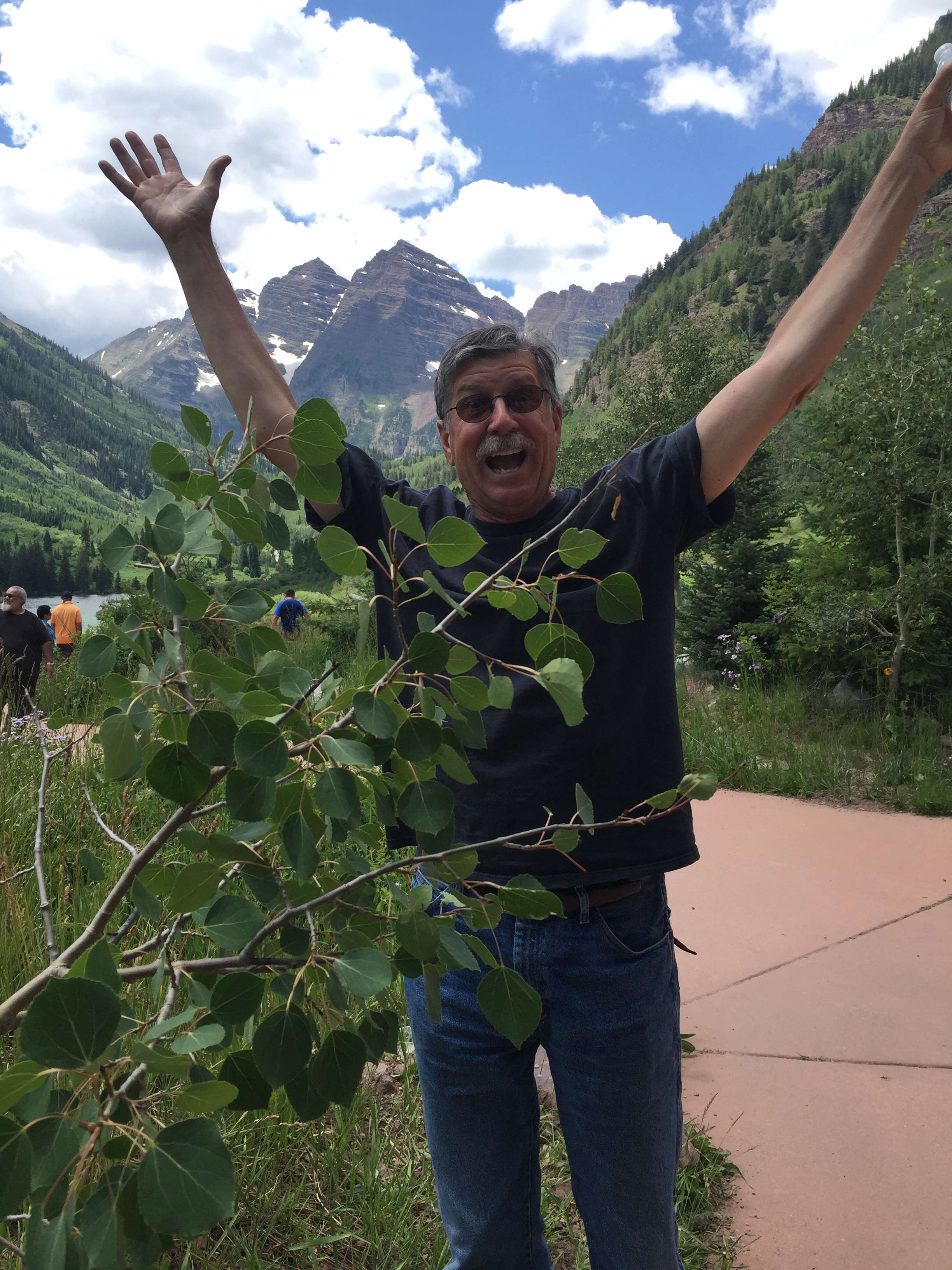
One last pic at Maroon Bells. (photo by a park ranger)
***
The Maroon Bells turnoff from Highway 82 is only a mile or so from Aspen, named for the abundance of aspen trees in the area. Aspen is a thriving ski area in the winter, and a summer destination for the rich and famous. Really rich, and really famous. Bank accounts with lots of zeros and commas. Front-page news in your grocery store tabloid rags.
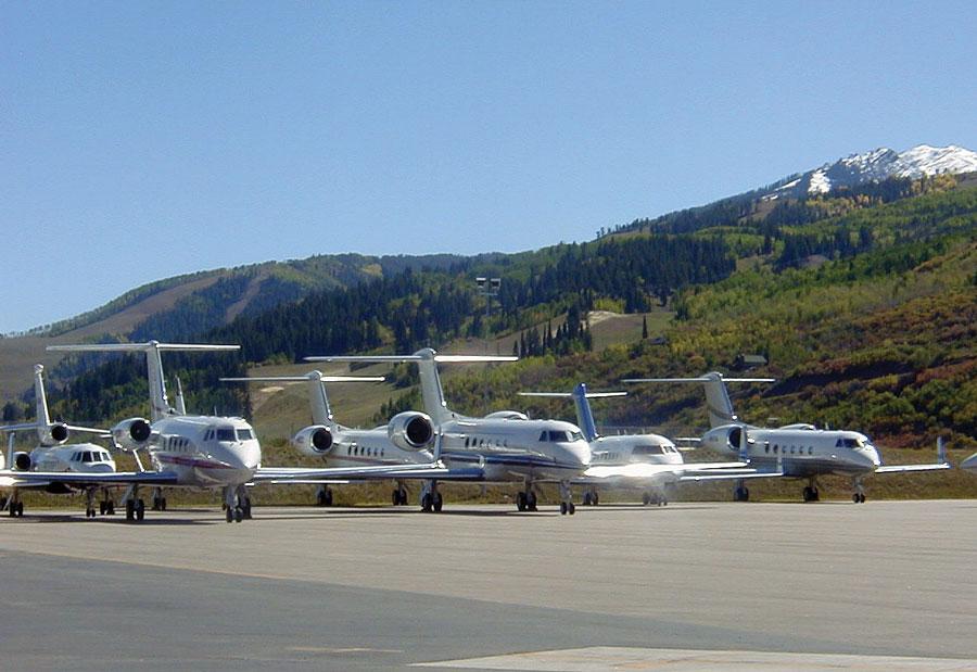
They fly in to the Aspen-Pitkin County Airport in their private jets, landing on the 8,000-foot runway. If you don’t own your own jet, this blog extends its sincerest condolences. The airport is also served by American Eagle, Delta Connection and United Express.
Private jets, play toys of the rich and famous, lined up at the Aspen airport.
Aspen is easy to get to, and very expensive to visit. It’s a pretty darn pricey place to live, too. Home sale prices in Aspen last year averaged $7.7 million. A penthouse condo sold for $16 million, or $5,247 per square foot. Ouch! And yet, inexplicably, the Aspen real estate market was down in 2016. Good time to buy?
Unable to afford much more than a burger and fries, we push on, continuing east on Highway 82. We’re on the “Top of the Rockies” Scenic Byway (Difficult!), which climbs at a six percent grade.
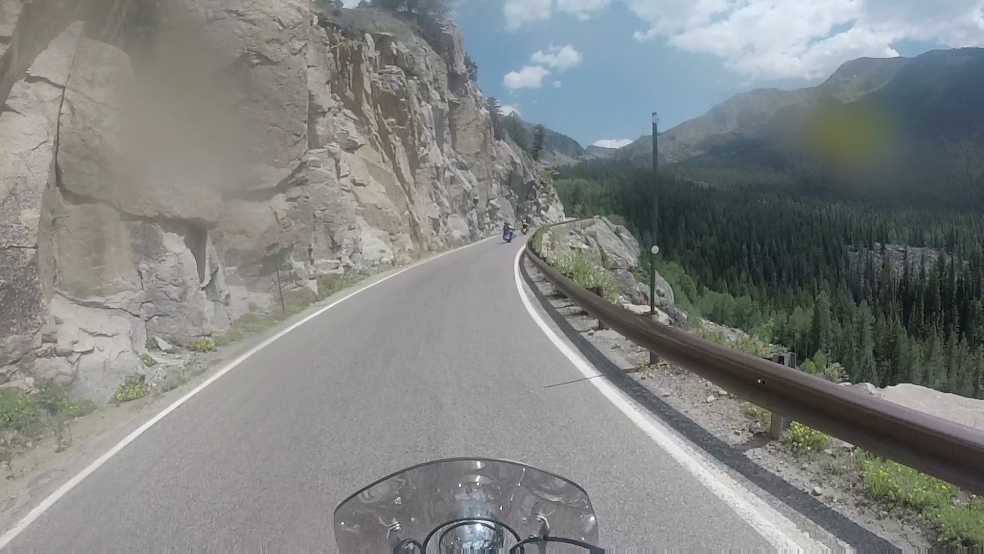
The road over Independence Pass gets quite narrow in places. Photo from Randy’s helmet-mounted GoPro camera. Note the bug splatter on the camera lens. Ick!
Twenty miles east of Aspen, we cross Independence Pass. At 12,095 feet, it’s the highest paved crossing of the Continental Divide. The pass is generally open from Memorial Day to November 1.
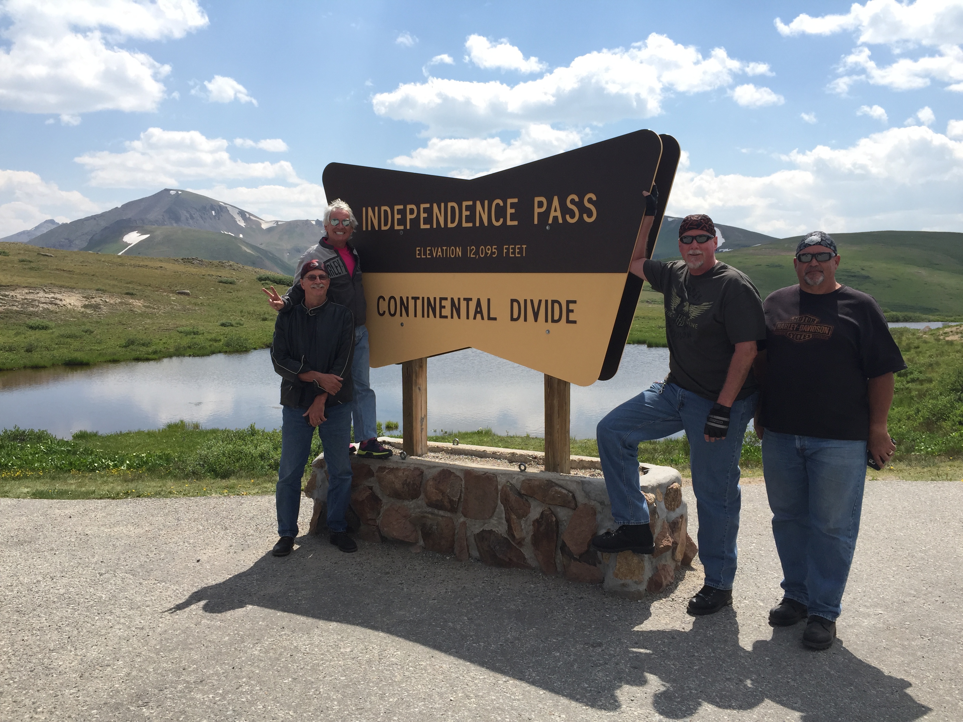
At Independence Pass, 12,095 feet.
The Continental Divide is a natural boundary line separating the watersheds of the Pacific Ocean from those of the Atlantic Ocean. Technically, a continental divide is a drainage divide on a continent where the drainage basin on one side of the divide feeds into one ocean or sea, and the basin on the other side feeds into a different ocean or sea.
The Continental Divide runs north-south from Alaska to Northwestern South America. In the continental US, it follows the crest of the Rocky Mountains. Thirteen paved mountain passes in Colorado cross the Continental Divide. Independence Pass is one of them.
Like many of the passes that cross the Continental Divide, it’s closed in the winter. But when Independence Pass reopens annually in late May, it’s a popular tourist destination. The pass gets its name from the village named Independence, which was established on July 4, 1879 as a gold mining boomtown. Independence is now just a ghost town four miles west of the pass.
In addition to marking the Continental Divide, Independence Pass is also the crest of the Sawatch Range, the Pitkin-Lake county line, and the boundary between the White River and San Isabel National Forests. And, a darn good place to pull over for photos from a spectacular vista point.
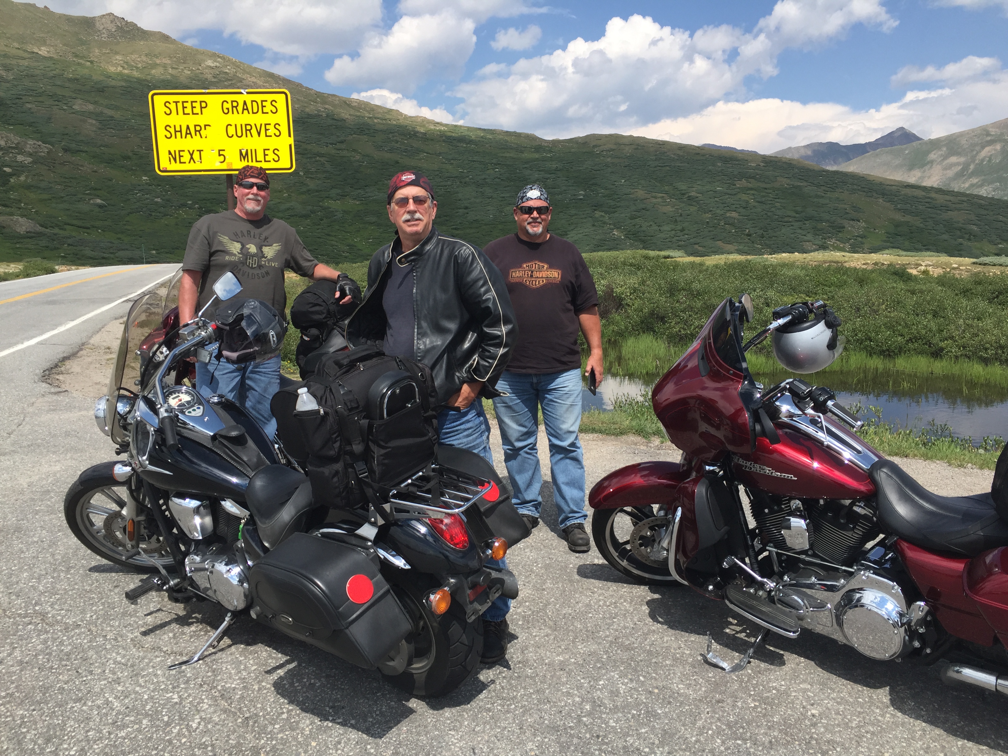
At Independence Pass. Steep grades, sharp curves. Yikes!
On a clear day, the Independence Pass scenic overlook offers views east to Mount Elbert, at 14,440 feet, Colorado’s highest peak. Mount Elbert is the second-highest mountain in the continental US (California’s 14,505-foot Mt. Whitney is the highest).
To the west, more 14ers stand out – including the Maroon Bells, Snowmass Mountain and Capitol Peak. At some point, you become almost numb to these elevations. Still, to put 14ers in perspective, Mount Elbert is just shy of half as high as Mount Everest.
I’m half as high as Dave (great segue), and here I moderate a conversation between Dave and Scott. (photo by Randy)
***
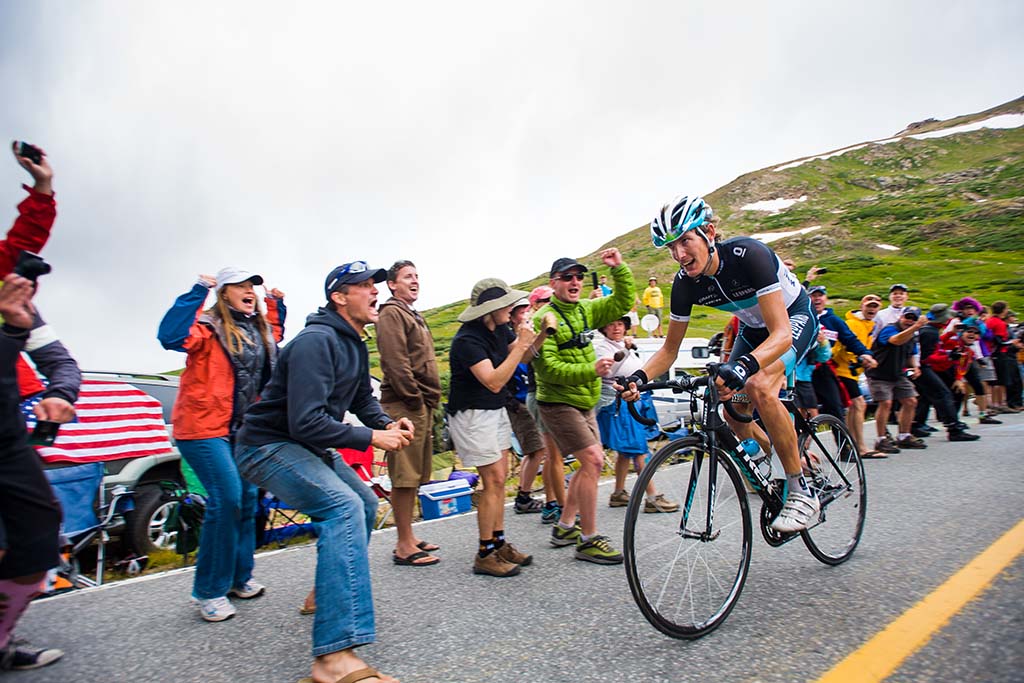
Since 2011, Independence Pass has been central to the route of the week-long USA Pro Cycling Challenge, held in late August. The bicycle race begins in Aspen and finishes in the streets of downtown Denver. Well, it did, anyway.
Pro cyclist Andy Schleck of Luxembourg approaches the top of Independence Pass (12,095 feet) during the now-defunct USA Pro Cycling Challenge. A month earlier, in July 2011, he finished second in the biggest bike race of all, the Tour de France.
There was no race in 2016, due to sponsorship issues, and race organizers cancelled the 2017 race as well, unable to find sufficient funding following the departure of key investors.
The race had been kept financially afloat by the founders of the Quiznos and Smashburger restaurant chains. But after losing an estimated $20 Million over the first five years, the backers decided to pull the plug. Sadly, with the demise of the 2017 race, the Pro Cycling Challenge is effectively dead. In its heyday, winners included American cyclists Tejay van Garderen, Levi Leipheimer and Christian Vande Velde.
***
We leave Independence Pass, and begin our descent toward Twin Lakes, 17 miles east of the pass. We drop 3,000 feet, before arriving in Twin Lakes, 9,200 feet high in the San Isabel National Forest. Twin Lakes is beautiful, but sparse. It has a population of less than 200. If you don’t eat at the Twin Lakes Inn, you’re not going to eat at all.
Just past Twin Lakes, we turn north on US Highway 24 and 30 minutes later, arrive in the historic town of Leadville. At 10,152 feet, Leadville is the highest incorporated city in the US. It’s a former silver mining town, whose population was nearly 30,000 at the height of the mining boom. Today, the population is closer to 2,700.
Leadville is credited with producing 240 million troy ounces of silver and nearly three million troy ounces of gold. For the curious among you: a troy ounce is a unit of measure used to denote the value of a precious metal; it’s about 10 percent heavier than the “avoirdupois” ounce, which you use for everyday purposes. So, an ounce of gold weighs 2.759537 grams more than an ounce of sugar. Got it?
If you’re into all things troy, you can visit Leadville’s National Mining Museum and Hall of Fame, which opened in 1987. Or, you can enjoy Leadville’s 70 square blocks of Victorian architecture, which are designed a National Historic Landmark District.
In the early 1980s, Leadville had the highest unemployment rate in the US. That’s when marathon runner Ken Chlouber dreamed of a way to restore vitality to the city. His solution: the inaugural Leadville Trail 100 run in 1983.
The Leadville Trail 100 Run is now in its 35th year. Sometimes called the “Race Across the Sky,” it’s a 100-mile ultramarathon with elevations ranging between 9,200 and 12,620 feet. In most years, fewer than half the starters complete the race within the 30-hour time limit. The course record is 15 hours and 42 minutes, set by Matt Carpenter in 2005.
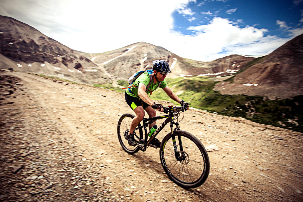
Biking the Leadville 100. Are your quads burning?
Readers of this blog who hate running but enjoy mountain biking can try the Leadville 100 mountain bike race, held the same weekend on a course that roughly parallels the running route. This year, both events will be held on August 19 and 20.
Good luck.
***
In Leadville, we turn north on Colorado Highway 91. A few miles east of Leadville along Highway 91 are a slew of 14ers: Mount. Sherman (14,036 feet), Mount Democrat (14,154), Mount Cameron (14,238 feet), Mount Lincoln (14,286 feet), Mount Bross (14,172 feet) and Quandary Peak (14,265).
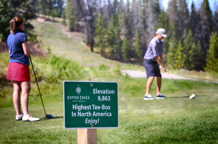
Twenty four miles past Leadville is the Copper Mountain Ski Area, the US Ski Team downhill training venue. Copper Mountain has 22 lifts, 140 runs, 2,465 skiable acres – and was featured in the 1994 movie, Dumb and Dumber.
Copper Mountain, high-altitude golf in the summer.
As we ride north on Highway 91, Copper Mountain is on our left, and to our right is the Breckenridge Ski Resort. Breckenridge is owned by Vail Resorts, which also operates Vail, Beaver Creek, Arapahoe Basin and Keystone in Colorado – Park City in Utah, Whistler/Blackcomb in British Columbia, Stowe in Vermont and three California Lake Tahoe resorts – Heavenly, Kirkwood and Northstar.
You can ski all those areas on a single Vail Resorts “Epic Pass,” which will set you back $859 for the 2017 / 2018 ski season. The Epic Pass also includes access to major European ski resorts, including Val d’Isere (where Sarah and I skied on our honeymoon) and Les Trois Vallees in France, Skirama Dolomiti Adamello Brenta in Italy, Verbier in Switzerland, and Arlberg in Austria. Air fare not included.
Copper Mountain, seemingly one of the few remaining ski areas on the planet not owned by Vail Resorts, is conveniently located at the junction of Highway 91 and Interstate 70. OK, well, there are other ski areas not in the Vail Resorts stable – among them Aspen, and Sunlight Mountain, which is exactly 18.2 miles from our front door in Carbondale. If only we had a front door.
***
We hop on I-70 for the 10-mile ride to Silverthorne, tonight’s destination. Silverthorne sits at 9,035 feet, not far from the Dillon Reservoir, which provides 40 percent of Denver’s fresh water supply.
We navigate to our motel, park the bikes, and settle in to our evening routine: a cold beer (diet coke for me), a hot shower, a tasty dinner, and a good night’s sleep.
***
Day Five Summary: Two hundred seven miles, two more scenic byways (Difficult!), coal country in decline, Mad Dogs and Englishmen, and crossing the Continental Divide.
Click here to see today’s complete route from Hotchkiss to Silverthorne.
We’re on our way to Sturgis!
Vroom, vroom.
***
Today in Bucket List History:
Bucket List Goal: “Leave Town and Don’t Tell Your Anyone Where You’re Going.”
Goal Achieved: On August 1, 1958, the US atomic sub “Nautilus” makes the first undersea voyage to the geographic North Pole. The Nautilus dived at Point Barrow, Alaska, and traveled nearly 1,000 miles under the Arctic ice cap to the North Pole.