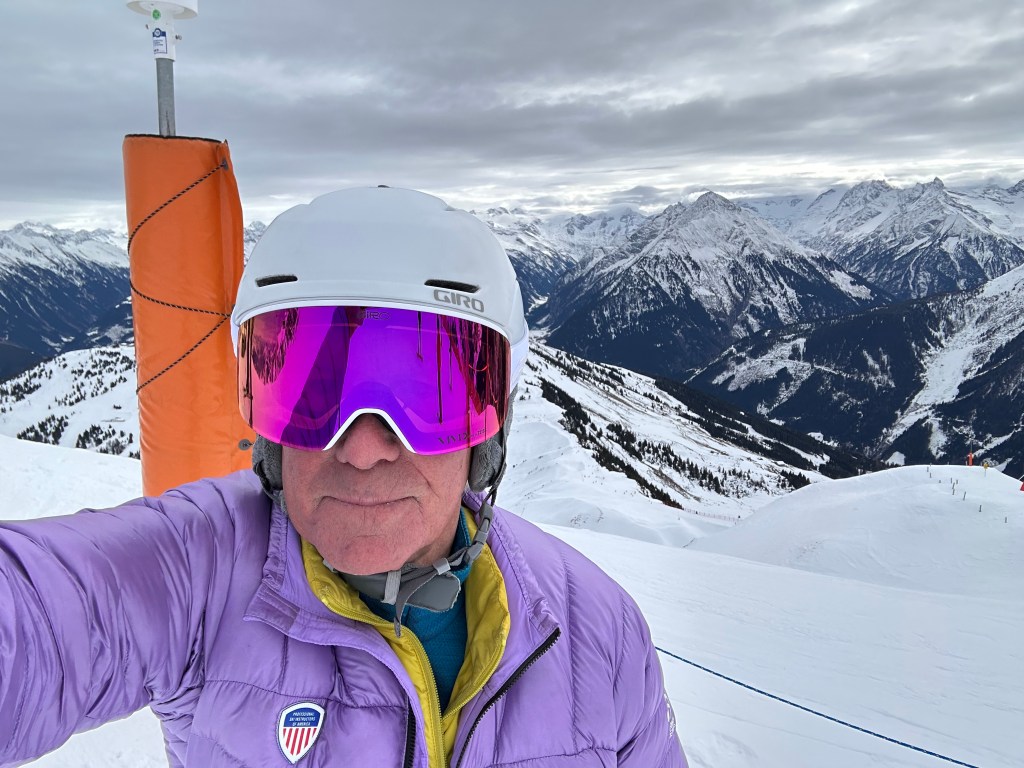
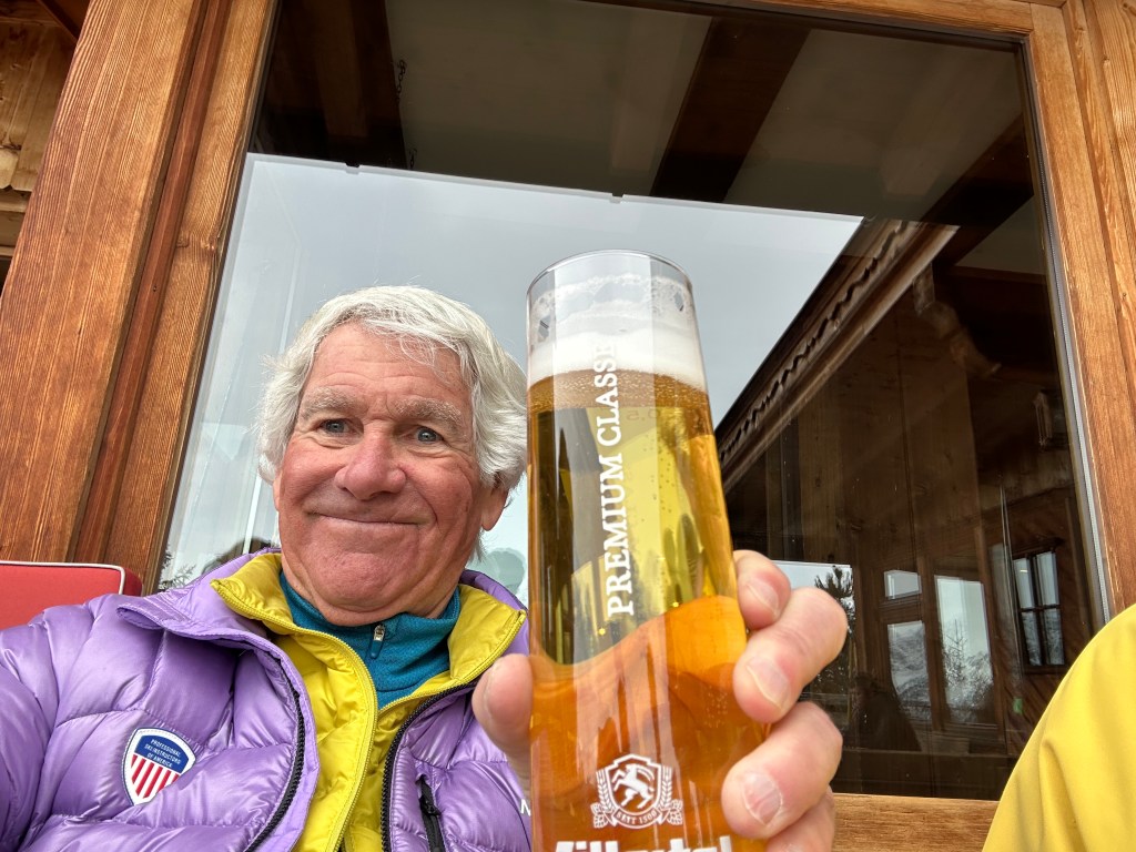
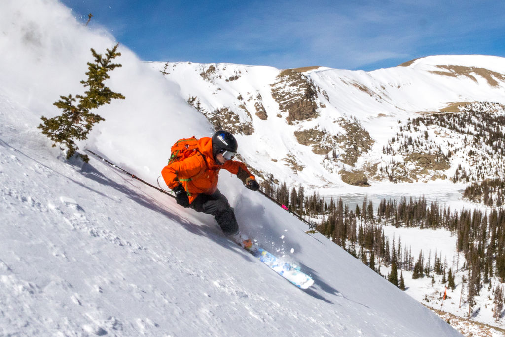
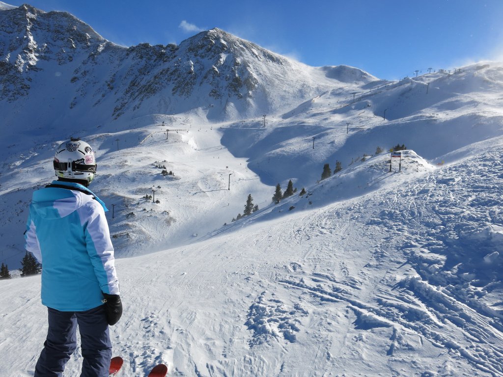
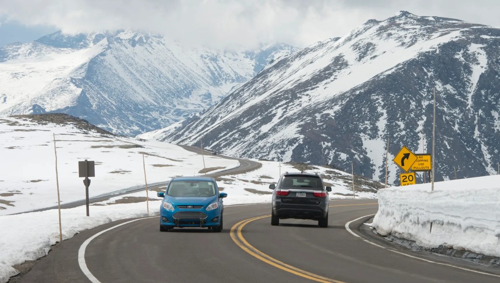
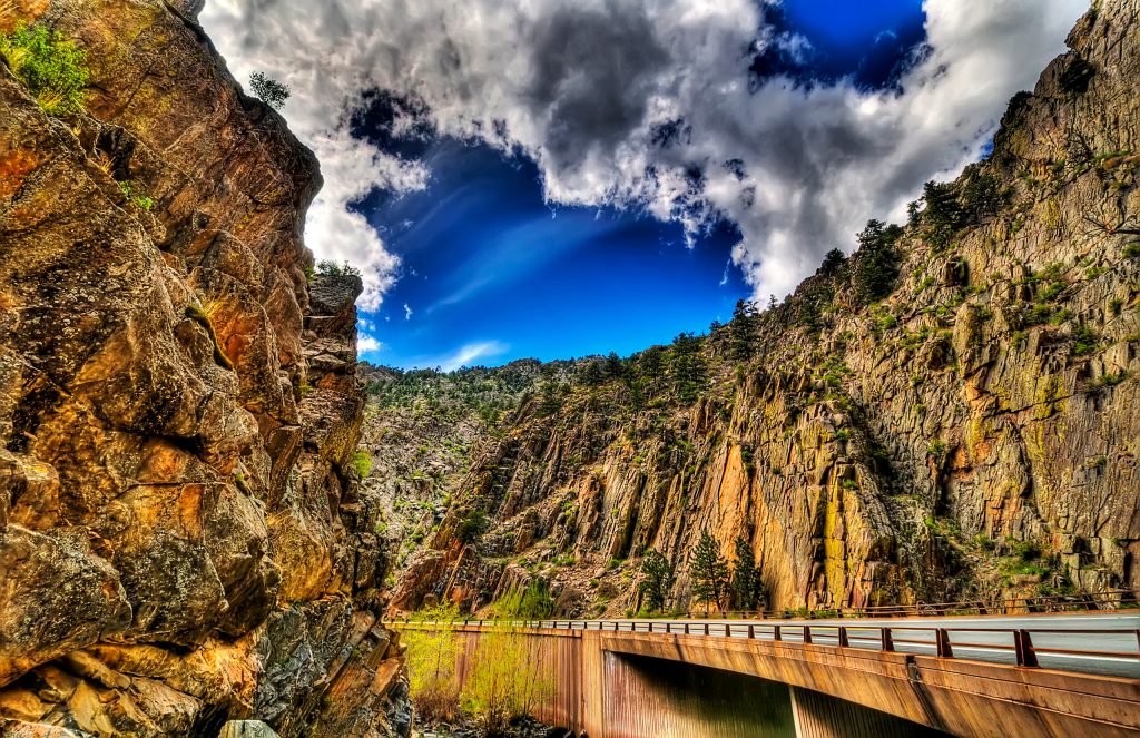
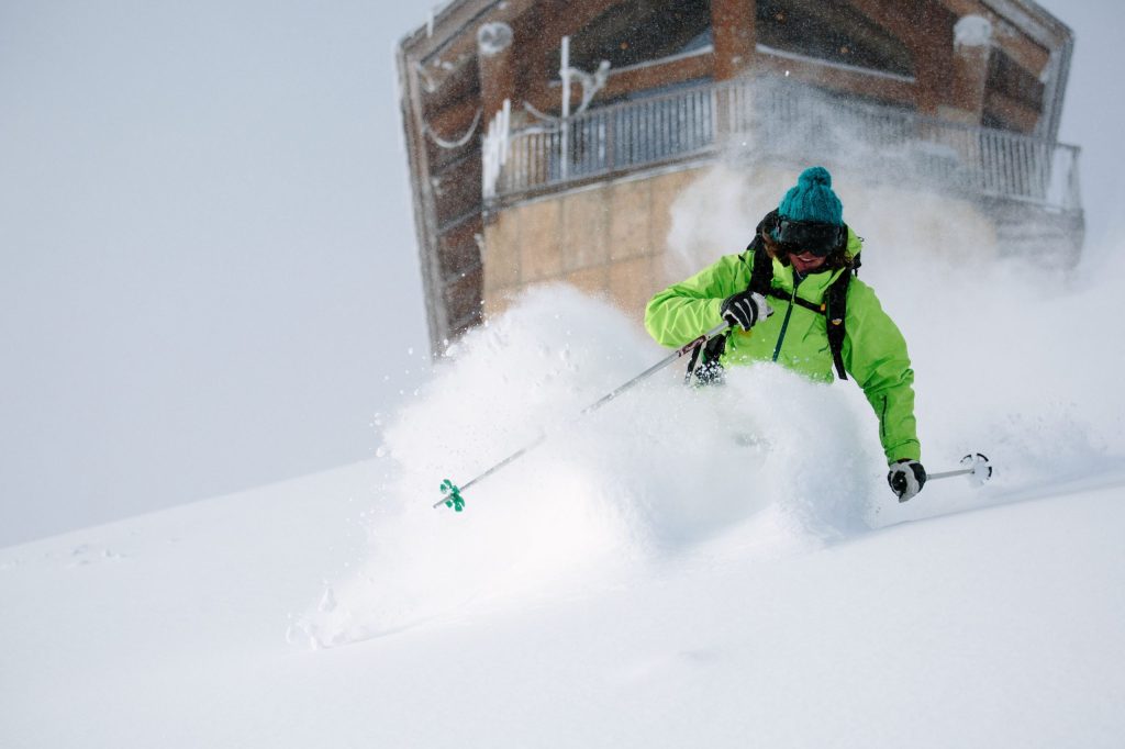
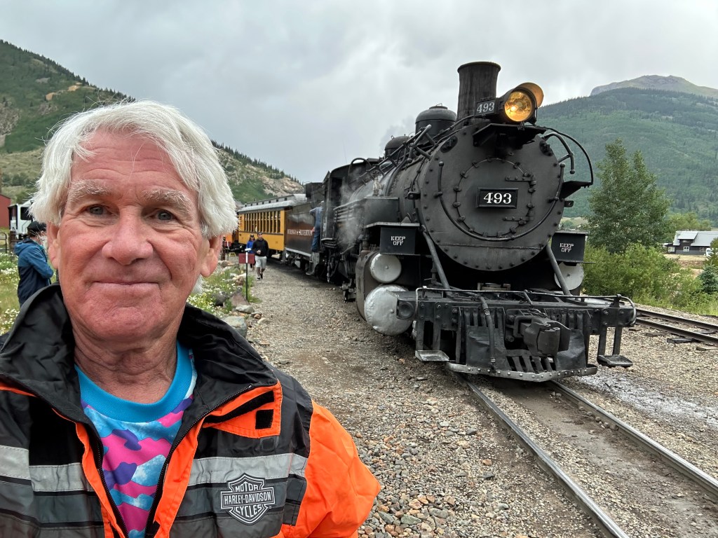
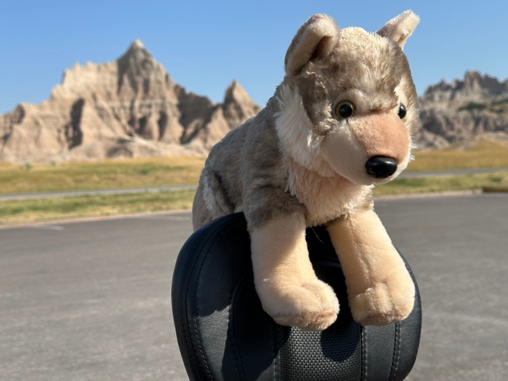
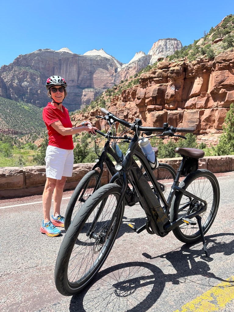
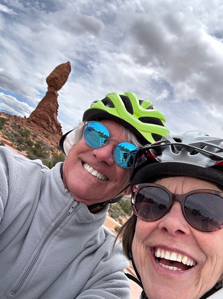
I’m on the famed Hintertux glacier (gletcher), 3,250 meters high in Zillertal, Austria.
It’s a blindingly sunny day. The snow is perfect. I wait patiently in line at the bottom of the long T-bar ride.
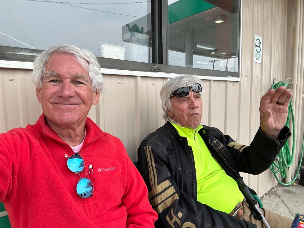
Hans is the liftie. He’s a large Austrian right out of central casting, orchestrating the loading from two converging queues.
“Achtung!” he bellows, followed by a lengthy blast of German only the homies could understood.
“Achtung!” gets my attention, which is the whole point of the word, isn’t it?
And I safely board the T-bar. Thanks, Hans.
The Tyrolean Alps stretch for as far as the eye can see.
The word, derived from the German verb achten (to pay attention to), was used in U2’s 1991 album “Achtung Baby.” That usage has given Achtung significant street creed for the past 35 years.
Does anyone out there remember Hogan’s Heroes, a blast from the TV past in the 1960s? Sergeant Hans Schultz, played by Austrian-born actor John Banner, is the lovable, bumbling Luftwaffe guard.
He used “Achtung” as a command for the American POWs to snap to attention.
Achtung, Baby!
***
And So it Begins
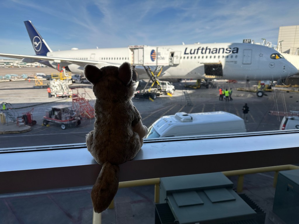
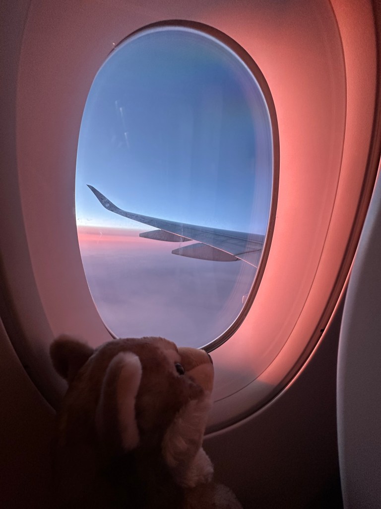
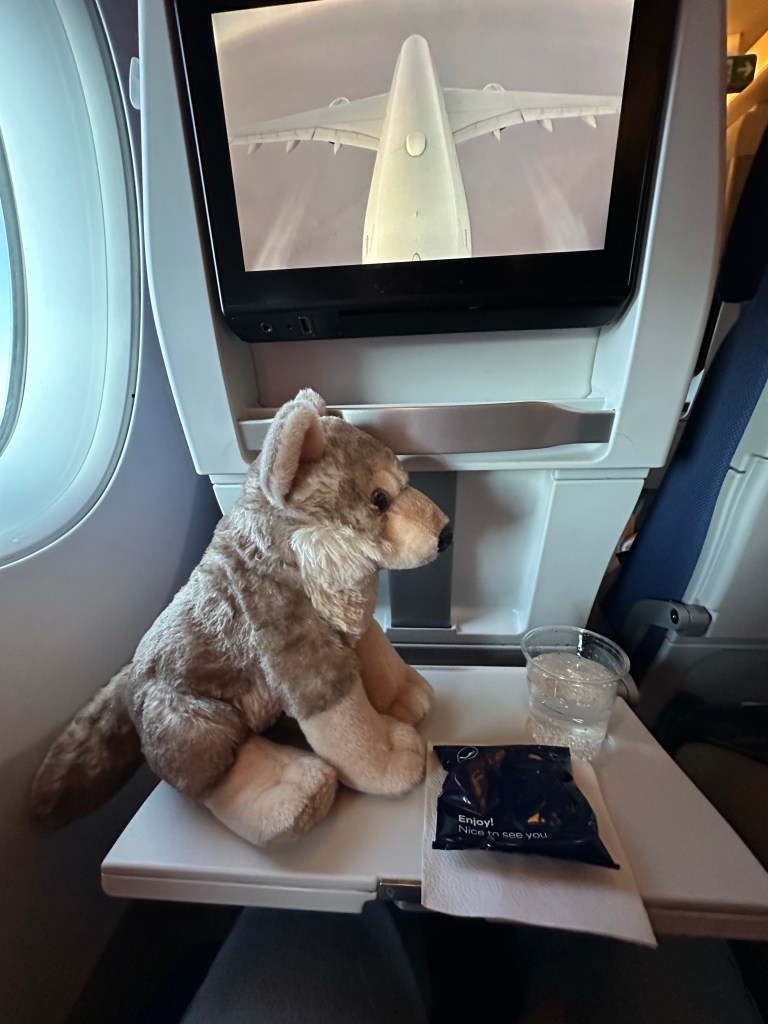
Walter Jr watches as the catering truck loads our soon-to-be departing airplane.
My journey gets underway on Feb. 4 at Denver International Airport, where Walter Jr and I board a Lufthansa non-stop flight to Munich.
While he has extensive passenger experience on Harleys, it’s his first time on an airplane. Walter Jr loves every moment, even though we are on an Airbus A350-900.
Blog note: I worked for 20 years at Boeing, Airbus’ only competitor. Airbus was the evil enemy for a time😆.
Hey, it’s a duopoly. We’ll figure out a way to co-exist.
Walter Jr doesn’t care what equipment he’s flying on, or who assembled it. He’s indifferent to who’s piloting the airplane (although screw you, Lufthansa flight crew, as you’ll learn later in this post).
Walter Jr just wants to be on his way to Europe.
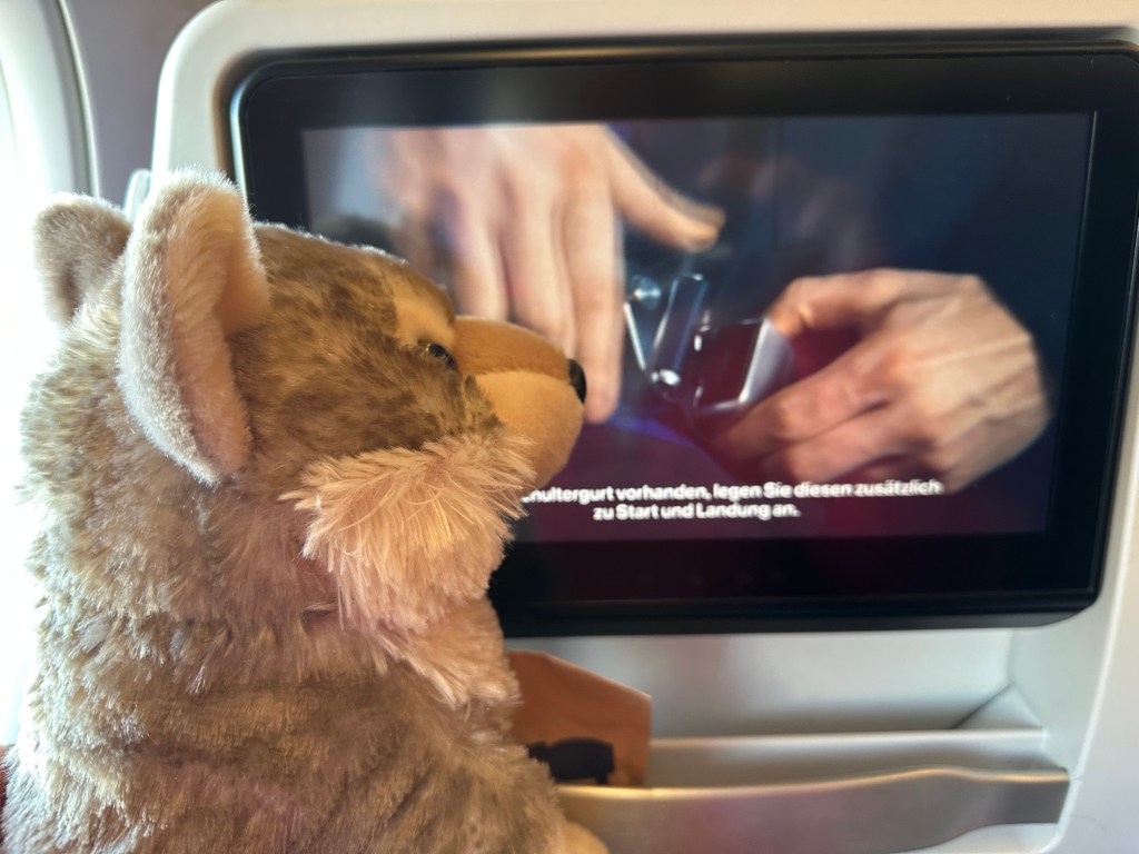
Walter Jr pays close attention to the on-board safety announcements.
The nine hour and 35 minute flight encounters headwinds that even a twin-aisle jet can’t overcome. We’ll eventually arrive 25 minutes late. In all, 10 hours in the air.
Walter Jr is oblivious to details like that. He’s simply in awe of the marvel that is modern air travel.
OK, you may wonder, how did this Austrian ski adventure come about?
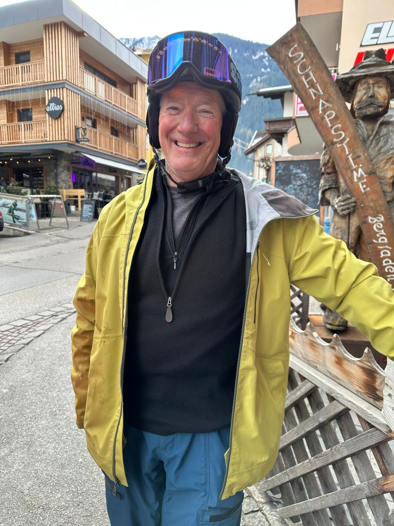
John looks right at home in downtown Mayrhofen.
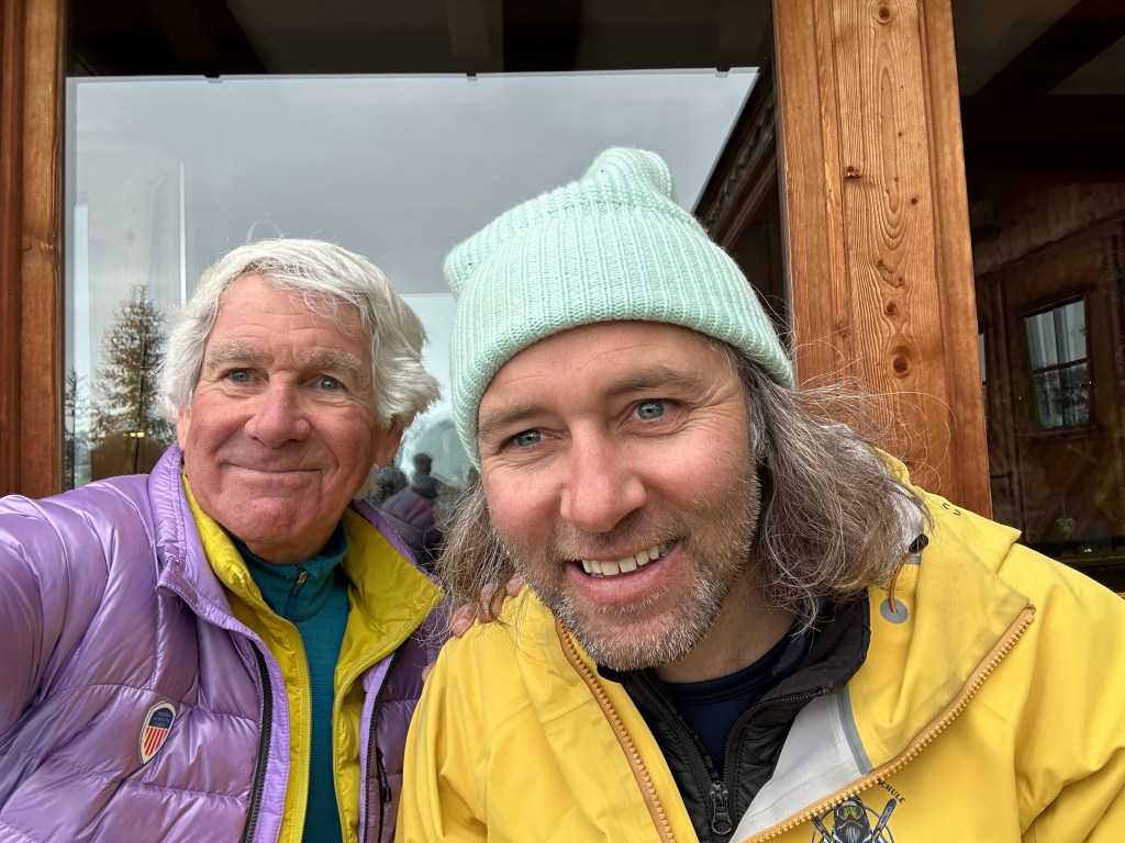
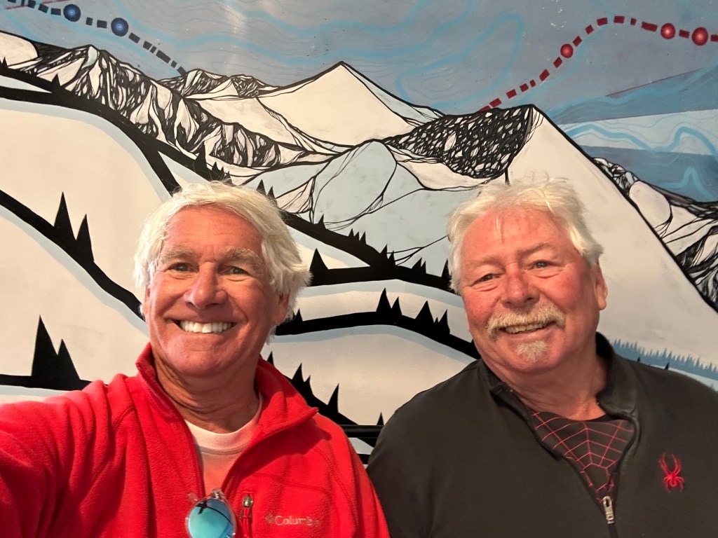
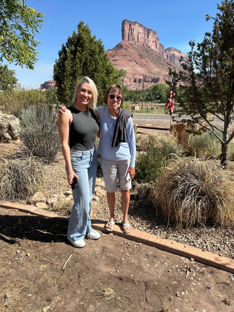
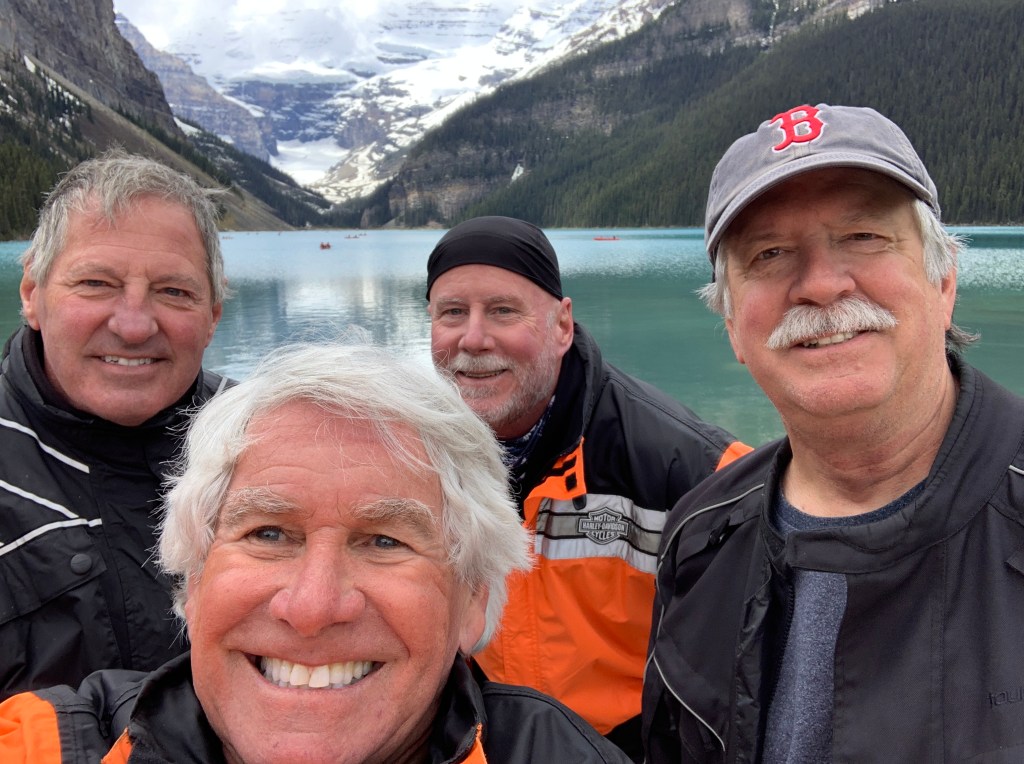
My friend and neighbor, John Lund, is a retired attorney from Salt Lake City. He now lives in Carbondale, just down the street from me. John’s been doing these European ski trips for the past five years with his lawyer pals from Utah.
Last fall, he invited me along for the 2026 edition. Sure, John musta mused, let’s see if the old guy has anything left in the tank 🤪
With Sarah’s encouragement and blessing, it took about five minutes to say yes.
Until this week, my last European ski trip was 25 years ago, a journey to Meribel, part of France’s ginormous Les Trois Vallees. With 183 lifts, it’s the largest connected ski area in the world.
The place claims to have 370 miles of ski runs, and it holds special memories for me as the first place I skied outside of North America (1991).
Je ski, donc je suis. (I ski, therefore I am.)
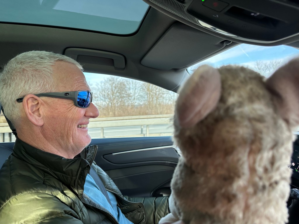
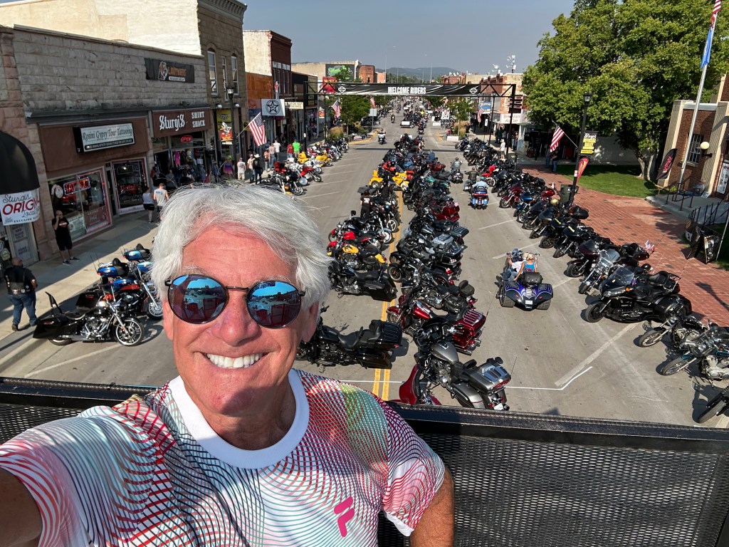
On the road to the Zillertal Alps. Walter Jr keeps a watchful eye on John’s driving.
We’re now on the German Autobahn in a rented Audi A6 wagon, headed for Zillertal, in the Tyrolean Alps. The ski area is almost as freakishly large as Les Trois Vallees, but here the mother tongue is German, not French.
***
About Zillertal
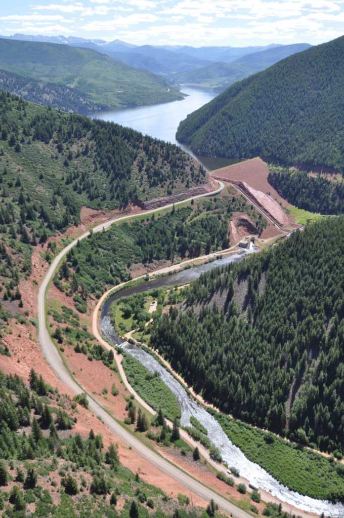
The Ziller River runs through Mayrhofen, where we’ll stay for the next week.
I would call it the Zillertal Valley, but that usage is incorrect. Followers of this blog know I hate imprecise language.
In German, tal means valley. So, Zillertal means Ziller valley.
“Zillertal Valley “ is unnecessarily redundant. There you go, word meisters.
Walter Jr, checking out the street life in downtown Mayrhofen.
Mayrhofen is the main city in Zillertal.
The name Mayrhofen originates from German, combining Mayer (steward, bailiff, or farm manager) and hof (court, farm, or estate). It refers to a “steward’s farm” or a settlement associated with an agricultural administrator, reflecting the region’s historical agrarian roots.
***
Send It!
On the road to the Ziller valley.
We arrive in Mayrhofen after a two and a-half hour drive from Munich.
We’re staying at the Hotel Pramstaller, elegant lodging considerably nicer than anything I ever experience on Harley trips.
The next morning (Feb. 6), we begin the first of six skiing days. I purchase a Zillertal Superski pass (384 euros 💶 for six days) — roughly $450 US Dollars. For 180 lifts!
That’s about the cost of two days of skiing at my home mountain, Snowmass, Colorado. The superski pass gets you all the buses and public transport in the valley, which we’ll use quite a lot. And the most stunning views imaginable.
Here’s how the Zillertal marketing people describe it.
“With 142 perfectly groomed kilometres of slopes, 61 state-of-the-art lifts, and 89% of skiable terrain above 1,700 metres across the entire area on average. Thanks to cutting-edge snowmaking technology, perfect conditions from December to April are our promise to you. You’ll find a ski area that leaves nothing to be desired. Ahorn, Penken, Finkenberg, Rastkogel and Eggalm together form a diverse network of slopes that beginners, leisure skiers and seasoned pros will all enjoy in equal measure.”
Well, that’s marketing crap. I should know. I worked in PR.
The “perfect” conditions left a lot to be desired. Not exactly their fault, to be sure.
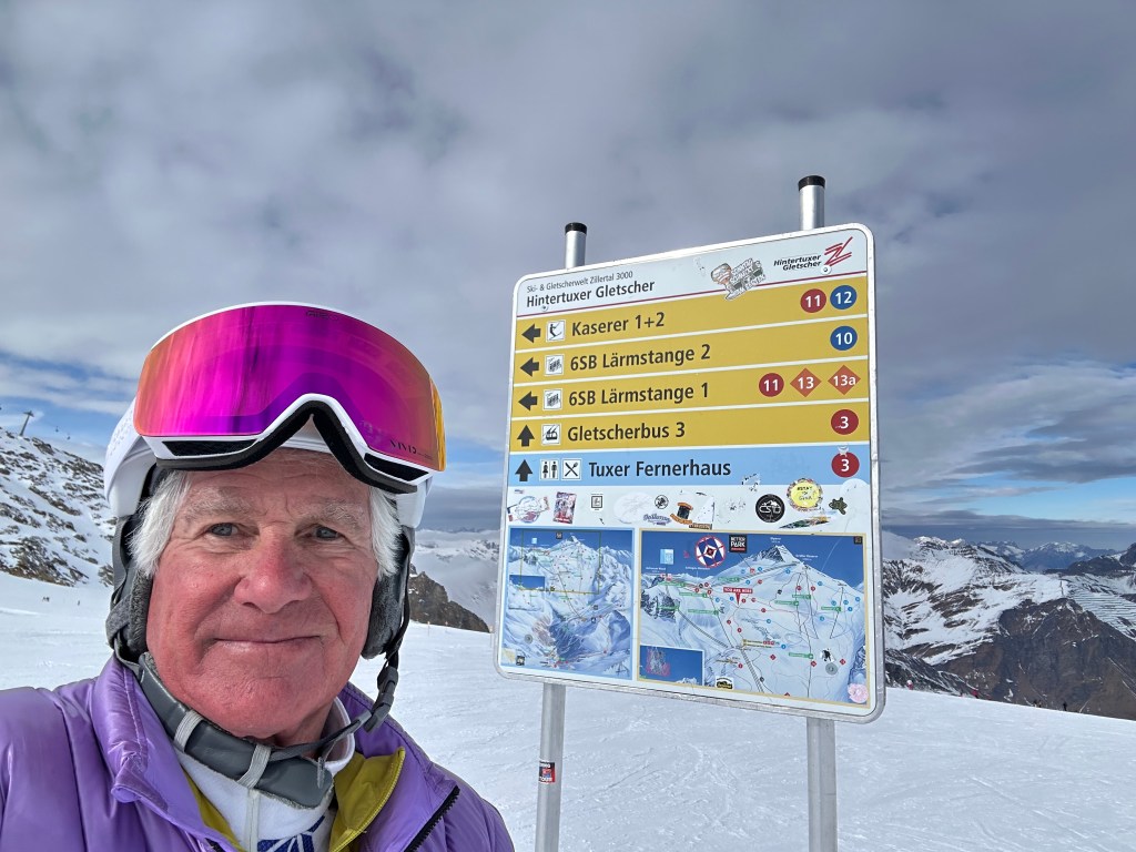
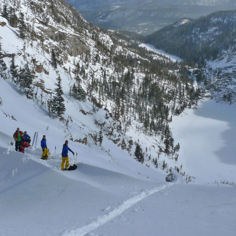
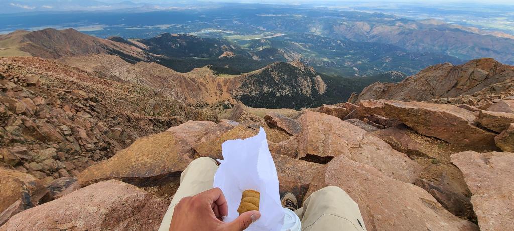
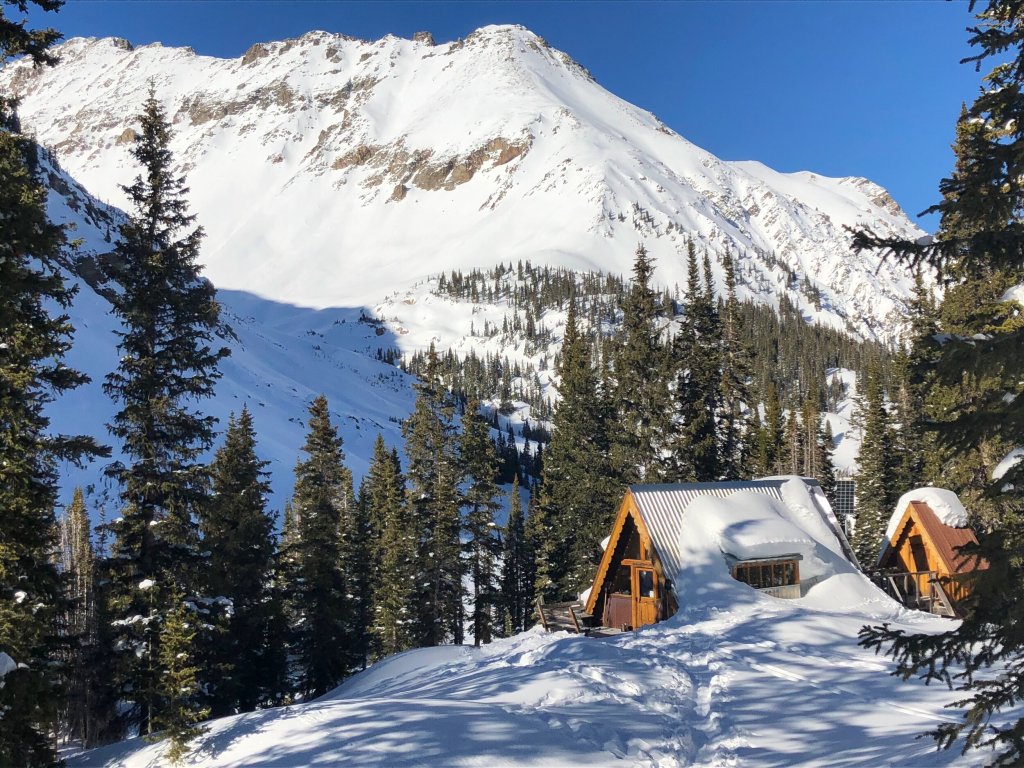
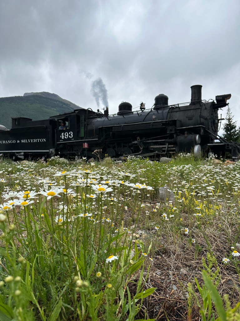
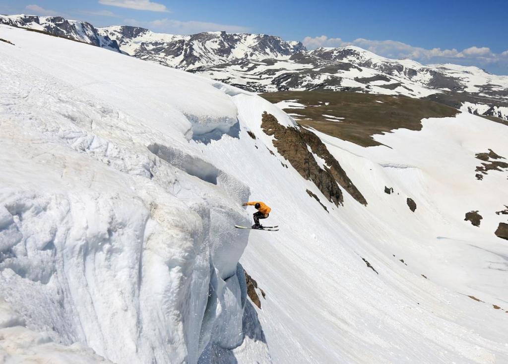
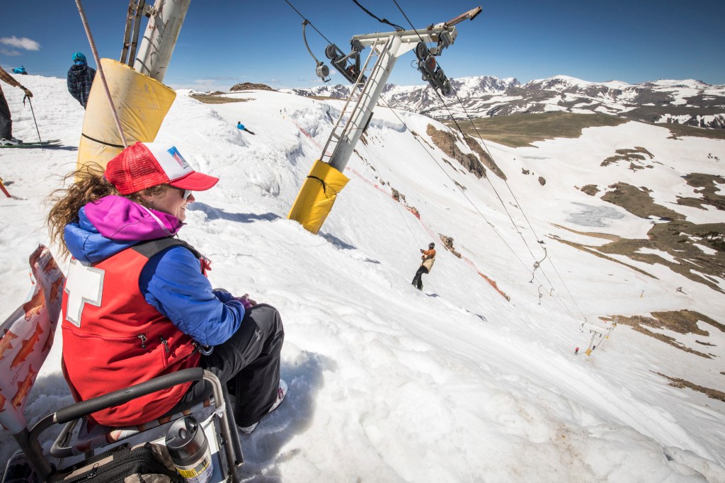
After a few weeks without snow ❄️, the conditions were ice-rinky. Fortunately, the gletcher saved the day for us, because the runs in that area generally avoided the freeze/thaw cycle prevalent in the rest of the valley.
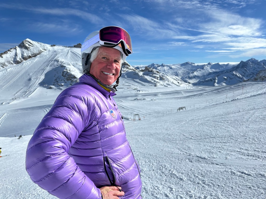
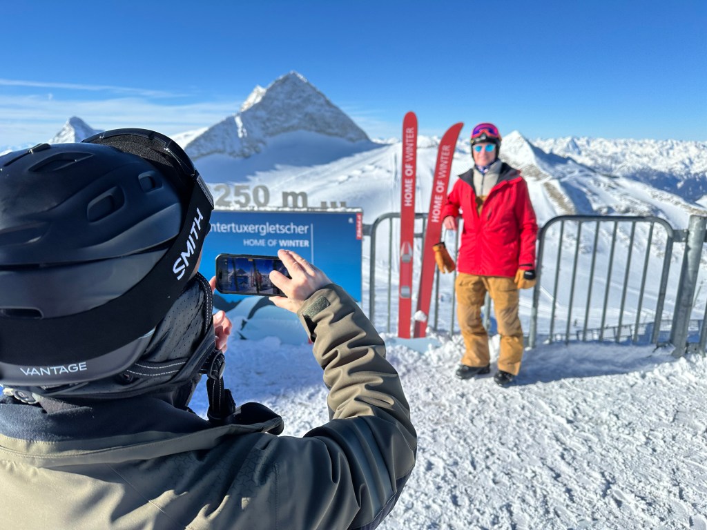
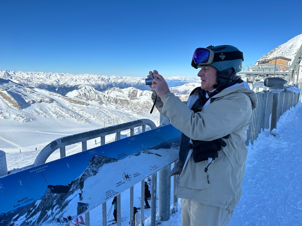
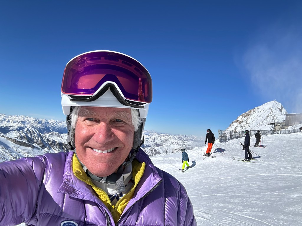
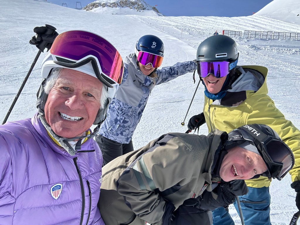
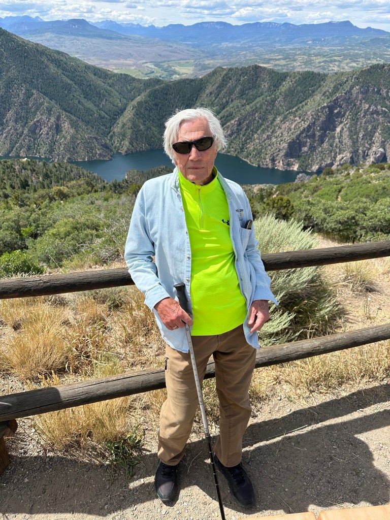
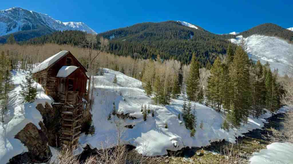
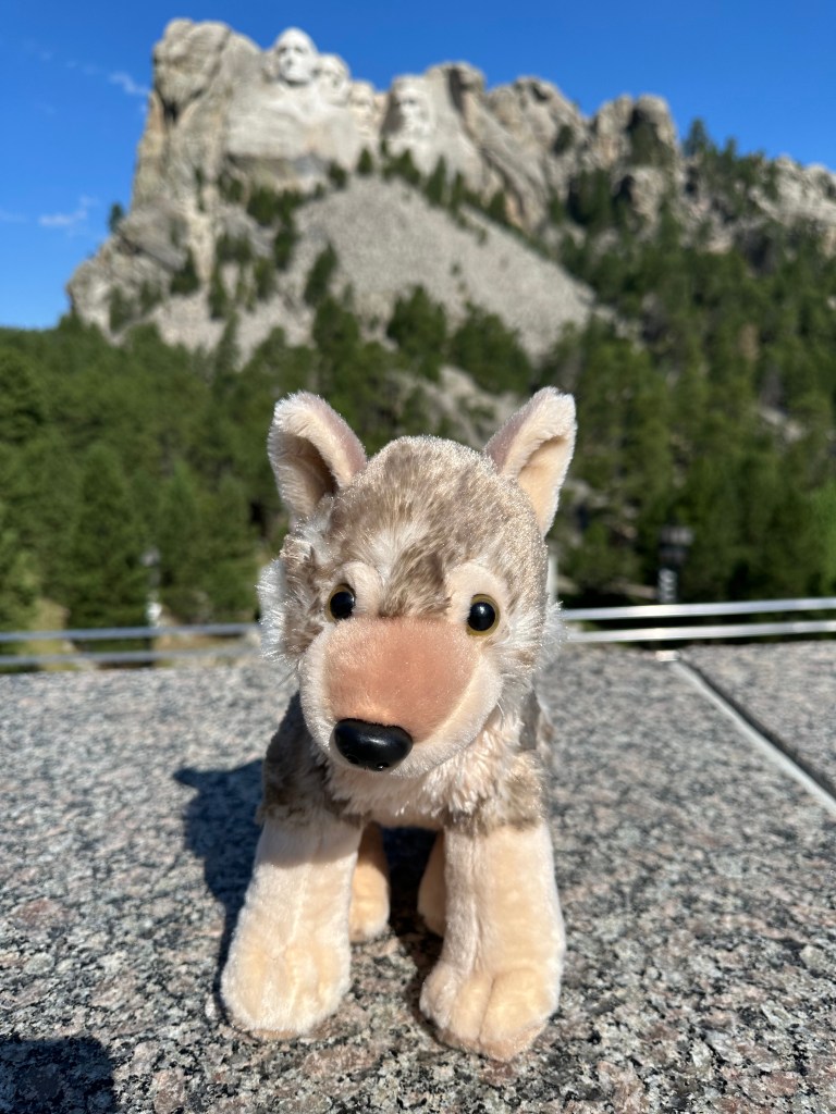
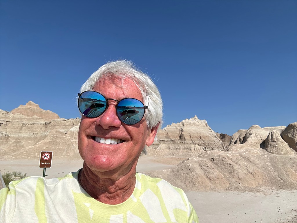
Joel snaps a pic of Tom at the top of the glacier, 3250 metres high (10,663 feet).
One run we did not ski is Harakiri, on Mount Penken. At this point in today’s blog post, I’d love to show you John casually wedeling down the run. But my Carbondale friend is a little too smart for that.
The Harakiri is the most demanding slope in Zillertal. With a gradient of up to 78 percent, it’s for experts only. We watched some non-experts try it. It was quite hilarious to see them sideslipping down an almost vertical sheet of ice.
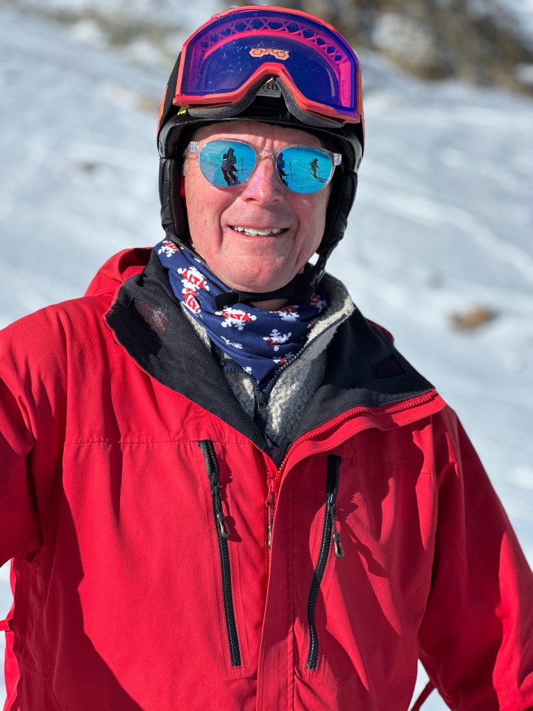
Nothing hilarious about this. Looking good, Tom.
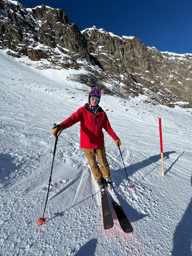
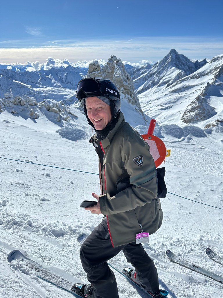
John seems to be enjoying himself. The alpine air is good for the soul.
On the glacier. No idea what the sign says.
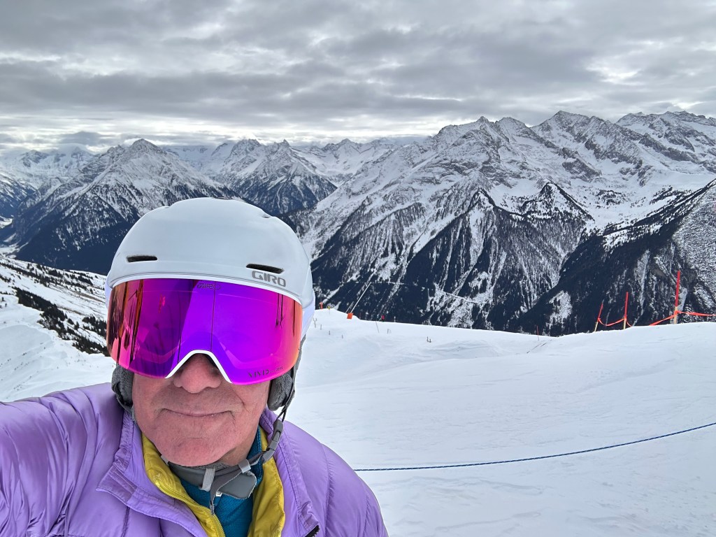
A blast of red.
Nice jacket. Purple must be the in color.
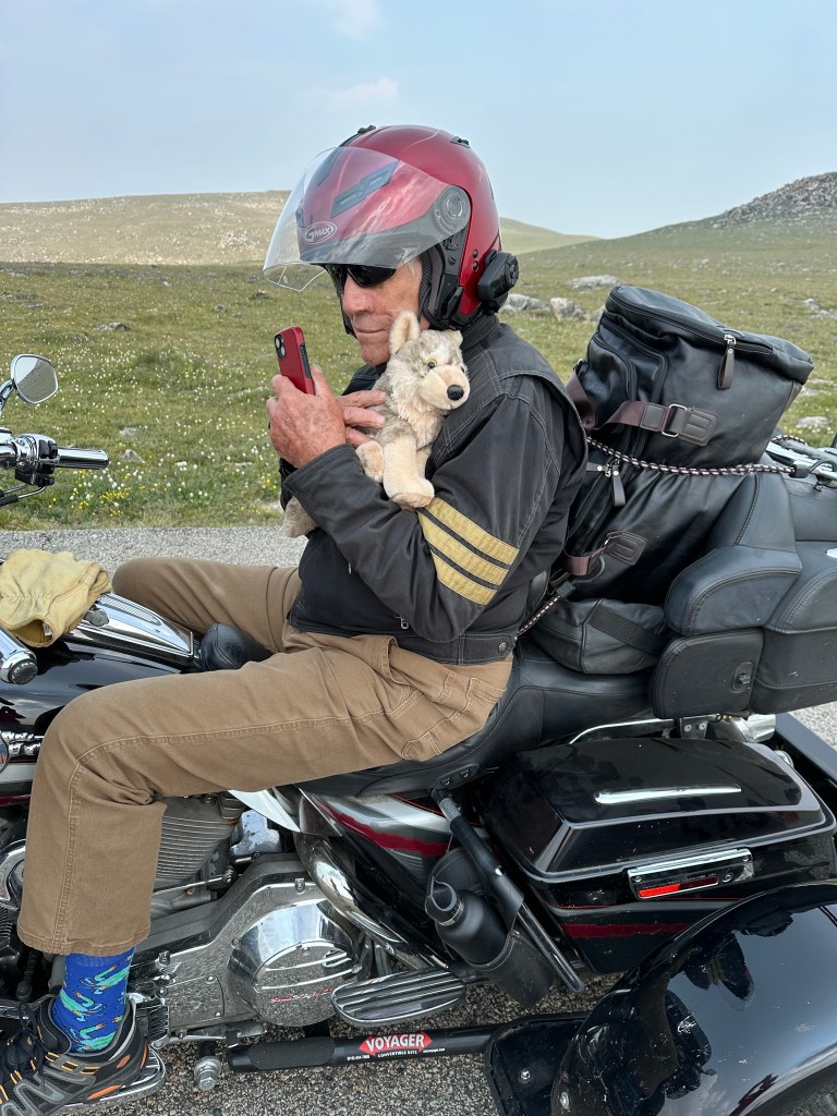
Put on your gloves, zip up your jacket, put your phone away, and saddle up, Joel.
***
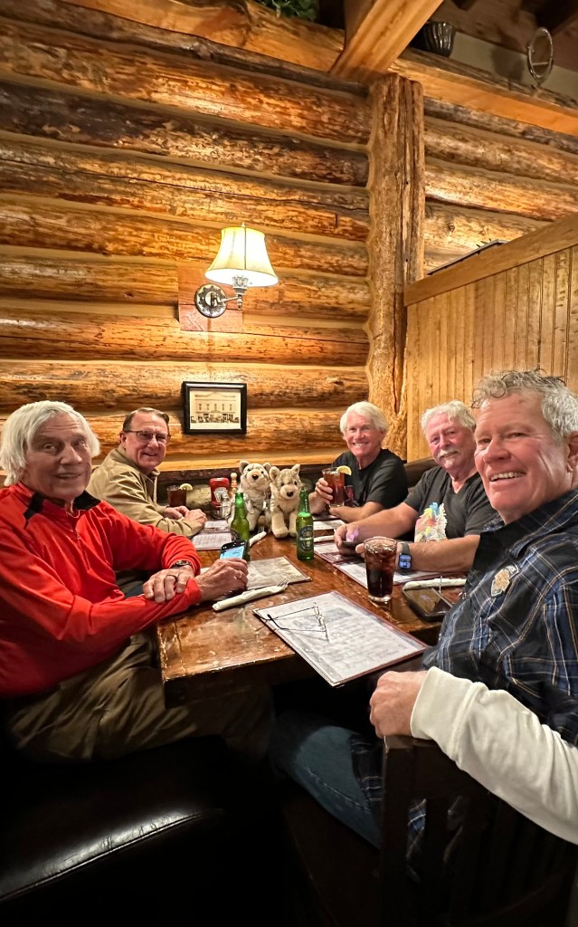
The Crew
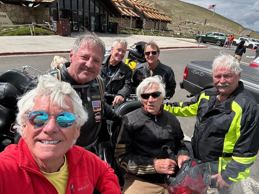
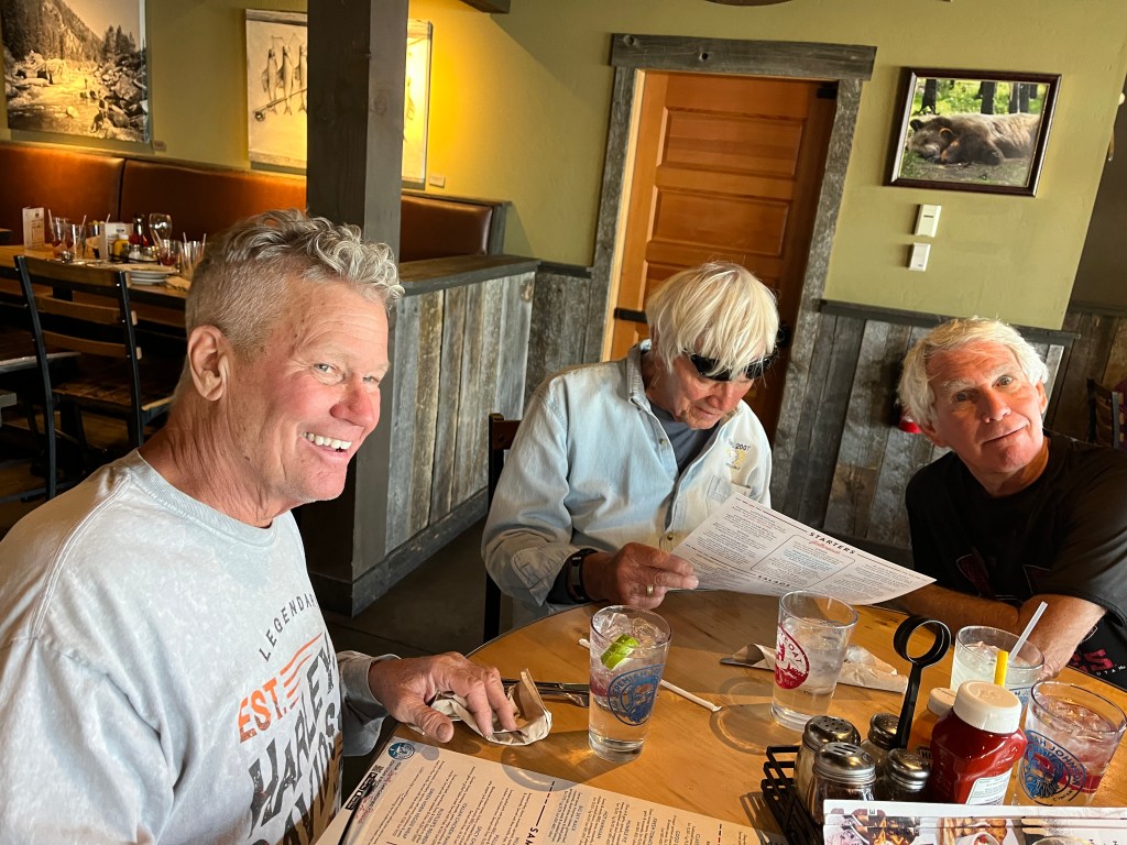
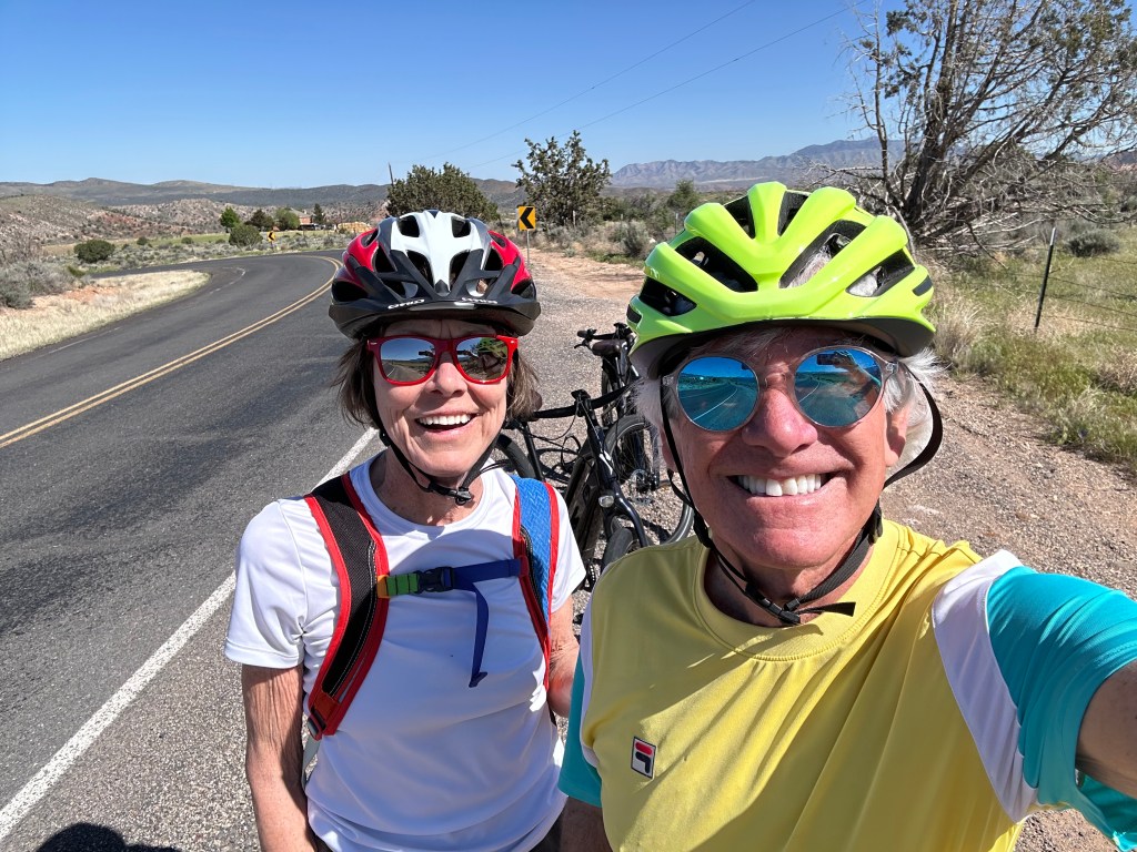
There are 11 of us on this trip, including Walter Jr (how can you not include him?).
Five came from Colorado’s Roaring Fork Valley, the rest from Salt Lake City.
I felt an immediate affinity for the Utah gang, as I spent seven years there — attending the University of Utah (Go Utes!), and working at the Salt Lake Tribune for two years.
Here’s who’s who on the crew:
John. Without my connection to John, I wouldn’t be writing this, because I’d likely be sitting at home in Carbondale eating bon-bons. John’s got a huge heart, always giving back to his community, helping those less fortunate. He served on the HOA board at River Valley Ranch alongside me (he’s still doing it; I retired). John’s a long-time attorney, with very interesting stories to tell. Can wedel with the best of them.
John Lund
***
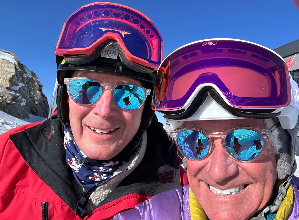
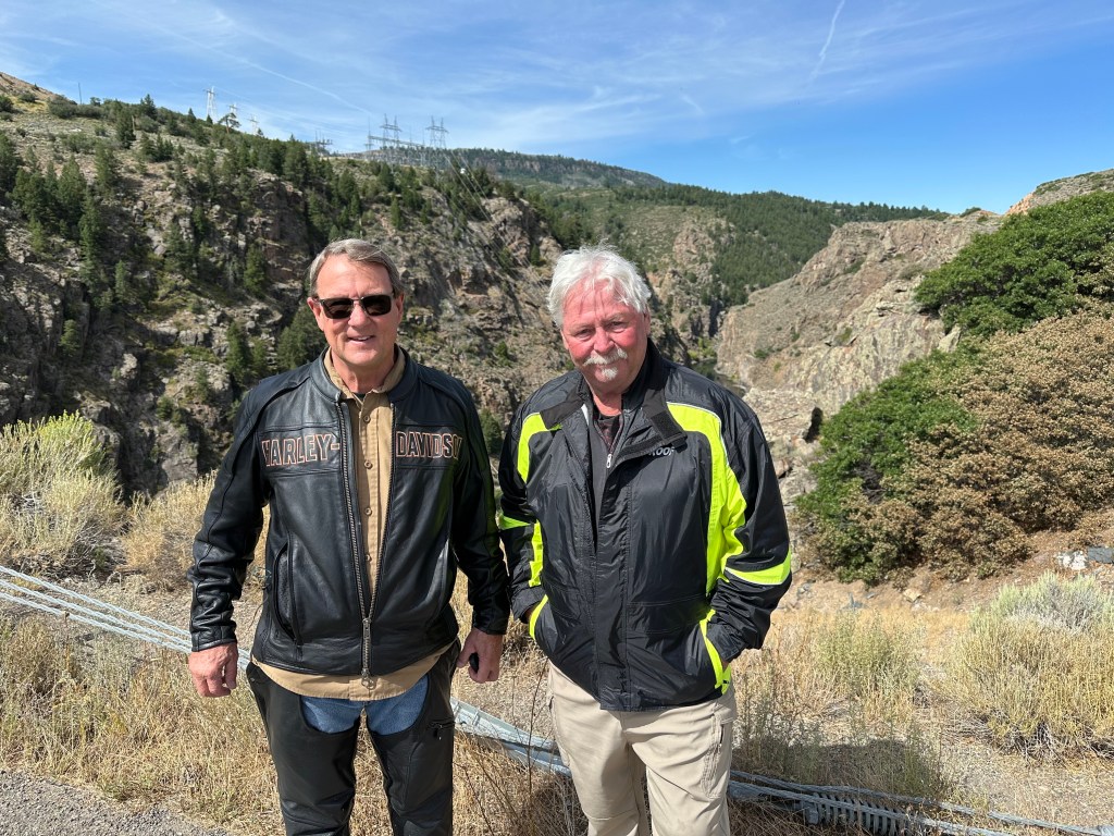
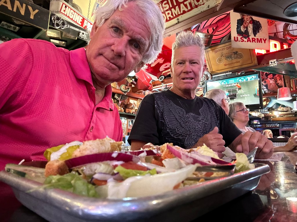
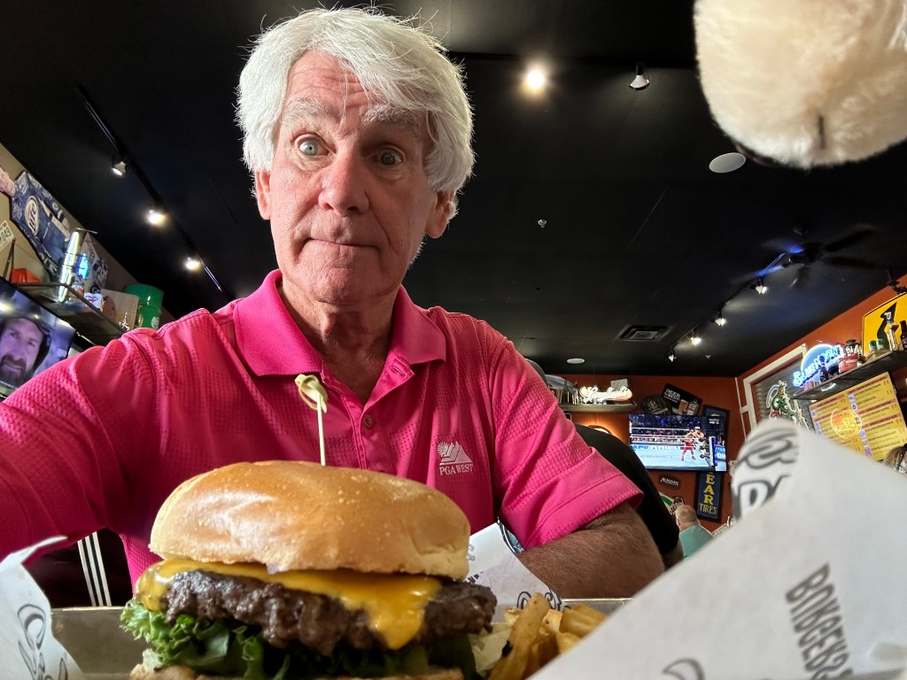
Tom. A rarity in this group in that he’s still actively working, Tom co-chairs the litigation department at the same law firm (Parsons Behle) where John finished up his career. Looks way younger than he actually is (sunscreen, good genes, or both?). Married to an attorney who is now a juvenile court judge in Salt Lake City. Has the work/life balance thing totally figured out. Enjoys a good beer now and again. And again. Wears the same cool mirrored sunglasses as I do.
Two cool guys with nearly matching dark glasses. That’s Tom Barton on the left.
***
Harry. Excellent skier, life of the party, big personality. Often seen with a camera in his hand, though a bit camera-shy himself. Except for one on-going case he wouldn’t tell us about, he’s retired from the legal world, where he practiced family law. Harry was working on a brief in his spare time during our stay in Austria, more than likely in his own briefs. For the rest of us, like doing homework on a deadline. Is a published author and photographer (Ski magazine).
Harry Caston unleashes his camera.
***
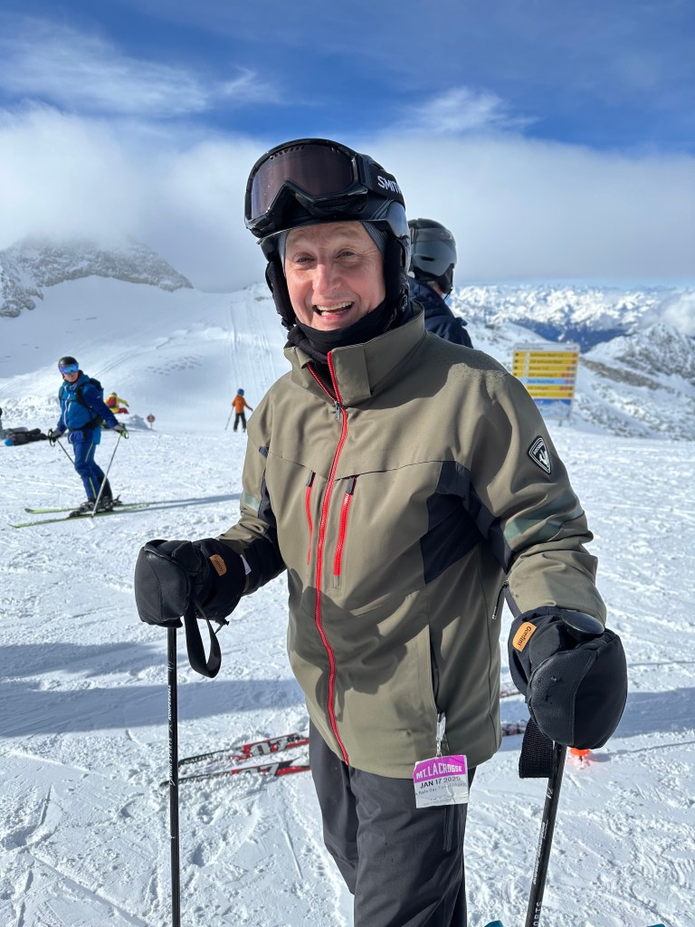
Joel: A former ski racer growing up in La Crosse, Wisconsin, Joel is a blur on the slopes. Dude’s fast; his high school ski team won the state championship! Joel is a recently retired federal bankruptcy judge who practiced bankruptcy law before being appointed to the bench. He was a law school classmate of John’s at the University of Utah (have I said “Go Utes!” yet?).
Joel Marker, ready for a few glacial turns, at a non-glacial pace. Yes, that’s a Mount La Crosse ski pass on his parka. #WisconsinBling
***
Gary D. Beginning with this trip, everyone calls him Gary D, to not be confused with Gary L (me!). Gary D is a retired attorney who practiced banking law at John and Tom’s law firm, and is the elder statesman on this trip (except me; I’m five years older than Gary D). He’s the epitome of laid back.
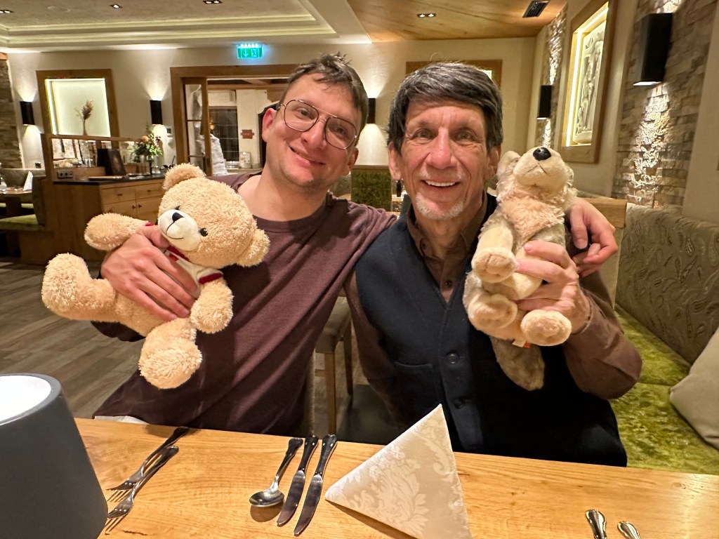
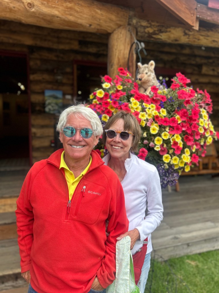
The Doctormans. Sam (with Mayrhofen Max), and Gary (with Walter Jr).
***
Sam. If you noted a visual similarity in the pic above between Gary D and the young man next to him, it’s because they’re father and son. Sam works in banking, but don’t hit him up for a loan; he’s a behind-the-scenes, back room kind of guy. Sam is recovering from a skydiving accident he’s lucky to have survived.
Mary Jo. Joel’s wife, but that’s not her only claim to fame. Mary Jo taught at the prestigious Rowland Hall school in Salt Lake City for 27 years. Speaks Italian, loves to travel. Did not ski on this trip, but hiked all over the Ziller valley. A fitness maniac with a killer smile.
Mary Jo Marker. Her smile lights up a room.
***
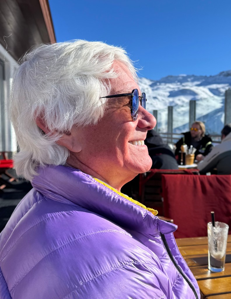
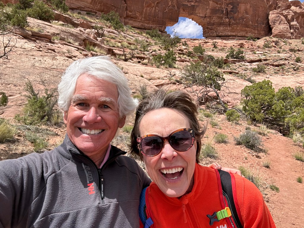
Julie. Another retired attorney, Julie was a long-time juvenile court judge in Salt Lake City. Oh, and she’s married to John. Julie also hiked all corners of the Ziller valley, along with Mary Jo. Interesting connection: when she was a judge, Julie mentored Tom’s wife, who now leads the Salt Lake juvenile judge corps.
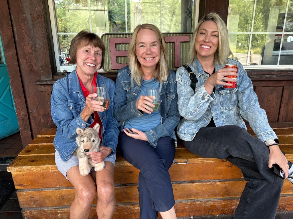
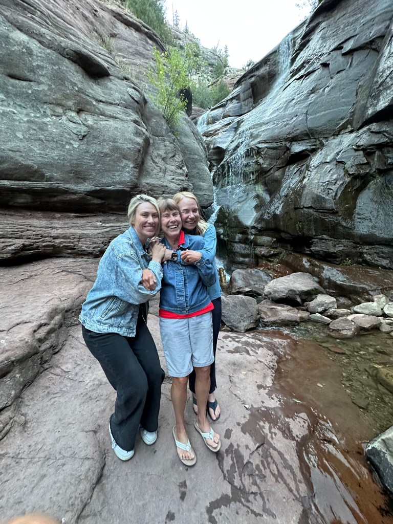
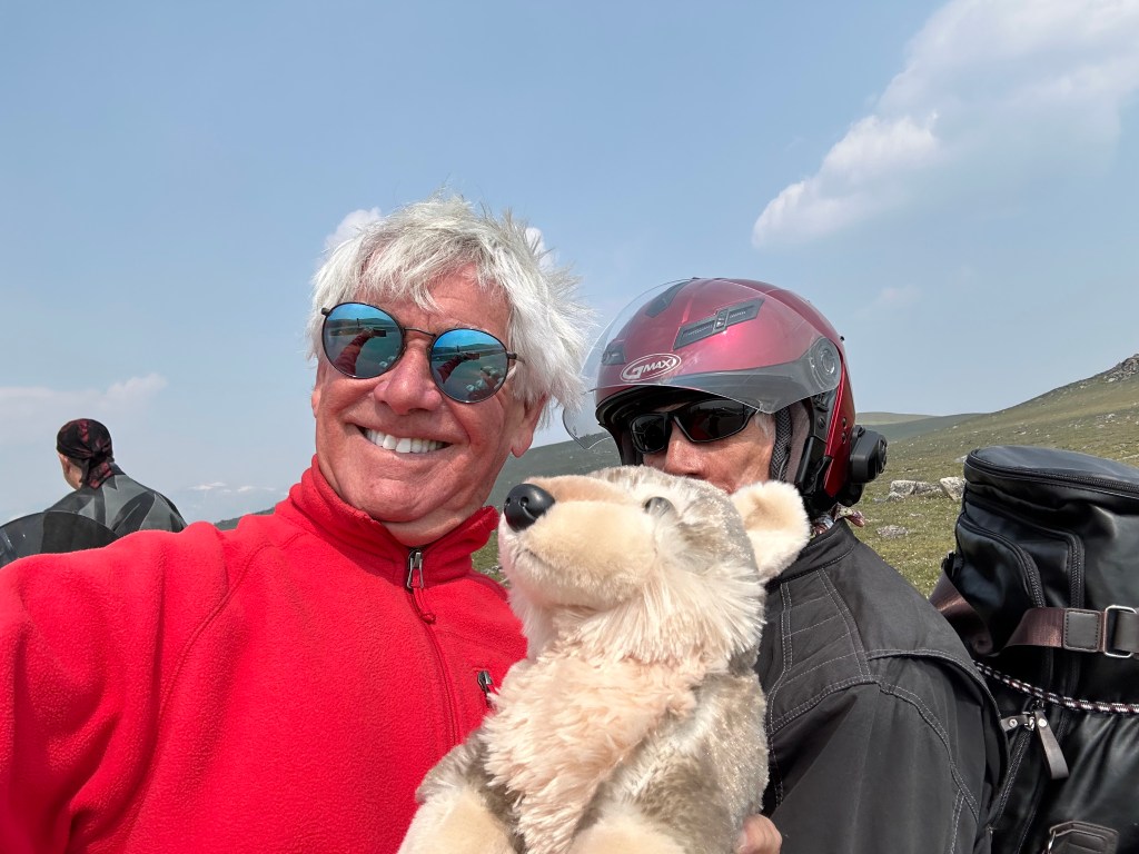
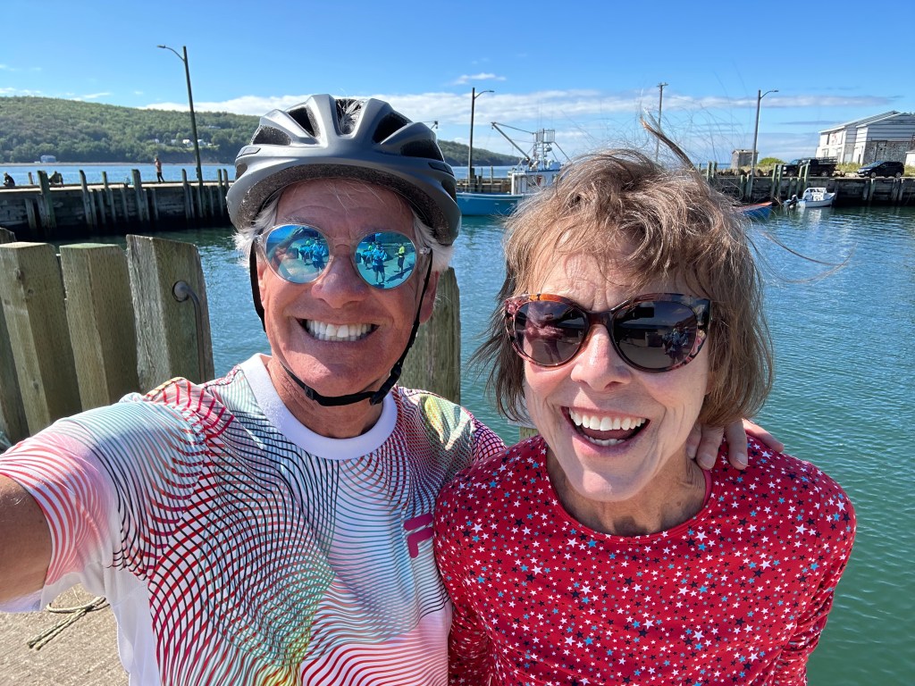
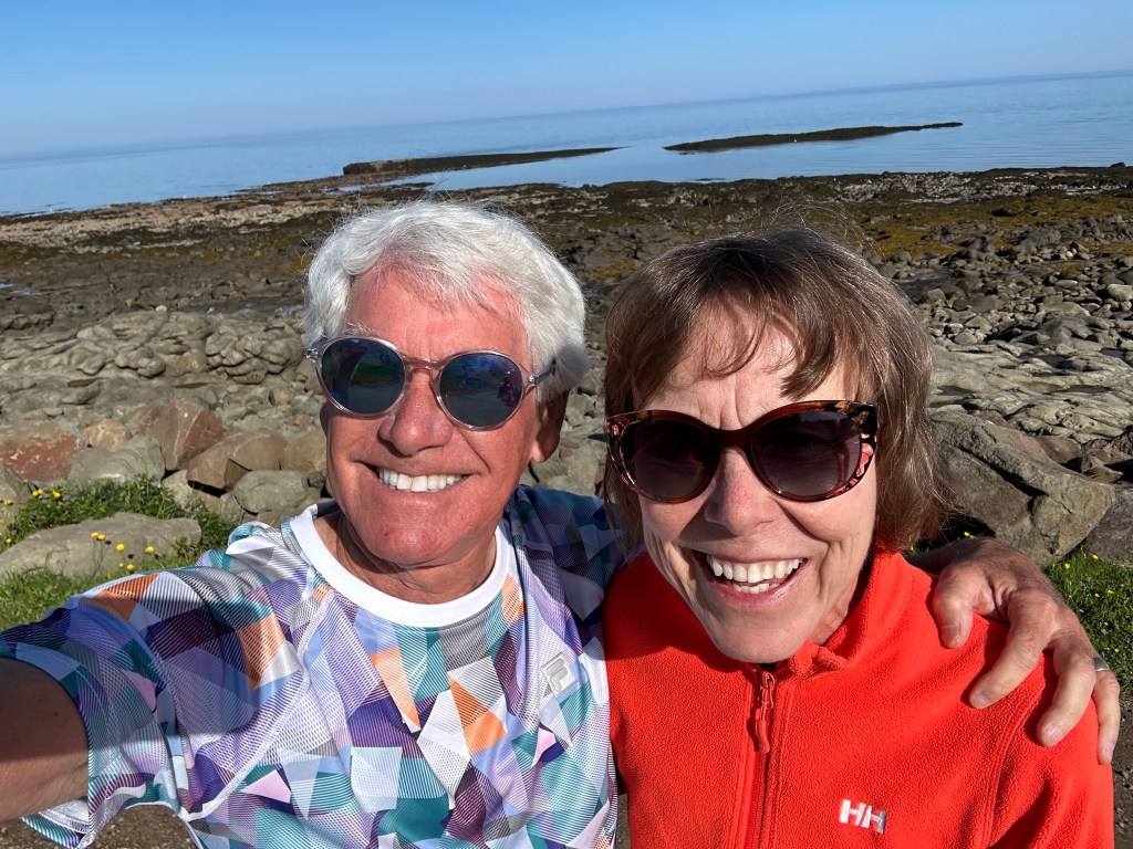
Julie Lund and me enjoying a light moment on the Hintertux glacier.
***
Fiona: Julie’s traveling companion, Fiona was at Carbondale’s world-famous Colorado Rocky Mountain School (CRMS) for many years as head of their culinary operations. Along with Julie and Mary Jo, she was part of the Mayrhofen girls’ hiking club. She skied the glacier for part of one day, and if that wasn’t enough of workout, then hiked down the mountain. Oof.
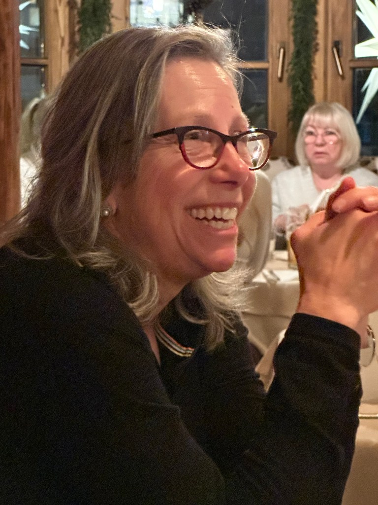
Fiona O’Donnell Pax goes pensive on us before dinner.
***
Gary L. You can read about me on my blog’s “My Posse” page.
Ready for the first run of the day.
***
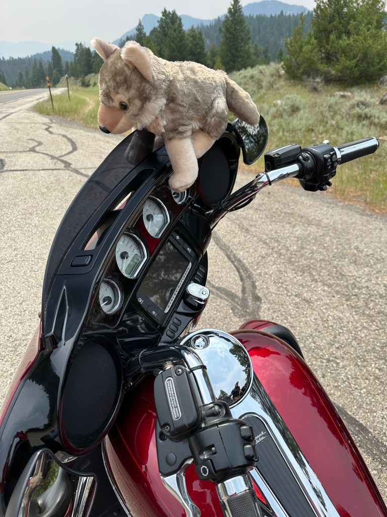
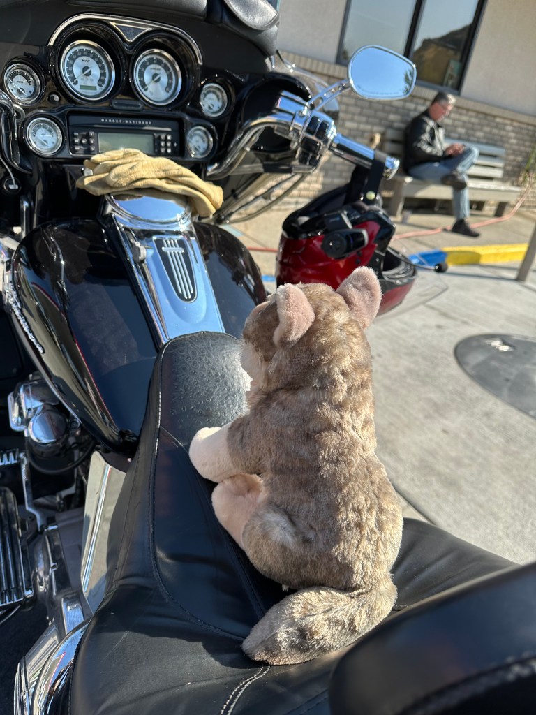
Walter Jr. You can read about Walter Jr on my blog’s “My Posse” page, too. Yes, Walter Jr has his own internet presence.
Walter Jr enjoys the in-flight camera view from the A350’s tail, looking forward.
***
That’s 11. But wait, there’s more.
Xaver. Pronounced “ZA-vuh,” he was our mountain guide for two days. One day on-piste, another day off-piste. Former ski racer, world-class skier, 37-year-old father of two. Runs his own one-man ski school (they do things differently in the alps). Has branded himself as the Ski Guru. Really fun guy. Full of life. Great hair!
Xaver Kröll, Mayrhofen’s Ski Guru.
***
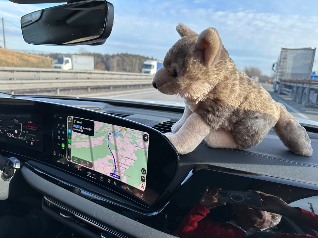
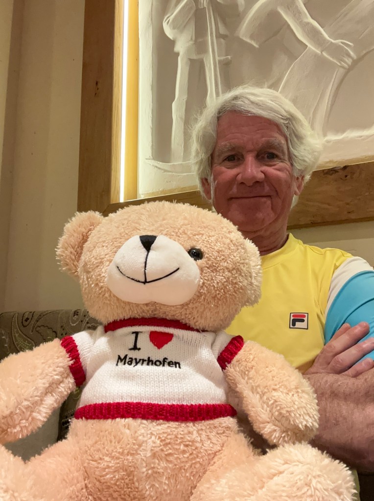
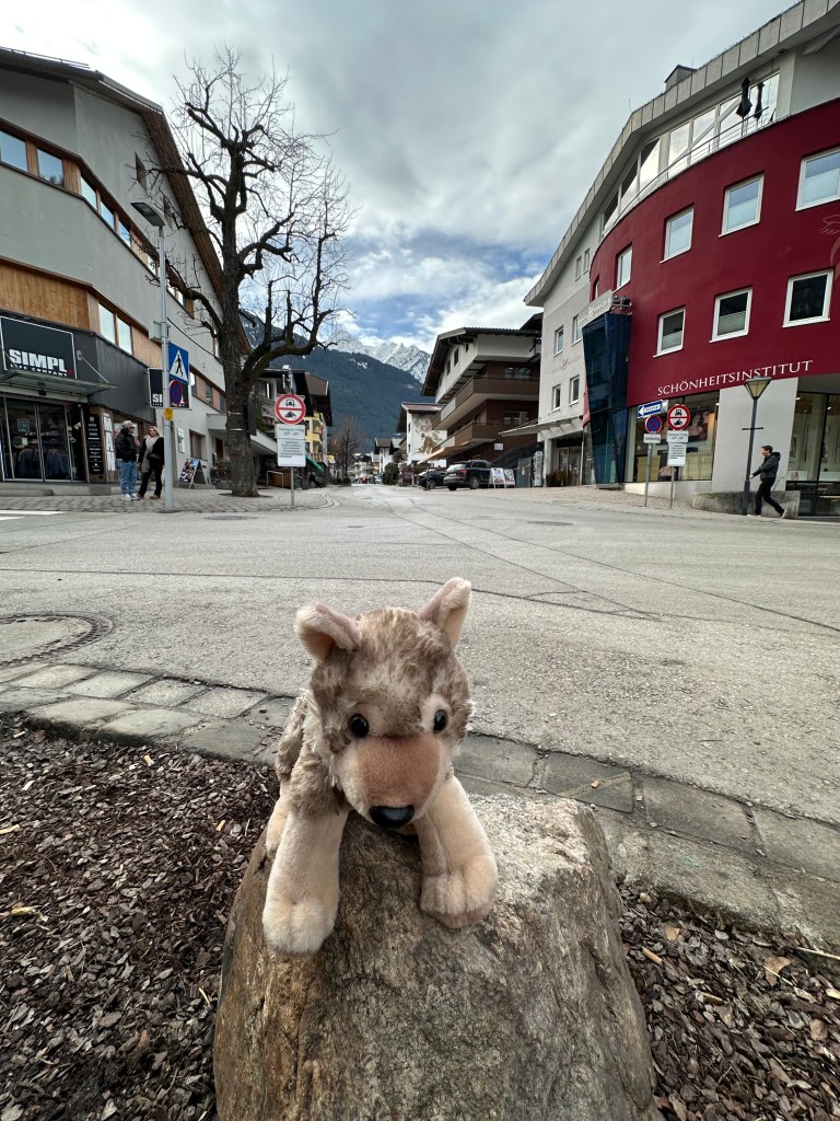
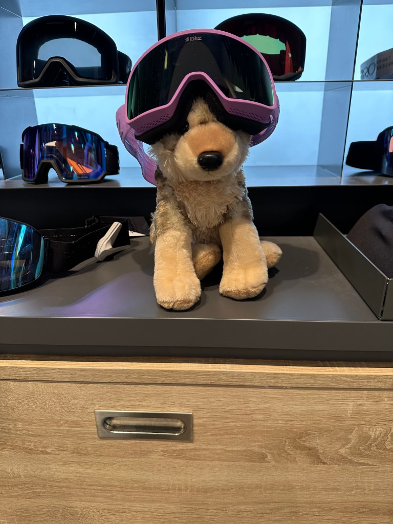
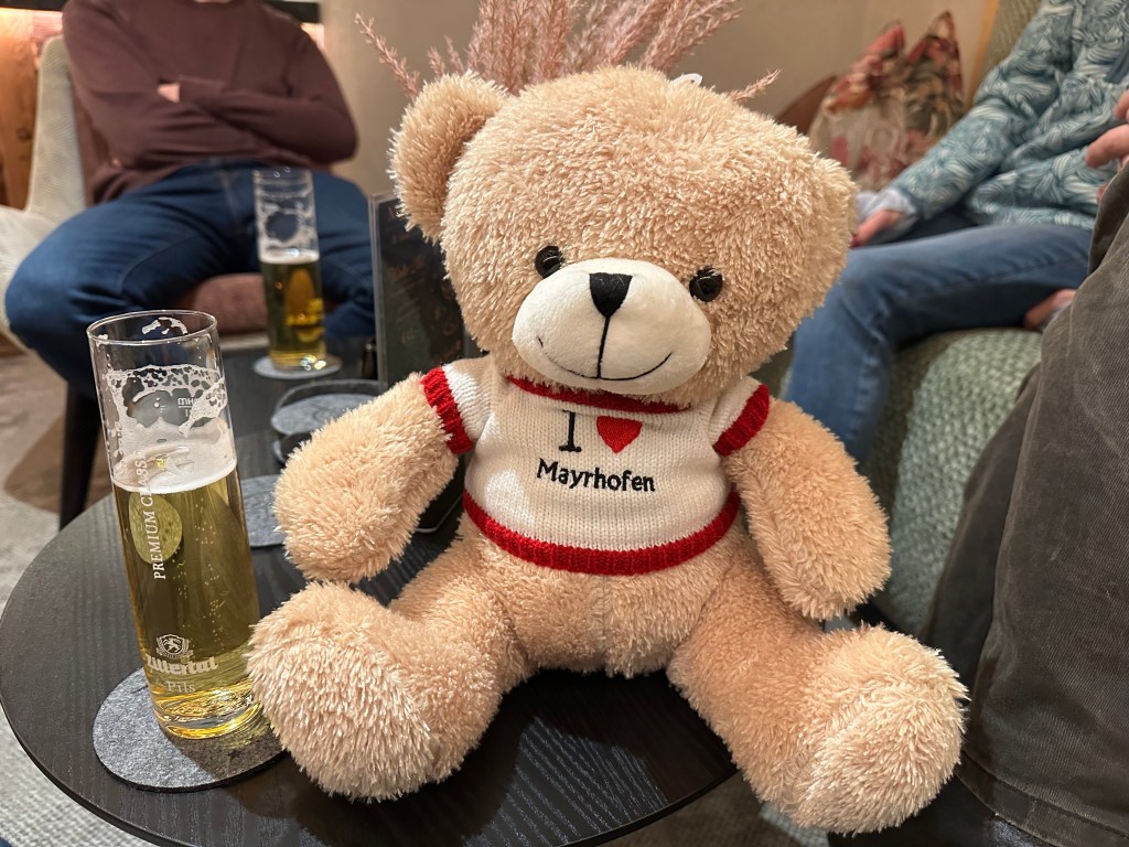
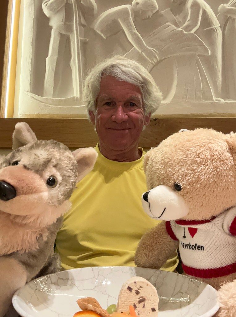
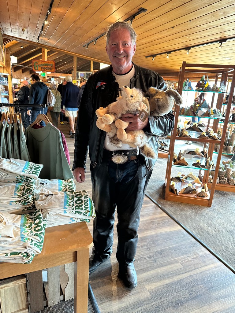
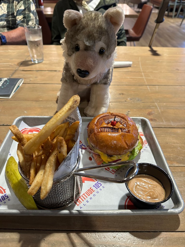
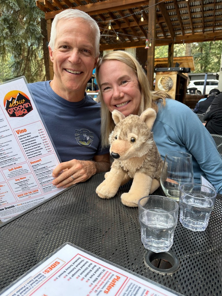
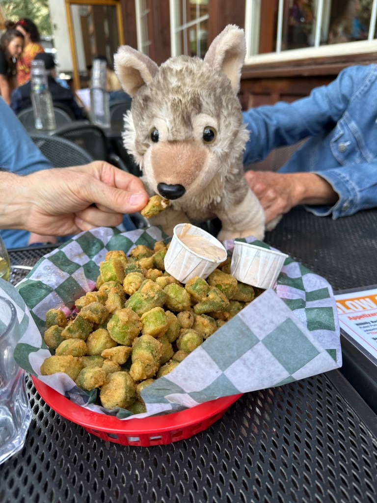
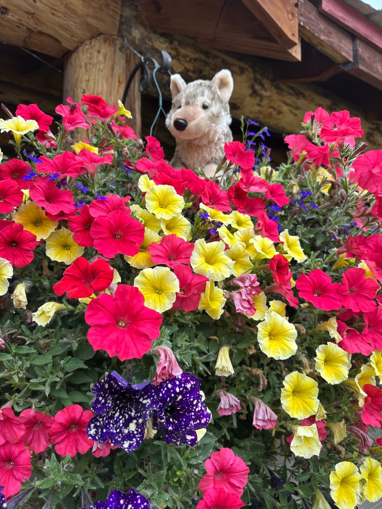
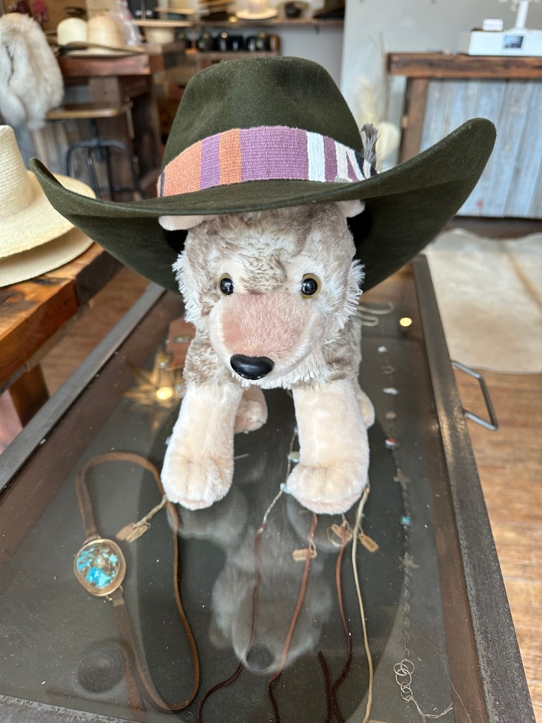
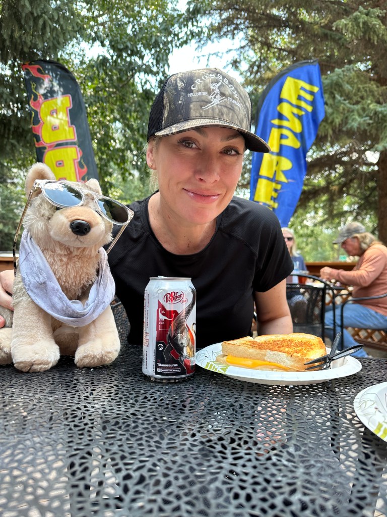
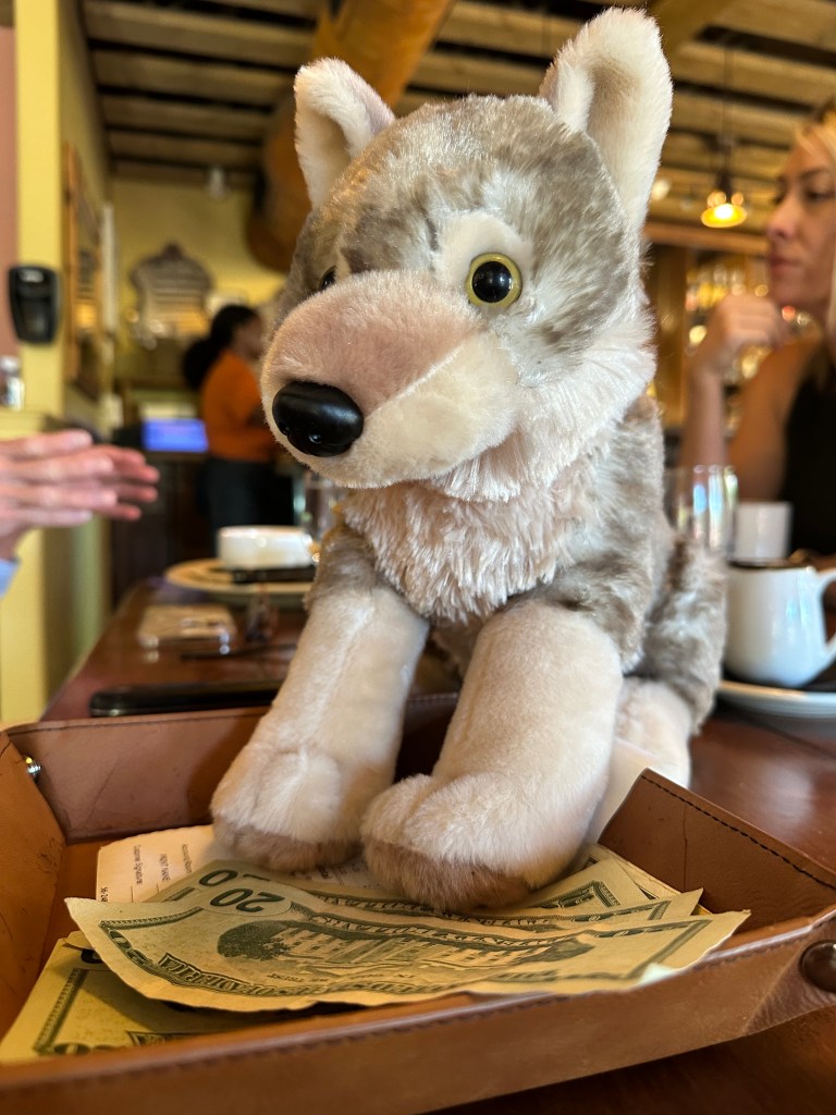
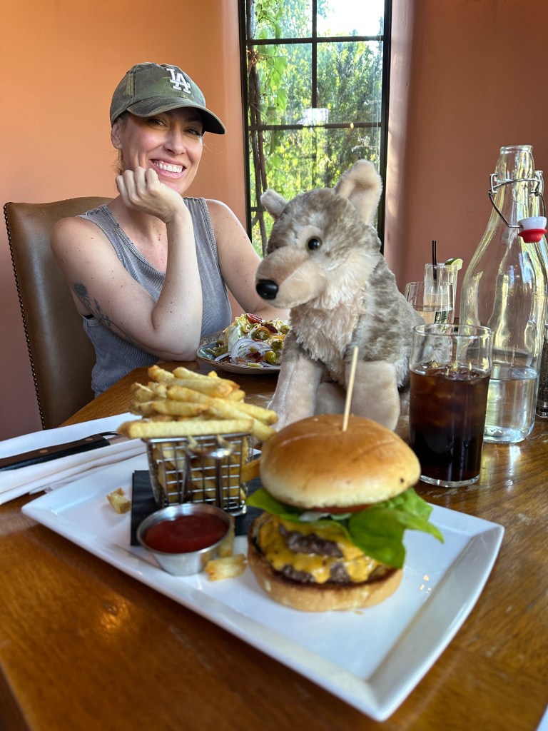
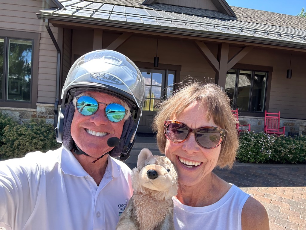
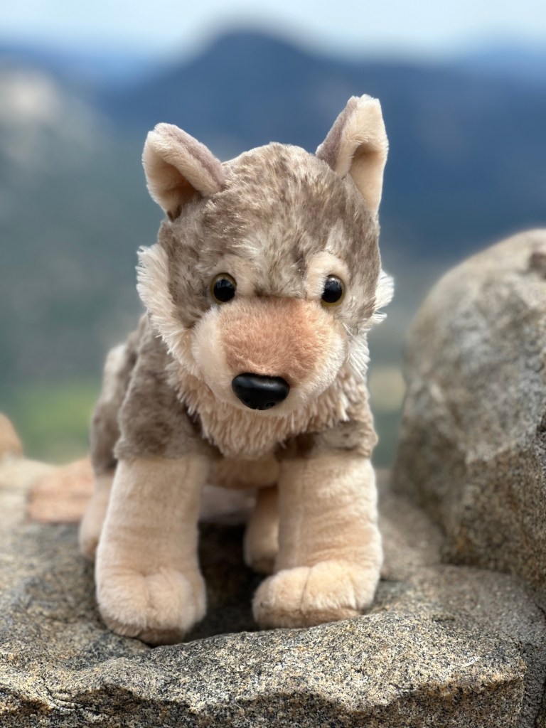
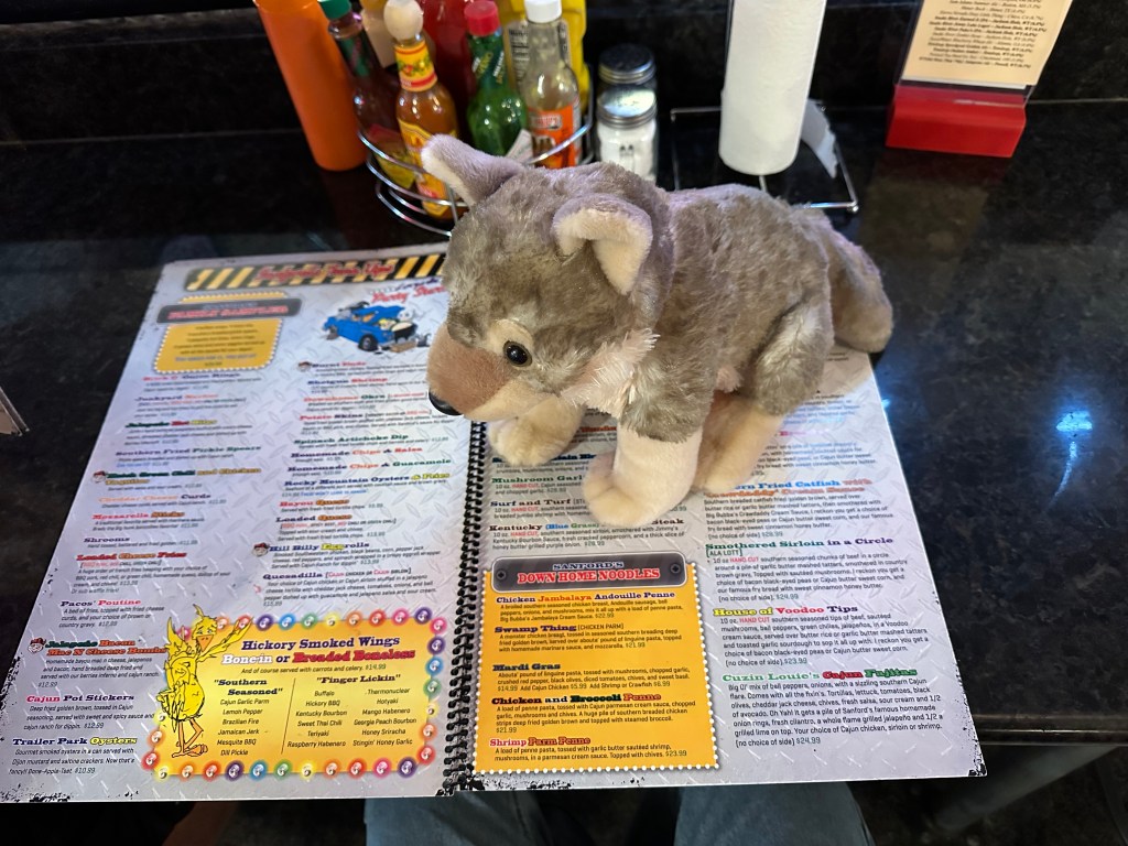
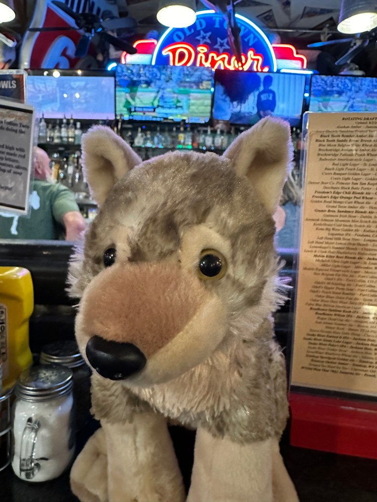
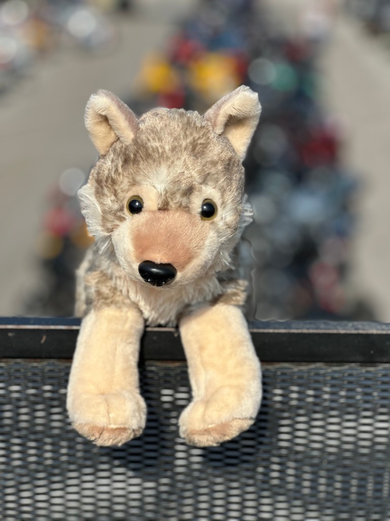
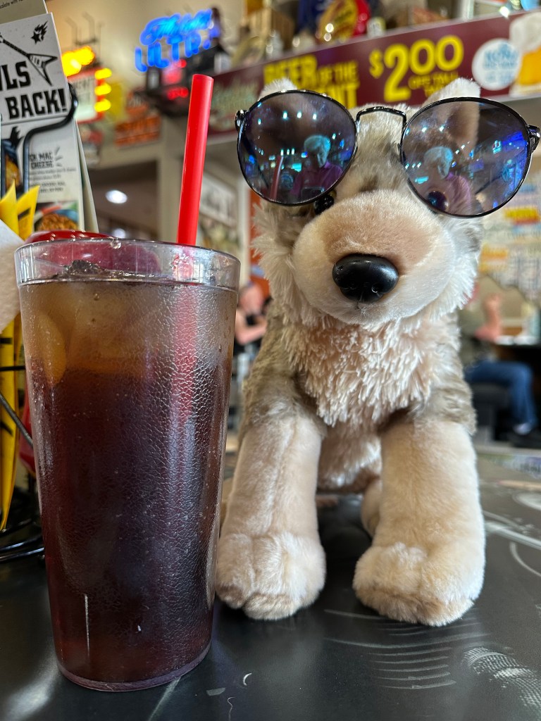
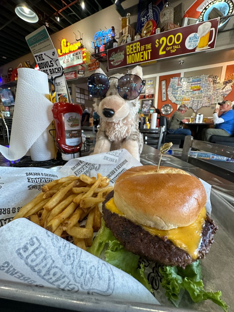
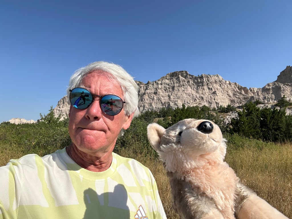
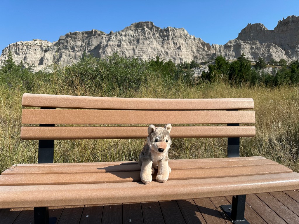
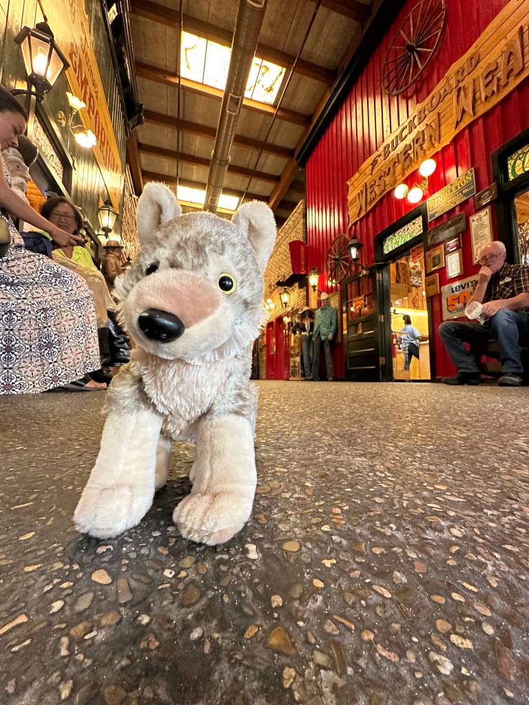
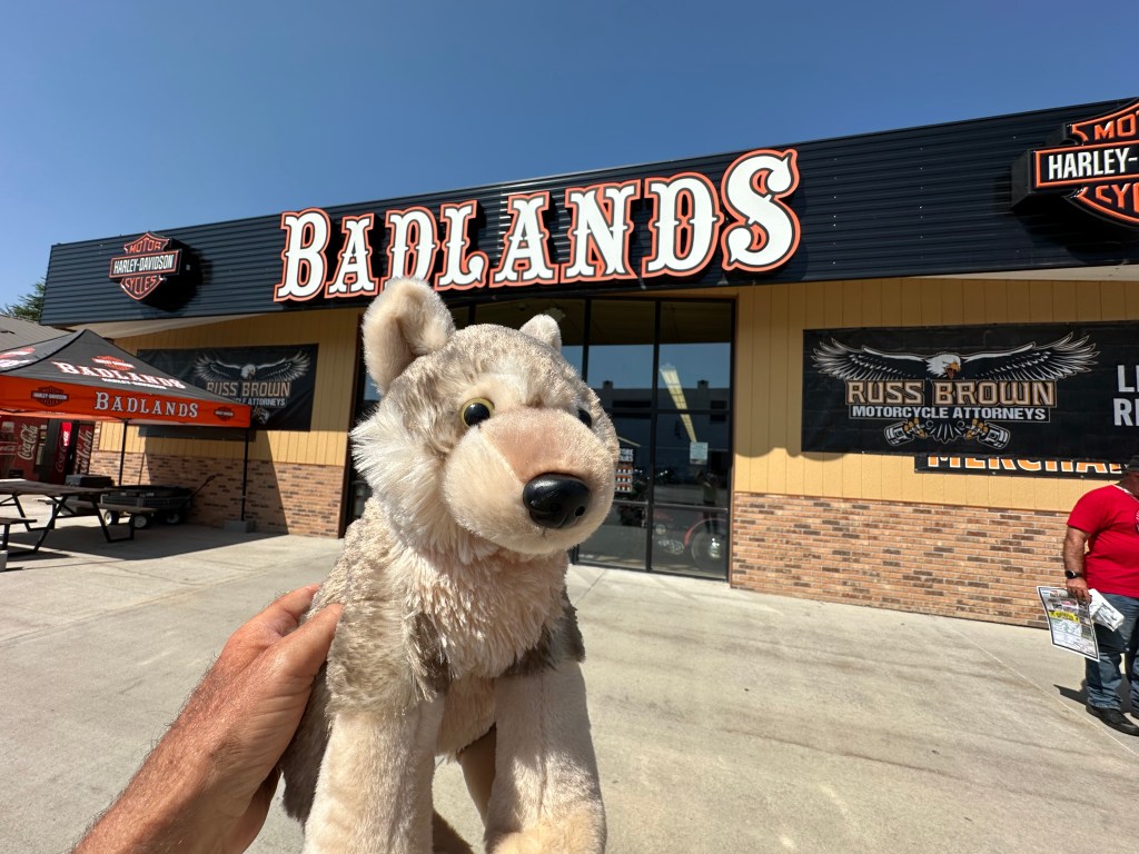
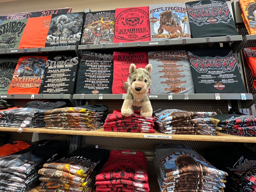
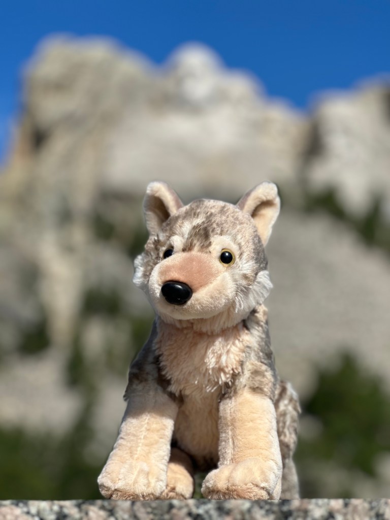
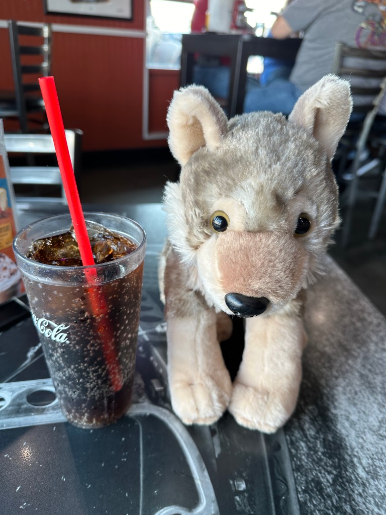
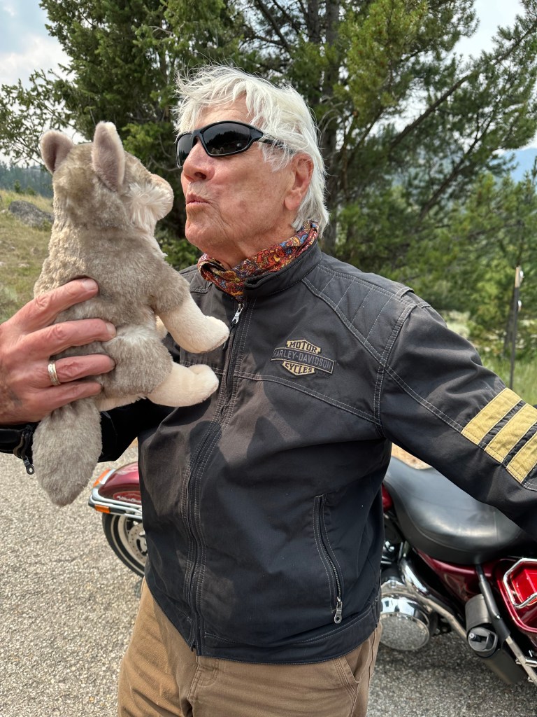
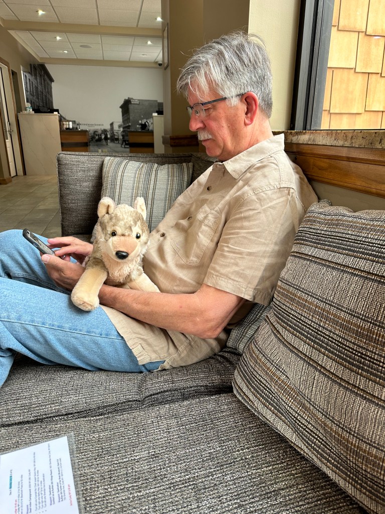
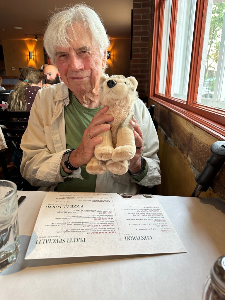
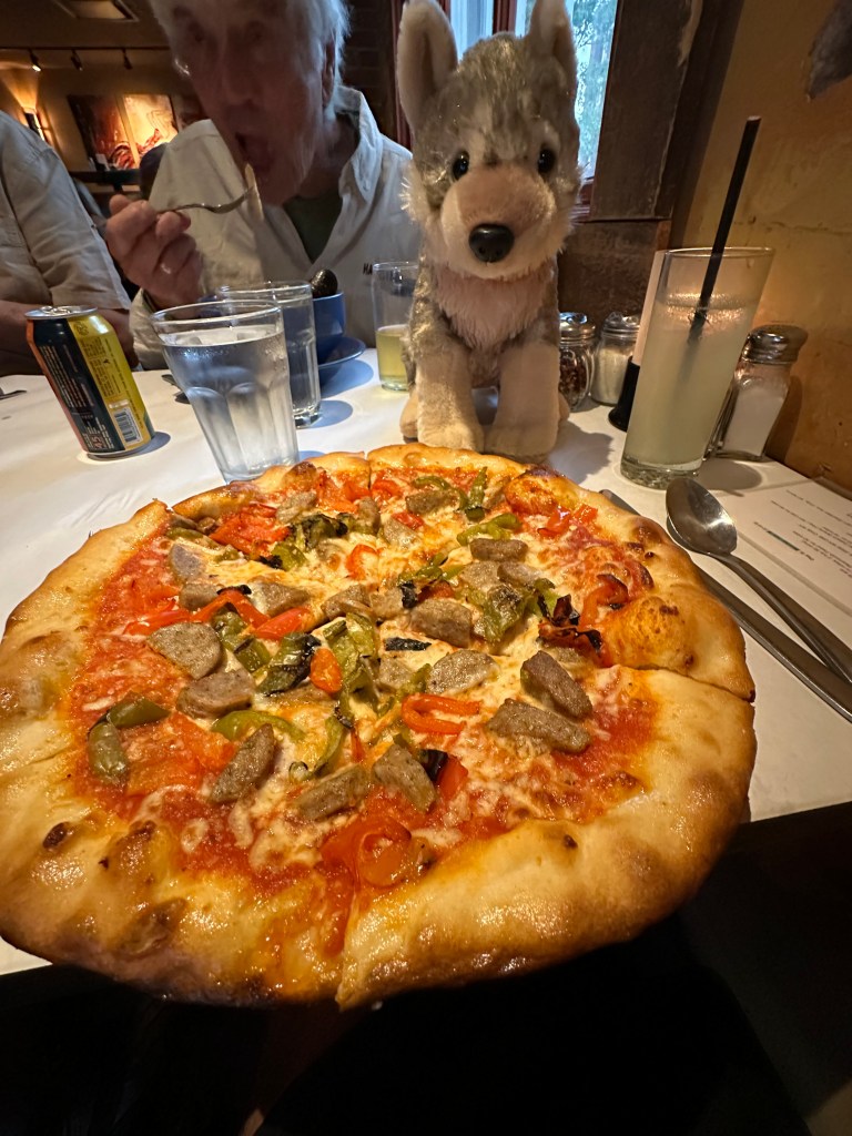
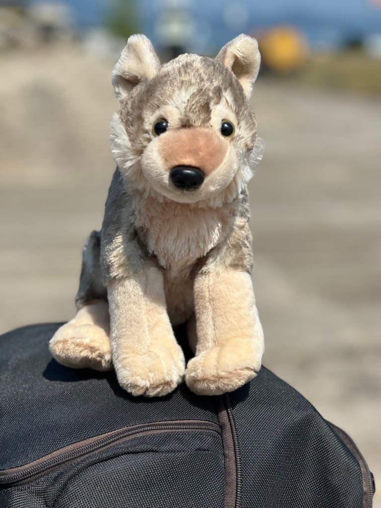
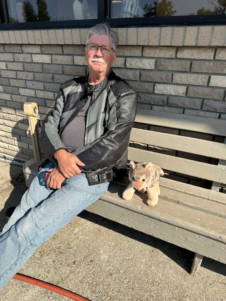
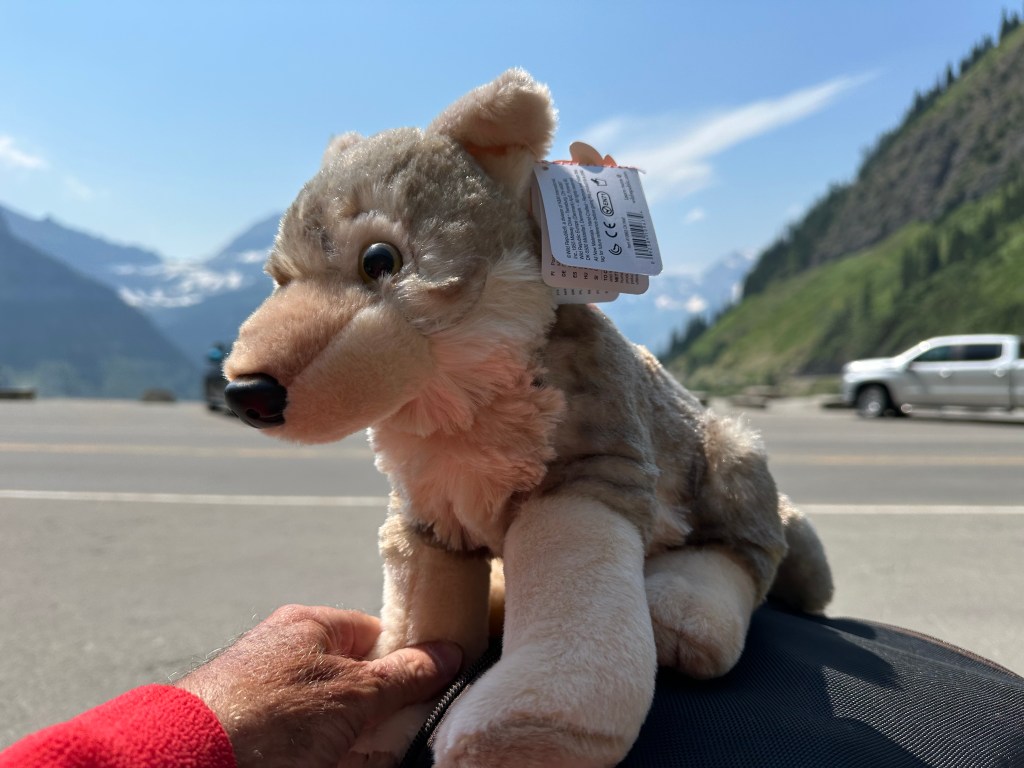
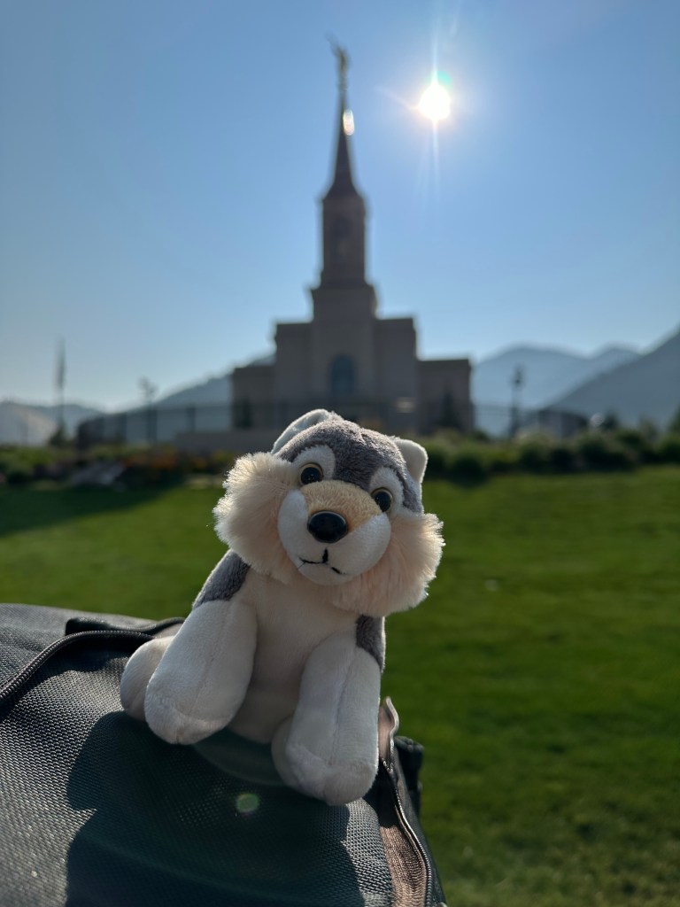
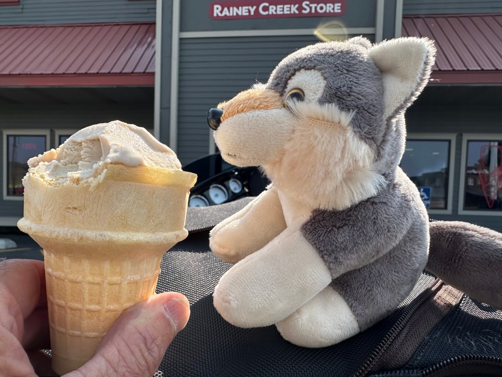
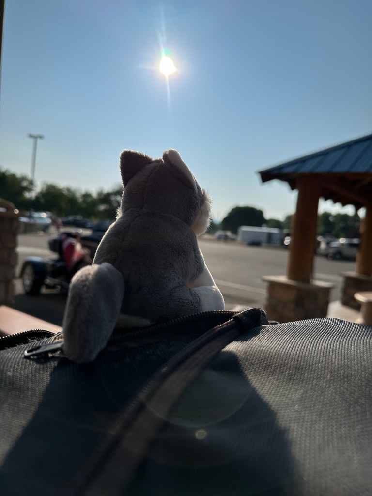
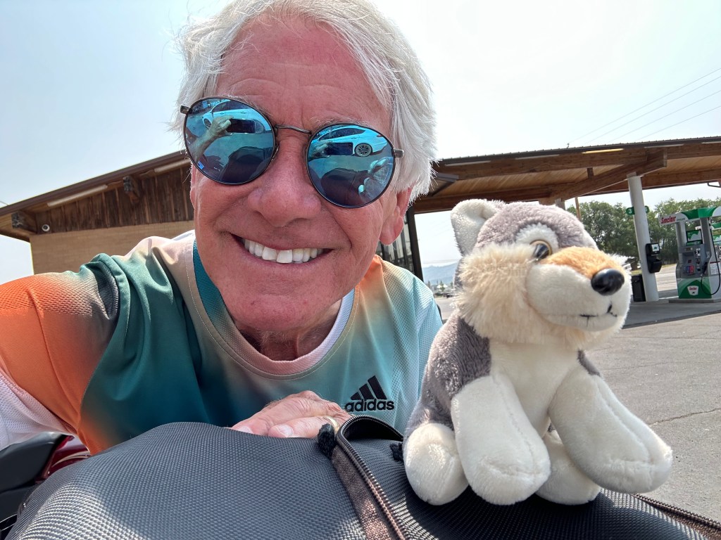
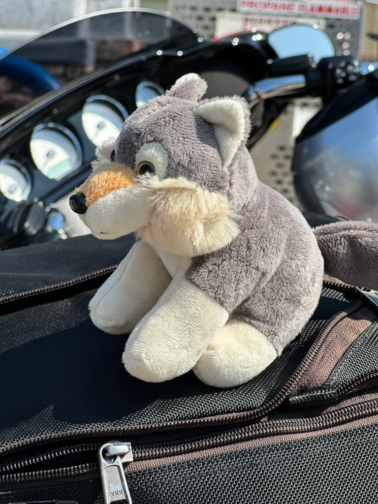
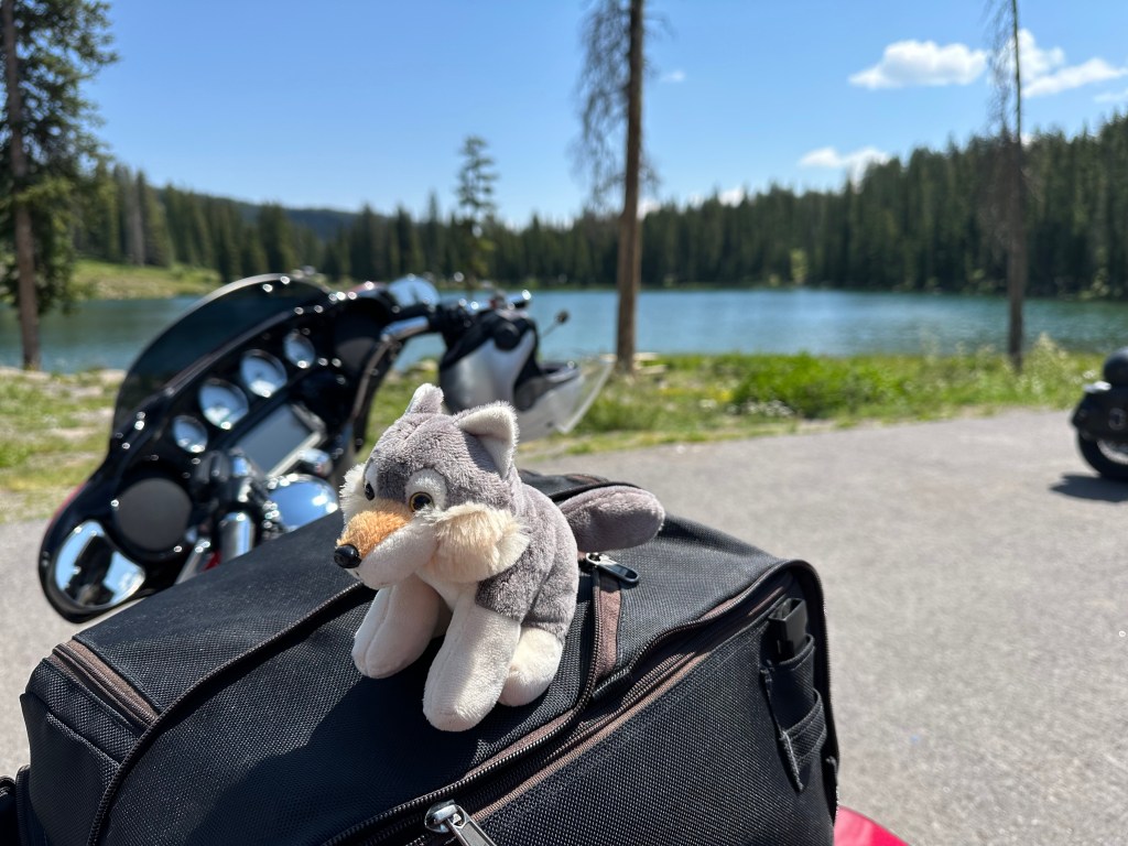
Maximillian. Walter Jr’s new BFF. Maximillian is a classic Austrian name. We’re gonna call him Mayrhofen Max for short. He’s a lovable bear with an “I ❤️Mayrhofen” sweater. I found him in a souvenir shop on my last day in Austria 🇦🇹.
Mayrhofen Max, a 28 Euro friend for Walter Jr and for me.
***
Walter Tours Downtown Mayrhofen
Wednesday was our last day In Mayrhofen. I’d had plenty of skiing this week, so I took a day off to squire Walter Jr around town.
I’ll have lots of snow time when I get home — 10 days in a row scheduled to teach at Snowmass. Beginning tomorrow! Missing a day of skiing is not tragic.
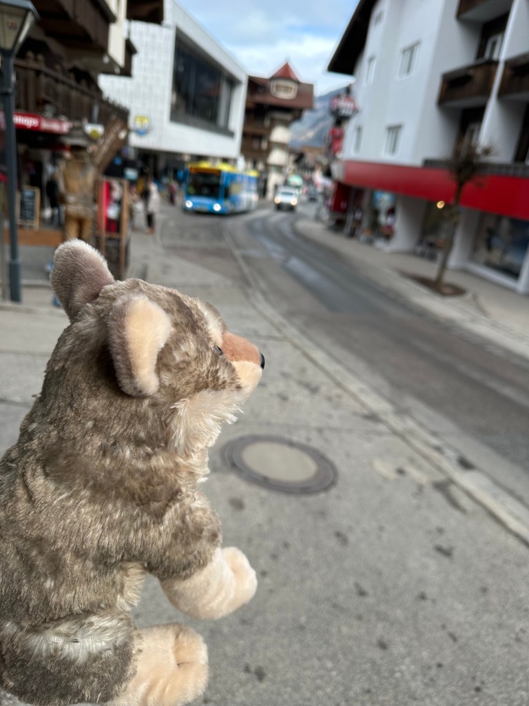
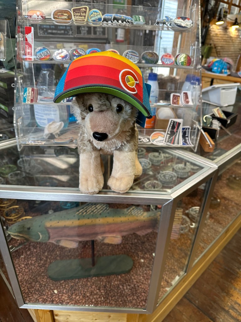
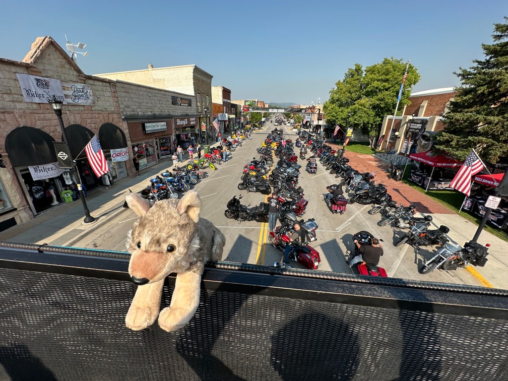
Here are some snaps of my grey wolf buddy exploring downtown Mayrhofen.
On the main shopping street in Mayrhofen.
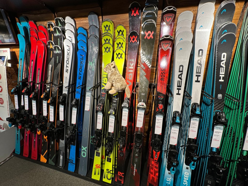
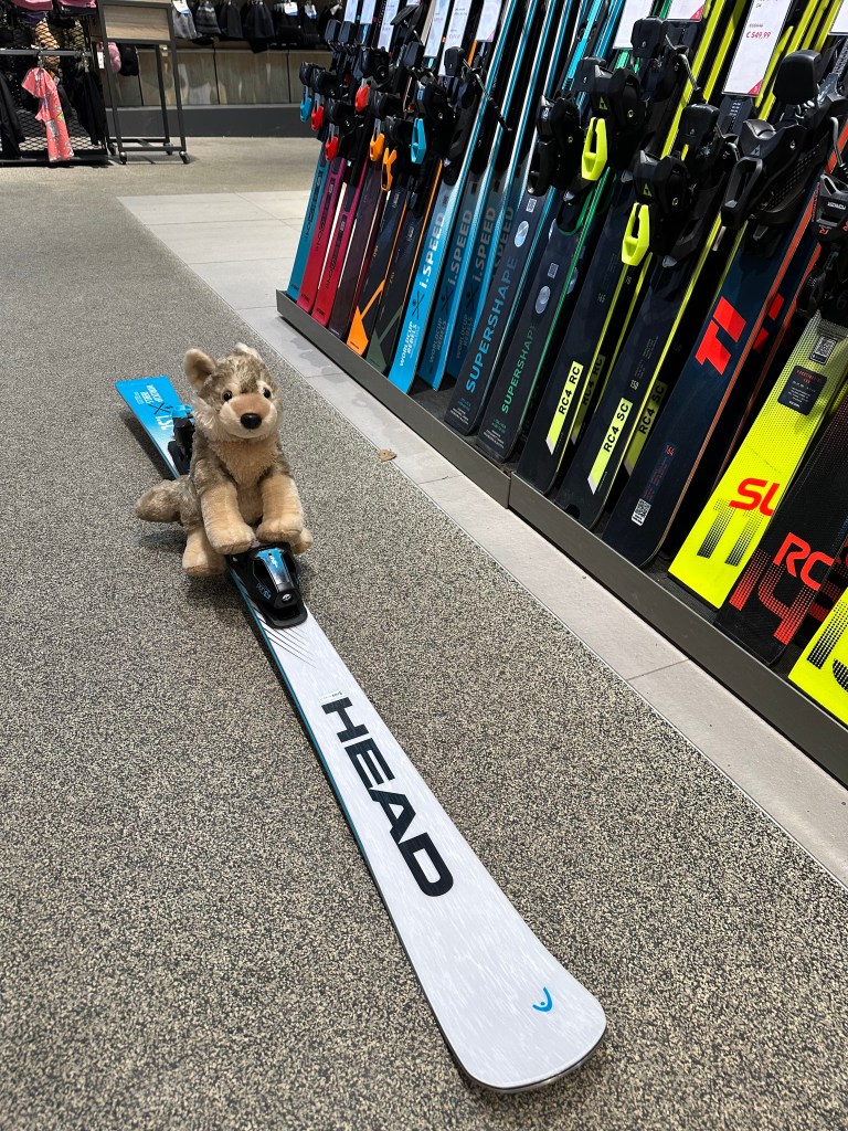
At a ski shop, checking out the merchandise.
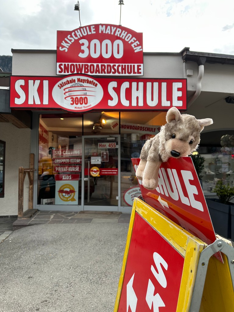
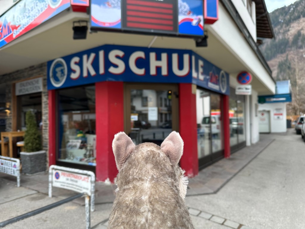
The Main Street is dottted with ski schools. It’s a different business model than at US resorts.
Walter Jr seems to be interested in a lesson. Can I help you, buddy?
Goggles, tres chic.
Maybe a monoski could be fun.
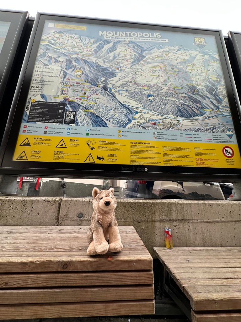
At the base of the Penkenbahn lift, Walter Jr contemplates the mountain map.
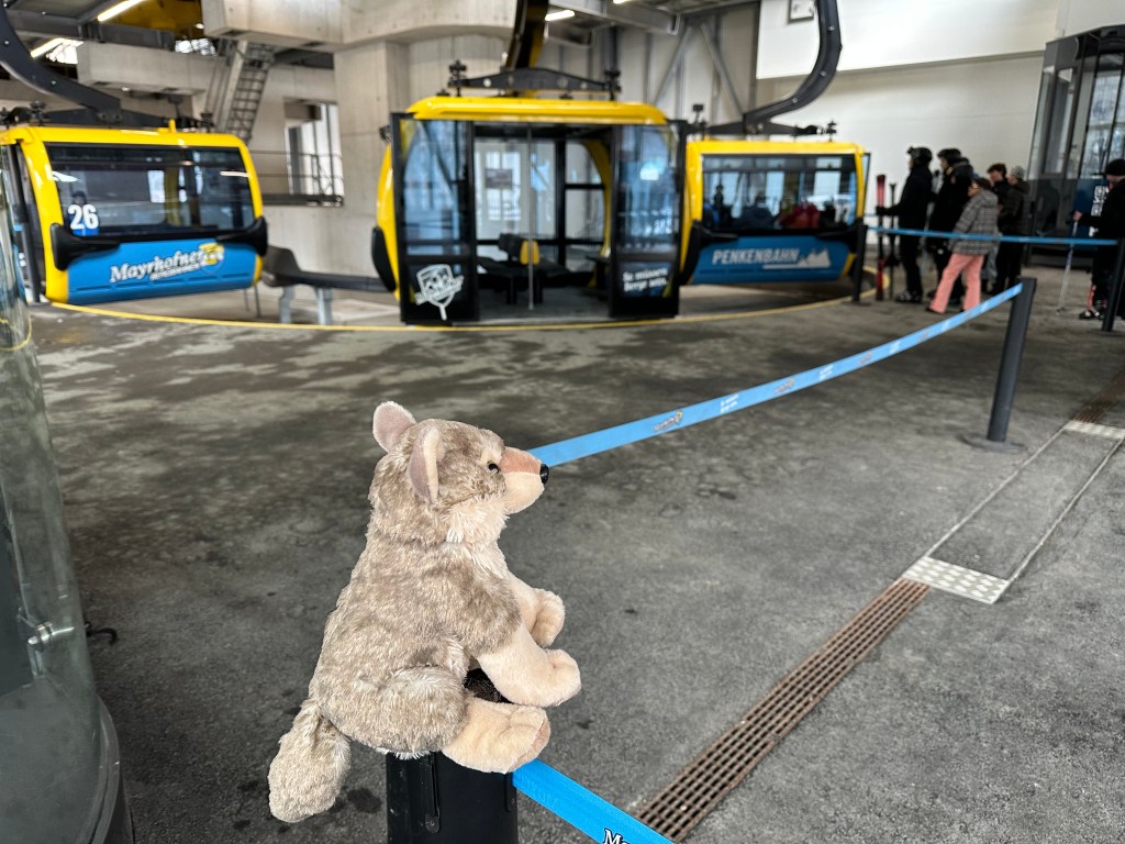
Keeping an eye on the gondola cars at the base of the Penkenbahn.
***
A Traveler’s Nightmare
For tens of thousands of travelers across Europe and beyond (including John, Julie, and me), Feb. 12 is a day of grounded dreams and logistical nightmares.
What began as a simmering pension dispute with flight and cabin crews has boiled over into a coordinated 24-hour strike, leaving Lufthansa’s primary hubs in Frankfurt, Munich, Hamburg and Berlin eerily quiet while departure boards glow with the dreaded red text of “Cancelled.”
We learned of this shitstorm mid-day yesterday after receiving a text from Lufthansa, telling us our flight had been cancelled. Are you freakin’ kidding me?
The strike has effectively paralyzed the German flag carrier’s mainline operations. Screw you, Lufthansa.
The cancellations are affecting an estimated 200,000 passengers. Imagine trying to get through to Lufthansa customer service to rebook 😆. It wasn’t easy.
Screw you, Lufthansa🖕
***
A Silver Lining
The 787: Completing my Boeing airplane bingo card.
The good news about the strike, if there was any: I was eventually rebooked on a United flight from Munich to Chicago and on to Denver. I’m on that flight right now.
Instead of Lufthansa’s A350 nonstop to Denver, I’m going Boeing 787! So what if it stops at O’Hare for a three-hour layover and connection.
The 787 Dreamliner is Boeing’s long-range state-of-the art twin-aisle jetliner, and until today, I’d never flown on one. I was once a bit of an aviation nerd. It’s good to be able to finally complete my Boeing airplane bingo card — 707, 727, 737, 747, 757, 767, 777, and now 787. I’ve flown on them all!
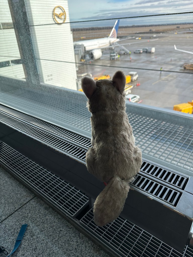
Walter Jr keeps an eye on our United 787 before we board it.
The 787 program was launched in 2004, when Sarah and I both still worked for the big ol’ airplane company.
After a shit-ton of expensive delays, billions in write-offs, unforced errors, self-inflicted wounds, branding nightmares, and a very troubled beginning, the 787 entered operational service in 2011.
Fifteen years later, I finally get my first ride.
***
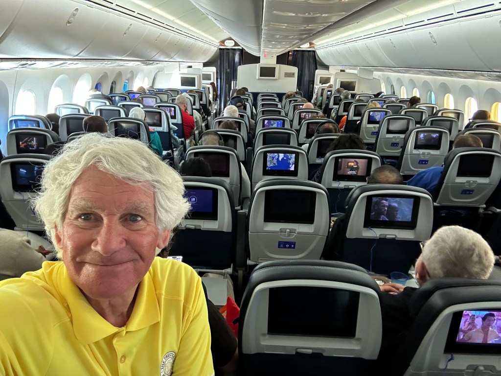
Aboard my first 787 flight.
As I write this, I’m sitting in seat 39D (aisle), en route to Chicago from Munich.
I’ve written this entire missive on my iPhone, mid-flight, fat fingers tapping away for your entertainment pleasure. You’re welcome.
As I reflect on the past week, I owe some big thanks:
Thank you to Sarah for giving me yet another hall pass (she does it every summer for my Harley trips).
Thank you to John, for inviting me to join his team.
And, thank you to John’s attorney buddies for being so welcoming — Tom, Harry, Joel, and Gary D. I am, after all, a foreign object inserted into their well-oiled travel machine.
I’m fine being the token non-lawyer in the group. I now know who to call if I ever get into trouble.
***
Post Script, and Awards
I’m gonna wrap up this post with a few awards. These honors are completely subjective, but hey, it’s my blog. I’m the final arbiter of good taste.
Best Ski Run: Anything on the glacier. The glacier was a godsend this week: without it, we would have been in ice rink mode all over Zillertal — everything but the Zamboni. Ice, ice, baby.
At the Hintertux glacier’s viewing area. That’s the Olperer peak in the background — 11,404 feet high.
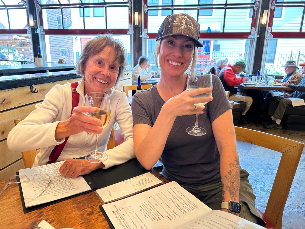
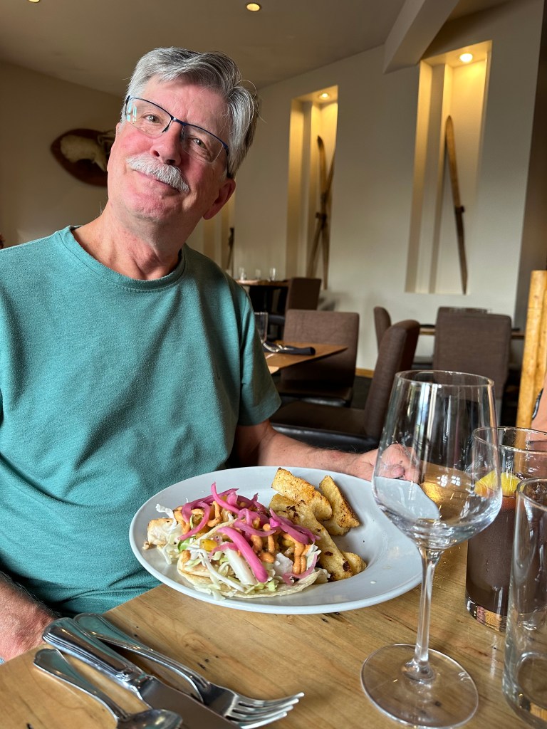
Best Meal: Our final night as a party of 10, at the Perauer Hotel, a 15-minute walk from the Pramstraller. It’s the Number 1 restaurant in Mayrhofen, as judged by both Yelp and TripAdvisor. From ambience to service to presentation, and of course, food — our entire two hours was a chef’s kiss 🧑🍳
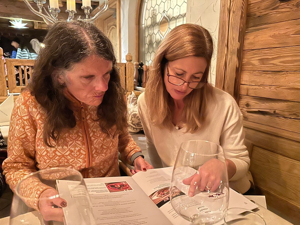
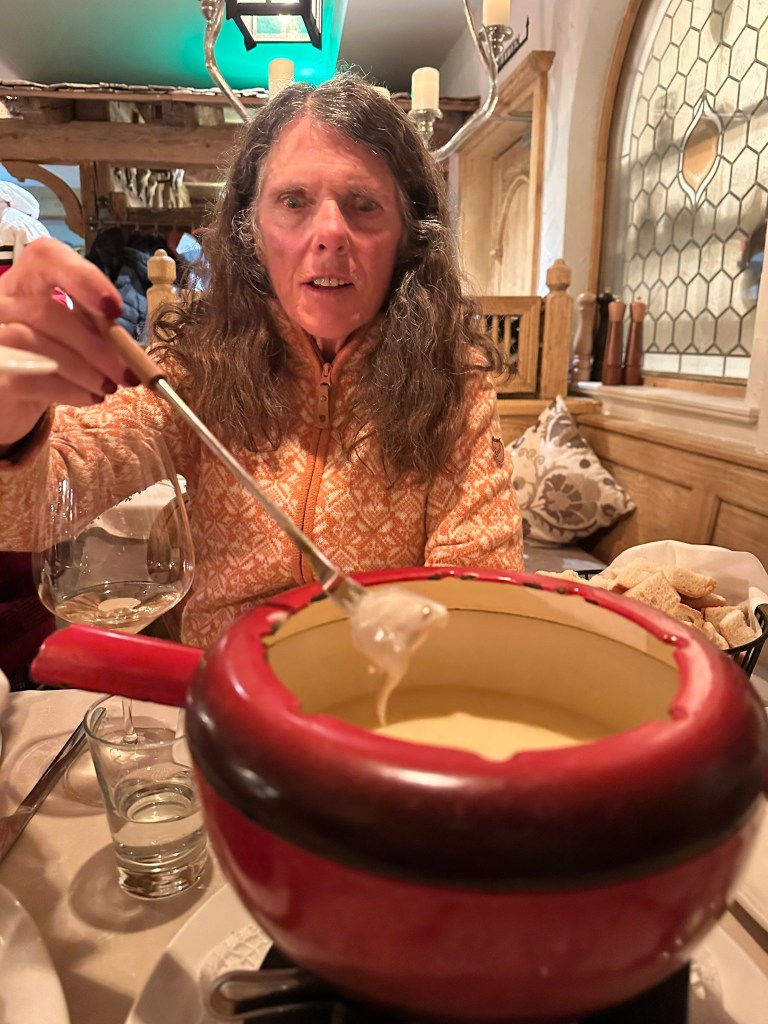
Julie and Fiona look over the menu at the Perauer Hotel restaurant. They settled on sharing fondue.
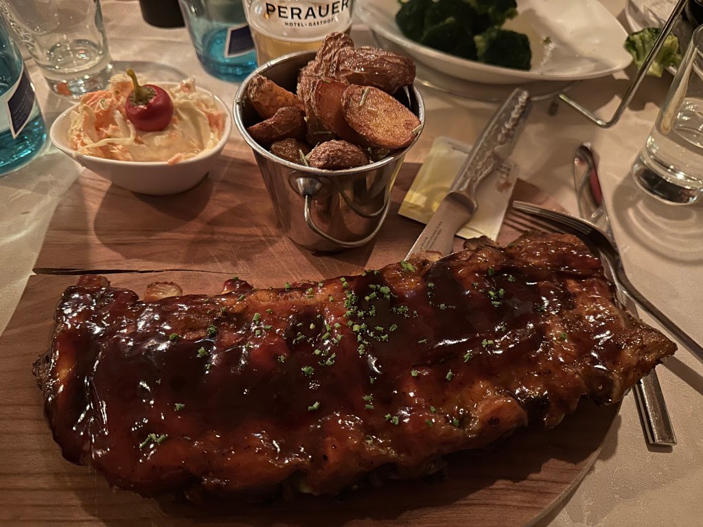
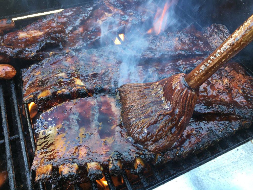
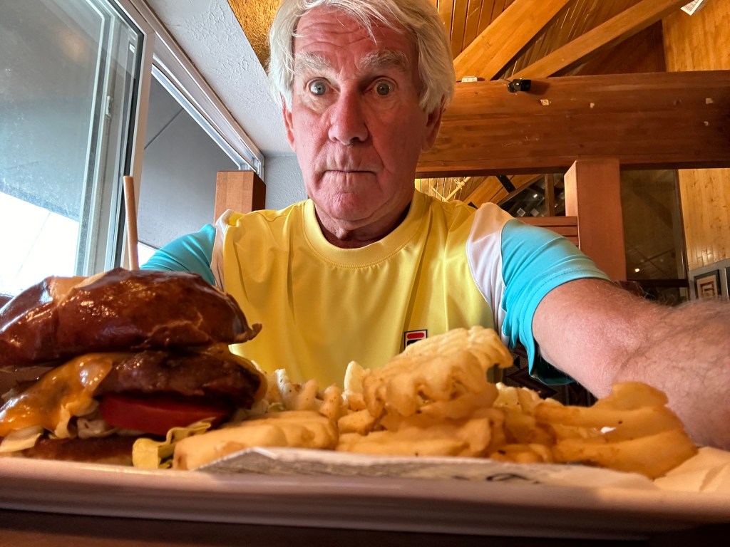
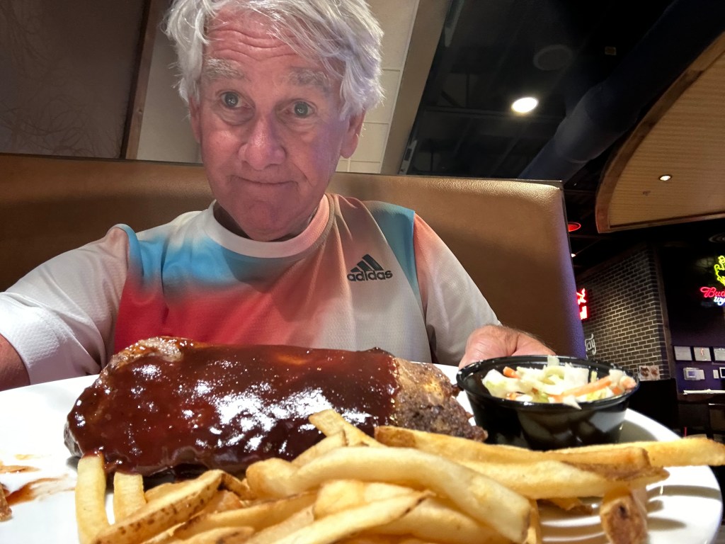
My barbecued veal ribs, potatoes (kartoffels), and cole slaw. Best meal of the week.
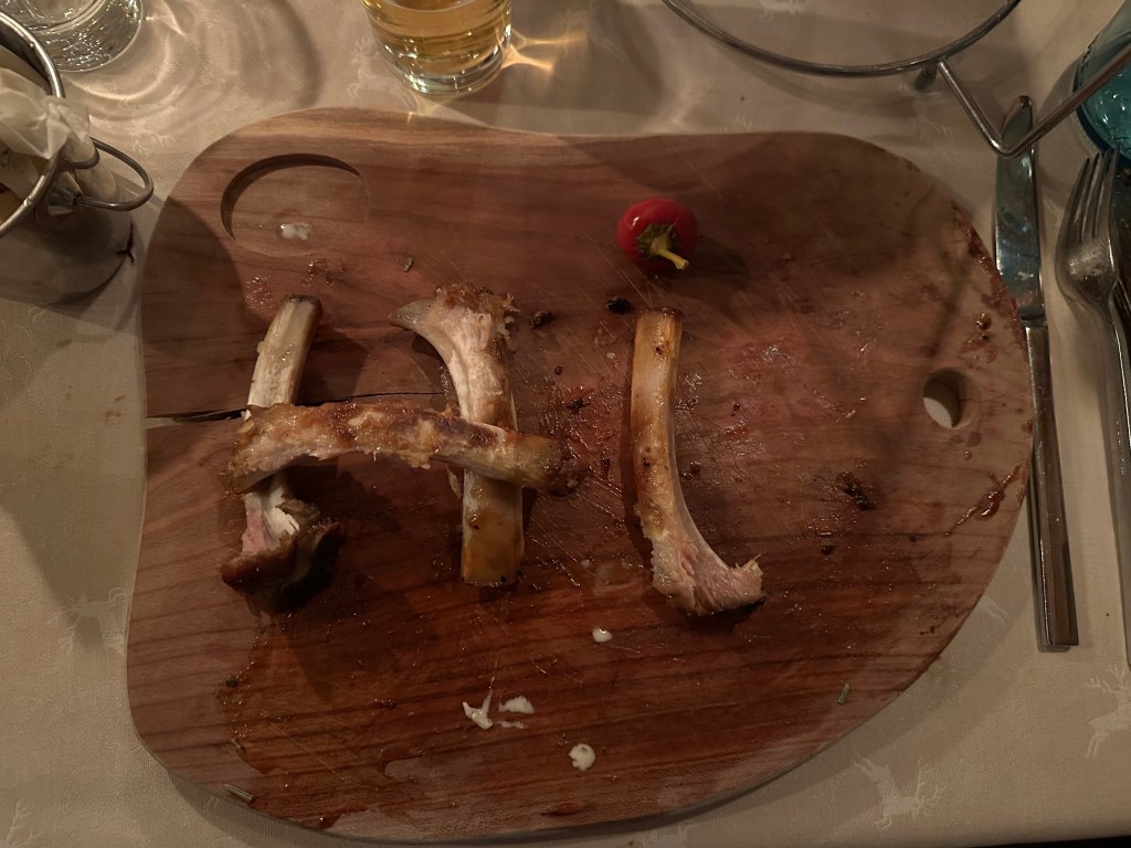
My signature “ribs-are-all-gone” move. Followers of this blog have seen this before.
Julie gets a fork full of fondue cheese.
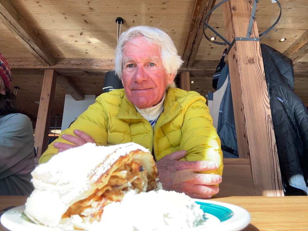
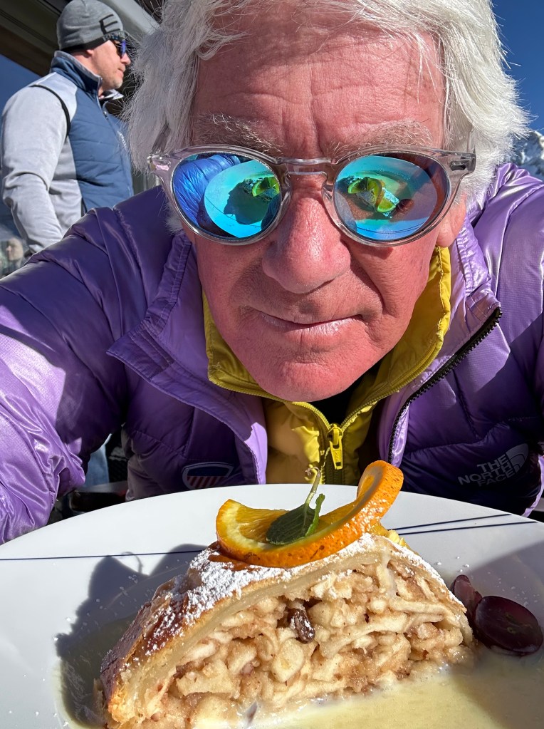
Best Dessert: Gotta be Streudel. Apple Streudel. Pretty sure I had six separate servings, at six different settings, including the Munich airport this morning. All were memorable. Sarah has enticed me to come home by promising to find a Streudel recipe and make it for my birthday 🎂 in two weeks.
Apple Streudel with whipped cream.
Apple Streudel with vanilla glaze.
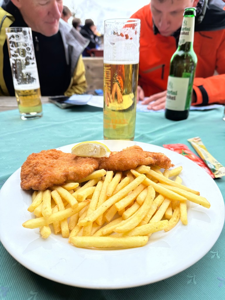
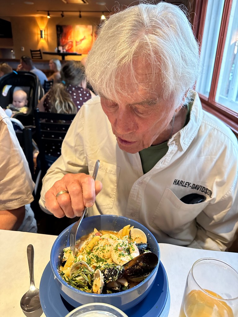
Best Schnitzel: Hard to say. I think I had five of them, two at lunch and three dinners. I promised myself I wouldn’t leave any schnitzel on the table, and I didn’t.
Mid-day schnitzel on the mountain.
Best Memory: A beautiful 20-something German college student from Stuttgart I rode with on the chairlift one day. She said exuberantly, “I love your purple jacket. It’s beautiful.” Back atcha, fraulein. John was with me and can vouch for this story.
Love the purple parka. Ees beautiful, ya?
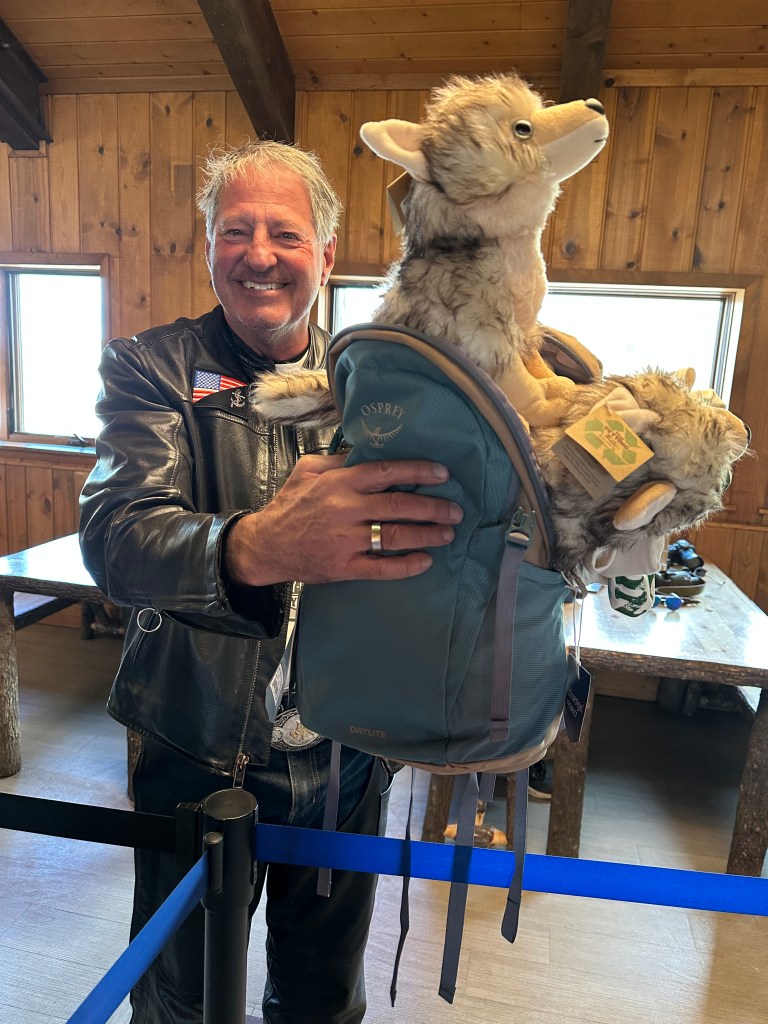
Best Acquisition: Walter Jr’s new BFF, Maximillian (a classic Austrian name), who I found while souvenir shopping just yesterday. We’ll call him Mayrhofen Max, for short. A great use of the last 28 Euros 💶 in my pocket.
Mayrhofen Max relaxes with a Pils before dinner.
Best Photobomb: On the Hintertux glacier, where all good things are possible, Fiona added a special touch, making her only day on skis 💯 percent worthwhile.
Say cheese!
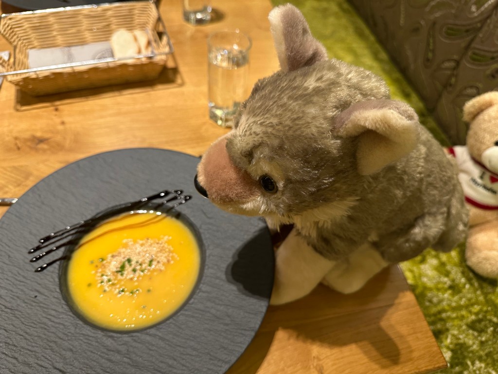
Best Five-course Dinner: The Hotel Pramstraller, where we ate last night. If you’re on the “half-board” program (I wasn’t), you get the five-course treatment every night!
Course #2 of our five-course dinner: carrot ginger soup. Other courses Wednesday night included salad, prawn and avocado mash, schnitzel and fries, and ice cream with fruit.
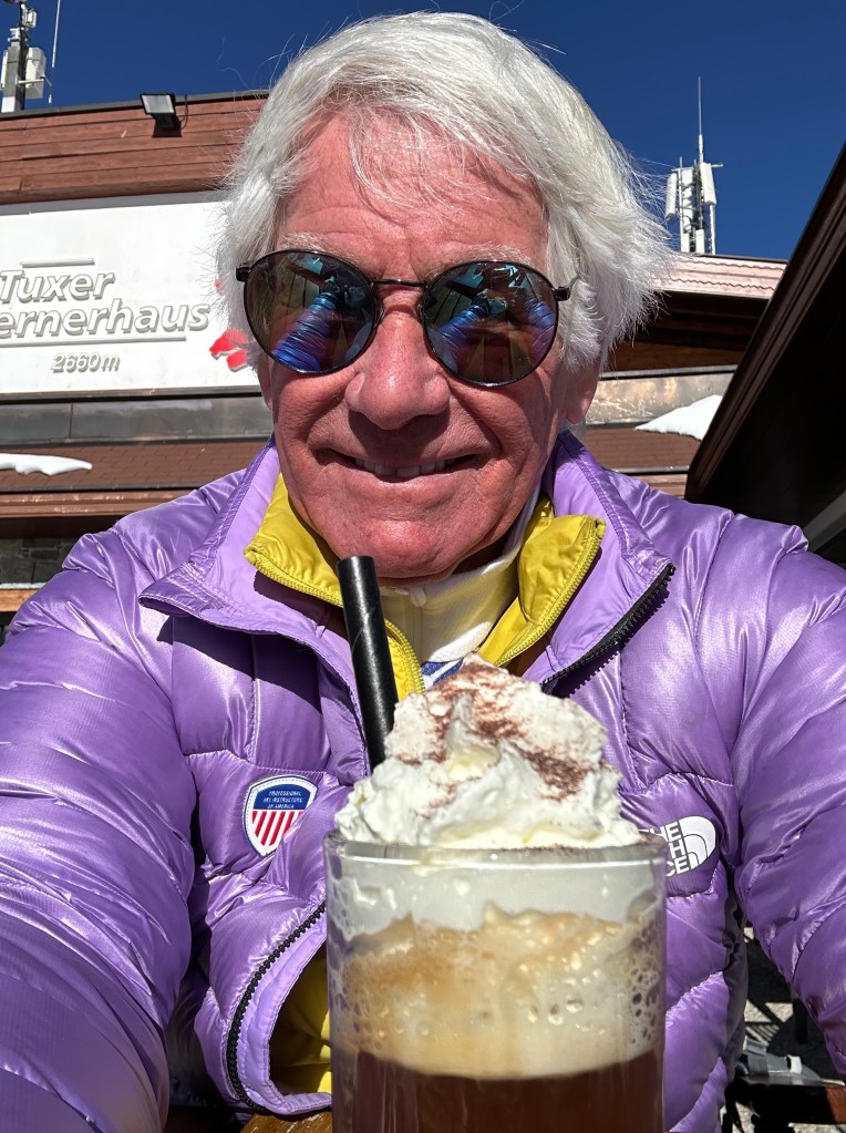
Best New (for me) Drink: Bombardino. A magical mix of Italian egg liquor (Advocatt) and brandy. Served hot with whipped cream on top, and garnished with cinnamon or cocoa powder. Very popular in Italy, especially at ski resorts.
Mid-day Bombardino.Yesssss!
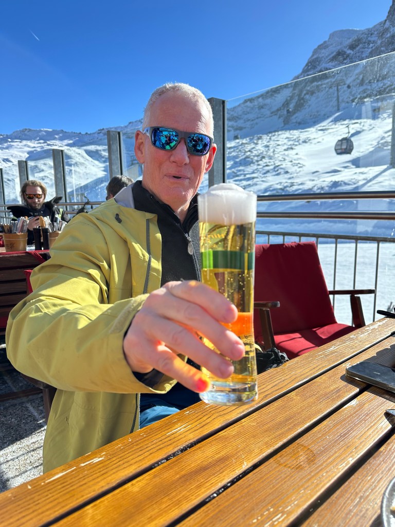
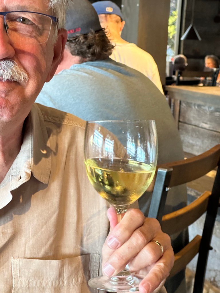
Most Commonly Consumed Beverage: Beer. All sizes and types. All times of day. Except breakfast.
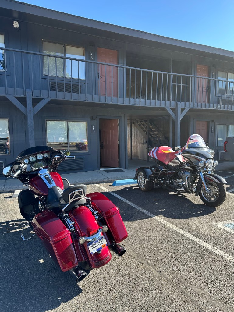
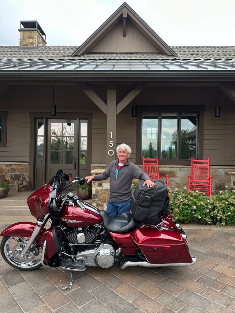
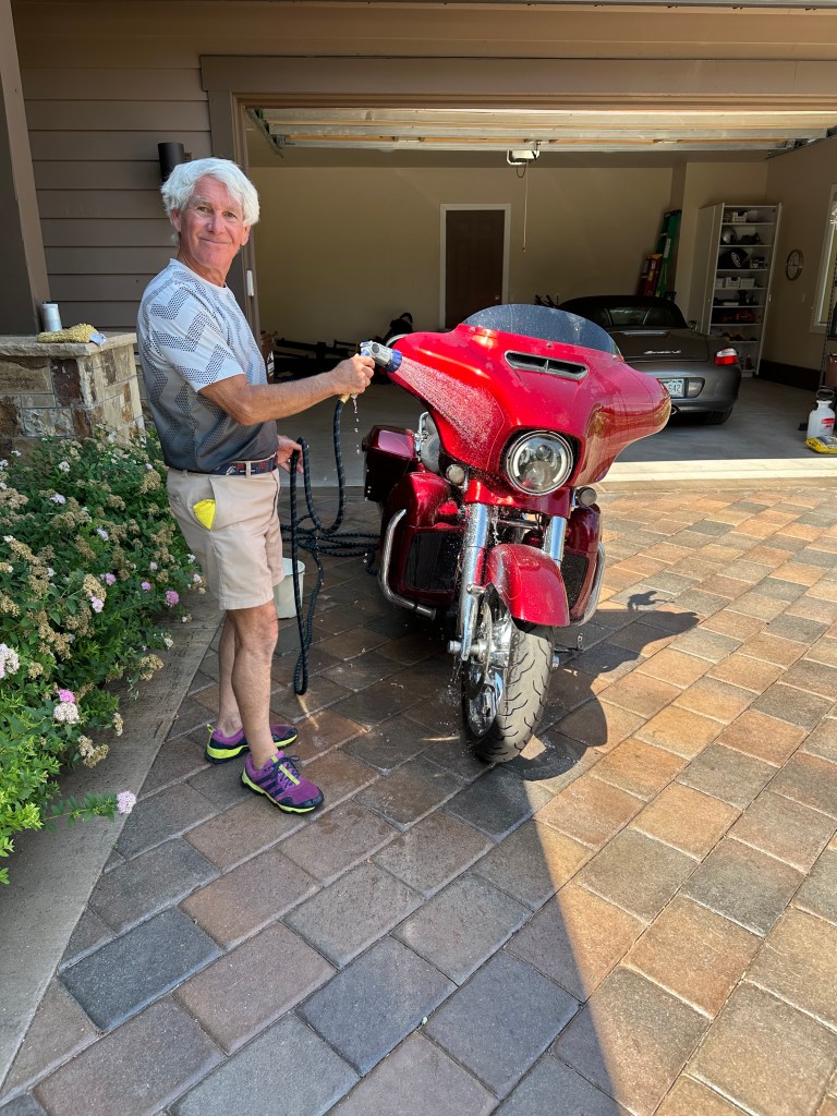
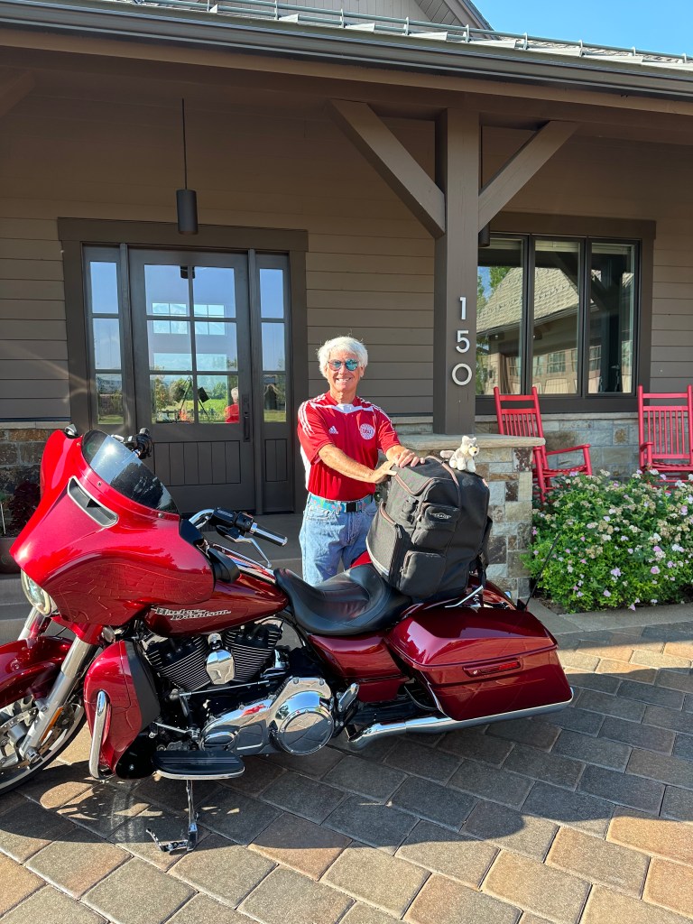
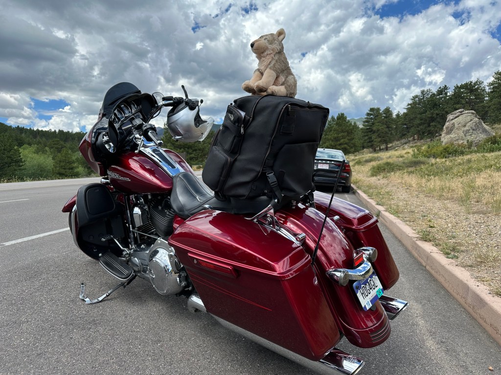
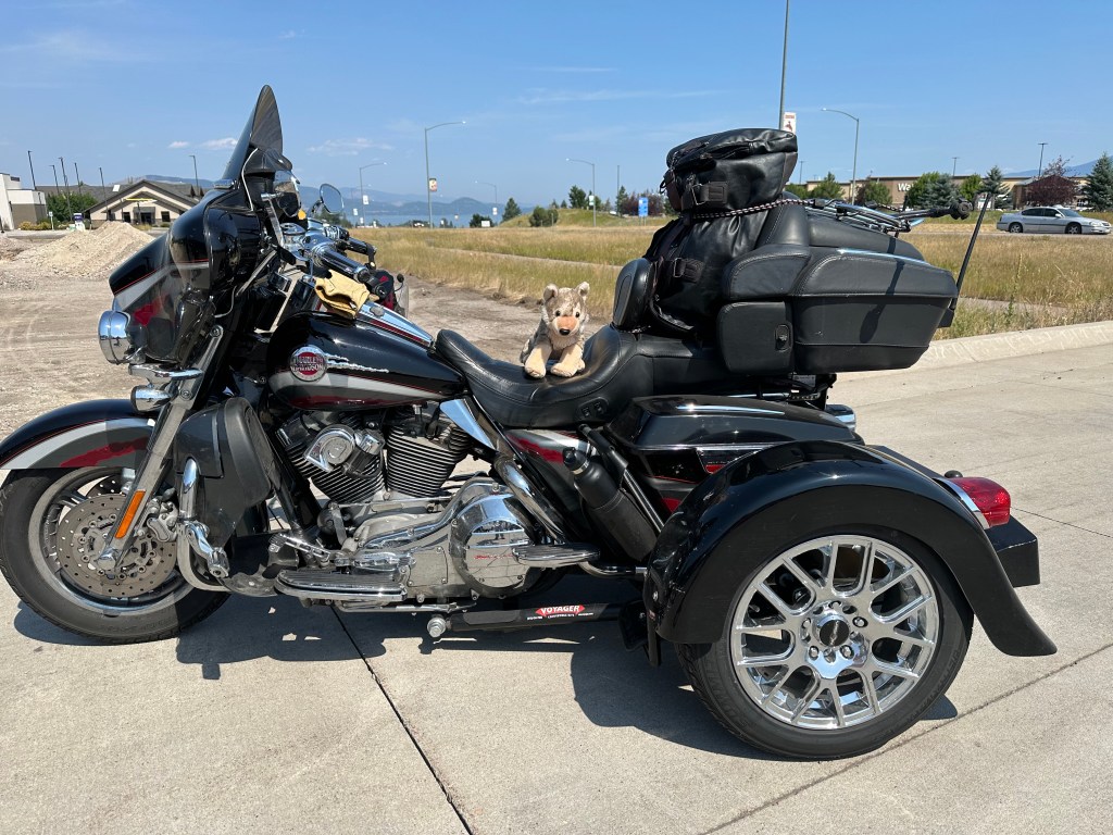
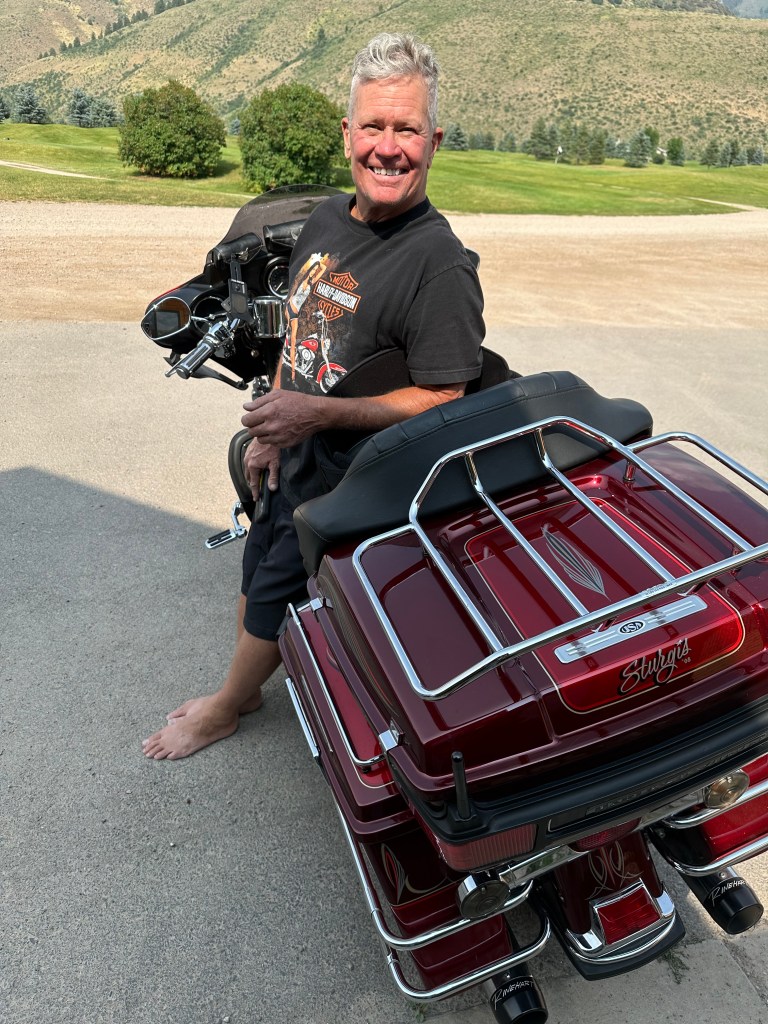
You’d hardly know I just finished two weeks and 3,000 miles on the road. Isn’t she a beaut?
***
It’s a ritual I know well by now. After 17 trips, going all the way back to 2009, I’ve got the post-ride routine figured out.
The day after my trip ends, I wash several weeks’ worth of bug goo and road grime off, shine up the Harley, and dream about next year.
I’m already dreaming.
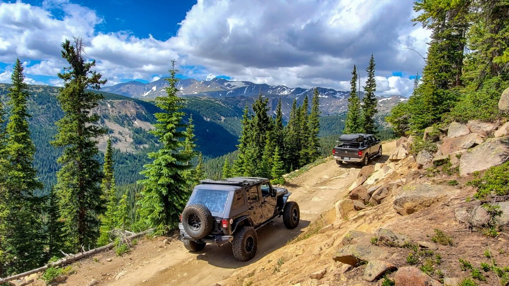
This year’s theme was Colorado’s Pass-a-Paloozas™, paved roadways over 10,000 feet. The state has 31 of them, and I rode 29 over the past two weeks.
To help you plan for your future on the road, here’s a list of all of them. All you need is a full tank of gas, and a free day or two. Time to start planning.
Trail Ridge Road: 12,183 feet
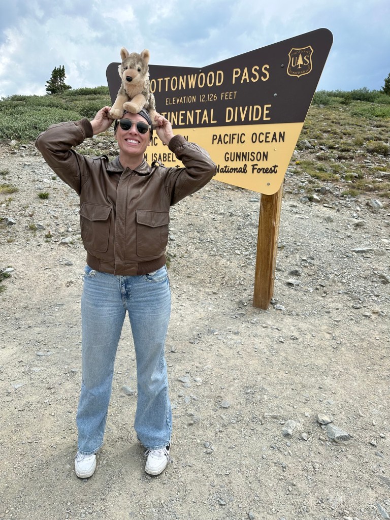
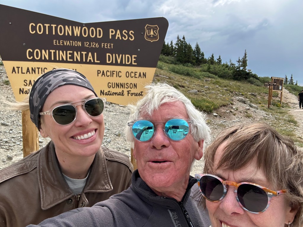
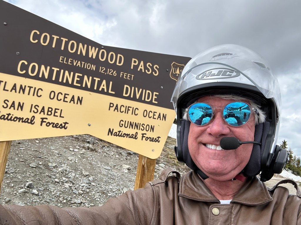
Cottonwood Pass: 12,126 feet
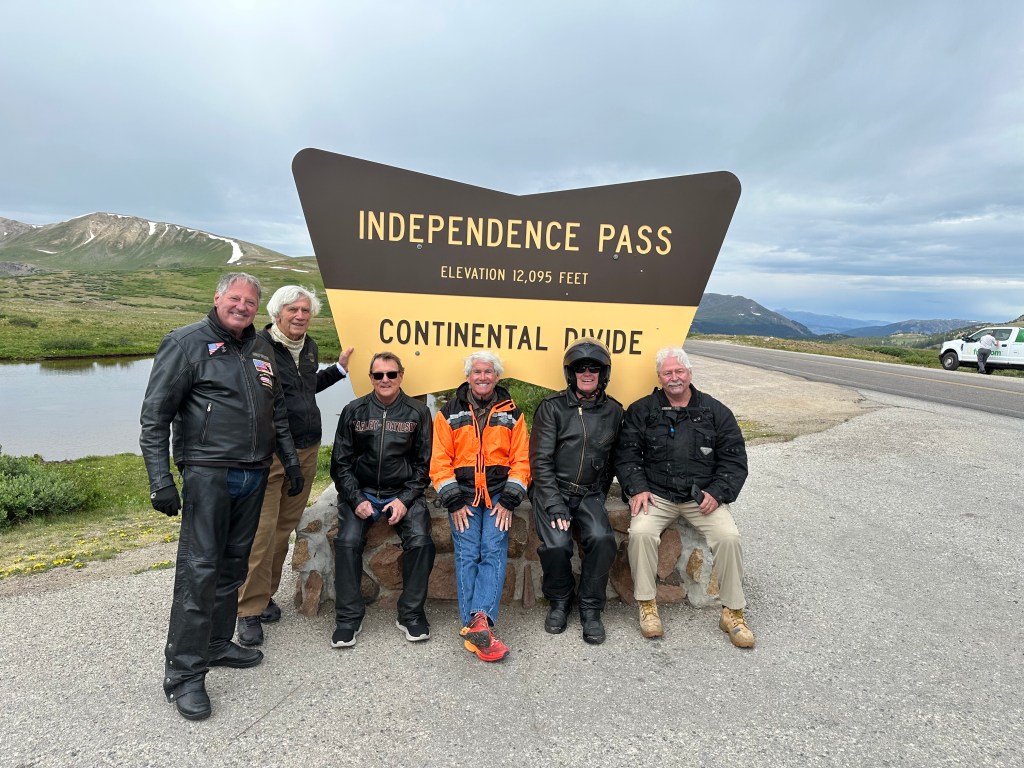
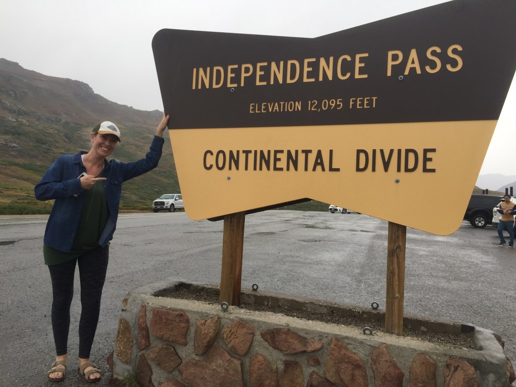
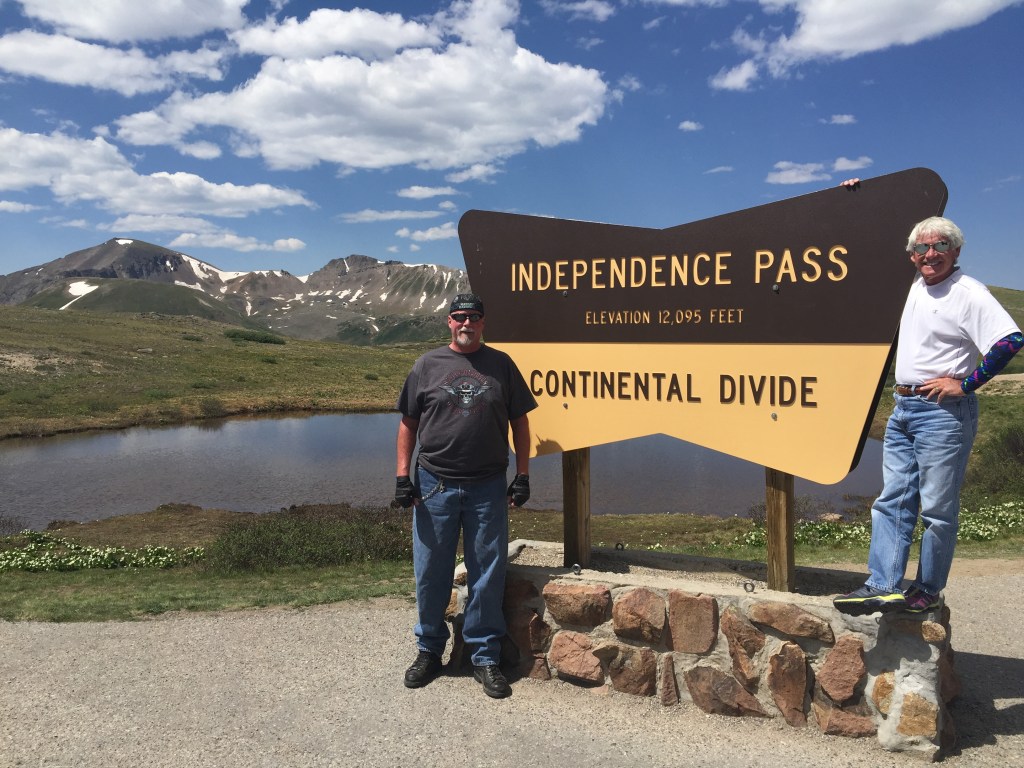
Independence Pass: 12,095 feet
Loveland Pass: 11,992 feet
Iceberg Pass: 11,827 feet
Guanella Pass: 11,669 feet
Hoosier Pass: 11,541 feet
Slumgullion Pass: 11,530 feet
Fremont Pass: 11,318 feet
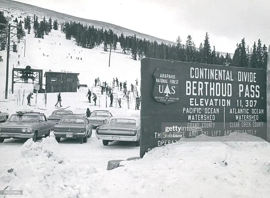
Berthoud Pass: 11,315 feet
Monarch Pass: 11,312 feet
Eisenhower Tunnel: 11,158 feet
Juniper Pass: 11,020 feet
Red Mountain Pass: 11,018 feet
Molas Pass: 10,910 feet
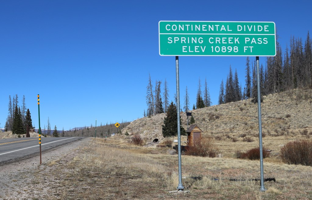
Spring Creek Pass: 10,901 feet
Wolf Creek Pass: 10,857 feet
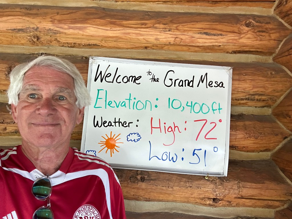
Grand Mesa Summit: 10,839 feet
Milner Pass: 10,759 feet
Vail Pass: 10,666 feet
Coal Bank Pass: 10,640 feet
Tennessee Pass: 10,424 feet
Cameron Pass: 10,276 feet
La Manga Pass. 10,230 feet
Cumbres Pass. 10,222 feet
Lizard Head Pass: 10,222 feet
North Pass: 10,149 feet
Red Hill Pass, 10,051 feet
Kenosha Pass: 10,001 feet
Here are the two I did not ride. One was closed for the summer, the other too far away.
At the Blue Mesa Reservoir, halfway home, Dan gets a little frisky. Maybe he needs some time with the wife?
Today marks my last day on the road, bringing to an end a 2,800-mile journey, crossing 29 of Colorado’s 31 Pass-a-Paloozas™. The whole point of the trip was bagging as many of the 10,000-foot-plus paved passes as possible. Mission accomplished.
There are no Pass-a-Paloozas™ on the menu today, but the riding promises to be spectacular.
How do I know this? I did the exact same ride, mile-by-mile, 10 days ago.
Then, I was with Sarah and Brittany, at the end of my week-long Family Ride. Today, I’ll do the same thing with the guys. The journey is so good, it’s worth doubling up.
Déjà Vu and Groundhog Day. Again.
There’s a great vista point on Highway 92 between the Blue Mesa Dam and Crawford. That’s the Gunnison River in the background.
This blog post will be intentionally light on words. No point in saying much of the same stuff I said on July 18, the usual details and color you either love or hate. If you want that kind of granularity, click here to read my previous post that took us from Ridgway, along the Black Canyon of the Gunnison, over McClure Pass, then the home stretch to Carbondale. That’s exactly what we’re doing today.
You may think I’m being lazy. Maybe.
But how many times do you want to read about Joe Cocker’s only Grammy (“Up Where We Belong”), the capacity of the Blue Mesa Dam (940,000 acre-feet of water), the Colorado state rock (Yule Marble), or the Hotchkiss town slogan (“The Friendliest Town Around”)?
Today, I’ll share just a few photos and captions, from today’s ride. After nearly 50,000 words of blogging over the past two weeks, you’re probably ready for a break.
At the Blue Mesa Dam. Gary #2 and Dan.
Dan strikes up a conversation with some riders from Fort Worth, Texas.
Almost home.
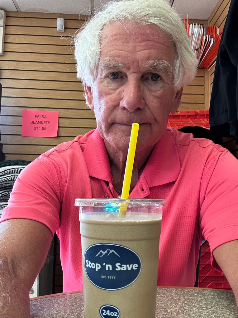
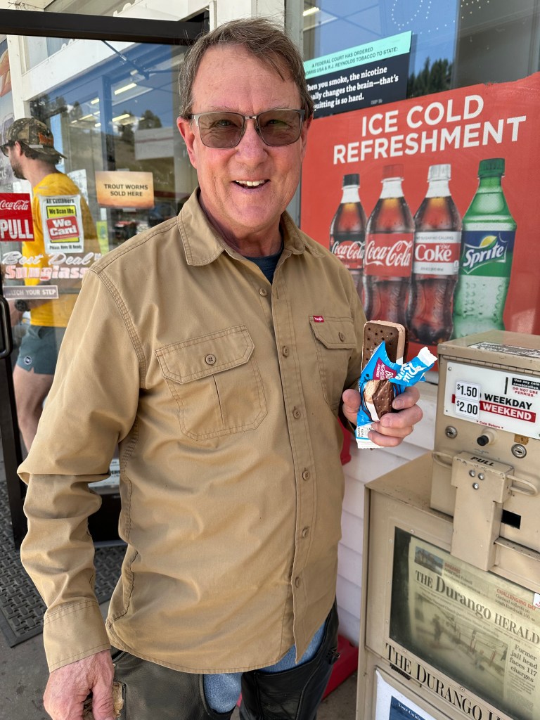
It was over 90 degrees when we passed through Paonia. So of course I hydrated at the Stop ‘n Save.
And there you have it.
Now, it’s time to clean up the bike, find a healthier diet, get some exercise, and return to living my best summer life in Carbondale.
I’ll have a very short blog post tomorrow to conclude this year’s adventure, including a complete listing of all the Colorado Pass-a-Paloozas™, in the event you’re inclined to give them a try. All of ’em, or one at a time.
(mic drop)
Gary, out.
Home at 2:30 pm, right on schedule.
To see today’s route from Ridgway, along the Black Canyon of the Gunnison, over McClure Pass, home to Carbondale, and zero Pass-a-Paloozas™, click here.
***
Today’s Not Quite Pass-a-Palooza™… Lead King Loop: 10,800 feet
The final Not QuitePass-a-Palooza™ of my two-week trip is right in our backyard, just 40 minutes from our front door in Carbondale.
As we passed by the turnoff to Marble a few hours ago, there were all kinds of off-road vehicles in the area. They were either just getting started, or just finishing, the spectacular Lead King Loop, a 13-mile adventure that begins and ends in Marble.
If you try the Lead King Loop – and you should – you’ll circumnavigate Sheep Mountain, see one of the most-photographed sights in Colorado, rearrange your dental work along the bumpy way, and experience a journey of a lifetime. I’ve done it three times – in 2014 (with Vern and Cindy Vennes), 2018 (with Brittany and Sarah), and 2023 (with Dr. Dan Gilbert).
Now, it’s your turn.
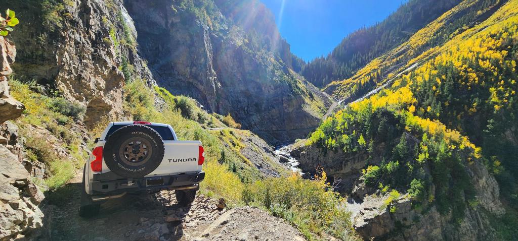
You’re gonna need a capable rig, and nerves to match, if you do the Lead King Loop. This shale gets slippery when wet. I’ve done the loop three times; how hard can it be?
Get Yourself Some Wheels. You’ve heard this before on many of our previous Not QuitePass-a-Paloozas™, but it’s particularly true on the Lead King Loop: you’re gonna need a high-clearance, four-wheel drive vehicle. No way around it. Air down your tires to improve traction and help prevent punctures; 20-25 psi is a good place to start. Oversize vehicles, such as full-size four-door pickups, are going to have tough sledding on this route.
Leaving Marble, you ride past Beaver Lake. You’re on (Gunnison) County Road 3. The road surface is gentle. Don’t let it fool you. You’ve got a rough, rocky road ahead.
A mile out of town, you come to a fork in the road, at the base of Daniels Hill. This is where you put your rig into four-wheel drive. Going left takes you onto the Lost Trail; going right keeps you on County Road 3, heading toward the tiny town of Crystal.
If you go left at the fork, you’ll do the loop clockwise. If you go right, you’ll do the loop counter-clockwise.
Lizard Lake. Why not camp there?
Let’s go Counter-clockwise. You go right, and in a mile, You’re at Lizard Lake, a highly desired camping spot on the road to Crystal. Follow the Crystal River for three miles, and you’ll end up at Crystal, which many people erroneously call a ghost town. More often than not, according to the dictionary, ghost towns are once-flourishing towns wholly or nearly deserted usually as a result of the exhaustion of some natural resource. Crystal didn’t run out of a resource; it’s just too damn remote and hard to get to.
Is Crystal a ghost town? The place is not what it used to be, though it’s hardly a ghost town, either. This time of year, the signs of life are everywhere.
Once called Crystal City, the community sits at 8,950 feet. Like so many Colorado mountain mining towns, it’s located in an area of extreme terrain, spectacular beauty, rugged isolation, and harsh winters.
Miners began working the area in the 1860s, but it was so difficult to access, that it took another 20 years before things began booming. In 1880, prospectors saw outcroppings of quartz crystals nearby, and named the area after the crystals. The town grew as a mining camp for several decades, with an average population of 500. In 1893, there were a half dozen mines, which produced silver, zinc and lead. Miners hoped to replicate the success of places like Leadville. That turned out to be a pipe dream.
In its heyday, Crystal had a newspaper, a post office, hotels, general stores, saloons and a pool hall. Ultimately, the difficulty in reaching Crystal led to its demise. Transporting ore to the depots in Crested Butte and Carbondale, and bringing the basic necessities and mail into Crystal were a challenge in the snow-free months, and nearly impossible in the winter.
Crystal in the winter can be an isolating experience. Not all days are this sunny.
Crystal has been mostly a ghost town since 1917, but it never truly died. Today, a few hearty locals spend summers there, and leave again when the snow falls.
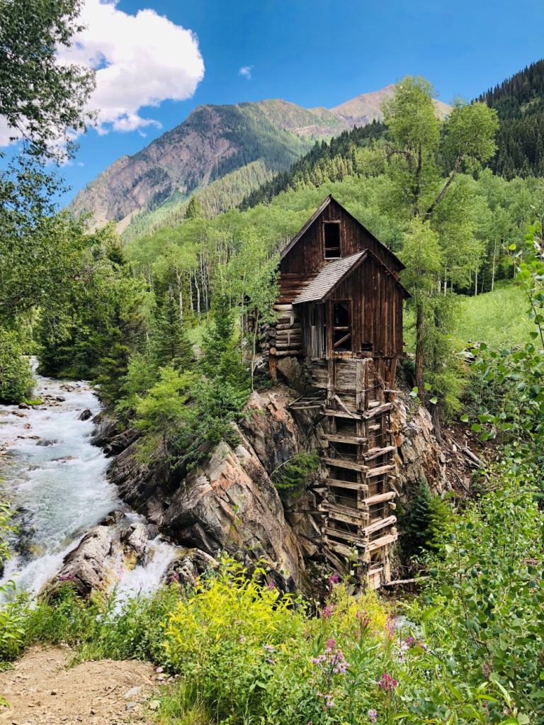
The Iconic Crystal Mill. Just a few hundred feet from Crystal is the famed Crystal Mill, a hydro power house on the banks of the Crystal River that once provided electricity for air drills, and ventilation for miners. Today, it’s one of the most photographed and recognized sights in Colorado.
The Crystal Mill is one of Colorado’s most photographed buildings, and for good reason.
There’s a Fork in the Road. Take it. Continuing on County Road 3 from Crystal, you come to another fork in the road. If you go right, you’ll head up Schofield Pass and the Devil’s Punchbowl. You may recall, that route was the very first Not QuitePass-a-Palooza™, on the first day of this trip, way back on July 12.
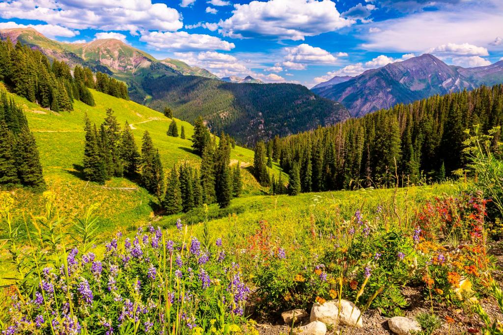
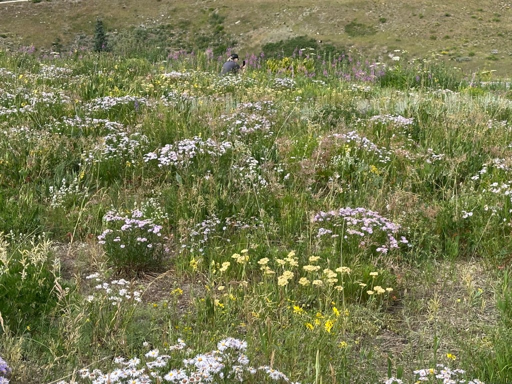
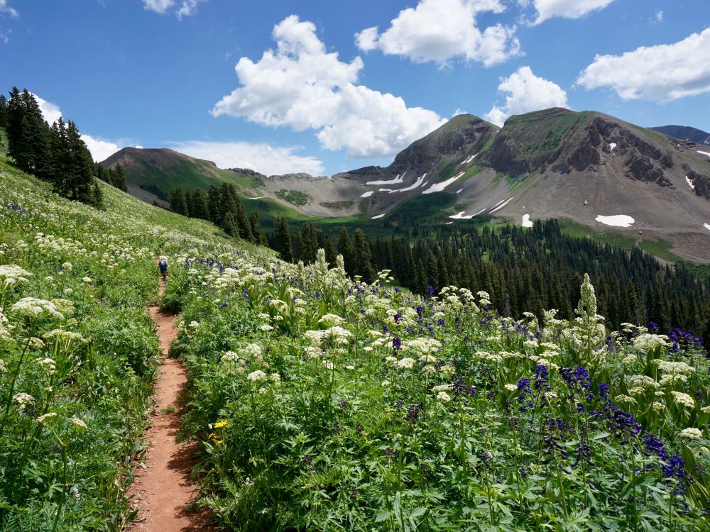
But we go left, staying on County Road 3, and following the North Fork of the Crystal River into the beautiful Lead King Basin. The road is built on slick shale, and can be extremely slippery when wet. Once in Lead King Basin, you’ll have idyllic views of Snowmass Mountain, and zillions of wildflowers, especially in August.
You’ll know it when you reach Lead King Basin. The road emerges from the trees into a gorgeous alpine basin with a waterfall cascading down from Geneva Lake.
The Lead King Basin in summer is quite spectacular.
The basin is quite remote; that’s part of its charm. But there’s one cabin located in Lead King Basin. It’s the home of Paul Harris, otherwise known as Lead King Paul, and it’s located next to the bridge over the Crystal River. Some have labeled Paul a hermit. Hermits live in solitude as a religious discipline; Paul just likes living in one of the most beautiful places in the world. The guy splits his time between Lead King Basin, where he’s a caretaker for an old miner’s cabin, and a trailer Marble. Lead King Paul has lived this life for 48 years.
In 1902, the Lead King mine was discovered. It produced lead and silver ore, and became one of the more profitable mines in the Crystal valley, but eventually became unsustainable because of its remoteness. The Lead King Mine has been abandoned since 1923. The mine gave the Lead King Loop its name.
Brittany cruising through Lead King Basin. Doing the loop checked off a box on her Colorado Bucket List.
The Acme of Lead King. You leave the Lead King basin, and begin climbing steeply over a series of switchbacks that take you to the high point of Lead King Loop, 10,800 feet. You’re now on Lost Trail Road, heading west, toward civilization.
Once you crest the top of Lead King Basin, you’ll drive back down to Marble between Arkansas Mountain and Sheep Mountain. About two miles beyond the highest point of the road, you’ll complete the loop at the top of Daniels Hill, then continue the remaining four miles into Marble. And with that, your work is done.
Brittany grabs one last pic on Lost Trail Road, before heading back into Marble. This was in 2018; the road hasn’t changed.
Get off Your Butt and Move. If you’d rather use your own legs to experience the Lead King Loop, every September there’s a 25K charity race that starts and ends in Marble, and completes the loop around Lead King Basin. You can run, walk or hike the loop. A good time is somewhere around two hours. All proceeds benefit the Marble Charter School.
The Lead King Loop attracts up to 17,000 visitors each summer. You can count yourself as being one of them.
Participants in the Lead King Loop 25K Charity Race, just getting started. They look so energetic. Check back in two hours to see how they feel.
To view today’s Not QuitePass-a-Palooza™ route from Marble, over the Lead King Loop, and back to Marble, click here.
Walter Jr, outside our hotel room in South Fork this morning. He’s ready to roll!
Today’s route takes us over some spectacular mountain passes. Four Pass-a-Paloozas™, an old mining town or two, and a turnoff to a Not Quite Pass-a-Palooza™.
It’s gonna be epic. And, much of it will seem oddly familiar. It may feel Déjà vu-ish, all over again.
We leave South Fork and head south along the South Fork of the Rio Grande. That may be the first time I’ve ever used the word South three times in one sentence.
In 20 miles, we arrive at Wolf Creek Pass.
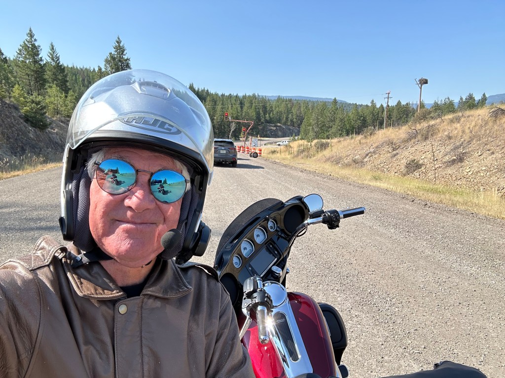
At a scenic overlook on Wolf Creek Pass, Clarence snaps a pic of the view.
Pass-a-Palooza™ … Wolf Creek Pass: 10,857 feet
Oooh. This seems oddly familiar. I seem to recall this road. We crossed Wolf Creek Pass just yesterday, at the end of our ride, as we came into South Fork. What may also seem oddly familiar is that Wolf Creek is an Honorable Mention Top Ten.
So, I won’t bore you with details about the pass, the ski area, or how they both got their names.
The sun’s out. Clarence is loving life.
On the descent over the west side of Wolf Creek Pass, we roll through Pagosa Springs. Yesterday, we rode along the town’s eastern outskirts, but didn’t actually see the San Juan River, which courses through Pagosa Springs.
In Pagosa Springs, we roll west along the town’s main street, US Highway 160.
This seems oddly familiar, too. That’s because Sarah, Brittany and I stayed here last week. If you want a refresher course in what’s what in Pagosa Springs, click here to read my blog post about our Pagosa Springs visit. Scroll down to the part about Pagosa Springs. Or don’t.
Sixty miles west of Pagosa Springs, all on Highway 160, we arrive in Durango. If that sounds oddly familiar, it’s because Sarah, Brittany and I rolled through Durango last week on our way to the Million Dollar Highway.
Wanna read, or re-read, my blog post about Durango and the road north of it? Click here to review my July 14 blog post, and get a full refresher course on Durango, and the three Pass-a-Paloozas™ that lead us to Ridgway, today’s destination.
At Molas Pass. 10,910 feet in the San Juan Mountains.
We turn north in Durango on US Highway 550, which will take us over three spectacular passes. They’ll all feel like Groundhog Day.
Pass-a-Palooza™ … Coal Bank Pass: 10,640 feet
Coal Bank is the first pass on our way to Ridgway.
Pass-a-Palooza™ … Molas Pass: 10,910 feet
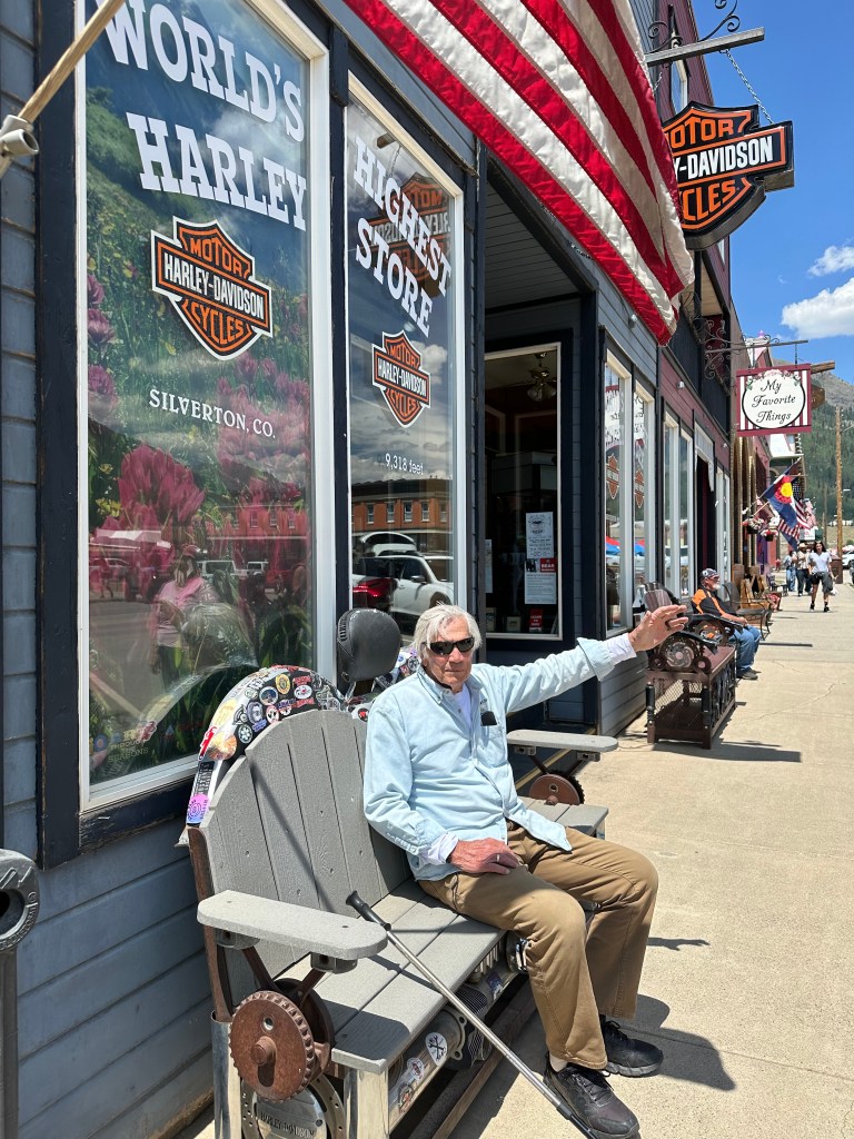
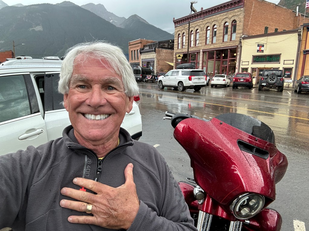
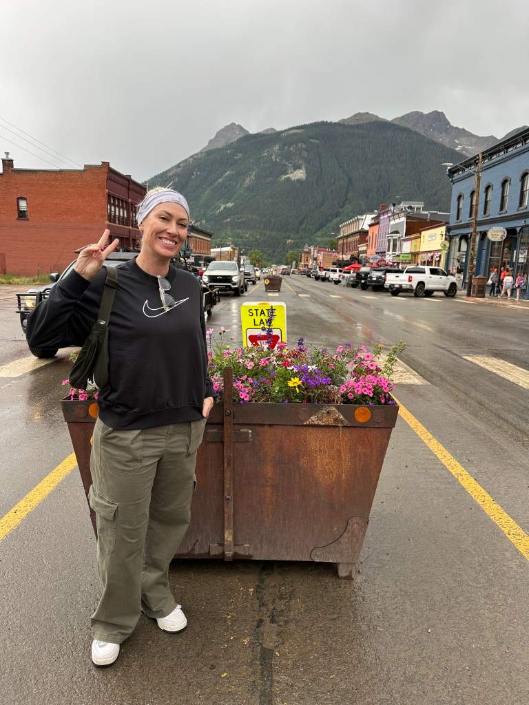
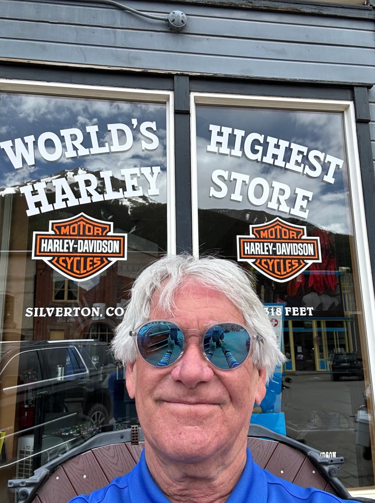
Then, Molas Pass, which brings us to Silverton, home of the world’s highest Harley store. Greene Street, the main drag in town, is named after George Greene, a pioneer and city father who played a key role in development of the town.
Dan takes a pic of something (me) at Molas Pass.
From Silverton, we head over one final Pass-a-Palooza™ of the day.
In Silverton, Mark stops to smell the roses.
And Clarence takes a seat in front of the world’s highest Harley store.
Pass-a-Palooza™ … Red Mountain Pass: 11,018 feet
Red Mountain Pass brings us to Ouray, which leads us to Ridgway, tonight’s destination.
Oooh, riding that route over the Million Dollar Highway seemed oddly familiar. To me, it did anyway. But it shouldn’t have to the guys, because they weren’t with me last week on my “Family Ride.”
If you felt cheated due to the lack of details and color in today’s ride, please click on the links (here and here) I provided earlier. Or, just get over it.
We, the guys on today’s ride, don’t feel cheated at all. We got to see some of the most beautiful roads in Colorado today, some of my all-time favorites. The Million Dollar Highway is #5 on my all-time Top Ten list.
Wish you could have joined us.
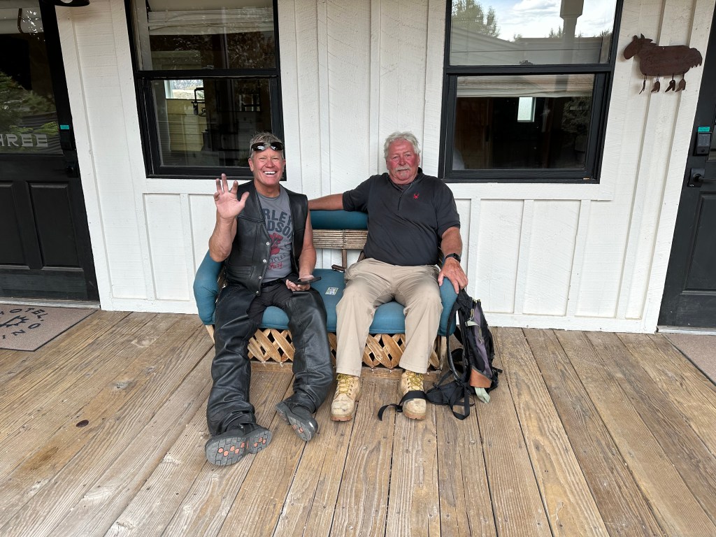
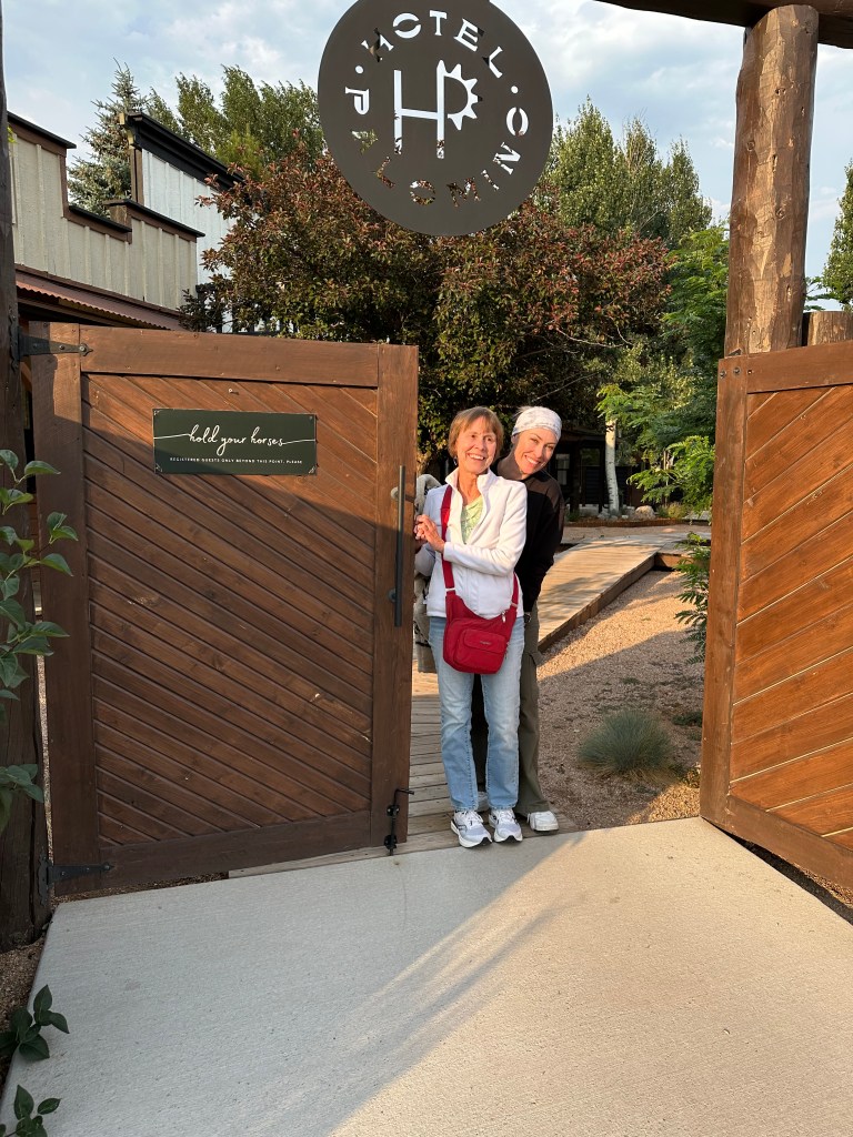
At the Hotel Palomino in Ridgway, I stumble across a couple of weary travelers.
To see today’s route from South Fork, over four Pass-a-Paloozas™ and the Million Dollar Highway, to Ridgway, click here.
***
Today’s Not Quite Pass-a-Palooza™… Stony Pass: 12,650 feet
When we were in Silverton earlier today, seeing the sights on Greene Street, we could have easily continued east on that street, and ended up on today’s Not Quite Pass-a-Palooza™. This off-road journey, by far the longest of my two-week trip, is Stony Pass. It’ll take adventurous souls from Silverton, over the pass, and on to Creede, a town you should be familiar with, by now.
The trek, which crosses the Continental Divide, is 64 miles from Silverton to Creede. Stony Pass is open for only a limited season each year, usually from May until October. As with all the other high mountain passes, snow is the reason. You’re gonna want a high-clearance, four-wheel drive vehicle.
As you leave Silverton, Greene Street turns into Blair Street, and Blair Street becomes (San Juan) County Road 2. Five miles from Silverton, we’re in Howardsville, a ghost town originally laid out in 1874 by the Bullion City Company as Bullion City.
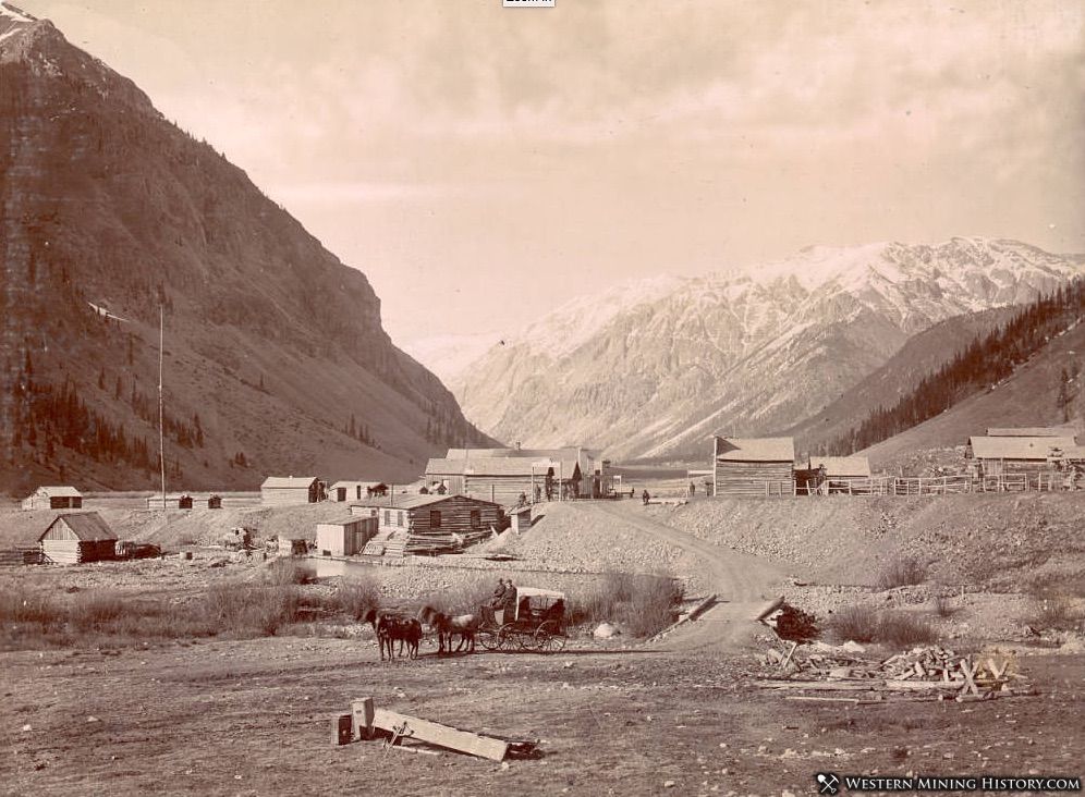
Howardsville, in the 1870s. We have George Howard to thank for this.
Howardsville was named after pioneer prospector George Howard, who built the first cabin at the site in 1873. The area became an early mining camp and the first county seat of La Plata County. It wasn’t long before the county was carved up into smaller counties, and Silverton took over the county seat for the newly established San Juan County.
When the railroad arrived at Silverton in 1882, it diminished the importance of Howardsville in the area, and the town began to decline.
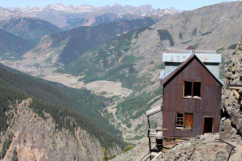
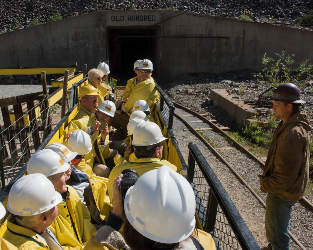
The bunkhouse at the Old Hundred Mine. It remained in operation through the 1930s. Nice view.
The Silverton Northern Railroad laid tracks to reach Howardsville in 1806, with an extension to the Old Hundred Mine, less than a mile from Howardsville. The founders of the mine, the Neigold brothers from Germany, spent 30 years developing mining veins on Galena Mountain. Because of their heritage, it’s believed the Old Hundred Mine was named after the popular German hymn, “Old Hundredth,” which itself came from the 100th Psalm.
Even though it lived in the shadow of nearby Silverton, Howardsville lived on as a small mining community for decades. As the mines in the area played out, most of the people moved to Silverton, effectively killing Howardsville. The town effectively died in 1939, when its post office shut down. Three years later, the railroad tracks to Howardsville were torn up.
Today, a number of structures remain from Howardsville’s boom times. The Old Hundred Mine remains open throughout the summer season for guided mine tours. You can pan for silver, gold and copper, and keep what you find. Good luck.
Today, you can tour the Old Hundred Mine.
Following a set of steep switchbacks, it’s about six miles from Howardsville to Stony Pass. The pass got its name because of the rocky terrain. You could pretty much say that about almost any of these off-road Pass-a-Paloozas™.
The route along Stony Pass was developed to connect the area’s mining operations in Silverton to the Front Range, via the town of Del Norte. The road was originally designed for pack animals and later was improved to accommodate wagons.
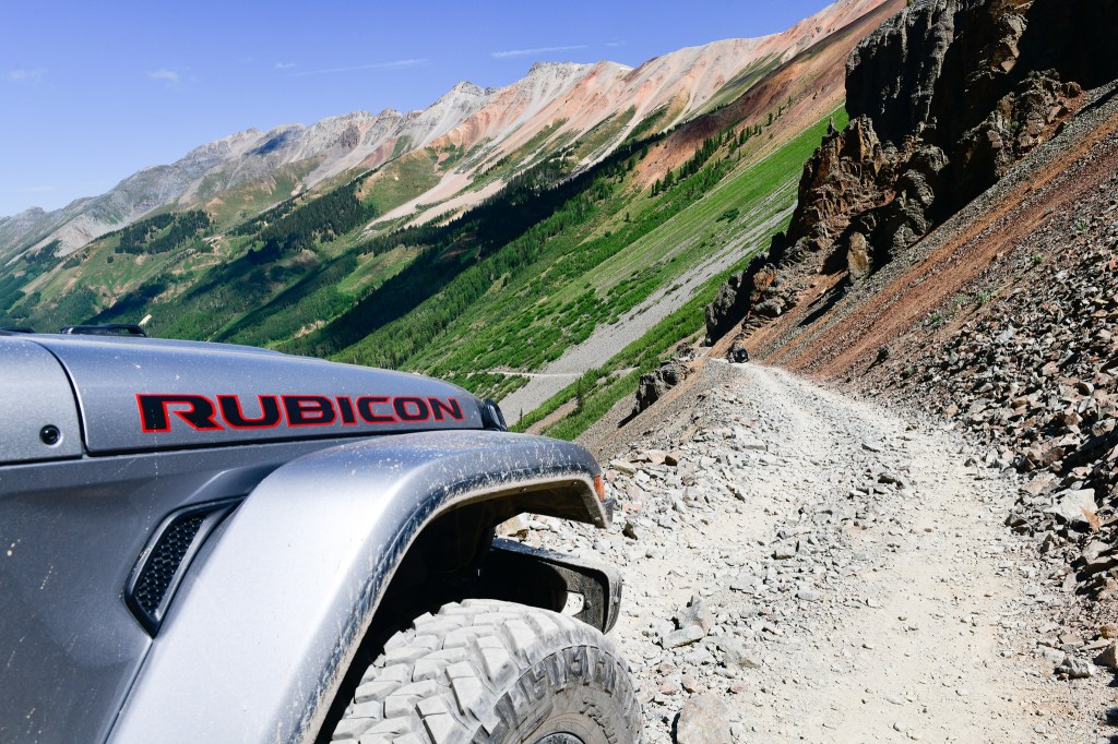
This is what the Road to Stony Pass looks like. Nice commercial for Jeep Rubicon.
On the east side of the pass, you’ll see small streams along the trail. These streams start at the Continental Divide, and are the headwaters of the Rio Grande River.
The Continental Divide Trail, which we learned about yesterday, crosses Stony Pass Road at Hunchback Pass.
The first car to cross Stony Pass did so in 1910. It was a Croxton-Keeton, an Ohio-built touring car with a four-cylinder, 30-horsepower engine, and a $2,750 price tag. The three occupants had to get out and clear boulders along the way, and build some sections of the road as they went. The car had many flat tires and mechanical problems, and had to be pulled by horses over Stony Pass’ final ascent. Their trip from Del Norte to Silverton took five days.
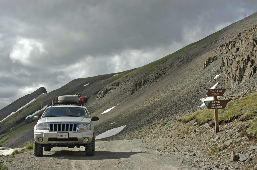
Modern vehicles can do the Stony Pass journey in considerably less than five days.
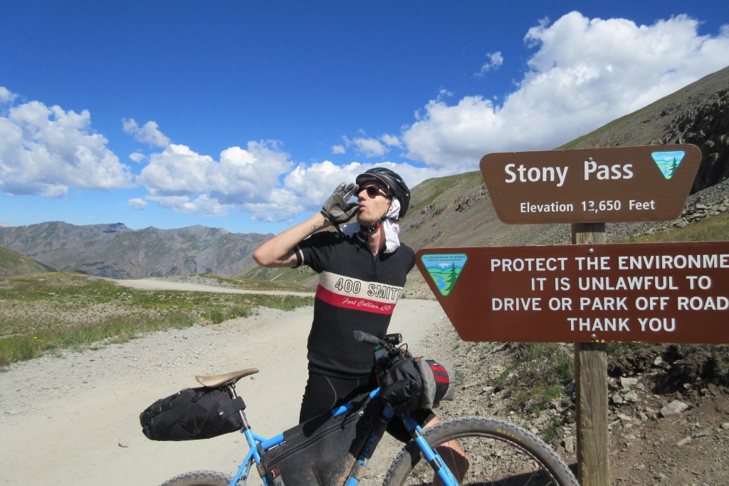
You can bike Stony Pass, too.
The descent from Stony Pass to the Rio Grande Reservoir is 18 miles. The reservoir sits at 9,450 feet, a drop of 3,200 feet from Stony Pass. It’s Colorado’s third-largest reservoir, with a capacity of 52,000 acre-feet of water.
The reservoir, completed in 1914, was originally designed to support agriculture in the San Luis Valley. Over the years, it’s become popular for fishing and recreation as well.
From the reservoir, you’ll have 14 miles to go before you reach Colorado Highway 149, which will take you the remaining 18 miles to Creede. Once you make it to Highway 149, the hard part is over. From here, the road is paved.
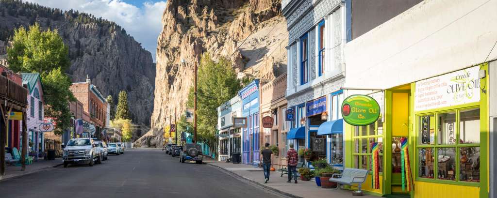
This is what awaits you at the end of your Stony Pass trip: Creede.
To view today’s Not QuitePass-a-Palooza™ route from Silverton, past Howardsville, over Stony Pass, and on to Creede, click here.
Two clean Harleys in front of room 109 (c’mon in, the door’s open) at the LOGE in South Park. In a few minutes, they’ll be leaving and landing in New Mexico.
During this two-week trip, I’ll cover about 2,800 miles. Ninety-nine percent of the time, I’ll be in Colorado; that’s where the Pass-a-Paloozas™are. Today will include the one percent that’s not in Colorado: a 28-mile stretch of road in northern New Mexico.
One of my ski school friends, Sandy, who’s from Albuquerque, has a sticker on his locker I’ve always enjoyed: “New Mexico. It’s Not New. And It’s Not Mexico.”
OK, New Mexico. See you in about two hours.
We begin the day riding east into the morning sun, toward Del Norte, 15 miles away. Del Norte, population 1,500, gets its name from the Rio Grande del Norte, “large river of the north” in Spanish. The town sits at 7,884 feet, on the banks of the Rio Grande, surrounded by the Rio Grande National Forest.
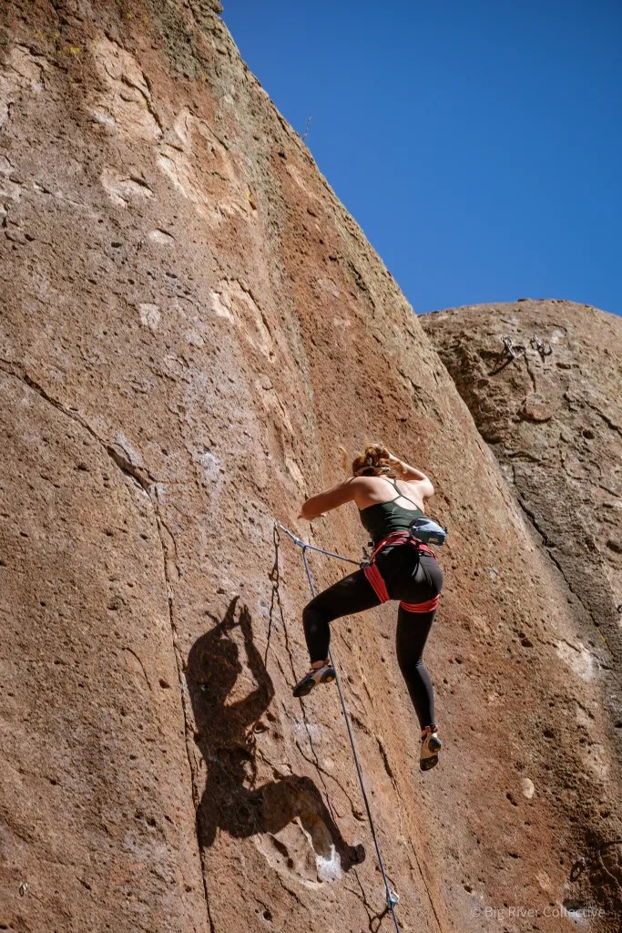
Just outside Del Norte is Penitente Canyon, once a worship area for the devout Catholic sect Los Hermanos Penitente. It’s now a worship area for devout rock climbers from around the world. Featuring more than 300 sport-climbing routes, the canyon has been featured in Climbing magazine. A penitent is a practitioner of ritual penance, typically Catholic; they’re known to practice self-whipping and other forms of torture, during Holy Week.
Rock climbing in Penitente Canyon.
Coors Barley in Monte Vista
We soon roll through Monte Vista, Spanish for “mountain view.” Monte Vista is bordered by the Sangre de Cristo (“blood of Christ”) range to the east, and the San Juan Mountains to the west. The town is in a high-plains valley in the San Luis Valley. Here, farmers raise potatoes, alfalfa and carrots, but the area has become famous for another agricultural product – Coors barley. The world’s largest single-site brewery, Miller Coors, based in Golden, relies on the farms around Monte Vista to produce special barley for its beer.
The Monte Vista National Wildlife Refuge is one of the area’s top attractions. Established by the Migratory Bird Conservation Commission in 1953, the wetland habitat provides a safe place for wildlife, especially migratory birds. In March and September, 20,000 migrating Sandhill Cranes use the refuge as a stopping point. One of the best times to visit the refuge is during the annual Monte Vista Crane Festival held each March.
Sandhill cranes are big in Monte Vista.
Fifteen miles beyond Monte Vista, we arrive in Alamosa, our first stop of the day. With a population of 10,000, Alamosa is the commercial center of the San Luis Valley, and home to Adams State University.
Alamosa was established in 1878 by the Denver & Rio Grande Railroad, and quickly became an important rail center. The railroad had an extensive construction, repair, and shipping facility in Alamosa for many years. Every June, Alamosa hosts “Summer Fest on the Rio,” a festival that has arts and crafts, musical entertainment, and activities for the kids. Cottonwood trees are abundant in the area, which may explain the town’s name; Alamosa, in Spanish, means “of cottonwood.”
Next town on the horizon is Antonito, Spanish for “highly praiseworthy.” Antonito, population 650, began as a sheep herding camp known as San Antonio Junction. The junction referred to its proximity to the Conejos and San Antonio rivers.
When the Denver & Rio Grande Railroad built its line south from Alamosa, the town was renamed Antonito and became an important town on the rail line. Antonito has a number of unique buildings, including a historic railroad depot that’s one of only a few lava rock depots remaining in the US.
The town is known for its many murals, most of them painted by Fred Haberlein. He received his formal training from a community of Benedictine nuns in Antonito. His work can be seen as far away as Quito, Ecuador, and as close to home as Carbondale. Fred’s most recognized public art in Carbondale is the 9-foot-by-48-foot “Interconnected Web of Life,” depicting a scene along the Crystal River, painted on the west side of the Dinkel Building.
He went on to complete 80 murals in the San Luis Valley before moving to Glenwood Springs with his wife, Teresa Platt, in 1988. For 18 years, Haberlein taught “Drawing on the Right Side of the Brain” at Colorado Mountain College. He died at his home in the Roaring Fork Valley in 2018, at the age of 74.
Colorado muralist Fred Haberlein has his works all over Antonito, and even in Carbondale.
Pass-a-Palooza™ … La Manga Pass: 10,230 feet
We turn west in Antonito. It’s a half-hour ride to the first Pass-a-Palooza™ of the day, La Manga Pass. For some reason, La Manga means “the sleeve.”
To get to the sleeve, we follow Colorado Highway 17, along the Conejos River. In Spanish, Conejos means “rabbits.” The river took that name in 1861 because of the area’s large rabbit population.
Pass-a-Palooza™ … Cumbres Pass: 10,222 feet
We dip down for a few miles, then rise up to the next pass: Cumbres, which means “summit” or “peak” in Spanish. OK, that makes sense. Cumbres and La Manga Passes are rarely closed in winter. The road over Cumbres Pass follows the same route as a railroad line built in the early 1880s by the Denver & Rio Grande Railroad as part of its extension from Alamosa to Durango.
Both Cumbres and La Managa Passes are in the San Juan Mountains.
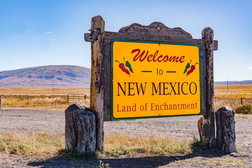
New Mexico, Here We Come!
Yes, it’s officially the Land of Enchantment.
My One Percent has finally arrived. It isn’t New. And it isn’t Mexico. We’re officially in the Land of Enchantment.
Four miles southwest of Cumbres Pass, we cross the border into New Mexico, as the road morphs from Colorado Highway 17 to New Mexico Highway 17.
Six more miles and we’re in Chama, a New Mexico village of 900 on the Rio Chama river. Today, Chama is Spanish slang for “bro” or “dude,” though that’s not the meaning town fathers had in mind. They named it after the Rio Chama.
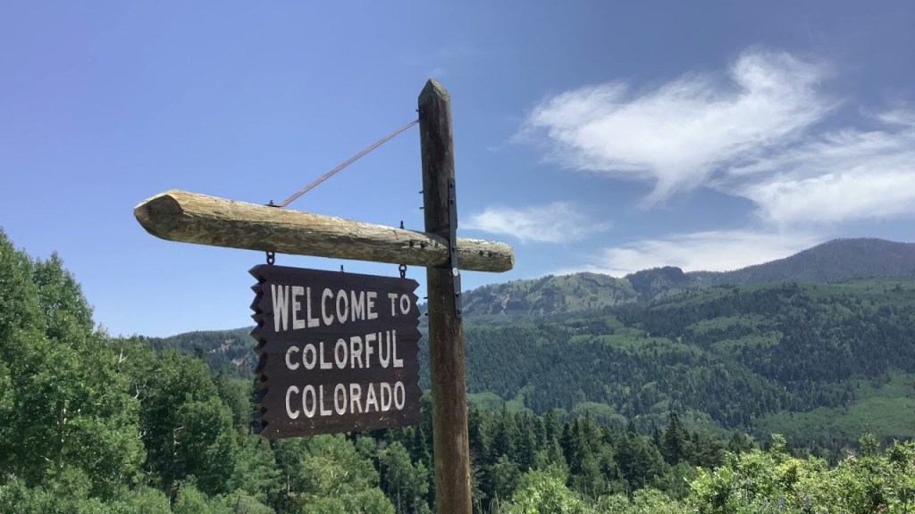
Colorado, Here We Come!
Thanks for the warm welcome, Colorado.
We leave Chama, and head back toward Colorado, where we’ll spend the remainder of the trip.
Our 28-mile New Mexico adventure is over, seemingly as soon as it began. The first Colorado sign of life we see is Chromo, which has a post office, but little else. Chromo takes its name from nearby Chromo Mountain.
There’s nowhere to stop in Chromo, so we power on toward Pagosa Springs, 20 miles ahead. We arrive at the town’s eastern edge, a few miles from downtown. Pagosa Springs was first discovered by Native American Ute Tribes, who called it Pagosah, meaning healing or boiling waters.
Following a break to adjust fluids, we press on toward our final pass of the day.
Pass-a-Palooza™ … Wolf Creek Pass: 10,857 feet
I experienced Wolf Creek Pass and its crossing of the Continental Divide last week with Sarah and Brittany. So, I’ll just remind you that there’s both a pass and ski area 20 miles ahead. And I’ll remind you that Wolf Creek Pass is yet another Top Ten list Honorable Mention.
Before heading to Wolf Creek Pass, an ice cream break in Pagosa Springs is a good idea.
the bikes are all lined up and ready to head west.
If you feel cheated and want to read all about Wolf Creek Pass, click here to view last week’s post, and scroll down to the section about Wolf Creek.
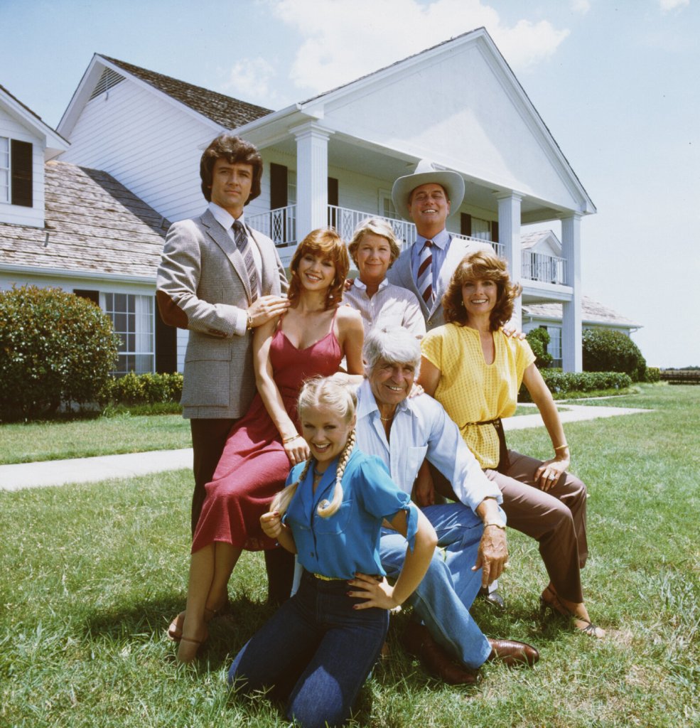
From the pass, we descend 2,550 feet over 18 miles before reaching tonight’s destination, South Fork. If that sounds familiar, it’s because this is our second night in South Fork. We again are on the lookout for reminders of Bobby Ewing or his brother, JR.
Dinner was so good at Ramon’s that we ate there again. Two nights in a row. And for the second consecutive night, Clarence started his dinner with a Virgin Mango Margarita!
To see today’s route from South Fork, over three Pass-a-Paloozas™, into New Mexico for 28 miles and back to South Fork for Night Two, click here.
***
Today’s Not Quite Pass-a-Palooza™… The Continental Divide Trail
Two of the passes we crossed today, Cumbres and Wolf Creek, share a common distinction. They’re both on the famous Continental Divide Trail.
The highest point on that trail is 14,278 feet, and it’s 3,100 miles long.
So, the Continental Divide Trail gets the honor of being today’s Not Quite Pass-a-Palooza™. The CDT, as it’s called, traverses 735 miles of the Rockies. In a normal year, snow covers most of the trail through May, and sections of it well into June. Plan accordingly.
The average elevation of the trail in Colorado is 10,000 feet above sea level. Along the way, it crests the highest summit on the Continental Divide: Gray’s Peak, a stunning 14,270 feet above sea level.
This section of the Continental Divide Trail connects Torreys and Gray’s Peak.
Heading north from the New Mexico – Colorado border, where we rode earlier today, the CDT soon enters the Weminuche Wilderness, Colorado’s largest designated wilderness area, situated in the Rio Grande and San Juan National Forests.
Other alpine highlights along Colorado’s Continental Divide Trail include the Collegiate Peaks and Rocky Mountain National Park, both boasting unparalleled views of glacial lakes, deep rounded valleys, and sharp, snow-capped summits.
Unlike the other Not Quite Pass-a-Paloozas™, you won’t be able to drive the CDT. Sorry ’bout that. You’ll need to get off your butt, put on some sturdy shoes, get yourself in shape, and start hiking. You can use your car to get to the trail; you’ll just need to park it and walk from there.
Park your car, and start walking.
For example, there’s a Continental Divide kiosk at Wolf Creek Pass, which we just rode over an hour ago. Just past the kiosk, take a dirt road, and in a mile and a half, you’ll be at a parking area, where you can begin your hike.
The CDT occasionally goes through towns, where you can enjoy a brief return to civilization, stock up on necessities, and have a sit-down meal before pressing on. Chama, New Mexico, where we were a few hours ago, is one of the towns that the trail crosses. If you run into someone at Fina’s Diner, they might be fresh off the trail, and might appreciate a conversation, a hug and an ice cream cone.
In Colorado, the trail goes through Pagosa Springs and South Fork, two places we saw today. The CDT also goes through these Colorado towns I’ve visited on this trip: Silverton, Lake City, Creede, Twin Lakes, Leadville, Silverthorne, Breckenridge, and Salida. I probably should have named this trip the Continental Divide Harley Trail Ride.
Some notable points on the CDT in Colorado include the shoulders of Mount Elbert and Mount Massive, two of Colorado’s highest fourteeners; the Collegiate Peaks Wilderness; and the Cumbres and Toltec Scenic Railroad, which we crossed today near Cumbres Pass.
The CDT is one of America’s National Scenic Trails, along with the Pacific Crest Trail, the Pacific Northwest National Scenic Trail, and several others.
This is the kind of scenery you’ll see if you get out on the Colorado portion of the Continental Divide Trail.
The establishment of the Appalachian Trail and the Pacific Crest Trail inspired proposals to create a Continental Divide Trail. You may remember the Pacific Crest Trail from the 2014 movie, Wild, starring Reese Witherspoon. The first section of the proposed Continental Divide Trail was laid out in Colorado in 1962 by the Rocky Mountain Trails Association.
Thru-hikers of the Continental Divide Trail, the Appalachian Trail and the Pacific Crest Trail can achieve what is known as the Triple Crown of Hiking. A thru-hike is doing the trail, end-to-end. Most people aren’t that ambitious, and don’t have that much free time. They generally do smaller portions of the CDT, then go back to work, or to school, or whatever it was they were doing.
Those ambitious enough to try thru-hiking usually begin the hike in April in New Mexico, hike northbound, and finish at the Canadian border in August or September. Colorado was overwhelmingly voted the most difficult state for thru-hikers in a survey of those who tried it.
The trail is generally marked with signs, letting hikers know they’re on the right track.
If you see signs like this, you’re probably not lost. You’re on both the Colorado Trail, and the Continental Divide Trail. That’s a serious hike you’re on, bro.
A good hiking pace on the CDT is 24 miles a day. Ooooh, that doesn’t seem so hard. One mile every hour.
If you do the whole thing, end to end, allow five to seven months. Before you start, you should know how to read a map, use a compass, manage resupplies, and deal with limited water. There’s a lot of helpful information out there for those who want to give it a whirl.
Time to get moving. You’re not getting any younger, or better looking.
Walter Jr is ready for a day on the road. This pic is in Lake City, a preview of things to come.
Today is the longest ride of my two weeks on the road, 277 miles.
Along the way, we’ll rack up four Pass-a-Paloozas™, cross the Continental Divide three times, ride Colorado’s steepest mountain pass, see the world’s biggest fork, and end the day in South Fork, almost made famous by an ‘80s TV show.
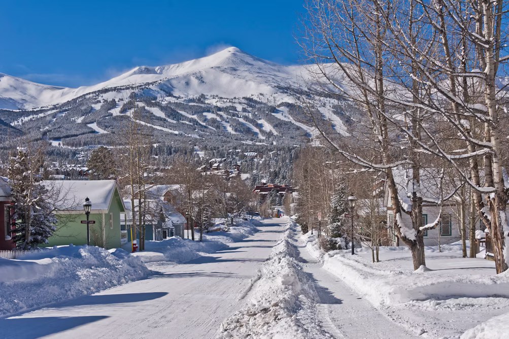
We leave Frisco and ride 10 miles south to Breckenridge, a town and ski resort located at the base of the Tenmile Range. Breckenridge sits at 9,600 feet, along the Blue River – a beautiful setting for the 5,000 residents who can somehow afford to live there.
Breckenridge is beautiful in the winter. And cold. Brecken-fridge, anyone?
What’s in a Name?
Breckenridge was created in 1859, named after prospector Thomas Breckenridge. But a year later, town fathers re-named the community Breckinridge (note the different spelling), hoping to flatter the US government and get a post office.
The plan for Breck to get a post office worked. The revised spelling was named after John C Breckinridge of Kentucky, the 14th Vice President of the United States. At age 36, he became the youngest Veep in US history, elected along with President James Buchanan in the 1856 election. He then ran for the presidency in 1860, losing to Abraham Lincoln.
In 1860, Breckinridge became the first post office between the Continental Divide and Salt Lake City. A year later, after John Breckinridge accepted a commission as a brigadier general in the Confederate Army, the town changed its name back to the original spelling of Breckenridge. It’s been that way ever since.
In the winter, the ski resort is the hub of the community. It’s owned and operated by Vail Resorts, so your Epic Pass is good there. Skiing goes all the way up to the top of Breckenridge. The Imperial Express lift takes you there, to 12,840 feet; it’s the highest lift in North America.
Known to Coloradans as “Breck,” the ski area claims to be the first major resort to allow snowboarding, in 1985. At the time, some resorts claimed they had insurance liability issues, while others didn’t want the young rebel snowboarders irritating their well-heeled skiing clientele. Today, only three North American resorts continue to ban snowboarders.
Breckenridge is known for being a winter icebox, and often referred to by Coloradans as “Brecken-Fridge.”
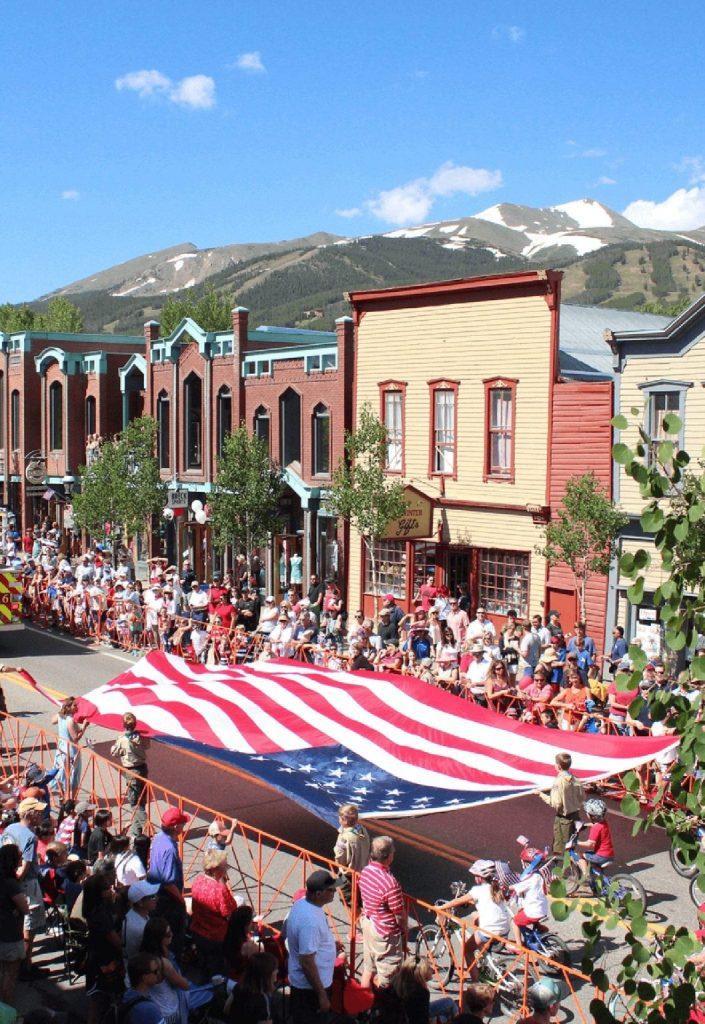
Fourth of July in Breckenridge. Party time, and you can take a run on the mountain.
In the summer, Breckenridge takes on an entirely different vibe. It hosts the National Repertory Orchestra and the Breckenridge Music Institute. There’s much to do here when the wildflowers are blooming: mountain biking, geocaching, ziplining, hiking, tubing, fly fishing, golfing, even skiing (on July 4).
Breckenridge is a favorite in Hollywood. It was the filming location of the 1989 comedy National Lampoon’s Christmas Vacation; the town stood in for Aspen in Dumb and Dumber.
Breckenridge is just a few miles south of the southern end of Dillon Reservoir, which provides 40 percent of Denver’s fresh water supply.
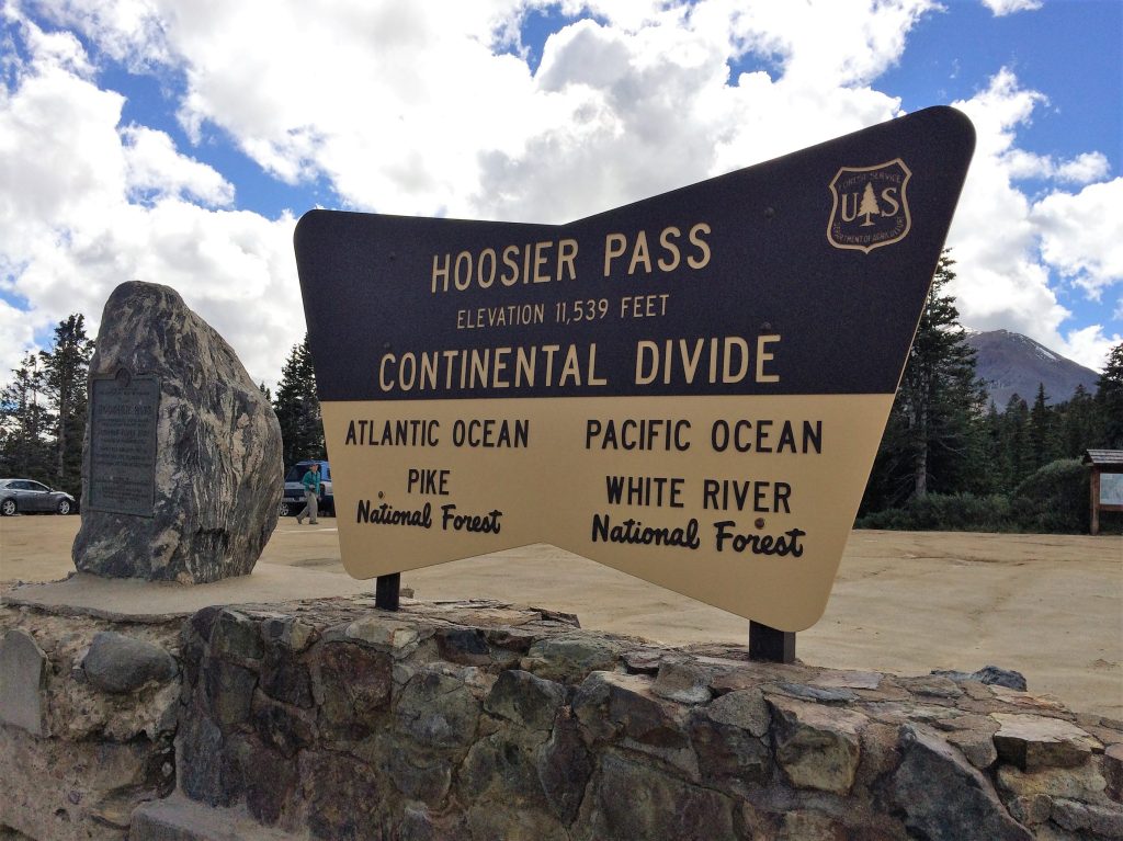
Pass-a-Palooza™ … Hoosier Pass: 11,539 feet
From Breckenridge, we head south on Highway 9, following the Blue River. A bunch of twists and hairpin turns later, we arrive at 11,539-foot Hoosier Pass, yet another crossing of the Continental Divide. The pass is one of several we’ll ride today earning Honorable Mention on my all-time Top Ten list.
Native American Tribes, including the Utes, were the first known users of Hoosier Pass. There’s a historical marker at the pass that commemorates its first crossing in 1844 by the Fremont Expedition, which explored the Rocky Mountains. John Fremont was an explorer and cartographer for the US Topographical Engineers. He had five western expeditions, became wealthy through railroad development, and ran unsuccessfully for president in 1856, crusading against the expansion of slavery.
This one’s for you, Larry Schneider!
Hoosier Pass gets its name from the Hoosier State of Indiana, where many of the area’s first mine camp residents came from during the 1860s. In recent years, it’s been common to ask anyone who cared, “Hoosier Daddy?” For the un-hip, when you ask someone, “Who’s your daddy?” you’re not looking for an answer; you’re making a point, in slang, about how great you are. The phrase acquired cultural cred in the 2007 episode of The Simpsons, called “Hoosier Daddy.”
There are many theories about where the name Hoosier comes from. They’re all amusing, and it’s hard to know which, if any, are to be believed. In any case, people from Indiana have been referred to as Hoosiers since 1832.
There’s even a band called Hoosier Daddy. They’re from Illinois, not Indiana. But one of the band member’s daughter lives in Indiana, so he truly is a “Hoosier Daddy.” Aren’t we all?
Hoosier Daddy. Speaks for itself.
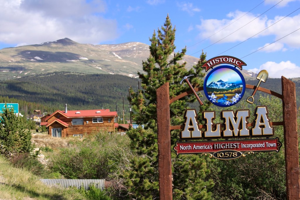
Getting High in Alma
Six miles after cresting Hoosier Pass, we roll through the town of Alma, population 300. At an elevation of 10,578 feet, Alma is the highest incorporated municipality in North America, and has the highest post office in the US.
Alma was named after Alma Janes, daughter of an early settler and merchant named Addison Janes. The town incorporated in 1873.
Yes, Alma is historic, and it has America’s highest town, highest post office, and highest saloon.
In the late 1870s, Alma’s population peaked at around 10,000 people. Mining, of course, drove the town’s growth: it was accessible to the silver mines on Mount Lincoln and Mount Bross, and also conveniently located for workers in the gulches of Mosquito and Buckskin creeks.
The historic Sweet Home Mine near Alma, formerly a silver mine, now produces the mineral rhodochrosite, a manganese carbonate that’s typically a rose-red color. The area around Alma today has 17,452 mining sites, mostly inactive or abandoned placer mines.
If you’re thirsty when passing through Alma, try the South Park Saloon, which claims to be the highest saloon in the US: 10,580 feet. They have takeout. And catering.
Fairplay. It’s Only Fair.
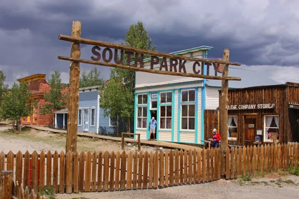
Only five miles past Alma, we come to the town of Fairplay, population 725. The town was named by settlers who were upset by the generous mining claims given to the earliest prospectors and promised a more equitable system for its residents. Equitable, you know, more fair.
Fairplay was a gold mining settlement, founded in 1859 during the early days of the Pikes Peak Gold Rush. Today, it’s the largest community in the grassland basin known as South Park. Fairplay has modern retail businesses on one end of town, and a historic area on the other.
South Park City is an open-air museum that connects you to the past.
Along Front Street as you come into town from Alma, you’ll find an open-air museum called South Park City. It’s intended to recreate the early days of the Colorado Gold Rush. South Park City contains 35 authentic relocated buildings, filled with more than 60,000 artifacts from the gold and silver mining boom times in the area. On the second weekend of August every year, South Park City hosts Living History Days, a celebration of the past where people in period dress perform the role of 19th century townspeople.
In Buena Vista, with the Collegiate Peaks in the background.
Fairplay sits at the junction of US Highway 285 and Colorado Highway 9. Here, we turn south on Highway 285 and head toward Buena Vista, an easy half-hour ride away. You may recall, I visited Buena Vista last week with Sarah and Brittany. Buena Vista sits on the Arkansas River, and might as well be Surf City, Colorado.
We continue south on US Highway 285, hang a right on US Highway 50 in Poncha Springs, and 17 miles later, we arrive at our next ski area, all shut down and buttoned up for the summer.
Monarch Mountain Ski Area
We’re now at the Monarch Mountain ski area, which originally opened in 1939 with one 500-foot rope tow, powered by a Chevy engine. The rope tow went up what is now the Gunbarrel ski run at the area.
The mountain – and skiing itself – was quite primitive at the time. Said one of the originals, reflecting back on those times: “We skied Gunbarrel for two years before we ever saw anyone who could turn on skis. The challenge was to make it to the bottom of the hill without falling down or skiing into the creek.”
There’s a lot you can do with 350 inches of snow a year.
Today, Monarch Mountain has one quad chair, four double chairs and two terrain parks. Its base elevation of 10,790 feet helps it acquire a big-time snowpack, about 350 inches of snowfall each year. The mountain is somewhat off the beaten path – Buena Vista is about 40 miles east, and Gunnison about 40 miles west. Its location helps keep lift lines short, and ticket prices affordable. An adult season pass is $629, about one-fifth of the cost of an Aspen-Snowmass pass. Monarch Mountain is privately owned by a group of individuals, led by Bob Nicolls.
Unlike many ski resorts that boom in the summer, Monarch Mountain is shut down this time of year. So, we’ll keep on riding. Next stop, Monarch Pass, two miles to the west.
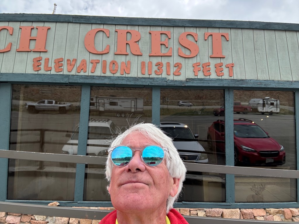
Pass-a-Palooza™ … Monarch Pass: 11,312 feet
Monarch Pass, which sits on the Continental Divide, is 540 feet below the ski area. The pass is open year-round, but can be challenging after a heavy winter snowfall. The pass earned Honorable Mention on my all-time Top Ten list.
At Monarch Mountain. A couple of ski instructors, right at home.
The current Monarch Pass is the third location on the Continental Divide to carry that name. The original road was built in 1880 and served as a wagon and stage road connecting the town of South Arkansas City (now called Salida) with Gunnison.
In 1922, the road was improved and rerouted to better accommodate motor vehicles. That road is known as the Old Monarch Pass. It remained an important unpaved crossing of the divide until 1939, when yet another highway realignment occurred – this one to accommodate the newly designated US-50 route, and more modern automobiles.
Both Monarch Pass, and the Monarch Mountain ski area are named after the tiny village of Monarch, which is about six miles east of the pass. Monarch sits at 9,544 feet, and is mostly a cluster of vacation homes. The community of Monarch is, as far as I can tell, named after the butterfly of the same name. Who knew?
You can thank the Monarch butterfly for the village of Monarch, Monarch Pass, and Monarch Mountain.
We begin the 40-mile journey west on US Highway 50 to Gunnison, 3,600 feet below. From our visit last week, you’ll recall that Gunnison is home to Western Colorado University, the oldest university in the Western Slope region.
We don’t stay in Gunnison long, just enough time to take a break and fill up with gas for our next adventure – the Silver Thread Scenic and Historic Byway. Ten miles west of Gunnison, we turn south onto Colorado Highway 149 and see what the Silver Thread is all about.
It’s a historic route that takes us through the Gunnison and Rio Grande National Forests, through Lake City and Creede, and on to today’s destination, South Fork.
An hour after our Silver Thread adventure begins, we arrive in Lake City, the only incorporated municipality in Hinsdale County. Lake City’s population hovers at around 400. The town is named after nearby Lake San Cristobal, Spanish for Saint Christopher. Lake San Cristobal sits at 9,003 feet. The water level is controlled by the seasonal addition or removal of boulders at the lake outlet.
Lake San Cristobal is tranquil and serene.
Like so many towns in the area, Lake City’s history is tied to mining. With the completion of the first road into the mountains in the region, Lake City served as a supply center for the hordes of miners and prospectors flooding into the area. The town boomed to as many as 5,000 settlers in the 1870s.
But as the first-discovered deposits were found to be only moderately productive and no new mineral deposits were found, the boom had subsided by 1879. With the arrival of the Denver & Rio Grande Railroad a decade later, Lake City saw a second upturn in the economy that lasted into the 1890s.
By 1905, the mining era was over, and Lake City entered a decades-long period of economic decline. While mining continued throughout the 20th century, it consisted primarily of exploration and speculation, rather than productive operation. When the 1930s arrived, tourism had emerged as a viable industry – and pretty much the only one in town.
As tourists recognized the scenic and recreational opportunities in the area, tourism took off. Visitors began arriving by automobile. Even though the roads were unpaved, the natural beauty brought them to Lake City. Highway 149 remained a dirt road until 1968, when paving was finally completed.
In Lake City, waiting to head up to Slumgullion Pass.
Pass-a-Palooza™ … Slumgullion Pass: 11,530 feet
Five miles out of Lake City, we roll by the Lake San Cristobal overlook. It’s at a switchback that’s worth a stop.
Five miles later, we arrive at Slumgullion Pass. Getting to the pass is a climb of 2,860 vertical feet from Lake City. You might remember this from last week, when I rode with Sarah and Brittany. Back then, I told you Slumgullion Pass had earned Honorable Mention on my all-time Top Ten list, and nothing has changed since then.
Pretty nice view from the San Cristobal overlook along Highway 149.
Pass-a-Palooza™ … Spring Creek Pass: 10,901 feet
Eight miles ahead is Spring Creek Pass, which sits on the Continental Divide. The pass is 629 feet below Slumgullion Pass. You’d hardly notice it except for the sign along the road.
If not for the sign, the pass would be invisible.
Beyond Spring Creek Pass, we roll by Hogback Mountain, begin to follow the Rio Grande River, and 33 miles after the pass, arrive in Creede. Creede was on our route last week, so I won’t bore you with the details again, but if you want to read about it, click here.
Leaving Creede, we proceed to the end of the Silver Thread Byway, and tonight’s destination: South Fork. The town sits on the South Fork of the Rio Grande River, and owes its origins to mining. South Fork was founded in 1882. Its growth was due to the railroad that connected it with Creede. The Rio Grande Western Railroad line was built to support silver mining in Creede.
It wasn’t until 1992, a century later, when South Fork achieved independent statutory town status. South Fork’s Riverbend Resort was the filming location of fictional “Kamp Komfort” in the 1983 hit movie National Lampoon’s Vacation.
South Fork, where we’re staying for the next two nights, should not be confused with Southfork, a ranch in Texas that combines South and Fork into Southfork.
The cast of Dallas, at Southfork. Who shot JR?
To see today’s route from Frisco, over four Pass-a-Paloozas™, ending in South Fork, click here.
Dinner at Ramon’s Mexican restaurant in South Fork. Clarence enjoyed his Virgin Mango Margarita.
***
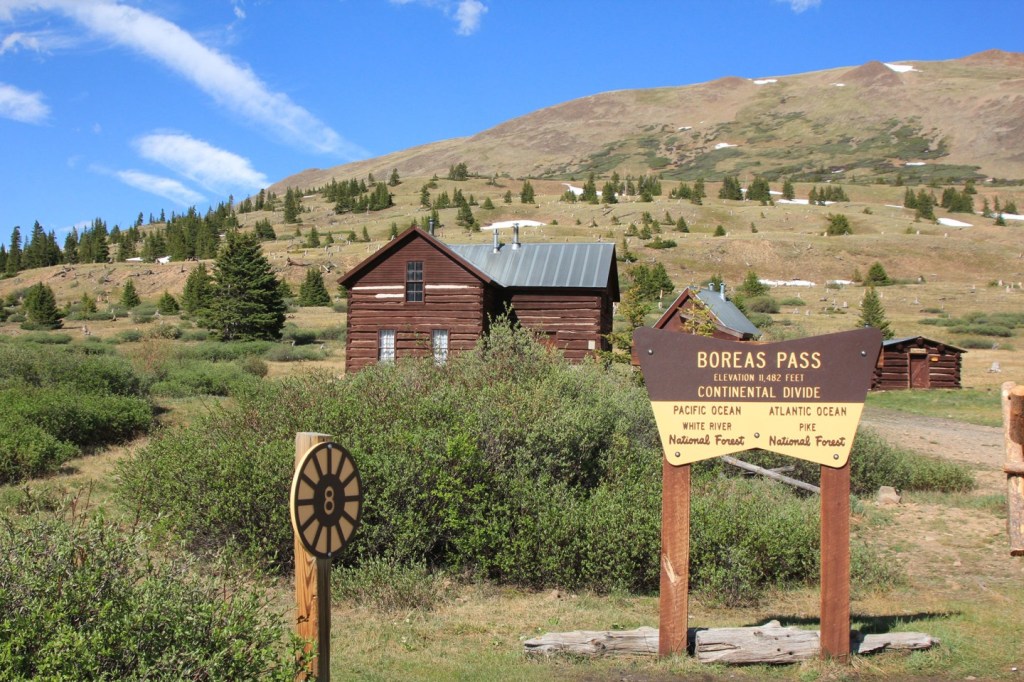
Today’s Not Quite Pass-a-Palooza™… Boreas Pass: 11,493 feet
As our ride began this morning, we rolled through Breckenridge, and cruised by the turnoff to Boreas Pass, a scenic, short, and relatively simple drive over the Continental Divide.
Boreas Pass, which connects Breckenridge with Como – 20 miles away – is considered an easy drive, a nice change of pace for today’s Not QuitePass-a-Palooza™. The route is suitable for low-clearance, two-wheel drive vehicles. It’s seldom you can say that about a Not QuitePass-a-Palooza™ road.
Leaving Breckenridge, elevation 9,600 feet, you get on Boreas Pass Road and begin an 1,800-foot climb to the pass.
The road began as a route to the gold mining area around Breckenridge for prospectors in the 1860s, helping them reach gold mines. Soon, it was widened to accommodate stagecoaches.
In 1882, under the direction of Sidney Dillon of the Union Pacific Railroad, workers began laying narrow gauge tracks up the pass, then known as Breckenridge Pass. Dillon named the pass Boreas, in honor of the ancient Greek god of the cold north wind, storms, and winter.
A good home for the Greek god of the cold north wind.
Building the rail line over the pass was a major engineering feat because construction crews had to contend with winter snows, north winds, and high altitude. At one time, Boreas Pass had the nation’s highest narrow-gauge railroad.
In the 1940s, the tracks were ripped out for the war effort, and it became a road again, this time modern enough to accommodate the latest vehicles.
Today, the road is closed in the winter, but is passable the rest of the year by ordinary vehicles, including bicycles. The road serves up sweeping views of the Tenmile mountains and Blue River Valley.
The round trip from Breckenridge to the top of the pass, a 15-mile journey, is popular with bicyclists. That says a lot about how gentle the road is. Not steep, and not rocky.
A leisurely ride up to Boreas Pass. Bring Fido along if you want.
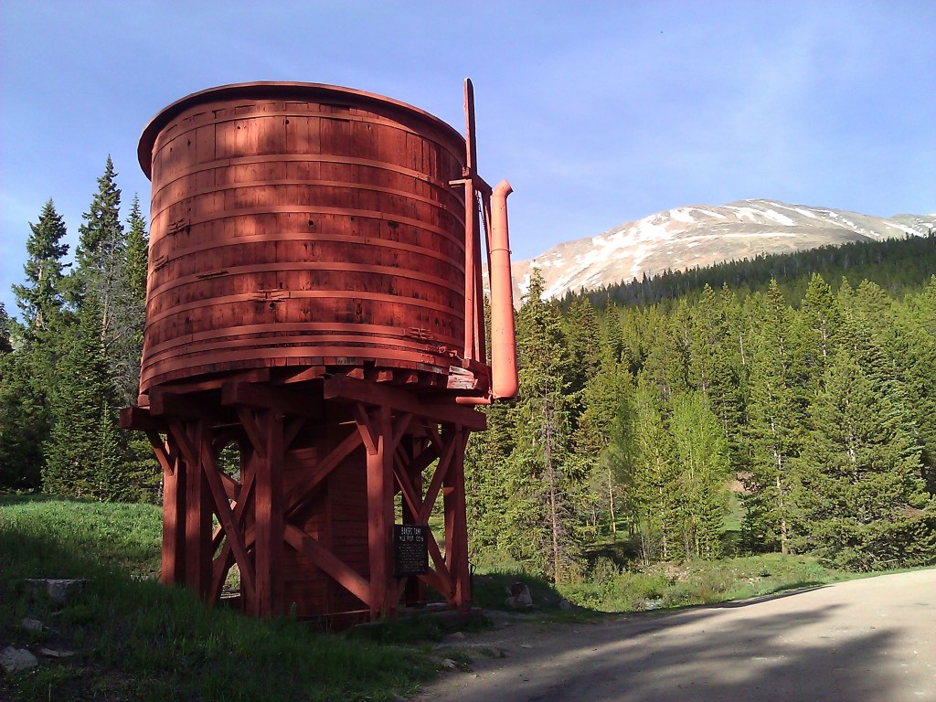
About halfway to the pass, the road takes you by an unmistakable landmark – the Bakers Tank water tower. It’s a restored railroad water tank in a distinctive rust red coloring.
Between 1884 and 1937, locomotives of the Colorado & Southern line used this tank to refill the boilers of steam locomotives. These locomotives, designed for the tight mountain curves and extreme grades, would take on water at the Bakers Tank. Steam engines drank huge quantities of water and the steeper the grade, the more often they needed to stop for water, literally gulping it. Summit County restored the Bakers Tank in 1958. When full, it holds 9,305 gallons of water.
The tank is an interesting piece of Colorado railroad history.
The iconic Bakers Tank water tower.
Three miles after the water tower, continuing south, you arrive at Boreas Pass.
The town of Boreas, now a ghost town, was built at the summit to house workers who maintained the railroad. At the time, it was the second highest railroad station in the world. A few of the buildings still stand and have been restored. One of those is the so-called Section House, built in 1883 to house the railroad men and their families who took care of a section of the narrow-gauge railway.
Next to the Section House sits Ken’s Cabin, also known as the historic Wagon Cabin, built in the 1860s when Boreas Pass was simply a wagon trail over the Continental Divide. Ken’s Cabin is used in the winter as a ski hut, part of the Summit Huts Association. It sleeps 12 people, at a cost of $40 per person, per night. During the winter, you won’t be able to drive to Ken’s Cabin; you’ll have to ski to get there. But isn’t that part of the fun?
Ken’s Cabin. It’s yours for a night, if you want it.
At its peak, at least 150 people lived in this mountainous outpost, helping to maintain the railroad and the trains that passed by. The Boreas post office was, at the time, the highest in the country. Today, that distinction belongs to the town of Alma, which sits at 10,758 feet above sea level. We visited Alma yesterday as part of a Not QuitePass-a-Palooza™ — our journey from Alma to Leadville.
The railroad line over Boreas Pass was abandoned in 1937, and after World War II, the Army Corps of Engineers reconstructed the route for automobile traffic.
Boreas Pass is a special place for that special day.
The area around Boreas Pass is a popular spot for weddings. They’re known as outdoor elopements. It’s a cottage industry set among picturesque mountains, green forests, and aspen groves.
The pass is one of many elopement spots in the Breckenridge area, all with stunning views of surrounding peaks and valleys. Many of these spots are along Boreas Pass Road. Wedding photographers specialize in these micro-weddings, and offer them as part of a package that may include personalized ceremonies, a professional officiant, and hair and makeup.
If you want to get married at the pass itself, you’ll have to do it in spring, summer or fall. Winter is the only season where the pass is unreachable. The Boreas Pass ghost town is a popular spot for I-dos.
Boreas Mountain is about a half-mile from the pass, and not on Boreas Pass Road. At 13,083 feet, its summit is about 1,500 higher than Boreas Pass. The hike to Boreas Mountain begins at the Boreas Pass summit.
The restored roundhouse at Como. Soon to be a tourist attraction?
But if you want to continue to the end of Boreas Pass Road, start heading down from the summit. In 1,700 feet, you’ll arrive in Como, which has its own depot, where the railroad once stopped. The Como depot is a half-mile from US Highway 285. When Como was established in 1859, Highway 285 obviously didn’t exist, but it was once part of a stagecoach route.
Como is a former railroad town that got its name from miners who came from Como, Italy, to work in the coal fields of the area. Today, it has many historic weathered structures, including the roundhouse and depot. Those buildings have been renovated by the Denver, South Park & Pacific Historical Society. There are plans to make them into an area tourist attraction.
To view today’s Not QuitePass-a-Palooza™ route from Breckenridge, over Boreas Pass, to Como, click here.
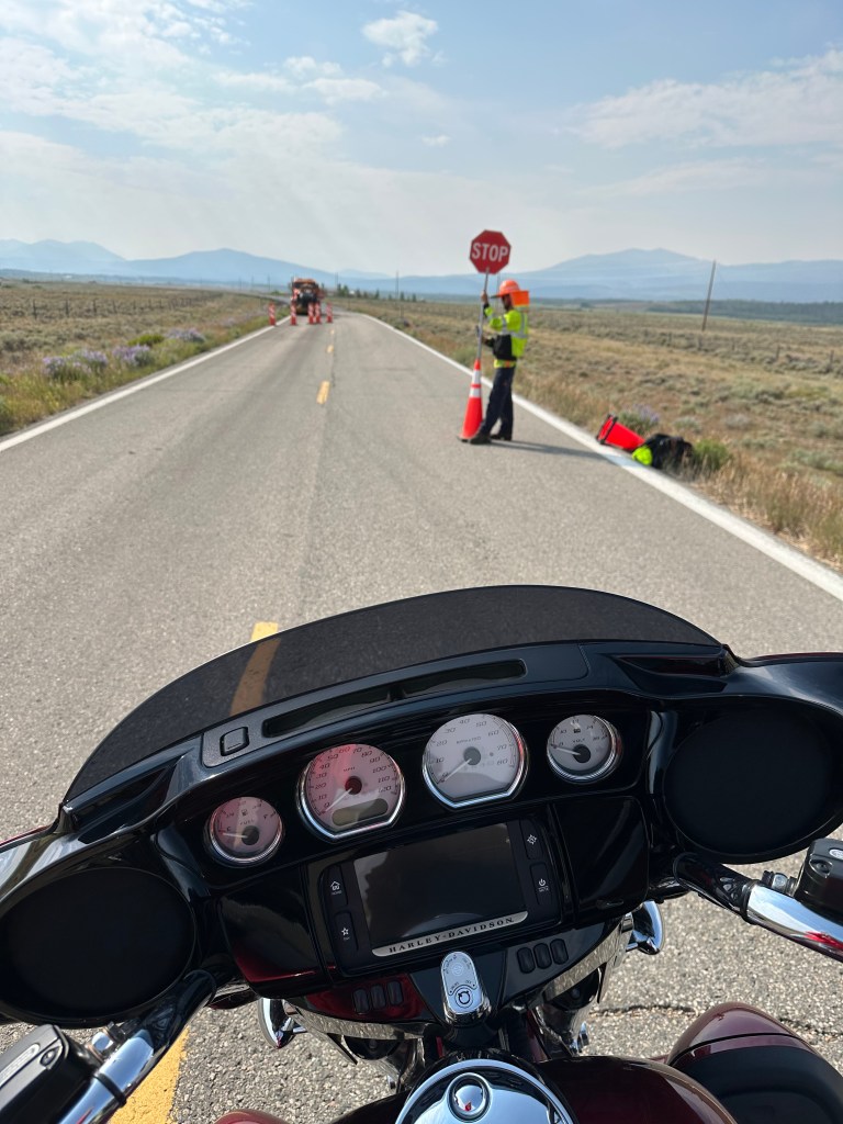
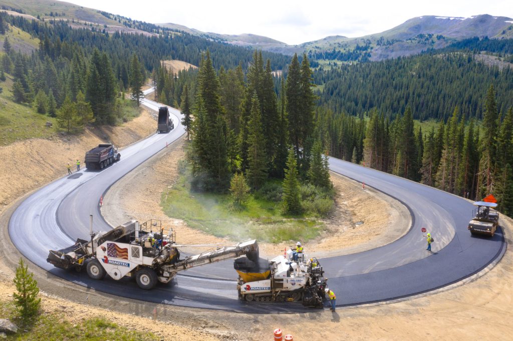
It’s road construction season in Colorado. This was not far from Walden, on our way toward Hot Sulphur Springs.
Today’s route looks like it was put together by a drunken sailor.
It zig-zags, corkscrews, loops through the Rockies, makes a wacky figure eight, rolls past a national monument, crosses five Pass-a-Palooza™, edges by some of the best skiing in Colorado, takes us by lakes, reservoirs and mountains – and ends, after 242 miles, in Frisco.
We leave Moose Town, USA, and head south on Colorado Highway 125.
In 53 miles, we arrive at Windy Gap Reservoir, a diversion dam on the Colorado River near Granby that’s part of the Northern Water Municipal Subdistrict. The reservoir diverts nearly 50,000 acre-feet of water each year from the Colorado River to the front range. A nearby pumping station sends water from the reservoir to Lake Granby, six miles away, where it’s then pumped over the mountains to the Front Range, to serve water users there.
The Windy Gap Reservoir helps slake the Front Range’s water thirst.
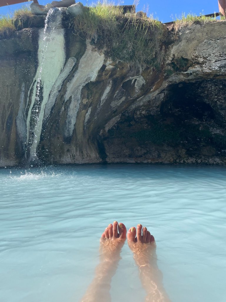
At the reservoir, we turn onto US Highway 40 and follow the Colorado River to Hot Sulphur Springs, where we take our first break of the day. The town of 685 is the county seat of Grand County, making you wonder, what else is in Grand County? Um, Fraser, Grand Lake, Kremmling, Parshall, Tabernash.
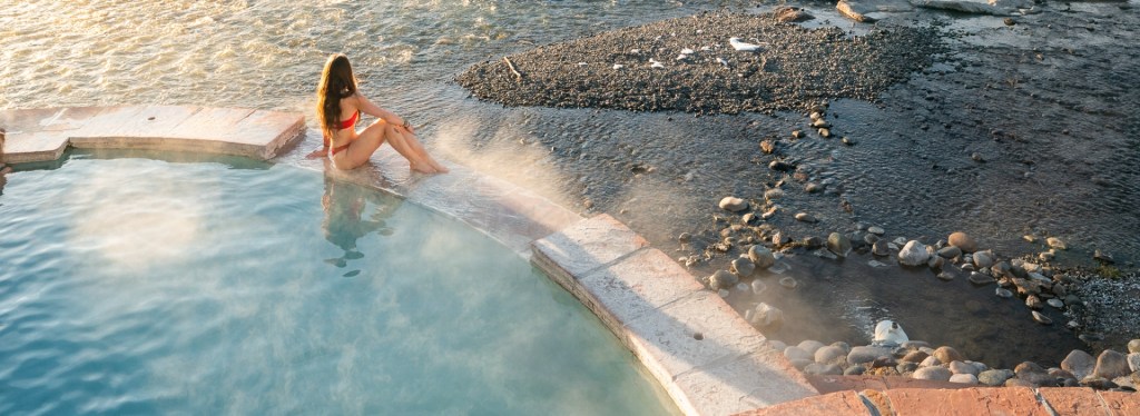
The big thing in Hot Sulphur Springs is the Resort and Spa there. Seven natural springs send 200,000 gallons of piping hot water to pools every day, at temperatures of 104 to 126 degrees Fahrenheit. By the time bathers experience the mineral-rich water in the resort’s 22 pools, it’s delivered to the pools at temperatures between 95 and 112 degrees. An aaaaaah, feels-so-good temperature.
The springs was originally a winter campground for Native Americans who came to use its waters for medicinal purposes.
Aaaaaah. That feels good. Yes, this is at one of the Hot Sulphur Springs pools.
We continue west on Highway 40 until arriving in Kremmling, 17 miles away. Kremmling was founded in 1881 during the Colorado silver boom, but the lack of mineral resources in the nearby mountains made the town grow more slowly than others at the time. The post office there was originally called Kinsey City in 1881, named after Aaron and John Kinsey, two brothers who made part of their ranch into a town. The first postmaster of Kinsey City was Kare Kremmling, and the town was renamed after him in 1895.
The town of 1,400 sits on the Colorado River. Kremmling calls itself the “Motorsports Capital of Grand County. That’s quite a distinction. It’s unclear what Kremmling means by “motorsports,” but we can only assume ATVs, snowmobiles, dirt bikes, and anything that’s off-road.
In Kremmling, we turn our on-road bikes south on Colorado Highway 9 and head toward Silverthorne, 37 miles ahead. Halfway there, we roll past the Green Mountain Reservoir, created by the building of Green Mountain Dam in 1943. The 153,000-acre foot reservoir stores water to benefit Colorado’s Western Slope. It was the first facility to be constructed as part of the Colorado – Big Thompson Project in 1937. The reservoir has six campgrounds, a boat launch facility, and is a popular spot for boating and fishing.
The Green Mountain Reservoir empties into the Blue River. We’ll follow the Blue River south for the next 20 miles, as we cruise toward Silverthorne, a town of about 5,000 that’s a base camp for nearby ski resorts – Keystone, Breckenridge, Loveland, and Arapahoe Basin.
For us, Silverthorne is a rest stop on our way to a bunch of 10,000-foot-plus passes. The journey for the next few hours is simple, yet confusing. Like life, sometimes. So, to help you readers follow the bouncing ball, here’s our dizzying route for the Pass-a-Paloozas™ ahead. If you’re riding with me, just follow me. We’ve got this.
How sweet it is!
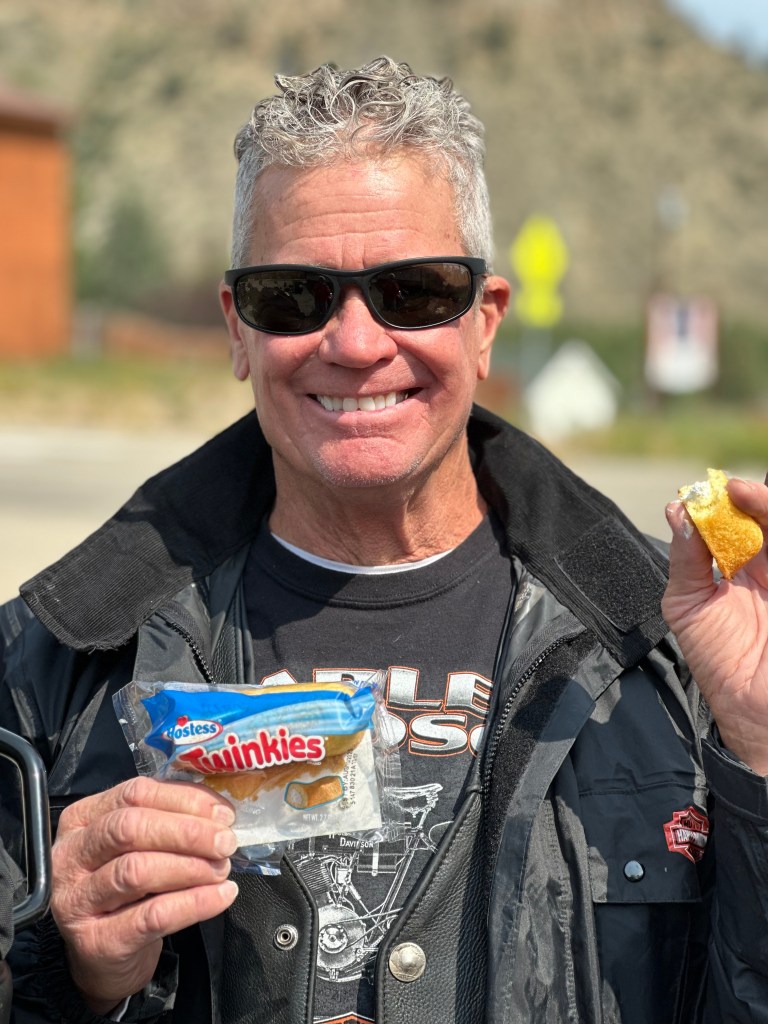
OMG, they’re still making twinkies!
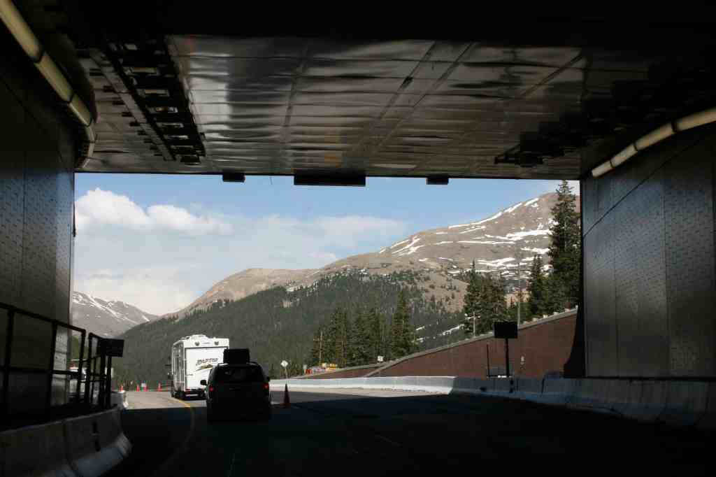
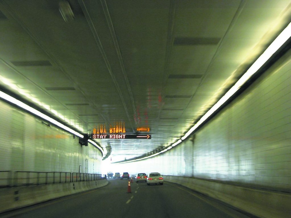
Pass-a-Palooza™ … Eisenhower Tunnel: 11,158 feet
Our first pass of the day is the Eisenhower – Johnson tunnels, about 10 miles east of Silverthorne, on I-70. This is the only mountain pass on this trip we go through, and not over.
The 1.7-mile-long Eisenhower – Johnson Memorial tunnels have a maximum elevation of 11,1587 feet, making them highest and longest mountain tunnels, and the highest point in the US Interstate Highway System. The only highway tunnels in the world that are higher are railroad tunnels in Asia, among them, the 16,171-foot high Hindutag Pass Tunnel in China’s Kunlun Mountains.
Since we’re traveling eastbound, we’ll go through the Eisenhower Tunnel, named after Dwight Eisenhower, the 34th US President, and one of the few five-star generals in US military history; the rank no longer exists. The westbound bore is the Johnson side.
Leaving the Eisenhower tunnel.
At its dedication in 1973, the Eisenhower tunnel became the highest vehicular tunnel in the world. The idea for a tunnel under Loveland Pass, the route over the Continental Divide, existed since the 1950s. William Loveland, president of the Colorado Central Railroad, dreamed of a tunnel under the divide in 1867, but instead got the wagon road now known as Loveland Pass built. We’ll explore that pass after we get out of the Eisenhower tunnel.
Serious discussion of the tunnel began when the state of Colorado lobbied for the Interstate Highway System to route a transcontinental highway across Colorado. Hard to imagine, but there was a time when the Interstate didn’t exist in Colorado.
Construction of Interstate 70 in Colorado began in the 1960s, and was mostly completed in the 1970s, with the final section through Glenwood Canyon opening in 1992. When construction on what would become the Eisenhower – Johnson tunnel began, it was the largest single federal-aid highway project in American history. It, too, was a key link in completing the Interstate through Colorado.
Tunnel construction in the 1960s. Can you dig it?
Civil engineers recommended tunneling under Loveland Pass, rather than attempting a route over it. Digging on the tunnel began in 1968, with the goal of opening it in three years. But project managers quickly learned that digging through the solid granite was going to be more difficult, time-consuming, and expensive than originally planned.
Inside the tunnel, miners discovered fragile rock layers that engineers didn’t anticipate, and the mountain couldn’t support itself once certain sections had been dug through. But crews eventually devised a way to bore through the tunnel without triggering a collapse, and the tunnel continued to inch deeper into the mountain. As one highway engineer put it, “We were pioneering every foot of the way.”
In 1973, the eastbound tunnel bore, the Eisenhower tunnel, opened for traffic. Six years later, the westbound Johnson bore opened, a mirror image of the initial Eisenhower bore. The second tunnel, called the Edwin C Johnson tunnel, is named after a former Colorado Governor and US Senator who lobbied for an Interstate Highway to be built across Colorado. One of his persuasion points was that the tunnel would start the biggest boom in Colorado mountain towns since the Gold Rush.
Today, the tunnels together carry an average of 35,000 vehicles a day, a number that peaks in July and August at up to 50,000 vehicles daily. To date, more than 450 million cars have passed through the two two-lane tunnels without a single fatality.
The tunnel is lined with porcelain wall tiles, leading it to be called “the country’s longest bathroom.”
Pass-a-Palooza™ … Loveland Pass: 11,992 feet
A few hundred feet after leaving the tunnel we pass the Loveland Ski Area, then take the first exit, which directs us toward Loveland Pass. We’re now on US Highway 6, the old road over the Continental Divide before the tunnels were built.
The road over Loveland Pass was once the main path between Denver and Colorado’s mountain ski towns. Today, it’s a way to bypass the tunnel for a more scenic view, or to access the ski slopes of Arapaho Basin. The pass, which rises 800 feet above the tunnel through a series of hairpin switchbacks, is the highest road in the US that’s kept open year-round. Loveland Pass, like so many on this trip, has earned Honorable Mention on my all-time Top Ten list.
One of Loveland Pass’ switchbacks. It’s a fun road, when the weather is good.
Loveland Pass is still used as an alternate to the Eisenhower tunnel, for bicycles, pedestrians, and vehicles carrying hazardous materials – all of those are prohibited from the tunnel and must use Loveland Pass to cross the Continental Divide. If Loveland Pass is closed, the hazmat restriction is temporarily lifted, the tunnel is closed to regular traffic once an hour, and vehicles carrying hazardous materials are escorted through the tunnel in a convoy.
Just three miles below Loveland Pass, after a steep descent, we roll past the Arapahoe Basin Ski Area, usually one of Colorado’s first ski areas to open every season, and the last to close. It often opens in mid-October, and continues to run lifts until June, sometimes July – and once, in 1995, as late as August 10.
From A-Basin’s top elevation of 13,050 feet, you can experience views of Lake Dillon, Breckenridge, Keystone and Loveland pass. The ski area, which opened in 1946, gets about 350 inches of snow a year, and is known mostly for its advanced and expert terrain. Arapahoe Basin is owned by Alterra, and you can use your Ikon Pass to ski there.
Above the treeline at A-Basin.
We continue descending beyond A-Basin, riding along the North Fork of the Snake River, which takes us to Keystone, another popular Summit County ski area. Vail Resorts owns the Keystone ski area, so you can use your Epic Pass to ski there. Keystone is centered around River Run Village, which sits at the base of the ski slopes.
The town of Keystone, 9,280 feet above sea level, has two golf courses, a man-made lake. Every summer, it hosts the Keystone Bluegrass & Beer Festival.
Keystone became Colorado’s newest Town in February 2024, when residents voted to incorporate.
At Keystone. What’s with the empty gondola cars?
Dam It, Dillon
From Keystone, it’s five miles to Dillon, where we fill up with gas before continuing the journey to the next passel of Pass-a-Paloozas™.
Riding into Dillon, we roll past the Dillon Reservoir, also called Lake Dillon. Whatever you call it, the body of water, fed by the Blue River, was created by the construction of the Dillon Dam in 1963. The idea to dam the Blue River and divert the water to Denver originated in the early 1900s.
The Denver Water Board acquired most of the land needed for the reservoir during the Great Depression, when many Dillon residents were unable to pay property taxes; the city of Denver paid the back taxes and took possession of the properties. The reservoir supplies water for the city of Denver. It’s Denver’s largest water storage facility.
The Dillon Reservoir, as seen from nearby Silverthorne.
Lake Dillon is huge, with nearly 27 miles of shoreline, holding 250,000 acre-feet of water. Interestingly, the old town of Dillon actually sits at the bottom of Lake Dillon, so there’s an underwater Ghost town beneath the lake. The entire town of Dillon was relocated to build the dam that created the reservoir.
In the summer, the reservoir is a popular spot for boating, fishing, hiking, and bicycling. It’s stocked each year by the Colorado Division of Wildlife with about 50,000 rainbow trout.
There’s a path that can be accessed all around the reservoir, called the Dillon Reservoir Loop. It’s an 18.8-mile layout that offers stunning views of Summit County’s mountain terrain. Known as the Dillon Reservoir Recpath, the route goes past Dillon, Silverthorne, and Frisco, tonight’s destination.
Cycling around the Dillon Reservoir on the Recpath.
Leaving Dillon in the rear-view mirror, we climb aboard I-70 for 10 miles, then exit onto Colorado Highway 91, the Top of the Rockies Scenic Byway. This beautiful highway leads us to our next big pass, and a gigantic mine with a hard-to-pronounce and difficult-to spell-product.
Pass-a-Palooza™ … Fremont Pass: 11,318 feet
Twenty miles south of Dillon, we arrive at Fremont Pass, and the Climax Mine, a major source of molybdenum.
The pass is named for John C. Frémont, an explorer who discovered the pass while traversing present-day Colorado during the 1840s. Fremont Pass is open year-round. It’s earned Honorable Mention on my all-time Top Ten list.
At the summit of Fremont Pass on the Continental Divide is the Climax Mine, which at one time supplied 75 percent of the world’s supply of molybdenum. Today, China produces the vast majority of the world’s molybdenum, about 130,000 metric tons a year. That’s two and a-half times as much as the US now produces.
Molybdenum is used as an alloying element for stainless steel and other metals. It enhances the resistance of metals to corrosion and builds their strength at high temperatures.
Amazing what you can do with molybdenum.
During the Leadville Silver Boom, prospector Charles Senter discovered and claimed the outcropping of molybdenite (molybdenum sulfide) veins in 1879, but he had no idea what the mineral there was. Senter determined that the rock contained no gold or silver, but retained the claims, just to be on the safe side. Each year he performed the assessment work required to maintain his lode claims, convinced that his mystery mineral must be of value.
In 1895, Senter found a chemist who identified the gray mineral as containing molybdenum. At the time there was virtually no market for the metal. In 1918, Senter received $40,000 for his mining claims and settled into a comfortable retirement in Denver.
When steelmakers determined the utility of molybdenum as an alloy in producing hard corrosion-resistant steel, the first ore shipments from the deposit began in 1915, when the Climax mine began full production.
Climax?
The name comes from the Climax railroad station that was built at the top of the Continental Divide as a place to uncouple helper locomotives after the long climb from Denver to the mining town of Leadville. It was the climax of the route.
Leadville, a Boomtown with a Colorful Past
Soon, we arrive in Leadville, a historic mining town with a colorful and rich history. It had both precious metals – gold and silver – and also industrial metals, including lead, zinc, copper, and iron.
Sitting at an elevation of 10,152 feet, Leadville is the highest incorporated city in the US. The Leadville Historic District has been designated a National Historic Landmark since 1961. Its population today is about 2,700. But during the mining boom of the late nineteenth century, with more than 30,000 residents, it was one of the wealthiest cities in the US, and Colorado’s second most populous city, after Denver.
Mining in the Leadville area began in 1859, when prospectors discovered gold at the mouth of California Gulch. By 1872, placer mining in the area yielded more than $2,500,000, roughly equivalent to $58,000,000 in today’s dollars.
Leadville was a bustling place in 1879, as depicted in Frank Leslies Illustrated Newspaper that year.
Leadville was founded in 1877 by mine owners Horace Tabor and August Meyer at the start of the Colorado silver boom. Initially, the settlement was called Slabtown, after the quickly built houses that sat on slabs. But when the residents petitioned for a post office, the name Leadville was chosen; they thought lead would be the dominant mineral in the area.
In 1879, Leadville was booming. Its city directory listed 10 dry goods stores, 4 churches, 4 banks, 31 restaurants, 120 saloons, 3 daily newspapers, 19 beer halls, 70 law firms to abate claim jumpers, 35 houses of prostitution, and 118 gambling houses. At the time silver was discovered in Oro Gulch, Leadville had three separate red-light districts.
Railroads played a vital role in Leadville’s history. In 1880, former president Ulysses S Grant rode the inaugural train into town on the Denver & Rio Grande Railroad. When Grant arrived at 10 pm, there was a two-mile long parade and bonfires lighting the way in the night.
Leadville’s downtown has a distinctively Victorian look today.
Pass-a-Palooza™ … Tennessee Pass: 10,424 feet
In Leadville, we turn north on US Highway 24 and head toward Tennessee Pass, another crossing of the Continental Divide. Tennessee Pass separates the Sawatch Range on the west and the Mosquito Range on the east. The pass got the name because it’s the native state of a group of early prospectors. It’s open year-round. Like so many other passes on today’s route, Tennessee Pass earned Honorable Mention on my all-time Top Ten list. And, ya gotta love a pass named after Sarah’s home state!
We roll by Ski Cooper, a small, family-oriented ski area at Tennessee Pass nine miles north of Leadville. Ski Cooper (not to be confused with Copper Mountain, which we’ll visit later today), is one of the oldest in Colorado. It opened in 1942, when the area served as the training site for the 10th Mountain Division, based at nearby Camp Hale during World War II.
Ski Cooper is owned by Lake County, and managed by a non-profit with a volunteer board. It has two chairlifts, 64 runs, and 470 skiable acres. A unique feature of Ski Cooper is the views of Colorado’s highest peaks, Mount Elbert and Mount Massive, a pair of fourteeners. A day pass, Monday through Friday, is $45. That’s what I’m talkin’ about!
Ski Cooper. It’s old school skiing at Tennessee Pass.
Cooper started in the early years of World War II, when foreign invasion of the U.S. was a real threat. The military believed that an invasion could be most effectively countered in the rugged terrain of the western Rockies or the eastern Appalachians. Charles Minot “Minnie” Dole, the civilian founder of the National Ski Patrol, urged the War Department to train special troops for mountain, ski, and winter warfare.
In 1942, the Army acted on Dole’s advice. It created the 10th Mountain Division and selected a training site near the remote railroad ice stop of Pando, midway between Leadville and Minturn, where we’ll be in half an hour. Army engineers leveled the valley floor near Pando and named the site Camp Hale, after Brigadier General Irving Hale, a Denver native and West Point graduate. At Cooper Hill, engineers cleared three ski runs and installed the region’s first T-bar tow.
The T-bar at Camp Hale got soldiers up the mountain.
Military ski training on the slopes of Cooper Hill wasn’t easy. The T-bar tow was used only occasionally. Would-be ski troopers often hauled their skis, an M-1 rifle, and a 90-pound pack to the top of Cooper Hill — on foot.
Following two years of rigorous training, the 10th Mountain Division was ordered to Italy to spearhead the advance of the US Fifth Army. In a series of actions in the Apennines that included Riva Ridge and Mt. Belvedere, the unit breached the German army’s supposedly impregnable Gothic Line, secured the Po River Valley, and liberated much of northern Italy.
By May, 1945, when the Germans surrendered, 992 10th Mountain Division ski troopers had been killed in action and 4,000 wounded, the highest casualty rate of any US. division in the Mediterranean Theater.
The history of the 10th Mountain Division and Camp Hale are why Camp Hale National Monument was established in 2022. Known as the Camp Hale – Continental Divide National Monument, it’s a memorial to the 10th Mountain Division, the Army’s first and only mountain infantry division.
Wanna learn a lot more about the history of the area? Read the official proclamation establishing the National Monument.
Then-President Joe Biden speaks at Camp Hale after declaring the WW II training ground a national monument in October 2022. He used his authority under the Antiquities Act to establish the 53,804-acre Camp Hale-Continental Divide National Monument.
Kirby Cosmo’s in Minturn
We leave Tennessee Pass, and head down valley 20 miles, toward the town of Minturn, 2,500 feet below. Minturn is named for Robert Minturn Jr, who was vice president of the Denver & Rio Grande Western Railroad that founded the town. When the railroad arrived in 1887, Minturn quickly developed into a booming crossroads for transportation and industry. The town was incorporated in 1904.
Minturn, population 1,000, sits about two miles south of I-70. Before we head that direction and tackle our final pass of the day, we settle in to Kirby Cosmo’s BBQ in Minturn. Their BBQ style hails from Asheville, North Carolina, and Greenville, South Carolina. The first time I rode with Clarence, five years ago, we stopped at Kirby Cosmo’s on his recommendation. It’s southern, and so is he. Said Yelp reviewer Lori W from Fairhope, Alabama – Clarence’s home state – “I hadn’t had a hushpuppy in years and these satisfied my craving,”
Every visit to Minturn since my first appearance at Kirby Cosmo’s, I’ve made a point of stopping in to the place. You never know when you might have a hushpuppy craving. We skipped it today, and pressed on toward Vail.
Darn, we passed up Q 😢
So, we hop on I-70, and in only five miles, roll by Vail, home to Colorado’s largest ski mountain.
The town of 5,000 was incorporated in 1966, four years after the Vail Ski Resort opened at the base of Vail Pass, which we’ll cross in just a few minutes. Vail – the town, the pass, the ski resort – are all named after Charles Vail, the highway engineer who routed US Highway 6 through the Eagle Valley in 1940. That path eventually became I-70, which we’re now riding.
One of the founders of the Vail Ski Resort was Pete Seibert, who served in the 10th Mountain Division during World War II. He trained at nearby Camp Hale, which we visited before our time at Kirby Cosmos, just a few hours ago. Seibert was wounded in Italy at the Battle of Riva Ridge, then went on to become a professional skier.
During his training at Camp Hale, he bivouacked on Vail Mountain and identified it as an ideal ski mountain. Along with other former members of the 10th Mountain Division, Seibert returned to Colorado after the war with the intention of opening a ski resort. Seibert was able to get funding from investors in the early 1960s, and the rest is history.
Vail officially opened for business in December 1962, with one gondola and two ski lifts. Today, it has 33 ski lifts, 195 marked trails, 5,317 skiable acres, and a whole lot of rich people. Vail’s longest run – four miles – is Riva Ridge, a nod to the battle in which its founder was wounded during World War II. Along with Snowmass, where I hang out in the winter, Vail has been named the number one ski resort in the US numerous times. Vail was the first resort owned by Vail Resorts, which now owns and operates 42 ski areas in the US, Canada, Australia and Europe.
Vail’s Back Bowls include 3,000 acres of skiing, more than many entire ski areas, including Jackson Hole and Sun Valley.
Pass-a-Palooza™ … Vail Pass: 10,666 feet
From Vail, it’s a 14-mile ride and a 2,500-foot climb to Vail Pass, which is open year-round, but can be an adventure on snowy, winter days.
The pass was not a traditional historical route through the Rockies. Before 1940, when Charles Vail envisioned the route we’re riding today, the most common route westward was over nearby Shrine Pass, just to the south. Today, Shrine Pass is a narrow, dirt road an unpaved road passable by all but the lowest passenger cars. Thanks to Charles Vail, it’s truly become the road less traveled.
Vail Pass is the road most frequently traveled, as it’s now the main east-west artery through the Rockies. It’s also our last pass of the day.
The road leads us to the base of Copper Mountain, about 1,000 below Vail Pass. Copper is not to be confused with Ski Cooper, which we visited earlier today on our ride over Tennessee Pass.
In the mid-1800s, miners came to the area looking for gold, but instead, they found low-grade copper ore. From then on, the mountain became known as Copper Mountain, long before the ski area came to life.
Nice view at Copper Mountain.
Copper Mountain sits at Wheeler Junction, where I-70 and Colorado Highway 91 meet. Copper is owned by Utah-based POWDR, and served by the IKON pass. The nearest town is Frisco, tonight’s destination. Frisco is just seven miles ahead on I-70, the conclusion of our five Pass-a-Palooza™ day.
Contrary to popular belief and urban legend, Frisco was not named after the city of San Francisco, on California’s west coast. In 1875, a railroad agent named Henry Learned was hired by rail companies and stakeholders who had interests in expanding their rail lines into the west. One of those was the St. Louis – San Francisco Railway, also known as the “Frisco Line.” Learned selected what’s now Frisco, Colorado, as a town site for the Frisco Line.
The name Frisco was derived from a combination of letters associated with the St. Louis – San Francisco Railway Company. It combined the “FR” from Francisco, the “IS” from St. Louis, and the “CO” from Company – to produce Frisco.
The Frisco Line, which originated in Missouri, never made its way to Frisco, Colorado. Two other railroad companies serviced Frisco: the Denver, South Park & Pacific; and the Denver & Rio Grande. The line did eventually get it right, making it as far south as Frisco, Texas.
Frisco, Colorado, with a population of 2,800, sits just east of I-70. Like so many towns we’ve visited, Frisco owes its history to mining. The area had nearly 15,000 mining claims, 829 of which are still active. Gold and silver mines covered nearby mountainsides.
A standup paddle boarder near the Frisco Marina, on Dillon Reservoir.
The town is at the far west end of the Dillon Reservoir, a recreational go-to spot in the summer. You can launch your boat at the Frisco Bay Marina, or rent a pontoon boat, fishing boat, kayak, canoe or stand-up paddle board.
Or, you can pull in to the Hotel Frisco Colorado on the town’s Main Street, and call it a day. That’s what we do.
To see today’s route from Walden, over five (!) Pass-a-Paloozas™, ribs in Minturn, and eventually on to Frisco, click here.
***
Today’s Not Quite Pass-a-Palooza™ … Mosquito Pass: 13,186 feet
Earlier today, we rolled through Leadville on our way to Tennessee Pass and then Minturn, where we ate at Kirby Cosmos BBQ.
Leadville was once the second-largest city in Colorado. It was home to the state’s most productive silver mining district. Today, it’s the highest incorporated city in the US. Leadville is a place of superlatives, you know – words that end in “est.” Because of all the mining in the Leadville area in the late 1800s, it’s always been a prime spot for high mountain roads, connecting mining towns with railroad stops. The value of mining in the area over the years is estimated to be more than $5 Billion in today’s dollars.
As Leadville grew in size during the mining boom, Mosquito Pass became a busy place. It was widened into a stagecoach road, with the town of Mosquito serving as a stage stop, supply point, and relay station. Mosquito is now a ghost town along the Mosquito Pass road, while Leadville is a thriving community.
Destination: Mosquito Pass.
And Leadville is the starting point for today’s Not QuitePass-a-Palooza™, Mosquito Pass. The road takes adventurous travelers like you on a 17-mile journey from Leadville, on its west end, to Alma on the east.
Mosquito Pass is the highest crossable vehicle mountain pass in the US outside of Alaska. While there are higher vehicle passes, they are all out and back. The trail crosses the Continental Divide, between the Arkansas and South Platte Rivers. In the 1870s, when Leadville’s silver mining district was legendary, Mosquito Pass was used as the fastest way to reach the mines. After all, Mosquito Pass is home to the largest concentration of old mines in the world.
The summit of the pass is 13,186 feet, the highest drivable pass in Colorado. At this elevation, snowstorms are possible any month of the year. But snow and ice never stopped the miners from crossing back and forth.
The Highway of Frozen Death. It’s a little less hazardous in a four-wheel drive, high-clearance vehicle.
The road is known as the “Highway of Frozen Death.” It got that name because some miners, trying to cross the pass in the dead of winter, were not prepared for the extreme cold that came with blinding blizzards at that elevation. Frozen bodies along the trail became too frequent, and Mosquito became known as the Highway of Frozen Death.
I’ll assume that nickname just makes you want to take on Mosquito Pass even more, so let’s get started.
You can bike over Mosquito Pass, if that floats your boat.
Matchless Mine Love Triangle. Only a half-mile out of town, on (Lake) County Road 3, you find the Matchless Mine, where one of Leadville’s most notorious silver kings, Horace Tabor, struck it rich. Tabor amassed great wealth almost overnight when he bought the Matchless Mine in 1879. It soon became one of the most productive silver mines of the era.
Soon after, he started a scandal when he left his wife Augusta, a respected community leader, for the young, beautiful Elizabeth “Baby Doe” McCourt. Horace and Baby Doe married, with wedding invitations fashioned from solid silver. But their high-flying lifestyle was not to last. When silver prices crashed, their fortune vanished. He died in 1899, leaving Baby Doe and their two daughters destitute. It was one of the most famous love triangles ever.
The Matchless Mine was named after a popular brand of chewing tobacco. Today, what’s left of the mine is an extension of the National Mining Hall of Fame and Museum, which provides tours of the mine during summer months.
The Matchless Mine is your first stop after leaving Leadville.
What’s in a Name? Before we get too far from Leadville, now’s a good time to consider where the Mosquito name came from. After all, it’s the name of a gulch, a mountain range, a pass, a peak, and a creek.
By 1861, a few hundred miners had moved into a gulch east of the Continental Divide near present-day Fairplay. They were getting enough silver out of the mountain to encourage more miners to move in and suddenly realized they were becoming a town. Meetings were held in an effort to find a name for their town but an agreement could not be reached.
After one long meeting to decide on a name for their town, residents could not come to a consensus. When the meeting reconvened the next day, they reopened the ledger to record their discussions and found a squashed mosquito on the page. “Mosquito” seemed like a good name, and a compromise was quickly reached. It was the only name they could agree on.
No one in the room was sure how to spell the pesky little insect, but they finally decided on, “Musquito”. The spelling was later corrected, followed by the naming of Mosquito Gulch as well as the town of Mosquito, and eventually the pass, the creek, the peak and the mountain.
You could name a lot of things after these annoying little pests.
New Monarch Mine. Leaving the Matchless Mine and its sad love triangle behind, you continue about three miles east on the road to Mosquito Pass and arrive at the New Monarch Mine. The New Monarch Mine’s ore house is one of the best-preserved structures in the Leadville Mining District.
The mine was owned by James Brown, husband to the Unsinkable Molly Brown. Unsinkable? Yep, she was a survivor of the Titanic sinkng in 1912, long after she left Leadville.
In Leadville, she met and married James Brown, who brought her great wealth from his mining success, allowing Molly Brown to become a philanthropist and world traveler. She worked in Leadville soup kitchens to assist miners’ families. For leading a life well lived, Molly Brown was inducted into the Colorado Women’s Hall of Fame in 1985.
In Hollywood movies, she’s been played by Thelma Ritter, Cloris Leachman, Tammy Grimes, Kathy Bates, Marilu Henner, and Debbie Reynolds – who earned a Best Actress Oscar nomination for her 1964 portrayal of the Unsinkable Molly Brown.
The New Monarch Mine.
It’s about four miles from the Monarch Mine, or what remains of it, to Mosquito Pass. Once you arrive at the pass, you will have gained 3,314 feet of elevation since leaving Leadville.
Finally, Arriving at the Pass. Mosquito Pass forms the border between Lake County and Park County. Because of its extreme weather, Mosquito Pass is usually only open for six to eight weeks after the snow melts in July.
Famed Methodist clergyman and Colorado pioneer Father John Lewis Dyer is one of the first known people to cross Mosquito Pass. Back in the 1860’s, Dyer was known to cross the pass several times per week, even if it required snowshoes, in order to spread his religious message. To supplement his meager preacher income, Father Dyer began carrying mail between Leadville and Alma, leaving in the evening so the snow was frozen and easier to cross.
Father Dyer was called “The Snowshoe Itinerant.” His snowshoes were actually skis; he crossed the frigid pass, again and again, on 12-foot-long wooden skis. At the top of the pass, a memorial marker can be found for Father Dyer, who lived to the age of 89. He was one of the first members of the Colorado Ski and Snowboarding Museum Hall of Fame, inducted in 1977.
A memorial to the Snowshoe Itinerant.
In 1879, the extremely treacherous mountain path through Mosquito Pass became a toll road. When it opened, the road carried more than 100 wagons, freighters, and stagecoaches to Leadville each day. The crowds didn’t last long, though. When the railroad came to Leadville in 1880, the bustling road lost its importance, and was abandoned. The town of Mosquito, on the east side of Mosquito Pass, was abandoned, too.
North London Mine and Mill. As you head down the mountain from Mosquito Pass toward Alma, about nine miles east, you’ll drop about 3,100 feet in elevation. Along the way, you’ll pass the site of the North London Mine and Mill, both were tremendously productive and among the richest gold, silver and lead mines in Colorado.
The mine was first established in 1873, and the mill was added 20 years later to help curb the expense of hauling materials to be processed off site. The North Mine and Mill sites were home to Colorado’s first aerial tramway, connecting the two operations.
The North London Mill site, sitting at 11,400 feet above sea level, has been recognized by the Park County Historic Preservation Committee as a local landmark. The North London Mill Preservation (NoLo) was formed in 2017 to plan, finance, preserve and manage the historic buildings at the mill site.
Ruins of the North London Mill.
When you’ve seen the remnants of the North London Mill, you have six miles to go before reaching Alma. At 10,578 feet, it’s America’s highest incorporated town; Leadville, at the other end of the road, is the highest incorporated city.
Your arrival in Alma concludes your 17-mile journey over the Highway of Frozen Death.
To view today’s Not QuitePass-a-Palooza™ route from Leadville, past the Monarch Mine, over Mosquito Pass, and into Alma, click here.
Rocky Mountain National Park is the fifth-most visited in the park system, after Great Smoky Mountains, Grand Canyon, Zion, and Yellowstone. More than four million visitors come to Rocky Mountain NP every year to check out its 415 square miles of dramatic beauty, rugged mountains, sparking lakes, 350 miles of hiking trails, and abundant wildlife.
Since 95 percent of the park is designated wilderness, and only accessible to adventurous hikers, a road from one end of the park to the other is perhaps the most popular way to explore it without burning many calories.
If you’re only gonna see one thing in the park, it’ll probably be Trail Ridge Road, a 48-mile highway in the sky that connects Estes Park, where our day begins, with Grand Lake, on the west end of the park.
Highway to the Sky: Trail Ridge Road.
Today, we’ll ride the Trail Ridge Road Scenic Byway over the highest continuously paved stretch of road in North America, cross the Continental Divide three times, and check out the highest visitor center in the National Parks system. Trail Ridge Road is one of my favorites. It’s #7 on my all-time Top Ten list.
The two-lane, 22-foot-wide road is formally known as US Highway 34. That’s the road we’ll take for the first few hours of our day.
In late July of 1913 a convict camp made from prison labor was established, and a crew of 38 men began work on the Fall River Road – the precursor to Trail Ridge Road. Construction continued, first by convict labor and then by contract, until finally on September 14, 1920, the Superintendent of Rocky Mountain National Park drove all the way from Estes Park to Grand Lake. It seemed like a miracle.
Boring the road through this rock, known as the Rock Cut, was quite a road-building challenge.
Rocky Mountain National Park is one of America’s oldest national parks, established in 1915 just before automobile ownership became mainstream.
Fall River Road was the first road into the park’s high country. It opened in 1921 and quickly proved inadequate for motor travel as a single-track road with steep grades up to 16 percent, tight curves, and a short annual season due to snowpack. By the late 1920s, greater numbers of visitors wanted to explore by car, but the original thoroughfare, Fall River Road, was too narrow for the increasing traffic
So, in 1926 the National Park Service began the search for an alternative route — one that would provide moderate grades, gentle curves, few places of heavy snow accumulation and, most important of all, unparalleled views of spectacular scenery.
The proposed Trail Ridge Road helped to bring about a new philosophy in National Park road building. Along with other roads in Yellowstone, Glacier, Yosemite, and the Grand Canyon, the public demand for easier access to its National Parks was becoming as important as the need to maintain the pristine wilderness.
Nearly 100 years ago, it took imagination to dream up this road. Turned out pretty good.
“A Trip to Never be Forgotten”
In the summer of 1926, SA Wallace of the Bureau of Public Roads came to the park to locate the new road. His selection was fortuitous; at the time, expertise in locating mountain roads was vested in the western railroads, and Wallace had recently come to the Bureau of Public Roads from the Santa Fe Railroad. Building the road turned out to be a major challenge – and achievement – in civil engineering.
Almost immediately the search for a path through the park narrowed to Trail Ridge, a feature that got its name from the Ute Trail, which traverses the entire length of the ridge.
Used for hundreds of years, the trail was once traveled by both Ute and Arapahoe Indians in an area where game was particularly abundant. The trail was so steep that in places the women had to remove the children from their backs and urge them to toddle along the trail. And so, they called the route the taieortbaa — The Child’s Trail.
After checking out the proposed trail, Wallace wrote, “The surveyed route via Trail Ridge is one of unsurpassed mountain scenery, high mountains, deep canyons, many lakes and perpetual snow, alpine flower gardens and wooded areas all combining to make a trip over it to be never forgotten.”
Nailed it.
In the early days, the road was less smooth, and less traveled, than it is today.
A Short Season
Trail Ridge Road, Rocky Mountain National Park’s heavily traveled highway to the sky, inspired awe before the first motorist ever traveled it. Building the road was partly a project of the Civilian Conservation Corps, a program created to employ young men to combat the country’s economic downturn during the Great Depression – and to improve US forests, parks and public lands.
Beginning in 1929, workers only had about four months of the year – mid-June to mid-October – to dig, excavate, dynamite and grade the road. At peak construction, 150 workers used horses, steam shovels, tractors and graders.
Eleven miles of the highway travel above treeline, the elevation near 11,500 feet where the park’s evergreen forests come to a halt. There, you’ll find few guard rails and no shoulders. Parts of it are, for me, a little intimidating. But I’m kind of a wimp.
Trail Ridge Road is not designed to be an all-season road. So of course, it generally opens around Memorial Day weekend each year, and shuts down around the end of October, weather permitting.
Clearing snow from Trail Ridge Road takes skill. And nerve.
National Park Service plow operators generally begin clearing the snow in mid-April. Crews from the west side of the park and other crews from the east side move along the road and eventually meet at the Alpine Visitor Center – 11,796 feet above sea level. It’s by far the highest visitor center in the National Parks system.
For all its harshness, the Trail Ridge tundra is a place of vibrant life and vivid colors. Pikas, marmots, ptarmigans and bighorn sheep are commonly seen. About 200 species of tiny alpine plants hug the ground, despite a growing season that may last just 40 days.
Pass-a-Palooza™ … Iceberg Pass: 11,827 feet
On our way up toward the highest point on the road, we roll over Iceberg Pass, and keep on climbing. Iceberg pass is 22 miles west of Estes Park. There’s not a lot of fanfare when you arrive at the pass, because there’s still more work to be done.
Pass-a-Palooza™ … Trail Ridge Road: 12,183 feet
Soon after Iceberg pass, we approach the highest point on Trail Ridge Road. It’s unmarked, but it’s there — 12,183 feet above sea level. I’ve been there a half-dozen times, or more – every time scanning for the plaque or sign or something telling me I’m there. Note to Park Service: C’mon, guys. You tout that this road is the highest continuously paved road in the US. So, how hard is it to put up a sign, or paint an X in the road to honor that distinction?
Oh, yes. This hypothetical spot on Trail Ridge Road, at 12,183 feet above sea level … it’s the highest I’ll get on my two-week Colorado Pass-a-Palooza™.
This guy might be looking for the sign that tells him he’s at Trail Ridge Road’s high point. Good luck finding it.
Trail Ridge Road is an American Scenic Byway and a designated All-American Road. At one time, you could take Trail Ridge Road to a ski area known as Hidden Valley, and sometimes called Ski Estes Park. It operated from 1955 to 1991.
The ski area featured an impressive 2,000-foot vertical drop from 11,400 to 9,400 feet, and by the time lifts began turning in 1955, the terrain was divided for each level of skier — 30 percent beginner, 30 percent intermediate, and 30 percent expert. There was also a base lodge with a cafeteria and gift shop, ski patrol headquarters, and a large parking area. A double chairlift was added in 1971, and the ski area became frequented mostly by Northern Colorado residents who would otherwise face a long drive to the larger ski resorts along Interstate 70.
In the late ’80s, it became apparent that Hidden Valley couldn’t compete with the bigger Colorado resorts. Following a meager snow season during which skier visits dropped by more than 30 percent, Hidden Valley removed its lifts in 1991 and closed ski operations for good. Today, there’s skiing in the park, but it’s backcountry touring – self-guided and self-propelled.
Backcountry skiing in Rocky Mountain National Park. There are no lifts. You’re on your own.
Many of the vehicles that go from east to west in the park stop at the Alpine Visitor Center, turn around and head back to Estes Park. The visitor center is just a mile west of the high point on Trail Ridge Road. It offers great vistas of the valleys below. The visitor center is a log building, designed to handle the deep snow of winter. In the spring the building is completely buried in the snow and has to be excavated with large snow removal equipment.
We take a break there, before continuing west to our final Pass-a-Palooza™ in the park.
At the Alpine Visitor Center.
Jim picked up stuffed animals at the visitor center for his grandchildren. But he had no room for them.
So he got creative and bought a pack that he could stuff the animals in … and wear home.
Necessity is the mother of invention. This is how Jim rode home (he had other commitments and had to leave the trip early.
One more pic before we head for Milner Pass.
We’re not the usual tourists, eager to head immediately back to Estes Park. So, we saddle up, and ride four miles west to Milner Pass – the only paved crossing of the Continental Divide in Rocky Mountain National Park. We do this because we want to see Milner Pass, and because it would be unthinkable to leave it off our Pass-a-Palooza™ bingo card.
Pass-a-Palooza™ … Milner Pass: 10,759 feet
Milner Pass sits on the Continental Divide. It has great views of Poudre Lake and provides awesome photo opportunities for tourists wanting to prove they’ve been there.
The two Garys at Milner Pass.
There’s a lake at Milner Pass.
The Continental Divide traverses the Americas from Alaska to Cape Horn in Chile. As it rains on the divide, the future course of a drop of water depends on a matter of feet. All water east of this pass will flow towards the Atlantic Ocean while all water on the west side will flow towards the Pacific Ocean.
Milner Pass is named for TJ Milner, an ambitious railroad promoter who surveyed a rail route across the divide, from Denver to Salt Lake City. Like many surveyed routes of the 1880s, the railroad line was never built. Milner Pass provides access to one end of the Ute Trail that leads to the Alpine Visitor Center.
Milner Pass is as far west as we’ll get on Trail Ridge Road. We turn around, and head back toward the Alpine Visitor Center, then over Trail Ridge Road’s high point, across Iceberg Pass, and down into Estes Park.
Big Thompson Canyon is like riding through a rock-chiseled amusement park.
Following a short break in Estes Park, we continue along the Big Thompson River Canyon. It’s a spectacular sight. People are fishing all along the river. The trout in the Big Thompson River are largely born in the wild, and range in size from 10 to 12 inches. The river has not been stocked since the mid-1990s. The river houses brown trout, brook trout, rainbow trout, and cutthroat trout.
We continue following the Big Thompson River east for about 15 miles, until we arrive at the Colorado Cherry Company, a fourth-generation family business specializing in everything Cherry and Berry.
It’s good place to get a dose of sweetness. So, we do.
Dan, grooving on sweets.
Cache la Poudre Scenic Byway
We leave the pie place and head north on (Larimer) County Road 27, which takes us to the Cache la Poudre River. Here, we turn left onto Colorado Highway 14, the Cache La Poudre Scenic Byway. We’ll ride this byway for the next 72 miles – to tonight’s destination: Walden.
The Cache la Poudre River got its name from an incident in the 1820s, when French trappers had to bury some of their gunpowder during a snowstorm in the area. “Hide the powder,” is how Cache la Poudre translates.
We’re now riding through the Cache la Poudre Wilderness and the Arapaho and Roosevelt National Forest. It’s a narrow canyon, deep and steep, carved by the river over millions of years. The water is high, and running quickly. Very popular place for kayaking. The whitewater swells to a crescendo during the spring runoff. Like many Colorado Rivers, the best waters for rafting and kayaking the Cache la Poudre are in June. We’re a little late, so we keep riding.
Peak kayaking season. Just missed it.
Our journey along the Cache la Poudre Scenic Byway continues, as we climb toward 10,276-foot Cameron Pass, which divides the Medicine Bow Mountains to the north, and the Never Summer Range to the south. The pass was named for Robert Cameron, former Civil War Union general and founder of the Fort Collins Agricultural Colony. Cameron, who graduated from medical school in Indiana, later served as a postal clerk in Denver, developed farms in Colorado, and was warden of the Colorado State Penitentiary. Interesting resume the guy had.
Pass-a-Palooza™ … Cameron Pass: 10,276 feet
Cameron Pass was surveyed several times for railroads, including once by the Union Pacific as a possible route through the Rockies. But no railroad was ever built over the pass. The pass gets a lot of snow in the winter, but is generally open year-round. It earned Honorable Mention on my all-time Top Ten list.
From Cameron Pass, we begin the gradual 2,100-foot descent to Walden, 30 miles away.
To our left is the Arapaho National Wildlife Refuge, a 23,464-acre site established in 1967, primarily to provide suitable nesting and rearing habitat for migratory birds. The Arapaho refuge provides a habitat for more than 200 species of waterfowl. It’s is one of more than 560 in the National Wildlife Refuge System across the US.
Walden is known as the Moose Viewing Capital of Colorado. More than 600 moose call this area home. On our way into town, we pass the Moose Visitor Center, which is run by Colorado Parks and Wildlife. It’s located near the logging camp of Gould. Outside the center, there’s a seven-foot-tall sculpture of a moose, made of barbed wire.
We’re ready for a break, and our timing is perfect. We pull into the town of Walden, population 500. Not only is this a break, it’s tonight’s destination. So really, it’s about a 16-hour break!
The appropriately-named Antlers Inn is our home for the evening, along with its restaurant, the River Rock Café.
Dinner at the River Rock Cafe in Walden, just downstairs from the Antlers Inn where we’re staying.
To see today’s route from Estes Park, over Trail Ridge Road, along the Cache la Poudre Scenic Byway, to Walden, click here.
***
Today’s Not Quite Pass-a-Palooza™… Hagerman Pass: 11,925 feet
I-70 through Glenwood Canyon. The interstate cuts Colorado in half.
I-70, bisects Colorado. It runs west to east for 453 miles, beginning in the high desert west of Grand Junction, and ending in the plains of Kanorado, which has a gas station and a “Welcome to Kansas” sign.
The interstate doesn’t begin and end in those places, but they are the western and eastern ends of it in Colorado. The entire stretch of I-70, 2,153 miles in all, runs from Cove Fort, Utah, to Baltimore, Maryland.
On this trip, most of our riding is south of I-70. Except today, when we ventured north into Rocky Mountan National Park, and as far north as Walden, where our day ended, about 100 miles north of I-70.
Even though we rode north of I-70 today, our Not QuitePass-a-Palooza™ will stay on the south side, and not be far from home. Really, really close to home. It begins 15 minutes from my front door.
The view from our backyard. From here, it’s a 15-minute drive to Basalt, where your journey over Hagerman Pass to Leadville begins.
Lunch Date in Leadville. Let’s say you’re in Carbondale, and you get up one day and decide to go to Leadville for lunch. Thinking of you, Mike and John. Good idea, guys.
There are a couple of ways to get there. Most people would drive through Aspen, over Independence Pass, by Twin Lakes, turn left at Highway 24, and drive north about 20 miles to Leadville. All are paved roads, well-maintained. Should take about two and a-half hours, give or take. Ninety miles, in all. A two-wheel sedan will be fine. Drive pretty much whatever you want.
But if you’re adventurous, you can take the road less travelled. Drive to Basalt, and begin your journey over Hagerman Pass. Sixty-four miles, and you’d better bring a four-wheel drive, high-clearance vehicle. You’ll need it.
Today’s Not QuitePass-a-Palooza™ takes you along the Frying Pan River, past Ruedi Reservoir, through Meredith, over Hagerman Pass, by Turquoise Lake, and into Leadville. If you’re lucky, the journey will take less than three hours. And you’ll be in Leadville in time for lunch at Mineral 1886, where you can chow down until the place closes at 2 pm.
Here you go, the Leadville 100 skillet awaits you.
Better get going. A menu favorite, The Leadville 100 – Maple-butter skillet bowl with two eggs, hash browns, chorizo, spinach, mushrooms, roasted tomato and a lot more – could be waiting for you. You have your choice of Gruyere or cheddar cheese, and for sauces, pick one: Hollandaise, green chile, red chile (hot) or sausage gravy.
Yes, the dish is called The Leadville 100. One hundred is not the number of calories you’ll consume; the Leadville 100 is an ultramarathon trail run and mountain bike extravaganza with 12,000 feet of elevation gain, held each August in the mountains near Leadville. Fewer than half of the starters complete the race within the 30-hour time limit.
Basalt, the Beginning of Your Journey. With the Leadville 100 skillet in mind, get yourself to Old Town Basalt. That’s the starting point for your off-road journey to Leadville.
Midland Avenue, the main street through Old Town becomes Frying Pan Road, which you’ll follow for the next 31 miles. As you leave Basalt behind, you’ll ride right along the Frying Pan River for 19 miles, until you reach the Ruedi Reservoir.
The Fryingpan River got its name when a group of trappers were supposedly attacked by a band of Ute Native Americans, and only two of the trappers survived, one of whom was injured. Leaving his wounded friend in a cave close by, the last man took off to look for help but not before hanging a frying pan in a tree so he could find the cave again on his return.
Just below the Ruedi Reservoir, Sarah enjoys fishing in the Fryingpan River, in an area known as the Toilet Bowl.
Fryingpan, in the context of the river, is generally spelled as one word, though the Frying Pan Road is two words. Whatever the spelling, the river is known for its Gold-Medal fishing. The dominant fish is the brown trout, but there are also rainbows, cutthroats and an occasional brookie.
Gold Medal Waters. The river originates east of Aspen in the Hunter Fryingpan Wilderness, and flows northwest to the Ruedi Reservoir, which dammed the river in 1968. Below the reservoir, the river travels another 14 miles before converging with the Roaring Fork at Basalt. The portion of the river from the dam to its confluence with the Roaring Fork has been designated as Gold Medal by Colorado Fish and Wildlife.
The Gold Medal designation may be awarded once it the fishery consistently produces a trout standing stock of at least 60 pounds per acre, and produces an average of at least 12 “quality trout” (14+ inches) per acre. The section of the river downstream of the reservoir is catch and release only for rainbows; bag limit for brown trout is two fish up to 14 inches long. If you’re local and you fish, you probably already knew that.
The Ruedi Reservoir, top of the photo, empties into the Fryingpan River, bottom of the photo.
Beyond the dam is the Ruedi (pronounced ROO-die) Reservoir, a 1,000-acre reservoir popular for camping, boating, fishing, and in the winter, ice fishing. A hydroelectric power plant that sits at the base of the dam produces five megawatts of electricity. The plant supplies electricity to the City of Aspen and is owned by the city.
Aspen Yacht Club. The reservoir sits at 7,766 feet of elevation. It’s home to the Aspen Yacht Club, which was founded in 1968 to promote the development of sailing. An annual membership is $700. To join, you’ll need to have a current member sponsor you, then be approved by the yacht club’s board.
The private yacht club is a non-profit organization with about 80 members. It has several events each year open to the public, including its annual regatta held at the end of July. The yacht club offers a clubhouse, boat ramp, and slips for its members.
In the heat of summer, there’s nothing more pleasant than spending a day sailing the waters of Ruedi Reservoir, as temps rarely top 80 degrees — and the water is far cooler.
Regatta day at the Aspen Yacht Club, on Ruedi Reservoir.
Heading to Hagerman Pass. At the east end of the reservoir, you’ll roll through Meredith, a tiny community that was once a limestone quarry and lumber camp in the 1890s. Today, Meredith has a general store, a US Post Office, a few homes, and not much more.
Ten miles past Meredith, Frying Pan Road (two words) turns to dirt and rock, and stays that way until you get to Leadville, 30 miles later, just in time for your Leadville 100 skillet at Mineral 1886.
There are many ways across Hagerman Pass. One of them is by bicycle.
After the paved portion of the road ends near Meredith, the road begins its 4,200-foot climb to Hagerman Pass. At the summit, it changes from Frying Pan Road to Hagerman Pass Road.
The 11,925-foot pass crosses the Continental Divide, traversing the Sawatch Range. It was named for James Hagerman, builder of the Colorado Midland Railroad, which connected Leadville with Aspen. Before the railroad over the pass was built, it was originally called Frying Pan Pass. Today, the road is passable only with four-wheel drive vehicles, bicycles, ATVs or on foot. Two-wheel drive vehicles will find the going tough due to stream crossings and rocky sections.
Another way over the pass is by four-wheel drive vehicle.
Hagerman Pass is generally open from late May through the first heavy snow in mid or late autumn. It was originally built as a railroad line in 1885 to reach the mines of Aspen. Today, Hagerman Pass follows much of the old rail line. At one time, the Colorado Midland Railroad traveled through tunnels to cross the Continental Divide. One of those tunnels was almost two miles long, eliminating the need for 13 snowsheds, and 12 bridges and trestles.
Starting in 1921, while it was still a railroad tunnel, it was also used as a water diversion tunnel, moving water from Ivanhoe Lake in the Colorado River Basin to Busk Creek in the Arkansas River Basin. After the railroad stopped running, the tunnel continued to be used for automobile traffic over Hagerman Pass. But after a 1943 cave-in on the west end of the tunnel, it was permanently closed to automobiles.
I did not ride my Harley to Hagerman Pass. This pic was not photoshopped, so how did I get there?
As you continue east toward Leadville, Hagerman Pass Road becomes Turquoise Lake Road, a sure sign you’ve arrived at Turquoise Lake. The lake is five miles west of Leadville. You’re almost there. Might as well call ahead and order your Leadville 100 skillet.
Turquoise Lake, which sits at 9,865 feet, was dammed in 1965 Although the name Turquoise Lake may have visitors expecting to see pristine pale blue/green waters, the reservoir actually derives its name from nearby turquoise mines. The Turquoise Lake Recreation Area is a prime spot for boating, fishing, camping and hiking. The 1,800-acre lake is stocked with rainbow, brown, cutthroat and Brook trout. You can see the sparkling lake from the summit of Hagerman Pass.
Remember the popularity of mountain elopements in Colorado? They’ve made it to Turquoise Lake near Leadville, too.
Once you get to Turquoise Lake, the road is again paved. You are approaching civilization in Leadville, now just a few miles away. You’ll follow Turquoise Lake Road, past the Mount Massive Golf Course, and into downtown Leadville, the highest incorporated city in the US.
Now that you’ve arrived, follow your GPS directions to 700 Harrison Avenue, the Historic Delaware Hotel, where you’ll find your table waiting at the Mineral 1886 restaurant. I hope the trip from Basalt was well worth your three hours.
Downtown Leadville. You made it. What a trip!
To view today’s Not QuitePass-a-Palooza™ route from Basalt, over Hagerman Pass, and into Leadville for lunch, click here.
Today’s 158-mile ride is the shortest of the week.
We begin by retracing our steps from yesterday afternoon. In the opposite direction. On US Highway 40. Southbound.
Pass-a-Palooza™ … Berthoud Pass: 11,315 feet
Right away – well, in 13 miles – we roll over Berthoud Pass, one of two Pass-a-Paloozas™ coming up today. From Winter Park, where our day began, it’s only about a 1,200-foot climb to the summit of Berthoud Pass.
Then, we drop about 2,800 feet to the town of Empire, which sits at the entrance to Interstate 70. Empire was originally called Empire City. It was named after New York, the “Empire State.” Empire had dreams of becoming a mining empire.
In the fall of 1860, miners struck silver in what is now Empire. The town enjoyed prosperity during the silver boom, from 1861 to 1865. Empire is home to the “Original” Hard Rock Café, opened in 1934 to serve hard rock miners, and host a sleeping dormitory for miners. There’s a gift shop now where the sleeping room once was.
The not-as-original Hard Rock Cafe, in San Francisco. Compared to Empire, Colorado — more glitz, less charm.
The café is not affiliated with the ubiquitous Hard Rock Café’s that are found worldwide. That restaurant chain founded in London in 1971, now has more than 165 locations in 70 countries. The venues include restaurants, hotels, casinos, and live music venues. Since 2006, the business has been owned by the Seminole Tribe of Florida, which bought it for $965 million.
The Empire building housing the Original Hard Rock Café was first built in 1898. Today, it’s home to the Guanella Pass Brewery Taproom, and the Empire Town Hall. No glitz. Lots of history.
Idaho Springs: Gateway to Mount Blue Sky
We leave Empire, hop on Interstate 70 East for a few miles, before exiting the highway in Idaho Springs, a small town with a big history.
Idaho Springs had a number of names before its current one, including: Jackson’s Diggings, Sacramento City, and Idahoe. The meaning originated from the Arapahoe Indian word Edauhoe, meaning “Gem of the Mountains.” But Jackson’s Diggins? That was the town’s original moniker, named after George Jackson, who discovered gold at the confluence of Chicago Creek and Vasquez Creek – now known as Clear Creek. The name Idaho Springs stuck, and that’s what the town of 2,000 has been called for most of its life.
Remnants of the old Argo mill and mine in Idaho Springs are very much alive today. The mine, which once processed $100 million of gold ore (nearly $3 trillion in today’s dollars!), is no longer functioning, but available for tours and gold panning lessons.
Like Empire, Georgetown, and much of this area, Idaho Springs was once a thriving mining town. Placer gold was first discovered in the area now called Idaho Springs in 1859. In June of that year, a formal organization of the mining district was enacted, the first such recorded in Colorado history. That was the beginning of the Colorado gold rush. The end came when most of the area’s mines closed and the mills fell silent, as all non-essential mining was banned in World War II to conserve powder and supplies.
The building of Interstate 70 in the late 1950s and early 1960s at the south edge of town dramatically changed the appearance of the area. A turning point in Idaho Springs history, this caused many travelers to pass alongside the town and led to an increase in population as it made commuting feasible to jobs in the Denver area just 20 miles east of town.
For many tourists, Idaho Springs is known as the jumping-off point to the highest paved road in North America – 14,410-foot Mount Blue Sky. Known as Mount Evans until 2023, Mount Blue Sky is today’s kinda-sorta, Not Quite Pass-a-Palooza™, which I’ll discuss a little later in this blog post. It’s kinda-sorta, because it’s for sure more than 10,000 feet, but the road is paved, so it’s not a true Pass-a-Palooza™.
It’s possible to ride to the top of Mount Blue Sky, a real Colorado fourteener. But you won’t be able to do it until at least Memorial Day weekend, 2026.
Pass-a-Palooza™ … Juniper Pass: 11,049 feet
We leave Idaho Springs and head south on Colorado Highway 103. It’s the road to Mount Blue Sky. But due to road re-construction, the upper part of that road is closed through spring 2026. It’s scheduled to re-open Memorial Day weekend in 2026, which won’t help us much today.
The portion of the road that’s closed is from the Forest Service welcome station to the summit parking lot. We’re able to roll by that welcome station, which sits at 10,600 feet, just by Echo Lake Park. If the road to Mount Blue Sky was open, it would be a 13-mile ride to the top of the mountain, a climb of about 3,500 feet.
But it’s not open, so we turn eastward and continue on Highway 103 for two miles, until we reach Juniper Pass, 11,049 feet. The pass connects the towns of Idaho Springs, with Evergreen, just west of Denver.
Juniper Pass is a popular location for Denver-area elopements. Google “Juniper Pass elopements” and you’ll find all kinds of ways to get teary-eyed.
Mountain elopements in Colorado are a thing. This one, on Juniper Pass, had a perfect setting, and weather to match.
From Juniper Pass, Highway 103 continues east toward the town of Evergreen, about 15 miles away. It’s a drop of about 3,800 feet from the summit of Juniper Pass, as the road winds its way toward civilization. Highway 103 eventually becomes (Jefferson) County Road 66, and brings us to the outskirts of Evergreen, population 7,200. Here, we take a short break before tackling the Peak to Peak Scenic Byway.
In Evergreen, after descending from Juniper Pass, Clarence and Jim discuss the finer points of, um, I have no idea.
We’re finished with Pass-a-Paloozas™ for the day, but there’s still some great riding ahead.
We work our way north on US Highways 40 and 6, past several major rock climbing areas: Nomad’s Cave, East Colfax the Catslab (is it Cat’s Lab, or Cat Slab?) and the Fiscal Cliff. All are along Clear Creek. These are the most popular climbing areas in Clear Creek Canyon.
Clear Creek Canyon offers world-class rock climbing. If you dare.
Black Hawk and Central City: Colorado Casino Mecca
Just past the climbing areas, we turn north onto Colorado Highway 119. Twenty miles later, we arrive in the side-by-side towns of Black Hawk and Central City, the beginning of the Peak-to-Peak Scenic Byway. Together, the two cities form the Central City / Black Hawk National Historic District.
Central City is our first sign of civilization on the Peak-to-Peak Scenic Byway. It was founded in 1859 by gold miners. It was soon called “the richest square mile on earth.” Central City and the adjacent city of Black Hawk form the Central City / Black Hawk Historic District.
There’s a lot of history here. By 1860, as many as 10,000 prospectors had flocked to the town, then known as Mountain City. Like most mining towns of that era, Black Hawk had gaming halls, saloons and brothels.
Black Hawk today. No brothels, but a lot of gaming halls.
Eventually, gold mining decreased rapidly between 1900 and 1920, as the veins were exhausted. Mining revived for a time in the 1930s, as the price of gold spiked from $20 to $35 an ounce. Mining shut down during World War II, when gold mining was declared non-essential to the war effort. The district was enlivened in the 1950s by efforts to locate uranium deposits, but those proved unsuccessful.
Today, the economies of Central City and Black Hawk are almost entirely based on casino gambling. Black Hawk, with a population of 128 has 18 casinos, some offering luxury hotel accommodations. Adjacent Central City, population, 785, has six casinos.
Those are interesting odds.
In the 1980s, the three historic mining towns of Black Hawk, Central City and Cripple Creek – southwest of Colorado Springs – were facing an economic crisis. Hard-rock mining no longer supported the economies of the towns, tourists were visiting other attractions across the state, and the buildings that gave the communities their historic character were deteriorating.
Like most states, Colorado did not have enough public funds to take on long-term restoration and preservation of the three towns, let alone the thousands of historic sites across the state.
Roulette is one of the games you can play in Central City, along with blackjack, craps and three-card poker.
So, Colorado looked to South Dakota, which had passed a state constitutional amendment legalizing gambling in the historic town of Deadwood. The South Dakota amendment carried the stipulation that revenues from gaming activities be used to revitalize the economically stagnant community, and provide for the long-term restoration and protection of its historic resources.
Citizens of Central City began pursuing a similar amendment in Colorado, which eventually became Amendment 4 on the 1990 ballot. On November 6, 1990, 57 percent of voters approved it – and the result is what you see when passing through Central City and Black Hawk.
Nederland, the Low Lands
Leaving Black Hawk, we join Colorado Highway 119 and continue our journey on the Peak-to-Peak Scenic Byway. Twenty miles of twisty road later, we arrive in the town of Nederland.
The town, with a population of about 1,500, began as a trading post between Ute Indians and European settlers during the 1850s. Nederland’s first economic boom came when minerals such as tungsten, silver and gold were discovered east of town in the late 1850s.
A man named Abel Breed owned the silver-rich Caribou Mine, not far from here. The mine was at roughly 10,000 feet. The high elevation meant fierce winds and deep winter, so when the Mining Company Nederland bought the mine in 1873, it moved the milling to a lower elevation, near where Nederland is today.
The Mining Company Nederland was based in The Netherlands. In the Dutch language, Nederland means “low land,” and based on casual usage by the Dutch miners, the area was soon called “Nederland.” In 1874, when the town was incorporated, the people chose Nederland as its name. The name stuck, and it remains today. Interestingly, Nederland sits at 8,236 feet. It’s a stretch to call it low land.
That’s Barker Meadow Reservoir in the foreground, Nederland on its shores.
Nederland sits right next to the Barker Meadow Reservoir, owned and managed by the city of Boulder. The reservoir, named after a previous owner of the land, Hanna Connell Barker, provides water for a hydroelectric plant, and supplies water to Boulder. It holds about 11,500 acre-feet of water.
By 1890 there was little ore to be milled, and Nederland became yet another mountain ghost town. By 1920, its population dwindled to about 200 people. The final boom in Nederlands happened in the 1940s, when demand for tungsten picked up during World War II. But that didn’t last, either.
In Nederland, Clarence enjoys an ice cream sandwich.
Today, Nederland has had a bit of a revival. It’s the hub of the Peak-to-Peak Scenic Byway. Nederland is an easy place to visit from nearby Boulder, just 17 miles away. The town is known as a gateway to outdoor recreation in the nearby Indian Peaks Wilderness, Rocky Mountain National Park, Roosevelt National Forest and the James Peak Wilderness.
The number one attraction in Nederland is the Carousel of Happiness. It’s one of the last carousels in the US with hand-carved wooden animals. A few years ago, the carousel welcomed its one millionth rider since opening in 2010. It has 56 different animals, 35 of which can be ridden. All the colorful creatures are carved by one man, Scott Harrison, who calls himself the Creative Custodian of the Carousel of Happiness. The carousel turns to the music of a restored 1913 Wurlitzer Band Organ.
One ride is $3, or you can do ten rides for $25. The happiness is free.
Nedeland carousel: a haven for happiness.
Lyons, Home of Red Sandstone
The Peak-to-Peak Scenic Byway continues as we leave Nederland. Fourteen miles from Nederland, we turn off the byway onto Colorado Highway 7, directing us toward the town of Lyons. The town sits at the intersection of Highway 7 and US Highway 36, which will take us to today’s final destination, Estes Park.
Lyons was founded in 1880 by Edward Lyon. After coming west from Connecticut at his doctor’s advice, he and his wife Adeline purchased 160 acres in the area. He noted the potential to quarry out the red sandstone outcroppings that offered easy quarrying access. Lyon platted the town in 1881, and it was incorporated 10 years later. It’s a mystery where the “s” came from at the end of the town’s name. It could have been called Lyon, but that was already taken by France’s third-most populous city, which has been around 2,000 years, about 1,860 years longer than Lyons, Colorado.
In 1864, the Denver, Utah & Pacific Railroad built a narrow-gauge track into Lyons, to ship the sandstone as far east as Chicago and New York. The sandstone shipments were used on brownstone houses in those cities. Sandstone was also used as rubble for railroad ballast, flagstone for sidewalks, and curbs and gutters.
Lyons sandstone, unique in all the world.
Today, Lyons has a population of about 2,000. It has large red sandstone mountains on three sides, considered the hardest sandstone in the world. The Lyons sandstone has a unique red or salmon color. While Edward Lyon established the quarrying business in town, it was less than a smashing success, and he left for California. Numerous owners succeeded him and developed successful quarry businesses. The red sandstone is now shipped worldwide. Lyons’ quarry business is celebrated in the town’s Redstone Museum.
In addition to the sandstone quarries known as Lyons Sandstone, the town is noted for its arts, culture and outdoor recreation. Lyons’ tagline: “The hip little town everybody loves.”
I love Lyons for the shade and NA beer. It was 90 when we arrived.
Dan loves Lyons, cuz it’s apparently a good place to make a phone call.
Estes Park, Home of the Stanley Hotel
Twenty miles from Lyons, we roll into Estes Park, tonight’s destination, The city is named after Missouri native Joel Estes, who founded the community in 1859, then moved his family there several years later. Estes, his wife Patsey, and six of their children moved to Colorado and landed at what was then Auraria, north of Denver.
Eventually, he and his son, Milton, were on a hunting and exploring trip when they discovered Little Thompson Creek, a tributary of the Big Thompson River. In a This-is-the-Place moment, reminiscent of Brigham Young in Utah, Thompson said upon seeing the Little Thompson, “this is the very place I have been seeking; here we will make our home.”
Estes Park sits along the Big Thompson, and adjoins Lake Estes. Its most famous landmark is the historic Stanley Hotel, which opened in 1909. The hotel was built by Freelan Oscar Stanley of Stanley Steamer fame. It served as the inspiration for the Overlook Hotel in Stephen King’s 1977 novel, The Shining, and its 1980 film adaptation.
Ooooooh, there’s a scary character. Jack Nicholson played Jack Torrance, a creatively blocked writer and recovering alcoholic.
Stanley did his best to bring visitors to his hotel, building nine-passenger steam buses to drive the route from Loveland to Estes Park through the Big Thompson River Canyon, and opening a bus line for the 20-mile ride along the Little Thompson River, between Lyons and Estes Park.
The Stanley Hotel sits on the Big Thompson River, named for English fur trapper David Thompson. He was employed in 1810 by the Northwest Fur Company to explore the Rockies. Thompson was tasked with finding a route to the Pacific Northwest to open up new trading territories. His maps were used by both the American and Canadian governments until the 1940s. In all, he mapped an area of 1.5 million square miles, nearly one-fifth of the entire North American continent.
At 7,522 feet of elevation, Estes Park is unique among famous Colorado mountain towns for not having a ski area. Over the years, it’s had a number of now-defunct ski areas, including Davis Hill, Hidden Valley, and Old Man Mountain. Davis Hill, which had no ski lifts, was located in downtown Estes Park; for the 1924 season, a Swiss ski instructor was hired to help locals learn the sport.
Today, the closest downhill skiing is Eldora Ski Resort, 47 miles away. Eldora, only 20 miles west of the college town of Boulder, is owned by Utah-based POWDR, and you can use your Ikon pass there.
While Estes Park no longer has a ski area per se, you can think of it as one enormous ski area. Estes Park sits on the eastern edge of Rocky Mountain National Park, a haven for backcountry skiing. We’ll visit the park tomorrow.
If you like backcountry skiing, Rocky Mountain National Park is your place. No lifts, and no lift lines.
To see today’s route from Winter Park, over Berthoud and Juniper Passes, along the Peak-to-Peak Scenic Byway, and on Estes Park, click here.
Dinner at the Latitude restaurant, inside our hotel. Dan was craving a vanilla shake.
Walter Jr and I shared a burger.
***
Today’s Not Quite Pass-a-Paloozas™… Mount Blue Sky, and Pikes Peak
Today’s Not Quite Pass-a-Paloozas™ are different than most. Yes, they are 10,000-foot-plus roads. But these roads are paved. And scary. What makes these Not Quite Pass-a-Paloozas™ unique is that they take you to the top of Colorado fourteeners – 14,000-foot mountains – and you have to pay a fee to get to the top.
These roads lead you up Mount Blue Sky and Pikes Peak, and they are the only two of Colorado’s 31 actual paved Pass-a-Paloozas™ I’m not riding on this trip.
Not gonna ride Mount Blue Sky because it’s closed. That’s a reasonable excuse. And, not gonna ride Pikes Peak, because it’s too far off the beaten path, more than 100 miles from anywhere I’ll be on this trip. Again, a plausible excuse.
While I’m not riding either of those mountains on this trip, I’ll describe the journeys for you in the hope that you’ll try them out, and let me know about it. (I rode to the top of Mount Blue Sky in 2014, when it was called Mount Evans, and someday, for symmetry purposes, will do Pikes Peak, too.)
The knife edge near the summit of Capitol Peak. On most of Colorado’s fourteeners, you have to earn your way to the top, without a paved road to get you there.
First, Mount Blue Sky: 14,130 feet
Earlier today, we rode about halfway to Mount Blue Sky, and when we couldn’t go any farther, at Echo Lake, we rode on to Juniper Pass, and eventually to Estes Park.
The road to Mount Blue Sky begins in Idaho Springs, just off of Interstate 70. From there, it’s 14 miles, and a 3,100-foot climb to Echo Lake, where the Forest Service gate to the summit is, and where the road is closed until 2026.
Because the Mount Blue Sky Scenic Byway is so popular, reservations are required to go beyond the Echo Lake entry point. The cost is only $2 per vehicle on recreation.gov, but without a reservation, the nice people at the gate with the ranger outfits won’t let you in. From this gate, it’s about 14 miles to the summit parking lot.
Mount Blue Sky, which I rode to the top in 2014 when it was called Mount Evans, is one of my all-time favorites, though I was scared half-to-death on much way to the top. That’s why Mount Blue Sky rates #7 on my all-time Top Ten list.
Although it’s 10,600 feet above sea level and 40 miles east of Denver, Echo Lake is part of Denver’s sprawling mountain park system. More than 100 years ago, Denver city officials realized that development was threatening some of the most scenic areas in the Rockies. To save those areas, the city purchased more than 14,000 acres of land to protect the natural beauty – including the parks and land near Mount Blue Sky.
Summit Lake sits at 13,000 feet, and is a good resting spot before tackling the final 1,100 feet to the actual summit of Mount Blue Sky.
Mount Blue Sky is the most prominent mountain overlooking Denver. For centuries, people looked up to it, but 162 years ago, the mountain changed from something to admire from afar, to something to experience up close and personal.
In 1863, Famous western landscape painter Albert Bierstadt became the first known person to summit the mountain. He initially named it after his wife-to-be, Rosalie. For a time, it was called Mount Rosalie – made famous by an 1866 painting he made called “A Storm in the Rocky Mountains, Mt. Rosalie.” The painting, measuring 83 by 142 inches, is exhibited at the Brooklyn Museum, which acquired it in 1976.
“A Storm in the Rocky Mountains, Mt. Rosalie,” by Albert Bierstadt.
What’s in a Name? The mountain, in 1895, was officially named “Mount Evans,” after John Evans, the second territorial governor of Colorado. The name Mount Rosalie was then moved to a 13,575-foot peak about three miles southeast; it’s called Rosalie Peak, and offers fabulous views of Mount Blue Sky and Mount Bierstadt.
In 2023, Mount Evans was renamed Mount Blue Sky, the culmination of a years-long controversy involving Evans’ role in the Sand Creek Massacre. In that 1864 incident, Evans ordered the US Army to slaughter about 150 Cheyenne and Arapahoe Native Americans – most of them women and children. Evans resigned his position as governor over the incident, and yet, the mountain bore his name for nearly 130 years.
It wasn’t until 2022 that the Colorado Geographic Naming Advisory recommended unanimously to change the name to Mount Blue Sky, a name that was proposed by the Cheyenne and Arapaho Tribes. According to the proposal, the new name is a nod to the Arapaho, known as the Blue Sky People, and the Cheyenne, who have an annual ceremony of renewal of life called Blue Sky. The US Board of Geographic Names voted to accept the naming recommendation in September 2023, and the change was effective immediately.
Nice view from the summit area of Mount Blue Sky. A lot of signs had to be changed when the new name went into effect.
Building the Byway. In the early 1900s Colorado was trying to attract new tourists to the state. At the time, the city of Colorado Springs had recently constructed a road up the side of Pikes Peak (more on that, later in this blog post). The Pikes Peak road was such a success it began drawing visitors away from the Denver area. In an attempt to attract people closer to the Denver area, a road to the top of Mount Evans was proposed to create a similar scenic driving experience, but more convenient for the Denver population.
Construction on the road up the mountain began in July 1923, and was completed seven years later. The road opened to the public in 1931. At the time, the road to what was then called Mount Evans was the highest in the world. Today, it’s the highest in North America. At 14,130 feet, it’s 20 feet higher than the Pikes Peak Highway, which you’ll learn about shortly.
Repairs to the highway, the reason we didn’t ride it today, are needed because the underlying roadway material near Summit Lake has settled, leaving a three-quarters of a mile section of the road pretty much undrivable. The slab of black asphalt, up to three feet in places, soaks up heat from the sun and melts up to 15 feet of permafrost below. The soil constantly freezes and thaws, heaving and buckling the pavement. It’s like a mini-roller coaster.
While the road to the summit is closed until next year, you can still make your way to the top of Mount Blue Sky, with a little a little more effort than sitting behind a steering wheel. The summit will be accessible via various hiking trails if you can’t wait until summer 2026 to picture yourself atop this fourteener.
The Meyer Womble Observatory has a pretty decent view, and that’s not even including the telescope.
When You Get to the Top. Once you arrive at the top, you’ll find several structures, including the ruins of the Crest House, home to a restaurant and gift shop, which was destroyed by a propane fire in 1979; and a high-altitude lab built by the University of Denver in 1935 to conduct cosmic ray research. That lab was expanded into an observatory in 1997, run by Denver University’s Department of Physics and Astronomy.
The road to the top of Mount Blue sky ends at a parking area and turnaround, just 135 vertical feet below the actual summit. There’s a quarter-mile trail from the parking lot to the actual summit. Hiking this trail allows you to bag a fourteener, the easy way. And you’ll have a great story to tell.
As you’d expect, the Mount Blue Sky Scenic Byway generally opens around Memorial Day – weather permitting, of course. And it usually closes around the first weekend in October.
Along the way, you’ll see scenic views of the Continental Divide, the entire Front Range, alpine lakes, mountain goat and bighorn sheep herds, marmots, birds, alpine wildflowers and Bristlecone Pine trees.
There’s wildlife on the way to the summit. The rider was part of the 2023 Mount Blue Sky Hill Climb.
Nice Day for a Ride. During normal summers, when the road is open, there’s an event that closes it to vehicle traffic one day each year in July: the Mount Blue Sky Hill Climb, held annually since 1962. The race begins in Idaho Springs, runs 27.4 miles, and climbs 6,590 feet. Think of it as a marathon on two wheels.
As many as one thousand riders compete each year in a number of categories, based on age and gender. The youngest rider was nine years old; the eldest 85. The course record is an astonishing one hour and 41 minutes, set by Tom Danielson in 2004.
The Hill Climb won’t be held this year, as the road to the top is closed for construction. If you want to ride in next year’s event, you have just about 12 months to train, and to get your entry in. It’s a USA Cycling sanctioned race that requires an annual USA Cycling license ($15) and a $110 registration fee – jersey not included, but you do get a complimentary beer and food at the finish party in Idaho Springs.
Or, you could be like a couple of adventurous guys who rode to the top, even when the road was closed – in November!
Riding to the summit in November. Good luck finding the road.
And now, Pikes Peak: 14,415 feet
Pikes Peak is the other Colorado paved Pass-a-Palooza™ I won’t be riding on this trip. So, of the 31 paved passes over 10,000 feet, I will have crossed them all — except Pikes Peak and Mount Blue Sky, two paved fourteeners.
The entrance to the Pikes Peak Highway is just 15 miles west of Colorado Springs, in Cascade, a tiny community where you’ll find the Brush Hollow Winery Tasting Room and Eatery. The Pikes Peak Highway is 85 miles from Denver, the Mile High City. And, it’s more than 200 miles from Carbondale, where you’ll find me when I’m not on the road.
For those who live on the Western Slope, like me, it’s inconvenient to get to. If there was any Colorado Pass-a-Palooza™ to skip on this trip, Pikes Peak is it.
When it’s handy, I can go back and do the Pikes Peak Highway pretty much any time I want. It’s a one-day drive from just about anywhere in the state, and at least partially open year-round, up to the altitude where snow removal becomes excessively difficult.
Building the road up Pikes Peak was quite a feat of civil engineering.
Pike’s Highest Peak. The Pikes Peak Highway is a 19-mile toll road that runs to the summit of 14,115-foot Pikes Peak. Its summit is only 15 feet shorter than the parking lot where the road ends at the top of Mount Blue Sky.
The highway has been around for more than 100 years, 77 of those under the care of the city of Colorado Springs, which manages and maintains the road. The road itself is actually owned by the US Forest Service; the city of Colorado Springs has a special permit to manage the highway and toll road.
From the starting point about a mile west of US Highway 24, the highway rises more than 6,700 feet. An estimated 500,000 people drive to the top of Pikes Peak each year. The mountain is named after explorer Zebulon Pike, even though he was unable to reach the summit when he attempted it in 1806. He and three other men from his exploration party tried climbing to the summit of what had been called Grand Peak. Slowed by rough terrain and inadequate supplies, the climbers never reached the top. On Thanksgiving Day, they saw it from a lesser summit to the south, probably Mt. Rosa, and decided to turn around.
Throughout its history, the mountain now known as Pikes Peak was first called El Capitán, Grand Peak, Great Peak, James Peak, and Long Mountain. Zebulon Pike named it “Highest Peak” in 1806, and the mountain was later commonly known as Pike’s Highest Peak, eventually shortened to just Pike’s Peak. The name stayed that way until it was simplified to Pikes (no apostrophe) Peak by the US Board on Geographic names in 1890. Who needs apostrophes, anyway?
No matter how you punctuate it, Pikes Peak is spectacular.
A Road to Promote Tourism. Before Pikes Peak had a highway to the top, the most common way to get there involved trails, donkeys or mules. In 1888, the Cascade Town Company opened the Pikes Peak Carriage Road (also called the Pikes Peak Wagon Road) to escort visitors to the summit. Then, the construction of the Cog Railway in 1891 opened an even easier way to the top. That railway route paved the way for the highway that exists today.
Spencer Penrose, who built the Broadmoor Hotel, the Cheyenne Mountain Zoo and other famous attractions in Colorado Springs, was looking for one more way to promote tourism in the area in the early 1900s. He got the idea to construct a highway to the top of Pikes Peak, and the road was built in 1915 at estimated cost of $500,000 – around $15 million today.
The highway was not technically completed until 2011, when the final 13 miles to the summit were paved; that last section had been a dirt road for the first 95 years of its existence.
Driving the dirt portion of the road at high speeds was always part of the thrill of the Pikes Peak International Hillclimb. That race began in 1916, to promote the newly opened highway, and is the second oldest continuous motorsports event in the US, after the Indy 500. It’s known as the Race to the Clouds, held every year on the last Sunday in June. Don’t get any crazy ideas to enter your hot little Subaru; it’s an invitation-only event.
This is what a record-setting finish looks like. That’s a Volkswagen I.D. R, not your grandpa’s Vee-Dub.
A Need for Speed. In the race, cars begin at the 9,390-foot mark, and drive 12.4 miles to the summit, covering the 156 turns in, well, no time at all. The fastest time is 7 minutes, 57.148 seconds, recorded in 2018 by French driver Romain Dumas in an all-electric Volkswagen I.D. R. That’s an average speed of 93.58 miles per hour. Top speeds are upwards of 140 miles an hour.
The event even includes motorcycles. Or it did. Motorcycles of all kinds.
In the 1950s, Harley-Davidsons won the motorcycle class twice in the 750 cc division. Vroom! Over the years, motorcycle winners have included Triumphs, Yamahas, Hondas, Husqvarnas, Ducatis, KTMs, and Aprilas.
In the 2019 event, four-time winner Carlin Dunne had rounded the final corner and was within sight of the finish line, when he lost control and was killed in a crash. He was riding a Ducati Streetfighter V4 Prototype bike. Dunne’s run up the mountain was the last time anyone raced up Pikes Peak on a motorcycle. His mother, who supported Dunne’s racing career and knew the risks, said of the event: “The reality is that you can’t make it a safe race.”
Motorcycles are no longer allowed in the Pikes Peak International Hillclimb.
When motorcycles could still race to the top of Pikes Peak. That is definitely not a Harley.
When You Get to the Top. Whether you’re in a race, leisurely driving your car, hiking or taking the Cog Railway, you will travel through four Colorado life zones on your way to the summit: foothills, montane, sub-alpine and alpine.
Of all the ways to reach the summit of Pikes Peak, one of the most challenging may be hiking the Barr Trail. This 13.5-mile route, which begins in Manitou Springs, gains 7,400 feet of elevation along the way. It’s basically a half-marathon, hiking uphill.
When you arrive at the summit, no matter how you get there, you’ll be greeted by a state-of-the-art visitor center known as the Pikes Peak Summit House. The building includes exhibits, a gift shop, and indoor and outdoor dining areas where you can enjoy a world-famous Pikes Peak donut.
The donuts are made in what’s believed to be the highest deep-fat fryer in North America, which produces more than 500,000 of the sweet treats every year. Your legendary donut will be fried using the same altitude-adjusted recipe that’s been passed down since 1916.
Yum.
A donut’s-eye view from the summit of Pikes Peak. Little donuts; big mountain.
The goal is the same as it was last week, when it was just me and the girls: to conquer as many Colorado Pass-a-Paloozas™ as possible.
If all goes according to plan, we should cross 27 of them this week – five today alone.
Oh, regarding the “-Palooza” … it’s a suffix that can be added to almost any word or term to make it seem special or party-worthy. So, Colorado Pass-a-Paloozas™ are mountain passes, at least 10,000 feet in elevation, that are paved. And party-worthy.
Beartooth Highway in Montana and Wyoming. It’s one of the few Pass-a-Paloozas™ outside of Colorado.
Few states have any of these 10K passes. Montana and Wyoming share the Beartooth Highway (10,947 feet). The road to the top of the Haleakala Crater on the Hawaiian island of Maui tops out at 10,023 feet. Sandia Crest in New Mexico is 10,678 feet. Utah’s Bald Mountain Pass is 10,734 feet. All the rest are in Colorado. Thirty one of them, by my count.
One more Pass-a-Palooza™ item of note before we leave Carbondale this morning: that pesky ™symbol, in superscript. You’ve been seeing it for the past week, and perhaps wondering what it means. Well, ™isa trademark symbol.
I haven’t formally registered this Pass-a-Palooza trademark; anyone can use a ™symbol regardless of whether they’ve successfully registered the trademark, or whether they’ve even applied for a trademark at all. The US Patent and Trademark Office has enough to do without me bothering them. I’ll continue to use the mark because it makes me feel so intellectual, having my own intellectual property.
There you have it. Colorado Pass-a-Palooza™. All mine.
Walter Jr is ready for a passel of Pass-a-Paloozas.
Aspen, Where You Can Buy a $108 Million House
As we head east, we gradually gain elevation from our 6,300-foot starting point in Carbondale. In 30 miles, we arrive in Aspen, elevation 7,900 feet. Aspen is a former silver mining town named for the abundance of aspen trees in the area.
Originally called Ute City, Aspen’s roots go back to the early 1880s, when silver was at its peak production. By 1892, Aspen had surpassed Leadville as the most productive silver mining district in the US. When the silver bust began a year later, Aspen mines closed and thousands of miners were put out of work. The area went into decline for many years.
By 1930, only 700 residents remained. But Aspen’s development as a ski resort soon began, as investors conceived of the idea. But the development was put on hold until after World War II, when the Aspen Skiing Company was founded. (Full disclosure: they’re my employer in the winter.)
Today, Aspen’s economy is based primarily on tourism. The ski company now has four mountains: Aspen, Buttermilk, Aspen Highlands and Snowmass – where I teach 7-to-12-year-old kids to ski. The four ski areas are owned by the Aspen Skiing Company. They are partner resorts on the Ikon Pass.
Real estate in Aspen is some of the most expensive in the country. The average price of a single-family home is around $14 million. Many of these properties are second and third and fourth homes for people who fly in and out of the Aspen airport in private jets.
As author F Scott Fitzgerald famously said, “Let me tell you about the very rich. They are different from you and me. They think, deep in their hearts, that they are better than we are because we had to discover the compensations and refuges of life for ourselves.” That kinda sums up Aspen.
In 2024, a home in Aspen sold for $108 million ($4,820 per square foot). It’s an unreal, obscene real estate market given to vulgar displays of wealth.
This is what $108 million buys you in Aspen.
Pass-a-Palooza™ … Independence Pass: 12,095 feet
For us, Aspen is just a small city of 6,600 on the way to our first Pass-a-Palooza™ of the day.
Leaving Aspen on Colorado Highway 82, we begin to climb more than 4,000 feet toward Independence Pass. The road is steep, narrow and twisty – with only a very few guardrails to keep us from plunging to oblivion.
We roll out of Aspen, and immediately begin our journey on the Top of the Rockies Scenic Byway. This spectacular roadway takes us across the Continental Divide and within view of Colorado’s two highest peaks, Mount Elbert (14,440 feet) and Mount Massive (14,421 feet).
From Aspen, it’s less than 20 miles to Independence Pass, which earned Honorable Mention on my all-time Top Ten list. The pass, at 12,095 feet, is the second-highest paved crossing of the Continental Divide, after only Cottonwood Pass, which I rode last week. Indy Pass, as it’s known, is generally open from Memorial Day to November 1, depending on what kind of a snow year we have.
Independence Pass gets its name from the village named Independence, which was established on July 4, 1879 – and is now a ghost town four miles west of the pass – on the Aspen side. Independence grew quickly as miners found gold in the mountains.
B Clark Wheeler, an early investor in those mines, funded the construction of a stage road from Independence to Leadville, the first road to cross the pass.It opened in November 1881, with winter already in full swing at the pass.
The 25-cent tolls, collected at three separate gates, primarily reflected the cost of retaining a large crew of men with snow shovels to keep the road open in wintertime; they were able to keep the road open through its first five winters. When the snow was too deep, sleighs were used instead of wagons. During the summer the stages were able to take the switchbacks at full speed, with dogs running in advance to warn other traffic. A typical voyage over the pass required 10–25 hours and five changes of horses.
Today, it’ll take us about 30 minutes and a thimble-full of gas to get to Independence Pass from Aspen.
At our first Pass-a-Palooza of the day, just 50 miles from Carbondale. From left: Jim, Clarence, Gary G, Gary L, Mark, and Dan. Yes, it’s confusing having two Garys, but we’ll figure it out.
Once over Independence Pass, we begin the journey down the mountain toward Twin Lakes, 17 miles east of the pass. Twin Lakes is 9,200 feet high in the San Isabel National Forest, a drop of nearly 3,000 feet from the pass.
From Twin Lakes, we head south on US Highway 24 toward Buena Vista, which I visited last week with Sarah, Brittany and Walter Jr, my gray wolf buddy. Surf City, Colorado, I called it. Locals just say BV.
In Buena Vista, we turn northeast en route to our next stop: Fairplay. The town, which sits at 9,953 feet –is the fifth-highest incorporated place in Colorado.
A town of about 700, Fairplay began as a gold mining settlement in 1859, during the early days of the Pike’s Peak Gold Rush. The town was named by settlers who were upset by the generous mining claims given to the earliest prospectors, and promised a more equitable system for its residents. Thus, Fairplay.
The big deal every year in Fairplay is the Burro Days festival, held on the last weekend of July. Burro Days celebrates the town’s mining heritage. The main feature of the festival is a 29-mile burro race from downtown Fairplay to the 13,000-foot summit of Mosquito Pass. First prize at one time was an ounce of gold; today, it’s $1,000. Mosquito Pass will be a Not Quite Pass-a-Palooza™next week.
Burro racing at Mosquito Pass.
Pass-a-Palooza™ … Red Hill Pass: 10,051 feet
Five miles beyond Fairplay is Red Hill Pass. It’s unlabeled at the summit, and without signage, you’d have no idea you crossed it. But there are indications as you begin the climb up the pass. True to its name, red hills flank both sides of the summit. The pass is open year-round and rarely closes due to winter snowfall.
Pass-a-Palooza™ … Kenosha Pass: 10,001 feet
In 15 miles, we soon roll by 10,001-foot Kenosha Pass, barely cracking the 10K barrier. It’s the lowest of all 31 Pass-a-Paloozas™ in Colorado, and is open year-round.
Before European settlers, Kenosha Pass was often used by Ute Indians headed toward hunting grounds near modern-day Fairplay. During the gold rush, the pass was traversed by prospectors hoping to find gold in the same area. In 1879, the Colorado Silver Boom began and the trail over Kenosha Pass was widened to accommodate wagons heading west. The pass was named for Kenosha, Wisconsin, by a stage coach driver who was from there.
Pass-a-Palooza™ … Guanella Pass: 11,669 feet
Dan, roadside, on the way to Guanella Pass.
Not far from Kenosha Pass, we arrive in the community of Grant. It’s tiny and unremarkable and wouldn’t be worth mentioning, except it’s the jumping off spot for our next Pass-a-Palooza™, Guanella Pass. This year marks the 10th anniversary of the paving of Guanella Pass, which was completed in 2015. Guanella Pass earned Honorable Mention on my all-time Top Ten list.
The history of Guanella Pass is rich and dates back to the time of early settlers and miners. The pass gets its name from Byron Guanella, a road supervisor for Clear Creek County in the late 19th and early 20th centuries. The route was originally a wagon road used by miners in the 1860s during the Colorado Gold Rush.
Clarence snaps a pic of Luna on the way to Guanella Pass. Luna is Anne’s (Mrs Blackwell), and a sister Gray Wolf to Walter Jr. It’s a long story. You can identify Luna by her bandana. Walter is bandana-less.
The 13-mile climb to the summit from Grant is part of the Guanella Pass Scenic Byway. The route from Grant to Georgetown is not maintained in the winter and often closes seasonally after the first heavy snow.
The Guanella Pass Scenic Byway passes through two national forests on its twisting path – the Arapaho National Forest and the Pike National Forest. Very close to the summit is the trailhead for Mount Bierstadt, which is off to our right. If you’re a hiker, Mount Bierstadt, 14,066 feet, is one of the least difficult of all the Colorado Fourteeners. It’s less than eight miles, out and back, from the trailhead to the summit of Mount Bierstadt. A nice day hike with your significant other. Looking at you, Allison and Michael.
There’s nothing technical about making your way to the top of Mount Bierstadt. Still, it’s a Fourteener, and you should pose proudly at the summit, as Allison and Michael did in 2024.
Historic Georgetown
From the Guanella Pass summit, it’s a 3,000-foot descent to Georgetown, only 10 miles away. The road is steep. And winding. There are quite a few first-gear hairpin turns. When the sign says “10 mph,” believe it.
Like so many other towns I’ve seen on this trip, Georgetown is a former mining industry hub that now exists solely on tourism.
In 1858, George and David Griffith arrived in nearby Idaho Springs, a little too late to claim any land to explore for mining. So, they ventured west, and a year later, George found gold. In 1860, the Griffiths formally incorporated the Griffith Mining District, and the town of Georgetown was born. Named after George, of course.
As it grew and thrived as a silver mining location, Georgetown was once Colorado’s third largest town, behind Denver and Leadville. Today, it has about 1,000 residents and a lot of visitors.
Jim is one of those visitors to Georgetown.
Once called the Silver Queen of Colorado, Georgetown hit its peak of prosperity in 1877. At the time, 5,000 people lived in and around the city, which had two newspapers, a telegraph office, a bank, five churches and several hotels. But when Leadville’s silver boom started in 1878, its production dwarfed Georgetown’s, and soon Georgetown began to lose its boomtown glow.
Georgetown was once a major boomtown. Then, it was overtaken by Leadville.
By the late 1930s, Georgetown’s population had dwindled to around 300. During World War II, most of the area’s old mining machinery was removed for scrap metal drives.
After the war, automobile tourism revived and transformed Georgetown’s economy, leading to a new focus on historic preservation. Today, Georgetown is a popular destination for tourists driving west on I-70 from Denver. The town also serves as a base for motorists driving the Guanella Pass Scenic Byway, or hiking nearby Fourteeners, like Mount Bierstadt.
One of the town’s landmarks is Georgetown Lake, a 55-acre reservoir created by a dam during Georgetown’s time as the epicenter of the silver boom. The reservoir stores water for town residents, and the dam provides hydroelectric power to Georgetown and nearby areas.
Georgetown Lake is a town landmark.
Pass-a-Palooza™ … Berthoud Pass: 11,315 feet
We leave Georgetown, jump on I-70 East for four miles, then exit the highway to bag our last Pass-a-Palooza™ of the day, Berthoud Pass. It’s yet another Colorado highway that earned Honorable Mention on my all-time Top Ten list.
About 15 miles later, we arrive at the pass, named for Edward L Berthoud, chief surveyor of the Colorado Central Railroad during its expansion throughout Colorado in the 1870s. He led surveys for railroads to booming mining camps in Georgetown, Leadville and San Juan County.
Accompanied by mountain man Jim Bridger, Berthoud discovered the pass in 1861 while surveying a possible route for the railroad. He concluded the pass was suitable as a wagon road, but not as a railroad; steep slopes of the pass presented major challenges for building and maintaining a railroad track.
Many years later, thanks to easy access to the summit, and its close proximity to Denver, just 50 miles away, Berthoud Pass became an attraction for downhill skiing. Throughout the 1930s and ‘40s, the Berthoud Pass Ski Area attracted thousands of visitors exploring the backcountry.
There’s a well-traveled story about a group of skiers, who had visited Sun Valley in 1936. They met at a restaurant in downtown Denver, and supposedly drew out plans on butcher paper for a lift at Berthoud Pass. The motor for the lift was donated by the Ford dealers in the Denver area, and these original skiers volunteered their time to operate the lift on the weekends.
It became Colorado’s first rope tow, giving birth to the state’s first formal ski area.
Berthoud Pass was a historic Colorado ski area.
In 1947, Colorado’s first two-person chairlift further opened the area. Years later, Berthoud Pass was known for being Colorado’s first ski area to allow snowboarders on its lifts.
Over time, due to competition from larger resorts, like nearby Winter Park, the Berthoud Pass Ski Area permanently shut down operations in 2003. Construction of I-70 in the early 1990s accelerated the demise of skiing at Berthoud Pass, as Denver residents would have direct passage to ski areas in Vail, Summit County, Beaver Creek and more.
In 2005, the US Forest Service tore down the lodge that once stood on the grounds, and today, you’d have a hard time finding any remnants of Colorado’s first ski area.
From the pass where the ski area once sat, we descend about 2,200 feet to the ski town of Winter Park, our destination for the night. The Winter Park Ski Resort is owned by the City of Denver, and managed by Alterra Mountain Company.
Dinner at the Smokehouse, 200 feet from our hotel. Ribs. Duh, it’s a BBQ place.
To see today’s route from Carbondale, over five Pass-a-Paloozas™, to Winter Park, click here.
***
Today’s Not Quite Pass-a-Palooza™… Argentine Pass: 13,207 feet
Earlier today, as we rolled into Georgetown on Guanella Pass Road, we were within a few hundred feet of a rocky road that takes adventurers to the highest vehicle-accessible pass in Colorado: 13,207-foot Argentine Pass.
That pass, which crosses the Continental Divide and serves as the border between Clear Creek and Summit Counties, is today’s Not QuitePass-a-Palooza™.
The road to Argentine Pass is as high as you can go on an off-road adventure.
Like so many high-mountain passes in Colorado, it was once used as a toll road, a stagecoach route, and a railway passage. The Argentine Central Railway ran from Georgetown to the pass between 1906 and 1918. These days, the jeep trail to the pass follows the grade of this abandoned railroad.
Your route today begins in Silver Plume, just a few miles west of Georgetown. Interstate 70 is conveniently adjacent to Silver Plume, making your Not QuitePass-a-Palooza™ journey easy to start.
As you might gather from its name, Silver Plume is a former silver mining camp that boomed in the 1880s. It’s part of the Georgetown-Silver Plume Historic District, which includes well-preserved examples of the buildings and mining structures of the Colorado Silver Boom from 1864 to 1893.
In 1864, silver was first discovered high on the slopes of McClellan Mountain, about two miles north of present-day Argentine Pass. This was the first discovery of silver ore in Colorado. Prospectors named the deposit the Belmont Lode, from the French for “beautiful mountain.” The surrounding area came to be known as the Argentine mining district, from argentum – Latin for silver.
This discovery led to the growth of Georgetown as an early center of silver mining in Colorado. Eventually, both sides of Argentine Pass were heavily mined, and the pass joined the East Argentine and West Argentine Mining Districts. Many signs of mining activity in those areas remain visible today, and you’ll see them on your way to Argentine Pass.
The road up to Argentine Pass. Off in the distance, you can see piles of tailings from the Waldorf Mine.
From Silver Plume, the journey to the top of Argentine Pass is 11 miles. You’ll climb 4,140 feet in those 11 miles, as you rise toward the pass.
In 1875, the Hayden Geological Survey reported the Argentine Pass wagon road to be the highest wagon road in Colorado. At the time, it was the primary route from Georgetown to the mining camps in the Blue River Valley – Breckenridge and Montezuma. Today, it’s your only route to the top of Argentine Pass. It’s a converted railroad bed, a ledge road cut from the side of the mountain.
As you roll toward the pass on (Clear Creek) County Road 352, eight miles from Silver Plume you arrive at the Tundra Hut, a backcountry hut perched at 11,594 feet. There’s some fabulous skiing in the bowl next to the hut.
In the winter, you’ll find some nice bowl skiing near the Tundra Hut.
A few switchbacks and two miles later, you arrive at Argentine Pass. Once there, you can admire the view, enjoy lunch, and bask in your accomplishment reaching the pass. There’s plenty of parking at the pass. You’ll want to park, because you can’t continue over to the west side of the pass.
Vehicle travel is only possible on the east (Georgetown) side of the pass, and only during the summer months, and only by a four-wheel drive vehicle with high clearance. The west side of the pass is accessible by foot or on mountain bike. Period.
You’d better have four-wheel drive and high clearance, if you want to make it up Argentine Pass.
Argentine Pass gets you many superlatives. It’s the highest point on the American Discovery Trail. It’s the highest road over the Continental Divide in North America. Of the multitude of off-roading destinations in Colorado, it’s the highest.
The views from the pass are spectacular. Grey’s and Torrey’s Peaks, a pair of Fourteeners, are what seems a stone’s throw away, on the other side of a gaping tundra trough. It’s said from Argentine Pass, you can see one-sixth of the state of Colorado.
Near the top of the pass, it looks moonscape-worthy.
To view today’s Not QuitePass-a-Palooza™ route from Silver Plume, up to Argentine Pass, and back to Silver Plume, click here.
After a week on the road, including four days of rain and wet pavement, Ruby was due for a wash.
Carbondale bike wash.
So, a logical step in getting ready to ride again is to clean up the old girl. That was one of today’s projects.
She’s now blindingly shiny and all set to leave tomorrow morning for week two on the road. The goal: to complete the remaining Pass-a-Paloozas™, 27 of them in the next eight days.
I’ve got this.
***
For the past week, I’ve posted about Not QuitePass-a-Palooza™ roads, those that take you over 10,000-foot-plus passes, and are not paved. These roads often connect old mining towns. For me, they are the roads less traveled. I have short legs that barely reach the ground on a good day, and I’m riding an 850-pound Harley. I wouldn’t do well off-roading on two wheels.
The road over Schofield Pass and by the Devils Punchbowl. Definitely a Not QuitePass-a-Palooza™.
Many of these roads were originally built to service Colorado’s once-thriving mining industry. Relics of old mining towns are a good reminder of how Colorado’s economy has evolved, and mostly left mining in the dust.
You can find abandoned mines throughout the state, particularly in the high mountains where we’ve been traveling. Colorado has an estimated 23,000 inactive and abandoned mines. For your own safety, you don’t want to go anywhere near them.
The old Lewis Mine near Telluride. How safe is that structure?
Metals have been mined in Colorado since the mid-1800s. Many of the historical metal mining districts in Colorado were created during the initial gold rush of 1858-61, which led to the discovery of other metals.
In 1875, Leadville had a population of 200. Within two years, its population grew to more than 15,000. By 1880, annual mining production increased to over 10 million ounces of silver and 66 million pounds of lead. And that’s just in Leadville.
Multiply those numbers by mining all over the state and you get a sense of just how prevalent it was, and how widespread its legacy is today. Abandoned mines are what’s left over from mining activities in the distant past. Back then, mine operators could simply walk away from a mine without removing safety or environmental hazards. And that’s what they generally did.
Abandoned mine structures in the Pike-San Isabel National Forest. Who’s gonna keep you safe from these hazards?
The Colorado Department of Natural Resources wants you to be aware of the dangers of these old mines, and the structures that supported them.
What could possibly go wrong? People die every year in old mine tunnels and shafts. It seems like harmless exploration, until it isn’t.
Mine openings often appear safe to explore. Don’t be fooled; they can be dangerous, and deadly. The mine openings can contain unstable soil, unsafe roofs and ladders, deadly gases, poisonous snakes and dangerous explosives. About 30 people die each year in the US from accidents involving abandoned mining operations.
The old Tomboy Mine between Telluride and Ouray. It’s a spectacular mountain setting. But does this look safe to explore?
The State of Colorado conducts abandoned mine inventories. These allow the state to identify the most hazardous sites and set priorities for reclamation and remediation. Here’s what Colorado’s Division of Reclamation Mining and Safety wants you to know:
Abandoned mines are not ventilated. As a result, pockets of deadly air and gases can be present. A lack of oxygen can cause dizziness and unconsciousness. It can kill you. So-called “bad air” is odorless and tasteless. And, possibly deadly.
Mines are not caves. Caves are formed naturally over thousands or millions of years; they’re unlikely to collapse. Mines are man-made by blasting, which fractures and weakens the surrounding rocks. Be aware of the differences. Explore caves; stay out of mines.
Structures are dilapidated. Support timbers, headframes, ladders, and other related structures may seem safe and solid, but rotted wood can easily crumble under a person’s weight.
Mine shafts are vertical openings. They represent the number one cause of death and injury in abandoned mines. Because no light enters a mine shaft, the depth is difficult to assess.
Staring into the abyss.
Explosives become highly unstable with time, and when exposed to the elements. Old dynamite often contains nitroglycerine, which can explode with the slightest disturbance. Perhaps the most dangerous explosives are unexploded blasting caps. Even a small vibration can trigger undetonated or unstable explosives, which are frequently left behind in mines.
Radioactivity. It’s the result of the natural decay process or radioactive minerals, like uranium and vanadium. Many abandoned uranium mines are potential sources of radiation.
Timber! Timbers were used to support the roof of mines. They weaken over time due to the weight of the roof rocks and the natural breakdown of the wood itself.
I can’t find my way out! Because mines can have so many openings leading in different directions, it’s easy to become lost and disoriented very soon after entering a mine. Don’t let this happen to you.
Animals live in abandoned mines. Rattlesnakes, bats, spiders, bears, or mountain lions can den or escape the heat in the dark recesses of a mine. Disturb them at your peril.
Are these bears cute? Yes. Do you want to stumble across them in an abandoned mine? Probably not.
There are around 500,000 abandoned mines across the US. Only a small fraction have been cleaned up. According to a report from the Environmental Protection Agency, remediation of the nation’s half million abandoned mines could cost more than $50 billion.
Have I scared you silly? Good.
Your takeaway from all this: Abandoned mines are not going away anytime soon. Exploring the backcountry where you’ll find them can be fun, but hazardous. Be aware of the dangers.
Most old mining sites have no signage to warn about the presence of their dangers, so your knowledge is key to protecting you from harm.
Consider this blog post all the warning you need.
The remains of the old Tomboy mine. Explore at your peril.
Tomorrow, I leave on week two of my Colorado Pass-a-Palooza™ journey.
We’ll ride 27 more 10,000-foot paved passes, and through the magic of blogging, roll right by old mining towns with high concentrations of abandoned mines.
My plan: Enjoy the beauty. And stay away from the mines.
Today marks the last day of our family ride. Sarah, Brittany, Walter Jr and me. It’s been quite the road trip.
We’ll leave Gunnison, see some beautiful scenery, ride some spectacular roads, make a pilgrimage to a familiar place, and end up at home in Carbondale by early evening.
Oh, and not a single Pass-a-Palooza™ today. We’ve done 10 already this week. Next week, I’ll do another 27 of them.
The first 26 miles of our day are on US Highway 50, heading west, rolling along the Blue Mesa Reservoir, Colorado’s second-largest. You’ll remember the Blue Mesa from Tuesday, when we rode along its shores, heading east toward Gunnison, on our way to the Silver Thread Scenic Byway.
The Blue Mesa Dam creates the Blue Mesa Reservoir, seen at the top of the photo. This view looks west to east.
Crawford, Home of Mad Dogs and Englishmen
Today, we reach the western end of the reservoir at the Blue Mesa Dam, a 390-foot-high structure that creates the reservoir. Although the dam does produce hydroelectric power, its primary purpose is water storage.
The reservoir stores about 940,000 acre-feet of water; an acre foot is the amount of water needed to cover one acre (43,560 square feet) with one foot of water. An acre foot is 325,851 gallons. The water spilling out of the dam, flowing west, goes into the Gunnison River.
On Highway 92, heading toward Crawford.
We turn west on Colorado Highway 92, and follow the Gunnison River for the next hour, as it runs along the north side of the Black Canyon of the Gunnison, which we visited earlier in the week. We’re on the West Elk Loop Scenic Byway. It will take us to Crawford, Hotchkiss, over McClure Pass, and eventually to Carbondale.
Along the North Rim of the Black Canyon of the Gunnison River.
Self-portrait at a scenic overlook, on the way to Crawford.
Forty-two miles beyond the dam, we arrive in Crawford, a town of about 400 named after George A Crawford, who sidled through the area in 1882, on his way to founding Grand Junction. Crawford was elected Kansas governor in 1861, then after leaving public life in Kansas, he headed west. When he passed through the area that now bears his name, Crawford suggested to local residents that this would be a good place for a post office and town to serve the needs of the new and growing ranching community. Locals agreed with his assessment and the next year a post office was erected and named after him.
Crawford apparently never even stayed a night in the area.
The town of Crawford’s most famous resident is, or was, British rock singer Joe Cocker, who owned a 316-acre ranch there until his death in 2014. While he may be best known for “You Are So Beautiful,” his best-selling song was “Up Where We Belong,” a duet with Jennifer Warnes that earned him a Grammy in 1983. The four-minute song covered the final scene of the movie, Officer and a Gentleman, where Lieutenant Zach Mayo (played by Richard Gere) sweeps Debra Winger off her feet and we all live happily ever after.
You go, Lieutenant Mayo. Who doesn’t love a happy ending?
Joe Cocker’s property in Crawford was known as Mad Dog Ranch, named after his live album, Mad Dogs and Englishmen, released in 1970. The album had some of Cocker’s biggest hits, including “Cry Me a River,” “Feelin’ Alright,” and “She Came in Through the Bathroom Window.”
Cocker was an OBE, Officer of the Most Excellent Order of the British Empire – the second-highest ranking after knighthood or damehood. Other notable OBEs include author JK Rowling, soccer player David Beckham and actress Keira Knightley. About 500 people receive the OBE each year. The King or Queen of the United Kingdom awards the honor, based on recommendations from the Prime Minister. OBEs go to individuals whose work has made them known nationally. It’s unclear whether this honor bestows any additional value to his Crawford property.
Joe Cocker, at his most iconic appearance: Woodstock. At the 1969 festival, his 14-song set included “You Are So Beautiful,” and the finale, “With a Little Help From My Friends.”
Mad Dog Ranch has been on the market for years, and it could still be yours. The property, with stunning views of Needle Rock and the surrounding West Elk Mountains, comes with a 15,000 square-foot home that includes 15 bathrooms and a five-car garage. The English Tudor-style home was built in 1994.
Amenities include seven en-suite bedrooms, a wood-paneled library, three hot tubs, a pond with two amusement park-style waterslides, equestrian facilities, a 6,570-square-foot guest house, 60 acres of irrigated fields and a gams room with a wet bar and a snooker table that once belonged to King Edward VII.
The current owners, friends of the Cocker family, bought it for $3.9 million from the Cocker estate in 2017 and have been trying to sell it pretty much ever since. Though it’s currently off the market, Mad Dog Ranch’s most recent listing price was $18 million.
The address is 43405 Cottonwood Creek Rd, Crawford, CO 81415 – about five miles northeast of town.
Check it out.
Mad Dog Ranch, a fixture in Crawford.
From Crawford to Hotchkiss to Carbondale
From Crawford, it’s about 10 miles to Hotchkiss, a town of about 900, named after Enos T Hotchkiss, a local pioneer. Hotchkiss calls itself “The Friendliest Town Around.”
It’s friendly enough that we stop there before heading north on Colorado Highway 133, which takes us past Paonia and over McClure Pass. For me, the road is familiar. Probably eight to ten times each summer, I’ll ride from Carbondale, over McClure Pass, and have lunch in Paonia or Hotchkiss.
After we cross McClure Pass, the skies darken and the rain begins to fall. It felt like a nighttime shower. We roll past Redstone and follow the Crystal River home. We arrive in Carbondale 30 minutes later, soaked, but happy.
We made it home, wet but happy. The skies darkened, and it poured from Redstone to Carbondale. And yet, we are two riders with big smiles.
As Brittany packs for her trip home to California tomorrow, we reflect on the past seven days on the road: a Harley, an SUV, Sarah, Brittany, Walter Jr and me. We traveled 1,300 miles, stayed at some pretty fabulous places, enjoyed some epic dinners, rode 10 Colorado Pass-a-Loozas™, and checked off 13 new items on Brittany’s Colorado Bucket List.
To see today’s route from Gunnison, along the West Elk Loop Scenic Byway, to Hotchkiss and the home stretch to Carbondale, click here.
Thanks for joining us on the journey, even if it was only through the magic of blogging. I’m gonna take a few days off, clean up the Harley, then leave Monday for one more week on the road. This time, just the guys.
***
Oh wait, there’s a postscript.
The day’s not quite over. Brittany’s favorite restaurant in the Roaring Fork Valley is Slow Groovin’ in Marble. So as the final stop in our week-long Family Trip, we join our neighbors, the Banburys, and drop by Slow Groovin’ for an early dinner. It’s Brittany’s third time there. She looks forward to a visiting the place every time she comes to Colorado. Appropriately enough, Slow Groovin’ is on her Colorado Bucket List, in the category called “Fun with Food and Beverage.” Check. ✅
Marble is about 25 miles from our home in Carbondale. The place is known for its Yule Marble quarry that provided stone for the Tomb of the Unknown Soldier, the Lincoln Memorial, Washington Monument, and many other famous structures. Yule Marble has pure composition (99.56% calcium carbonate), light veining, and consistency of pattern throughout the formation. It rocks.
Yule Marble is often compared with classical Italian and Greek marble. The quarry, 1,100 feet above Marble, after you’ve driven a three-mile gravel road, is the only place on earth where Yule Marble is found.
The town of Marble sits at 8,000 feet in the upper Crystal River valley, at the foot of the West Elk Mountains. You won’t find a prettier mountain town. Anywhere.
Of the 200 or so full-time residents of Marble, 15 to 20 of them work at the quarry. It’s believed that the remaining operational quarry has enough marble to last for several hundred years. More than likely, it’ll outlive this blog.
The marble for the exterior of the Lincoln Memorial came from the Yule Marble quarry in Marble. The stone in different parts of the memorial came from several parts of the US, including Massachusetts, Tennessee, Alabama and Georgia — symbolizing the importance of the Union to Lincoln.
Of course, Marble isn’t just known for its quarry. It’s also the home of Slow Groovin’, a down-home BBQ restaurant that seems right at home in this quiet mountain town.
At Slow Groovin’, the Jean Jacket Brigade shares a moment with Walter Jr before dinner.
Followers of this blog may recall that in 2018, I dedicated an entire trip to finding the best ribs in Colorado. For two solid weeks, I rode all over the state with my riding pal Dave, stopping each day at a barbecue restaurant, then rating the ribs in that day’s blog post as if I was some kind of food critic. After sampling BBQ throughout the Rockies, I discovered a simple truth: the best ribs are just a short drive from home – at Slow Groovin’ in Marble.
The Banburys joined us for a BBQ dinner in Marble.
So it’s fitting that Marble is the final stop on what’s been an epic trip. Glad you could join us.
Walter Jr enjoyed fried okra as an appetizer.
On the way home, we stopped by Hays Falls. It was a perfect ending to a perfect week.
***
Today’s Not Quite Pass-a-Palooza™… Kebler Pass: 10,007 feet
If you drew a straight line over the Elk Mountains between my house in Carbondale and Crested Butte, the distance is 38.69 miles. Give or take.
But only birds, airplanes, and drones can travel that route. Well really, only birds. There’s not an airport in Carbondale, and drones don’t have adequate range to make the trip.
Crested Butte. Not far from Carbondale, at least as the crow flies. Two Crested Butte icons are in this photo: Mount Crested Butte, and the area’s famed wildflowers.
In any case, Crested Butte isn’t very far from Carbondale.
But when you hop in your car, or saddle up on your motorcycle, you’re generally in for a much longer trip, pretty much the one we took today – through Gunnison, along the Blue Mesa Reservoir, the West Elk Loop, the north rim of the Black Canyon of the Gunnison, over McClure Pass, and into my driveway.
The drive is spectacular. But there’s a better way to do it, a shortcut that saves 100 miles and perhaps 90 minutes.
That shortcut is today’sNot Quite Pass-a-Palooza™, Kebler Pass. As we’ve learned this week, a Not QuitePass-a-Palooza™ is at least 10,000 feet, and unpaved. Kebler fits that definition.
The ribbon of road that snakes through the Aspen grove is Kebler Pass.
Coming from Crested Butte, it’s easy to find your way to Kebler Pass. Leaving town, you quickly turn onto (Gunnison) County Road 12, which leads you over the pass and on to Colorado Highway 133. From there, it’s only 42 miles – all on Highway 133 – and you’ll be in Carbondale.
The road from Crested Butte, over Kebler Pass, and on to Highway 133 covers about 30 spectacular miles. Winding through the West Elk Mountains, it follows an old Ute Indian trail, and a one-time railway grade. The route became a private road before being taken over by the state of Colorado, which improved the road in 1930 to something like its current configuration.
Like so many of my Not Quite Pass-a-Palooza™ routes, Kebler Pass once was the site of a mining activity. It produced under the Kebler name from 1919 until it closed in 1954. In its prime, the old Kebler coal mine produced 7,000 tons of coal a month, and employed more than 140 miners. The mine was named for Julian Kebler, a longtime employee of the Colorado Fuel and Iron Company, which operated the mine. Kebler’s name was attached not only to the mine, but to the pass as well.
There’s a reason most of the best pictures of Kebler Pass are shot in the fall.
In 1893 the Denver & Rio Grande Railroad replaced Kebler Pass Road with tracks and began providing service to Crested Butte and to the mines around the summit of the pass. Kebler Pass, a town located at the pass’s summit, served as a rail station.
Today, the road is mostly graded dirt. A handful of its 30 miles are paved, mostly near the top of the pass. Kebler Pass is probably the best maintained and least bumpy, of all the Not Quite Pass-a-Paloozas™ I’ll describe over the course of this trip. The road is passable for two-wheel drive, low-clearance vehicles. It’s probably the most Harley-friendly Not Quite Pass-a-Palooza™ you’ll find in Colorado.
Kebler Pass has a gigantic stand of Aspens, one of the largest in the world. Aspen trees grow from a single root system and all of these trees are a single living organism named the Kebler Pass Aspen Grove. Tourists, and locals like us, descend on the pass every autumn to marvel at the fall colors as they change from green to brilliant oranges, reds, and golds. Leaf peeping is quite the spectacle. It’s a modern-day form of the gold rush.
Kebler Pass in the fall. Now that’s quite a splash of color.
Once winter sets in, the pass closes – usually around mid-October. The road, while closed to auto traffic, is a popular snowmobile route in the winter. It reopens in mid-to-late June. Unlike some of the other Not Quite Pass-a-Paloozas™, you’ll find no danger over Kebler Pass. Just beauty. That’s a welcome change.
All along Kebler Pass Road, there are hikes to be taken, and camp sites to pitch your tent. A popular spot for both is the Lost Lake, one of several campgrounds in the area not far from the pass.
You’ll find beautiful views of the West Elk Mountains from Lost Lake.
On your drive from Crested Butte, you’ll arrive at the 10,007-foot pass in about seven miles. Then, from the summit, it’s about a 3,800-foot descent to the intersection with Highway 133, where Kebler Pass Road ends.
Turn left, and go to Paonia and Hotchkiss. Turn right and in 42 miles you’ll be in Carbondale. Either way, the road is smooth and paved.
To view today’s Not QuitePass-a-Palooza™ route from Crested Butte, over Kebler Pass, to the Paonia Reservoir, click here.
At The Blend, for breakfast in Buena Vista. She had a breakfast bowl, and Sarah’s oatmeal is in the foreground.
Sometimes, you just gotta dream. Otherwise, you’re simply existing, just idly taking up space. Who wants to be that person?
One of my dreams is taking these trips every summer.
There are many reasons I love them. The open road. The fellowship. The food. The adventure. The blogging. The planning, the anticipation, and then the execution.
Eight years ago, the theme for my trip in 2017 was pursuing one’s bucket list. I wrote a blog post at the start of that trip, describing the importance of a bucket list, or a dream, or whatever you want to call it.
I don’t have a bucket list. But if I did, it would include these trips.
Brittany, in Crested Butte. August 2023. It’s her favorite Colorado mountain ski town, and has earned a permanent spot on her Bucket List.
Brittany does have a bucket list, and it’s uniquely focused on Colorado.
It’s a comprehensive list divided into categories, including adventure seeking, hiking and biking, music in mountain settings, festivals, spectacular roads, communing with nature, visiting Colorado mountain ski towns, and eventually making Colorado her home.
Sarah and I think of ourselves as facilitators of her dreams. During each of her visits to Colorado, we look forward to checking off one box after another. ✅ ✅ ✅
Bucket List: Riding Independence Pass ✅
Indy Pass, a Bucket List destination. August 2018.
Bucket List: Experiencing Colorado’s Fall Colors ✅
Experiencing Colorado’s fall colors, making it a Bucket List-worthy day. October 2021.
Bucket List: Hiking from Maroon Bells to Crested Butte ✅
At West Maroon Pass, on the hike from Maroon Lake to Crested Butte. It’s the number one hike in Colorado, and of course it made Brittany’s Bucket List. August 2023.
Bucket List: Ribs at Slow Groovin’ in Marble ✅
Ribs at Slow Groovin’ in Marble. Nothing tastier, and more deserving of making Brittany’s Bucket List. October 2021.
Bucket List: Concerts at Snowmass ✅
Seeing the Brothers Comatose in concert at Snowmass, August 2023. It’s music worthy of a Bucket List.
Bucket List: Driving a Porsche over McClure Pass ✅
Driving over McClure Pass, October 2021. Bucket List, for sure.
Bucket List: Taking a Ski Lesson from a Certified Instructor (me!) ✅
And finally, a ski lesson at Snowmass from a real pro. February 1970. Bucket List!
Check. Check. And Check. ✅ ✅ ✅
One bucket list category we’re absolutely crushing is Colorado Mountain Ski Towns. On this trip alone, we’ll visit five of them, including Brittany’s all-time favorite, Crested Butte. Check! ✅
Today will be our third visit with Brittany to Crested Butte. She has fallen in love with the place since first setting eyes on it.
Same chair, 2025 version.
Today’s ride, Day Five of this trip, will be a short one. Just 137 miles.
We’re intentionally giving ourselves plenty of time to explore the vibe and ambience of Crested Butte.
Our day begins in Buena Vista and ends in Gunnison. By Colorado standards, those are two pretty unremarkable places. Surf City, and College Town.
Along the way, we will, of course, knock off one Pass-a-Palooza™. Because it’s on our way to Crested Butte.
Powering up the highway toward Monarch Pass.
We begin by heading south on US Highway 285, then turning west in Poncha Springs on Highway 50. Eighteen miles later, we arrive at Monarch Pass.
At Monarch Pass.
This is at Monarch Pass, too. Inside the gift store.
Pass-a-Palooza™ … Monarch Pass: 11,312 feet
Monarch Pass is located on the Continental Divide, at the southern end of the Sawatch Range. It’s open year-round. In the winter, Monarch Pass is how you get to the Monarch Mountain ski area, located just a mile from the 11,312-foot summit. Monarch Pass earned Honorable Mention on my all-time Top Ten list.
The ski area’s 10,780-foot base elevation gives it an abundance of snow, about 400 inches a year. Monarch first opened in 1939, with one rope tow running up the Gunbarrel trail. The rope tow was cobbled together with a gearbox from an old oil derrick and a Chevy truck engine, powering a 500-foot lift. Today, Monarch has five lifts, serving about 800 skiable acres. The ski area has been privately owned by Bob Nicolls since 2002.
Backcountry skiing at Monarch Mountain. Lotsa pow!
Hmmm. This Looks Familiar …
A mile past the ski area, heading west, we cross the pass, and begin the 3,600-foot descent to Gunnison, 40 miles away. Along the way, we have a good opportunity to practice speed control. Ten curves have a 35 MPH advisory, and one has a 30 MPH advisory. That’s a snail’s pace on a major US highway. For trucks with a maximum weight of 80,000 pounds, the top safe speed (posted) is 15 MPH. An even slower snail.
So, we ride our two vehicles – each built for speed – carefully and arrive in Gunnison shortly after noon. Seems like we were just here. Well, we were. Yesterday. On our way to Almont.
We continue north on Colorado Highway 135, and 10 miles later, we roll through Almont. Seems like we were just here. Well, we were. Yesterday. On our way to Cottonwood Pass.
From Almont, our destination is only 17 miles up the road: Crested Butte, Brittany’s favorite Colorado mountain ski town, by a long shot. Mine, too.
Tick off another check mark on her Bucket List. ✅
The flowers on Elk Avenue were as colorful as we’ve ever seen them.
Even Walter Jr couldn’t get enough of them.
The historic part of town, on Elk Avenue, is unspoiled by development and greed. People actually live in old Victorian houses on the main street in town.
We park the Harley, and the SUV, change into walking-around-town clothes, and begin exploring.
The name Crested Butte comes from the “crested buttes” that geologist Ferdinand Hayden identified in 1873. He surveyed the Elk Mountains, and named the present-day Crested Butte Mountain and Gothic Mountain the “crested buttes,” which he could see from the top of what is now Teocalli Mountain, a 13,208-foot peak. Teocalli, an Aztec word meaning “sacrificial mound built in a pyramidal form,” is just eight miles from Crested Butte.
With a population of about 1,600, Crested Butte is a former coal mining town that sits in the Slate River Valley. Tourism drives its economy. But that wasn’t always the case.
Hat tourism.
In the 1860s and ‘70s, coal and silver mining began to open in the area – Crested Butte and surrounding towns. Mining, along with ranching, formed the backbone of the local economy. But when silver mining began to decline, as it did in so many Colorado towns, many of those towns around Crested Butte failed.
At the Wooden Nickel.
Crested Butte was in a better position than the other communities to survive, because it served as a supply town to the surrounding areas. After the coal mines closed, the town began to shrink, and didn’t revive until a ski area was built on Crested Butte Mountain in the 1960s. The resort rapidly revitalized the town’s economy around tourism – at first, based on skiing at the Crested Butte Mountain Resort, opened in 1960 when Fred Rice and Dick Elfin purchased a ranch on Mount Crested Butte.
The mountain has since become a major Colorado ski resort, with 3,000 vertical feet, 121 trails, 14 lifts, 1,500 skiable acres, and 300 inches of snow a year. The ski area is owned and operated by Vail Resorts.
Purple Lupine, with Mount Crested Butte in the background. You really haven’t experienced true wildflower nirvana until you’ve been to Crested Butte.
More purple flowers.
And how the photo above was taken.
Today, Crested Butte has a thriving year-round tourist economy.
Throughout the year, the town hosts festivals and parades. In the winter, there’s Torchlight, New Years, Winter Carnival, Butte Bash College Ski Week and Mardi Gras. Springtime, you can expect Extreme Board Fest, Slushuck and Flauschink. In the summer, look for Crested Butte Bike Week, Crested Butte Music Festival, Crested Butte International Film Festival, 4th of July, the Crested Butte Wildflower Festival, Alpenglow Concert Series, Festival of the Arts and Ball Bash. And in the fall, there’s Fall Fest, Vinotok, and Paragon Peoples’ Fair.
What a lineup! Party in the mountains, just like Telluride.
At Bjorkstam Hat Company, Brittany checks out the goods.
Walter Jr found a hat to his liking, too.
It’s a fun, charming, unpretentious town. We’re quite fortunate that Brittany will share it with us every few years.
Dinner at Ryce Asian Bistro. Cheers, y’all!
Our favorite places to stay in Crested Butte – Cristiana Guesthaus, and Elk Mountain Lodge, were both unavailable tonight And maybe that’s OK; Brittany’s stayed at each of them on previous trips.
So, after an early dinner in Crested Butte, we head back to Gunnison for the night, our last one on the road. Tomorrow evening, we’ll be home in Carbondale.
Wildflower hunting expedition. Brittany’s out there somewhere, among the flowers.
To see today’s route from Buena Vista, over Monarch Pass, to Crested Butte and back to Gunnison, click here.
***
Today’s Not Quite Pass-a-Palooza™ … Pearl Pass: 12,713 feet
As we left Crested Butte and headed toward Gunnison, south on Colorado Highway 135, we drove by the turnoff to one of the most spectacular rides in the Elk Mountains: Pearl Pass.
Today’s Not Quite Pass-a-Palooza™ is the road over Pearl Pass, which will take you across the 12,713-foot pass, then down to the ghost town of Ashcroft, and eventually into Aspen.
The turnoff to Pearl Pass is about four miles south of Crested Butte. From Crested Butte, you’ll make a left onto Forest Service Road 7738 and begin climbing nearly 4,200 feet to the pass.
The road over Pearl Pass can look like a moonscape.
The road follows a path miners built in the early 1870s, taking them from Crested Butte over Pearl Pass, and on to Aspen. It’s a notoriously difficult road, with an abundance of boulders, steepness, and unforgiving scree fields. Pearl Pass is the highest jeep road in the Elk Mountain range.
Name Origins of Pearl Pass. After much research, I discovered Pearl Pass was named after nearby Pearl Mountain, 13,262 feet above sea level. Pearl Mountain is the 349th highest mountain in Colorado. But who (or what?) was Pearl Mountain named after?
Minnie Pearl (actual name Sarah Ophelia Colley Cannon), who performed at the Grand Ole Opry from 1940 through 1991? Singer Pearl Bailey, who you knew from the Old Ed Sullivan Show? Or, Pulitzer-prize winning writer Pearl Buck (The Good Earth), who would have turned 133 on June 26? The name origin of Pearl Mountain is a mystery that may simply be unsolvable.
For what it’s worth, nearby West Pearl Mountain 13,312 feet, is also known as Oyster Peak. Pearls, in nature, come from oysters. Yes, they do.
The road over Pearl Pass crosses the Continental Divide between Pearl Mountain and Star Peak, 13,527 feet above sea level. Because of heavy snow, it’s generally best travelled in August and September. Sometimes it’s open in July, but can still be snowed in. Some years, the snow doesn’t melt sufficiently to allow passage at all.
From Crested Butte, it’s about 18 miles to the crest of Pearl Pass.
The Tagert Hut is part of the 10th Mountain Division hut system.
Tagert Hut, as Nature Intended It. As you begin the 5,100-foot descent to Aspen from Pearl Pass, you’ll roll past the Tagert Hut, part of the 10th Mountain Division Hut Association system of huts. By the time you get here, at 11,280 feet, you’ve already descended about 1,400 feet in three miles from the Pearl Pass summit.
The original Tagert Hut was a dam-keeper cabin for a hydroelectric plant during the silver mining of the late 1880s. It’s named for Billy Tagert, an Aspen pioneer and teamster who hauled supplies to mining camps in the Elk Range. Originally the term teamster meant a person who drove a team, usually of oxen, horses, or mules, pulling a wagon; that’s what Tagert did — and for his efforts, he has a hut in his name. Today, the International Brotherhood of Teamsters has more than 1.4 million members, mostly truck drivers and warehouse workers, but no huts.
The current Tagert Hut, rebuilt at the same location, is at the foot of the rugged Pearl Basin. It was the first popular ski hut destination in the Elk Range. You can rent this or any of the other huts in the 10th Mountain Division system. The Tagert Hut sleeps seven, and goes for $320 a night.
A 10th Mountain Division Hut trip is on Brittany’s Colorado Bucket List. It’s gonna have to wait ’til another visit.
The ghost town of Ashcroft has a number of abandoned buildings, some better preserved than others.
Ashcroft, Another Ghost Town. From the Tagert Hut, it’s another five miles, and a 1,700-foot descent to the ghost town of Ashcroft, a former silver mining town that went boom to bust in a very short time. Originally founded as Castle Forks City in 1880, the name was changed a year later to Chloride, and then Ashcroft the following year. Ashcroft may have been a misspelling of the name of early prospector and entrepreneur TE Ashcraft, for whom the town was named.
By 1885, Ashcroft was home to as many as 3,500 people. It had six hotels and 20 saloons, was bigger than Aspen, and closer to the railroad in Crested Butte. Ashcroft was booming. Its mines initially produced 14,000 ounces of silver per ton, enough to induce Leadville silver millionaire Horace Tabor to invest in the nearby Tam O’Shanter – Montezuma Mine. The town was bustling. Stage service ran over Taylor and Pearl Psses. Ashcroft’s population was bigger than Aspen’s, and the future seemed bright.
But, as Aspen grew, Ashcroft went bust by the turn of the 20th century. At that time, only a handful of aging, single men lived in Ashcroft. All owned mining claims, but spent most their time fishing and hunting, or reading and drinking in a local bar. The town’s last resident, Jack Leahy, died in 1939, officially making Ashcroft a ghost town.
As Ashcroft was fading into history, interest in the area revived as skiing started to become more popular in the US. Investors bought the Ashcroft town site and surrounding land at the base of Hayden Peak, where they hoped to build what would have been Colorado’s first alpine ski resort. In the late 1930s they constructed the Highland-Bavarian Lodge a few miles north of Ashcroft, received a US Forest Service permit for their resort, and even secured a state bond issue to build an aerial tram. But the start of World War II derailed their plans, and Aspen – not Ashcroft – because the center of the area’s ski development.
Today, in addition to a number of well-worn structures, Ashcroft is home to an upscale restaurant, the Pine Creek Cookhouse, open year-round. It’s a popular place for weddings and all sorts of celebrations, billing itself as “American alpine cuisine at its finest.” For lunch, you can get a Rocky Mountain Elk Bratwurst ($39), or for dinner, you can score a Deconstructed Venison Wellington ($62). In the winter, you can combine a sleigh ride or cross-country skiing / snowshoeing, with dinner afterward.
You can get married at the Pine Creek Cookhouse. It’ll be expensive, but you’ll never forget the views.
The End of the Ride. Weddings, more commonly called elopements, are popular in Ashcroft, whether at the Pine Creek Cookhouse, or the Ashcroft ghost town. It’s easy to get to from the Aspen side, the views are other-worldly, and it’s less expensive than the glitz of Aspen.
In Ashcroft, the road from Pearl Pass transitions to pavement. From here, it’s an easy – and fun – 12-mile ride into Aspen. You’ll descend another 1,600 feet, and pass both the Aspen Highlands and Aspen ski areas on your way into town.
All told, it’s about 38 miles from Crested Butte, over Pearl Pass, and into Aspen. The journey can be done by a four-wheel drive, high-clearance vehicle. You can also ride your bicycle.
Better get in shape if you’re gonna ride Pearl Pass.
Every year since 1976, the oldest mountain bike event in the world takes cyclists from Crested Butte to Aspen, over Pearl Pass. It’s believed to be the longest-running organized mountain bike ride in the world. The event is staged annually on the second weekend in September.
The Pearl Pass Tour leaves the Crested Butte Mountain Heritage Museum at Fourth and Elk Street, at 9 am sharp. You still have time to get in shape for the ride. If you wanna go old school, grab a vintage bike for your ride. The bikes are generally one speeds, with balloon tires, and are known as “klunkers.” That’s how they rode it originally, and some still do.
The Pearl Pass Klunker Tour. Why not?
The summit of Pearl Pass. They made it! You can, too.
To view today’s Not QuitePass-a-Palooza™ route from Crested Butte, over Pearl Pass, through Ashcroft, and into Aspen, click here.
Quiche for breakfast at Pagosa Baking Company. It was yummy!
The first 44 miles of today’s ride is an echo of yesterday’s finish. We head back up Wolf Creek Pass, over the Continental Divide, to South Fork. The town of 500 sits at the confluence of the South Fork and Rio Grande Rivers.
There’s not much to do here, so we turn east toward Del Norte, a town of 1,500 in the San Luis Valley named for the Rio Grande del Norte, or “large river of the north.” Del Norte was a booming mining and ranching center in the last quarter of the 1800s and on the short list for the capital of Colorado when Denver got the final nod.
There’s not much to do in Del Norte, either, so we turn northeast and head toward Saguache, whose name comes from a Ute word, meaning “water at the blue earth.” Saguache Creek flows just outside of the town, from its beginnings high in the San Juan Mountains. Saguache, population 530, is pronounced Suh-WATCH.
On the road, heading toward North Pass. Yes, I blew past the logging truck like it was standing still!
Pass-a-Palooza™ … North Pass: 10,149 feet
Not much to do here, either. So, we turn northwest in search of at least a modicum of something to do. Thirty-one miles later, we arrive at North Pass. At 10,149 feet, it’s today’s first of two Pass-a-Paloozas™. North Pass, also known as North Cochetopa Pass, takes us over the Continental Divide. The pass is open year-round.
Three happy travelers, at the pass.
From North Pass, it’s 40 miles to Gunnison. The road snakes through a narrow canyon before coming to an end where it meets US Highway 50. We turn west, and in eight miles, arrive in Gunnison, a college town of about 6,600. It was named in honor of Captain John Gunnison, a US Army officer who surveyed for the transcontinental railroad in 1853. He stayed only three days before traveling west to Utah. Apparently, a three-day stay is the minimum for having a city named after you.
On campus at Western Colorado University.
The city is home to Western Colorado University, originally founded as the Colorado State Normal School for Children in 1901. A normal school is one created to train high school graduates to be teachers; its purpose is to establish teaching standards, or norms – thus the word “normal.”
Western Colorado University, the first college on Colorado’s Western Slope, is home to about 3,000 students – roughly half of Gunnison’s population. With more than 750 miles of singletrack trails surrounding the city, Western’s students love the area’s biking, hiking and other outdoor activities.
A notable graduate of Western Colorado University is Gudy Gaskill, a mountaineer generally regarded as the driving force behind the creation of the Colorado Trail, a 567-mile path that runs from Denver to Durango. It passes through six national forests, six wilderness areas, and eight mountain ranges. For that achievement, she earned a place in the Colorado Women’s Hall of Fame. Yes, Gudy is the correct spelling; her given name is Gudrun, which has Old Norse and Scandinavian roots.
Hall-of-Famer Gudy Gaskill. Yes, that’s how you spell Gudy.
Onward over the Continental Divide
Ten miles north of Gunnison, we arrive in the quaint fishing village of Almont. The first permanent settlers to Almont were the aptly named Fishers – Samuel C Fisher and his family. The town bore their name until 1881. Samuel Fisher named the town for Almont of Kentucky, the horse that sired his favorite stallion. In the late 1800s, miners in the area brought their ore to Almont, where it was transported by train to Gunnison.
Almont sits where the Taylor and East Rivers meet to form the Gunnison River. This location makes it a prime fly-fishing spot. Almont has several year-round fishing resorts, including the Three Rivers Resort, Carmel’s on the Taylor, and the Taylor River Lodge.
Trout fishing on the Taylor River, not named after Taylor Swift.
The Taylor River is not named after Taylor Swift, and not after James Taylor, a couple of musicians you may have heard of. The river is named after Jim Taylor, one of the first men to discover gold in the area. The Taylor Park Reservoir and Dam are named for U.S. Representative Edward Taylor, who lived in Glenwood Springs and helped get the reservoir built by a Congressional bill. Lotta Taylors to keep track of.
We follow the Taylor Park River for 25 miles before arriving at the Taylor Park Reservoir, which is filled with rainbow trout and northern pike. The reservoir, sitting at 9,336 feet, is a haven for ice fishing in the winter.
The nearby Taylor Park Trading Post is the jumping off point for today’s Not Quite Pass-a-Palooza™. We’ll get to that a little later in this blog post.
At the reservoir, we turn east onto Colorado Highway 306, and head toward Cottonwood Pass, the highest paved crossing of the Continental Divide.
Pass-a-Palooza™ … Cottonwood Pass: 12,126 feet
The idea for the road over Cottonwood Pass began in 1955, when the US Forest Service needed a way to get timber out of the heavily forested area. The area surrounding the pass is the Gunnison National Forest to the west – where we are now – and the San Isabel National Forest to the east, where we’re headed. Cottonwood Pass earned Honorable Mention on my all-time Top Ten list.
By 1958, a dirt road over the pass was in place. Originally, the eastern side of the pass was the first to be paved – from Cottonwood Pass to Buena Vista. Then, in 2019, the paving on the western side of the pass was completed, from Almont to Cottonwood Pass. For the first time, this opened up the entire roadway, from Almont to Buena Vista, today’s destination.
Putting the finishing touches on the eastern side of Cottonwood Pass.
At the top of the pass, 12,126 feet high on the Continental Divide, there are great views of the surrounding Collegiate peaks, particularly Mount Princeton to the south.
The road is closed in winter, due to heavy snowfall and avalanches. When open, generally from May through October, the pass is one of the few routes through the Sawatch Range accessible in a standard two-wheel drive passenger vehicle. Or a Harley.
The pass straddles two counties: Gunnison, on the west – and Chaffee on the east. From the pass, we continue east toward Buena Vista, 20 miles from here.
This was Brittany’s first time at Cottonwood Pass. Same for Walter Jr.
it was pretty chilly for mid-July.
The descent lasts more than 4,000 feet. Buena Vista sits on the Arkansas River at 7,989 feet. The name Buena Vista is Spanish for “good view.” The views are of the river, and the nearby Collegiate Peaks, including Mount Princeton, Mount Yale, and Mount Harvard. The Collegiate Peaks have the highest concentration of 14,000-plus-foot peaks in the US. Tomorrow, we’ll visit the Collegiate Peaks Scenic Byway.
It was a nice view from the summit.
As we approach Buena Vista, the biggest challenge may be agreeing on a pronunciation. Many towns in Colorado, including Buena Vista, take their names from the Spanish language, including the state name itself. Colorado means “colored red.”
Pronouncing Buena Vista should be simple, too. BWAY-nuh VIS-tuh. Except that’s not how it’s pronounced. Coloradans say it BYEW-nuh VIS-tuh. What?
As the story goes, in 1879 a local woman named Alsina Dearheimer wanted to put a unique twist on the town’s name. Her husband was a language and music professor, which may have inspired her linguistic leanings. She knew what the correct Spanish pronunciation was, but she wanted something more catchy, so she borrowed from the first syllable of the English word, “beautiful.”
And there you have it. BYEW-nuh VIS-tuh. Beautiful.
Or, if you want to sound like the locals, just call it “B-V” for short.
Surf’s Up, Dude!
Surfing in BV. On the Arkansas River.
In Buena Vista, on the Arkansas River, Rocky Mountain River Surfing is a thing. The Whitewater Park in BV offers everything from gentle waves for beginners to endless rides for the more experienced. You can ride on StandUp Paddleboards, kayaks, rafts, or actual surfboards.
The park offers five distinct waves, including the Uptown Wave, the Downtown Wave, and the Staircase Wave. It’s the longest whitewater park in Colorado, and the center of river activities in BV.
There’s even a hotel by one of the water features. It’s the Surf Hotel and Surf Chateau, overlooking the surf waves of the Buena Vista Whitewater Park. That’s where we’re staying. It’s a hip, trendy place, popular for weddings, events, parties, and hosting travelers on Harleys and SUVs.
Salted Paloma for Brittany. Rose for Sarah. Dinner at Wesley & Rose Lobby Bar, at the Surf Hotel. Cheers, y’all!
To see today’s route from Pagosa Springs, over Cottonwood Pass, to Buena Vista, click here.
***
Today’s Not Quite Pass-a-Palooza™ … Tin Cup Pass: 12,154 feet
Earlier today, we crossed the Continental Divide by riding over Cottonwood Pass. At 12,125 feet, it’s Colorado’s highest paved crossing of the Continental Divide.
There’s another nearby crossing of the divide, also in the Sawatch Mountain Range, about 10 miles south of Cottonwood Pass. It’s called Tincup Pass, and it’s today’s Not Quite Pass-a-Palooza™.
The rocky road over Tincup Pass.
Tincup Pass, at 12,154 feet, is 29 feet higher than Cottonwood Pass, but Tincup Pass is unpaved. It connects the Taylor Park Reservoir with Nathrop, just eight miles south of Buena Vista, where we’re staying tonight.
The road to Tincup Pass begins at Taylor Park Trading Post, on the east end of the Taylor Park Reservoir. In October 1859, a prospector named Jim Taylor dropped a tin cup into Willow Creek for a drink of water and noticed gold flakes shimmering off of the creek bed. Et voila, Tincup was born. Taylor carried the cup and its gold flakes back to camp in a tin cup, later naming the valley “Tin Cup Gulch.”
Tin Cup is variously spelled both as two words – Tin Cup – and as one word, Tincup. The TINCUP whiskey, named for Colorado mining pioneers and the tin cups they drank whiskey from, cleverly spells its name in all caps. One word, too.
Thirsty? Check your spelling.
The town of Tincup sits at 10,157 feet. It’s an 820-foot climb and a seven-mile drive from Taylor Park Reservoir on (Gunnison) County Road 765. Originally named Virginia City, Tincup was once a prominent mining town. Today, it’s a community of summer homes. Many historic buildings are still standing. Tincup has a small general store, and Frenchy’s Café on the Pond, a small log cabin restaurant in the middle of nowhere. Frenchy’s is named after a Frenchman who once ran a saloon in Tincup.
In 1882, there were more than 6,000 residents in and around Tincup, and 20 saloons, the largest of which was Frenchy’s. In 2025, 143 years later, you can still go to Frenchy’s for burgers, sandwiches, shakes and homemade pies – and on Friday nights, prime rib.
After recovering from your Tincup food coma, follow County Road 267 for six miles, and you’ll arrive at Tincup Pass – 12,154 feet.
It’s a rough road, but well worth the trouble.
Saint Elmo’s Fire. From Tincup pass, you’ll drop nearly 4,600 feet on your way to Nathrop, and the Arkansas River Valley. But first, you go through another high-country ghost town: Saint Elmo. Like so many other Colorado ghost towns, Saint Elmo was abandoned after mining there collapsed.
Some Saint Elmo context: Saint Elmo is formally known as Erasmus of Formia, a Christian saint and martyr. He is venerated as the patron saint of sailors. Historically, Saint Elmo’s fire has had many spiritual meanings, including a sign of good luck, a sign of the saint’s guardianship, and a warning of an imminent lightning strike. St. Elmo’s Fire, the 1985 movie, was an R-rated post-college drama that introduced us to Demi Moore, Emilio Estevez, Ally Sheedy and other young actors.
Saint Elmo, the Colorado ghost town, was originally named Forest City, but its name was changed because many other towns already had that name. The name Saint Elmo was chosen by Griffith Evans, one of the founding fathers, who was reading a novel with the same title. Today, it’s one of Colorado’s best preserved ghost towns. A general store is open during the summer, when tourists drop by in their off-road vehicles.
Saint Elmo. Nicely preserved for a ghost town.
The journey from Saint Elmo is all downhill. You’ll eventually pass the Mount Princeton Hot Springs Resort, and arrive in Nathrop, on your way back to modern civilization.
Much of Nathrop’s history revolves around Henry Nachtrieb, a German businessman who owned and developed much of the land surrounding Nathrop. The name Nathrop is an easier-to-pronounce version of his last name because he found that Americans couldn’t say it correctly. Kinda like Buena Vista.
From Nathrop, just drive eight miles north on US Highway 285 (paved!), and you’ll find yourself in Buena Vista, where we’re staying tonight.
To see today’s Not Quite Pass-a-Palooza™ route from Taylor Park Trading Post over Tincup Pass and on to Nathrop, click here.
Morning coffee in Ridgway at the Cimmaron Bookstore and Coffeehouse.
A French toast muffin and latte. Life’s good.
Ridgway at 7:30 am. It’s a colorful place.
Today we look forward to the longest ride of the week: 258 miles, including three Pass-a-Paloozas™, one national park, and a scenic byway. Our day starts in Ridgway, and ends in Pagosa Springs – not far from the New Mexico border.
Rolling out of Ridgway, we head north on US Highway 550 toward Montrose, a city of 20,000. The city is named after the Marquis of Montrose, immortalized in Sir Walter Scott’s novel, A Legend of Montrose.
Montrose is chock-a-block full of stoplights. Because of that feature, it’s my riding pal Dave’s favorite Colorado mountain town. Sort of. After a hot summer ride in 2018 that included waits at seemingly every signal, Dave called me on my helmet-mounted headset and said Montrose was where he wanted me to spread his ashes when the time comes.
Got ya covered, Bro!
Vanilla latte, no sugar.
A Very Black Canyon
The Black Canyon of the Gunnison National Park, established in 1999, is 11 miles northeast of Montrose. Head east on US Highway 50 for six miles, north on Colorado Highway 347 for five miles, and you’ll arrive at the Park’s visitor center.
Views in the park are very dramatic. That’s an understatement.
Wow!
The Ute people had known the canyon to exist for a long time before the first Europeans saw it. They referred to the river as “much rocks, big water.”
The first official account of the Black Canyon was provided by Captain John Williams Gunnison in 1853, who was leading an expedition to survey a route from Saint Louis and San Francisco. He described the country to be “the roughest, most hilly and most cut up,” he had ever seen, and skirted the canyon south towards present-day Montrose, which we just rolled through a few minutes ago.
The Gunnison River drops an average of 34 feet per mile through the entire canyon, making it the fifth-steepest mountain descent of a river in North America. By comparison, the Colorado River in the Grand Canyon drops an average of 7.5 feet per mile.
The Black Canyon is so named due to its steepness, which makes it difficult for sunlight to penetrate the canyon. As a result, it’s often shrouded in shadow, causing the rocky walls to appear black. At its narrowest point, the canyon is only 40 feet wide at the river.
The Black Canyon’s Painted Wall is a much-photographed photo spot.
Within the canyon, the Painted Wall is the tallest sheer cliff in Colorado: 2,250 feet high.
The 48-mile-long canyon is known for crumbling rock and dizzying heights. It’s a haven for rock climbers. Double Black Diamond. Experts only.
The main attraction in the park is the scenic drive along the canyon’s south rim, which we explore for the next hour. Besides us, about 200,000 tourists will visit the park this year.
Unfortunately, we saw none of that. The park is closed, due to wildfires 😂😂😂
A slurry plane drops fire retardant on the southeastern edge of the South Rim fire burning at Black Canyon of the Gunnison National Park.
So we ride past the turnoff to the Black Canyon, and head east on US Highway 50 toward the Blue Mesa Reservoir, the biggest body of water entirely in Colorado. With 96 miles of shoreline, the Blue Mesa is America’s largest lake trout and kokanee salmon fishery.
After riding along the southern and northern shores of the reservoir for 10 miles, we turn onto Colorado Highway 149 and head south. This begins our journey on the Silver Thread Scenic Byway.
The Silver Thread
This road was once a trail used by the Ute Indians, helping them reach hunting camps and hot springs. In the 1850s, the Utes were overwhelmed by homesteaders and miners, and were forcibly relocated to the southwest corner of Colorado. Their ancestral paths were eventually widened and improved to become the Del Norte-to-Antelope Toll Road. It was a pay-to-ride stage line that linked the supply station of Del Norte to the mines in Creede and Lake City – two of our stops later today.
In 1990, the Colorado Transportation Commission chose a 75-mile stretch of this highway to become a Scenic and Historic Byway. A Silver Thread Committee set a goal of promoting all the resources on the byway, educating the public about them, and improving safety and comfort along the Silver Thread. The committee also sought designation of the Silver Thread as an All-American Highway; that hasn’t happened yet, as there are only two All-American Roads in Colorado – so far. Those two are the San Juan Skyway, which we rode yesterday, and Trail Ridge Road, which I’ll ride next week.
With the discovery of silver in Lake City and Creede in the late 1880s, toll roads and railroads were extended at a breakneck pace, creating a vast transportation network throughout the San Juan Mountains.
It took quite an imagination to envision railroads through the San Juan Mountains.
Lake City and Creede flourished until the silver panic of 1893. Even after the panic, the mountains were still rich with ore, so miners regrouped and opened again, operating with great success for decades. It was only in the last half of the twentieth century that the silver market completely collapsed, forcing the mines to close. Those mines remain a legacy as rich as the silver veins that still run through the San Juan Mountains.
Lake City, A Vegan Delight
An hour after leaving Gunnison, we roll into the town of Lake City, which sits at 8,660 feet. Lake City is named after nearby Lake San Cristobal, Colorado’s second-largest natural lake. San Cristobal is Spanish for “Saint Christopher.”
At the Chillin’ Internet Cafe in Lake City, Brittany and Walter Jr enjoy a grilled cheese sandwich.
The small mountain community was founded as a mining town when four prospectors illegally set up mines in Ute territory in 1871. After the Ute people ceded the territory in 1874, miners discovered a hotspot for silver and gold in what was then called the Hotchkiss Lode – now known as the Golden Fleece Mine.
The remains of the Golden Fleece Mine near Lake City.
With the completion of the first road into the mountains of this region, Lake City served as a supply center for the many miners and prospectors flooding into the area, starting in the 1880s. At its peak, the town boomed to as many as 5,000 settlers. Today, Lake City has shrunk to about 430 year-round residents.
By 1905, the mining era was effectively over and Lake City entered a decades-long period of decline. Its economic driver today is tourism. The mountains around Lake City provide an array of outdoor recreation opportunities, including fishing, hunting, boating, mountain climbing, off-roading, horseback riding, and hiking.
The town is on the National Register of Historic Places and has a designated Historic Downtown. It still has many of its original buildings from the mid-1800s. The town’s remote location and decades of economic contraction helped conserve the buildings from the mining era, allowing Lake City to avoid many of the modern “improvements” to historic buildings that often happen in more prosperous towns.
Ice climbing in Lake City is part of the town’s Winter Whiteout.
In the winter, Lake City hosts Winter White Out, a series of winter-themed events. Starting at the end of January and lasting six weeks, activities like pond hockey on Lake San Cristobal, an ice-climbing competition, and a snowshoe race take over the city.
Before leaving town, here’s a Lake City fun fact: In 1874, Alferd Packer, Lake City’s most notorious resident, was jailed for killing and eating five fellow gold prospectors when their group became trapped in a blizzard atop nearby Slumgullion Pass. Packer became known as the Colorado Cannibal. After his release from prison, he reportedly became a vegetarian. You can visit the massacre site, and then go to the Hinsdale County Museum to view the skeletal leftovers from the meal.
Mango smoothie at the Chillin’ Internet Cafe.
Getting ready to leave Lake City, and head for Slumgullion Pass.
As we leave town, not at all hungry, we roll past the Lake City Ski Hill. This place is skiing as it used to be.
Lake City’s Poma lift is Colorado’s oldest operating lift, an Arapahoe Basin hand-me-down. The lift ran at A-Basin in the 1950s before arriving in Lake City in 1966 to open what the town called the Lake City Winter Wonderland. The name of the ski area owned and operated by the town has since changed to better fit its modest ambitions. It’s now simply called the Lake City Ski Hill and Terrain Park.
Lift tickets are $25 for a day pass, $10 for children 17 and under. Those rates include equipment, if you need it – skis, boots and poles – free of charge. The ski hill, with its 247 vertical feet, is usually open Saturday, Sunday, and Monday, from 10 am to 2 pm. If you need a warm-up during your ski day, stop by the small hut where lift tickets are sold, and grab a cup of hot chocolate. The family-friendly ski area is owned and operated by the town of Lake City.
There’s no artificial snow-making here, but given Lake City’s brutal winters, it isn’t necessary.
Lake City Ski Hill: 247 feet of vertical greatness.
Pass-a-Palooza™ … Slumgullion Pass: 11,530 feet
From Lake City, it’s a steep 10-mile climb to Slumgullion Pass, which sits on the Continental Divide.
Climbing toward Slumgullion Pass.
Slumgullion Pass, which earned Honorable Mention on my all-time Top Ten list, is mostly known as part of the Slumgullion Earthflow National Natural Landmark. About 700 years ago, a large chunk of decomposing volcanic rock slid down the mountain to form a natural dam. This blocked the Lake Fork of the Gunnison River and created Lake San Cristobal.
The “Slumgullion Slide,” as it is known, is still active today and can move up to 20 feet per year in certain areas. The earth flow is about four miles long and covers more than 1,000 acres. Geologists come from all over the world to study this rare phenomenon; there’s no site quite like it anywhere else on earth.
It’s believed Slumgullion Pass got its name because pioneers thought the “yellow” nature of mud from the earth flow looked like slumgullion stew, a popular dish for miners, with its variety of vegetables and meat. Today, the modern version of slumgullion stew is familiarly known as American Goulash. Give it a try. Probably tastes better than it sounds.
An alternate version of the name origin story is that New Englanders named it Slumgullion because the slide resembled the multicolored “refuse” from butchered whales. A third explanation is that the nearby Slumgullion earth flow resembles the muddy deposit left in the miners’ sluice boxes.
Wherever the name comes from, Slumgullion Pass is said to be the steepest in Colorado, with a nine percent grade. The pass is open year-round.
Slumgullion. It passes for a stew.
Pass-a-Palooza™ … Spring Creek Pass: 10,901 feet
Continuing south on Colorado Highway 149 for eight miles, our next Pass-a-Palooza™ is Spring Creek Pass. It, too, sits on the Continental Divide.
From here, the road drops about 2,000 feet over the next 33 miles, as we descend into Creede, a historic former mining town of about 250 residents. The town was named after Nicholas C Creede, who discovered the Holy Moses Mine in the area. As the story goes, Creede shouted “Holy Moses” upon finding the now famous Amethyst vein on East Willow Creek.
Creede, a Fork in the Road
Walter Jr found a home with a beautiful basket of flowers.
Gas and go in Creede, at the Mercantile.
Creede hosts the annual Colorado State Mining Championships, a celebration of its historic past. The event, known as the “Days of ’92,” has been held every July Fourth since 1892. Competitions include hand steeling, hand mucking, double jacking and single jacking. These methods of working the rock by hand were used by miners before they had electricity to power their tools. About 10,000 people come to Creede every Independence Day weekend to watch these rapidly disappearing historic mining techniques.
In 1891, at the height of the mining boom, Creede’s population swelled to 10,000. In Creede, that mining heritage is celebrated year-round at the Underground Mining Museum. It offers a glimpse into Creede’s rich mining past. The museum was “mined” out of the mountainside in the early 1990s, a few years after Creede’s last mine closed. About 45,000 visitors a year experience the underground.
A production of Young Frankenstein at the Creede Repertory Theatre.
Creede also hosts a nationally-acclaimed Repertory Theatre that has produced a number of plays about Colorado and Creede. The theater, which this year celebrates its 60th season, is open throughout the summer. Last season, featured presentations included Steel Magnolias, Sherwood: The Adventures of Robin Hood, and The Royale. Pretty impressive cultural happenings for a town of less than 300 residents.
A fork in the road.
Oh, there’s one roadside attraction we need to check out. The Creede Fork, also known as the World’s Largest Fork, is a 40-foot aluminum sculpture built in 2012. Created by artists Chev and Ted Yund, the fork is made of aluminum and weighs more than 600 pounds. The unique piece of art was commissioned by Keith Siddel as a birthday present for his wife, Denise Dutwiler, owner of the local Cascada Bar & Grill, which has since closed.
If you feel compelled to visit the fork, you can find it at 981 La Garita Street.
Fork you.
And speaking of forks – great segue – the town of South Fork is 24 miles ahead on our journey toward Pagosa Springs, tonight’s destination.
There’s little actually in South Fork, but it’s where we turn southwest on US Highway 160, and head for today’s final Pass-a-Palooza™.
Pass-a-Palooza™ … Wolf Creek Pass: 10,857 feet
Wolf Creek Ski Area is just 15 miles ahead. The resort, opened in 1939, claims to get the most snow of any ski area in Colorado – more than 500 inches a year. With all that snow, you’d expect Wolf Creek to open early, and it usually does. Historically, Wolf Creek is one of the first ski areas in Colorado to open each season. For the 2024-25 season, it did not disappoint, opening on October 22, following a 21-inch dump.
Wolf Creek, with a base elevation of 10,300 feet, is one of Colorado’s last family-owned ski areas. It has seven lifts, and serves more than 1,600 acres of terrain – topping out at 11,900 feet. For a relatively small ski area, Wolf Creek has an impressive helping of extreme, including a run aptly named 52° Trees. Guess how steep it is. Well, it’s one of the steepest inbounds ski runs in Colorado. Last season, Wolf Creek celebrated its 85th anniversary. Daily lift tickets are $68. The ski area has been privately owned by Kingsbury Pitcher, a member of the Colorado Ski Hall of Fame, since 1976.
Skiing at Wolf Creek. Snow, and lots of it.
A mile of Highway 160 is all that separates Wolf Creek Ski Area from Wolf Creek Pass. The pass sits at 10,857 feet, and we reach it just a minute after rolling past the ski area. Wolf Creek Pass earned Honorable Mention on my all-time Top Ten list.
As Spring Creek Pass did a few miles back, Wolf Creek Pass sits on the Continental Divide. As anyone who made it through elementary school geography knows, a Continental Divide is a boundary that separates a continent’s river systems. Each river system feeds into a distinct ocean, bay or sea. For Colorado’s Continental Divides, like Wolf Creek Pass, water on one side flows into the Atlantic Ocean basin, and on the other side it flows into the Pacific basin. We’re headed toward the Pacific drainage side.
In 1916, the first-ever road along Wolf Creek Pass finished construction – as a dirt road. The original route was only 12 feet wide, which was doubled in 1930 as more traffic started to move through the area. Twenty years later, the road was paved and began to resemble what we know today as Highway 160.
You might wanna watch your speed over Wolf Creek Pass.
The pass became nationally known in 1975 when famous country musician CW McCall released a song of the same name. In McCall’s song “Wolf Creek Pass”, the singer tells the tale of summiting the Great Divide through “37 miles of Hell” in his large semi-truck. The song was released on McCall’s “Wolf Creek Pass” album, which features other odes to Colorado like “Rocky Mountain September” and “Glenwood Canyon.” You may recall from a few days ago that CW McCall was actually named Bill Fries. He was a former mayor of Ouray, the Colorado mountain town we rode through on Monday.
Water-Based Wellness
Tonight’s destination, Pagosa Springs, is just 23 miles ahead, and it’s all downhill from here. Pagosa Springs sits at 7,110 feet, along the San Juan River.
The town is named for a system of hot sulfur springs located there, which includes the world’s deepest geothermal hot spring. Pagosa comes from the Ute word meaning “healing waters.” The Ute people revered the hot springs for what they believed were healing powers in the pungent-smelling waters, which contain 13 minerals.
You can get into some real hot water in Pagosa Springs.
The hot springs drive the town’s thriving tourism industry. Pagosa Springs occupies a prominent place on Colorado’s hot springs loop. The town has several resorts with mineral-rich, thermal hot springs, located right on the San Juan River. Water from the “mother” spring is about 144 degrees Fahrenheit. Mix that with some river water and you’ve got yourself a relaxing experience. The tourism marketing people call it “water-based wellness.”
Visitors can can get a day pass at several of the resorts to soak their tired bones. At The Springs Resort, $59 gives you access to 20 pools. The resort calls it a journey of enlightenment. Here, even if you behave yourself, you can really get into hot water.
We check into the RiverWalk Inn, tonight’s lodging, and check out the soaking possibilities.
Dinner at Beny’s, a Mexican restaurant 200 feet from our hotel. That’s a Corona-rita Brittany ordered. Cheers, y’all!
To see today’s route from Ridgway, over Wolf Creek Pass, and on to Pagosa Springs, click here.
***
Today’s Not QuitePass-a-Paloozas™ … Cinnamon Pass & Engineer Pass
Just a few hours ago, we passed through the idyllic mountain community of Lake City. The town of 400, sitting at 8,672 feet in the San Juan Mountains, is the kickoff point for today’s Not-Quite Pass-a-Paloozas™: Cinnamon Pass (12,640 feet) and Engineer Pass (12,800 feet).
Those two passes are part of the Alpine Loop, a 50-mile journey from Lake City, through the mountains, deserted mining towns, and back to Lake City. It’s a spectacular ride, but one not quite ready for a traveling Harley and Porsche – so I’ll describe the route to you to pique your off-road interest, and you can do it at your leisure.
The Alpine Loop includes two Not Quite Pass-a-Paloozas™.
Cinnamon Pass. Over the 50 miles of the Alpine Loop, you’ll climb and descend more than 4,000 feet. It’s one of the most do-able four-wheel drive treks in the San Juan Mountains. More than 100,000 people take on the Alpine Loop each summer, making it one of the most famous off-highway roads in the US.
To get the Alpine Loop started, from Lake City, you drive south on Colorado Highway 149, the Silver Thread Highway. A mile later, you turn off on (Hinsdale) County Road 30 and the fun begins.
The road follows Lake San Cristobal, which Lake City is named after. Twenty-two miles beyond Lake City, after climbing 4,000 feet, you arrive at Cinnamon Pass.
Cinnamon Pass. You just might find a Cinnamon Girl there.
During Colorado’s gold rush, Cinnamon Pass was used to reach what would become the town of Silverton. In 1877, a wagon road was established over Cinnamon Pass, connecting Lake City to the Animas Valley. Nineteenth-century miners used the road to transport their ore to Silverton, Ouray, and Lake City.
It’s somewhat unclear where the name Cinnamon comes from. I spent a stupid amount of time trying to answer that riddle. Best I could come up with: A prescient miner in the 1800s got a way-too-early look at Neil Young’s lyrics, and liked the tune, a lot. “I wanna live with a Cinnamon Girl. I could be happy the rest of my life with a Cinnamon Girl.” A Cinnamon Girl is apparently one who has traversed Cinnamon Pass in a 4 x 4 jeep.
Neil Young has never said who the Cinnamon Girl is, as he prefers to leave lyric interpretations to the listener.
A colorful day on the Alpine Loop.
Animas Forks, Another Ghost Town. The ghost town of Animas Forks is about three miles past Cinnamon Pass. Animas Forks sits at 11,185 feet, in a bit of a valley between Cinnamon Pass and Engineer Pass, three more miles to the north. The town’s first log cabin was built in 1873, and within a few years, it had become a bustling mining community. At the time, Animas Forks had 30 cabins, a hotel, general store, saloon and post office. By 1883, 450 people lived there. As mining declined and people moved away, Animas Forks was on its way toward becoming a ghost town, which it did in the 1920s.
Today, it has no permanent residents, but property is available for purchase, if you’re adventurous and have $375,000 to spend. In the summer, the former town site is a tourist attraction on the Alpine Loop. The nine standing buildings within the town site have been stabilized, and in some cases, restored.
This structure at 820 County Road 19 in Animas Forks, and the 31-acre property around it, was recently for sale for $375,000. It’s considered a one bedroom, one-bath fixer upper. This property is eligible for grants and tax incentives related to historic properties, mining reclamation, and economic development. Interested?
Engineer Mountain: 12,968 feet. On the way to Engineer Pass, three miles ahead, you pass Engineer Mountain, 12,968 feet. It’s just three feet higher than 12,965-foot Mount Sopris, which is essentially in my Carbondale backyard. Engineer Mountain, and the pass, are named after the US Army Corps of Engineers, who surveyed the land in 1873. So, the land was name in honor of masters of geography and cartography.
Engineer Mountain is a double-crested summit with grey columnar cliffs. It was sculpted by a 2,000-foot wall of ice sliding south during the Pleistocene epoch. Climbing it is technical, and is classified as having 4th class and low 5th class sections of rock to scale on your way to the summit. Not for novices.
Climbing Engineer Mountain. Not exactly a walk in the park.
Engineer Pass: 12,800 feet. You’ll pass by Engineer Mountain just before you get to Engineer Pass, which is at 12,800 feet. Remember Otto Mears, who we talked about yesterday? He was known as the Pathfinder of the San Juans, building the road between Ouray and Silverton. Six years before building what became the Million Dollar Highway, Mears extended his toll road from Lake City and through to Animas Forks, via Engineer Pass.
So the road you’re traveling over, Engineer Pass, has similar roots as the Million Dollar Highway. From its completion in August 1877, this road was an important stagecoach route and the principal supply route for the wagons and mule trains that hauled supplies and ore among all the main mining camps in the area. Within three years, the route had daily stages run by the Rocky Mountain Stage and Express Company.
Engineer Pass has perhaps the toughest, but most scenic, section of road, on the Alpine Loop. Just as with Cinnamon Pass, you’ll need a 4 x 4, high clearance vehicle to successfully navigate Engineer Pass.
The road over Engineer Pass. It’s very drivable in places.
Capitol City, What Might Have Been. From the summit of Engineer Pass, you begin descending toward Lake City, now about 18 miles away. Only nine miles from Engineer Pass, you roll through what remains of Capitol City. Originally named Galena City, it was founded in 1877 by George Lee, who had lofty visions of what the town could become. At its peak, there were 800 people living here, and Lee changed the town’s name to Capitol City, as he and the town’s founders dreamed of it becoming the state’s capitol. Things didn’t quite work out as he’d hoped.
Today, only the old post office, a few old buildings and brick kilns remain. It’s yet another Colorado mining ghost town. You can find private homes and private land surrounding what was once Capitol City, a 200-acre site.
One of the remnants of Capitol City, a reminder of what might have been.
Henson. Hensen. Hansen. Hanson? Just a few more points of interest on the last few miles as you head back to Lake City. The first is the ghost town (of course!) of Henson, about five miles past Capitol City. Henson’s name has historically been spelled a variety of different ways, including Hansen, Hanson, Hensen, and Honsen. The Board on Geographic Names – yes, it’s the final arbiter of place names – officially supported the current spelling in 1896.Henson was named for Henson Creek, which was named for a pioneer settler, Henry Henson.
After gold was found here in 1871, the town continued to grow with the success of the Ute-Ulay and Hidden Treasure mines. Henson, which has many remaining artifacts from the mining era, is the site of the Ute-Ulay mine, now abandoned (of course!).
A unique remnant of the mining days is the Henson Creek Dam, an old hydroelectric dam that supplied power for the nearby mine. Called the Hidden Treasure Dam, it burst in 1973, causing significant flooding downstream. The dam still stands and is visible from the road, but with a big hole in it.
Dam it! The remains of the Hidden Treasure dam across Henson Creek. The dam catastrophically burst in 1973. It originally supplied electric power to the Ute-Ulay mine facility.
Hard Tack Mine. The final point of interest before arriving back in Lake City is the Hard Tack Mine, only a mile down the road from Henson. This mine, built 125 years ago, is now a tourist attraction.
The Hard Tack Mine originated as an underground transport tunnel to move ore for the Hidden Treasure Mining Company, located a quarter-mile up the mountain. Both the Hidden Treasure and Hard Tack mines contributed to a bustling community from the 1890s until 1930. More than a million dollars in silver ore were produced.
Like so many mines in the San Juan Mountains, they shut down. But unlike most other mines, these got a new life by offering tours. For $13, you can now see how miners, back in the day, blasted their way deep into the earth using only hand tools and dynamite. Today, the Hard Tack Mine is operated by Lake City residents George and Beth Hurd, with their daughter Buffy and her family. The mine tour season generally lasts from June until September. Bring a jacket; it’s a constant 45 degrees (F) in the mine.
The old Hard Tack Mine is now a museum, and you can explore it.
Only three miles up the road from the Hard Tack Mine, you arrive back in Lake City, completing the 50-mile Alpine Loop. That was fun!
To see today’s Not-Quite Pass-a-Palooza™ route over Cinnamon Pass and Engineer Pass – the Alpine Loop – click here.
Today’s gonna be a four Pass-a-Palooza™ day: Lizard Head (10,222 feet), Coal Bank (10,640 feet), Molas (10,910 feet) and Red Mountain (11,018 feet)!
Our first pass is just minutes away. We leave Telluride and turn south onto Colorado Highway 145, which will take us over Lizard Head Pass. We’ll be on the San Juan Skyway Scenic Byway.
Pass-a-Palooza™ … Lizard Head Pass: 10,222 feet
Over the next 12 miles, as we ride south on Highway 145, we climb about 1,500 feet – until we reach Lizard Head Pass, which rates an Honorable Mention on my all-time Top Ten list.
The pass sits at 10,222 feet. It’s named after Lizard Head, a nearby volcanic pinnacle that reaches to 13,119 feet. Lizard Head is about two miles to our right as we cross the pass; you can’t see it from the highway. It’s surrounded by a group 14,000-foot peaks: Mount Wilson (14,252 feet), Wilson Peak (14,021 feet), and El Diente Peak (14,175 feet).
Does that look like a Lizard Head? Apparently so, because that’s what it’s called.
This is the view from the top of Lizard Head. It’s an incredibly difficult climb to its summit. The climber in the white helmet is sitting on the peak.
The name Lizard Head comes from the peak, which is said to look like the head of a lizard. Lizard Head is only the 556th-highest peak in Colorado, but it may be the most difficult summit to reach. Said Albert Ellingwood, who made the first ascent of Lizard Head in 1920, “A rottener mass of rock is inconceivable.”
Modern climbers with nylon ropes, sticky rubber soles, a good understanding of time-honored crack climbing techniques, and spring-loaded camming devices, will still have a difficult time imagining ascending the spire without any of these, as Ellingwood did. Climbing Lizard Head is so difficult that many accomplished alpinists simply hike around it on trails and admire the view. Lizard Head is known as Colorado’s hardest summit to reach, as the easiest route to the top is a 5.8+, meaning it’s a vertical climb with small, challenging handholds and footholds.
Twelve miles after crossing Lizard Head Pass, we roll into the town of Rico, Spanish for “rich.” Its motto: “A Slice of Paradise.” Rico, with a population of 172, sits at 8,825 feet along the Dolores River, a tributary of the Colorado River. Most of Rico’s visitors, including us, come for its outdoor recreation in the nearby mountains and national forests. I’d consider a road trip like this a form of outdoor recreation.
Rico is about 45 miles from where our day began, in Telluride. From Rico, we follow the Dolores River for 37 miles until arriving in the town of Dolores, Spanish for “sorrows.” Dolores is just a 20-minute ride to Mesa Verde National Park. Ancient Puebloans were the first to inhabit the area. Many of their artifacts have been found, and are on display at the Canyons of the Ancients Museum. Canyons of the Ancients is a National Monument that has the highest known archaeological site density in the US, with well-preserved evidence of Native American cultures. It’s about 25 miles west of Dolores, in the Four Corners region of the southwestern US.
The Canyons of the Ancients covers 176,000 acres, and to do it justice, you’d need to spend days there. We have three Pass-a-Paloozas™ ahead of us today, so we press on toward Durango, 45 miles east of Dolores.
Durango. Now the Fun Begins!
The Durango-to-Silverton train hugs the mountainside, and three and a half hours later, it arrives in Silverton.
Durango was founded in 1879 by the Denver & Rio Grande Railway. Two years later, the railroad arrived, constructing a narrow-gauge line to haul passengers and freight to Silverton – 45 miles away – and to transport silver and gold ore from the San Juan Mountains. The historic train, top speed 18 miles an hour, has been in continuous operation since 1882, and today, you can board it in Durango and ride three and a-half hours to Silverton. Once in Silverton, you’ll relax for 30 minutes before the return trip begins.
Durango is just a few miles north of the New Mexico – Colorado border. The city is named after Durango, Mexico – which was named after Durango, Spain. All three Durangos are sister cities. The word Durango originates from the Basque word Urango, meaning “water town.” Durango sits on the Animas River at an elevation of 6,510 feet.
The Animas River’s official name is El Rio de las Animas Perdidas. Roughly translated, this means, “The River of Lost Souls.” Spanish explorers named the river after several explorers who traveled on the river and were lost. Their bodies were never found, and last rites could not be administered. As they were devoted Catholics, they believed the dead men’s souls could not enter heaven and would be relegated to Purgatory, a temporary punishment for souls after death, where they can atone for past sins and prepare for heaven.
Purgatory, of course, is also the name of a ski area about 25 miles north of Durango. It’s owned and operated by Mountain Capital Partners. You travel north along the Animas River on US Highway 550 to get there.
If this is what Purgatory looks like, more people should consider being lost souls.
Pass-a-Palooza™ … Coal Bank Pass: 10,640 feet
From Durango, we head north on US Highway 550, and immediately start climbing. In about 34 miles, we gain 4,100 feet of elevation, and arrive at Coal Bank Pass, our second Pass-a-Palooza™ of the day.
Coal Bank Pass sits at 10,640 feet – just a hair over two miles high. Its name refers to the area’s rich mining history. The pass is open year-round, but can be challenging in the winter due to heavy snowfall.
Pass-a-Palooza™ … Molas Pass: 10,910 feet
On the way to Molas Pass, it began to rain. I was not exactly dressed for it.
Our next Pass-a-Palooza™ is Molas Pass, seven miles north of Coal Bank Pass on Highway 550. It’s unclear where the name came from, but Molas is the 65,765th most common surname in the world. There’s a good chance someone with that name once lived here, or came through the area. The Molas name is most prevalent in Paraguay, Spain and the Philippines.
Like all three passes on this stretch of US Highway 550, Molas is open all year, but you might want to use extra caution after a winter snowfall.
Bicyclists and the train leave Durango simultaneously, heading to Silverton. The annual Iron Horse Bicycle Classic attracts riders from all over the US.
Molas Pass may be best known for its role in the annual Iron Horse Bicycle Classic, where bicyclists race a train up the mountain from Durango to Silverton. Molas is the second and final mountain pass in the Iron Horse. Every May, over Memorial Day weekend, since 1972 – it’s a big test of man versus machine. In the event, cyclists race over mountain passes to beat the steam engine train – the Durango & Silverton Narrow Gauge Railroad, which runs the same route.
To beat the train, cyclists need to cover the 47 miles in less than three and a half hours. Thousands of riders, professional and less so, show up for the event from all over the country. First place winners, in the men’s and women’s divisions, each get $1,000. And, they get the title of King and Queen of the Mountain. Quinn Simmons, a Durango native, holds the record for the event: 2 hours, 11 minutes and 29 seconds.
Silverton: The End of the (Railroad) Line
We arrive in Silverton after 30 minutes of riding in the rain.
At Silverton Harley, Brittany finds a new friend: Robert.
Less than eight miles after crossing Molas Pass, we arrive in Silverton, where the Iron Horse Bicycle Classic ends. Silverton, which sits at 9,308 feet in the San Juan Mountains, got its start in the 1860s as a mining town.
The town boomed from silver mining until the collapse of the silver market in the panic of 1893. Silverton’s last operating mine closed in 1992. The entire town is included as a federally designated National Historic Landmark District, paying homage to Silverton’s mining days.
On Greene Street, the main drag in Silverton.
Waiting for the 2:45 train, leaving Silverton, heading to Durango.
I’m waiting, too.
A few puffs of steam, and the train is set to leave.
Today, Silverton’s population is about 600, and its economy relies almost entirely on tourism. Most of the mountain peaks surrounding Silverton are 13ers; the highest is Storm Peak, at 13,487 feet. Silverton is less than 15 miles from 7 of Colorado’s 58 14ers. It’s known as one of the premier gateways into the Colorado backcountry. Silverton is a beautiful setting for a mountain town. Coming here is on Brittany’s Colorado’s Bucket List. More on that, later in the week.
At the world’s highest Harley store.
About six miles north of town is the Silverton Mountain Ski Area, Colorado’s most extreme. The area has one chairlift, and its terrain is only suitable for advanced and expert skiers or riders. If you go there, you’ll be required to have avalanche gear, due to the unpatrolled and ungroomed nature of the mountain. So, before getting on the chairlift, make sure you have an avalanche beacon, a shovel and a probe. You won’t be allowed on the lift without them. Since 2024, the ski area has been owned by Brock Strasbourger and Andy Culp of Aspen.
In addition to Silverton Mountain’s 1,819 acres of lift-accessed skiing, the mountain also serves as a base area for more than 22,000 acres of helicopter-accessed skiing. Have a big birthday, anniversary, party, fundraiser, family reunion, or corporate retreat coming up? You can rent the entire mountain! Prices start at $9,900 for a group of 40 people. Get out your credit card, and let the Evites fly.
Skiing at Silverton Mountain Ski Area. Somewhere in his backpack, the skier has an avalanche beacon, a shovel and a probe.
Silverton is home to the world’s highest Harley-Davidson store, where you can find wildly overpriced Silverton Harley-branded chachkas ($50 t-shirts, anyone?). The town is a good place to stop, grab a drink, and walk Silverton’s main street, Greene Street – before riding ten miles north to our next pass.
Pass-a-Palooza™ … Red Mountain Pass: 11,018 feet
This pass is named for nearby Red Mountain, 12,836 feet. The “Red” name is derived from the iron oxide-laden rock that forms its slopes. Like all passes on US Highway 550, it’s open year-round, but can be quite amusing in the winter, depending on snow conditions. Avalanches are frequent and can block the highway for some time, until road crews find the time and nerve to clear the highway.
Red Mountain Pass straddles a divide that separates Ouray and San Juan Counties. The lower part of the pass toward Ouray is blasted into near-vertical cliffs of quartzite, hundreds of feet above Red Mountain Creek and the Uncompahgre River Gorge. This section of road is winding, narrow and has no shoulder.
The pass is at the summit of the iconic “Million Dollar Highway,” and from here, we head down toward Ouray, 13 miles north of Red Mountain Pass.
The Million Dollar Highway is one of my favorites, and for good reason. It rates #5 on my all-time Top Ten list.
Keep your eyes on the road, and you’ll probably be OK.
There are several stories about how the road came to be called the “Million Dollar Highway.” One is a legend that the road was made from a million dollars’ worth of gold and silver filled tailings. Another is a tale of a woman who traveled the road saying, “I would not travel that road again for a million dollars.” Yet another is that the view is worth a million dollars.
The truth is that when the three contractors paving the highway in the 1920s – the State of Colorado, the US government and the US Forest Service – compared notes, they realized that the cost of their three projects to upgrade the road to an automobile road totaled $1 Million. Someone suggested that “We have ourselves a million-dollar highway,” and the name stuck.
Building the Million Dollar Highway
It’s been estimated that a billion dollars’ worth of metals has been produced by the mines scattered between Ouray and Silverton. As costly as ore was to extract during the mining boom, it was even more expensive to ship. Prospectors needed a dependable road to move the ore, and that’s why, in the 1880s, Otto Mears began stitching together various pack trails, stage roads and railroad grades. Over time, Mears built more than 450 miles of toll roads and railroads throughout the San Juan Mountains.
Starting in 1883, Mears, an Estonian immigrant, used dynamite to begin blasting a toll road out of the cliffs south of Ouray. The road he built over Red Mountain Pass, used by horse and mule-drawn wagons, is now known as the Million Dollar Highway. In the 1880s, the road was a private venture by Mears, a railroad man and entrepreneur. He was known as the “Pathfinder of the San Juans.” His work, dynamiting through solid rock in the Uncompahgre Gorge and over Red Mountain, is still marveled at by engineers today.
To help pay for this “highway” that finally connected Silverton and Ouray, Mears charged wagon drivers a passage fee, making this one of Colorado’s first toll roads. The tollgate was set up about two miles south of Ouray, at the narrowest point in the road. Mears made sure the road was narrow there, to prevent anyone from circumventing his toll bridge. He originally collected $5 for horse-drawn wagons and $1 per cattle head. (Adjusted for inflation, that’s about $130 and $26 in today’s dollars!)
The Million Dollar Highway, before it had that name. It’s a true shelf road, carved out of the side of a mountain.
Local merchants and miners who contributed money and labor toward completing the road soon went sour on Mears. By 1887, San Juan County and the state of Colorado took over maintenance of the road, ending his dominance of Red Mountain Pass.
The road was technically completed in 1905, but was extremely rough, especially for automobiles at the time. The first car navigated the Red Mountain wagon road to Ouray in 1910, when Ouray doctor LG Crosby and some companions made the six-mile journey to Ironton in a new Ford Model T, on a house call.
At the time, the journey was considered miraculous; obviously, no one had four-wheel drive, high clearance vehicles. And they certainly didn’t have the kind of power you would expect today on a road with grades up to eight percent. The road was finally paved by the Colorado Department of Transportation in the 1930s.
The Million Dollar Highway is part of the San Juan Skyway Scenic Byway, which we’ve been on for much of the day – starting in Telluride, going over Lizard Head Pass, and continuing through Durango and on to where we are now.
The road is maintained year-round, though driving it in the winter is not for the faint of heart. About 40 accidents take place every year on this highway, averaging about seven deaths a year. It’s recently been ranked Number 2 on a list of most dangerous roads in the US. In 2013, it was named to USA Today’s list of the world’s most dangerous roads – alongside the “Death Road” in Bolivia, which at one time averaged more than 200 accidents and nearly 100 deaths every year.
The original Death Road in Bolivia, even more thrilling, and far more dangerous, than Colorado’s Million Dollar Highway.
Death Road starts high in the Andes – 15,100 feet – and ends in the jungle at 3,800 feet. Formally known as North Yungas Road, it’s now used primarily by bicyclists and hikers (a newer, safer road has been built for motorized vehicles). The old Death Road connects Bolivia’s capital, La Paz, with the town of Coroico in the Amazon rainforest.
Comparatively speaking, the Million Dollar Highway is a harmless ride in the park. Let’s do it!
Ironton, Another Colorado Ghost Town
Continuing north on US Highway 550, about four miles south of Red Mountain Pass is Ironton. It’s yet another ghost town high in the Rockies.
In 1883, Ironton had big plans to become a town of 50,000 residents. During its best years, Ironton saw two trains a day arrive on the rail lines from Silverton, and at one time had a population of about 1,000 people. Things did not turn out as planned, and by 1921, the former postmaster in Ironton hung a note on the door of the post office, saying it had been closed not long after the rail lines in the area were discontinued.
At one time, residents in Ironton had built 100 structures in just 21 days. Many of the buildings are still standing, though no longer in use.
By 1960, there was just one man living all by himself in Ironton. He was selected to appear on the TV game show “I’ve Got a Secret,”hosted by Garry Moore. The episode aired on July 1, 1963. Milton Larson gave clues to contestants who had to guess what his secret was. Larson’s secret: he was the only person who still lived in Ironton.
An abandoned building in Ironton. Milton Larson’s house?
You-Ray!
Yes, that’s how you pronounce Ouray. You-RAY. We were introduced to Ouray in yesterday’s Not-Quite Pass-a-Palooza™, which took us from Telluride, over Imogene Pass, and into Ouray.
There’s a lot to do in Ouray, from soaking in natural hot springs to ice climbing. Every January, the town hosts the Ouray Ice Festival. There’s great off-roading in the area; many of my “Not-Quite Pass-a-Paloozas™ explore the nearby San Juan Mountains.
Here’s a Ouray fun fact: in 1986, Bill Fries, more commonly known as CW McCall, was elected Mayor, and served six years in that role. If that name sounds familiar, CW McCall was actually an advertising executive with Bozell & Jacobs, at the time an Omaha-based agency. He was best known for his character CW McCall, a truck-driving country singer he originally created for a series of bread commercials.
The name McCall was inspired by McCall’s magazine, which Fries had on his desk at the time. He assumed the role of CW McCall for a series of albums and songs in collaboration with co-worker and Mannheim Steamroller founder, Chip Davis. Fries wrote the lyrics and sang; Davis, who wrote jingles for Bozell & Jacobs, wrote the music.
Anyone who had a radio in 1975 could remember the words, Breaker one-nine, this here’s the Rubber Duck. “Convoy” was the number-one song on both the country and pop charts, and is ranked number 106 on Rolling Stone magazine’s 200 Greatest Country Songs of All Time. Fries died in 2022 at his home in Ouray, at age 93.
Bill Fries, former Mayor of Ouray. Is this what you imagined CW McCall looks like?
Calling it a Day, Stopping in Ridgway
Today’s destination, Ridgway, is only 10 miles away. We’ll get there by continuing north on US Highway 550. The sphincter-tightening part of today’s ride is over; from Ouray on, it’s a gentle journey the rest of the way.
Ridgway is named for Robert Matthew Ridgway, the superintendent of the Denver & Rio Grande Railroad. The railroad company established the town in 1891 as a headquarters and hub for the growing ranch community.
Today, the town is home to about 1,200 residents. It may be best known for its production of Grammy Award trophies, which are manufactured here exclusively by Billings Artworks. The trophies are all hand-made, assembled and plated on site. The Gramophone trophy – Grammy for short – has been awarded more than 8,000 times since the first Grammy Awards ceremony in 1959.
John Billings, and some of his handiwork.
It takes John Billings and his staff of two apprentices about 15 hours to finish each Grammy in his small Ridgway workshop. All told, Billings uses about 6,000 pounds a year of a special metal alloy he calls “grammium,” which is smelted in California. Expensive stuff. But once the statuette has been awarded, its actual value drops to $0, as the Recording Academy reportedly has banned the resale of its awards.
Ridgway has the only stoplight in Ouray County, at the intersection of US Highway 550 and Colorado Highway 62. Tonight, we’re staying at the Hotel Palomino, a few hundred feet from that stoplight. The hotel is a hip place with its own restaurant that just happens to be Ridgway’s #1 rated eating place.
After successfully navigating four Pass-a-Paloozas™, and spending most of the day above 10,000 feet, we’ll call it a day, and a good one at that.
Dinner at Eatery 66 in Ridgway.
Tonight’s lodging: the Hotel Palomino.
To see today’s route from Telluride, over Lizard Head Pass, the Million Dollar Highway, and on to Ridgway, click here.
***
Just a few hours ago, we were in Silverton, a former silver mining town high in the San Juan Mountains. From Silverton, we headed north on US Highway 550, rolling over Red Mountain Pass, then on to Ouray and then tonight’s destination, Ridgway.
If we had been slightly more adventurous, and interested in tackling a Not QuitePass-a-Palooza™, we could have turned west before crossing Red Mountain Pass, and headed toward Ophir Pass. This is the route miners took in the 1880s, as they traveled from Silverton to Telluride, via Ophir Pass. And it’s today’s Not Quite Pass-a-Palooza™: Ophir Pass.
See that road cut into the side of the mountain? That’s Ophir Pass.
You can follow their wagon tracks by turning onto Forest Service Road 679, which will bring you to Ophir Pass in about four miles. At one time, you could also take the railroad on this route. Otto Mears, who built the Million Dollar Highway, also oversaw construction of the railroad that ran from Telluride to Durango over Ophir Pass. The railroad was a feat of engineering, with three tiers of tracks, loops, and trestles up to 100 feet high.
The road over Ophir Pass opened in 1953. Today, it’s used mostly by high-clearance, four-wheel-drive vehicles and motorcycles (unlike mine) designed for this kind of riding. The road is closed in the winter, and generally plowed open in June, often with walls of snow up to 20 feet high at the summit.
You can do Ophir Pass on a motorcycle, too. You can. I won’t.
Heading to Ophir. After crossing 11,814-foot Ophir Pass, you begin descending toward the town of Ophir, about three miles to the west. On the west side of Ophir Pass, the road becomes Forest Service Road 630, and takes you to the old town of Ophir, just two miles south of the Telluride Ski resort, pretty much where our day began.
In those three miles, from Ophir Pass to the town of Ophir, you drop about 2,100 feet of elevation into the valley. That’s where you’ll find Ophir, a mining town established in 1881. By 1885, the population of Ophir grew to two hundred. In three more years, it blossomed to five hundred. At its peak, Ophir had five saloons, several churches, a school, and its own electricity and water works.
The town was often snowbound because of avalanches. In December 1883, a mail carrier named Swen Nilson left Silverton to deliver sixty pounds of Christmas packages and letters to Ophir and was never seen or heard from again. Although some people believed he had stolen the mail and fled the country, Swen’s brother set out to search for him. After two years, he finally discovered Swen’s skeleton with the mail sack still around his neck.
The town of Ophir. Where’s Swen?
By the 1950s, mining in Ophir had stopped, and just a few people still called Ophir home. By 1970, there was just a single remaining resident. Should he have been on I’ve Got a Secret, too?
But Ophir found a new lease on life with the opening of the nearby Telluride ski resort in 1972. Today the town has more than 100 residents.
Name Origin of Ophir. The Ophir name comes from early settlers, who named the town after a region in the Old Testament known for its gold. Turns out Ophir is an occasional name for babies, too. According to The Bump, a website dedicated to pregnancy, baby names, and all things toddler-related, Ophir is the 11,704th most popular name in the US. (The Bump gets its data from the Social Security Administration, so it’s pretty reliable.) The most popular boy names today: Liam, Noah and Oliver. For girl names, it’s Olivia, Emma, and Charlotte.
For the record, Gary is the 2,211th most popular boy name for births today. According to The Bump, the use of Gary has fallen dramatically from its heights in the 1950s, when I was born. (My parents named me after Gary Cooper, the actor.)
Whatever your name, the town of Ophir has some awesome real estate opportunities. Many are quaint, small cabins. Others are more palatial.
This home at 1860 Ophir Road sold for $5,285,000 in 2024. It’s a 4,157-square foot palace that sits on 15 acres, with more than 1,000 feet of direct frontage on both sides of the Howard Fork of the San Miguel River.
From the town of Ophir, you’re only about two miles on a dirt road to Colorado Highway 145, then another ten miles of paved highway to Telluride.
In all, your journey from Silverton, over Ophir Pass, and on to Telluride has been 26 miles. Without unexpected snags along the way, the trip should take a couple of hours.
To view today’s Not QuitePass-a-Palooza™ route from Silverton, over Ophir Pass, and into Telluride, click here.
Walter Jr pays the breakfast bill. Cash, of course.
Sandstone mesas are a beautiful backdrop at Gateway Canyons.
Today will be the shortest ride of the week, maybe the shortest in the history of mankind. Just 110 miles.
We’re trading one resort for the rich and famous, Gateway Canyons, for another: Telluride. Editor’s note: we’re neither rich nor famous. But a guy’s gotta dream, am-I-right?
it was already warm when we saddled up at 10:30 am.
There are no Colorado Pass-a-Paloozas™ (10,000 feet-plus, and paved) on today’s route. We’ll spend much of our road time on the spectacular Unaweep-Tabeguache Scenic Byway, Colorado Highway 141. We follow the Dolores and San Miguel Rivers, which, over millions of years, ate away at the soft sandstone to carve out breathtaking canyons and gorges.
Unaweep Canyon. Millions of years in the making.
The Hanging Flume, an Engineering Marvel
Our first point of interest is 29 miles from where our day began in Gateway. It’s known as the Hanging Flume, and there’s an overlook off of the Unaweep-Tabeguache Scenic Byway where you can see it.
The hanging flume is a three-sided, six-foot-wide and four-foot-deep wooden trough that’s suspended for ten miles along sandstone walls, high above the Dolores River canyon. The hanging flume sits 75 feet or more above the rivers, and is an engineering marvel, considering the era in which it was designed and built. It’s a relic of the Colorado gold rush of the 1880s.
The hanging flume along the Unaweep-Tabeguache Scenic Byway was commissioned by the Montrose Placer Mining Company, and built between 1887 and 1891. In the late 19th century, mining companies constructed flumes to get water to their mines, to help with hydraulic mining. Hydraulic mining uses high-pressure water jets to dislodge minerals from the ground. Flumes were used to provide the volume and pressure needed for hydraulic mining. When in use, the Dolores Canyon flume conveyed 80 million gallons of water each day to the mines it served.
The Hanging Flume is an engineering marvel. How did they do that?
Much about the construction of the hanging flume remains shrouded in mystery, including how workers could have driven 18-inch holes into the canyon wall in an age before power drills. To build the flume, Ponderosa pine lumber was logged in the La Sal Mountains of Utah, and cut into large planks. Some 1.8 million board feet of it was used in building the hanging flume. At least 18 wagon trails were built to carry materials to locations on the rim of Dolores Canyon, where they could be lowered to the workers below. This was an ambitious project.
The flume operated in the Dolores River Canyon for only a few years. After placer mining activities ended, it was used as an irrigation source for nearby ranching, then abandoned, looted and scavenged for timber and other resources. Remnants can still be seen today.
Parts of the flume have survived sun and weather for more than 130 years, in part because its remoteness is out of reach of vandals. In 2006 the nonprofit World Monuments Fund placed the hanging flume on its “100 Most Endangered Sites” list, which highlights historic sites in urgent need of preservation funding and protection. What remains of the flume is on the National Register of Historic Places.
The Hanging Flume, as seen from the Dolores River. StandUpPaddleboarders were likely not around when the flume was built 130 years ago.
Uravan, a Blast from the Past
Six miles past the Hanging Flume overlook we come to Uravan, or what’s left of it.
Uravan is an abandoned uranium mining town that’s now a Superfund site. Federally funded Superfund sites allow the Environmental Protection Agency to clean up contamination. There’s plenty to clean up at a former uranium mine.
Uravan was a company town established by the Vanadium corporation in 1936 to extract the rich vanadium ore in the region. As a byproduct of vanadium extraction, small amounts of uranium were also produced, at the time mostly used as a yellow pigment for ceramics.
The Colorado Plateau holds the richest uranium deposits in the US. During World War II, Uravan secretly provided part of the uranium needed by the Manhattan Project for the first atomic bomb. American military requirements for uranium declined in the 1960s, and in time, the domestic uranium mining industry collapsed. Uravan was officially closed in 1985.
The town, which once housed 700 residents, was literally built out of radioactive material. Discarded mine tailings were used as the foundation for new buildings, water lines were set through milling waste, and the locals’ favorite hillside was littered with condemned mill equipment. Today, buried beneath the dirt and sand, the former town of Uravan looks largely like it did before its residents ever called the radioactive valley home.
The name Uravan comes from Uranium (Ura) + Vanadium (Van) = Uravan.
Probably don’t want to get too close to Uravan, or what’s left of it.
Naturita = Little Nature. Norwood = Rest Stop
Soon, we arrive in Naturita, and it’s time for a break. Naturita is a town of about 500 whose name means “little nature” in Spanish. In the late 1800s, Naturita was a vibrant ranch community along the San Miguel River. The town still sits on the San Miguel River, but is less vibrant today.
In the 1930s and ‘40s, Uranium mining was the main economic driver in Naturita, keeping mills busy during World War II. Eventually, market prices fell, mills closed, and people moved out of town in search of the next great thing.
Brittany found a new hat in Naturita.
She wears it well.
A few miles past Naturia, we turn off Highway 141 and continue southeast on Colorado Highway 145, toward the town of Norwood, 20 miles away. The town, which sits at a little more than 7,000 feet, is named after Norwood, Missouri, the native home of a first settler. With a population of a little more than 500, there isn’t much in Norwood. But if you like stargazing, it’s a certified International Dark Sky Community.
Miners discovered the land where Norwood is today in the late 1870s, while they were surveying the San Miguel River for gold. We discover it as a place to pull over and take a break, before pushing on to today’s destination, Telluride.
Selfie time in Norwood.
With all those photos, you’ve got to sit down and review them.
Heading to Telluride
From Norwood, it’s a little more than 30 miles to Telluride, elevation 8,754 feet. Nice place for a ski area. Or a silver mine.
Telluride is a former silver mining camp, founded in 1878 as “Columbia.” But due to confusion with a California town of the same name, it was renamed Telluride in 1887, for the gold telluride minerals found in other parts of Colorado. A telluride mineral has the telluride anion as a main component. But tellurium was never found in the Telluride area.
A popular myth claims the name Telluride comes from the phrase, “To hell you ride,” which was shouted by loved ones when departing for the mining camps. Telluride was once only accessible through a narrow and dangerous mountain pass, so miners were often sent on their way with this shout.
Mining was Telluride’s only industry until 1972, when the first ski lift was installed. As mining phased out and tourism began to take shape, the local population changed as well. Mining families left Telluride to settle elsewhere in communities where mining offered hope of continued employment.
Skiing at Telluride. This guy didn’t get first tracks, but pretty close.
Telluride now has a reputation for world-class skiing, stunning ambiance, and other-worldly prices. Due to its significant role in the history of the American West, the core area of Telluride was designated a National Historic Landmark District in 1961. Telluride has been rated the #1 ski resort in North America by Conde Nast readers several times in recent years. (The current #1 is Snowmass, my employer in the winter!) The ski area is owned by Chuck Horning, a real estate investor from California. Telluride is part of the Epic Pass.
Like many Colorado mountain ski towns, Telluride is considered a playground for the rich and famous. The average home price is about $8 million. An unlimited season pass during ski season is $2,100. If you’re a toddler – 5 years old and younger – your season ski pass is only $25.
Downtown Telluride has some well-cared-for Victorian homes with beautiful flowers in front.
More of downtown Telluride.
Staying at the Madeline Hotel during ski season? Your room’s gonna run you well over $1,300 per night, including fees. The price is justified, because you’re staying in an “Oxygen-Enriched King Room.” Yes, it uses an advanced air purification system to infuse the room with oxygen-rich air. A marketing gimmick, perhaps. The hotel says the goal of the oxygen enriching is to help guests sleep better, have more energy, and combat altitude sickness. Your $1,300-a-night room also comes with complimentary sledding and ice skating for children 12 and under. You only live once.
At the Madeleine. Nice digs.
Today, like many ski areas, Telluride is an all-season resort. The town is home to all sorts of festivals, all summer long. On the festival calendar: the Telluride Jazz Festival, Blues and Brews, the Telluride Bluegrass Festival, Telluride Film Festival, Telluride Wine Festival, Telluride Balloon Festival, and Telluride Yoga Festival. Today, as we roll into town, Telluride Table, a celebration of wine and food, wraps up. Next week, Telluride hosts its Americana Music Festival.
The Telluride valley is a beautiful setting for a Jazz Festival.
This place is party town, USA.
Our party – me, Sarah, Brittany and Walter Jr – gets started early, as we arrive at the Hotel Telluride at the end of our 110-mile day, park the vehicles, and explore the town.
After shopping, Brittany found the middle of Main Street.
We rode the gondola (free!) to Mountain Village.
And we rode back down to Telluride.
And finally, the day ends with dinner at Smuggler’s Union. Cheers!
To see today’s route from Gateway, to Telluride, via the Unaweep-Tabeguache Scenic Byway, click here.
***
Today’s Not Quite Pass-a-Palooza™ … Imogene Pass: 13,114 feet
Today, at the end of our journey, we pulled into Telluride on Colorado Highway 145. The road is nicely paved, well-marked, and easily traveled – all year, in any conditions.
One hundred forty years ago, another way to arrive in Telluride was from Imogene Pass, just seven miles to the east, and a climb of 4,360 vertical feet. The road over Imogene Pass crosses a ridge connecting Telluride with Ouray, which is another ten miles east of Imogene Pass, and mostly downhill from the pass.
A tunnel on the way to Imogene Pass.
The road between the two former mining towns is remote, rocky, and is the third-highest drivable pass in Colorado. Imogene Pass, 13,114 feet high in the San Juan Mountains, is today’s Not Quite Pass-a-Palooza™. Only Argentine Pass (13,207 feet) and Mosquito Pass (13,186 feet) offer higher non-paved crossings in Colorado. We’ll get to those later in this trip.
Imogene Pass is closed by snow during winter, generally between October and June or early July. But it’s open now, as in right now – July 13! And yet, as you can tell by the words and photos, Imogene Pass is not gonna see Harleys – mine or anyone else’s, anytime soon.
When Imogene Pass was first constructed in 1880, it was just a series of pack trails beaten into the ground by prospectors and their burros. The pass was named after Imogene Richardson, the wife of a nearby Camp Bird Mine owner, Andy Richardson. He was a pioneering minerals prospector who reportedly was the first “white man” to enter the basin. Camp Bird is about five miles from Imogene Pass, pretty much halfway between the pass and Ouray.
As you’ve heard – and this is a recurring theme – mining was a very big deal in these parts of Colorado. Until it wasn’t. There are an estimated 23,000 abandoned mine sites in Colorado’s Rocky Mountains, and each needed a road for miners to access them. Nearly all of my Not Quite Pass-a-Paloozas™ (unpaved 10,000-foot plus mountain passes) are in the vicinity of abandoned mines.
But the mining bust is a story for another day. We’re here to talk about the high mountain passes that connect former mining towns.
A relic of the old Tomboy mining town.
Tomboy Mine. Leaving Telluride and heading east toward Imogene Pass, you’re embarking on a 17-mile journey to Ouray. Google Maps says it’ll take nearly four hours by bicycle; half that by jeep. Might as well get started.
It’s about five miles to the now-deserted mining town of Tomboy, site of the Tomboy Mine. This mine, set in a glacial cirque known as Savage Basin, was located in 1880 by Otis Thomas. It sat at 11,509 feet – about 3,000 feet above Telluride.
Thomas had a nickname – Tomboy – and that name became synonymous with the mine. For several years after the mine was found, little activity occurred, because it was so hard to reach. In the early twentieth century, the area would inspire Harriet Fish Backus to write her memoir “Tomboy Bride.”
Between 1894 and 1926 the Tomboy Mine produced gold and zinc, causing the town of Tomboy to balloon to nearly 1,000 residents. In its heyday, Tomboy hosted a store, stable, school, and YMCA with a bowling alley, in addition to the residences for local miners. When the ore ran out, so did the people.
Tomboy today: a reminder of what once was.
Today, the mine and camp ruins sit as a reminder of what once was. In 1897, the mine was sold for two million dollars, a considerable sum in those days. A daily stage ran across the shelf road now known as Imogene Pass, carrying passengers and mail. Today the ride by four-wheel drive vehicle is simpler, but no less thrilling.
The Tomboy Mine was one of the top three producers in the Telluride mining district, along with the Smuggler-Union and the Liberty Bell. Tomboy’s mine closed in 1928, and the camp was abandoned.
If you drive the road over Imogene Pass, you’re sure to see remains of the Tomboy camp and its mining relics. Today, it’s just a ghost town on the way to Ouray.
More of what remains of Tomboy.
Imogene Pass. From Tomboy, it’s about two miles to Imogene Pass. Some of Colorado’s famous 14ers – and many 13ers – are visible from the pass. On a clear day, you can see all the way to Utah, 90 miles away. Decaying buildings and mining relics dot the hillsides.
As you approach the pass, the road gets steeper, narrower, and scarier. You’ll need a four-wheel drive vehicle with high clearance, low gears and skid plates to safely navigate the pass. Even with all that stuff to help out, it can be sketchy and unnerving, unless you’re an experienced hand at these kinds of roads.
If you’d like to check it out, but don’t have the right vehicle – or nerve – there are guided jeep tours you can take from either Telluride or Ouray.
You don’t need your own wheels to travel over Imogene Pass.
Camp Bird Mine. From the 13,114-foot pass, it’s about five miles to Camp Bird. Along the way, you’ll drop about 3,400 vertical feet.
Camp Bird was established in 1896 by Thomas Walsh, an immigrant from Tipperary, Ireland. He was prospecting the Imogene Basin at a time when most miners had given up on the area. The basin was historically a silver mining area, and the silver panic of 1893 had put the area into an economic tailspin. But Walsh thought there might be undiscovered gold in the area, and he began buying up old claims. Turns out his hunch was correct.
Camp Bird was one of the richest and most famous mines in the world, producing more than $26 million in gold between 1896 and 1910. The mine closed in the late 1970s, having made more than $50 million during its 90-year run.
The Camp Bird Mine was a sprawling complex.
The mill itself was sold to a Canadian company, Mongolian Gold, in 1995. It was disassembled, shipped to Mongolia, and reassembled for use in a significantly smaller capacity than was the case at the Camp Bird Mine.
Today, the mine site has three very large tailing piles that are being actively eroded by three different streams. The US Environmental Protection Agency monitors the tailing piles in an effort to prevent further erosion.
Oh, the Camp Bird name? It came from the thieving ravens, probably Gray Jays, that so frequently stole food from miners’ camps.
A Gray Jay in the wild. The Camp Bird mine was named after them.
Ouray, the End of the Road. Your ride isn’t quite over. It’s about five miles from the Camp Bird Mine – and a drop of about 2,000 vertical feet – to the town of Ouray, where your journey from Telluride ends. Ouray sits at an elevation of 7,792 feet, and its location has earned it the nickname “Switzerland of America.”
The town was established by miners seeking silver and gold in the surrounding mountains. Prospectors arrived in 1875, and within two years, gold veins were discovered in nearby Imogene Basin. By 1877, Ouray had grown to more than 1,000 residents, and was named the county seat of the newly formed Ouray County.
Ouray is named for an Uncompahgre Ute Indian chief, who in the 1800s, tried to keep his people and their land safe from the gradual encroachment of white settlers and miners. The original name for the valley and the town was Uncompahgre, the Ute word for the hot mineral springs located there.
Ouray’s entire Main Street is registered as a National Historic District, with most buildings dating from the late 19th century. Today, with mining played out, Ouray’s economy is based entirely on tourism – people like you who have just completed a thrilling 17-mile ride (or drive) from Telluride, over Imogene Pass, and into Ouray.
Ouray. A nice setting for a picturesque Colorado mountain town.
To view today’s Not QuitePass-a-Palooza™ route from Telluride, over Imogene Pass, through the Camp Bird mining site, and into Ouray, click here.
***
OK, That Was Fun! Now Let’s Do It on Foot. Now that we’ve arrived at the end of our 17-mile journey from Telluride to Ouray, via Imogene Pass, it’s time to think about doing it again. The other direction. On foot!
The start of the Imogene Pass Run, in Ouray. Doesn’t look so hard. Just wait ’til later.
An annual foot race is held every year over the pass between Ouray (7,810 feet) and Telluride (8,750 feet). It happens on the first Saturday following Labor Day. The grueling 17-mile race has an elevation gain of just over a mile.
The start line location is the corner of Fourth Avenue and Main in Ouray. The runners finish at the Sheridan Opera House on Oak Street in Telluride. The event has an 11 percent average grade; 33 percent maximum grade. The winning time for men is generally around 2 hours and 15 minutes.
Now it’s getting fun!
The Imogene Pass run began in September 1974 when Rick Trujillo ran from Ouray to Telluride, via Imogene Pass to train for the Pikes Peak Marathon. He ran the route after a day’s work at the Camp Bird Mine! A month later, six runners, including Trujillo, participated in the first Imogene Pass Mountain Marathon. Now age 77, Trujillo, is President of the Imogene Pass Run Board of Directors. He won the inaugural event, 51 years ago, in a time of 2 hours 21 minutes and 18 seconds.
The course record: Matt Carpenter of Manitou Springs, now 60 years old, turned in a time of 2 hours, 5 minutes and 56 seconds – in 1993. Carpenter, an ultramarathoner and high-altitude marathon runner, has won 18 Pikes Peak races. At 5-foot-7 and 123 pounds, he’s a chiseled running machine.
At his peak, during tests at the US Olympic Training Center, his VO2, a measure of the body’s ability to intake oxygen, was calculated at 90.2, the highest the training center had recorded up to that point. VO2 max is the maximum amount of oxygen that your body can take in and use. It’s a function of both the body’s ability to deliver oxygen via the heart, lung and blood and the body’s ability to use oxygen in the working muscles and other tissues. (For you VO2 fans, Norwegian bicyclist Oskar Svendsen has the highest VO2 max ever known – 97.5 milliliter per kilogram per minute, set when he was a junior rider in Lillehammer in 2012.)
Matt Carpenter’s VO2 was off the charts. How’s yours?
Due to its popularity, the event now has a maximum of 1,500 entrants each year. Registration opens on June 1 for the September race. If you haven’t signed up yet for the 2025 run already, you’re probably too late. The event normally sells out in about 30 minutes.
If you‘ve been paying even a modicum of attention, you know that my Colorado Pass-a-Palooza™ is a slew of mountain passes that are at least 10,000 feet in elevation. And, paved.
By my count, there are 31 of them in Colorado. On this trip, I’ll ride 29.
McClure Pass, exactly 24.9 miles from my front door, does not qualify. It measures in at only 8,763 feet, seemingly puny compared to many of the passes we’ll ride the next two weeks.
But here I am, talking about McClure. Because I love it. So much, in fact, that I’ll call it an Almost Pass-a-Palooza™.
Brittany, at McClure Pass. Yes, this was a few years ago, and in the fall, but it’s a great pic.
Eleven years ago, I rode over the pass on Colorado Highway 133 from Hotchkiss and Paonia, then down toward Redstone, following the Crystal River. This was my first motorcycle trip to Colorado, and my first exposure to the Crystal River Valley, which I now call home. Since then, I’ve ridden McClure Pass dozens of times. To Paonia for lunch. To Hotchkiss for BBQ.
Because I can.
McClure Pass, open year-round, sits on the boundary between Pitkin and Gunnison Counties. The approaches on either side of the pass have an eight percent grade, making McClure Pass among the steepest in Colorado. The only Colorado pass that’s steeper is Slumgullion Pass, east of Lake City; its north side is a 9.4 percent grade. Slumgullion Pass, at 11,529 feet, is on my Colorado Pass-a-Palooza™ list, and we’ll visit it on Tuesday.
The Ute Indians were among the first known humans to use McClure Pass while inhabiting the Crystal and Muddy Valleys. In 1776 Spanish settlers began exploring the area, which would later be settled by miners, farmers and ranchers.
Over the course of a century, the trail along McClure Pass was transformed from a hunting route to a wagon road by the late 1800s. In 1947, the route was improved to its modern form and was named for Thomas “Mac” McClure, who built and ran a hotel along the railroad nearby.
McClure is credited with cutting the first road leading from the Crystal River Valley to the North Fork of the Gunnison River. He was originally a miner who came to the Crystal River Valley from Leadville in 1910, to dig not for gold or silver, but for red. Red potatoes.
Gotta love Red McClure Potatoes.
Red McClure Potatoes: A Colorado Treasure
An immigrant from Little Kenny, Ireland, McClure landed in Philadelphia at the age of 21. Upon hearing of gold strikes out west, he moved to Colorado and ended up in Leadville, a Victorian-era mining town, in 1876.
But he never strayed far from his Irish roots, and when he moved from Leadville to Catherine – now the site of Catherine Store in Carbondale – he purchased a piece of land, where he began cultivating that well-known Irish staple: potatoes.
Over time, he developed what was to become the Red McClure potato. After many grafting experiments, McClure developed his unique potato variety in the early 1900s, specifically bred for its adaptability to Colorado’s high altitude and arid growing conditions. His potato was a mutation of the Peachblow. Fist-sized, ruddy red, with deep eyes. McClure’s “Red” became popular for its disease resistance, high yield and excellent storage qualities, making it a favorite for potato growers in the region. Red McClure potatoes are perfect for baking, French fries, mashing or creaming.
His variety was introduced around 1910, and by the 1930s, the Crystal River Valley exported more than 400 rail cars filled with potatoes every year, more than the entire state of Idaho. The soils and climate here are said to be optimal for potato growing.
By 1933, when the silver mines of Aspen had closed and Silver Mine train cars stopped running between Aspen and Denver, the potato trade market also collapsed. Sadly, the potato fields in this area vanished, and so did the McClure potato. But it’s making a bit of a comeback these days.
McClure reds: making a comeback.
This October, Carbondale hosts its 116th annual Potato Day celebration, held at Sopris Park. Other than Mountain Fair, Potato Day is Carbondale’s biggest party, a three-day festival commemorating the annual potato harvest, which begins every September.
Potatoes remain the top vegetable crop in the United States. (China and India are the world’s biggest potato producers.) Spuds are grown commercially in 30 states. Idaho now grows more potatoes than any other state, followed by Washington. North Dakota, Wisconsin and yes, Colorado.
Most of Colorado’s potatoes today come from the San Luis Valley in south-central Colorado, which sits at 7,600 feet and has a magical combination of sunshine, pure mountain water, and nutrient-rich soil. But when you write the history of Colorado taters, it all begins here in the Crystal River Valley.
French Fries: one of the better uses of potatoes. The average American eats 111 pounds of potatoes a year. This includes 48 pounds of frozen, 34 pounds of fresh, 17 pounds of chips, and 12 pounds of dehydrated potato products.
Pass-a-Palooza™ … Grand Mesa: 10,849 feet
On the other side of McClure Pass, we roll through the old mining town of Somerset, then past the farm town of Paonia, then Hotchkiss, whose brand is “Friendliest Town Around.”
Here in Hotchkiss, we take our first break of the day before pressing on to the first real Pass-a-Palooza™ of the trip: the Grand Mesa, whose roadway tops out at 10,849 feet. The Grand Mesa earned Honorable Mention on my all-time Top Ten list.
From Hotchkiss, we head west on Colorado Highway 92. As we look to our right (north), there’s a huge flat-top mountain. It’s the Grand Mesa, the world’s largest mesa, with an area of about 500 square miles. The top of the Grand Mesa is a layer of basalt poured by lava approximately 10 million years ago, which has protected the mesa from the erosion suffered by surrounding sedimentary rocks.
The Grand Mesa stretches for about 40 miles, between the Colorado River and the Gunnison River, its tributary to the south. For those unfamiliar with the term, a mesa is a flat-topped mountain or hill – wide, flat with steep sides. Mesa is a Spanish word that means table.
On the Grand Mesa, above 10,000 feet..
Long before it was called the Grand Mesa, the Ute Indian tribe lived in this area and called it “Thunder Mountain,” because of how the mesa towers over the valley 6,000 feet below. In 1776, the Utes guided Europeans through the area. Later, buggy trips brought travelers to the area. Stage lines and freight wagons eventually replaced the buggies. And in 1933, the Civilian Conservation Corps built Veteran Road (now Land’s End Road) that twists its way to the top of the mesa. And finally, modern automobiles could drive the road.
Land’s End Road is half paved, half dirt, half gravel. One hundred percent awesome. You do the math.
The Land’s End Road climbs to the very top of the Grand Mesa.
Grand Mesa Scenic Byway
We turn north on Colorado Highway 65, taking us to the Grand Mesa Scenic Byway, which rises from 4,780 feet to 10,849 feet. The byway, open year-round, winds through 63 miles of the Grand Mesa National Forest.
Since the late 1800s, the valley floor has been home to farmers, who rely on water from the Grand Mesa for their crops and orchards. On our way up, we pass through the agricultural towns of Orchard City, elevation 5,446 feet, and Cedaredge, elevation 6,135 feet. Then we begin climbing in earnest – more than 5,000 feet over the next 20 miles. Every October, Cedaredge hosts Applefest, a celebration of the town’s most abundant fruit.
Yesss! 10,400 feet. Our first Pass-a-Palooza.
Cute couple on the Mesa.
With more than 300 mountain lakes, streams, rivers and creeks, the Grand Mesa offers great choices for trout fishing. The waters are stocked with rainbow, brooks and cutthroat, mostly ranging from eight to 12 inches long.
The Grand Mesa is home to the Powderhorn Mountain Resort, one of Colorado’s most down-to-earth ski areas. It’s one of the two remaining ski areas in Colorado that still allows free season passes for 80-and-up skiers. Don’t laugh; that will be you some day. The ski area is owned by Utah-based Pacific Group Resorts.
From Powderhorn, it’s only about eight miles to Mesa, home to a few hundred residents, including my ski school friend, Stephanie, who once ran the ski school at Powderhorn.
Probably gonna be my best day ever.
Unaweep-Tabeguache Scenic Byway
After briefly exploring the Grand Mesa, we turn around and head back down to the valley floor. About an hour later, as we near Grand Junction, we turn south on Colorado Highway 141. From here, it’s 44 miles to today’s destination: Gateway. The scenic byway follows West Creek, which empties into the Dolores River in Gateway.
To get there, we follow the Unaweep-Tabeguache Scenic Byway, one of Colorado’s 26 Scenic and Historic Byways. The road is so spectacular that it rates an Honorable Mention on my all-time Top Ten list.
We’re riding Unaweep Canyon. In the Ute language, roughly translated, Unaweep means “the canyon with two mouths.” It’s believed to be the only canyon in the world to have two creeks flowing out in opposite directions. West Creek flows out one end and East Creek out the other; east toward Whitewater, and west toward Gateway. Unaweep is pronounced YOON-uh-weep.
Tabeguache? In the Ute language, it means people who camp on the sunny side of the mountains, and is the name for one of the original six Ute bands in Colorado. It’s pronounced tab-uh-WATCH.
Brittany moves from the SUV to the Harley. She’s very adaptable.
Here, the high Uncompahgre Plateau meets the red rock deserts of the Southwest. Uncompahgre? In the Ute language, it means a place with red water. It’s pronounced un-come-PAH-gray.
For countless generations, native people followed plentiful game herds through the region. After Ute Indians were forcibly removed from the area in 1881 and sent to reservations, white settlers arrived in the canyon and began cattle ranching. There are still traces of mines and waste piles dotting the landscape, leftover remnants of the mining era that began in 1900. The quest was for a yellow mineral called carnotite, containing three metals crucial to 20th century science: radium, vanadium, and uranium.
The Unaweep-Tabeguache Scenic Byway goes on for 133 miles, following the Dolores and San Miguel Rivers all the way to Naturita, which we’ll visit tomorrow. Today, we ride 44 miles of the byway and end up in Gateway.
Best photobomb ever.
Gateway, Home of the Photobomb
Gateway is about an hour southwest of Grand Junction, and an hour north of Naturita. It sits at an elevation of about 4,600 feet – pretty much as low as we’ll be all week.
The beauty of the land is huge, but the feel is small. Gateway has a population of about 100. If you blink, you’ll miss it.
Gateway’s history is steeped in the people of the Pueblo, Fremont and Ute Native American tribes. The first homesteaders came in 1884, and in 1903, they built a small, dirt-floored cabin to be used as a schoolhouse. uses the same one-room school as was originally built in the early 1900s. Its 20 students today sit in the same classroom as their predecessors did.
In 1904, the post office was established and the name “Gateway” was given to the town, as it is a gateway to Colorado from nearby Utah.
Gateway Canyons Resort, our home for the evening. Nice digs.
Once you arrive in Gateway, there are really only two things here worth seeing (besides the school): the Gateway General Store (home of the photobomb!) and Gateway Canyons Resort, where we’re staying tonight.
The resort was developed by John Hendricks, former Discovery Channel founder and CEO. He first saw the site in 1995 and was moved by its beauty and history enough to buy the land and begin designing a world-class property.
Gateway Canyons is on most lists of top resorts in the US, in the West, and in Colorado. Among its honors: Conde Nast Traveler’s Readers’ Choice Awards, US News & World Report Gold Badge, Travel and LeisureWorld’s Best, Forbes Luxury Hotel, Rocky Mountain Bride, and more.
It’s way fancier than my usual accommodations, and yet, we deserve this moment of indulgence. Besides, it’s the only place to stay in Gateway.
So, we’ll park the Harley and the SUV, call it a day, and pamper ourselves ‘til tomorrow morning.
To see today’s route from Carbondale, over McClure Pass, up the Grand Mesa, and to Gateway, click here.
Dinner at the Paradox Grilll. Walter Jr joined us at the table.
***
Today’s Not Quite Pass-a-Palooza™ … Schofield Pass: 10,707 feet
Yum. Slow Groovin’, here we come!
Earlier today, on our way to McClure Pass, we rode past the turnoff to Marble, best known to followers of this blog as the home of Slow Groovin’ – Colorado’s tastiest ribs.
But Marble is also a starting point for the road over Schofield Pass, which ends in Crested Butte. It’s a 25-mile journey along the deadliest trail in Colorado. Schofield Pass Road is not an automatic death sentence, but it can be quite treacherous. I’m not recommending or endorsing it, just writing about it.
In July 1970, an over-loaded pickup truck ran off the road and plunged 300 feet into the Crystal River, sinking in 20 feet of water and killing nine of the 12 passengers on board. That, in a nutshell, is why Schofield Pass is Number One my Not-QuitePass-a-Palooza™ list.
On the day of that deadly crash, the maiden voyage of a new GMC Jimmy began in Crested Butte and headed northwest toward Marble. So, that’s the route we’ll take today as I describe the path over Schofield Pass. Only you don’t have to worry about me dying.
Mount Crested Butte in wildflower season. This is where the road to Schofield Pass begins.
We’ll begin in Crested Butte, my favorite Colorado mountain ski town, which sits at 8,865 feet. Leaving town, the paved road soon turns to dirt and rocks, and a high-clearance four-wheel drive vehicle is recommended from here to Marble. It’s a very rough ride. Emphasis on “very.” And, on “rough.”
Gothic, a Ghost Town: From Crested Butte, it’s eight miles to the old ghost town of Gothic, accessible year-round, but easiest when the snow melts off. A handful of original structures remain in Gothic, but nearly all are deserted. The Rocky Mountain Biological Lab, a non-profit environmental research center, operates in Gothic. Students spend the summer here studying the local ecosystem. Professors and scientists have published more than 1,500 scientific papers in Gothic studying climate change and ecology.
In the late 1800s, Gothic was a silver mining town. At its peak, the town had about 1,000 locals, and its own US Post Office. In its heyday, there were around 400 buildings here, including eight saloons, a newspaper and a dance hall. In 1880, president Ulysses S Grant checked out Gothic, part of a visit to Salida, Gunnison and Leadville.
Gothic got its name from nearby Gothic Mountain, 12,631 feet high in the Elk Mountain range. Its pinnacles are said to resemble Gothic architecture.
Gothic Mountain, home to the (ghost) town of Gothic. Remind you of Gothic architecture?
Schofield Pass. Leaving Gothic, you continue on Schofield Pass Road toward the ghost town of Schofield, which sits at the top of the pass between Crested Butte and Marble. A mill was built here in 1881, and at its height, Schofield had a hotel, restaurant, post office, store, carpenter, blacksmith, barber, and daily mail service. It was a rockin’ place. By 1885, the ores played out, and Schofield, like so many mining towns in Colorado at the time, was on its way to becoming a ghost town.
Schofield Pass is at 10,707 feet above sea level. To get here it’s been an almost 2,000 foot vertical climb from where we began in Crested Butte.
The pass is named after BF Schofield, a silver miner in the area in the 1870s. In 1873, the first wagon road was built over Schofield Pass to what is now known as the Crystal River. The route was known as “S.O.B. Trail” due to the road’s difficulty – both building it and then navigating it by wagon.
Schofield Pass. Built for wagons, and modern vehicles, too. Some of them, anyway.
Devil’s Punchbowl. The old wagon road began to lose popularity and was not rebuilt until the mid 1900s. Overall, the project building the road took 22 years to complete, allowing access from Crested Butte to Marble, beginning in 1958.
The rugged, one-lane shelf road has a roadbed blasted into sheer canyon cliffs. This is where the danger comes in. If you’re not livin’ on the edge, you’re taking up too much space!
As you head toward the ghost town of Crystal, home of the famous Crystal Mill, there’s a reminder of the fatal accident from 1970: Devil’s Punchbowl. The Punchbowl is a series of waterfalls along the Crystal River Canyon, ending in a deep pool of water. It’s in the middle of a very intimidating ¾-mile section of a narrow shelf road, barely wide enough for one vehicle. The White River National Forest classifies Schofield Pass as “extremely dangerous.”
Heading down Schofield Pass toward the Devil’s Punchbowl. Don’t try this at home.
Crystal, a Ghost Town. A few miles past Devil’s Punchbowl, you arrive in what remains of the old mining town of Crystal. Here, you can breathe a sigh of relief that you conquered Schofield Pass, and didn’t disappear into the Devil’s Punchbowl. Though Crystal is often called a ghost town, many of its buildings are still standing, and people live there in the summer.
Miners began working the area in the 1860s, but because it was so difficult to get to, another 20 years went by before Crystal became a boomtown. Also known as Crystal City, the town boomed as a mining camp for several decades. In its heyday, there were a half dozen mines, producing silver, zinc and lead. Crystal had its own newspaper, the Silver Lance, as well as a post office, general stores, saloons, a pool hall, and the Crystal Club, an executive club for men.
By 1917, all the mines had closed, the population dwindled to seven, and Crystal had officially become a ghost town. What ultimately did Crystal in was the immense difficulty in reaching the place.
The famed Crystal Mill. You can hardly go wrong with a photograph of this place.
Just after you leave Crystal, you’ll find perhaps the most photographed sight in Colorado: the old Crystal Mill. This wooden powerhouse was built in 1893 as the Sheep Mountain Power House, on an outcrop of the Crystal River. The mill closed its operations in 1917. Continuing efforts to preserve it have been aided by the Gunnison and Aspen Historical Societies, and by residents of Crystal and Marble.
From the Crystal Mill, it’s six miles west to the town of Marble, which got its name from the stone that is quarried there: Yule Marble. It’s the only place on earth where Yule Marble is found. Yule Marble is named after prospector George Yule, who in 1874, stumbled across the stuff on a mountainside, 1,500 feet above Marble.
The Tomb of the Unknown Soldier. Marble from Marble.
Marble, the End of the Road. Beautiful white marble from Marble provided the stone for the exterior of the Lincoln Memorial, and the Tomb of the Unknown Soldier at Arlington National Cemetery. There are about 130 full-time residents of Marble. Fifteen to 20 of them work at the quarry. It’s believed that the remaining operational quarry has enough marble to last for several hundred years, more than likely outliving the life of this blog.
Yule Marble is Colorado’s official state rock. Its almost pure (99.4 percent) calcite grains are tightly joined to give it a luminous quality. Yule Marble was declared the state rock in 2004 after a group of Girl Scouts successfully petitioned the state legislature, saying it seemed odd that the state known for its Rocky Mountains did not have an official state rock. Now it does.
The state rock, Yule Marble, should not be confused with the state gem, Aquamarine, or the state mineral, Rhodochrosite. Lovers of geology will note that those three Colorado state symbols are Red, White and Blue.
Rocks aside, perhaps the best reason to be in Marble, is Slow Groovin’. Here, you can celebrate your successful completion of Schofield Pass – and living to tell your grandchildren about it – with a healthy heaping of ribs. For an appetizer, try the Atomic Buffalo Turds, or Un-Routine Poutine. Seriously.
To view today’s Not QuitePass-a-Palooza™ route from Crested Butte, over Schofield Pass, and on to Marble, click here.
Ribs at Slow Groovin’ in Marble. This is how you celebrate after surviving Schofield Pass, or in this photo from 2018, how you eat after enjoying the more sedentary 28-mile ride from Carbondale.
Walter Jr, at Mount Rushmore, part of my 2024 ride. He didn’t take a position on the advisability of short or long posts. I did.
Last year, my blog posts had a simple theme: “I would have written you a short letter, but I didn’t have time, so I wrote you a long one.”
This approach highlights the importance of brevity and editing in writing. I committed to keeping each post short and sweet – 100 words or less.
My foray into conciseness was a smashing success. Over 17 days, I averaged 98.65 words per post. Hooray for terse, tight and telegraphic!
But the experiment was misguided and myopic. I hated it.
I’m a Boomer. Definitely not part of the Instagram and Twitter (X) generations. TikTok baffles me. I don’t like having artificial character constraints on my writing and creative expression.
I was a journalism major. I like my words.
According to Professor Albus Dumbledore of Harry Potter fame, words are our most inexhaustible source of magic. They hold power and beauty.
Albus Dumbledore of the Harry Potter fantasy world. Professor Dumbledore, as headmaster of the wizarding school Hogwarts, appreciated the magic of words. So do I. Actor Michael Gambon, above, appeared in six of the eight Harry Potter films and had a brief cameo in the seventh.
I’ve already pounded out more than 100 words to begin this post. You really want me to quit now?
This year, I’m gonna be my usual blog self again, knowing there will be hate and love out there, in somewhat equal measure, whether I lean toward brevity or verbosity. Because it’s my comfort zone, I’ll spew in your direction a mountain of words, and an avalanche of pics. If you like your material pithy – as it was last year – fine. Skip over the words and just view the photos. You won’t hurt my feelings.
But if you’re among the literati who felt cheated by last year’s arbitrarily truncated posts (looking at you, Dave B), this year I’ll keep on writing until I’ve told the story I want to tell.
I hope there’s a little something for everyone in my posts this year. Bring on the love or hate. Just tell me why.
Moving on …
Colorado Pass-a-Palooza™ Begins Tomorrow!
When you see me, with my Harley, in the driveway at home, it’s time for a trip to get underway. This was the start of last year’s journey. It’s a tradition to wear the Danish national soccer jersey on Day One. That’ll be my attire tomorrow.
Tomorrow morning, I blast out of town to begin my annual Harley ride. Vroom!
This year’s trip is notable for several reasons.
First, it’s a family birthday party. In February, I turned 75. In September, Sarah turns 70. November would mark my Dad’s 100th birthday. Walter Jr celebrates his 1st birthday next week.
Those milestones call for something special. So, we’re observing the occasion by hitting the road for a week with our unofficially adopted daughter, Brittany. Just the four of us. Call it a Family Ride.
One Harley. One SUV. Infinite possibilities.
Me and my two favorite girls, Sarah and Brittany, at 12,490-foot West Maroon Pass in 2023. The three of us (plus Walter Jr) leave tomorrow on what will be a birthday party for the ages.
Second, the trip will be entirely within Colorado. This state is so beautiful, its mountain roads so spectacular, why leave?
And, it will be a Colorado Pass-a-Palooza™ gone wild. By my count, Colorado has 31 paved passes over 10,000 feet, and we’ll do almost all of them.
Finally, we’re putting the haute back in Harley travel. Some of you have rightly observed my plain-Jane, bargain-basement taste in hotels over the years. This year, we’re going five-star (where available, of course). Did any of you blog followers ever imagine seeing my Harley parked in front of a $500/night hotel?
Gateway Canyons Resort, where we’ll be staying tomorrow night. For sure, it’s the nicest lodging to ever host my Harley for a night.
Speaking of Champagne tastes … Brittany arrived in Colorado this afternoon.
Coming from sea level in southern California, she’s now acclimating to our Rocky Mountain altitude. And attitude. We’re at 6,300 feet in Carbondale; we’ll spend much of the next week over 10,000 feet. If you’re not used to it, the heights can take your breath away.
To properly kick off this year’s ride, we hosted a reception tonight in her honor. Had about 20 of Brittany’s favorite people from Carbondale drop by to wish her a safe ride.
These three are ready to ride. As soon as the neighbors show up, we’ll all be ready to party.
An all-you-can-eat buffet.
That’s Carl. The name tag is a dead giveaway.
Bye, y’all.
***
Today’s Not Quite Pass-a-Palooza™ … Black Bear Pass: 12,840 feet
It wasn’t hard picking out the 29 Colorado Pass-a-Palooza™ byways for this trip. They’re all over the place. Colorado has the highest average (mean) elevation of any state.
To qualify for Pass-a-Palooza™ status, the road needs to have a name, have a summit, be over 10,000 feet, and be paved. Pretty simple. Very Colorado.
This is a classic Colorado Not-Quite Pass-a-Palooza™. Above 10,000 feet, and clearly not paved. What were these guys thinking?
There are a ton of fantastic 10K roads in Colorado that do not qualify for Pass-a-Palooza™ status. These are places where you clearly would never find me on a Harley. At the end of each day’s post for the next few weeks, I’ll single out one of them.
It should be easy to understand why these roads didn’t make my list. They’re Not Quite Pass-a-Palooza™ worthy. Not even close.
Today’s Not-Quite Pass-a-Palooza™ is Black Bear Pass, officially known as US Forest Service Road 648. Black Bear Pass tops out at 12,840 feet.
Black Bear Pass is a Not-QuitePass-a-Palooza™. At 12,840 feet, it’s beyond spectacular, but you won’t find me up there on a Harley – or any other vehicle.
This dirt and gravel road connects the 11,018-foot summit of Red Mountain Pass on US Highway 550 (which is on my Colorado Pass-a-Palooza™, and we’ll ride later this week), to the mountain ski town of Telluride. Black Bear Pass began, in the 1800s, as a wagon road from Red Mountain Pass to Ingram Basin, to haul ore from the Black Bear Mine in the Telluride Mining District. The mine produced lead and zinc, and traces of copper, gold and silver.
On your Black Bear journey, if you dare, you’ll find spectacular views of the Telluride Valley, Ingram Falls, and 385-foot-high Bridal Veil Falls – the tallest waterfall in Colorado. According to the US Forest Service, and anyone who’s traveled the road, Black Bear Pass is a very technical trail that’s not for inexperienced drivers. It’s a shelf road – cut into the side of a cliff – with 1,000-foot drop-offs, dangerous off-camber switchbacks, tight turns and loose shale. The road is only open a few months a year, in the summer. It typically closes after the first snowfall, usually in September.
Some of the switchbacks require a three-point turn. For mountain novices, a three-point turn is somewhat different from a three-point shot in basketball. A three-point turn, also known as a “K-turn,” is a technique used to turn a vehicle around in a small space by moving forward, reversing, and then moving forward again. It’s a key skill for passing many driver’s license exams, and even more importantly, for surviving the tight switchbacks on Black Bear Pass.
These are the notorious “steps” on Black Bear Pass. More than a few vehicles have rolled over coming down the steps. The photo doesn’t make it look steep; it IS steep.
While much of it – the first 5.6 miles – is considered moderately difficult, the mile-long stretch of “steps,” then steep, tight, switchbacks on the Telluride side above Bridal Veil Falls is stupidly difficult and immensely intimidating. The road is such a tight fit for the average-sized vehicle, it can only be traveled in one direction – toward Telluride. From Highway 550 all the way to Telluride, it’s about 11 miles in all. Expect to take at least two hours on your journey – if there’s no traffic on Black Bear Pass.
Black Bear Pass is considered one of the most dangerous roads in the country. It has a very slim margin of error. Said differently, don’t try this at home. If your teenage daughter just got her license, don’t offer her your Camry for a fun weekend off-roading adventure and a chance to snap some cool Instagram pics.
The road is for experts only, like a double black run at your favorite ski resort. There’s a sign at the trailhead that says it all: “You don’t have to be crazy to drive this road – but it helps.” Bingo.
You’ll need a high-clearance, short-wheel base, four-wheel drive vehicle. Motorcycles can take on this road, but it’s a safe bet a Harley’s never done it. And I won’t be the first.
To view today’s Not QuitePass-a-Palooza™ route from Red Mountain Pass, over Black Bear Pass and into Telluride, click here.
These are the same steps on Black Bear Pass, and this is how a bicyclist chose to navigate them. That’s Telluride, way off in the distance in the center of the photo.
Wondering how to ride Black Bear Pass on a bicycle? Click here to experience the story of a journey most wouldn’t dare try.
Day 17 is my final ride of this journey. Today, I’ll cross three mountain passes above 11,000 feet – all are part of the Colorado Pass-a-Palooza™ — rated Honorable Mention on my Top Ten. I leave Winter Park, immediately climbing toward 11,306-foot Berthoud Pass. After a brief stop in Georgetown, I head up Guanella Pass, 11,670 feet. To cap off the day, I ride over 12,095-foot Independence Pass and into Aspen. Soon, I arrive in Carbondale, where Sarah has dinner waiting. I’m home! And, drum roll please … my last 17 blog posts averaged 98.65 words each. Mission accomplished!
We leave Cheyenne and head for Colorado’s Rocky Mountains. Two hours later, after a detour due to wildfire, we arrive Estes Park, the eastern entrance to Rocky Mountain National Park. Here, we begin our ride on Trail Ridge Road, #7 on my Top Ten List. Trail Ridge Road winds its way for 48 miles, with a maximum elevation of 12,183 feet, until reaching Grand Lake, the western entrance to the park. From Grand Lake, we continue south to overnight in Winter Park, Colorado’s longest continually operating ski resort, owned by the City of Denver, and operated by Alterra Mountain Company.
On Day Fifteen, we begin the journey home. Leaving Rapid City for the last time, we ride south through the town of Hermosa, known as the eastern gateway to the Black Hills. We see miles and miles of grasslands as we continue through Buffalo Gap and turn west toward Wyoming. Halfway through today’s ride, we arrive in Lusk, known for being the county seat of the least populated county in the least populated state of the US. We gas up, roll through Torrington, and eventually arrive in Wyoming’s capital city of Cheyenne at the end of a 291-mile day.
The temps were over 100 much of the day. Staying hydrated was at the top of the to-do list.
It was “only” 92 upon arrival in Cheyenne, which felt blissfully cool. Then, the skies darkened and it began raining. Walter Jr kept an eye on the hotel parking lot.
Walter Jr checks out the menu at Sanford’s Pub n Grub. So many choices, so little time
He chose Cajun ribs. Splitting a half rack with me.
Yes, I actually had a salad. Being a carnivore, Walter Jr passed.
Usually, my rides are about the journey, not the destination. Today, we’ll flip that script and say we’re all about the destination. Our destination today is the world-famous Sturgis Motorcycle Rally, which draws more than a half-million Harley-heads every year during the first week in August. The event brings more than $800 million in revenue to South Dakota annually. This year is the 84th version of the rally, meaning it’s been around ten years longer than I have. Sturgis is just 45 miles from Rapid City, if you take the scenic route through Vanocker Canyon, which we do. Party time!
Walter jr seemed a bit overwhelmed by all the noise and infantile behavior. So I let him play on his own for the day.
It’s my third taste of Sturgis. And last. The town is basically just a T-shirt shop. I don’t do Harley t-shirts, or rally t-shirts. My last t-shirt was in 2016, when I spent $27K on a new Harley and they threw in a free t-shirt 🤪
For $50,000 this could be yours. Mark did not bite.
I checked out the new bikes. They’re pretty nice. But I resisted.
Rider’s POV.
Road Glide, not my style. Blue, not my color.
It was stupid hot. 💯 in the shade. So a lemonade was pretty thirst-quenching.
An hour later, I’ll have another.
Cooler than ever, Walter Jr had a sweet iced tea as a cool down before dinner. It was just me and Walt. Mark went to Taco Bell. Or McDonalds. Or Subway. So Walter Jr was my date. Burgers on me.
Today we head east to visit Badlands National Park, about 75 miles from Rapid City. It’s called “Badlands” because the Lakota people noted its extreme temperatures, lack of water, and rugged terrain. Highlight of the park is its 38-mile Scenic Byway, taking us past spectacular buttes, cliffs and multi-colored spires. On the way back to Rapid City, we visit Wall Drug, a 76,000-square foot collection of cowboy-themed stores drawing two million visitors each year. Hey, remember my pledge at the beginning of this trip, to keep my daily blog posts to less than 100 words? How am I doing?
We arrived in Badlands National Park around 830, and it was already 90 degrees. Even Walter Jr was feeling the heat.
Badlands.
Walter Jr got some “me” time with few distractions.
There were more cars than motorcycles, a rarity during bike week.
No pets. Says who?
The Badlands topography is otherworldly.
From Badlands, it was a short ride to Wall, home of world-famous Wall Drug.
No souvenirs for me, other than this selfie.
While in Wall, we visited Badlands Harley.
As at most Harley stores, there were t-shirts galore. Sadly, none in Walter Jr’s size. Harley Davidson has been described as a t-shirt company that sells motorcycles on the side.
Walter Jr kept shopping, and found a hat he liked.
No t-shirts for me, either. Not my jam.
From Wall, we rode 55 miles to Rapid City, where we visited Black Hills Harley. Walter was amazed by the thousands of bikes and acres of parking.
There’s something for everyone. This bike was for sale. Mark did not buy it.
The for-sale tent was gigantic. I didn’t spend any money …
… except on hydration. It was stifling hot. This $8 scoop of ice cream helped.
So did this strawberry-pineapple frozen drink, an hour later.
Walter takes a bison for a ride, outside the Dakotah Steakhouse, tonight’s dinner destination. Eat your hearts out Dave, Gail, Scott and Jackie! And Randy.
Once inside, Walter Jr cools down with an iced tea.
Eating healthy!
Me? Not so much. But the Prime Rib Dip is mighty tasty.
Our exploration of the Black Hills begins by taking us to the Mount Rushmore National Memorial, 25 miles from Rapid City. We ride the Needles Highway, named for its needle-like granite formations. A highlight of the Black Hills is Iron Mountain Road, a 17-mile stretch of paved paradise featuring 314 curves, 14 switchbacks, and three pigtail bridges. No visit to the area would be complete without exploring Custer State Park and its Wildlife Loop Road, where we see free-roaming buffalo cross the road. Today’s journey: 135 miles, our shortest yet, but it is the quintessential Black Hills riding experience.
Walter Jr checks out the presidential view at Mount Rushmore.
The flag of every US state and territory is on display as we arrive.
Walter Jr almost didn’t get onto the grounds, but I convinced the staff that they should make an exception, because he’s my comfort animal.
The weather was perfect for a morning selfie.
Yes, it was.
Walter Jr posed, because he hasn’t had selfie training yet.
One last pic of the flags and the presidents, and we’re off.
Mark pauses on the Needles Highway before going through the one-lane Needles Tunnel.
Walter Jr keeps an eye on the tunnel, and lets us know when it’s our turn to go.
The one-lane tunnels on Needles Highway and Iron Mountain Road are beautifully engineered, and a bit claustrophobic.
On the Wildlife Loop in Custer State Park, there are bison (buffalo) all over the place.
At the Peter Norbeck Overlook, we’re midway between Custer State Park and Keystone.
Walter Jr had an overlook of the overlook sign.
And in Keystone, about 25 miles before the end of our day, he watches over the Main Street, where we got ice cream cones.
It was nearly 100 today, and Walter Jr needed some cold iced tea. So we stopped at a restaurant to wet his whistle and grab dinner. He was my dining companion again, as Mark opted for Subway. I didn’t take it personally, and neither did Walter Jr.
Dinner at Sickies Garage in Rapid City. Boneless wings.
On Day Eleven of our trip, we head for the Black Hills. But first, we stop at Devils Tower National Monument, made famous by the Stephen Spielberg movie, Close Encounters of the Third Kind. Then we roll through Sundance, Wyoming, named after the Sun Dance ceremony practiced by several American Native American tribes. We cross into South Dakota, and ride the Spearfish Canyon Scenic Byway on our way to the historic town of Deadwood. After rolling through Nemo, home of the clownfish, at the end of a 223-mile day, we overnight in Rapid City, known as the “City of Presidents.”
Have I mentioned the lack of population in this part of the world? Wyoming has the second-lowest population density in the US, less than six people per square mile. In Manhattan, there are nearly 73,000 residents per square mile. On Day Ten of our 2024 journey, we don’t see many people, but we do experience Ten Sleep in the Bighorn Mountains, and Buffalo, home to the Johnson County Cattle War in the 1890s. After 266 miles on the road and few humans en route, we end up in Gillette, which calls itself the “Energy Capital of the US.”
On Day Nine of our trip, today’s ride is the shortest yet. From Billings to Cody, Wyoming — where our day ends, it’s only 174 miles. But along the way, we experience the #2 ride on my Top Ten List — the Beartooth Highway and Chief Joseph Scenic Byway. In Red Lodge, our final Montana stop, we begin the journey up to 10,947-foot Beartooth Pass, described by Charles Kuralt as “the most beautiful drive in America.” Then, we join the Chief Joseph Highway, which takes us through the Absaroka Mountains and into Cody, home of the Buffalo Bill Museum.
Third time I’ve been on the Beartooth Highway. Today was the first time it didn’t rain.
Beartooth Highway is the hardest, most difficult road I’ve ever ridden. On a trike like Clarence’s, it’s a full-on upper body workout. If Clarence wasn’t in shape before, he is now.
WTFO, Mark Mark?
We turned off of the Beartooth Highway onto the Chief Joseph Scenic Highway. The CJSH was awesome, too.
Clarence has become quite fond of Walter Jr.
And yet … Walter Jr feels most at home on my Harley.
At more than 147,000 square miles, Montana is a big state. Fourth-largest in the US. Today is our sixth day of riding in Montana, and we’re not done yet. Rolling mostly west to east, we ride along the Musselshell River, entered by the Lewis and Clark Expedition on May 20, 1805. The end of our ride brings us to Billings, home of Beartooth Harley-Davidson. Billings is Montana’s largest city, with a population of nearly 120,000. Montana is the third least densely populated state; only Alaska and Wyoming have fewer people per square mile. Where are all the peeps?
Today begins the annual two-day Flathead Cherry Festival, right here in Polson, Montana. We mark the occasion by circumnavigating Flathead Lake, with its 200 square miles of surface area and 185 miles of shoreline. Cherries are sold everywhere, and we buy a few — for roadside sampling. After three hours of riding, we roll into Missoula, known for its blue-ribbon trout fishing, and home to the University of Montana. At day’s end, after 280 miles, some of them along the Blackfoot River, we find ourselves in Montana’s capital, Helena, birthplace of actor Gary Cooper – whom I was named after.
Walter Jr on Clarence’s bike. We’ll leave when he gives up his seat to Clarence.
The best snack in Montana
Cow country.
Neef a tow? Call Randy.
Clarence checks out the upcoming route on his personalized TripTik.
Roadside rest stop.
Admiring Clarence’s machine.
Clarence sneaks another ice cream sandwich. Note to Anne: put the big guy on a diet when he gets home.
Walter Jr had a great day. Held on tight, and did not fall off 🤪
Waiting for a table at Melanque Mexican restaurant. It took an hour to be seated. It was this. Or McDonald’s. Or Taco Time. Or Wendy’s. So we wait, while Clarence chatted up another waiter.
While yesterday was this trip’s shortest ride, today will be the longest: 319 miles. On Day Six of this year’s journey, we ride north, within a few miles of Canada, before heading south along Lake Koocanusa and through the Kootenai National Forest. We ride a large counter-clockwise loop, through the towns of Eureka, Plains, and Libby — before ending at tonight’s destination, Polson — located at the south end of Flathead Lake. It’s the largest freshwater lake west of the Mississippi, and a haven for lovers of Montana’s Flathead cherries grown in the area. Fruit stands are everywhere. Cherries, anyone?
Today’s ride, Day Five of our trip, is the most spectacular so far. We leave Choteau and head northwest. We’re immediately blasted by 40 MPH crosswinds, the strongest I’ve ever experienced on a motorcycle. We eventually roll through the tiny town of St. Mary, best known as the Eastern end of the world-famous Going-to-the-Sun Road. This one-of-a-kind highway, #9 on my Top Ten list, takes us through Glacier National Park. We’re on this road for 48 memorable miles, seeing unbelievable vistas and red buses galore. They’re called “Red Jammers,” for the sound the gears make while shifting. Overnight in Kalispell.
Taking a break from being windblown, in Browning, Montana.
Mango smoothie, today’s hydration of choice.
In Glacier National Park. Finally.
Still windy, but we’re here.
Randy poses on the Going-to-the-Sun Road.
That’s a lot of gray, windblown hair.
Studly.
Less studly.
Looking good, Clarence.
Walter Jr, who I “rescued” at the Glacier National Park visitor center. Walter Jr is a gray wolf, and will accompany me the rest of the trip. Here he is, enjoying a stop in the Going-to-the-Sun Road. The original Walter that you’ve seen in photos the past four days, blew off my Harley in the windstorm and is somewhere in Montana, hopefully finding a new life for himself 😢😢😢
For the first time on this trip, we spend an entire day in just one state: Montana. We leave Big Sky, ride along the beautiful Gallatin River toward Bozeman, and pass by Helena, Montana’s capital city. Riding mostly north, we work our way toward the town of Chateau, population 1,700, known for being part of the Montana Dinosaur Trail. Choteau, where we’ll spend the night, is home to a 2,700-acre ranch owned by former late-night TV host David Letterman. The ranch is actually in Saypo, 35 miles west of Choteau. You deserve more details, but I’m out of words.
On Day Three, we slow down the pace, riding a leisurely 243 miles — about four and a half hours in the saddle. Again, we ride through three states — this time Wyoming, Idaho, and Montana. We pass within about a mile of Yellowstone National Park, gas up near the park, and move on toward our overnight destination of Big Sky, Montana. We stay at a lodge named after one of my childhood news idols, Chet Huntley, yes — the guy paired with David Brinkley from 1956 to 1970 on NBC’s Huntley Brinkley Report. It always ended with “Goodnight, David. Goodnight, Chet.”
Walter poses in front of the Afton Mormon (LDS) Temple on our way out of town. He wasn’t able to go inside; you need a “temple recommend” for that, showing you are pure and worthy.
It was warm today. I took the opportunity to hydrate, just outside of West Yellowstone.
Clarence has his own form of nourishment.
Walter tries a cone at an ice cream shop earlier in the day in Idaho. The ice cream, made in nearby Idaho Falls, is called Farr’s. The syrup for the coffee flavor came from Guatemala!
Welcome, Randy. Fish tacos at Chet’s. Randy joins us from Seattle after two long days of solo riding.
On Day Two, we ride through four states — Colorado, Idaho, Utah and Wyoming ––and end up at the world’s largest elkhorn arch. The Afton, Wyoming, arch is 18 feet tall, 75 feet wide and is composed of 3,011 intertwined elk antlers. Along the way, we pass through little-known coal mining community Kemmerer, Wyoming, where JC Penney was founded in 1902. The day’s highlight is the Flaming Gorge Dam, which produces more than 344 million kilowatt hours of power each year, and is famous for 30-pound trophy lake trout. Fun fact: Utahns pronounce it, “Flaming Garge,” which rhymes with Large.
Today, I leave on a 17-day, 4,000-mile trip with a new travel companion, Walter the wandering wolf. My biggest challenge is keeping to my commitment of posting less than 100 words per day. Those first two sentences already took up one-third of today’s word allotment! Highlights of Day One’s journey include McClure Pass, only 20 miles from my front door, and Grand Mesa, the world’s largest mesa that tops out at 11,221 feet. We’ll explore Douglas Pass, too. After a ride of 248 miles – 4 hours and 55 minutes in the saddle – we end the day in Rangely, Colorado.
In a motel in Riggins, Idaho — after dinner. This is how I write blog posts at the end of a long day on the road. It’s not easy to be verbose with an iPhone. (June 2022)
“I would have written you a short letter, but I didn’t have time, so I wrote you a long one.“
This infamously mis-attributed quote highlights the importance of brevity and editing in writing. I should know. I’m a writer. And I muffed the quote.
The actual quote is, “If I Had More Time, I Would Have Written a Shorter Letter,” and people think it came from Mark Twain. Or Thoreau. Or Churchill. Or Albert Einstein. Even Oscar Wilde.
Nope. It didn’t.
The earliest recorded use of the quote comes from French mathematician and philosopher Blaise Pascal’s work “Lettres Provinciales” in 1657. Written in French, the quote says, “Je n’ai fait celle-ci plus longue que parce que je n’ai pas eu le loisir de la faire plus courte.“
Translated to English, the actual quote is “I have made this longer than usual because I have not had time to make it shorter.”
Blaise Pascal: You want it shorter? Give me more time.
Two hundred years later, in 1857, essayist and philosopher Henry David Thoreau used a variation on the quote in a letter, saying, “Not that the story need be long, but it will take a long while to make it short.”
And, in 1871, writer and humorist Mark Twain included a version of the quote in a letter to a friend. He wrote, “You’ll have to excuse my lengthiness — the reason I dread writing letters is because I am so apt to get to slinging wisdom and forget to let up. Thus, much precious time is lost.”
You get the idea. Good writing is hard.
Why is this even blog-worthy?
Bike is clean, packed, and ready to go.
Tomorrow (Sunday), I leave on my annual summer Harley trip. Two friends from the Roaring Fork Valley, Clarence Blackwell and Mark Mark Thompson, will be joining me. (To learn about them, click on “My Posse,” and scroll down til you find their bios.)
This pre-departure missive you’re now reading is my 200th blog post. Two hundred!
That milestone got me to thinking: what kind of blog stats have I amassed since I began this craft in 2009?
So, I did some research, reviewing every post since then. Here’s what I discovered:
I have diarrhea of the keyboard.
Since 2009, I’ve written more than a third of a million words. 340,266 to be exact. Of that total, 31,419 of those words were in photo captions, to support the 2,846 photos I’ve posted.
How do I know all this? Let’s just say I used technology to help with the counting. I assure you the numbers are correct.
(For context, Leo Tolstoy’s War and Peace, which took six years to write, comes in at a whopping 587,287 words. It has 365 chapters, one for every day of the year. So maybe, by comparison, I’m a bit of a keyboard slacker.)
In waltzing down memory lane, and looking at all 199 of my previous posts, I realized a few things. First, it’s been quite a ride. And, as with many things in life, clear favorites emerged. Some rides are better than others. Many border on epic.
I began to notice patterns.
One of the patterns: I smile a lot, because I’m having a good time, hanging with good friends, and riding spectacular routes. Here, I’m with Scott, Dave, Jim and John. That’s the Golden Gate Bridge in the background, part of our ride along the Pacific Coast Highway, from the Canadian Border to Southern California. (July 2019)
Many of my favorite rides coincided with routes universally recognized as “best-ins,” as in Best-in-the-West, Best-in-the US, Best-in Colorado.
This blog post identifies my own Top Ten.
What follows are my Top Ten Best Rides over the past 15 years, based on scenery, ride enjoyment, road quality and other intangible factors.
Pretty subjective stuff, for sure. So, how do you know what a great ride is? Um, you know it when you ride it. (Similar concept to Supreme Court Justice Potter Stewart’s 1964 test for obscenity: “I know it when I see it.”)
That’s me in Spearfish Canyon, in South Dakota’s Black Hills. It’s a beautiful ride that somehow did not make my Top Ten. You know it when you ride it. (August 2017)
If any of this gives you ideas for your own travel, great. Go for it! Or, live vicariously through my riding and writing. Up to you.
This post is a tidy 15,058 words, including photo captions, of course. I just couldn’t forgive myself for leaving out details you might enjoy.
After this post, and for the next few weeks, my challenge will be brevity. But how?
Terse, Tight and Telegraphic, as I learned in journalism school. Trim the fat. Delete words that mean little or nothing. Less is more (thanks, Ludwig Mies van der Rohe!). Replace a phrase with a word. Use the active voice. Write with verbs (rather than saying “make a decision,” just say “decide.”) Use straightforward language. Avoid jargon. Revise ruthlessly. Harshly criticize everything you write, as you write it. Use as few words, sentences and paragraphs as possible. Then stop. Write like a human (no offense, ChatGPT). Be authentic. Be respectful of your readers’ time. Write with economy.
All good ideas.
So, for the next few weeks, I commit to keeping each day’s post to less than 100 words. Starting tomorrow. Hold me accountable. Yes, you heard me correctly. Less than 100 words each day. I can do this!
But until tomorrow, for the rest of this post, I’ll be as verbose as I wanna be.
Now, in the spirit of “If I Had More Time, I Would Have Written a Shorter Letter,” here goes.
***
Gary’s Top 10 Rides!
Honorable Mention:
Cottonwood Pass, one of the many Colorado high mountain passes earning Honorable Mention. We’ll call Cottonwood Pass is part of what I call the “Colorado Pass-a-Palooza.” (June 2023)
Colorado Pass-a-Palooza
Cottonwood Pass. 12,126 feet (Gunnison County Road 742 and Colorado Highway 306)
Lizard Head Pass. 10,222 feet (Colorado Highway 145)
Independence Pass is part of the Colorado Pass-a-Palooza that earned Honorable Mention for my Top Ten best rides. (June 2018)
Also earning Honorable Mention:
Angeles Crest Highway (California Highway 2)
Death Valley National Park (California Highway 190)
Avenue of the Giants (California Highway 254)
Tail of the Dragon (North Carolina, US Highway 129)
Unaweep / Tabeguache Byway (Colorado Highway 141)
Needles Highway (South Dakota Highway 87)
Iron Mountain Road (South Dakota, US Highway 16A)
North Cascades Highway (Washington Highway 20)
Monument Valley (US Highway 163)
Washington State’s North Cascades Highway, Honorable Mention on my Top Ten. (July 2019)
Death Valley National Park, also earning Honorable Mention. It was well over 100 degrees at Stovepipe Wells. (May 2022)
Monument Valley, another Honorable Mention. The road was pretty basic, but the scenery was other-worldly. (May 2023)
***
And now … the Top Ten!
#10. Lolo Pass
Jim, Dave, Randy and me along the Clearwater River, heading down Lolo Pass. (June 2022)
Beginning in Kooskia, Idaho, the road over Lolo Pass runs for 132 spectacular miles along the Clearwater and Lochsa Rivers, ending of course, in the town of Lolo, Montana. It’s part of the Northwest Passage Scenic Byway.
I’ve ridden this road twice -– in 2021 from West to East, and in 2022, from East to West. Either direction is a motorcyclist’s fantasy.
Kooskia marks the beginning of the Lolo Pass Highway, known among Harley fanboys as one of the top rides in the country. From Kooskia, it’s 100 miles to Lolo Pass, and 32 more to the town of Lolo.
So, you should do what all smart Harley riders do, and turn east on Highway 12, beginning the journey to Lolo Pass. Where the ride begins, the road is Idaho Highway 12 (also known as the Lewis and Clark Highway); it becomes Montana Highway 12 after crossing Lolo Pass into Montana.
You’ll follow Highway 12, and the Clearwater River, east.
Heading east toward Lolo Pass. (July 2021)
Fifteen miles later, you arrive in the tiny town of Syringa, named for the shrub that grows in the area. It’s also the Idaho state flower. Syringa is a woody shrub with clusters of white, fragrant flowers. Native Americans found many uses for syringa; the wood was used to make pipe stems, harpoon shafts, bows, arrows, root digging sticks, and snowshoes. The bark and leaves of syringa were used to make soap.
The town of Syringa is in the Nez Perce – Clearwater National Forest, which you’ll ride through for the next three hours, until you arrive at Lolo. Most of the path of the Lolo Pass Highway runs along the Clearwater and Lochsa Rivers.
Your journey will be much easier than the Lewis and Clark Expedition’s. In 1805, they descended the Clearwater in dugout canoes.
In the town of Lowell, population 30, the Middle Fork of the Clearwater River becomes the Lochsa River. Lochsa (pronounced LOCK-saw) is a Nez Perce word meaning rough water. Kayakers and whitewater rafters run the Lochsa, generally between April and June.
Randy and I enjoy a light moment on our way toward Lolo Pass. (July 2021)
You’re now following Highway 12 along the Lochsa River’s north bank. This roadway, completed in the early 1960s, was one of the last two-lane US highways built.
You won’t see much for the next two hours, until you arrive at Lochsa Lodge, constructed in 1929 for hunters. Sportsmen traveled by trail from Missoula, Montana, and from Kooskia, Idaho, to stay at the lodge, before Highway 12 was built.
Lochsa Lodge is one of the few places on the Lolo Pass Highway where food and beverage is available. Their signature dish: blackberry cobbler, a la mode.
From Locha Lodge, it’s 13 miles to Lolo Summit, sitting on the border between Idaho and Montana at an elevation of 5,233 feet. It’s the highest point on the historic Lolo Trail, which was used by Nez Perce in the 18thcentury, and the Lewis and Clark Expedition, on their westward snowbound journey in September 1805.
Lewis and Clark came here. So can you.
The Lolo Trail is a National Historic Landmark, designated for its importance to the Lewis and Clark Expedition, and its role in the 1877 Nez Perce War.
There are different stories as to where the name Lolo came from. The name Lolo was not used by Lewis and Clark. Its first known mention is in the 1810 journal of David Thompson, who described three fur trappers, probably of French descent: Michael, Lolo and Gregoire.
From Lolo Pass atop the Bitteroot Range, you descend about 3,000 feet over the next 32 miles until arriving in Lolo, Montana. Lolo is home to Travelers’ Rest State Park, where Lewis and Clark camped in 1805 and 1806. The Lewis and Clark expedition party included 27 unmarried soldiers, a French-Indian interpreter, and a contracted boat crew — 45 people in all.
Lewis, Clark, and their fellow expeditioners, found the area that is now Travelers’ Rest State Park a relaxing place to hang out. For them, it was ideal to stop, rest, hunt and repair their gear before tackling the trip over Lolo Pass. Today, the park is distinguished for being the only archaeologically verified campsite of the Lewis and Clark expedition.
Roadside pizza stop, heading west on Lolo Pass. The pizza was left over from the previous night’s dinner at MacKenzie River Pizza in Polson, Montana. (June 2022)
The road over Lolo Pass, 132 miles in all, ends in Lolo, population 4,000. More than likely, if you’re riding West to East, you’ll continue for ten miles to Missoula, Missoula, and find a place to stay. When I rode Lolo Pass from East to West, in 2022, I kept riding past Kooskia for 66 miles, and overnighted in the fishing town of Riggins, Idaho.
The Going-to-the-Sun Road through Glacier National Park is one of a kind.
If you’re of a certain age, get out your lifetime National Parks pass. You’ll use it to ride the world-famous Going-to-the-Sun Road, which takes you through Glacier National Park.
The 48-mile ride begins in West Glacier, Montana, and ends in St. Mary, Montana.
In West Glacier, you’ll turn off of US Highway 2, onto Glacier Route 1 Road, more commonly known as the Going-to-the-Sun Road.
I rode this route in 2021, West to East. In 2024, I’ll ride it from East to West. Either way you do it, you’re gonna be blown away.
My description below of the road is from a West-to-East perspective.
West Glacier sits at the west entrance to Glacier National Park. You’ll enter the park here and head for the visitor center in Apgar, two miles away, on the southern end of Lake McDonald.
Apgar is one of the main villages in the park. In addition to the visitor center, it has a restaurant, gift shops, boat rentals, and the largest campground in Glacier National Park. Apgar also has a reservation center for Red Bus Tours.
Apgar Village is the starting point for almost all Red Bus Tours. These buses are better known as Red Jammers. The fleet of 33 Red Jammers in Glacier National Park is widely considered to be the oldest touring fleet of vehicles anywhere in the world.
When the park opened in 1910, it had just a few miles of rough wagon roads, and the primary mode of transportation was the railway, which took affluent guests to luxurious chalets. Officials convinced local businesses and Congress to support a trans-mountain road through the park.
Construction on the Going-to-the-Sun Road began more than a century ago.
Construction of the road, now known as the Going-to-the-Sun Road, began in the 1920s and was completed in 1933. While a modern marvel at the time, park officials quickly realized many motorists were terrified of driving on it. They contracted White Motor Company of Cleveland, Ohio to produce a fleet of buses to be piloted by expert drivers.
The buses, with their roll-back convertible tops, leave Apgar and head for the Going-to-the-Sun Road. The Red Jammers are the vintage White Motor Company/Bender Body Company Model 706 buses that have transported park visitors since 1936. They’re called “Reds” for their distinctive livery, painted to match the color of ripe mountain ash berries.
The bus drivers are called “jammers” because of the sound the gears made, back in the day, when the driver shifted on the park’s steep roads. The “jamming” sound came from the unsynchronized transmissions, where double clutching was required to shift gears prior to a 1989 fleet retrofit that added automatic transmissions.
For you Millennials and others too young to remember unsynchronized transmissions (or shifting at all), double clutching involves manually matching the engine speed with the speed of the driveshaft. It’s harder than it looks and sounds, but unless you’re driving Grandpa’s vintage Model T, this is a skill you don’t need these days.
Red Jammers. Double clutch away.
Double clutching is a lost art.
Nearly all transmissions today are automatic, and of those that do call for shifting, nearly all have synchronized gearboxes. Amazing that Millennials look so puzzlingly at that pedal to the left of the brake. Yes, the clutch.
Beginning in 2019, Legacy Classic Trucks, based in Driggs, Idaho, started restoring and updating each bus with a new Ford chassis and Ford 6.2 liter V-8 engine, including a hybrid electrical system — to increase fuel economy and lower emissions.
Vroom!
Red Jammers are a fixture in Glacier National Park.
Leaving Apgar, you begin your journey east on the Going-to-the-Sun Road.
It’s a spectacular ride along the eastern shoreline of Lake McDonald, the largest lake in the park. The high alpine lake is 10 miles long and nearly 500 feet deep. It was once occupied by massive glaciers that carved this area thousands of years ago.
Just as the Red Jammers take tourists through the park on the Going-to-the-Sun Road, a fleet of classic wooden boats is available to explore the park’s major lakes. The boats are part of the Glacier Park Boat Company.
A 57-foot boat, DeSmet, has been cruising Lake McDonald since the 1930s. The DeSmet, a carvel-planked vessel with cedar on an oak frame, can carry up to 70 passengers. The boat, named after Father Pierre DeSmet, a prominent Jesuit missionary in the area, has never left Lake McDonald since being launched here almost a century ago.
The DeSmet, plying the waters of Lake McDonald for nearly a hundred years.
Similar boats ply the waters of the other major lakes in Glacier National Park: The Sinopah on Two Medicine Lake, Little Chief, and Joy II on Saint Mary Lake, the Morning Eagle on Lake Josephine, and Chief Two Gunson Swiftcurrent Lake.
Each fall, the boats are lifted on a cradle-and-track system, and moved into custom boathouses built specifically for each boat. The vessels are closed up, protected against the brutal Glacier Park winters, and then re-launched every spring for the summer tourist season.
The DeSmet begins its tours of Lake McDonald at historic Lake McDonald Lodge. The lodge, built in 1913, sits on the southeast shore of the lake. It’s a National Historic Landmark. Artist Charles Russell was a frequent at the hotel in the 1920s, and is believed to have etched pictographs in the dining room’s original fireplace hearth.
Six miles past the Lake McDonald Lodge is the Trail of the Cedars, a short, easy trail mostly on boardwalks and flat ground. The trail is named after the towering trees you’ll hike beneath. This cedar forest, resembling the ecosystems of the Pacific Northwest, is the only one of its kind in in the park.
There’s nothing like the beauty in Glacier National Park, but you can pretty much say that about all the national parks.
All national parks are distinguished by their unique natural beauty. How do you even begin to compare Grand Canyon, Yosemite, Yellowstone, Zion and Grand Teton? Naturalist John Muir, known as the “Father of the National Parks,” summed up his view of Glacier National Park in a simple thought.
“It is the best care-killing scenery on the continent.”
Care-killing scenery.
Glacier National Park encompasses more than one million acres, and it borders Waterton Lakes National Park in Canada. The two parks are known as the Waterton-Glacier International Peace Park and were designated as the world’s first International Peace Park in 1932.
Glacier is the eighth-most visited of the national parks, with about three million visitors a year. It’s so popular, that you now need a $30 “timed-entry” ticket, an advance reservation you book through recreation.gov, to ride the Going-to-the-Sun Road. At least you need one going West to East. If you ride East to West, no timed pass required; it’s the park service’s way of encouraging you to enter the park at St. Mary, rather than West Glacier.
One of the few remaining glaciers in Glacier National Park. Soon, there will be none left.
In the mid-19th century, about 150 glaciers still existed in the area that is now Glacier National Park. By 1910, only 25 active glaciers remained. Scientists studying the glaciers in the park believe all the active glaciers in the park may disappear over the next ten years. Global warming is real. Glacier National Park’s name will outlive its glaciers.
The first major vista on the 51-mile long Going-to-the-Sun Road is Red Rock Point, a popular pullout on the north side of the road. Eight miles beyond Red Rock Point is The Loop, where the road makes a tight hairpin turn. It’s the lone switchback on the Going-to-the-Sun Road, marking the beginning of the narrow, carved-into-the-mountainside portion of the road.
The Loop, on a peaceful summer day.
At first, the road’s surface was crushed gravel. It wasn’t until 1952, 20 years after opening the Going-to-the-Sun Road, that the entire road was paved.
Building the road was a feat of engineering because the many obstacles faced by engineers and laborers during its construction road. Sheer cliffs, short construction seasons, 60-foot snowdrifts and tons of solid rock made road building across the Continental Divide a unique challenge.
The road is narrow and winding. As a result, vehicles going over the highest portions of the roadway are limited to 21 feet in length and 10 feet in height, due to overhanging rocks. For comparison purposes, 12,095-foot Independence Pass, east of Aspen, restricts vehicles to no more than 35 feet in length.
Because of the intense winters and heavy snowfall, the Going-to-the-Sun Road generally opens in late June or early July, and closes the third Monday of October. It’s a short season, but well worth the wait.
The Going-to-the-Sun Road has been fittingly recognized for its epic nature.
It’s on the National Register of Historic Places. And, it’s a National Historic Civil Engineering Landmark -– joining such structures and accomplishments as the Brooklyn Bridge, Cape Hatteras Lighthouse, Grand Central Terminal and Captain George Vancouver’s Mapping of the West Coast of North America.
Logan Pass is unmistakable.
A few miles east of The Loop is Logan Pass. At 6,646 feet, it’s the highest point on Going-to-the-Sun Road. The pass is named after William R. Logan, the first superintendent of the park.
Logan Pass offers breathtaking scenery amid what’s called “the backbone of America,” the Continental Divide. As you work our way toward the east end of the park, you’ll approach 9,647-foot Going-to-the-Sun Mountain. It’s just a mile or so from the Logan Pass Visitor Center.
Your descent from Logan Pass takes you toward St. Mary Lake, the second-largest in the park, after Lake McDonald. The Going-to-the-Sun Road runs along the lake’s north shore.
The lake is nearly 10 miles long, and when you reach the eastern end of it, you arrive at the town of St. Mary, home to the St. Mary Visitor Center. Saint Mary marks the end of the Going-to-the-Sun Road.
Remember Father DeSmet, the Jesuit missionary, and the inspiration for naming the Lake McDonald boat, DeSmet. Well, he also had a hand in providing the name for St. Mary.
Once upon a time, Father DeSmet was caught in a heavy fog coming off of Divide Mountain, When the fog cleared, the first thing he saw was the face of Saint Mary. He was able to use this as a landmark to help guide himself down to St. Mary Lake. Divine inspiration? It’s a good story, anyway.
Dave and yours truly, just outside the park. (July 2021)
From St. Mary, you can turn south on US Highway 89 and ride 30 miles to East Glacier Village, home to historic Glacier Park Lodge. It’s a good place to park the bikes, find your room, grab a cold beer, and call it a day.
At the end of the Blue Ridge Parkway, and the start of Skyline Drive. (June 2011)
The Blue Ridge Parkway runs 469 miles from Cherokee, North Carolina, to Front Royal, Virginia. If you want to keep riding, and I did, you can continue on Skyline Drive for 105 additional miles through Shenandoah National Park.
I rode this route twice, in 2011 from South to North — and in 2012, from North to South. Both times I was with Ray Sanders, my riding mentor, who lived not far away in Farragut, Tennessee. Ray died in 2022.
The Blue Ridge Parkway, known as “America’s Favorite Drive,” runs mostly along the Blue Ridge Mountains, a major mountain chain that’s part of the Appalachian Mountains. The Parkway includes the Great Smoky Mountains, the Balsams, the Pisgahs, the Craggies, and the Black Mountains. This place seems to have been constructed for motorcycles.
The Blue Ridge Parkway was actually built to connect Shenandoah National Park to the Great Smoky Mountains National Park. The Blue Ridge Parkway was constructed in the 1930’s as part of the New Deal programs President Franklin D. Roosevelt implemented to put Americans back to work following the Great Depression.
The Civilian Conservation Corps did great things for America, including the Blue Ridge Parkway.
It began as a Civilian Conservation Corps project in the 1930s, and took more than 52 years to complete. Originally called the Appalachian Scenic Highway, construction began on September 11, 1935. During World War II, Civilian Conservation Corps crews were replaced by conscientious objectors in the Civilian Public Service program.
The Civilian Conservation Corps ran from 1933 to 1942 as part of FDR’s New Deal. It provided unskilled manual labor jobs related to the conservation and development of natural resources in rural lands owned by federal, state and local governments. The CCC was designed to provide employment for young men who had difficulty finding jobs during the Great Depression.
Over the program’s life, some 2.5 million young men participated. Among the Civilian Conservation Corps’ most famous alumni: actors Raymond Burr, Robert Mitchum and Walter Matthau; test pilot Chuck Yeager; and baseball players Stan Musial and Red Schoendienst. One of the most spectacular and enduring legacies of the CCC’s efforts is the Blue Ridge Parkway.
The Parkway is the most visited unit in the National Park System. It welcomed 16.7 million people in 2023.
This is one of the last sections built, to complete the parkway — near Grandfather Mountain, North Carolina.
The Civilian Conservation Corps did not construct the entire Blue Ridge Parkway. The final stretch of the Parkway was completed around Grandfather Mountain, North Carolina, in 1983. The Parkway is entirely in two states: Virginia (our ride today) and North Carolina (our ride tomorrow). Its highest point is 6,053 feet on Richland Balsam Mountain. The speed limit is never above 45 MPH, which is a good way to guarantee a leisurely and safe ride.
There are 26 tunnels constructed along the Blue Ridge Parkway. On is in Virginia and the other 25 are in North Carolina.
The Blue Ridge Parkway is a great place to spend time on two wheels.
The Parkway makes its way through 29 counties of Virginia and North Carolina, across streams, railway ravines, and cross roads with six viaducts and 168 bridges.
There are more than 200 overlooks along the Parkway. Some have spectacular scenic vistas; others just are small parking lots looking head-on at trees. The views may have been good when the Parkway was built, but the trees have grown up over the past 70-or-so years, all but destroying some views. But if you’re selective, you can easily find overlooks worth seeing.
The parkway has been the most visited unit of the National Park System nearly every year since 1946. Land on either side of the road is owned and maintained by the National Park Service, and in many places parkway land is bordered by US Forest Service property.
On my rides through the Blue Ridge Parkway, I allowed three days to complete the journey. You could do it in less time, but what’s your hurry?
At Blowing Rock, along the Blue Ridge Parkway. (June 2011)
At a pull-out, just below the highest point on Trail Ridge Road: 12,183 feet. (August 2017)
I’ve ridden Trail Ridge Road four times, and once, continued on to Mount Blue Sky (formerly Mount Evans) in the same day. This ride combined the highest paved road in North America (14,265 feet) with the highest continuously paved road in the US (12,183 feet). Talk about a Rocky Mountain High! It was a 133-mile thrill ride.
Trail Ridge Road, US Highway 34, begins in Grand Lake, Colorado, winds its way for 48 miles through Rocky Mountain National Park, and ends in Estes Park, Colorado.
It took the Civilian Conservation Corps from 1929 to 1932 to build the road, because heavy snows kept them from working more than three months a year.
Trail Ridge Road gets a lot of snow. You don’t need a measuring device to figure that out.
As you might guess, it’s closed during the winter. Trail Ridge Road usually opens in late May, and closes around Columbus Day in October, when the National Park Service gives up fighting the snow and turns the road back to Mother Nature for the winter.
National Park Service plow operators normally begin clearing the snow in mid-April, when crews from the west side of the park and crews from the east side of the park eventually meet at the Alpine Visitor Center — 11,796 feet above sea level. That Visitor Center is the highest in the National Park System. It’s not easy being a snowplow operator on this road; snowdrifts are often up to 22 feet deep.
Rocky Mountain National Park has more than 100 peaks above 10,000 feet. The “10ers” are so common you almost don’t even notice them. The park has nearly 60 peaks above 12,000 feet.
Sixteen miles into the park, after a series of steep switchbacks, you’ll arrive at 10,759-foot Milner Pass. It sits on the Continental Divide.
On Trail Ridge Road, not far from the peak. (August 2017)
I’ve ridden Trail Ridge Road West to East twice, and East to West twice. The day I did Trail Ridge Road and Mount Blue Sky back-to-back, I began in Grand Lake and rode West to East. That ride was with Ray Sanders, who — at age 84 — realized he was nearing the end of his riding days, and believed he had one last journey left in him. Ray wanted to ride Trail Ridge Road one last time, and he rode all the way out from Tennessee just to do it.
With a maximum elevation of 12,183 feet near Fall River Pass, Trail Ridge Road is the highest continuous paved road in the U.S. A continuous paved road is one that doesn’t simply doesn’t end at a summit, resulting in a turnaround to head back down. The road is considered continuous because it, um, continues.
For comparison purposes, the highest continuous paved road in the world is the Karakoram Highway, connecting China and Pakistan through the Khunjerab Pass in the Karakoram mountain range. The highway opened to the public in 1986; it reaches 15,397 feet in elevation. In recent years, the Karakoram Highway has become an adventure tourism destination, providing the pathway to expeditions for almost all peaks in Gilgit-Baltistan, including 28,251-foot K2, the Earth’s second highest mountain.
The Karakoram Highway is even higher and more extreme than Trail Ridge Road.
Because of its high elevation and extremely difficult construction, the Karakoram Highway is sometimes referred to as the Eighth Wonder of the World. The highway took 20 years to complete – and in the process, more than 800 Pakistanis and 200 Chinese workers lost their lives.
From the Kawuneeche Visitor Center at the entrance to Rocky Mountain National Park, Trail Ridge Road follows the North Fork of the Colorado River through the Kawuneeche Valley.
The road takes you through Rocky Mountain National Park. The park headquarters, Beaver Meadows Visitor Center, is a National Historic Landmark, designed by the Frank Lloyd Wright School of Architecture at Taliesin West in Scottsdale, Arizona.
Sarah and I outside the Alpine Visitor Center on Trail Ridge Road, elevation 11,796 feet. I was riding the Harley; she was following in the Boxster. Best sag wagon ever. (June 2023)
You’ll arrive in Estes Park at the eastern end of Rocky Mountain National Park. The town is named after Missouri native Joel Estes, who founded the community in 1859, then moved his family there four years later.
From Estes Park, to get to your next destination — Mount Blue Sky — you head south on Colorado Highway 7 for about 20 miles. To your right, you can see Longs Peak, at 14,255 feet, the highest peak in Rocky Mountain National Park.
You continue on Colorado Highway 72, also known as the Peak to Peak Scenic Highway. Established in 1918, it’s Colorado’s oldest Scenic Byway. Its curvy road winds through the Arapaho National Forest, and the Indian Peaks Wilderness Area.
Eventually, you arrive in Central City, known for being Colorado’s gambling mecca, turn on to I-70 East, and a few miles later exit the interstate in Idaho Springs. From here, you turn onto Colorado Highway 103, which takes you in the direction of one of Colorado’s 58 14ers — Mount Blue Sky.
From here, it’s only 28 miles to the Mount Blue Sky parking lot.
The mountain was originally named Mount Evans after John Evans, second governor of the Colorado Territory from 1862 to 1865. In 2023, it was renamed Mount Blue Sky. There has been a renaming process underway for years to strip former Governor Evans’ name from the peak. Evans, who served as territorial governor from 1862 to 1865, was forced to resign in disgrace for his role in the 1864 Sand Creek Massacre, a deadly attack on Native Americans that led to the deaths of more than 230 Cheyenne and Arapaho people, mostly women, children and older adults.
You’ll see a lot of mountain goats up here.
In November 2022, the Colorado Geographic Naming Advisory Board in November voted unanimously to change the name to Mount Blue Sky, a move supported by officials in Clear Creek County, Governor Jared Polis, and many Native American tribe leaders and members who participated in the renaming process. Polis, in his recommendation to change the mountain’s name, said “each of the 14,000-foot peaks in Colorado deserves a name befitting their majesty.”
Mount Blue Sky rises to 14,265 feet, and dominates the Denver metropolitan area skyline, rising 9,000 feet above the Mile-High City. Mount Blue Sky is 31 miles west of Denver, as the crow flies. Trip Advisor identifies 135 attractions in the Denver area, and ranks Mount Blue Sky at the very top of the list.
Thirteen miles of climbing on CO-103 takes you past Echo Lake Park, where you turn onto Colorado Highway 5 for another 14 miles, as you appear to be riding directly into the sky.
You are now on the Mount Blue Sky Scenic Byway, riding toward the top of Mount Blue Sky. The road takes us within 135 vertical feet of the summit. The parking lot is that close to the summit.
Ray and I, in the parking lot at what was then Mount Evans — 14,130 feet. (June 2014)
As you might expect, the Mount Blue Sky Scenic Byway is strictly a summer-time ride. The road generally opens around Memorial Day; the Colorado Department of Transportation closes the top five miles after Labor Day, and shuts down the rest of the road after the first “significant snowfall,” or the first weekend in October — whichever comes first.
From Mount Blue Sky, the view is breathtaking.
And the air is thin. There’s considerably less oxygen up here than most of us are accustomed to. About 20 percent of people will experience symptoms of altitude sickness above 8,000 feet. There’s a big sign near the summit of Mount Blue Sky, warning of the risks of altitude sickness.
Acute Mountain Sickness is the most common unhealthy response to altitude. It’s a collection of signs that your body is becoming ill and has not adapted successfully to a higher altitude. Symptoms include fatigue, dizziness, loss of appetite, nausea or vomiting, confusion, and difficulty walking. The single most important factor in reducing forms of altitude sickness is descending toward sea level.
From the top of Mount Blue Sky, you work your way down Colorado Highways 5 and 103, and back to Idaho Springs, where you’ll re-join I-70. There are any number of towns you can go to from here to overnight — Georgetown, Silverthorne, Frisco. Wherever you end up tonight, it will have been an incredible ride, one only possible in Colorado.
Near the top of the road to Mount Blue Sky’s summit, there are some tight hairpin turns.
A beautiful day on the Icefields Parkway. (June 2022)
The only ride in my Top 10 not in the US is Canada’s Icefields Parkway. I’ve ridden this beautiful road twice, in 2015 and 2022. My Seattle friend, Randy Suhr, was along for both of those journeys,
The Icefields Parkway is entirely within the Canadian province of Alberta, starting in Jasper and ending in Lake Louise. It’s 145 miles of spectacular.
The story of the Icefields Parkway began 50 million years ago. Fierce tectonic forces pushed the ocean floor and transformed it into the mountains that today make up the Canadian Rockies.
By the end of the 19th century, the Canadian Pacific Railway responded to the growing interest in mountaineering in the Rockies by giving seasonal contracts to Swiss guides. They led mountaineers and tourists in explorations of the area. Meanwhile, to the north, tourism in the region was also gathering momentum with the establishment of Jasper National Park in 1907 and the Grand Trunk Pacific Railway reaching Jasper in 1911.
As an economic project during the Depression Era, the Government of Canada decided to transform what was then known as the “Wonder Trail” into a single-track road. In 1931, construction began for the Icefields Highway: a new road that would make the famous mountain path accessible to everyone.
It took 600 men and nearly 10 years to complete the project. Workers were paid about $5 a month with a stipend for clothing and tobacco. With only one tractor per crew, most of the work was completed by hand, and with teams of horses.
The Icefield Parkway was the first road in the world that could take people to the toe of a glacier. This photo was taken around 1940 and shows the Athabasca Glacier in the background.
At first, the 18-foot-wide road was gravel and dirt, before being paved, realigned, and modernized in 1961.
The road, the first in the world that could take people to the toe of a glacier, was completed in 1940. The highway was the brainchild of Arthur Oliver Wheeler, the principal land surveyor in charge of plotting the border between Alberta and British Columbia in the early 1900s.
You’ll follow the Athabasca River from Jasper, south and east on the Icefields Parkway. The Athabasca River runs some 765 miles from the Columbia Icefield in Jasper National Park, northeast to Lake Athabasca in northern Alberta and Saskatchewan.
Randy, Jim, Dave and me at Athabasca Falls. (June 2022)
Twenty miles out of Jasper, you’ll find Athabasca Falls, just off the parkway. From the roadside parking lot, it’s a short hike to the falls – and well worth the effort. A series of short and easy pathways take visitors along these impressive cascades and up close to the roaring falls themselves.
Athabasca Falls is about 75 feet high, not much compared to other more famous waterfalls, but it’s very powerful, due to the sheer volume of water flowing into the gorge from the Athabasca River, fed by the massive Columbia Icefield.
Only 15 miles past Athabasca Falls, you come to Sunwapta Falls. With a drop of 61 feet, Sunwapta Falls consists of an upper and lower fall with a hike that will get you close enough to feel the mist. It’s a Class 6 waterfall, meaning it’s unrunnable, and you’re likely to die if you try.
The Columbia Icefield, composed of eight glaciers and encompassing an area of about 125 square miles, sits near the halfway mark on the Icefields Parkway. This ice mass is one of the largest south of the Arctic Circle and is one of the most reachable in North America. The Athabasca, Snowdome, and Stutfield Glaciers can be seen from the parkway.
The Athabasca Glacier is a 10,000-year-old sheet of ice, nearly four miles long, and up top 1,000 feet thick. The glacier has lost 60 percent of its volume in the last 170 years, and experts believe it will be completely gone within 70 years. The Athabasca Glacier is receding about 16 feet a year.
Commercial tours are available to run tourists up the glacier in the summer. The three-hour round-trip costs about $90.
Getting up close and personal on the Columbia Icefield.
You cross the Saskatchewan River, then arrive at Bow Summit, at 6,840 feet. It’s the highest point on the drive from Banff to Jasper and the highest elevation crossed by a public road in Canada. Bow Summit, in Banff National Park, provides a stunning overlook of the Bow Valley.
From here, you’re only 20 miles from Lake Louise, world famous for its turquoise lakes, the Victoria Glacier, spectacular mountains, a world-class ski resort and a palatial hotel.
On my 2015 Icefields Parkway ride, Randy and I rode 35 miles past Louise and stayed in Banff. In 2022, Randy, Dave, Jim and I rode 15 miles past Banff to the town of Canmore, and overnighted there.
Both locations have many comfortable places to stay, and to eat. Best yet, you’ll never be far away from a Tim Horton’s, best budget coffee and donuts in Canada.
One of the highlights of riding the Icefields Parkway is checking out Moraine Lake, near Lake Louise. (June 2022)
US Highway 550 from Durango, Colorado, to Ouray, is where you’ll find the Million Dollar Highway. I’ve ridden this spectacular road four times, twice from South to North (Durango to Ouray), and twice from North to South.
In all, it’s 70 miles each way, with a nearly mandatory side trip to the historic town of Silverton.
Below, I’ll describe the ride, South to North, beginning in Durango.
Durango is named after Durango, Mexico — which was named after Durango, Spain. All three Durangos are sister cities. The word Durango originates from the Basque word “Urango,” meaning “water town.” Durango sits on the Animas River at an elevation of 6,500 feet.
The city was founded in 1879 by the Denver & Rio Grande Railway. The railroad arrived in 1881, constructing a narrow-gauge line to haul passengers and freight to Silverton — and to transport silver and gold ore from the San Juan Mountains. The historic train has been in continuous operation since 1882. For $85, you can board in Durango for the 3 ½ hour, 45-mile ride to Silverton. There, you’ll relax for 30 minutes before the return trip begins. The train’s top speed is 18 miles an hour.
You can ride the train from Durango to Silverton. Or, hop on your Harley.
Leaving Durango, you head north on US Highway 550, which will take you all the way to Ouray.
You’ll be on the San Juan Skyway, another of Colorado’s designated Scenic Byways. Eleven of Colorado’s 26 byways are designated as “America’s Byways,” giving Colorado more national designations (America’s Byways) than any other state. The Colorado Scenic and Historic Byways Program is a statewide partnership designed to provide recreational, educational and economic benefits to Coloradans and visitors. Sponsors include Colorado’s Departments of Tourism and Transportation.
These byways even have a motorcycle skill rating map, providing a useful tool to help riders decide whether they have the skills needed for these often-challenging roads. The “ride difficulty levels” are rated Easy, Moderate or Difficult.
Easy roads are suitable for beginning riders, with gradual grades and gentle curves. Difficult roads require advanced riding skills, have steep grades and sharp, technical turns.
This road is part of the San Juan Scenic Byway, and it’s considered Difficult. Very Difficult.
Durango Mountain Resort is family friendly, affordable, and laid back — compared to major Colorado resorts.
About 25 miles from Durango, you’ll pass by the Durango Mountain Resort, sometimes known by its former name, Purgatory. The name Purgatory comes from Purgatory Creek, which runs through the area — and from Purgatory Flats, today the location of the ski area’s base. The ski resort’s base is at 8,793 feet; its peak is 10,822 feet.
Legend has it that the Purgatory name comes from miners who were trying to get from Durango to the prosperous mines in the Silverton area. They had to pay 50 cents to use the toll road. Miners who couldn’t afford the toll were stuck in the area, which became known as Purgatory Flats. They couldn’t afford to get up the mountain, but couldn’t see themselves quitting and going down, either. Now that’s purgatory.
On your way north, you’ll see the spectacular nature of Colorado’s Rockies. With the exception of California’s Mount Whitney (14,505 feet), the Rockies have the tallest peaks in mainland North America, the highest of which is Mount Elbert at 14,433 feet.
This is the view from the top of Mt. Elbert. Interesting fashion statement.
Colorado has 58 mountain summits that are 14,000 feet or higher. They’re known as the 14ers.
A few miles to the east is Mount Eolus, at 14,083 feet – actually the 32nd-highest of the 14ers. Close by are Sunlight Peak (14,059 feet) and Windom Peak (14,082 feet). After a while, you almost become blasé about 13,000-foot peaks. Colorado has 637 of them, way too many to mention, but hugely impressive, nonetheless.
The Rockies are a haven for snow-addicted thrill seekers. Some have climbed all 54 of the 14ers. Chris Davenport thought that wasn’t difficult enough, so he decided to climb up, then ski down all the 14ers. If you’ve got the time, check out his adventure.
About halfway from Durango to Ouray, you’ll ride over Coal Bank Pass, which sits at 10,640 feet. Its name refers to the area’s rich mining history.
Twenty miles past Coal Bank Pass is Molas Pass, 10,910 feet. Molas Pass is the second and last mountain pass in the Iron Horse Bicycle Classic, where bikes race a train up the mountain from Durango to Silverton. Every May, over Memorial Day weekend, since 1972 — it’s a big test of man versus machine. In the event, cyclists race over mountain passes to beat the steam engine train – the Durango and Silverton Narrow Gauge Railroad, which runs the same route. To beat the train, cyclists need to cover the 47 miles in less than three and a half hours. Thousands of riders, professional and less so, show up for the event from all over the country. It’s quite the party.
The descent in the Iron Horse Bicycle Classic can be quite a speed test. Above, Caleb Classen leads Howard Grotts down Coal Bank Pass in the 2023 event, won by Classen in a time of two hours, seven minutes and 18 seconds. His average speed for the 47 mile ride: 22.1 miles an hour!
From Molas Pass, it’s only seven miles to Silverton, a former silver mining camp, now designated a National Historic Landmark District – and the only incorporated municipality in San Juan County.
Silverton, at 9,308 feet, is home to the world’s highest Harley Davidson store. The store draws quite a few Harley riders, including us. “They want the T-shirt,” said store owner Jeff Murray, “and the only way they can get it is to come to Silverton.”
I did not buy a t-shirt. (June 2023)
Nearby Silverton Mountain, six miles from downtown Silverton, is Colorado’s highest and steepest ski area, with un-groomed, no-easy-way-down expert terrain only. With more than 400 inches of snow each year, the resort describes itself as “all thrills, no frills … deep and steep.”
It has one chairlift that begins at the base elevation of 10,400 feet, and rises to 12,300 feet. For the truly adventurous, which is pretty much everyone who comes here, the ski area includes skiing all the way up to 13,487 feet. To get there, you can hike. Or, take a helicopter.
Because of the unpatrolled and un-groomed nature of Silverton Mountain, skiers are required to have avalanche gear: a beacon, shovel and probe. The ski resort is open December through April, Thursday through Sunday. Lift tickets are $59 for the day. Or, you can get an all-day heli-skiing pass for $999, which includes six “drops.”
Be sure to bring your “A” game.
Skiing at Silverton Mountain is the real deal.
From Silverton, the remaining 25 miles of US Highway 550 are quite a thrill. This road, part of the San Juan Skyway Scenic Byway, is known as the Million Dollar Highway. It’s one of the most scenic roads in the US — and one of the most perilous, according to dangerousroads.org.
The Million Dollar Highway has steep cliffs, narrow lanes, hairpin curves, and few guardrails. On a motorcycle, it’s a thrill ride and a truly sphincter-tightening experience. I’ve ridden the road four times now, each time like Grandpa would. That’s how I roll. The Million Dollar Highway gets a little less frightening every time you ride it. Or not.
There are several stories about how the road got its nickname of the “Million Dollar Highway.” One is a legend that the road was made from a million dollars’ worth of gold and silver filled tailings. Another is a tale of a woman who traveled the road saying, “I would not travel that road again for a million dollars.” Yet another is that the view is worth a million dollars.
Part of the famed “S Loop.”
The truth is that when the three contractors paving the highway in the 1920s – the State of Colorado, the U.S. government and the U.S. Forest Service — compared notes, they realized that the cost of their three projects to upgrade the road to an automobile road totaled $1 million. Someone suggested that “We have ourselves a million-dollar highway,” and the name stuck.
Though the entire stretch from Silverton to Ouray earns the Million Dollar designation, it’s really the 12 miles from the summit of Red Mountain Pass (11,018 feet) through the Uncompahgre Gorge to Ouray, where the highway gets its reputation.
It’s unclear exactly where the Million Dollar Highway gets its name. Locals disagree as to whether it is named for the millions of dollars of gold, silver and other minerals extracted from these mountains, the cost of building the road (reputed to be a million dollars a mile), or for the spectacular views.
Riding north from Silverton, you’ll pass through the ghost town of Ironton. At one time, Ironton was a major transportation junction between Red Mountain and Ouray, in addition to having some of its own mines. Ironton sits at 9,756 feet, and is about two-thirds of the way from Silverton to Ouray.
In the winter, Ironton has cross country ski trails and hiking trails leading to beautiful vistas. In mining’s heyday, it was home to many miners who worked in the mines above town on the slopes of Red Mountain. In the late 1800s, two trains arrived daily in Ironton, coming from Silverton.
Ironton’s mines made their wealth from silver and lead, and eventually from gold. From Ironton, it’s only eight miles on US Highway 550 before you get to Ouray.
Woo-hoo, just a few miles from Ouray.
You arrive in Ouray with a sense of exhilaration and survival.
Ouray, which sits at 7,792 feet, is one of the most breathtakingly beautiful mountain towns imaginable.
Named after Chief Ouray of the Ute Indian Tribe, Ouray was originally established by miners chasing silver and gold in the surrounding mountains. Prospectors arrived here in 1875. At the height of its mining boom, Ouray had more than 30 active mines.
All of Ouray’s Main Street is registered as a National Historic District. Several buildings are listed on the National Register of Historic Places.
It’s a beautiful setting for a town.
Today’s Ouray economy is based entirely on tourism. Ouray bills itself as the “Switzerland of America,” because of its setting at the narrow head of a valley, enclosed on three and a half sides by steep mountains. Much of the tourism is focused on ice climbing, mountain biking, hiking and off-roading in the San Juan Mountains.
There are places to stay overnight in Ouray, or you can continue 35 miles north to Montrose, which has motels, fast-food franchises, and stoplights galore. Or, if you’re lucky enough to live in Carbondale, as I am, ride 100 more miles and sleep in your own bed.
With John Tracy, overlooking the Pacific Ocean along the Pacific Coast Highway. (July 2019)
The Pacific Coast Highway runs more than a thousand miles from Southern California to the Strait of Juan de Fuca in Washington State. I’ve ridden this spectacular coastal highway twice, once each direction, including the Oregon coast and crossings of the Golden Gate Bridge
But by far the best-known, and most beautiful stretch of road is about 100 miles of California coastline, from the seaside city of Monterey to the artistic colony called Cambria.
The route description below will take us from North to South, beginning around Monterey Bay.
The dunes at Ford Ord Dunes State Park.
Ford Ord Dunes State Park was once the home of the Fort Ord Army training area. The old Army facility closed in 1994, and some of the land was converted into the Fort Ord National Monument.
During its peak, the base hosted as many as 50,000 soldiers — many receiving basic training there, as I would have if I’d been drafted into the Vietnam War. My 1969 draft lottery number was 236, allowing me to skip the Fort Ord and boot camp experience altogether.
The site functioned as a military base for more than 70 years until it was closed down as a result of the 1988 Base Realignment and Closure act, signed by President George H. W. Bush. Fort Ord was the biggest base to be shut down that year by what is commonly known as BRAC.
Base Realignment and Closure is a congressionally-authorized process to increase the Department of Defense efficiency by closing and consolidating military installations. Since the first BRAC in 1988, more than 350 installations have been closed.
Not far from Fort Ord is California State University, Monterey Bay. It’s located on the site where Fort Ord used to be. The university was founded in 1994 with an enrollment of 654 students. Today, it has 10 times that many. Fun fact: 64 percent of the students here are female.
A tradition on these trips is to stop in Monterey for clam chowder along their fishermen’s wharf. It’s a simple concept: clam chowder served out of a hollowed-out piece of French bread.
Chowder on the Monterey pier. Great tradition. (June 2022)
If there was any justice in this world, even a shred of basic fairness, a motorcycle ride in this area would certainly include the famed 17-Mile Drive. It’s one of the most scenic drives anywhere.
The 17-Mile Drive is the main road through the gated community of Pebble Beach. For $12 per vehicle (it’s reimbursed if you spend $35 or more at any Pebble Beach restaurant!), you get the opportunity to visit world-famous golf courses, see the Lone Cypress Tree, and ride past Lovers Point Park.
If you’re on a Harley, you’ll do none of that. The uber-wealthy snobs who own property here in the Del Monte Forest for some reason are not fans of motorcycles, and don’t allow them. No vroomin’ in the ‘hood.
Damn rich people.
This is what we would have seen, if we had left the Harleys at home, or taken an Uber.
Just past the southern gate to the 17-Mile Drive, you pass Carmel, formally known as Carmel-by-the-Sea. Carmel is a small beach town famed for its natural scenery and rich artistic history. Carmel has several unusual laws, including a prohibition on wearing high-heel shoes without a permit. Actor-director Clint Eastwood was elected Mayor of Carmel in 1986, and served a two-year term.
Point Lobos is just south of Carmel. The Point Lobos State Natural Reserve is called the crown jewel of California’s 280 state parks. Point Lobos, with its headlands, coves and rolling meadows, is full of hiking trails. Wildlife here includes seals, sea lions, sea otters and — from December to May — migrating gray whales. The area used to be the home of a thriving whaling and abalone industry.
After Point Lobos, you’ll roll through Carmel Highlands, then Garrapata State Park — with its two miles of beachfront and coastal hiking. From here, it’s only a few miles to the picturesque Bixby Creek Bridge, perhaps the most photographed in California — after the Golden Gate.
Before the Bixby Creek Bridge opened in 1932, residents of the Big Sur area were virtually cut off during winter due to blockages on the often-impassable Old Coast Road, which led 11 miles inland.
The Bixby Creek Bridge is as iconic as it gets.
Big Sur has been called the longest and most scenic stretch of undeveloped coastline in the lower 48. It’s a popular destination for about seven million people who live within a day’s drive, and visitors from across the world. The region receives about the same number of annual visitors as Yosemite National Park, but offers extremely limited bus service, few restrooms, and a narrow two-lane highway with few places to park alongside the road.
In Big Sur, you’re about a mile inland, nestled among redwood forests. Leaving Big Sur, you make a beeline to the coast. For the next 80 miles, there’s minimal development and maximal beauty. It’s a narrow, twisty roadway with steep drop-offs over cliffs that drop precipitously to the Pacific Ocean.
Now the fun really begins.
Along the Pacific Coast Highway, near Gorda. (June 2022)
Twelve miles south of Big Sur, you roll through Julia Pfeiffer Burns State Park. The 3,762-acre park is named for Julia Pfeiffer Burns, a respected pioneer and rancher in the Big Sur region in the early 20th century, who lived in the area for much of her life until her death in 1928. The park has fabulous hiking, and even scuba diving in the Julia Pfeiffer Burns Underwater Area.
For the next several hours, until you reach San Simeon, it’s nothing but miles and miles of unparalleled visual allure. There are occasional places, like Lucia, Gorda, and Ragged Point, to pull over and grab a beverage. But the unending rugged beauty and lack of development is what sets this road apart.
A few miles before San Simeon is the Piedras Blancas State Marine Reserve, a 20-square mile area that protects all marine life within its boundaries, including sea lions, elephant seals, harbor seals, northern fur seals and sea otters. These marine protected areas are designed to conserve and restore ocean biodiversity.
If you like elephant seals — and who doesn’t? — you’ll enjoy Elephant Seal Vista Point, the last place to gawk at nature before San Simeon. Elephant seals are huge, loud, and so ugly they’re cute. On San Simeon State Beach, about 18,000 elephant seals crowd this four-mile stretch of beach.
The peak months for viewing elephant seals here: October through March. Timing is everything.
Elephant seals. Noisy, and plentiful.
William Randolph Hearst’s timing was impeccable. He got disgustingly wealthy in the early 1900s, making a fortune in the newspaper business, developing what was at the time the largest newspaper chain in the US. Hearst dreamed big, and lived large. Between 1919 and 1947, he built La Cuesta Encantada (The Enchanted Hill), known today as the Hearst Castle.
At the height of Hearst’s wealth, the estate around the castle totaled more than 250,000 acres. Hearst, his castle and his lifestyle were satirized by Orson Welles in his 1941 film, Citizen Kane.
The Hearst Castle, a good reminder of when there was money in daily journalism.
The Hearst Castle is a 90,000-square foot mansion that overlooks the Pacific Ocean. Today, the Hearst Castle is a state park, and a National Historic Landmark.
From San Simeon, it’s only 10 miles to Cambria, a popular overnight destination at the end of the Pacific Coast Highway. What a day. What a ride!
With Randy Suhr, on Utah’s fabulous Highway 12. Wake up, Randy! (May 2016)
Highway 12 begins a few miles south of Panguitch, Utah, and ends in Torrey. I’ve ridden this road, all 124 miles of it, a half dozen times. I absolutely love it. Except the hogbacks. That’s my personal challenge, and they shouldn’t bother you, assuming you’re OK with steep drop-offs on both sides of the roadway, with no guardrails.
This roadway is beyond awesome, and is on everyone’s list of “best motorcycle rides in the US.” It’s all great. Except the hogbacks.
Highway 12 is an All-American Road, Utah’s only byway with that designation. Considering all the next-level awesome riding in Utah, that’s saying something.
Mark Mark Thompson, at the entrance to Red Canyon. (June 2023)
Heading east on Highway 12, you soon arrive at the start of Red Canyon. The red color of the rock that characterizes this canyon — and this part of Utah — is due to the combination of iron and oxygen, called iron oxides. Of all the common colorful minerals found in Earth’s crust, few are as abundant, dynamic, and multi-colored as iron. The beauty of Utah’s Red Rock Country is due to a single element: iron. The process of the iron oxide weathering is what gives the rock its signature red color.
Soon, you’re surrounded by brilliant red sandstone spires and formations. The rocks are largely limestone, built from sediment of a lake that covered the region 35 to 50 million years ago.
Near the beginning of Red Canyon, Highway 12 ducks through two short red rock arch tunnels, originally built in the early 1900s. Since their original construction, the tunnels have served as the unofficial gateway to nearby Bryce Canyon National Park, which we’ll visit shortly. Both tunnels are listed as National Historic Landmarks.
The tunnels in Red Canyon serve as an unofficial Gateway to nearby Bryce Canyon National Park. (June 2023)
Highway 12 was added to the Utah state highway system in 1914, and it required tunneling through two rock formations. Ceremonies to open the newly authorized Bryce Canyon National Park, occurred in front of one of the tunnel arches in almost 100 years ago. On June 1, 1925, a 315-car caravan arrived at the Red Canyon tunnels to celebrate the opening of Utah National Park — later renamed Bryce Canyon National Park. A banner at the ceremony proclaimed, “Welcome to Utah’s Fairyland.”
The tunnels are technically part of the state’s bridge inventory, and are inspected regularly for structural integrity. In 2018, before the busy tourist season got underway, construction crews shored up the tunnels, a $2.5 million rehabilitation project brought about by nearly 100 years of decay and erosion.
Less than 10 miles past the tunnels, you pass by the turnoff to Bryce Canyon National Park, home of the hoodoo.
Like most of Utah, the area near this canyon was settled by Mormon pioneers in the 1850s, and named after Ebenezer Bryce, who homesteaded here in 1874. Bryce, originally from Scotland, became a ship’s carpenter, converted to Mormonism, and left Scotland for Utah in 1847 at age 17. He was the only member of his family to be a Mormon Church convert; his father was so displeased about the conversion that he disowned young Ebenezer.
Bryce Canyon is a natural amphitheater adorned with hoodoos, irregular pillars of red, white, pink, and orange. Hoodoos exist on every continent, but Bryce Canyon has the largest concentration of them anywhere on earth. Hoodoo shapes are affected by the erosional patterns of alternating hard and softer rock layers.
Bryce Canyon is hoodoo central.
But if you’re truly committed to Highway 12, you skip Bryce Canyon and keep riding northeast.
Just ahead is Tropic, the largest of three small ranching communities that make up the Bryce Valley. Tropic was founded in 1892, when 15 pioneer families came to settle the community. Today, the small town of 500 residents remains a ranching community, and is also part of the valley’s booming tourism industry. Ebenezer Bryce’s historic cabin is now a pioneer museum in Tropic, and you can visit it. The cabin is about two miles south of town, on the east side of the Pahreah River.
The other two ranching communities ahead on Highway 12 are Cannonville and Henrieville. Both started off with a strong Mormon history, and retain the church’s cultural and religious dominance today.
Cannonville, population around 150, bears the name of George Q. Cannon, a Mormon leader in the late 1800s. He was the church’s chief political strategist, and an early member of the church’s Quorum of the Twelve Apostles, a dozen old white men who lead the church. Cannon was a five-time Utah territorial delegate to the US Congress.
Henrieville, with a population is a little more than 200, is named after James Henrie, another Mormon leader. Henrie was the first president of the Mormon Panguitch Stake, which was established in 1877.
You can take guided tours of the Grand Staircase area.
Just past Henrieville you’ll see the actual “stairs” in the Grand Staircase-Escalante National Monument, extending across 1.9 million acres of federally owned land. Cannonville, Henrieville, and Escalante — a few miles up the road — sit along the northwest edge of the huge monument. Grand Staircase-Escalante is so large that it borders Bryce Canyon National Park, Capitol Reef National Park, Lake Powell, Glen Canyon National Recreation Area, Vermillion Cliffs National Monument, and stretches almost to the Grand Canyon.
Grand Staircase-Escalante National Monument was established as a National Monument in 1996 by President Bill Clinton, under the authority of the Antiquities Act, which gives presidents the authority to protect land. Establishing the National Monument was a big moment for conservation in the US. In this vast monument, you’ll see everything from Navajo sandstone cliffs to narrow slot canyons and arches. It’s so huge and remote that it was the last part of the lower 48 United States to get mapped.
In 30 miles, you arrive in Escalante, home to about 800 residents. Escalante’s been on maps for a long time.
The scenery near Escalante. That’s a lot of red.
The town of about 800 is named after Silvestre Vélez de Escalante, a Franciscan missionary and a member of the first European expedition into southern Utah. Escalante was part of a small group that left Santa Fe, New Mexico — and tried to find a route to the missions of California.
The Dominguez–Escalante Expedition followed a route north through western Colorado, west across central Utah, and then southwest through what is now called the Escalante Desert, finally circling back to the east after reaching Arizona near the north rim of the Grand Canyon. They returned to Santa Fe having never entered California or the areas near what is today the city of Escalante.
In the 1870s, settlers from Panguitch first visited the area, where they met members of the John Wesley Powell expedition. The settlement was named based on a suggestion of Powell’s group to honor Escalante, even though the expedition had not traveled into the valley. In June 1875, the settlers returned to survey the valley. They staked out 20-acre parcels, liked what they saw, and decided to stay.
After a break in Escalante, you press on for the final 64 miles to Torrey. This stretch of road is some of the most awe-inspiring of the day.
Building Highway 12 was no piece of cake. Utah took nearly four decades to complete construction of the byway. It’s an engineering masterpiece, which you’ll soon discover.
The hogback on Highway 12 gets your attention, if you’re riding a two-wheeled vehicle.
Sporadically, from the 1940s to the 1980s, construction crews blasted, cut and paved their way through rugged hills and cliffs. Road construction was an engineering marvel, and was the work of the Civilian Conservation Corps.
Soon, you’ll have a startling vista of the Escalante Canyons, a labyrinth of deep channels breaking up the expanse of petrified dunes, appears. There are no guardrails along this section of Highway 12, which local residents have named the Hogsback, or Little Burma Road. With 14 percent grades, it snakes along a ridge with fatal drop offs on either side. It’s only fatal if you go off the road.
Sometimes known as Hell’s Backbone, the road follows the spine of the Aquarius Plateau, skirting the edge of the Box and Death Hollow. Hell’s Backbone was built to connect Escalante with Boulder, a distance of 28 miles.
Building this roadway was quite the feat of civil engineering.
I’ve ridden the hogbacks a half dozen times, all with the same feeling of utter terror. As someone who loathes steep drop-offs — on hikes and Harley rides — I hate this part of Highway 12. But it’s the only route to Torrey, so I just press on, as I’m sure you will, too.
The next town ahead is Boulder, which sits at 6,700 feet at the base of Boulder Mountain – just eight miles past the Hogback.
Boulder claims to be the last community in the continental US to receive its mail by mule train. Completion of a year-round dirt road in 1939 opened Boulder to car traffic from the south and west. The mail mules are now retired.
Torrey, the destination at the end of the Highway 12 ride, is just 37 miles north of Boulder on Highway 12. In 1977, this stretch of road was the only remaining unpaved section of Highway 12. Before the Boulder Mountain section of Highway 12 was paved, snow and mud closed the dirt road from late November until May. Even in the summer months, traveling the unpaved road over Boulder Mountain could be a bone-rattling adventure.
On Highway 12 over Boulder Mountain, Dave attends to Randy’s windshield, as rain approaches. (May 2016)
Paving the Boulder Mountain road brought change to communities along Highway 12. And it attracted visitors from around the world to these once-isolated communities, making tourism a central part of local economies. That, along with its designation as an All-American Highway, brought tourism to Boulder.
If you have time, stop by Hell’s Backbone Grill for lunch. Travelers will be pleasantly surprised to find this Zagat-rated organic eatery, run on Buddhist principles, with a focus on sustainability. The restaurant serves a style of “Four Corners cuisine,” an updated combination of cowboy classics, Mormon recipes and traditional Southwestern fare. The food is organic and locally produced, matched with the seasons. For a town of 200, Boulder has some other restaurants worth a try, including Sweetwater Kitchen and Burr Trail Grill.
Five-star dining in the middle of nowhere.
Leaving the town of Boulder, elevation 6,700 feet, you’ll begin your journey up the mountain.
You’ll climb nearly 3,000 feet, twisting and turning, before arriving at the Highway 12 summit of Boulder Mountain. Also known as Bluebell Knoll and Boulder Top, Boulder Mountain reaches 11,317 feet – not the highway, the mountain peak.
When the Tour de Utah bicycle race was held annually, beginning in 2010, it attracted world-class cyclists for a 700-mile, week-long battle. One of the stages ended in Torrey. The 99-mile ride began in Escalante, went over Boulder Mountain, and crossed the finish line in Torrey. During that day’s ride, the peloton gained 9,435 vertical feet, and included a King-of-the-Mountain climb.
The race’s terrain boasted a mix of high-altitude mountains, punchy climbs, testing time trials and rapid sprint finishes. Each year, the field got bigger and stronger, and included well-known cycling names who had Tour de France experience; Levi Leipheimer won the event in 2010 and 2011.
The Tour de Utah is no longer held, primarily due to lack of economic support. Cycling hasn’t caught on in the US, the way it has in Europe. Utah’s isn’t the first race to disappear off the USA bicycle racing calendar; the Tour de California, and the Tour of Colorado have both fallen by the wayside, leaving no major American cycle races.
The Tour de Utah took advantage of Utah’s breathtaking scenery along Highway 12.
Whether on bicycle, motorcycle, car or truck, Highway 12 traverses the eastern side of the mountain from Boulder to Torrey. It follows the same route as the peloton did.
Boulder Mountain’s 50,000 acres of trees cover half of the Aquarius Plateau, making it the highest wooded plateau in North America. The mountain is filled with a dense forest of pine and aspen trees. As you approach the summit, you’re riding above the tree line. It’s very stark, and a much lower tree line than what you experience in Colorado.
The summit of Highway 12, which sits at 9,591 feet, is nearly flat and covers roughly 70 square miles.
As you would expect, the summit is about halfway between Boulder and Torrey. Here, you begin the 3,000-foot descent into Torrey, which, for a small town, has several nice places to stay.
Torrey sits at the intersection of Utah Highways 12 and 24. The town is home to an annual Cowboy Music and Poetry Festival. It also has a Chamber Music Festival, held every summer over a three-day weekend in June.
Chamber music among the red rocks.
Torrey is probably best known as the gateway to Capitol Reef National Park. Because of its clear skies and high elevation, Torrey has been designated one of just 115 certified International Dark Sky Places in the world. Nearby Capitol Reef National Park is also a designated Dark Sky Park, and was the first National Park in the U.S. to become one.
Originally settled by Mormon pioneers in the 1880s and called Youngstown, the town was renamed when it got a US post office. It was named in honor of Wyoming legislator and Rough Rider Colonel Jay L. Torrey. The town of Torrey has always attracted famous visitors, including Major John Wesley Powell, outlaw Butch Cassidy, author Zane Grey and artist Maynard Dixon.
I’ve ridden the Beartooth Pass Scenic Highway twice. Same year, same trip. Two days in a row. Rained like crazy both days. Ugh. And yet, it is Number Two on my Top Ten list. It’s that awesome.
The name “Beartooth” comes from a Crow name, Na Piet Say, meaning “the bear’s tooth” and refers to a sharp spire that juts from the Beartooth plateau. The Beartooths are the location of Granite Peak, which at 12,807 feet, is the highest point in the state of Montana.
The ride over Beartooth Pass and onto Chief Joseph Scenic Byway begins in Red Lodge, Montana. Elevation here is 5,588 feet.
Red Lodge marks the start of the Beartooth Highway to Chief Joseph Scenic Byway ride.
On September 17, 1851, the United States government signed a treaty with the Crow Nation, ceding the area that now contains Red Lodge, to the Crow Indians. An 1880 treaty between the US government and the Crow allowed the area to be settled, starting April 11, 1882.
For the Crow Indians, Red Lodge was a place of worship and hunting. They painted their council tepee with red clay. Folklore tells us this tradition gave Red Lodge its name.
In 2015, Red Lodge was named one of the top 10 ski towns in America (seven of the 10 are in Colorado!). Red Lodge is a great ski town — not because of the Beartooth Basin Summer Racing Camp — more on that below — but because of Red Lodge Mountain, just six miles from town.
Red Lodge Mountain is well known for its friendly, small-town personality and its no-attitude approach to skiing.
Red Lodge Mountain officially opened in 1960 with one chairlift and three runs. It was then called Grizzly Peak. Today, it has six chairlifts and a vertical rise of about 2,000 feet to the summit of Grizzly Peak. You can get a full-day lift ticket for $69. It’s only $29 if you’re a child, between 6 and 12 years old. An all-day pass for Super Seniors (like me!) is $24.
Red Lodge Mountain provides a scenic backdrop for a ski area.
Leaving Red Lodge, the road immediately climbs, and quite steeply. In 5,000 feet, we’ll be at Rock Creek Vista Point. Great spot to fire off some high elevation photos.
Then, after seven more miles of climbing, you pass the Beartooth Basin Summer Ski Area. Yes, summer ski area. It’s in Wyoming, just a few miles south of the Montana border.
Beartooth Basin is the lone ski area in North America that is open only in the summer. It’s generally skiable from late May through early July — a six-week season, if road conditions cooperate. Because the Bearthooth Highway is closed in the winter, you couldn’t access this ski area in winters, even if you wanted to.
Formerly known as Red Lodge International Summer Racing Camp, Beartooth Basin is one of North America’s oldest alpine ski training areas. Historically the Basin was a summer destination for alpine racing athletes, operated as a private camp.
Skiing Beartooth Basin can be an extreme experience.
The summer racing camp was established in the mid-1960s by Austrian ski racing legends Pepi Gramshammer, Erich Sailer and Anderl Molterer. For 25 summers here on the Beartooth Highway, the Austrians coached as many as eight thousand youngsters from all over the United States and around the world.
Ownership changed in 2003, when an adventurous group of locals from nearby Red Lodge invested in the race camp and opened the door to a younger generation of skiing enthusiasts.
Today, the ski area is staffed with professional ski patrol and lift attendants, like many other ski areas. Unlike most other ski areas, there is no lodge. No warming hut. No retail. You could call it backcountry skiing with a lift.
The area’s ticket office. As old-school as it gets.
The summer-only ski area includes 600 acres of terrain that vary in pitch from 15 degrees to 50 degrees. That’s ridiculously steep! Anything over 45 degrees is considered a controlled free fall. Don’t try this at home.
The locally owned and operated Beartooth Basin Summer Ski Area is served by two platter lifts. Its isolation is both a blessing and a curse. The location keeps things local, obscure, and offers up some incredible views. It also causes access issues and creates increased costs.
Beartooth Basin faces steep economic challenges — aging infrastructure, high equipment costs, costly insurance policies, and major engineering inspections on top of the unique challenge of its remote location. To preserve this unique western skiing experience for future generations, the ski area’s owners in 2019 launched a crowdfunding campaign to raise funds in an effort to keep the place alive.
Said the resort management in a Facebook post: “We enjoy being owned and operated by local ski enthusiasts, and not some big corporate entity. We would rather measure success in smiles than the bottom line.” The Kickstarter campaign sought contributions to support lift maintenance, insurance costs, fuel, snow surface maintenance, and terrain expansion.
Sadly, due to lack of snow, the ski area cancelled its 2024 season. It’s the second time in four years this has happened. Beartooth Basin has had a rough go of it in recent years. They experienced significant mechanical issues with their surface lifts in 2021, did not open in 2022 due to low snowfall, and were forced to close early in 2023 due uncooperative weather.
Operators of Beartooth Basin hope to be back in business for the 2025 season. #NeverSummer
Beartooth Basin even has its own ski patrol.
Soon, you’ll see the Top of The World Store, one of the few reminders of civilization along the Beartooth Highway. Here, you can get groceries, gas, and most importantly, a Wyoming fishing license. Never know when you’re gonna have an insatiable desire to drop a line and catch a trout. Even at 9,400 feet above sea level.
Each year, the Wyoming Game and Fish department stocks nearby Beartooth Lake with nearly 6,000 trout – half rainbow and half cutthroat. The lake, which sits at 8,900 feet, is a [popular destination for fishing, boating, camping, hiking and backpacking.
In 2021, we rode the Beartooth Highway twice in two days, both directions, and got rained on each time! (August 2021)
All along the Beartooth Highway, it’s not uncommon for August snowstorms to roll through. In the summer (now!), temperatures can range from the 70s on sunny days to below freezing during sudden snowstorms. Riders should be prepared for just about anything. Fingers crossed.
Thirty-nine miles from Red Lodge, you turn off of the Beartooth Highway and on to Wyoming Highway 296, which soon becomes the Chief Joseph Scenic Byway.
The scenic byway runs a total of 46 miles through magical Sunlight Basin, along the Clark’s Fork of Yellowstone River. The road closely follows the path taken by the Nez Perce as they fled the US Cavalry in 1877. Several historical and interpretative signs along the road provide more information about the flight of the Nez Perce.
The Chief Joseph Scenic Byway is named after the Native American chief of the Nez Perce Tribe. Following the Battle of the Big Hole in Montana in 1877, Chief Joseph fled east through Yellowstone. He and 1,000 members of his tribe ran from the US Cavalry, who were trying to force the tribe onto a reservation so that white ranchers could have their lands. The tribe was stopped only 30 miles from its destination, the Canadian border.
In his speech of surrender, Chief Joseph expressed dignity and defeat with his famous words, “Hear me, my chiefs; I am tired; my heart is sick and sad. From where the sun now stands, I will fight no more forever.”
Roadside pizza on the Chief Joseph Scenic Byway. There are no pizzerias on this byway; it was leftovers from last night’s dinner at the Red Lodge Pizza Co. (August 2021)
Just past a view of 11,300-foot Sugarloaf Mountain, the road makes a series of tight switchbacks and hairpins, culminating at Dead Indian Summit.
Dead Indian Pass, at 8,071 feet, is the highest elevation on the Chief Joseph Highway. From here, the views of the higher peaks of the North Absaroka Mountains are spectacular. You can also see the deep canyon that the Clarks Fork Yellowstone River flows through.
From Dead Indian Pass, it’s 30 miles to Cody, which sits on the banks of the Shoshone River at the western edge of the Bighorn Basin. The city is named after William Frederick Cody — better known as Buffalo Bill — a scout, bison hunter and showman, and one of the most colorful figures of the American Old West.
At one time a 14-year-old rider for the Pony Express, he got the nickname “Buffalo Bill” when he had a contract to supply Kansas Pacific Railroad workers with buffalo meat. He’s purported to have killed 4,282 American bison (commonly known as buffalo) in an 18-month period in the late 1860s. Dude was lethal.
Cody is where the ride ends. From Red Lodge to Cody, the route is 113 miles. The two roads — Beartooth Pass and Chief Joseph Scenic Byway, seamlessly blend together, as if they were a single road.
While in Cody, be sure to visit the Buffalo Bill Center of the West. Here, you’ll find the Buffalo Bill Museum, the Plains Indian Museum, the Cody Firearms Museum, the Draper Natural History Museum, and the Whitney Western Art Museum. All for $22. You may never leave.
One pass down, one more to go. With Dave and Scott. (August 2015)
These two passes in the Sierra Nevada mountains can be ridden back-to-back. I’ve done it twice, in 2015 and 2019. For riding a motorcycle, this is as good as it gets.
The road over Ebbetts Pass, Highway 4, runs 80 miles, beginning in Markleeville and ending in Angels Camp — in the heart of California’s gold country.
To get started, you’ll probably leave South Lake Tahoe, where you overnighted. From here, you head south about 30 miles on California Highway 89 over Luther Pass to Markleeville, population 200. Markleeville is the county seat and largest community in Alpine County. With a population of just over 1,200, it’s the least populous of California’s 58 counties.
Jacob J. Marklee founded a toll bridge crossing the East fork of the Carson River in 1861. He hoped to tap into the traffic from the silver mining boom in the region. After his death in a gunfight in 1863, a post office was opened and named after Marklee.
Markleeville is on the map for annually hosting a bicycle race called the Death Ride Tour of the California Alps. The Death Ride is held every year in mid-July, and costs $209 to enter. The event attracts extreme athletes from all over the US, who pedal over six Sierra passes for a total distance of 103 miles and more than 15,000 feet of elevation gain. The winner generally finishes in around eight hours of riding time. Survival is considered a pretty reasonable goal.
The posse, in Markleeville. John, Jim, Scott, Dave. (July 2019)
In Markleeville, the fun really begins.
Highway 4, the road over Ebbetts Pass, is also known as the Alpine State Highway. John Ebbetts, a California pioneer and Captain of the Knickerbocker Exploring Party of New York, first traversed the pass in April 1851 with a large mule train. Ebbetts hoped it would make a suitable route for the transcontinental railroad to cross the Sierra Nevada range, as he observed little snow there at the time.
He might have thought differently if he’d been around in the winter, when snow is generally abundant. The transcontinental railroad was eventually built in the 1860s to cross the Sierras over Donner Pass, near Truckee, California — where Interstate 80 is today.
Ebbetts Pass summits at 8,730 feet. It’s a 61-mile National Scenic Byway that generally closes for the winter in Mid-November, and stays shut down until May or June. Today, there’s no snow, and still no railroad over Ebbetts Pass.
Traveling Ebbetts Pass on a motorcycle, you really need to bring your “A” game.
Ebbetts Pass narrows, often has barely room for two vehicles to pass, no shoulders, and precipitous drop-offs. The road is quite steep and features countless blind hairpin corners, hitting a 24 percent maximum gradient. An extensive section of the pass has no dividing line, and in some places is basically a one-lane road. Strap in.
About a third of the way from Markleeville to Angels Camp, you’ll ride past Lake Alpine. The lake sits at 7,300 feet and covers 180 acres. Here, you’ll find the Lake Alpine Lodge, which calls itself “Just above the middle of nowhere.”
While taking a short break from riding, Dave hooks a big one at Lake Alpine. (August 2015)
Lake Alpine Lodge was originally built in 1927, but the building collapsed from heavy snowfalls five years later, and was eventually rebuilt. The lake is the first thing you come to after entering the Stanislaus State Forest. Lake Alpine was created in 1892 when a creek was dammed, allowing the valley to fill and providing a steady supply of water to mining operations in Angels Camp, the termination of the Ebbetts Pass road.
Angels Camp sits atop a massive vein of gold. Five mines operated here, producing a total of more than $20 million in gold during the 1880s and 1890s.
From Angels Camp, it’s a 15-mile ride on historic highway 49, to the town of Sonora. The town was founded during the California gold rush by Mexican miners from Sonora, Mexico –- after which the town is named. Sonora is the only incorporated community in Tuolumne County.
Stopping to compare notes along Sonora Pass. (July 2019)
Here, the road over Sonora Pass begins. Known by the California Department of Transportation as Highway 108, it also runs 80 miles. Same as Ebbetts Pass.
The road over Sonora Pass spectacular as well. The grade exceeds 8 percent most of the way, and reaches 26 percent.
At 9,623 feet, it’s the second-highest highway pass in the Sierra Nevadas. Sonora Pass is closed throughout the winter and generally re-opens in May or June. This year’s opening was May 16.
The first documented immigrant traverse of Sonora Pass appears to have been in the late summer of 1852 by a wagon train known as the Clark-Skidmore Company. With the discovery of deposits and development of silver and gold mining east of the Sierra Nevada in the beginning of the 1860s, merchant interests in the counties on both sides of the pass pushed for development of a road that would enable them to improve transportation and trade. Surveying for a road through Sonora Pass began in 1863 and the road was in use by 1865.
Sonora Pass is a fun place to ride, and to pose. (August 2015)
Leaving the town of Sonora, the climbing begins immediately, following the route originally set by surveyors in the 1860s.
Thirteen miles east of Sonora, you climb to 3,648 feet and roll through the town of Twain-Harte. Its motto: “More Trees Than People.” The unique hyphenated town name is derived from the last names of two famous authors who lived in California in the 1800s, Mark Twain and Bret Harte.
From Twain-Harte, you pass Strawberry, named after the wild strawberries that grow there. Then, you continue climbing for 54 miles, gaining more than 5,600 feet of elevation until you reach the summit of Sonora Pass.
Near Strawberry. Where are the strawberries? (July 2015)
As you roll by the summit of Sonora Pass, you’ll pass Pickel Meadow, at 6,762 feet. It’s home to the US Marine Corps Mountain Warfare Training Center.
The MWTC is considered to be the Marine Corps’ premier training site for preparing Marines to serve in mountainous regions, with an emphasis on cold and high-altitude confrontations. This training post was first established in 1951 to provide cold weather training for replacement personnel bound for the Korean War.
During the 1980s, the facility’s focus was on training and preparing Marines and operational units for deployments on NATO’s northern flank, particularly Norway. In recent years, the training center provided pre-deployment training for the war in Afghanistan.
The ride over Sonora Pass ends in Sonora Junction, about five miles east of Pickel Meadow. Here, you can either turn north on US Highway 395 and head back toward Lake Tahoe, or turn south on US-395 and ride 17 miles to your overnight destination -– Bridgeport. As the county seat of Mono County, Bridgeport is known in the summer for its trout streams and backcountry lakes. These waters offer some of the premier Rainbow, Brown and Cutthroat trout fishing found anywhere in the world.
In Bridgeport, at the end of a spectacularly epic ride. (July 2019)
From South Lake Tahoe, over Ebbetts Pass and then Sonora Pass, your ride to Bridgeport is 220 miles. Time in the saddle is about 5 hours and 10 minutes.
Zion Canyon Scenic Drive. We had the road to ourselves.
Last summer, for our 25th wedding anniversary, Sarah and I rode bicycles through Nova Scotia. It was a guided Backroads tour. We enjoyed that journey so much we thought hitting the road with our own bikes would be a worthwhile next adventure.
So, we recently packed his-and-hers Specialized e-bikes on Sarah’s SUV, and headed for southern California, where we lived for 17 years before moving to Colorado. Along the way, we rode in St. George, Utah; in La Quinta, California; and in three of Utah’s national parks — about 200 miles in all.
While this blog (All Vroom, All the Time) was established as a way to share my Harley adventures — what I call “vrooming” — it turns out all two-wheel travel has a vroom element to it.
For those of you who think I may have fallen off the planet due to lack of posting since August 2023, below is a short recap of our recent travels. If you’re not into bicycles, and are jonesing for Harley content, I’ll be leaving on my annual Harley trip in July. Hang in there.
In the meantime, let the pedaling begin.
St. George, Utah: Veyo Loop
The 44-mile Veyo Loop, beginning and ending in St. George, offers scenic views galore.
The loop climbs about 1,800 vertical feet. This was pretty sporty for our first ride of the season!
La Quinta, California
Our journey continued south to La Quinta, where we stayed with the Wisener family. We got to celebrate Vicki’s birthday with her. That’s Brittany, our unofficially adopted daughter, in the foreground.
Then, we hung with Cindy Vennes, who was our riding partner and host in southern La Quinta.
Henderson, Nevada
Leaving southern California and heading north toward home, we stayed with the Bowman family in Henderson, Nevada. You may remember Dave as my Harley riding buddy. He and Gail, both camera-shy, have a lovely pool. It turned out to be a good napping spot.
Zion National Park, Utah
It’s only a three-hour drive from Henderson to Zion National Park, our next riding stop. We rode to the Temple of Sinawava. The name honors the Paiute’s Coyote god.
This part of Zion is home to the famous Narrows hike along the Virgin River. Leaving our water shoes at home, we chose to ride instead.
The next day, we rode Kolob Terrace Road, an unforgettable 50-mile out-and-back with 4,800 feet of vertical climb. OK, well … we didn’t do the whole thing, but still, if you’re a serious rider, this is the most challenging on-road adventure in the park.
On the Kolob Terrace Road, you’re in Zion National Park, but don’t have to pay an entrance fee. The road barely has any traffic. C’mon people. Do it.
Bryce Canyon National Park, Utah
After an overnight in Panguitch, Utah, we rode through Bryce Canyon National Park. The hoodoos are otherworldly.
It was cold and windy, but picture perfect.
Sarah was shivering at the Natural Bridge overlook, so we snapped a few pics, and rode back to the car.
Arches National Park, Utah
I’ve been to Arches National Park before, four times. Always on a Harley. This time, I provided my own power — at least most of it (the bike’s pedal assist was helpful).
We had nice weather. Just the right temperature for a spring day ride.
If you haven’t been to Arches, you don’t know what you’re missing.
There’s a whole lot of Estrada Sandstone, carved over millions of years.
That formation behind us is Balanced Rock, rising 128 feet into the desert sky. Along with Delicate Arch, seen on Utah’s license plates, Balanced Rock is one of the most iconic features in the park.
Moab, Utah: Jeep Arch Trail
Yours truly, in search of the Jeep Arch.
Look Ma, no bikes! One day we left the bikes behind and went for a hike in the Moab wilderness. There are a million spectacular places to go in this area. We chose the Jeep Arch Trail. It’s a four-mile, four-hour, 1,000-foot vertical rise adventure whose payoff is the view of the Jeep Arch, which you can see behind us. Looks kinda like a jeep. Use your imagination.
Our Moab hosts and Carbondale neighbors, John and Julie Lund, led the way. Yep, that’s a Jeep behind them.
***
After 17 days on the road, we arrived home in Carbondale, ready for our next adventure. Suggestions, anyone?
Ten days and 200 miles of pedaling later, it’s time to say goodbye to Canada.
The beauty of Nova Scotia is hard to overstate. Water seemingly everywhere. Farmland. Friendly, super polite people.
Would we do it again? Yep. In a Halifax heartbeat.
While we wait for our flight back to Colorado, here are a few pics from a lovely visit to Nova Scotia.
Au revoir 🇨🇦
Nova Scotia, known as Canada’s ocean playground.
Day One. Our Backroads guide, Sam, fits Sarah on her e-bike.
At Blue Rocks, after a day of riding in the rain.Waterlogged, but happy. In Nova Scotia, you’re never far from the water.Or, actually on the water.Aboard a ferry in La Have.Sun. At last.Overlooking the harbor in Lunenburg.Whatever.Wine is big in Nova Scotia. We stoped for lunch at a winery in Bear River that made a great “Rose, eh?”Rose, eh? (Center)At the Bay of Fundy, home of the world’s highest tides. Here, the tides are out. Cheers!At the Port Royal National Historic Site;Lobster Roll. My new go-to dinner!The White Owl, high and dry at the Bay of Fundy.The Bay of Fundy, one last time. A bientot. On the farm, Sarah’s happy place, near Wolfville.