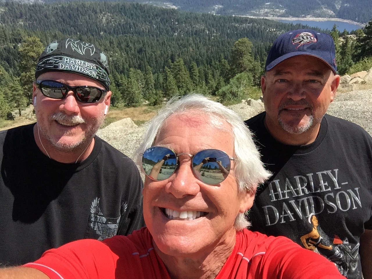
Today will be our longest ride so far – 300 miles – and it marks our last day on the road as a threesome.
By tonight, we should be back in Lake Arrowhead, ready to return to our own homes – and life as we know it. You knew the party had to end eventually.
After a hearty (not) breakfast at The motel in Three Rivers, we work our way south on Highway 198, riding along the southern shore of Lake Kaweah.
The lake is a reservoir, formed by Terminus Dam on the Kaweah River. Its primary purpose is flood control, so the lake is maintained at a very low – or empty – level most of the year. It generally only fills in May and June. Because of California’s unprecedented drought, the lake is now unusually low, affecting lake recreation and nearby farming.
We follow Highway 198 to the eastern outskirts of Visalia, and turn east onto Yokohl Drive. The road rises gently through rolling hills as we ride thru Yokohl Valley, named after a band of Foothill Yokuts Indians.
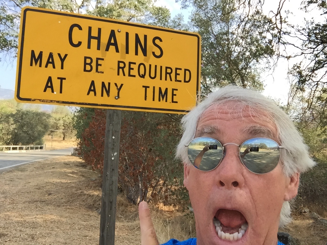
Surprises on a mountain road. Chains, in the summer?
Twenty-two miles later, we rejoin Highway 190 and turn east. For the next 20 miles, the road is extremely twisty, with numerous switchbacks and blind curves. We’re riding at less than 20 miles an hour much of the time.
The Pierpoint Springs Resort is one of the few places along this roller coaster to grab a beverage and a snack. They have great homemade pie, too. And a wi-fi hotspot!
From here, the road continues to be extraordinarily twisty. Eventually, the elevation drops 7,000 feet to the valley floor. Highway 190 becomes Route 107, the Great Western Divide Highway.
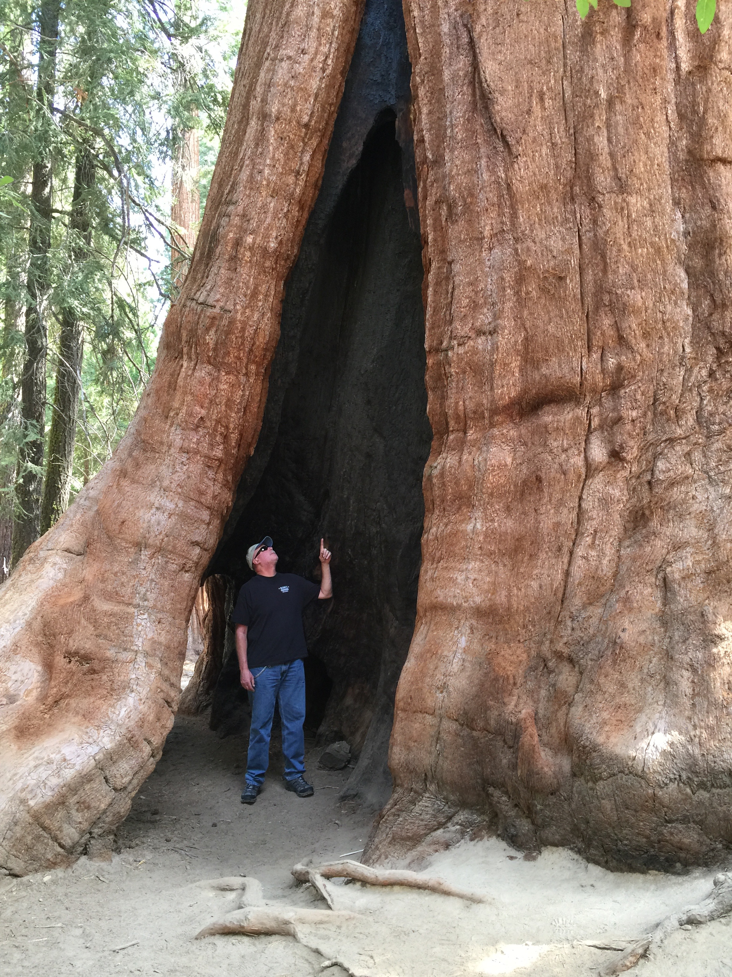
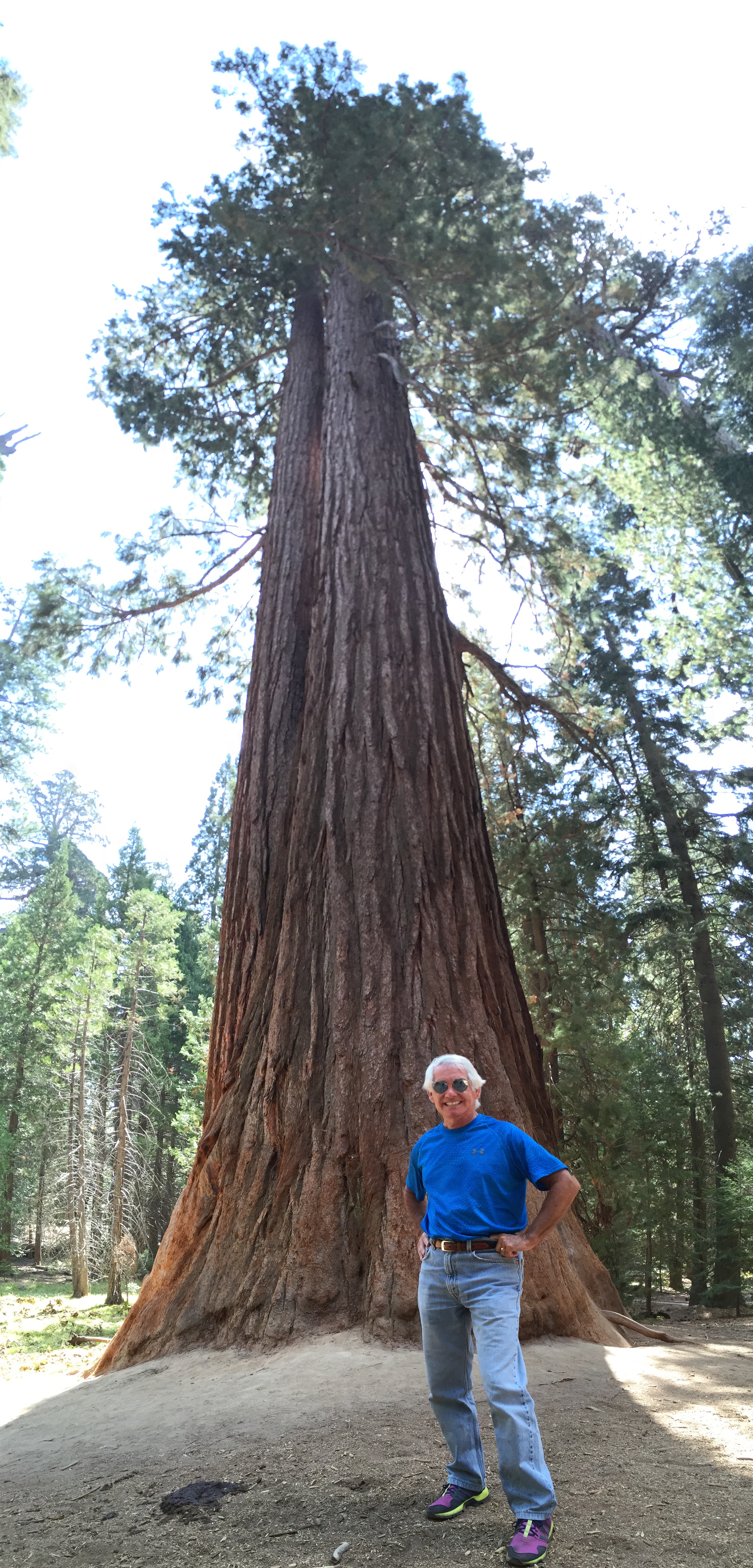
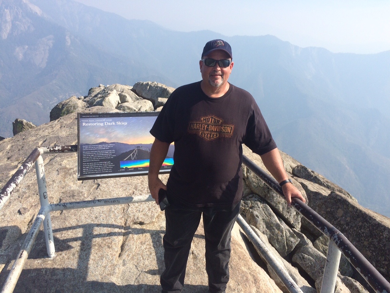
Twenty miles from the Pierpoint Springs pie stop, following a long descent, we arrive in Long Meadow Grove, home of the Trail of 100 Giants. The grove covers about 341 acres of giant sequoias.
On the Trail of 100 Giants.
There’s a unique mile-long interpretive trail, where you can get a close-up look at the grove’s more than 800 sequoias. One hundred twenty-five of them are more than 10 feet in diameter.
This is one of the few sequoia groves with a large number of “twins,” two sequoias growing tightly side-by-side, in order to share resources. This grove even has one twin that rangers call a “sequedar,” a sequoia and a cedar that have grown together.
“These giant sequoias clearly are the work of the ages,” the President said, as he dedicated the National Monument. “They grow taller than the Statue of Liberty, broader than a bus, they are the largest living things on this Earth; so perfectly adapted to their environment that one has never been known to die of old age. They began when America was not even imagined, and Europe was in the Dark Ages.”
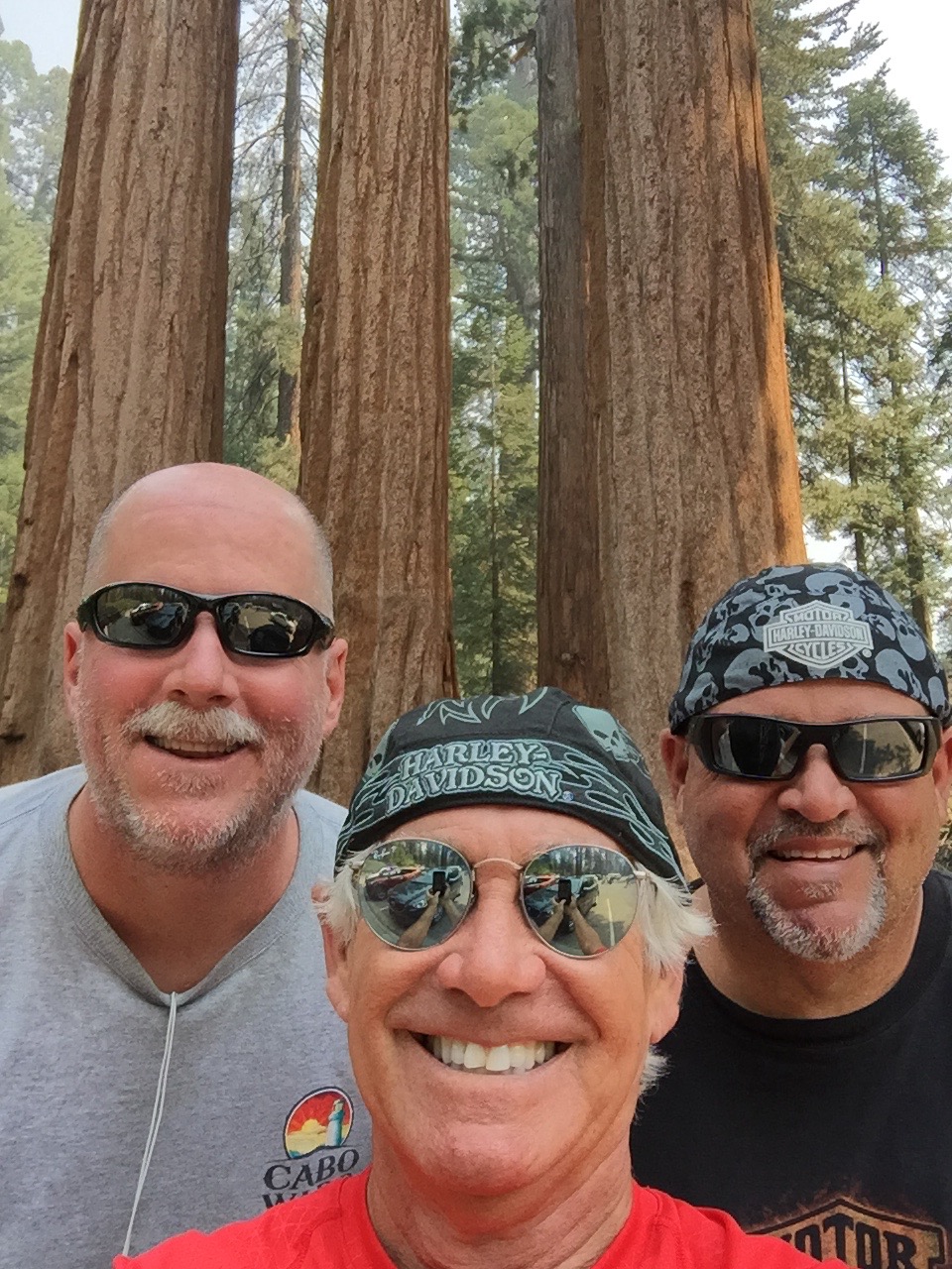
100 Giants, and I’m not one of them.
***
Ten miles east, we pass through Johnsondale, elevation 4,711 feet. Now on Mountain Highway 99, we roll south along the Kern River. It’s a 2,000-foot drop and a 45-minute ride to Kernville. The mid-day sun is searing. White water river adventures – rafting and kayaking – are a popular activity on the Kern River, particularly in the spring. Right now, in mid-summer, the river is barely moving. River rafting companies have shut down operations until next year, hoping for greater snowpack and runoff in 2016. Rafting season this year was completely cancelled.
The Kern River was named after artist and topographer Edward Kern, and so, obviously, was the city of Kernville. Kernville’s big annual event is Whiskey Flat Days, the yearly celebration of the historic Wild West days here. The event is held every President’s Day weekend. We weren’t even close.
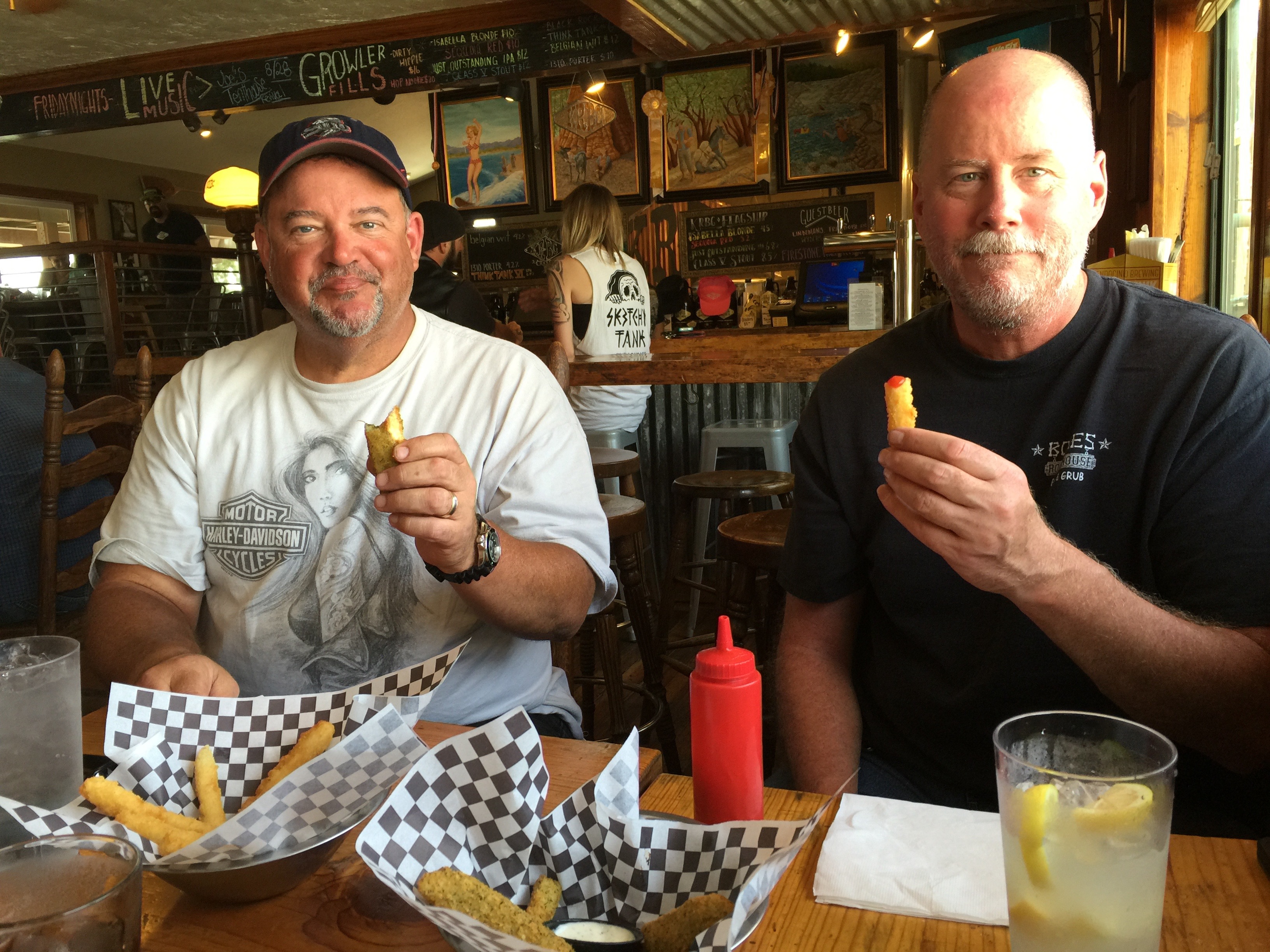
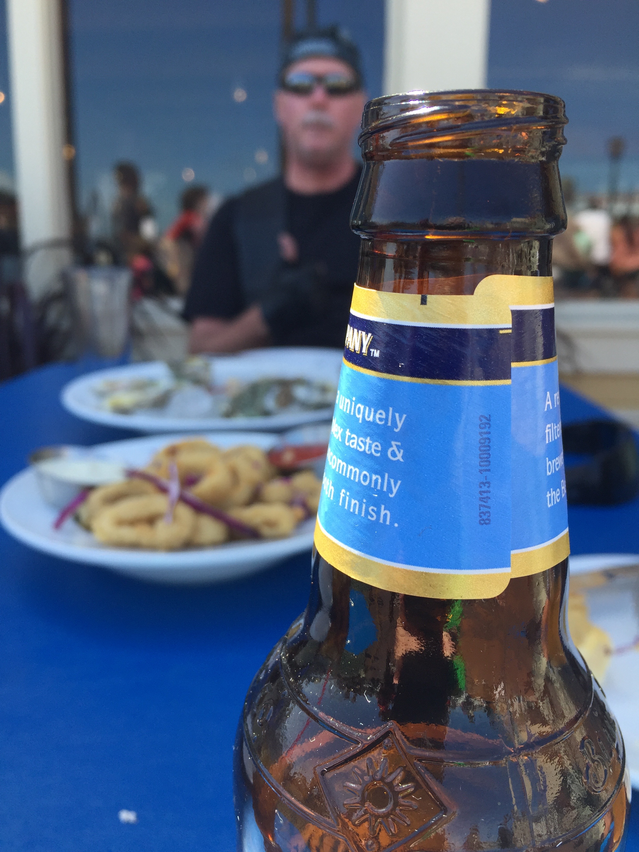
Lunch in Kernville, at the Kern River Brewery.
A few miles south of Kernville, we spot the north shores of Lake Isabella, a reservoir in Kern County created by Isabella Dam. At 11,000 acres, it’s one of the larger reservoirs in California. We pass through the South Fork Wildlife Area, turn east on Highway 178, and quickly pass through Weldon. Highway 178 is also called the Isabella Walker Pass Road.
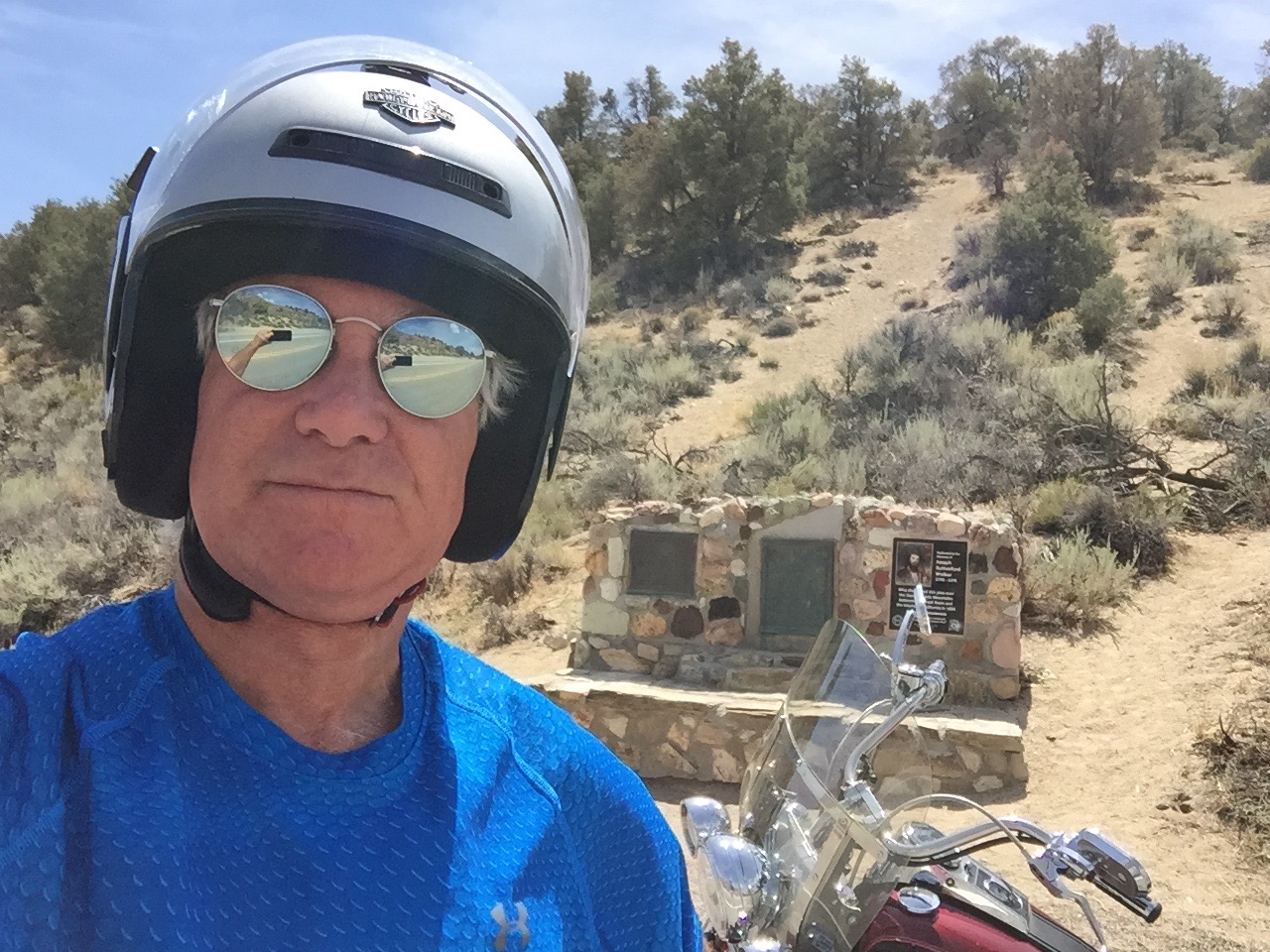
Walker Pass is slightly less than a mile high – 5,250 feet – and is a National Historic Landmark. The highest point on Highway 178, it was charted as a route through the Sierra in 1834 by Joseph R. Walker, a member of the Bonneville Expedition. Walker learned of the route from Native Americans.
The 2,663-mile Pacific Crest Trail, which begins at the US-Mexico border and ends at the US-Canada border, crosses Highway 178 at Walker Pass. Northbound hikers who arrive at Walker Pass can look forward to the longest roadless stretch of the entire trail. The trail crosses many of the areas we’ve been for the past week, including Yosemite National Park, Kings Canyon National Park, Sonora Pass, Ebbetts Pass and Carson Pass.
At Walker Pass.
The Pacific Crest Trail was made famous in the 2014 Hollywood film, Wild, starring Reese Witherspoon as trekker Cheryl Strayed, on a journey of self-discovery and healing. Hey everyone … take a hike.
***
Descending from Walker Pass, in eight miles we come to a T in the road at the junction with Highway 14 – the Aerospace Highway. Faced with our biggest decision of the day – north or south – we counter-intuitively turn north.
With a few jogs in the road, we ride through Inyokern, a hybrid name combining Inyo and Kern Counties. Inyokern is actually in Kern County.
In Inyokern, we turn south on US Highway 395, which we’ll follow for the next 50 miles. While highly scenic in the Sierra Nevada Mountains, Highway 395 from Inyokern south is straight, flat and boring. You’d expect that of the Mojave Desert. The Mojave is a high desert; in Inyokern, we’re at 2,455 feet. But it’s still a desert and in the mid-afternoon sun, it’s blazing hot.
As we approach Kramer Junction, we eye, on our right, a massive solar power generating plant. It’s part of the Solar Energy Generating Systems, whose capacity at several locations in the desert is 354 megawatts. The facility is privately owned and operated by NextEra Energy Resources, which says 354 megawatts is enough to power more than 232,000 homes.
The complex of 936,384 high-tech mirrors is the world’s second largest solar thermal energy generating facility, consisting of nine solar power plants in the Mojave Desert. The solar generation uses parabolic trough, solar thermal technology to make electricity. Mirrors and heat transfer make it all happen.
The Kramer Junction solar facility receives an average of 340 days of sunshine a year. Today is one of them.
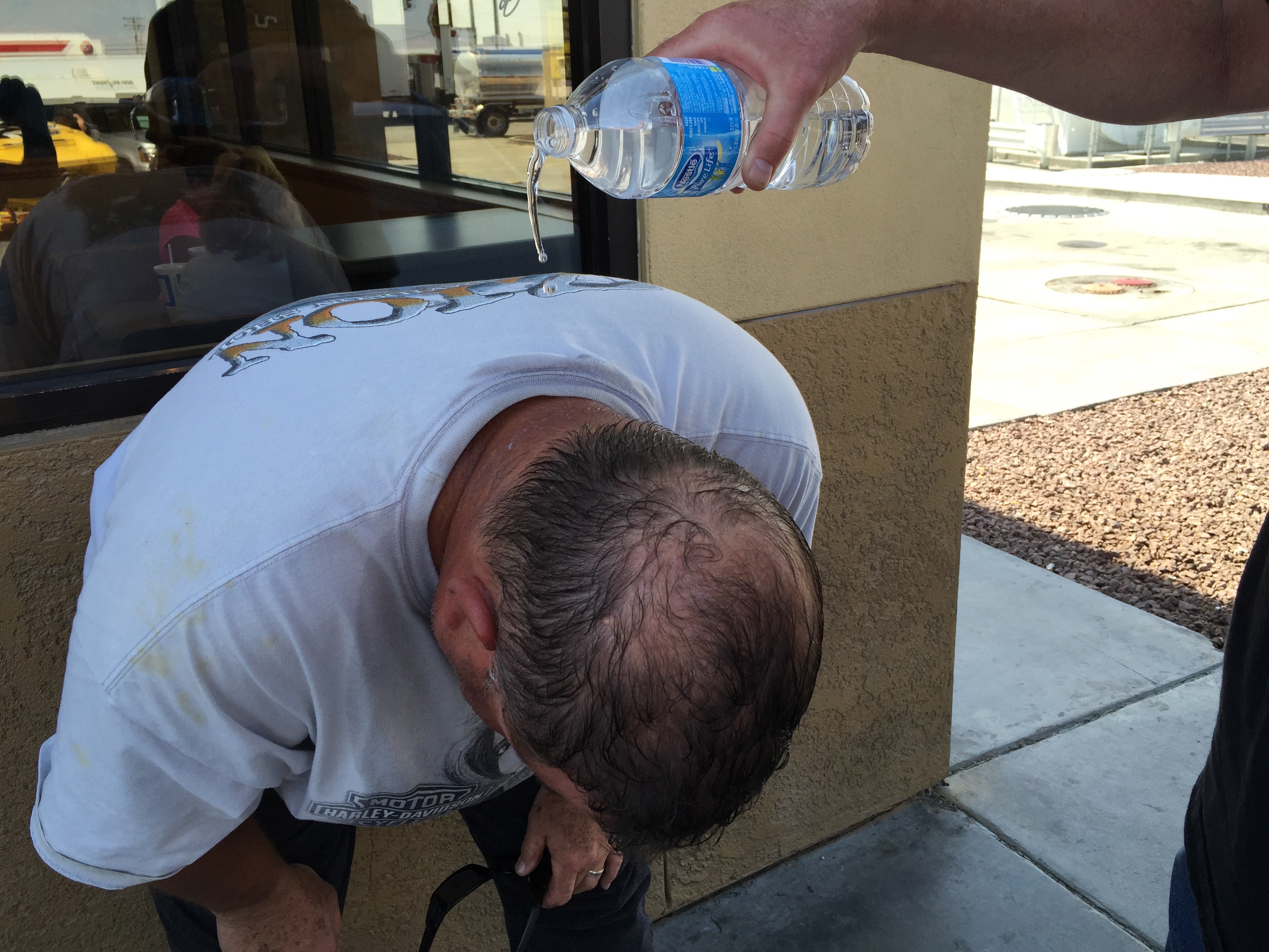
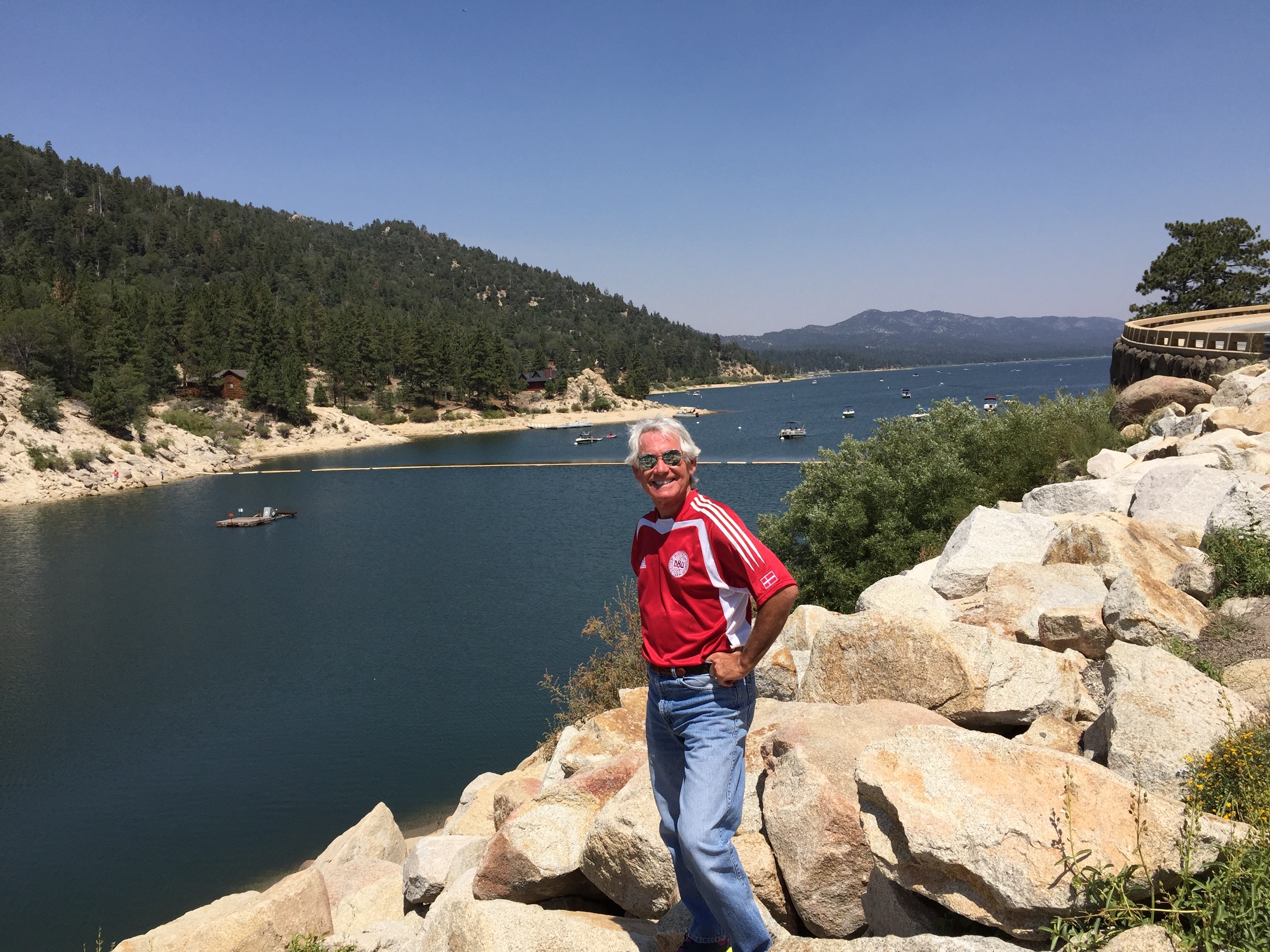
Scott cools off on a 102-degree day at Kramer Junction.
Kramer Junction, also known as Four Corners, sits at the intersection of US Highway 395 and California Highway 58. It has several gas stations, fast food restaurants, a slow food restaurant (The Roadhouse), a population of 2,231, and not much else.
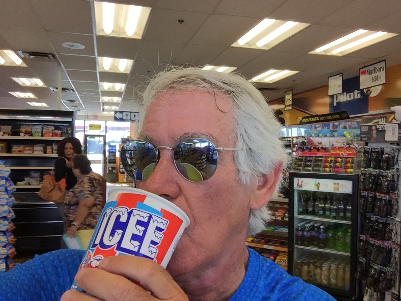
An Icee break at Kramer Junction.
West on Highway 58 takes us to Mojave, home to the Mojave Air and Space Port where the first private space flight, SpaceShipOne, was launched in 2004. East on Highway 58 brings us to Barstow, a transportation hub named after William Barstow Strong, former president of the Atchison, Topeka and Santa Fe Railway.
But we are heading south, so we continue on US-395 for another 40 blah miles.
One of the few interesting sights along the way is just north of Adelanto, where we roll by the Southern California Logistics Airport – a boneyard for retired commercial airplanes. The airport, perhaps more diplomatically and euphemistically, calls itself a “transitional” facility. A halfway house for distressed aluminum.
Formerly George Air Force Base – which closed in 1993 – the logistics airport has a 15,000-foot runway. That’s the longest in the US, other than Denver International Airport. The Southern California Logistics Airport, technically in Victorville, can accommodate all currently flying commercial and military aircraft, 24 hours a day. The facility claims VFR (Visual Flight Rules) weather 360 days a year, meaning there are a lot of clear, sunny days, perfect flying weather. Good for Harley riding, too. Except for the heat.
Because of the dry climate here, it’s a conducive environment for preserving aircraft. To protect airliners during their storage from wind and sun damage, engines and windows are tightly covered with white, reflective materials – allowing the airplane to be stored safely for years until it’s ready to return to active duty, or be salvaged. Airliner boneyards in the western US serve several functions: temporary storage, maintenance, parts reclamation, and scrapping.
***
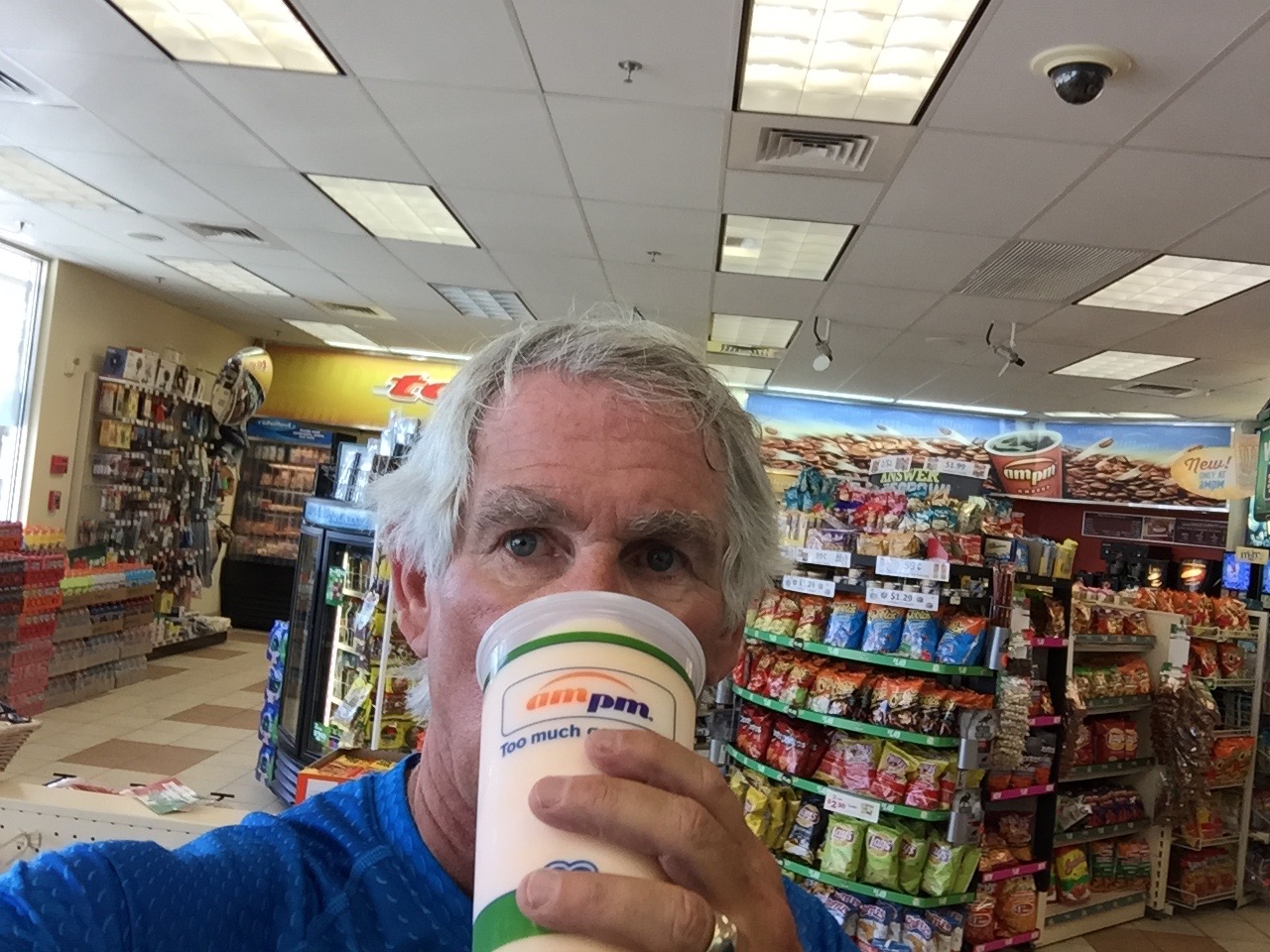
Just before hopping on I-15, I take one last hydration break.
In 13 miles, we merge onto I-15 south and continue our journey to Lake Arrowhead. We’re not big fans of Interstate highway riding, so we fortunately are on I-15 for only eight miles before exiting at Cajon Junction. If that sounds familiar, it’s because we crossed Cajon Junction on Day 1 on our way to the Angeles Crest Highway.
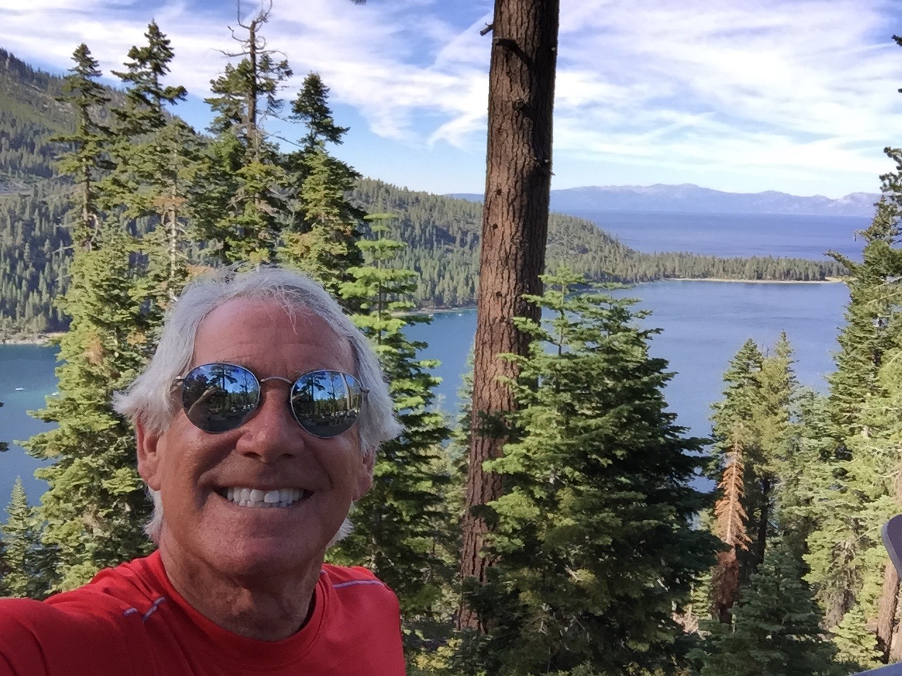
We turn east onto Highway 138 for the 22 mile ride past Silverwood Lake and Crestliine. Three miles on the Rim of the World Highway, and we’re back in Lake Arrowhead, where our journey began eight days ago – and where it now ends.
***
To view today’s route from Three Rivers to Lake Arrowhead, click here.
Cheers! To a safe trip, and looking forward to the next one.
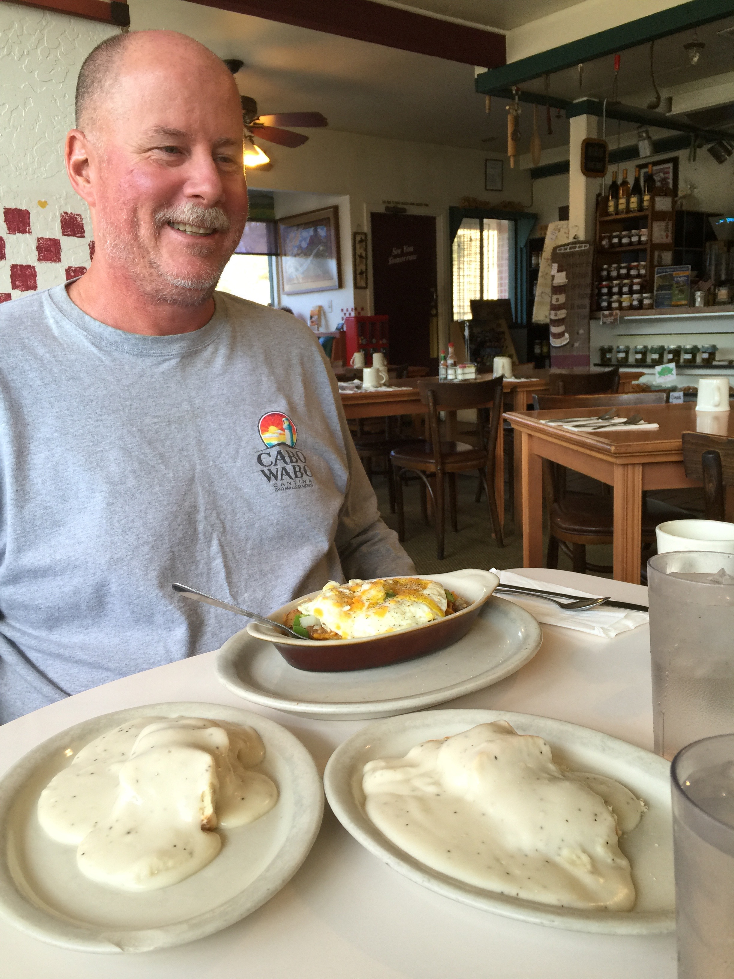
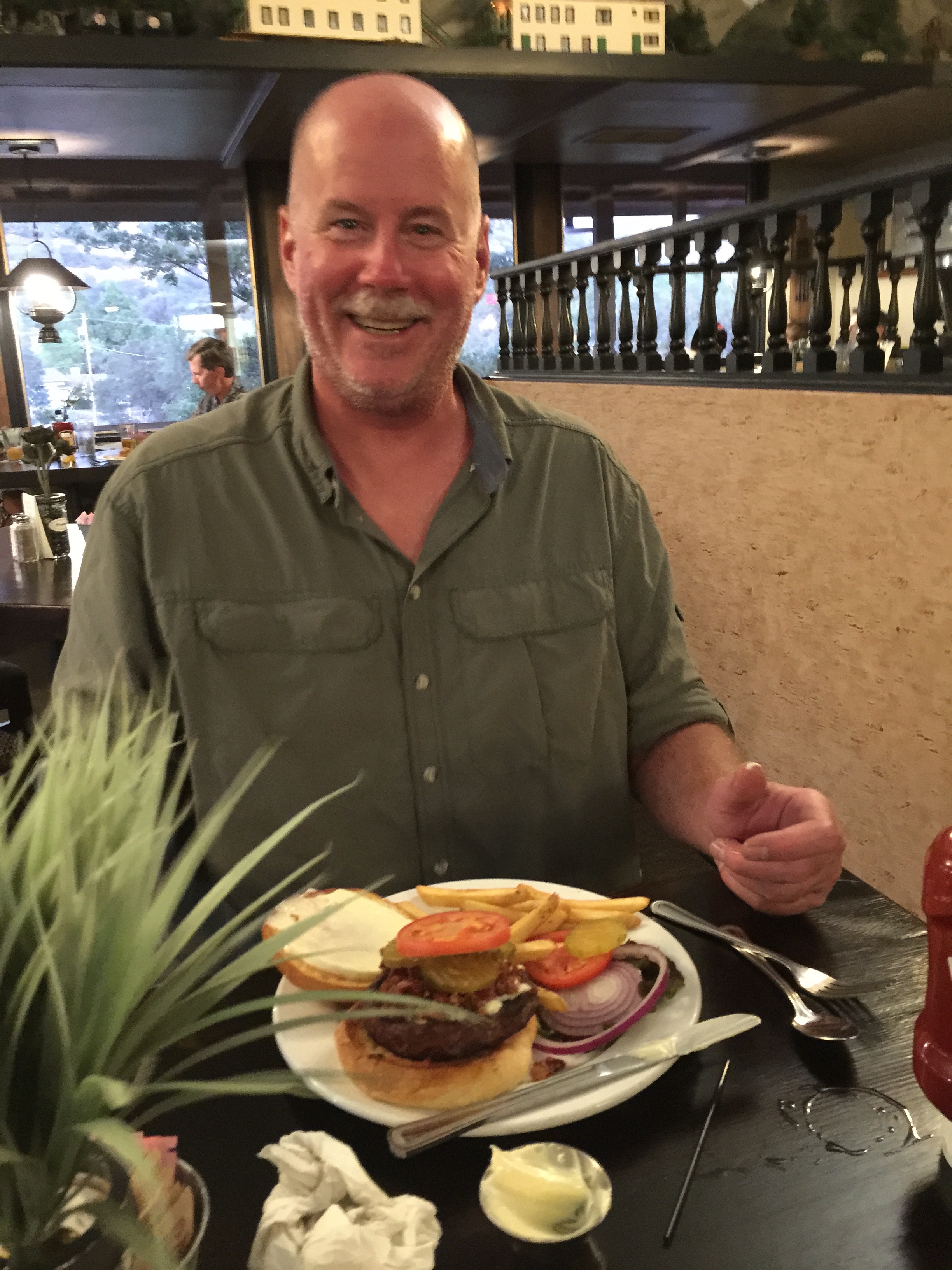
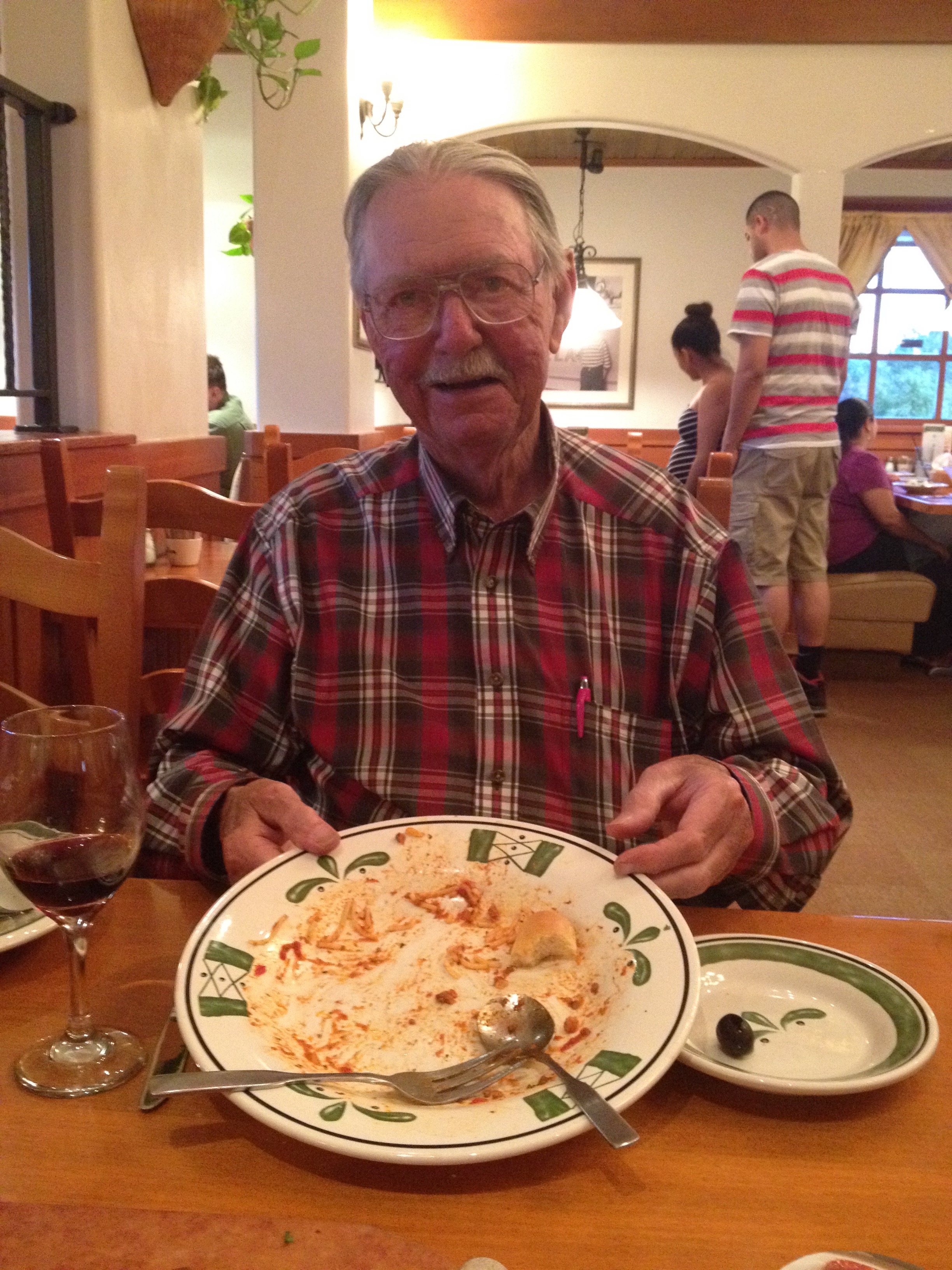
Breakfast at Katie’s Country Kitchen in Oakhurst. A hearty way to start the day!
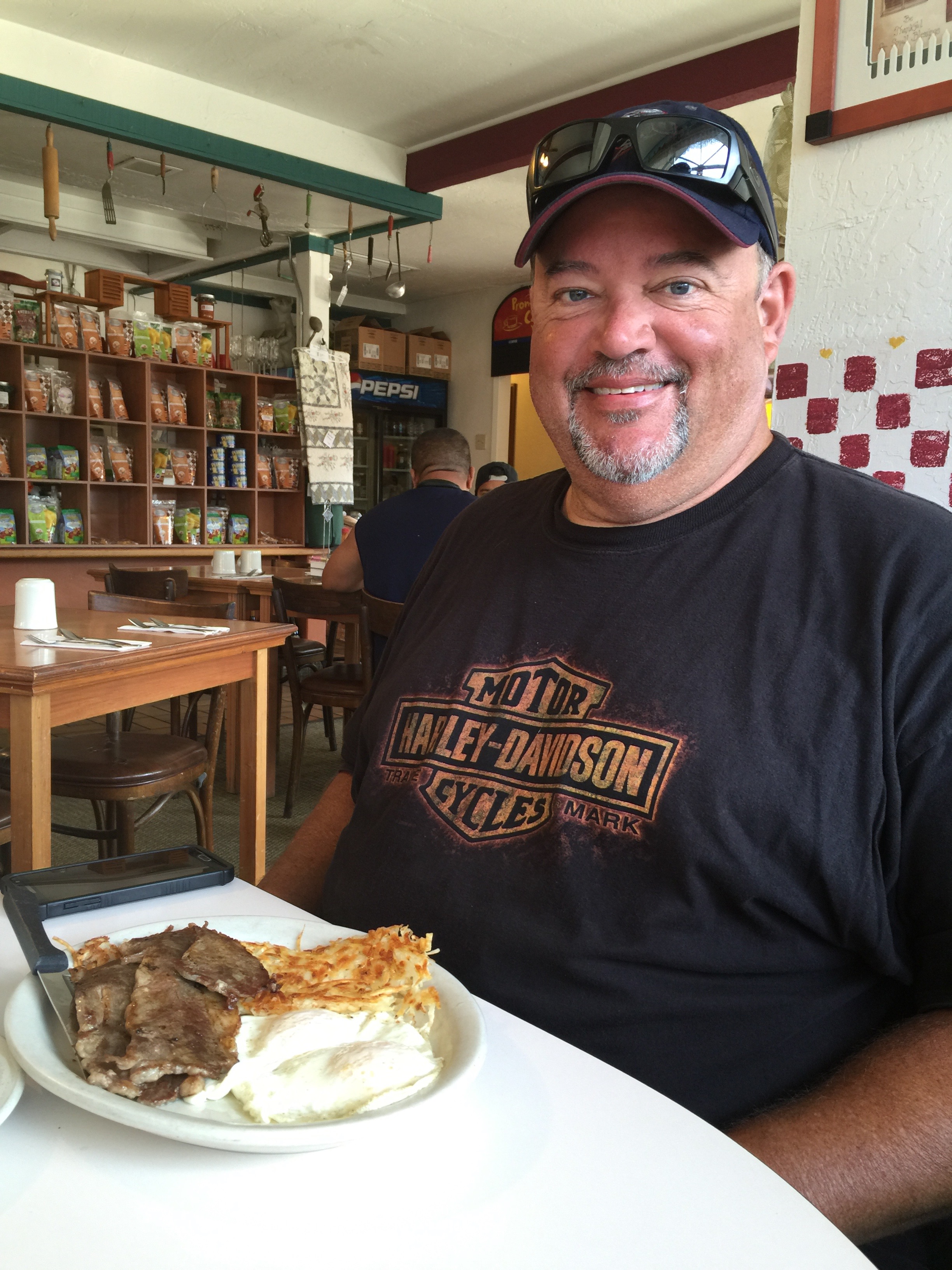
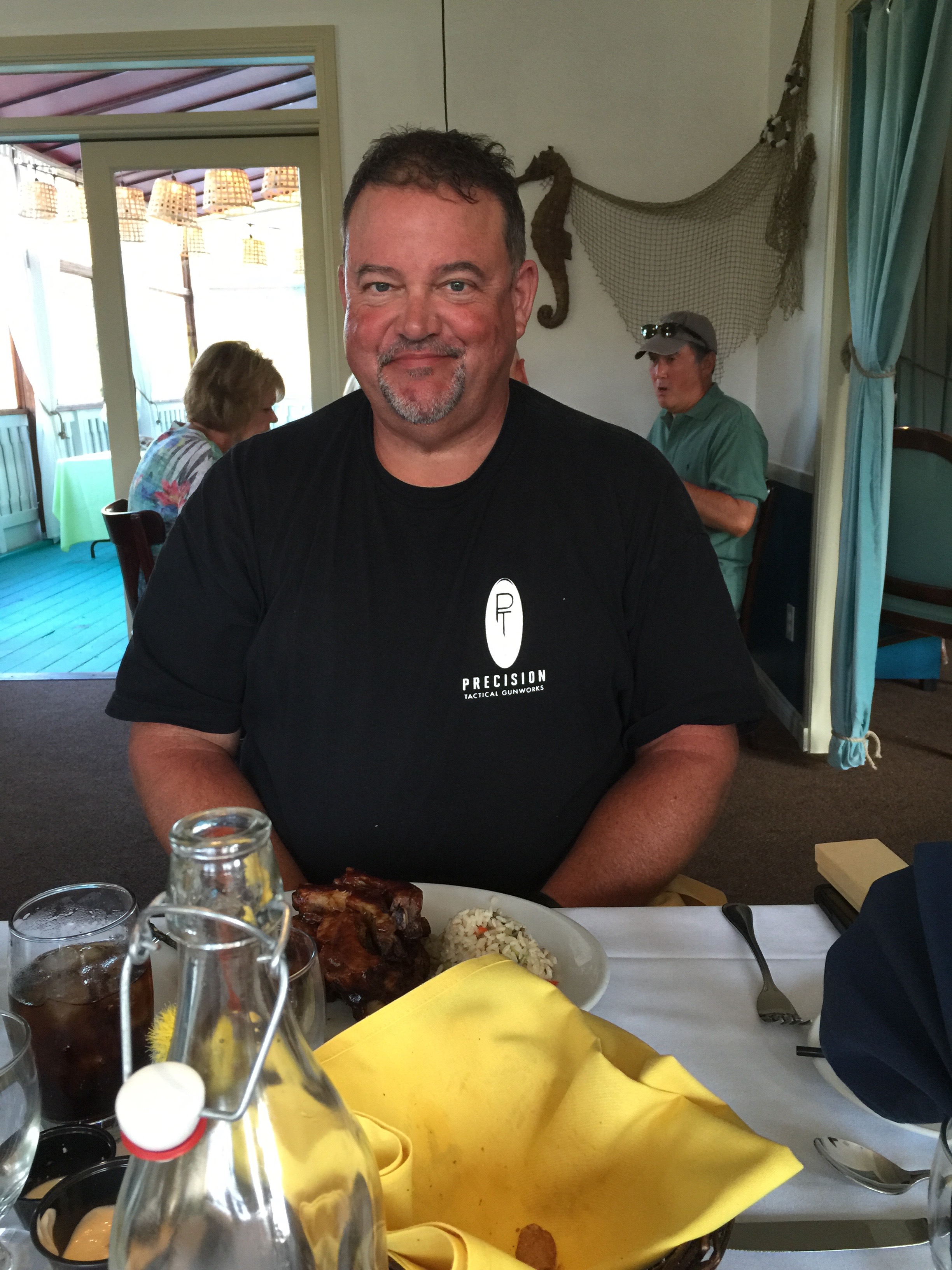
Man, the big guy can really put away a big breakfast.
Each day on this trip, we seem to do things in twos:
August 21: two notable biker roadhouses – Newcomb’s Ranch, and the Rock Store.
August 22: two cool town nicknames – “Clam Capital of the World,” and “Gibraltar of the Pacific.”
August 23: two monumental structures – the Hearst Castle and Bixby Bridge.
August 24: two bad habits – gold and gambling.
August 25: two major Sierra passes – Ebbetts and Sonora.
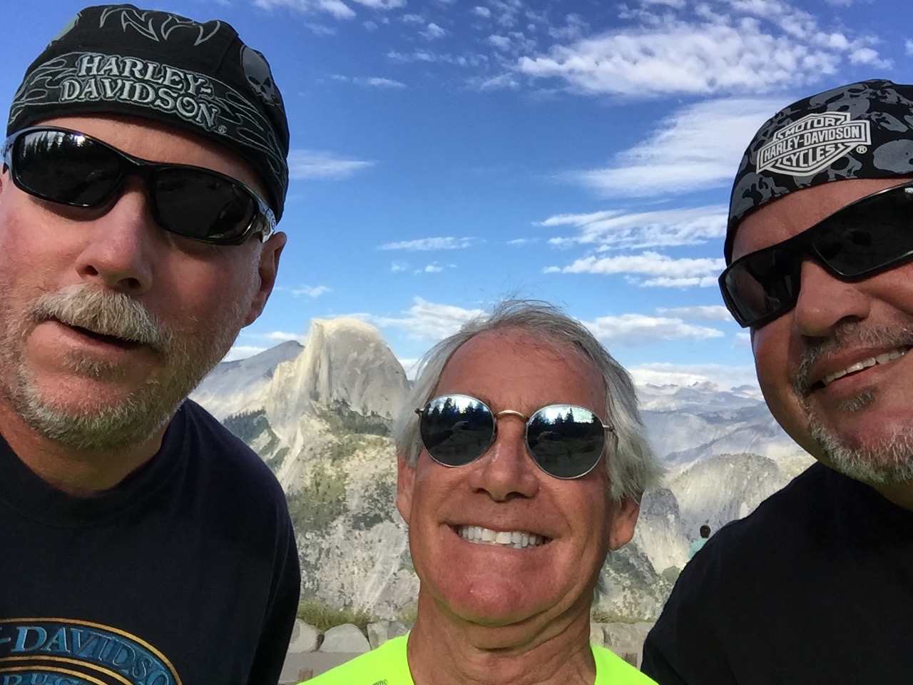
August 26: two hunks of granite – El Capitan and Half Dome.
Today, we’ll continue the streak by visiting two National Parks – Kings Canyon and Sequoia.
***
Smoke gets in your eyes.
We begin our 222-mile journey by heading south through the western foothills of the Sierra Nevada Mountains, mostly on gently curving two-lane roads. We’re in the Sierra National Forest, riding along Bass Lake.
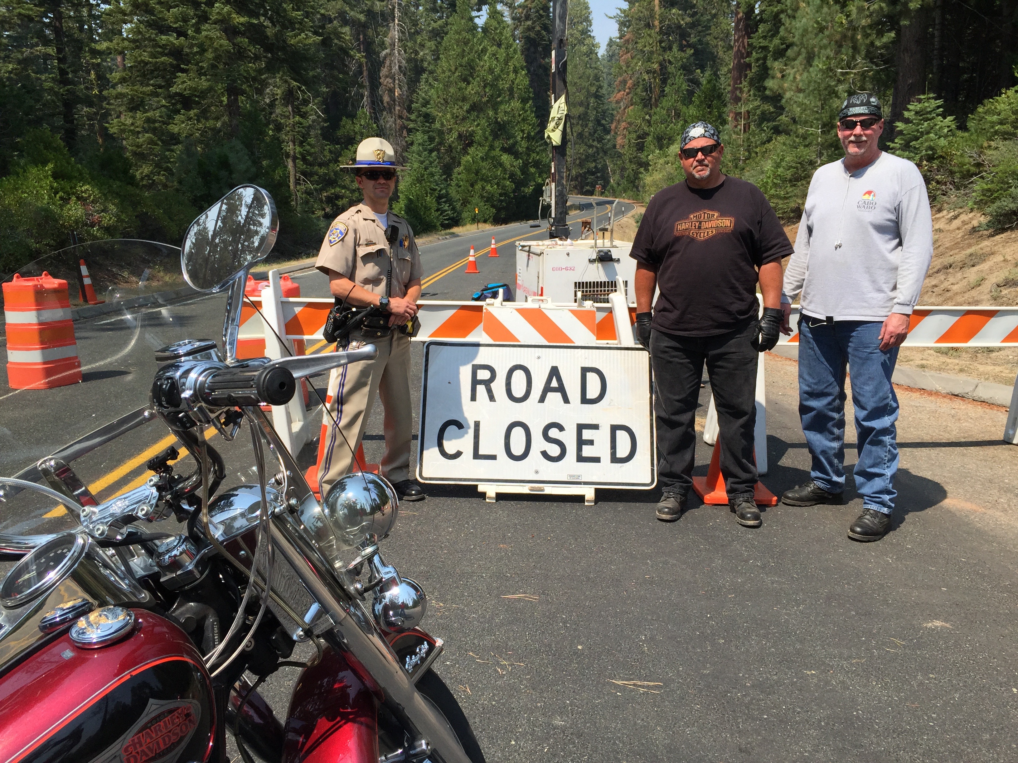
We motor through the teeny communities of North Fork and Auberry. In Auberry, the smoke from the Hume Lake fire is thick, causing us to reassess our ride into King’s a Canyon. We stop at a convenience store, and develop Plans B and C, in case the road is closed or the smoke is so dense we have to skip the National Parks altogether today. Turns out the road into Kings Canyon is closed; the fire has been burning more than a month and is still only 25 percent contained.
We press on, riding east on Highway 180, and 65 miles after leaving Oakhurst, we see a hint of today’s first destination as we turn left onto Highway 180 – Kings Canyon Road. The hint is the road sign. I can take a hint.
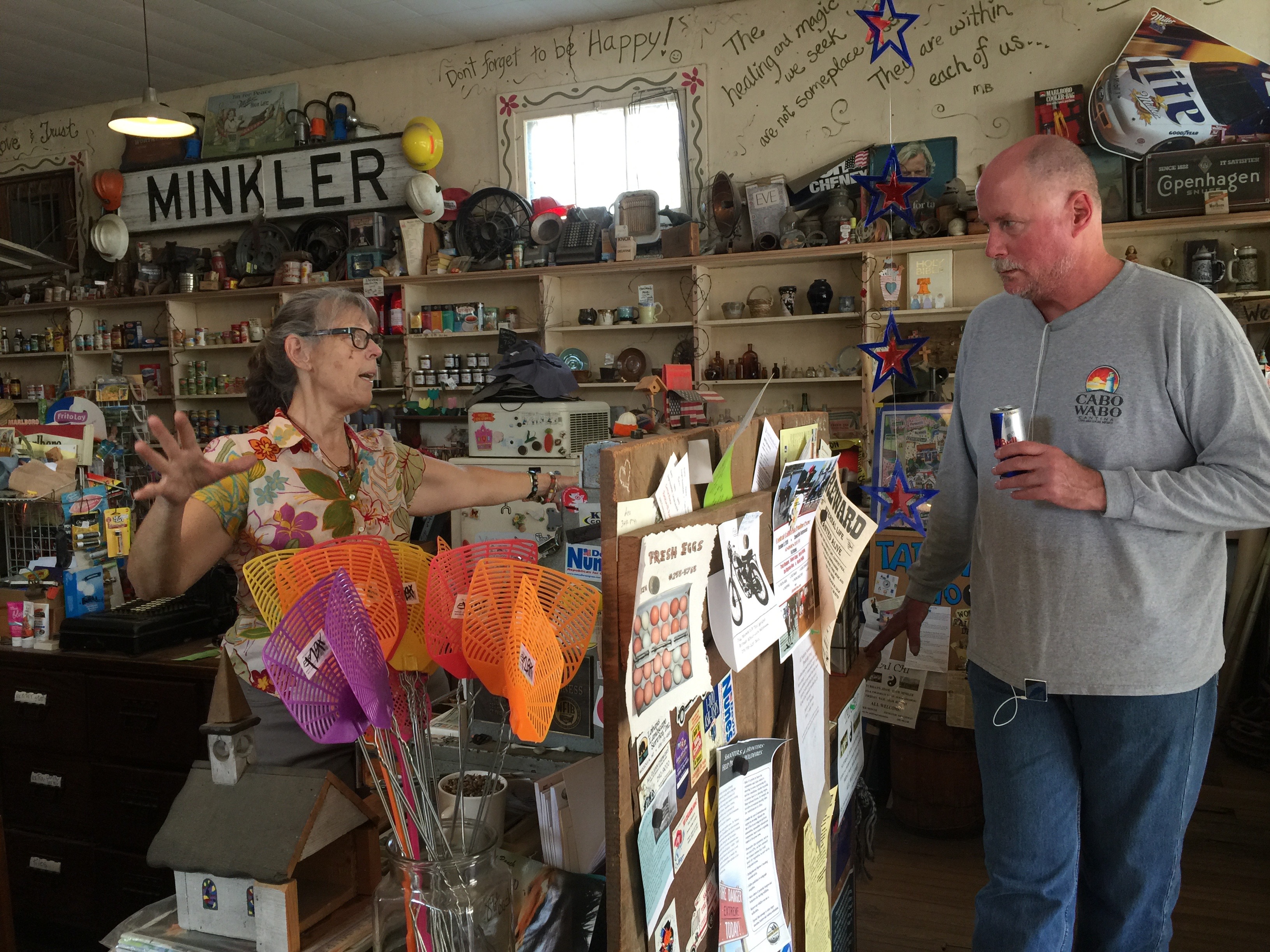
Over the next 40 miles, Highway 180 will gradually climb to 6,600 feet in the Sierras and enter Kings Canyon National Park. We pass through Minkler, Squaw Valley, and Clingan’s Junction Grocery – the last gas station for more than 100 miles.
Dave makes a new friend at the general store in Minkler.
After gassing up, the road rises dramatically. From here, it’s about 18 miles of twisty roads with spectacular views to the south and west. Well, spectacular if you could see them, which we can’t today because of the smoke in the air. And then we arrive at the park entrance, where the ranger gives us the official word about the road closure.
Interestingly, when you enter Kings Canyon National Park, you also enter Sequoia National Park. They share the same entry point and the same National Park Service website. The two parks are separate, but quite closely related. Since the 1940s, both parks have been administered jointly.
The sequoias at Grant Grove are ginormous.
Rolling past the small community of Wilsonia, we turn into Grant Grove, a stand of sequoia trees, whose centerpiece is the General Grant Tree. At 267 feet tall and a ground circumference of 108 feet, it’s the third largest tree in the world — and is more than 3,000 years old. The tree was named in 1867 after Ulysses S. Grant, Union Army general and the 18th US President.
In 1926, President Calvin Coolidge proclaimed it the “Nation’s Christmas Tree,” perhaps one of his more notable accomplishments while in office. And, in 1956, President Dwight Eisenhower declared the tree a “National Shrine,” a memorial to those who died in war. It’s the only living object with that designation.
Visitors busily snap photos and try to find a way to fit the entire tree in the frame. Good luck with that.
Sequoia selfie.
Time to leave the Sequoiadendron giganteum in the Grant Grove behind, and explore Kings Canyon itself, which we would do if the road is open, but it remains closed due to the Hume Lake fire. Sadly, that’ll have to wait for another trip. We do take the opportunity to snap some pix of the Road Closed sign, a bittersweet memory captured on my iPhone. As we continue along Highway 180, there’s nothing but unbridled beauty for 35 miles until we reach the end of the road at Kanawyer. All you can do there is dismount and begin hiking.
Kings Canyon is named after the Kings River, whose headwaters originate at elevations above 13,000 feet in the Sierra Nevada mountains. The Kings River was named in 1805 by the commander of a Spanish military expedition into California’s Central Valley.
The canyon was carved by glaciers out of granite and closely follows the river. The granite walls of the canyon, in places, tower 4,000 above the canyon floor. It’s one of the deepest canyons in the US.
Bummer. Road through Kings Canyon is closed due to smoke and fire.
At the Road Closed sign, we turn around and reverse our direction, and begin heading back toward Grant Grove, our last vision of Kings Canyon National Park, which this year celebrates its 75th anniversary.
***
With a slight left turn, we are now on Highway 198, entering Sequoia National Park. The two parks are that close.
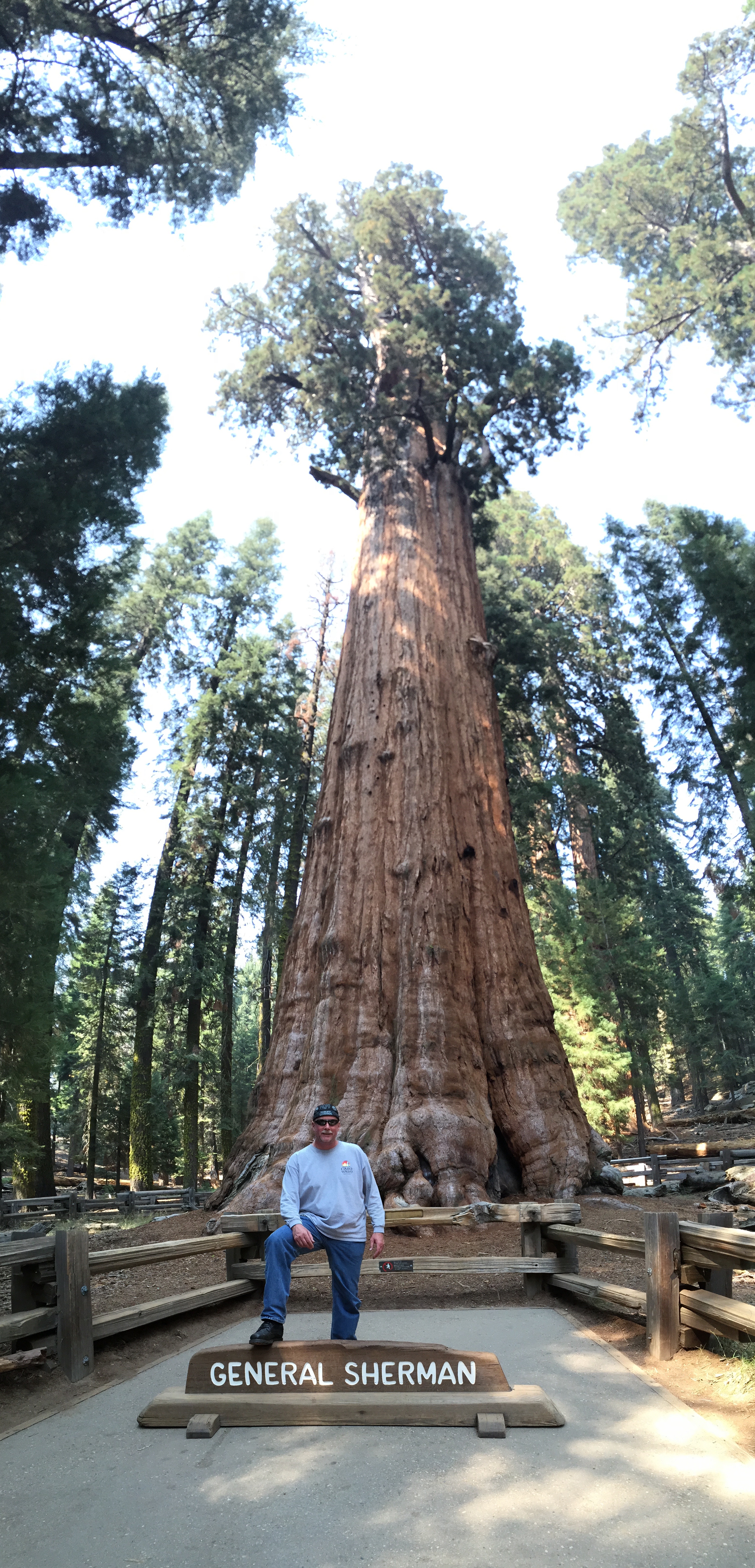
Highway 198 is also called Generals Highway, named after two of the world’s largest and most famous Sequoia trees – the General Grant and the General Sherman. We will visit the General Sherman tree in about 45 minutes.
Dave poses in front of the General Sherman Tree.
The Generals Highway snakes south through Sequoia National Park, twisting and turning amid giant trees. The park is also full of huge redwood trees, often mistakenly confused with sequoias. Both naturally occur only in California, share a distinctive cinnamon-colored bark, and the proclivity for growing to overwhelming heights. Sequoias thrive in higher elevation habitats than redwoods. Redwoods are generally taller. Sequoias weigh more, though where would you find a scale large enough to verify that?
Sequoia National Park was created essentially to protect the giant sequoia trees from logging. It was the first national park formed to protect a living organism.
The park contains among its natural resources the highest point in the contiguous 48 United States, 14,505-foot Mount Whitney – named after Josiah Whitney, chief of the California State Geological Survey in the 1860s and ’70s.
My riding partners, Dave and Scott, have both summited Mount Whitney; Scott has done it three times, the Mount Whitney trifecta!. My wife, Sarah, has conquered the mountain, too. All proudly signed their names in the register that sits at the summit. The register is brought down the mountain several times each season by Park rangers, who place it in Mount Whitney’s permanent archives. If you make it to the top, your name has a place in history.
Dave and Scott have hiked Mount Whitney. So has Sarah. Me, I’m a slacker.
Mount Whitney is a 22-mile hike, round trip, with an elevation gain of more than 6,100 feet. About 10,000 people a year successfully complete the journey – a mostly non-technical but uber-grueling ascent. Permits are required, and like the 17-Mile Drive in Carmel, motorcycles are not allowed.
Note: my resume does not include a Mount Whitney climb, but I have summited Colorado’s Mount Evans, 14,130 feet. On a Harley.
We turn off The Generals Highway and into the parking lot to view the General Sherman Tree. By volume, it’s the largest known living single stem tree on earth – estimated at 52,500 cubic feet.
The Sherman Tree is named after the Civil War general William Tecumseh Sherman. The tree was named by naturalist James Wolverton, who had served as a lieutenant under Sherman.
In 1931, following scientific comparisons with the General Grant tree, General Sherman was identified as the world’s largest. Size matters, especially to arborists.
Two miles down the road, we pass the Giant Forest Museum and come to the Moro Rock Trailhead. It’s a spectacular hike that ends with 352 stairs to a vista point on Moro Rock, where you can enjoy panoramic views of the western half of Sequoia National Park and the Great Western Divide.
Scott at the top of Moro Rock. The views, sadly, were obscured by smoke.
It’s easily one of the most popular hikes in the park.
Moro Rock rises 6,725 feet above sea level. It is a prominent granite protrusion on the edge of the Giant Forest visible to everyone driving up the Generals Highway into Sequoia National Park from the south.
For the next 10 miles from Moro Rock south, the road is probably the twistiest, baddest, steepest alpine thrill ride I’ve ever been on. There are dozens of well-marked hairpin turns so tight that I get well acquainted with first gear all the way down. This marks my fourth trip on this road and my knuckles are still ashen white.
We descend all the way to 843 feet above sea level, landing in the town of Three Rivers, population 2,182. The town’s name comes from its location near the junction of the North, Middle, and South Forks of the Kaweah River.
Three Rivers bills itself as the gateway to Sequoia National Park. We exit the park and wonder what kind of two-fer tomorrow will bring.
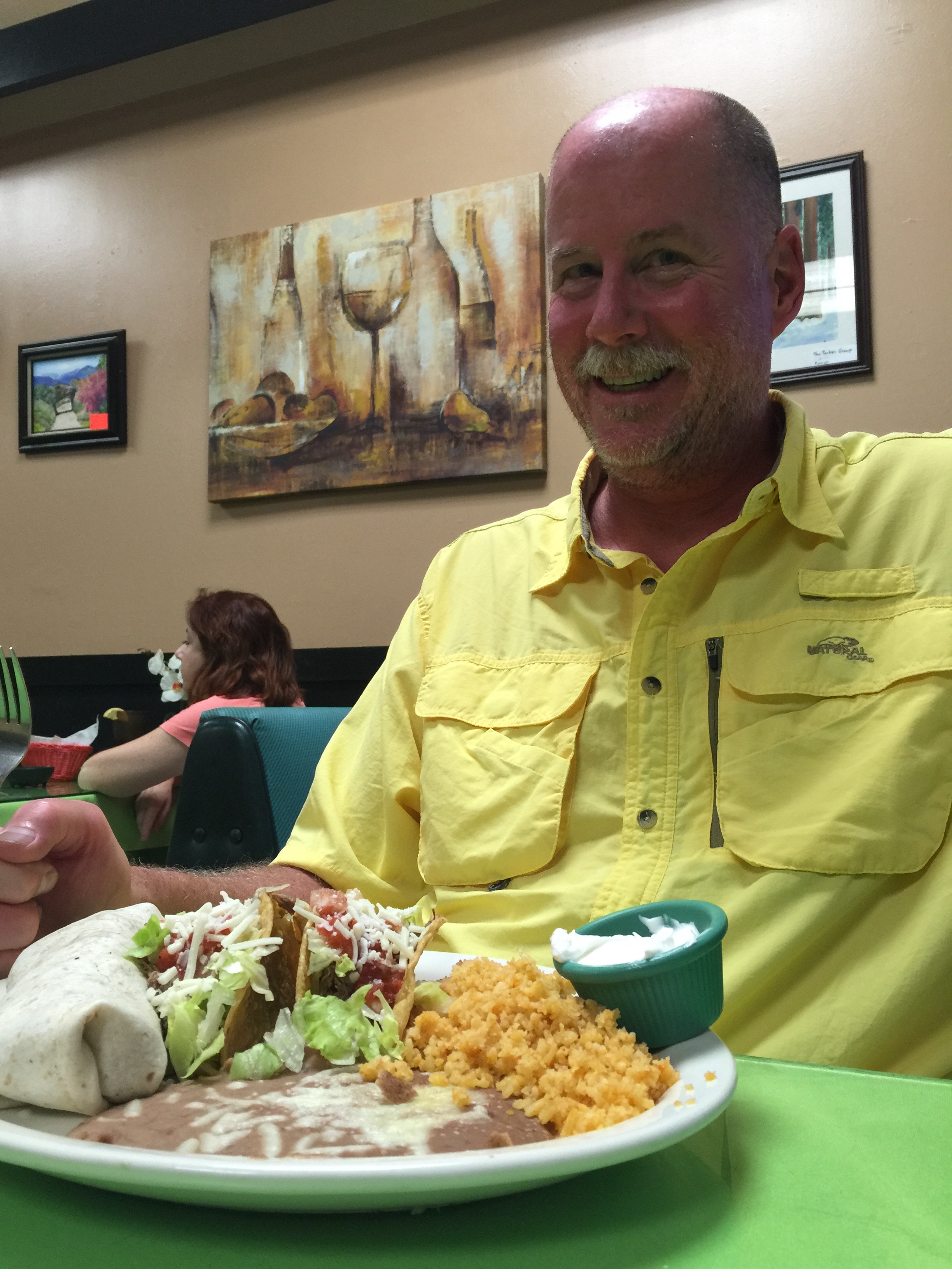
A chipotle burrito for dinner in Three Rivers.
***
To view today’s route from Oakhurst to Three Rivers, click here.
Exactly one year from yesterday – on August 25, 2016 – the US National Park Service will celebrate its centennial. The Park Service was created by an act of Congress, and signed into law by President Woodrow Wilson. The bill mandated the Park Service conserve areas of natural and historic beauty – and leave them unimpaired for the enjoyment of future generations.
The US has 59 National Parks, ranging in size from 5,000 acres (Hot Springs, Arkansas) to 8 million acres (Wrangell – St. Elias, Alaska). Two Alaskan parks in the system (Gates of the Arctic and Lake Clark) host less than 13,000 visitors each year, while Great Smoky Mountains National Park in Tennessee and North Carolina attracts more than 9 million a year.
Joshua Tree National Park is only 30 miles from our front door in La Quinta. American Samoa National Park is 5,000 miles away.
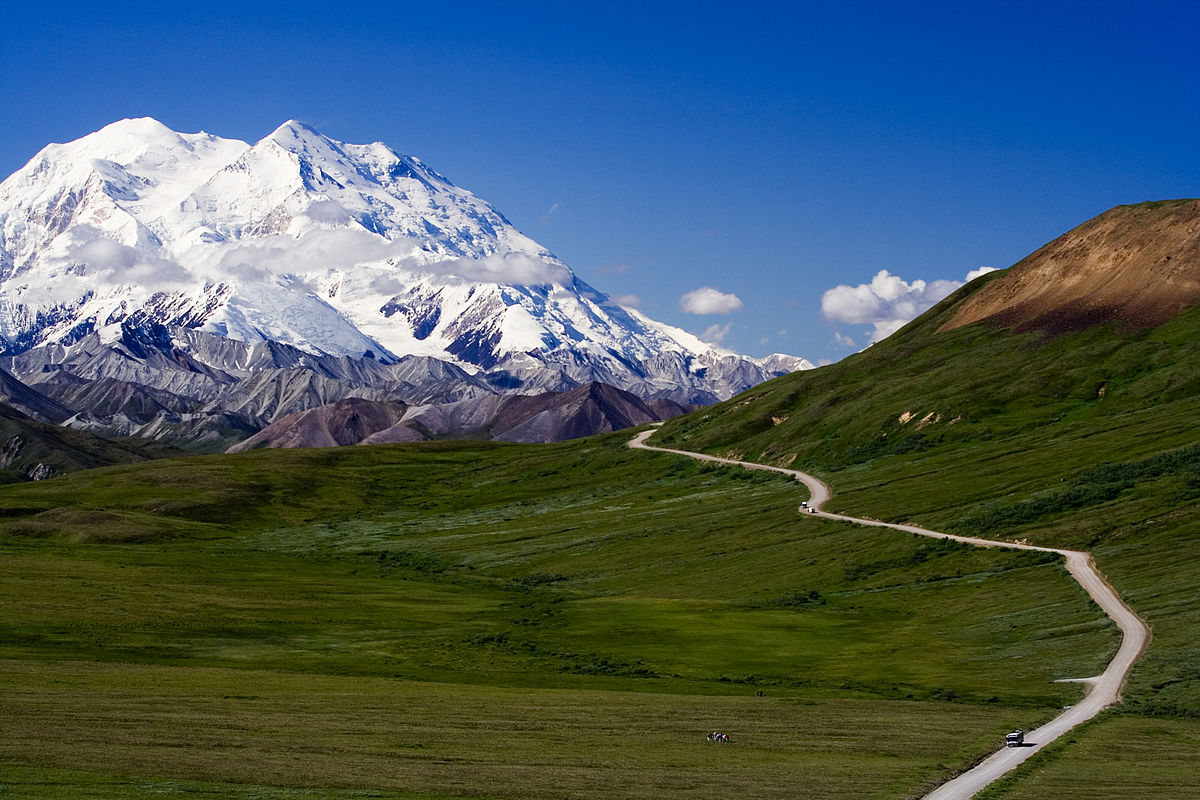
The highest is Denali, in Alaska – 20,268 feet. And the lowest (and toastiest) is in Death Valley, 282 feet below sea level.
Denali National Park, the highest.
The US National Park System is a study in extremes. Extreme isolation. Extreme beauty. Extreme spirituality. Extreme awesomeness.
Perhaps the two most extremely spectacular National parks, with geological features unmatched anywhere in the world, are Grand Canyon, in Arizona – and Yosemite National Park in California. Most of the National Parks are in the western US. We are extremely fortunate to live so close to so many of them.
Yosemite is about 40 miles from Bridgeport, where we spent the night. The highlight of today’s journey will be our visit to Yosemite.
***
There’s much to see on the way to Yosemite.
We leave Bridgeport early – about 7:45 am – on our way to a mammoth family reunion. More on that in a minute.
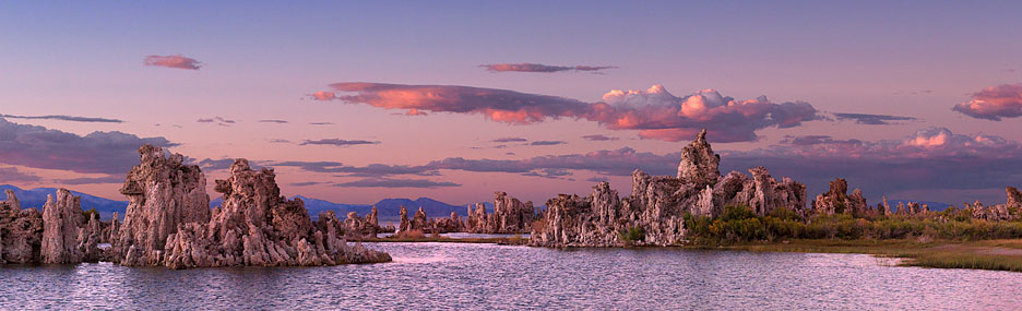
Mono Lake, one of the oldest in the western hemisphere.
In 20 miles, US Highway 395 south takes us to Mono Lake, believed to be one of the oldest lakes in the western hemisphere. Scientists believe it was formed about 750,000 years ago.
Mono Lake, with about 70 square miles of surface area, has life that’s composed of algae, brine shrimp, and alkali flies. It’s one of the most productive ecosystems in the world. The lake is alkaline, with a salt content nearly three times as high as the ocean.
As you may recall from the first day of our ride last week, we traveled on Mulholland Drive, named after civil engineer William Mulholland, who was responsible for building the Los Angeles city water infrastructure. He designed and supervised the building of the Los Angeles Aqueduct, a 233-mile long system to move water from the Owens Valley to the San Fernando Valley.
It turns out his achievement had unintended consequences that have greatly affected Mono Lake. Mulholland’s project diverted Mono Lake’s tributary streams 350 miles south to meet the growing water demands of Los Angeles.
As a result, the volume of Mono Lake has dropped by half, and its salinity has doubled. Click here to learn more about the fragile ecology of Mono Lake and the effort to save it.
***
Ten miles down the road, we arrive in Lee Vining, a tiny community on the southwest shore of Mono Lake. The town was named after Leroy Vining, who founded it in in 1852 as a mining camp.
The economy of Lee Vining relies largely on tourism, since it is the closest town to the east entrance of Yosemite National Park. Tourism here is mostly confined to the summer months, because California Highway 120 through Yosemite is closed the rest of the year due to heavy snowfall. This year, after an unusually warm and dry winter, the highway opened on May 4.
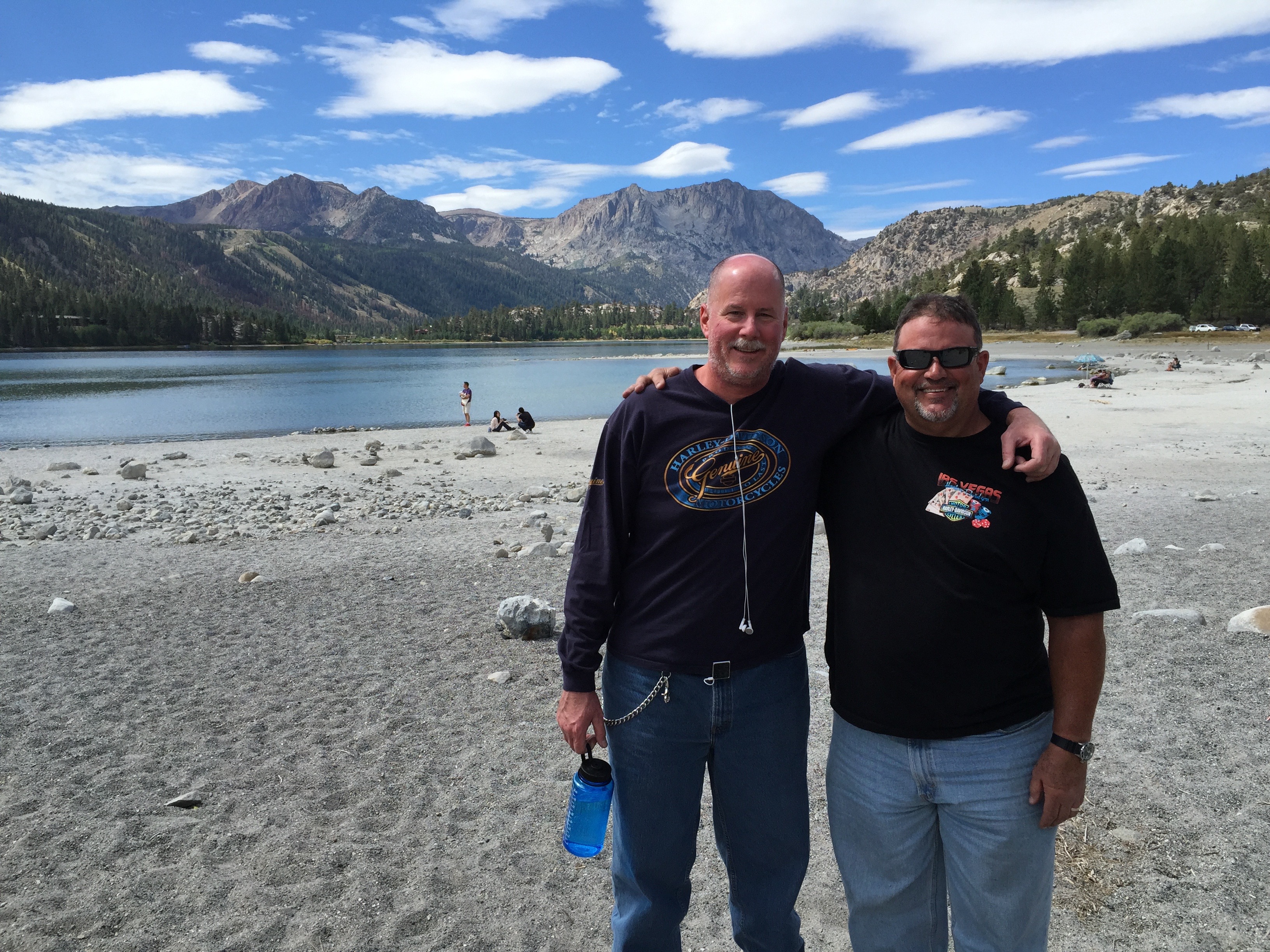
From Lee Vining, we continue south on US-395 past June Lake and Wilson Butte, an 8,405-foot mountain peak that’s the 917th highest in California and the 8,320th highest in the US. No particular significance to Wilson Peak. Some people are just curious about these things.
About 50 miles of Bridgeport, we turn west toward Mammoth Mountain Ski Area, founded in the 1940s by Dave McCoy, a hydrographer for the Los Angeles Department of Water and Power. As a member of the Eastern Sierra Ski Club, McCoy noticed that Mammoth Mountain consistently had more snow than other mountains in the Sierras. He bought a portable rope tow from the club in 1941, usually keeping it at Mammoth. In 1953, the US Forest Service awarded a permit to McCoy to operate the ski area, and he built it into one of the largest in California – comparable to Squaw Valley and Heavenly Valley in the Lake Tahoe area.
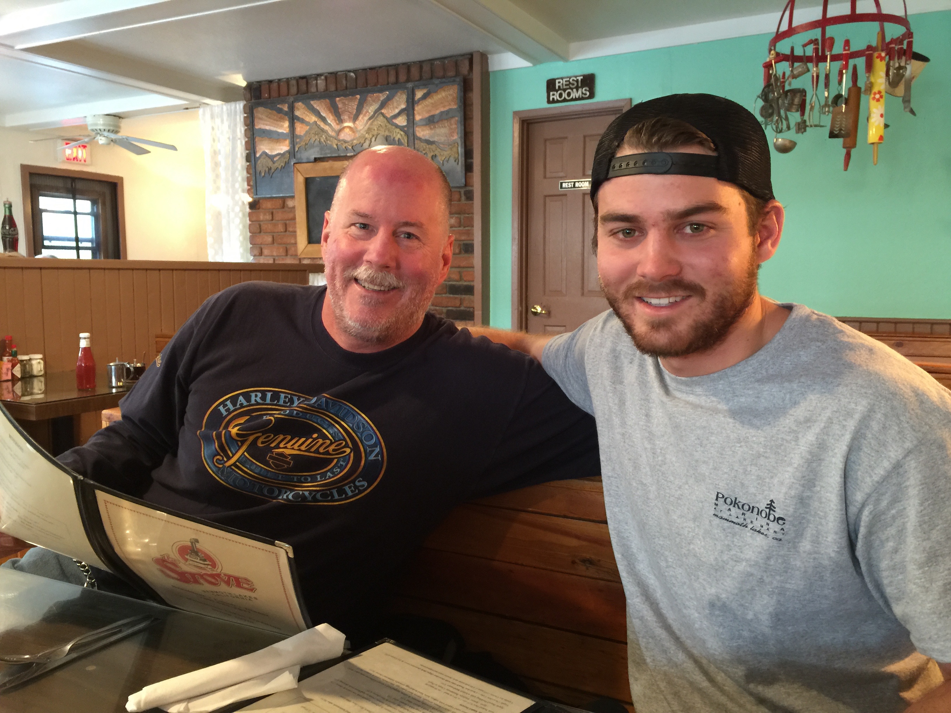
Dave and Nathan meet up for breakfast at the Stove.
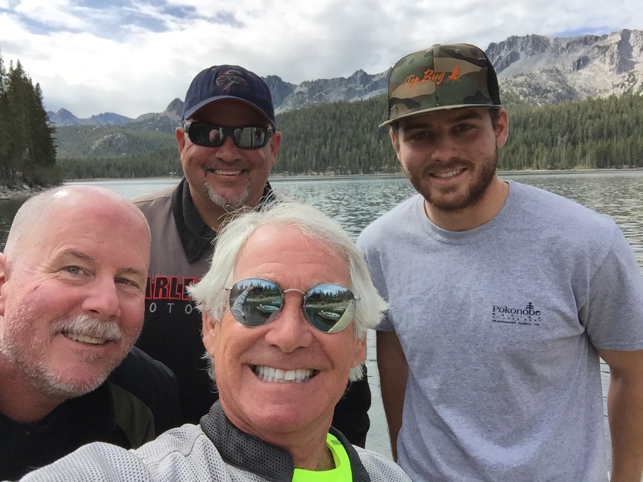
To get to Mammoth Mountain, you pass through Mammoth Lakes, the only incorporated town in Mono County. Mammoth Lakes is the site of today’s family reunion. We’re meeting Dave’s 23-year-old son, Nathan, for breakfast at The Stove, a popular hangout.
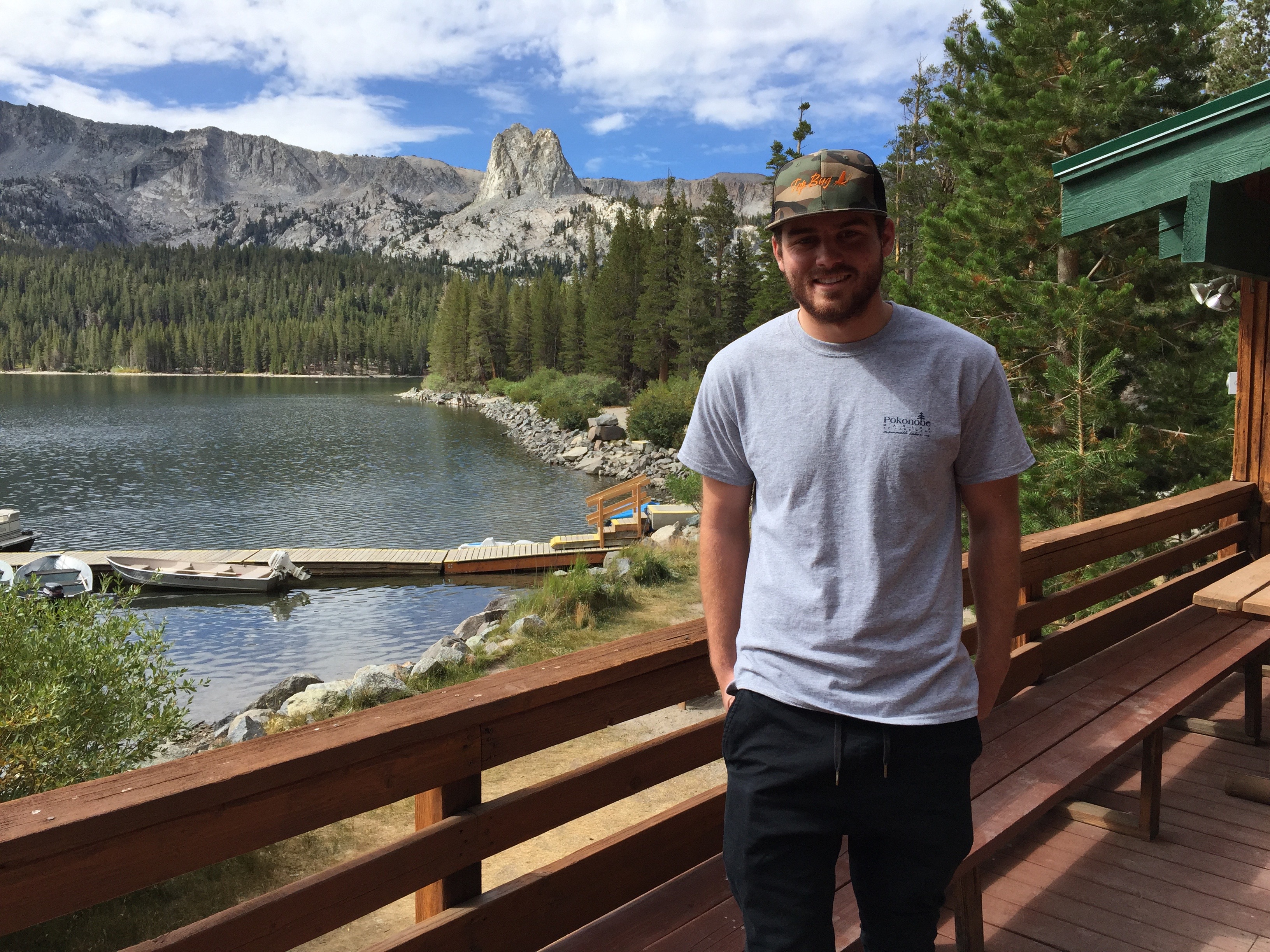
Nathan’s “office” on Lake Mary.
Nathan, an Orange County resident nearly his entire life (spent a couple of years in St. Louis, a million miles from here), is working in Mammoth Lakes for the summer. Lucky kid. Dave and Scott catch up on what Nathan’s been doing: renting and launching boats to summer tourists at the Pokonobe Resort and Marina on Lake Mary, just south of town. Lake Mary is the largest of the alpine lakes in the area; others include Horseshoe Lake, Lake Marnie, Lake George, McCloud Lake, Crystal Lake, TJ Lake and Twin Lakes. All are within a few hundred feet of one another.
It’s a great gig for a college student on summer break. The reunion of father, son and great uncle makes for a nice family moment. A Kodak moment adapted to modern times with an iPhone and GoPro camera.
Good times on Lake Mary.
When summer’s over, Nathan will return home to Fullerton, where he’ll complete his studies in Human Development at Hope International University.
***
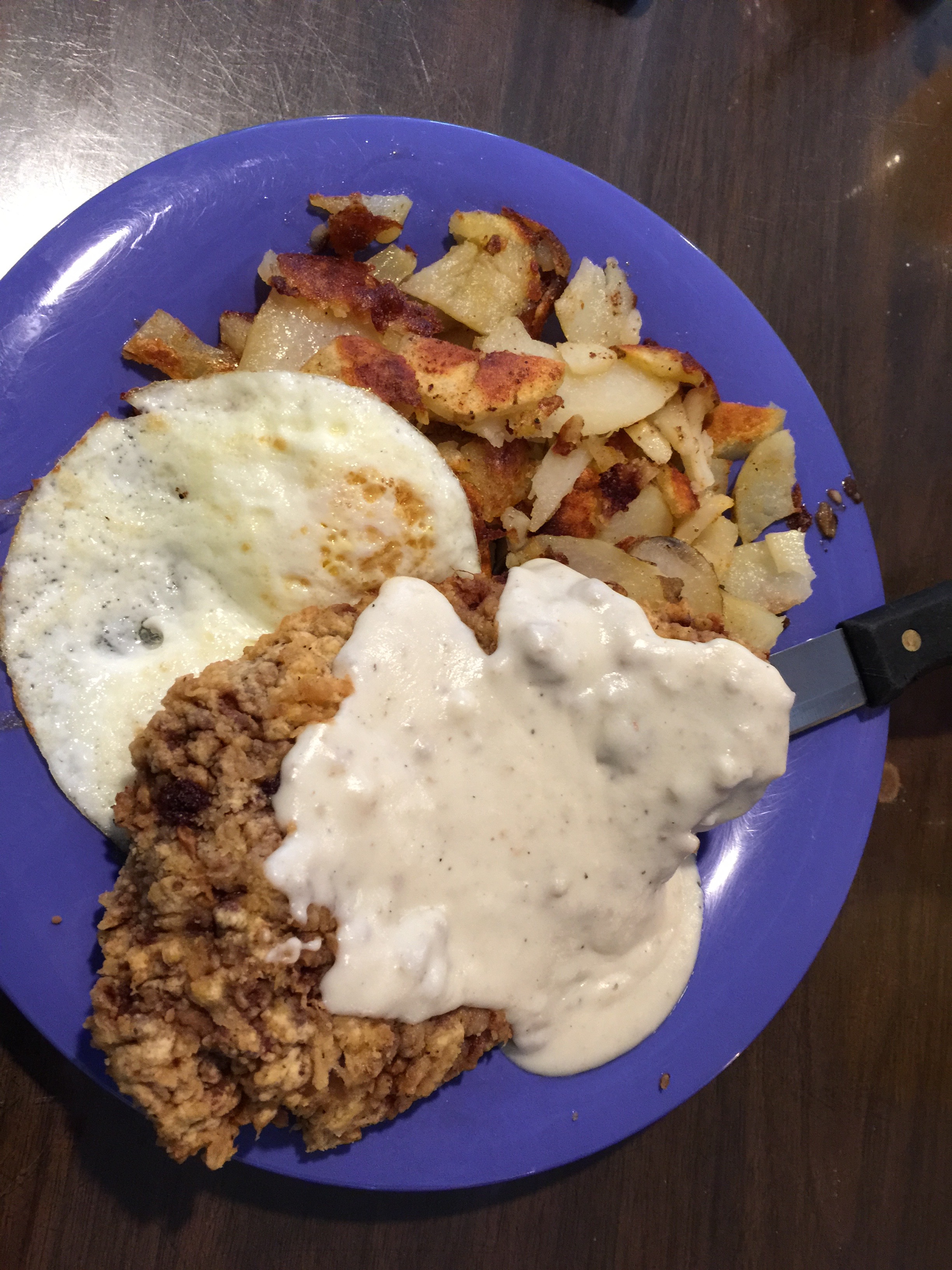
Someone had chicken fried steak for breakfast. Not saying who.
After breakfast, we head north on Highway 395, taking a scenic detour to ride the June Lake Loop, which takes us through the quaint town of June Lake and past the June Lake ski area. We pass by June Lake itself, which holds special meaning for Scott and Dave’s families, as they’ve camped together there many times. It’s a nostalgic visit evoking many good memories. After completing the June Lake Loop, we retrace our steps to Highway 395, and head north to Lee Vining, where we see signs for Yosemite National Park.
Dave and Scott get nostalgic at June Lake.
We turn west onto Highway 120, which will take us over Tioga Pass (9,943 feet) and into Yosemite. To our right is Tioga Peak, 11,526 feet. The road climbs steeply and, seemingly in no time, we are at the pass, which just happens to be at the Tioga Pass Entrance Station to the park.
Tioga Pass is named after Tioga Mine, like so many former mining areas in California, now a ghost town. The name “Tioga” originated in New York. It comes from an Iroquois and Mohawk term, meaning “where it forks.”
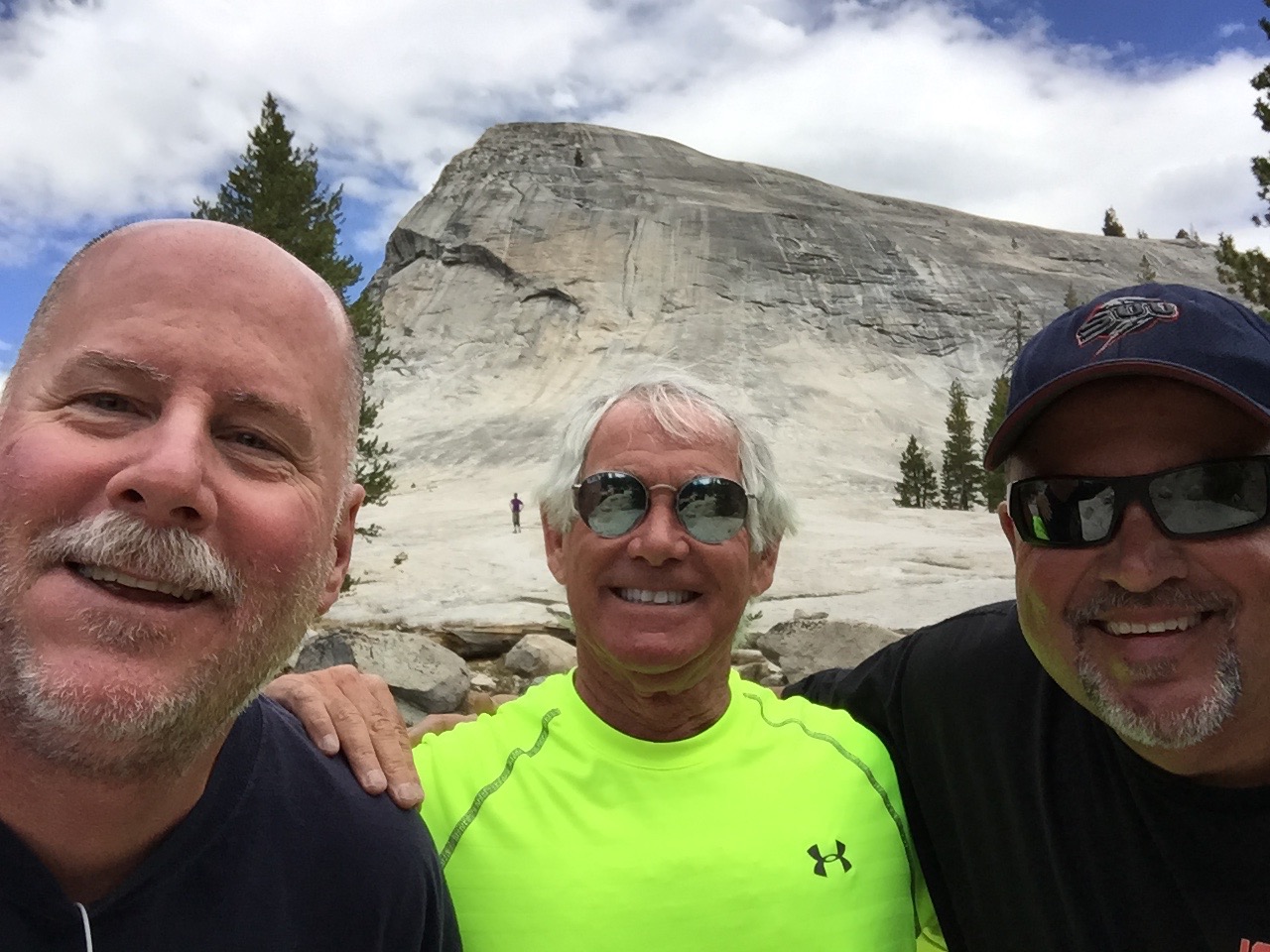
Our first fork in the road brings us to Lembert Dome, where we’ll hike to the top of this granite monolith. Lembert Dome dominates the eastern end of Tuolumne Meadows. It’s nearly three miles round trip, and the hike is the most challenging we’ll have on this trip. Lembert Dome tops out at 9,450 feet. We face a 700-foot vertical rise to get there. But the effort is well worth it, as the top of the dome provides expansive views of Tuolumne Meadows, and surrounding peaks and domes.
At Lembert Dome.
Tuolumne Meadows is studded with granite domes – Pothole Dome, Fairview Dome, Medicott Dome, and Lembert Dome.
***
Yosemite National Park has four visitor centers. Twenty-one miles into the park, we arrive at the easternmost one: Tuolumne Meadows Visitor Center. Here, we could learn about the many activities in the Park, including hikes all along Tioga Pass. There’s more hiking here than in any other part of Yosemite. Today seems to be a great day to combine riding and hiking.
Tanaya Lake. Pretty frigid.
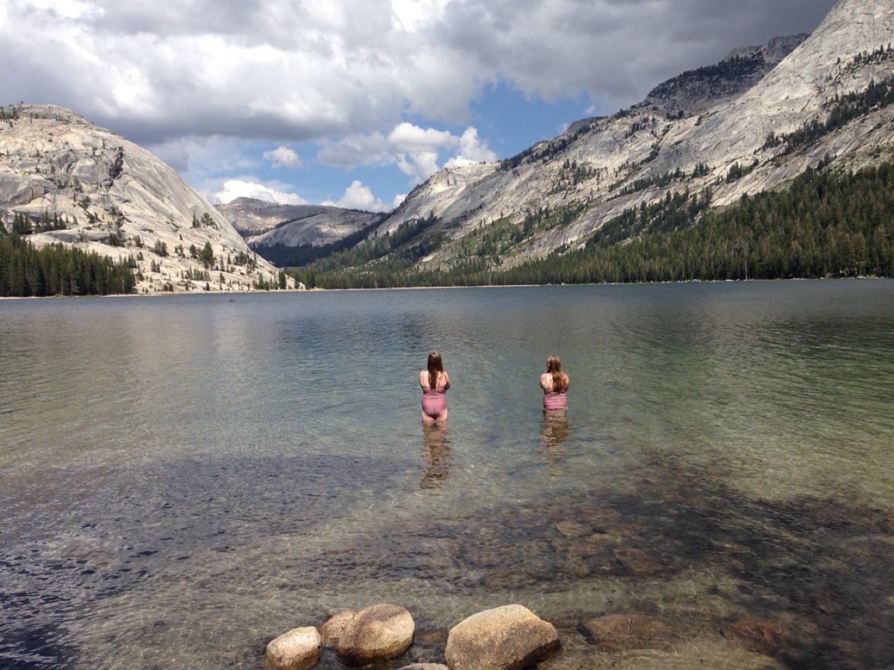
Our next point of interest is Tenaya Lake, at 8,150 feet. Highway 120 runs right along the lake. Tenaya Lake was created by the Tenaya Glacier, which flowed out of the vast Tuolumne Ice Sheet and down to the Yosemite Valey. The lake is named after Chief Tenaya, a Native American chief of the Ahwahnechee people. Hiking, fishing, canoeing and kayaking are all popular summer activities at the lake.
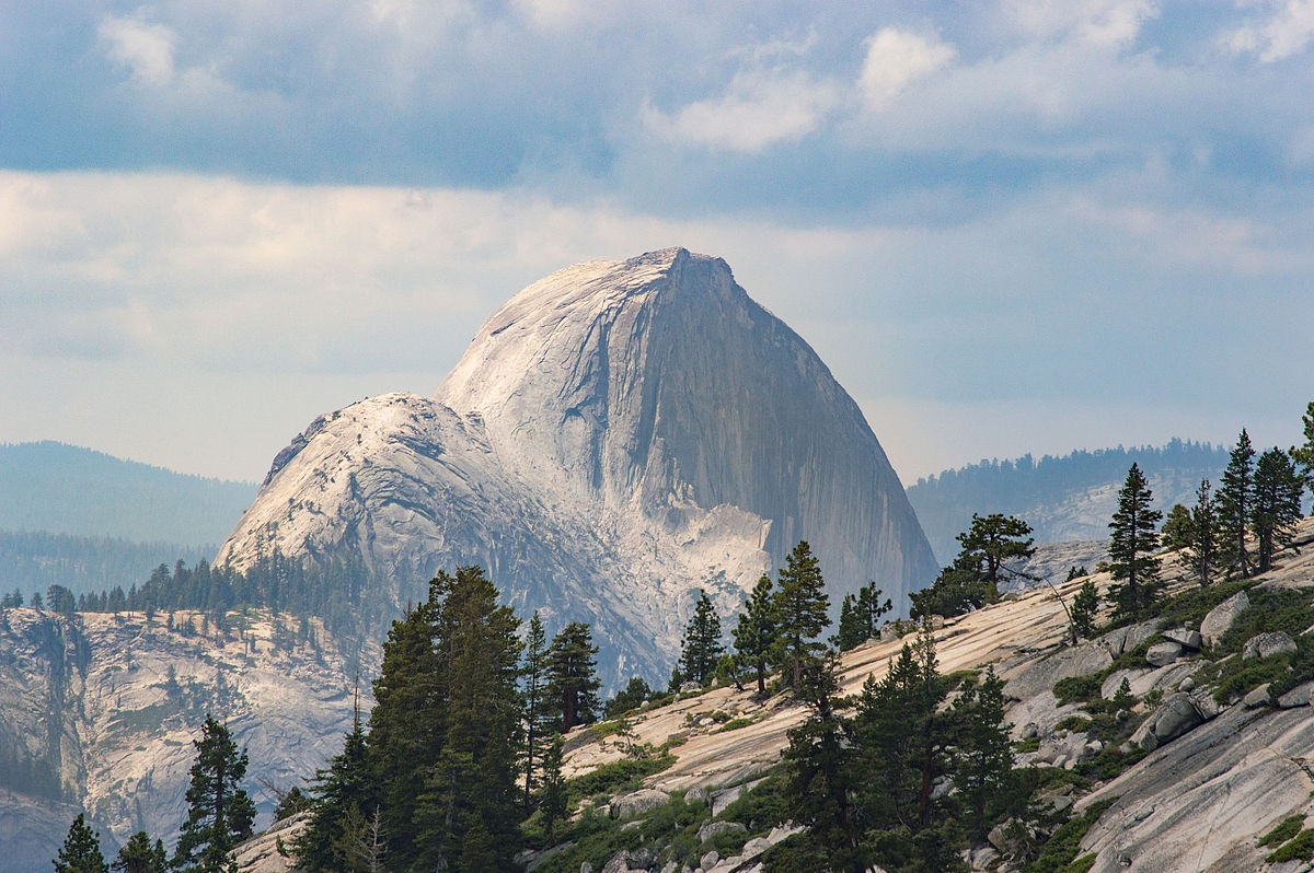
As we ride west, we arrive at Olmsted Point, about 10 miles from Tuolumne Meadows. It’s a viewing area that gives us a glimpse into Tenaya Canyon, and – off in the distance to the southwest – the northern side of Half Dome. The site is named after landscape architects Frederick Law Olmsted and his son, Frederick Law Olmsted, Jr.
The view from Olmsted Point. That’s Half Dome in the distance.
For anyone willing to hike a quarter of a mile up and back on the Olmsted Point Nature Trail, the view gets even better. It’s a 100-foot elevation rise from the 8,300-foot trailhead, and the views are spectacular. We have a clear view of Half Dome. Looking east, we see Tenaya Lake and the granite domes that envelop it. As short as this hike is, it may provide the best bang for the buck – best view for the least effort – along Tioga Pass.
If the Tioga Pass highway opens behind schedule next summer, you can probably blame Olmsted Point. The avalanche risk here makes this one of the most dangerous parts of the road to clear and usually one of the last areas to be passable.
Our 30-mile descent from Olmsted Point takes us to Crane Flat, elevation 6,200 feet. It’s a major campground with 271 campsites, just 16 miles from Yosemite Village, in the heart of Yosemite Valley.
***
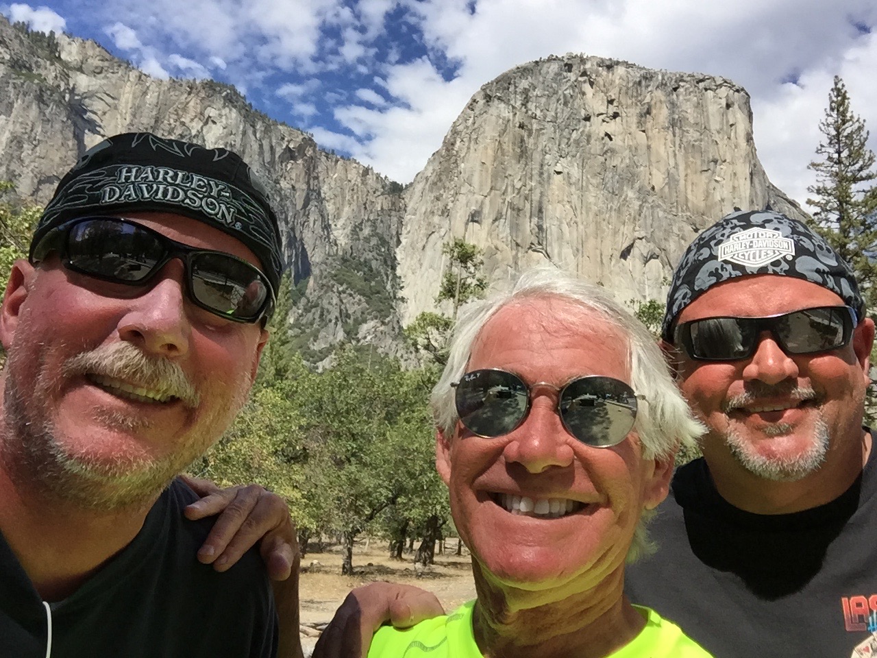
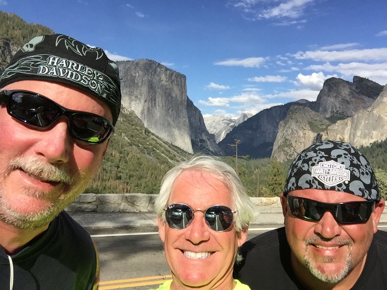
At Crane Flat, we turn east onto Big Oak Flat Road for the ride into Yosemite Valley, home to many of the famous cliffs and waterfalls that make Yosemite National Park famous. Yosemite features towering granite faces, dramatic waterfalls, and old-growth forests at a unique intersection of geology and hydrology. Half Dome and El Capitan rise from the park’s centerpiece, the glacier-carved Yosemite Valley. From its vertical walls drop Yosemite North America’s tallest waterfall.
Yosemite’s natural beauty was the impetus for the first implementation of the National Park concept, as we know it today. Yosemite was made a National Park in 1890, and will celebrate its 125th anniversary on October 1.
El Capitan in the background.
Riding through Yosemite Valley, we are stunned by the sight of El Capitan, the world’s largest granite monolith, towering more than 3,000 feet above the valley floor. It’s on any serious rock climber’s bucket list.
Once considered impossible to climb, El Capitan is now the standard for big-wall climbing.
Using ropes only for safety and not assistance, Tommy Caldwell and Kevin Jorgensen in January 2015 became the first climbers to successfully ascend The Dawn Wall of El Capitan. It took them 19 days, and their effort attracted worldwide media attention. Wanna watch?
Or better yet, wanna climb? Now, thanks to Google Maps and its Street View technology, you can actually put yourself squarely on El Capitan’s granite face. Armchair climbers can look around in all directions – down to the floor of Yosemite Valley, up the blank face to the top of the cliff, at the broad view of Yosemite’s other granite monoliths, and up close at the pebbled grain and crake of El Capitan itself. Check this out … not for the faint of heart, or for vertigo sufferers.
Another famous Yosemite climb that requires little skill but great nerve is Half Dome, a granite crest that rises more than 4,700 feet from the valley floor. If you’re in reasonably good shape, you can hike from the valley floor and then grab onto cables for the final 400 incredibly steep feet to the top of Half Dome. The hike is in great demand – and there’s limited supply – so you’ll need to get a permit from the Park Service. Think you’re a candidate to hike Half Dome? Click here to find out.
And, for you serious video voyeurs, here’s an absolutely incredible video of climbers scaling, then highlining the Totempole. Don’t try this at home! (guaranteed to be the best video you’ll watch on this blog all week).
Where’s the Totempole? Tasmania. A long way from Yosemite.
***
Cooling off in Yosemite Village.
We arrive in Yosemite Village, the hub of the valley. It’s home to National Park Service staff, and has a variety of facilities, including the park’s main visitor center, museums, art galleries, a fire station, medical clinic, restaurants, gift shops and even a K-8 school. Well-heeled visitors can stay at the Ahwanee Hotel, where rooms go for around $500 a night. Thankfully, there’s no vacancy at the Ahwanee tonight.
Scott needed a bit of a brew break in Yosemite Village, too.
After a bit of sightseeing in the village, we leave the valley floor and head south into the mountains, toward Glacier Point – about an hour’s ride. We turn onto California Highway 41, also called Wawona Road, and immediately arrive at Artist Point. Tourists stop and shoot photos, though few set up easels and a canvas.
In June 1855, 39-year-old artist Thomas Ayres did just that. He stood here and drew a picture of Yosemite Valley, the first ever by a professional artist. It was published in James Mason Hutchings’ California Magazine in 1856 and was a major contributor to the renown Yosemite Valley would soon begin to receive. Sadly, Ayres didn’t get long to enjoy it; he perished at sea in 1858.
The view from Artist Point.
From Artist Point, you have a partial view of Half Dome, and can see Bridalveil Meadow, Royal Arches, partial views of North Dome and Ribbon Falls, plus a few corners of the Merced River. If you’re a serious photographer, you’ll find this spot eminently tripod-worthy.
Another awesome photo op is just a mile up the road at Tunnel View. At this scenic overlook, you have a panoramic view of the valley that has been embraced by artists and photographers since it opened in 1933. The view includes the southwest face of El Capitan, Half Dome, and Bridalveil Falls. It’s the view of the valley you’ll see just before going through the Wawona Tunnel portal as you head south on Wawona Road.
We continue south for seven miles, then turn sharply north on Glacier Point Road. Sixteen twisty miles later, we arrive at Glacier Point, a spectacular overlook at 7,214 feet with a superb view of the Yosemite Valley, including Half Dome.
The road to Glacier Point is usually open from June through October. In winter, Glacier Point Road closes due to snow. This year, Glacier Point Road opened on March 28, the earliest opening on record. Glacier Point’s primary activity: enjoying the view.
The view from Glacier Point. That’s Half Dome in the distance.
We leave Glacier Point, ride 13 miles south, and arrive at the Sentinel Dome parking lot, on the south wall of Yosemite Valley. California Hiking, a book we embraced to discover hikes for this trip, calls the Sentinel Dome hike one of the “Top 10 With a View” in California. Since the book evaluates and describes more than 1,000 hikes across the state, we’ll take that as a solid recommendation to scale Sentinel Dome.
The trail climbs vertically 400 feet to a final elevation of 8,100 feet. From the top of Sentinel Dome, you have a 360-degree view of Yosemite National Park. Looking west, we look down Yosemite Valley and beyond to the Merced River canyon. On exceptionally clear days, you can see all the way to Mt. Diablo in the Coastal Range. To the north, we see Yosemite Valley, including El Capitan and Yosemite Falls. To the east, we see Half Dome and an assortment of High Sierra peaks.
Wow. Just wow.
The hike back down to the trailhead is anti-climactic. We hop back on our bikes for the hour and a half ride to tonight’s destination: Oakhurst.
On our way back to Wawona Road, we notice the turnoff to Badger Pass Ski Area, just a few hundred yards off Glacier Point Road. Badger Pass is a small ski area located within Yosemite National Park, one of only three lift-serviced ski areas operating in a US National Park (Olympic National Park’s Hurricane Ridge is one of the others). From a base at 7,200 feet, Badger Pass offers 800 vertical feet of skiing, and every February, it hosts the annual Yosemite Nordic Holiday, a series of cross-country races.
***
Now back on Wawona Road, we ride south toward the village of Wawona. Wawona sits on the south fork of the Merced River, 27 miles south of Yosemite Village. At 3,999 feet, it has less than 200 residents and is the site of the historic Wawona Hotel, built in 1876. The hotel is designated a National Historic Landmark and is on the National Register of Historic Places.
Wawona feels very much unlike other areas of Yosemite we’ve been for most of the day. Across from the hotel is a nine-hole, par 35 golf course, one of the few within any US National Park. (There’s also a golf course at Furnace Creek Resort in Death Valley National Park.)
Yosemite is known for its massive Sequoia groves. About five miles south of Wawona, we see the turnoff for Mariposa Grove, which has about 500 mature sequoias, among the rarest, oldest and largest living organisms in the world.
The sequoias are monsters in Mariposa Grove.
The grove includes the Columbia Tree, tallest in Yosemite at 285 feet, and the Grizzly Giant, estimated at 2,400 years old, the most mature in the grove. The Wawona Tree had a tunnel cut through it in the nineteenth century that was wide enough for horse-drawn carriages and early automobiles to drive through. Weakened by the large opening at its base, the tree fell down in a storm in 1969. Its collapse is seen as a turning point in the preservation program in America’s National Parks.
Much to our disappointment, Mariposa Grove closed for restoration in July and won’t re-open until summer 2017. The Park Service says the restoration project will prepare the Grove for its next 150 years of inspiring visitors. The Mariposa Grove restoration project is designed to restore dynamic ecological processes and increase the resiliency of the grove to withstand natural stressors such as climate change and altered fire patterns.
While Mariposa Grove will have to wait, we can look forward to seeing a lot more sequoias tomorrow, when we visit Sequoia National Park.
On the way to tonight’s destination, Oakhurst, we continue south on Highway 41. The road twists and descends past the tiny communities of Fish Camp, Sugar Pine, and Yosemite Forks.
After a 180-mile ride that began on the eastern side of the Sierras, we arrive in Oakhurst, formerly called Fresno Flats.
Oakhurst’s claim to fame: the pioneering computer game developer Sierra On-Line was based here from 1981 to 1999. The company achieved many industry firsts, including the development of the first 3D adventure game (King’s Quest) and one of the first online gaming networks.
Our only game tonight is dinner and writing this blog, which I’m now doing.
***
To view today’s route from Bridgeport to Oakhurst, click here.
Yesterday, we crossed the Sierras once. Today, we’ll double our fun.
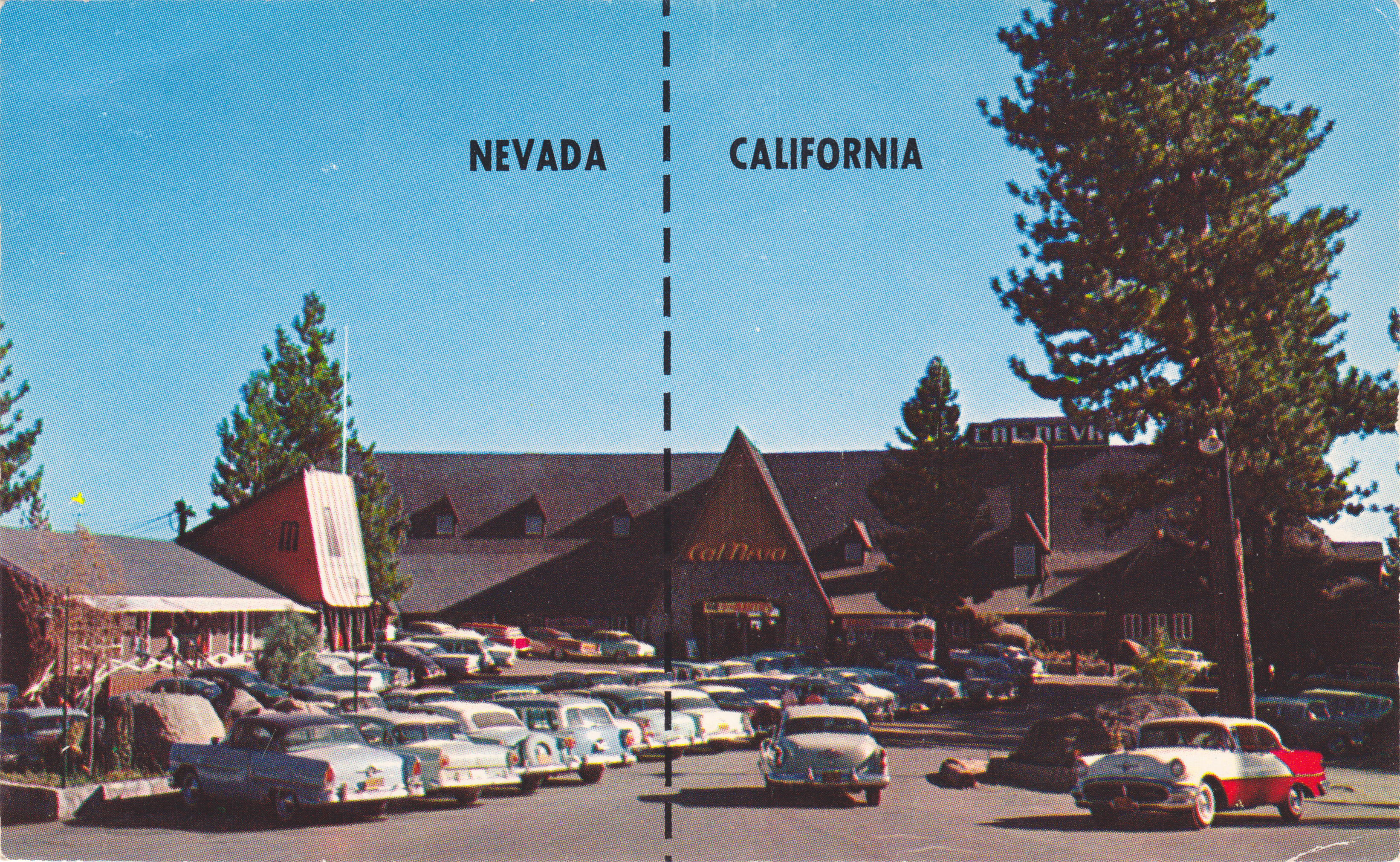
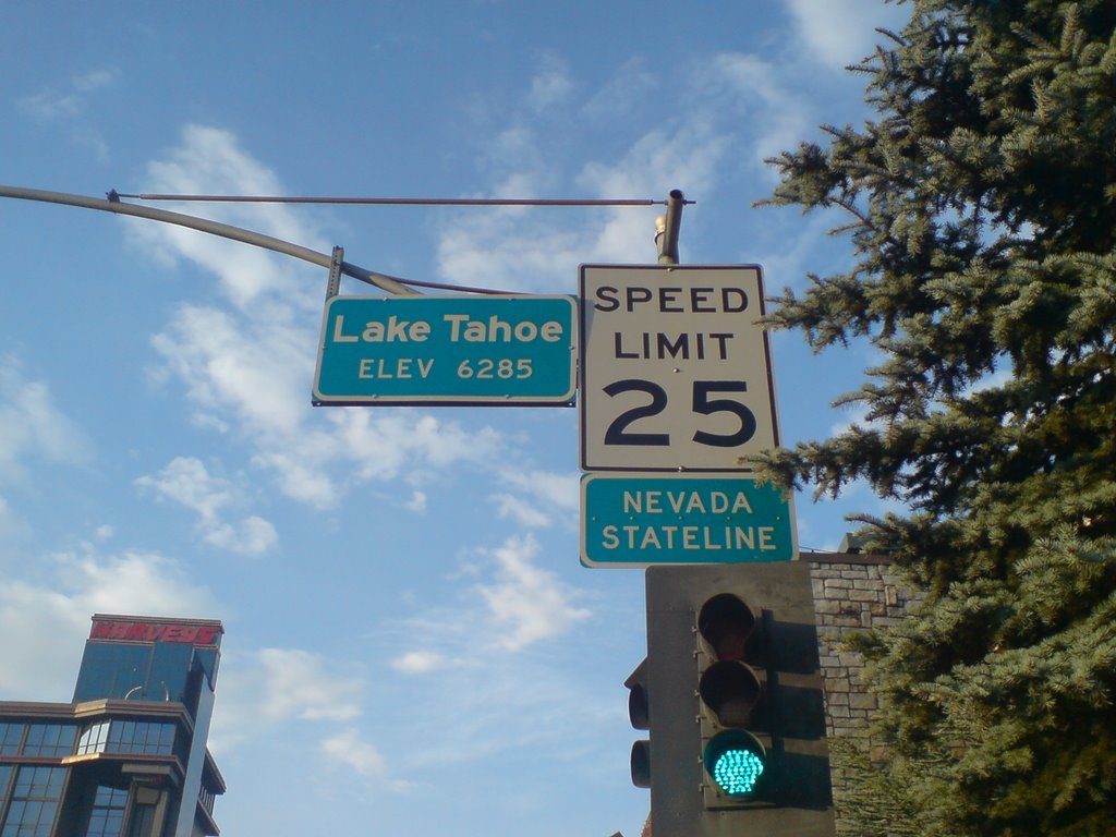
The good times begin as we leave California and roll into Stateline, Nevada. It’s not much of a roll, actually. South Lake Tahoe, where we were a minute ago, and Stateline, where we are now – are effectively one town with a dual personality.
Muffins for breakfast at Sugar Pine Bakery in South Lake Tahoe.
The population of Stateline in the 2010 census was 842. To tell you all you need to know about Stateline, there are nearly 1,600 slot machines at Harrah’s and Harvey’s combined – that’s almost two for every Stateline resident.
Stateline is a single-industry town: gambling. It has five casinos. Most of TripAdvisor’s “Top Things to do in Stateline” revolve around gambling. Number 9: “Boogie Nights at MontBleu, formerly Caesar’s Palace.
We quickly boogie out of Stateline – it’s only 512 acres – and turn east onto Highway 207, which takes us over the Kingsbury Grade. About two miles up the twisty two-lane road, we pass within a few hundred yards of the Heavenly Valley ski resort’s Boulder Carpet chairlift. It’s one of Heavenly’s 30 lifts.
Muffin for Dave, too.
Heavenly Valley straddles California and Nevada, and boasts the highest elevation of all the Lake Tahoe area resorts, with a peak of 10,067 feet. Shopping for a place to carve some turns later this year? Season passes are now available for Heavenly’s 2015-16 season. You can get an adult “Epic Pass” for $769, giving you unlimited access to Heavenly Valley, and the other ski areas operated by Vail Resorts, among them: Vail, Park City, Beaver Creek and Breckenridge.
My fondest memory of Heavenly Valley was in April 1968 when as a ski-racer wannabe, I saw Jean-Claude Killy compete in the World Cup season-ending slalom, where he finished seventh, 1.75 seconds behind American Spider Sabich. Earlier that year, Killy swept all three alpine events at the Grenoble, France, Olympics – and was dominant throughout the season in the slalom, giant slalom and downhill.
Here he is, skiing to gold three times at the 1968 Olympic Games. Has technique changed any since then?
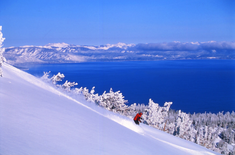
Heavenly Valley has great views of Lake Tahoe.
January 5, 1998, was a dark day in Heavenly Valley history. That’s when when musician and politician Sonny Bono crashed into a tree on “Orion,” an intermediate slope high on Heavenly’s Nevada side. He died instantly. At the time, Bono was a US congressman, representing the Coachella Valley. Before that, he was Palm Springs’ mayor. And long before that, Sonny and Cher sang “I Got You Babe.”
***
On that note, we continue up Kingsbury Grade toward its 7,344-foot summit. It provides a spectacular view of the valley to the east and south.
We descend to the bottom of Kingsbury Grade, into the community of Mottsville. It’s apparently named for Mott the Hoople, a ’70s English rock band best known for the song, “All the Young Dudes.” Who knew?
In Mottsville, we turn south on Nevada Highway 206 for a few miles, then south on Highway 88, crossing the state line back into California, where we’ll remain for the rest of our trip.
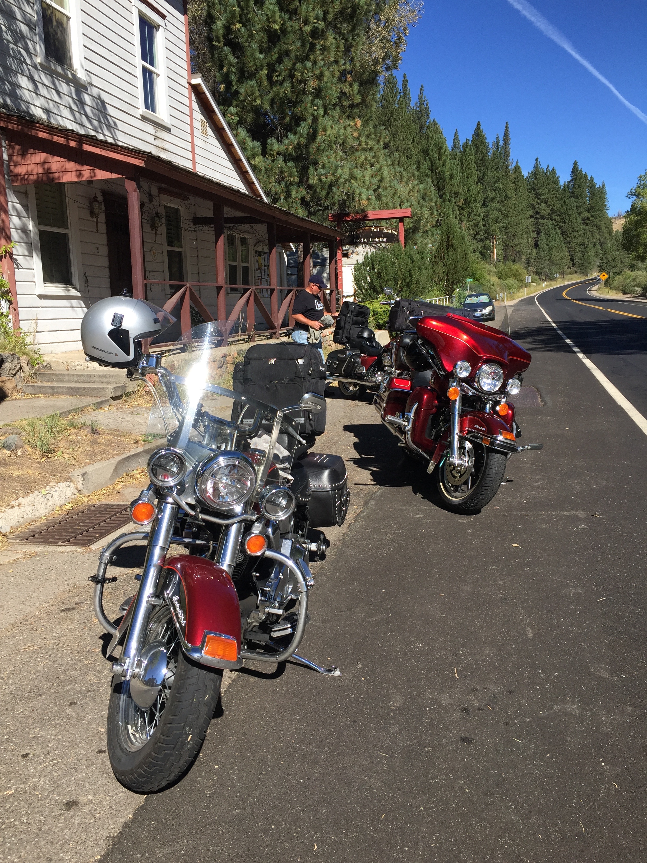
Pausing in Markleville, before beginning the climb over Ebbetts Pass.
Less than an hour from our start in South Lake Tahoe, we arrive in Markleeville, elevation 5,531 feet. Markleeville is on the map for annually hosting a bicycle race called the Death Ride. The Death Ride attracts more than 3,000 riders, who pedal over five Sierra passes for a total distance of 129 miles and more than 15,000 feet of elevation gain. The winner generally finishes in around eight hours of riding time. Survival is considered a pretty ambitious goal.
This year’s Death Ride, called the “Tour of the California Alps,” was held July 11.
Bicyclists in the Death Ride climb and descend Monitor Pass (8,314 feet) from both directions, Ebbetts Pass (8,730 feet) from both directions and Carson Pass (8,652 feet). Their entry fee is $140.
In a much less painful fashion than what the bicyclists experience, we’ll cross Ebbetts Pass today. For free.
From Markleeville, we continue five miles south and then turn onto California Highway 4, which we’ll ride for the next few hours, taking us across Ebbetts Pass and back to Gold Rush Country.
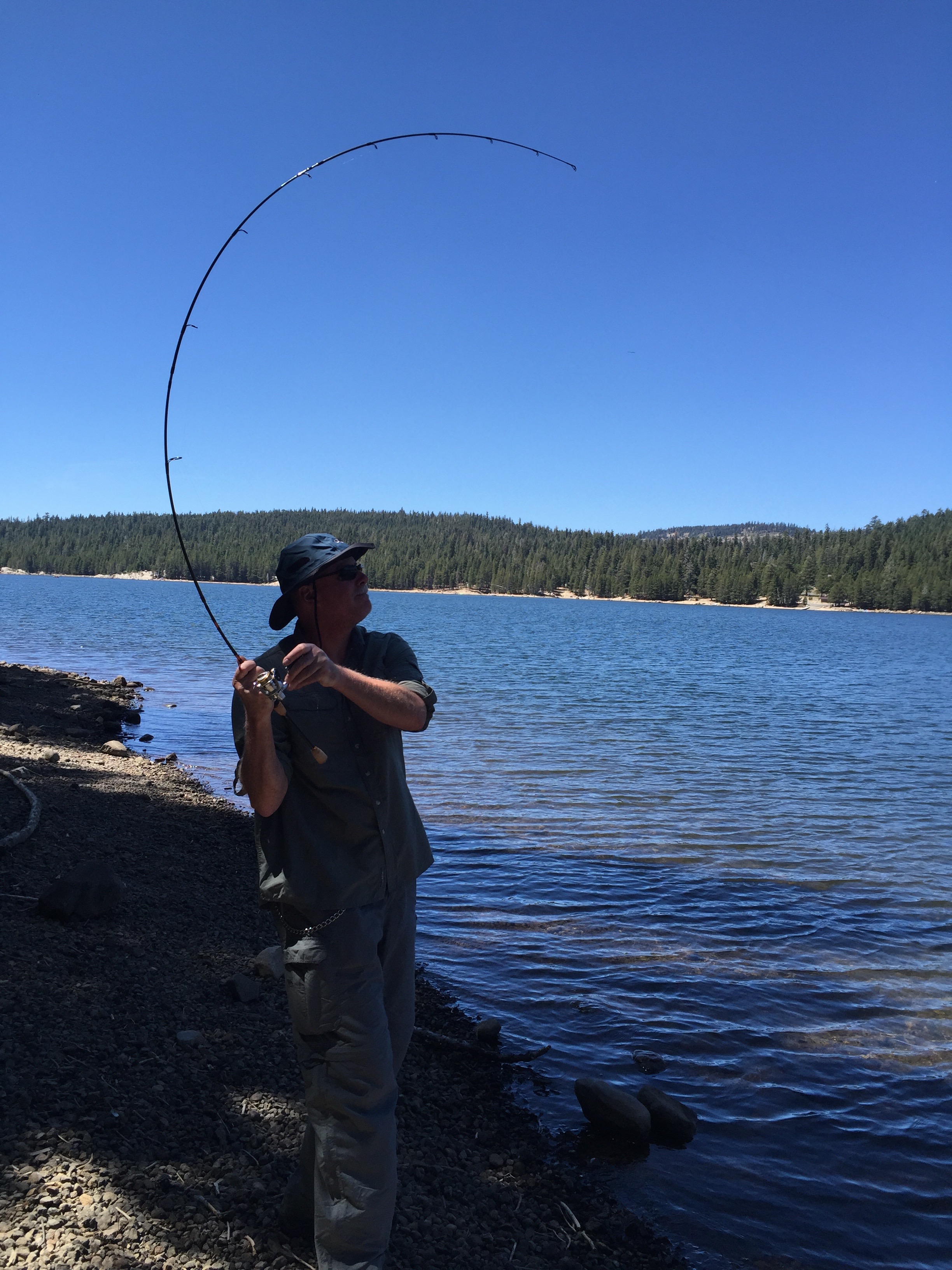
We stop at Alpine Lake after crossing Ebbetts Pass. Dave trained his whole life for this fishing moment.
Highway 4 is also known as the Alpine State Highway. John Ebbetts, a California pioneer, first traversed the pass in April 1851 with a large mule train. He hoped it would make a suitable route for the transcontinental railroad, as he observed little snow at the time. He might have thought differently if he’d been there in the winter, when snow is generally abundant.
Ebbetts Pass is a 61-mile National Scenic Byway that generally closes for the winter in Mid-November, and stays closed until May or June. Today, there’s no snow, and no railroad over Ebbetts Pass.
And there’s been little calorie burn for the three guys on Harleys since leaving Lake Tahoe this morning. In the Lake Alpine area, there are some excellent hikes to get some alpine exercise and take advantage of the views.
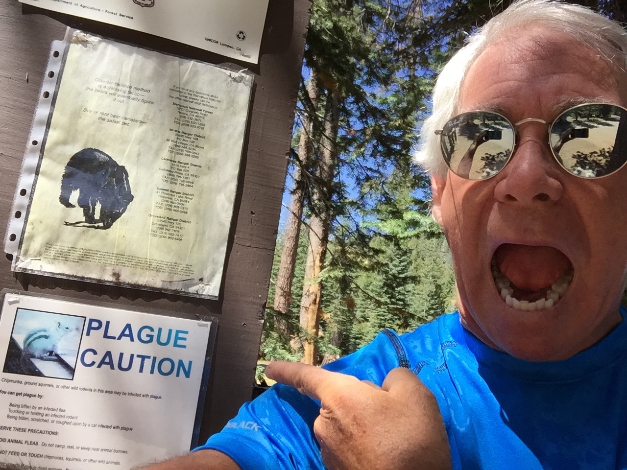
Near Alpine Lake, we see a plague caution. OMG!
We stop at Lake Alpine and ponder tackling Inspiration Point trail, a nearly three-mile hike with a 600-foot elevation gain. From Inspiration Point, there’s a nice view of Lake Alpine. In a few months, the fall colors here will be spectacular, as the aspen trees turn to gold.
Instead, we hike the Lakeshore Trail to Lake Alpine, where Dave fishes for 30 minutes and catches a huge rainbow trout, then tosses it back because it’s not quite big enough for dinner for three. Post-fishing, we climb on our bikes, and descend more than 7,300 feet in an hour, arriving in Angels Camp around 2 pm. We’re back in Gold Rush country again.
Angels Camp is sometimes referred to as “Frogtown,” because it’s where Mark Twain’s short story about the jumping frog took place. The frog-jumping event is commemorated with a Jumping Frog Jubilee each May at the Calaveras County Fairgrounds, just east of the city.
***
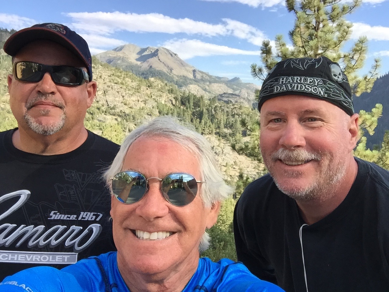
If bicyclists can do five Sierra passes in a day, we should be good for at least two. Our next one is Sonora Pass.
To get there, we turn south in Angels Camp and follow Highway 49, the Gold Rush Trail, to Sonora. Sonora is the county seat of Tuolumne County, and the only incorporated community in the county.
Sonora, population 4,900, sits in the Sierra foothills at 1,785 feet. It is is home to museums, art galleries, live theater and the annual Sonora Possum Stew Cookoff. Why not?
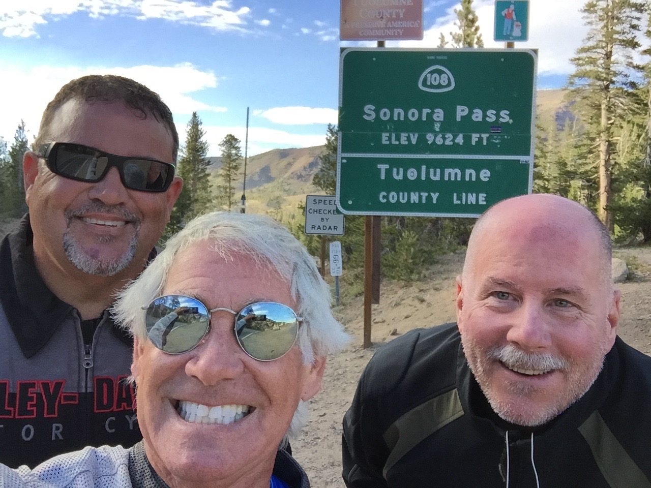
Stopping on Highway 108, Sonora Pass.
In Sonora, we turn east onto Highway 108, which will take us over the 9,313-foot pass. It’s the second-highest highway pass in the Sierra Nevada range, 321 feet lower than Tioga Pass to the south, which we’ll do tomorrow – giving us all four Sierra passes in three days.
Like Ebbetts Pass, Sonora Pass is closed throughout the winter and generally re-opens in May or June. This year’s opening was May 22. The highway over the pass is extremely steep, exceeding eight percent most of the way, with up to 26 percent grades in some locations.
The first documented immigrant traverse of Sonora Pass appears to have been in the late summer of 1852 by a wagon train known as the Clark-Skidmore Company. Nearly a century later, in 1943, the location scenes for the mountainous hideout of the Republican Spanish guerilla band in For Whom the Bell Tolls, were filmed here.
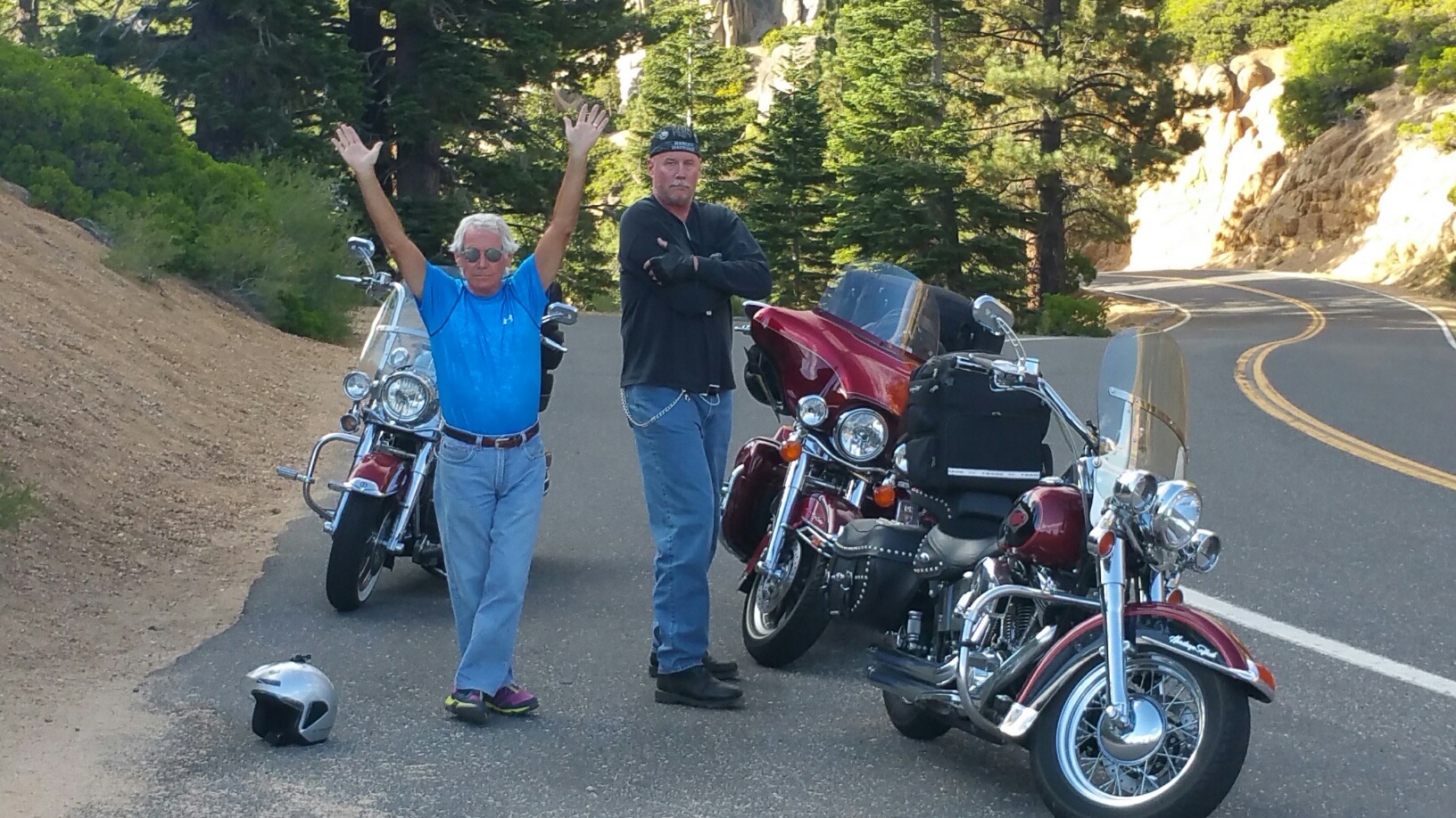
Thirteen miles east of Sonora, we climb to 3,648 feet and roll through the town of Twain-Harte. Its motto: “More Trees Than People.” Twain-Harte’s population is 2,200. Number of trees: more than that.
Dave checks out the aptly named Disaster Peak on Highway 108.
The unique hyphenated town name is derived from the last names of two famous authors who lived in California in the 1800s, Mark Twain and Bret Hart.
Twain (1835-1910), born Samuel Langhorne Clemens, is the more famous of the two. The Adventures of Tom Sawyer and its sequel, Adventures of Huckleberry Finn, have been staples in American classrooms for years.
Harte (1836-1902) is best remembered for his short fiction featuring miners, gamblers and other romantic figures of the California Gold Rush. Among his works: The Tales of the Argonauts, The Stolen Cigar Case, and Plain Language from Truthful James.
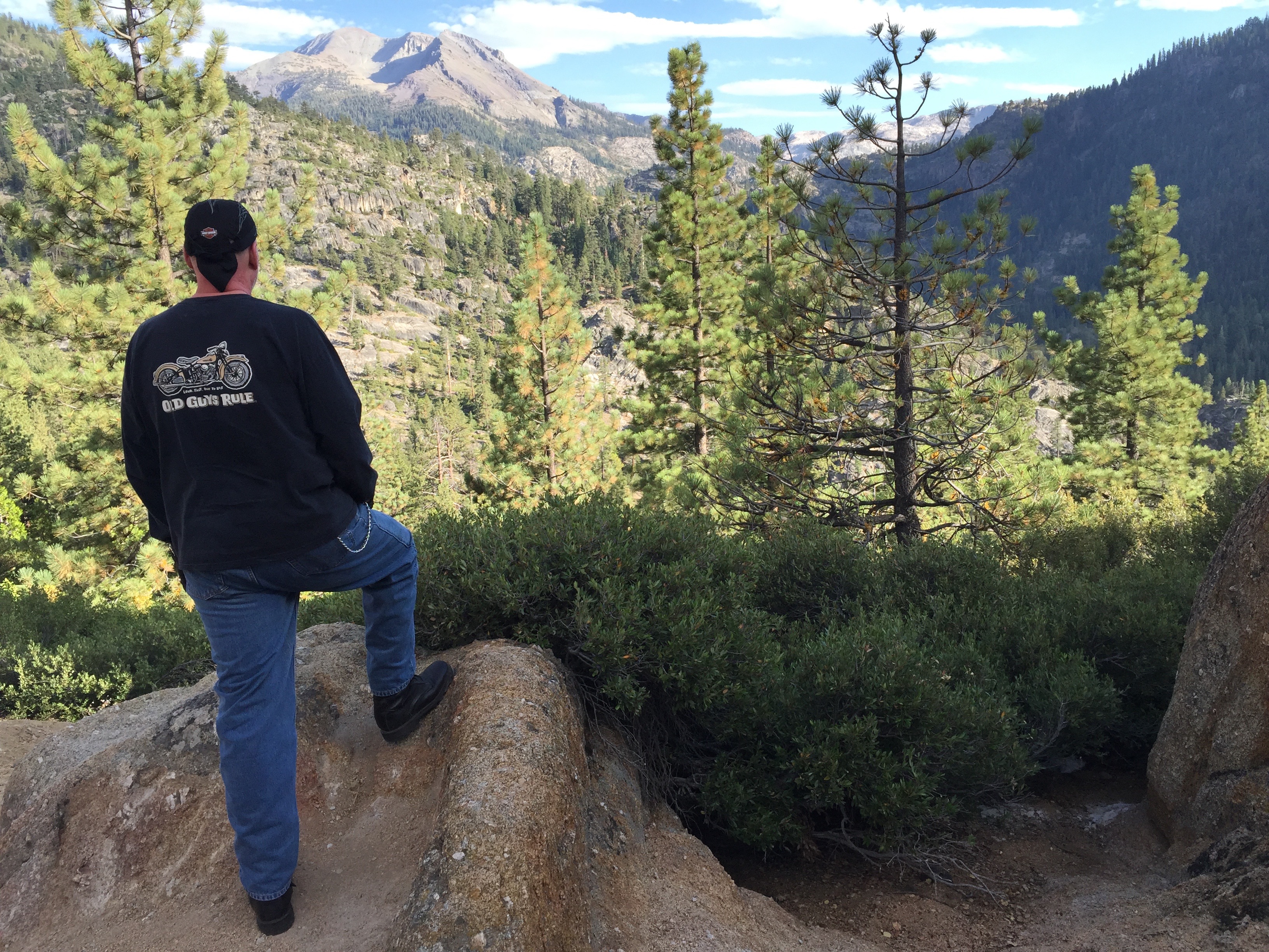
From Twain-Harte, we steadily climb for 54 miles, gaining more than 5,600 feet of elevation until we reach the summit of Sonora Pass. It’s all downhill from here. Until tomorrow, when we’ll be 321 feet higher.
At Sonora Pass: elevation 9,624 feet.
***
We continue on Highway 108, and begin our descent toward tonight’s destination: Bridgeport. Ten miles east of the summit is Pickel Meadow, at 6,762 feet. It’s home to the US Marine Corps Mountain Warfare Training Center.
The MWTC is considered to be the Marine Corps’ premier training site for preparing Marines to serve in mountainous regions, with an emphasis on cold and high altitude confrontations. This training post was first established in 1951 to provide cold weather training for replacement personnel bound for Korea.
During the 1980s, the facility’s focus was on training and preparing Marines and operational units for deployments on NATO’s northern flank, particularly Norway. In recent years, the training center provided pre-deployment training for the war in Afghanistan.
The Mountain Warfare Training Center is just four miles west of the eastern end of Highway 108, which terminates at US Highway 395. We turn east onto US-395, and in 20 miles, we arrive at Bridgeport.
Love the body language, along Highway 108.
At 6,463 feet, Bridgeport is well below the heights we experienced earlier in the day. But it still feels like a mountain village. Bridgeport’s population is 575, though it swells in the summer because of tourism. It is a trout fishing haven.
Bridgeport Reservoir, Twin Lakes, Virginia Lakes, Green Creek, the East Walker River, the West Walker and numerous small tributaries and backcountry lakes offer some of the premier Rainbow, Brown and Cutthroat trout fishing to be found anywhere in the world. The Bridgeport Fish Enhancement Program sponsors fishing tournaments twice per season. Bridgeport’s Trout Tournament is held annually in late June.
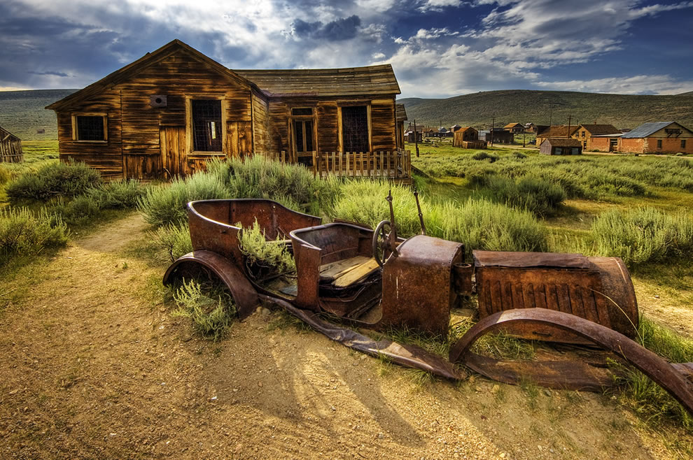
Bridgeport is also notable for its proximity to the well-preserved ghost town of Bodie, about 24 miles east. A gold-mining ghost town that once had a population of nearly 10,000, Bodie is now a State Historic Park. Today, it looks pretty much the same as it did more than 50 years ago when the last residents left. It’s been preserved in what’s called a state of “arrested decay.”
Bodie: a state park ghost town in a state of arrested decay.
After 225 miles, six hours in the saddle, and bagging two major Sierra passes, our hunger is anything but arrested. We’re pooped, and ready to relax.
We settle in to our rooms at the funky Redwood Motel, a relic of the 1950s, look forward to a hot shower and juicy burger, and dream about tomorrow’s visit to one of the most spectacular places on earth.
***
To view today’s route from South Lake Tahoe to Bridgeport, click here.
We’re making history today. At least, we’re following history.
For much of the morning, our route takes us to Mother Lode country, heart of California’s gold rush.
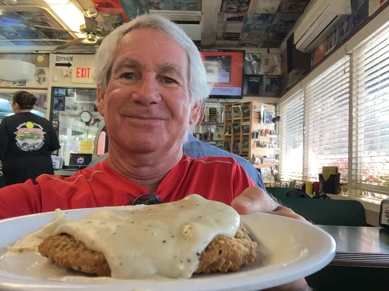
A healthy (chicken fried steak) breakfast at the Happy Burger Diner.
The gold rush began in earnest in 1948 when gold was found at Sutters Mill. The original fleck of gold discovered at the mill is currently on display at the Smithsonian Institution.
California’s Gold Rush brought an estimated 300,000 people to this area. About half arrived by sea from Asia, and half came overland from the eastern US. Because of the year they began arriving in droves (1849), the gold-seekers became known as forty-niners.
Today, we’ll travel Highway 49, known as the Gold Rush Trail. It’s also called the Golden Chain Highway.
The ’49ers established hundreds of instant mining towns along the western foothills of the Sierra Nevada. Many of these historic and picturesque towns still exist, linked by California Highway 49.
We leave Mariposa, home of California State Mining Museum, and head north.
Found gold in China Camp (or was it quartz?)
Highway 49 twists and climbs past panoramic vistas. We pass through the old mining town of Coulterville. Angels Camp is just a few miles to the east, and nearby Murphys has on display the largest crystalline gold nugget in the world. At 44 pounds, it’s worth about $3.5 million. We roll through Chinese Camp – at one time home to an estimated 5,000 miners who emigrated from China to take part in the gold rush.
Sixty miles from Mariposa, we arrive in Copperopolis. Unlike most of the other mining towns in Calaveras County, Copperopolis’ claim to fame is not gold, but copper. Copperopolis is also famous for a shack on Jack Ass Hill, where Mark Twain is believed to have written one of his most famous works, The Celebrated Jumping Frog of Calaveras County.
Beyond Copperopolis, we pass through San Andreas, a California Historical Landmark that’s the county seat of Calaveras County. A few miles past Mokelumne Hill – once one of the richest gold mining towns in California – we arrive in Jackson, our last mining town before we turn east into the Sierra Nevada Mountains.
***
If you haven’t noticed by now, many California place names derive from either Spanish, or from Native American tribes who settled the land long before Europeans arrived.
It’s toasty in Jackson.
Here in Jackson, we turn our focus eastward to the Sierra Nevada mountain range. Sierra Nevada is Spanish for “snowy range.” There’s generally snow in the Sierras during the winter and spring. None now.
The Sierra Nevada range, where we will spend much of the remainder of our journey, runs 400 miles from north-to-south. Notable features include Lake Tahoe, the largest alpine lake in North America – and today’s destination. The Sierras are home to three National Parks – Yosemite, Sequoia, and Kings Canyon – all of which we will visit over the next few days.
In Jackson, temperatures are now in the ‘90s, and we look forward to riding into the Sierra foothills and then the higher elevations to cool off.
California Highway 88 takes us east, as we gradually twist and climb into the El Dorado National Forest. Highway 88 becomes Carson Pass, named for frontiersman Christopher Houston “Kit” Carson. He was a fur trapper, wilderness guide, Indian agent and US Army officer.
Carson Pass, at 8,574 feet, is marked by a California Historical Landmark. There’s a memorial where Carson carved his name into a tree. The historic pass was a point on the Carson Trail during the gold rush.
At Bear River Reservoir vista point, going over Kit Carson Pass.
There are four major passes across the Sierra Nevada range: Carson Pass, Ebbetts Pass, Sonora Pass, and Tioga Pass – all of which we’ll cross later this week.
Unlike the other three, Carson Pass is generally open throughout the winter except during the worst snowstorms.
At Carson Pass, you can pull into the visitor information center parking lot, where you could leave your bikes for an hour while you hike to Frog Lake. It’s about two miles round trip, and not at all difficult. The Frog Lake hike is popular with families and children.
From Frog Lake, there’s a scenic view of Elephant Back, a mountain whose peak is at 9,585 feet. As it turns out, Elephant Back – a pile of volcanic rubble, looks just like its name. You may not be familiar with elephants, but you’ll know an elephant back when you see one.
Silver Lake is a spectacular high alpine lake along Kit Carson Pass.
***
Not far from Carson Pass, we descend to Kirkwood, home of the Kirkwood Mountain Resort – about 30 miles south of Lake Tahoe. With 15 lifts, a base elevation of 7,800 feet, and 2,000 vertical feet of skiing, Kirkwood is one of the region’s larger resorts. It’s owned by Vail Resorts, which also owns Heavenly Valley at South Lake Tahoe, and Northstar, near the north shore of Lake Tahoe.
Near Sorensens, we turn off of Highway 88 and onto Highway 89, which will take us over 7,740-foot Luther Pass and into the Lake Tahoe area, a major tourist destination.
Lake Tahoe’s surface elevation is 6,225 feet. Its maximum depth is more than 1,645 feet. Among US lakes, only Oregon’s Crater Lake is deeper. One more stat: Lake Tahoe is the sixth-largest lake by volume in the US, behind only the five Great Lakes, and it’s the largest alpine lake in North America.
We pass through Meyers, a one-time stagecoach stop, trading post and Pony Express station. It’s now registered as California Historical Landmark #708.
Hot dog lunch in Meyers.
To our right is the Lake Tahoe Airport, a general aviation facility that sits at 6,264 feet. The airport opened in 1959 with a 5,900-foot runway, and at one time had commercial jet service with Pacific Air Lines flying Boeing 727-100s from Los Angeles to San Jose to Lake Tahoe.
Other airlines followed – including Holiday Airlines, Pacific Southwest Airlines, Air California, Aspen Airways and Golden Gate Airlines. Boeing 737s, MD-80s and BAC-111s all showed up. Douglas DC-9s were the last jets to use this airport. Commercial air service has been gone since the end of the 20th century.
***
As a teenager, I often hung out with family and friends at Lake Tahoe, visiting perhaps a hundred times in the 1960s. It was mostly skiing in the winter, and an occasional summer vacation thrown in for good measure.
One thing I never did was travel all the way around the lake, non-stop. Today, we just might.
At Inspiration Point, overlooking Emerald Bay.
We begin by following Highway 89 North through Camp Richardson to Emerald Bay, where the views from Inspiration Point are breathtaking (see photos). Then, it’s on to Meeks Bay, and Homewood. Homewood is a small ski area on the west shore of Lake Tahoe. It’s owned by the same company that owns the more famous North Tahoe resorts – Squaw Valley and Alpine Meadows.
Homewood will be both the start and finish next month for the annual Tahoe 200, an ultra endurance race that takes runners on a 202.5-mile tour of Lake Tahoe and surrounding areas. The race starts on September 11 at 9 am, and competitors have until September 15 at 1 pm to complete the event – a 100-hour cut off. With an elevation gain of 39,800 feet, the Tahoe 200 is for serious athletes and true masochists (people who take pleasure in pain).
Entry fee is $950. To qualify, you must have completed at one 100-mile mountain race (defined as having more than 15,000 feet of climbing), or two 100 mile non-mountain races (defined as having less than 15,000 feet of climbing). Or, if like most of you, you haven’t met these requirements and still want to run in the event, the Race Director can approve you as a non-traditional entrant.
Last year’s winner, 36-year-old Ewan Horsburgh of Katoomba, Australia, finished the Tahoe 200 in 61 hours and 32 minutes. He edged out the second-place finisher by two hours and 11 minutes. The top woman in the race finished 14 hours behind the winner. Of the 90 runners, some coming from as far away as Japan, India, and Brooklyn, 30 did not finish. You slackers!
The Tahoe 200: agony of da feet.
With no disrespect to these ultra-jocks, seems like it’s a whole lot simpler, and far less expensive, to just ride around the lake.
***
Soon, we pass by Tahoe City. If we continued on Highway 89, we’d end up at Squaw Valley – where I learned to ski – and which hosted the Winter Olympic Games, both in 1960.
It’s so much fun following the shoreline of the lake that we turn onto Highway 28 and continue along Dollar Point, Carnelian Bay, Kings Beach, and then cross the Nevada state line in Crystal Bay. This is where the famed Cal Neva Resort sits, straddling the border between California and Nevada.
Little-known fun fact: Cal Neva was the first place I ever gambled at a casino. Played roulette for hours in the late 1960s, placing dumb bets on red and black while being served free Harvey Wallbangers all night long. Full disclosure: I was 19 at the time.
I have rarely gambled since. I consider gambling a tax on stupidity.
Cal Neva, built in 1926 by a wealthy San Francisco businessman, attracted big-name entertainers in the 1960s. For a time, Frank Sinatra owned the resort. He built the Celebrity Room theater, which saw performances by Sinatra, Dean Martin, Sammy Davis Jr. and many others. Sinatra’s gambling license was temporarily lifted by the Nevada Gaming Control Board when Chicago mobster Sam Giancana was spotted there.
Cal-Neva: straddling the state line. Those were the days!
The casino/resort has been undergoing major renovations by its new owner for the past two years, and remains closed. Recent news reports at one time indicated the possibility of a December 12, 2015 re-opening date – to coincide with Frank Sinatra’s 100th birthday.
For you Southern Californians who just can’t get enough of all things Sinatra, a Frank Sinatra centennial exhibition will open at the Grammy Museum in downtown Los Angeles October 21. His career included 30 Grammy nominations and 11 wins, among them, “It Was a Very Good Year” and “Strangers in the Night.”
Next point of interest: Incline Village, Nevada. It’s known as a haven for wealthy individuals from California who want to unshackle themselves from California’s burdensome tax system. Incline Village is also home to Diamond Peak, a small ski resort with six chairlifts. In the summer, you can play golf at a Robert Trent Jones-designed course and stay at the nearby Hyatt Regency.
Too sedate? Reno is only a 45-minute drive north over the Mt. Rose Highway.
From here, continue south on Highway 28, which brings us along the eastern shore of Lake Tahoe, where there’s a merge onto US-Highway 50 to complete the circumnavigation of the lake.
Completing the Lake Tahoe circumnavigation.
Just across the state line, with Harrah’s Hotel/Casino to our left and Harvey’s to our right, we enter California and arrive at tonight’s destination in South Lake Tahoe. It’s the end of a 250-mile ride that began in gold rush country, brought us over Kit Carson Pass, and evoked memories from a half-century ago.
How could tomorrow be any better?
***
To view today’s route from Mariposa to South Lake Tahoe, click here.
Today, we ride one of the top five motorcycle roads in America: Highway 1 between San Simeon and Carmel. This twisting, cliff-hugging route has been designated an All-American Road. More accurately, it’s all-world! A true bucket-list ride.
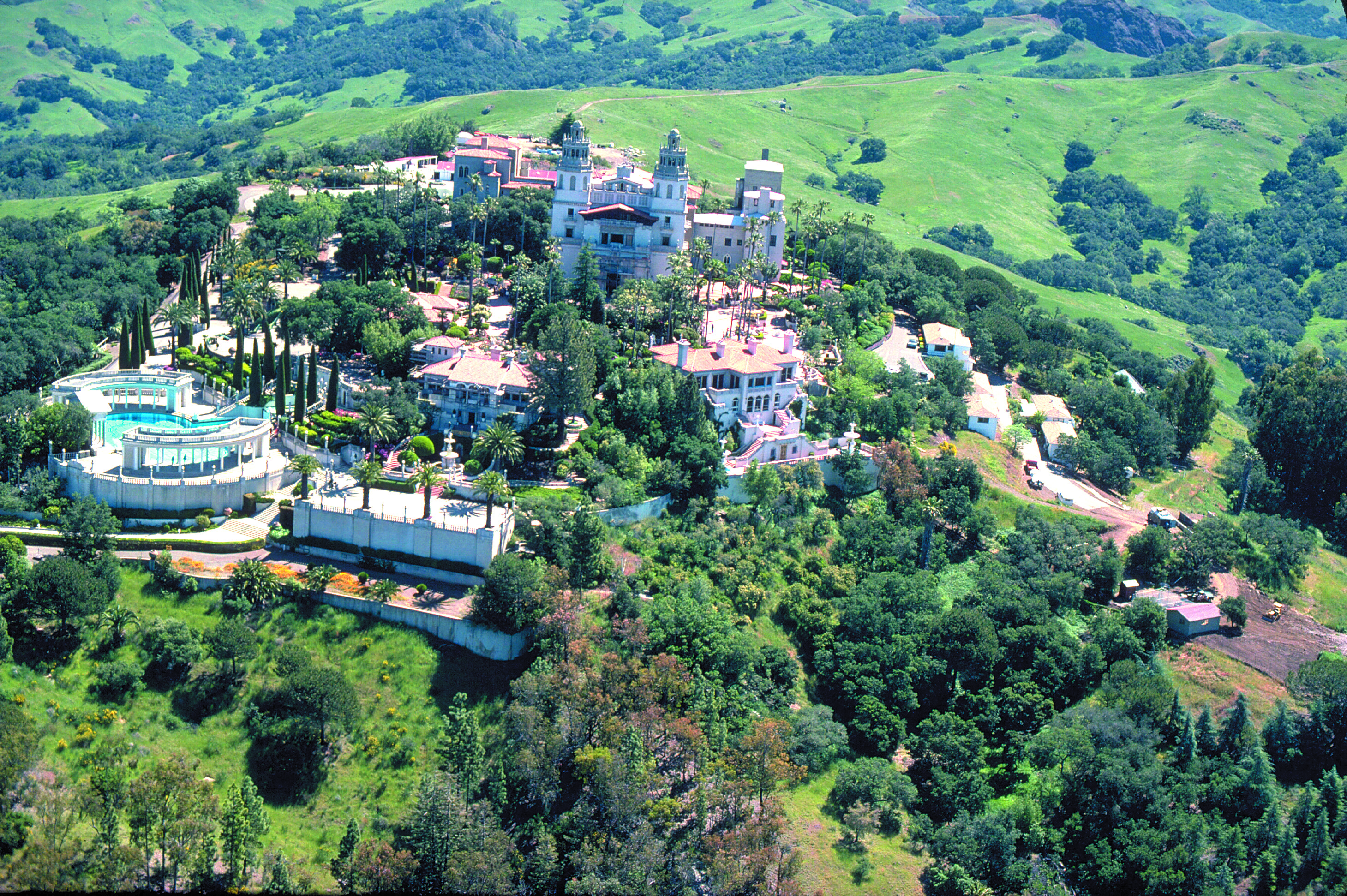
The Hearst Castle, from an era when newspapers actually made money.
After breakfast in Cambria, it’s 10 miles on Highway 1 to San Simeon, best known for the Hearst Castle, an ostentatious reminder of the days when there was big money to be made in newspapers. The castle was the brainchild of newspaperman William Randolph Hearst. It’s now a National and California Historic Landmark, and is part of the California State Park System.
The castle sits atop a hill of the Santa Lucia Range at an elevation of 1,600 feet. Casa Grande, the main building on the castle grounds, is 60,645 square feet. Including several “smaller” buildings on the grounds, the castle features 56 bedrooms, 61 bathrooms, indoor and outdoor swimming pools, a movie theater, an airfield, and the world’s largest private zoo. Nice life.
Here’s a high def video tour of the castle, much cheaper and less time consuming than actually going there.
You could spend all day at the Hearst Castle. Or you could ride a Harley to Big Sur.
We point six wheels northward and opt for Big Sur.
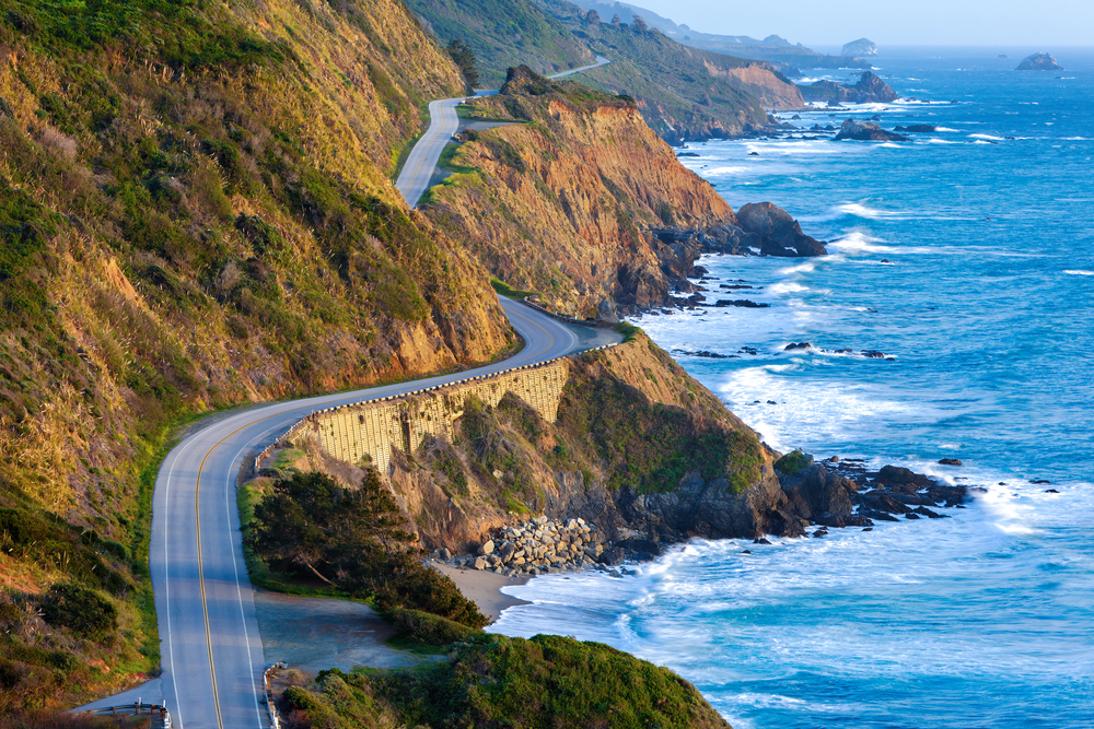
Soon, the road climbs steeply and the views increase dramatically. It’s stunning.
The Pacific Coast Highway is visually stunning, everywhere you look.
We pass the Piedras Blancas Light Station on a point supposedly named in 1542 by Juan Rodriguez Cabrillo for its rocks stained white with bird droppings. Piedras Blancas means white rocks. Early mariners used the large white offshore rocks as navigational landmarks.
In 1875, a light station was established to aid maritime navigation. The lighthouse still sends a white flash every 10 seconds to assure mariners of their location and warn them of the rocky coastline. The light station today is operated by the Bureau of Land Management, and managed as an historic park and wildlife sanctuary.
Continuing north, there’s nothing but mile after mile of breathtaking vistas. It’s hard to focus on the road, and not the view.
Building this highway was no small accomplishment. The state and Federal governments appropriated funds in 1921 and the road from San Simeon to Carmel was completed in 1937, built for around $10 million – in 1930 dollars. Construction was handled by inmates from California’s San Quentin Prison, who were paid 35 cents per day and had their sentences reduced in return.
We are doing this ride pro bono – literally, for the public good. No charge. You’re welcome.
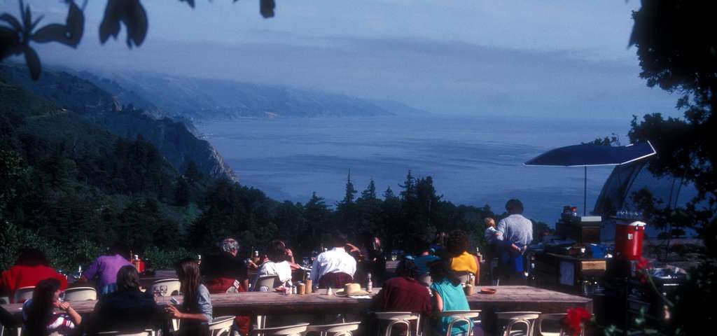
The area’s increasing popularity in the 1950s and ’60s brought the attention of Hollywood celebrities. Orson Welles and his wife at the time, Rita Hayworth, bought a Big Sur cabin on impulse during a trip down the coast in 1944. They never spent a single night there, and the property is now the location of a wildly popular restaurant, Nepenthe.
Thirsty and Hungry? A Nepenthe Bloody Mary is $11, a Castroville Artichoke appetizer $11.50, Nepenthe Steak $41.50, Minestrone Soup $25.50, and a California Artisanal Cheese Plate for dessert $17.00. Add a couple of glasses of wine, and a generous tip — and your dinner bill for one could run you $150 or more.
Nice view from the deck at Nepenthe.
Besides sightseeing from the highway, which is our approach, Big Sur offers hiking, mountain climbing and other outdoor activities. Big Sur’s Cone Peak is the highest coastal mountain in the contiguous 48 states, ascending 5,155 feet above sea level, only three miles from the ocean.
Big Sur is filled with dozens of scenic hiking trails, some climbing into the mountains with expansive views of the Pacific Ocean. For a little variety in today’s ride, we park our bikes at Julia Pfeiffer Burns State Park in Big Sur and hike the shortest trail in the area – the McWay Waterfall trail.
The trail is less than three-quarters of a mile out and back. The view of the 80-foot falls is one of the most popular images of Big Sur. The McWay Waterfall Trail gets its name from McWay Creek, which cascades onto the sandy shore below. For you travelers who enjoy hikes, the McWay Falls hike is certifiably awesome, as noted by Sunset magazine’s list of 50 Best Hikes in the West.
As short as it is, the hike provides a welcome respite from hours in the saddle.
***
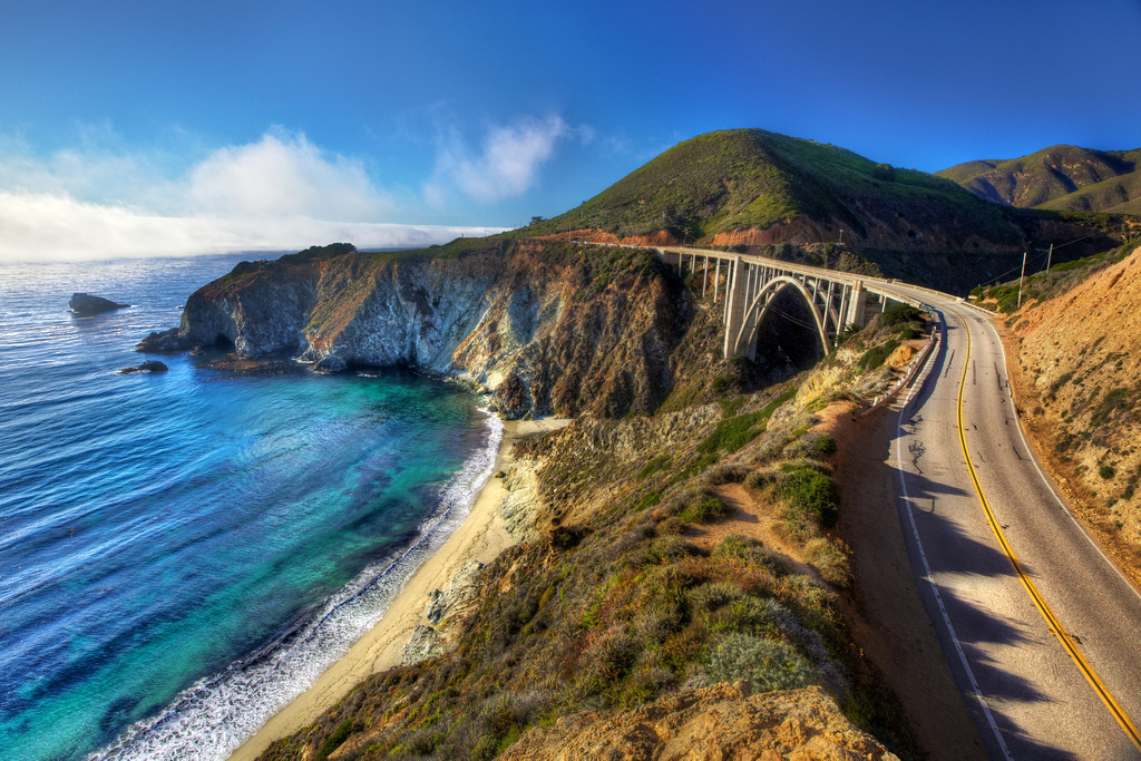
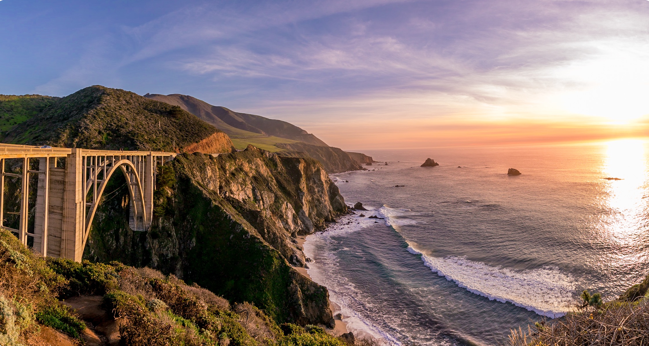
Construction of the San Simeon to Carmel road required 33 bridges, the largest of which was the much-photographed Bixby Creek Bridge, 20 miles past McWay Falls. The bridge is a single-span concrete arch more than 280 feet high and 714 feet long. When completed in 1932, it was the longest concrete arch span on the California State Highway System. Originally built for less than $200,000, it was seismically retrofitted in the late 1990s at a cost of about $20 million.
The Bixby Creek Bridge, about 13 miles south of Carmel, is one of the most photographed features on the California coast, and has been frequently used in automobile commercials and films. It was seen in the opening sequences of Play Misty for Me, and The Sandpiper.
Another view of the Bixby Creek Bridge.
For a drone’s eye view of the bridge, check this out; few people have seen Bixby Bridge from these vantage points!
Carmel, formally known as Carmel-by-the-Sea, is known for its natural scenery and rich artistic history. Actor-director Clint Eastwood, though a rabid-right Republican, served as the nonpartisan mayor of Carmel from 1986 to 1988.
The beach town has bountiful natural charm, enhanced by some local ordinances that keep things just right. There are no fast food restaurants in Carmel. That’s the law. The city’s municipal code also bans wearing shoes that have heels more than two inches in height, unless the wearer has obtained a permit. And, the city once prohibited the sale and consumption of ice cream on public streets. It’s a little like Singapore, which bans chewing gum – but without the tropical humidity.
Lunch on the pier in Monterey. Oysters and chowder.
***
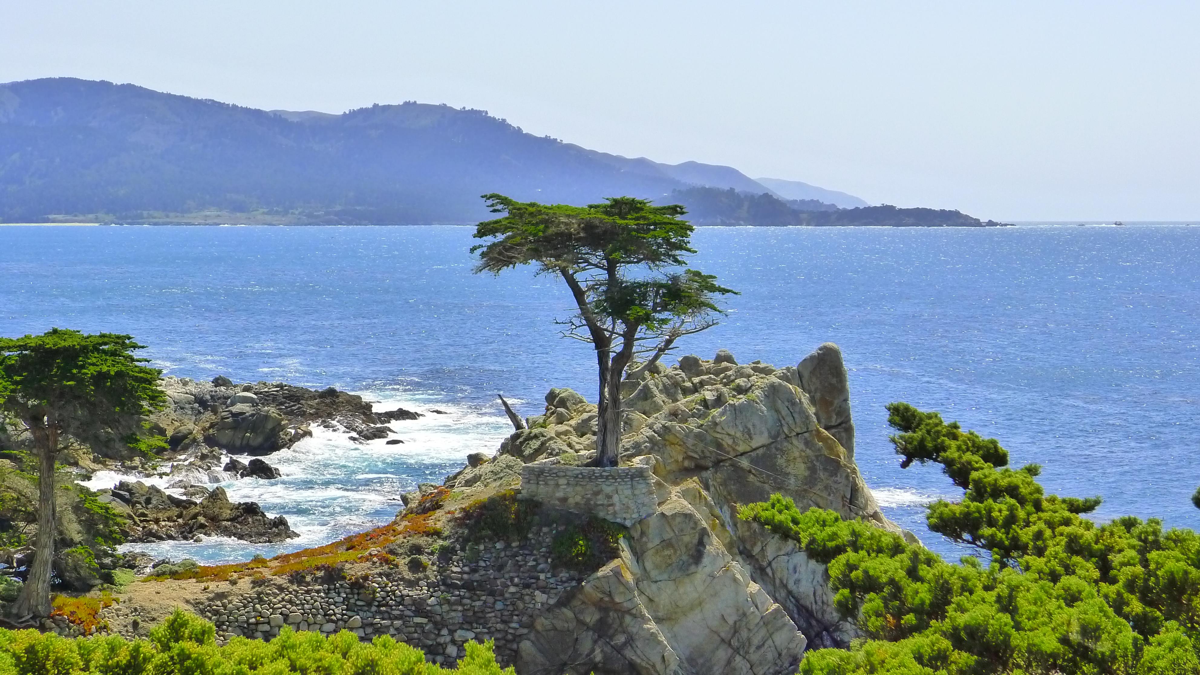
Just north of Carmel is an entrance to the world-renowned 17-Mile Drive. If you’ve ever been to Pebble Beach to play golf or have a glass of Chardonnay, you took the 17-Mile Drive to get there.
I’ve driven the 17-Mile Drive a half-dozen times over the past 50 years, and couldn’t wait to do it again. How awesome to drive past the much-photographed Lone Cypress tree on our Harleys!
Imagine my disappointment in planning this trip to find out that the 17-Mile Drive doesn’t allow motorcycles. It’s a privately owned forest, and they can allow in (or exclude) whomever they want. Damn rich people. Here’s a video showing what we would have seen on the 17-Mile Drive if we’d been allowed through the gates.
The Lone Cypress, on 17 Mile Drive. No Harleys allowed 😦
We ride on, past Carmel and Monterey, home of the world-famous Monterey Bay Aquarium, located at the site of a former sardine cannery on Cannery Row. Here, we stop for oysters, calamari, and clam chowder served in sourdough bread. After lunch, we continue north. To our left along Highway 1 is Fort Ord, a former Army post on Monterey Bay that closed in 1994. Nearly two million soldiers passed through the gates here, many as part of their infantry training.
The fort was named for Major General Edward Cresap Ord, a Union Army leader during the Civil War. As a young lieutenant, he supervised construction of Fort Ord’s predecessor, Fort Mervine, in the 1840s.
Most of the fort’s land now makes up the Fort Ord Dunes and National Monument, whose 7,200 acres have more than 86 miles of trails that can be explored on foot, bike or horseback. Fort Ord’s former military golf courses, Bayonet and Black Horse, are now public and have hosted PGA tour events.
Fort Ord Dunes. Nice to look at. Riding a Harley? No so much.
Castroville is the next city in our sights. It’s known as the “Artichoke Capital of the World.” The annual Artichoke Festival is held at the end of May. Marilyn Monroe was given the honorary title of Artichoke Queen in 1947 during a visit to the Monterey Bay area.
In Moss Landing, our final seaside encounter of the week, we turn inland and head for Gilroy, another food-themed city.
We wind our way over the twisty Hecker Pass, Highway 152, before arriving in Gilroy, the “Garlic Capital of the World.” Gilroy holds its Garlic Festival annually in late July. The event includes a garlic braiding workshop, celebrity cooking demonstrations, and free garlic ice cream.
Amazing what a pungent bulb can do for the local economy.
***
The remainder of today’s ride – the next 100 miles or so – is what you might call transit. Nothing exciting. Just putting ourselves in a place where tomorrow’s ride will be awesome from start to finish.
The rest of the way is hot, flat, mostly straight, and quite boring.
We roll through Los Banos, Spanish for “the baths.” It’s named after a spring that feeds natural wetlands in the western San Joaquin Valley. We are a long way from the ocean, but the elevation here is barely over 100 feet. Might as well be in Kansas. It’s hot.
Next city on our transit is Merced, known as the “Gateway to Yosemite.” We skirt the heart of downtown Merced, which isn’t missing much. Property values here were flattened during the recent Great Recession. Merced suffered one of the greatest property price collapses in the country.
Dinner in Mariposa. We’ll call it a day.
Leaving Merced, we’re riding east on Highway 140, the Central Yosemite Highway. Yosemite – that has a nice ring to it. We’ll soon visit the National Park that is among the most photographed of them all.
The road ever-so-gradually begins to climb, as we near the foothills of the Sierra Nevada mountains. In an hour, we arrive in Mariposa, Spanish for “butterfly.” Notable former residents of Mariposa include William Costello, original voice of Popeye the sailor; and John Fremont, first US Senator from California, first Republican candidate for president and explorer of the West with American frontiersman Kit Carson. More on Kit Carson tomorrow.
Mariposa, elevation 1,950 feet, was founded on the banks of a seasonal stream known as Aqua Fria, and was once known by that name – Aqua Fria – meaning “cool water.”
Aqua Fria or Mariposa – it doesn’t really matter. We have arrived at our destination for the day – 273 miles and seven hours of saddle time later.
Tomorrow, we begin the week by doing two states: Solid and Liquid. Or, California and Nevada.
Won’t that be interesting?
***
To view today’s route from Cambria to Mariposa, click here.
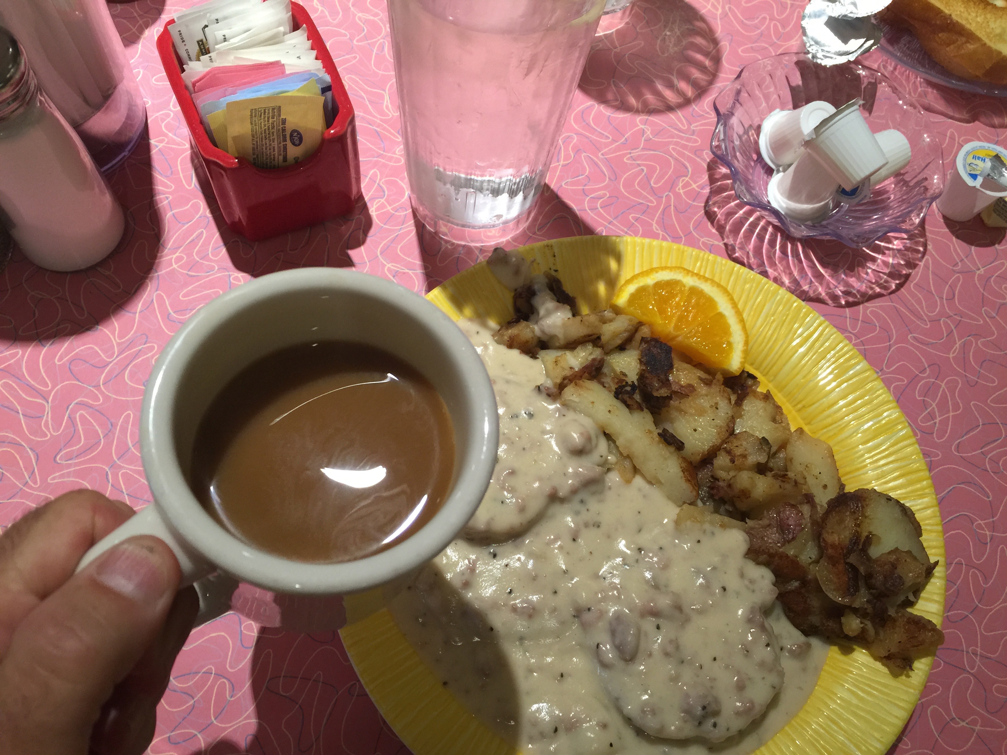
The day begins with a yummy breakfast at Bonnie Lu’s Country Cafe. Biscuits and Gravy for me. Healthier fare for Dave and Scott.
My biscuits-and-gravy breakfast at Bonnie Lu’s Country Cafe.
Best activity after a caloric overload: sit on your butt for the next six hours and enjoy the scenery.
We head north from Ojai on Highway 33, the Maricopa Highway. Designated a National Scenic Highway, it’s a twisty road, following Matilija Canyon through the Santa Ynez Mountains. We climb to Pine Mountain Pass – at 5,080 feet, it’s more than 4,300 feet above Ojai.
From Pine Mountain Pass, we descend comfortably into a flat area that takes us to Lockwood Valley. We are now heading East on Lockwood Valley Road. There’s very little out here of note. Trees and mountains. And Harleys. Lockwood Valley sits at about 4,800 feet.
Highway 33, the Maricopa Highway, is a fun ride.
The only road ahead is the one that takes us to Lake of the Woods, a community of less than 1,000 residents in the Los Padres National Forest. Lake of the Woods was named for a mountain reservoir that has been dry since 1962, when its dam burst. Lake of the Woods is located in Cuddy Canyon of the San Emigdio Mountains.
In Lake of the Woods, we turn west on Cuddy Valley Road, and remain in the mountains. To our left is Mount Pinos, whose 8,847-foot summit is the highest point in Ventura County. We descend along the Bitter Creek National Wildlife Refuge, designed to protect the dwindling California condor foraging and roosting habit.
The Bitter Creek Refuge provides grassland, oak woodland, chaparral, pinion pine/juniper/oak woodland, and wetland habitat for endangered critters. Among those struggling species are San Joaquin kit fox, blunt-nosed leopard lizard, giant kangaroo rat, and species of Federal concern such as western spade foot toad, western horned lizard, and tri-colored blackbird. That’s information you’ll only find on this blog. Or on the Internet, if you care to look for it.
Taking a break along the side of the road.
We reach Highway 166, the Cuyama Highway, and turn west. Cuyama, which lies ahead several miles, is derived from Chumash, meaning “To Rest, to Wait.” We will do neither, as there’s nowhere to rest and little to wait for. Cuyama is surrounded by apricot, peach and plum orchards.
Highway 166 takes us past family farms and fruit orchards before we meet US Highway 101, just north of Santa Maria. Until the Interstate Highway System was built, Highway 101 was the primary north-south route through California. It’s also known as El Camino Real (“The Royal Road”), where its route along the southern and central California coast approximates the old trail that linked the Spanish missions in the 18th and 19th centuries.
El Camino Real (pronounced ree-AL) meets the ocean in Pismo Beach, which was once known as the “Clam Capital of the World.” That moniker has disappeared, thanks to over-harvesting. Pismo clams were once so abundant they were harvested with plows on the beach. Clamming is still legal, but few remain to be found. They are a favorite meal of the protected sea otter, which pretty much wipes out what’s left of the local clam population.
This stretch of Highway 1 is called the Cabrillo Highway, named for Juan Rodriguez Cabrillo, a Portuguese explorer noted for his 16th century exploration of the west coast on behalf of the Spanish Empire. He was the first European explorer to navigate the coast of present-day California.
The Cabrillo Highway brings us to San Luis Obispo, where we turn north onto California Highway 1 – the Pacific Coast Highway. We will stay on this road for the next 155 miles, 32 of them today and the rest tomorrow.
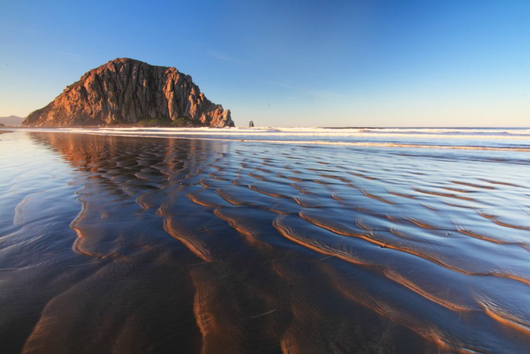
Morro Rock, a distinctive sight along PCH.
Still inland on a coastal highway, we soon reach the coastline in Morro Bay, whose most prominent physical feature is Morro Rock, a 576-foot high volcanic plug. Known to locals as “The Rock,” it was quarried from 1889 until 1969. There’s no public access to the rock, because it’s a reserve for the peregrine falcon. Morro Bay calls itself “The Gibraltar of the Pacific.”
Twenty more miles on Highway 1 and we arrive at Cambria, a seaside village doubling as an art colony. Cambria is roughly halfway between Los Angeles and San Francisco. And it’s 100 percent of the way to today’s destination.
Our ride finishes quietly as we pull into the motel and begin to think about dinner. In our rear-view mirror: a tidy 230 miles of mountain roads, valleys and a hint of ocean.
What’s cookin’?
***
Come to think of it, we’ve been sitting on our butts all day and could use some exercise. Might be nice to burn a few calories before dinner.
We’re very close to the Pacific Ocean. Why not a beach walk?
Moonstone Beach, a great spot for a walk in Cambria.
About a mile north of us is the Moonstone Beach Boardwalk, which runs north and south along the beach for about 1.5 miles. The boardwalk meanders along the Moonstone Beach. There are opportunities to jump off the boardwalk and put footprints in the sand.
If you are curious, a moonstone is not to be confused with a moon rock.
Moonstones, which are seen on this beach in abundance, are gemstones, whose name is derived from a visual effect caused by light diffraction. You probably knew this, but the moonstone is Florida’s state gem. Florida made that selection to commemorate the moon landings nearly a half-century ago, because the rockets to the moon were launched from Florida’s Kennedy Space Center. Here is Apollo 11 lifting off toward the Moon, on July 16, 1969.
Five days later, Neil Armstrong became the first human to step on the surface of the Moon.
Ribs at the Cambria Pub and Steakhouse.
We do our own exploring tonight, successfully foraging for food in Cambria. Dinner at Cambria Pub and Steakhouse.
***
To view today’s route from Ojai to Cambria, click here.
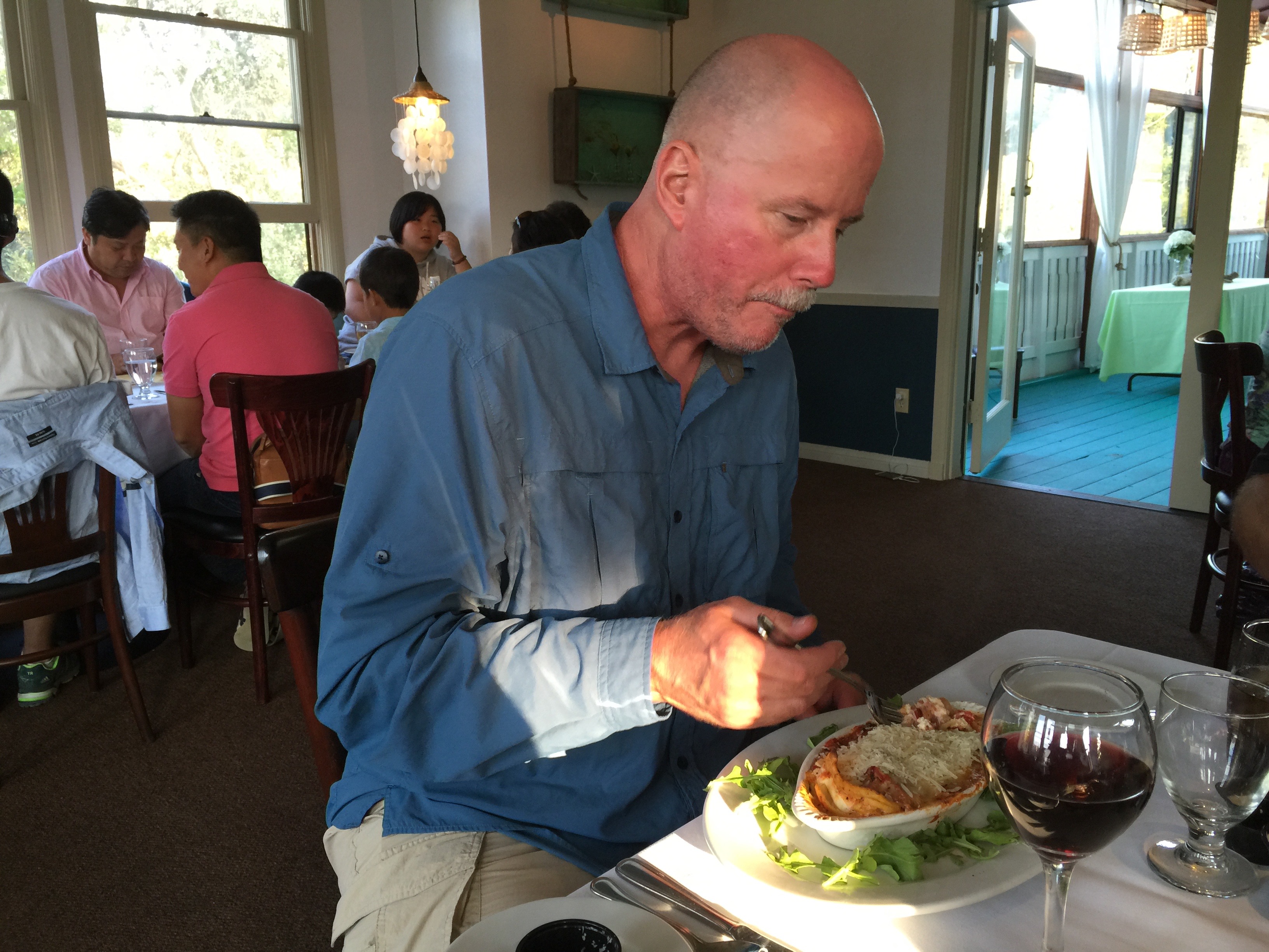
Dave ordered the veggie lasagna, as close to health food as it gets on a road trip.
And then, we’re going to the beach. How California-clichéd is that?
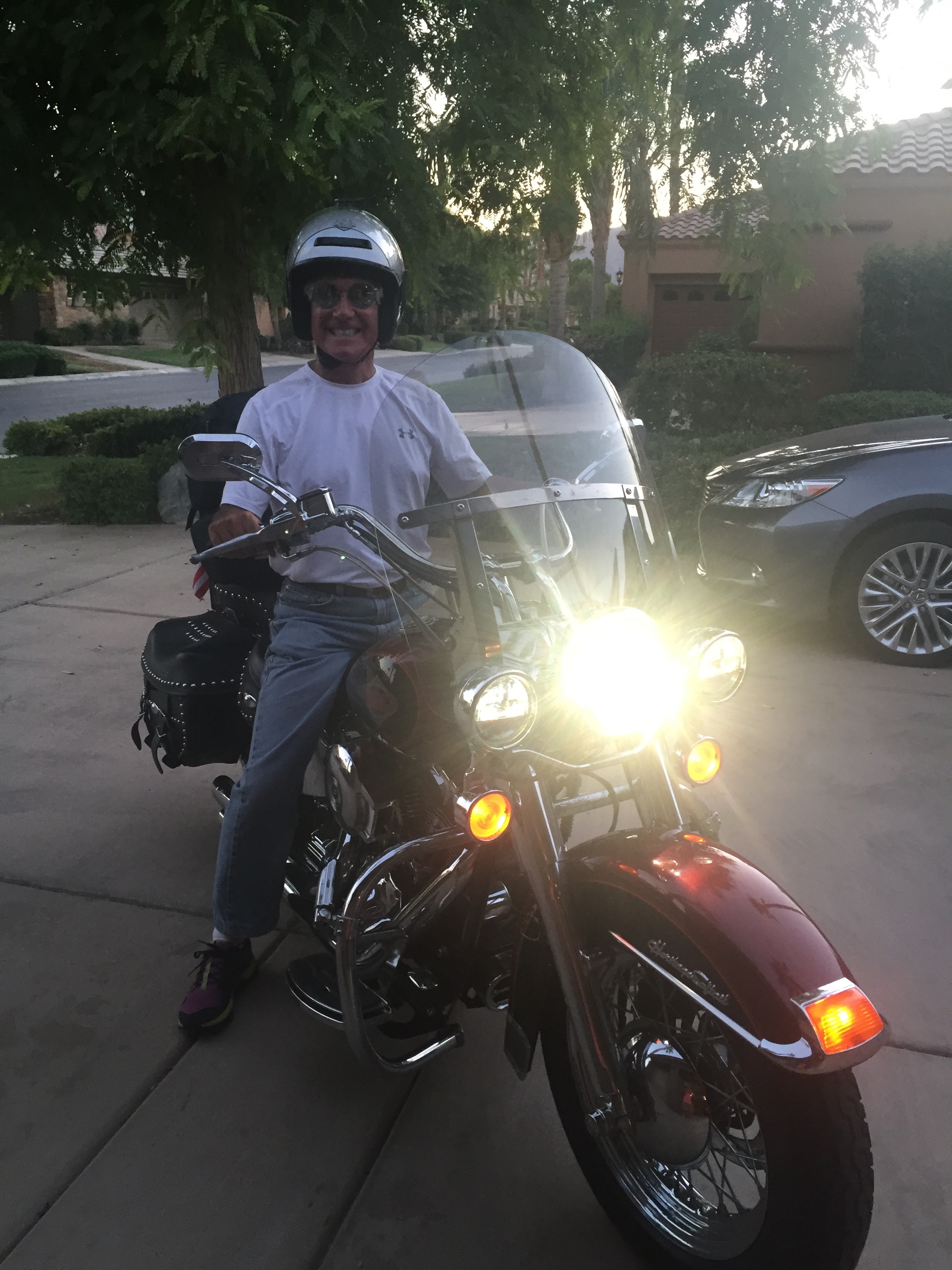
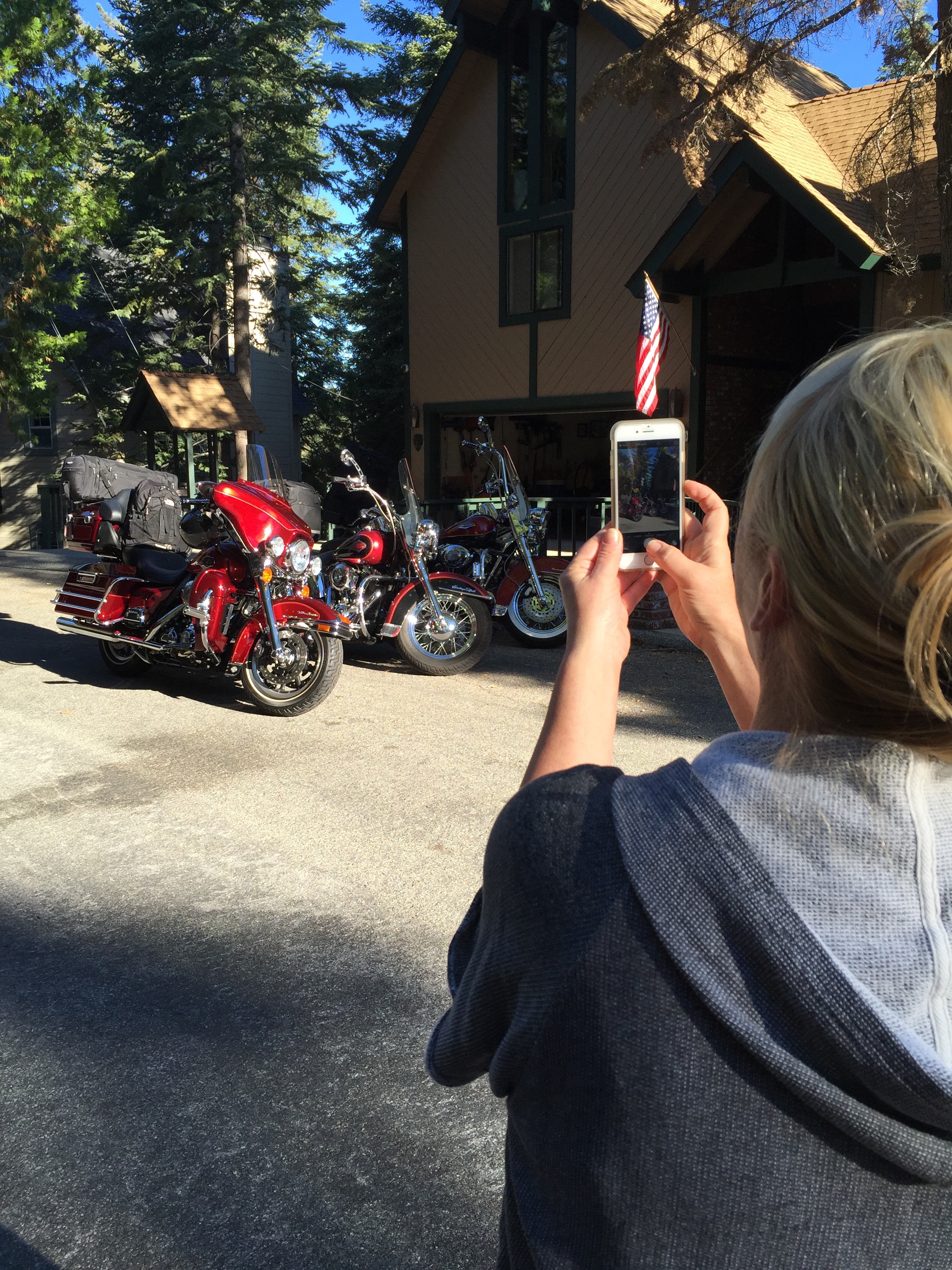
Gail Bowman snapping pix of the bikes before we leave Lake Arrowhead.
Day 1 of our journey begins on the Rim of the World Highway, designated a Scenic Byway because it literally feels like you are on the rim of the world. It’s a 110-mile route that traverses the rim of the San Bernardino Mountains from Cajon Pass to San Gorgonio Pass. We follow this narrow, twisting path for about 22 miles before reaching Cajon Junction, where Highway 138 crosses I-15.
We could turn right onto the Interstate, and in three hours we’d be in Las Vegas. But this trip is about reality, not fantasy, so we continue west toward the San Gabriel Mountains.
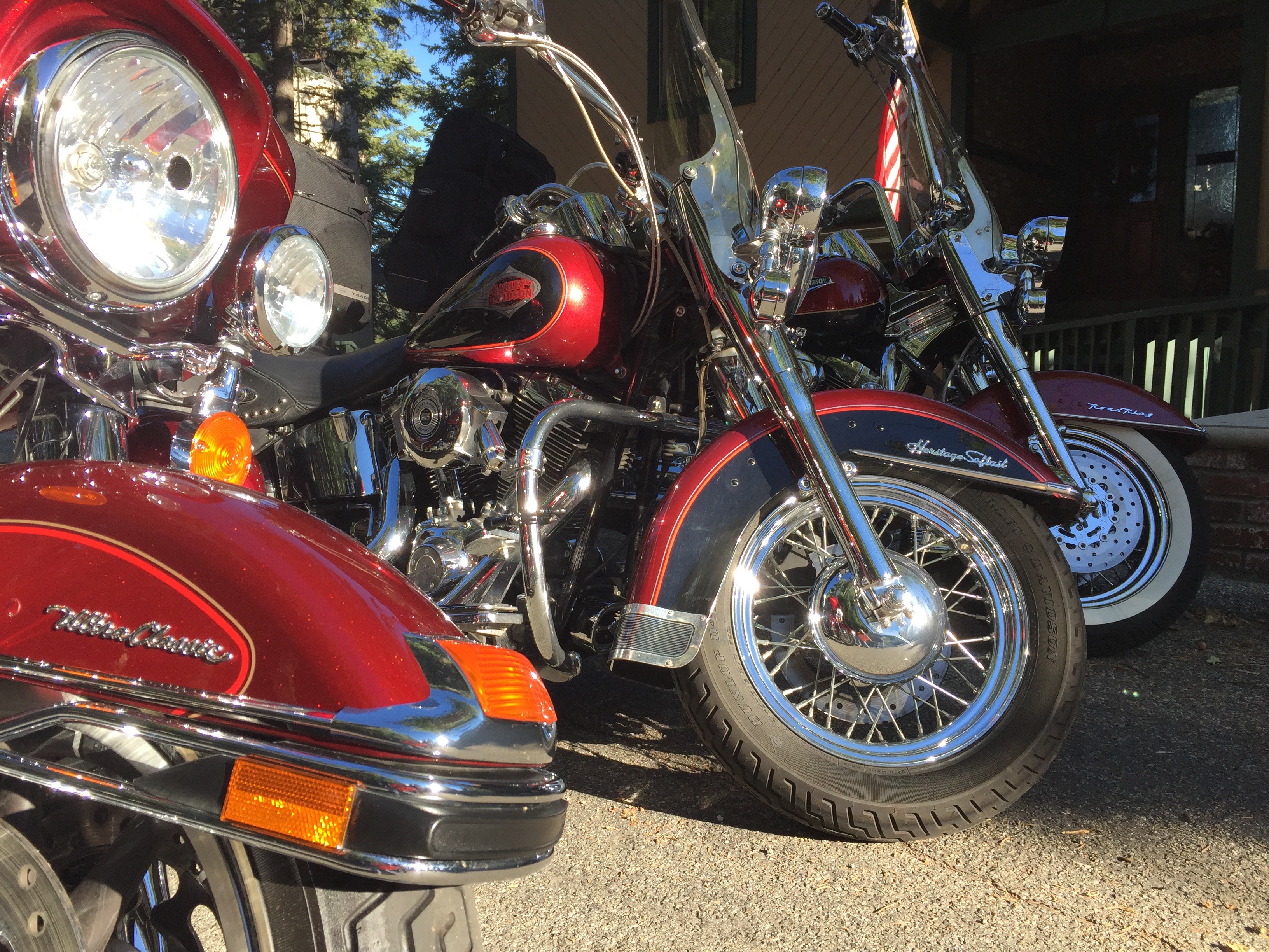
All red, and raring to go.
Thirty minutes later, we turn onto Highway 2 and arrive in Wrightwood, a quaint community located in a pine-covered valley at 5,935 feet. Wrightwood is at the east end of the Angeles Crest Highway, which we will follow for the next 60 miles to La Canada Flintridge, just north of Pasadena.
The Angeles Crest Highway is a two-lane thrill ride that corkscrews through the Angeles National Forest – through chaparral and montane forest habitats, along the highest and most scenic ridges of the San Gabriel mountain range. It is considered among the top motorcycle roads in the US.
The road has been used extensively in Hollywood movies, including racing scenes in the 1968 Disney film, The Love Bug, starring Dean Jones, Michelle Lee, and a 1963 VW Beetle named Herbie. The Angeles Crest Highway was also featured in the Love Bug’s 1977 sequel, Herbie Goes to Monte Carlo – where the highway doubles for a mountain road in the French Alps.
Construction of the Angeles Crest Highway began in 1929, when it was originally intended to be a fire access road. Much of it was built by prison labor. Original plans called for Angeles Crest Highway to be upgraded to a freeway in the 1950s, but that idea was later considered geographically improbable and the plans were abandoned.
We’re pretty much on our own out here, off the grid in a sense. Cell phone reception is spotty, and, when available, signal strength and clarity is poor. If you tried to call us today, we’ll have to get back to you.
Stopping in Wrightwood for water, snacks, whatever.
The highest point on the Angeles Crest Highway is 7,903 feet at the Dawson Saddle. Much of the highway is closed in winter due to rockfall and avalanche hazards. Today, the road is clear and the skies are sunny as we press on toward several ski resorts convenient for millions of Southern California snow enthusiasts.
Five minutes west of Wrightwood is the Mountain High Ski Area at Big Pines. It bills itself as “Southern California’s closest ski resort.” From a base at 6,600 feet, Mountain High has 1,600 vertical feet in three distinct areas: West, East and North. It’s one of the oldest ski areas in the US, beginning in 1937 with a single rope tow.
Twenty-two miles west of Mountain High is another ski area – Mount Waterman. From a base elevation of 7,000 feet, Mount Waterman has 1,000 vertical feet of skiing – when it’s open. If Mountain High is Southern California’s closest ski resort, Mount Waterman may be Southern California’s closed-est ski resort. The past four seasons, there hasn’t been enough snow to open for business. In the summer, however, it does have an 18-hole disc golf course.
Dave checks out Mount Waterman. Not much skiing today.
Ten minutes from Mount Waterman is the Chilao Visitors Center, one of two on the Angeles Crest Highway. It offers an introduction to the Angeles National Forest through a variety of exhibits, trails and activities. We get all the introduction we need by continuing our ride west.
Other than visitor centers, one of the few buildings on the Angeles Crest Highway is Newcomb’s Ranch, a biker haven about 10 minutes west of Mount Waterman. Newcomb’s Ranch is the only private property along the Angeles Crest Highway. It’s called the “informal headquarters for riders” by Los Angeles magazine, and “one of Southern California’s most famous Rickey Racer Roadhouses” by Motorcyclist magazine.
The Newcomb family, which also created the Mount Waterman ski area, built the roadhouse in 1939. Since then, it’s variously served as a restaurant, hotel, general store, gas station and brothel. Only one of those descriptions serves our purposes today. We stop, admire the bikes, hydrate, relax – and then continue west.
Cooling off at Newcomb’s Ranch.
From Newcomb’s Ranch, it’s 27 miles to La Canada Flintridge, the western terminus of the Angeles Crest Highway. Hey, that was fun!
If you’re more into pictures than words, click here to watch a time-lapse motorcycle ride from one end of Angeles Crest to the other – 66 miles in 10 GoPro minutes.
***
We’re back in the big city now. Or we’re at least aware of its presence.
Nearly 23 million people call Southern California home, and for the next 50 miles, we’ll be among many of them. On a sunny, pleasant August day, we’re reminded why so many find SoCal such a nice place to live. Just look skyward and you’ll get it.
We continue south on Highway 2, but now it’s a multi-lane freeway with typical mid-day Friday afternoon traffic. Soon, we turn west on the Ventura Freeway, so named because Ventura is where it ends – or begins, depending on your perspective.
Just past the Los Angeles Zoo, we turn onto Forest Lawn Drive and are reminded that show business is still a big deal around here. We ride past the famed Warner Bros. and Universal Studios. A lot of big name movies have been made on their lots, including ET, Jaws, Gravity and American Sniper. And TV shows, too – from 77 Sunset Strip to The Big Bang Theory.
Mulholland Drive, the movie version.
Near Cahuenga Pass, we jump onto Mulholland Drive, a famous road named after pioneering Los Angeles civil engineer William Mulholland. Mulholland was responsible for building the Los Angeles city water infrastructure and providing a water supply that allowed LA to grow into one of the largest cities in the world. He designed and supervised the building of the Los Angeles Aqueduct, a 233-mile long system to move water from the Owens Valley to the San Fernando Valley. In a sense, you have him to thank for Los Angeles being a mass of wall-to-wall humanity. Without the water he brought to the LA basin, the city likely would not resemble what you see today.
Mulholland Drive, which has been featured in movies, songs and novels, is a 21-mile two-lane road that follows the ridgeline of the eastern Santa Monica Mountains and the Hollywood Hills. It provides spectacular views of the Los Angeles Basin, the San Fernando Valley and the Hollywood Sign. There’s a small overlook on Mulholland Drive where you can see the Hollywood Sign, whose letters are 45 feet high. The sign, created in 1923 as an advertisement for local real estate development, sits on Mount Lee, at 1,708 feet, the tallest peak in Los Angeles.
One of the most famous sights in the entire Los Angeles area.
Along Mulholland Drive, you’ll find some of the most exclusive and expensive homes in the world. As this is not a house-hunting trip, we keep our eyes on the road and follow Mulholland Drive to the Skirball Cultural Center, near I-405. The Skirball Center is devoted to exploring the connections between Jewish heritage and American democratic ideals. A five-minute walk from the Skirball Center is the American Jewish University, founded nearly 70 years ago by Rabbi Mordecai Kaplan to create an institution representing the diversity of Judaic expression in the US.
***
I-405 North takes us back to the Ventura Freeway, which leads to Topanga Canyon Boulevard., and on to Topanga itself. Topanga is an artsy community in the Santa Monica Mountains, attracting filmmakers, musicians, actors and other unapologetic liberals. The annual Topanga Film Festival is held every summer.
Lunch at a 7-11 just off the Ventura Freeway. This is what extreme hunger looks like on a Harley trip..
It’s believed that the name Topanga means “Where the Mountain Meets the Sea.” Some millennial parents are actually naming their kids Topanga. It’s among the top 300 names on babynames.com. Hey, it’s California!
In Topanga, we turn northwest onto Mulholland Highway. Not Mulholland Drive. This one is a highway, or at least that’s what it’s called. It feels like anything but a highway. It’s a two-lane zig-zagger that crosses Malibu Canyon Road and takes us to the tiny community of Cornell, in the wine country area of the Santa Monica Mountains.
Cornell, sandwiched between Malibu and Agoura Hills, is mostly surrounded by protected open space and state park land. The Tour de California bicycle race occasionally passes through here, attracting locals who cheer the cyclists on.
The hottest spot in Cornell, the place we have to check out, is The Rock Store, a famed hangout for glitterati motorcyclists including Jay Leno, Harrison Ford, Arnold Schwarzenegger, John Travolta and Peter Fonda. One bike magazine calls it a “wonderful collection of humanity and two wheels where diversity isn’t just tolerated, it’s celebrated.”
Dave hydrates at the Rock Store.
The Rock Store is a nice place to park, ogle, covet, and just compare biker notes. “Mine has more chrome” is the Harley equivalent of “Mine is bigger than yours.”
We see a few motorcycles and a bright yellow Lamborghini, but no signs of the Hollywood elite. While Jay Leno is nowhere to be found, here’s a fun clip of him talking about, then riding one of his 90 bikes, a 1936 Harley Davidson Knucklehead.
***
Refreshed and ready for more, we continue west on Mulholland Highway, then turn south on Latigo Canyon Road, another super-twisty two-lane road. Latigo Canyon Road takes us to Highway 1, also known as the Pacific Coast Highway.
Next stop, Malibu. Or, as they call it locally, “The Boo.” We don’t stop in Malibu; we power through it and enjoy the views of the California coastline.
Except for its extraordinary views and multi-million dollar mansions, Malibu is a small town that holds little interest for tourists. Still, it’s amazing to think that earlier in the day, we were riding above 7,000 feet, and now we are skirting the Pacific Ocean.
Riding PCH. California coastal scenery at its finest.
We follow the Pacific Coast Highway for about 30 miles, past El Matador State Beach, Point Dume State Beach, Lee Carrillo State Park, and Point Mugu State Park, where the road turns inland. The ocean vistas were spectacular, but they’re gone for now. On Sunday, we will jump back onto the Pacific Coast Highway’s most scenic section, one of America’s top motorcycle roads.
From PCH, we jump onto US Highway101, and make a quick stop at the Camarillo Harley store. Arriving five minutes before closing time, Dave buys a new gas cap to replace one that mysteriously “went missing.” It’s a long story, involving a senior moment and lack of a documented checklist. Next time you see Dave, ask him about it.
Dave, buying a new gas cap. You can never have too many.
First, it’s time to head for tonight’s destination, Ojai (pronounced OH-hi).
Ojai is a tourist destination, about 15 miles north of Highway 1. We are three tourists in search of a tasty dinner and a comfortable bed, so it should suit us just fine.
Ojai’s culture revolves around ecology, health and organic agriculture, spirituality, music and art. It’s home in mid-June to the annual Ojai Music Festival, which has had among its performers Igor Stravinsky (stylistic ballet and symphony composer), Esa-Pekka Salonen (principal conductor of the London Philharmonic Orchestra) and Aaron Copland (“Fanfare for the Common Man”).
Copland wrote Fanfare For the Common Man in 1942, inspired in part by a famous speech made earlier in the year, where Vice President Henry Wallace proclaimed the dawning of the “Century of the Common Man.” You will recognize this fanfare, as it’s performed by the New York Philharmonic Orchestra at the 9/11 museum dedication ceremony in May 2014.
***
Lavender in Ojai is quite the thing.
Another popular June event is the Ojai Lavender Festival, a celebration of the color purple held in Libbey Park. It showcases lavender art, as well as lavender-themed crafts, soaps, jewelry and clothing. This year’s lavender fest included music from the Honeysuckle Possums.
Sadly, we seem to be two months late for Ojai’s festival season 😦
In make-believe, the title characters of The Bionic Woman and the The Six Million Dollar Man are described in those 1970s TV series as having been childhood sweethearts in Ojai. Jamie Sommers (Lindsay Wagner) and Steve Austin (Lee Majors) appear in a number of episodes that take place in and around Ojai.
In real-life, notable current and past residents of Ojai include film composer Elmer Bernstein, Oscar-winning actress Julie Christie, jazz musician Maynard Ferguson, and David Zucker, director of Airplane! and The Naked Gun.
As the sun begins to set, our eyes begin to droop and sleep beckons. Dinner, drinks, fade to black.
Today’s 250-mile ride was a perfect start to a week of riding. Let’s do it all over again tomorrow.
***
To view today’s route from Lake Arrowhead to the Rock Store in Cornell, click here.
To view the remainder of today’s route, from Cornell to Ojai, click here.
Some noteworthy things have happened on August 20 over the past 150 years:
In 1866, President Andrew Johnson formally declares the Civil War over.
In 1882, Tchaikovsky’s “1812 Overture” opens in Moscow.
In 1920, the first US commercial radio station, WWJ (Detroit) begins daily broadcasting.
In 1940, British Prime Minister Winston Churchill famously says of the RAF: “Never in the field of human conflict was so much owed by so many to so few.”
In 1965, the Rolling Stones release their single, “Satisfaction,” in the UK.
In 1980, Reinhold Messner of Italy is the first to solo ascent Mt. Everest.
In 1998, the Supreme Court of Canada rules that Quebec cannot legally secede from Canada without the federal government’s approval.
In 2011, celebrity booty model Kim Kardashian marries basketball player Kris Humphries; the marriage lasts 72 days.
And, in 2015, three guys, all set to begin a 2,000-mile Harley excursion, decide to stay in Lake Arrowhead, relax, and leave tomorrow instead.
Keep calm, everyone, and nobody will get hurt.
With yesterday’s blog build-up, you’d think Dave, Scott and I would be in the Sierras by now. Not to worry. We’ll have plenty of time to ride, beginning Friday morning.
Dave cooking his “world- famous” ribeye steaks.
So today, we cool our jets, fill our tanks, explore Lake Arrowhead on the Bowman’s pontoon boat, have our last home-cooked meal (Dave’s “world-famous” ribeye steaks) for 10 days, and give you the day off from reading this blog.
We plan to leave bright and early tomorrow. See you then.
A world-famous meal, waiting to be devoured. Then, in the morning, we hit the road!
Today, I hit the road for my seventh major ride in seven years. If I had any writing ability, I’d call that an annual event.
But this time there’s a big difference: Sarah’s coming along.
That’s right, I’ll have adult supervision. To help kick off my 2015 ride through the Sierras, Sarah will trail in the Boxster – sort of a high-class “sag wagon.” Sag, as you may know, is an acronym for “support and gear,” or “support and grub.”
Either way, it’s awesome to have her on the road with me.
***
Over the past six years, you may recall my riding partner on these mountain excursions has been Ray Sanders. Ray was raised in Kentucky’s coal country, had a distinguished career as an engineer, and now lives in Farragut, Tennessee. Ray, who will be 85 in November, is married to Sarah’s cousin, Tina.
Thanks, Ray. Here’s to you!
Together, Ray and I rode to Lake Tahoe and back twice, along the Blue Ridge Mountains in North Carolina and Virginia, to Civil and Revolutionary War sites, New England in the fall, and scaled the highest paved road in North America – 14,130 feet — just below the summit of Colorado’s Mount Evans.
After 65 years of riding, Ray is moving on to other adventures.
So it’s somewhat bittersweet today as I begin a 2,000-mile ride in search of some of California’s more spectacular sights, knowing Ray won’t be a part of it. I think of all the places we’ve been together – probably 15,000 miles on the road – and it’s hard not to be wistful.
I am deeply appreciative of all Ray taught me during our rides, and I will miss him greatly.
***
8:30 am in La Quinta. Ready to hit the road.
As we pull out of the driveway of our La Quinta home, it’s 8 am and already 90 degrees, with an expected high of 113 by 5 pm. We’ll be stuck in the blistering desert heat most of the day, unless we’re lucky enough to find shade or shelter in the mountains.
It’ll be a blast-furnace-like experience for me; riding at 50 miles an hour, the wind in my face isn’t the least bit refreshing. It feels Saharan and stifling. And poor Sarah: she’ll miss the guilty pleasure of driving topless (the Boxster is a convertible). Motorcycles and ragtops aren’t much fun when the temperatures are, as the Urban Dictionary calls it, “Africa hot.”
Today’s destination is Lake Arrowhead, a mile-high town northwest of here in the San Bernardino Mountains. Lake Arrowhead is only 65 straight-line miles from La Quinta, but our route will be a full 175 road miles. We’ll either be lost, or intentionally in the mountains to avoid the crushing heat.
On El Paseo, not quite ready to shop.
In 20 minutes, we arrive in Palm Desert, home of the El Paseo shopping district. It’s our valley’s version of Rodeo Drive. Bill Gates has a home in Palm Desert. So does Phil Condit, former CEO at Boeing.
No time for retail therapy or breakfast with Phil and Bill, so we head south on Highway 74 into the San Jacinto Mountains. The road immediately becomes steep and twisty – what most self-respecting motorcyclists and their sag wagon drivers live for.
A side note: on my Harley rides for the past six years, I constantly reviewed my rear-view mirror, making sure Ray wasn’t far behind. It’s a little odd this time, as Ray is not there, but instead I see Sarah following me.
About 45 minutes after leaving home, we arrive at the Paradise Valley Café, a favorite biker hangout at the intersection of Highways 74 and 371. If we turned left onto 371, the road would take us to Temecula, in the heart of Southern California wine country.
Sarah and Gary at Highway 74 vista point.
A very cool thing happens our way up Highway 74, something you Harley riders will relate to. A California Highway Patrol motorcycle officer passes me going down the hill. He gives me a “Harley wave,” first time that’s ever happened to me. How neat was that! A peace officer giving peace a good name!
But we continue straight, heading toward Idyllwild, a rustic mountain destination known as one of the “100 Best Small Art Towns in America.” With a population of about 4,000, Idyllwild was once the summer home for bands of Cahuilla Indians who migrated to the area to escape the heat of lower elevation deserts. Their thought process was similar to mine and Sarah’s – except they probably didn’t arrive here on Harleys and Porsches.
Today, Idyllwild is home to artists and musicians, including drummer David Atwood of the 1970s rock group America (“Ventura Highway,” “A Horse With No Name“). Casey Abrams, from American Idol season 10 (2011) is an Idyllwilder, as is PGA Tour golfer Brendan Steele.
Hydrating at “Higher Ground” in Idyllwild.
The biggest event every year in Idyllwild is the two-day Jazz in the Pines festival, which just wrapped up on August 16. Featured bands this year included the Euphoria Brass Band and the Graham Dechter Quartet. For more, visit http://www.idyllwildjazz.com
***
Over the next eight days as you read this blog (“Travels With Harley”), you’ll note links to additional information – film clips, YouTube videos, websites and more. Those links, which look like the one for the Jazz in the Pines festival in the previous paragraph, should be easy to spot. Many are eminently clickworthy; just depends on your hunger for knowledge. Apologies, in advance, if YouTube causes you to watch a few seconds of ads before the video begins; that’s how they pay the bills.
Full disclosure: if you click on all of them, be prepared to waste a considerable amount of your life viewing this blog. Your choice. As I like to say every year – if you happen to learn anything or derive mild entertainment value from reading these blog posts, well, you’re welcome.
I look forward to having you along for the ride over the next nine days – and I welcome your feedback. Feel free to comment on the photos, the route, the writing, the weather, our culinary choices – whatever. You can make your comments directly on the blog. Or keep them to yourself.
***
Sarah cooling off in Idyllwild.
One other thing about communication: over the last month, I have moved up a step on the technology food chain. I now have a Twitter account. Yes, I tweet. I’m a novice at this, so don’t expect hashtag-o-mania right out of the gate.
Every day during my ride, I will tweet some information or photos not available on this blog. You could say I’m saving some special (aka, exclusive) stuff for you Twitter followers, or Twits as I like to call you.
To find me on Twitter, I’m: @LQHarleyBoy
If you don’t have a Twitter account, you can still see my latest tweet by going to twitter.com, and entering @LQHarleyBoy in the search field.
My Twitter coach is @DanLewisNews … so if you don’t like what you see, it’s probably his fault.
***
From Idyllwild, we head north on the Banning-Idyllwild Panoramic Highway, as the road climbs to 6,165 feet, then begins descending into Banning, about 30 miles away. Banning is on I-10, in the San Gorgonio Pass, also known as Banning Pass.
Named after Phineas Banning, a stagecoach line owner, the city has a population of nearly 30,000. Banning sits at about 2,350 feet, but it’s still darn hot. So, to cool off, we head up into the mountains again, this time the San Bernardinos.
We jump on I-10 for a few miles, then exit in Beaumont, French for beautiful mountain. The road takes us through Oak Glen, a charming orchard town with less than 700 residents, but zillions of apples. The Oak Glen apple orchards produce the Vasquez and King David varieties, which are grown exclusively here. For you apple aficionados, antique varieties once grown here – but no longer commercially available – include the Ben Davis, the Gravenstein, and the Pink Pearl.
There’s a wonderful five-mile scenic loop through Oak Glen with more than 30 ranches, farms and businesses, and we enjoy every turn.
At beautiful Big Bear Lake.
Before long, we turn onto Highway 38 and begin climbing toward Big Bear Lake. CA-38 is a terrific, twisty road that rises to Onyx Summit. At 8,443 feet, it’s the highest highway pass in Southern California.
I wouldn’t say the air is frigid, but it’s certainly a welcome departure from what our friends in La Quinta are now experiencing. The air temperature is generally about five degrees cooler per 1,000 feet of elevation gain. So, as we cross Onyx Summit, it’s about 70 instead of the 110 it probably is in La Quinta.
Soon, we arrive at Big Bear Lake, a small mountain town sitting at 6,750 feet. The lake is Southern California’s largest recreation lake, teeming with fishing activity in the summer. It’s quite scenic, and made a nice backdrop for 1960s TV Westerns, including a number of Bonanza episodes. In the winter – if there’s snow – many Southern Californians ski and shred (snowboard) at nearby Snow Summit.
***
Now on Highway 18, we continue west toward Lake Arrowhead, eventually arriving around 1 pm. Lake Arrowhead is a beautiful mountain resort town in the San Bernardino Mountains, set amid pine, cedar and dogwood forests. Its economy is based almost entirely on tourism. Nothing wrong with that. You could say the same for La Quinta, and it works fine for us.
After 175 miles on the road, we’re ready to call it a day.
At his mountain retreat, Dave battles bats with his “Bat Net.”
We arrive at the mountain home of my old Boeing boss and good friend, Dave Bowman. By old, I mean “long ago.” Dave’s actually 10 years younger than I am. And a foot taller.
At Boeing, I supported Dave when he was VP/General Manager of the C-17 Globemaster III program. I strung together subjects and verbs to tout the C-17’s achievements, and Dave had profit-and-loss responsibility for the $3 billion-a-year program. Then, I retired in 2008, Dave left the company in 2010, and it’s been all downhill for the C-17 ever since. Just sayin’ …
After assembling about 270 C-17s for the US Air Force and major international customers over the past 25 years, this fall Boeing is building the final C-17 and shutting down its Long Beach factory forever. It will live on forever in pictures and video.
***
Following a distinguished career at Boeing, Dave recently retired as Senior VP of Program Management at Eaton, a global leader in power management, with $22 billion in annual revenue. Dave worked in Eaton’s Cleveland, Ohio, office, which wasn’t entirely conducive to motorcycle riding – though it is home to Rock-N-Roll City Harley Davidson, named for Cleveland’s Rock and Roll Hall of Fame. In May, the Hall of Fame year celebrated its 10-millionth visitor. Rock on!
Retirement, apparently, means Dave finally has the time to ride his Harley in a meaningful way. He has mostly used his 2008 Ultra Glide for day trips from his Fullerton home. Now, he’s going to join me for the next eight days as we ride through California’s mountain ranges and along its Pacific coast.
It’s great to reconnect with him, after years of communicating primarily through this blog.
Dave and his wife, Gail, are graciously hosting Sarah and me at their Lake Arrowhead retreat before the boys begin their journey.
We have a lot of catching up to do.
***
Dinner at the Bowman home in Lake Arrowhead.
It’s a festive atmosphere at the Bowman Lake Arrowhead home. The setting is perfect for relaxing before we terrorize California’s coastline and mountains.
Sarah and I are catching up with Dave and Gail. We reminisce about the good old days, and look forward to even better ones ahead.
When the Harley ride begins in earnest, Sarah will head back to La Quinta and it will be just the guys. Dave and Gary.
Oh, and Scott, too.
Scott Donaldson will be the third of our riding threesome. He’s with us tonight as we chill at the lake.
Scott is Gail’s uncle. You’d think that would make him an old man. Not so much.
Scott Donaldson is in the house.
He’s Dave’s age (55). Scott and Dave have known each other for more than 40 years, starting when they were students together in Mrs. Fox’s 8th-grade algebra class at Alexander Hamilton Junior High School in Long Beach. You remember algebra: integers, single-variable equations, polynomials and the Pythagorean theorem. Pythagoras was quite the mathematician and philosopher.
Scott and Dave both went on to Cal State University at Long Beach after high school, and have remained best buddies ever since, often riding their Harleys together.
What do you call your wife’s uncle who’s also your good friend? Didn’t know there was a term for that until I looked it up on genealogy.com. Scott is Dave’s “fruncle-in-law.” Seriously.
Scott is a native Southern Californian who lives in La Habra with his wife, Jackie. They’re just a few miles away from the Bowman’s primary residence in Fullerton.
After a career in grocery retail management, Scott is now a Superintendent in vessel operations for SSA Marine – Stevedoring Services of America at Terminal C60 in Long Beach, the second-busiest container port in the US. The facility is dedicated to supporting Matson Navigation, providing service to the Hawaiian Islands, Guam and three ports in China.
Scott rides a 2007 Road King Classic. Dave has a 2008 Ultra Glide. I have a 2001 Softail Heritage Classic. All Harleys. Why ride anything else?
Speaking of riding … let’s fire up the bikes and get moving! Vroom, Vroom.
***
To view today’s route from La Quinta to Lake Arrowhead, click here.