Our day begins with a wonderful morning ride on the Meadows in the Sky Parkway, a 13-mile journey that climbs steeply from downtown Revelstoke to 4,921 feet. After 16 switchbacks through forests of cedar and hemlock, spruce and fir, we arrive at Balsam Lake, 3,400 feet above Revelstoke.
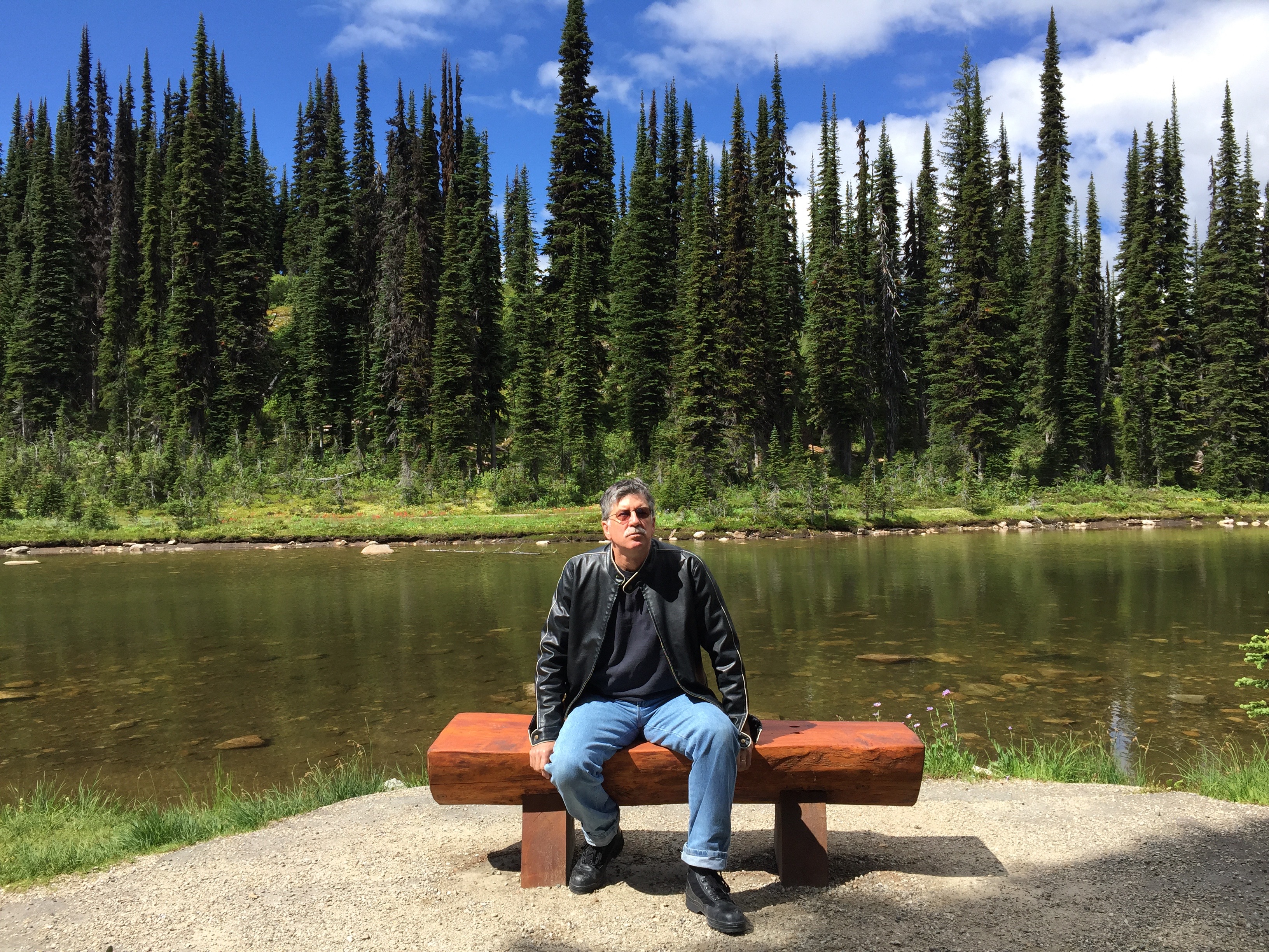
Randy takes five at Balsam Lake.
At the top, the subalpine landscape often explodes with wildflowers. The view from the summit is astounding, with breathtaking vistas of the Columbia River and Revelstoke. For those with patience, you can take a shuttle one kilometer to a second summit, this one at 6,350 feet. (Yes, I mixed metric and English units; it happens a lot in Canada.) Here, you find Mount Revelstoke’s historic firetower, built in 1927 – and declared a Canadian National Historic Site 60 years later.
The Parkway is part of Mount Revelstoke National Park, one of the few in Canada established at the request of local citizens. A Meadows in the Sky fun fact: it’s known as the “Royal Road” because of some of its visitors. The last royal visit was in 1955, when Queen Elizabeth II and Prince Philip visited the city of Revelstoke and the National Park. No word on whether they took the shuttle to the summit.
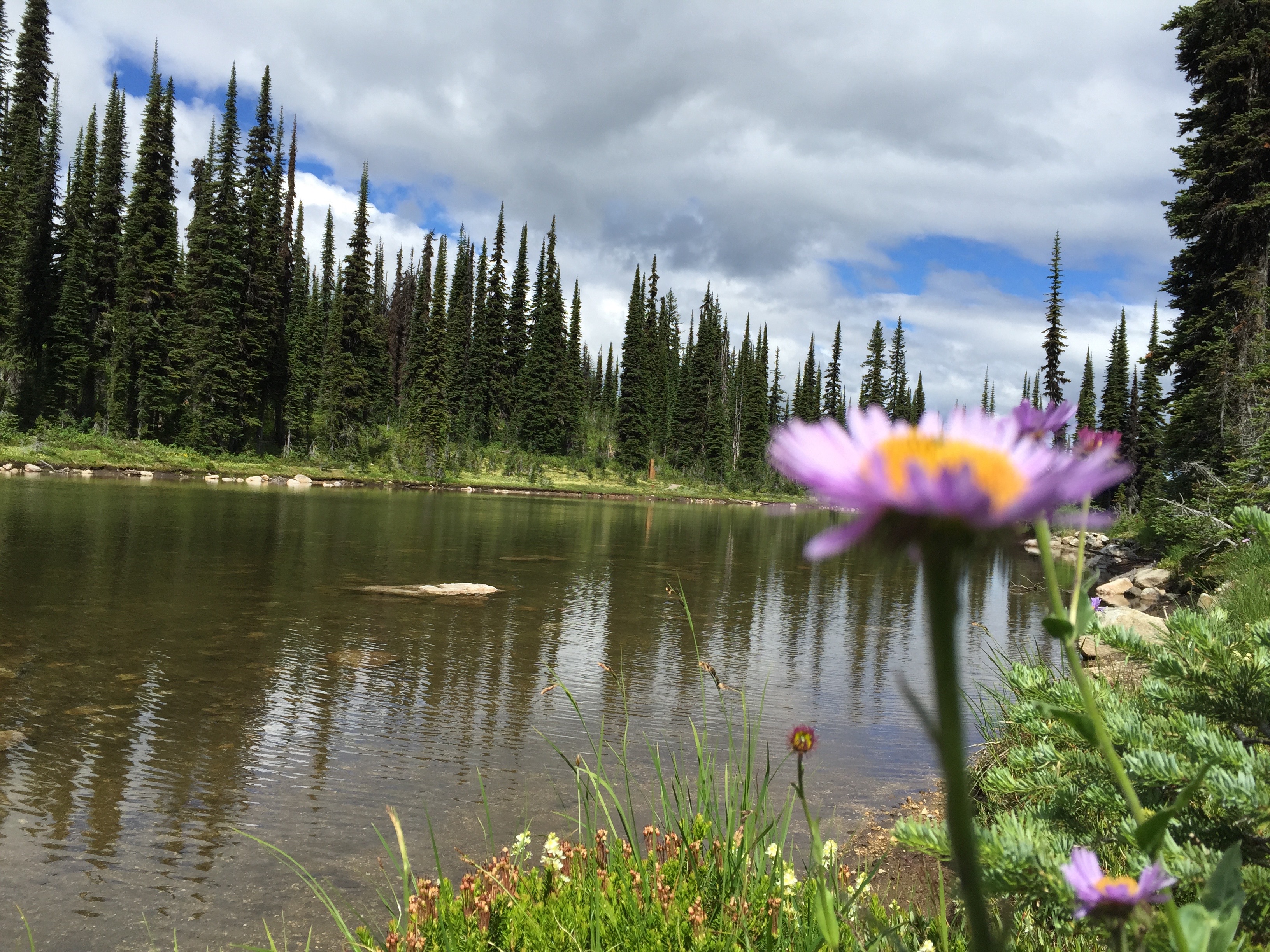
Wildflowers in bloom at Balsam Lake.
We descend steeply, but carefully, back down to Revelstoke, where we jump on the Trans-Canada Highway and head west. The highway follows the Eagle River. Forty-five minutes from Revelstoke, we pass through Sicamous, a resort town that bills itself as the “Houseboat Capital of Canada.“
Sicamous sits on the eastern shore of Shuswap Lake, which has four arms, forming a shape reminiscent of the letter H. The lake is the centerpiece of Shuswap Lake Provincial Park.
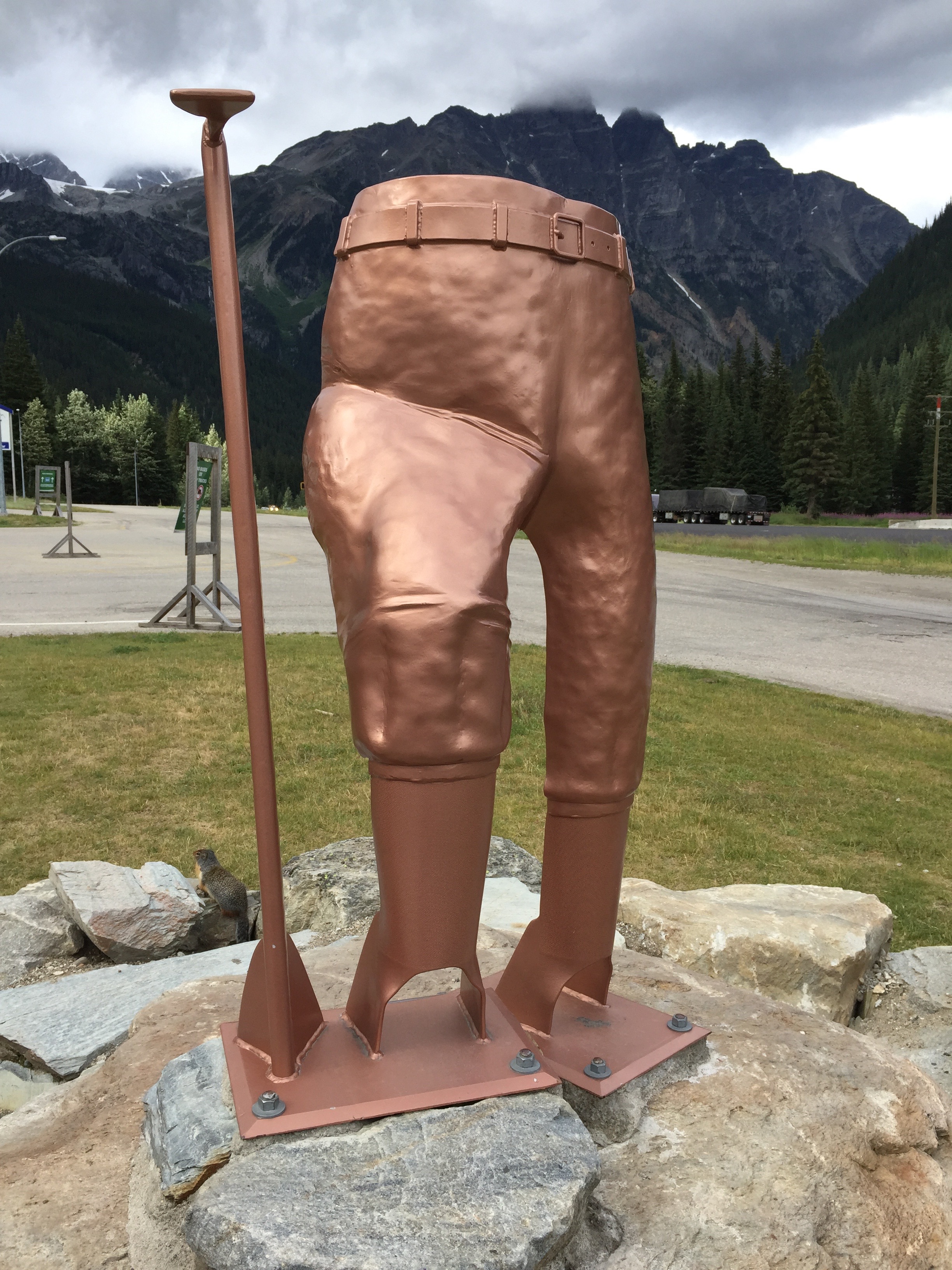
We turn south in Sicamous and follow Highway 97A, the Vernon-Sicamous Highway, along the eastern shore of Mara Lake. After turning west onto Highway 97, we arrive in the small community of Falkland BC, home to one of Canada’s largest Canadian flags.
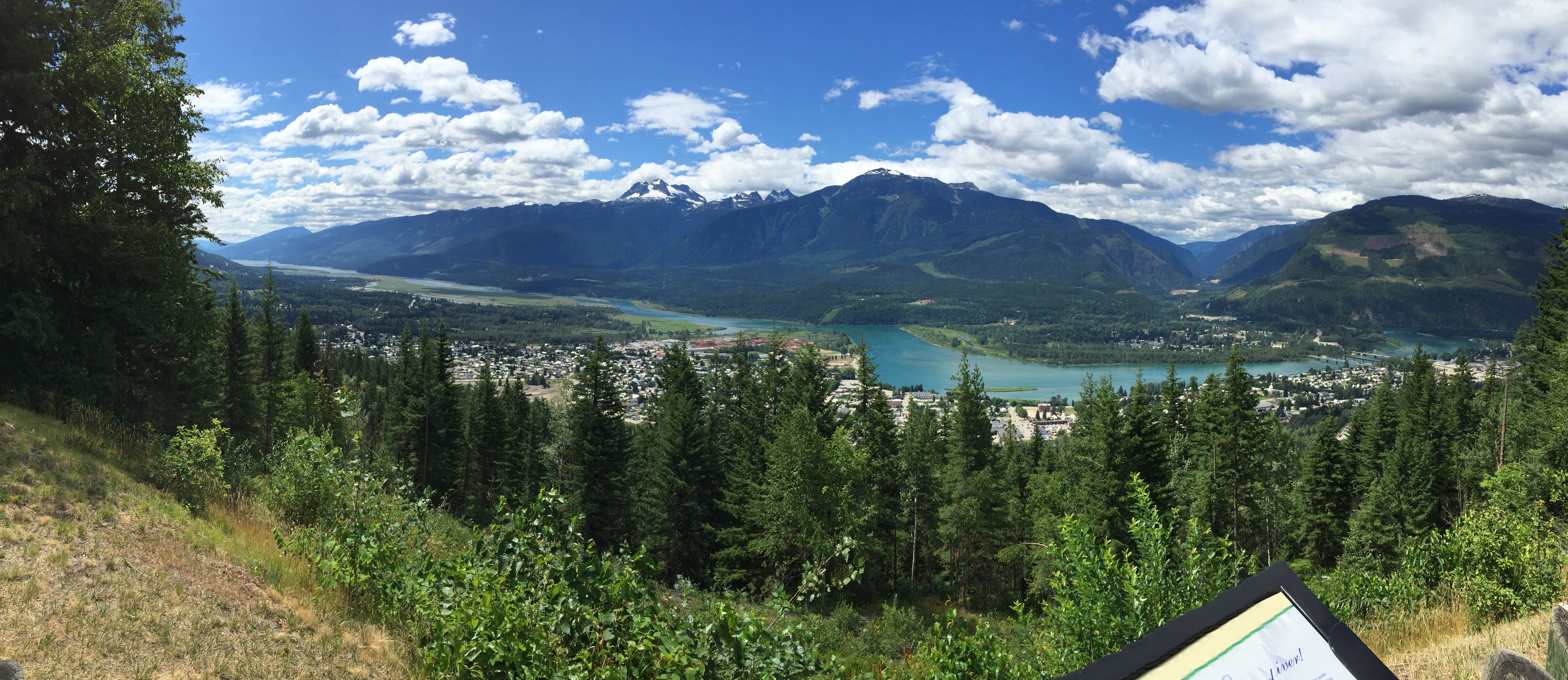
The view of Revelstoke on the way down from Balsa Lake.
The flag is 500 feet above the valley floor on Gyp Mountain. It’s 28 feet high, 56 feet wide, but isn’t really a flag in the traditional sense – you know, flapping in the wind. No, this flag is made out of wood, telephone poles, cement blocks and metal. Seriously. The colors (colours?) of the maple leaf are heated onto enamel. The flag is designed to withstand 35 tons of wind pressure. Quite the feat of engineering, it resides on the list of Canada’s large roadside attractions.
From Falkland, it’s only 50 miles to Kamloops, where we turn in our Harleys, and discover to our pleasant surprise, that Randy’s F-150 is still in the parking lot where we left it. The trash hauler is ready to take us back to the USA.
Today, our last on two wheels, covered about 200 miles. We have 300 more miles to go in the trash hauler before arriving back in the Seattle area. Long day. Great week.
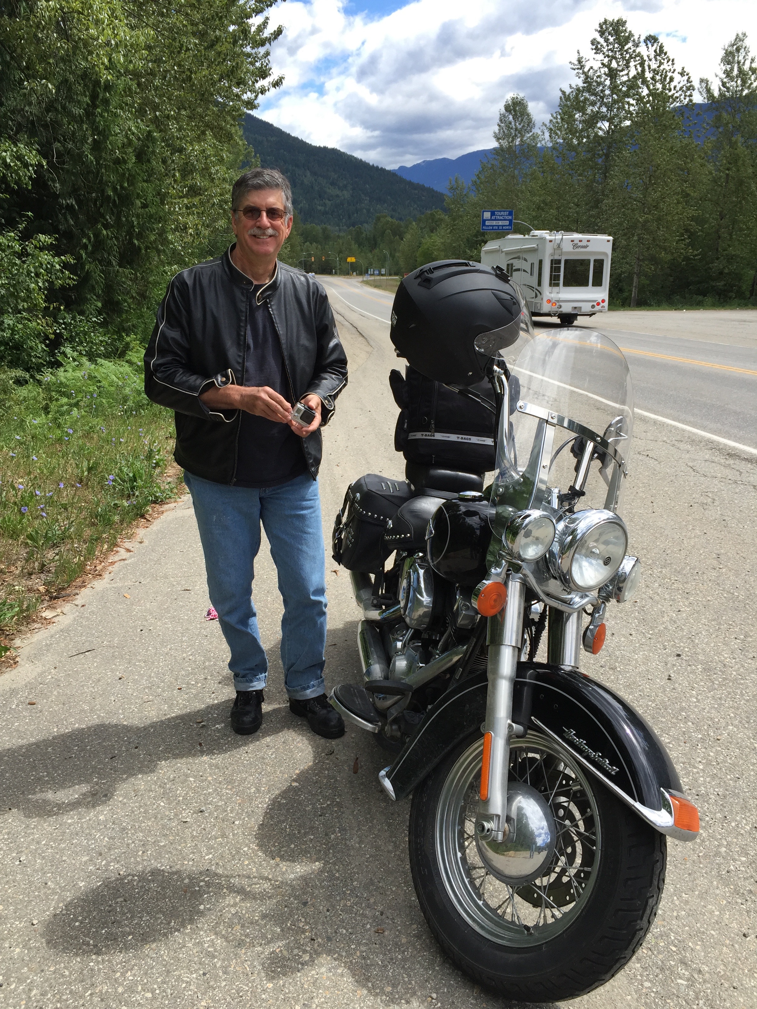
Now … who among you is ready to ride? Gary and Randy do it.
We leave Banff this morning, beginning our third day of riding the Canadian Rockies.
Retracing our steps from yesterday, we ride west on the Trans-Canada Highway for a few miles, then turn onto Highway 1A, also known as the Bow River Parkway. After 15 easy miles, we arrive in Castle Junction, named for nearby Castle Mountain. Castle Mountain’s highest point is 9,744-foot Television Peak, which gets its name from the TV repeater located on top.
The view from Storm Mountain Lodge. Wet and wild.
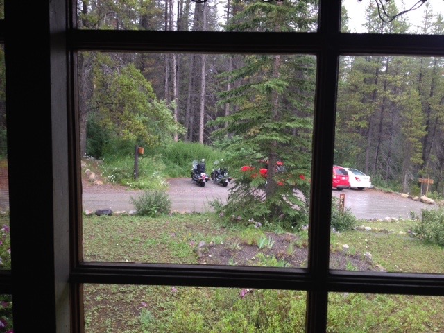
In Castle Junction, we turn south and west onto Highway 93, the Kootenay Highway. We are now back in British Columbia, where we’ll remain for the duration of our ride. The skies immediately darken, and rain quickly turns to sleet and, oh no, hail! We duck into the aptly named Storm Mountain Lodge to wait out the ill-tempered weather.
The Kootenay region of southeastern British Columbia derives its name from the Kootenay River. The name is often confused with Kootenai, a county in northern Idaho whose largest city is Coeur d’Alene. Kootenai County, Idaho, is named after the Kootenai Tribe. Actually, different spelling, same river.
Killing time at Storm Mountain Lodge, waiting for the rain to stop.
Whatever. The Kootenay Highway follows the contours of the Kootenay River, through Vermillion Crossing. We are now in Kootenay National Park. There’s a lot of Kootenay going on.
After 65 miles on the Kootenay Highway, we arrive in Radium Hot Springs, named for the hot springs located in nearby Kootenay National Park. The hot springs complex is actually a part of the Canadian National Park System. The complex contains two large pools, one with hot water for soaking – temperatures are usually around 104 degrees – and the other, a more traditional swimming pool kept at around 84 degrees. The pools are open year round. For $6.30, we could have stopped for a dip.
The pool at Radium Hot Springs.
The hot springs were named after the radioactive element, radium. An analysis of the water here showed that it contained small traces of radon, which is a decay product of radium. Turns out the radiation dosage from bathing in the nearby pools is insignificant; about .13 millirem from the water for a half-hour bath. A millirem is one thousandth of a rem. Hey, it’s not exactly like you’re in Chernobyl. Three final radium fun facts: its symbol is Ra, its atomic number is 88, and its discoverers were Marie and Pierre Curie.
***
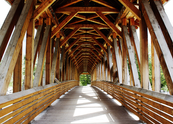
In Radium Hot Springs, we turn north onto Highway 95, which follows the Columbia River for more than 60 miles. The town of Golden, at the northern terminus of Highway 95, is home to the 150-foot-long Kicking Horse Pedestrian Bridge, the longest freestanding timber frame bridge in Canada. The bridge is named after the nearby Kicking Horse River and Kicking Horse Pass.
The Kicking Horse Pedestrian Bridge.
What up with all the kicking? The river was named in 1858, when explorer James Hector was kicked by his packhorse while exploring the river. Hector survived and named the river as a result of the incident.
The town of Golden brings us back to the Trans-Canada Highway, which we will ride for the next 90 miles, much of it along the Columbia River. We cross Rogers Pass, a 4,360-foot high mountain pass in the Selkirk Mountains. Rogers Pass is named for Albert Bowman Rogers, a surveyor hired by the Canadian Pacific Railway in 1881 to find a pass through the Selkirk Mountains. The railway told Rogers they’d name the pass after him — if he found one — and give him a $5,000 bonus to boot. Incentives do work. Thanks to Rogers’ discovery, Canadian Pacific built the railway through the pass in 1884.
We are now in yet another park, Glacier National Park.
An interesting statue at Rogers Pass in Glacier National Park.
Glacier is one of seven national parks in British Columbia. The park’s history is closely tied to two primary Canadian transportation routes, the Canadian Pacific Railway, completed in 1885, and the Trans-Canada Highway, completed in 1963.
After passing through Canyon Hot Springs, we are now following Illecillewaet River, a tributary of the Columbia. The Illecillewaet (good luck spelling or pronouncing it) flows into the north end of Upper Arrow Lake in Revelstoke, tonight’s destination.
Like so many other towns and communities across Canada, Revelstoke was founded in the 1880s when the Canadian Pacific Railway was built through the area. The city was named in appreciation of Lord Revelstoke, head of a British investment bank that helped save the Canadian Pacific Railway from bankruptcy in the summer of 1885. The Revelstoke Railway Museum celebrates the history and heritage of rail’s impact on Revelstoke.
Today, the area may be best known for the Revelstoke Mountain Resort, a ski area with North America’s greatest vertical rise: 5,620 feet. By comparison, Chamonix, in the French Alps has a vertical rise of 7,326 feet. And, the Cloudmont ski area atop Lookout Mountain in Mentone, Alabama, has 150 feet of vertical. Ya gotta start somewhere.
After 245 miles on the road, we call it a day, grab a bite to eat at The Village Idiot (a hip ski restaurant) and spend our last evening in Canada. Tomorrow, the USA beckons.
Dinner at (with?) the Village Idiot, in Revelstoke.
After a hearty breakfast in Jasper, we ride south along the Athabasca River. Athabasca is a Cree word meaning “grass or reeds here and there.”
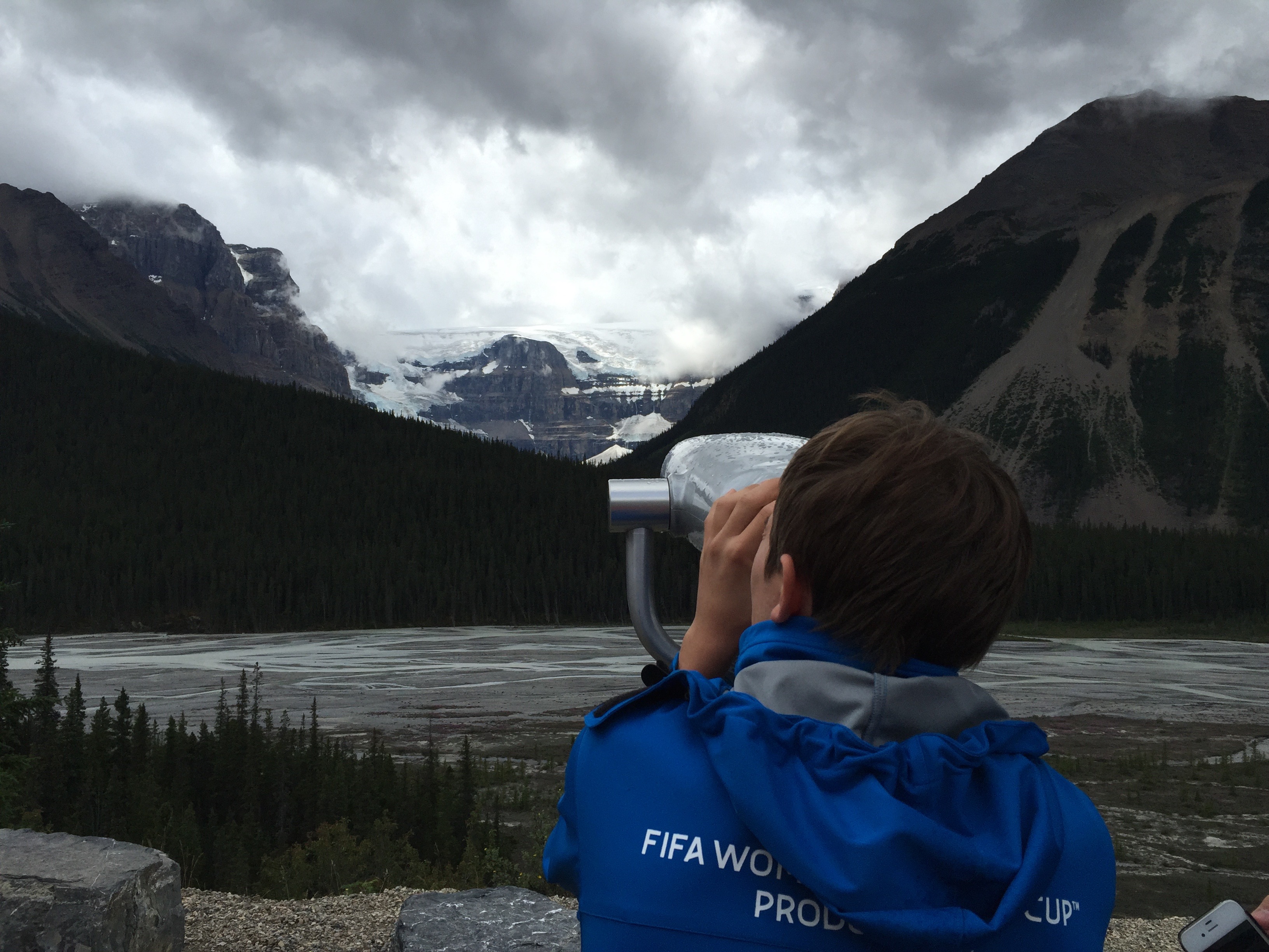
Today we will see one of the most spectacular sights in Canada. No grass is involved. Today’s natural high is mountains. And glaciers.
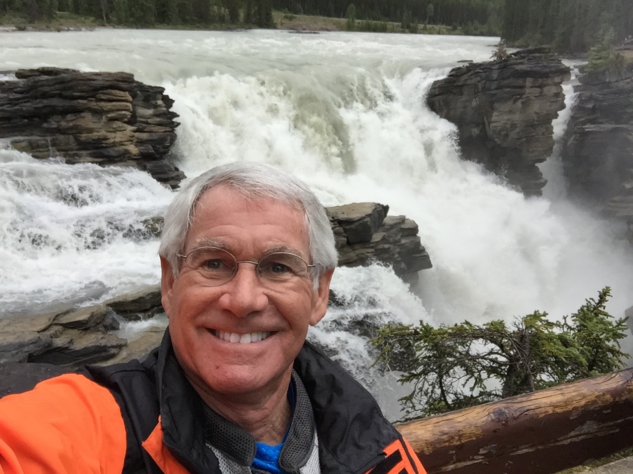
At Athabasca Falls, along the Icefields Parkway.
We turn south on Highway 93, the Icefields Parkway, or as the French call it, Promenade des Glaciers. The Icefields Parkway, whose northern end runs along the Athabasca River, will take us past Athabasca Falls to Lake Louise and Banff.
The Icefields Parkway parallels the Continental Divide through some of the most wild and remote portions of Banff and Jasper National Parks. It is a veritable feast of glaciated peaks, turquoise lakes, waterfalls and the spectacular Athabasca Glacier – part of the Columbia Icefield.
This summer, the Icefields Parkway celebrates its 75th birthday. It now attracts more than 1.2 million visitors every year, and has been recognized as one of the world’s “top drives of a lifetime” by National Geographic Traveler magazine. For a look at some other awesome drives, check out Twisted Sifter’s assessment of “roads to drive before you die“
Randy posing at Athabasca Falls.
Because of its close proximity to the Icefields Parkway, and rather easy accessibility, the Athabasca Glacier is the most visited glacier in North America (take that, Alaska!). It’s one of the few places where you can literally drive right up to a glacier. The Columbia Icefield is the largest collection of ice and snow in the entire Rockies, and second only to the Arctic Circle among Northern Hemisphere ice-and-snow collections.
The glacier is currently receding at a rate of about 15 feet a year; it’s lost more than half of its volume over the past 125 years.
This part of Canada seems to have a superlative around every bend in the road. It’s a three-hour ride from Jasper to Lake Louise, nearly all of it breathtakingly spectacular. Words are wholly inadequate to convey its beauty.
Everyone wants to see the glaciers along the Icefield Parkway.
***
Pictures are clearly the best the best way to express nature’s awesomeness. You may have noticed, in some of the photos posted on this blog, the presence of a GoPro camera or two – sometimes mounted on our helmets, sometimes on our bikes, occasionally in our hands. We even have a 53-inch telescoping GoPro selfie stick! I have a GoPro camera, and Randy has one, too. We brought the high-definition action cameras on this trip with the intention of making a movie about our journey.
Randy and I are GoPro neophytes, but we figured that, with our backgrounds in TV and film – me as a producer, and Randy as a director – we should be able to make a short film that won’t set back our careers or embarrass our families. Highly unlikely that anyone’s gonna fire us if the project flops.
A couple of stud muffins at Lake Louise.
When we get home, our plan is to take the footage from this trip, learn a bit about editing and eventually post our video online. No clue how long this will take us, but when the video is ready, we’ll send you a link to it.
In the meantime, here are some GoPro videos that should give you an idea of what we aspire to.
***
We cross the Saskatchewan River at a berg aptly named Saskatchewan River Crossing. It’s the only place between Jasper and Lake Louise offering basic services like gas, food and lodging.
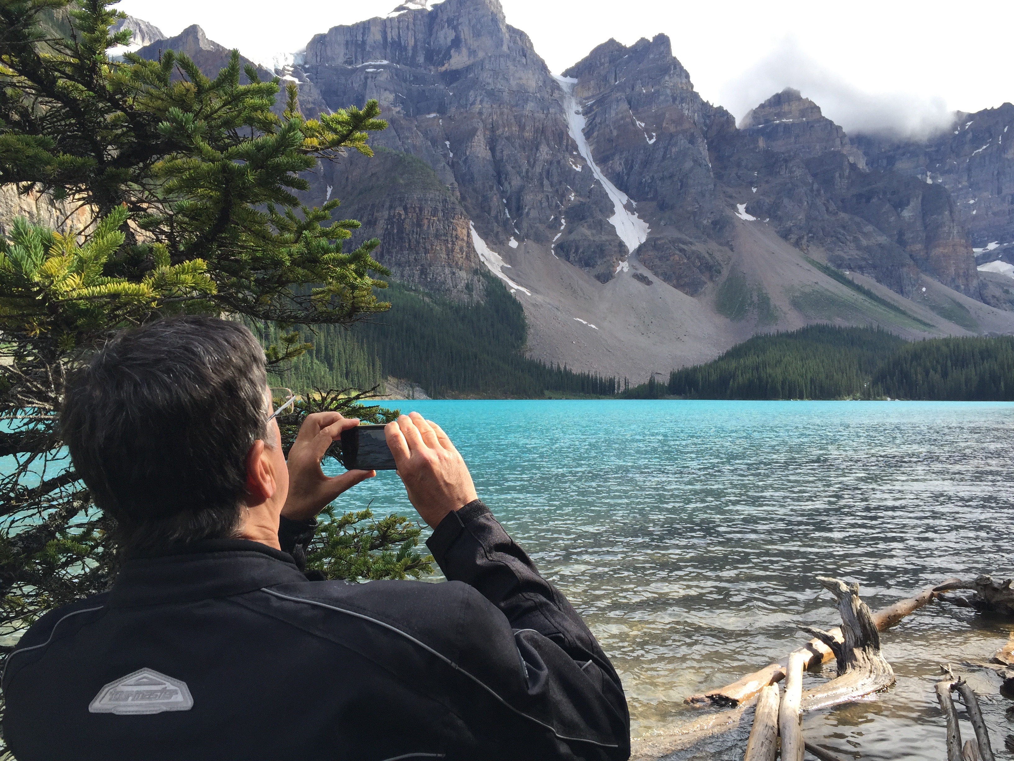
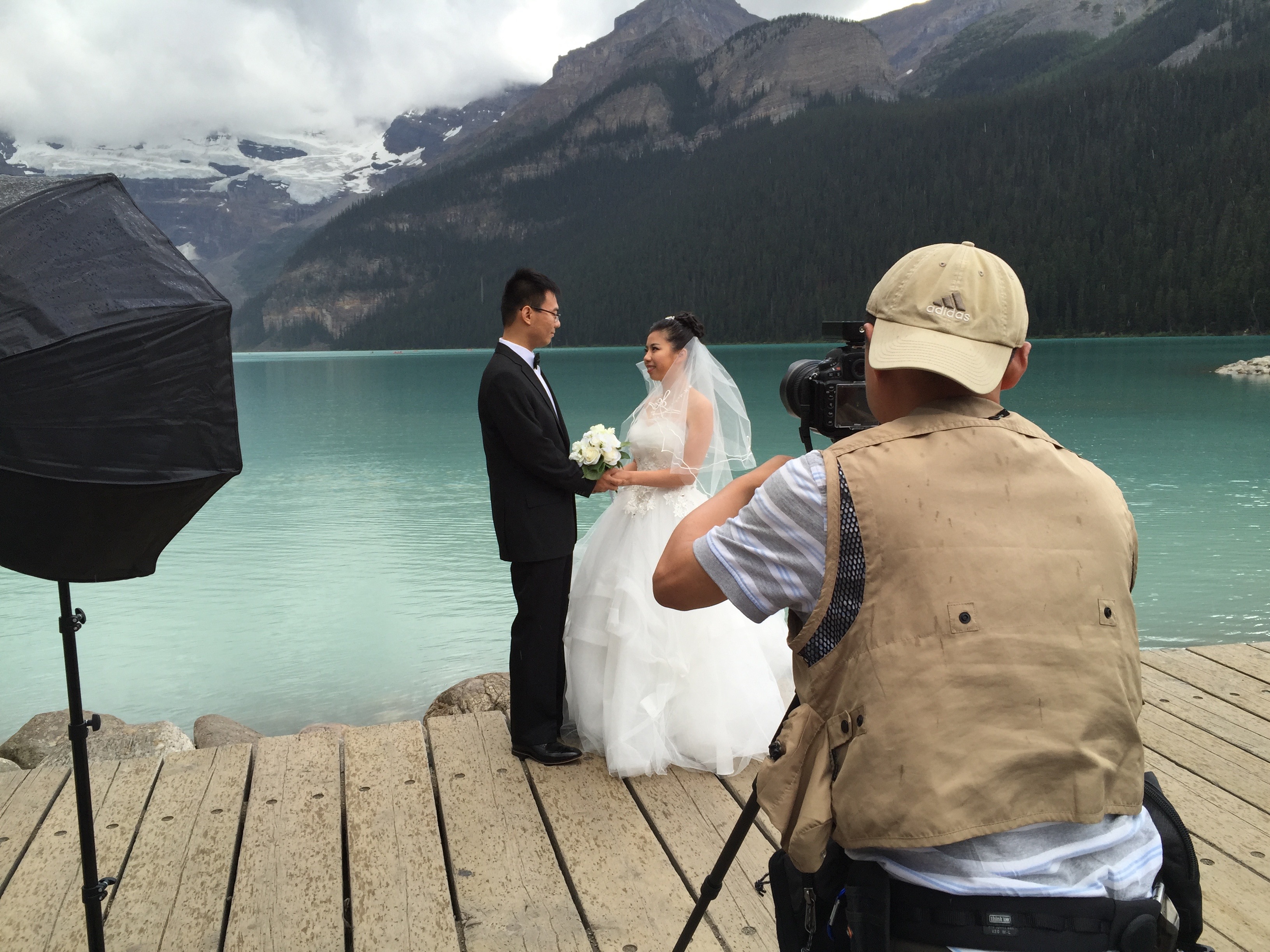
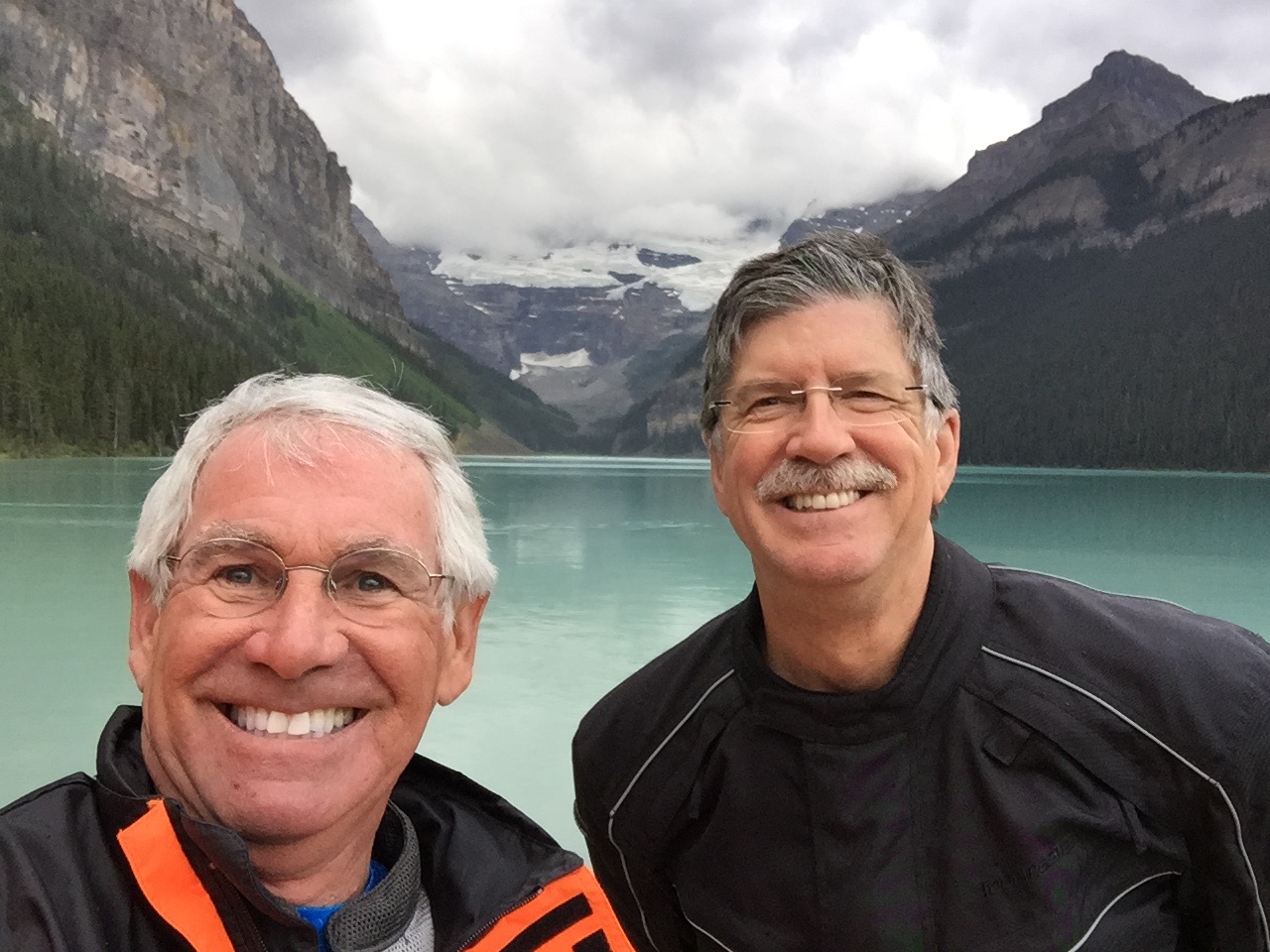
We arrive in Lake Louise, elevation 5,741 feet, around 6 o’clock. Here, you can max out your credit card staying at the Fairmont Chateau Lake Louise, or you can engage in more pedestrian activities like visiting Moraine Lake, one of the most photographed spots in the Canadian Rockies.
Randy, snapping a pic at Moraine Lake.
Moraine Lake, in Banff National Park, is about 10 miles south of Lake Louise. It’s a very popular spot for tourists. The lake’s water is a distinct shade of blue, nearly turquoise, due to the refraction of light off the rock flour deposited in the lake. Rock flour, sometimes call glacial flour, consists of fine-grained, silt-sized particles of rock, generated by mechanical grinding of bedrock by glacial erosion or by artificial grinding to a similar size. The rock flour is so fine that it doesn’t sink to the bottom of the lake. Instead, it remains suspended throughout the water.
The view of the mountains behind the lake is known as the “twenty-dollar view.” It’s really a million-dollar view, but a twenty will have to do: Moraine Lake was featured on the backside of the 1969 and 1979 issues of the Canadian twenty-dollar bill. Visiting Moraine Lake is Number two on Trip Advisor’s list of things to do in the Lake Louise Area.
In Lake Louise, we turn south on Highway 1, Canada’s Trans-Canada Highway, or as the French call it, Route Transcanadienne. The French have a name for everything in Canada. They should; French is one of two official languages in Canada, and is the mother tongue to about 22 percent of the Canadian population. The other? Um, English. French speakers are much more prevalent in eastern Canada, particularly Quebec.
The Trans-Canada Highway travels through all ten Canadian provinces, between the Pacific and Atlantic Oceans. Along with the Trans-Siberian Highway and Australia’s Highway 1, the Trans-Canada Highway is one of the world’s longest national highways.
In all, about 8,000 miles of road are classified as Trans-Canada Highway. The highway may stitch Canada together, but the Canadian federal government is responsible only for sections of highway that pass through national parks; the provinces look after everything else.
From Lake Louise to Banff – today’s destination, the Trans-Canada Highway follows the Bow River, an important source of water for irrigation, drinking water and hydroelectric power generation, primarily for Calgary’s use. Calgary, known for its Stampede that ended on Sunday, is about 100 miles east of Lake Louise.
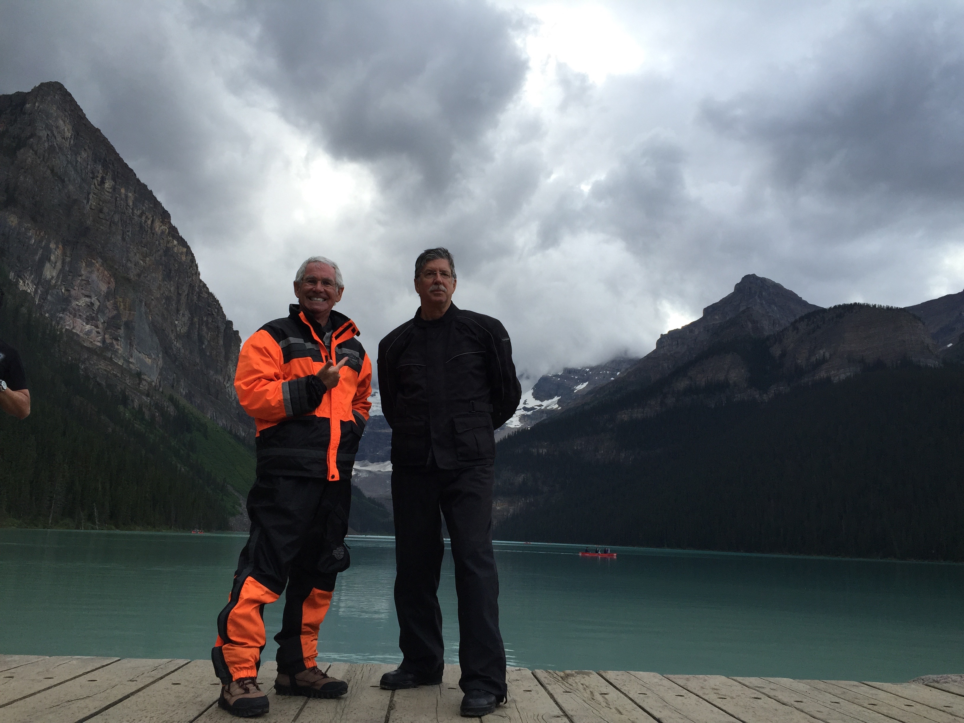
At Lake Louise. These guys are already married.
From Lake Louise, it’s less than an hour’s ride to Banff, which sits at 4,600 feet, near the confluence of the Bow and Spray Rivers. Banff was first settled in the 1880s, after the transcontinental railway was built through the Bow Valley. The area was named Banff in 1884 by George Stephen, president of the Canadian Pacific Railway. Stephen was born in Banff, Scotland, and apparently was fond of his birthplace.
Banff, whose skyline is dominated by the peaks of Mount Rundle (9,675 feet) and Mount Cascade (9,839 feet), is yet another United Nations World Heritage Site. A Banff fun fact: the International Astronomical Union officially adopted the name Banff for a crater on Mars. Get out your telescopes: the crater is at latitude 17.7 degrees north and longitude 30.8 degrees west. Those are Mars coordinates.
We arrive in Banff, ending our 225-mile day, and, like explorers of old, begin foraging for food. Our culinary search ends at at a charming pizza restaurant, where we eat al fresco and enjoy the mountain ambience.
***
Number one attraction in Banff on Trip Advisor’s List of “top things to do:” riding the Banff Gondola ($39.95), which rises to 7,486 feet on the shoulder of Sulphur Mountain.
Number eighteen on Trip Advisor’s list: golf at Banff Springs Golf Course, a Stanley Thompson-designed layout, open from May through October. Banff Springs is owned and operated by the ritzy Fairmont Banff Springs Hotel, which overlooks the course. Banff Springs is open to the public, and you can play it for $239, plus tax.
You go, Jordan!
Speaking of open, a shout-out tonight to 21-year-old Jordan Spieth, who tees off tomorrow morning at the British Open in Fife, Scotland, on the third leg of his quest for golf’s Grand Slam. Spieth begins his round at 9:26 Greenwich Mean Time, Scotland’s time zone. ESPN’s TV coverage begins at 9:00 am local time (1:00 am here in Jasper); if you’re a Jordan Spieth fan with insomnia, you can watch his entire round.
In April, Spieth was a runaway winner at the Masters, and on Father’s Day, he won the US Open at Chambers Bay. Last weekend, he won the John Deere Classic, a celebration of green-hued farm equipment. It was his fourth win this year! And now, he takes on the world’s best golfers at the British Open, referred to by golf purists (snobs) simply as, “The Open.” This week’s event marks the 29th time The Open has been held at the Old Course at St. Andrews, a tradition dating back to 1873.
The Grand Slam, which you also can have for free at Denny’s on your birthday, has never been achieved in a single calendar year.
Our day begins with breakfast at the Strawberry Moose Snackery, a three-minute walk from our hotel. The Snackery is full of locals. We appear to be the only tourists who’ve discovered the place. The sun’s out, a good omen after yesterday’s ride in the rain.
So enamored with the story about how the Yellowhead Highway got its name (think of a blond guy), we decide this morning to follow the road north to the entrance of Mount Robson Provincial Park.
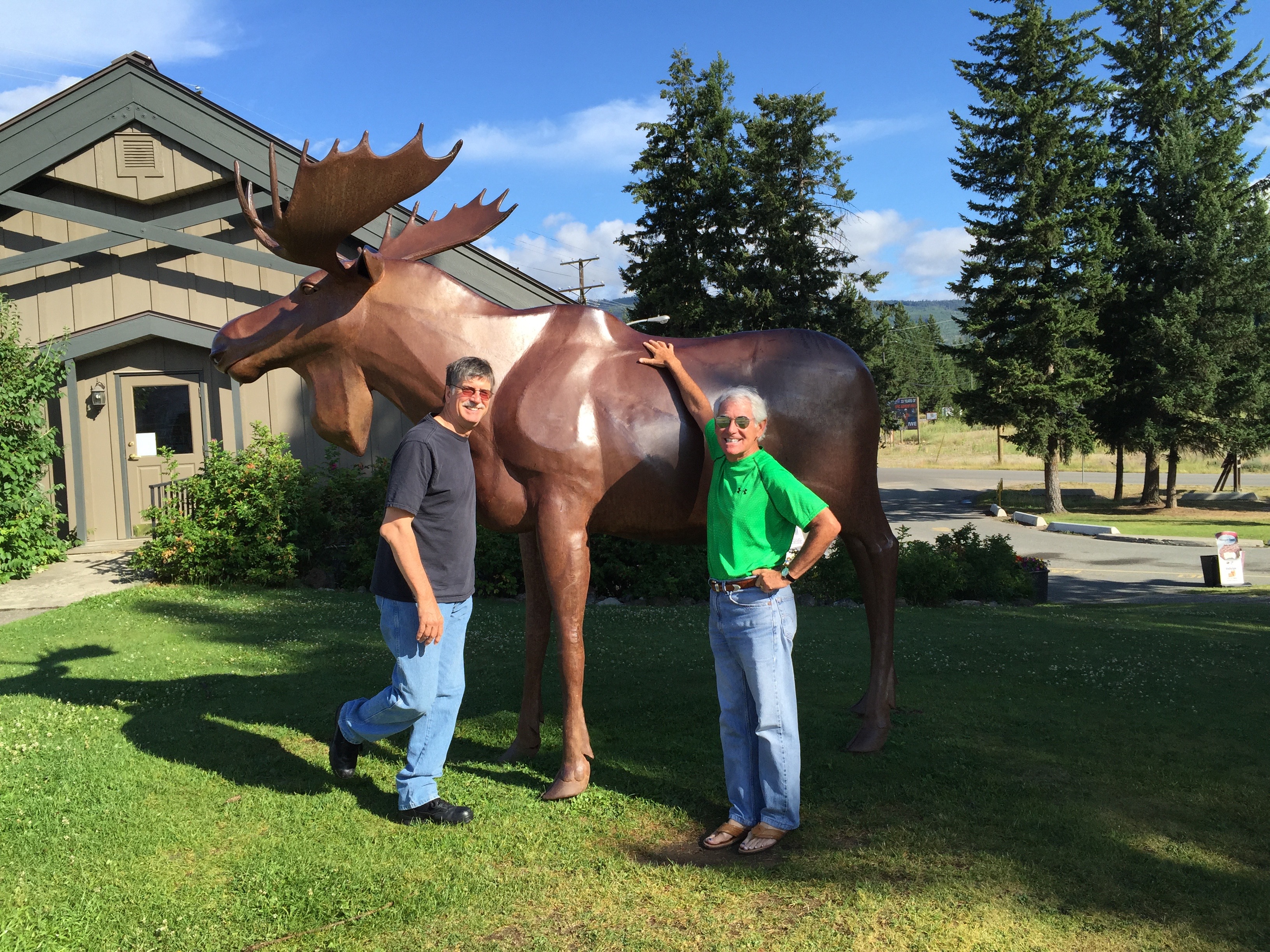
A moose on the loose in Clearwater, British Columbia, after breakfast.
The Southern Yellowhead Highway traces the gentle curves of the North Thompson River most of the way to the village of Valemount, a railway station that’s home to 1,000 residents. Ten miles north of Valemount, we arrive in Tête Jaune Cache, which sits on the Fraser River.
Tête Jaune Cache is at the intersection of the Southern Yellowhead Highway, and the Yellowhead Highway – Canada Highway 16. This settlement of 500 residents is also named after fur trader and trapper Pierre Bostonais (remember him from yesterday’s blog post?). Bostonais was nicknamed Tête Jaune by French explorers because of his blond hair; Tête Jaune is French for yellow head. Cache means “hiding place.”
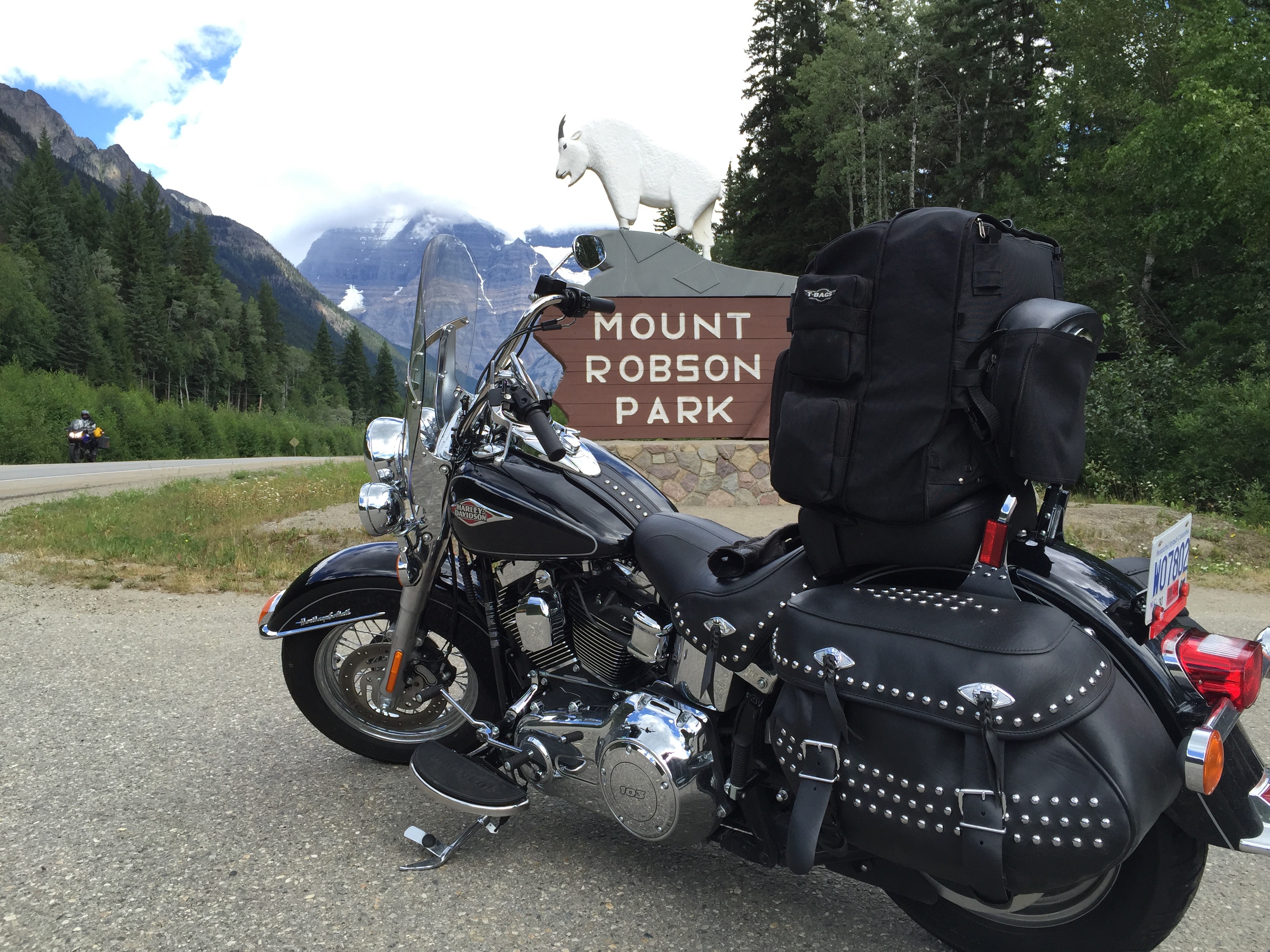
Entering Mount Robson Provincial Park.
And with that, we turn east onto the Yellowhead Highway. We are in Mount Robson Provincial Park, named for Mount Robson, at 12,972, the highest point in the Canadian Rockies (the highest point in Canada is Mount Logan, 19,551 feet high in the Yukon Territory). Mount Robson is one of the most photographed features in the Canadian Rockies. Mount Robson Provincial Park is included within the Canadian Rocky Mountain Parks World Heritage Site, a designation noted by the United Nations.
We will spend the next few days exploring the Canadian Rockies, a mountain range that looks unlike any you’ve ever seen. Unless of course, you’ve been to the Canadian Rockies. First time for me.
The Canadian Rockies span the provinces of British Columbia and Alberta. With jagged, ice-capped peaks, it’s a region of dramatic wilderness, alpine lakes, diverse wildlife and many outdoor recreation sites. National Parks include Yoho, home to Takakkaw waterfall; Jasper, famed for its Athabasca Glacier; and Banff, site of glacier-fed Lake Louise.
This week, we’ll visit all those places, and many other Canadian national and provincial parks.
Randy, checking out his portfolio along the Yellowed Highway.
***
We continue along the Yellowhead Highway, following the Fraser River past Moose Lake and into the province of Alberta. Shortly, we arrive in Jasper, the commercial center of Jasper National Park. Jasper National Park and Robson National Park border each other; it’s a seamless transition between the two.
Jasper, established in 1813, is a Canadian National Historic Site. There’s much to do here in the summer – whitewater rafting, rock climbing, hiking, fishing, golf, bicycling, wildlife viewing. Then, in the winter, Jasper is known for ice climbing, cross-country skiing, ice skating, skiing, snowboarding and other activities taking advantage of the winter whiteness.
Making movies along the Yellowhead Highway.
There are more than 50 hotels, motels, chalets, and bed and breakfast inns in Jasper – among them the famed Jasper Park Lodge and Fairmont Jasper. Jasper is a very popular place for tourists from all over North America – and across the globe. In all, thousands of rooms are available. Except when they aren’t. We thought we may have found the last available room in town, at the Lobstick Lodge.
Join the crowd if you don’t know what a lobstick is. It’s a little-known traditional marker found in the boreal forests of Canada by removing the lower branches of a pine tree. The remaining tuft on the top of the tree makes it conspicuous from a distance. Lobsticks mark trails, portages, sources of food or hunting grounds. Canada loves its lobsticks. At least 18 places across Canada are named after the lobsticks that once stood there – including towns, bays, creeks, islands, lakes and rivers. Woo-hoo, eh!
Historically, Canadians have also used lobsticks as cultural markers, to signify meeting places, burial grounds, ceremonial sites or as personal totems. In 2012, Saskatchewan historian and writer Merle Massie called for the lobstick to be added to Canada’s list of biopolitical symbols. In her words, “I like how the lobstick is both natural (a tree) and culturally modified (shaped, changed, adapted, marred or scarred) – in many ways, a fitting symbol of Canada itself.”
Dinner at Earls in Jasper.
Here’s some late-breaking news: at the last minute, a less expensive room has just opened up at the nearby Maligne (“muh-LEEN”) Lodge, a block from the Lobstick Lodge. As this is a guy trip, we settle for the cheaper room at the Maligne Lodge and cancel our lobstickness, so all the explanation about lobsticks, as it turns out, may have been unnecessary. But the process of the Lobstick Lodge booking taught me a new word. Bottom line: we saved money and increased our vocabulary. What could be better?
Maligne Lodge, by the way, is named after Maligne Lake, not far from here in Jasper National Park. Finally, you need to know where the word maligne comes from. It comes from the French word for malignant, or wicked. The name was used by Father Pierre-Jean de Smet in the mid-1800s to describe the turbulent river that flows from the lake in the spring. The name soon spread to Maligne Lake, Maligne River, Maligne Canyon, Maligne Pass, Maligne Mountain and the Maligne Range. How wicked!
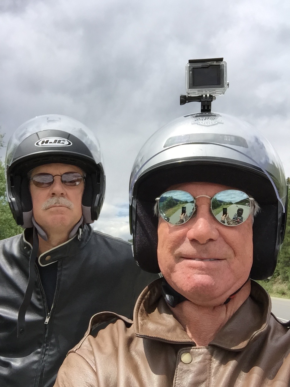
Every year, this blog elicits eager comments from wanna-be riders. The basis for their enthusiasm: Gary Lesser rides a Harley; how hard could it be?
There are a lot of you out there who apparently think the vroom-vroom life on the road is worth trying.
“Hey, I’d like to ride with you,” some blog readers tell me.
Always open to new adventures, I welcome their interest. “Great,” I say. “Do you have a bike?”
One such would-be rider is my old friend, Randy Suhr, who expressed his fanaticism last summer, after I completed an 18-day journey through the Colorado Rockies. Randy’s answer to my do-you-have-a-bike question: “Nope, I sure don’t.”
That took care of that.
Until February of this year, when Randy jumped in with both feet and bought a 2006 Yamaha V Star, a 650cc V-twin. It’s his first motorcycle since the 1970s, when he was young and crazy, as we all were back then. Since February, he’s endured damp, gray Seattle days, getting reacquainted with the mechanics of riding: balance, coordination, safety, judgment, situational awareness, and a little chutzpah thrown in for good measure.
So far, Randy’s specialized in baby steps – day trips of an hour or two.
Now, after a thousand miles of prep work, he’s ready to ride.
***
Gary, Randy, and the F-150 Trash Hauler that will take us to Canada, eh?
Our journey begins this morning at a Starbucks, a block off of I-5 in Lynnwood, Washington, just north of Seattle. In addition to providing caffeinated stimulants for the Millennial Generation, Starbucks is the rendezvous point on our way north from the Puget Sound area. I’m coming from Snohomish. Randy arrives from Poulsbo, a Scandinavian-themed city on the Kitsap Peninsula, where he and his wife, Jo, are remodeling an old family home.
Passports in hand, we head for Canada.
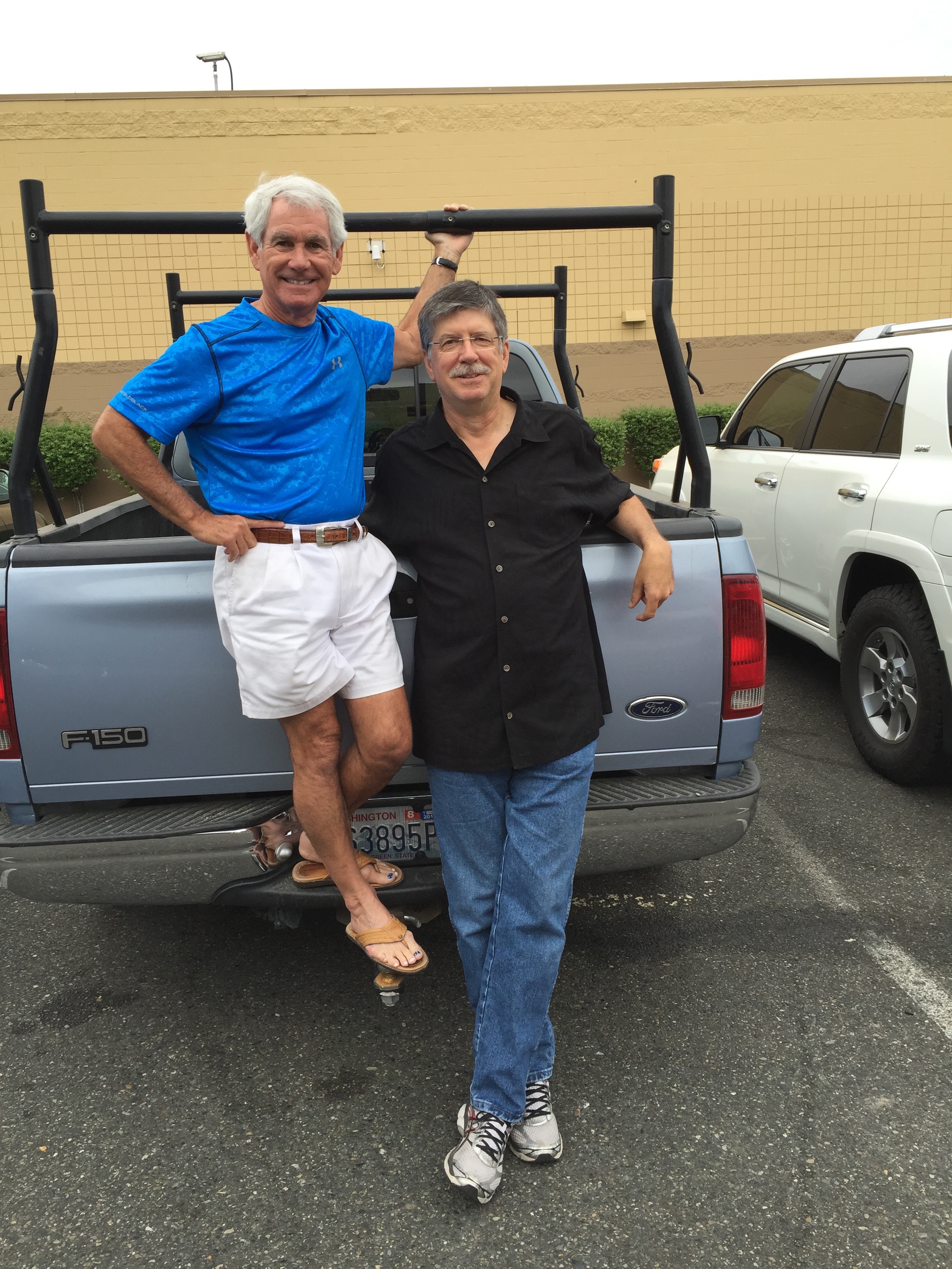
First, let me introduce you to Randy. We’ve known each other since 1983, when I was a TV news producer at KOMO-TV in Seattle, and he was a director. I structured the nightly newscast, selecting what stories appeared in what order, defining the “look” of the show, coordinating with live crews in the field. Randy worked with the technical team, giving birth to my vision.
Restless after rising to the top of his profession in Seattle, Randy headed south for Los Angeles, the second-largest TV market in the US. There, he directed news programming at KNBC – a long, long way from his childhood home in Republic, Washington, population 1,073. In his spare time while working for NBC in Burbank, Randy tried to break into the film business – a long-time dream of his. It’s a tough road, where success is often based more on cronyism than merit.
Randy worked on a number of films, including Star Trek IV: The Voyage Home, Grumpy Old Men, and Smoke Signals. He hung out with such Hollywood luminaries as Jack Lemmon, Walter Matthau, Ann-Margret, William Shatner and Leonard Nimoy. The last 15 years of his career – until his retirement in 2014 – were spent primarily as a first assistant director on various TV sitcoms, including Everybody Loves Raymond (141 episodes) and The New Adventures of Old Christine (88 episodes). Yes, Randy knows Ray Romano and Julia Louis-Dreyfus on a first-name basis.
Randy worked on 141 episodes of what he calls “ELR.”
At one time, Everybody Loves Raymond had 24 million viewers in a week, and The New Adventures of Old Christine 15 million. That’s quite a few more eyeballs than watched the Seattle newscasts Randy and I worked on.
After retiring, Randy and Jo (she also worked at KOMO in the 1980s), sold their house in Van Nuys, California, and moved back to the Seattle area. They now split their time between Poulsbo and a townhouse in Phinney Ridge, near Seattle’s Green Lake and Woodland Park Zoo. They’re remodeling the Phinney Ridge home, too. Randy and Jo should host a do-it-yourself home improvement show on HGTV!
***
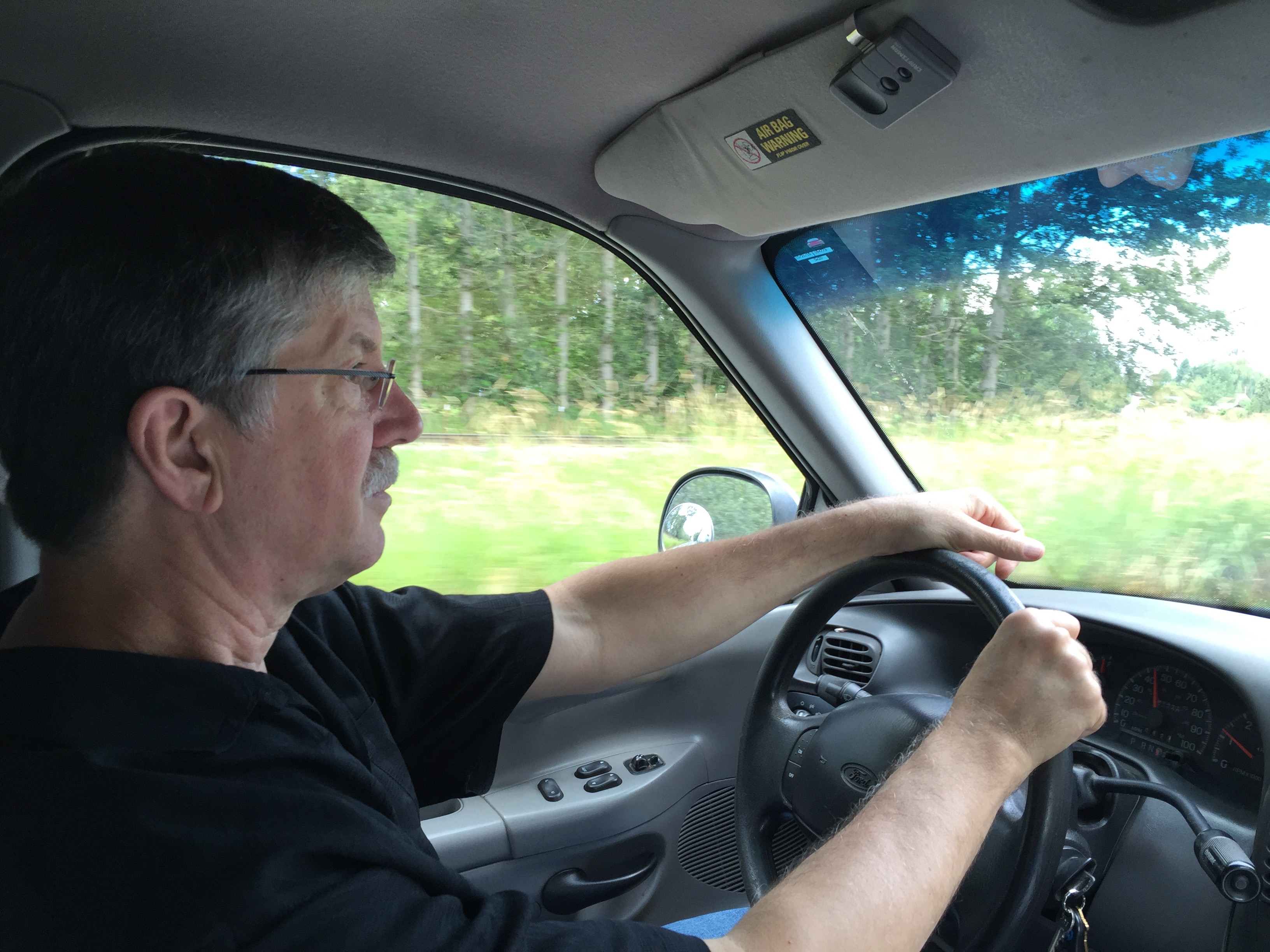
I grab my motorcycle gear – helmet, pack, footwear, Garmin navigation unit – and jump in Randy’s 1998 Ford F-150 pickup truck. He says it’s a good solid trash hauler. I don’t take that personally.
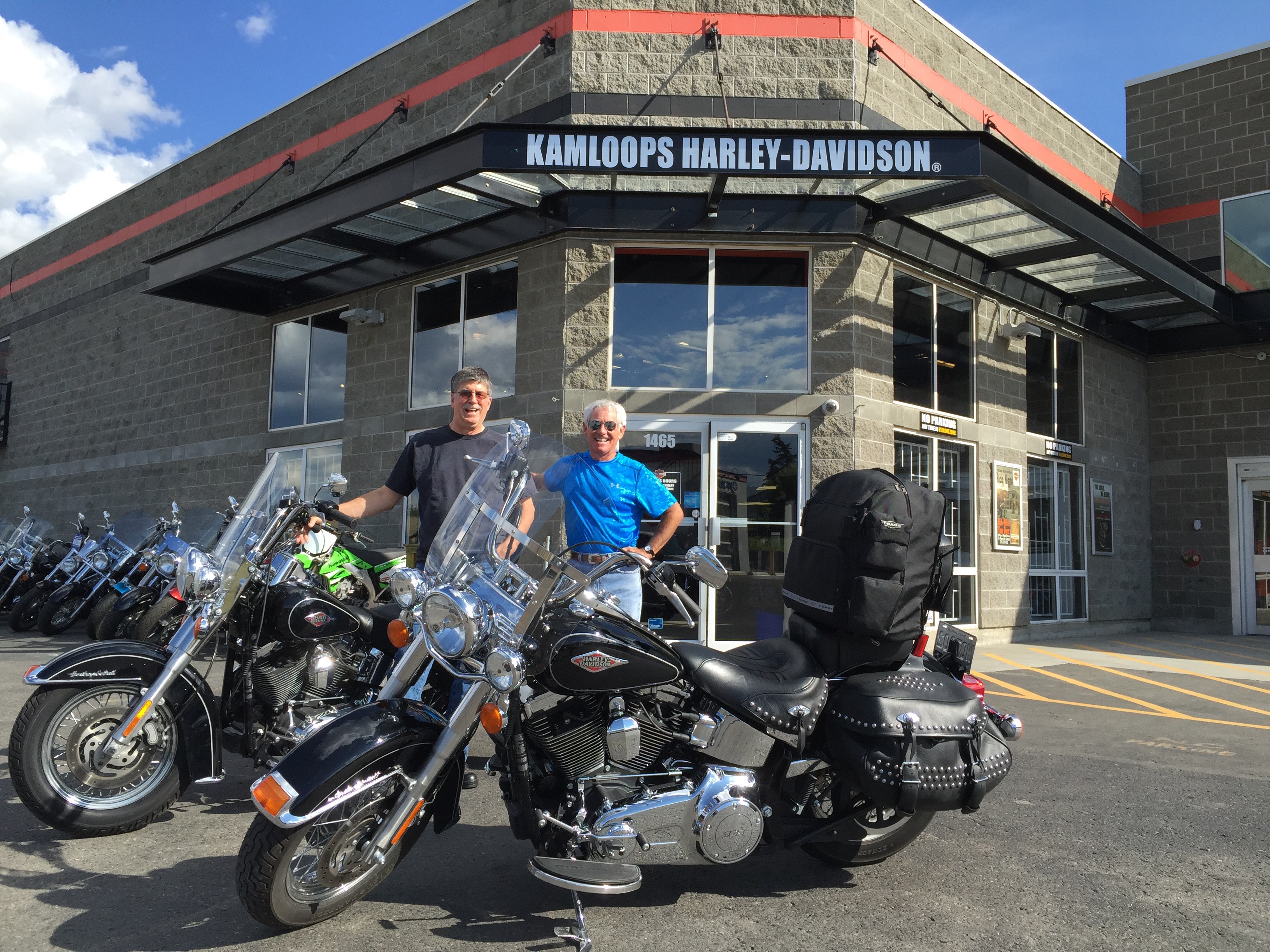
Today, the F-150 will haul Randy and me north for the 270-mile drive to Kamloops, British Columbia. There, we will rent a pair of Harley Davidson Softail Heritage Classics – just like mine, only 15 years newer. We plan to ride the Canadian Rockies until Friday. It’ll be Randy’s introduction to Harley life on the road.
Driving the Trash Hauler through Whatcom County, en route to Canada.
As we catch up on things – I haven’t seen Randy for a few years – we drive north on I-5 through Bellingham, and turn east on Highway 542, the Mount Baker Highway. Eventually, we arrive in Sumas (pronounced SUE-mass), Washington, a tiny town in Whatcom County, where we’ll cross the international border into Canada.
A mile north of the border, just south of Abbotsford, British Columbia, we turn east on the Trans-Canada Highway and continue toward Kamloops, about 170 miles away. Our path takes us along Canada’s mighty Fraser River, British Columbia’s longest river. It flows for more than 850 miles, from the Canadian Rockies into the Strait of Georgia in Vancouver.
The river is named after British fur trader and explorer Simon Fraser, who, in the early 1800s, charted much of what is now British Columbia. His exploration was partly responsible for the US-Canadian boundary later being established at the 49th parallel. OK, the War of 1812 played a role, too, but that’s another story for some other Harley rider’s blog.
Once in Kamloops, we fill out paperwork, familiarize ourselves with understanding Canadian and Canadians (they’re a lot like Americans, eh?), and transfer our bike gear from the F-150 onto the Harleys.
By now, it’s nearing 5 pm. And the fun is just beginning.
***
All set to ride. Two identical Harley Heritage Softail Classics.
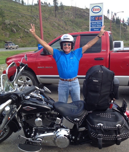
From Kamloops, we follow Highway 5 north, riding along the North Thompson River. The river is the largest tributary of the Fraser River. The Thompson was named by Simon Fraser in honor of his friend, explorer David Thompson.
We’re on the Southern Yellowhead Highway, which in 75 miles brings us to the town of Clearwater, British Columbia – tonight’s destination. Like most similarly named towns, Clearwater is named for its, um, clear water. The town got its name from explorers who rafted down the North Thompson River in 1862. As they arrived at the mouth of what is now the Clearwater River, they noted its distinct clarity compared to the muddy North Thompson. They called it, simply, Clear Water. Et voilà!
And while we’re doing place name etymology, the Yellowhead highway that brings us into Clearwater is named for the Yellowhead Pass, a mountain pass across the Continental Divide through the Canadian Rockies. We’ll visit Yellowhead Pass tomorrow.
It’s believed that Yellowhead Pass was named for Pierre Bostonais, whose nickname was “Tete Jaune,” French for yellow head. This wouldn’t make much sense at all, except that Bostonais’ yellow head nickname was a result of his blond hair. Bostonais was a trapper who led one of the first expeditions for the Hudson’s Bay Company to what is now the interior of British Columbia. I can only imagine my good friends will now start referring to me as gris jaune. Look it up.
En route to Clearwater, British Columbia.
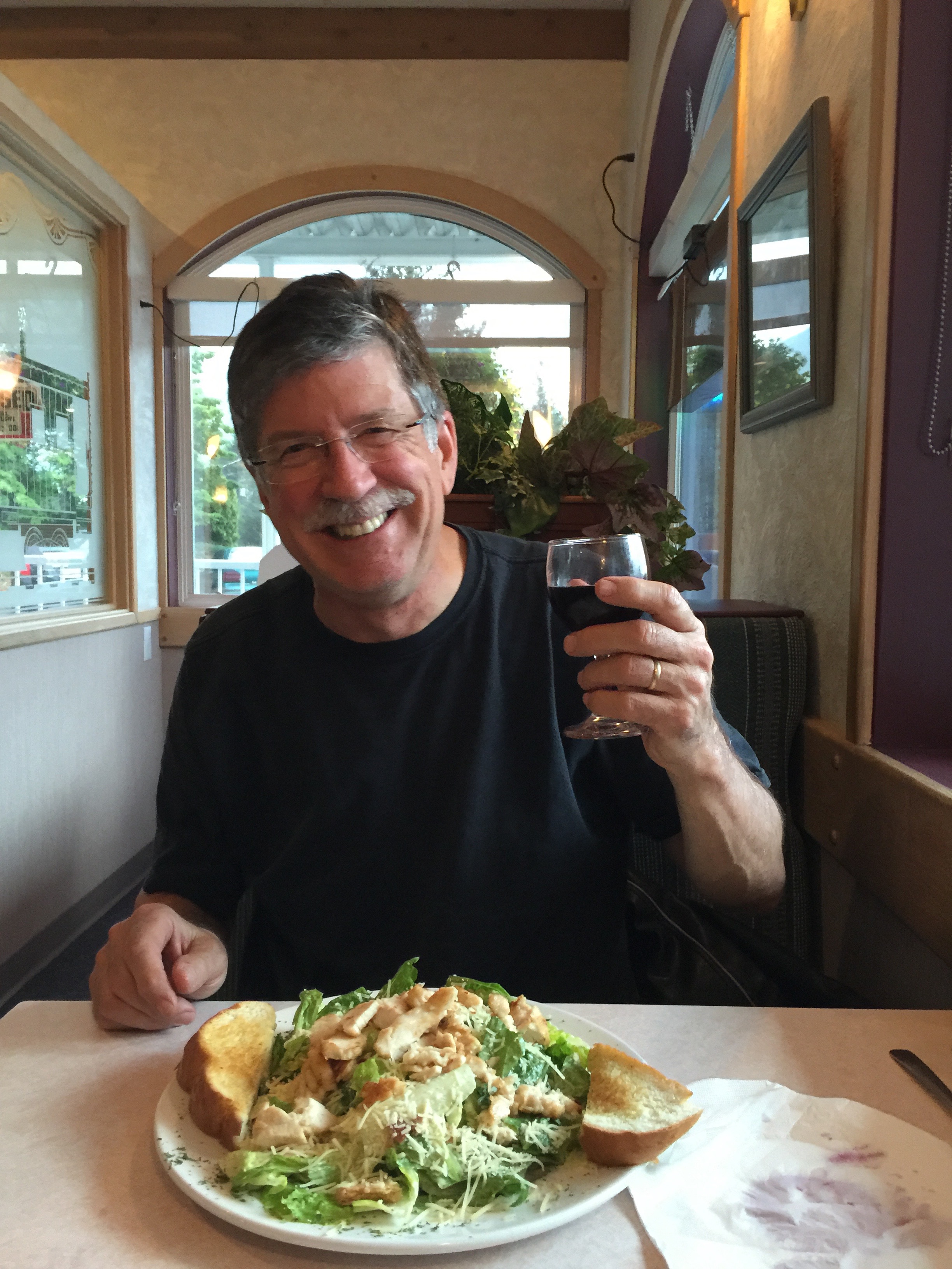
We arrive in Clearwater, British Columbia, about 7:00 pm. Clearwater sits at nearly 52 degrees north latitude, so the days are quite long here in the Great White North, a term made famous by the Mackenzie brothers of SCTV renown.
We have plenty of daylight, at least enough to find the motel and walk to dinner.
At dinner, we’re still drying out. We rode the last 30 minutes into Clearwater in a steady rain. Not much going on in Clearwater. With a population of 2,331, Clearwater’s workforce is predominantly employed by the forest industry. Those who don’t work with trees are probably in the tourism business. Wells Gray Provincial Park, a 1.3 million-acre wilderness park, is just north of here.
Day One of our journey is a success. A short, but good ride on the Harleys. A long drive in the F-150.
Dinner at the Old Caboose Restaurant in Clearwater. Cheers.
Tomorrow, we explore the Canadian Rockies!
***
I look forward to having you along for the ride over the next four days – and I welcome your feedback on this blog (“Travels With Harley”). Feel free to comment on the photos, the French translations, the writing, the history lessons – whatever. You can make your comments directly on the blog, or if you’re a private person, you can send your thoughts to me by email.
If, as you read the blog between now and Friday, you happen to learn anything, you’re welcome!