***
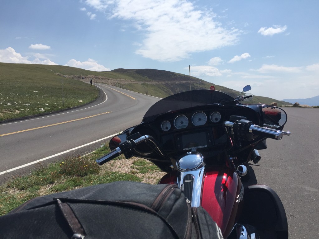
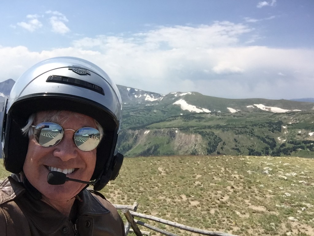
I’ve ridden Trail Ridge Road six times, and once, continued on to Mount Blue Sky (formerly Mount Evans) in the same day. This ride combined the highest paved road in North America (14,265 feet) with the highest continuously paved road in the US (12,183 feet). Talk about a Rocky Mountain High! It was a 133-mile thrill ride.
Trail Ridge Road, US Highway 34, begins in Grand Lake, Colorado, winds its way for 48 miles through Rocky Mountain National Park, and ends in Estes Park, Colorado.
It took the Civilian Conservation Corps from 1929 to 1932 to build the road, because heavy snows kept them from working more than three months a year.
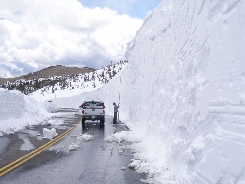
As you might guess, it’s closed during the winter. Trail Ridge Road usually opens in late May, and closes around Columbus Day in October, when the National Park Service gives up fighting the snow and turns the road back to Mother Nature for the winter.
National Park Service plow operators normally begin clearing the snow in mid-April, when crews from the west side of the park and crews from the east side of the park eventually meet at the Alpine Visitor Center — 11,796 feet above sea level. That Visitor Center is the highest in the National Park System. It’s not easy being a snowplow operator on this road; snowdrifts are often up to 22 feet deep.
Rocky Mountain National Park has more than 100 peaks above 10,000 feet. The “10ers” are so common you almost don’t even notice them. The park has nearly 60 peaks above 12,000 feet.
Sixteen miles into the park, after a series of steep switchbacks, you’ll arrive at 10,759-foot Milner Pass. It sits on the Continental Divide.
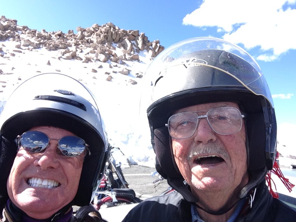
I’ve ridden Trail Ridge Road West to East twice, and East to West three times. The day I did Trail Ridge Road and Mount Blue Sky back-to-back, I began in Grand Lake and rode West to East. That ride was with Ray Sanders, who — at age 84 — realized he was nearing the end of his riding days, and believed he had one last journey left in him. Ray wanted to ride Trail Ridge Road one last time, and he rode all the way out from Tennessee just to do it.
With a maximum elevation of 12,183 feet near Fall River Pass, Trail Ridge Road is the highest continuous paved road in the U.S. A continuous paved road is one that doesn’t simply doesn’t end at a summit, resulting in a turnaround to head back down. The road is considered continuous because it, um, continues.
For comparison purposes, the highest continuous paved road in the world is the Karakoram Highway, connecting China and Pakistan through the Khunjerab Pass in the Karakoram mountain range. The highway opened to the public in 1986; it reaches 15,397 feet in elevation. In recent years, the Karakoram Highway has become an adventure tourism destination, providing the pathway to expeditions for almost all peaks in Gilgit-Baltistan, including 28,251-foot K2, the Earth’s second highest mountain.
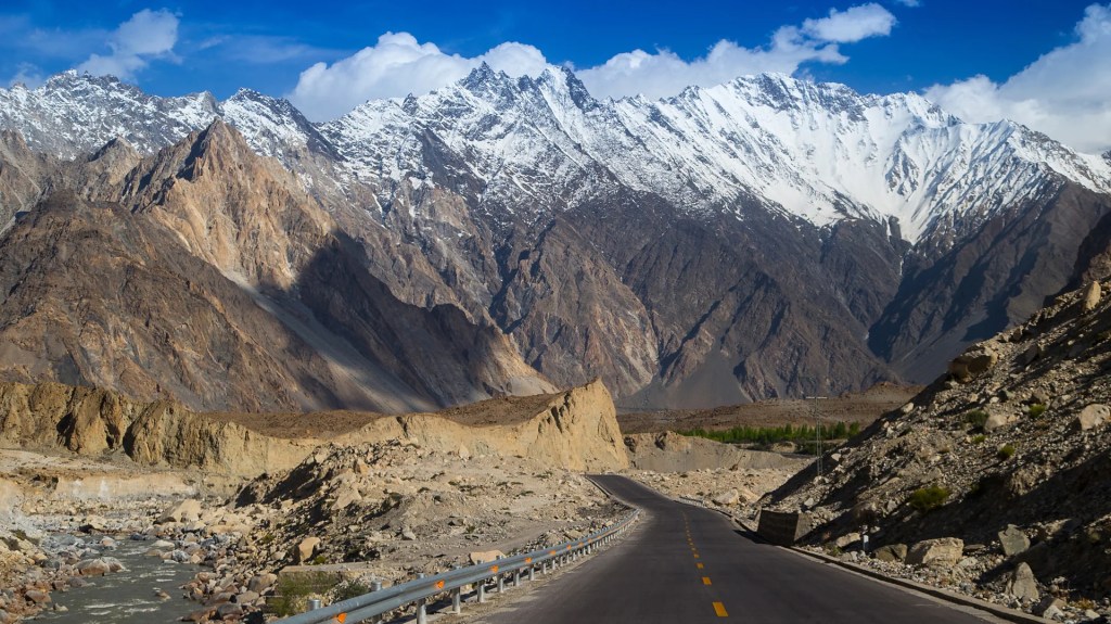
Because of its high elevation and extremely difficult construction, the Karakoram Highway is sometimes referred to as the Eighth Wonder of the World. The highway took 20 years to complete – and in the process, more than 800 Pakistanis and 200 Chinese workers lost their lives.
From the Kawuneeche Visitor Center at the entrance to Rocky Mountain National Park, Trail Ridge Road follows the North Fork of the Colorado River through the Kawuneeche Valley.
The road takes you through Rocky Mountain National Park. The park headquarters, Beaver Meadows Visitor Center, is a National Historic Landmark, designed by the Frank Lloyd Wright School of Architecture at Taliesin West in Scottsdale, Arizona.
You’ll arrive in Estes Park at the eastern end of Rocky Mountain National Park. The town is named after Missouri native Joel Estes, who founded the community in 1859, then moved his family there four years later.
From Estes Park, to get to your next destination — Mount Blue Sky — you head south on Colorado Highway 7 for about 20 miles. To your right, you can see Longs Peak, at 14,255 feet, the highest peak in Rocky Mountain National Park.
You continue on Colorado Highway 72, also known as the Peak to Peak Scenic Highway. Established in 1918, it’s Colorado’s oldest Scenic Byway. Its curvy road winds through the Arapaho National Forest, and the Indian Peaks Wilderness Area.
Eventually, you arrive in Central City, known for being Colorado’s gambling mecca, turn on to I-70 East, and a few miles later exit the interstate in Idaho Springs. From here, you turn onto Colorado Highway 103, which takes you in the direction of one of Colorado’s 58 14ers — Mount Blue Sky.
From here, it’s only 28 miles to the Mount Blue Sky parking lot.
The mountain was originally named Mount Evans after John Evans, second governor of the Colorado Territory from 1862 to 1865. In 2023, it was renamed Mount Blue Sky. There has been a renaming process underway for years to strip former Governor Evans’ name from the peak. Evans, who served as territorial governor from 1862 to 1865, was forced to resign in disgrace for his role in the 1864 Sand Creek Massacre, a deadly attack on Native Americans that led to the deaths of more than 230 Cheyenne and Arapaho people, mostly women, children and older adults.
In November 2022, the Colorado Geographic Naming Advisory Board in November voted unanimously to change the name to Mount Blue Sky, a move supported by officials in Clear Creek County, Governor Jared Polis, and many Native American tribe leaders and members who participated in the renaming process. Polis, in his recommendation to change the mountain’s name, said “each of the 14,000-foot peaks in Colorado deserves a name befitting their majesty.”
Mount Blue Sky rises to 14,265 feet, and dominates the Denver metropolitan area skyline, rising 9,000 feet above the Mile-High City. Mount Blue Sky is 31 miles west of Denver, as the crow flies. Trip Advisor identifies 135 attractions in the Denver area, and ranks Mount Blue Sky at the very top of the list.
Thirteen miles of climbing on CO-103 takes you past Echo Lake Park, where you turn onto Colorado Highway 5 for another 14 miles, as you appear to be riding directly into the sky.
You are now on the Mount Blue Sky Scenic Byway, riding toward the top of Mount Blue Sky. The road takes us within 135 vertical feet of the summit. The parking lot is that close to the summit.
As you might expect, the Mount Blue Sky Scenic Byway is strictly a summer-time ride. The road generally opens around Memorial Day; the Colorado Department of Transportation closes the top five miles after Labor Day, and shuts down the rest of the road after the first “significant snowfall,” or the first weekend in October — whichever comes first.
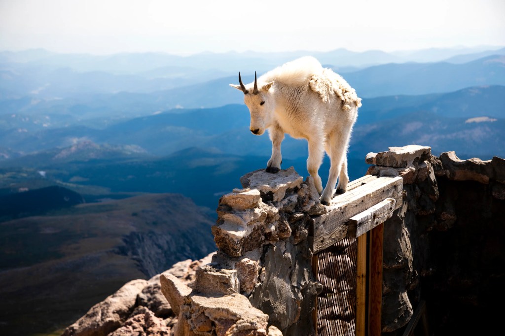
From Mount Blue Sky, the view is breathtaking.
And the air is thin. There’s considerably less oxygen up here than most of us are accustomed to. About 20 percent of people will experience symptoms of altitude sickness above 8,000 feet. There’s a big sign near the summit of Mount Blue Sky, warning of the risks of altitude sickness.
Acute Mountain Sickness is the most common unhealthy response to altitude. It’s a collection of signs that your body is becoming ill and has not adapted successfully to a higher altitude. Symptoms include fatigue, dizziness, loss of appetite, nausea or vomiting, confusion, and difficulty walking. The single most important factor in reducing forms of altitude sickness is descending toward sea level.
From the top of Mount Blue Sky, you work your way down Colorado Highways 5 and 103, and back to Idaho Springs, where you’ll re-join I-70. There are any number of towns you can go to from here to overnight — Georgetown, Silverthorne, Frisco. Wherever you end up tonight, it will have been an incredible ride, one only possible in Colorado.
To explore this route, click here.
