****
US Highway 550 from Durango, Colorado, to Ouray, is where you’ll find the Million Dollar Highway. I’ve ridden this spectacular road six times, three times from South to North (Durango to Ouray), and three more from North to South.
In all, it’s 70 miles each way, with a nearly mandatory side trip to the historic town of Silverton.
Below, I’ll describe the ride, South to North, beginning in Durango.
Durango is named after Durango, Mexico — which was named after Durango, Spain. All three Durangos are sister cities. The word Durango originates from the Basque word “Urango,” meaning “water town.” Durango sits on the Animas River at an elevation of 6,500 feet.
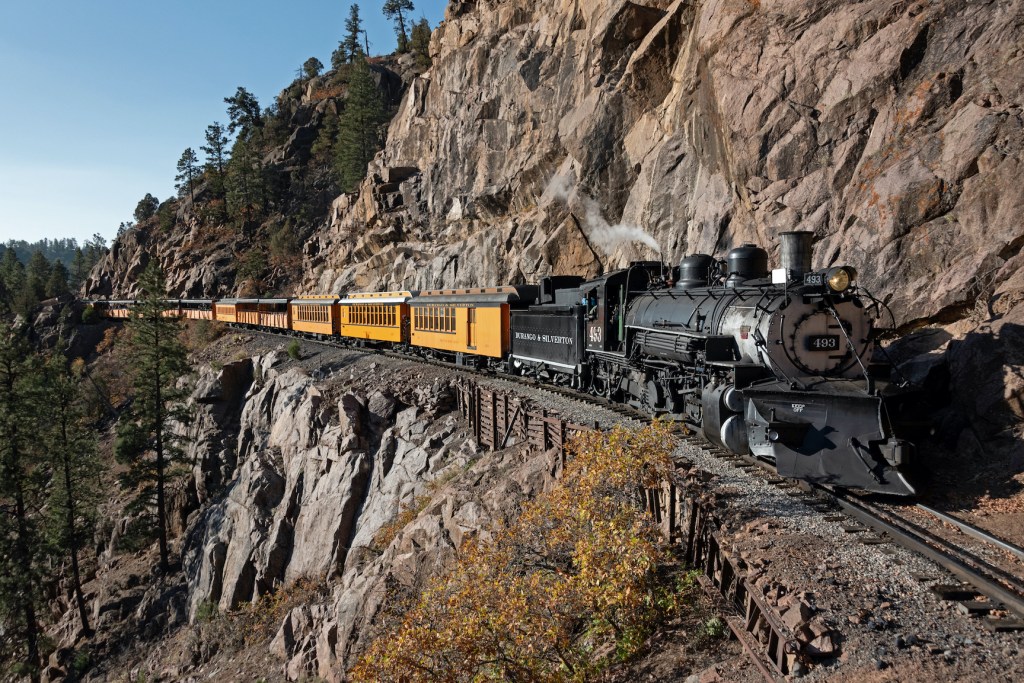
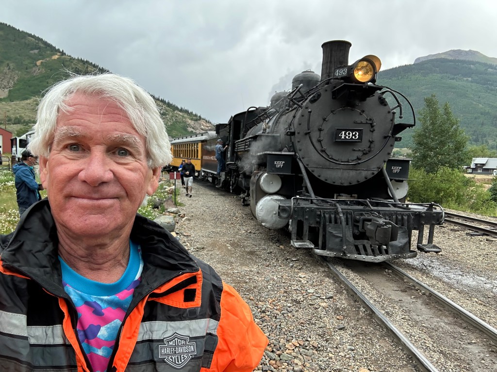
The city was founded in 1879 by the Denver & Rio Grande Railway. The railroad arrived in 1881, constructing a narrow-gauge line to haul passengers and freight to Silverton — and to transport silver and gold ore from the San Juan Mountains. The historic train has been in continuous operation since 1882. For $85, you can board in Durango for the 3 ½ hour, 45-mile ride to Silverton. There, you’ll relax for 30 minutes before the return trip begins. The train’s top speed is 18 miles an hour.
Leaving Durango, you head north on US Highway 550, which will take you all the way to Ouray.
You’ll be on the San Juan Skyway, another of Colorado’s designated Scenic Byways. Eleven of Colorado’s 26 byways are designated as “America’s Byways,” giving Colorado more national designations (America’s Byways) than any other state. The Colorado Scenic and Historic Byways Program is a statewide partnership designed to provide recreational, educational and economic benefits to Coloradans and visitors. Sponsors include Colorado’s Departments of Tourism and Transportation.
These byways even have a motorcycle skill rating map, providing a useful tool to help riders decide whether they have the skills needed for these often-challenging roads. The “ride difficulty levels” are rated Easy, Moderate or Difficult.
Easy roads are suitable for beginning riders, with gradual grades and gentle curves. Difficult roads require advanced riding skills, have steep grades and sharp, technical turns.
This road is part of the San Juan Scenic Byway, and it’s considered Difficult. Very Difficult.
About 25 miles from Durango, you’ll pass by the Durango Mountain Resort, sometimes known by its former name, Purgatory. The name Purgatory comes from Purgatory Creek, which runs through the area — and from Purgatory Flats, today the location of the ski area’s base. The ski resort’s base is at 8,793 feet; its peak is 10,822 feet.
Legend has it that the Purgatory name comes from miners who were trying to get from Durango to the prosperous mines in the Silverton area. They had to pay 50 cents to use the toll road. Miners who couldn’t afford the toll were stuck in the area, which became known as Purgatory Flats. They couldn’t afford to get up the mountain, but couldn’t see themselves quitting and going down, either. Now that’s purgatory.
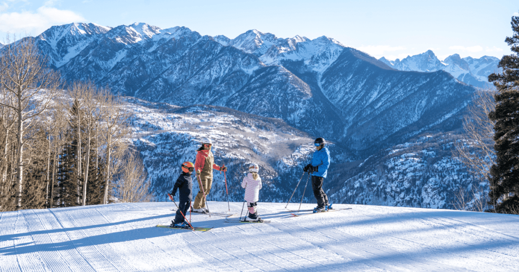
On your way north, you’ll see the spectacular nature of Colorado’s Rockies. With the exception of California’s Mount Whitney (14,505 feet), the Rockies have the tallest peaks in mainland North America, the highest of which is Mount Elbert at 14,433 feet.
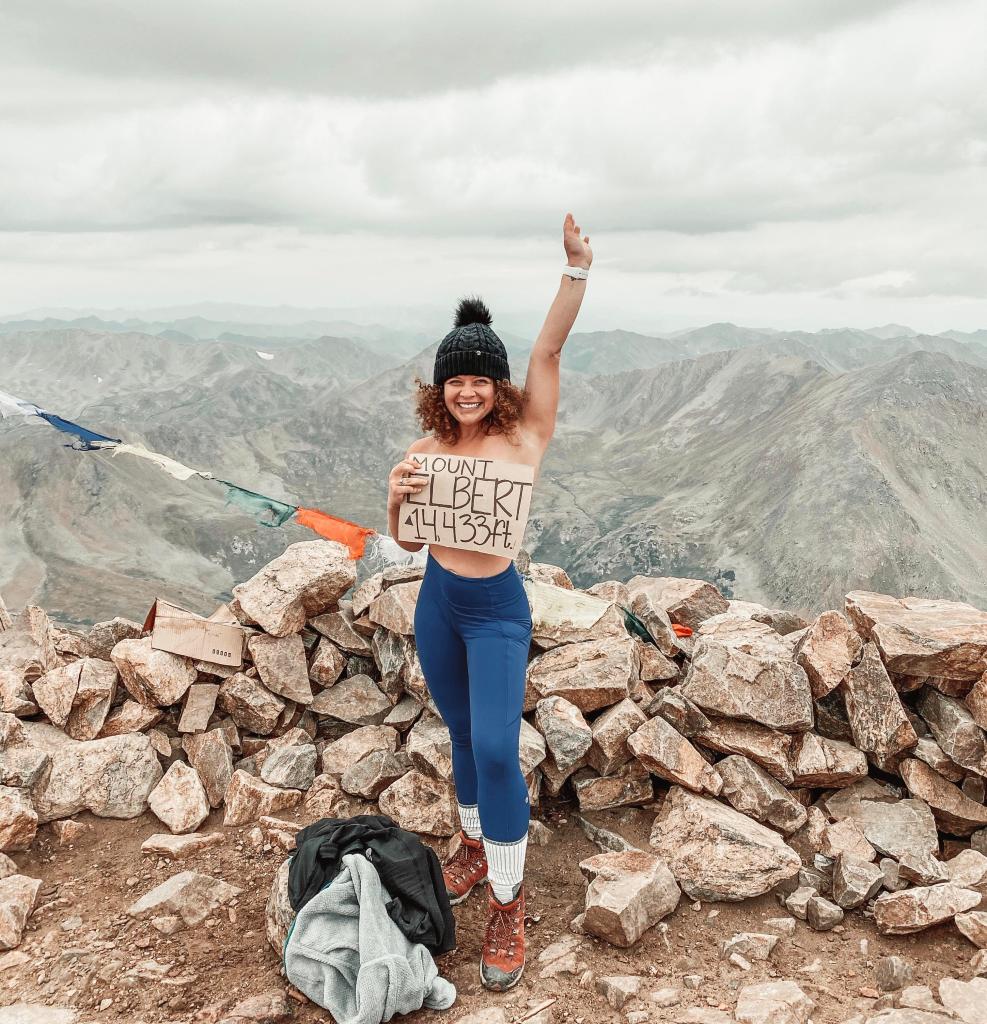
Colorado has 58 mountain summits that are 14,000 feet or higher. They’re known as the 14ers.
A few miles to the east is Mount Eolus, at 14,083 feet – actually the 32nd-highest of the 14ers. Close by are Sunlight Peak (14,059 feet) and Windom Peak (14,082 feet). After a while, you almost become blasé about 13,000-foot peaks. Colorado has 637 of them, way too many to mention, but hugely impressive, nonetheless.
The Rockies are a haven for snow-addicted thrill seekers. Some have climbed all 54 of the 14ers. Chris Davenport thought that wasn’t difficult enough, so he decided to climb up, then ski down all the 14ers. If you’ve got the time, check out his adventure.
About halfway from Durango to Ouray, you’ll ride over Coal Bank Pass, which sits at 10,640 feet. Its name refers to the area’s rich mining history.
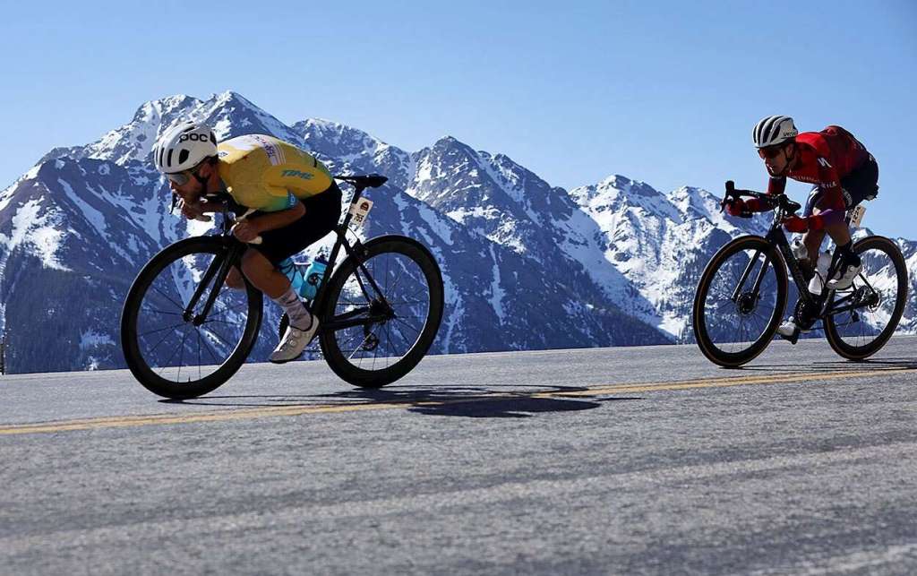
Twenty miles past Coal Bank Pass is Molas Pass, 10,910 feet. Molas Pass is the second and last mountain pass in the Iron Horse Bicycle Classic, where bikes race a train up the mountain from Durango to Silverton. Every May, over Memorial Day weekend, since 1972 — it’s a big test of man versus machine. In the event, cyclists race over mountain passes to beat the steam engine train – the Durango and Silverton Narrow Gauge Railroad, which runs the same route. To beat the train, cyclists need to cover the 47 miles in less than three and a half hours. Thousands of riders, professional and less so, show up for the event from all over the country. It’s quite the party.
From Molas Pass, it’s only seven miles to Silverton, a former silver mining camp, now designated a National Historic Landmark District — and the only incorporated municipality in San Juan County.
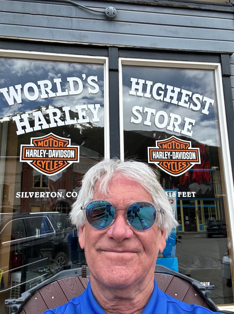
Silverton, at 9,318 feet, is home to the world’s highest Harley Davidson store. The store draws quite a few Harley riders, including us. “They want the T-shirt,” said store owner Jeff Murray, “and the only way they can get it is to come to Silverton.”
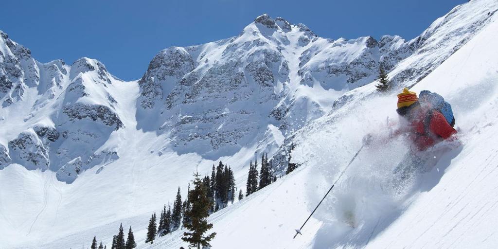
Nearby Silverton Mountain, six miles from downtown Silverton, is Colorado’s highest and steepest ski area, with un-groomed, no-easy-way-down expert terrain only. With more than 400 inches of snow each year, the resort describes itself as “all thrills, no frills … deep and steep.”
It has one chairlift that begins at the base elevation of 10,400 feet, and rises to 12,300 feet. For the truly adventurous, which is pretty much everyone who comes here, the ski area includes skiing all the way up to 13,487 feet. To get there, you can hike. Or, take a helicopter.
Because of the unpatrolled and un-groomed nature of Silverton Mountain, skiers are required to have avalanche gear: a beacon, shovel and probe. The ski resort is open December through April, Thursday through Sunday. Lift tickets are $59 for the day. Or, you can get an all-day heli-skiing pass for $999, which includes six “drops.”
Be sure to bring your “A” game.
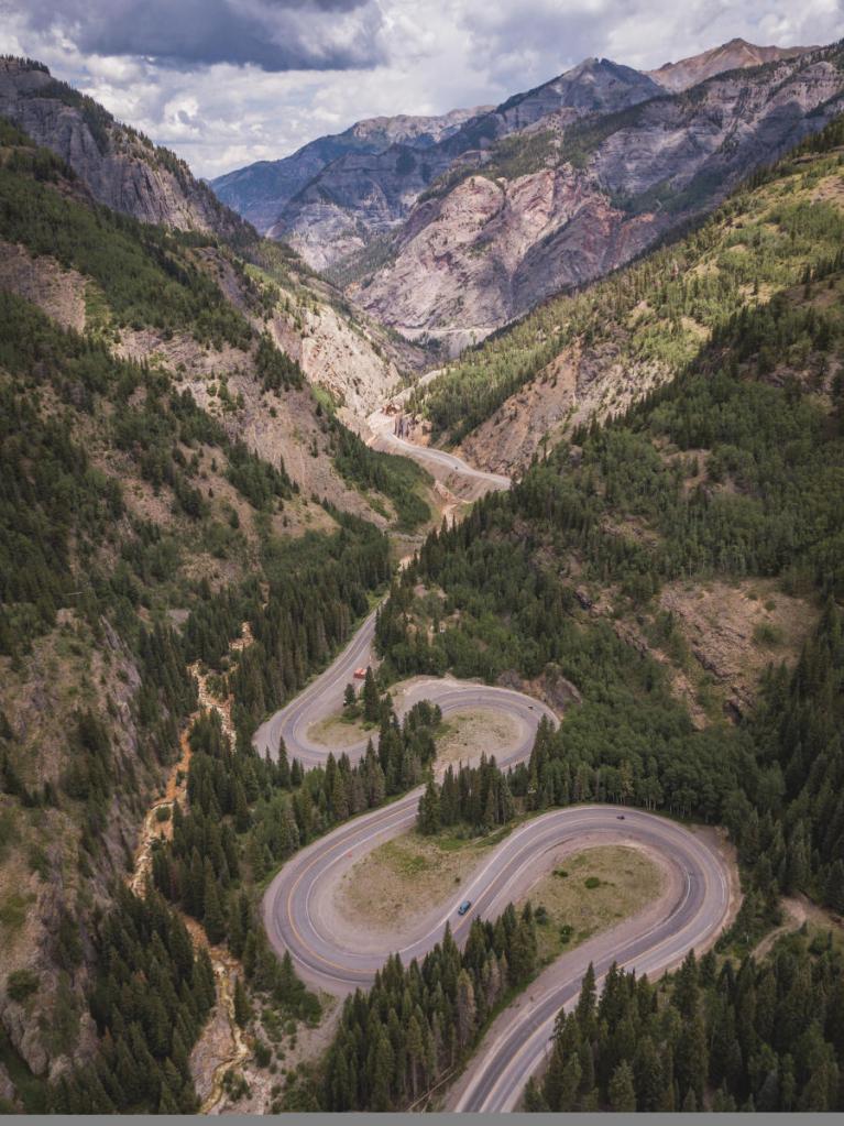
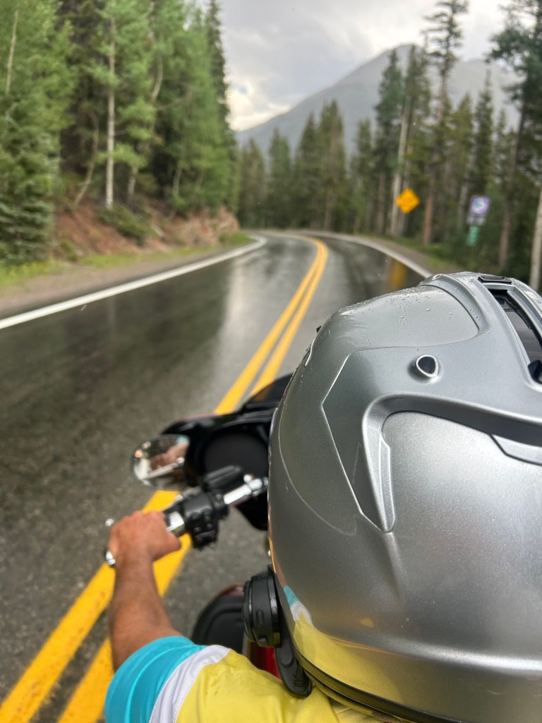
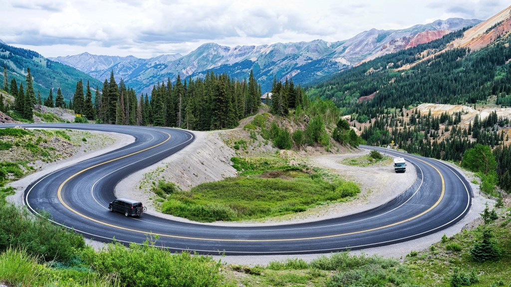
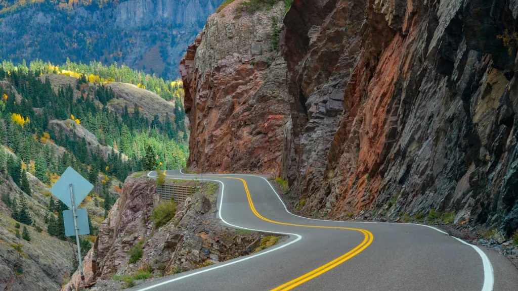
From Silverton, the remaining 25 miles of US Highway 550 are quite a thrill. This road, part of the San Juan Skyway Scenic Byway, is known as the Million Dollar Highway. It’s one of the most scenic roads in the US — and one of the most perilous, according to dangerousroads.org.
The Million Dollar Highway has steep cliffs, narrow lanes, hairpin curves, and few guardrails. On a motorcycle, it’s a thrill ride and a truly sphincter-tightening experience. I’ve ridden the road four times now, each time like Grandpa would. That’s how I roll. The Million Dollar Highway gets a little less frightening every time you ride it. Or not.
There are several stories about how the road got its nickname of the “Million Dollar Highway.” One is a legend that the road was made from a million dollars’ worth of gold and silver filled tailings. Another is a tale of a woman who traveled the road saying, “I would not travel that road again for a million dollars.” Yet another is that the view is worth a million dollars.
The truth is that when the three contractors paving the highway in the 1920s – the State of Colorado, the U.S. government and the U.S. Forest Service — compared notes, they realized that the cost of their three projects to upgrade the road to an automobile road totaled $1 million. Someone suggested that “We have ourselves a million-dollar highway,” and the name stuck.
Though the entire stretch from Silverton to Ouray earns the Million Dollar designation, it’s really the 12 miles from the summit of Red Mountain Pass (11,018 feet) through the Uncompahgre Gorge to Ouray, where the highway gets its reputation.
It’s unclear exactly where the Million Dollar Highway gets its name. Locals disagree as to whether it is named for the millions of dollars of gold, silver and other minerals extracted from these mountains, the cost of building the road (reputed to be a million dollars a mile), or for the spectacular views.
Riding north from Silverton, you’ll pass through the ghost town of Ironton. At one time, Ironton was a major transportation junction between Red Mountain and Ouray, in addition to having some of its own mines. Ironton sits at 9,756 feet, and is about two-thirds of the way from Silverton to Ouray.
In the winter, Ironton has cross country ski trails and hiking trails leading to beautiful vistas. In mining’s heyday, it was home to many miners who worked in the mines above town on the slopes of Red Mountain. In the late 1800s, two trains arrived daily in Ironton, coming from Silverton.
Ironton’s mines made their wealth from silver and lead, and eventually from gold. From Ironton, it’s only eight miles on US Highway 550 before you get to Ouray.
You arrive in Ouray with a sense of exhilaration and survival.
Ouray, which sits at 7,792 feet, is one of the most breathtakingly beautiful mountain towns imaginable.
Named after Chief Ouray of the Ute Indian Tribe, Ouray was originally established by miners chasing silver and gold in the surrounding mountains. Prospectors arrived here in 1875. At the height of its mining boom, Ouray had more than 30 active mines.
All of Ouray’s Main Street is registered as a National Historic District. Several buildings are listed on the National Register of Historic Places.
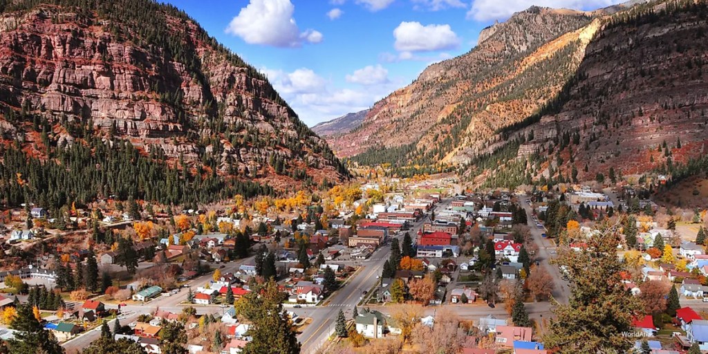
Today’s Ouray economy is based entirely on tourism. Ouray bills itself as the “Switzerland of America,” because of its setting at the narrow head of a valley, enclosed on three and a half sides by steep mountains. Much of the tourism is focused on ice climbing, mountain biking, hiking and off-roading in the San Juan Mountains.
There are places to stay overnight in Ouray, or you can continue 35 miles north to Montrose, which has motels, fast-food franchises, and stoplights galore. Or, if you’re lucky enough to live in Carbondale, as I am, ride 100 more miles and sleep in your own bed.
To explore this route, click here.
