***
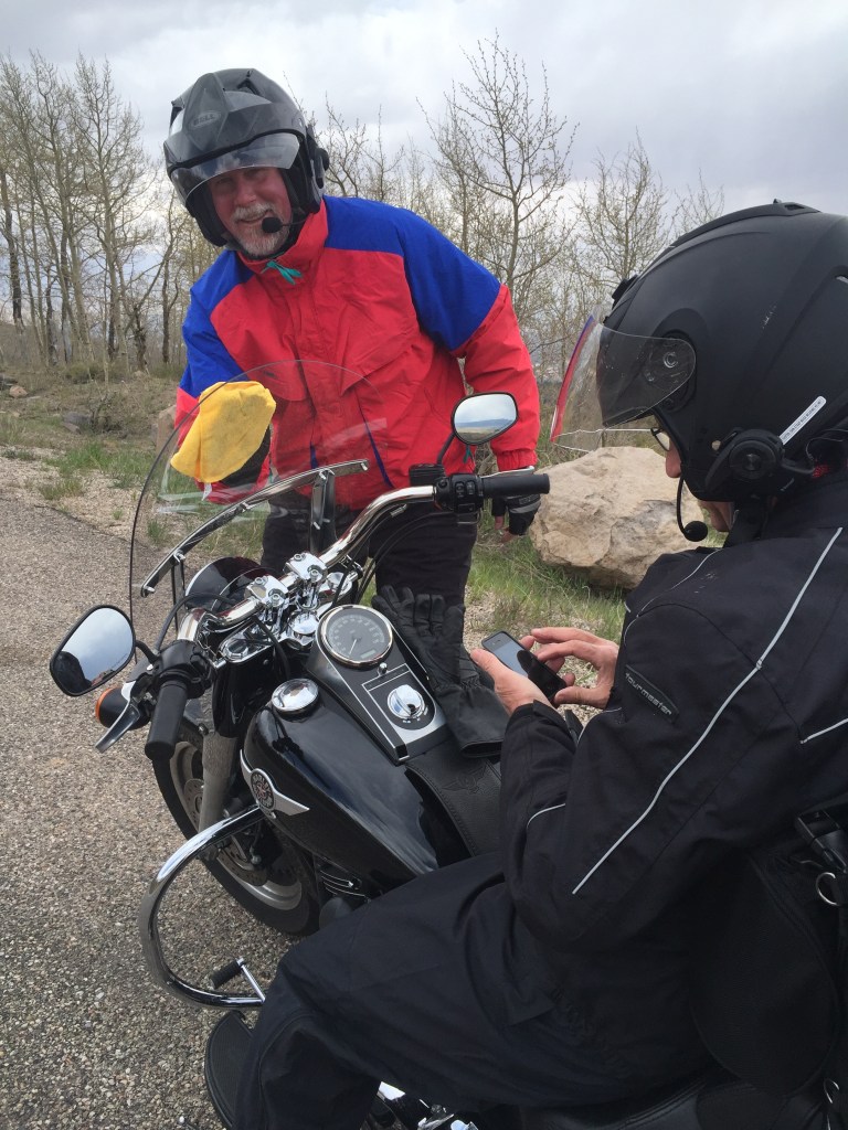
Highway 12 begins a few miles south of Panguitch, Utah, and ends in Torrey. I’ve ridden this road, all 124 miles of it, a half dozen times. I absolutely love it. Except the hogbacks. That’s my personal challenge, and they shouldn’t bother you, assuming you’re OK with steep drop-offs on both sides of the roadway, with no guardrails.
This roadway is beyond awesome, and is on everyone’s list of “best motorcycle rides in the US.” It’s all great. Except the hogbacks.
Highway 12 is an All-American Road, Utah’s only byway with that designation. Considering all the next-level awesome riding in Utah, that’s saying something.
Heading east on Highway 12, you soon arrive at the start of Red Canyon. The red color of the rock that characterizes this canyon — and this part of Utah — is due to the combination of iron and oxygen, called iron oxides. Of all the common colorful minerals found in Earth’s crust, few are as abundant, dynamic, and multi-colored as iron. The beauty of Utah’s Red Rock Country is due to a single element: iron. The process of the iron oxide weathering is what gives the rock its signature red color.
Soon, you’re surrounded by brilliant red sandstone spires and formations. The rocks are largely limestone, built from sediment of a lake that covered the region 35 to 50 million years ago.
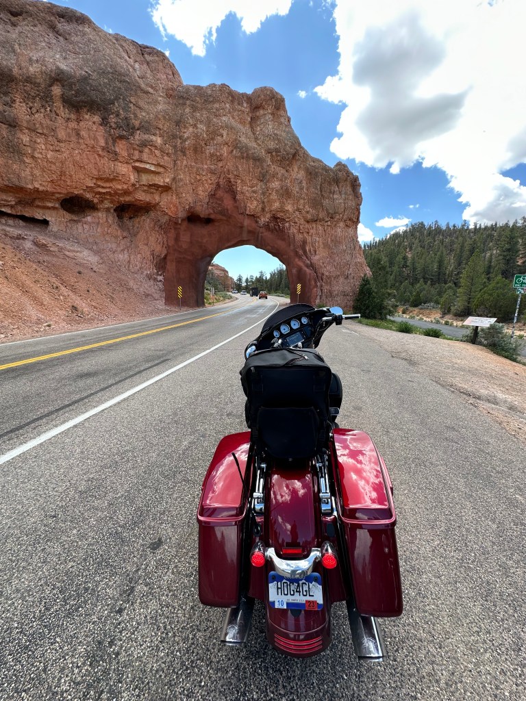
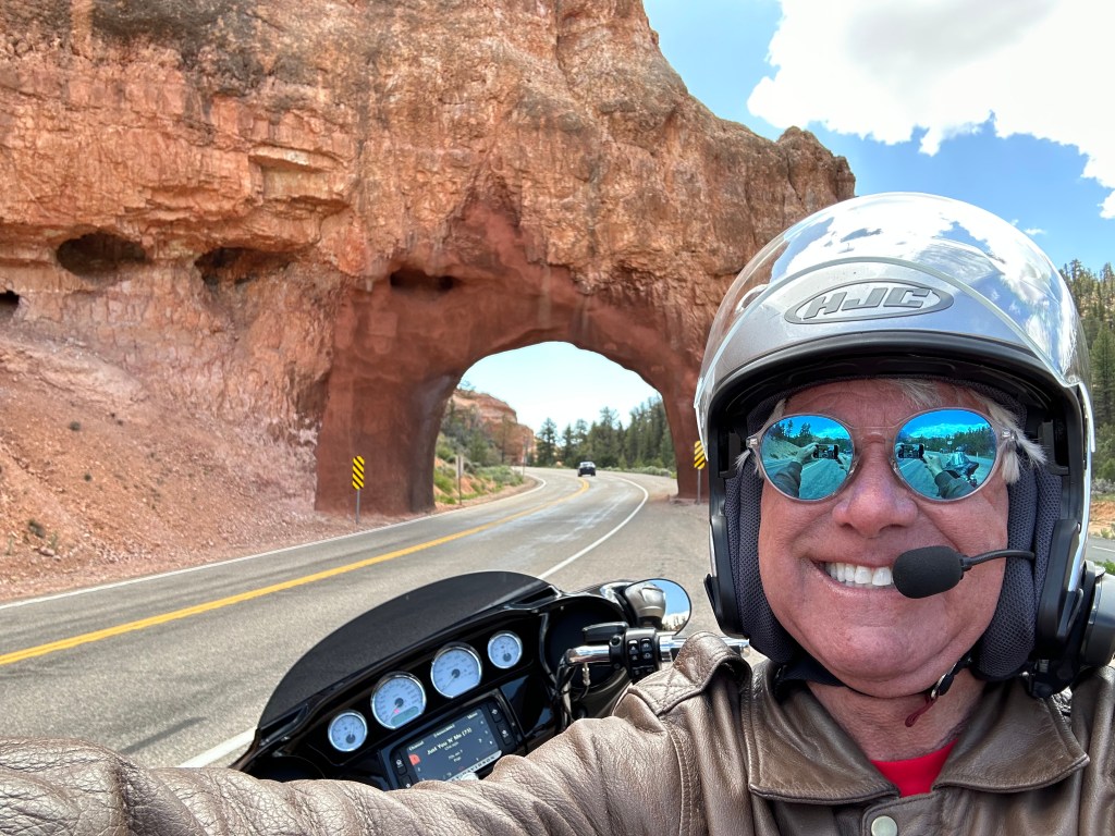
Near the beginning of Red Canyon, Highway 12 ducks through two short red rock arch tunnels, originally built in the early 1900s. Since their original construction, the tunnels have served as the unofficial gateway to nearby Bryce Canyon National Park, which we’ll visit shortly. Both tunnels are listed as National Historic Landmarks.
Highway 12 was added to the Utah state highway system in 1914, and it required tunneling through two rock formations. Ceremonies to open the newly authorized Bryce Canyon National Park, occurred in front of one of the tunnel arches in almost 100 years ago. On June 1, 1925, a 315-car caravan arrived at the Red Canyon tunnels to celebrate the opening of Utah National Park — later renamed Bryce Canyon National Park. A banner at the ceremony proclaimed, “Welcome to Utah’s Fairyland.”
The tunnels are technically part of the state’s bridge inventory, and are inspected regularly for structural integrity. In 2018, before the busy tourist season got underway, construction crews shored up the tunnels, a $2.5 million rehabilitation project brought about by nearly 100 years of decay and erosion.
Less than 10 miles past the tunnels, we pass by the turnoff to Bryce Canyon National Park, home of the hoodoo.
Like most of Utah, the area near this canyon was settled by Mormon pioneers in the 1850s, and named after Ebenezer Bryce, who homesteaded here in 1874. Bryce, originally from Scotland, became a ship’s carpenter, converted to Mormonism, and left Scotland for Utah in 1847 at age 17. He was the only member of his family to be a Mormon Church convert; his father was so displeased about the conversion that he disowned young Ebenezer.
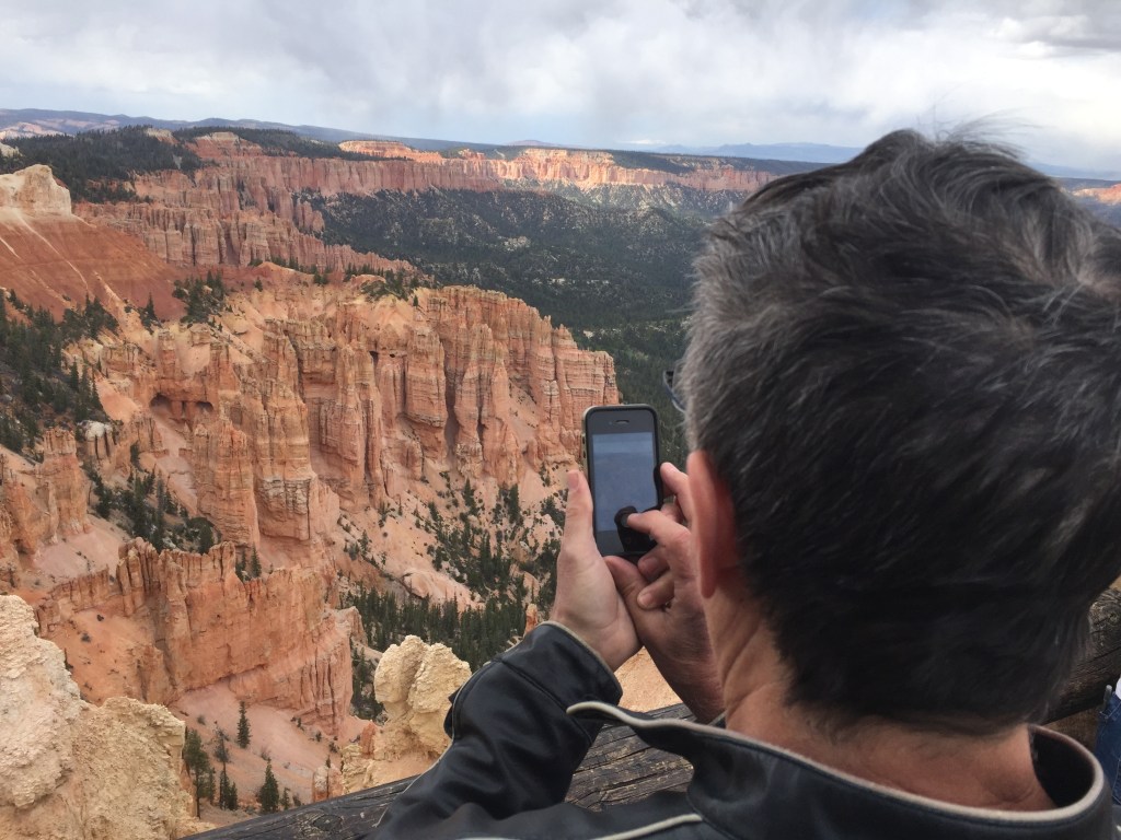
Bryce Canyon is a natural amphitheater adorned with hoodoos, irregular pillars of red, white, pink, and orange. Hoodoos exist on every continent, but Bryce Canyon has the largest concentration of them anywhere on earth. Hoodoo shapes are affected by the erosional patterns of alternating hard and softer rock layers.
But if you’re truly committed to Highway 12, you skip Bryce Canyon and keep riding northeast.
Just ahead is Tropic, the largest of three small ranching communities that make up the Bryce Valley. Tropic was founded in 1892, when 15 pioneer families came to settle the community. Today, the small town of 500 residents remains a ranching community, and is also part of the valley’s booming tourism industry. Ebenezer Bryce’s historic cabin is now a pioneer museum in Tropic, and you can visit it. The cabin is about two miles south of town, on the east side of the Pahreah River.
The other two ranching communities ahead on Highway 12 are Cannonville and Henrieville. Both started off with a strong Mormon history, and retain the church’s cultural and religious dominance today.
Cannonville, population around 150, bears the name of George Q. Cannon, a Mormon leader in the late 1800s. He was the church’s chief political strategist, and an early member of the church’s Quorum of the Twelve Apostles, a dozen old white men who lead the church. Cannon was a five-time Utah territorial delegate to the US Congress.
Henrieville, with a population is a little more than 200, is named after James Henrie, another Mormon leader. Henrie was the first president of the Mormon Panguitch Stake, which was established in 1877.
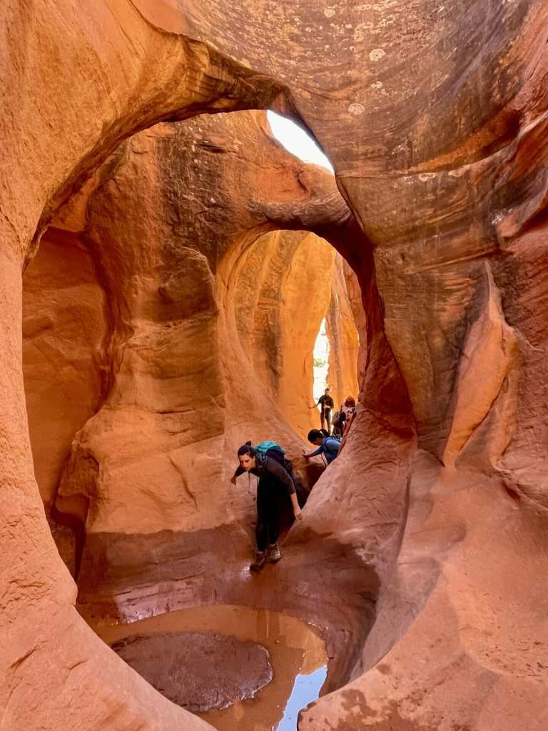
Just past Henrieville you’ll see the actual “stairs” in the Grand Staircase-Escalante National Monument, extending across 1.9 million acres of federally owned land. Cannonville, Henrieville, and Escalante — a few miles up the road — sit along the northwest edge of the huge monument. Grand Staircase-Escalante is so large that it borders Bryce Canyon National Park, Capitol Reef National Park, Lake Powell, Glen Canyon National Recreation Area, Vermillion Cliffs National Monument, and stretches almost to the Grand Canyon.
Grand Staircase-Escalante National Monument was established as a National Monument in 1996 by President Bill Clinton, under the authority of the Antiquities Act, which gives presidents the authority to protect land. Establishing the National Monument was a big moment for conservation in the US. In this vast monument, you’ll see everything from Navajo sandstone cliffs to narrow slot canyons and arches. It’s so huge and remote that it was the last part of the lower 48 United States to get mapped.
In 30 miles, you arrive in Escalante, home to about 800 residents. Escalante’s been on maps for a long time.
The town of about 800 is named after Silvestre Vélez de Escalante, a Franciscan missionary and a member of the first European expedition into southern Utah. Escalante was part of a small group that left Santa Fe, New Mexico — and tried to find a route to the missions of California.
The Dominguez–Escalante Expedition followed a route north through western Colorado, west across central Utah, and then southwest through what is now called the Escalante Desert, finally circling back to the east after reaching Arizona near the north rim of the Grand Canyon. They returned to Santa Fe having never entered California or the areas near what is today the city of Escalante.
In the 1870s, settlers from Panguitch first visited the area, where they met members of the John Wesley Powell expedition. The settlement was named based on a suggestion of Powell’s group to honor Escalante, even though the expedition had not traveled into the valley. In June 1875, the settlers returned to survey the valley. They staked out 20-acre parcels, liked what they saw, and decided to stay.
After a break in Escalante, you press on for the final 64 miles to Torrey. This stretch of road is some of the most awe-inspiring of the day.
Building Highway 12 was no piece of cake. Utah took nearly four decades to complete construction of the byway. It’s an engineering masterpiece, which we’ll soon discover.
Sporadically, from the 1940s to the 1980s, construction crews blasted, cut and paved their way through rugged hills and cliffs. Road construction was an engineering marvel, and was the work of the Civilian Conservation Corps.
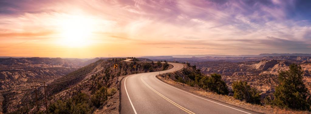
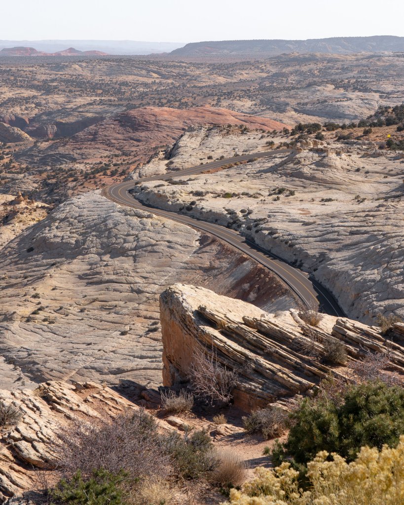
Soon, you’ll have a startling vista of the Escalante Canyons, a labyrinth of deep channels breaking up the expanse of petrified dunes, appears. There are no guardrails along this section of Highway 12, which local residents have named the Hogsback, or Little Burma Road. With 14 percent grades, it snakes along a ridge with fatal drop offs on either side. It’s only fatal if you go off the road.
Sometimes known as Hell’s Backbone, the road follows the spine of the Aquarius Plateau, skirting the edge of the Box and Death Hollow. Hell’s Backbone was built to connect Escalante with Boulder, a distance of 28 miles.
I’ve ridden the hogbacks a half dozen times, all with the same feeling of utter terror. As someone who loathes steep drop-offs — on hikes and Harley rides — I hate this part of Highway 12. But it’s the only route to Torrey, so I just press on, as I’m sure you will, too.
The next town ahead is Boulder, which sits at 6,700 feet at the base of Boulder Mountain – just eight miles past the Hogback.
Boulder claims to be the last community in the continental US to receive its mail by mule train. Completion of a year-round dirt road in 1939 opened Boulder to car traffic from the south and west. The mail mules are now retired.
Torrey, the destination at the end of the Highway 12 ride, is just 37 miles north of Boulder on Highway 12. In 1977, this stretch of road was the only remaining unpaved section of Highway 12. Before the Boulder Mountain section of Highway 12 was paved, snow and mud closed the dirt road from late November until May. Even in the summer months, traveling the unpaved road over Boulder Mountain could be a bone-rattling adventure.
Paving the Boulder Mountain road brought change to communities along Highway 12. And it attracted visitors from around the world to these once-isolated communities, making tourism a central part of local economies. That, along with its designation as an All-American Highway, brought tourism to Boulder.
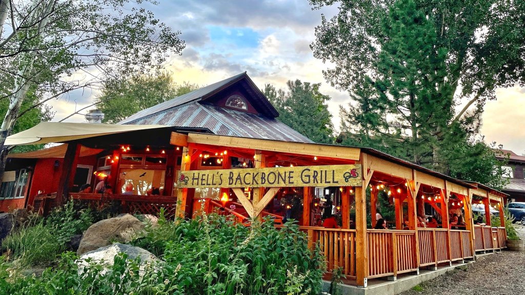
If you have time, stop by Hell’s Backbone Grill for lunch. Travelers will be pleasantly surprised to find this Zagat-rated organic eatery, run on Buddhist principles, with a focus on sustainability. The restaurant serves a style of “Four Corners cuisine,” an updated combination of cowboy classics, Mormon recipes and traditional Southwestern fare. The food is organic and locally produced, matched with the seasons. For a town of 200, Boulder has some other restaurants worth a try, including Sweetwater Kitchen and Burr Trail Grill.
Leaving the town of Boulder, elevation 6,700 feet, you’ll begin your journey up the mountain.
You’ll climb nearly 3,000 feet, twisting and turning, before arriving at the Highway 12 summit of Boulder Mountain. Also known as Bluebell Knoll and Boulder Top, Boulder Mountain reaches 11,317 feet – not the highway, the mountain peak.
When the Tour de Utah bicycle race was held annually, beginning in 2010, it attracted world-class cyclists for a 700-mile, week-long battle. One of the stages ended in Torrey. The 99-mile ride began in Escalante, went over Boulder Mountain, and crossed the finish line in Torrey. During that day’s ride, the peloton gained 9,435 vertical feet, and included a King-of-the-Mountain climb.
The race’s terrain boasted a mix of high-altitude mountains, punchy climbs, testing time trials and rapid sprint finishes. Each year, the field got bigger and stronger, and included well-known cycling names who had Tour de France experience; Levi Leipheimer won the event in 2010 and 2011.
The Tour de Utah is no longer held, primarily due to lack of economic support. Cycling hasn’t caught on in the US, the way it has in Europe. Utah’s isn’t the first race to disappear off the USA bicycle racing calendar; the Tour de California, and the Tour of Colorado have both fallen by the wayside, leaving no major American cycle races.
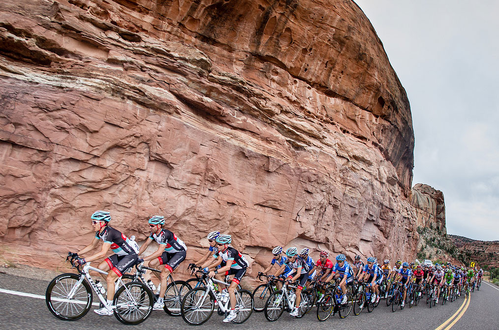
Whether on bicycle, motorcycle, car or truck, Highway 12 traverses the eastern side of the mountain from Boulder to Torrey. It follows the same route as the peloton did.
Boulder Mountain’s 50,000 acres of trees cover half of the Aquarius Plateau, making it the highest wooded plateau in North America. The mountain is filled with a dense forest of pine and aspen trees. As we approach the summit, we’re riding above the tree line. It’s very stark, and a much lower tree line than what we experience in Colorado.
The summit of Highway 12, which sits at 9,591 feet, is nearly flat and covers roughly 70 square miles.
As you would expect, the summit is about halfway between Boulder and Torrey. Here, you begin the 3,000-foot descent into Torrey, which, for a small town, has several nice places to stay.
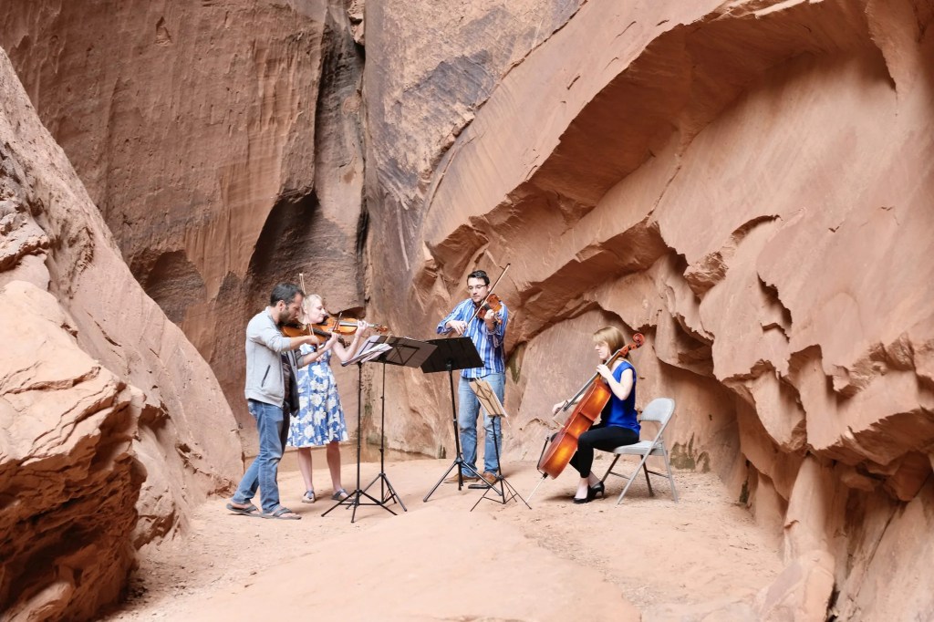
Torrey sits at the intersection of Utah Highways 12 and 24. The town is home to an annual Cowboy Music and Poetry Festival. It also has a Chamber Music Festival, held every summer over a three-day weekend in June.
Torrey is probably best known as the gateway to Capitol Reef National Park. Because of its clear skies and high elevation, Torrey has been designated one of just 115 certified International Dark Sky Places in the world. Nearby Capitol Reef National Park is also a designated Dark Sky Park, and was the first National Park in the US to become one.
Originally settled by Mormon pioneers in the 1880s and called Youngstown, the town was renamed when it got a US post office. It was named in honor of Wyoming legislator and Rough Rider Colonel Jay L. Torrey. The town of Torrey has always attracted famous visitors, including Major John Wesley Powell, outlaw Butch Cassidy, author Zane Grey, and artist Maynard Dixon.
To explore this route, click here.
