Today’s route takes us over some spectacular mountain passes. Four Pass-a-Paloozas™, an old mining town or two, and a turnoff to a Not Quite Pass-a-Palooza™.
It’s gonna be epic. And, much of it will seem oddly familiar. It may feel Déjà vu-ish, all over again.
We leave South Fork and head south along the South Fork of the Rio Grande. That may be the first time I’ve ever used the word South three times in one sentence.
In 20 miles, we arrive at Wolf Creek Pass.
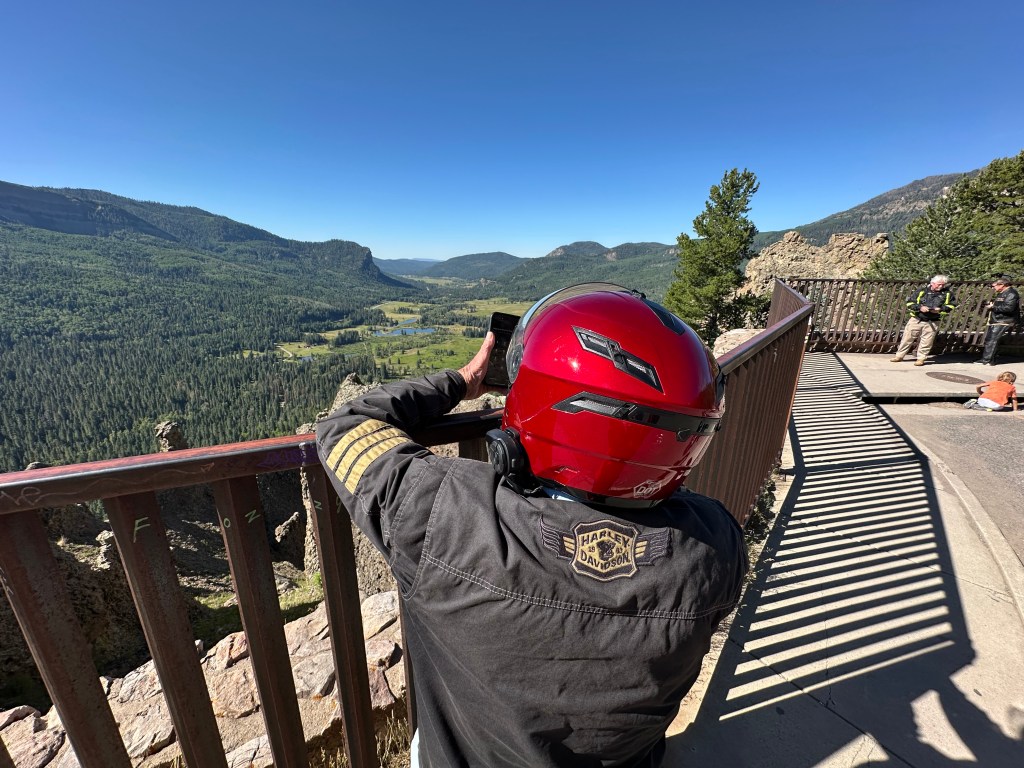
Pass-a-Palooza™ … Wolf Creek Pass: 10,857 feet
Oooh. This seems oddly familiar. I seem to recall this road. We crossed Wolf Creek Pass just yesterday, at the end of our ride, as we came into South Fork. What may also seem oddly familiar is that Wolf Creek is an Honorable Mention Top Ten.
So, I won’t bore you with details about the pass, the ski area, or how they both got their names.
On the descent over the west side of Wolf Creek Pass, we roll through Pagosa Springs. Yesterday, we rode along the town’s eastern outskirts, but didn’t actually see the San Juan River, which courses through Pagosa Springs.
In Pagosa Springs, we roll west along the town’s main street, US Highway 160.
This seems oddly familiar, too. That’s because Sarah, Brittany and I stayed here last week. If you want a refresher course in what’s what in Pagosa Springs, click here to read my blog post about our Pagosa Springs visit. Scroll down to the part about Pagosa Springs. Or don’t.
Sixty miles west of Pagosa Springs, all on Highway 160, we arrive in Durango. If that sounds oddly familiar, it’s because Sarah, Brittany and I rolled through Durango last week on our way to the Million Dollar Highway.
Wanna read, or re-read, my blog post about Durango and the road north of it? Click here to review my July 14 blog post, and get a full refresher course on Durango, and the three Pass-a-Paloozas™ that lead us to Ridgway, today’s destination.
We turn north in Durango on US Highway 550, which will take us over three spectacular passes. They’ll all feel like Groundhog Day.
Pass-a-Palooza™ … Coal Bank Pass: 10,640 feet
Coal Bank is the first pass on our way to Ridgway.
Pass-a-Palooza™ … Molas Pass: 10,910 feet
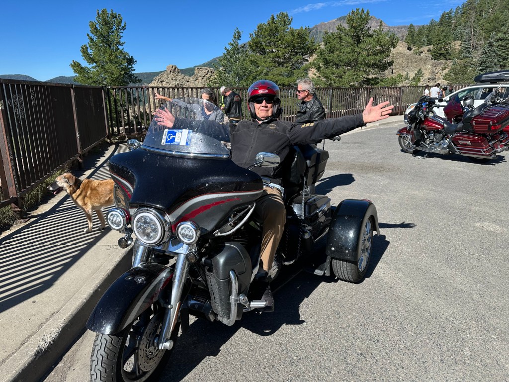
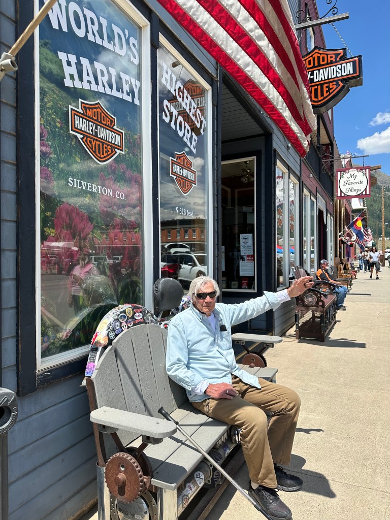
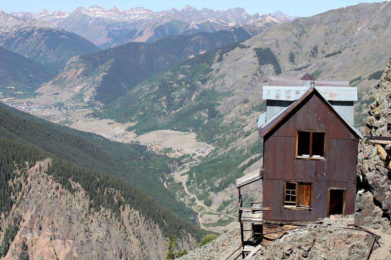
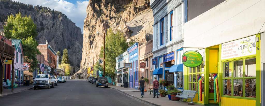
Then, Molas Pass, which brings us to Silverton, home of the world’s highest Harley store. Greene Street, the main drag in town, is named after George Greene, a pioneer and city father who played a key role in development of the town.
From Silverton, we head over one final Pass-a-Palooza™ of the day.
Pass-a-Palooza™ … Red Mountain Pass: 11,018 feet
Red Mountain Pass brings us to Ouray, which leads us to Ridgway, tonight’s destination.
Oooh, riding that route over the Million Dollar Highway seemed oddly familiar. To me, it did anyway. But it shouldn’t have to the guys, because they weren’t with me last week on my “Family Ride.”
If you felt cheated due to the lack of details and color in today’s ride, please click on the links (here and here) I provided earlier. Or, just get over it.
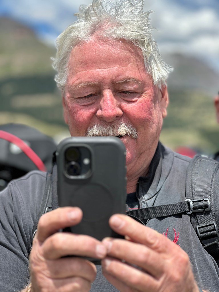
We, the guys on today’s ride, don’t feel cheated at all. We got to see some of the most beautiful roads in Colorado today, some of my all-time favorites. The Million Dollar Highway is #5 on my all-time Top Ten list.
Wish you could have joined us.
To see today’s route from South Fork, over four Pass-a-Paloozas™ and the Million Dollar Highway, to Ridgway, click here.
***
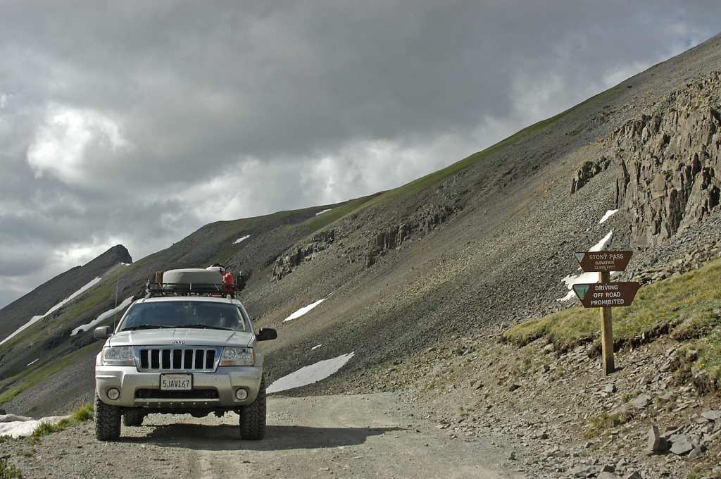
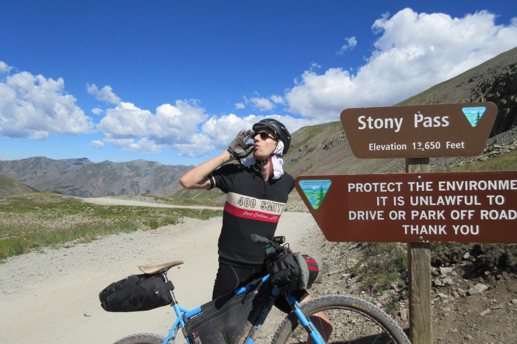
Today’s Not Quite Pass-a-Palooza™… Stony Pass: 12,650 feet
When we were in Silverton earlier today, seeing the sights on Greene Street, we could have easily continued east on that street, and ended up on today’s Not Quite Pass-a-Palooza™. This off-road journey, by far the longest of my two-week trip, is Stony Pass. It’ll take adventurous souls from Silverton, over the pass, and on to Creede, a town you should be familiar with, by now.
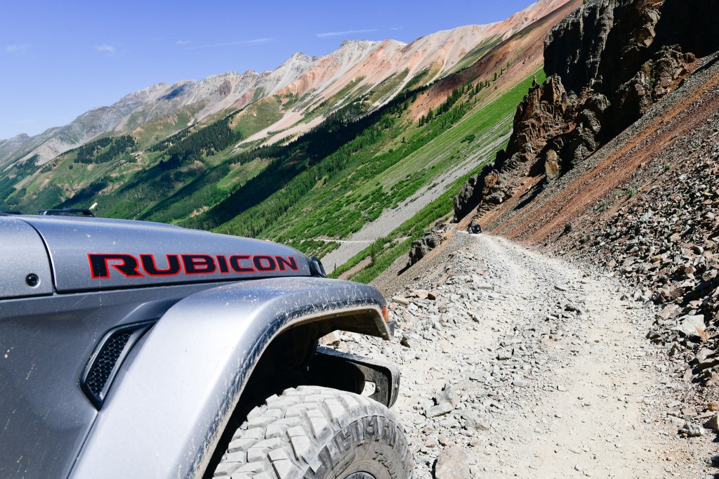
The trek, which crosses the Continental Divide, is 64 miles from Silverton to Creede. Stony Pass is open for only a limited season each year, usually from May until October. As with all the other high mountain passes, snow is the reason. You’re gonna want a high-clearance, four-wheel drive vehicle.
As you leave Silverton, Greene Street turns into Blair Street, and Blair Street becomes (San Juan) County Road 2. Five miles from Silverton, we’re in Howardsville, a ghost town originally laid out in 1874 by the Bullion City Company as Bullion City.
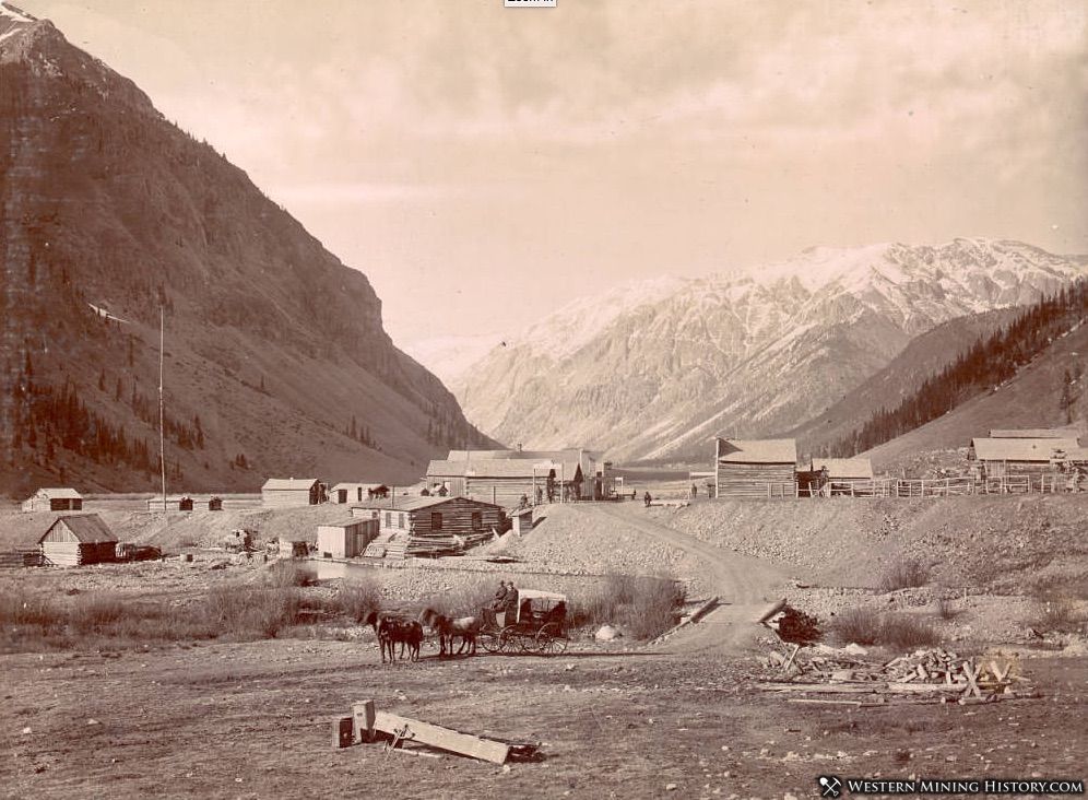
Howardsville was named after pioneer prospector George Howard, who built the first cabin at the site in 1873. The area became an early mining camp and the first county seat of La Plata County. It wasn’t long before the county was carved up into smaller counties, and Silverton took over the county seat for the newly established San Juan County.
When the railroad arrived at Silverton in 1882, it diminished the importance of Howardsville in the area, and the town began to decline.
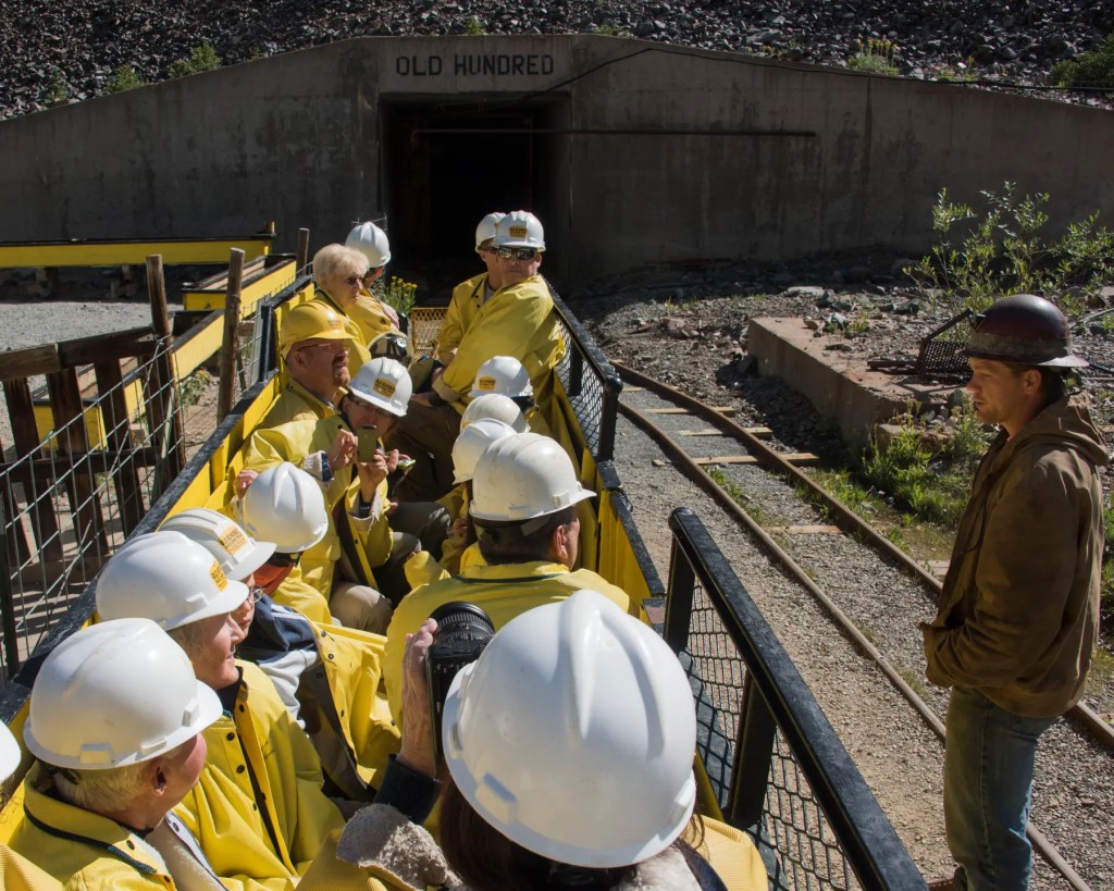
The Silverton Northern Railroad laid tracks to reach Howardsville in 1806, with an extension to the Old Hundred Mine, less than a mile from Howardsville. The founders of the mine, the Neigold brothers from Germany, spent 30 years developing mining veins on Galena Mountain. Because of their heritage, it’s believed the Old Hundred Mine was named after the popular German hymn, “Old Hundredth,” which itself came from the 100th Psalm.
Even though it lived in the shadow of nearby Silverton, Howardsville lived on as a small mining community for decades. As the mines in the area played out, most of the people moved to Silverton, effectively killing Howardsville. The town effectively died in 1939, when its post office shut down. Three years later, the railroad tracks to Howardsville were torn up.
Today, a number of structures remain from Howardsville’s boom times. The Old Hundred Mine remains open throughout the summer season for guided mine tours. You can pan for silver, gold and copper, and keep what you find. Good luck.
Following a set of steep switchbacks, it’s about six miles from Howardsville to Stony Pass. The pass got its name because of the rocky terrain. You could pretty much say that about almost any of these off-road Pass-a-Paloozas™.
The route along Stony Pass was developed to connect the area’s mining operations in Silverton to the Front Range, via the town of Del Norte. The road was originally designed for pack animals and later was improved to accommodate wagons.
On the east side of the pass, you’ll see small streams along the trail. These streams start at the Continental Divide, and are the headwaters of the Rio Grande River.
The Continental Divide Trail, which we learned about yesterday, crosses Stony Pass Road at Hunchback Pass.
The first car to cross Stony Pass did so in 1910. It was a Croxton-Keeton, an Ohio-built touring car with a four-cylinder, 30-horsepower engine, and a $2,750 price tag. The three occupants had to get out and clear boulders along the way, and build some sections of the road as they went. The car had many flat tires and mechanical problems, and had to be pulled by horses over Stony Pass’ final ascent. Their trip from Del Norte to Silverton took five days.
The descent from Stony Pass to the Rio Grande Reservoir is 18 miles. The reservoir sits at 9,450 feet, a drop of 3,200 feet from Stony Pass. It’s Colorado’s third-largest reservoir, with a capacity of 52,000 acre-feet of water.
The reservoir, completed in 1914, was originally designed to support agriculture in the San Luis Valley. Over the years, it’s become popular for fishing and recreation as well.
From the reservoir, you’ll have 14 miles to go before you reach Colorado Highway 149, which will take you the remaining 18 miles to Creede. Once you make it to Highway 149, the hard part is over. From here, the road is paved.
To view today’s Not Quite Pass-a-Palooza™ route from Silverton, past Howardsville, over Stony Pass, and on to Creede, click here.
