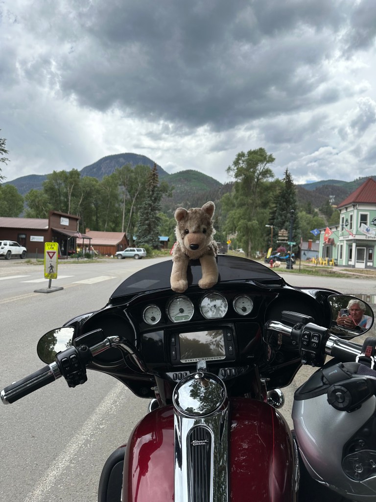
Today is the longest ride of my two weeks on the road, 277 miles.
Along the way, we’ll rack up four Pass-a-Paloozas™, cross the Continental Divide three times, ride Colorado’s steepest mountain pass, see the world’s biggest fork, and end the day in South Fork, almost made famous by an ‘80s TV show.
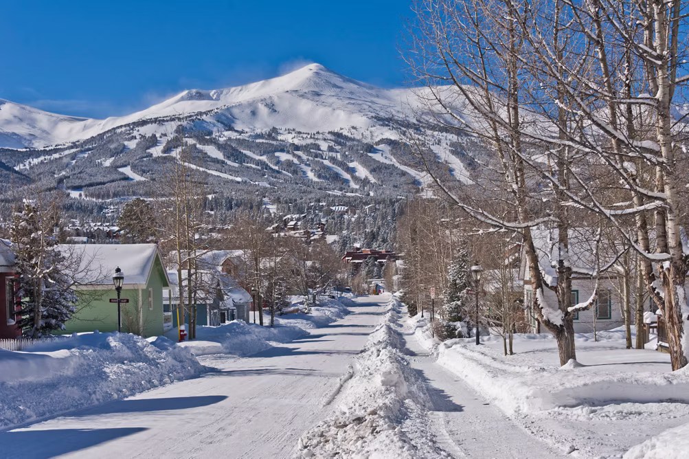
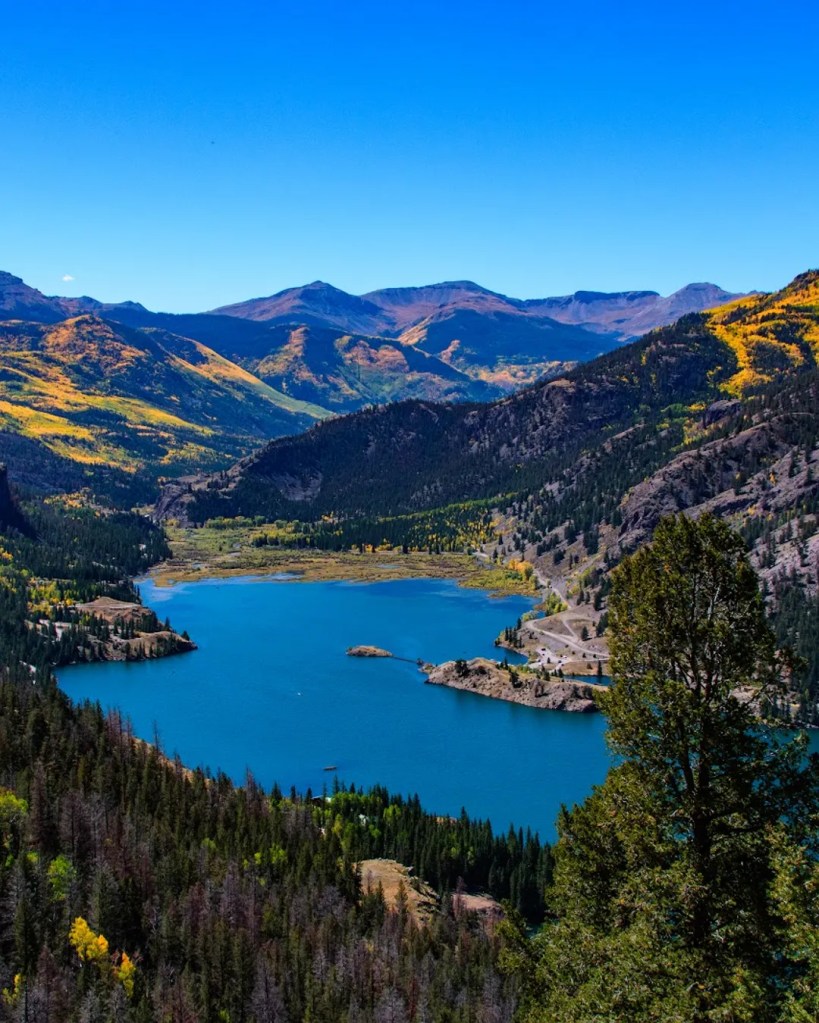
We leave Frisco and ride 10 miles south to Breckenridge, a town and ski resort located at the base of the Tenmile Range. Breckenridge sits at 9,600 feet, along the Blue River – a beautiful setting for the 5,000 residents who can somehow afford to live there.
What’s in a Name?
Breckenridge was created in 1859, named after prospector Thomas Breckenridge. But a year later, town fathers re-named the community Breckinridge (note the different spelling), hoping to flatter the US government and get a post office.
The plan for Breck to get a post office worked. The revised spelling was named after John C Breckinridge of Kentucky, the 14th Vice President of the United States. At age 36, he became the youngest Veep in US history, elected along with President James Buchanan in the 1856 election. He then ran for the presidency in 1860, losing to Abraham Lincoln.
In 1860, Breckinridge became the first post office between the Continental Divide and Salt Lake City. A year later, after John Breckinridge accepted a commission as a brigadier general in the Confederate Army, the town changed its name back to the original spelling of Breckenridge. It’s been that way ever since.
In the winter, the ski resort is the hub of the community. It’s owned and operated by Vail Resorts, so your Epic Pass is good there. Skiing goes all the way up to the top of Breckenridge. The Imperial Express lift takes you there, to 12,840 feet; it’s the highest lift in North America.
Known to Coloradans as “Breck,” the ski area claims to be the first major resort to allow snowboarding, in 1985. At the time, some resorts claimed they had insurance liability issues, while others didn’t want the young rebel snowboarders irritating their well-heeled skiing clientele. Today, only three North American resorts continue to ban snowboarders.
Breckenridge is known for being a winter icebox, and often referred to by Coloradans as “Brecken-Fridge.”
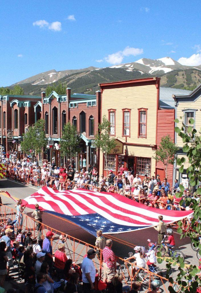
In the summer, Breckenridge takes on an entirely different vibe. It hosts the National Repertory Orchestra and the Breckenridge Music Institute. There’s much to do here when the wildflowers are blooming: mountain biking, geocaching, ziplining, hiking, tubing, fly fishing, golfing, even skiing (on July 4).
Breckenridge is a favorite in Hollywood. It was the filming location of the 1989 comedy National Lampoon’s Christmas Vacation; the town stood in for Aspen in Dumb and Dumber.
Breckenridge is just a few miles south of the southern end of Dillon Reservoir, which provides 40 percent of Denver’s fresh water supply.
Pass-a-Palooza™ … Hoosier Pass: 11,539 feet
From Breckenridge, we head south on Highway 9, following the Blue River. A bunch of twists and hairpin turns later, we arrive at 11,539-foot Hoosier Pass, yet another crossing of the Continental Divide. The pass is one of several we’ll ride today earning Honorable Mention on my all-time Top Ten list.
Native American Tribes, including the Utes, were the first known users of Hoosier Pass. There’s a historical marker at the pass that commemorates its first crossing in 1844 by the Fremont Expedition, which explored the Rocky Mountains. John Fremont was an explorer and cartographer for the US Topographical Engineers. He had five western expeditions, became wealthy through railroad development, and ran unsuccessfully for president in 1856, crusading against the expansion of slavery.
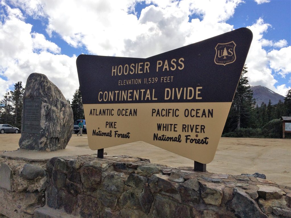
Hoosier Pass gets its name from the Hoosier State of Indiana, where many of the area’s first mine camp residents came from during the 1860s. In recent years, it’s been common to ask anyone who cared, “Hoosier Daddy?” For the un-hip, when you ask someone, “Who’s your daddy?” you’re not looking for an answer; you’re making a point, in slang, about how great you are. The phrase acquired cultural cred in the 2007 episode of The Simpsons, called “Hoosier Daddy.”
There are many theories about where the name Hoosier comes from. They’re all amusing, and it’s hard to know which, if any, are to be believed. In any case, people from Indiana have been referred to as Hoosiers since 1832.
There’s even a band called Hoosier Daddy. They’re from Illinois, not Indiana. But one of the band member’s daughter lives in Indiana, so he truly is a “Hoosier Daddy.” Aren’t we all?

Getting High in Alma
Six miles after cresting Hoosier Pass, we roll through the town of Alma, population 300. At an elevation of 10,578 feet, Alma is the highest incorporated municipality in North America, and has the highest post office in the US.
Alma was named after Alma Janes, daughter of an early settler and merchant named Addison Janes. The town incorporated in 1873.
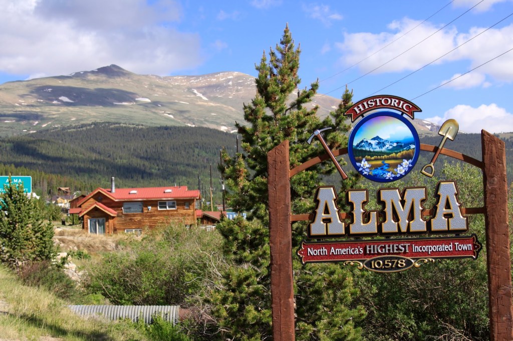
In the late 1870s, Alma’s population peaked at around 10,000 people. Mining, of course, drove the town’s growth: it was accessible to the silver mines on Mount Lincoln and Mount Bross, and also conveniently located for workers in the gulches of Mosquito and Buckskin creeks.
The historic Sweet Home Mine near Alma, formerly a silver mine, now produces the mineral rhodochrosite, a manganese carbonate that’s typically a rose-red color. The area around Alma today has 17,452 mining sites, mostly inactive or abandoned placer mines.
If you’re thirsty when passing through Alma, try the South Park Saloon, which claims to be the highest saloon in the US: 10,580 feet. They have takeout. And catering.
Fairplay. It’s Only Fair.
Only five miles past Alma, we come to the town of Fairplay, population 725. The town was named by settlers who were upset by the generous mining claims given to the earliest prospectors and promised a more equitable system for its residents. Equitable, you know, more fair.
Fairplay was a gold mining settlement, founded in 1859 during the early days of the Pikes Peak Gold Rush. Today, it’s the largest community in the grassland basin known as South Park. Fairplay has modern retail businesses on one end of town, and a historic area on the other.
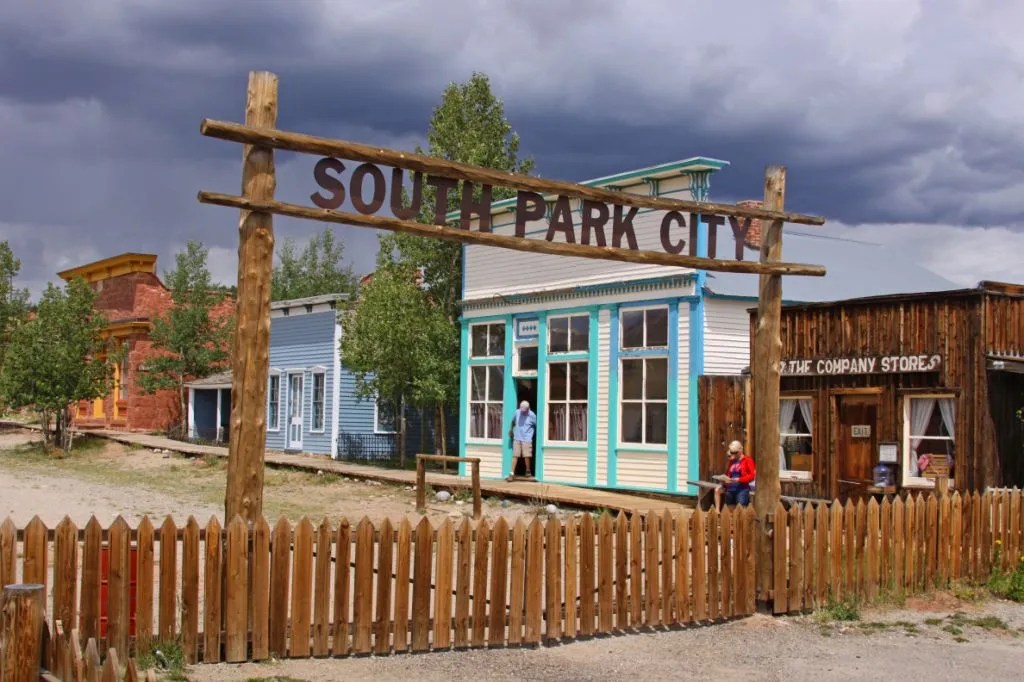
Along Front Street as you come into town from Alma, you’ll find an open-air museum called South Park City. It’s intended to recreate the early days of the Colorado Gold Rush. South Park City contains 35 authentic relocated buildings, filled with more than 60,000 artifacts from the gold and silver mining boom times in the area. On the second weekend of August every year, South Park City hosts Living History Days, a celebration of the past where people in period dress perform the role of 19th century townspeople.
Fairplay sits at the junction of US Highway 285 and Colorado Highway 9. Here, we turn south on Highway 285 and head toward Buena Vista, an easy half-hour ride away. You may recall, I visited Buena Vista last week with Sarah and Brittany. Buena Vista sits on the Arkansas River, and might as well be Surf City, Colorado.
We continue south on US Highway 285, hang a right on US Highway 50 in Poncha Springs, and 17 miles later, we arrive at our next ski area, all shut down and buttoned up for the summer.
Monarch Mountain Ski Area
We’re now at the Monarch Mountain ski area, which originally opened in 1939 with one 500-foot rope tow, powered by a Chevy engine. The rope tow went up what is now the Gunbarrel ski run at the area.
The mountain – and skiing itself – was quite primitive at the time. Said one of the originals, reflecting back on those times: “We skied Gunbarrel for two years before we ever saw anyone who could turn on skis. The challenge was to make it to the bottom of the hill without falling down or skiing into the creek.”
Today, Monarch Mountain has one quad chair, four double chairs and two terrain parks. Its base elevation of 10,790 feet helps it acquire a big-time snowpack, about 350 inches of snowfall each year. The mountain is somewhat off the beaten path – Buena Vista is about 40 miles east, and Gunnison about 40 miles west. Its location helps keep lift lines short, and ticket prices affordable. An adult season pass is $629, about one-fifth of the cost of an Aspen-Snowmass pass. Monarch Mountain is privately owned by a group of individuals, led by Bob Nicolls.
Unlike many ski resorts that boom in the summer, Monarch Mountain is shut down this time of year. So, we’ll keep on riding. Next stop, Monarch Pass, two miles to the west.
Pass-a-Palooza™ … Monarch Pass: 11,312 feet
Monarch Pass, which sits on the Continental Divide, is 540 feet below the ski area. The pass is open year-round, but can be challenging after a heavy winter snowfall. The pass earned Honorable Mention on my all-time Top Ten list.
The current Monarch Pass is the third location on the Continental Divide to carry that name. The original road was built in 1880 and served as a wagon and stage road connecting the town of South Arkansas City (now called Salida) with Gunnison.
In 1922, the road was improved and rerouted to better accommodate motor vehicles. That road is known as the Old Monarch Pass. It remained an important unpaved crossing of the divide until 1939, when yet another highway realignment occurred – this one to accommodate the newly designated US-50 route, and more modern automobiles.
Both Monarch Pass, and the Monarch Mountain ski area are named after the tiny village of Monarch, which is about six miles east of the pass. Monarch sits at 9,544 feet, and is mostly a cluster of vacation homes. The community of Monarch is, as far as I can tell, named after the butterfly of the same name. Who knew?
We begin the 40-mile journey west on US Highway 50 to Gunnison, 3,600 feet below. From our visit last week, you’ll recall that Gunnison is home to Western Colorado University, the oldest university in the Western Slope region.
We don’t stay in Gunnison long, just enough time to take a break and fill up with gas for our next adventure – the Silver Thread Scenic and Historic Byway. Ten miles west of Gunnison, we turn south onto Colorado Highway 149 and see what the Silver Thread is all about.
It’s a historic route that takes us through the Gunnison and Rio Grande National Forests, through Lake City and Creede, and on to today’s destination, South Fork.
An hour after our Silver Thread adventure begins, we arrive in Lake City, the only incorporated municipality in Hinsdale County. Lake City’s population hovers at around 400. The town is named after nearby Lake San Cristobal, Spanish for Saint Christopher. Lake San Cristobal sits at 9,003 feet. The water level is controlled by the seasonal addition or removal of boulders at the lake outlet.
Like so many towns in the area, Lake City’s history is tied to mining. With the completion of the first road into the mountains in the region, Lake City served as a supply center for the hordes of miners and prospectors flooding into the area. The town boomed to as many as 5,000 settlers in the 1870s.
But as the first-discovered deposits were found to be only moderately productive and no new mineral deposits were found, the boom had subsided by 1879. With the arrival of the Denver & Rio Grande Railroad a decade later, Lake City saw a second upturn in the economy that lasted into the 1890s.
By 1905, the mining era was over, and Lake City entered a decades-long period of economic decline. While mining continued throughout the 20th century, it consisted primarily of exploration and speculation, rather than productive operation. When the 1930s arrived, tourism had emerged as a viable industry – and pretty much the only one in town.
As tourists recognized the scenic and recreational opportunities in the area, tourism took off. Visitors began arriving by automobile. Even though the roads were unpaved, the natural beauty brought them to Lake City. Highway 149 remained a dirt road until 1968, when paving was finally completed.
Pass-a-Palooza™ … Slumgullion Pass: 11,530 feet
Five miles out of Lake City, we roll by the Lake San Cristobal overlook. It’s at a switchback that’s worth a stop.
Five miles later, we arrive at Slumgullion Pass. Getting to the pass is a climb of 2,860 vertical feet from Lake City. You might remember this from last week, when I rode with Sarah and Brittany. Back then, I told you Slumgullion Pass had earned Honorable Mention on my all-time Top Ten list, and nothing has changed since then.
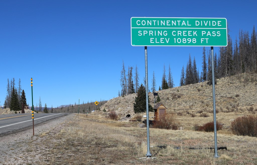
Pass-a-Palooza™ … Spring Creek Pass: 10,901 feet
Eight miles ahead is Spring Creek Pass, which sits on the Continental Divide. The pass is 629 feet below Slumgullion Pass. You’d hardly notice it except for the sign along the road.
Beyond Spring Creek Pass, we roll by Hogback Mountain, begin to follow the Rio Grande River, and 33 miles after the pass, arrive in Creede. Creede was on our route last week, so I won’t bore you with the details again, but if you want to read about it, click here.
Leaving Creede, we proceed to the end of the Silver Thread Byway, and tonight’s destination: South Fork. The town sits on the South Fork of the Rio Grande River, and owes its origins to mining. South Fork was founded in 1882. Its growth was due to the railroad that connected it with Creede. The Rio Grande Western Railroad line was built to support silver mining in Creede.
It wasn’t until 1992, a century later, when South Fork achieved independent statutory town status. South Fork’s Riverbend Resort was the filming location of fictional “Kamp Komfort” in the 1983 hit movie National Lampoon’s Vacation.
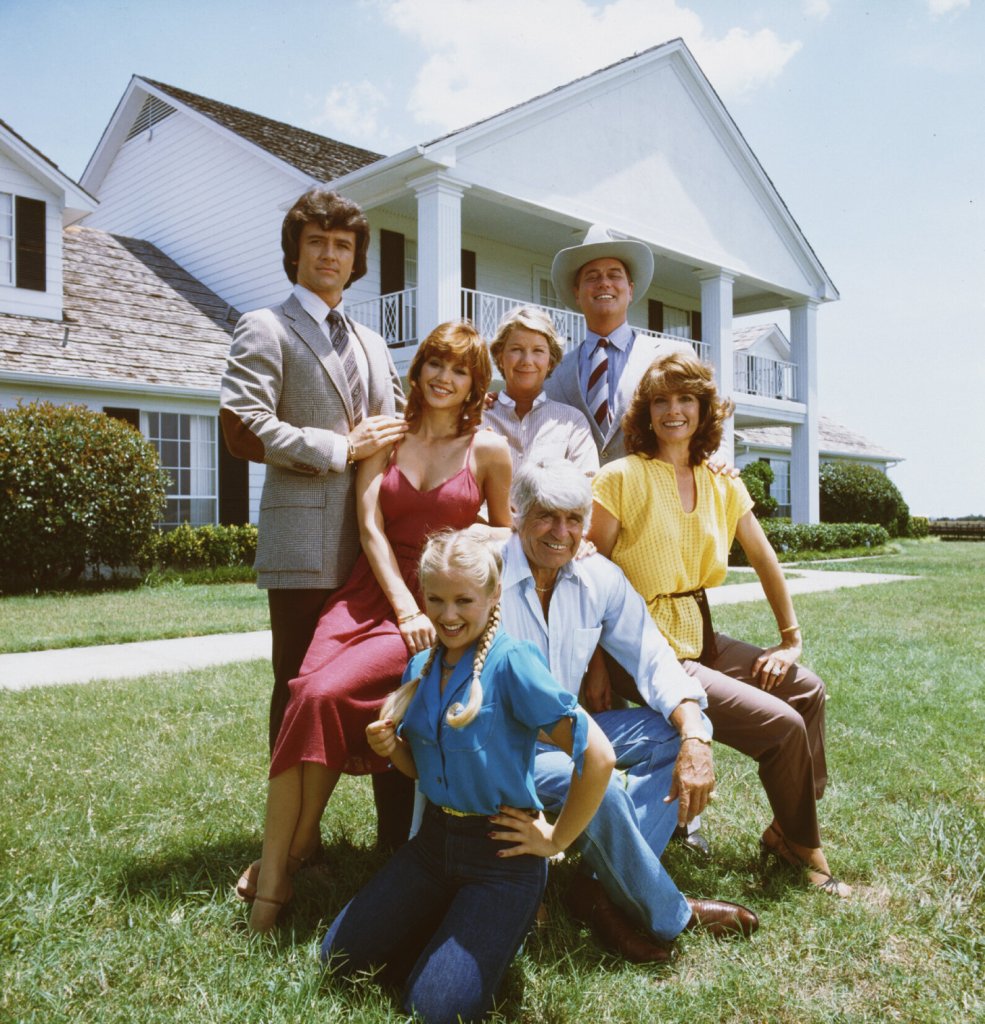
South Fork, where we’re staying for the next two nights, should not be confused with Southfork, a ranch in Texas that combines South and Fork into Southfork.
To see today’s route from Frisco, over four Pass-a-Paloozas™, ending in South Fork, click here.
***
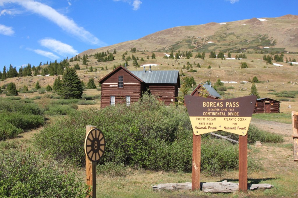
Today’s Not Quite Pass-a-Palooza™… Boreas Pass: 11,493 feet
As our ride began this morning, we rolled through Breckenridge, and cruised by the turnoff to Boreas Pass, a scenic, short, and relatively simple drive over the Continental Divide.
Boreas Pass, which connects Breckenridge with Como – 20 miles away – is considered an easy drive, a nice change of pace for today’s Not Quite Pass-a-Palooza™. The route is suitable for low-clearance, two-wheel drive vehicles. It’s seldom you can say that about a Not Quite Pass-a-Palooza™ road.
Leaving Breckenridge, elevation 9,600 feet, you get on Boreas Pass Road and begin an 1,800-foot climb to the pass.
The road began as a route to the gold mining area around Breckenridge for prospectors in the 1860s, helping them reach gold mines. Soon, it was widened to accommodate stagecoaches.
In 1882, under the direction of Sidney Dillon of the Union Pacific Railroad, workers began laying narrow gauge tracks up the pass, then known as Breckenridge Pass. Dillon named the pass Boreas, in honor of the ancient Greek god of the cold north wind, storms, and winter.
Building the rail line over the pass was a major engineering feat because construction crews had to contend with winter snows, north winds, and high altitude. At one time, Boreas Pass had the nation’s highest narrow-gauge railroad.
In the 1940s, the tracks were ripped out for the war effort, and it became a road again, this time modern enough to accommodate the latest vehicles.
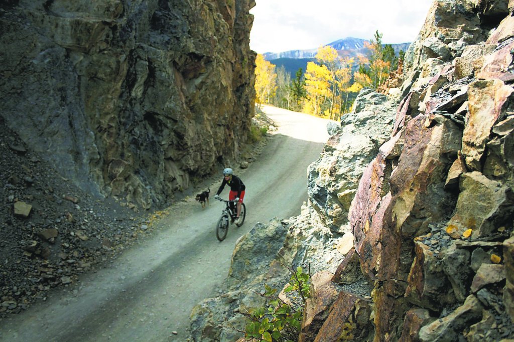
Today, the road is closed in the winter, but is passable the rest of the year by ordinary vehicles, including bicycles. The road serves up sweeping views of the Tenmile mountains and Blue River Valley.
The round trip from Breckenridge to the top of the pass, a 15-mile journey, is popular with bicyclists. That says a lot about how gentle the road is. Not steep, and not rocky.
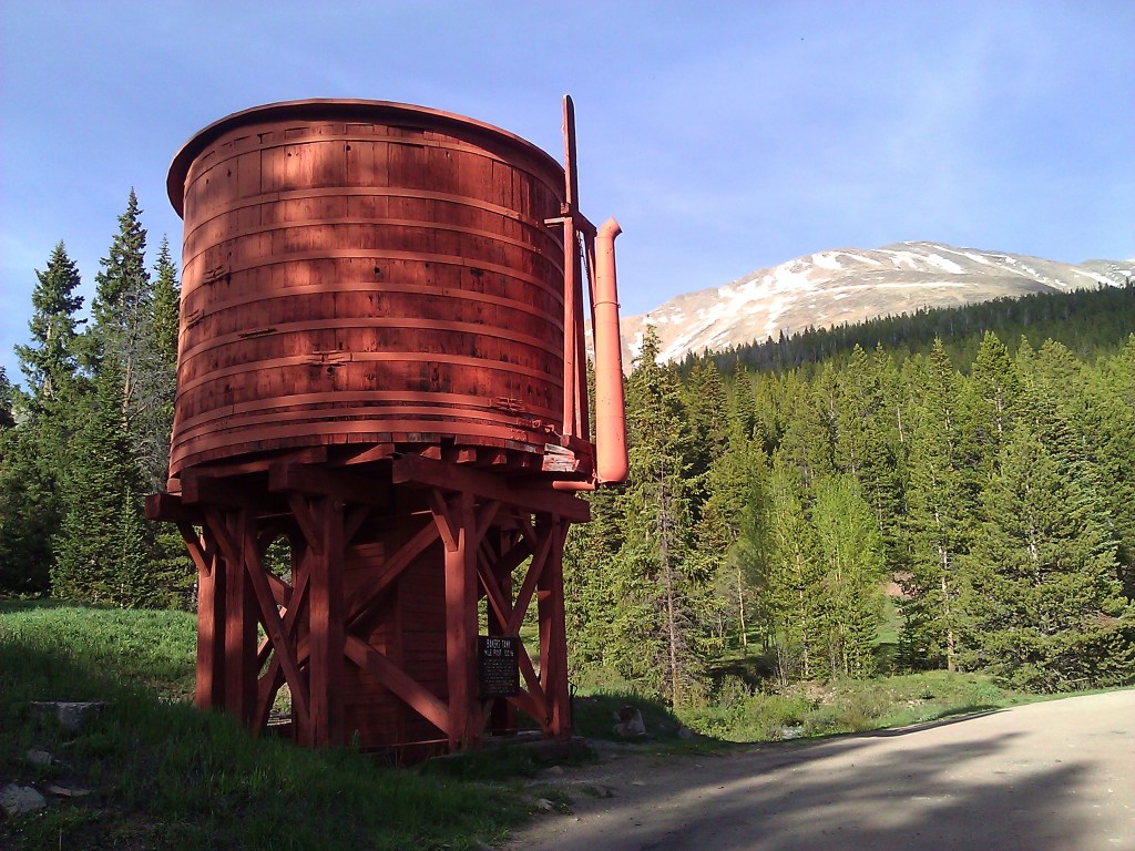
About halfway to the pass, the road takes you by an unmistakable landmark – the Bakers Tank water tower. It’s a restored railroad water tank in a distinctive rust red coloring.
Between 1884 and 1937, locomotives of the Colorado & Southern line used this tank to refill the boilers of steam locomotives. These locomotives, designed for the tight mountain curves and extreme grades, would take on water at the Bakers Tank. Steam engines drank huge quantities of water and the steeper the grade, the more often they needed to stop for water, literally gulping it. Summit County restored the Bakers Tank in 1958. When full, it holds 9,305 gallons of water.
The tank is an interesting piece of Colorado railroad history.
Three miles after the water tower, continuing south, you arrive at Boreas Pass.
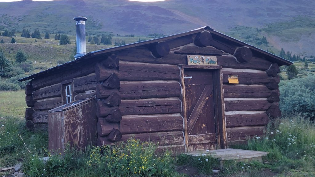
The town of Boreas, now a ghost town, was built at the summit to house workers who maintained the railroad. At the time, it was the second highest railroad station in the world. A few of the buildings still stand and have been restored. One of those is the so-called Section House, built in 1883 to house the railroad men and their families who took care of a section of the narrow-gauge railway.
Next to the Section House sits Ken’s Cabin, also known as the historic Wagon Cabin, built in the 1860s when Boreas Pass was simply a wagon trail over the Continental Divide. Ken’s Cabin is used in the winter as a ski hut, part of the Summit Huts Association. It sleeps 12 people, at a cost of $40 per person, per night. During the winter, you won’t be able to drive to Ken’s Cabin; you’ll have to ski to get there. But isn’t that part of the fun?
At its peak, at least 150 people lived in this mountainous outpost, helping to maintain the railroad and the trains that passed by. The Boreas post office was, at the time, the highest in the country. Today, that distinction belongs to the town of Alma, which sits at 10,758 feet above sea level. We visited Alma yesterday as part of a Not Quite Pass-a-Palooza™ — our journey from Alma to Leadville.
The railroad line over Boreas Pass was abandoned in 1937, and after World War II, the Army Corps of Engineers reconstructed the route for automobile traffic.
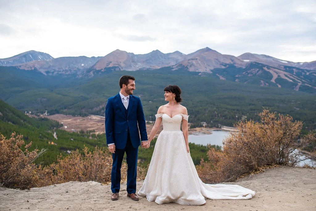
The area around Boreas Pass is a popular spot for weddings. They’re known as outdoor elopements. It’s a cottage industry set among picturesque mountains, green forests, and aspen groves.
The pass is one of many elopement spots in the Breckenridge area, all with stunning views of surrounding peaks and valleys. Many of these spots are along Boreas Pass Road. Wedding photographers specialize in these micro-weddings, and offer them as part of a package that may include personalized ceremonies, a professional officiant, and hair and makeup.
If you want to get married at the pass itself, you’ll have to do it in spring, summer or fall. Winter is the only season where the pass is unreachable. The Boreas Pass ghost town is a popular spot for I-dos.
Boreas Mountain is about a half-mile from the pass, and not on Boreas Pass Road. At 13,083 feet, its summit is about 1,500 higher than Boreas Pass. The hike to Boreas Mountain begins at the Boreas Pass summit.
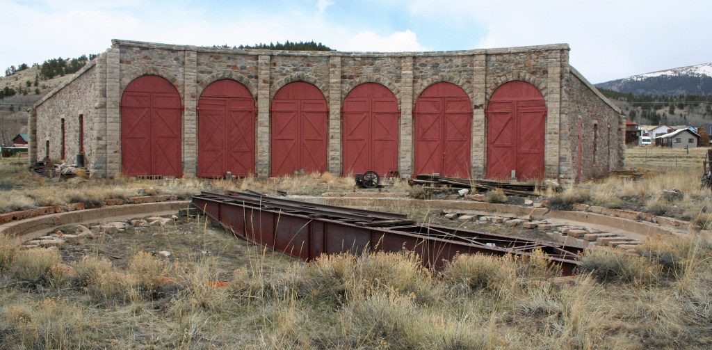
But if you want to continue to the end of Boreas Pass Road, start heading down from the summit. In 1,700 feet, you’ll arrive in Como, which has its own depot, where the railroad once stopped. The Como depot is a half-mile from US Highway 285. When Como was established in 1859, Highway 285 obviously didn’t exist, but it was once part of a stagecoach route.
Como is a former railroad town that got its name from miners who came from Como, Italy, to work in the coal fields of the area. Today, it has many historic weathered structures, including the roundhouse and depot. Those buildings have been renovated by the Denver, South Park & Pacific Historical Society. There are plans to make them into an area tourist attraction.
To view today’s Not Quite Pass-a-Palooza™ route from Breckenridge, over Boreas Pass, to Como, click here.
