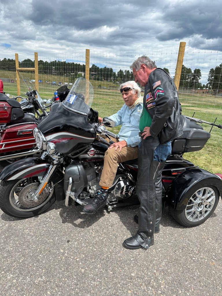
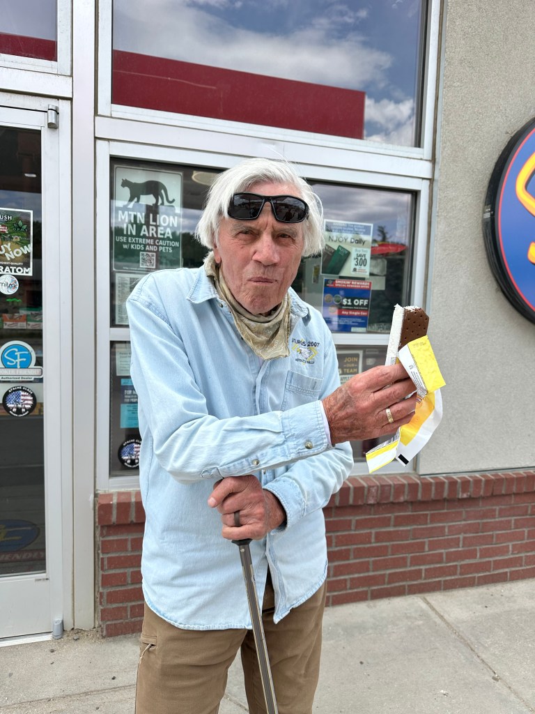
Today’s 158-mile ride is the shortest of the week.
We begin by retracing our steps from yesterday afternoon. In the opposite direction. On US Highway 40. Southbound.
Pass-a-Palooza™ … Berthoud Pass: 11,315 feet
Right away – well, in 13 miles – we roll over Berthoud Pass, one of two Pass-a-Paloozas™ coming up today. From Winter Park, where our day began, it’s only about a 1,200-foot climb to the summit of Berthoud Pass.
Then, we drop about 2,800 feet to the town of Empire, which sits at the entrance to Interstate 70. Empire was originally called Empire City. It was named after New York, the “Empire State.” Empire had dreams of becoming a mining empire.
In the fall of 1860, miners struck silver in what is now Empire. The town enjoyed prosperity during the silver boom, from 1861 to 1865. Empire is home to the “Original” Hard Rock Café, opened in 1934 to serve hard rock miners, and host a sleeping dormitory for miners. There’s a gift shop now where the sleeping room once was.
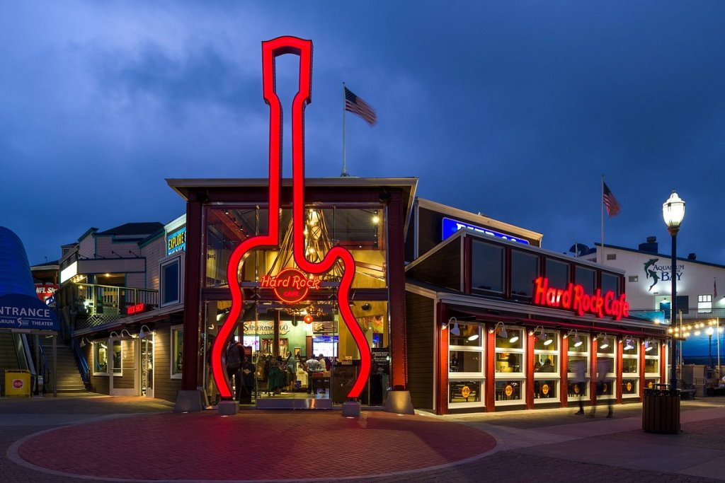
The café is not affiliated with the ubiquitous Hard Rock Café’s that are found worldwide. That restaurant chain founded in London in 1971, now has more than 165 locations in 70 countries. The venues include restaurants, hotels, casinos, and live music venues. Since 2006, the business has been owned by the Seminole Tribe of Florida, which bought it for $965 million.
The Empire building housing the Original Hard Rock Café was first built in 1898. Today, it’s home to the Guanella Pass Brewery Taproom, and the Empire Town Hall. No glitz. Lots of history.
Idaho Springs: Gateway to Mount Blue Sky
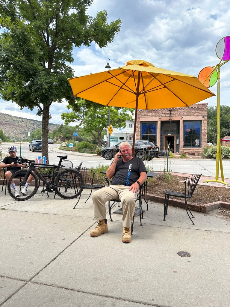
We leave Empire, hop on Interstate 70 East for a few miles, before exiting the highway in Idaho Springs, a small town with a big history.
Idaho Springs had a number of names before its current one, including: Jackson’s Diggings, Sacramento City, and Idahoe. The meaning originated from the Arapahoe Indian word Edauhoe, meaning “Gem of the Mountains.” But Jackson’s Diggins? That was the town’s original moniker, named after George Jackson, who discovered gold at the confluence of Chicago Creek and Vasquez Creek – now known as Clear Creek. The name Idaho Springs stuck, and that’s what the town of 2,000 has been called for most of its life.
Like Empire, Georgetown, and much of this area, Idaho Springs was once a thriving mining town. Placer gold was first discovered in the area now called Idaho Springs in 1859. In June of that year, a formal organization of the mining district was enacted, the first such recorded in Colorado history. That was the beginning of the Colorado gold rush. The end came when most of the area’s mines closed and the mills fell silent, as all non-essential mining was banned in World War II to conserve powder and supplies.
The building of Interstate 70 in the late 1950s and early 1960s at the south edge of town dramatically changed the appearance of the area. A turning point in Idaho Springs history, this caused many travelers to pass alongside the town and led to an increase in population as it made commuting feasible to jobs in the Denver area just 20 miles east of town.
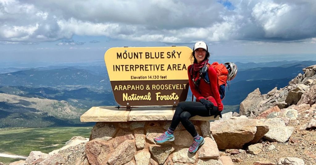
For many tourists, Idaho Springs is known as the jumping-off point to the highest paved road in North America – 14,410-foot Mount Blue Sky. Known as Mount Evans until 2023, Mount Blue Sky is today’s kinda-sorta, Not Quite Pass-a-Palooza™, which I’ll discuss a little later in this blog post. It’s kinda-sorta, because it’s for sure more than 10,000 feet, but the road is paved, so it’s not a true Pass-a-Palooza™.
Pass-a-Palooza™ … Juniper Pass: 11,049 feet
We leave Idaho Springs and head south on Colorado Highway 103. It’s the road to Mount Blue Sky. But due to road re-construction, the upper part of that road is closed through spring 2026. It’s scheduled to re-open Memorial Day weekend in 2026, which won’t help us much today.
The portion of the road that’s closed is from the Forest Service welcome station to the summit parking lot. We’re able to roll by that welcome station, which sits at 10,600 feet, just by Echo Lake Park. If the road to Mount Blue Sky was open, it would be a 13-mile ride to the top of the mountain, a climb of about 3,500 feet.
But it’s not open, so we turn eastward and continue on Highway 103 for two miles, until we reach Juniper Pass, 11,049 feet. The pass connects the towns of Idaho Springs, with Evergreen, just west of Denver.
Juniper Pass is a popular location for Denver-area elopements. Google “Juniper Pass elopements” and you’ll find all kinds of ways to get teary-eyed.
From Juniper Pass, Highway 103 continues east toward the town of Evergreen, about 15 miles away. It’s a drop of about 3,800 feet from the summit of Juniper Pass, as the road winds its way toward civilization. Highway 103 eventually becomes (Jefferson) County Road 66, and brings us to the outskirts of Evergreen, population 7,200. Here, we take a short break before tackling the Peak to Peak Scenic Byway.
We’re finished with Pass-a-Paloozas™ for the day, but there’s still some great riding ahead.
We work our way north on US Highways 40 and 6, past several major rock climbing areas: Nomad’s Cave, East Colfax the Catslab (is it Cat’s Lab, or Cat Slab?) and the Fiscal Cliff. All are along Clear Creek. These are the most popular climbing areas in Clear Creek Canyon.
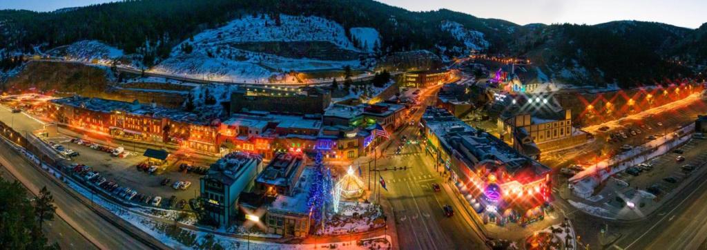
Black Hawk and Central City: Colorado Casino Mecca
Just past the climbing areas, we turn north onto Colorado Highway 119. Twenty miles later, we arrive in the side-by-side towns of Black Hawk and Central City, the beginning of the Peak-to-Peak Scenic Byway. Together, the two cities form the Central City / Black Hawk National Historic District.
Central City is our first sign of civilization on the Peak-to-Peak Scenic Byway. It was founded in 1859 by gold miners. It was soon called “the richest square mile on earth.” Central City and the adjacent city of Black Hawk form the Central City / Black Hawk Historic District.
There’s a lot of history here. By 1860, as many as 10,000 prospectors had flocked to the town, then known as Mountain City. Like most mining towns of that era, Black Hawk had gaming halls, saloons and brothels.
Eventually, gold mining decreased rapidly between 1900 and 1920, as the veins were exhausted. Mining revived for a time in the 1930s, as the price of gold spiked from $20 to $35 an ounce. Mining shut down during World War II, when gold mining was declared non-essential to the war effort. The district was enlivened in the 1950s by efforts to locate uranium deposits, but those proved unsuccessful.
Today, the economies of Central City and Black Hawk are almost entirely based on casino gambling. Black Hawk, with a population of 128 has 18 casinos, some offering luxury hotel accommodations. Adjacent Central City, population, 785, has six casinos.
Those are interesting odds.
In the 1980s, the three historic mining towns of Black Hawk, Central City and Cripple Creek – southwest of Colorado Springs – were facing an economic crisis. Hard-rock mining no longer supported the economies of the towns, tourists were visiting other attractions across the state, and the buildings that gave the communities their historic character were deteriorating.
Like most states, Colorado did not have enough public funds to take on long-term restoration and preservation of the three towns, let alone the thousands of historic sites across the state.

So, Colorado looked to South Dakota, which had passed a state constitutional amendment legalizing gambling in the historic town of Deadwood. The South Dakota amendment carried the stipulation that revenues from gaming activities be used to revitalize the economically stagnant community, and provide for the long-term restoration and protection of its historic resources.
Citizens of Central City began pursuing a similar amendment in Colorado, which eventually became Amendment 4 on the 1990 ballot. On November 6, 1990, 57 percent of voters approved it – and the result is what you see when passing through Central City and Black Hawk.
Nederland, the Low Lands
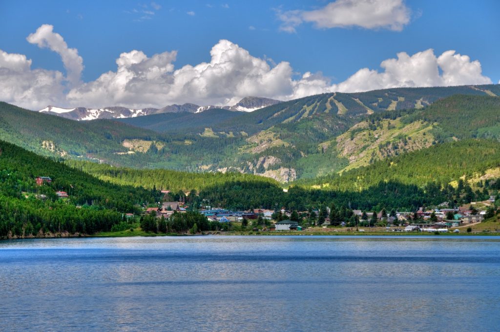
Leaving Black Hawk, we join Colorado Highway 119 and continue our journey on the Peak-to-Peak Scenic Byway. Twenty miles of twisty road later, we arrive in the town of Nederland.
The town, with a population of about 1,500, began as a trading post between Ute Indians and European settlers during the 1850s. Nederland’s first economic boom came when minerals such as tungsten, silver and gold were discovered east of town in the late 1850s.
A man named Abel Breed owned the silver-rich Caribou Mine, not far from here. The mine was at roughly 10,000 feet. The high elevation meant fierce winds and deep winter, so when the Mining Company Nederland bought the mine in 1873, it moved the milling to a lower elevation, near where Nederland is today.
The Mining Company Nederland was based in The Netherlands. In the Dutch language, Nederland means “low land,” and based on casual usage by the Dutch miners, the area was soon called “Nederland.” In 1874, when the town was incorporated, the people chose Nederland as its name. The name stuck, and it remains today. Interestingly, Nederland sits at 8,236 feet. It’s a stretch to call it low land.
Nederland sits right next to the Barker Meadow Reservoir, owned and managed by the city of Boulder. The reservoir, named after a previous owner of the land, Hanna Connell Barker, provides water for a hydroelectric plant, and supplies water to Boulder. It holds about 11,500 acre-feet of water.
By 1890 there was little ore to be milled, and Nederland became yet another mountain ghost town. By 1920, its population dwindled to about 200 people. The final boom in Nederlands happened in the 1940s, when demand for tungsten picked up during World War II. But that didn’t last, either.
Today, Nederland has had a bit of a revival. It’s the hub of the Peak-to-Peak Scenic Byway. Nederland is an easy place to visit from nearby Boulder, just 17 miles away. The town is known as a gateway to outdoor recreation in the nearby Indian Peaks Wilderness, Rocky Mountain National Park, Roosevelt National Forest and the James Peak Wilderness.
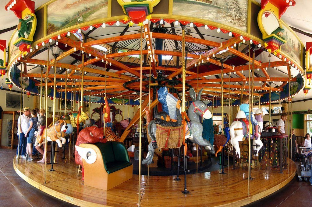
The number one attraction in Nederland is the Carousel of Happiness. It’s one of the last carousels in the US with hand-carved wooden animals. A few years ago, the carousel welcomed its one millionth rider since opening in 2010. It has 56 different animals, 35 of which can be ridden. All the colorful creatures are carved by one man, Scott Harrison, who calls himself the Creative Custodian of the Carousel of Happiness. The carousel turns to the music of a restored 1913 Wurlitzer Band Organ.
One ride is $3, or you can do ten rides for $25. The happiness is free.
Lyons, Home of Red Sandstone
The Peak-to-Peak Scenic Byway continues as we leave Nederland. Fourteen miles from Nederland, we turn off the byway onto Colorado Highway 7, directing us toward the town of Lyons. The town sits at the intersection of Highway 7 and US Highway 36, which will take us to today’s final destination, Estes Park.
Lyons was founded in 1880 by Edward Lyon. After coming west from Connecticut at his doctor’s advice, he and his wife Adeline purchased 160 acres in the area. He noted the potential to quarry out the red sandstone outcroppings that offered easy quarrying access. Lyon platted the town in 1881, and it was incorporated 10 years later. It’s a mystery where the “s” came from at the end of the town’s name. It could have been called Lyon, but that was already taken by France’s third-most populous city, which has been around 2,000 years, about 1,860 years longer than Lyons, Colorado.
In 1864, the Denver, Utah & Pacific Railroad built a narrow-gauge track into Lyons, to ship the sandstone as far east as Chicago and New York. The sandstone shipments were used on brownstone houses in those cities. Sandstone was also used as rubble for railroad ballast, flagstone for sidewalks, and curbs and gutters.
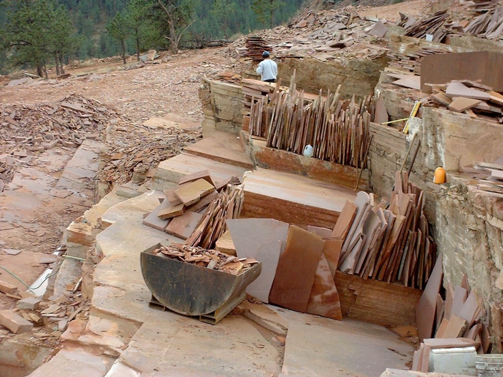
Today, Lyons has a population of about 2,000. It has large red sandstone mountains on three sides, considered the hardest sandstone in the world. The Lyons sandstone has a unique red or salmon color. While Edward Lyon established the quarrying business in town, it was less than a smashing success, and he left for California. Numerous owners succeeded him and developed successful quarry businesses. The red sandstone is now shipped worldwide. Lyons’ quarry business is celebrated in the town’s Redstone Museum.
In addition to the sandstone quarries known as Lyons Sandstone, the town is noted for its arts, culture and outdoor recreation. Lyons’ tagline: “The hip little town everybody loves.”
Estes Park, Home of the Stanley Hotel
Twenty miles from Lyons, we roll into Estes Park, tonight’s destination, The city is named after Missouri native Joel Estes, who founded the community in 1859, then moved his family there several years later. Estes, his wife Patsey, and six of their children moved to Colorado and landed at what was then Auraria, north of Denver.
Eventually, he and his son, Milton, were on a hunting and exploring trip when they discovered Little Thompson Creek, a tributary of the Big Thompson River. In a This-is-the-Place moment, reminiscent of Brigham Young in Utah, Thompson said upon seeing the Little Thompson, “this is the very place I have been seeking; here we will make our home.”
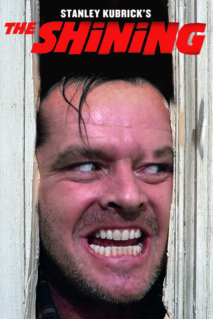
Estes Park sits along the Big Thompson, and adjoins Lake Estes. Its most famous landmark is the historic Stanley Hotel, which opened in 1909. The hotel was built by Freelan Oscar Stanley of Stanley Steamer fame. It served as the inspiration for the Overlook Hotel in Stephen King’s 1977 novel, The Shining, and its 1980 film adaptation.
Stanley did his best to bring visitors to his hotel, building nine-passenger steam buses to drive the route from Loveland to Estes Park through the Big Thompson River Canyon, and opening a bus line for the 20-mile ride along the Little Thompson River, between Lyons and Estes Park.
The Stanley Hotel sits on the Big Thompson River, named for English fur trapper David Thompson. He was employed in 1810 by the Northwest Fur Company to explore the Rockies. Thompson was tasked with finding a route to the Pacific Northwest to open up new trading territories. His maps were used by both the American and Canadian governments until the 1940s. In all, he mapped an area of 1.5 million square miles, nearly one-fifth of the entire North American continent.
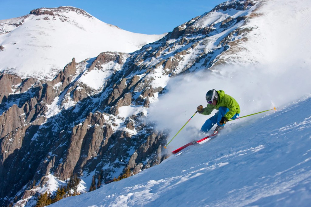
At 7,522 feet of elevation, Estes Park is unique among famous Colorado mountain towns for not having a ski area. Over the years, it’s had a number of now-defunct ski areas, including Davis Hill, Hidden Valley, and Old Man Mountain. Davis Hill, which had no ski lifts, was located in downtown Estes Park; for the 1924 season, a Swiss ski instructor was hired to help locals learn the sport.
Today, the closest downhill skiing is Eldora Ski Resort, 47 miles away. Eldora, only 20 miles west of the college town of Boulder, is owned by Utah-based POWDR, and you can use your Ikon pass there.
While Estes Park no longer has a ski area per se, you can think of it as one enormous ski area. Estes Park sits on the eastern edge of Rocky Mountain National Park, a haven for backcountry skiing. We’ll visit the park tomorrow.
To see today’s route from Winter Park, over Berthoud and Juniper Passes, along the Peak-to-Peak Scenic Byway, and on Estes Park, click here.
***
Today’s Not Quite Pass-a-Paloozas™… Mount Blue Sky, and Pikes Peak
Today’s Not Quite Pass-a-Paloozas™ are different than most. Yes, they are 10,000-foot-plus roads. But these roads are paved. And scary. What makes these Not Quite Pass-a-Paloozas™ unique is that they take you to the top of Colorado fourteeners – 14,000-foot mountains – and you have to pay a fee to get to the top.
These roads lead you up Mount Blue Sky and Pikes Peak, and they are the only two of Colorado’s 31 actual paved Pass-a-Paloozas™ I’m not riding on this trip.
Not gonna ride Mount Blue Sky because it’s closed. That’s a reasonable excuse. And, not gonna ride Pikes Peak, because it’s too far off the beaten path, more than 100 miles from anywhere I’ll be on this trip. Again, a plausible excuse.
While I’m not riding either of those mountains on this trip, I’ll describe the journeys for you in the hope that you’ll try them out, and let me know about it. (I rode to the top of Mount Blue Sky in 2014, when it was called Mount Evans, and someday, for symmetry purposes, will do Pikes Peak, too.)
First, Mount Blue Sky: 14,130 feet
Earlier today, we rode about halfway to Mount Blue Sky, and when we couldn’t go any farther, at Echo Lake, we rode on to Juniper Pass, and eventually to Estes Park.
The road to Mount Blue Sky begins in Idaho Springs, just off of Interstate 70. From there, it’s 14 miles, and a 3,100-foot climb to Echo Lake, where the Forest Service gate to the summit is, and where the road is closed until 2026.
Because the Mount Blue Sky Scenic Byway is so popular, reservations are required to go beyond the Echo Lake entry point. The cost is only $2 per vehicle on recreation.gov, but without a reservation, the nice people at the gate with the ranger outfits won’t let you in. From this gate, it’s about 14 miles to the summit parking lot.
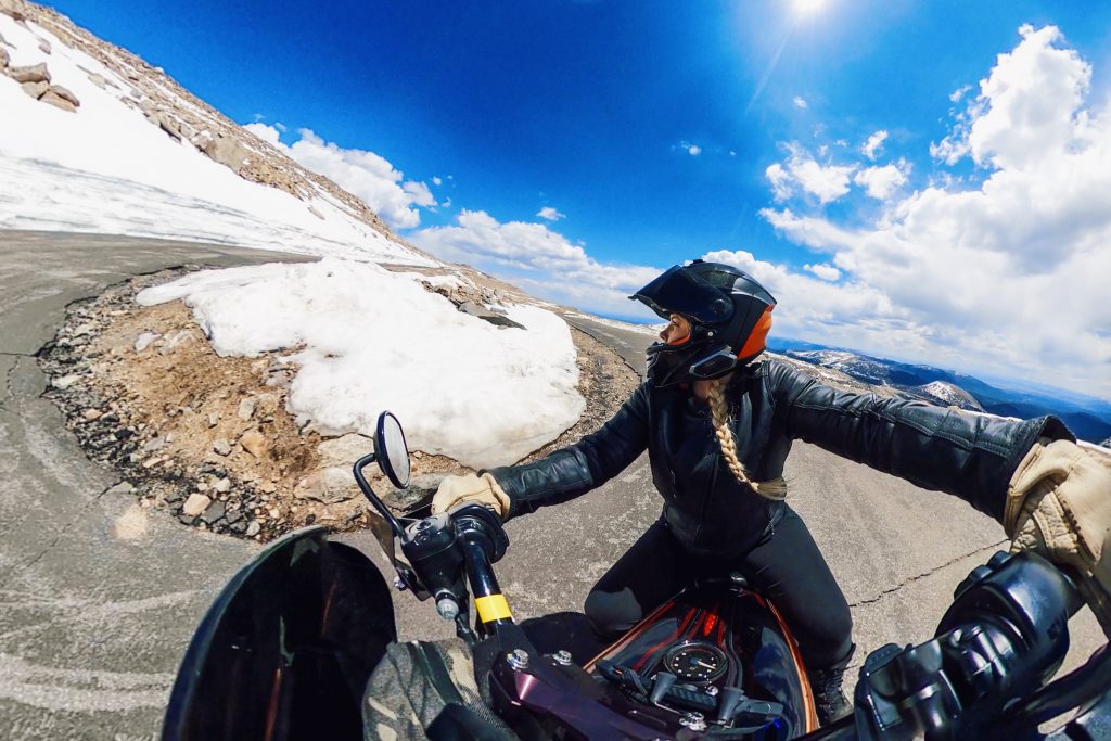
Mount Blue Sky, which I rode to the top in 2014 when it was called Mount Evans, is one of my all-time favorites, though I was scared half-to-death on much way to the top. That’s why Mount Blue Sky rates #7 on my all-time Top Ten list.
Although it’s 10,600 feet above sea level and 40 miles east of Denver, Echo Lake is part of Denver’s sprawling mountain park system. More than 100 years ago, Denver city officials realized that development was threatening some of the most scenic areas in the Rockies. To save those areas, the city purchased more than 14,000 acres of land to protect the natural beauty – including the parks and land near Mount Blue Sky.
Mount Blue Sky is the most prominent mountain overlooking Denver. For centuries, people looked up to it, but 162 years ago, the mountain changed from something to admire from afar, to something to experience up close and personal.
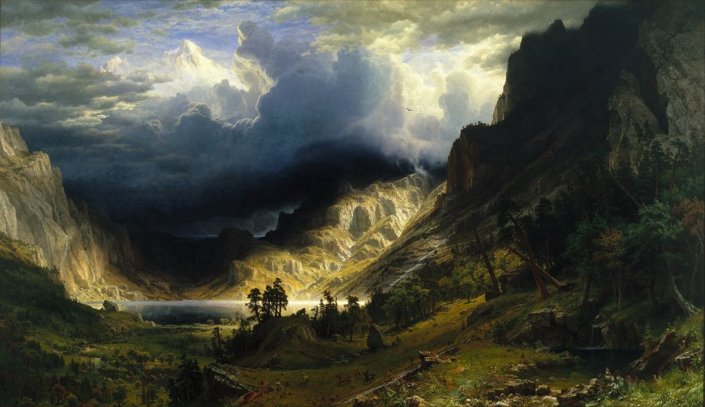
In 1863, Famous western landscape painter Albert Bierstadt became the first known person to summit the mountain. He initially named it after his wife-to-be, Rosalie. For a time, it was called Mount Rosalie – made famous by an 1866 painting he made called “A Storm in the Rocky Mountains, Mt. Rosalie.” The painting, measuring 83 by 142 inches, is exhibited at the Brooklyn Museum, which acquired it in 1976.
What’s in a Name? The mountain, in 1895, was officially named “Mount Evans,” after John Evans, the second territorial governor of Colorado. The name Mount Rosalie was then moved to a 13,575-foot peak about three miles southeast; it’s called Rosalie Peak, and offers fabulous views of Mount Blue Sky and Mount Bierstadt.
In 2023, Mount Evans was renamed Mount Blue Sky, the culmination of a years-long controversy involving Evans’ role in the Sand Creek Massacre. In that 1864 incident, Evans ordered the US Army to slaughter about 150 Cheyenne and Arapahoe Native Americans – most of them women and children. Evans resigned his position as governor over the incident, and yet, the mountain bore his name for nearly 130 years.
It wasn’t until 2022 that the Colorado Geographic Naming Advisory recommended unanimously to change the name to Mount Blue Sky, a name that was proposed by the Cheyenne and Arapaho Tribes. According to the proposal, the new name is a nod to the Arapaho, known as the Blue Sky People, and the Cheyenne, who have an annual ceremony of renewal of life called Blue Sky. The US Board of Geographic Names voted to accept the naming recommendation in September 2023, and the change was effective immediately.
Building the Byway. In the early 1900s Colorado was trying to attract new tourists to the state. At the time, the city of Colorado Springs had recently constructed a road up the side of Pikes Peak (more on that, later in this blog post). The Pikes Peak road was such a success it began drawing visitors away from the Denver area. In an attempt to attract people closer to the Denver area, a road to the top of Mount Evans was proposed to create a similar scenic driving experience, but more convenient for the Denver population.
Construction on the road up the mountain began in July 1923, and was completed seven years later. The road opened to the public in 1931. At the time, the road to what was then called Mount Evans was the highest in the world. Today, it’s the highest in North America. At 14,130 feet, it’s 20 feet higher than the Pikes Peak Highway, which you’ll learn about shortly.
Repairs to the highway, the reason we didn’t ride it today, are needed because the underlying roadway material near Summit Lake has settled, leaving a three-quarters of a mile section of the road pretty much undrivable. The slab of black asphalt, up to three feet in places, soaks up heat from the sun and melts up to 15 feet of permafrost below. The soil constantly freezes and thaws, heaving and buckling the pavement. It’s like a mini-roller coaster.
While the road to the summit is closed until next year, you can still make your way to the top of Mount Blue Sky, with a little a little more effort than sitting behind a steering wheel. The summit will be accessible via various hiking trails if you can’t wait until summer 2026 to picture yourself atop this fourteener.
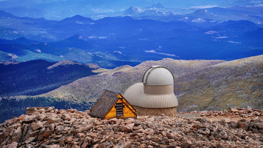
When You Get to the Top. Once you arrive at the top, you’ll find several structures, including the ruins of the Crest House, home to a restaurant and gift shop, which was destroyed by a propane fire in 1979; and a high-altitude lab built by the University of Denver in 1935 to conduct cosmic ray research. That lab was expanded into an observatory in 1997, run by Denver University’s Department of Physics and Astronomy.
The road to the top of Mount Blue sky ends at a parking area and turnaround, just 135 vertical feet below the actual summit. There’s a quarter-mile trail from the parking lot to the actual summit. Hiking this trail allows you to bag a fourteener, the easy way. And you’ll have a great story to tell.
As you’d expect, the Mount Blue Sky Scenic Byway generally opens around Memorial Day – weather permitting, of course. And it usually closes around the first weekend in October.
Along the way, you’ll see scenic views of the Continental Divide, the entire Front Range, alpine lakes, mountain goat and bighorn sheep herds, marmots, birds, alpine wildflowers and Bristlecone Pine trees.
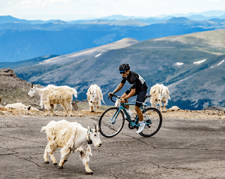
Nice Day for a Ride. During normal summers, when the road is open, there’s an event that closes it to vehicle traffic one day each year in July: the Mount Blue Sky Hill Climb, held annually since 1962. The race begins in Idaho Springs, runs 27.4 miles, and climbs 6,590 feet. Think of it as a marathon on two wheels.
As many as one thousand riders compete each year in a number of categories, based on age and gender. The youngest rider was nine years old; the eldest 85. The course record is an astonishing one hour and 41 minutes, set by Tom Danielson in 2004.
The Hill Climb won’t be held this year, as the road to the top is closed for construction. If you want to ride in next year’s event, you have just about 12 months to train, and to get your entry in. It’s a USA Cycling sanctioned race that requires an annual USA Cycling license ($15) and a $110 registration fee – jersey not included, but you do get a complimentary beer and food at the finish party in Idaho Springs.
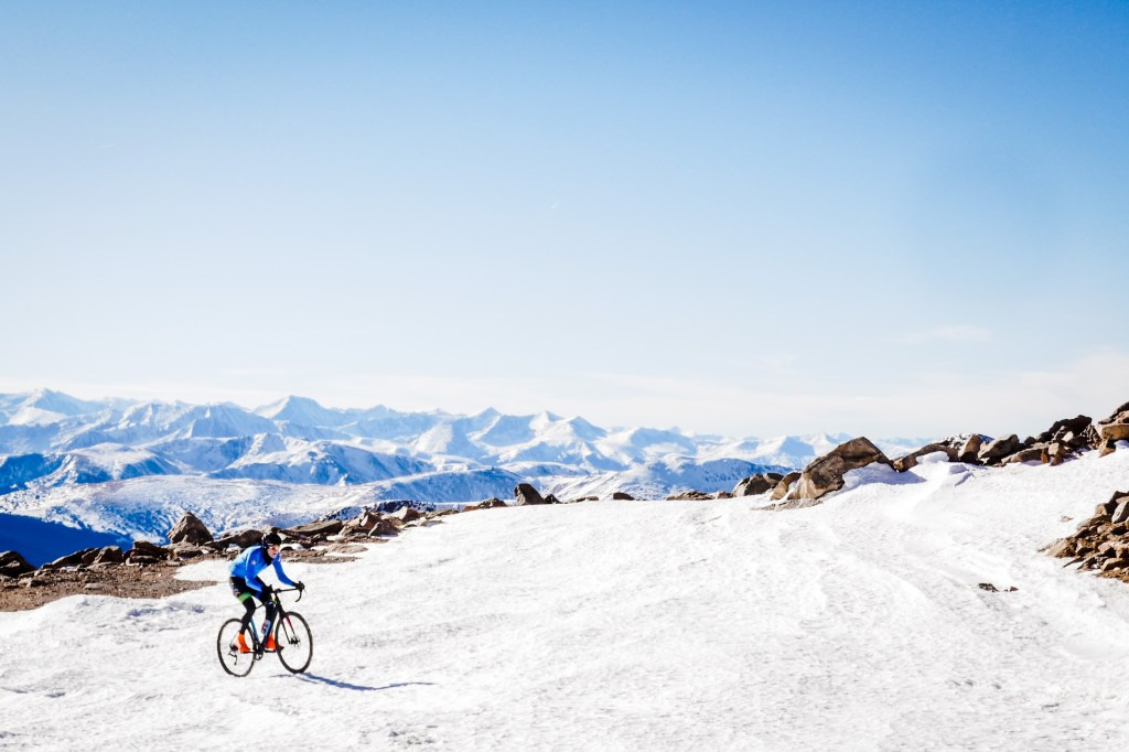
Or, you could be like a couple of adventurous guys who rode to the top, even when the road was closed – in November!
And now, Pikes Peak: 14,415 feet
Pikes Peak is the other Colorado paved Pass-a-Palooza™ I won’t be riding on this trip. So, of the 31 paved passes over 10,000 feet, I will have crossed them all — except Pikes Peak and Mount Blue Sky, two paved fourteeners.
The entrance to the Pikes Peak Highway is just 15 miles west of Colorado Springs, in Cascade, a tiny community where you’ll find the Brush Hollow Winery Tasting Room and Eatery. The Pikes Peak Highway is 85 miles from Denver, the Mile High City. And, it’s more than 200 miles from Carbondale, where you’ll find me when I’m not on the road.
For those who live on the Western Slope, like me, it’s inconvenient to get to. If there was any Colorado Pass-a-Palooza™ to skip on this trip, Pikes Peak is it.
When it’s handy, I can go back and do the Pikes Peak Highway pretty much any time I want. It’s a one-day drive from just about anywhere in the state, and at least partially open year-round, up to the altitude where snow removal becomes excessively difficult.
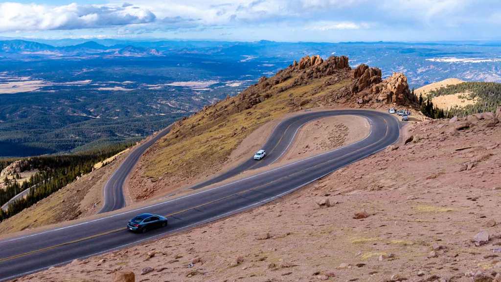
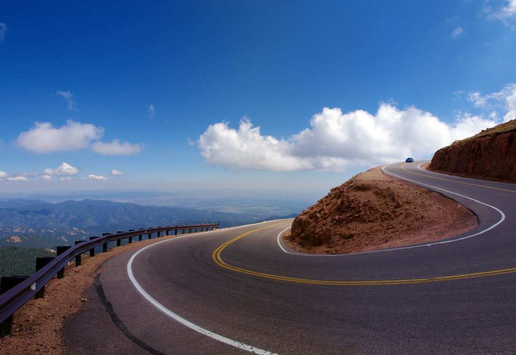
Pike’s Highest Peak. The Pikes Peak Highway is a 19-mile toll road that runs to the summit of 14,115-foot Pikes Peak. Its summit is only 15 feet shorter than the parking lot where the road ends at the top of Mount Blue Sky.
The highway has been around for more than 100 years, 77 of those under the care of the city of Colorado Springs, which manages and maintains the road. The road itself is actually owned by the US Forest Service; the city of Colorado Springs has a special permit to manage the highway and toll road.
From the starting point about a mile west of US Highway 24, the highway rises more than 6,700 feet. An estimated 500,000 people drive to the top of Pikes Peak each year. The mountain is named after explorer Zebulon Pike, even though he was unable to reach the summit when he attempted it in 1806. He and three other men from his exploration party tried climbing to the summit of what had been called Grand Peak. Slowed by rough terrain and inadequate supplies, the climbers never reached the top. On Thanksgiving Day, they saw it from a lesser summit to the south, probably Mt. Rosa, and decided to turn around.
Throughout its history, the mountain now known as Pikes Peak was first called El Capitán, Grand Peak, Great Peak, James Peak, and Long Mountain. Zebulon Pike named it “Highest Peak” in 1806, and the mountain was later commonly known as Pike’s Highest Peak, eventually shortened to just Pike’s Peak. The name stayed that way until it was simplified to Pikes (no apostrophe) Peak by the US Board on Geographic names in 1890. Who needs apostrophes, anyway?
A Road to Promote Tourism. Before Pikes Peak had a highway to the top, the most common way to get there involved trails, donkeys or mules. In 1888, the Cascade Town Company opened the Pikes Peak Carriage Road (also called the Pikes Peak Wagon Road) to escort visitors to the summit. Then, the construction of the Cog Railway in 1891 opened an even easier way to the top. That railway route paved the way for the highway that exists today.
Spencer Penrose, who built the Broadmoor Hotel, the Cheyenne Mountain Zoo and other famous attractions in Colorado Springs, was looking for one more way to promote tourism in the area in the early 1900s. He got the idea to construct a highway to the top of Pikes Peak, and the road was built in 1915 at estimated cost of $500,000 – around $15 million today.
The highway was not technically completed until 2011, when the final 13 miles to the summit were paved; that last section had been a dirt road for the first 95 years of its existence.
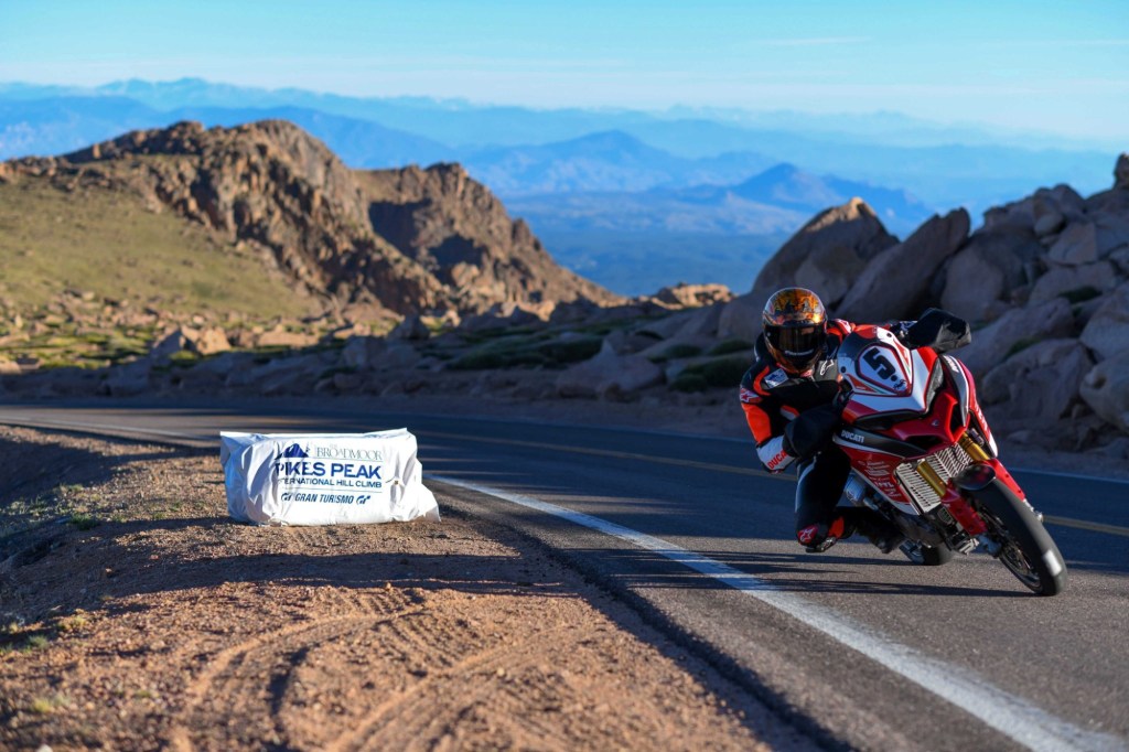
Driving the dirt portion of the road at high speeds was always part of the thrill of the Pikes Peak International Hillclimb. That race began in 1916, to promote the newly opened highway, and is the second oldest continuous motorsports event in the US, after the Indy 500. It’s known as the Race to the Clouds, held every year on the last Sunday in June. Don’t get any crazy ideas to enter your hot little Subaru; it’s an invitation-only event.
A Need for Speed. In the race, cars begin at the 9,390-foot mark, and drive 12.4 miles to the summit, covering the 156 turns in, well, no time at all. The fastest time is 7 minutes, 57.148 seconds, recorded in 2018 by French driver Romain Dumas in an all-electric Volkswagen I.D. R. That’s an average speed of 93.58 miles per hour. Top speeds are upwards of 140 miles an hour.
The event even includes motorcycles. Or it did. Motorcycles of all kinds.
In the 1950s, Harley-Davidsons won the motorcycle class twice in the 750 cc division. Vroom! Over the years, motorcycle winners have included Triumphs, Yamahas, Hondas, Husqvarnas, Ducatis, KTMs, and Aprilas.
In the 2019 event, four-time winner Carlin Dunne had rounded the final corner and was within sight of the finish line, when he lost control and was killed in a crash. He was riding a Ducati Streetfighter V4 Prototype bike. Dunne’s run up the mountain was the last time anyone raced up Pikes Peak on a motorcycle. His mother, who supported Dunne’s racing career and knew the risks, said of the event: “The reality is that you can’t make it a safe race.”
Motorcycles are no longer allowed in the Pikes Peak International Hillclimb.
When You Get to the Top. Whether you’re in a race, leisurely driving your car, hiking or taking the Cog Railway, you will travel through four Colorado life zones on your way to the summit: foothills, montane, sub-alpine and alpine.
Of all the ways to reach the summit of Pikes Peak, one of the most challenging may be hiking the Barr Trail. This 13.5-mile route, which begins in Manitou Springs, gains 7,400 feet of elevation along the way. It’s basically a half-marathon, hiking uphill.
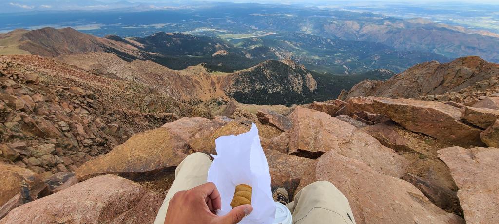
When you arrive at the summit, no matter how you get there, you’ll be greeted by a state-of-the-art visitor center known as the Pikes Peak Summit House. The building includes exhibits, a gift shop, and indoor and outdoor dining areas where you can enjoy a world-famous Pikes Peak donut.
The donuts are made in what’s believed to be the highest deep-fat fryer in North America, which produces more than 500,000 of the sweet treats every year. Your legendary donut will be fried using the same altitude-adjusted recipe that’s been passed down since 1916.
Yum.

I find if hard to believe a kawaski didn’t win the Pike peak motorcycle race at least once. Looks like a good ride..
LikeLike