
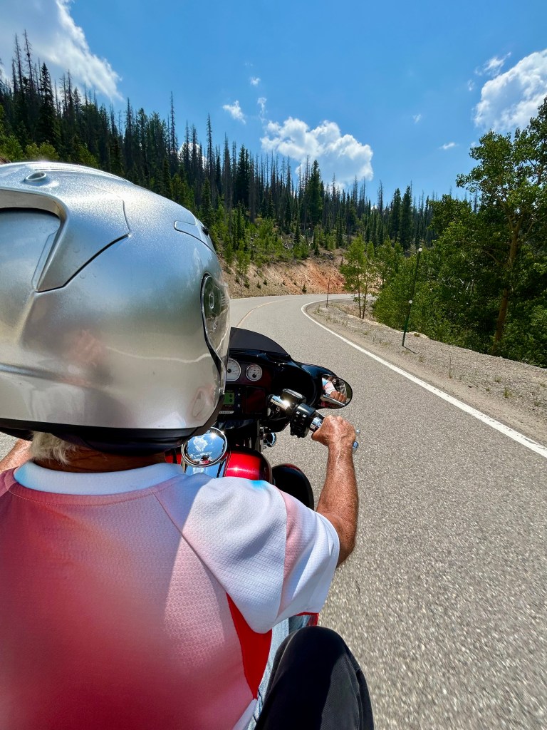
Today we look forward to the longest ride of the week: 258 miles, including three Pass-a-Paloozas™, one national park, and a scenic byway. Our day starts in Ridgway, and ends in Pagosa Springs – not far from the New Mexico border.
Rolling out of Ridgway, we head north on US Highway 550 toward Montrose, a city of 20,000. The city is named after the Marquis of Montrose, immortalized in Sir Walter Scott’s novel, A Legend of Montrose.
Montrose is chock-a-block full of stoplights. Because of that feature, it’s my riding pal Dave’s favorite Colorado mountain town. Sort of. After a hot summer ride in 2018 that included waits at seemingly every signal, Dave called me on my helmet-mounted headset and said Montrose was where he wanted me to spread his ashes when the time comes.
Got ya covered, Bro!
A Very Black Canyon
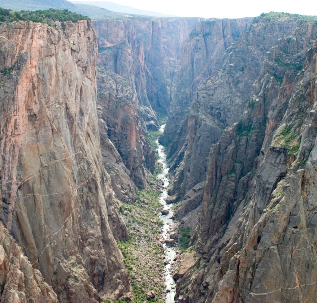
The Black Canyon of the Gunnison National Park, established in 1999, is 11 miles northeast of Montrose. Head east on US Highway 50 for six miles, north on Colorado Highway 347 for five miles, and you’ll arrive at the Park’s visitor center.
Views in the park are very dramatic. That’s an understatement.
The Ute people had known the canyon to exist for a long time before the first Europeans saw it. They referred to the river as “much rocks, big water.”
The first official account of the Black Canyon was provided by Captain John Williams Gunnison in 1853, who was leading an expedition to survey a route from Saint Louis and San Francisco. He described the country to be “the roughest, most hilly and most cut up,” he had ever seen, and skirted the canyon south towards present-day Montrose, which we just rolled through a few minutes ago.
The Gunnison River drops an average of 34 feet per mile through the entire canyon, making it the fifth-steepest mountain descent of a river in North America. By comparison, the Colorado River in the Grand Canyon drops an average of 7.5 feet per mile.
The Black Canyon is so named due to its steepness, which makes it difficult for sunlight to penetrate the canyon. As a result, it’s often shrouded in shadow, causing the rocky walls to appear black. At its narrowest point, the canyon is only 40 feet wide at the river.
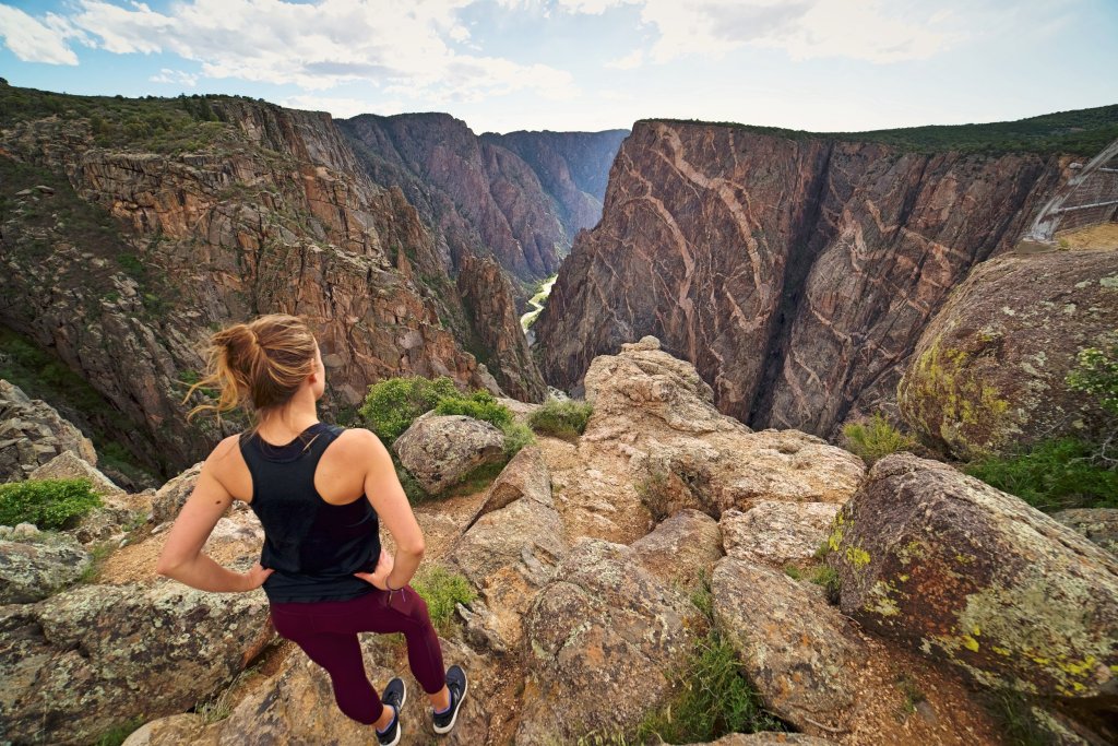
Within the canyon, the Painted Wall is the tallest sheer cliff in Colorado: 2,250 feet high.
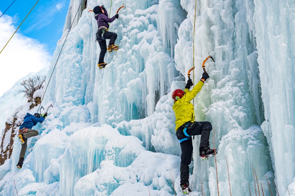
The 48-mile-long canyon is known for crumbling rock and dizzying heights. It’s a haven for rock climbers. Double Black Diamond. Experts only.
The main attraction in the park is the scenic drive along the canyon’s south rim, which we explore for the next hour. Besides us, about 200,000 tourists will visit the park this year.
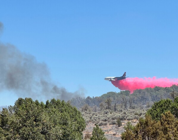
Unfortunately, we saw none of that. The park is closed, due to wildfires 😂😂😂
So we ride past the turnoff to the Black Canyon, and head east on US Highway 50 toward the Blue Mesa Reservoir, the biggest body of water entirely in Colorado. With 96 miles of shoreline, the Blue Mesa is America’s largest lake trout and kokanee salmon fishery.
After riding along the southern and northern shores of the reservoir for 10 miles, we turn onto Colorado Highway 149 and head south. This begins our journey on the Silver Thread Scenic Byway.
The Silver Thread
This road was once a trail used by the Ute Indians, helping them reach hunting camps and hot springs. In the 1850s, the Utes were overwhelmed by homesteaders and miners, and were forcibly relocated to the southwest corner of Colorado. Their ancestral paths were eventually widened and improved to become the Del Norte-to-Antelope Toll Road. It was a pay-to-ride stage line that linked the supply station of Del Norte to the mines in Creede and Lake City – two of our stops later today.
In 1990, the Colorado Transportation Commission chose a 75-mile stretch of this highway to become a Scenic and Historic Byway. A Silver Thread Committee set a goal of promoting all the resources on the byway, educating the public about them, and improving safety and comfort along the Silver Thread. The committee also sought designation of the Silver Thread as an All-American Highway; that hasn’t happened yet, as there are only two All-American Roads in Colorado – so far. Those two are the San Juan Skyway, which we rode yesterday, and Trail Ridge Road, which I’ll ride next week.
With the discovery of silver in Lake City and Creede in the late 1880s, toll roads and railroads were extended at a breakneck pace, creating a vast transportation network throughout the San Juan Mountains.
Lake City and Creede flourished until the silver panic of 1893. Even after the panic, the mountains were still rich with ore, so miners regrouped and opened again, operating with great success for decades. It was only in the last half of the twentieth century that the silver market completely collapsed, forcing the mines to close. Those mines remain a legacy as rich as the silver veins that still run through the San Juan Mountains.
Lake City, A Vegan Delight
An hour after leaving Gunnison, we roll into the town of Lake City, which sits at 8,660 feet. Lake City is named after nearby Lake San Cristobal, Colorado’s second-largest natural lake. San Cristobal is Spanish for “Saint Christopher.”
The small mountain community was founded as a mining town when four prospectors illegally set up mines in Ute territory in 1871. After the Ute people ceded the territory in 1874, miners discovered a hotspot for silver and gold in what was then called the Hotchkiss Lode – now known as the Golden Fleece Mine.

With the completion of the first road into the mountains of this region, Lake City served as a supply center for the many miners and prospectors flooding into the area, starting in the 1880s. At its peak, the town boomed to as many as 5,000 settlers. Today, Lake City has shrunk to about 430 year-round residents.
By 1905, the mining era was effectively over and Lake City entered a decades-long period of decline. Its economic driver today is tourism. The mountains around Lake City provide an array of outdoor recreation opportunities, including fishing, hunting, boating, mountain climbing, off-roading, horseback riding, and hiking.
The town is on the National Register of Historic Places and has a designated Historic Downtown. It still has many of its original buildings from the mid-1800s. The town’s remote location and decades of economic contraction helped conserve the buildings from the mining era, allowing Lake City to avoid many of the modern “improvements” to historic buildings that often happen in more prosperous towns.
In the winter, Lake City hosts Winter White Out, a series of winter-themed events. Starting at the end of January and lasting six weeks, activities like pond hockey on Lake San Cristobal, an ice-climbing competition, and a snowshoe race take over the city.
Before leaving town, here’s a Lake City fun fact: In 1874, Alferd Packer, Lake City’s most notorious resident, was jailed for killing and eating five fellow gold prospectors when their group became trapped in a blizzard atop nearby Slumgullion Pass. Packer became known as the Colorado Cannibal. After his release from prison, he reportedly became a vegetarian. You can visit the massacre site, and then go to the Hinsdale County Museum to view the skeletal leftovers from the meal.
As we leave town, not at all hungry, we roll past the Lake City Ski Hill. This place is skiing as it used to be.
Lake City’s Poma lift is Colorado’s oldest operating lift, an Arapahoe Basin hand-me-down. The lift ran at A-Basin in the 1950s before arriving in Lake City in 1966 to open what the town called the Lake City Winter Wonderland. The name of the ski area owned and operated by the town has since changed to better fit its modest ambitions. It’s now simply called the Lake City Ski Hill and Terrain Park.
Lift tickets are $25 for a day pass, $10 for children 17 and under. Those rates include equipment, if you need it – skis, boots and poles – free of charge. The ski hill, with its 247 vertical feet, is usually open Saturday, Sunday, and Monday, from 10 am to 2 pm. If you need a warm-up during your ski day, stop by the small hut where lift tickets are sold, and grab a cup of hot chocolate. The family-friendly ski area is owned and operated by the town of Lake City.
There’s no artificial snow-making here, but given Lake City’s brutal winters, it isn’t necessary.
Pass-a-Palooza™ … Slumgullion Pass: 11,530 feet
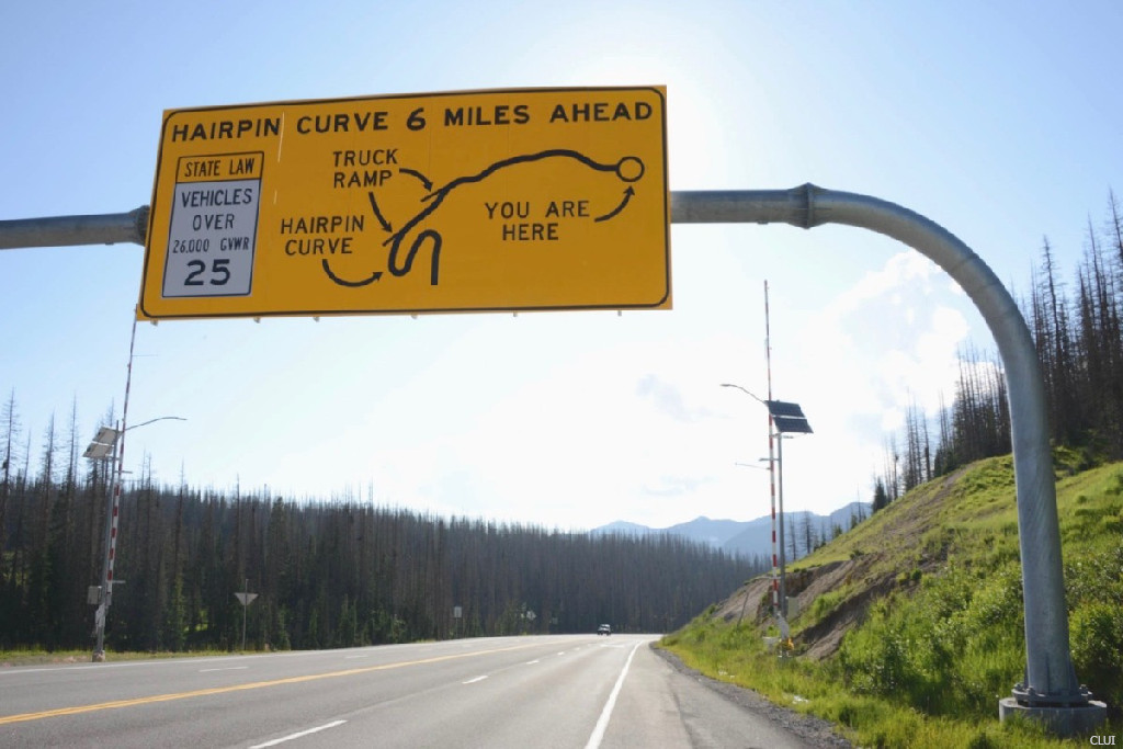
From Lake City, it’s a steep 10-mile climb to Slumgullion Pass, which sits on the Continental Divide.
Slumgullion Pass, which earned Honorable Mention on my all-time Top Ten list, is mostly known as part of the Slumgullion Earthflow National Natural Landmark. About 700 years ago, a large chunk of decomposing volcanic rock slid down the mountain to form a natural dam. This blocked the Lake Fork of the Gunnison River and created Lake San Cristobal.
The “Slumgullion Slide,” as it is known, is still active today and can move up to 20 feet per year in certain areas. The earth flow is about four miles long and covers more than 1,000 acres. Geologists come from all over the world to study this rare phenomenon; there’s no site quite like it anywhere else on earth.
It’s believed Slumgullion Pass got its name because pioneers thought the “yellow” nature of mud from the earth flow looked like slumgullion stew, a popular dish for miners, with its variety of vegetables and meat. Today, the modern version of slumgullion stew is familiarly known as American Goulash. Give it a try. Probably tastes better than it sounds.
An alternate version of the name origin story is that New Englanders named it Slumgullion because the slide resembled the multicolored “refuse” from butchered whales. A third explanation is that the nearby Slumgullion earth flow resembles the muddy deposit left in the miners’ sluice boxes.
Wherever the name comes from, Slumgullion Pass is said to be the steepest in Colorado, with a nine percent grade. The pass is open year-round.

Pass-a-Palooza™ … Spring Creek Pass: 10,901 feet
Continuing south on Colorado Highway 149 for eight miles, our next Pass-a-Palooza™ is Spring Creek Pass. It, too, sits on the Continental Divide.
From here, the road drops about 2,000 feet over the next 33 miles, as we descend into Creede, a historic former mining town of about 250 residents. The town was named after Nicholas C Creede, who discovered the Holy Moses Mine in the area. As the story goes, Creede shouted “Holy Moses” upon finding the now famous Amethyst vein on East Willow Creek.
Creede, a Fork in the Road
Creede hosts the annual Colorado State Mining Championships, a celebration of its historic past. The event, known as the “Days of ’92,” has been held every July Fourth since 1892. Competitions include hand steeling, hand mucking, double jacking and single jacking. These methods of working the rock by hand were used by miners before they had electricity to power their tools. About 10,000 people come to Creede every Independence Day weekend to watch these rapidly disappearing historic mining techniques.
In 1891, at the height of the mining boom, Creede’s population swelled to 10,000. In Creede, that mining heritage is celebrated year-round at the Underground Mining Museum. It offers a glimpse into Creede’s rich mining past. The museum was “mined” out of the mountainside in the early 1990s, a few years after Creede’s last mine closed. About 45,000 visitors a year experience the underground.

Creede also hosts a nationally-acclaimed Repertory Theatre that has produced a number of plays about Colorado and Creede. The theater, which this year celebrates its 60th season, is open throughout the summer. Last season, featured presentations included Steel Magnolias, Sherwood: The Adventures of Robin Hood, and The Royale. Pretty impressive cultural happenings for a town of less than 300 residents.
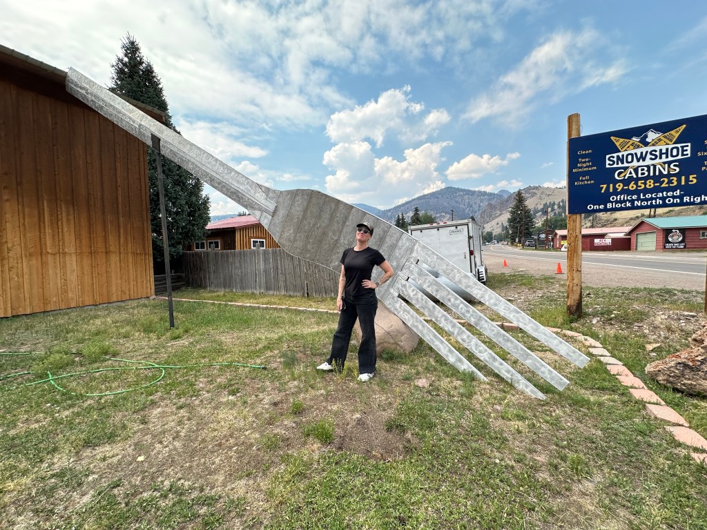
Oh, there’s one roadside attraction we need to check out. The Creede Fork, also known as the World’s Largest Fork, is a 40-foot aluminum sculpture built in 2012. Created by artists Chev and Ted Yund, the fork is made of aluminum and weighs more than 600 pounds. The unique piece of art was commissioned by Keith Siddel as a birthday present for his wife, Denise Dutwiler, owner of the local Cascada Bar & Grill, which has since closed.
If you feel compelled to visit the fork, you can find it at 981 La Garita Street.
And speaking of forks – great segue – the town of South Fork is 24 miles ahead on our journey toward Pagosa Springs, tonight’s destination.
There’s little actually in South Fork, but it’s where we turn southwest on US Highway 160, and head for today’s final Pass-a-Palooza™.
Pass-a-Palooza™ … Wolf Creek Pass: 10,857 feet
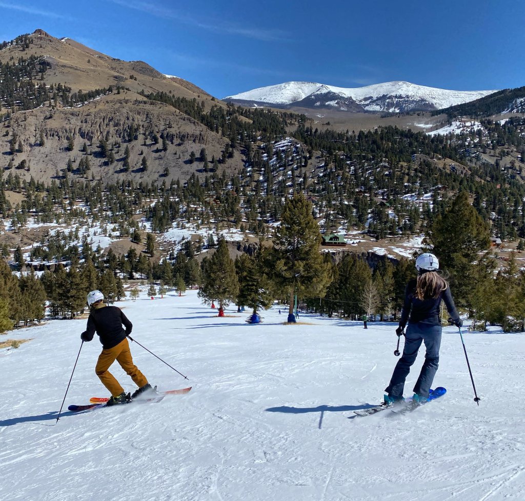
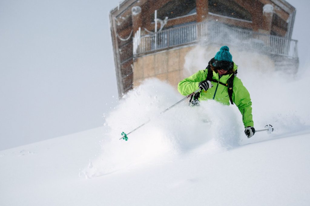
Wolf Creek Ski Area is just 15 miles ahead. The resort, opened in 1939, claims to get the most snow of any ski area in Colorado – more than 500 inches a year. With all that snow, you’d expect Wolf Creek to open early, and it usually does. Historically, Wolf Creek is one of the first ski areas in Colorado to open each season. For the 2024-25 season, it did not disappoint, opening on October 22, following a 21-inch dump.
Wolf Creek, with a base elevation of 10,300 feet, is one of Colorado’s last family-owned ski areas. It has seven lifts, and serves more than 1,600 acres of terrain – topping out at 11,900 feet. For a relatively small ski area, Wolf Creek has an impressive helping of extreme, including a run aptly named 52° Trees. Guess how steep it is. Well, it’s one of the steepest inbounds ski runs in Colorado. Last season, Wolf Creek celebrated its 85th anniversary. Daily lift tickets are $68. The ski area has been privately owned by Kingsbury Pitcher, a member of the Colorado Ski Hall of Fame, since 1976.
A mile of Highway 160 is all that separates Wolf Creek Ski Area from Wolf Creek Pass. The pass sits at 10,857 feet, and we reach it just a minute after rolling past the ski area. Wolf Creek Pass earned Honorable Mention on my all-time Top Ten list.
As Spring Creek Pass did a few miles back, Wolf Creek Pass sits on the Continental Divide. As anyone who made it through elementary school geography knows, a Continental Divide is a boundary that separates a continent’s river systems. Each river system feeds into a distinct ocean, bay or sea. For Colorado’s Continental Divides, like Wolf Creek Pass, water on one side flows into the Atlantic Ocean basin, and on the other side it flows into the Pacific basin. We’re headed toward the Pacific drainage side.
In 1916, the first-ever road along Wolf Creek Pass finished construction – as a dirt road. The original route was only 12 feet wide, which was doubled in 1930 as more traffic started to move through the area. Twenty years later, the road was paved and began to resemble what we know today as Highway 160.
The pass became nationally known in 1975 when famous country musician CW McCall released a song of the same name. In McCall’s song “Wolf Creek Pass”, the singer tells the tale of summiting the Great Divide through “37 miles of Hell” in his large semi-truck. The song was released on McCall’s “Wolf Creek Pass” album, which features other odes to Colorado like “Rocky Mountain September” and “Glenwood Canyon.” You may recall from a few days ago that CW McCall was actually named Bill Fries. He was a former mayor of Ouray, the Colorado mountain town we rode through on Monday.
Water-Based Wellness
Tonight’s destination, Pagosa Springs, is just 23 miles ahead, and it’s all downhill from here. Pagosa Springs sits at 7,110 feet, along the San Juan River.
The town is named for a system of hot sulfur springs located there, which includes the world’s deepest geothermal hot spring. Pagosa comes from the Ute word meaning “healing waters.” The Ute people revered the hot springs for what they believed were healing powers in the pungent-smelling waters, which contain 13 minerals.
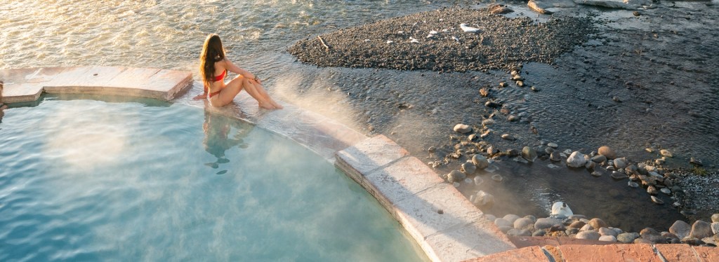
The hot springs drive the town’s thriving tourism industry. Pagosa Springs occupies a prominent place on Colorado’s hot springs loop. The town has several resorts with mineral-rich, thermal hot springs, located right on the San Juan River. Water from the “mother” spring is about 144 degrees Fahrenheit. Mix that with some river water and you’ve got yourself a relaxing experience. The tourism marketing people call it “water-based wellness.”
Visitors can can get a day pass at several of the resorts to soak their tired bones. At The Springs Resort, $59 gives you access to 20 pools. The resort calls it a journey of enlightenment. Here, even if you behave yourself, you can really get into hot water.
We check into the RiverWalk Inn, tonight’s lodging, and check out the soaking possibilities.
To see today’s route from Ridgway, over Wolf Creek Pass, and on to Pagosa Springs, click here.
***
Today’s Not Quite Pass-a-Paloozas™ … Cinnamon Pass & Engineer Pass
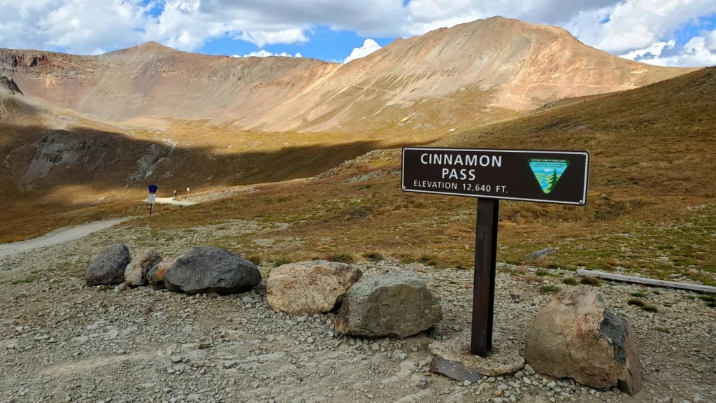
Just a few hours ago, we passed through the idyllic mountain community of Lake City. The town of 400, sitting at 8,672 feet in the San Juan Mountains, is the kickoff point for today’s Not-Quite Pass-a-Paloozas™: Cinnamon Pass (12,640 feet) and Engineer Pass (12,800 feet).
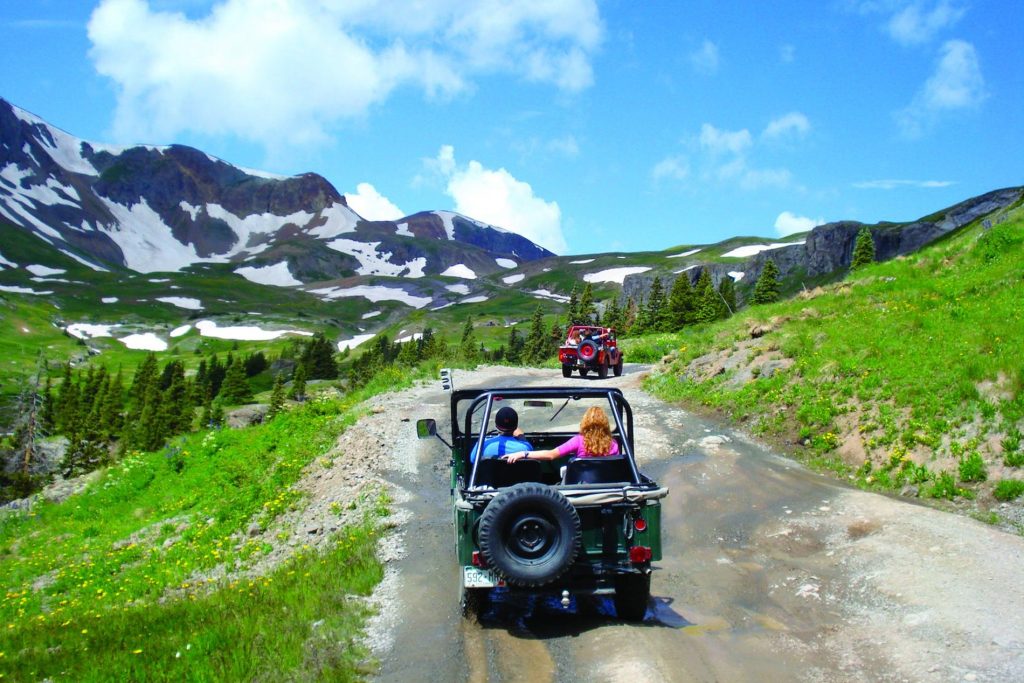
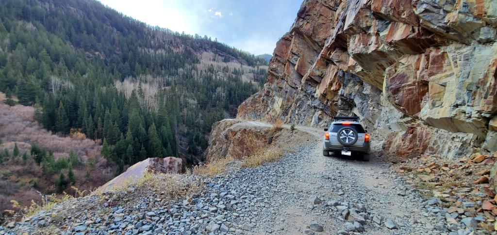
Those two passes are part of the Alpine Loop, a 50-mile journey from Lake City, through the mountains, deserted mining towns, and back to Lake City. It’s a spectacular ride, but one not quite ready for a traveling Harley and Porsche – so I’ll describe the route to you to pique your off-road interest, and you can do it at your leisure.
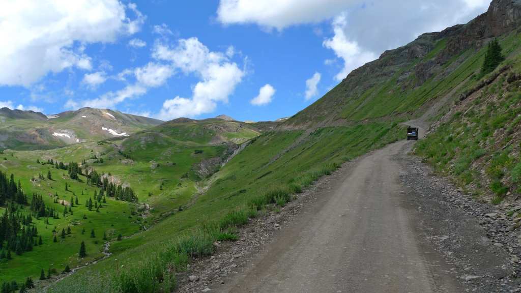
Cinnamon Pass. Over the 50 miles of the Alpine Loop, you’ll climb and descend more than 4,000 feet. It’s one of the most do-able four-wheel drive treks in the San Juan Mountains. More than 100,000 people take on the Alpine Loop each summer, making it one of the most famous off-highway roads in the US.
To get the Alpine Loop started, from Lake City, you drive south on Colorado Highway 149, the Silver Thread Highway. A mile later, you turn off on (Hinsdale) County Road 30 and the fun begins.
The road follows Lake San Cristobal, which Lake City is named after. Twenty-two miles beyond Lake City, after climbing 4,000 feet, you arrive at Cinnamon Pass.
During Colorado’s gold rush, Cinnamon Pass was used to reach what would become the town of Silverton. In 1877, a wagon road was established over Cinnamon Pass, connecting Lake City to the Animas Valley. Nineteenth-century miners used the road to transport their ore to Silverton, Ouray, and Lake City.
It’s somewhat unclear where the name Cinnamon comes from. I spent a stupid amount of time trying to answer that riddle. Best I could come up with: A prescient miner in the 1800s got a way-too-early look at Neil Young’s lyrics, and liked the tune, a lot. “I wanna live with a Cinnamon Girl. I could be happy the rest of my life with a Cinnamon Girl.” A Cinnamon Girl is apparently one who has traversed Cinnamon Pass in a 4 x 4 jeep.
Neil Young has never said who the Cinnamon Girl is, as he prefers to leave lyric interpretations to the listener.
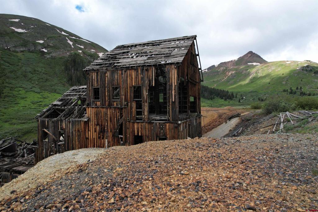
Animas Forks, Another Ghost Town. The ghost town of Animas Forks is about three miles past Cinnamon Pass. Animas Forks sits at 11,185 feet, in a bit of a valley between Cinnamon Pass and Engineer Pass, three more miles to the north. The town’s first log cabin was built in 1873, and within a few years, it had become a bustling mining community. At the time, Animas Forks had 30 cabins, a hotel, general store, saloon and post office. By 1883, 450 people lived there. As mining declined and people moved away, Animas Forks was on its way toward becoming a ghost town, which it did in the 1920s.
Today, it has no permanent residents, but property is available for purchase, if you’re adventurous and have $375,000 to spend. In the summer, the former town site is a tourist attraction on the Alpine Loop. The nine standing buildings within the town site have been stabilized, and in some cases, restored.
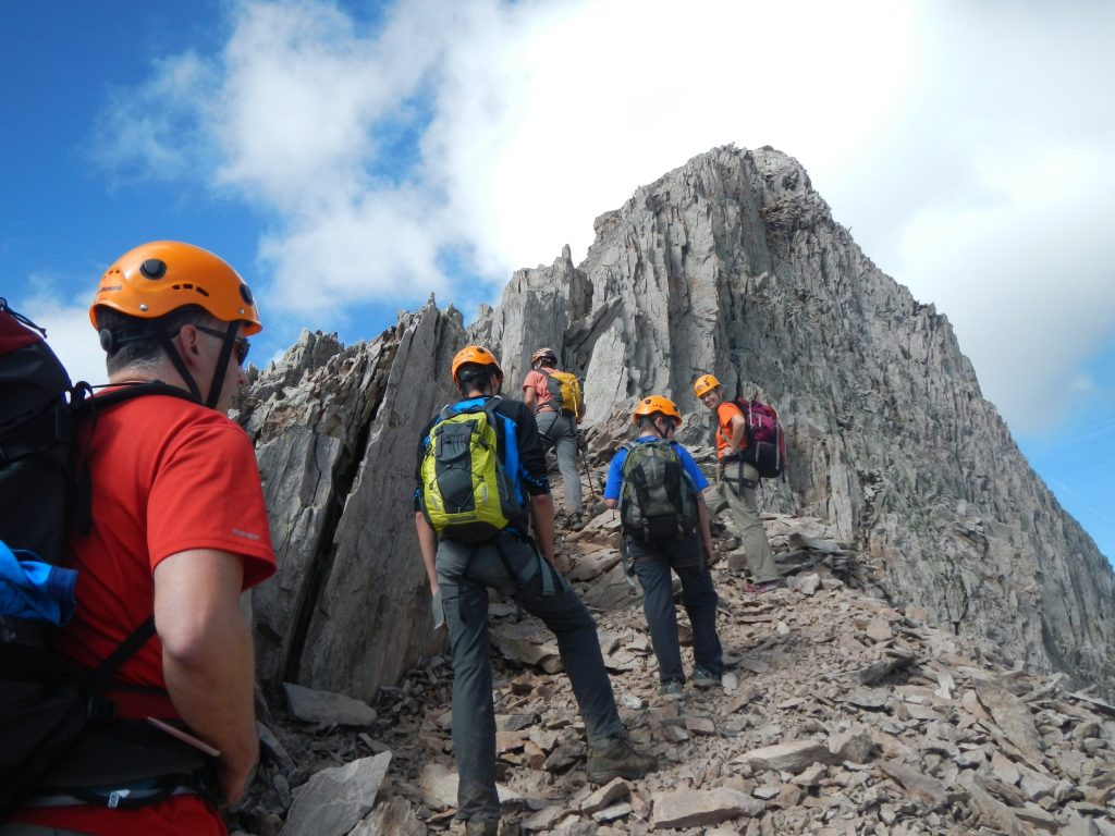
Engineer Mountain: 12,968 feet. On the way to Engineer Pass, three miles ahead, you pass Engineer Mountain, 12,968 feet. It’s just three feet higher than 12,965-foot Mount Sopris, which is essentially in my Carbondale backyard. Engineer Mountain, and the pass, are named after the US Army Corps of Engineers, who surveyed the land in 1873. So, the land was name in honor of masters of geography and cartography.
Engineer Mountain is a double-crested summit with grey columnar cliffs. It was sculpted by a 2,000-foot wall of ice sliding south during the Pleistocene epoch. Climbing it is technical, and is classified as having 4th class and low 5th class sections of rock to scale on your way to the summit. Not for novices.
Engineer Pass: 12,800 feet. You’ll pass by Engineer Mountain just before you get to Engineer Pass, which is at 12,800 feet. Remember Otto Mears, who we talked about yesterday? He was known as the Pathfinder of the San Juans, building the road between Ouray and Silverton. Six years before building what became the Million Dollar Highway, Mears extended his toll road from Lake City and through to Animas Forks, via Engineer Pass.
So the road you’re traveling over, Engineer Pass, has similar roots as the Million Dollar Highway. From its completion in August 1877, this road was an important stagecoach route and the principal supply route for the wagons and mule trains that hauled supplies and ore among all the main mining camps in the area. Within three years, the route had daily stages run by the Rocky Mountain Stage and Express Company.
Engineer Pass has perhaps the toughest, but most scenic, section of road, on the Alpine Loop. Just as with Cinnamon Pass, you’ll need a 4 x 4, high clearance vehicle to successfully navigate Engineer Pass.
Capitol City, What Might Have Been. From the summit of Engineer Pass, you begin descending toward Lake City, now about 18 miles away. Only nine miles from Engineer Pass, you roll through what remains of Capitol City. Originally named Galena City, it was founded in 1877 by George Lee, who had lofty visions of what the town could become. At its peak, there were 800 people living here, and Lee changed the town’s name to Capitol City, as he and the town’s founders dreamed of it becoming the state’s capitol. Things didn’t quite work out as he’d hoped.
Today, only the old post office, a few old buildings and brick kilns remain. It’s yet another Colorado mining ghost town. You can find private homes and private land surrounding what was once Capitol City, a 200-acre site.
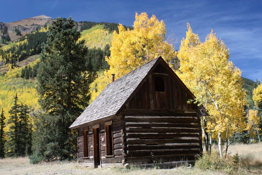
Henson. Hensen. Hansen. Hanson? Just a few more points of interest on the last few miles as you head back to Lake City. The first is the ghost town (of course!) of Henson, about five miles past Capitol City. Henson’s name has historically been spelled a variety of different ways, including Hansen, Hanson, Hensen, and Honsen. The Board on Geographic Names – yes, it’s the final arbiter of place names – officially supported the current spelling in 1896. Henson was named for Henson Creek, which was named for a pioneer settler, Henry Henson.
After gold was found here in 1871, the town continued to grow with the success of the Ute-Ulay and Hidden Treasure mines. Henson, which has many remaining artifacts from the mining era, is the site of the Ute-Ulay mine, now abandoned (of course!).
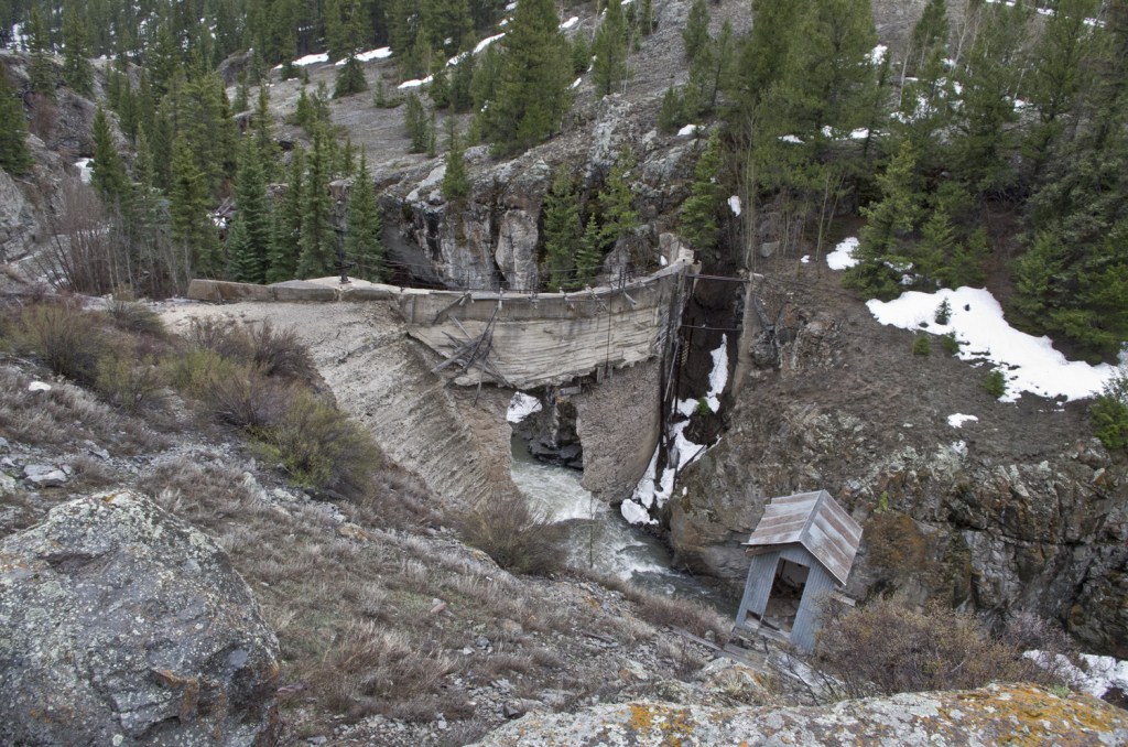
A unique remnant of the mining days is the Henson Creek Dam, an old hydroelectric dam that supplied power for the nearby mine. Called the Hidden Treasure Dam, it burst in 1973, causing significant flooding downstream. The dam still stands and is visible from the road, but with a big hole in it.
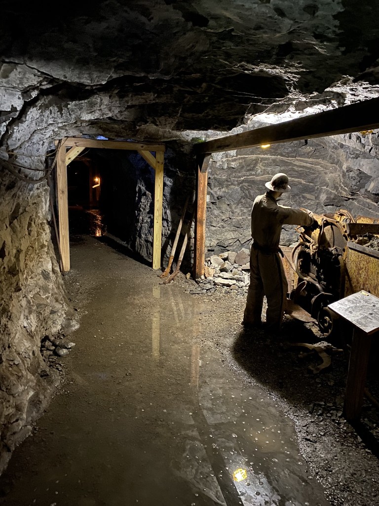
Hard Tack Mine. The final point of interest before arriving back in Lake City is the Hard Tack Mine, only a mile down the road from Henson. This mine, built 125 years ago, is now a tourist attraction.
The Hard Tack Mine originated as an underground transport tunnel to move ore for the Hidden Treasure Mining Company, located a quarter-mile up the mountain. Both the Hidden Treasure and Hard Tack mines contributed to a bustling community from the 1890s until 1930. More than a million dollars in silver ore were produced.
Like so many mines in the San Juan Mountains, they shut down. But unlike most other mines, these got a new life by offering tours. For $13, you can now see how miners, back in the day, blasted their way deep into the earth using only hand tools and dynamite. Today, the Hard Tack Mine is operated by Lake City residents George and Beth Hurd, with their daughter Buffy and her family. The mine tour season generally lasts from June until September. Bring a jacket; it’s a constant 45 degrees (F) in the mine.
Only three miles up the road from the Hard Tack Mine, you arrive back in Lake City, completing the 50-mile Alpine Loop. That was fun!
To see today’s Not-Quite Pass-a-Palooza™ route over Cinnamon Pass and Engineer Pass – the Alpine Loop – click here.

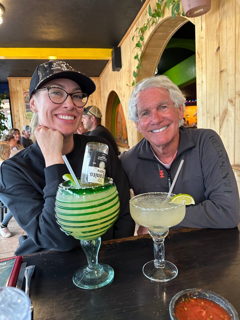
Sounds like a great day of riding (minus fires and Montrose … blah!). Great writing as usual to engage us all. My compliments to Brittany for her Corona-rita selection. You should have ridden with the rest of the posse in past years! LOL! Keep rolling rubber side down!
Dave
LikeLike
Thought of you at every stoplight in Montrose. All 74 of them 🤪
LikeLike
You are my inspiration.
Get Outlook for Androidhttps://aka.ms/AAb9ysg
LikeLike
Maybe you should pick your role models more carefully?
LikeLike