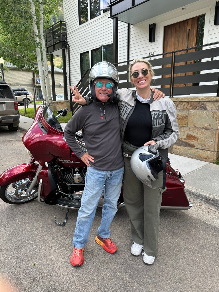
Today’s gonna be a four Pass-a-Palooza™ day: Lizard Head (10,222 feet), Coal Bank (10,640 feet), Molas (10,910 feet) and Red Mountain (11,018 feet)!
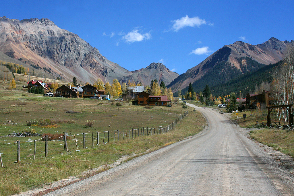
Our first pass is just minutes away. We leave Telluride and turn south onto Colorado Highway 145, which will take us over Lizard Head Pass. We’ll be on the San Juan Skyway Scenic Byway.
Pass-a-Palooza™ … Lizard Head Pass: 10,222 feet
Over the next 12 miles, as we ride south on Highway 145, we climb about 1,500 feet – until we reach Lizard Head Pass, which rates an Honorable Mention on my all-time Top Ten list.
The pass sits at 10,222 feet. It’s named after Lizard Head, a nearby volcanic pinnacle that reaches to 13,119 feet. Lizard Head is about two miles to our right as we cross the pass; you can’t see it from the highway. It’s surrounded by a group 14,000-foot peaks: Mount Wilson (14,252 feet), Wilson Peak (14,021 feet), and El Diente Peak (14,175 feet).
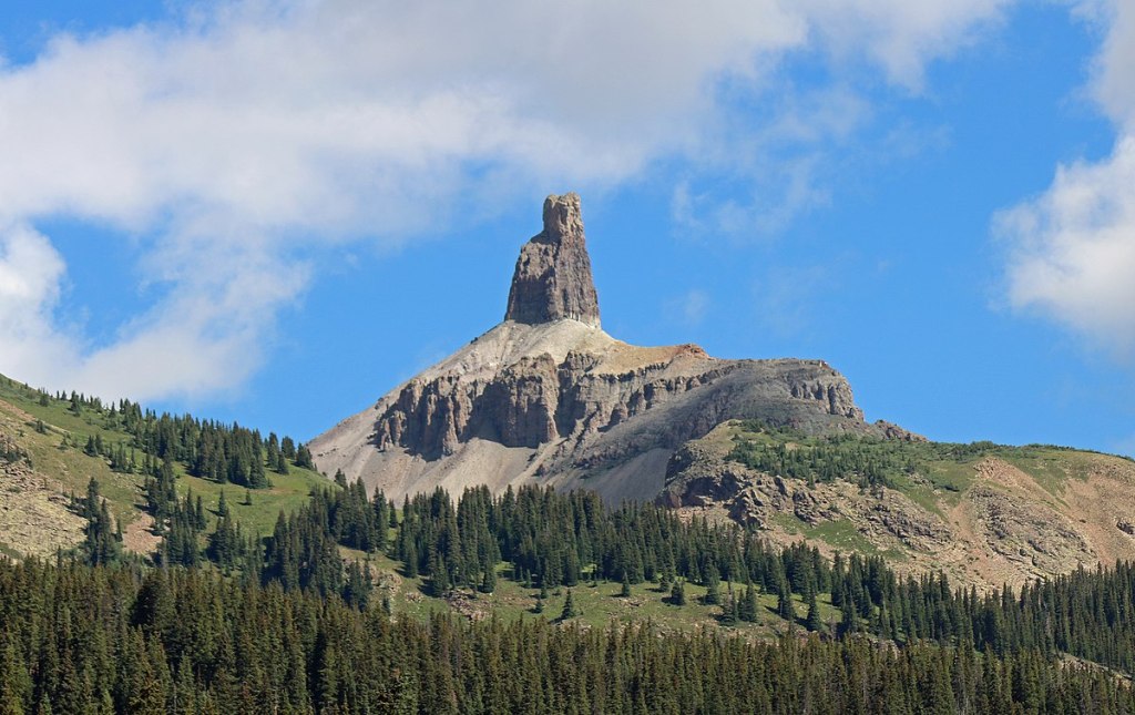
The name Lizard Head comes from the peak, which is said to look like the head of a lizard. Lizard Head is only the 556th-highest peak in Colorado, but it may be the most difficult summit to reach. Said Albert Ellingwood, who made the first ascent of Lizard Head in 1920, “A rottener mass of rock is inconceivable.”
Modern climbers with nylon ropes, sticky rubber soles, a good understanding of time-honored crack climbing techniques, and spring-loaded camming devices, will still have a difficult time imagining ascending the spire without any of these, as Ellingwood did. Climbing Lizard Head is so difficult that many accomplished alpinists simply hike around it on trails and admire the view. Lizard Head is known as Colorado’s hardest summit to reach, as the easiest route to the top is a 5.8+, meaning it’s a vertical climb with small, challenging handholds and footholds.
Twelve miles after crossing Lizard Head Pass, we roll into the town of Rico, Spanish for “rich.” Its motto: “A Slice of Paradise.” Rico, with a population of 172, sits at 8,825 feet along the Dolores River, a tributary of the Colorado River. Most of Rico’s visitors, including us, come for its outdoor recreation in the nearby mountains and national forests. I’d consider a road trip like this a form of outdoor recreation.
Rico is about 45 miles from where our day began, in Telluride. From Rico, we follow the Dolores River for 37 miles until arriving in the town of Dolores, Spanish for “sorrows.” Dolores is just a 20-minute ride to Mesa Verde National Park. Ancient Puebloans were the first to inhabit the area. Many of their artifacts have been found, and are on display at the Canyons of the Ancients Museum. Canyons of the Ancients is a National Monument that has the highest known archaeological site density in the US, with well-preserved evidence of Native American cultures. It’s about 25 miles west of Dolores, in the Four Corners region of the southwestern US.
The Canyons of the Ancients covers 176,000 acres, and to do it justice, you’d need to spend days there. We have three Pass-a-Paloozas™ ahead of us today, so we press on toward Durango, 45 miles east of Dolores.
Durango. Now the Fun Begins!
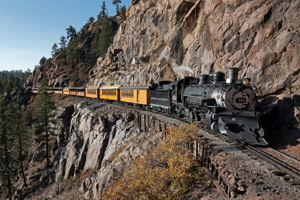
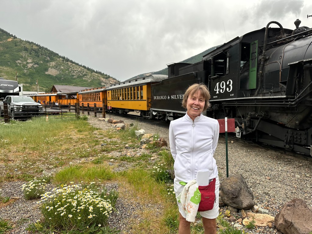
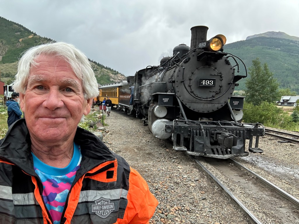
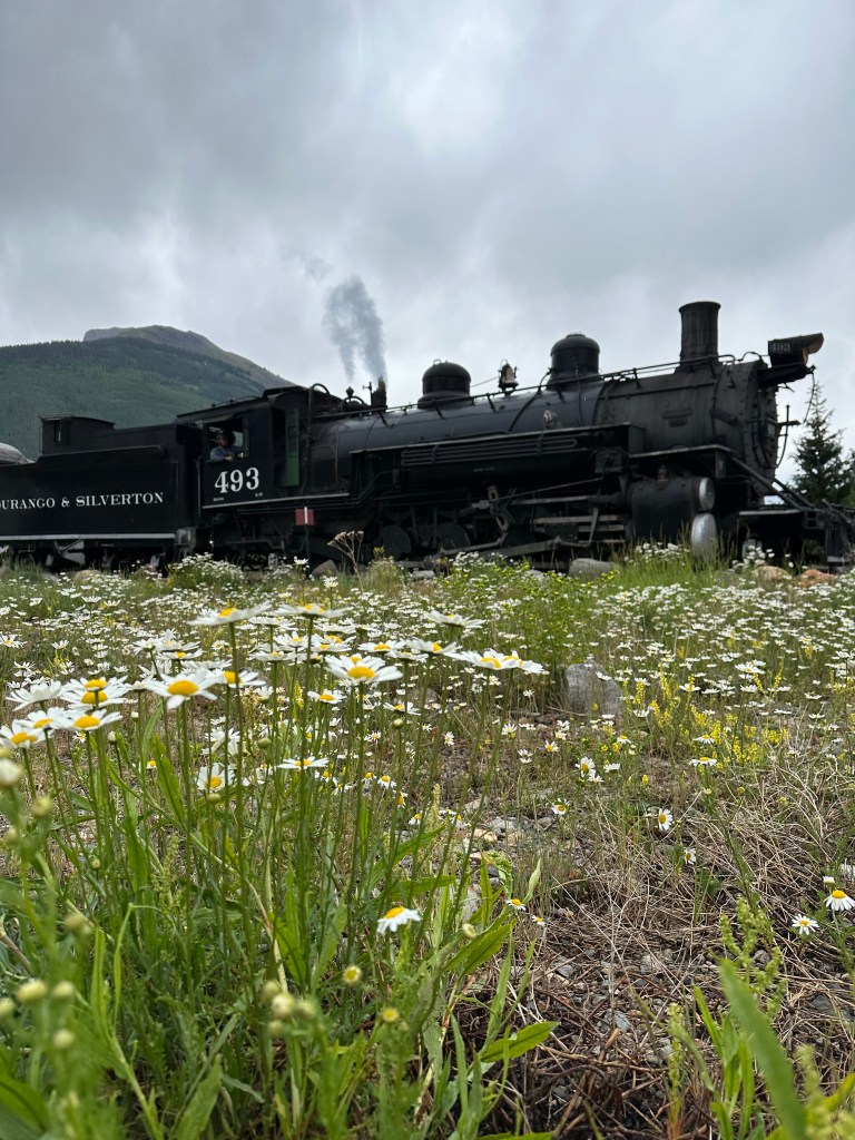
Durango was founded in 1879 by the Denver & Rio Grande Railway. Two years later, the railroad arrived, constructing a narrow-gauge line to haul passengers and freight to Silverton – 45 miles away – and to transport silver and gold ore from the San Juan Mountains. The historic train, top speed 18 miles an hour, has been in continuous operation since 1882, and today, you can board it in Durango and ride three and a-half hours to Silverton. Once in Silverton, you’ll relax for 30 minutes before the return trip begins.
Durango is just a few miles north of the New Mexico – Colorado border. The city is named after Durango, Mexico – which was named after Durango, Spain. All three Durangos are sister cities. The word Durango originates from the Basque word Urango, meaning “water town.” Durango sits on the Animas River at an elevation of 6,510 feet.
The Animas River’s official name is El Rio de las Animas Perdidas. Roughly translated, this means, “The River of Lost Souls.” Spanish explorers named the river after several explorers who traveled on the river and were lost. Their bodies were never found, and last rites could not be administered. As they were devoted Catholics, they believed the dead men’s souls could not enter heaven and would be relegated to Purgatory, a temporary punishment for souls after death, where they can atone for past sins and prepare for heaven.
Purgatory, of course, is also the name of a ski area about 25 miles north of Durango. It’s owned and operated by Mountain Capital Partners. You travel north along the Animas River on US Highway 550 to get there.
Pass-a-Palooza™ … Coal Bank Pass: 10,640 feet
From Durango, we head north on US Highway 550, and immediately start climbing. In about 34 miles, we gain 4,100 feet of elevation, and arrive at Coal Bank Pass, our second Pass-a-Palooza™ of the day.
Coal Bank Pass sits at 10,640 feet – just a hair over two miles high. Its name refers to the area’s rich mining history. The pass is open year-round, but can be challenging in the winter due to heavy snowfall.
Pass-a-Palooza™ … Molas Pass: 10,910 feet
Our next Pass-a-Palooza™ is Molas Pass, seven miles north of Coal Bank Pass on Highway 550. It’s unclear where the name came from, but Molas is the 65,765th most common surname in the world. There’s a good chance someone with that name once lived here, or came through the area. The Molas name is most prevalent in Paraguay, Spain and the Philippines.
Like all three passes on this stretch of US Highway 550, Molas is open all year, but you might want to use extra caution after a winter snowfall.
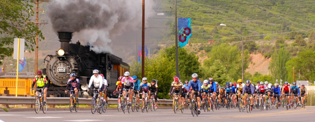
Molas Pass may be best known for its role in the annual Iron Horse Bicycle Classic, where bicyclists race a train up the mountain from Durango to Silverton. Molas is the second and final mountain pass in the Iron Horse. Every May, over Memorial Day weekend, since 1972 – it’s a big test of man versus machine. In the event, cyclists race over mountain passes to beat the steam engine train – the Durango & Silverton Narrow Gauge Railroad, which runs the same route.
To beat the train, cyclists need to cover the 47 miles in less than three and a half hours. Thousands of riders, professional and less so, show up for the event from all over the country. First place winners, in the men’s and women’s divisions, each get $1,000. And, they get the title of King and Queen of the Mountain. Quinn Simmons, a Durango native, holds the record for the event: 2 hours, 11 minutes and 29 seconds.
Silverton: The End of the (Railroad) Line
Less than eight miles after crossing Molas Pass, we arrive in Silverton, where the Iron Horse Bicycle Classic ends. Silverton, which sits at 9,308 feet in the San Juan Mountains, got its start in the 1860s as a mining town.
The town boomed from silver mining until the collapse of the silver market in the panic of 1893. Silverton’s last operating mine closed in 1992. The entire town is included as a federally designated National Historic Landmark District, paying homage to Silverton’s mining days.
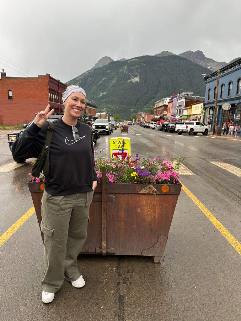
Today, Silverton’s population is about 600, and its economy relies almost entirely on tourism. Most of the mountain peaks surrounding Silverton are 13ers; the highest is Storm Peak, at 13,487 feet. Silverton is less than 15 miles from 7 of Colorado’s 58 14ers. It’s known as one of the premier gateways into the Colorado backcountry. Silverton is a beautiful setting for a mountain town. Coming here is on Brittany’s Colorado’s Bucket List. More on that, later in the week.
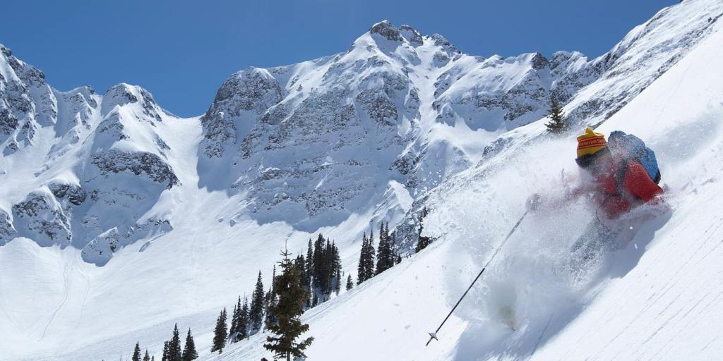
About six miles north of town is the Silverton Mountain Ski Area, Colorado’s most extreme. The area has one chairlift, and its terrain is only suitable for advanced and expert skiers or riders. If you go there, you’ll be required to have avalanche gear, due to the unpatrolled and ungroomed nature of the mountain. So, before getting on the chairlift, make sure you have an avalanche beacon, a shovel and a probe. You won’t be allowed on the lift without them. Since 2024, the ski area has been owned by Brock Strasbourger and Andy Culp of Aspen.
In addition to Silverton Mountain’s 1,819 acres of lift-accessed skiing, the mountain also serves as a base area for more than 22,000 acres of helicopter-accessed skiing. Have a big birthday, anniversary, party, fundraiser, family reunion, or corporate retreat coming up? You can rent the entire mountain! Prices start at $9,900 for a group of 40 people. Get out your credit card, and let the Evites fly.
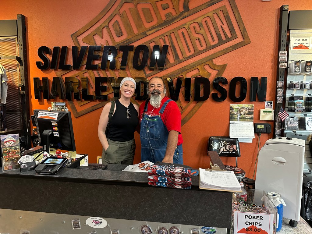
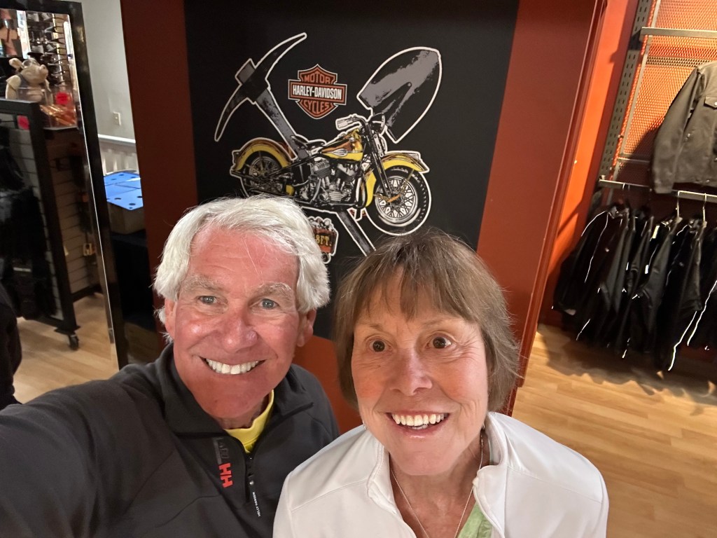
Silverton is home to the world’s highest Harley-Davidson store, where you can find wildly overpriced Silverton Harley-branded chachkas ($50 t-shirts, anyone?). The town is a good place to stop, grab a drink, and walk Silverton’s main street, Greene Street – before riding ten miles north to our next pass.
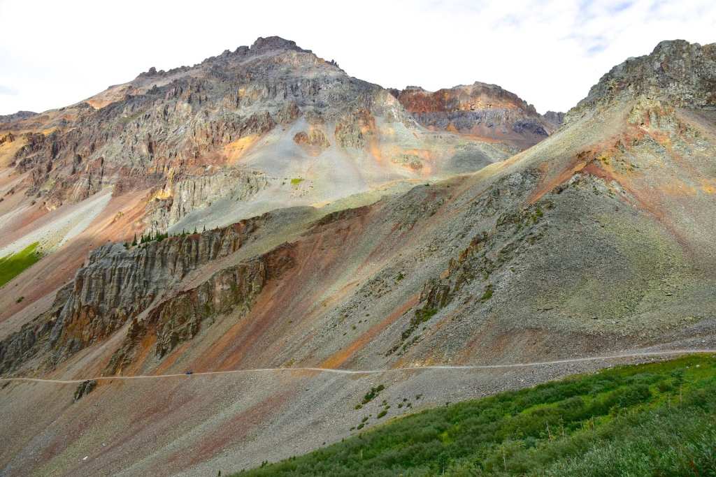
Pass-a-Palooza™ … Red Mountain Pass: 11,018 feet
This pass is named for nearby Red Mountain, 12,836 feet. The “Red” name is derived from the iron oxide-laden rock that forms its slopes. Like all passes on US Highway 550, it’s open year-round, but can be quite amusing in the winter, depending on snow conditions. Avalanches are frequent and can block the highway for some time, until road crews find the time and nerve to clear the highway.
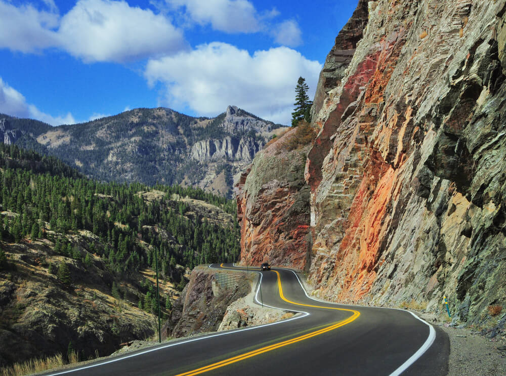
Red Mountain Pass straddles a divide that separates Ouray and San Juan Counties. The lower part of the pass toward Ouray is blasted into near-vertical cliffs of quartzite, hundreds of feet above Red Mountain Creek and the Uncompahgre River Gorge. This section of road is winding, narrow and has no shoulder.
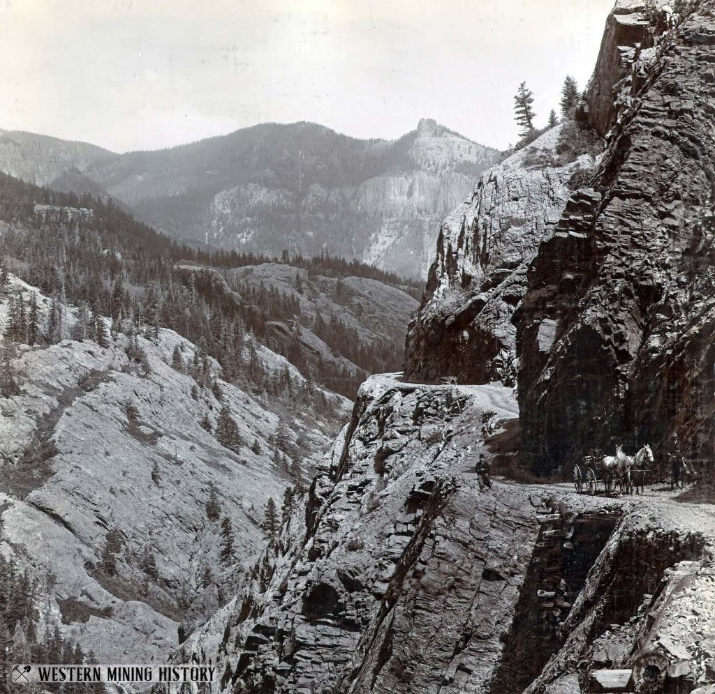
The pass is at the summit of the iconic “Million Dollar Highway,” and from here, we head down toward Ouray, 13 miles north of Red Mountain Pass.
The Million Dollar Highway is one of my favorites, and for good reason. It rates #5 on my all-time Top Ten list.
There are several stories about how the road came to be called the “Million Dollar Highway.” One is a legend that the road was made from a million dollars’ worth of gold and silver filled tailings. Another is a tale of a woman who traveled the road saying, “I would not travel that road again for a million dollars.” Yet another is that the view is worth a million dollars.
The truth is that when the three contractors paving the highway in the 1920s – the State of Colorado, the US government and the US Forest Service – compared notes, they realized that the cost of their three projects to upgrade the road to an automobile road totaled $1 Million. Someone suggested that “We have ourselves a million-dollar highway,” and the name stuck.
Building the Million Dollar Highway
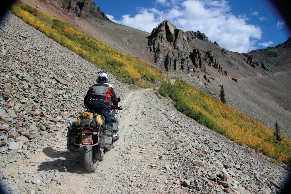
It’s been estimated that a billion dollars’ worth of metals has been produced by the mines scattered between Ouray and Silverton. As costly as ore was to extract during the mining boom, it was even more expensive to ship. Prospectors needed a dependable road to move the ore, and that’s why, in the 1880s, Otto Mears began stitching together various pack trails, stage roads and railroad grades. Over time, Mears built more than 450 miles of toll roads and railroads throughout the San Juan Mountains.
Starting in 1883, Mears, an Estonian immigrant, used dynamite to begin blasting a toll road out of the cliffs south of Ouray. The road he built over Red Mountain Pass, used by horse and mule-drawn wagons, is now known as the Million Dollar Highway. In the 1880s, the road was a private venture by Mears, a railroad man and entrepreneur. He was known as the “Pathfinder of the San Juans.” His work, dynamiting through solid rock in the Uncompahgre Gorge and over Red Mountain, is still marveled at by engineers today.
To help pay for this “highway” that finally connected Silverton and Ouray, Mears charged wagon drivers a passage fee, making this one of Colorado’s first toll roads. The tollgate was set up about two miles south of Ouray, at the narrowest point in the road. Mears made sure the road was narrow there, to prevent anyone from circumventing his toll bridge. He originally collected $5 for horse-drawn wagons and $1 per cattle head. (Adjusted for inflation, that’s about $130 and $26 in today’s dollars!)
Local merchants and miners who contributed money and labor toward completing the road soon went sour on Mears. By 1887, San Juan County and the state of Colorado took over maintenance of the road, ending his dominance of Red Mountain Pass.
The road was technically completed in 1905, but was extremely rough, especially for automobiles at the time. The first car navigated the Red Mountain wagon road to Ouray in 1910, when Ouray doctor LG Crosby and some companions made the six-mile journey to Ironton in a new Ford Model T, on a house call.
At the time, the journey was considered miraculous; obviously, no one had four-wheel drive, high clearance vehicles. And they certainly didn’t have the kind of power you would expect today on a road with grades up to eight percent. The road was finally paved by the Colorado Department of Transportation in the 1930s.
The Million Dollar Highway is part of the San Juan Skyway Scenic Byway, which we’ve been on for much of the day – starting in Telluride, going over Lizard Head Pass, and continuing through Durango and on to where we are now.
The road is maintained year-round, though driving it in the winter is not for the faint of heart. About 40 accidents take place every year on this highway, averaging about seven deaths a year. It’s recently been ranked Number 2 on a list of most dangerous roads in the US. In 2013, it was named to USA Today’s list of the world’s most dangerous roads – alongside the “Death Road” in Bolivia, which at one time averaged more than 200 accidents and nearly 100 deaths every year.
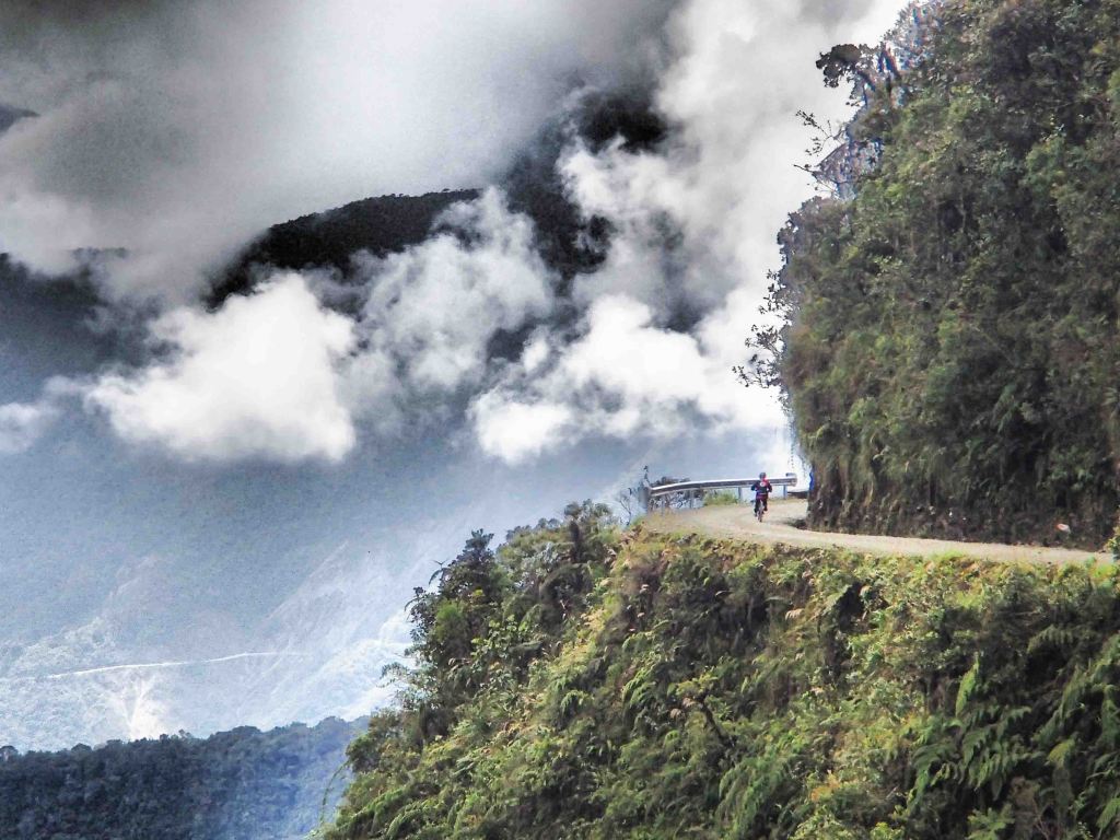
Death Road starts high in the Andes – 15,100 feet – and ends in the jungle at 3,800 feet. Formally known as North Yungas Road, it’s now used primarily by bicyclists and hikers (a newer, safer road has been built for motorized vehicles). The old Death Road connects Bolivia’s capital, La Paz, with the town of Coroico in the Amazon rainforest.
Comparatively speaking, the Million Dollar Highway is a harmless ride in the park. Let’s do it!
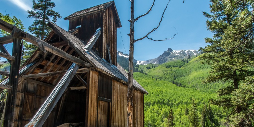
Ironton, Another Colorado Ghost Town
Continuing north on US Highway 550, about four miles south of Red Mountain Pass is Ironton. It’s yet another ghost town high in the Rockies.
In 1883, Ironton had big plans to become a town of 50,000 residents. During its best years, Ironton saw two trains a day arrive on the rail lines from Silverton, and at one time had a population of about 1,000 people. Things did not turn out as planned, and by 1921, the former postmaster in Ironton hung a note on the door of the post office, saying it had been closed not long after the rail lines in the area were discontinued.
At one time, residents in Ironton had built 100 structures in just 21 days. Many of the buildings are still standing, though no longer in use.
By 1960, there was just one man living all by himself in Ironton. He was selected to appear on the TV game show “I’ve Got a Secret,” hosted by Garry Moore. The episode aired on July 1, 1963. Milton Larson gave clues to contestants who had to guess what his secret was. Larson’s secret: he was the only person who still lived in Ironton.
You-Ray!
Yes, that’s how you pronounce Ouray. You-RAY. We were introduced to Ouray in yesterday’s Not-Quite Pass-a-Palooza™, which took us from Telluride, over Imogene Pass, and into Ouray.
There’s a lot to do in Ouray, from soaking in natural hot springs to ice climbing. Every January, the town hosts the Ouray Ice Festival. There’s great off-roading in the area; many of my “Not-Quite Pass-a-Paloozas™ explore the nearby San Juan Mountains.
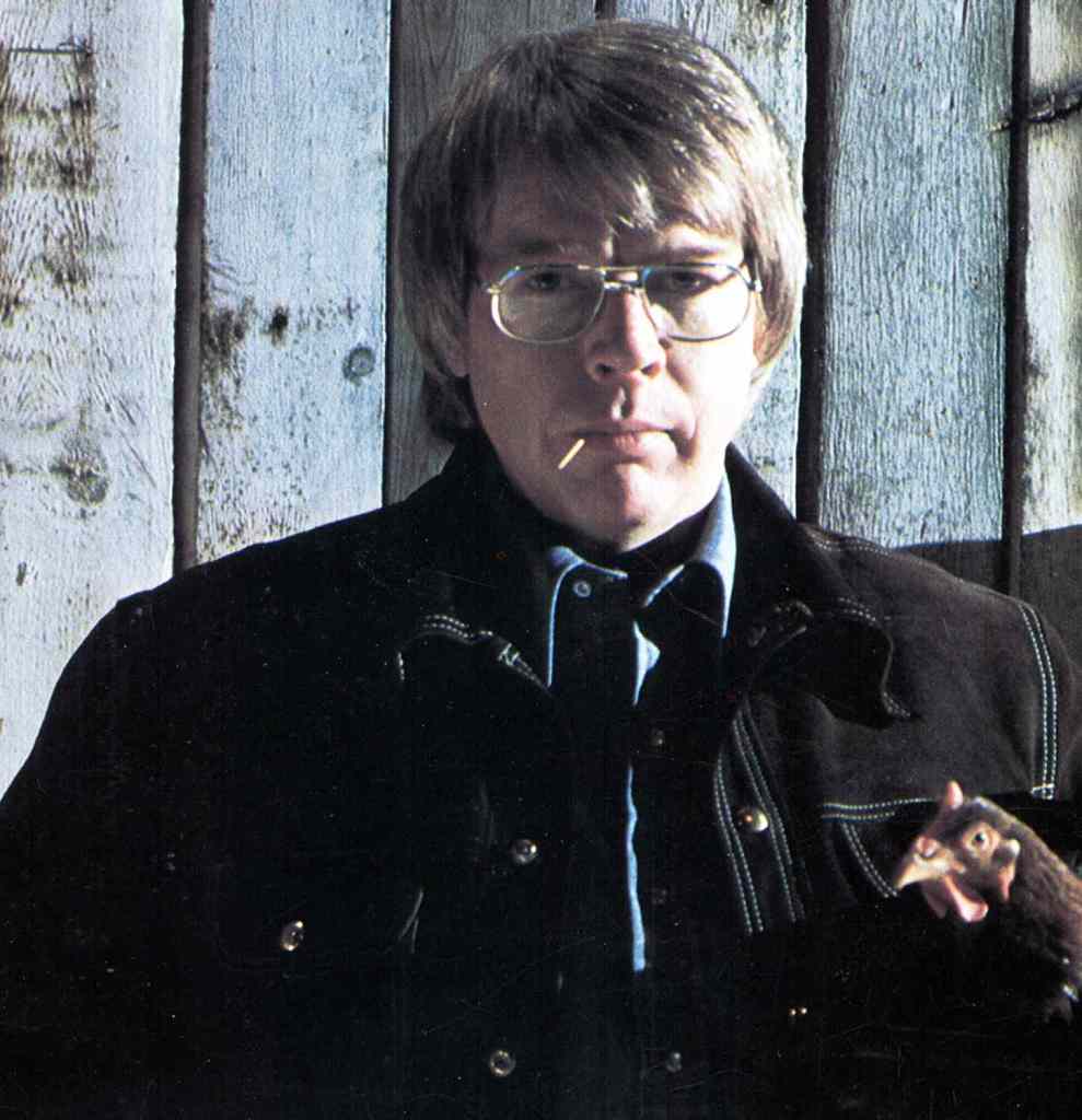
Here’s a Ouray fun fact: in 1986, Bill Fries, more commonly known as CW McCall, was elected Mayor, and served six years in that role. If that name sounds familiar, CW McCall was actually an advertising executive with Bozell & Jacobs, at the time an Omaha-based agency. He was best known for his character CW McCall, a truck-driving country singer he originally created for a series of bread commercials.
The name McCall was inspired by McCall’s magazine, which Fries had on his desk at the time. He assumed the role of CW McCall for a series of albums and songs in collaboration with co-worker and Mannheim Steamroller founder, Chip Davis. Fries wrote the lyrics and sang; Davis, who wrote jingles for Bozell & Jacobs, wrote the music.
Anyone who had a radio in 1975 could remember the words, Breaker one-nine, this here’s the Rubber Duck. “Convoy” was the number-one song on both the country and pop charts, and is ranked number 106 on Rolling Stone magazine’s 200 Greatest Country Songs of All Time. Fries died in 2022 at his home in Ouray, at age 93.
Calling it a Day, Stopping in Ridgway
Today’s destination, Ridgway, is only 10 miles away. We’ll get there by continuing north on US Highway 550. The sphincter-tightening part of today’s ride is over; from Ouray on, it’s a gentle journey the rest of the way.
Ridgway is named for Robert Matthew Ridgway, the superintendent of the Denver & Rio Grande Railroad. The railroad company established the town in 1891 as a headquarters and hub for the growing ranch community.
Today, the town is home to about 1,200 residents. It may be best known for its production of Grammy Award trophies, which are manufactured here exclusively by Billings Artworks. The trophies are all hand-made, assembled and plated on site. The Gramophone trophy – Grammy for short – has been awarded more than 8,000 times since the first Grammy Awards ceremony in 1959.

It takes John Billings and his staff of two apprentices about 15 hours to finish each Grammy in his small Ridgway workshop. All told, Billings uses about 6,000 pounds a year of a special metal alloy he calls “grammium,” which is smelted in California. Expensive stuff. But once the statuette has been awarded, its actual value drops to $0, as the Recording Academy reportedly has banned the resale of its awards.
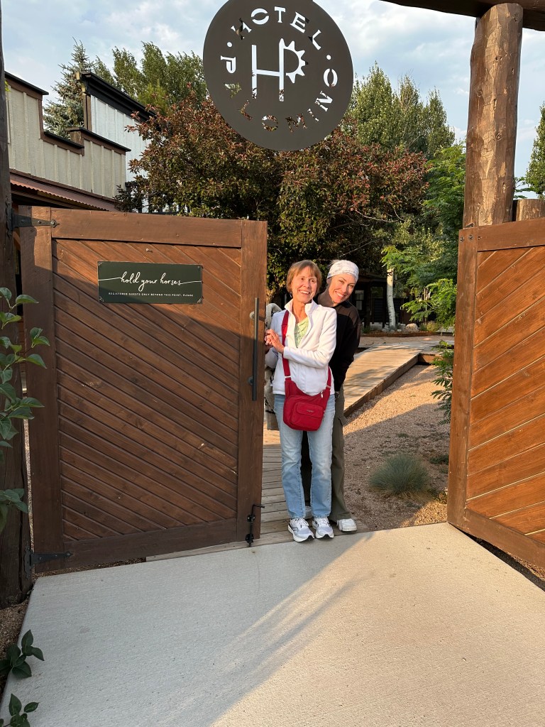
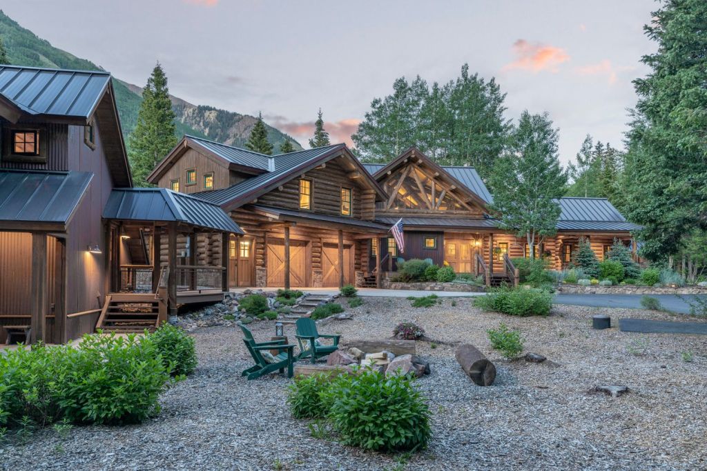
Ridgway has the only stoplight in Ouray County, at the intersection of US Highway 550 and Colorado Highway 62. Tonight, we’re staying at the Hotel Palomino, a few hundred feet from that stoplight. The hotel is a hip place with its own restaurant that just happens to be Ridgway’s #1 rated eating place.
After successfully navigating four Pass-a-Paloozas™, and spending most of the day above 10,000 feet, we’ll call it a day, and a good one at that.
To see today’s route from Telluride, over Lizard Head Pass, the Million Dollar Highway, and on to Ridgway, click here.
***
Just a few hours ago, we were in Silverton, a former silver mining town high in the San Juan Mountains. From Silverton, we headed north on US Highway 550, rolling over Red Mountain Pass, then on to Ouray and then tonight’s destination, Ridgway.
If we had been slightly more adventurous, and interested in tackling a Not Quite Pass-a-Palooza™, we could have turned west before crossing Red Mountain Pass, and headed toward Ophir Pass. This is the route miners took in the 1880s, as they traveled from Silverton to Telluride, via Ophir Pass. And it’s today’s Not Quite Pass-a-Palooza™: Ophir Pass.
You can follow their wagon tracks by turning onto Forest Service Road 679, which will bring you to Ophir Pass in about four miles. At one time, you could also take the railroad on this route. Otto Mears, who built the Million Dollar Highway, also oversaw construction of the railroad that ran from Telluride to Durango over Ophir Pass. The railroad was a feat of engineering, with three tiers of tracks, loops, and trestles up to 100 feet high.
The road over Ophir Pass opened in 1953. Today, it’s used mostly by high-clearance, four-wheel-drive vehicles and motorcycles (unlike mine) designed for this kind of riding. The road is closed in the winter, and generally plowed open in June, often with walls of snow up to 20 feet high at the summit.
Heading to Ophir. After crossing 11,814-foot Ophir Pass, you begin descending toward the town of Ophir, about three miles to the west. On the west side of Ophir Pass, the road becomes Forest Service Road 630, and takes you to the old town of Ophir, just two miles south of the Telluride Ski resort, pretty much where our day began.
In those three miles, from Ophir Pass to the town of Ophir, you drop about 2,100 feet of elevation into the valley. That’s where you’ll find Ophir, a mining town established in 1881. By 1885, the population of Ophir grew to two hundred. In three more years, it blossomed to five hundred. At its peak, Ophir had five saloons, several churches, a school, and its own electricity and water works.
The town was often snowbound because of avalanches. In December 1883, a mail carrier named Swen Nilson left Silverton to deliver sixty pounds of Christmas packages and letters to Ophir and was never seen or heard from again. Although some people believed he had stolen the mail and fled the country, Swen’s brother set out to search for him. After two years, he finally discovered Swen’s skeleton with the mail sack still around his neck.
By the 1950s, mining in Ophir had stopped, and just a few people still called Ophir home. By 1970, there was just a single remaining resident. Should he have been on I’ve Got a Secret, too?
But Ophir found a new lease on life with the opening of the nearby Telluride ski resort in 1972. Today the town has more than 100 residents.
Name Origin of Ophir. The Ophir name comes from early settlers, who named the town after a region in the Old Testament known for its gold. Turns out Ophir is an occasional name for babies, too. According to The Bump, a website dedicated to pregnancy, baby names, and all things toddler-related, Ophir is the 11,704th most popular name in the US. (The Bump gets its data from the Social Security Administration, so it’s pretty reliable.) The most popular boy names today: Liam, Noah and Oliver. For girl names, it’s Olivia, Emma, and Charlotte.
For the record, Gary is the 2,211th most popular boy name for births today. According to The Bump, the use of Gary has fallen dramatically from its heights in the 1950s, when I was born. (My parents named me after Gary Cooper, the actor.)
Whatever your name, the town of Ophir has some awesome real estate opportunities. Many are quaint, small cabins. Others are more palatial.
From the town of Ophir, you’re only about two miles on a dirt road to Colorado Highway 145, then another ten miles of paved highway to Telluride.
In all, your journey from Silverton, over Ophir Pass, and on to Telluride has been 26 miles. Without unexpected snags along the way, the trip should take a couple of hours.
To view today’s Not Quite Pass-a-Palooza™ route from Silverton, over Ophir Pass, and into Telluride, click here.

Did you all just miss the fire?
LikeLike
The fires have closed Black Canyon of the Gunnison NP, which will change Tuesday’s route 😢
LikeLike
Looking good!!! We drove a King Ranch over Ophir pass….I was ready to get out of the car and push!!Keep havin’ fun!!Mimi
LikeLike
I would not get anywhere near that pass. I admire your sense of adventure!
LikeLike
I so enjoy your travels. I sit down with a cup of coffee and learn so much, not to menti
LikeLike
Happy to contribute to your learning 😀
LikeLike