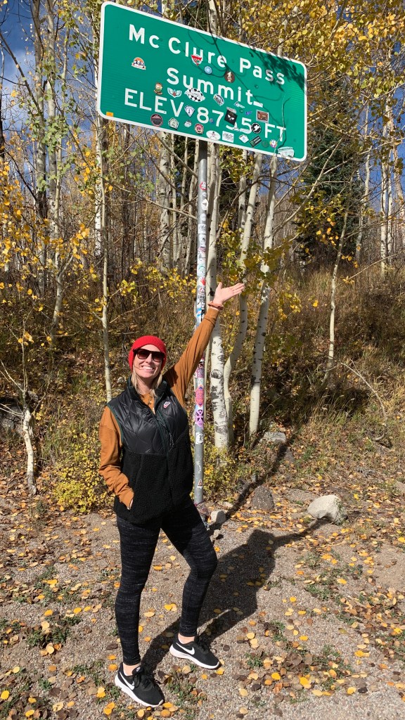
Almost Pass-a-Palooza™ … McClure Pass: 8,763 feet
If you‘ve been paying even a modicum of attention, you know that my Colorado Pass-a-Palooza™ is a slew of mountain passes that are at least 10,000 feet in elevation. And, paved.
By my count, there are 31 of them in Colorado. On this trip, I’ll ride 29.
McClure Pass, exactly 24.9 miles from my front door, does not qualify. It measures in at only 8,763 feet, seemingly puny compared to many of the passes we’ll ride the next two weeks.
But here I am, talking about McClure. Because I love it. So much, in fact, that I’ll call it an Almost Pass-a-Palooza™.
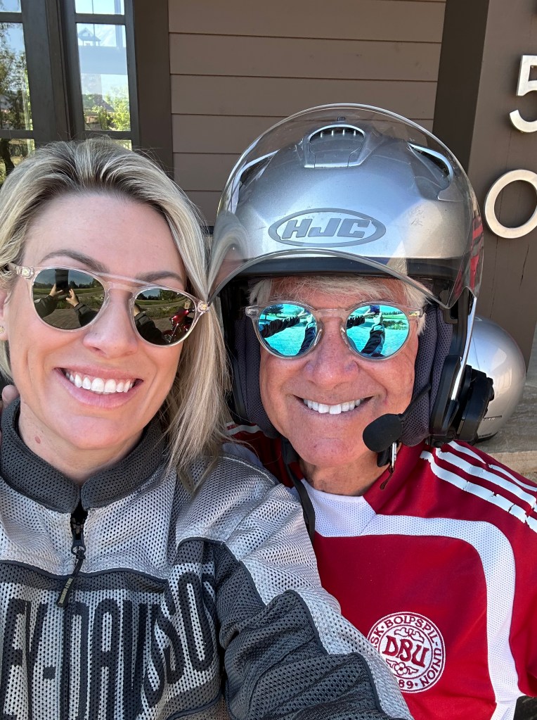
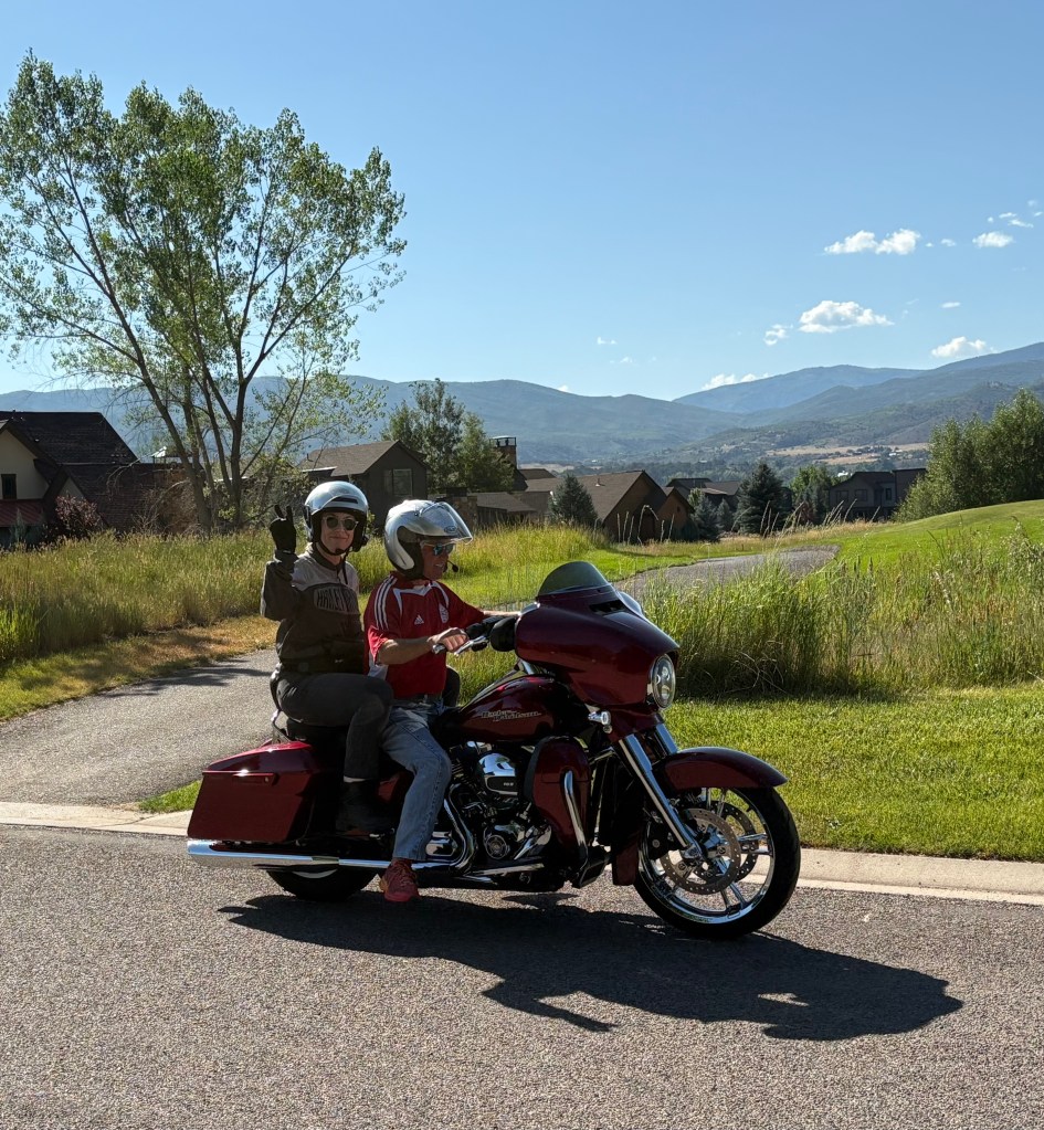
Eleven years ago, I rode over the pass on Colorado Highway 133 from Hotchkiss and Paonia, then down toward Redstone, following the Crystal River. This was my first motorcycle trip to Colorado, and my first exposure to the Crystal River Valley, which I now call home. Since then, I’ve ridden McClure Pass dozens of times. To Paonia for lunch. To Hotchkiss for BBQ.
Because I can.
McClure Pass, open year-round, sits on the boundary between Pitkin and Gunnison Counties. The approaches on either side of the pass have an eight percent grade, making McClure Pass among the steepest in Colorado. The only Colorado pass that’s steeper is Slumgullion Pass, east of Lake City; its north side is a 9.4 percent grade. Slumgullion Pass, at 11,529 feet, is on my Colorado Pass-a-Palooza™ list, and we’ll visit it on Tuesday.
The Ute Indians were among the first known humans to use McClure Pass while inhabiting the Crystal and Muddy Valleys. In 1776 Spanish settlers began exploring the area, which would later be settled by miners, farmers and ranchers.
Over the course of a century, the trail along McClure Pass was transformed from a hunting route to a wagon road by the late 1800s. In 1947, the route was improved to its modern form and was named for Thomas “Mac” McClure, who built and ran a hotel along the railroad nearby.
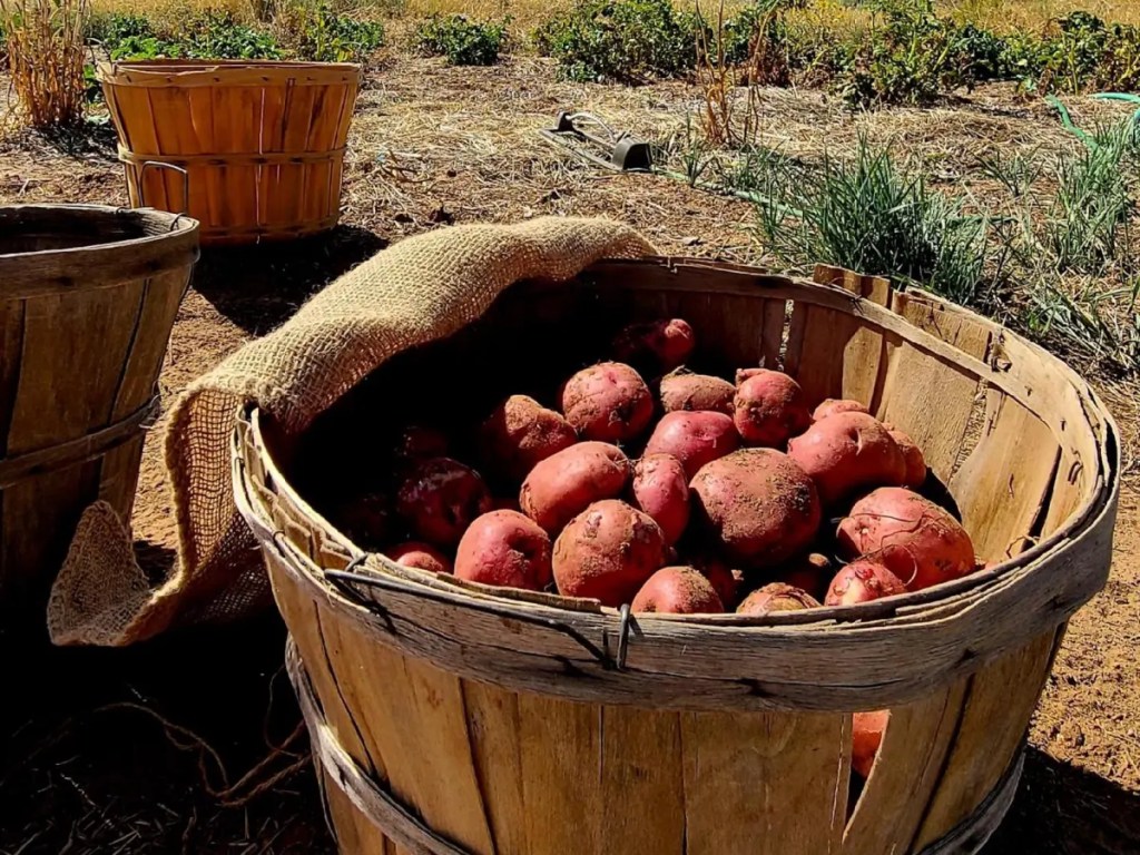
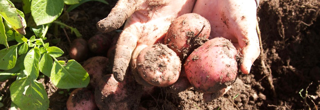
McClure is credited with cutting the first road leading from the Crystal River Valley to the North Fork of the Gunnison River. He was originally a miner who came to the Crystal River Valley from Leadville in 1910, to dig not for gold or silver, but for red. Red potatoes.
Red McClure Potatoes: A Colorado Treasure
An immigrant from Little Kenny, Ireland, McClure landed in Philadelphia at the age of 21. Upon hearing of gold strikes out west, he moved to Colorado and ended up in Leadville, a Victorian-era mining town, in 1876.
But he never strayed far from his Irish roots, and when he moved from Leadville to Catherine – now the site of Catherine Store in Carbondale – he purchased a piece of land, where he began cultivating that well-known Irish staple: potatoes.
Over time, he developed what was to become the Red McClure potato. After many grafting experiments, McClure developed his unique potato variety in the early 1900s, specifically bred for its adaptability to Colorado’s high altitude and arid growing conditions. His potato was a mutation of the Peachblow. Fist-sized, ruddy red, with deep eyes. McClure’s “Red” became popular for its disease resistance, high yield and excellent storage qualities, making it a favorite for potato growers in the region. Red McClure potatoes are perfect for baking, French fries, mashing or creaming.
His variety was introduced around 1910, and by the 1930s, the Crystal River Valley exported more than 400 rail cars filled with potatoes every year, more than the entire state of Idaho. The soils and climate here are said to be optimal for potato growing.
By 1933, when the silver mines of Aspen had closed and Silver Mine train cars stopped running between Aspen and Denver, the potato trade market also collapsed. Sadly, the potato fields in this area vanished, and so did the McClure potato. But it’s making a bit of a comeback these days.
This October, Carbondale hosts its 116th annual Potato Day celebration, held at Sopris Park. Other than Mountain Fair, Potato Day is Carbondale’s biggest party, a three-day festival commemorating the annual potato harvest, which begins every September.
Potatoes remain the top vegetable crop in the United States. (China and India are the world’s biggest potato producers.) Spuds are grown commercially in 30 states. Idaho now grows more potatoes than any other state, followed by Washington. North Dakota, Wisconsin and yes, Colorado.
Most of Colorado’s potatoes today come from the San Luis Valley in south-central Colorado, which sits at 7,600 feet and has a magical combination of sunshine, pure mountain water, and nutrient-rich soil. But when you write the history of Colorado taters, it all begins here in the Crystal River Valley.

Pass-a-Palooza™ … Grand Mesa: 10,849 feet
On the other side of McClure Pass, we roll through the old mining town of Somerset, then past the farm town of Paonia, then Hotchkiss, whose brand is “Friendliest Town Around.”
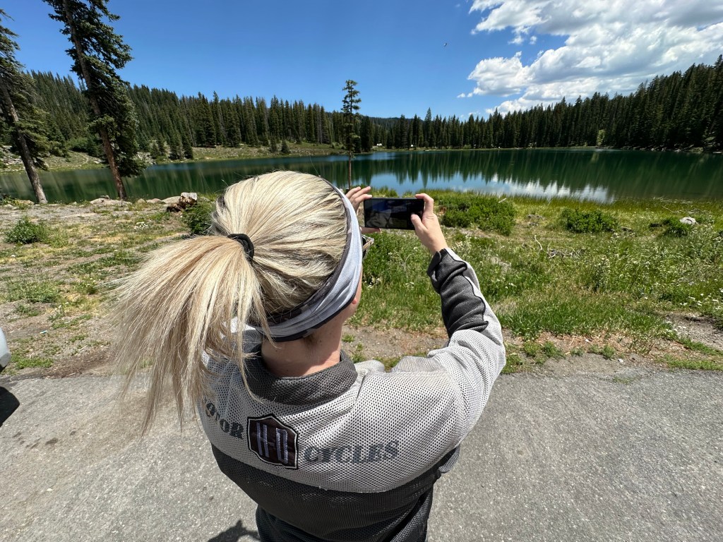
Here in Hotchkiss, we take our first break of the day before pressing on to the first real Pass-a-Palooza™ of the trip: the Grand Mesa, whose roadway tops out at 10,849 feet. The Grand Mesa earned Honorable Mention on my all-time Top Ten list.
From Hotchkiss, we head west on Colorado Highway 92. As we look to our right (north), there’s a huge flat-top mountain. It’s the Grand Mesa, the world’s largest mesa, with an area of about 500 square miles. The top of the Grand Mesa is a layer of basalt poured by lava approximately 10 million years ago, which has protected the mesa from the erosion suffered by surrounding sedimentary rocks.
The Grand Mesa stretches for about 40 miles, between the Colorado River and the Gunnison River, its tributary to the south. For those unfamiliar with the term, a mesa is a flat-topped mountain or hill – wide, flat with steep sides. Mesa is a Spanish word that means table.
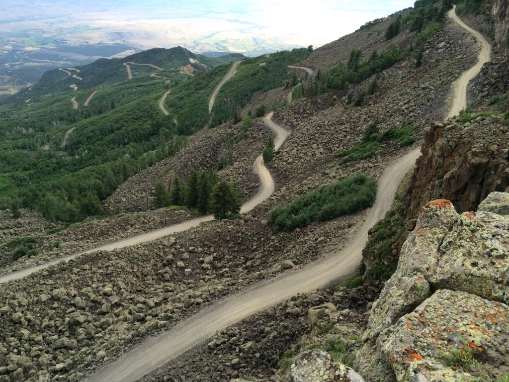
Long before it was called the Grand Mesa, the Ute Indian tribe lived in this area and called it “Thunder Mountain,” because of how the mesa towers over the valley 6,000 feet below. In 1776, the Utes guided Europeans through the area. Later, buggy trips brought travelers to the area. Stage lines and freight wagons eventually replaced the buggies. And in 1933, the Civilian Conservation Corps built Veteran Road (now Land’s End Road) that twists its way to the top of the mesa. And finally, modern automobiles could drive the road.
Land’s End Road is half paved, half dirt, half gravel. One hundred percent awesome. You do the math.
Grand Mesa Scenic Byway
We turn north on Colorado Highway 65, taking us to the Grand Mesa Scenic Byway, which rises from 4,780 feet to 10,849 feet. The byway, open year-round, winds through 63 miles of the Grand Mesa National Forest.
Since the late 1800s, the valley floor has been home to farmers, who rely on water from the Grand Mesa for their crops and orchards. On our way up, we pass through the agricultural towns of Orchard City, elevation 5,446 feet, and Cedaredge, elevation 6,135 feet. Then we begin climbing in earnest – more than 5,000 feet over the next 20 miles. Every October, Cedaredge hosts Applefest, a celebration of the town’s most abundant fruit.
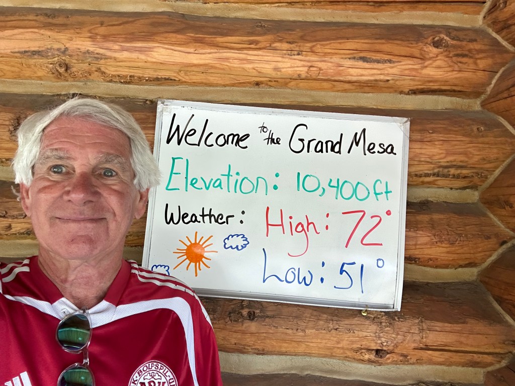
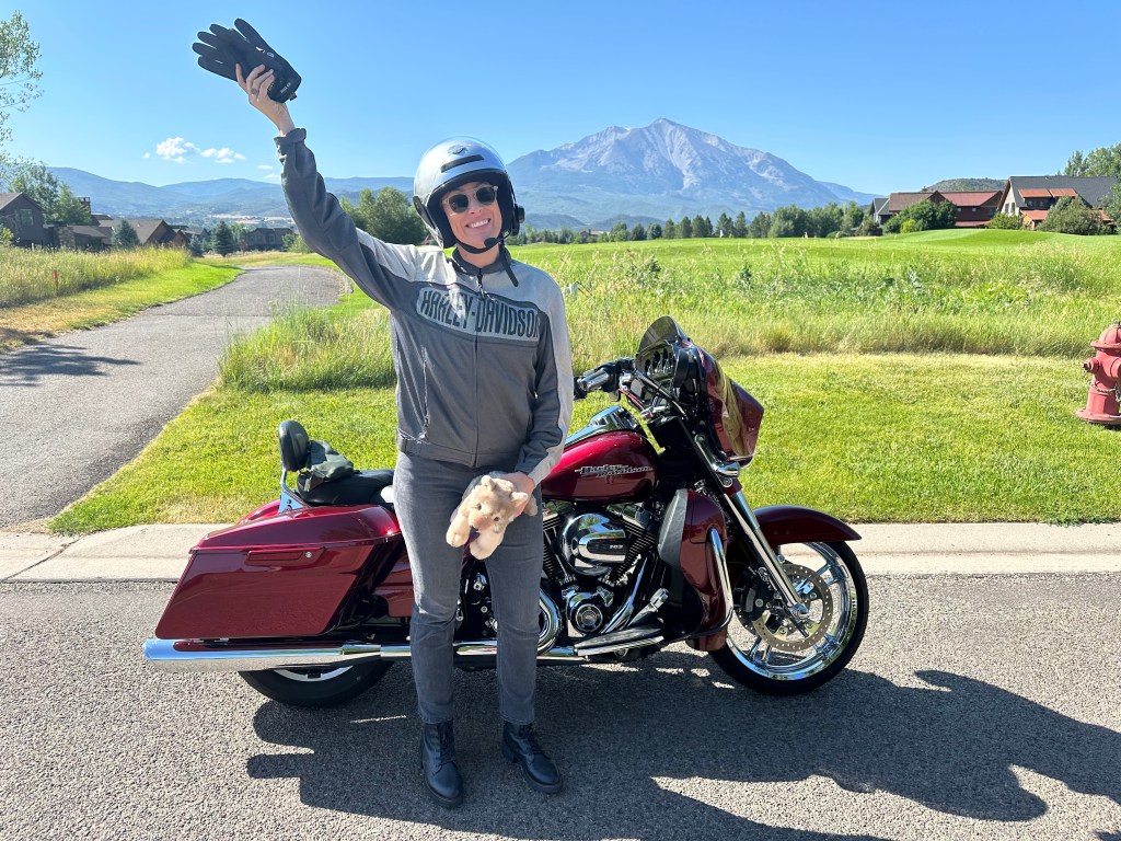
Yesss! 10,400 feet. Our first Pass-a-Palooza.
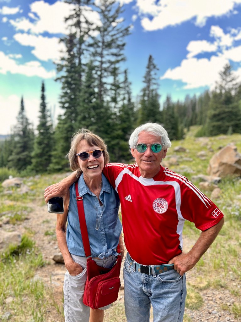
Cute couple on the Mesa.
With more than 300 mountain lakes, streams, rivers and creeks, the Grand Mesa offers great choices for trout fishing. The waters are stocked with rainbow, brooks and cutthroat, mostly ranging from eight to 12 inches long.
The Grand Mesa is home to the Powderhorn Mountain Resort, one of Colorado’s most down-to-earth ski areas. It’s one of the two remaining ski areas in Colorado that still allows free season passes for 80-and-up skiers. Don’t laugh; that will be you some day. The ski area is owned by Utah-based Pacific Group Resorts.
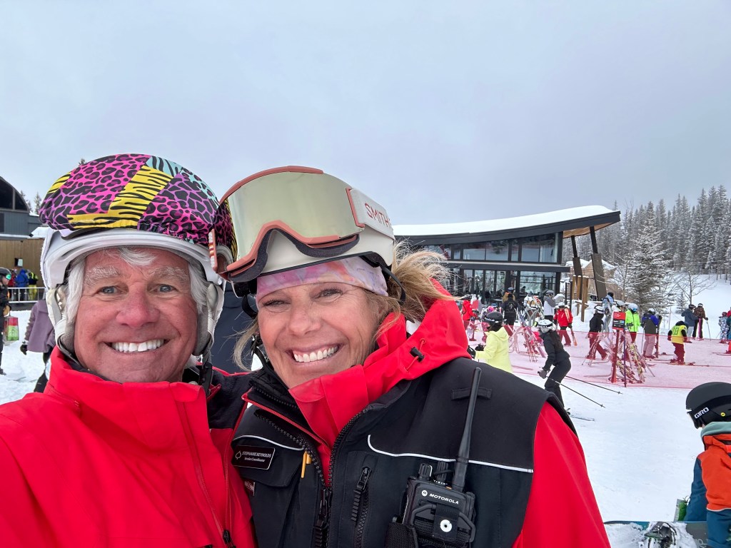
From Powderhorn, it’s only about eight miles to Mesa, home to a few hundred residents, including my ski school friend, Stephanie, who once ran the ski school at Powderhorn.
Unaweep-Tabeguache Scenic Byway
After briefly exploring the Grand Mesa, we turn around and head back down to the valley floor. About an hour later, as we near Grand Junction, we turn south on Colorado Highway 141. From here, it’s 44 miles to today’s destination: Gateway. The scenic byway follows West Creek, which empties into the Dolores River in Gateway.
To get there, we follow the Unaweep-Tabeguache Scenic Byway, one of Colorado’s 26 Scenic and Historic Byways. The road is so spectacular that it rates an Honorable Mention on my all-time Top Ten list.
We’re riding Unaweep Canyon. In the Ute language, roughly translated, Unaweep means “the canyon with two mouths.” It’s believed to be the only canyon in the world to have two creeks flowing out in opposite directions. West Creek flows out one end and East Creek out the other; east toward Whitewater, and west toward Gateway. Unaweep is pronounced YOON-uh-weep.
Tabeguache? In the Ute language, it means people who camp on the sunny side of the mountains, and is the name for one of the original six Ute bands in Colorado. It’s pronounced tab-uh-WATCH.
Here, the high Uncompahgre Plateau meets the red rock deserts of the Southwest. Uncompahgre? In the Ute language, it means a place with red water. It’s pronounced un-come-PAH-gray.
For countless generations, native people followed plentiful game herds through the region. After Ute Indians were forcibly removed from the area in 1881 and sent to reservations, white settlers arrived in the canyon and began cattle ranching. There are still traces of mines and waste piles dotting the landscape, leftover remnants of the mining era that began in 1900. The quest was for a yellow mineral called carnotite, containing three metals crucial to 20th century science: radium, vanadium, and uranium.
The Unaweep-Tabeguache Scenic Byway goes on for 133 miles, following the Dolores and San Miguel Rivers all the way to Naturita, which we’ll visit tomorrow. Today, we ride 44 miles of the byway and end up in Gateway.
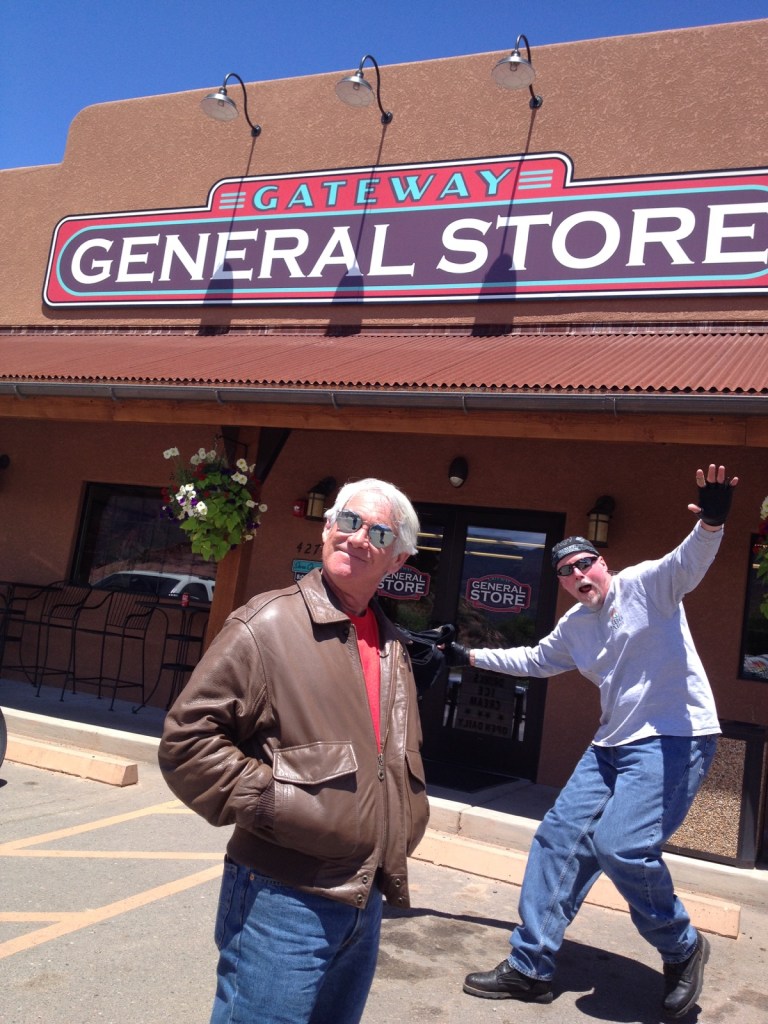
Gateway, Home of the Photobomb
Gateway is about an hour southwest of Grand Junction, and an hour north of Naturita. It sits at an elevation of about 4,600 feet – pretty much as low as we’ll be all week.
The beauty of the land is huge, but the feel is small. Gateway has a population of about 100. If you blink, you’ll miss it.
Gateway’s history is steeped in the people of the Pueblo, Fremont and Ute Native American tribes. The first homesteaders came in 1884, and in 1903, they built a small, dirt-floored cabin to be used as a schoolhouse. uses the same one-room school as was originally built in the early 1900s. Its 20 students today sit in the same classroom as their predecessors did.
In 1904, the post office was established and the name “Gateway” was given to the town, as it is a gateway to Colorado from nearby Utah.
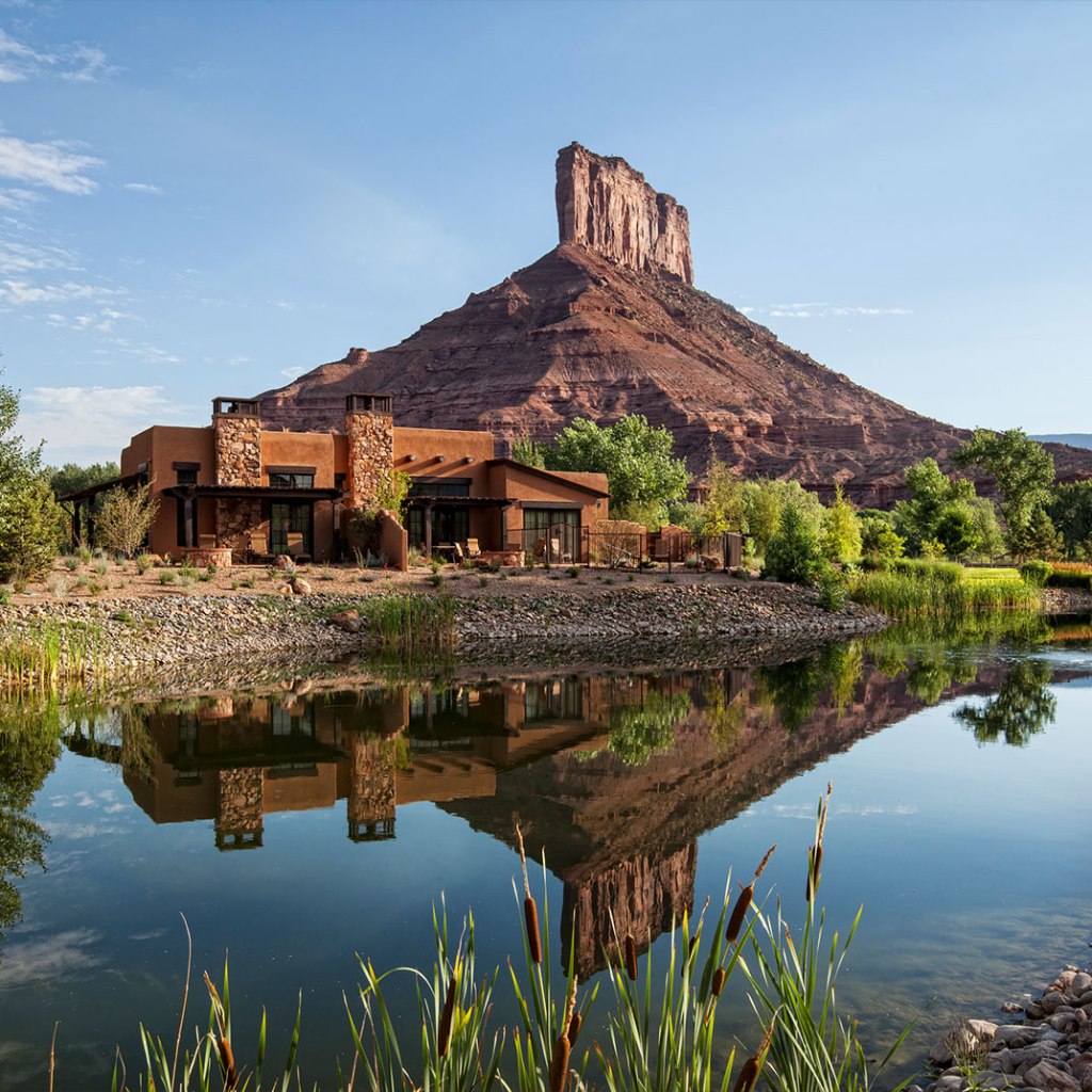
Once you arrive in Gateway, there are really only two things here worth seeing (besides the school): the Gateway General Store (home of the photobomb!) and Gateway Canyons Resort, where we’re staying tonight.
The resort was developed by John Hendricks, former Discovery Channel founder and CEO. He first saw the site in 1995 and was moved by its beauty and history enough to buy the land and begin designing a world-class property.
Gateway Canyons is on most lists of top resorts in the US, in the West, and in Colorado. Among its honors: Conde Nast Traveler’s Readers’ Choice Awards, US News & World Report Gold Badge, Travel and LeisureWorld’s Best, Forbes Luxury Hotel, Rocky Mountain Bride, and more.
It’s way fancier than my usual accommodations, and yet, we deserve this moment of indulgence. Besides, it’s the only place to stay in Gateway.
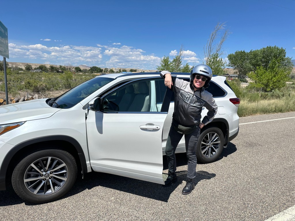
So, we’ll park the Harley and the SUV, call it a day, and pamper ourselves ‘til tomorrow morning.
To see today’s route from Carbondale, over McClure Pass, up the Grand Mesa, and to Gateway, click here.
***
Today’s Not Quite Pass-a-Palooza™ … Schofield Pass: 10,707 feet
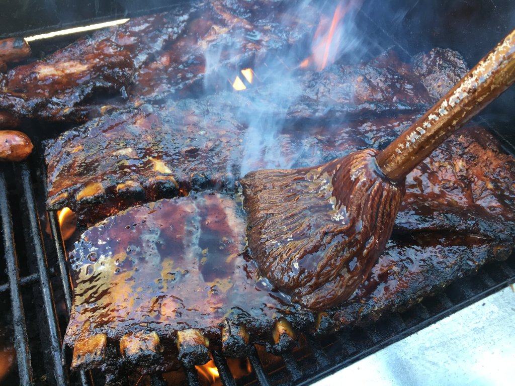
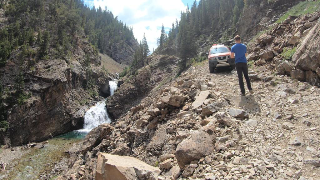
Earlier today, on our way to McClure Pass, we rode past the turnoff to Marble, best known to followers of this blog as the home of Slow Groovin’ – Colorado’s tastiest ribs.
But Marble is also a starting point for the road over Schofield Pass, which ends in Crested Butte. It’s a 25-mile journey along the deadliest trail in Colorado. Schofield Pass Road is not an automatic death sentence, but it can be quite treacherous. I’m not recommending or endorsing it, just writing about it.
In July 1970, an over-loaded pickup truck ran off the road and plunged 300 feet into the Crystal River, sinking in 20 feet of water and killing nine of the 12 passengers on board. That, in a nutshell, is why Schofield Pass is Number One my Not-Quite Pass-a-Palooza™ list.
On the day of that deadly crash, the maiden voyage of a new GMC Jimmy began in Crested Butte and headed northwest toward Marble. So, that’s the route we’ll take today as I describe the path over Schofield Pass. Only you don’t have to worry about me dying.
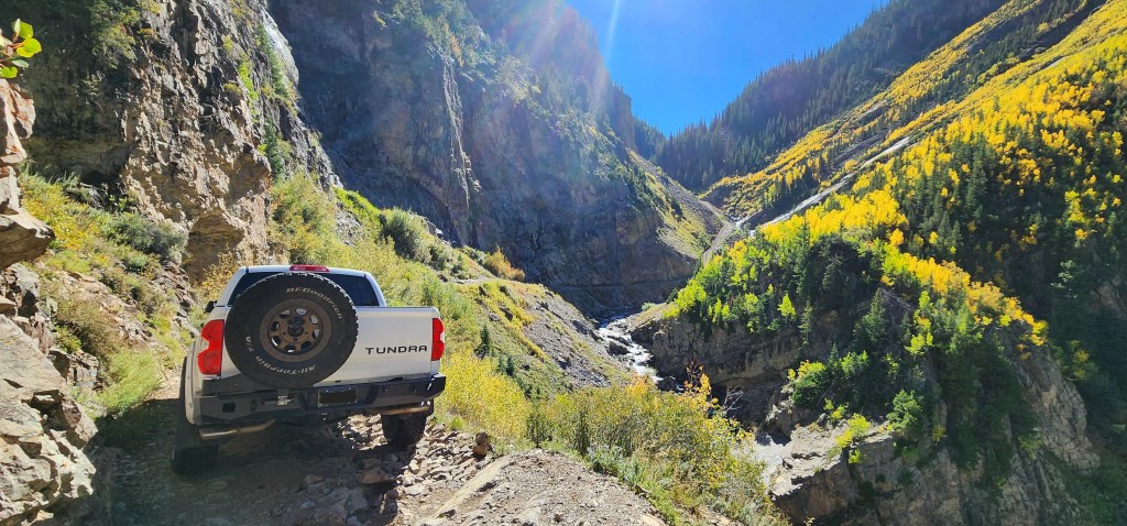
We’ll begin in Crested Butte, my favorite Colorado mountain ski town, which sits at 8,865 feet. Leaving town, the paved road soon turns to dirt and rocks, and a high-clearance four-wheel drive vehicle is recommended from here to Marble. It’s a very rough ride. Emphasis on “very.” And, on “rough.”
Gothic, a Ghost Town: From Crested Butte, it’s eight miles to the old ghost town of Gothic, accessible year-round, but easiest when the snow melts off. A handful of original structures remain in Gothic, but nearly all are deserted. The Rocky Mountain Biological Lab, a non-profit environmental research center, operates in Gothic. Students spend the summer here studying the local ecosystem. Professors and scientists have published more than 1,500 scientific papers in Gothic studying climate change and ecology.
In the late 1800s, Gothic was a silver mining town. At its peak, the town had about 1,000 locals, and its own US Post Office. In its heyday, there were around 400 buildings here, including eight saloons, a newspaper and a dance hall. In 1880, president Ulysses S Grant checked out Gothic, part of a visit to Salida, Gunnison and Leadville.
Gothic got its name from nearby Gothic Mountain, 12,631 feet high in the Elk Mountain range. Its pinnacles are said to resemble Gothic architecture.
Schofield Pass. Leaving Gothic, you continue on Schofield Pass Road toward the ghost town of Schofield, which sits at the top of the pass between Crested Butte and Marble. A mill was built here in 1881, and at its height, Schofield had a hotel, restaurant, post office, store, carpenter, blacksmith, barber, and daily mail service. It was a rockin’ place. By 1885, the ores played out, and Schofield, like so many mining towns in Colorado at the time, was on its way to becoming a ghost town.
Schofield Pass is at 10,707 feet above sea level. To get here it’s been an almost 2,000 foot vertical climb from where we began in Crested Butte.
The pass is named after BF Schofield, a silver miner in the area in the 1870s. In 1873, the first wagon road was built over Schofield Pass to what is now known as the Crystal River. The route was known as “S.O.B. Trail” due to the road’s difficulty – both building it and then navigating it by wagon.
Devil’s Punchbowl. The old wagon road began to lose popularity and was not rebuilt until the mid 1900s. Overall, the project building the road took 22 years to complete, allowing access from Crested Butte to Marble, beginning in 1958.
The rugged, one-lane shelf road has a roadbed blasted into sheer canyon cliffs. This is where the danger comes in. If you’re not livin’ on the edge, you’re taking up too much space!
As you head toward the ghost town of Crystal, home of the famous Crystal Mill, there’s a reminder of the fatal accident from 1970: Devil’s Punchbowl. The Punchbowl is a series of waterfalls along the Crystal River Canyon, ending in a deep pool of water. It’s in the middle of a very intimidating ¾-mile section of a narrow shelf road, barely wide enough for one vehicle. The White River National Forest classifies Schofield Pass as “extremely dangerous.”
Crystal, a Ghost Town. A few miles past Devil’s Punchbowl, you arrive in what remains of the old mining town of Crystal. Here, you can breathe a sigh of relief that you conquered Schofield Pass, and didn’t disappear into the Devil’s Punchbowl. Though Crystal is often called a ghost town, many of its buildings are still standing, and people live there in the summer.
Miners began working the area in the 1860s, but because it was so difficult to get to, another 20 years went by before Crystal became a boomtown. Also known as Crystal City, the town boomed as a mining camp for several decades. In its heyday, there were a half dozen mines, producing silver, zinc and lead. Crystal had its own newspaper, the Silver Lance, as well as a post office, general stores, saloons, a pool hall, and the Crystal Club, an executive club for men.
By 1917, all the mines had closed, the population dwindled to seven, and Crystal had officially become a ghost town. What ultimately did Crystal in was the immense difficulty in reaching the place.
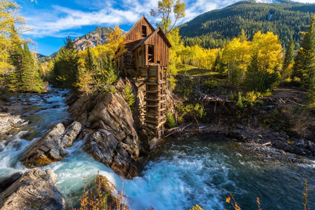
Just after you leave Crystal, you’ll find perhaps the most photographed sight in Colorado: the old Crystal Mill. This wooden powerhouse was built in 1893 as the Sheep Mountain Power House, on an outcrop of the Crystal River. The mill closed its operations in 1917. Continuing efforts to preserve it have been aided by the Gunnison and Aspen Historical Societies, and by residents of Crystal and Marble.
From the Crystal Mill, it’s six miles west to the town of Marble, which got its name from the stone that is quarried there: Yule Marble. It’s the only place on earth where Yule Marble is found. Yule Marble is named after prospector George Yule, who in 1874, stumbled across the stuff on a mountainside, 1,500 feet above Marble.
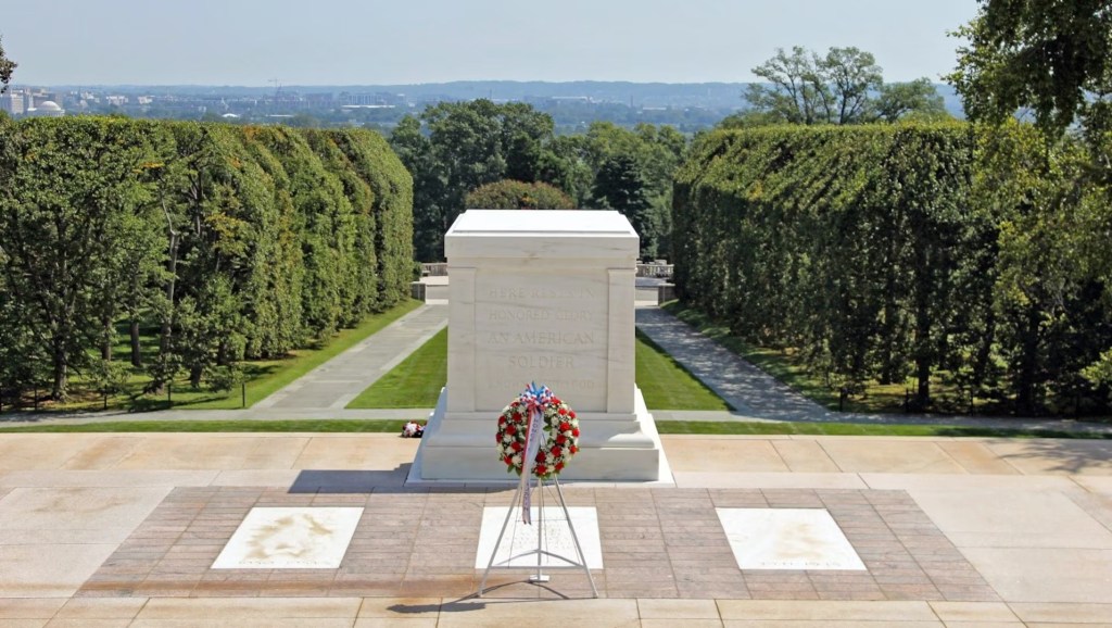
Marble, the End of the Road. Beautiful white marble from Marble provided the stone for the exterior of the Lincoln Memorial, and the Tomb of the Unknown Soldier at Arlington National Cemetery. There are about 130 full-time residents of Marble. Fifteen to 20 of them work at the quarry. It’s believed that the remaining operational quarry has enough marble to last for several hundred years, more than likely outliving the life of this blog.
Yule Marble is Colorado’s official state rock. Its almost pure (99.4 percent) calcite grains are tightly joined to give it a luminous quality. Yule Marble was declared the state rock in 2004 after a group of Girl Scouts successfully petitioned the state legislature, saying it seemed odd that the state known for its Rocky Mountains did not have an official state rock. Now it does.
The state rock, Yule Marble, should not be confused with the state gem, Aquamarine, or the state mineral, Rhodochrosite. Lovers of geology will note that those three Colorado state symbols are Red, White and Blue.
Rocks aside, perhaps the best reason to be in Marble, is Slow Groovin’. Here, you can celebrate your successful completion of Schofield Pass – and living to tell your grandchildren about it – with a healthy heaping of ribs. For an appetizer, try the Atomic Buffalo Turds, or Un-Routine Poutine. Seriously.
To view today’s Not Quite Pass-a-Palooza™ route from Crested Butte, over Schofield Pass, and on to Marble, click here.
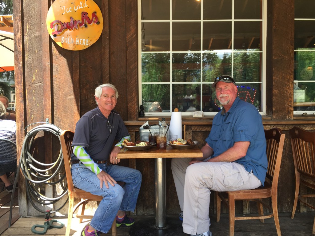

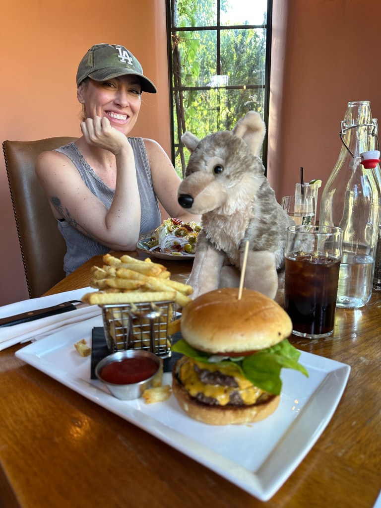
soooo love riding McClure Pass! Great first day bro! Shoulda packed your fly gear for Grand Mesa. Ha! And Sarah let you eat that double burger?
LikeLike
Sarah lets me eat pretty much anything I want, especially if fries come with it. Turns out she likes fries, too. I think you’d like Gateway. Been there?
LikeLike
Sarah lets me eat pretty much anything I want, especially if fries come with it. Turns out she likes fries, too. I think you’d like Gateway. Been there?
LikeLike
As always great info and a fun travel log.
Hill Blair 970-203-5640 skihill9@gmail.com box 5551 Snowmass Village , CO 81615
LikeLike
I admire your taste in blogs, Uncle Hill 😀
LikeLike
I sooooo loved riding McClure pass! Big sweeping curves and climbs! Shoulda packed fly gear for Grand Mesa bro! Ha! Great Day One! I can see it all! And Sarah let you eat that double burger? Can’t wait to see what’s next.
LikeLike
Thanks, Gary! Looks like a super start to your Pass-a-pulooza!!Mimi
LikeLike
Thank you Gary, stay safe!Sent from my iPhone
LikeLike