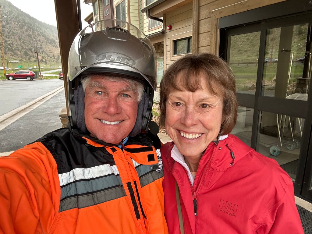
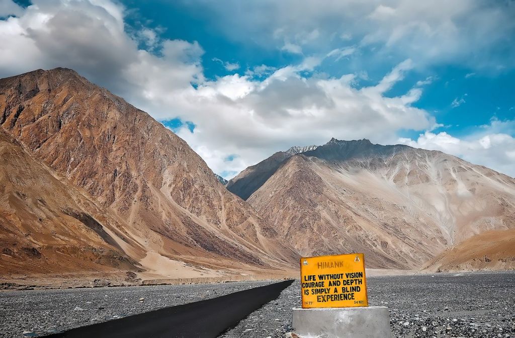
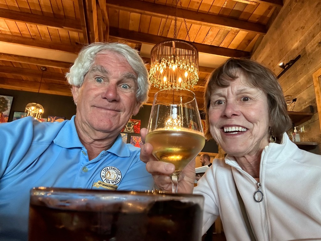
Our morning begins by laying out all the gear to ascend a Fourteener. We’ll need warm clothes, sun protection, and some nerve. And, fuel in the tank. No ropes, crampons or ice axes are needed.
OK, we’re not exactly climbing a Fourteener. We are riding to the top of one. Still, if you’re keeping score, and we are – it counts.
We leave Georgetown, hop on I-70 for ten miles, and exit in Idaho Springs, when we see the signs for Mount Evans. That’s today’s Fourteener.
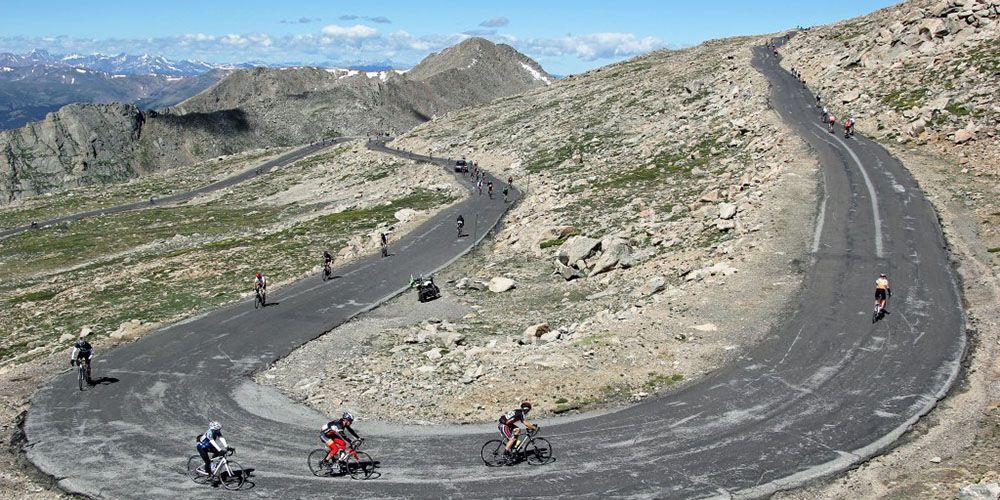
From Idaho Springs, it’s a 13-mile ride to the Mount Evans Welcome Station. Along the winding road – Colorado Highway 103 – we begin our nearly 7,000-foot climb to the summit of Mount Evans. It’s the highest paved road in North America.
This spectacular road is part of the Mount Evans Scenic Byway, which we’ll be on for the next hour, until we reach the summit.
The road to Mount Evans, once thought to be an impossible dream, is the result of a tourism arms race in the early 1900s between the cities of Denver and Colorado Springs. First, the Cascade and Pikes Peak Toll Road Company completed a 16-mile road up the north side of Pikes Peak, just 12 miles from Colorado Springs. The road topped off at 14,115 feet, and established a major tourist attraction that brought visitors from the Denver area.
Not to be outdone, Denver’s Mayor proposed that a road be constructed to the top of Mount Evans, 60 miles west of Denver. In 1917, he procured state funds to build the road. Construction began in 1923. Seven years later, the road was completed and opened to the public.
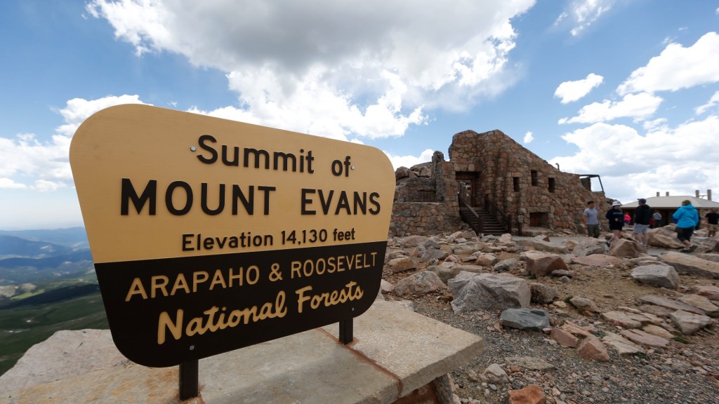
During the summers of 1941 and 1942, Denver’s Mountain Parks department built a structure at the top of Mount Evans, with a restaurant and gift shop. Called the Summit House, the facility was a significant tourist draw until a propane cannister fire burned it down in 1979. The Summit House hasn’t been rebuilt, but its rock foundation and wall remain as an observation platform and windbreak for mountain travelers. The building was once the highest business structure in North America. That honor now apparently belongs to Il Rifugio at Snow Plume, a 12,456-foot high restaurant at the Arapahoe Basin Ski Area.
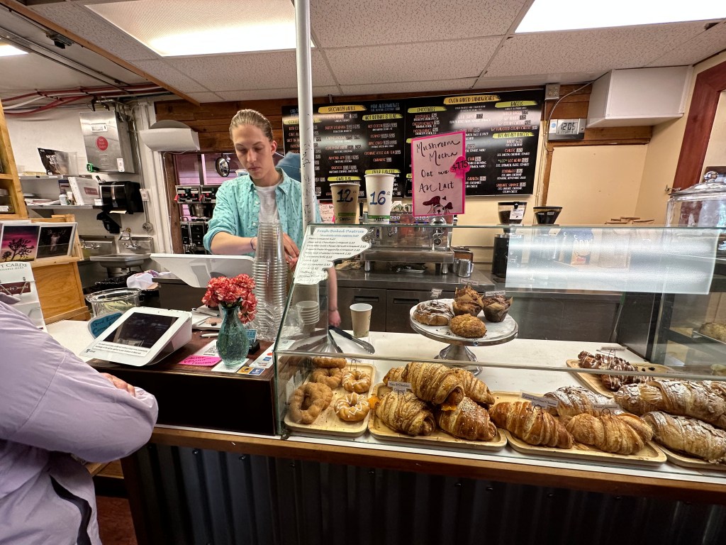
On our way to the Welcome Station, we pass Echo Lake, a beautiful high alpine lake that sits at 10,600 feet, at the base of Mount Evans. Echo Lake Lodge is right above the lake. It has a general store, restaurant, and gift shop. It’s the last place to stop and take a deep breath before heading up the mountain.
From the Mount Evans Welcome Station, it’s 14 miles to the summit. Well, 14 miles to the summit parking lot, which is at 14,130 feet. If you want to actually summit Mount Evans, you can hike the last 134 vertical feet to the top. The actual summit, for you detail freaks, is at 14,264 feet, making Mount Evans Colorado’s fourteenth highest Fourteener.
Journeying to the Mount Evans summit parking lot is a lot like taking a trip through Canada to Nome, Alaska. Every 1,000 feet of elevation gain is equivalent to traveling 600 miles north in latitude. Instead of traveling through vast continental regions, we roll through regions characterized by specific plants and animals known as life zones. It’s usually about 40 degrees colder at the top of Mount Evans than it is in Idaho Springs, where our journey began.
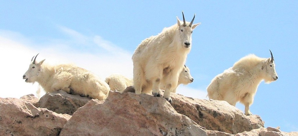
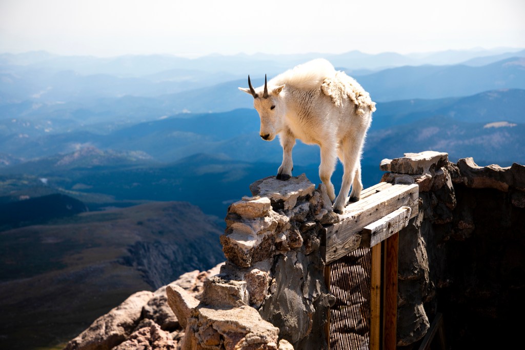
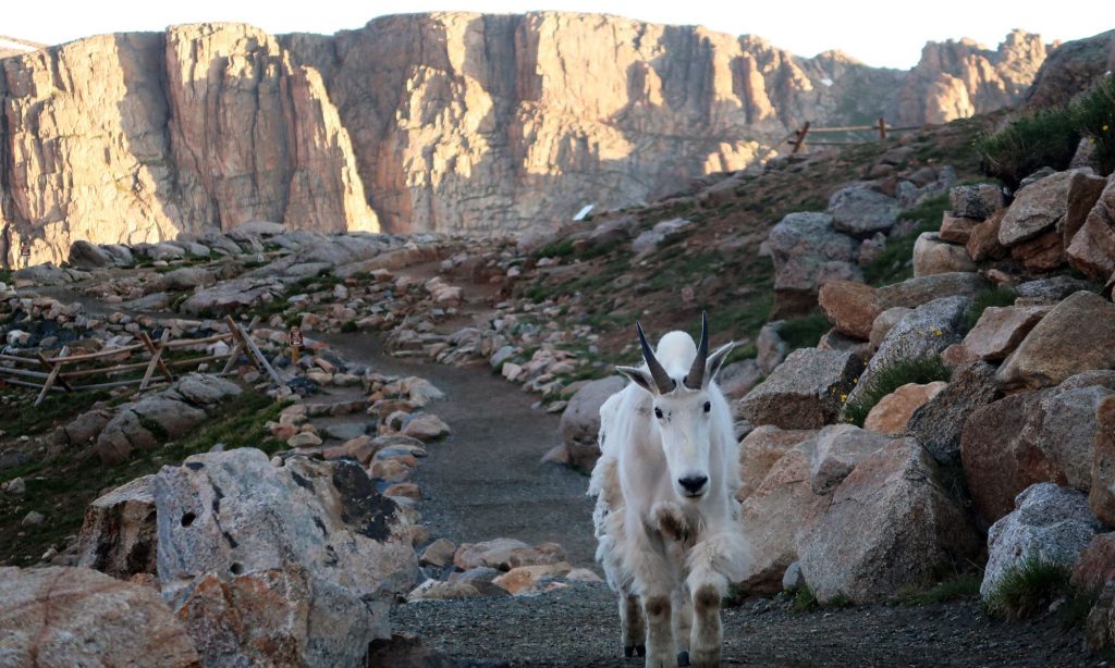
High above the timberline on Mount Evans, mountain goats are a common sight. You’re pretty much guaranteed to see them on your journey to the summit. Except what you’re seeing isn’t really a goat, it’s more closely related to some African antelope species. That’s a technicality though. Everyone calls these sure-footed animals mountain goats, and that’s unlikely to change.
The mountain goats’ hooves are padded to help them grip rocky surfaces and ledges, and they have extra-strong hind legs that allow them to spring up steep slopes with ease. Surprisingly, despite being so well adapted to Colorado’s higher terrain, mountain goats are not native to Colorado. They were brought here from the Northern Rockies as game animals in the mid-twentieth century.
From the summit, or the summit parking lot – your choice – you can see much of the Continental Divide in Colorado. It’s quite a view.
Because of winter snowfall and the impossible nature of keeping the road cleared, the road to Mount Evans is generally open only from Memorial Day to Labor Day.
Yes, generally open. Except for a late spring snowstorm. That’s what happened yesterday, closing the road to the summit. Fouled again 😢
Can We get Higher?
Mount Evans is undoubtedly a very high road, and the highest paved road in North America, it’s not the world’s highest. Depending on how you define a road – is it paved? Is it designed for vehicles? Is it accessible? – there are other roads that leave Mount Evans in the high-altitude dust.
Ojos del Salado, along the Argentina/Chile border, reaches 21,942 feet. It’s a volcano that some daring drivers try to scale, but it’s not really a road. Still, it might be the highest point anyone’s ever driven. Except the moon.
Umling La Pass in India tops out at 19,024 feet. It’s on the ridgeline between Koyul Lungpa and the Indus River.
A road to the top of the Uturuncu volcano in Bolivia reaches 18,799 feet. It’s not paved, and not well-maintained. But it is a road.
Semo La in southern Tibet takes you to 18,258 feet. It is paved.
If you’re willing to get out your passport and explore, you can try those roads. Sure, it would be a thrill, but isn’t scaling Mount Evans just a bit more convenient?
Berthoud Pass
After admiring the view, and satisfied with our accomplishment, we begin the 7,000-foot descent from the top of Mount Evans, toward the valley below.
An hour later, we arrive in Idaho City, take a break, and discuss the plan for the rest of the day.
We’ve got two more Scenic Byways to ride, and seven 10,000-foot + summits to cross. So, we find our way to US Highway 40, and head for Berthoud Pass. The 11,315-foot pass is named for Edward L. Berthoud, chief surveyor of the Colorado Central Railroad during its expansion throughout Colorado in the 1870s. He led surveys for railroads to booming mining camps in Georgetown, Leadville and San Juan County.
Accompanied by mountain man Jim Bridger, Berthoud discovered the pass in 1861 while surveying a possible route for the railroad. He concluded the pass was suitable as a wagon road, but not as a railroad.
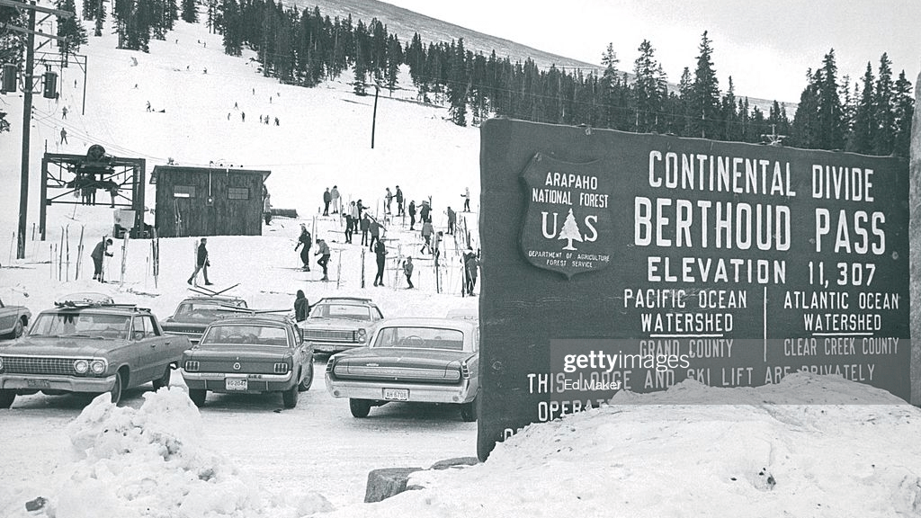
Many years later, thanks to easy access to the summit, and its close proximity to Denver, just 50 miles away, Berthoud Pass became an attraction for downhill skiing. Throughout the 1930s and ‘40s, the Berthoud Pass Ski Area attracted thousands of visitors exploring the backcountry.
A group of volunteer ski enthusiasts decided to take matters into their own hands and get a ski area off the ground. They found financing through the May Company and Denver Ford dealers, and in 1937, created Colorado’s first rope tow, giving birth to the state’s first formal ski area.
In 1947, Colorado’s first two-person chairlift further opened the area. Over time, due to competition from larger resorts, like nearby Winter Park, the Berthoud Pass Ski Area permanently shut down operations in 2003.
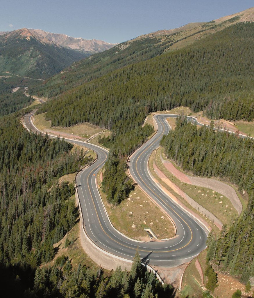
The road over the pass is well-designed, well-maintained, and fun to ride. Going over Berthoud Pass, we cross the Continental Divide. Again. I’ve almost lost count. OK, it’s seven.
From the pass, we descend about 2,200 feet to the ski town of Winter Park. The Winter Park Ski Resort is owned by the City of Denver, and managed by Alterra Mountain Company.
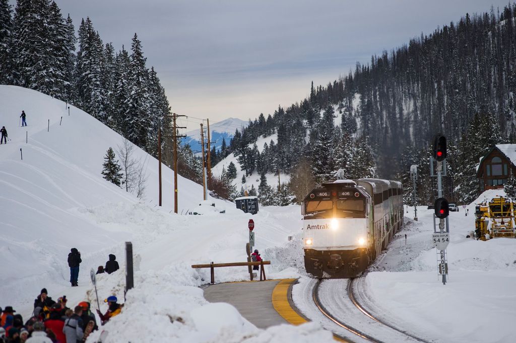
If you live on the Front Range, and driving over Berthoud Pass to go skiing isn’t your thing, you can take the train from Denver directly to Winter Park. The Winter Park Express is a partnership between Amtrak and the Winter Park Resort, dropping skiers at the doorstep of the ski area. The train departs Union Station in Denver at 7 am, and arrives in Winter Park by 9 am. Very convenient. The original Ski Train began running in 1940, and has operated continuously, with a short break following the recession of 2008.
About 1,000 people live in Winter Park. Close to a million people visit here every year. Skiing in the winter, mountain biking and hiking in the summer.
Continuing northwest on Highway 40, we roll through the town of Fraser, on our way to Granby, a town of 2,100. Granby was founded in 1904 along the route of the Denver, Northwestern & Pacific Railway. Unlike so many towns we’ve visited on this trip, mining did not play a role in its history. The town was named after Granby Hillyer, a Denver lawyer who later served as a US Attorney for the area.
Rocky Mountain National Park, Ray’s Favorite
From Granby, we ride north on US Highway 34, following the shoreline of Lake Granby, Colorado’s third-largest body of water. The lake was created when Granby Dam was built in 1950. Lake Granby is home to the Lake Granby Yacht Club. At 8,280 feet, it’s one of the highest-elevation yacht clubs in the world (the Dillon Lake Yacht Club, 9,017 feet, apparently holds that title). This road is part of the Colorado River Headwaters Scenic Byway. Yep, another one.
The highway continues along the western shore of Shadow Mountain Lake and brings us to the town of Grand Lake, which calls itself the snowmobiling capitol of Colorado, and the Western Gateway to Rocky Mountain National Park. Grand Lake is the largest natural body of water in Colorado – natural, in that it wasn’t created by a dam.
Grand Lake is our last civilization before arriving at the entrance to Rocky Mountain National Park, just a mile up the road. Rocky Mountain National Park is the tenth national park we’ve visited on this trip.
We enter the park, and stop by the Kawuneeche Visitor Center to remind ourselves what we want to see in the park. There’s plenty to see; that’s why the park gets more than three million visitors every year.
Rocky Mountain National Park has five visitor centers. Our target is the Alpine Visitor Center, which sits at 11,796 feet. It’s the highest elevation visitor center in the National Park System.
Rocky Mountain National Park is a busy place. It’s the fourth-most visited of all the national parks. In 2022, it had 4.3 million visitors. Here’s a bit of trivia for you: since 1904, National Parks Services sites across the country have attracted more than 15.7 billion visitors!
We’re now riding on the Trail Ridge Road Scenic Byway. It’s is the fourteenth scenic byway on this trip, and the fifth visit to an All-American Road. Keeping tabs on all this is quite the effort.
Trail Ridge Road snakes roughly 50 miles from Grand Lake to Estes Park on the east end of the park. The road was planned and built from about 1929 through 1938. It was designed to replace Fall River Road, which opened in 1920 as one of the first auto routes in the park. But the narrow, one-way road wasn’t paved, suffered from numerous snow slides, and had only limited access to scenic overlooks. Congress appropriated $450,000 for Trail Ridge Road in 1928, and the Civilian Conservation Corps began working on road construction.
Trail Ridge Road has 11 miles of road above 11,000 feet, and four miles above 12,000 feet. All of this is above the timberline, and looks a bit like a moonscape, or what I think a moonscape would look like.
Before long, we arrive at Milner Pass, the twenty-second 10,000-foot + pass we’ve scaled on this trip, and the eighth crossing of the Continental Divide. Milner Pass is at 10,759 feet, on our way to more than 12,000 feet on Trail Ridge Road. The pass is named for T.J. Milner, a railroad promoter who surveyed a rail route across the divide from Denver to Salt Lake City. Like many surveyed routes of the 1880s, the railroad line was never built.
The road has a special significance for me, going back nine years. At the time, my posse consisted of me, and Sarah’s cousin, Ray Sanders. Ray was a long-time rider, with hundreds of thousands of miles under his belt. At the age of 83, then riding a Harley Heritage Softail Classic, Ray knew his riding days were nearing an end. For our 2014 journey, he wanted to go out in style, and ride his favorite road anywhere – Trail Ridge Road. Ray rode nearly 2,000 west from his home in Farragut, Tennessee, and met me near the Hoover Dam in Boulder City, Nevada. He got his wish of riding Trail Ridge Road one last time, and I had the privilege of seeing him do it.
Sadly, Ray died last year at the age of 91.
His memory rides with me every time I’m in this park.
Eventually, we find our way to the Alpine Visitor Center.
It’s a great place to stop, grab a drink, and enjoy the view.
A 4,000-foot Drop to Estes Park
We leave the visitor center, and have about 400 feet of climbing before we get to the highest point on Trail Ridge Road – 12,183 feet. From here, it’s a 28-mile, 4,600-foot descent to tonight’s destination, Estes Park.
Along the way, we cross Iceberg Pass, the highest of the three mountain passes within Rocky Mountain National Park. Iceberg Pass is at 11,827 feet. Before there were any roads on this pass, the point served as an important pass along routes walked by native people. The Arapaho Indian tribe referred to what is now Trail Ridge Road as “taienbaa,” which translates to “Where the Children Walked.” As the story goes, the route was so steep, that children could not be carried, but rather had to walk on their own.
Our day ends, as we roll into Estes Park. The town of 6,000 residents has a beautiful setting, at the east end of Rocky Mountain National Park. It sits on the scenic Big Thompson River.
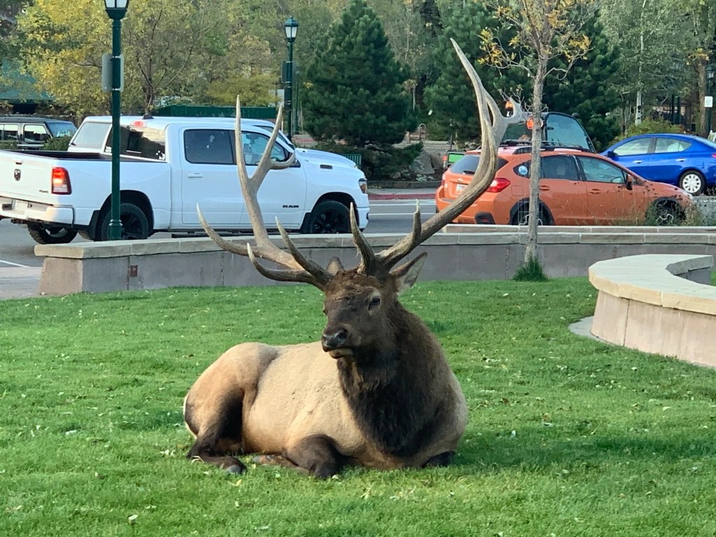
Today, Estes Park’s economy is entirely built around tourism. It’s known for outdoor adventure, natural beauty, and watchable wildlife; you’re likely to see elk in the downtown park.
We check into the hotel for the first of two nights in Estes Park.
There’s much to celebrate. Breathing clear, clean, fresh Rocky Mountain air. Riding to the top of a Fourteener. Spending much of the day between 10,000 feet and 14,000 feet. Honoring the memory of my riding mentor, Ray Sanders.
***
The Day in Review:
Click here to see today’s complete route from Georgetown, Colorado to Estes Park, Colorado – via the Colorado River Headwaters Scenic Byway, the Mount Evans Scenic Byway, and the Trail Ridge Scenic Byway – an All-American Road.
Today’s Takeaways:
- Riding to the top of a Fourteener, Mount Evans.
- Crossing the Continental Divide, again and again.
- Trail Ridge Road, Ray’s favorite.
Today’s Trivia: The Mountain With an Identity Crisis
The name Mount Evans has been unpopular for a long, long time. Most Coloradans acknowledge the name is inappropriate, believing it’s time to move on, beyond a name with undeniably bad mojo.
There’s been a renaming process underway for years to strip former Governor John Evans’ name from the 14,265-foot peak. Evans, who served as territorial governor from 1862 to 1865, was forced to resign in disgrace for his role in the 1864 Sand Creek Massacre, a deadly attack on Native Americans that led to the deaths of more than 230 Cheyenne and Arapaho people, mostly women, children and older adults.
For some Native American Coloradans, renaming the peak has been a decades-long process that was very nearly resolved earlier this year.
“No name can undo the pain and suffering caused by the Sand Creek Massacre, but removing the name of the man most responsible for the massacre honors the very tribes that Evans sought to destroy. There is no place to honor perpetrators of atrocities on America’s public lands,” Paul Spitler, director of wilderness policy at The Wilderness Society, said in a petition filed supporting the recommended name change, to Mount Blue Sky.
In November 2022, the Colorado Geographic Naming Advisory Board in November voted unanimously to change the name to Mount Blue Sky, a move supported by officials in Clear Creek County, Governor Jared Polis, and many Native American tribe leaders and members who participated in the renaming process. Polis, in his recommendation to change the mountain’s name, said “each of the 14,000-foot peaks in Colorado deserves a name befitting their majesty.”
After Governor Polis recommended the name change, it was all but certain that the US Board on Geographic Names would accept Mount Blue Sky when it met in early March 2023. Then, out of the blue sky, the federal board deferred a vote that would have forever banished the Mount Evans name to the dustbin of history.
On the day the board was schedule to approve the name change, it said, without naming which one, a “tribal government had requested government-to-government consultation,” and as a result, the Board on Geographic Names punted on making a decision at all.
During Colorado’s deliberations on the renaming last year, Northern Arapaho tribe members advocated for Mount Blue Sky, and Northern Cheyenne tribe members supported the name Mount Cheyenne Arapaho. It appears that the Northern Cheyenne believe they weren’t consulted in the renaming process, and Tribal Administrator William Walks Along said the Northern Cheyenne would never go along with Mount Blue Sky.
Three months have passed since the federal government deferred its renaming decision. It’s anyone’s guess when this issue will be finally resolved.
It has taken years of board meetings and 56 naming, or renaming, proposals to get to this point. The iconic peak will keep the Evans name while the decision remains up in the air.
And now you know.

What a great adventure! I especially like the remembrance of traveling with Ray in the past. What a wonderful vicarious travelog. Thank you!
LikeLike
Hello Gary and Sarah:
I so enjoy reading your blog and so happy to see you enjoying it together at least in part. Sarah is so much more photogenic than you Gary! Amazing scenery and loaded with information that must take quite a bit of study Gary as I know you do not have a photographic memory. Who knew USA had so much to see? So fun to “ride along”.
LikeLike