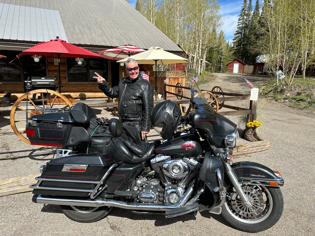
Today, we get serious about a Rocky Mountain High.
For the first week of this trip, we acclimated to elevations that were generally in the 5,000 to 7,000-foot range. High, but not extreme. Beautiful, but not breathtaking.
This morning, we begin our pursuit of bagging 30 10,000-foot highway passes – all of them in Colorado, which has the highest concentration of big mountains in the lower 48 states. Thirty is a lot of roadways over 10K. Very few exist outside of Colorado — a handful in Wyoming and New Mexico, and two in Hawaii – to the 10,023-foot summit of the Haleakala crater on Maui, and the 13,781-foot summit of Mauna Kea on the island of Hawaii.
At 10,000 feet, there’s about 33 percent less effective oxygen in the atmosphere than there is at sea level. Although air contains 20.9 percent oxygen at all altitudes, lower air pressure at high altitude makes it feel like there is a lower percentage of oxygen. Because air molecules at high altitudes are more dispersed, each breath delivers less oxygen to the body. Essentially, everything is more difficult at higher altitudes – breathing, walking, thinking.
Sounds like a plan.
The Grand Mesa
We leave Palisade, briefly point east on I-70, and exit onto Colorado Highway 65 – the Grand Mesa Scenic Byway. The summit of this roadway is 10,839 feet. We’ll be there in an hour.
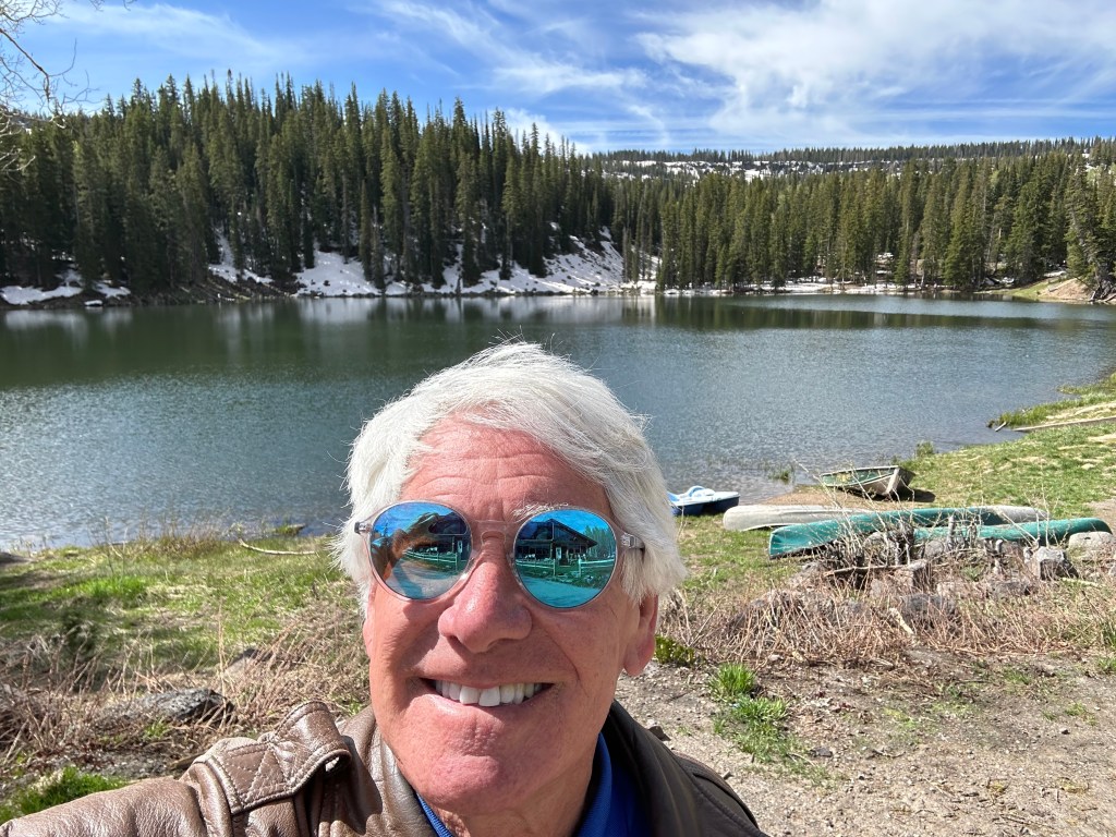
We’re heading up the Grand Mesa, the world’s largest flat-topped mountain.
A mesa is an isolated hill with steep sides and a flat top. It stands distinctly above a surrounding plain. The term “mesa” was adopted from the Spanish word, meaning “table.” Spanish explorers of the American southwest, home to many mesas, used the word because the tops of mesas look like the tops of tables.
So, think of the Grand Mesa as a gigantic table that sits above Palisade and its valley. The Grand Mesa rises about 6,000 feet above the surrounding river valleys. Much of the mesa is within the Grand Mesa National Forest. It covers about 500 square miles, and stretches for about 40 miles. The Grand Mesa sits between the Colorado River and the Gunnison River – two powerful bodies of water responsible for eroding parts of the formation, giving it its unique shape.
The Grand Mesa Scenic Byway is a 63-mile road that goes through a canyon, up to the top of the mesa, and down the other side. The byway is open year-round, with occasional closures for snow removal or avalanche control. It starts in a desert canyon, and passes aspen foothills, lakes, alpine forests and meadows along the way.
The Grand Mesa has an endless list of recreational activities, drawing visitors from all over Colorado. Camping, hiking, mountain biking, horseback riding, and fishing are popular in the summer. In the fall and winter, the mesa attracts big game hunters, cross-country skiers, snowmobilers, and skiers.
More than 300 stream-fed lakes swarm with rainbow, cutthroat, and brook trout. Mesa Lakes Lodge, which we pass on our way to the summit, is a good place to pick up fishing tips, fishing gear, and fish.
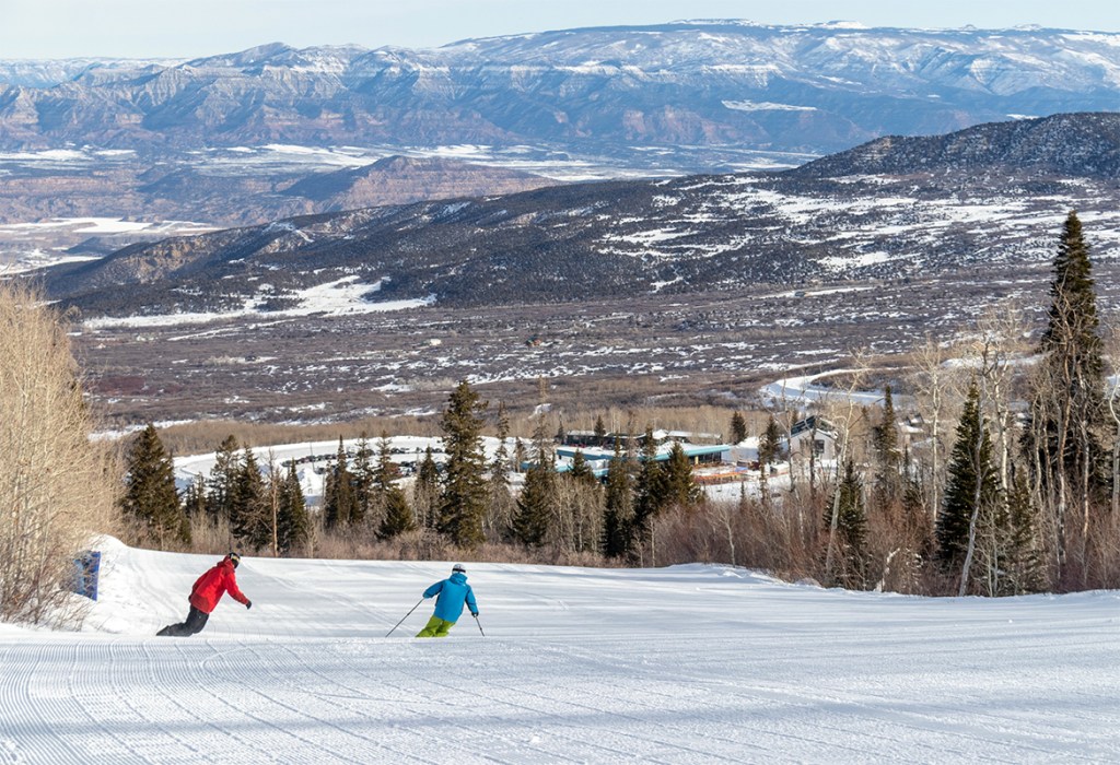
Skiers from the Grand Junction area flock to the Powderhorn Mountain Resort, Colorado’s western-most ski area. It’s about 20 miles from the bottom of the Grand Mesa Scenic Byway. The resort sits on the side of the Grand Mesa, and offers views of the valley below. From a base elevation of 8,200 feet, Powderhorn rises to 9,850 feet. An adult season pass is $699 – one fourth of the cost a season pass at Colorado’s major resorts.
We crest the 10,839-foot Grand Mesa summit, not quite reaching the top of the Grand Mesa. The highest point in the Grand Mesa is 11,237 feet. To get there, you take a side road called the Land’s End Road – partly paved, partly dirt, partly gravel, 100 percent stupid on a Harley.
Grand Mesa is the first of four 10,000-foot + passes we cross today.
Now, we begin the 5,000-foot descent to the valley south of the mesa. It’s about 25 degrees warmer down there. Looking forward to T-shirt weather again.
Heading to Ouray
After passing through the agricultural communities of Cedaredge and Orchard City, we arrive in Delta, a town of 9,000 nestled between the Grand Mesa, the West Elk Mountains and the Uncompahgre Plateau. Delta is known as the City of Murals, though we see none as we roll through town.
In Delta, we turn south on US Highway 50.
If the ride for the next hour seems familiar, it’s because we (Sarah and I) were here a week ago.
We roll past Olathe, Colorado’s corn capitol. We pass through Montrose, where I’ll one day spread Dave’s ashes. Then, we arrive in Ridgway, where Grammys are made.
Here in Ridgway, at Ouray County’s only stoplight, we continue south toward Ouray. This is a different path than what Sarah and I took last week.
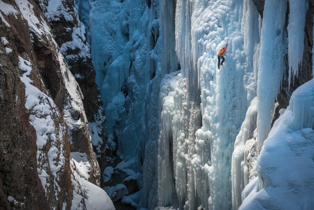
Ouray, ten miles ahead, sits at 7,792 feet at the foot of the San Juan Mountains and at the narrow head of a deep canyon. Known as the “Switzerland of America,” it’s one of the most spectacular settings for a mountain town imaginable. With a population of 950, Ouray’s economy is based almost entirely on tourism.
Much of the tourism is focused on ice climbing, mountain biking, hiking, trail running and four-wheel drive off-roading into the San Juan Mountains. Ouray built the world’s first ice climbing park, consisting of frozen waterfalls from 80 to 200 feet high along more than a mile of the Uncompahgre Gorge.
Riding the Million Dollar Highway
In addition to all that, Ouray is also the starting point for the Million Dollar Highway, part of the San Juan Skyway Scenic Byway. Whatever you call it, the road is one of the top three rides I’ve ever been on – along with Utah’s Highway 12 and California’s Pacific Coast Highway.
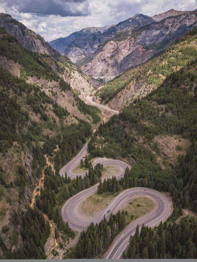
The 20-mile section of US Highway 550 known as the Million Dollar Highway starts just south of Ouray, crosses Red Mountain Pass, and ends in Silverton. The twisting two-lane highway is filled with hairpin turns, and exposed sections – steep drop-offs with no shoulder and no guardrails.
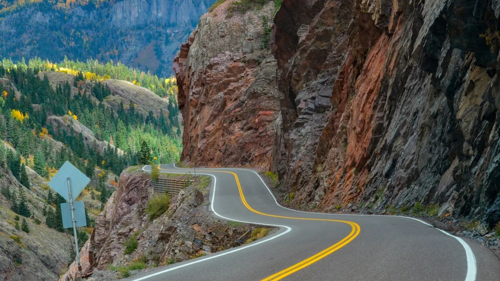
To me, portions of the road are next-level terrifying. The first few miles from Ouray are particularly frightening. The scenery is beautiful, but I can only look straight ahead, and concentrate on not riding off the narrow road, plunging hundreds of feet to my certain death at the bottom of the Uncompahgre Gorge. How embarrassing would that be?
There are several stories about how the road got its nickname of the “Million Dollar Highway.” One is a legend that the road was made from a million dollars’ worth of gold and silver filled tailings. Another is a tale of a woman who traveled the road saying, “I would not travel that road again for a million dollars.” Yet another is that the view is worth a million dollars.
The truth is that when the three contractors paving the highway in the 1920s – the State of Colorado, the US government and the US Forest Service – compared notes, they realized that the cost of their three projects to upgrade the road to an automobile road totaled $1 million. Someone suggested that “We have ourselves a million-dollar highway,” and the name stuck.
Five miles before Red Mountain Pass, we come to the ghost town of Ironton, once a booming mining district. In the 1870s and 1880s, Ironton was the second-largest silver mining district in Colorado. At its peak, Ironton was home to 1,000 people. A June 19, 1884 edition of the Colorado Daily Chieftain said “Ironton is an excellent site for a town with an ample supply of water from the Red Mountain creek for a town of 50,000 people.” Gotta love that kind of optimism.
The town faded into obscurity in the early twentieth century as mining cratered. As we ride past what was once Ironton, buildings from more than 100 years ago are still visible, though long unoccupied.
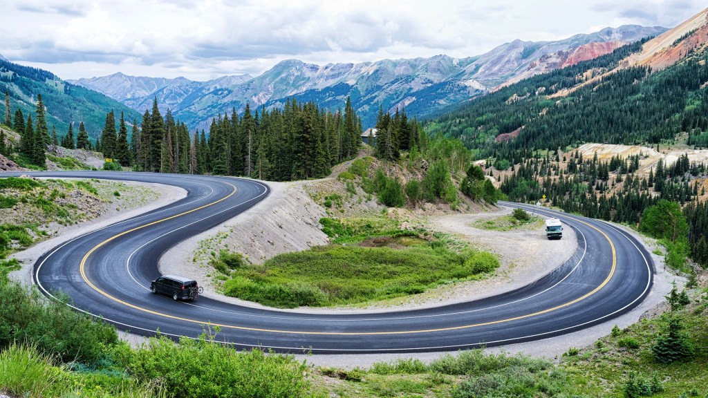
Nearing Red Mountain Pass, we roll through two tight hairpin turns known as the “S Loop.” On a motorcycle – any kind of transportation, really – these turns have an intoxicating rhythm.
We finally arrive at Red Mountain Pass – 11,018 feet – just 12 miles after leaving Ouray. Cresting the summit is exhilarating. The pass is named for nearby Red Mountain, 12,836 feet. The “Red” name is derived from the iron oxide-laden rock that forms their slopes.
On the south side of Red Mountain Pass, we begin the descent toward Silverton, about 10 miles away.
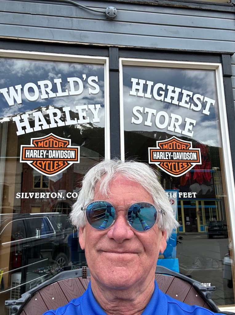
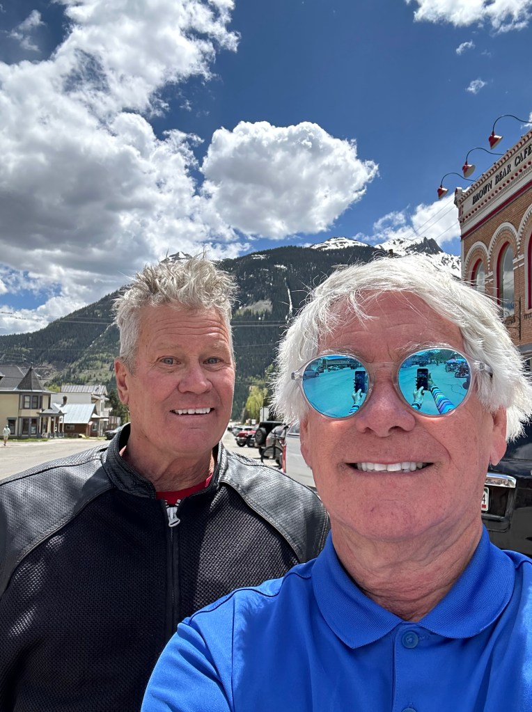
Silverton, population 600, got its start in the 1860s as a mining town. The town boomed from silver mining until the collapse of the silver market in the panic of 1893. Silverton’s last operating mine closed in 1992, and today, the town’s economy is wholly based on tourism. The entire town is a federally designated National Historic Landmark District, paying homage to Silverton’s mining days.
You’re probably noticing a pattern that distinguishes the early days of many Colorado towns. Just as it was almost redundant in Utah, saying “this town was established by Mormon pioneers,” same goes for Colorado. Except in Colorado, the repetitive line is, “this town got its start during the mining boom of the 1880s.” Mining is to Colorado, as Mormons are to Utah. Something like that.
From Silverton, it’s about 45 miles to tonight’s destination, Durango. We continue south on the San Juan Skyway Scenic Byway to get there.
There are two more mountain passes to cross before we arrive in Durango. The first of them is Molas Pass, seven miles south of Silverton.
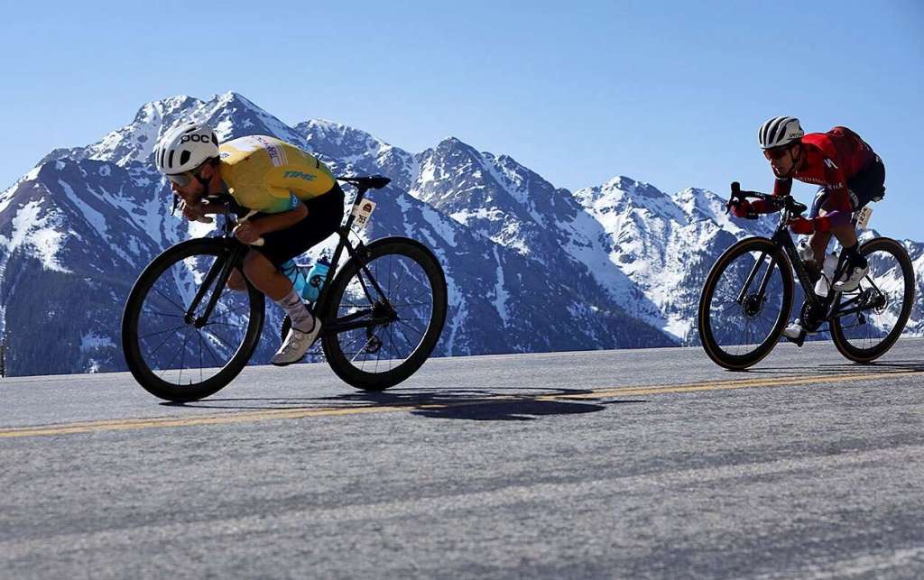
Molas Pass, 10,910 feet, is the second and last mountain pass in the Iron Horse Bicycle Classic, where bikes race a train up the mountain from Durango to Silverton. Every May, over Memorial Day weekend, since 1972 – it’s a big test of man versus machine. In the event, cyclists race over mountain passes to beat the steam engine train – the Durango and Silverton Narrow Gauge Railroad, which runs the same route. To beat the train, cyclists need to cover the 47 miles in less than three and a half hours. Thousands of riders, professional and less so, show up for the event from all over the country. It’s quite the party.
This year’s event was held just two weeks ago, on May 27. Nearly 1,900 riders participated. The winner was pro racer Caleb Classen from Team California. His time for the 47 miles: 2 hours, 7 minutes and 18.6 seconds.
Our ride is somewhat less taxing on the lungs and legs.
Just seven miles from Molas Pass, we arrive at Coal Bank Pass, our final major pass of the day. Coal Bank Pass sits at 10,640 feet. Its name refers to the area’s rich mining history. Coal Bank Pass is the tenth 10,000-foot summit of our trip. It’s getting a bit routine.
We’ll descend 4,000 feet over the next 30 miles before arriving in Durango, tonight’s destination.
Durango, the Water Town
Durango is named after Durango, Mexico – which was named after Durango, Spain. All three Durangos are sister cities. The word Durango originates from the Basque word “Urango,” meaning “water town.” The town of 19,000 sits on the Animas River at an elevation of 6,510 feet.
The Animas River’s official name is El Rio de las Animas Perdidas. Roughly translated, this means, “The River of Lost Souls.” The Spanish explorers named the river after several explorers who traveled on the river and were lost. Their bodies were never found, and last rites could not be administered. Being devout Catholics, they believed the dead men’s souls could not enter heaven and would be relegated to Purgatory.
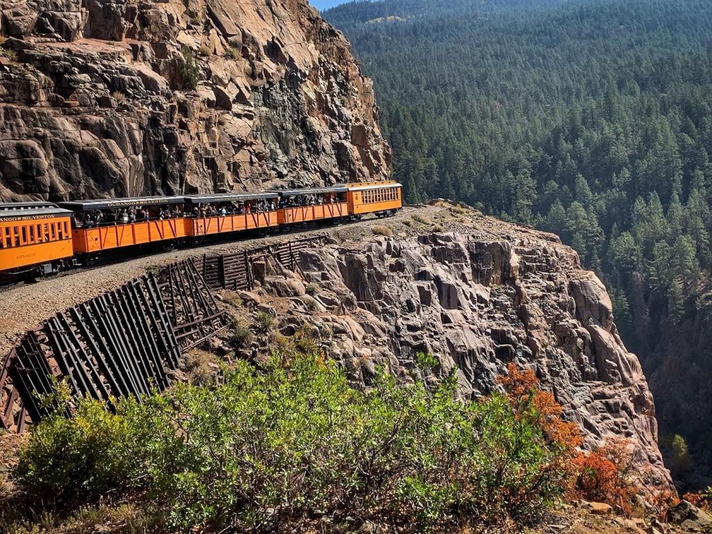
Durango was founded in 1879 by the Denver & Rio Grande Railway. The railroad arrived in 1881, constructing a narrow-gauge line to haul passengers and freight to Silverton – and to transport silver and gold ore from the San Juan Mountains. The historic train has been in continuous operation since 1882. For $199 plus an 8 percent Historic Preservation Fee, you can board in Durango for the journey to Silverton. The train, which runs year-round, is not a speedy endeavor; it’ll take three and a-half hours for the 45-mile ride. Its top speed is 18 miles an hour. Once in Silverton, you’ll relax for 30 minutes before the return trip begins.
Durango is also home to the SnowDown Festival, a historic downtown district, and Fort Lewis College. It’s a beautiful setting for a college, a motorcycle ride, or a movie. Parts of the 1969 film, Butch Cassidy and the Sundance Kid, were filmed north of town along the Animas River, and scenes from the 1991 film City Slickers were shot in Durango. Best line in City Slickers: “We’re lost but we’re making really good time.”
On today’s 206-mile ride, we made really good time, too. Pulled into Durango, on schedule, around 3:30 pm. Time to check in to the hotel, write today’s blog post, walk downtown, and grab dinner.
Tomorrow, we explore a new state. New Mexico. It’s new for us, anyway.
On January 27, 1912, New Mexico became the forty-seventh state admitted to the union — just two weeks ahead of Arizona, and 47 years before Alaska and Hawaii.
We’ll check out the Land of Enchantment in the morning.
***
The Day in Review:
Click here to see today’s complete route from Palisade, Colorado, to Durango, Colorado – via the Million Dollar Highway.
Today’s Takeaways:
- The grandest of mesas
- Memories of mining
- Million-dollar madness
Today’s Trivia: Origins of the Million-Dollar Highway
The explorer John C. Fremont once described the San Juan Mountains as “the highest, most rugged, most impracticable and inaccessible” in all the Rockies. That’s a lot of superlatives. The mean elevation of the mountain range is 10,000 feet.
There’s only one reason roads were made to ever cross the formidable San Juans: money.
It’s been estimated that a billion dollars’ worth of metals has been produced by the mines scattered between Ouray and Silverton. As costly as ore was to extract, it was even more expensive to ship. Prospectors needed a dependable road to move the ore, and that’s why, in the 1880s, Otto Mears began stitching together various pack trails, stage roads and railroad grades.
Starting in 1883, Mears, an Estonian immigrant, – began blasting a toll road out of the cliffs south of Ouray. The road he built over Red Mountain pass, used by horse and mule drawn wagons, is now known as the Million Dollar Highway. In the 1880s, the road was a private venture by Mears. A railroad man and entrepreneur, Mears was known as the “Pathfinder of the San Juans.” His work, dynamiting solid rock in the Uncompahgre Gorge and over Red Mountain, is still marveled at by engineers today.
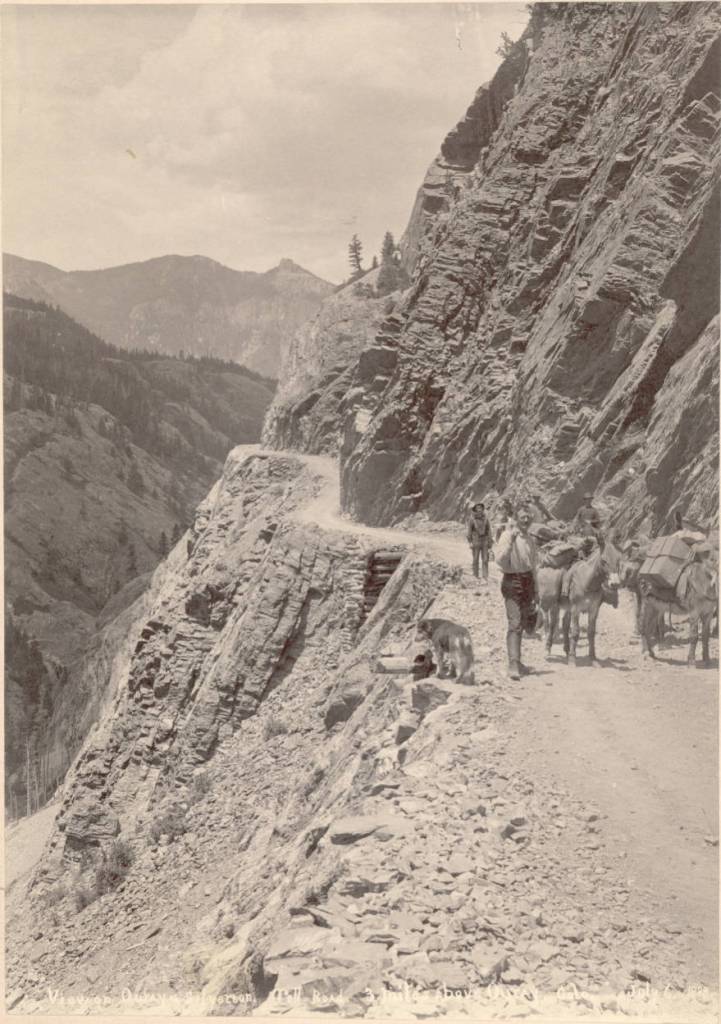
To help pay for this “highway” that finally connected Silverton and Ouray, Mears charged wagon drivers a passage fee, making this one of Colorado’s first toll roads. The tollgate was set up about two miles south of Ouray, at the narrowest point in the road. Mears made sure the road was narrow there, to prevent anyone from circumventing his toll bridge. He originally collected $5 for horse-drawn wagons and $1 per cattle head. (Adjusted for inflation, that’s about $130 and $26 in today’s dollars!)
Local merchants and miners who contributed money and labor toward completing the road soon went sour on Mears. By 1887, San Juan County and the state of Colorado took over maintenance of the road, thus ending his dominance of Red Mountain Pass.
The road was technically completed in 1905, but was extremely rough, especially for automobiles at the time. The first automobile navigated the Red Mountain wagon road to Ouray in 1910 when Ouray doctor L.G. Crosby and some companions made the six-mile journey from Ouray to Ironton in a new Model T on a house call. Yes, house calls used to be a thing.
At the time, the journey was considered miraculous; obviously, no one had four-wheel drive, high clearance, and the kind of power you would expect today on a road with grades up to eight percent. The road was finally paved by the Colorado Department of Transportation in the 1930s.
Archival photos show that large earthen blocks served as guardrails in the road’s early days. Unfortunately, the blocks left snowplow drivers no place to push the 300 inches of snow that annually fall on the San Juans, so the Department of Transportation removed them to aid snow clearing. That’s why today, in the few miles south of Ouray, there are no guardrails.
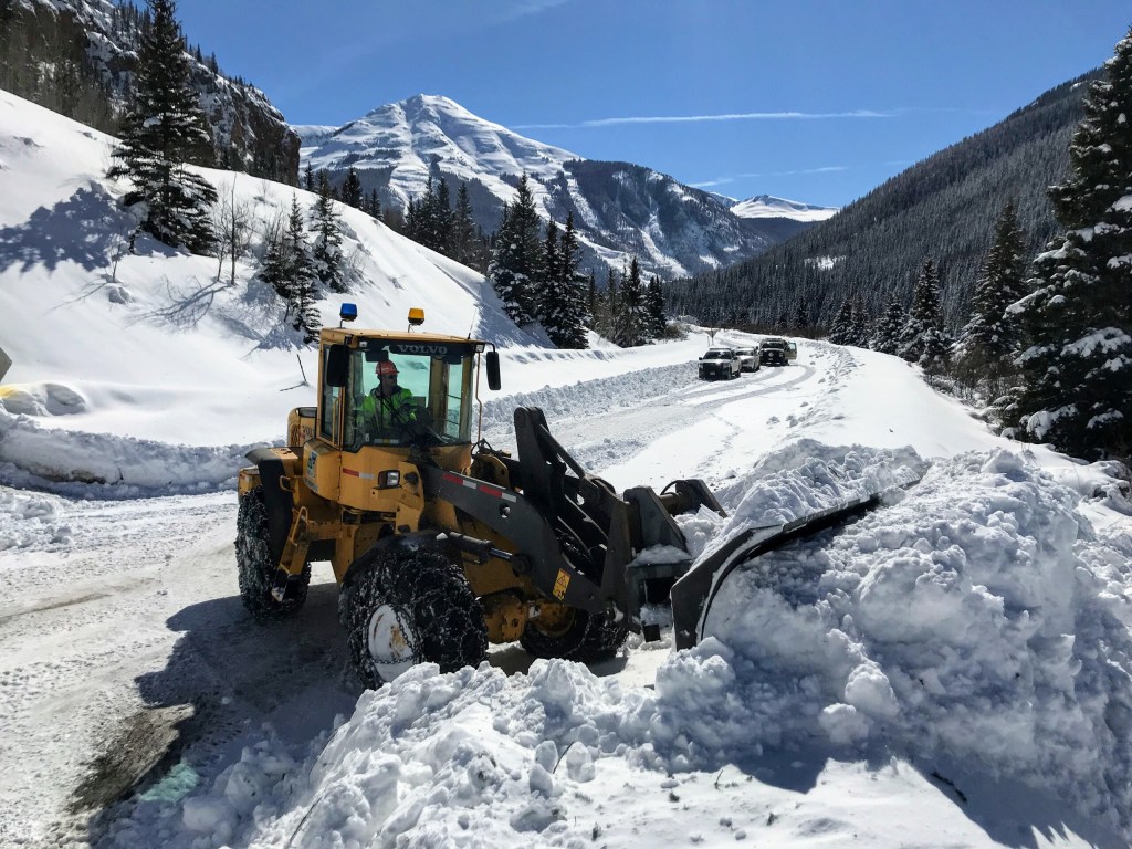
The Million Dollar Highway is maintained year-round, though driving it in the winter is not for the faint of heart. The road intersects 70 avalanche chutes. Keeping the road clear from snowslides is a monumental task for the Department of Transportation.
Maybe you’re better off just staying home, where it’s cozy and warm by the fire.
And now you know.

My favorite day route so far. And I was not there to enjoy. You are dropping on my favorites list. Ha! Love it all bro!
LikeLike
Beautiful scenery! Your travels bring back memories from way back…..
LikeLike
I’ve been following your trips for years now even though I don’t think I’ve ever commented. But decided this time I would to say that it always so exciting to hear of all the travels and places and the history and adventures….and kinda scary and thrilling too seeing some of the twisted roads along the way. Good on you and Dave and the others for going on these wonderful travels and sharing . It’s like reading a good book and feeling like you’re on the adventure too. I see Dave missed this one but I’m sure you guys will have plenty more. Keeps you young fersure. Carry on and keep sharing cause your descriptions are like us feeling like we’re on the journey too! Have fun and be safe! Gail Meeter
LikeLike
Hi Gail! Great to see you continuing to travel on these journeys through Gary’s awesome blogs. Hope you and family are abundantly blessed. Come see us in Nevada sometime. Miss you! Hugs!
LikeLike
So good to hear from you, Gail! Glad you’ve been able to follow our travels, and vicariously be there with us. Missing Dave this year, but know he’s along in spirit (and hating me for riding without him 🤪).
LikeLike
Hope you stop in Santa Fe, NM.
LikeLike
SUPER photos thanks Gary!!!!
LikeLike