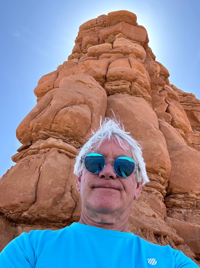
Yesterday, we were in Utah’s Fairyland. Today, we ride through Wonderland.
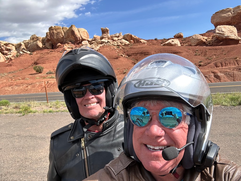
Just five minutes east of Torrey, we roll through Capitol Reef National Park. It’s our sixth national park visit of this trip.
National Park Service Director Stephen Mather first visited southwestern Utah in November 1919, and was immediately enthralled with the scenery – and potential – of Zion and Bryce Canyon. In a speech commenting on the vistas, he proclaimed the need for roads, lodges, and publicity. While he hadn’t yet visited the area that is today Capitol Reef National Park, the seed was being planted.
Partially in Wayne County, the area was originally named “Wayne Wonderland” in the 1920s by local boosters Ephraim Pectol and his brother-in-law, Joseph Hickman. Pectol, who operated the Wayne grocery store, and Hickman, the principal of Wayne High School, led the local booster effort to promote their self-designated wonderland.
Together, they established a Wayne Wonderland Club, which raised $150 (at the time, a lot of money) to interest a Salt Lake City photographer in taking a series of promotional photos. For several years, the photographer, J.E. Broaddus, traveled and lectured on Wayne Wonderland. Broaddus helped publicize the beauty of the Utah areas that would later become Bryce Canyon National Park, Zion National Park, and Dinosaur National Monument.
In 1933, Pectol, the Wonderland booster, was elected to the Utah state legislature, and almost immediately contacted the White House, asking for the creation of Wayne Wonderland National Monument.
The area was first designated a national monument in 1937 by President Franklin Roosevelt, setting aside nearly 38,000 acres for the new monument. Funds for administration of Capitol Reef National Monument were nonexistent; it would be a long time before the first rangers would arrive. It did not officially open to the public until 1950.
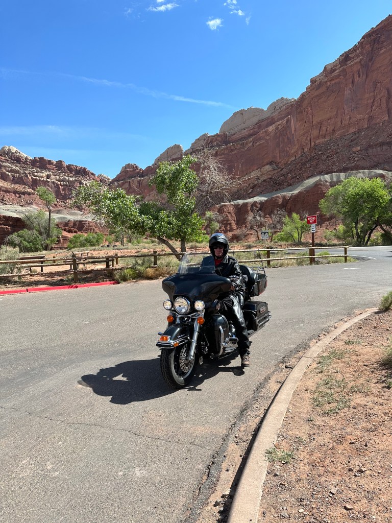
The area now known as Capitol Reef was difficult to get to for many years, but road access was improved in 1962 with the construction of Highway 24 through the Fremont River canyon. We’re now on that road.
Capitol Reef grew in size dramatically as it stepped up from National Monument to National Park status in 1971, when President Richard Nixon signed legislation creating the new national park. Capitol Reef National Park now preserves about 241,000 acres of desert landscape. The story of its establishment, from initial boosterism, to National Monument, to National Park, is quite the saga.
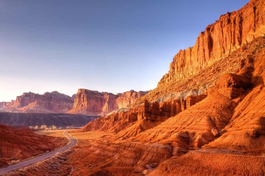
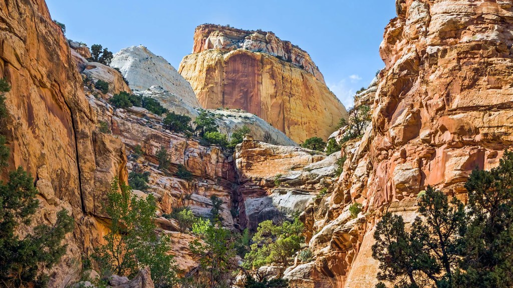
The park was named for its whitish Navajo Sandstone cliffs with dome formations – similar to the white domes often placed on capitol buildings. That explains the “Capitol” … but what about “Reef?” Locally, reef refers to any rocky barrier to land travel, just as ocean reefs are barriers to sea travel.
Like 16 other National Parks that are mostly on major highways, including Washington state’s North Cascades National Park, California’s Redwood National Park, and Great Smoky Mountains National Park – the most visited in the US – there’s no gate to enter Capitol Reef, and no entry fee.
Cruising the Fremont River to Hanksville
In 1866, Mormons began to explore the area looking for suitable areas to settle, and in the 1870s, they moved into the area and settled in what is now known as the Fruita District.
The settlers used the convenience of the Fremont River and quickly established fruit orchards. By the 1920s, Fruita had been nicknamed the “Wayne County Garden of Eden,” referring to the most productive farmland in Wayne County. The primary crops grown here were cherry, apricot, peach, pear, apple, and a few plum, mulberry, almond, and walnuts. Today there are still over 2,700 trees in the Fruita Historic Orchards.
We roll through the Fruita area, as Highway 24 meanders through the canyon carved by the Fremont River. Forty-five minutes later, we arrive in Hanksville, a town of 200 with a few gas stations and little else.
Hanksville got its name from an early settler, Ebenezer Hanks, who arrived in the 1880s. The town was not incorporated until 1999. Today, agriculture, mining and tourism are the main drivers of the local economy. Tourism is particularly important, as motorists – and riders like us – pass through, many on their way to Lake Powell. Hanksville was at one time a supply post for Butch Cassidy and the Wild Bunch, who would hide out at Robbers Roost in the desert southeast of town.
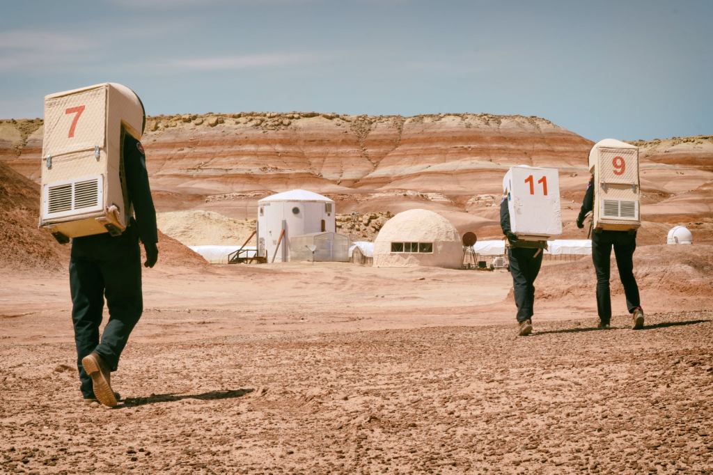
Just a few miles from Hanksville, you can visit the Mars Desert Research Station. Or you can try to visit it. The place doesn’t offer tours, and isn’t open to visitors, but is interesting nonetheless. The station is owned and operated by the Mars Society, a non-profit organization dedicated to convincing governments and the public of the benefits of Mars exploration. Its isolation in the Utah desert allows for rigorous field studies, where crews carry out their mission under the constraints of a simulated Mars mission. It’s the longest-running Mars surface research facility in the world.
During the uranium mining frenzy following World War II, Hanksville became a supply center for the prospectors and miners scouring the deserts of the Colorado Plateau. Many abandoned mines can be found in the deserts surrounding the town.
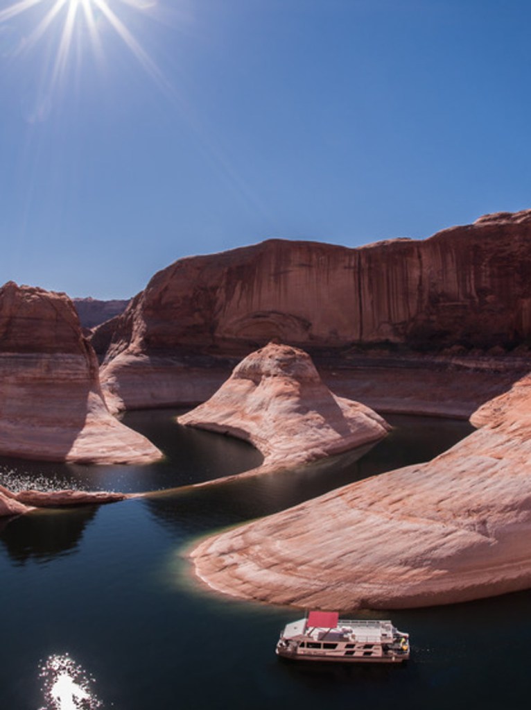
Travelers, many with boats on trailers, head south from Hanksville toward Lake Powell on Utah Highways 95 and 276. It’s only 67 miles to the Bullfrog Marina, one of six marinas on Lake Powell. While the lake’s low water level has closed a number of marinas, the Bullfrog Marina and boat launch remain open. Bullfrog is the closest to the Salt Lake City metropolitan area, and offers the most amenities outside of Wahweap Marina, near Page, Arizona.
With an early morning departure from Salt Lake, you can be on the water in Lake Powell by lunch.
From Green River to Canyonlands
But our journey doesn’t lead to Lake Powell. Instead, I turn north from Hanksville and ride 55 mostly boring miles on desolate Highway 24 and Interstate 70 to Green River, which sits, as you might imagine, on the Green River.
We arrive in Green River around 11 am, time for gas and a drink. We’re in the Utah desert, and it’s hot.
After our break, we press on toward one of today’s highlights, Canyonlands National Park. In about 45 minutes, we arrive at the entrance to Canyonlands, my second national park of the day, and seventh of this trip.
Utah has five national parks. Canyonlands is the largest, stretching across 527 square miles. The park’s endless canyons were formed over millions of years by the currents and tributaries of the Green and Colorado Rivers. Those two rivers divide Canyonlands into four distinct districts; one of them is called “Island in the Sky,” which I’ll visit today.
Island in the Sky attracts about 77 percent of the estimated 400,000 visitors to Canyonlands each year. Its popularity is due to the Island in the Sky scenic drive – a paved road – and its close proximity to Moab, tonight’s destination. The scenic drive is a 34-mile round trip from the park’s northern entrance.
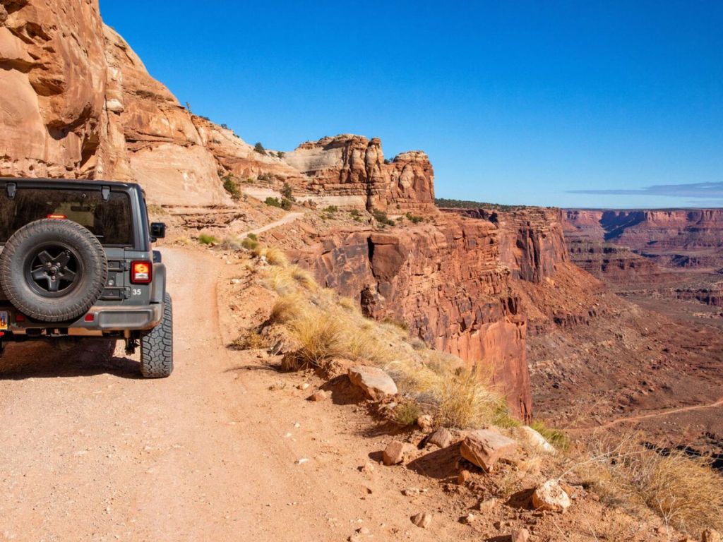
You could take weeks to explore Canyonlands. It’s loaded with four-wheel drive roads that range from intermediate difficulty to extremely technical. Many of these roads, particularly in the Needles district, require high-clearance vehicles. As the National Park Service points out, you should know what you’re doing if you drive these roads; there’s a high risk of vehicle damage, and towing costs usually exceed $1,500.
You won’t see any Harleys off-roading here.
Canyonlands has been a national park since 1964, when President Lyndon Johnson signed legislation establishing it. Author Edward Abbey, a frequent visitor, described the Canyonlands as “the most weird, wonderful, magical place on earth.”
By far the most photographed scene in the park is Mesa Arch, just a quarter-mile walk from the main highway. Mesa Arch sits on the edge of a 500-foot cliff, part of a 1,200-foot drop into Buck Canyon. Photographing it at sunrise is well worth the loss of sleep. We only missed it by about seven hours.
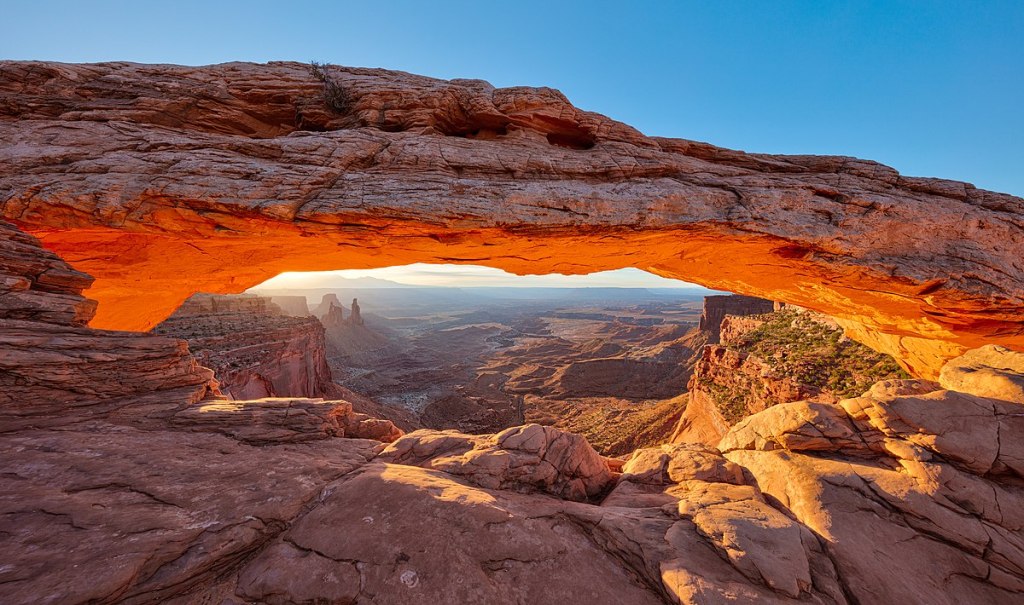
From Mesa Arch, it’s only six miles to the end of the road, the Grand View Point Overlook. The overlook lies at the southernmost end of the Island in the Sky scenic drive. At the overlook, you can see across miles of corrugated canyons and distant mountains.
Dead Horse Point
Since Grand View Point is the end of the road, we turn around and head north, toward the park’s entrance. Soon, we see signs for Dead Horse Point State Park. Sure, why not?
The 22-mile road to the point is called the Dead Horse Mesa Scenic Byway. At the highest viewpoint on a clear day, the La Sal Mountains can be viewed to the east, the Abajo Mountains to the south, The Henry Mountains to the west and the Bookcliffs to the north.
The view from Dead Horse Point is one of the most photographed vistas in Utah, which has a lot of them. Towering 2,000 feet above a gooseneck bend in the Colorado River, the overlook provides an awesome panorama of Canyonlands’ sculpted pinnacles and buttes.
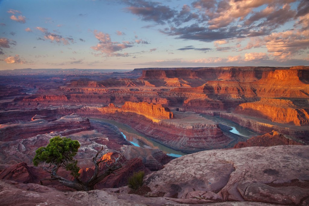
If for no other reason, Dead Horse Point is worth visiting, just to get a sense of where the name came from. In the late 1800s, the point was used as a corral for wild mustangs roaming the mesa top. Cowboys herded them across the narrow neck of land and onto the point. One time, for some unknown reason, horses were left on the waterless point, where they subsequently died of thirst.
The 5,362-acre state park is a slender peninsula of land extending off the massive plateau that’s home to Canyonlands’ Island in the Sky district. It has several overlooks, which we might try, and an eight-mile hiking trail, which we won’t.
After snapping hopefully Instagrammable photos – I don’t think either of us has Instagram! – we begin the 45-minute ride to Moab, where we’ll call it a day.
On our way into town, we ride past the entrance to Arches National Park, which we’ll explore tomorrow.
Moab is just moments away from both Canyonlands and Arches National Parks, which makes it a perfect location for outdoor enthusiasts. Moab’s unique combination of small resort town hospitality, beautiful scenery and the cool waters of the Colorado River has made it one of the most sought-after destinations in the Southwest.
Moab’s population of 5,300 swells exponentially in the summer, as tourists like us arrive in search of the Edenic experience. About three million visitors a year explore the town, whose motto is “Discover Moab.” Safe to say, it’s been discovered.
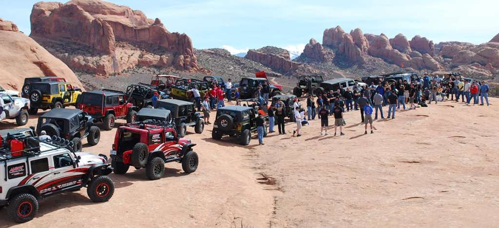
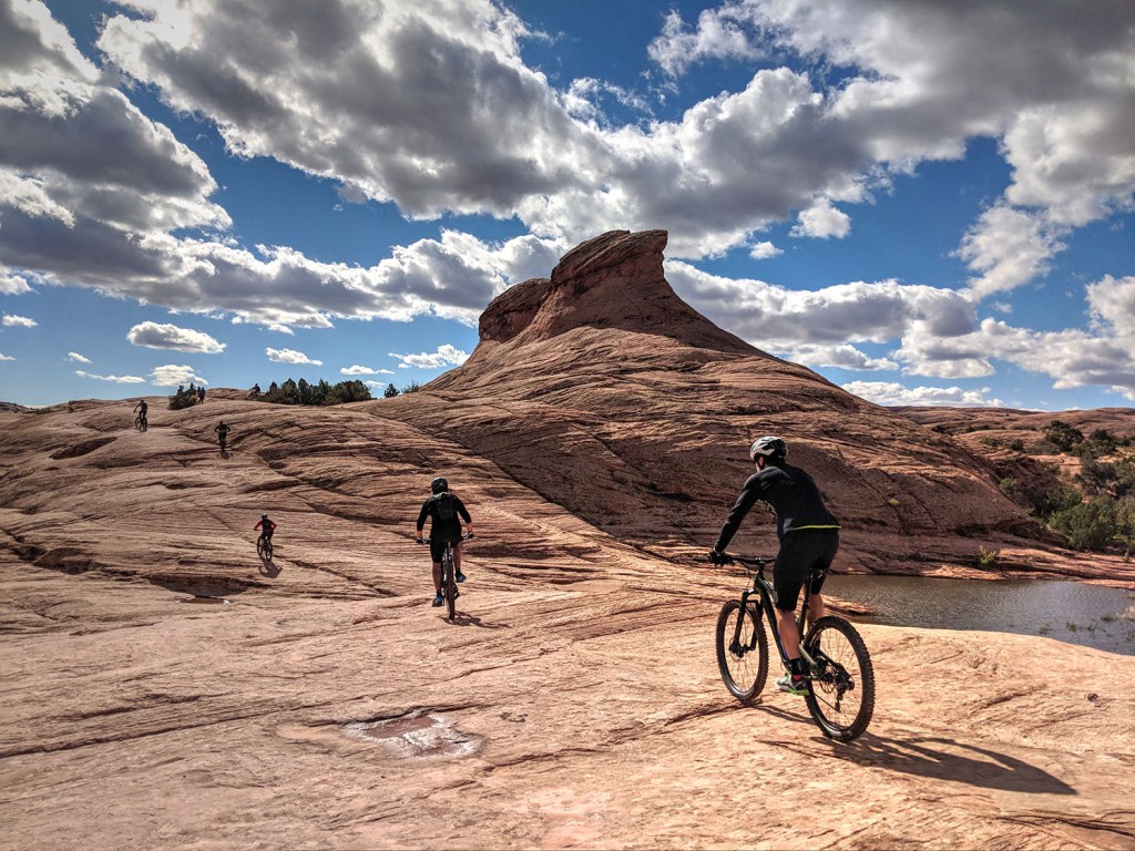
The town’s economy was originally based on agriculture, but gradually shifted to mining, then to tourism, which dominates the landscape today. Moab is a popular base for mountain bikers who ride the area’s extensive network of trails, including the Slickrock Trail, and for off-roaders who come for the annual Moab Jeep Safari. There’s no end to what you can do here for fun.
Sodom, Gomorrah and Moab
Before we call it a day, let’s chew on how Moab got its name.
By 1880, the tiny village had grown into a bustling community in need of a post office. To get a post office, however, the community needed a name. William Pierce, a Mormon settler, farmer, and occasional dentist – interesting combo – suggested the name Moab. In its biblical reference, Moab was a dry, sandy wilderness whose climate mirrored the arid climate of the Utah settlement. Biblically, Moab is just short of the Promised Land. Turns out there are 137 Bible verses that mention Moab.
Pierce, who had the idea for the Moab name, became the first postmaster of the newly named town. Fair to say the name wasn’t wildly popular with the locals; 59 Moab residents immediately complained to the new Grand County Court about it. They argued Moab was “… so unfavorably commemorative of the character of an incestuous and idolatrous community existing 1897 years before the Christian era” that it deserved a better name. The naysayers didn’t like the Biblical reference to the wicked cities of Sodom and Gomorrah.
But every time it was brought to a vote, the name change failed.
So, Moab it is.
***
The Day in Review:
Click here to see today’s complete route from Torrey, Utah to Moab, Utah – via Utah Highway 12, an All-American Road.
Today’s Takeaways:
- Wayne Wonderland becomes Capitol Reef.
- Mesa Arch at sunrise. Just missed it!
- Dead Horse Point, worth a photo.
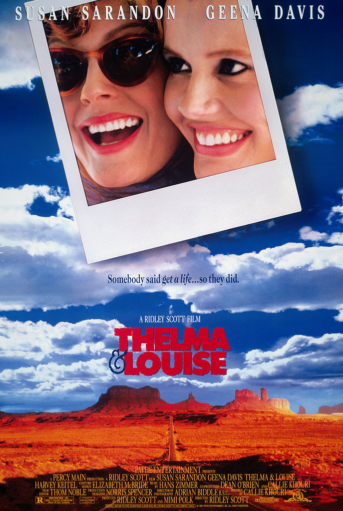
Today’s Trivia: Thelma and Louise Visit Dead Horse Point
Thirty-two years ago, Louise Sawyer kissed Thelma Dickerson hard on the lips, stomped on the accelerator of her 1966 Ford Thunderbird, and drove straight over the edge of the Grand Canyon, leaving a posse of cops to eat their dust.
The last time they were seen, they were hovering in the wide-open sky above the canyon, forever young and beautiful.
It was an unforgettable end to a memorable movie, a feminist female buddy road crime comedy-drama starring Geena Davis (Thelma) and Susan Sarandon (Louise). Both received Oscar nomination for Best Actress.
Like so many things in Hollywood, there was a bit of artistic license involved.
The scene was not shot at the Grand Canyon. Filmmakers made it at Fossil Point, which is visible from Dead Horse Point, Utah — where we were earlier today.
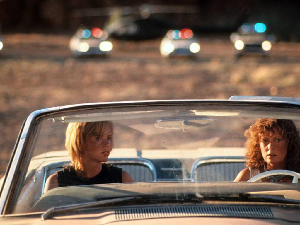
As a result of that scene, Fossil Point is often referred to as Thelma and Louise Point. Yes, it’s an unofficial name, but if you Google Thelma and Louise Point, it’ll show up just off of Potash Road, not from the Colorado River. It’s south-southeast of the main overlook at Dead Horse Point State Park.
To shoot the scene, the film’s producers needed to send a real car flying off the cliff. Their budget didn’t allow for special effects. They bought three identical Thunderbirds, stripped everything out of the cars so they’d be light enough to slingshot into the air. Dummies were constructed to sit in Thelma and Louise’s seats, with plaster casts of their heads for a more realistic effect.
On the day of the shoot, the first car they flung into the air sunk like a rock. But after a few adjustments, the second sacrificial car soared into a perfect arc, landing about 400 feet below, on a shelf next to the Colorado River. Shooting ended without ever having to use the third T-bird.
If you’re a Thelma and Louise diehard, you can check out the places where the movie’s iconic moments took place. And if you’re a stickler for details, and wonder how accurate the location shooting was, here’s a good read.

One more bit of Thelma and Louise trivia: Michelle Pfeiffer and Jodie Foster were originally chosen for the lead roles. As pre-production of the film dragged on, the two eventually dropped out, with Pfeiffer going on to star in Love Field, and Foster in The Silence of the Lambs. Meryl Streep and Goldie Hawn were next in line, but that didn’t work out either.
For the past 30+ years, Geena Davis and Susan Sarandon have been synonymous with Thelma and Louise. Turned out pretty well for both of them.
For all the descriptions of the film as being a feminist masterpiece, one New York film critic called it “a misogynist tale about unbelievably ditzy women who lose what remains of their reason under pressure and suffer the ultimate punishment.”
Oh, that.
And now you know.

Gary… Pretty sure Donna and I read all your posts over the years . We’ve enjoyed these recent ones the most . Keep ‘em comin .🏍️
LikeLike
Pretty sure you’ve committed every word I’ve written to memory, Pete.
LikeLike
Great memories my brother! Wishing I was there with you! Shall I start now? You are killing me! ❤️
LikeLike
Yes, Dave. Start now.
LikeLike
Garry – – – another wonderful blog, and some of our favorite territory. But, you obviously don’t know Hanksville. It has a gre
LikeLike
Hey Bruce. No one knows Hanksville like you do. I should have consulted with you before posting 🤪
LikeLike
Little known fact. Originally Thelma and Louise we going to be riding Kawaski Vulcans. But the producers didn’t want to waste these fine bikes flinging them off a cliff.
Other than that small thought love the blog. And remember some of our rides through that area.
LikeLike
Did not know that Kawasaki trivia, Randy. Fascinating! Tomorrow, we go to Arches NP. Remember that place? Vroom.
LikeLike
Great route. Inspirational to see so many national Parks on one trip and with a passenger. Keep having fun.
Diablo Circle John
LikeLike