Leaving Cortez, we head south on US Highway 491. We’re on the Trail of the Ancients Byway, one of 13 National Scenic Byways in Colorado.
It’s Ancient History
The Trail of the Ancients is a 116-mile route across the arid, cultural terrain of the Ancestral Puebloan people. Along the route, visitors can see clues about the ancient civilization with cliff dwellings and rock art. Attractions along the byway include Hovenweep National Monument and Mesa Verde National Park, which both contain dense clusters of ancestral sites and artifacts. If you like seeing really, really old stuff, this Four Corners region can entertain you for days on end.
Off in the distance, to the west, is the Canyons of the Ancients National Monument, another monument protecting archaeologically significant areas. The monument covers 176,000 acres. It’s part of the National Landscape Conservation System – consisting of 32 million acres set aside by the Bureau of Land Management to conserve, protect and restore nationally significant landscapes. The Canyons of the Ancients has more than 6,000 archaeological sites representing Ancestral Puebloan and other Native American cultures.
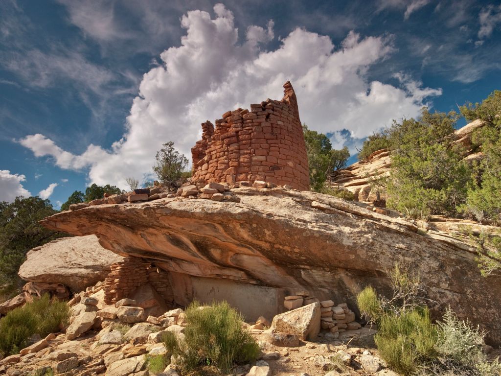
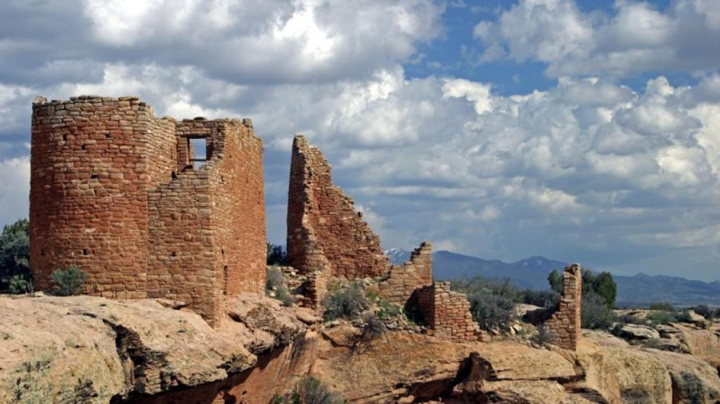
On the west end of the Canyons of the Ancients National Monument is Hovenweep National Monument, which includes six groups of Ancestral Puebloan villages. Here, there’s evidence of hunter-gatherers as far back as 8,000 B.C. In 900 A.D., it’s believed that more than 2,500 people lived here.
The International Dark-Sky Association designated Hovenweep an International Dark Sky Park in 2014, making it a good place to stargaze – because there’s not much out here to get between you and the stars. Hovenweep is one of 10 such parks we’ll visit on this trip, all designated International Dark Sky Parks. All are certified by the International Dark Sky Association, and are said to have exceptional starry nights.
Go Utes!
You can feel the Ute heritage here. We’re not just on a Scenic Byway. We’re also rolling through the Ute Mountain Reservation, home of the Ute Mountain Tribe.
The reservation consists of about 553,000 acres in Colorado’s Montezuma and La Plata Counties, and San Juan County in New Mexico. The Ute Mountain Ute Reservation has about 2,000 residents. Most of the people on the reservation live in the town of Towaoc which is also the site of the Ute Mountain Indian Agency.
The Ute Mountain Ute Tribe are the Weeminuche band of the Ute Nation of Indians. Anyone familiar with my history knows I’m a Ute, meaning I’m a proud graduate of the University of Utah (BS, Journalism, 1973).
With the approval and blessing of the Ute tribe, the Utah athletic teams are known as the Utes, in honor of the tribe for which the state of Utah is named. The tribe says the University nickname raises tribal visibility and community awareness, and generates a source of pride to members of the Ute Indian Tribe.
(Note: When I was in school, Utah’s official athletic nickname was the “Redskins,” a practice that was mercifully discontinued in 1972 when, bowing to NCAA pressure, the school finally realized “Redskin” was an ethnic slur and offensive to most Native Americans.)
The Ute Mountain Ute Tribe is one of three federally recognized tribes of the Ute Nation, and are mostly descendants of the historic Weeminuche Band, who moved to the Southern Ute reservation in 1897.
As we ride south out of Cortez, we pass within about five miles of Ute Mountain, also known as Ute Peak, or Sleeping Ute Mountain. At 9,984 feet, it’s the highest point on the reservation. Unlike other “sleeping” mountains – Rainier, Shasta and Mount Hood in the Pacific Northwest – the Sleeping Ute is not a dormant volcano. The sleeping aspect refers to its silhouetted image of a reclining Ute Indian Chief, resting on his back, with his arms folded. The formation is about 12 miles long and 5 miles wide. These mountains were valued as a sacred place by the Weeminuche Ute band.
A Monument Worth Skipping
Twenty miles south of Cortez, we turn west on US Highway 160, still within the Ute Mountain Ute Reservation.
We’re just a few miles from the Four Corners Monument – marking the geographically unique location where Arizona, Colorado, New Mexico and Utah meet. The monument is the only point in the US shared by four states, which is why this area is called the Four Corners region.
The Four Corners Monument, which attracts about 250,000 visitors each year, is maintained as a tourist attraction by the Navajo Nation. It’s often mistakenly referred to as the Four Corners “National” Monument, which leads many people to think that it’s free of charge to visit. The monument is actually jointly owned by Native American tribes – the Navajo Nation, which owns the corners of Utah, Arizona, and New Mexico, and the Utes, who own the southwest corner of Colorado.
For a $5 admission fee, you can snap cheesy photos that’ll last a lifetime. The place is little more than a one-minute photo op. When it’s your turn, the hosts annoyingly remind you to take your pic, and move along – so someone else can do the same. No more than three snaps a person, please.
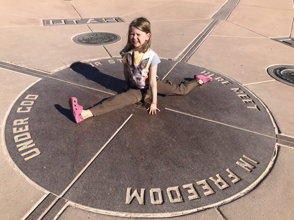
I stopped at the monument on a scorching hot desert day in 2017. Sarah’s been there before as well. Once you’ve done Four Corners, the experience doesn’t improve with age and time.
We graciously pass on a Four Corners visit, and move on.
Bluff to Mexican Hat
So, we turn north on Colorado Highway 41, crossing into Utah and eventually following the San Juan River to the town of Bluff, population 90. Bluff is nestled between sandstone bluffs and the San Juan River. It sits on the Trail of the Ancients Scenic Byway.
Bluff was settled in 1880 by Mormon pioneers seeking to establish a mission in the Four Corners area. The party, which has since become known as the Hole-In-The-Rock Expedition, had been sent to establish a religious presence among the local Native Americans and open the region to further white settlement.
Members of the expedition discovered they were up against some of the most rugged and forbidding terrain in the western United States. The trail they planned to follow was supposed to be a “short cut” that would take them directly across the Colorado River, and lop almost 500 miles off their trip. Instead, what they encountered was a narrow notch in the canyon wall, nicknamed the Hole-In-The-Rock. It led down to the Colorado River more than 1,000 feet below.
Twenty-five miles southwest of Bluff, we arrive in Mexican Hat, whose population is comfortably in double digits. The town, if you want to call it that, is named for a curiously sombrero-shaped rock outcropping on the northeast edge of town. The Mexican hat is a flattened pancake disk atop a 300-foot-high talus cone. Mexican Hat is frequently noted on lists of unusual place names.
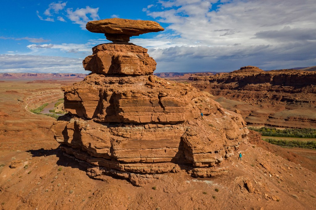
Mexican Hat was originally known as Goodridge, after E.L. Goodridge, a man who made an oil claim here in 1882. During an early oil boom, the population blossomed to 1,000; the ensuing bust caused the population to plummet to one. During the uranium boom the town once again increased, but soon withered. Today Mexican Hat has several motels, gas stations and restaurants – and a population of about 30.
As we leave Mexican Hat, we cross the Jason R. Workman Memorial Bridge, which spans the San Juan River. Workman, a 1997 graduate of nearby San Juan High School, was a member of US Navy SEAL Team Six, when he was killed in action in Afghanistan. He died, along with 37 others, when a Chinook helicopter was shot down on August 6, 2011, on its way to aid in an intense firefight.
Stark Beauty in Monument Valley
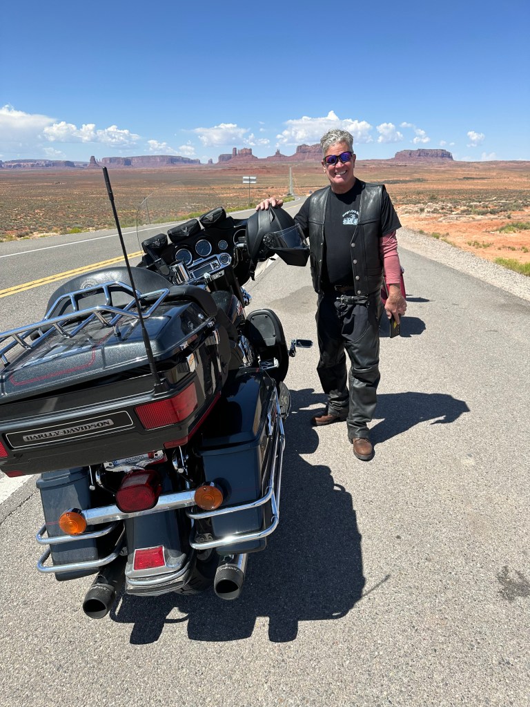
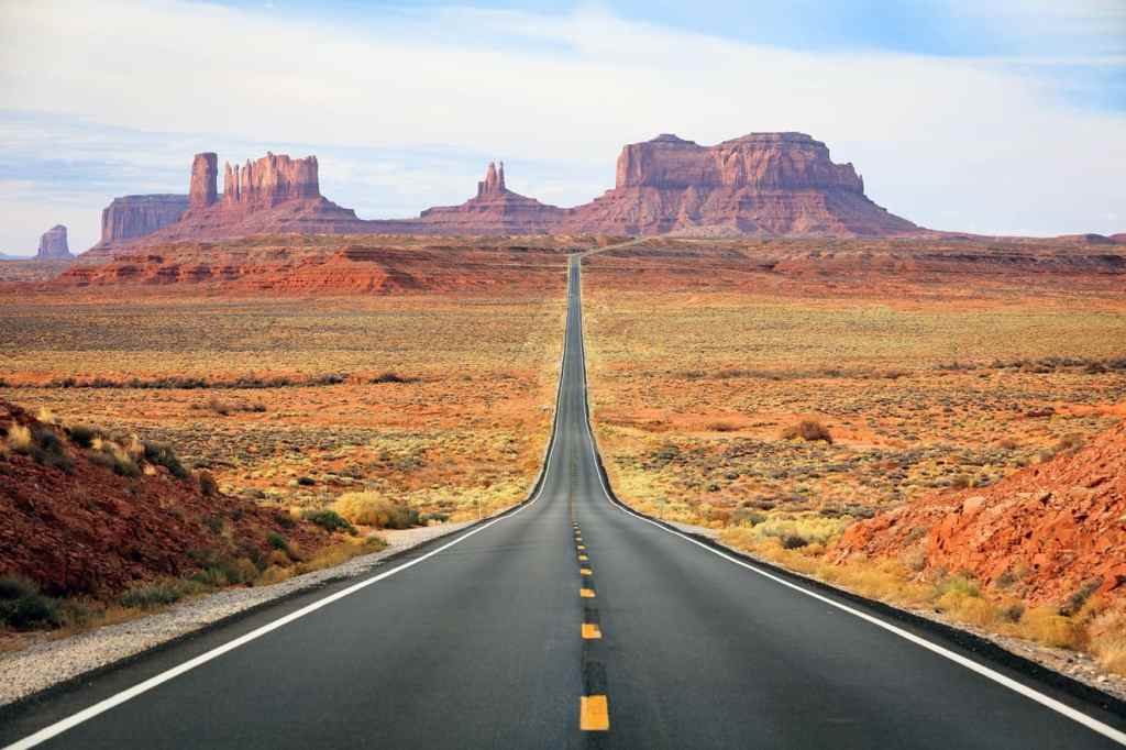
We soon cross into Arizona, and enter Oljato-Monument Valley. It’s the home to a cluster of famously photographed sandstone buttes. The largest reaches 1,000 feet above the valley floor.
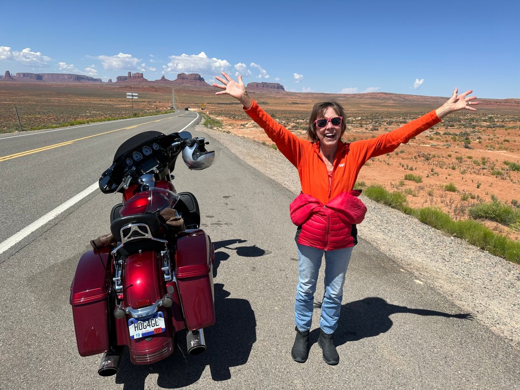
Monument Valley is considered a sacred area that lies within the Navajo Nation Reservation. The valley has been featured in a number of Hollywood films, including John Ford’s “Stagecoach” (1939) and Sergio Leone’s “Once Upon a Time in the West” (1967) – the first Spaghetti Western to be filmed outside Europe.
We’re squarely in the middle of the Navajo Nation, a 27,413-square mile Native American territory, mostly in northeastern Arizona and northwestern New Mexico. It’s the largest land area retained by a Native American tribe in the US. By area, the Navajo Nation is larger than 10 states. It’s roughly the same size as Ireland (27,133 square miles), but not nearly as much fun.
The area that’s now the Navajo Nation has a long history going back as far as pre-historic times and the subsequent arrival of Spanish and European settlers. Its desolate desert landscape stretches as far as the eye can see.
Tourists come to Monument Valley, looking for Forrest Gump Point. You’ll know it when you see it.

The well-known viewpoint was used in the movie, Forrest Gump. The title character, played by Tom Hanks, had been running for three years, two months, fourteen days and sixteen hours. Suddenly he decides to stop, leaving his faithful followers astonished. You may remember the scene from the movie; it’s when he says, “I’m pretty tired. I think I’ll go home now.”
There’s a sign by the side of the road with the words, “Forrest Gump finished his run at this point, 1980.” On your next visit to Monument Valley, you can find Forest Gump Point on your GPS at 37°06’09.5″N 109°59’21.1″W. How’s that for precision?
Life is like a box of chocolates.
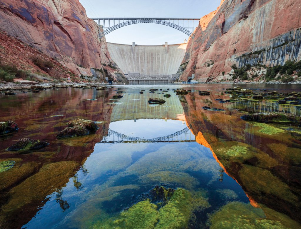
In Kayenta, we turn southwest on US Highway160, then join Arizona Highway 98, and point toward Page, Arizona – 64 miles away. Page sits near the Glen Canyon Dam and Lake Powell, both huge tourist draws.
Party Time in Page
In 1957, Page was founded as a housing community for workers and their families during construction of the nearby Glen Canyon Dam. Page is to Glen Canyon Dam as Boulder City, Nevada, is to the Hoover Dam. The city was originally called Government Camp, but was later named for John Page, commissioner of the Bureau of Reclamation from 1936 to 1943.
Page, population 7,400, is considered the gateway to the Glen Canyon National Recreation Area and Lake Powell, which attract more than three million visitors each year.
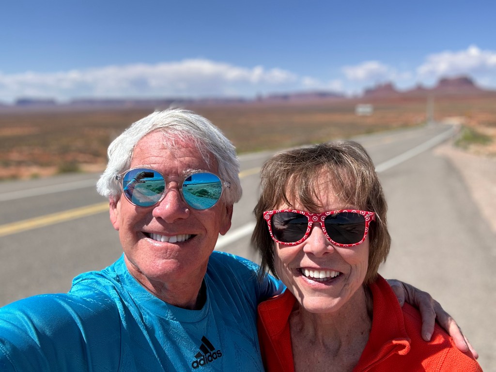
When we planned this trip last fall, six travelers were expected to arrive in Page this afternoon, coming from La Habra, California; Henderson, Nevada; and Carbondale, Colorado. There would be two riders each, on three separate motorcycles. They would comprise the co-ed posse that will ride the next three days, visiting three National Parks and all sorts of red rock.
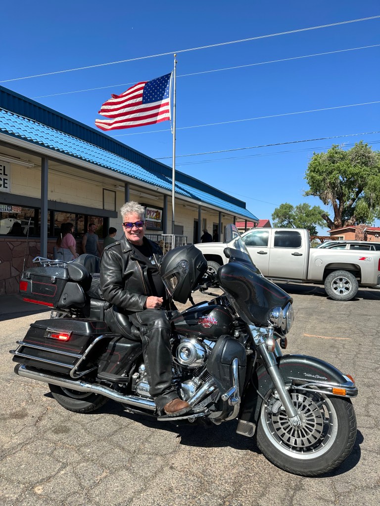
Until a month ago, that remained the plan. Then, life happened, plans changed, and the motorcycle crew is now down to two: me and Sarah. But wait, there’s more. In an unexpected twist, Dave and Gail arrive in Page by pickup truck. Yes, a freakin’ Ford F-150!
Whatever their mode of transport, we’re just darn glad to see them. It’s gonna be a great time on the road ahead, just a little different than we anticipated. Interestingly, for you number crunchers, there will still be six wheels – just configured differently.
***
The Day in Review:
Click here to see today’s complete route from Cortez, Colorado, to Page, Arizona.
Today’s Takeaways:
- Old is good. In this part of the world, it enhances your chances of National Monument status.
- Go Utes!
- Four Corners Monument? Meh. Save your $5.
Today’s Trivia: Fun With Quadripoints
Some people actually visit the Four Corners Monument to cross it off their bucket lists. After taking photos and contorting your body to be in four states at once, you’ve done about all there is to do at Four Corners.
As the only “quadripoint” in the US, it’s almost an accident of political geography. But is it in the correct place?You be the judge.
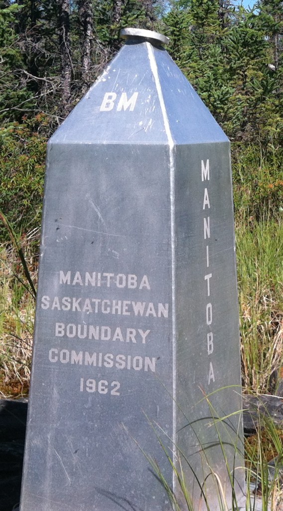
Interestingly, Canada also has a four corners point. It’s where the provinces of Manitoba, Saskatchewan, the Northwest Territories and Nunavut Territories meet. There’s a three-foot high aluminum obelisk marking this extremely remote location. It’s hundreds of miles from any road or railway.
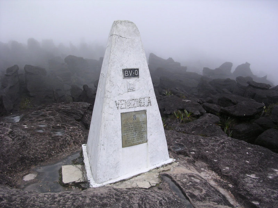
There’s only one international quadripoint. It’s in the middle of the Zambezi River in southern Africa, where Namibia, Zambia, Zimbabwe, and Botswana all touch. The quadripoint – good luck locating it precisely – is known as the “Four Corners of Africa.”
If that’s too hard to find, you geography geeks can lower your standards and fixate on the confluence of three countries, not four. They’re called tripoints, trijunctions, triple points, or tri-border areas. There are approximately 176 of these international trifectas. Nearly half are situated in rivers, lakes or seas. China has 16 of them. They’re more common than you’d think.
And now you know.

Gary,
Thanks for your postings. Very entertaining.
In the past, you’ve provided links to map representations of you daily travels.
I don’t see those now.
Best regards,
Doug Martin
LikeLike
Hi Doug. Scroll to bottom, under Day in Review” where it says “ Click here to see today’s route.” I don’t want to disappoint you 🤪
LikeLiked by 1 person
Gary & Sara, Love these blogs. Makes me wants to buy another Harley!!
Attached is a photo of ´âSitting Owl Rockâ in Monument Valley that I took many years ago. (added clouds later)
Ride safe.
jwc
LikeLike
You’re never too old to ride, Jim!
LikeLike
Epic day on the South Rim for the newbie! Can’t wait for tomorrow’s adventure.
LikeLike