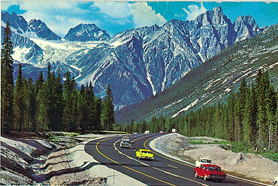
We begin our day on route transcanadienne, the Trans-Canada Highway. We’re retracing our steps from yesterday afternoon in Banff National Park.
Riding northwest from Canmore, we pass the famed Mount Rundle on our left.
Mount Rundle, 9,675 feet at its summit, overlooks the towns of Banff and Canmore. The mountain was named after Reverend Robert Rundle, a Methodist minister invited by the Hudson’s Bay Company to do missionary work in western Canada in the 1840s.
The wedge-shaped mountain, which extends more than seven miles lengthwise, could easily be considered a small mountain range. There are seven distinct peaks. Rundle 1 is at the far north end of the range; Rundle 7 at the south end. With enough skills and time, you can traverse from Rundle 1 to Rundle 7
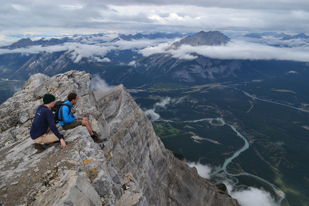
Mount Rundle, whichever number you pick, is one of the most popular climbs in the Canadian Rockies. For climbers and hikers in the know, Mount Rundle is considered a “scramble.”
Scrambling is a walk up steep terrain involving the use of one’s hands. It’s a somewhat ambiguous term that lies somewhere between hiking, walking, easy mountaineering and rock climbing. It’s a middle ground between hiking and moderate rock climbing.
To fully enjoy scrambling, plan to be free of technical apparatus, like ropes. There’s a lot to learn about scrambling. Be prepared before you try it. Especially in places like Mount Rundle.
***
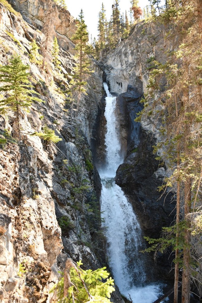
We pass the Trans-Canada Highway turnoff to Banff – been there, done that – and exit the highway near Silverton Falls, a two-tiered waterfall that empties into the Bow River.
We’re now on Alberta Highway 93, the Banff Windermere Highway. We soon cross the continental divide, where we find ourselves in British Columbia and the road becomes BC Highway 93.
The Continental Divide is the boundary between British Columbia and Alberta. It’s also the boundary between Banff National Park, which we’re leaving, and Kootenay National Park, which we’re entering.
The Kootenay region of British Columbia is huge, covering nearly 19 million acres. The region takes its name from the Kootenay River, which we’ll follow for the next hour or so.
Kootenay gets its name from the Kutenai First Nations people. Note the two different spellings of Kootenay/Kutenai.
In Idaho, Kootenai is the preferred spelling. That’s where you’ll find the city of Kootenai, and Kootenai County, home to the resort city of Coeur d’Alene.
That’s three different spellings in the past two paragraphs.
But wait, there’s more. An 1814 map of North America by Aaron Arrowsmith included the Coo-too-nay River.
Yes, It’s confusing. There are at least 34 ways to spell Co Tinneh, Coutannie, Cottonahou – or whatever you call it, and however you spell it.
***

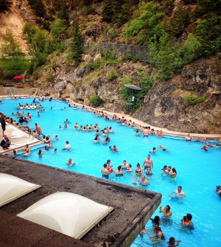
As we roll through Kootenay National Park – that’s the park’s official spelling – we eventually find ourselves in the town of Radium Hot Springs, at the crossroads of Highways 93 and 95. We’ll turn north on Highway 95.
Radium Hot Springs, population 700, is one of the main attractions in Kootenay National Park. The hot springs pool in town has water temperatures that range from 95 to 117 °F. The town is named for the odorless hot springs that heat the pool.
Development of the hot springs began when a British medical journal suggested, and a 1914 chemical analysis confirmed, the presence of radium within the water. For you geology fans out there, the top five minerals found in the Radium Hot Springs are: Sulphate, Calcium, Bicarbonate, Silica, and Magnesium.
Radium is a highly radioactive element and can be extremely dangerous. However, it was once used in many everyday products, including wristwatches and toothpaste, and thought to have curative properties until its intense radioactivity was found to cause adverse health effects. Radium has an abundance of about one part per trillion in the Earth’s crust.
With Bugaboo Provincial Park on our left, we now follow the Columbia River northwest until we reach the town of Golden, population about 4,000. It’s about 65 miles froom Radium Hot Springs to Golden, which sits at the intersection of British Columbia Highway 95 and the Trans-Canada Highway.
Much of Golden’s history is tied to the Canadian Pacific Railway and the logging industry. Today, the town’s economy still relies on those two influences, but the development of the Kicking Horse Mountain Resort has made tourism a big draw.
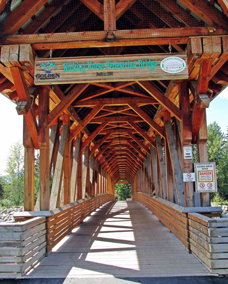
Golden is home to the Kicking Horse Pedestrian Bridge, the longest free-standing timber frame bridge in Canada. The bridge spans the Kicking Horse River, which runs through Golden.
In 2001, more than 100 members of the Timber Framers Guild came from the US, Europe, and all over Canada to help construct the bridge. The superstructure weighs approximately 210,000 pounds and was made of 72,000 board feet of Douglas-fir timbers.
There are a lot of things in this area named after the Kicking Horse River: the Kicking Horse Pedestrian Bridge, the Kicking Horse Mountain Resort, and Kicking Horse Pass among them. The Kicking Horse name has an interesting background.
It began with railway expansions from the prairie provinces – Alberta, Manitoba and Saskatchewan. In 1858, Sir James Hector, a geologist and member of the Palliser Expedition, set out in search of mountain passes that would cross the Continental Divide into a western river valley. At his camp near Wapta Falls, a packhorse bolted, and Hector gave chase. As he rounded up the horse, it kicked him, breaking his ribs and knocking him into unconsciousness.
Both the river and the pass were named Kicking Horse, for Hector’s ornery steed.
***
We follow the Trans-Canada Highway, and 50 miles past Golden arrive at Rogers Pass. The 4,364-foot pass, in in the Selkirk Mountains, in the heart of Glacier National Park. The pass is a Canadian National Historic Site.
In 1881, as Canadian Pacific Railway looked for a route over the unexplored Selkirks, it offered Major Albert Bowman “A.B.” Rogers naming rights and a $5,000 bonus to locate a pass. Apparently, he was successful, as the pass is now named after him. Rogers refused to cash the $5,000 check, and instead framed it upon his wall until Canadian Pacific General Manager William Cornelius Van Horne offered him a gold watch as an incentive to cash it. Folklore has generated many variations of this story.
From Rogers Pass, it’s about 40 miles to tonight’s destination, Revelstoke.
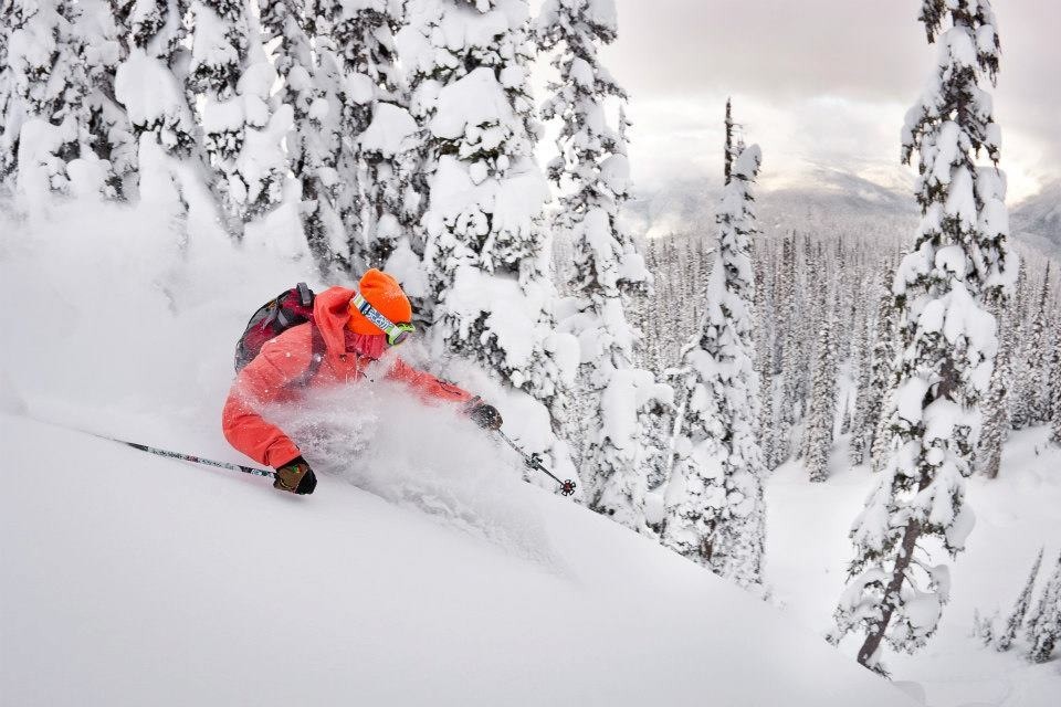
As is tradition – you know I love traditions – we make a brief visit to the Revelstoke Mountain Resort on our way into town. If there’s a ski area on our route, I wanna see it. The Revelstoke Mountain Resort sits on the shoulder of 8,074-foot Mount Mackenzie, named for Scotland-born Alexander Mackenzie, Canada’s second prime minister.
Revelstoke Mountain Resort has the largest vertical rise of any ski area in North America – 5,620 feet. Snowmass, where I work in the winter, has 4,406 feet of vertical rise. Largest vertical drop in the world: 8,982 feet, at Chamonix in France.
Revelstoke’s Master Plan calls for the eventual construction of as many as 25 lifts, and an expansion to 10,000 skiable acres, making it the largest resort in North America. Today, it has 3,120 skiable acres, comparable in size with Snowmass, which has 3,362 skiable acres.
Largest ski area in the world: Les Trois Vallées in France, which has nearly 26,000 skiable acres. That would make it larger than the five biggest US ski resorts combined. Les Trois Vallées integrates three resorts in the Northern French Alps: Val Thorens, Courchevel, and Meribel. I’ve skied there twice. It’s pretty epic.
***
Revelstoke Mountain Resort’s ski season ended on April 19, same as Snowmass.
With no skiing on the horizon until the 2022-23 season begins in November, we call it a day, and settle into Revelstoke for the night.
How, again, do you spell “Cootonais?”
***
To view today’s route in Google Maps, click here.
My number today: 88 (atomic number of Radium)
What’s your number?
***
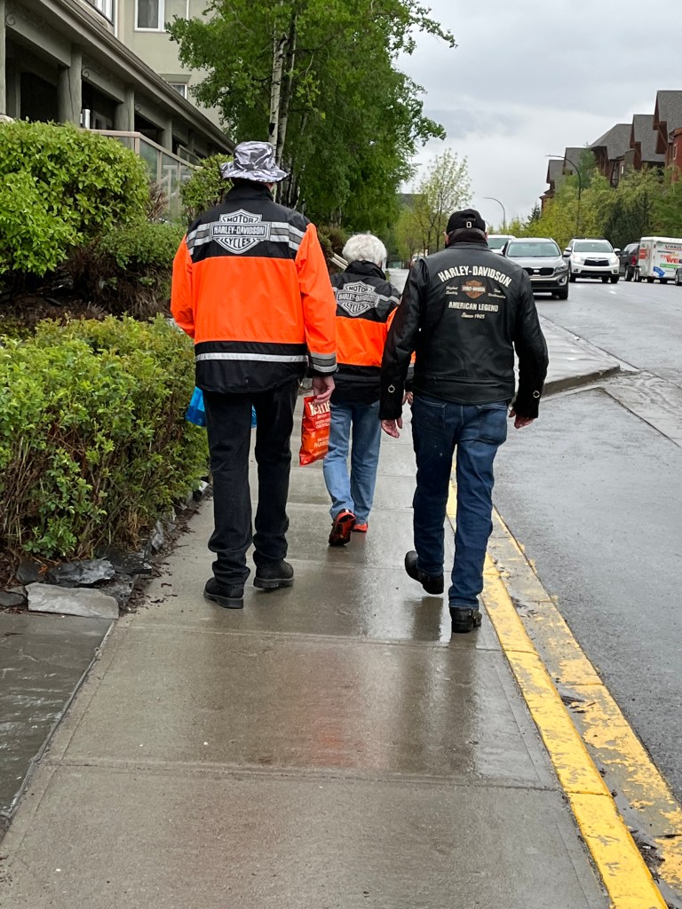
Late-breaking update: The trip I just described turns out to be the fantasy of a delusion man. Me.
It’s what we would have done, except the weather today was totally shitty. It rained hard, all day, everywhere we were going, from Canmore all the way to Revelstoke. Why would anyone of sound mind ride on a say like that?
So, following a posse team meeting, we erred on the side of safety and comfort, and decided to stay in Canmore one more night. We are at a great hotel, with laundry (in our rooms!!!) and underground bike wash facilities.
We plan to be back on schedule tomorrow And yes, ladies (Sarah, Gail, Terri and Jo) — we will be home on time. Plan on it 😀🙏😀
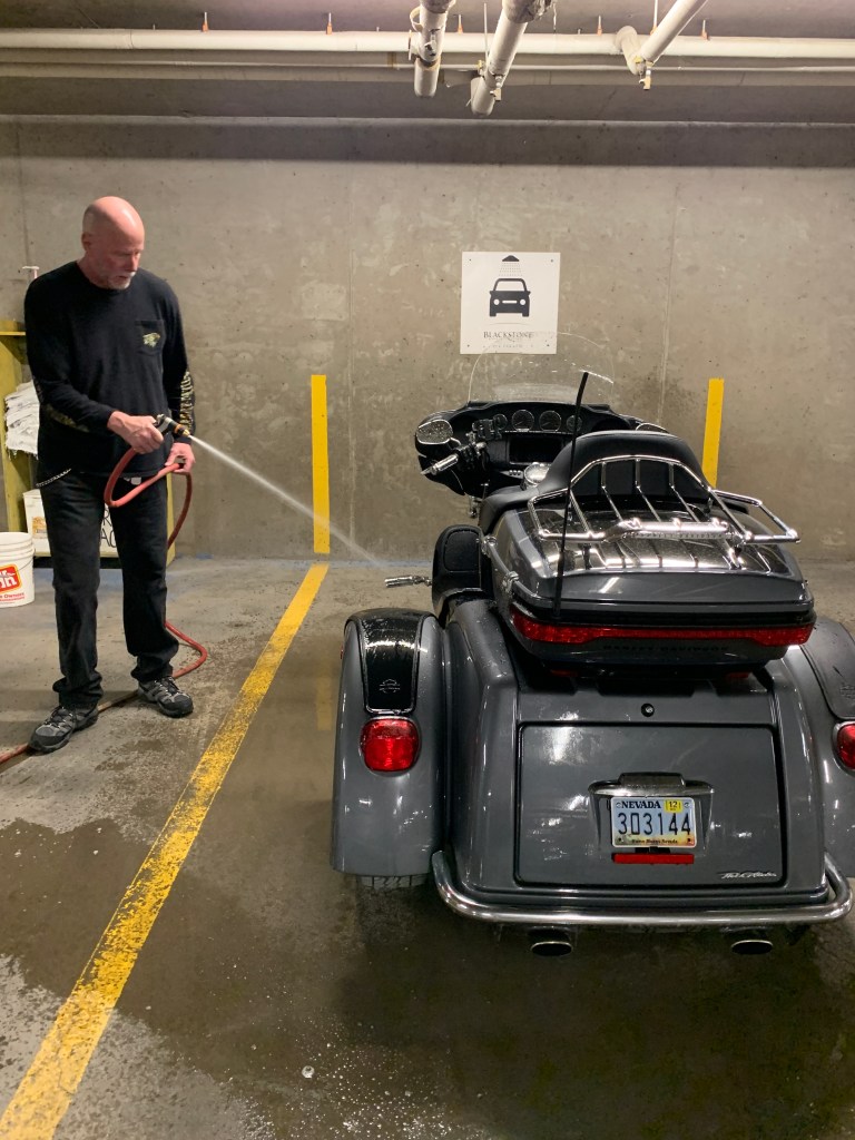
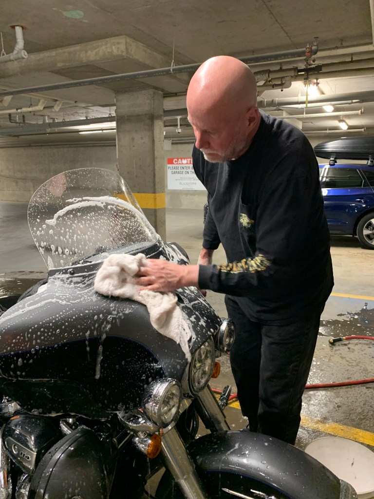
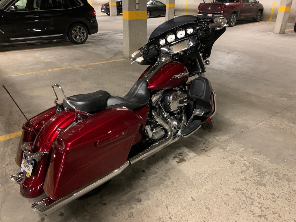

Sorry El Presidente. Clearly, the cleanest and shiniest Harley in Canmore tonight belongs to yours truly. My number today is “el numero uno” my friend!
LikeLike
Um, we may need to have a Simon Cowell-like judging panel to assess cleanliness of the three spotless bikes (Randy: WTF?)
LikeLike
Glad you found chips as you foraged for food this morning! I’m happy you decided to avoid the weather and wash things today and that you’re still on track to arrive home as planned. Enjoy gentlemen!
LikeLike
Sometimes foraging takes strange turns. Way to see the detail in an otherwise inoccuous photo. 😢
LikeLike
Baby, chips were for this afternoon. Had a nice healthy breakfast of eggs, tomato, veggies and cheese in a healthy wrap. No pic so not sure it happened. All good. But, I confess that like all our rides, I am aging weight daily. LOL! Bring in the veggies when I get home!
LikeLiked by 1 person
Fascinating trip so far, thanks for sharing!
LikeLike