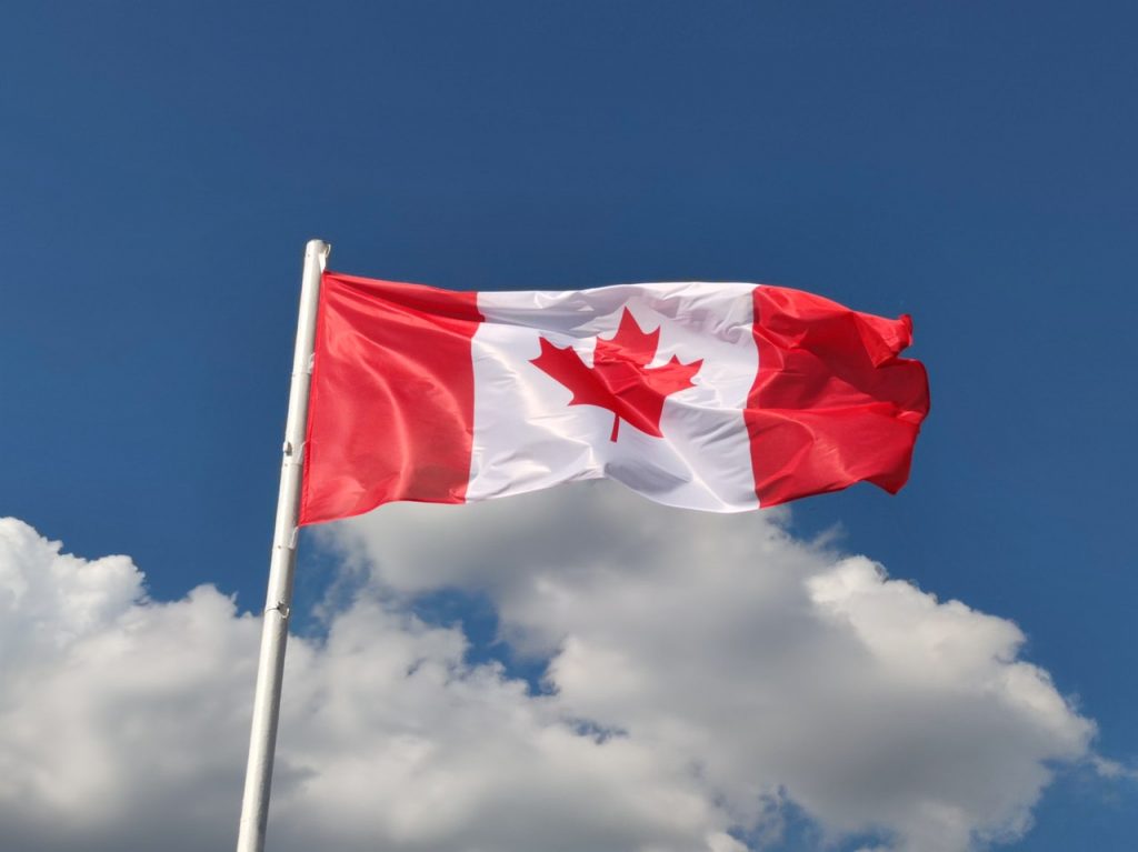
By tonight, we’ll be in Canada. We expect to hear eh more than occasionally.
It’ll be our first visit there since 2019, when a pre-Covid trip took us to Victoria, British Columbia for a one-night stand. Dave, Jim and Randy were along for the ride on that trip, too.
This time, we’ll be in Canada six nights, with the highlight coming this weekend, when we visit the Icefields Parkway, in the Canadian Rockies.
But first, we’ve got to find our way to Canada. It’s almost 260 miles from here.
Let’s get started.
***
We roll out of Oak Harbor for the last time, heading north on Washington Highway 20, which we’ll be on for the next 200 miles.
Another crossing of the Deception Pass Bridge brings us to Fidalgo Island, where we follow Highway 20 east, cross the Swinomish Channel and find ourselves back on the mainland.
The Skagit County cities of Burlington and Sedro-Woolley are ahead. Soon, civilization becomes sparse. We’re riding along the Skagit River, which brings us to the town of Concrete, once home to the Washington Portland Cement Company. Concrete was originally named Cement City.

Along Highway 20, towns seem to be spaced 15 miles apart.
Rockport is 15 miles ahead.
Another 15 miles and we arrive in Marblemount.
Fifteen more miles and we’re in Newhalem.
These small towns each have populations of less than 50 residents.
***
Newhalem sits at 515 feet of elevation. It’s at the beginning of our climb on the North Cascades Highway. In Newhalem, we find the North Cascades Visitor Center at the west end of the North Cascades National Park.
Newhalem is a company town owned by Seattle City Light. It’s populated entirely by employees of the Skagit River Hydroelectric Project, which extends 40 miles along the Skagit River from Newhalem to the Canadian border. Seattle City Light has generated hydroelectric power on the upper Skagit River since 1918.
The name Newhalem? It comes from a Salish Indian language and roughly means “goat snare.” This apparently relates to the traditional use of snares to capturing mountain goats on nearby slopes, for use in creating goat wool.
***
Leaving Newhalem, it’s five miles to Diablo Lake, a reservoir that’s part of the Skagit River Hydroelectric Project. At one time, the Diablo Dam was the world’s tallest, standing 389 feet high. The dam was completed in 1930, and began generating electricity in 1936.
The Diablo Lake Vista Point provides breathtaking views of the lake.
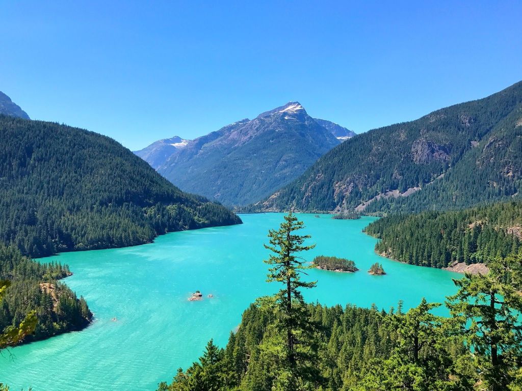
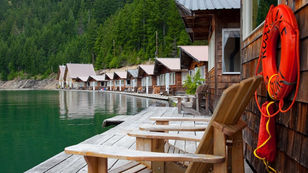
Two miles ahead, the Ross Lake Overlook offers similarly spectacular views of Ross Lake, a large reservoir that was once called Ruby Dam. Ross Lake is a major recreation destination within the North Cascades, attracting visitors with fishing, canoeing, kayaking and hiking.
A favorite destination for travelers is the Ross Lake Resort, consisting of 15 floating cabins and a marina on Ross Lake. Getting to the resort requires a one-mile hike from State Highway 20. There are no roads to the resort.
We’re in North Cascades National Park, and never had to stop and show our passes for entry. Because Highway 20 is a major east-west route, there’s no fee for entering, and no ranger gate. For various reasons, 14 other national parks have no entry fee, including Kenai Fjords in Alaska, Hot Springs in Arkansas, Congaree in South Carolina, and Redwood in California.
The North Cascades Highway’s path across the Cascade mountains follows one of the oldest roads in Washington, established in 1896 as a wagon route. Even before that, it was originally the corridor used by local Native American tribes as a trading route for more than 8,000 years.
At 5,477 feet, Washington Pass is the highest point on the North Cascades Highway. Winters are brutal here. The highway closes every winter due to heavy snowfall and avalanche danger. It generally takes four to six weeks to clear the road of its winter snow covering, before opening in the spring.
***
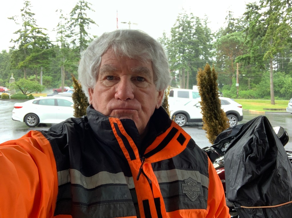
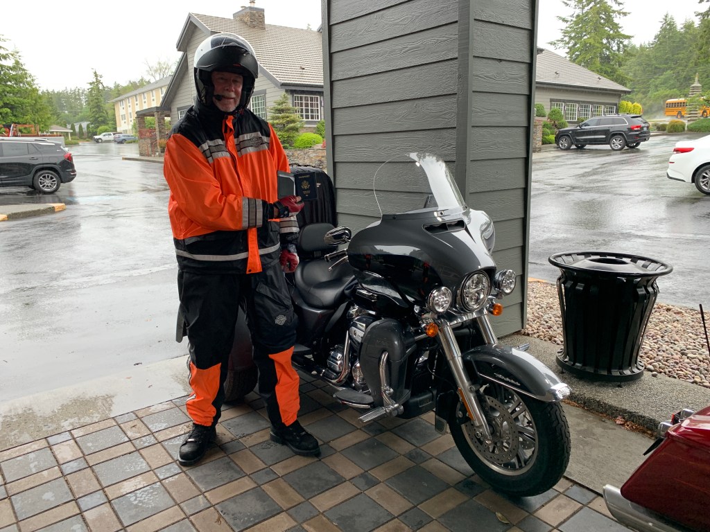
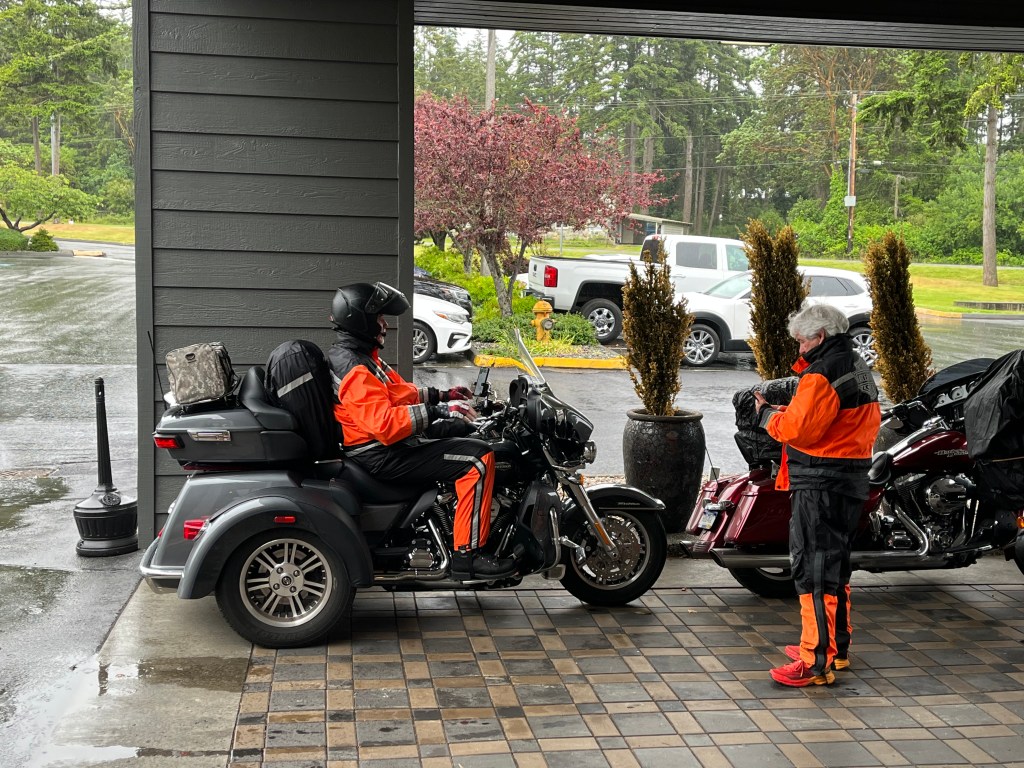
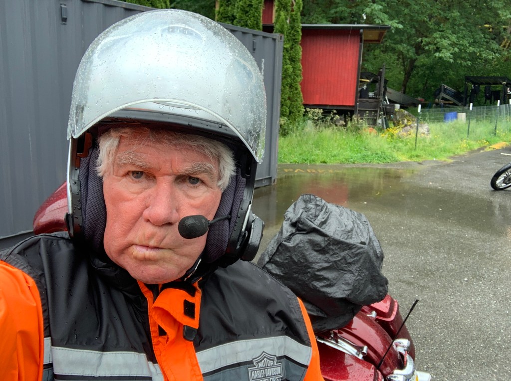
It’s been raining like crazy all day, since we left Oak Harbor. The temperature at Washington Pass is 37 degrees. We are soaked to the bone and freezing our asses off 😢
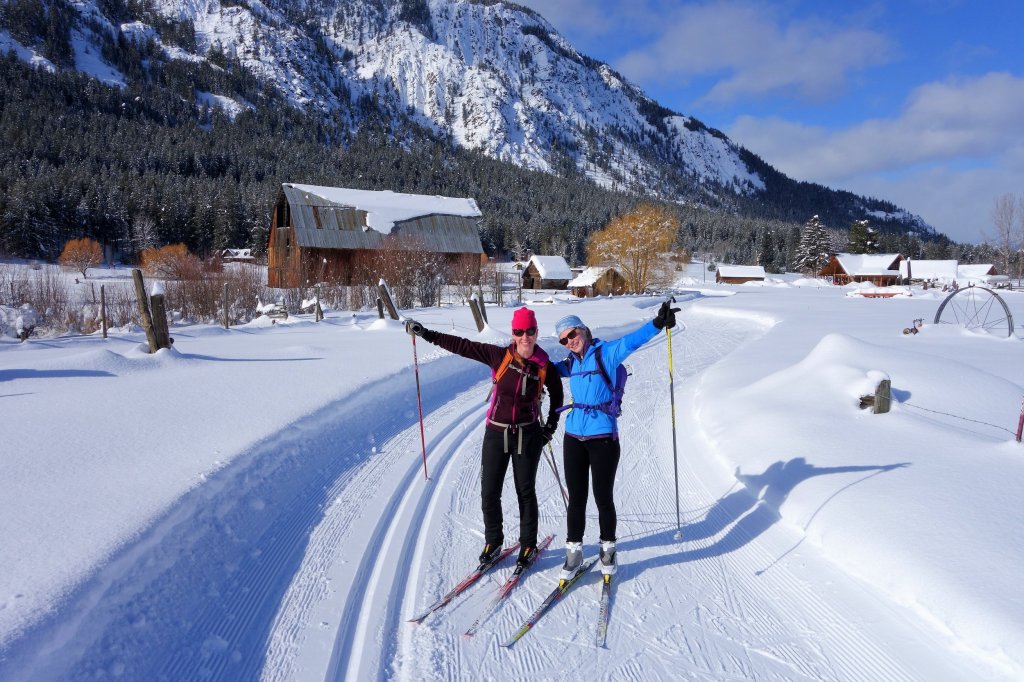
We descend from Washington Pass, and roll through the town of Mazama, at the upper end of the Methow Valley. Mazama boomed in the early 20th century as the departure point for mining towns in the rugged Harts Pass area. Today, with a population of about 160, Mazama has a general store, adventure supply store, gas station, café and two restaurants. It’s home to one of the world’s longest cross-country skiing trails, stretching for 120 miles.
Mazama is only 15 miles from Winthrop, continuing the town-every-15-miles-on-Highway-20 concept.
Winthrop, population 350, is known for its Old West design of all the buildings in town, complete with false-fronts and boardwalk sidewalks. The town theme idea was inspired by Leavenworth, Washington – which is based on a Bavarian mountain town.
One of the western-themed buildings is Three Fingered Jack’s, where you can get a Jack’s Country Breakfast, or a Jack Attack Burger for lunch or dinner. Jack’s is the oldest legal saloon in Washington State.
Eight miles down the road (what happened to 15-mile spacing?) is Twisp, a town of about 900 that sits at the confluence of the Twisp and Methow Rivers. Twisp calls itself a “dynamic center for art, culture and adventure.”
After four hours of rain, it finally stops in Twisp. we’re drenched, but things are looking up.
From Twisp, it’s 30 miles to Okanogan, again shattering the concept of towns 15 miles apart. Okanogan, population about 2,600, means “rendezvous” or “meeting place” in a Native American language.
Ahead are three more small towns in the next 50 miles of US Highway 97 before we arrive in Canada: Omak (“Heart of the Okanogan”), Tonasket (“All Roads Lead to Tonasket”), and Oroville – which sits at the southern edge of Osoyoos Lake.
Oroville, with a population of about 2,000, is the last US civilization we’ll see for a week.
First settled in the late 1850s, it was named Oro, after the Spanish word for gold. Oro seemed like a fitting name; it was an effort to attract prospectors and merchants to nearby gold mines. But the US Post Office objected to the name “Oro” because a town in Washington was already named “Oso,” so in 1909, the name was changed to Oroville.
The Canada / US Border is just four miles north of Oroville. The Oroville / Osoyoos border crossing is open 24 hours a day, year-round.
We show the Canada Border Services agents our proof of Covid vaccination, and US passports. They let us into the country, anyway.
We’ve arrived in the Great White North!
***
Once in Canada, we suddenly show signs of advanced politeness, like all Canadians. That’s the stereotype anyway.
We’re riding like normal people as we enter the town of Osoyoos, British Columbia, two miles on the northern side of the border, and tonight’s destination. Osoyoos, nestled on the banks of Osoyoos Lake, means “narrowing of the waters” in the local Okanagan language.
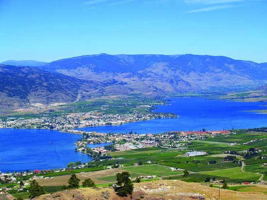
Osoyoos calls itself “Canada’s Warmest Welcome,” a nod to the pleasant summer temperatures there. Its average daytime temperature, year-round, is 62 degrees, making it one of the warmest in Canada. Osoyoos Lake is said to be the warmest freshwater lake in Canada.
The weather is ideal for fruit growing. Osoyoos has commercial orchards growing cherries, apricots, nectarines, peaches, plums, pears and apples. Agriculture is a major component of the local economy, as you can tell from the abundant produce stands along the highway entering town.
We’re relieved to finally be in Canada. It’s taken me nearly two weeks to get here. The Great White North beckoned, and we’ve arrived.
Great White North?
Although it’s unknown who coined the term “Great White North” in reference to Canada, the nickname has been in use for decades. Here’s the basis of the nickname:
Great: Canada is “Great” because the only country larger than it is Russia. Canada’s total area is nearly four million square miles, but nearly 80 percent of Canada’s population lives within 90 miles of the US-Canada border. To go with its Great title, Canada also has the longest coastline in the world.
White: The real-life Great White North, also known as Canada’s Arctic Archipelago, is nearly 580,000 square miles. The population of the entire region is just 14,000 people. Quttinirpaaq National Park in Nunavut receives less than 20 visitors a year. It’s the second most northerly park on Earth, after Greenland National Park. Quttinirpaaq National Park covers 14,585 square miles, making it the second largest park in Canada. The park has extensive glaciers and ice caps, desert-like conditions, and life forms that are uniquely adapted to the extreme polar environment
North: This is a simple explanation. Canada and the US are the two biggest countries in North America. Canada just so happens to be the furthest north, and it’s long been known as America’s “neighbor to the North.”
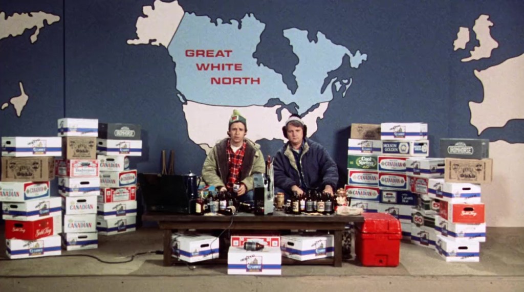
The term “Great White North” was made famous on the 1980s TV show, SCTV. It featured two fictional Canadian brothers, Bob and Doug McKenzie, who played upon Canadian stereotypes in each episode, which included saying “hoser,” finishing every sentence with “eh?,” eating back bacon, and drinking beer.
We’re in the Great White North for the next six days.
***
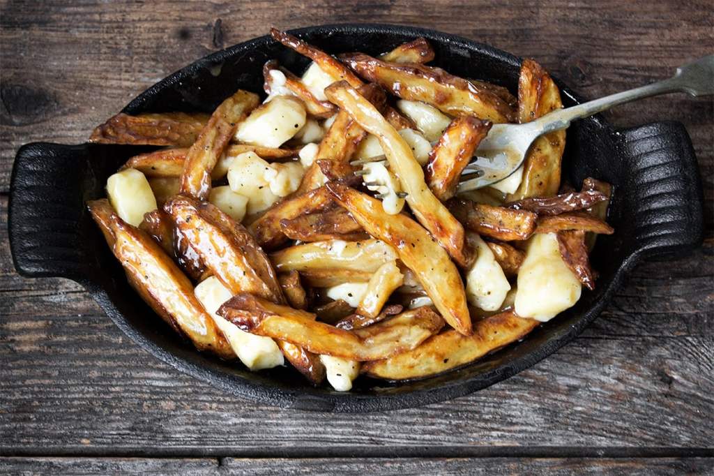
There’s a lot to love about Canada, including poutine, informally known as Canadian comfort food.
Poutine consists of French fries and cheese curds with light brown gravy on the top. Oof. I can feel my arteries hardening just thinking about it.
Poutine is a fast-food dish that’s usually offered in small diners, pubs, roadside chip wagons and hockey arenas. At least that’s how the poutine craze began, before it became popular everywhere in Canada, at every price point and for nearly every palate.
While poutine is now available at fine restaurants and fast-food chains alike, it was completely unknown until the mid-20th century. It first appeared in rural Quebec snack bars in the late 1950s.
The word poutine is commonly believed to have originated from the English word pudding (or its French equivalent, pouding) used to describe a mixture, typically messy, of various foods. In Québec, the term poutine is slang for mess.
While poutine is, for many, an unlikely choice for haute cuisine, the sturdy classic became a chef favorite during the comfort food revolution of the 2000s. Celebrated Montreal chef Martin Picard of Au Pied de Cochon was the first to elevate poutine. In 2002, he introduced his often-imitated foie gras poutine, combining high and low Quebec cuisine on a single plate.
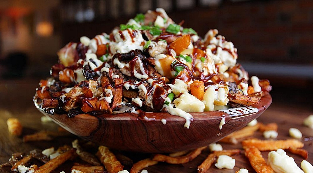
Poutine is now a Canadian national staple, even the subject for fantasy foodies. Here’s a list any self-respecting poutineer would want to be part of.
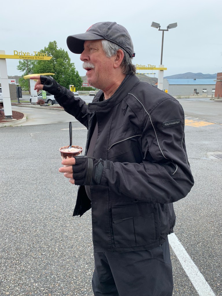
Tonight in Osoyoos, there are all kinds of poutine possibilities: Gnocchi poutine at a wine bar; butterchicken poutine at a family restaurant; pizza poutine at a pizza joint. Even A&W Canada has poutine. Same for Dairy Queen, McDonalds, Burger King, Wendy’s and KFC. It’s everywhere.
Posse poutine party, anyone?
***
To view today’s route in Google Maps, click here.
My number today: 1,170 (calories in a “regular” helping of poutine at New York Fries, a Canadian-based fast casual restaurant chain specializing in hand-cut fries and authentic poutine).
What’s your number?

Eh….what’s that? You’ve all finally made it to the Great White North! Hoping your travels
include sunny, dry weather.
LikeLiked by 1 person
Sounds fabulous! Enjoy!
LikeLiked by 1 person