Our Highway One funfest is just beginning. Strap in.
Yesterday we experienced its most famous section – the 65 miles from San Simeon to Big Sur.
Today, we cross the world’s most famous bridge – the Golden Gate – and follow the California coastline for 206 memorable miles.
***
Navigation, on these rides, can be critical, and often challenging. On the California coast, you’d have to be a moron to get lost.
Simple as this: follow the Highway One signs, and make sure the Pacific Ocean is on your left.
That’s what we do as we leave the Santa Cruz Boardwalk, heading north toward San Francisco.
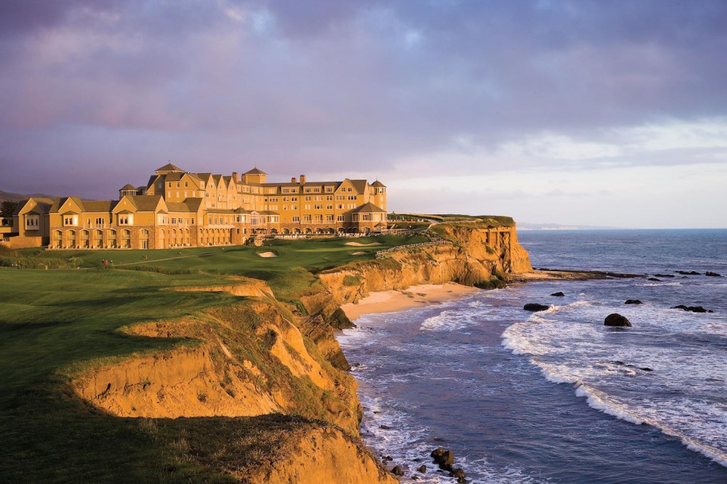
There’s little development and scant civilization until we reach Half Moon Bay, named for its half-moon shape. The area’s largest employer is the Ritz Carlton hotel, a luxury resort with two beachfront golf courses designed by Arthur Hills. The LPGA held its Samsung World Championship here on the Ocean Course in 2008. The winner: American Paula Creamer, who grew up 40 miles away in Pleasanton.

This stretch of Highway One is called the Cabrillo Highway. It’s named after Juan Rodríguez Cabrillo, a Spanish explorer known for checking out the west coast. He was the first European to navigate the coast of present-day California, and is best known for exploring the coast for two years, beginning in 1542.
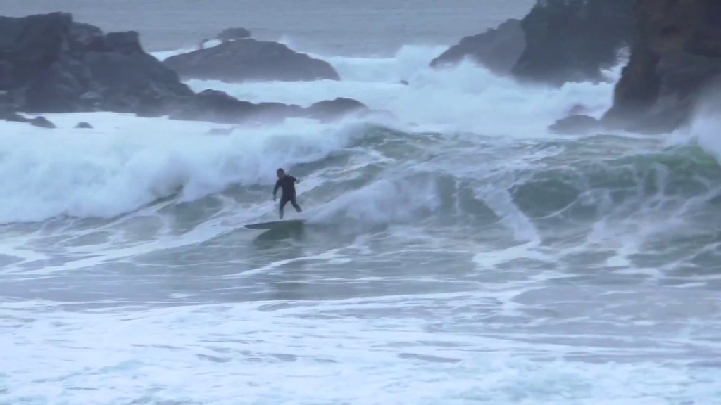
Soon, we see signs of life as we approach the city of Pacifica, which sits between Half Moon Bay and San Francisco. Pacifica, which is Spanish for “peaceful,” is a surfing destination with a renowned skateboard park.
Highway One becomes Interstate 280, which takes into the heart of San Francisco. With a population of more than 870,000, San Francisco is by far the largest city we’ll see on this trip.
Named for Saint Francis, the city has some interesting history.
- During the Great Depression, not a single bank in San Francisco failed.
- The Beatles gave their last full concert at Candlestick Park on August 29, 1966.
- In 1906, three quarters of the city was destroyed by an earthquake and fire.
- The US Navy originally planned to paint the Golden Gate Bridge black with yellow stripes. The famed “international orange” color was intended to be a sealant.
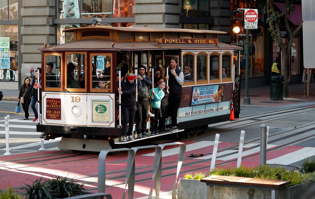
- The city’s cable cars are the only National Historical Monuments that can move. The cables that pull the cars run at a constant speed of 9.5 miles an hour.
As we roll through the city, the road quickly becomes Highway One again, or 19th Avenue, as the locals call it. We see block after block of old, overpriced houses and apartments in the Sunset and Golden Gate Heights districts. In San Francisco, the average price of single-family homes is more than $1,200 dollars per square foot. The median price for condos in San Francisco is $1.25 million, and for single family homes it’s $1.75 million.
We pass through Golden Gate Park, a 1,017-acre urban park that’s San Francisco’s version of New York’s Central Park. With 13 million visitors a year, Golden Gate Park is the fifth-most visited city park in the US, after Central Park, Chicago’s Lincoln Park, and two parks in San Diego.
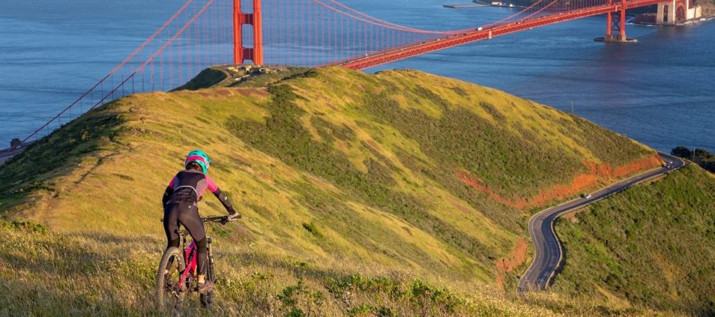
The Presidio is just ahead. Originally El Presidio Real de San Francisco, the Presidio a park and former US military fort. It’s part of the Golden Gate National Recreation Area.
The Presidio had been a fortified location since 1776, when New Spain established the Presidio to gain a foothold in the San Francisco Bay. Today, the park has wooded areas, hills and scenic vistas overlooking the Golden Gate Bridge, San Francisco Bay and the Pacific Ocean.
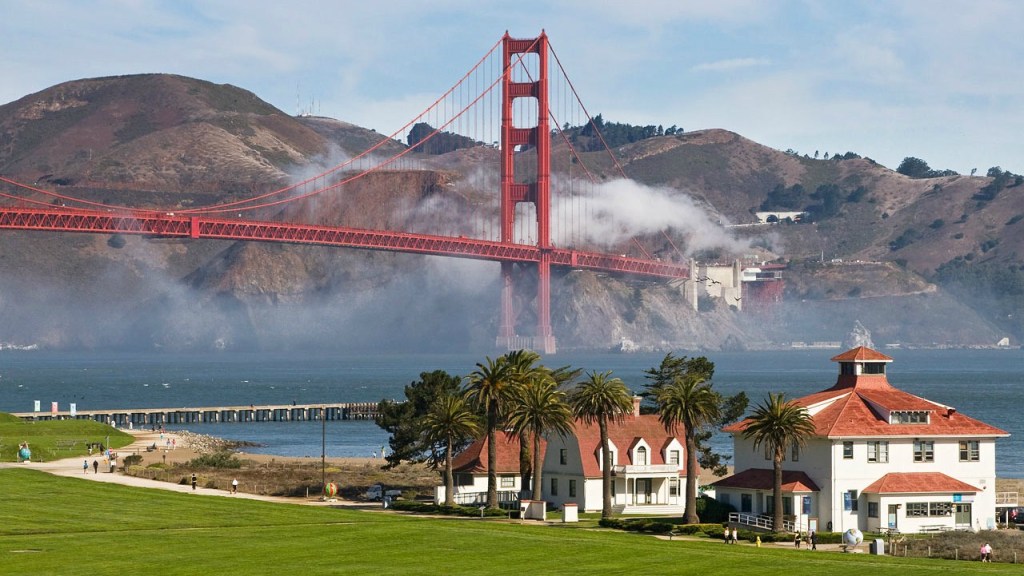
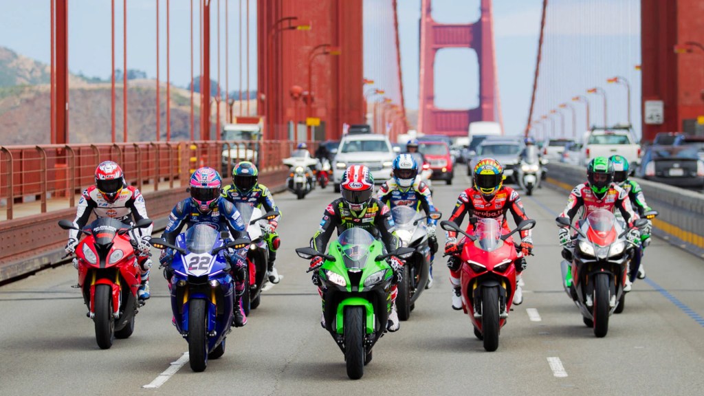
All of a sudden, out of nowhere, the Golden Gate Bridge appears. One of the most famous and photographed sights in the world, the bridge spans the Golden Gate, a one-mile-wide strait connecting the Pacific Ocean and San Francisco Bay.
With its 746-foot tall towers, Art Deco styling and distinctive international orange color, the bridge draws 10 million visitors annually, not counting the estimated 112,000 vehicles that cross the bridge daily, commuting to and from work in San Francisco.
In 1955, when I first crossed the bridge as a kid – OK, as a passenger in our family car – the toll was 25 cents.
Today, as northbound riders, we won’t be reaching into our pockets for quarters to pay the toll. The toll now is $8.05 for two-axle vehicles; it’s paid electronically at the San Francisco end, for southbound travelers.
There’s no discount for motorcycles. But because we’re crossing the bridge northbound, it’s free today!
The Golden Gate Bridge has been declared one of the Seven Wonders of the Modern World by the American Society of Civil Engineers. It’s a pretty elite list, including the tunnel under the English Channel, the Empire State Building, and the Panama Canal.
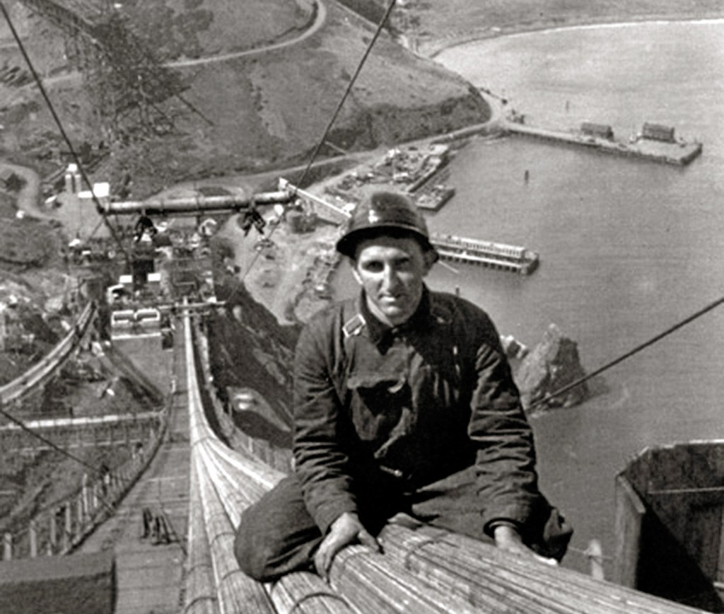
When the Golden Gate Bridge opened in 1937, after four years of construction, it had cost more than $35 million to build. That’s chump change by today’s standards. It was completed ahead of schedule and under budget. At the time of its opening, the bridge was both the longest and tallest suspension bridge in the world.
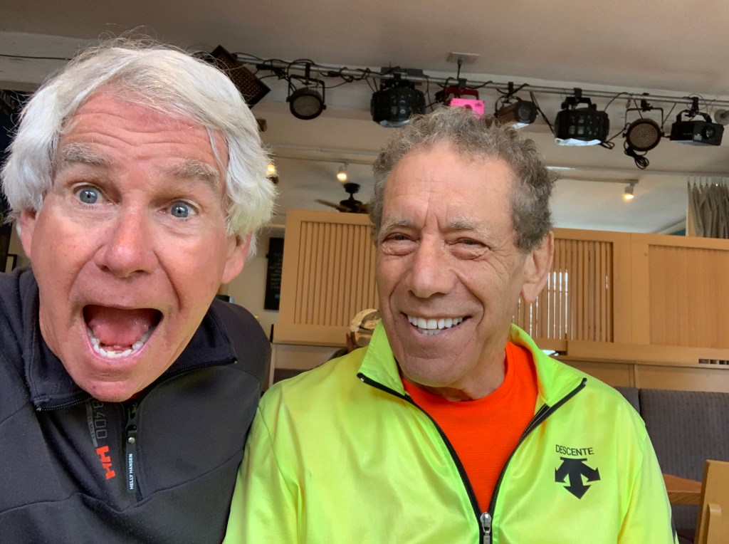
On the north side of the Golden Gate, we enter Marin County, home of San Quentin State Prison and my 81-year-old cousin, Rich.
Skirting the Golden Gate National Recreation Area and the Tennessee Valley, we roll through Muir Beach, named after John Muir, an influential Scottish-American naturalist who was an early advocate for the preservation of America’s wilderness.
He co-founded the Sierra Club, and devoted most of his later life to the preservation of western forests. Muir briefly studied natural sciences at the University of Wisconsin but, ultimately, chose to spend his lifetime enrolled in what he called the University of Wilderness.
We’re now on the Shoreline Highway, which Highway One is called locally. We are riding along the southern end of Mount Tamalpais State Park, whose primary feature is 2,571-foot Mount Tamalpais. The park is full of redwood and oak forests. It’s a popular hiking, picnicking and camping destination for Bay Area residents. The western slopes of Mount Tamalpais descend to the Pacific Ocean at Stinson Beach. Mountain biking is said to have been invented on the slopes of Mount Tam, as the locals call it.
Stinson Beach is a popular day trip for San Francisco residents eager to get out of the city.
It’s a great place for beachcombing, especially in the winter, when the crowds are smaller, and during morning low tides. The waters off Stinson Beach are part of the Red Triangle, an area extending from Bodega Bay to Big Sur and including the Farallon Islands. Shark attacks, especially from Great Whites, are occasional within the triangle; but still, quite rare. A surfer at Stinson Beach was attacked by a Great White in 1998; another surfer was attacked in 2002.
Stinson Beach has been the setting for a number of Hollywood movies, including Play It Again, Sam; Basic Instinct; and Shoot the Moon.
Today, Stinson Beach is a good place for lunch, and to catch up with my cousin, who I haven’t seen since Covid.
***
After our Stinson Beach lunch, Highway One turns inland. On our way north we pass through Bolinas, Olema, Point Reyes Station, and the appropriately named town of Bivalve.
Bivalve was founded by the Pacific Oyster Company, after it established 450 acres of oyster beds there in 1907. Bivalves, of course, are aquatic mollusks that have a compressed body enclosed within a hinged shell, such as oysters, clams, mussels, and scallops.
We’re nearing Bodega Bay, a marine habitat used for navigation, recreation, and commercial and sport fishing including shellfish harvesting. In the US, a bodega is a small convenience store. In a Spanish-speaking country, a bodega is a wine shop or wine cellar.
Bodega Bay is most famous for its role in the 1963 Alfred Hitchcock film, The Birds, Hitchcock’s first horror/fantasy film. The movie centers on a small California coastal town (Bodega Bay) that is inexplicably attacked and rendered helpless by massive flocks of aggressive birds.
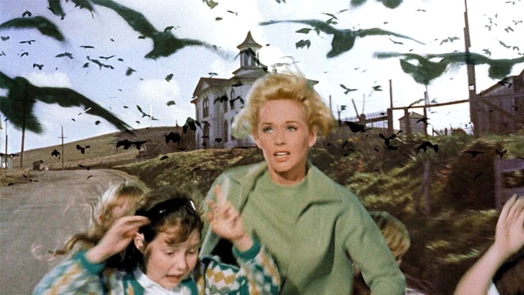
The majority of the birds seen in the film are real, although an estimated $200,000 was spent on the creation of mechanical birds for the film. The crow attacks were enhanced by what was then called the special effects department. The special effects shots of the attacking birds were completed at Walt Disney Studios by animator/technician, Ub Iwerks. Iwerks is better known for being the co-creator of Mickey Mouse in 1928. The other co-creator: Walt Disney.
From Bodega Bay, it’s only 62 miles to tonight’s destination, Point Arena. Because we’re on Highway One, it’ll take an hour and 40 minutes to get there. What’s the rush?
Formerly known as Punta Arena, the quaint city, population 450, has long been associated with hippie and counterculture groups. It’s one of the smallest incorporated cities in California.
It’s small, yet big enough for several restaurants, and the charming Wildflower Boutique Motel, our home for the evening.
Did someone say dinner?
***
To view today’s route in Google Maps, click here.
My number today: $187,000,000 (annual revenue from the Golden Gate Bridge)
What’s your number?

Especially enjoyed today’s blog. I was sent to Bay Area in the 90s to work at Howard Terminal, a still operating cargo terminal. Talk now is of converting into a ball park. I hope not. The info on the Golden Gate returned childhood memories as my great grandfather worked on the bridge and family shared how horrific the experience was for those folks. No law suits back then. He later became a glass blower, safer except for particles in his lungs. So, Thank you! I totally enjoyed!
LikeLike
Thank you for sharing those special memories, Lynn. Glad you were able to connect with your past. Your great grandfather must have had some fascinating stories about working on the bridge.
LikeLike
Awesome story and history momma! Thanks! ❤️
LikeLike
Thanks for the info, love it!!
LikeLike
Hey, Who’s up for re-election in RVR besides you? Are you rerunning?
Regards,
Yvonne Perry 630-730-1000
>
LikeLike
John Lund’s term is also up. We are both University of Utah grads; John in Law, and me I. Typing.
I’ll have to talk with my advisor, Jim I, and see if he has any political guidance. Am on the fence, or on the wall, like Humpty Dumpty 🤪
LikeLike