***
***
Our day begins with a hundred miles of humdrum transit. Then, we’ll visit a world-famous national monument, and end with Black Hills beauty.
Much of Wyoming is spectacular. Our morning ride east out of Buffalo is anything but.
It’s a boring 70 miles on Interstate 90 to Gillette, which calls itself the Energy Capital of the Nation. With a population of about 32,000, Gillette is Wyoming’s fourth-largest city – after Cheyenne, Casper and Laramie.
Gillette sits in the heart of the Powder River Basin, known for its coal deposits. The Powder River was so named because the sand along a portion of its banks resembles powder or dust.
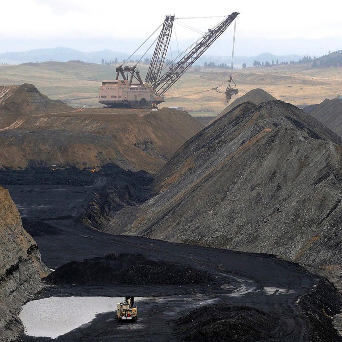
The Powder River region supplies about 40 percent of coal production in the US. Wyoming has been the top coal-producing state in the United States since 1988, accounting for more than twice as much as West Virginia, and more than the entire Appalachian region. The area has been home to the eight largest US coal mines.
Nearly 14 percent of US greenhouse gas emissions come from burning Powder River Basin coal.
It’s a dirty, filthy place. There is no such thing as clean coal. And there sure as heck isn’t any “beautiful, clean coal.” That’s an energy industry myth, popularized by the coal industry and propagated by a recent occupant of the White House.
“Clean coal” refers to coal plants that capture the carbon dioxide emitted from smokestacks and bury it underground as a way of limiting global warming. It’s also known as carbon capture and storage. If you’ve ever driven by or been to a coal mine, you know how stinkin’ dirty it really is.
For us, for today, it’s clean enough here in Gillette to relax, grab a soda, and anticipate the day ahead. By mid-day, we hope to find something photo-worthy.
But first, we jump back on Interstate 90 and ride 30 miles to Moorcroft, population 1,000. Moorcroft sits on the banks of the Belle Fourche River, which we’ll follow off and on much of the rest of the day.
In the latter part of the 19th century, the Belle Fourche River was known as the North Fork of the Cheyenne River. Belle Fourche is a name derived from French meaning “beautiful fork.”
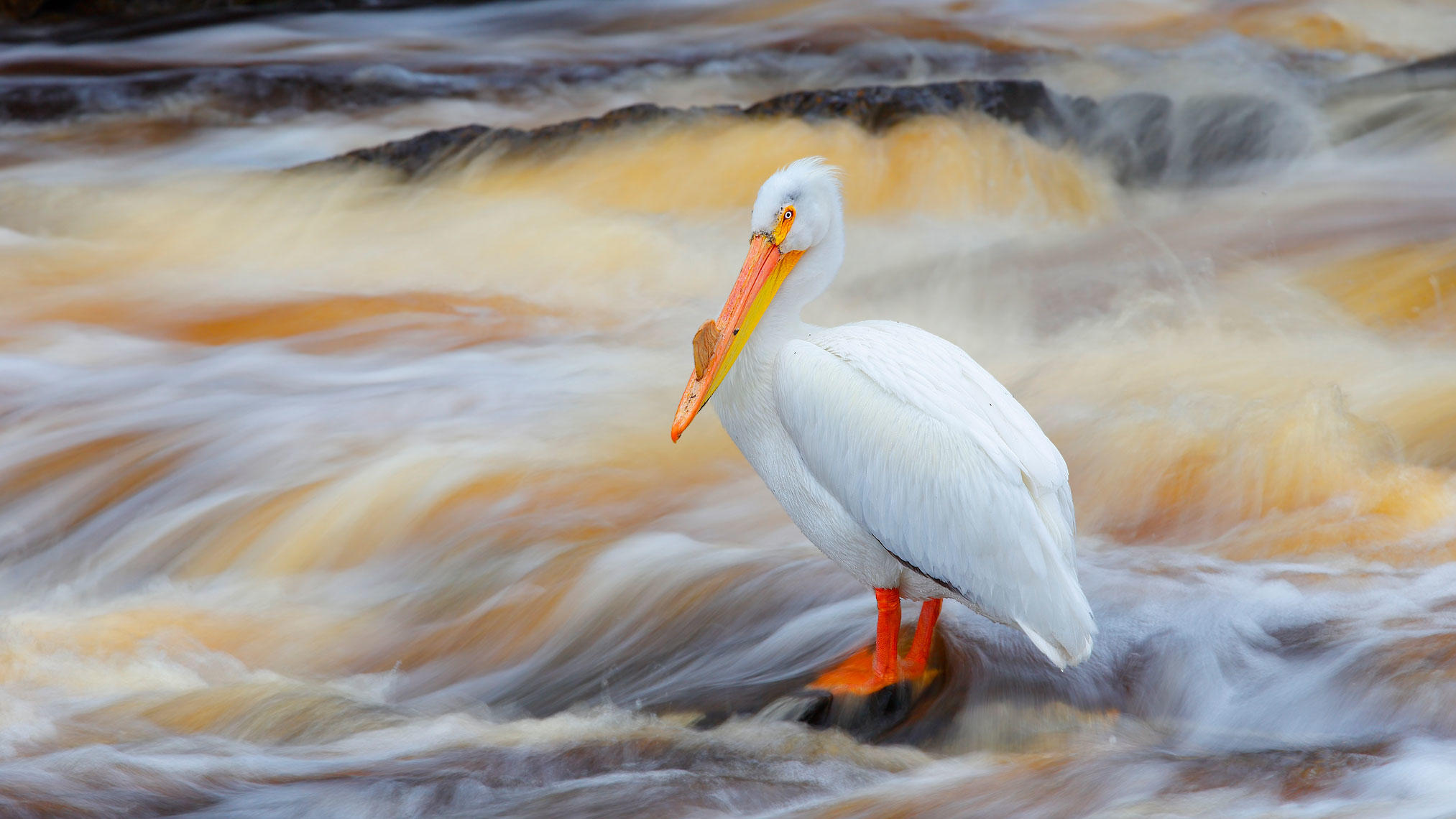
In Moorcroft, we turn north on US Highway 14, which immediately takes us past Keyhole Reservoir and State Park. The area offers a variety of fishing and water sports, in addition to camping, picnicking, hiking and bird watching. About 225 bird species can be observed in the park; during the summer, the most abundant species include the White Pelican, Osprey, Common Yellowthroat and Savannah Sparrow.
***
The mountains that surround Keyhole form the western boundary of the Black Hills, where we’ll spend the next four or five days.
The Black Hills are a small, isolated mountain range rising from the Great Plains, whose highest point is 7,244-foot Black Elk Peak, formerly known as Harney Peak.
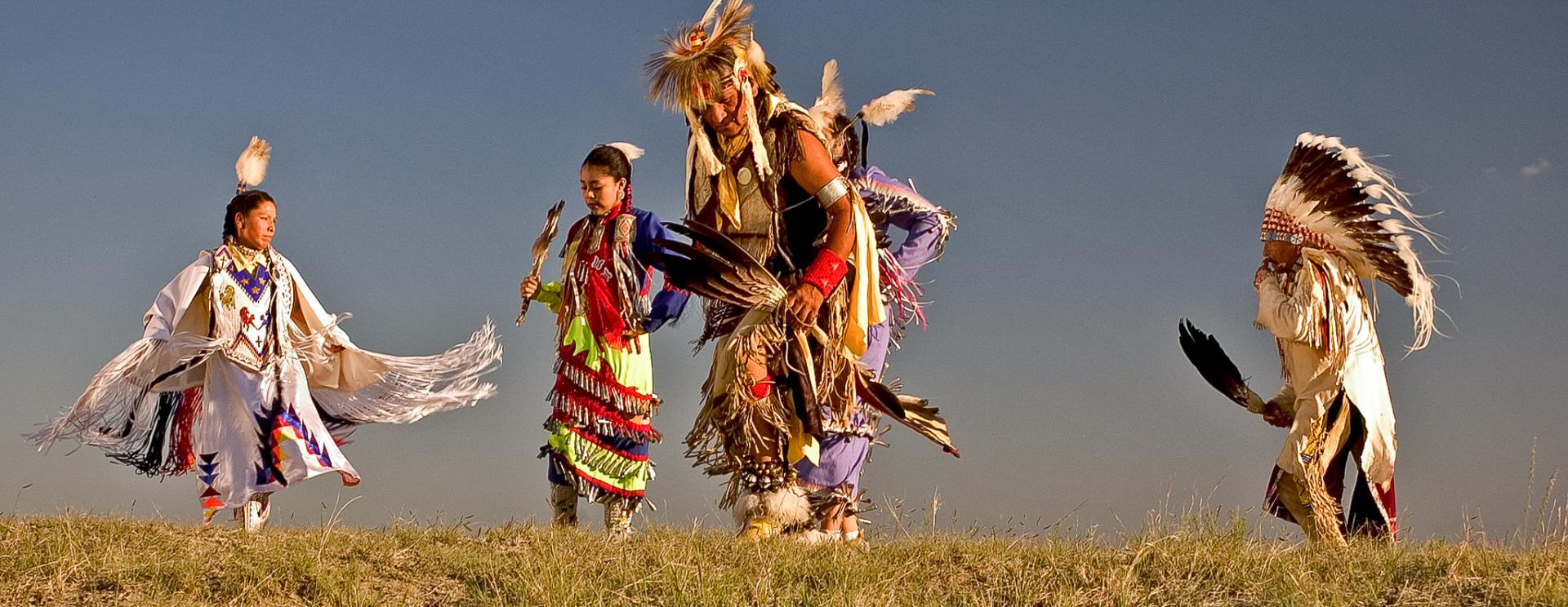
Black Hills? The Lakota Indians considered the hills black because of their dark appearance from a distance, as the hills were covered in trees.
Native Americans have a long history in the Black Hills. After conquering the Cheyenne tribe in 1776, the Lakota took over the territory of the Black Hills. In 1868, the US government signed the Fort Laramie Treaty, which was designed to bring peace between the whites and the Sioux, who agreed to settle within the Black Hills reservation in the Dakota Territory.
The treaty also exempted the Black Hills from all white settlement. Forever. But when an expedition led by General George Custer discovered gold in the Black Hills in 1874, thousands of miners swept into the area in a frenzied gold rush.
During the gold rush, the US Government defeated the Lakota and their Cheyenne and Arapaho allies, taking control of the region, in violation of the Treaty of Fort Laramie. The Lakota never accepted the validity of the US appropriation and to this day, they continue efforts to reclaim the area in the Black Hills that was once theirs.
Today, the Black Hills may be best known for Mount Rushmore and the annual Sturgis motorcycle rally – our ultimate destination on this trip.
***
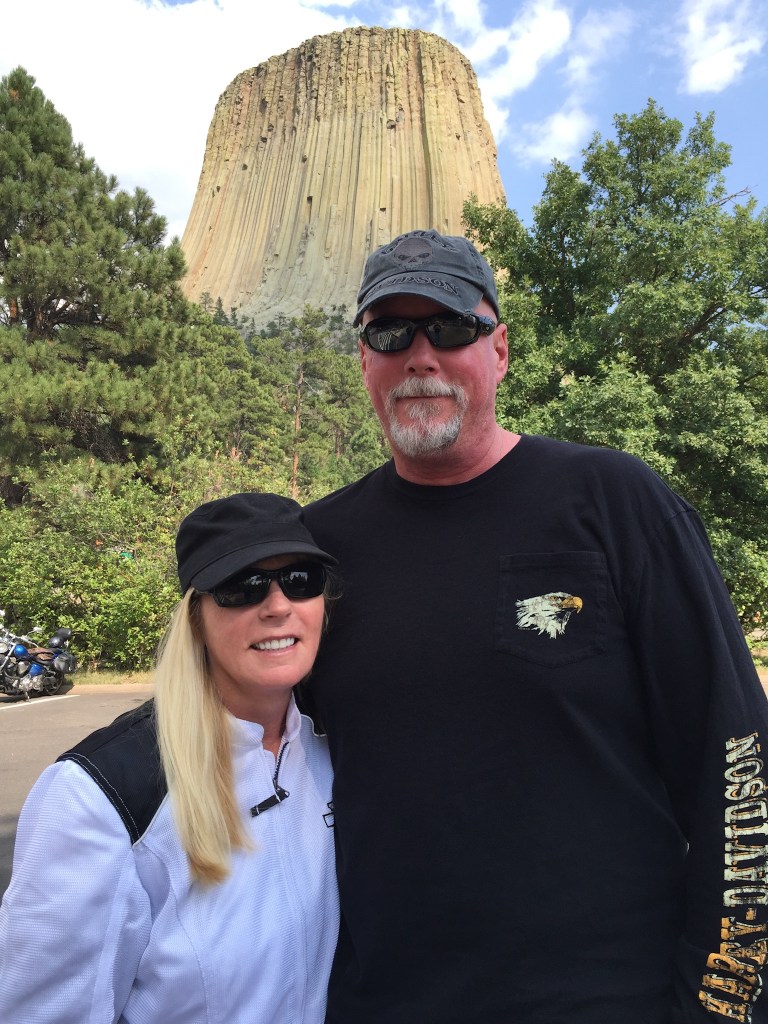
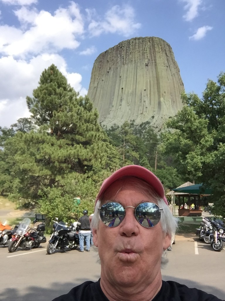
We ride along the western edge of the Black Hills for about 30 miles. Ahead of us appears this huge, quite recognizable monolith: Devils Tower National Monument.
Devils Tower is a laccolithic butte rising dramatically 1,267 feet above the tree-lined Belle Fourche River. The tower itself stands 867 feet, from base to summit. Every year, about 400,000 tourists like us visit Devils Tower. About one percent of them climb it.
In 1906, President Theodore Roosevelt proclaimed the two-square mile park surrounding the tower as America’s first National Monument. The stone pillar is about 1,000 feet in diameter at the bottom, and 275 feet at the top, making it the premier rock-climbing challenge in the Black Hills.
The name Devil’s Tower originated in 1875 during an expedition led by Colonel Richard Dodge, when his interpreter speaking to Native Americans mis-interpreted the name to mean “Bad God’s Tower,” which then became Devil’s Tower. Following standard geographic naming conventions, the apostrophe was dropped and, voila, you have Devils Tower.
The monster monolith is most famous for its role in the 1977 Steven Spielberg movie, Close Encounters of the Third Kind. The movie’s release caused a huge increase in the number of visitors (and climbers) to the monument. Most years, it sees nearly a half-million visitors, almost as many as the Washington Monument.
***
I’m compelled to share a brief story about Devils Tower, one with a very local connection.
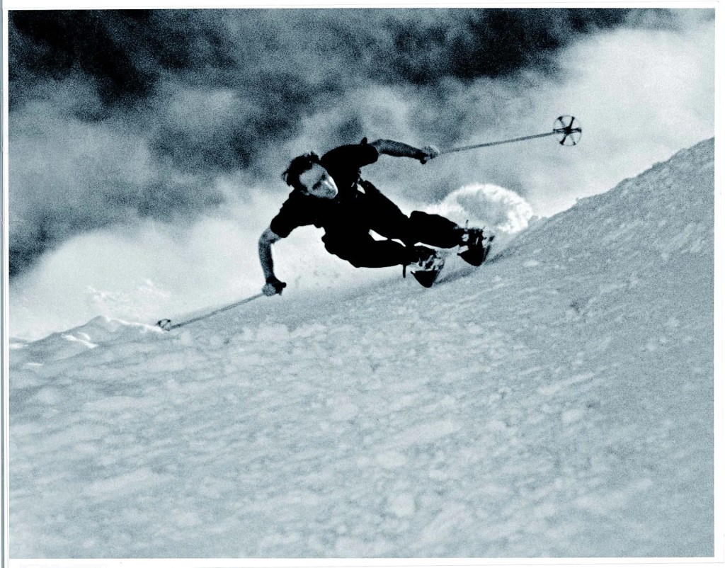
My across-the-street neighbor in Carbondale, Dave Durrance, lit up when I told him I was making a pilgrimage to Devils Tower. Dave is part of the famous Durrance skiing family; his dad, Dick Durrance, was the most accomplished ski racer of his time, winning 17 national championships in the 1930s and ‘40s. He was the Bode Miller of his time. Dick, who later led the Aspen Skiing Company, and the Alta ski resort in Utah, is in the US Skiing and Snowboarding Hall of Fame.
But this story isn’t about Dick.
Dick’s brother, and Dave’s uncle, Jack Durrance, made one of the first ascents of Devils Tower in 1938, pioneering what has since become known among climbers as the “Durrance Route.” The route, now the most popular way up Devils Tower for modern climbers, is recognized in the historic climbing text, Fifty Classic Climbs of North America. Three years after inventing the Durrance Route, Jack Durrance made news for a daring rescue mission atop Devils Tower, volunteering to bail out a parachutist stuck on top of the monolith. It’s quite a story.
The Durrance family is a Colorado treasure. I’m fortunate enough to ski several times every season at Snowmass with Dave, a former racer, coach and member of the US National Ski Team. His technique and style are as precise as his artwork. Even at age 75, he is a blur coming down the mountain.
Whoosh!
***
Our Devils Tower experience complete, we now head for the heart of the Black Hills.
US Highway 14 brings us to Sundance, population about 1,200. Sundance is named after the Sun Dance ceremony practiced by several American Indian tribes, which often involves the community gathering together to pray for healing.
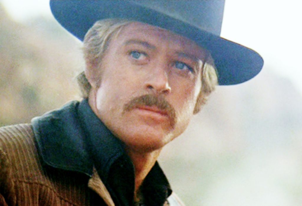
The town is perhaps best known for someone who passed through it in the late 19thcentury. After his release from the Sundance jail in 1888, Harry Longabaugh, an outlaw and member of Butch Cassidy’s Wild Bunch, acquired the moniker, “The Sundance Kid.”
His nickname entered the popular culture with 1969 release of the movie Butch Cassidy and the Sundance Kid. Robert Redford, who portrayed Longabaugh in the movie, later named his Sundance Ski Resort near Provo, Utah, and the Sundance Film Festival, after this character.
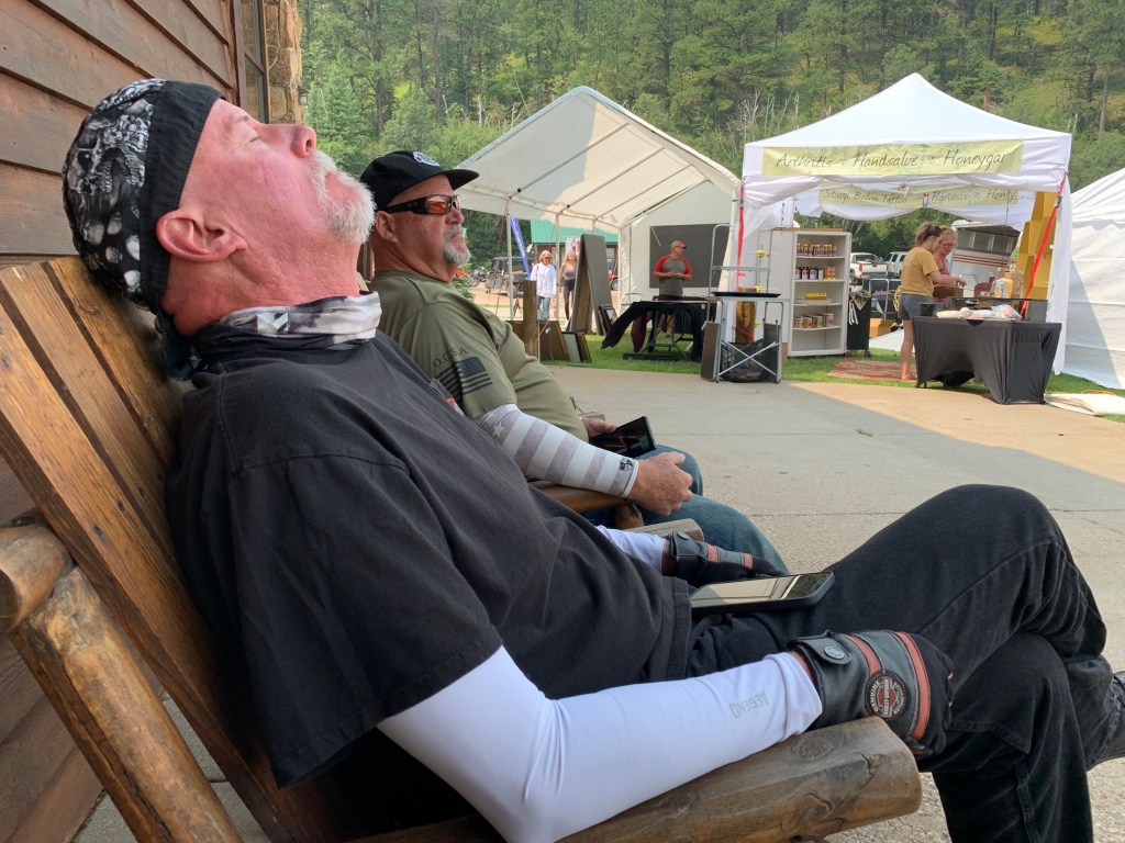
Another surprise in Sundance: even though it’s a small town seemingly in the middle of nowhere, it has a Harley dealer, Deluxe Harley-Davidson. As Dave and Scott will tell you, it’s not possible to have too many Harley stores; you should see their t-shirt collections!
***
In Sundance we reluctantly reboard Interstate 90. Thankfully, we’re on it for less than six miles, before exiting.
We cross Sundance Creek, and leave the Interstate on Moskee Road. Moskee had its beginning in the early 1900s as a lumber and sawmill town. Today it’s a ghost town.
Moskee Road delivers us to Buckley Canyon, which gives way to Grand Canyon Road. In less than 10 miles, we cross into South Dakota, named after the Lakota and Dakota Sioux Native American tribes. Dakota is the Sioux word for “friends” or “allies.”
The Sioux dominated the area in the 1800s. By the late 19thcentury, European-American settlement intensified after a gold rush in the Black Hills and the construction of railroads from the east. Encroaching miners and settlers triggered a number of wars with Indian tribes, ending with the Wounded Knee Massacre in 1890. The Battle of Wounded Knee was a massacre of several hundred Lakota Indians, almost half of whom were women and children, by US Army soldiers.
South Dakota’s official website uses the tagline, “Great Faces. Great Places” – also the state’s official slogan. The Great Faces are a reference to the four US Presidents, whose likenesses are carved into Mount Rushmore, which we’ll visit tomorrow.
***
As we cross into South Dakota, Grand Canyon Road becomes Wagon Canyon Road, then Roughlock Falls Road. Of course, it takes us to Roughlock Falls, which got its name from pioneers who “roughlocked” their wheels when traveling down the canyon, to prevent the wagons from rolling freely.
Just past Roughlock Falls, at the ghost town of Savoy, we turn onto US Highway 14, which brings us to Cheyenne Crossing, at the south entrance to Spearfish Canyon National Scenic Byway.
Cheyenne Crossing is also home to the Stage Stop Café, known widely for having the best Indian tacos in the Black Hills. For the curious, Indian tacos, also known as Navajo tacos, are made with Indian fry bread instead of tortillas.
After Native Americans were relocated to reservations, beginning in 1851, they were rationed flour, powdered milk, salt, and lard. From these rations, Indian tacos were invented. Since then, they have become a common food in states with large Native American populations.
Hungry for Indian tacos? Here’s a good recipe.
***
In Cheyenne Crossing, we continue east on US Highway 14, rolling past the Terry Peak Ski Area, which calls itself the “best kept secret” in the Midwest. Terry Peak draws sklers from all of South Dakota and slices of Wyoming, North Dakota, Nebraska and Minnesota. Midwesterners drive up to eight hours to sample its 1,052-foot vertical feet of skiing.
The area opened in 1936 with one rope tow built by the Bald Mountain Ski Club. Terry Peak got its first chairlift in 1954, and today has four lifts, 30 runs and 450 skiable acres.
The city of Lead, population about 3,000, is just a few miles ahead on our route. Lead (pronounced “leed”) was named for its deposits of valuable ores. It’s the site of the Homestake Mine, the oldest, largest, deepest (8,240 feet) and most productive gold mine in the Western Hemisphere, before it closed in 2002 after 125 years of operation.
The Homestake Mining Company founded the city of Lead as a company town for its employees. At its peak, the mine employed 2,200 workers and supported a vibrant community with virtually no unemployment.
The mine produced more than 40 million troy ounces of gold during its lifetime, before low gold prices, poor ore quality, and high costs caused its demise. During its heyday, Lead was the economic engine of South Dakota, led by the Homestake Mine.
***
Just east of Lead, we turn south on US Highway 385, riding past Tomahawk Lake Country Club until the road intersects with Nemo Road. Nemo was established in 1877, and of course, was named after the clownfish made famous in the 2003 Pixar movie, Finding Nemo.

For you Nemo fans, there are 28 species of clownfish. The most common clownfish, and the one that looks most like Nemo, is the percula clown fish. It’s bright orange with white stripes. Clownfish live on the ocean floor. And, of course, in South Dakota’s Black Hills.
We roll through Nemo – there’s little to see other than clownfish littering the highway – and continue on our way to Rapid City, tonight’s destination – only 23 miles away.
Nemo Road eventually becomes South Canyon Road, and takes us directly into Rapid City, South Dakota’s second-largest city, after Sioux Falls. The city is named after Rapid Creek, where the settlement began in the 1870s.
The public discovery of gold in 1874 by the Black Hills Expedition, led by George Armstrong Custer, brought a mass influx of European-American miners and eventual settlers into this region of the Dakota Territory.
Rapid City, known as the “Gateway to the Black Hills,” is our home for the next four days.
Time to unpack!
***
Day Twelve Summary: 249 miles. Black Hills, Devils Tower, finding Nemo.
Click here to see today’s complete route from Buffalo, Wyoming, to Rapid City, South Dakota.
Today’s fun facts, favorite foods, funky place names and famous folks:
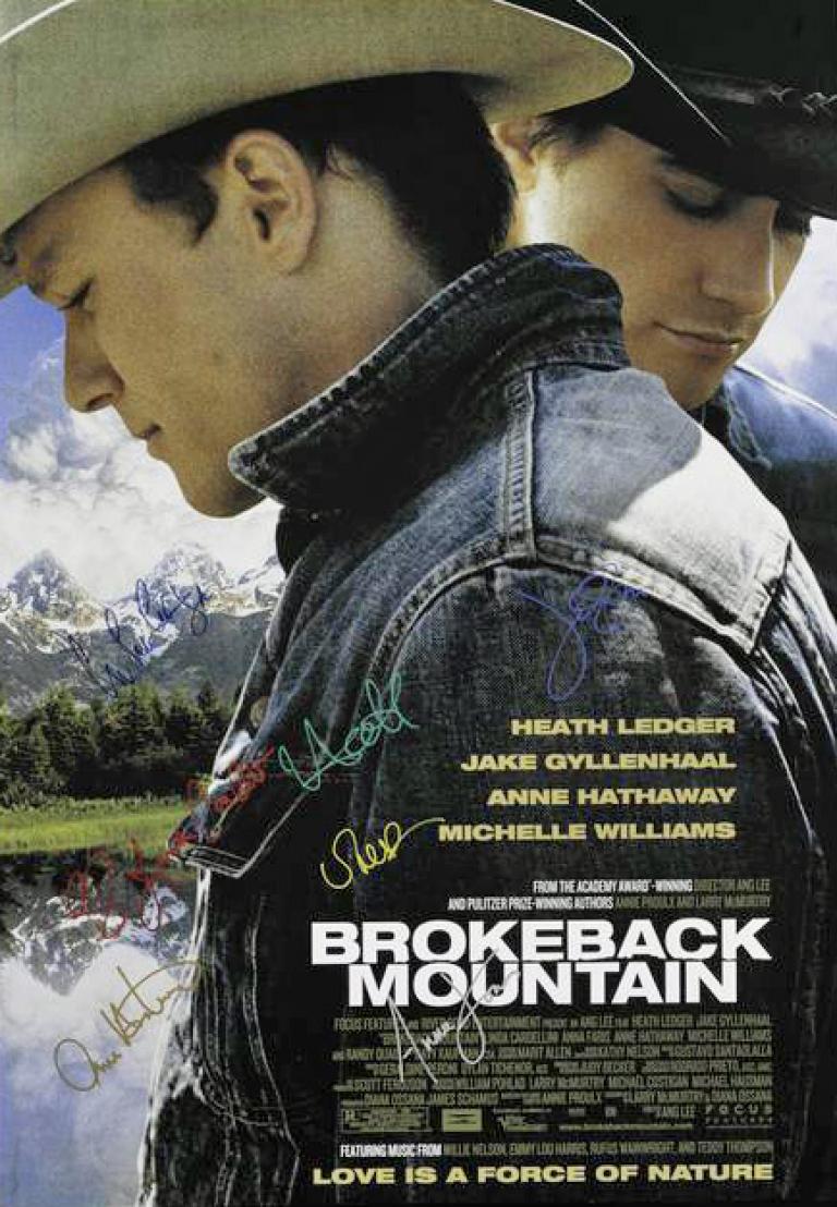
Wyoming fun fact: There is no Brokeback Mountain in Wyoming. The 2005 film was set in the mountains of Wyoming, but was actually filmed in Alberta, Canada. According to the state’s director of Tourism, the movie increased Wyoming tourism more than any other movie since Close Encounters of the Third Kind brought visitors to Devils Tower.
South Dakota fun fact: South Dakota is the home of the Dakota, Lakota and Nakota tribes, which make up the Sioux Nation. South Dakota has one of the largest Native American populations, with nine official tribes and 60,000 people.
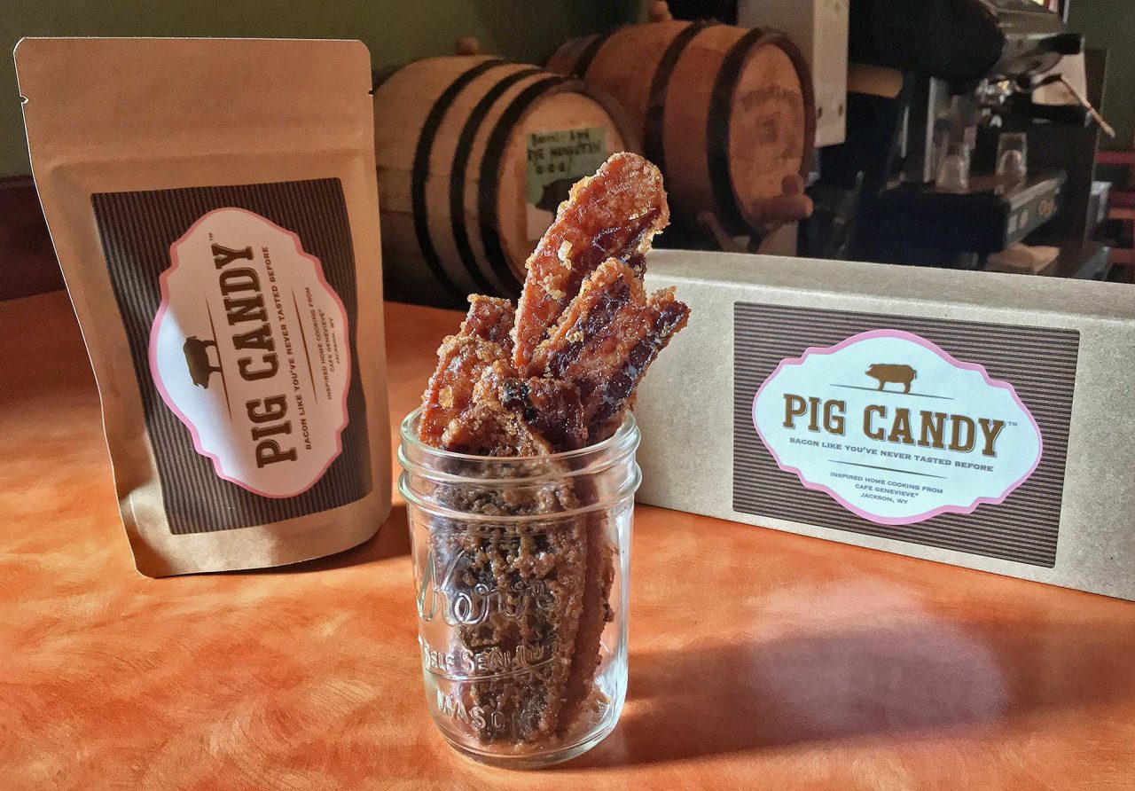
Wyoming: When in Jackson, stop at Café Genevieve, and try their Pig Candy. Yes, Pig Candy. It’s a bacon lover’s dream come true. Thick applewood-smoked bacon is cooked fresh daily and covered in a blend of sugars and spices; it’s baked “low and slow,” which results in the ultimate coating.
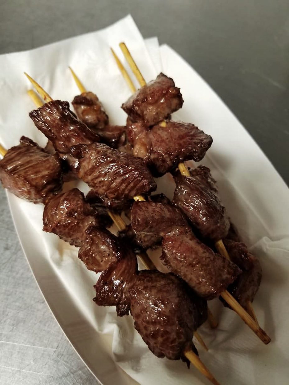
South Dakota favorite food: You can’t visit South Dakota without trying Chislic. Made from lamb, beef, deer or venison, these half-inch meat cubes are grilled or deep-fried to perfection. In 2018, the South Dakota Legislature named Chislic as the state’s “Official nosh.” When in Sioux Falls, you’ve gotta go to Urban Chislic, a new restaurant where you select your meat and choose from 18 different dipping sauces or 9 dry rubs. All Chislic, all the time!
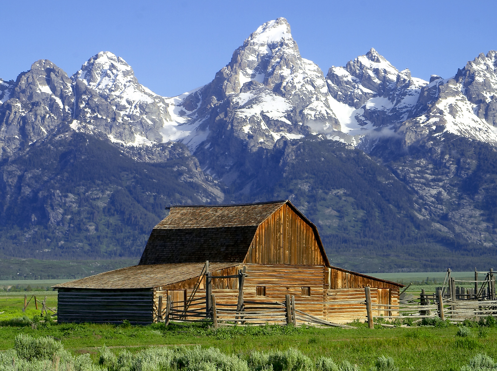
Wyoming funky place name: The Mormon Row Historic District is in Grand Teton National Park, near the town of Moose – which we visited last week. In the late 1800s, leaders of Mormon Church sent parties from the Salt Lake Valley to establish new communities and support their expanding population. The homesteading area was known as Mormon Row, and is now on the National Register of Historic Places.
South Dakota funky place name: The town of Running Water, population 36, sits in the southeast part of the state, near the confluence of the Niobrara and Missouri rivers. That’s where Running Water got its name. The meeting of those two rivers created a current that French trappers and explorers called, L’eau Qui Court (“the waters that run”).

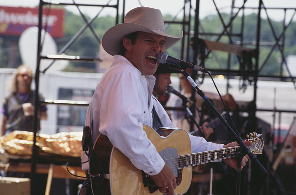
Wyoming famous folk: Country music singer/songwriter and rodeo champion Chris LeDoux grew up in Cheyenne, and lived much of his life in Wyoming. To help pay his expenses while traveling the country on the national rodeo circuit, he began composing and singing songs, describing his lifestyle. LeDoux recorded three dozen albums, was nominated for a Grammy, and honored with the Academy of Country Music Cliffie Stone Pioneer Award. He died in 2005 at the age of 56.
South Dakota famous folk: Former US Congressman and Senator George McGovern grew up in Mitchell, South Dakota before embarking on a lifelong career in public service. McGovern was one of the first and best-known politicians to strongly oppose the Vietnam War. He may be best remembered nationally for his 1972 presidential run against Richard Nixon, losing in one of the biggest landslides in US history. McGovern died in 2012 at the age of 90.

Sturgis, anyone?
Vroom.
A look ahead @ tomorrow: Mount Rushmore.

Hi Gary…Your Awesome blogs were worth the two year wait😍⛷
Stay Safe .. my ❤️to You&Sarah
LikeLike
Hey, Peggy’s in the house! Glad you’ve been lurking, and nice to hear from you. Colorado is still awaiting your visit. Vroom!
LikeLiked by 1 person