Four Harley riders, stricken by the Covid-19 shitstorm and deprived of a 2020 trip, are set to rumble. It’s been two years since the posse last hit the road. Time to get moving.
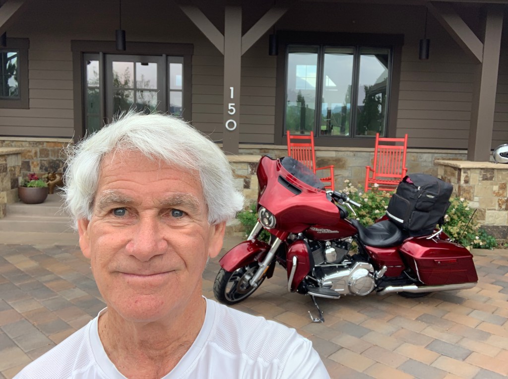
This morning, I exit Carbondale. Alone. Destination: Vernal, Utah.
Riding companions Dave and Scott, are on their way to Vernal, too. They’re coming from southern California (La Habra) and southern Nevada (Henderson). With any luck, we’ll meet for dinner tonight in Vernal.
The fourth member of this year’s posse, Randy, is still in Seattle. He’s getting ready to meet us somewhere in Idaho, later this week. Randy will likely show up with a black Kawasaki, chauffeured in the back of an F-150 pickup truck. We love him, anyway. Dude has style.
I leave our Cozy Carbondale Cottage, ride a mile through the River Valley Ranch community Sarah and I call home, and head south on Colorado Highway 133.
We’re on our way to Sturgis!
The Crystal River is on my left. The views are stunning. We are so blessed to live in this Rocky Mountain paradise.
Soon, I pass Avalanche Ranch, a secluded hot springs with 18 cabins and gorgeous views of the valley. While staying at Avalanche Ranch, you can fish, hike, bike, and canoe on the Crystal River. In the winter months, snowshoeing, sledding, skiing, and tubing are popular.
Year-round, it’s an in-demand wedding destination.
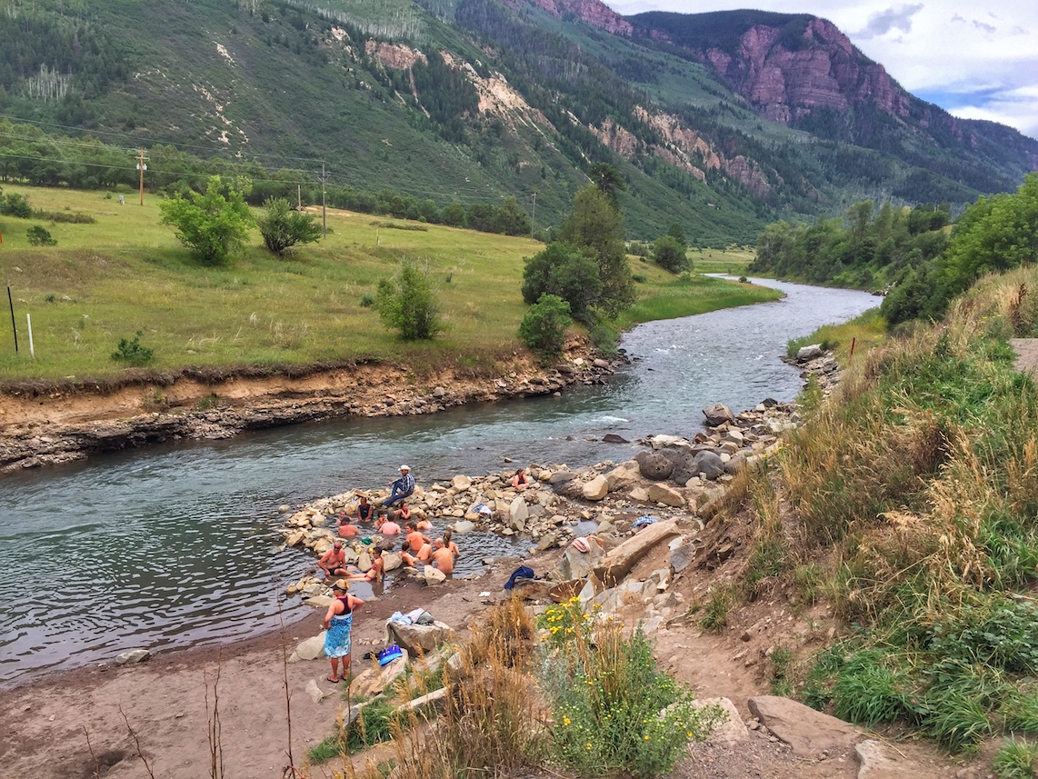
About a mile past Avalanche Ranch, a few hundred feet north of mile marker 55, is Penny Hot Springs. It’s a low-key, clothing-optional pool used by locals who aren’t interested in spending money on commercial hot springs in nearby Glenwood Springs. Penny Hot Springs is free. Whether you want to or not, you might see some skin there.
The hot springs are named for Dan Penny, who in the 1960s ran a small hotel and bathhouse on the railroad line upstream of Avalanche Creek. Visitors would stay at his hotel, visit the hot springs bathhouse, remove their clothes, and in the free-spirited manner of the ‘60s, soak up the Rocky Mountain vibes in the nude.
At Penny Hot Springs, white-hot spring water mixes with the frigid Crystal River and creates varied temperature pools, depending on how much river water is allowed into the rock pools. Penny Hot Springs is a bare bones, completely natural experience.
For those who love soaking in hot springs – and paying for it – there’s actually a Colorado Historic Hot Springs Loop. The loop takes you on a driving tour of the state’s best hot springs. The springs are all within a day’s ride of here.
Ride. Soak. Relax. Repeat.
Maybe another time.
***
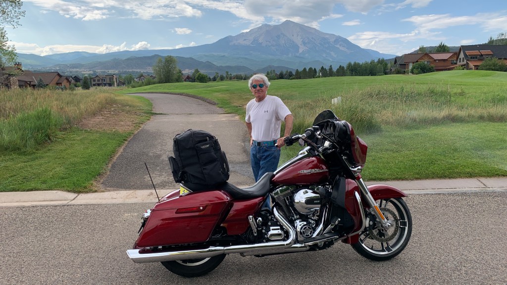
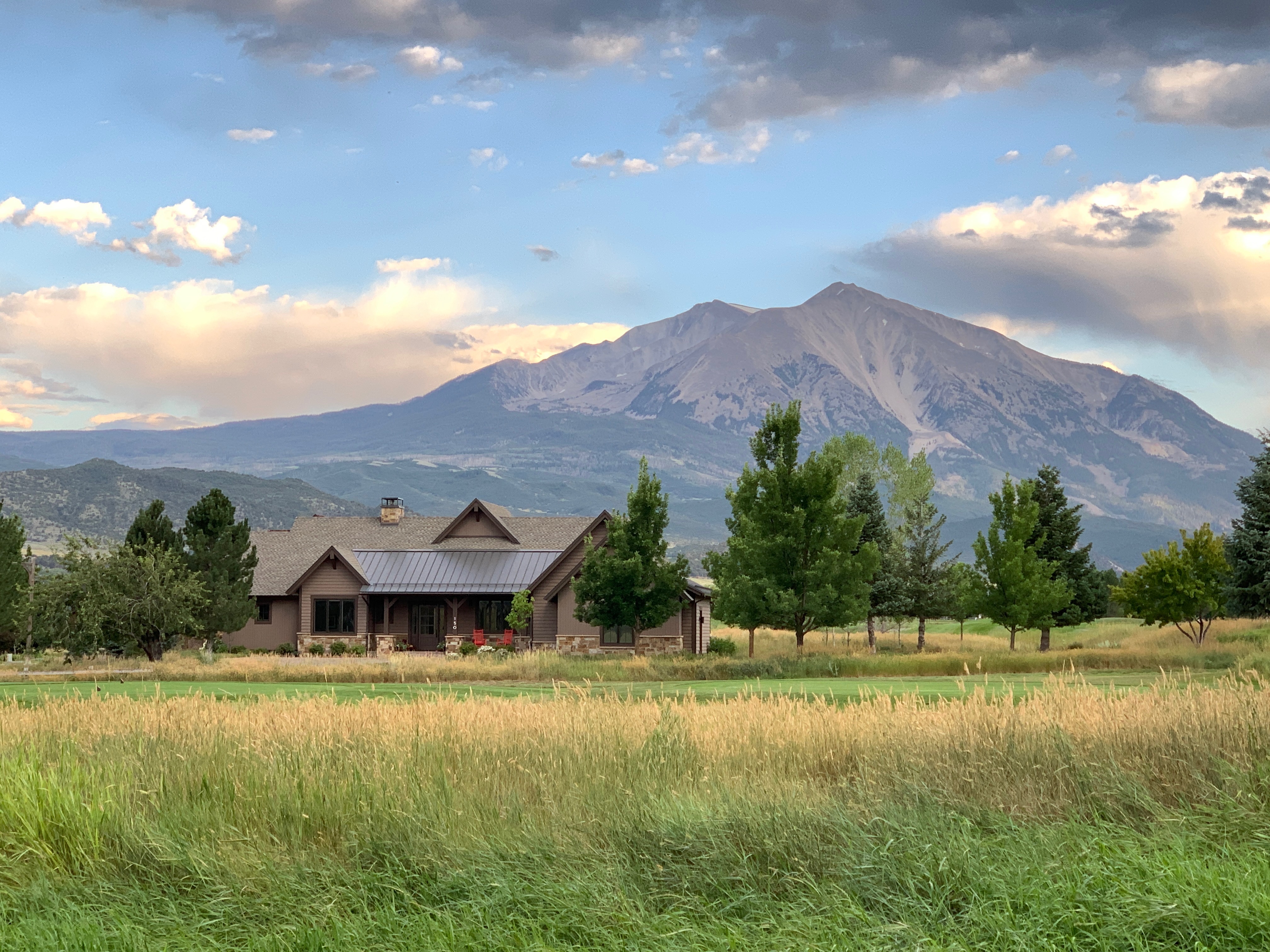
As I continue south on Highway 133, Mount Sopris is on my left. You can’t miss it. The mountain is named for Richard Sopris, former prospector, mayor of Denver, and part of the first European expedition in the Roaring Fork Valley. He surveyed the area around the mountain in 1860 on a mapping and gold exploration trip.
His group traveled only as far as the base of the mountain. The details they collected while exploring the area were used in creating the first maps of what was then the Colorado Territory.
Sopris is a popular summer hike for locals. It’s a little more than 13 miles to the summit and back, with a vertical rise from the trailhead of about 4,400 feet. The average grade is 12 percent, with a maximum steepness of 34 percent near the top. This is not a leisurely day hike.
A lot of hikers camp overnight at Thomas Lakes – a little more than halfway up – then complete the remaining three miles to the peak the next day. From Thomas Lakes, the first mile or so is along a dirt trail, but from there on, beginning at around 11,800 feet, it’s mostly jagged and loose rocks until you reach the top. If you like scree fields and talus, this is the perfect place for you. The final 1,000 feet is really more of a scramble than a hike.
But getting to the top has a huge payoff. The views are spectacular, including McClure Pass to the south, the Elk Mountains, and classic 14,000-foot peaks like Maroon Bells, Pyramid Peak, Capitol Peak and Snowmass Peak.
Mount Sopris, part of the Elk Mountain Range, is the dominant feature in almost any photo of the Roaring Fork Valley. At 12,953 feet, Sopris is the view everyone in the valley wants to have. Sarah and I are lucky enough to see it, bigger-than-life, every single day.
Life is good.
From Carbondale, as I continue along the West Elk Scenic Byway, it’s about 16 miles south to the nearest town, Redstone. By the time I roll past Redstone, I’ve already climbed about 1,000 feet.
Known as the “Ruby of the Rockies,” Redstone sits at 7,200 feet, on the banks of the Crystal River. It’s an unimaginably beautiful setting for a Colorado mountain town.
Redstone is a charming little village, home to about 130 residents. Here you’ll find the Redstone Castle, an opulent 42-room Tudor-style mansion that’s listed on the National Register of Historic Places. After years of distress, the castle was recently purchased, restored, and reopened. And now it’s for sale, again. For $16,900,000 — it could be yours! Our friend, Jeff Bier, has the listing. Nice commission on that sale!
About five miles south of Redstone, there’s a turnoff to the town of Marble. If I turn onto Gunnison County Road 3, I’d arrive in Marble about 20 minutes from now, in time for a very early lunch.
Marble is located in a valley of the upper Crystal River, surrounded by the tall peaks of the Maroon Bells-Snowmass and Raggeds Wilderness Areas.
The Town of Marble got its name from the stone that is quarried there: Yule Marble. It’s the only place on earth where Yule Marble is found. This beautiful white marble from Marble provided the stone for the exterior of the Lincoln Memorial, and the Tomb of the Unknown Soldier at Arlington National Cemetery.
To most of the world, Marble is famous for its marble.
For me, the best part about Marble is Slow Groovin’, the BBQ restaurant that attracts foodies from all over western Colorado. Two years ago, Dave and I took part in the 2018 Rocky Mountain Rib Rally – an opportunity to explore beautiful scenery, then visit restaurants each evening in search of Colorado’s best ribs.
At the end of two weeks on the road, after riding all over Colorado and thoughtfully evaluating Rocky Mountain grill masters, we ranked the state’s tastiest ribs. Turns out we didn’t have to go far to find the best.
Slow Groovin’ topped on our list.
***
I still have 260 miles to go before parking my bike for the day.
This is no time for early morning ribs. So I roll past the turnoff to Marble and continue south on Colorado Highway 133. Almost immediately, I begin the steep climb toward McClure Pass.
At 8,763 feet, the pass sits on the boundary between Pitkin and Gunnison Counties. The approaches on either side of the pass have an eight percent grade, making McClure Pass among the steepest in Colorado, joining Red Mountain Pass and Hoosier Pass, also at eight percent. The only Colorado pass that’s steeper is Slumgullion Pass, with a 9.4% grade.
Thomas McClure, a local farmer and Irish mining immigrant, is credited with cutting the first road leading from the Crystal River Valley over “McClure’s Pass” to the North Fork of the Gunnison River. He’s also known for developing the “Red McClure” potato in the early 1900s. By the 1930s, the Roaring Fork Valley exported more than 400 rail cars filled with potatoes every year, more than the entire state of Idaho.
Times change.
Today, Colorado produces less than five percent of all US potatoes. Idaho, whose license plates tout its “Famous Potatoes,” raises more than 30 percent of all spuds grown in the US. In two days, we’ll be deep into potato country when we roll through Idaho. You can expect to learn a lot more about potatoes then.

***
Once over McClure Pass, I begin the descent toward Paonia. Along the way, I pass Paonia State Park and Paonia Reservoir. I’m now following the North Fork of the Gunnison River.
This is coal country, or at least what used to be coal country. The mines in Somerset and Bowie, producing Uintah coal, aren’t what they used to be. Employment and production have both plummeted precipitously. The future of coal in the west is grim.
Ten minutes past the Bowie coal mine, I roll through the town of Paonia, population 1,500. Paonia is known today for its fruit orchards, which produce peaches, apples, cherries, pears, and plums. There are also wineries galore, including Black Bridge, Stone Cottage Cellars, and Endless Endeavor.
The Paonia area is one of the few regions of Colorado that has successfully cultivated and bottled a pinot noir. Black Bridge Winery offers a Beezley Block Pinot, made entirely from grapes harvested at their peak of flavors. The name “Beezley Block” honors the tough, pioneer farmers who cleared the land where the vineyard prospers today.
If this weren’t a Harley adventure, I’d have some excellent wine tasting in my future.
Nine miles past Paonia, I arrive in Hotchkiss, a town of less than 1,000 residents, named after Enos T. Hotchkiss, a local pioneer who settled here in the 1880s. Hotchkiss calls itself the “Friendliest Town Around.” For me, Hotchkiss is a prime lunch destination for summer Harley rides – 132 miles (round trip) to Zach’s and back.
Today In Hotchkiss, I turn onto Colorado Highway 92 and head toward Delta – about 20 miles to the west. The city of Delta isn’t much to get excited about.
The town’s symbol is an 85-foot cottonwood tree, known as the Ute Council Tree. It was once a gathering point for tribal discussions. Today, the tree symbolizes the growing connections between Colorado Utes and the Western Slope’s other residents. It’s dedicated to Chief Ouray and his wife, Chipeta, who strove to keep peace between the Utes and the white man. Chief Ouray met with white settlers under this very tree, well before there was a city of Delta.
Delta got its name because of its location on the delta where the Uncompahgre River flows into the Gunnison River. Delta has other meanings and uses. It’s also the fourth letter of the Greek alphabet. Uppercase Delta “Δ” is the symbol for change in any changeable quantity, in both math and science. Just sayin’ …
Delta is right off US Highway 50, which crosses 12 states, connecting Delta with Sacramento, California, to the west – and Ocean City, Maryland, to the east.
***
Leaving Delta, I head west on Highway 50 toward Grand Junction, about 40 miles away. I’m riding along the edge of the Dominguez-Escalante National Conservation Area – 210,172 acres of protected public lands. Dominguez-Escalante, with its red rock canyons and sandstone bluffs, is part of the Uncompahgre Plateau.
As I roll past this conservation area, I’m not far from the Gunnison River. Eventually the Gunnison River empties into the Colorado River. When that happens, I’ll be in Grand Junction, the largest city on Colorado’s Western Slope.
The Grand in Grand Junction refers to the Grand River, renamed the Upper Colorado in 1921. And Junction, of course, refers to the confluence of the two major rivers – the Colorado and Gunnison.
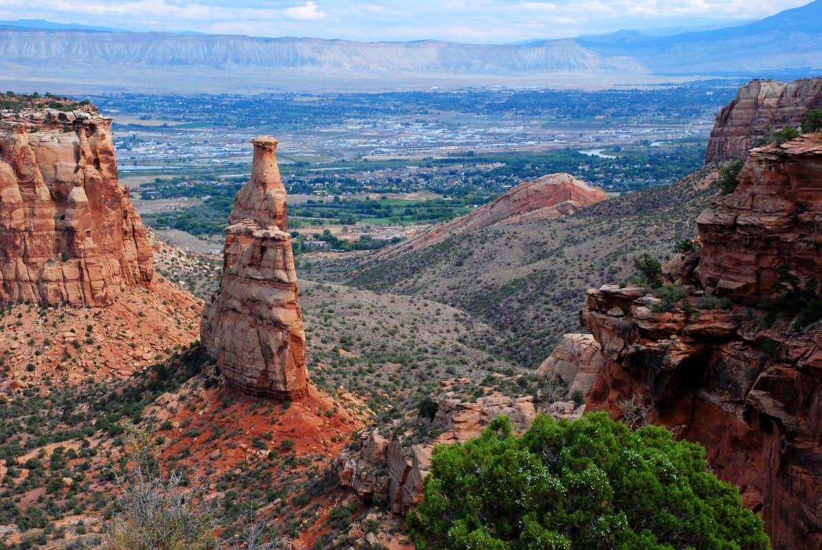
Where the two rivers meet, I turn west on Monument Road, so named because it takes us to Colorado National Monument. The monument’s 32 square miles include red rock canyons and a breathtaking sheer-walled landscape.
The featured attraction is Monument Canyon, which includes rock formations such as 450-foot-high Independence Monument, the canyon’s tallest freestanding formation and its most iconic landmark.
There are several ways to experience this huge monolith: Drive to the Independence Monument View pullout, which is what I do. Or, for the super adventurous, you can climb to the top, after first hiking 12 miles to its base.
Every Fourth of July for the past 110 years, climbers ascend to the top of Independence Monument, and unfurl a large American flag.
***
Leaving Colorado National Monument, I arrive at the city of Fruita, once known for its fruit production. Today, it’s better known for mountain biking, hiking, rafting, and its proximity to the Colorado National Monument.
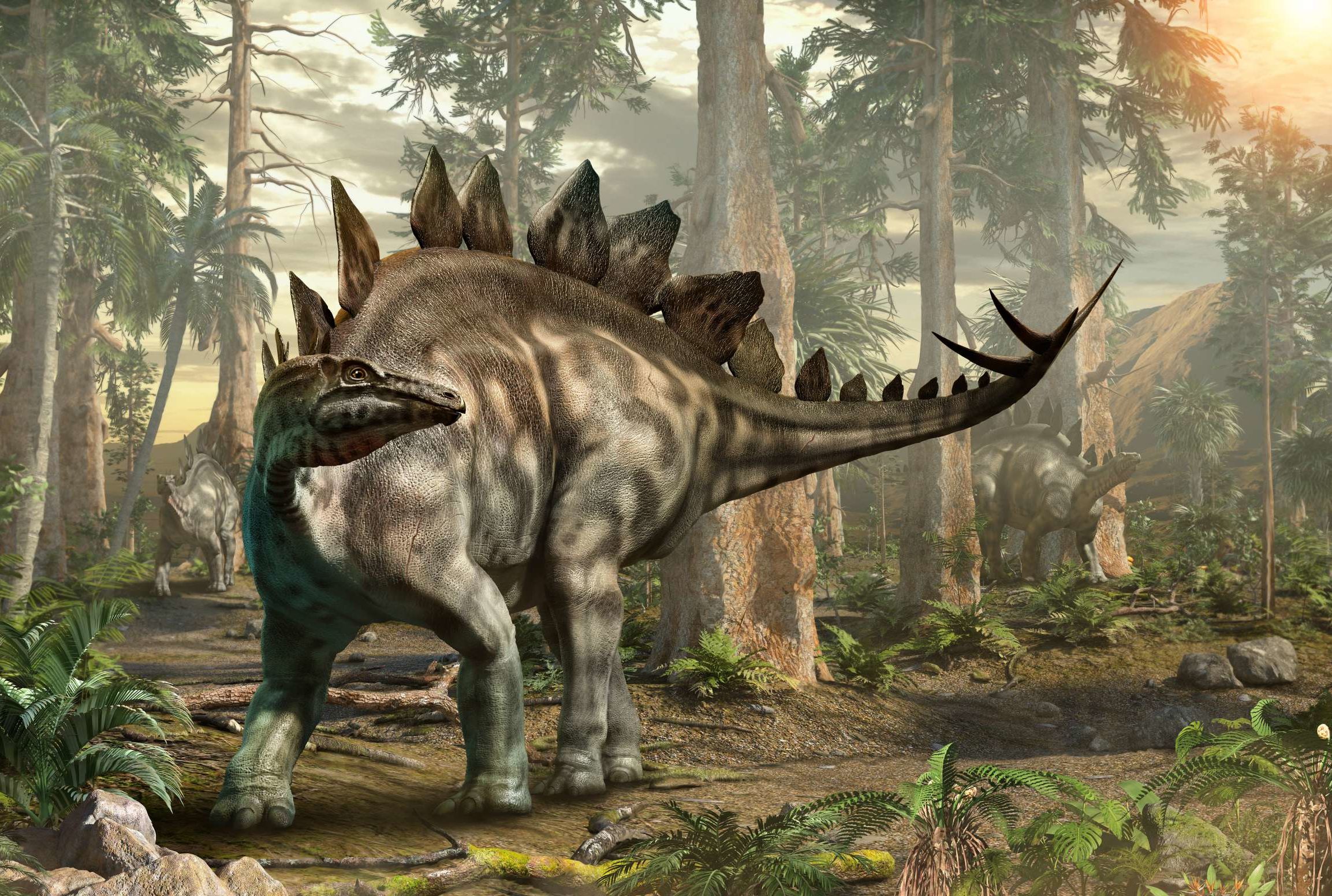
Fruita is home to the Western Colorado Dinosaur Museum. I am in the heart of dinosaur country, a paleontologist’s fantasyland.
Here, you could discover that Colorado’s state dinosaur is the Stegosaurus. The Stegosaurus was a large herbivorous dinosaur that lived in the area now called Colorado, 150 million years ago. This was the mid-Jurassic to the late Cretaceous period.
Colorado is one of eight states to have an official state dinosaur.
In Fruita, after 150 miles of riding since leaving Carbondale this morning, I stop for gas, and plan the remainder of today’s ride through dinosaur country.
I leave Fruita and head northwest on US Highway 50, toward the town of Loma, whose name comes from a Spanish word meaning “small hill.” Here, I turn onto Colorado Highway 139, and head north. The highway, also known as Douglas Pass Road, leads to 8,205-foot Douglas Pass, in the Bookcliff Mountains.
Along the way, I have views of Utah’s La Sal Mountains, which have a dozen peaks over 12,000 feet. La Sal means “the salt.”
This area is sparsely populated. There isn’t much to see for about 70 miles until I come to the town of Rangely, population 2,400.
An unexpected treat in Rangely is its Automotive Museum, a collection of 35 classic cars, and even a 1907 Indian motorcycle. It’s ranked #2 on the list of top things to do in Rangely.
Rangely, which has a golf course, gas stations, a community college, and a hospital, is the last civilization of note I’ll see until reaching today’s destination an hour from now.
***
Leaving Rangely, I head west on Colorado Highway 64, and roll through the town of Dinosaur. With a population of just over 300, there’s not much in Dinosaur, though the town does have three marijuana shops, including – you guessed it – the Dino Dispensary.
Dinosaur was originally known as Baxter Springs, then renamed Artesia for its valued water supply. The name was changed again to Dinosaur in 1966, hoping to capitalize on the town’s proximity to Dinosaur National Monument, which gets about 300,000 visitors a year. The monument’s headquarters, the Canyon Visitor Center, is just east of town on US Highway 40.
In Dinosaur, I turn west on Highway 40, and in a few miles, I’m in Utah, home for many years to the “Greatest Snow on Earth” license plate. It does get cold and snowy in this part of Utah during the winter, but the nearest ski area is Park City, about 100 miles west.
Dinosaur National Monument is just north of here on the southeast flank of the Uinta Mountains. The monument, about an hour’s drive southeast from the city of Price, is in both Utah and Colorado. It boasts one of the densest concentrations of Jurassic dinosaur fossils in the world. The bones are just as nature arranged them, 150 million years ago, deposited by an ancient stream.
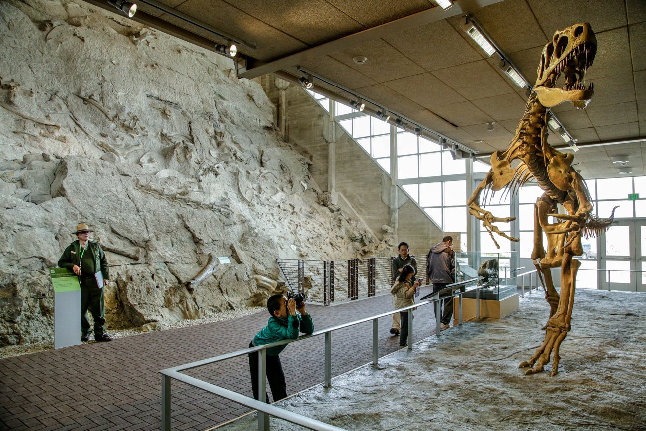
Although most of the monument area is in Colorado, the Dinosaur Quarry and its exhibit hall are in Utah. For the adventurous, you can find more than 800 paleontological sites and fossils of dinosaurs, including the Allosaurus, Utah’s official state fossil.
The Allosaurus was the predominant North American predator during the Late Jurassic period. It measured around 16 feet in height, 39 feet in length, and weighed in at about four tons.
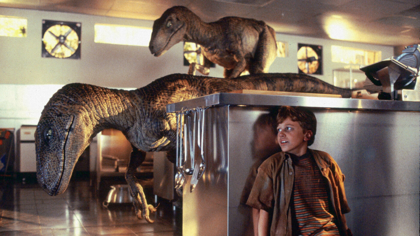
The Allosaurus is Utah’s official state fossil, not to be confused with the official state dinosaur. In 2018, Utah Governor Gary Herbert signed into a law a bill making the Utahraptor the official state dinosaur. The Utahraptor is a cousin of the Velociraptor, made famous by the Hollywood movie, Jurassic Park.
Weighing up to 1,000 pounds and being up to 23 feet long, the Utahraptor was conslderably larger than the Velociraptor. Unlike its Jurassic Park portrayal, the Velociraptor was actually the size of a turkey, weighing only about 30 pounds.
Both had lethal killing claws on each foot. Pick your poison.
***
Soon, I cross the Green River, roll through the town of Jensen – Utah’s entrance to Dinosaur National Monument – and arrive at today’s destination, Vernal.
Unlike most Utah towns that were settled by Mormon settlers, Vernal was not. It began in 1878 as Ashley Center, named in honor of William H. Ashley, an early fur trader who entered this area in 1825 by floating down the Green River in a bull boat made of willow branches, covered with animal hides.
The town was renamed Vernal in 1893. “Vernal” implies a spring like growth; the vernal equinox marks the beginning of spring.
Despite its non-Mormon origins, the city of about 10,000 today has its own Mormon Temple, the 51st built worldwide (there are now more than 175), and the 10th in the state of Utah. The Vernal Temple, dedicated in 1997, was the first built from a previously existing structure. Before becoming a temple, it was the Uintah Stake Tabernacle for Mormons in eastern Utah. Except for the angel Moroni, which all LDS temples have, the Vernal Temple doesn’t look at all like a Mormon temple.
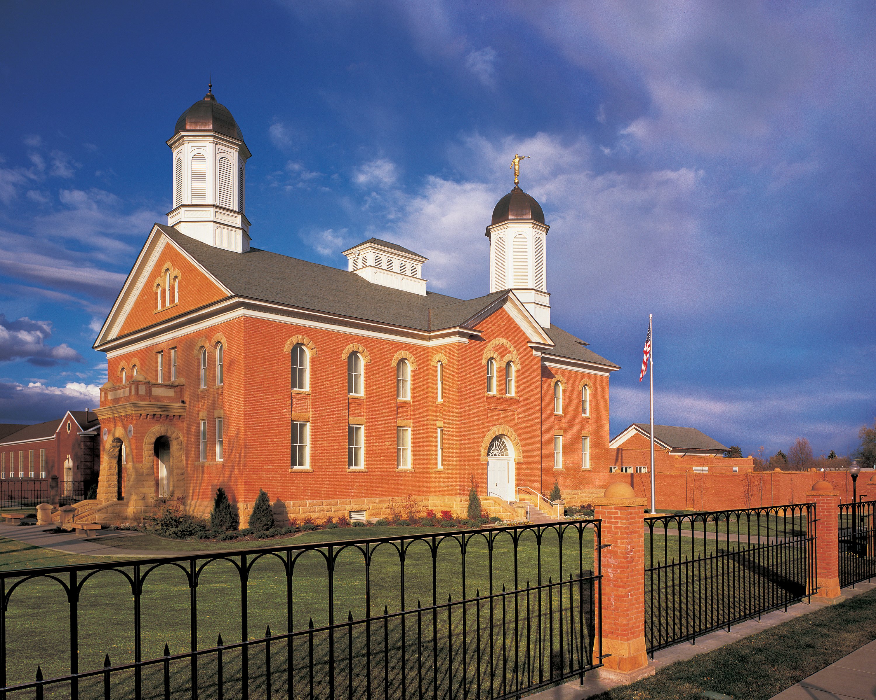
The Vernal Temple is less than a mile from tonight’s destination: the aptly named Dinosaur Inn.
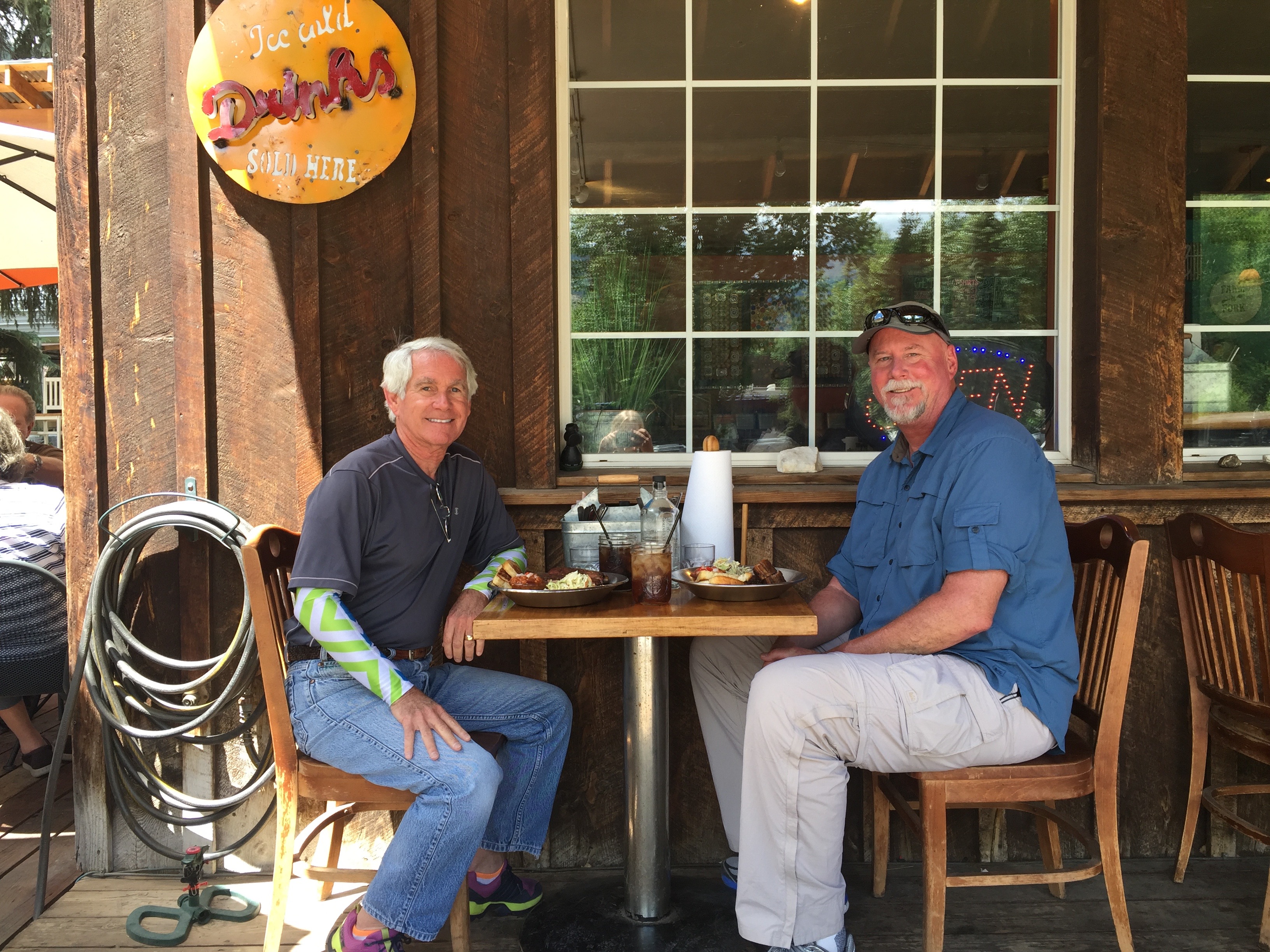
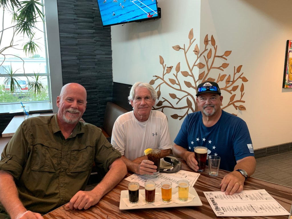
At the Dinosaur Inn, the posse grows from one to three — as Dave, Scott and I meet for the first time since our 2019 ride to Canada.
***
Day One Summary: 284 miles. On the road at last, taking a rib hiatus, two state dinosaurs for the price of one.
Click here to see today’s complete route from Carbondale, Colorado, to Vernal, Utah.
Today’s fun facts, favorite foods, funky place names and famous folks:
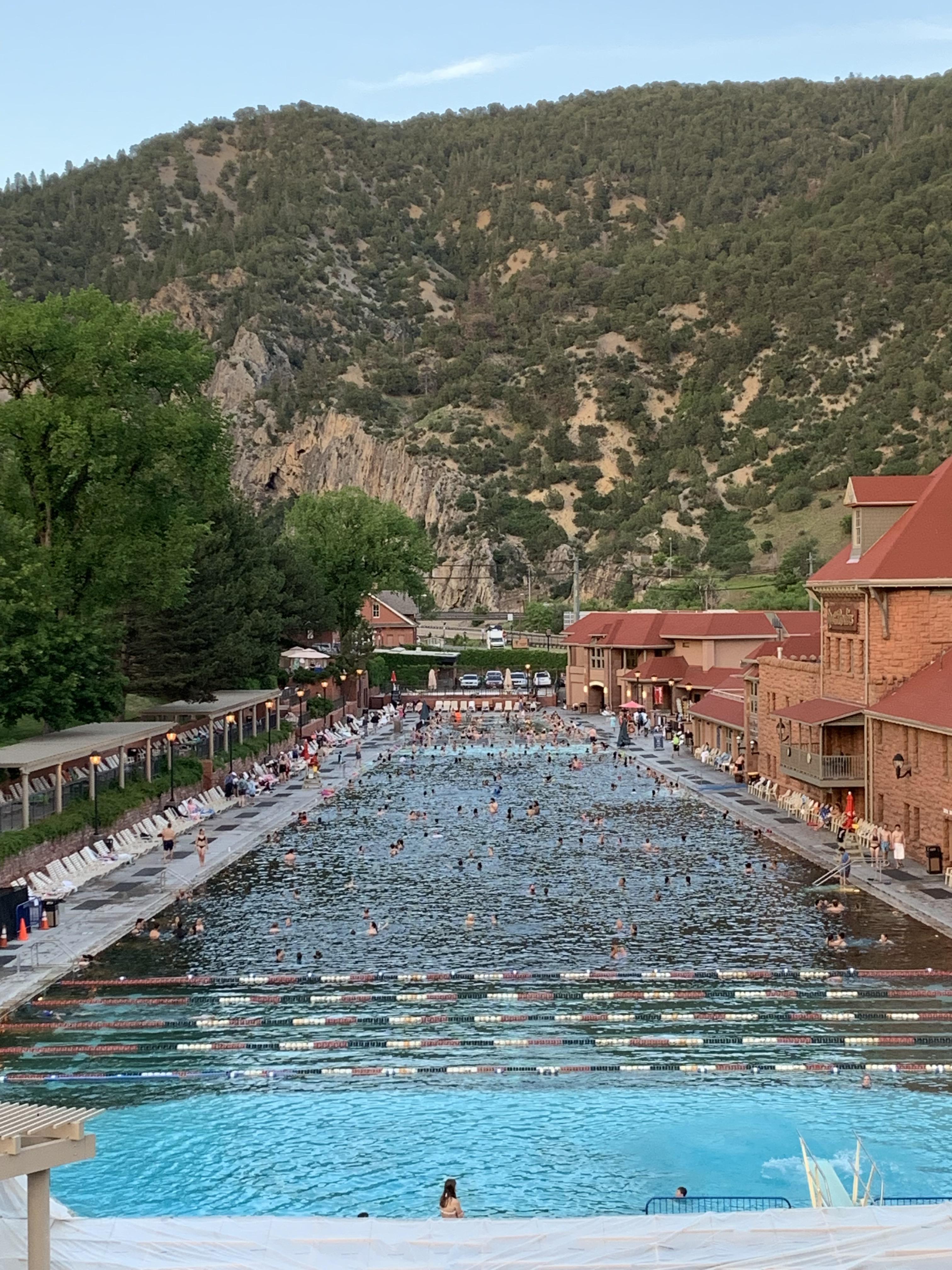
Colorado fun fact: The world’s largest natural hot springs pool is located in Glenwood Springs. The two-block long pool is across the street from the historic Hotel Colorado, a favorite stop of former president Teddy Roosevelt. It’s a popular place. You can get an annual pass for $348, or a family pass for $797. Just want to dip your toes in for the day? That’ll be $49.75 during peak season (now).
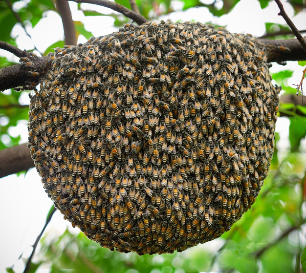
Utah fun fact: The state symbol is the beehive, symbolizing thrift and industry, which is also the state motto. Utah is known as the Beehive State. So, of course, it’s no surprise that the Utah state insect is the honeybee.
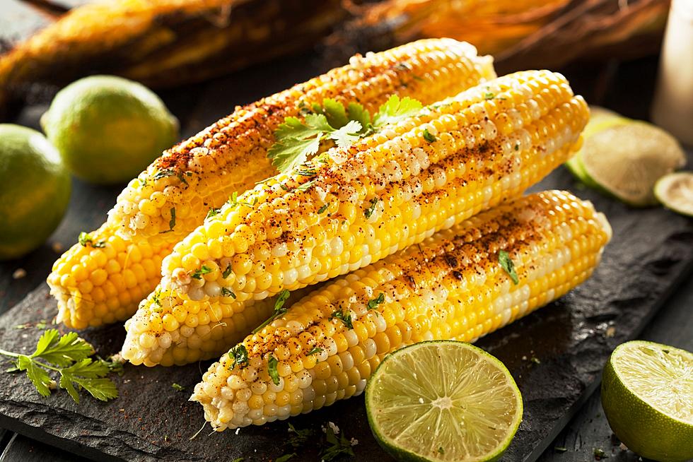
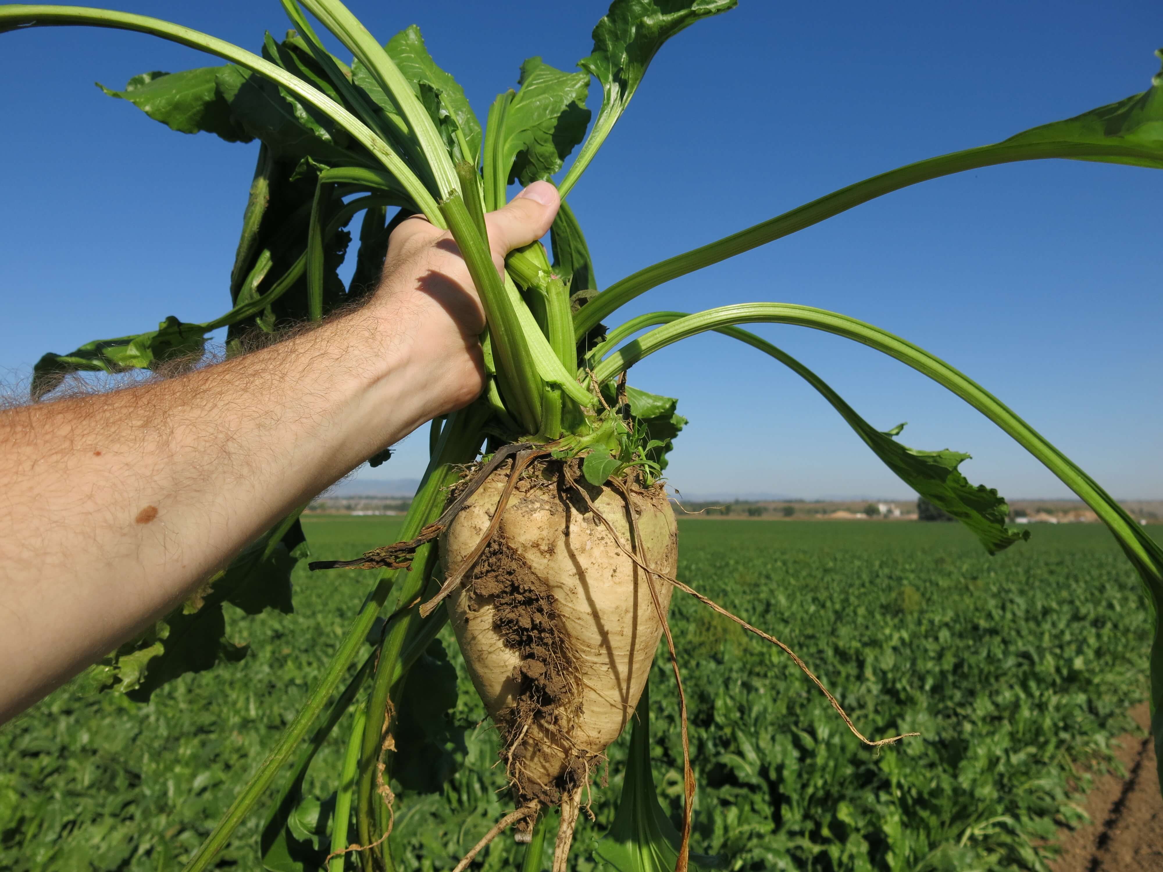
Colorado favorite food: Colorado does not have an official state food, but two favorites are Palisade peaches and Olathe sweet corn. The first peach tree was planted in Palisade in 1882, and today, the area east of Grand Junction produces hundreds of thousand of pounds of perfect peaches, exported throughout the US and around the world. Olathe, which once grew sugar beets and barley, has hot days and cool nights, ideal for growing sweet corn. The crop has a mid-summer harvest, and usually hits store shelves by July.
Utah favorite food: Jell-O is the state’s official snack food. Utah residents consume more Jell-O per capita than any other state in America. One theory: Jell-O and its jiggly allure is one of the only acceptable vices for rebellious LDS teens. A basic batch of Jell-O shots is made with one cup of juice, one packet of gelatin, a half cup of cold water and a half cup of alcohol, usually vodka. With these proportions, your Jell-O shots will be around 10 percent alcohol, by volume.

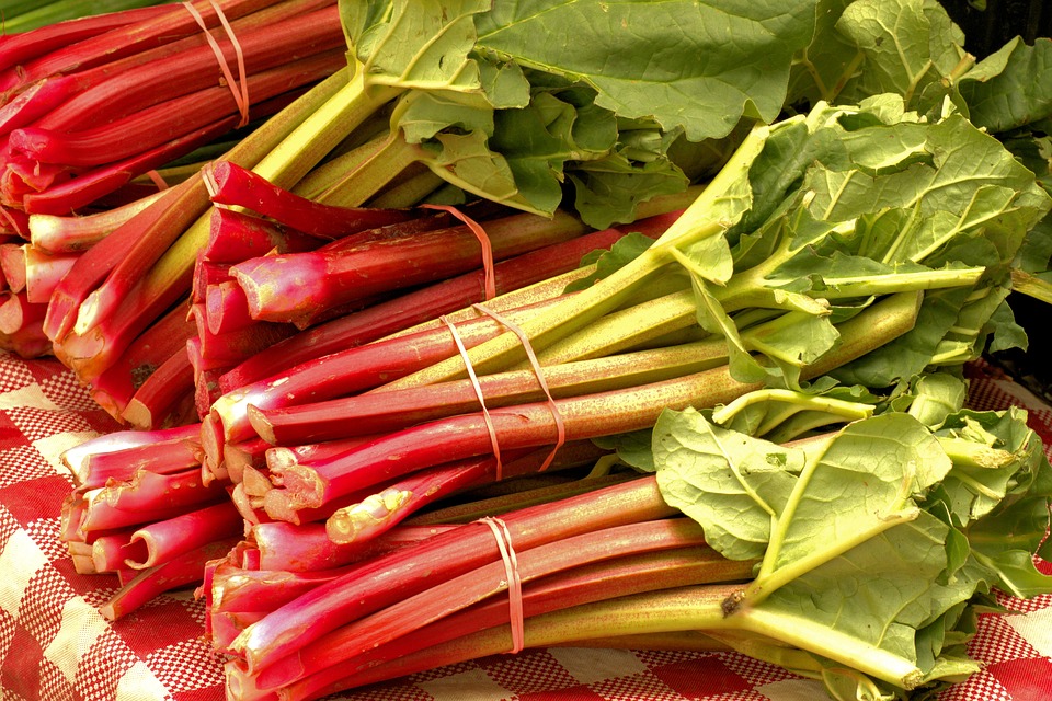
Colorado funky place name: Pieplant, in Gunnison County, is named for the wild rhubarb that grows wild near this early 20th-century mining town. Today, Pieplant is a former mining area, now a ghost town along the Taylor River. After mining there died down, local cowboys would stay in the deserted cabins while tending to their herds.
Utah funky place name: Amalga, settled in 1850, got its name from the Amalgamated Sugar Company that agreed to build a factory in the town in the early 1900s, refining sugar from sugar beets. The factory was shut down in 1929 due to a sugar beet blight which caused 22 sugar factories in the western US to close. Today, Amalga’s economy centers around dairy farming.
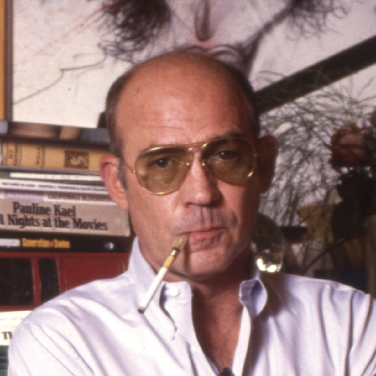
Colorado famous folk: Journalist and author Hunter S. Thompson, founder of so-called “gonzo” journalism, lived in Woody Creek, near Aspen. His most famous work is Fear and Loathing in Las Vegas, a book first serialized in Rolling Stone magazine, in which he grapples with the implications of what he considered the failure of the 1960s counterculture movement. Following a series of health problems, Thompson committed suicide in 2005 at the age of 67.
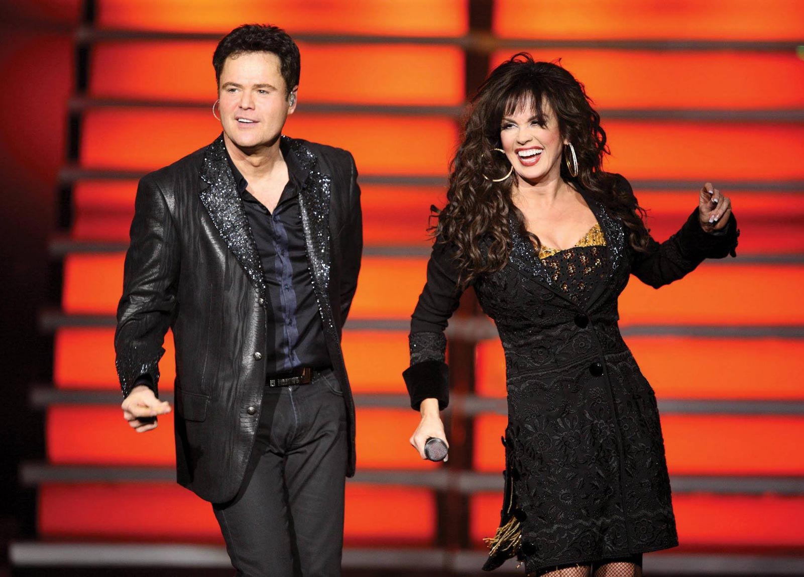
Utah famous folk: The Osmond Brothers, all six of them, got their start in Ogden, Utah. They included Merrill, Jay, Alan, Wayne, Jimmy, and of course, Donny. Little sister Marie had a musical career, too. Today, 63-year-old Donny lives in Provo and 61-year-old Marie lives in nearby Orem. “Donny and Marie,” a 90-minute variety show, ran continuously at the Flamingo Hotel in Las Vegas for 11 years. Their 1,730 performances are the most of any singing act in Vegas history.
Sturgis, anyone?
Vroom.
A look ahead @ tomorrow: The Cowboy State!

Safe riding to you and your friends. Glad you made it safely to Vernal. Hwy 133 was closed earlier today (Hay’s Fall area) due to a rock and mud slide. Not sure if it has reopened. Always enjoy your nightly adventure read. Continue safe travels. Dot and Dennis
LikeLike
Glad to provide some quality bedside reading for you, Dot! I’ll try to stay away from Hwy 133 for a few days 🤓
LikeLike
Being in Vernal for one night we had the BEST pizza almost anywhere in the US and a bottle of wine and yes us are talking Utah with their strict alcohol rules . We are not exaggerating and are not on drugs or anything close especially for Utah. Could not believe in the middle of nowhere (basically) we could have such great pizza but the owner had a true brick pizza oven as in Italy. To this day our wonderful review of the restaurant is still on the top of the list. You brought back a lot of wonderful memories of Vernal even though it is a small town.
We loved the dinosaur exhibit there. Brings back a lot of great memories and also seeing the dinosaur exhibit there was the best exhibit of anywhere. Our dear friends Bob and Sue Brown told us about the dinosaur exhibit. Bob passed away about 3 months ago.
Can hardly wait till your next vroom email.
All of you travel safely!!
J&B
LikeLike
Our Sturgis lunch stop was The Knuckle Saloon. If you haven’t had dinner yet, Antica Forma was the great pistachio pesto pizza place.
Keep the shiny side up. J.
LikeLike
Sorry to hear about Bob. He was a nice man.
LikeLike
Gary, You and Sarah have not aged a day since you left La Quinta. Both of you look great. Looking forward to reading more of your entertaining travels.
Be safe.
Deborah Brill
LikeLike
Good to have you along this year, Deborah. You haven’t aged either! Hard to believe we left LQ four years ago. Hope all is well in the ‘hood.
LikeLike
Ah life is returning to normal when I can read your well researched and entertaining travel blog. We are in Wisconsin beginning our trek south to LQ. We were fishing on the Canadian border with all our family. So from the most northern to the most southern points in the US you would have been overwhelmed at all the opportunities to research and write little ditties. I wouldn’t dream of trying to compete with you but you do make me want to try just so I have a record of my adventures that I can relive in my dotage.
Miss you and Sarah. Safe travels and keep on blogging.
Judith xx
LikeLike
The Queen is in the house!
LikeLike