After three days of “transit” – long, mostly boring rides to get to where you really want to be – we are truly ready for some serious riding. Seriously awesome riding.
Leaving Durango, we head north on US Highway 550, which will take us all the way to Ouray, 70 miles to the north.
We’re on the San Juan Skyway, another of Colorado’s designated Scenic Byways. Eleven of Colorado’s 26 byways are designated as “America’s Byways,” giving Colorado more national designations (America’s Byways) than any other state. The Colorado Scenic and Historic Byways Program is a statewide partnership designed to provide recreational, educational and economic benefits to Coloradans and visitors. Sponsors include Colorado’s Departments of Tourism and Transportation.
These byways even have a motorcycle skill rating map, providing a useful tool to help riders decide whether they have the skills needed for these often-challenging roads. The “ride difficulty levels” are rated Easy, Moderate or Difficult.
Easy roads are suitable for beginning riders, with gradual grades and gentle curves. Difficult roads require advanced riding skills, have steep grades and sharp, technical turns.
The San Juan Scenic Byway, which we’re riding today, is rated Difficult. Over the next few days as we ride through Colorado, we’ll be on at least six more Scenic Byways rated Difficult: West Elk Loop, McClure Pass, Independence Pass, Rocky Mountain National Park, and Cache la Poudre Canyon.
Buckle up!
***
About 25 miles from Durango, we pass by the Durango Mountain Resort, sometimes known by its former name, Purgatory. The name Purgatory comes from Purgatory Creek, which runs through the area – and from Purgatory Flats, today the location of the ski area’s base. The ski resort’s base is at 8,793 feet; its peak is 10,822 feet.
Legend has it that the Purgatory name comes from miners who were trying to get from Durango to the prosperous mines in the Silverton area. They had to pay 50 cents to use the toll road. Miners who couldn’t afford the toll were stuck in the area, which became known as Purgatory Flats. They couldn’t afford to get up the mountain, but couldn’t see themselves quitting and going down, either. Now that’s purgatory.
***
On our way north, we see the spectacular nature of Colorado’s Rockies. With the exception of California’s Mount Whitney (14,505 feet), the Rockies have the highest peaks in mainland North America, the highest of which is Mount Elbert at 14,440 feet.
Colorado has more than 50 mountain summits that are 14,000 feet or higher. They’re known as the 14ers.
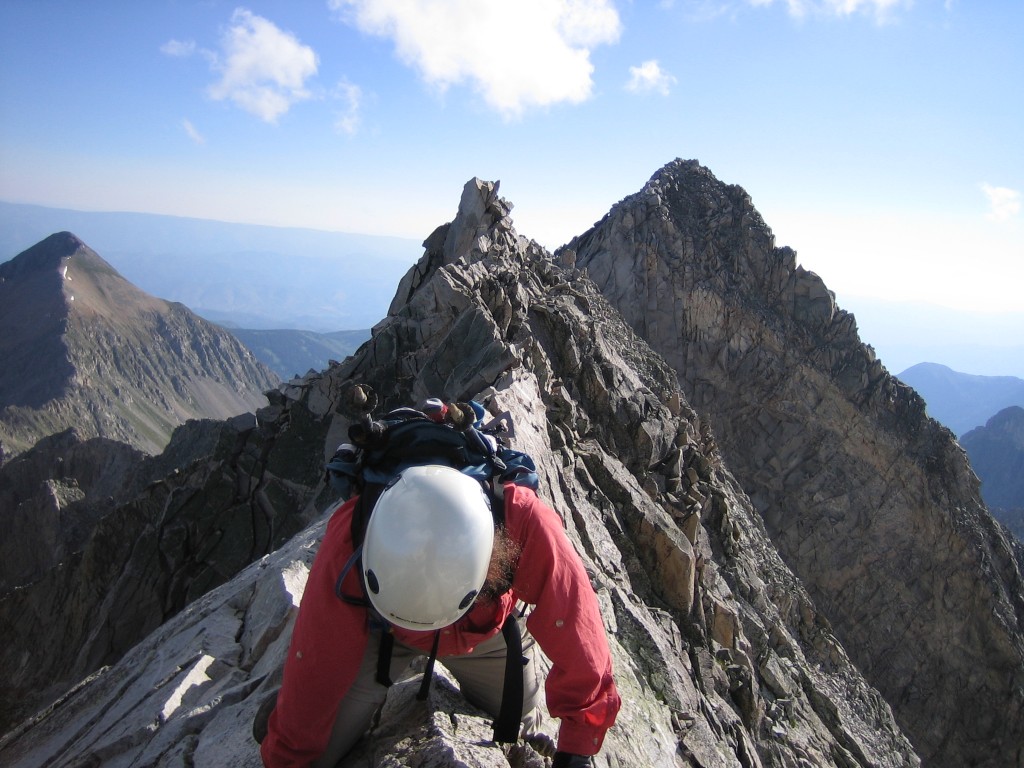
A few miles to the east is Mount Eolus, at 14,083 feet – actually the 32nd-highest of the 14ers. Close by are Sunlight Peak (14,059 feet) and Windom Peak (14,082 feet). After a while, you almost become blasé about 13,000-foot peaks. Colorado has 637 of them, way too many to mention, but hugely impressive, nonetheless.
The Rockies are a haven for snow-addicted thrill seekers. Some have climbed all 54 of the 14ers. Chris Davenport thought that wasn’t difficult enough, so he decided to climb up, then ski down all the 14ers. If you’ve got the time, check out his adventure.
I’ll point out some of the 14ers as we ride near them in the next few days.
***
We continue north on US-550 to Silverton, a former silver mining camp, now designated a National Historic Landmark District – and the only incorporated municipality in San Juan County.
Silverton, at 9,308 feet, is home to the world’s highest Harley Davidson store. The store draws quite a few Harley riders, including us. “They want the T-shirt,” said store owner Jeff Murray, “and the only way they can get it is to come to Silverton.”
Nearby Silverton Mountain, six miles from downtown Silverton, is Colorado’s highest and steepest ski area, with un-groomed, no-easy-way-down expert terrain only. With more than 400 inches of snow each year, the resort describes itself as “all thrills, no frills … deep and steep.”
It has one chairlift that begins at the base elevation of 10,400 feet, and rises to 12,300 feet. For the truly adventurous, which is pretty much everyone who comes here, the ski area includes skiing all the way up to 13,487 feet. To get there, you can hike. Or, take a helicopter.
Because of the unpatrolled and un-groomed nature of Silverton Mountain, skiers are required to have avalanche gear: a beacon, shovel and probe. The ski resort is open December through April, Thursday through Sunday. Lift tickets are $59 for the day. Or, you can get an all-day heli-skiing pass for $999, which includes six “drops”.
Be sure to bring your “A” game.
It’s a one-of-a-kind resort, whose owners call it a “labor of love.”
***
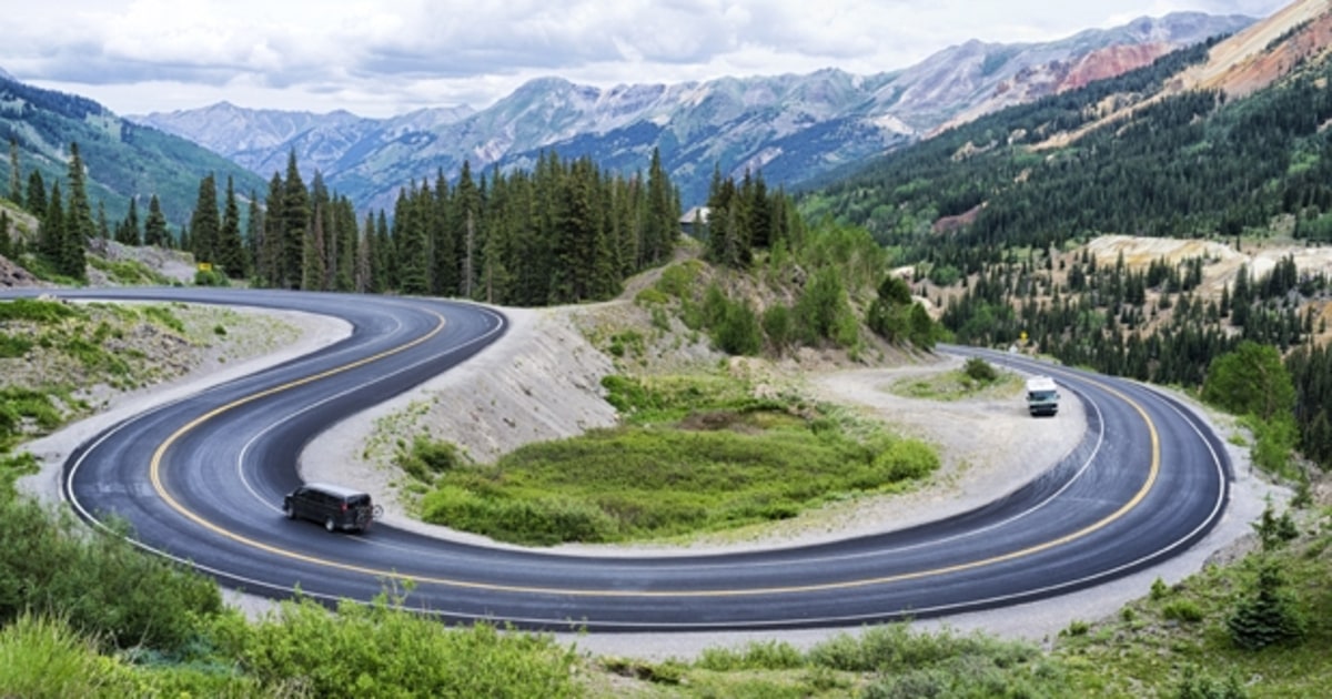
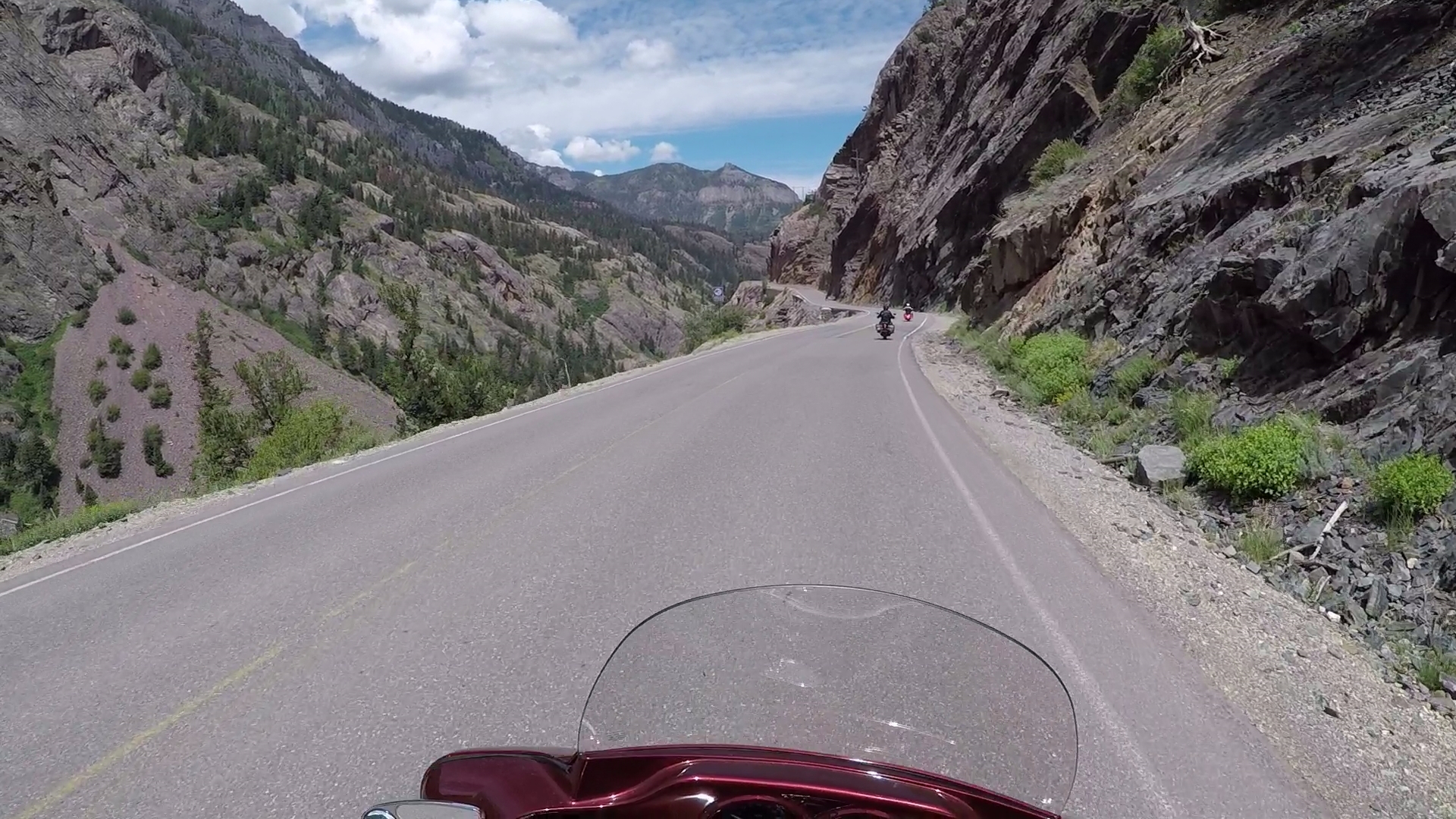
From Silverton, the remaining 25 miles of US Highway 550 are quite a thrill. This road, part of the San Juan Skyway Scenic Byway, is known as the Million Dollar Highway. It’s one of the most scenic roads in the US – and one of the most perilous, according to dangerousroads.org.
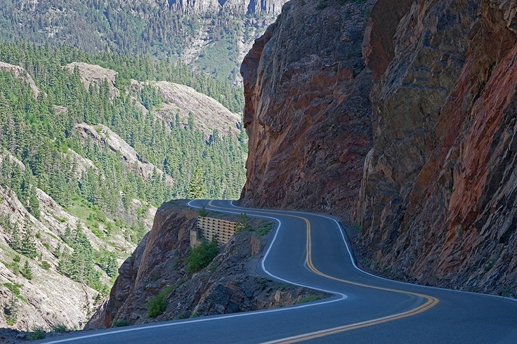
The Million Dollar Highway has steep cliffs, narrow lanes, hairpin curves, and few guardrails. On a motorcycle, it’s a thrill ride and a truly sphincter-tightening experience. I’ve ridden the road four times now, each time like Grandpa would. That’s how I roll. The Million Dollar Highway gets a little less frightening every time you ride it. Or not.
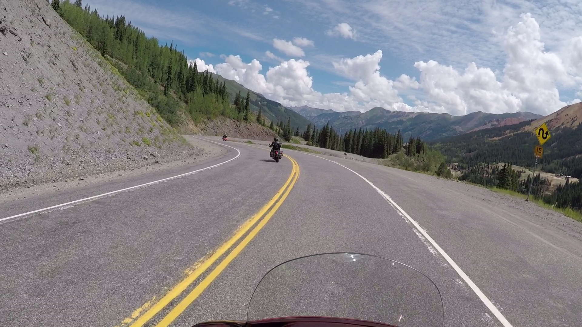
Though the entire stretch from Silverton to Ouray earns the Million Dollar designation, it’s really the 12 miles from the summit of Red Mountain Pass through the Uncompahgre Gorge to Ouray, where the highway gets its reputation.
The Million Dollar Highway goes over three mountain passes: Coal Bank Pass (10,640 feet), Molas Pass (10,970 feet), and Red Mountain Pass (11,018 feet).
It’s unclear exactly where the Million Dollar Highway gets its name. Locals disagree as to whether it is named for the millions of dollars of gold, silver and other minerals extracted from these mountains, the cost of building the road (reputed to be a million dollars a mile), or for the spectacular views.
***
Riding north from Silverton, we pass through the ghost town of Ironton. At one time, Ironton was a major transportation junction between Red Mountain and Ouray, in addition to having some of its own mines. Ironton sits at 9,756 feet, and is about two-thirds of the way from Silverton to Ouray.
In the winter, Ironton has cross country ski trails and hiking trails leading to beautiful vistas. In mining’s heyday, it was home to many miners who worked in the mines above town on the slopes of Red Mountain. In the late 1800s, two trains arrived daily in Ironton, coming from Silverton.
Ironton’s mines made their wealth from silver and lead, and eventually from gold. From Ironton, it’s only eight miles on US Highway 550 before we get to Ouray.
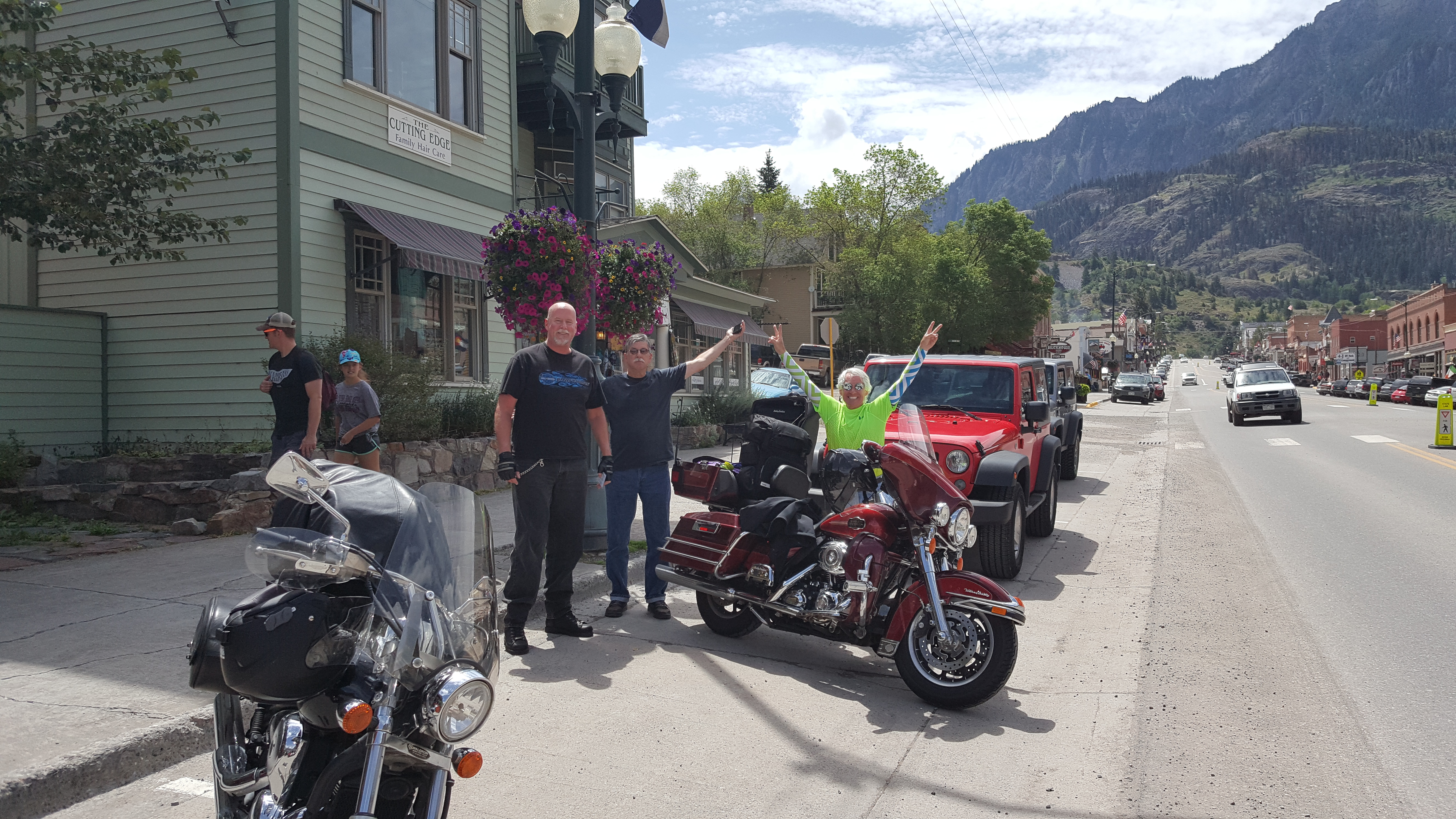
We arrive in Ouray with a sense of exhilaration and survival.
Exhale.
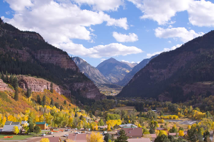
Ouray, which sits at 7,792 feet, is one of the most breathtakingly beautiful mountain towns imaginable.
Named after Chief Ouray of the Ute Indian Tribe, Ouray was originally established by miners chasing silver and gold in the surrounding mountains. Prospectors arrived here in 1875. At the height of its mining boom, Ouray had more than 30 active mines.
All of Ouray’s Main Street is registered as a National Historic District. Several buildings are listed on the National Register or Historic Places.
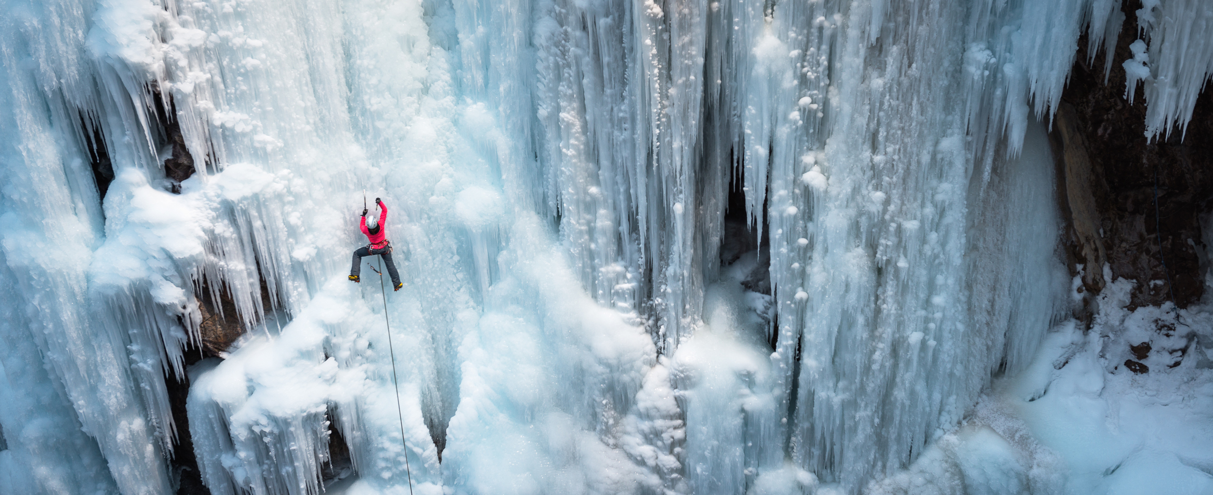
Today’s Ouray economy is based entirely on tourism. Ouray bills itself as the “Switzerland of America,” because of its setting at the narrow head of a valley, enclosed on three and a half sides by steep mountains. Much of the tourism is focused on ice climbing, mountain biking, hiking and off-roading in the San Juan Mountains.
Ouray is considered the winter ice-climbing capital of the U.S. It has the world’s first ice climbing park, expanding on previously popular natural falls, with dozens of frozen waterfalls from 80 to 200 feet high along more than a mile of the Uncompahgre Gorge. The Ouray Ice Park’s slogan: “Get Your Axe in Gear!”
Ouray is also a popular destination for motorcyclists, as it marks the beginning (or end) of the Million Dollar Highway.
***
We leave Ouray and continue north on US Highway 550. In 10 miles, we come to the town of Ridgway, which sits just below 7,000 feet. Ridgway was featured in the John Wayne movie, True Grit, and other western movies including How the West Was Won, and Tribute to a Bad Man.
One other thing about Ridgway: the Grammy Award trophy is manufactured here by Billings Artworks. The trophies are all hand-made, assembled and plated on site. The Gramophone trophy – Grammy for short – has been awarded nearly 8,000 times since the first Grammy Awards ceremony in 1959, and every single one of those Grammies was made here in Ridgway. Click here to read more about the Ridgway workshop that works all year long to produce the precious trophies.
Ridgeway is also known for having the only stoplight in Ouray County – at the intersection of US Highway 550 and Colorado Highway 62.
We stop at the light, then continue north toward Montrose, another 27 miles down the road. The city was incorporated in 1882, and named after Sir Walter Scott’s novel, A Legend of Montrose.
Montrose sits at 5,806 feet above sea level, and is considered a gateway to many spectacular areas in the Rockies. If you have time in Montrose, you can visit the Museum of the Mountain West, the Ute Indian Museum, or the Russell Stover Candy Factory.
You can also head east out of town and visit a nearby National Park, the Black Canyon of the Gunnison. That’s our plan.
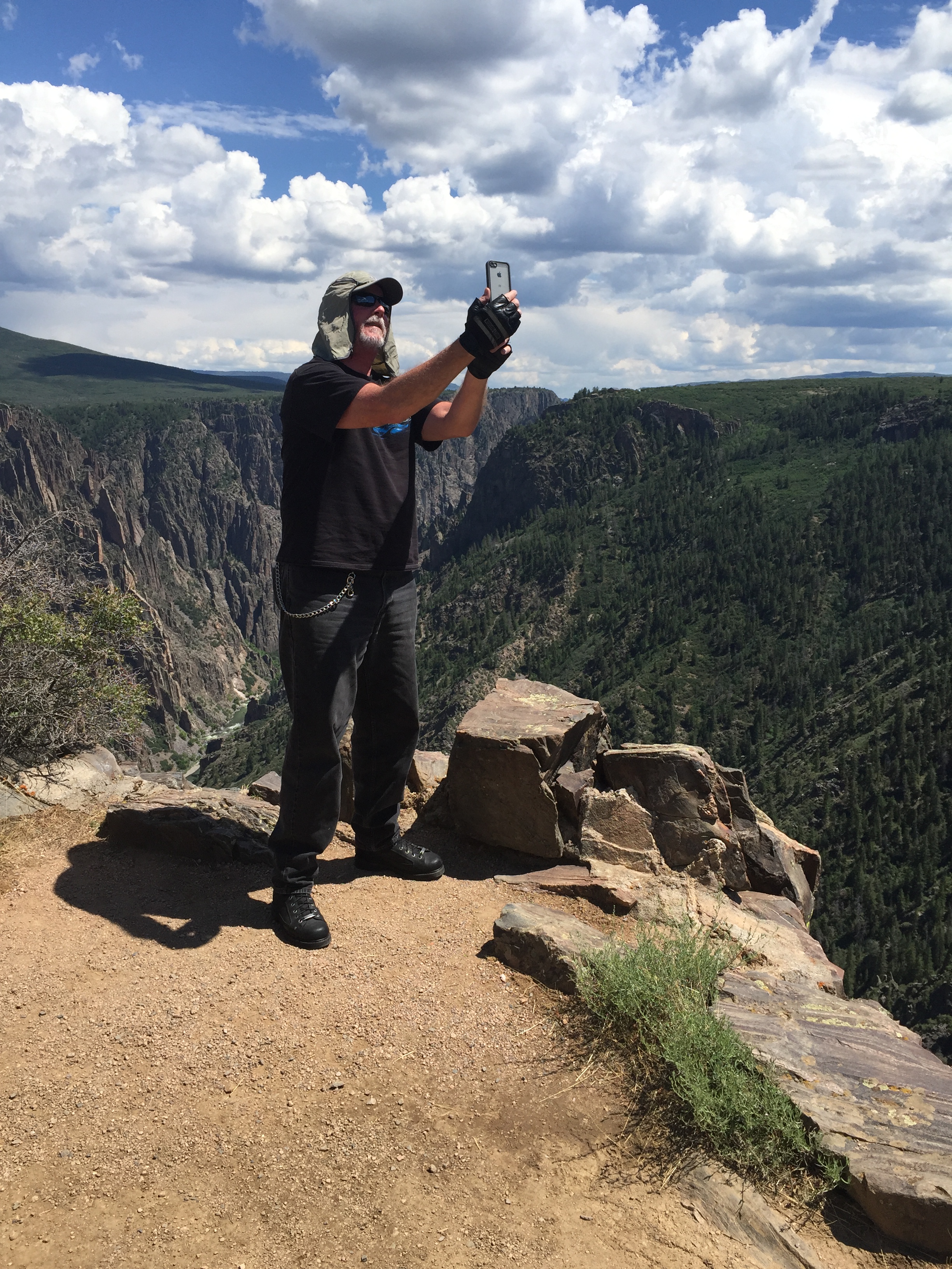
The Black Canyon of the Gunnison National Park is only about 11 miles northeast of Montrose. To get there, we ride east on US Highway 50 for 6 miles, North on Colorado Highway 347 for 5 miles, and we arrive at the Park’s visitor center.
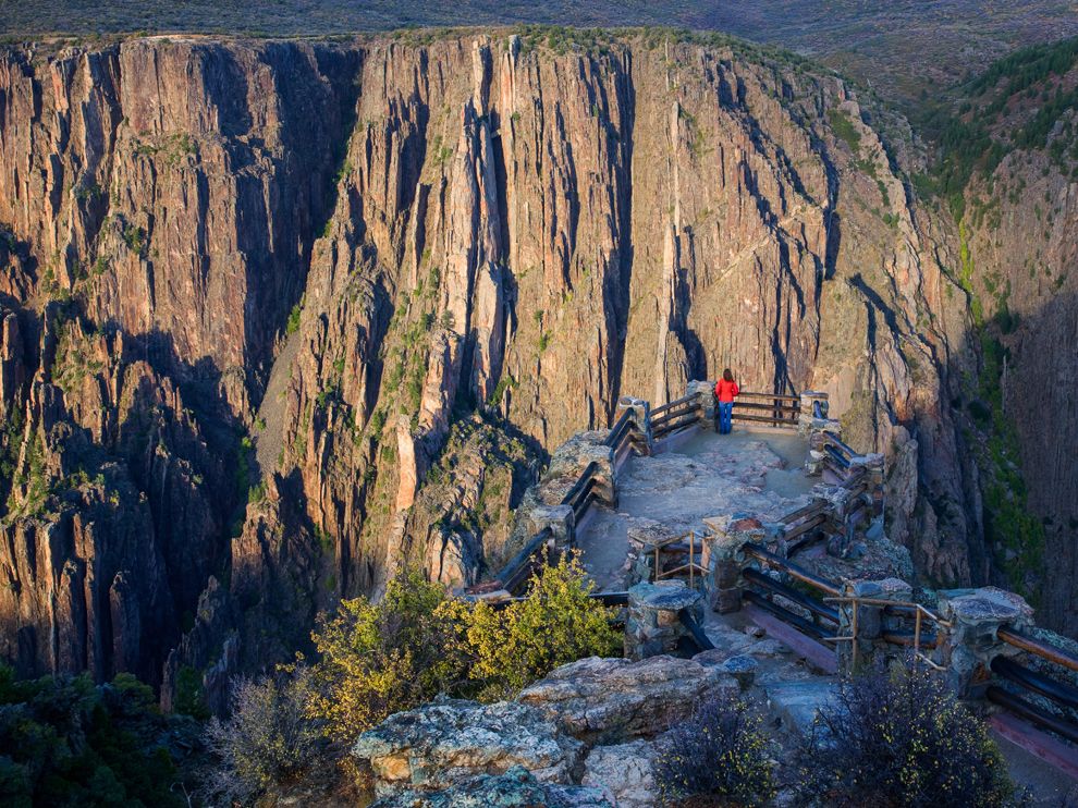
The park gets its name (“Black Canyon”) because parts of the Gunnison River gorge receive only 33 minutes of sunlight a day. As a result, it’s often shrouded in shadow, causing the rocky walls to appear black. The steepness of its walls makes it difficult for sunlight to penetrate the canyon, which is known for crumbling rock and dizzying heights. It’s a haven for rock climbers. Experts only.
The main attraction in the park is the scenic drive along the canyon’s south rim, which we explore for the next hour.
***
After staring at the canyon walls, we press on, riding east on US Highway 50 toward Gunnison.
Gunnison was named in honor of Captain John Gunnison, a US Army officer who surveyed for the transcontinental railroad in 1853. The city is home to Western State Colorado University, originally founded as the Colorado State Normal School for Children in 1901. A normal school is one created to train high school graduates to be teachers; its purpose is to establish teaching standards, or norms – thus the word “normal.”
But we never quite get to Gunnison. About 25 miles west of town, we reach the Blue Mesa Reservoir – along the Gunnison River – and take a detour.
The Blue Mesa Reservoir is the largest body of water entirely in Colorado.
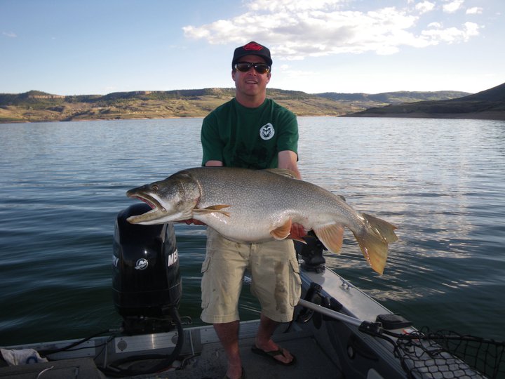
With 96 miles of shoreline, it’s the largest lake trout and kokanee salmon fishery in the US. It was the first large dam built along the Gunnison River.
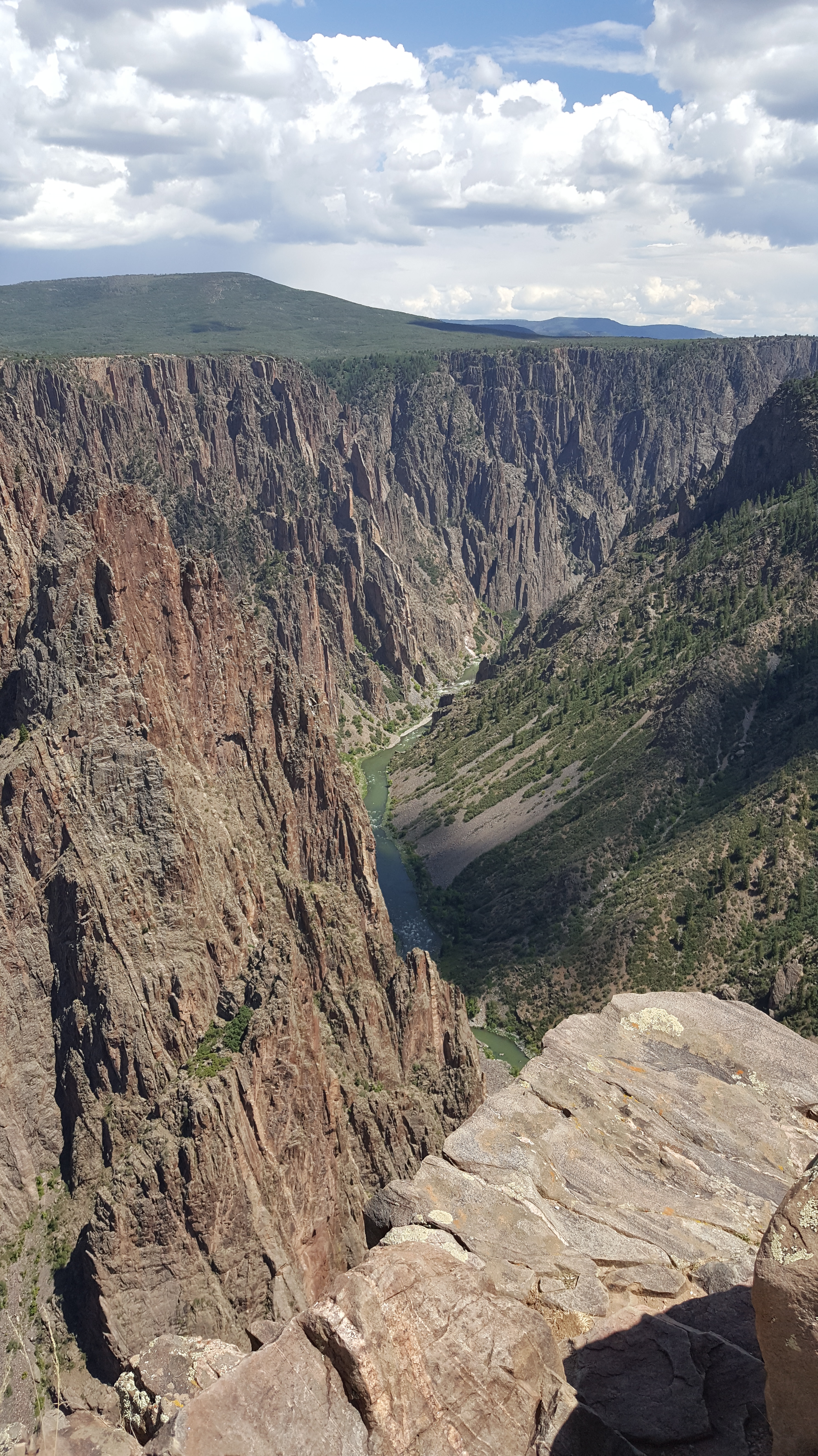
When we arrive at the west end of the Blue Mesa Reservoir, we turn onto Colorado Highway 92, a twisty mountain road that snakes along the north rim of the Black Canyon of the Gunnison. There are gorgeous views at seemingly every turn. We’ll be on Highway 92 for the next 52 miles.
Highway 92 is part of the West Elk Loop Scenic Byway (Difficult!) and is considered among the best motorcycle rides in Colorado, right up there with the Million Dollar Highway.
We peer down into the Black Canyon of the Gunnison River from a different perspective than what we saw earlier today. We’re now riding along the north rim. In the park a few hours ago, we rode along the south rim.
The road begins to straighten as it takes us past Gould Reservoir, Crawford Reservoir, and Crawford State Park – before we arrive in the town of Crawford.
It’s a tiny ranch town, perhaps best known for its resident rocker, Joe Cocker, who owned a 240-acre ranch here until his death in 2014. Called Mad Dog Ranch, it has a European-style, seven-bedroom, nine-bathroom, 15,873 square-foot home with a turret at the entrance.
Mad Dog Ranch is named after Cocker’s 1970 album, Mad Dogs and Englishmen. The ranch, if you care to visit it, is at 43405 Cottonwood Creek Road, about three miles east of Crawford.
At the time of his death nearly three years ago, Cocker had the place on the market for $7.85 million. With no buyers coming forward for several years, his estate tried unsuccessfully to sell it at auction. Earlier this year, it was on the market again. Asking price: $4,950,000. I scoured the internet far and wide, unable to find out conclusively if anyone had bought the property. Good news for you: it may still be available.
***
We continue north on Highway 92 for another 11 miles until we reach the town of Hotchkiss, our destination for the night. Hotchkiss calls itself the “Friendliest Town Around.”
Hotchkiss. Seriously?
It’s a town whose population is less than 1,000 – but it has the aptly named Hotchkiss Inn, and the awesome Zach’s BBQ for dinner. Sounds like a great place to park the bikes and get ready for tomorrow.
We’ll call it a day, despite our disappointment that Zach’s is closed on Monday’s. Boo-hoo.
***
Day Four Summary: Two hundred fifty five miles, a million-dollar highway, seeing our first 14ers, and surviving one of the most dangerous roads in the world. We are awesome!
Click here to see today’s complete route from Durango to Hotchkiss.
We’re on our way to Sturgis!
Vroom, vroom.
***
Today in Bucket List History:
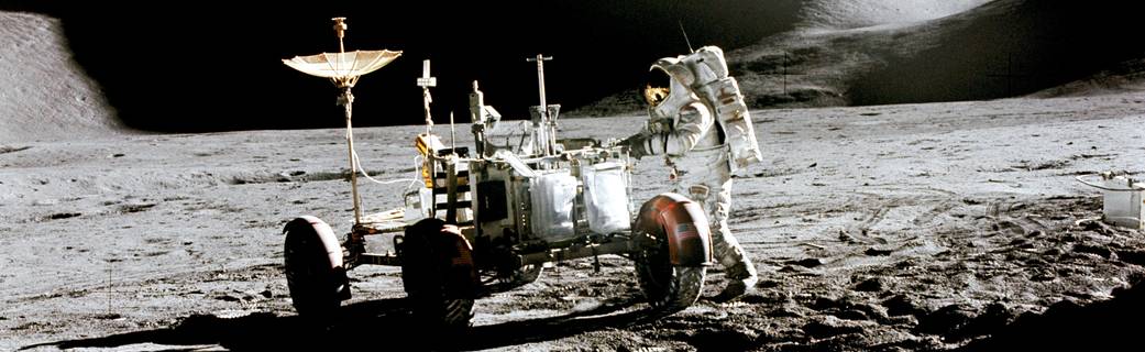
Bucket List Goal: “Take a Memorable Journey.”
Goal Achieved: On July 31, 1971, Apollo 15 astronauts take a three-hour ride on the moon in the Lunar Roving Vehicle, covering more than 17 miles. Apollo 15 was the ninth manned mission to the moon, quite a trip in itself – lasting more than 12 days, and covering about 477,000 miles. Apollo 15 made 74 orbits around the moon – totaling 1,264,137 miles – while astronauts David Scott and James Irwin were on the moon.
What’s on your bucket list?

Love riding along. I’m really glad I didn’t know about the Million Dollar Highway ahead of time and that Dave would end up taking selfies at the top of Black Canyon! WTH Bowman!
LikeLike
The big guy is living on the edge, or so to seems. But he’s completely under control. Or so it seems. Look forward to seeing you in a few days, Mrs. B.
LikeLiked by 1 person
You know me Baby. Growing older but not growing up!
LikeLiked by 1 person
Thank you for your informative travel guided motorcycle road trip.
I believe you have a calling to replace the deceased Hugh Howser!
I must live in a shell, I had know idea of the million dollar road.😳
Cheers and safe travels.
LikeLike
Pretty sure you don’t live in a shell, Donna. Maybe the Million Dollar Highway is in your future! Huell Howser and I play for different teams, so I don’t think I can possibly replace him.
LikeLike
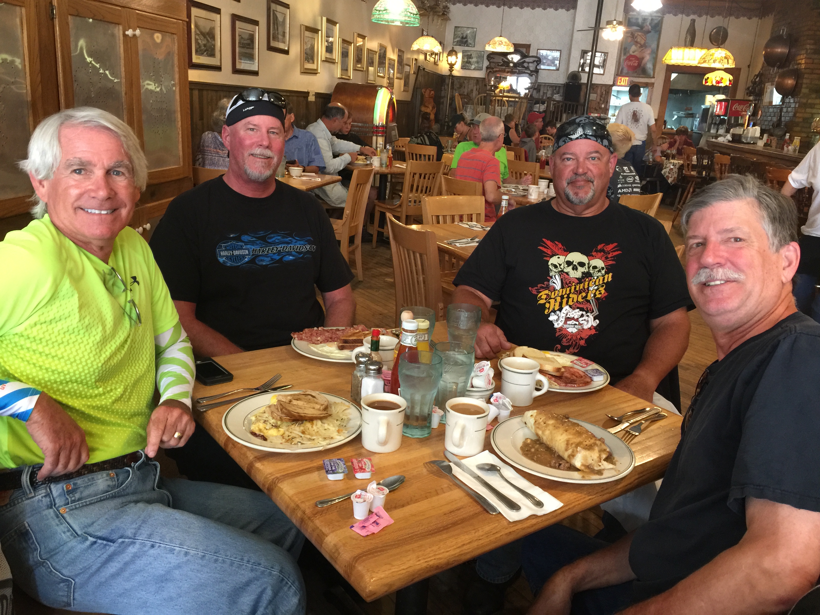
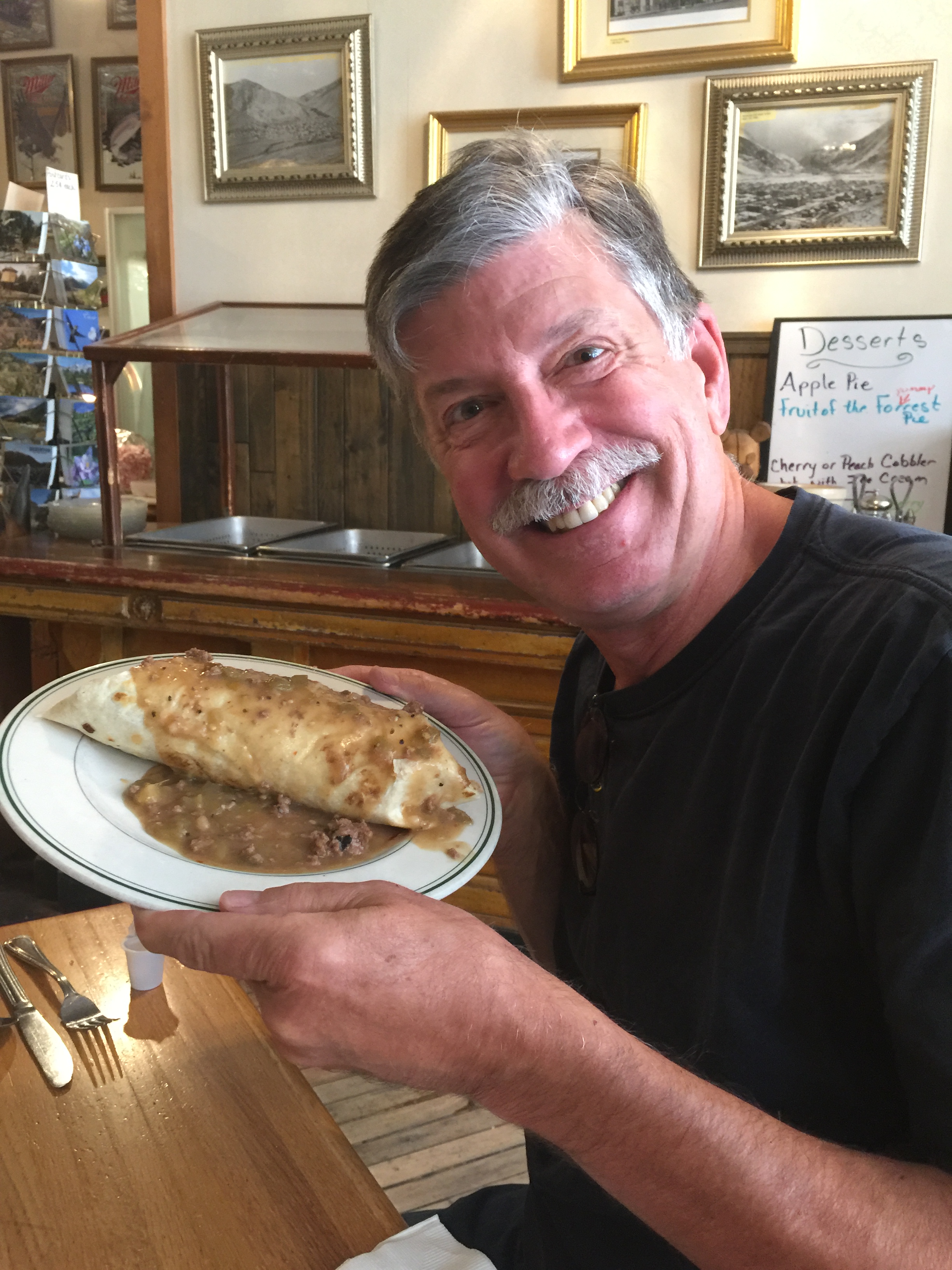
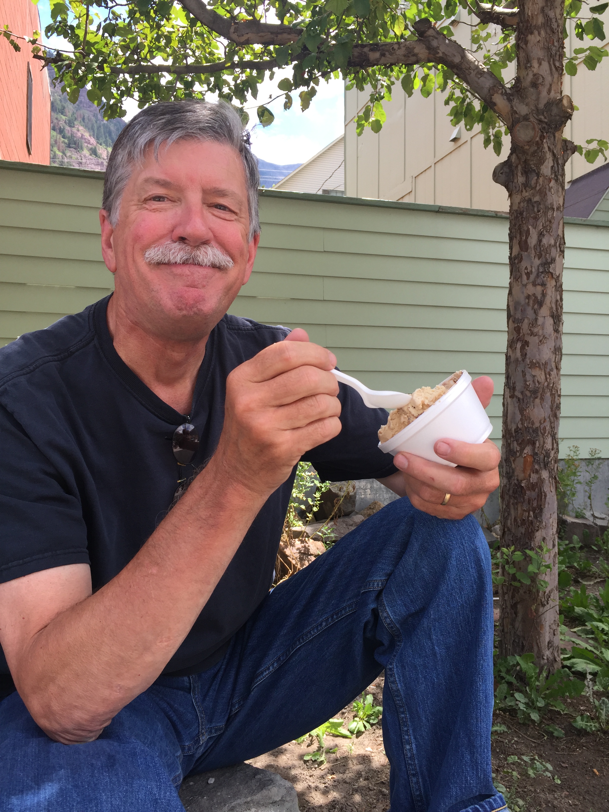
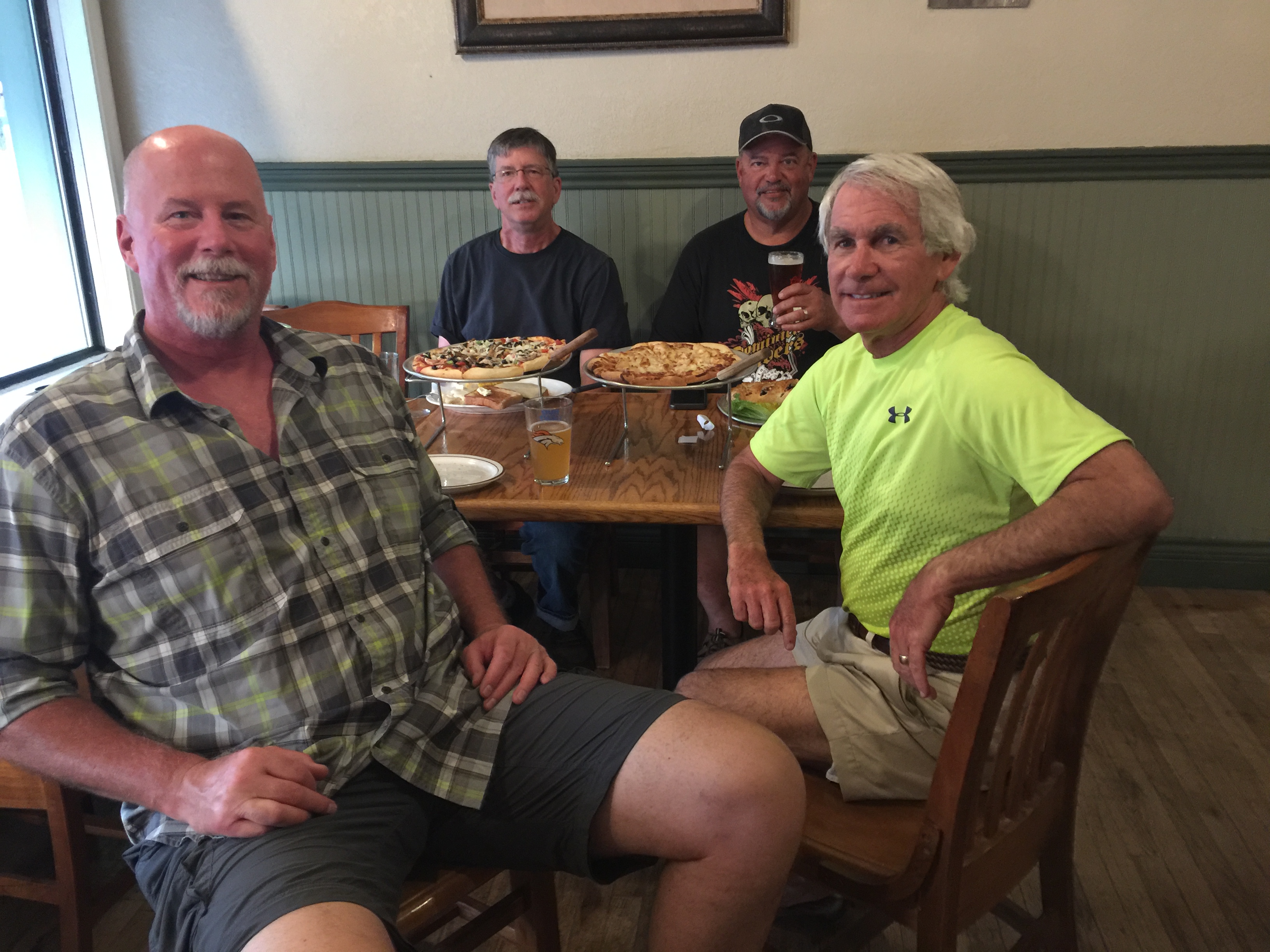
Ok. Picture of Randy with large burrito, Randy with ice cream, Randy driving on the wrong side of the road, Randy with large chicken fried steak.
Is there a trend here??!!!
Just looking out for Randy.
LikeLike
Hi Mr Harriott. Nice to have you back from the dead. Randy apparently has a big target 🎯 on his cute little helmet. So much good material… tough to pass up. A target-rich blog environment. Tomorrow I’ll look for someone else to pick on, someone more my size.
LikeLike
Awesome photos by all. Are you all miked together to share moments while riding🤔
I have a feeling tomorrow is going to be an exciting day. Cannot wait for pics of your new abode in progress.
LikeLike
We DO all have microphones, and use them primarily for “mission-critical” communications. Ya know, like “Hey, my butt’s sore. How bout a break?”
Yes, big day in C-town. Breakfast at Village Smithy, signing loan docs, checking out the (hopefully) newly poured foundation footings. Woo-hoo!
LikeLike
Drove the Million Dollar Highway 5 years ago and it was awesomely scary! Love this part of Colorado. Did you happen to see “Handlebars Saloon” in Silverton for lunch? Great food and tons of atmosphere.
More jealous everyday but loving all the detail.
Deborah
LikeLike
I love this part of Colorado, too. Maybe we should move here.
LikeLike
Seeing all that food you guys eat, no wonder you have to diet the rest of the year!
PS – Made it to London safe and sound. Just beginning our journey.
LikeLike
Well then, chubby little me will look forward to reading YOUR blog. Post soon. Early and often.
LikeLike
A wonderful adventure for you all! Ride safe….
LikeLike
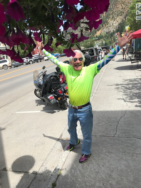
Are You the tall one in the bright yellow shirt?? W/all the brains?
Your poor cousin.. :((
Looks amazing and learning so much in regards to your travels..
Would love to be on the back..
So fun..
Sarah was a doll,
have fun and stay safe..
Stalker Sam.. my initials!!
In cognito!!! 🏍🏍🏍🏍
LikeLike
Yes, I am the tall one in the bright yellow shirt. You should come next time. Always room more more in the posse. Good to have you along for the ride, Peg. Vroom, vroom!
LikeLike
Gary great geography lesson and a wonderful history lesson riding with you through Colorado. Too bad Zach’s was closed but looks like you all are getting plenty of calories!!
LikeLike
You been to Zach’s, Rich? You get around!
LikeLike