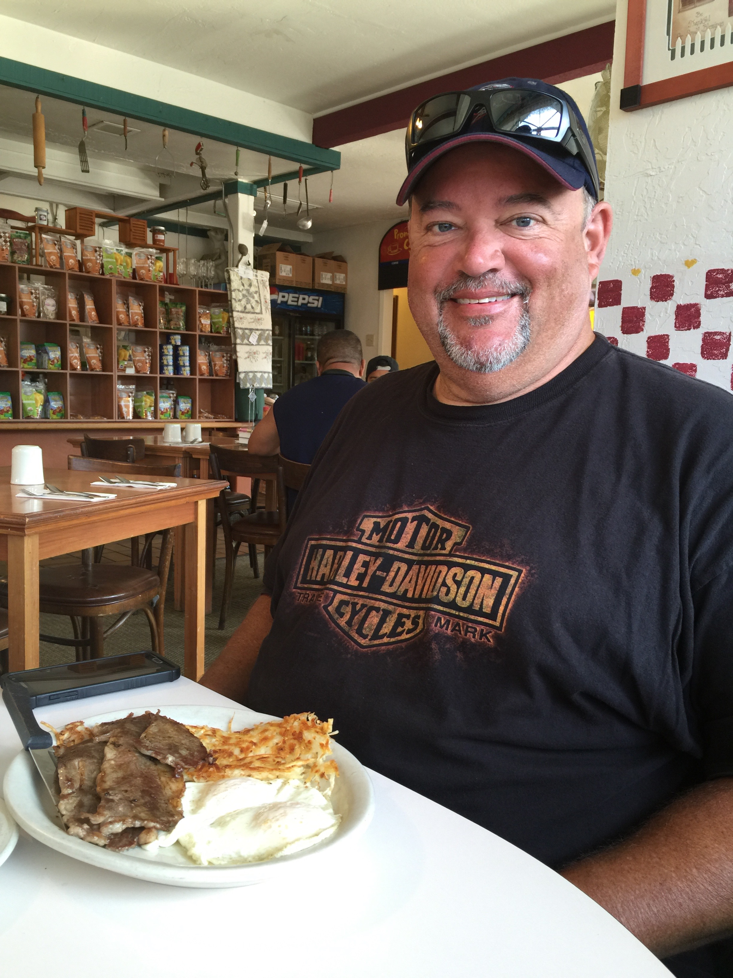
Each day on this trip, we seem to do things in twos:
- August 21: two notable biker roadhouses – Newcomb’s Ranch, and the Rock Store.
- August 22: two cool town nicknames – “Clam Capital of the World,” and “Gibraltar of the Pacific.”
- August 23: two monumental structures – the Hearst Castle and Bixby Bridge.
- August 24: two bad habits – gold and gambling.
- August 25: two major Sierra passes – Ebbetts and Sonora.
- August 26: two hunks of granite – El Capitan and Half Dome.
Today, we’ll continue the streak by visiting two National Parks – Kings Canyon and Sequoia.
***
We begin our 222-mile journey by heading south through the western foothills of the Sierra Nevada Mountains, mostly on gently curving two-lane roads. We’re in the Sierra National Forest, riding along Bass Lake.
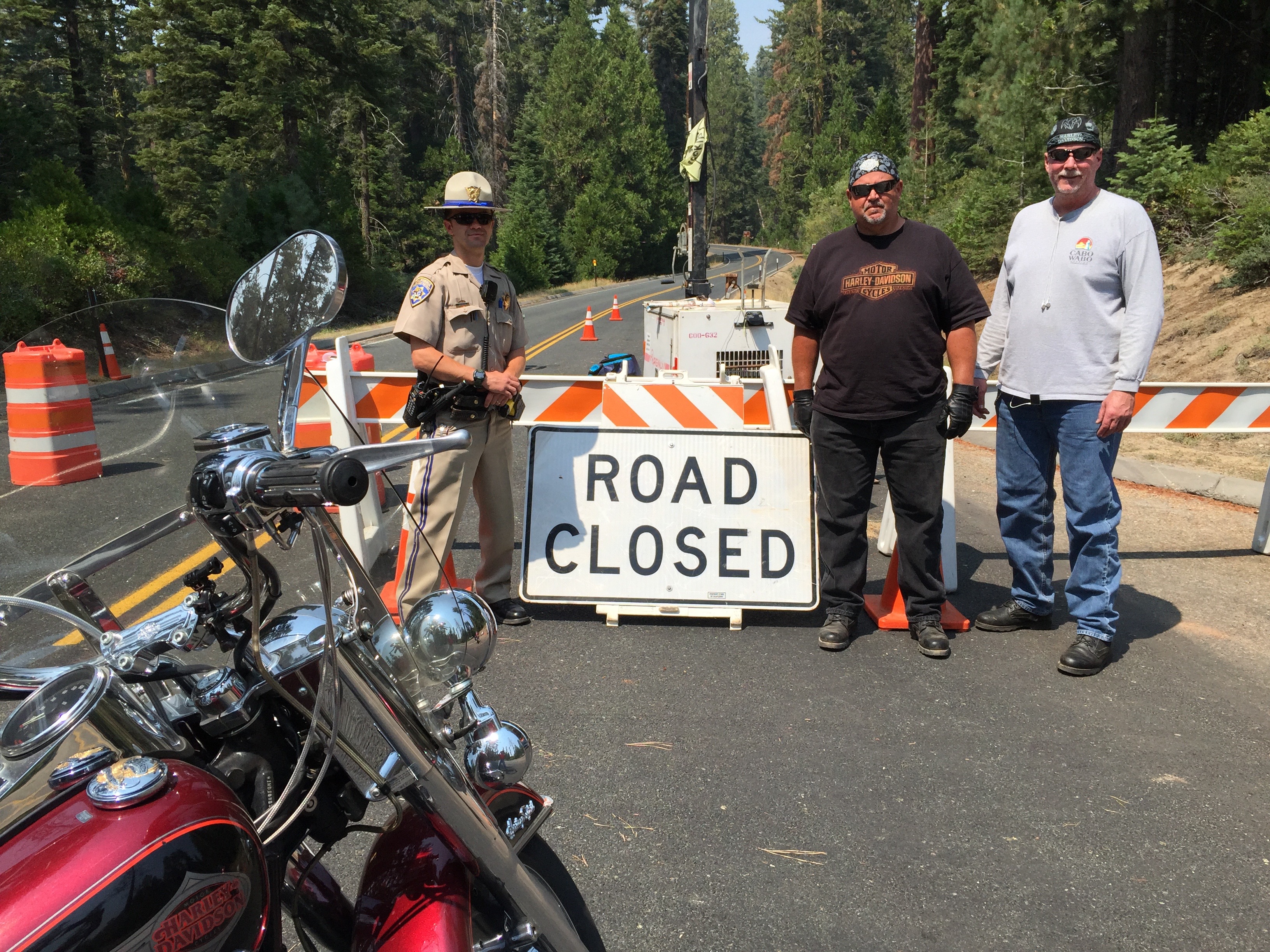
We motor through the teeny communities of North Fork and Auberry. In Auberry, the smoke from the Hume Lake fire is thick, causing us to reassess our ride into King’s a Canyon. We stop at a convenience store, and develop Plans B and C, in case the road is closed or the smoke is so dense we have to skip the National Parks altogether today. Turns out the road into Kings Canyon is closed; the fire has been burning more than a month and is still only 25 percent contained.
We press on, riding east on Highway 180, and 65 miles after leaving Oakhurst, we see a hint of today’s first destination as we turn left onto Highway 180 – Kings Canyon Road. The hint is the road sign. I can take a hint.
Over the next 40 miles, Highway 180 will gradually climb to 6,600 feet in the Sierras and enter Kings Canyon National Park. We pass through Minkler, Squaw Valley, and Clingan’s Junction Grocery – the last gas station for more than 100 miles.
After gassing up, the road rises dramatically. From here, it’s about 18 miles of twisty roads with spectacular views to the south and west. Well, spectacular if you could see them, which we can’t today because of the smoke in the air. And then we arrive at the park entrance, where the ranger gives us the official word about the road closure.
Interestingly, when you enter Kings Canyon National Park, you also enter Sequoia National Park. They share the same entry point and the same National Park Service website. The two parks are separate, but quite closely related. Since the 1940s, both parks have been administered jointly.
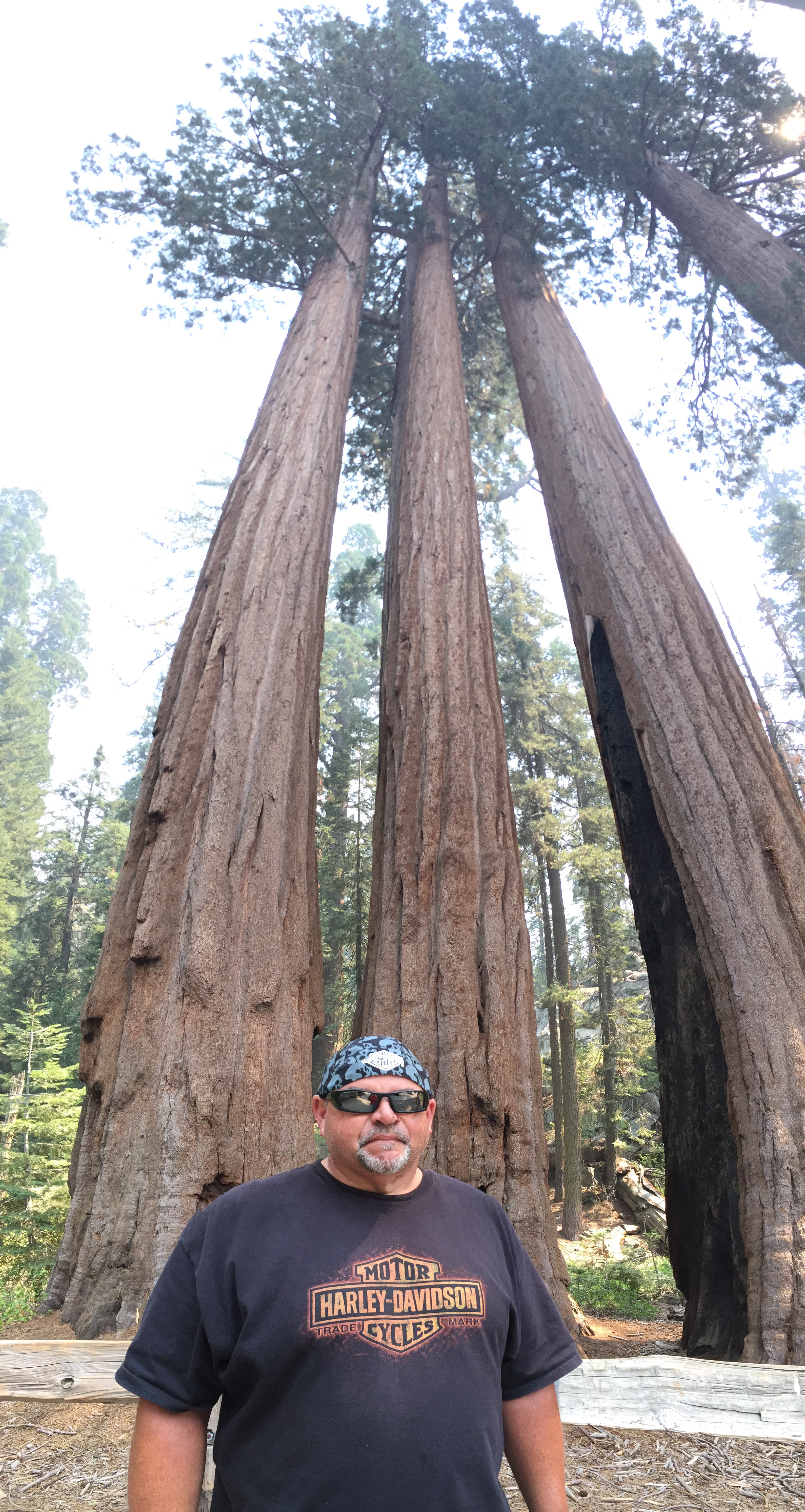
Rolling past the small community of Wilsonia, we turn into Grant Grove, a stand of sequoia trees, whose centerpiece is the General Grant Tree. At 267 feet tall and a ground circumference of 108 feet, it’s the third largest tree in the world — and is more than 3,000 years old. The tree was named in 1867 after Ulysses S. Grant, Union Army general and the 18th US President.
In 1926, President Calvin Coolidge proclaimed it the “Nation’s Christmas Tree,” perhaps one of his more notable accomplishments while in office. And, in 1956, President Dwight Eisenhower declared the tree a “National Shrine,” a memorial to those who died in war. It’s the only living object with that designation.
Visitors busily snap photos and try to find a way to fit the entire tree in the frame. Good luck with that.
Time to leave the Sequoiadendron giganteum in the Grant Grove behind, and explore Kings Canyon itself, which we would do if the road is open, but it remains closed due to the Hume Lake fire. Sadly, that’ll have to wait for another trip. We do take the opportunity to snap some pix of the Road Closed sign, a bittersweet memory captured on my iPhone. As we continue along Highway 180, there’s nothing but unbridled beauty for 35 miles until we reach the end of the road at Kanawyer. All you can do there is dismount and begin hiking.
Kings Canyon is named after the Kings River, whose headwaters originate at elevations above 13,000 feet in the Sierra Nevada mountains. The Kings River was named in 1805 by the commander of a Spanish military expedition into California’s Central Valley.
The canyon was carved by glaciers out of granite and closely follows the river. The granite walls of the canyon, in places, tower 4,000 above the canyon floor. It’s one of the deepest canyons in the US.
At the Road Closed sign, we turn around and reverse our direction, and begin heading back toward Grant Grove, our last vision of Kings Canyon National Park, which this year celebrates its 75th anniversary.
***
With a slight left turn, we are now on Highway 198, entering Sequoia National Park. The two parks are that close.
Highway 198 is also called Generals Highway, named after two of the world’s largest and most famous Sequoia trees – the General Grant and the General Sherman. We will visit the General Sherman tree in about 45 minutes.
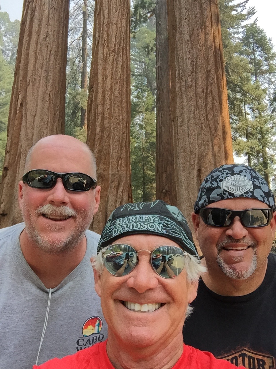
The Generals Highway snakes south through Sequoia National Park, twisting and turning amid giant trees. The park is also full of huge redwood trees, often mistakenly confused with sequoias. Both naturally occur only in California, share a distinctive cinnamon-colored bark, and the proclivity for growing to overwhelming heights. Sequoias thrive in higher elevation habitats than redwoods. Redwoods are generally taller. Sequoias weigh more, though where would you find a scale large enough to verify that?
Sequoia National Park was created essentially to protect the giant sequoia trees from logging. It was the first national park formed to protect a living organism.
The park contains among its natural resources the highest point in the contiguous 48 United States, 14,505-foot Mount Whitney – named after Josiah Whitney, chief of the California State Geological Survey in the 1860s and ’70s.
My riding partners, Dave and Scott, have both summited Mount Whitney; Scott has done it three times, the Mount Whitney trifecta!. My wife, Sarah, has conquered the mountain, too. All proudly signed their names in the register that sits at the summit. The register is brought down the mountain several times each season by Park rangers, who place it in Mount Whitney’s permanent archives. If you make it to the top, your name has a place in history.
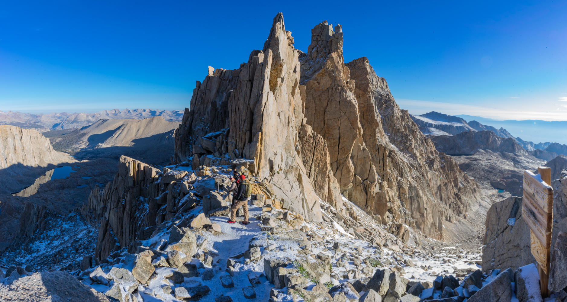
Mount Whitney is a 22-mile hike, round trip, with an elevation gain of more than 6,100 feet. About 10,000 people a year successfully complete the journey – a mostly non-technical but uber-grueling ascent. Permits are required, and like the 17-Mile Drive in Carmel, motorcycles are not allowed.
Note: my resume does not include a Mount Whitney climb, but I have summited Colorado’s Mount Evans, 14,130 feet. On a Harley.
Here’s what you’ll experience when you hike Mount Whitney:
***
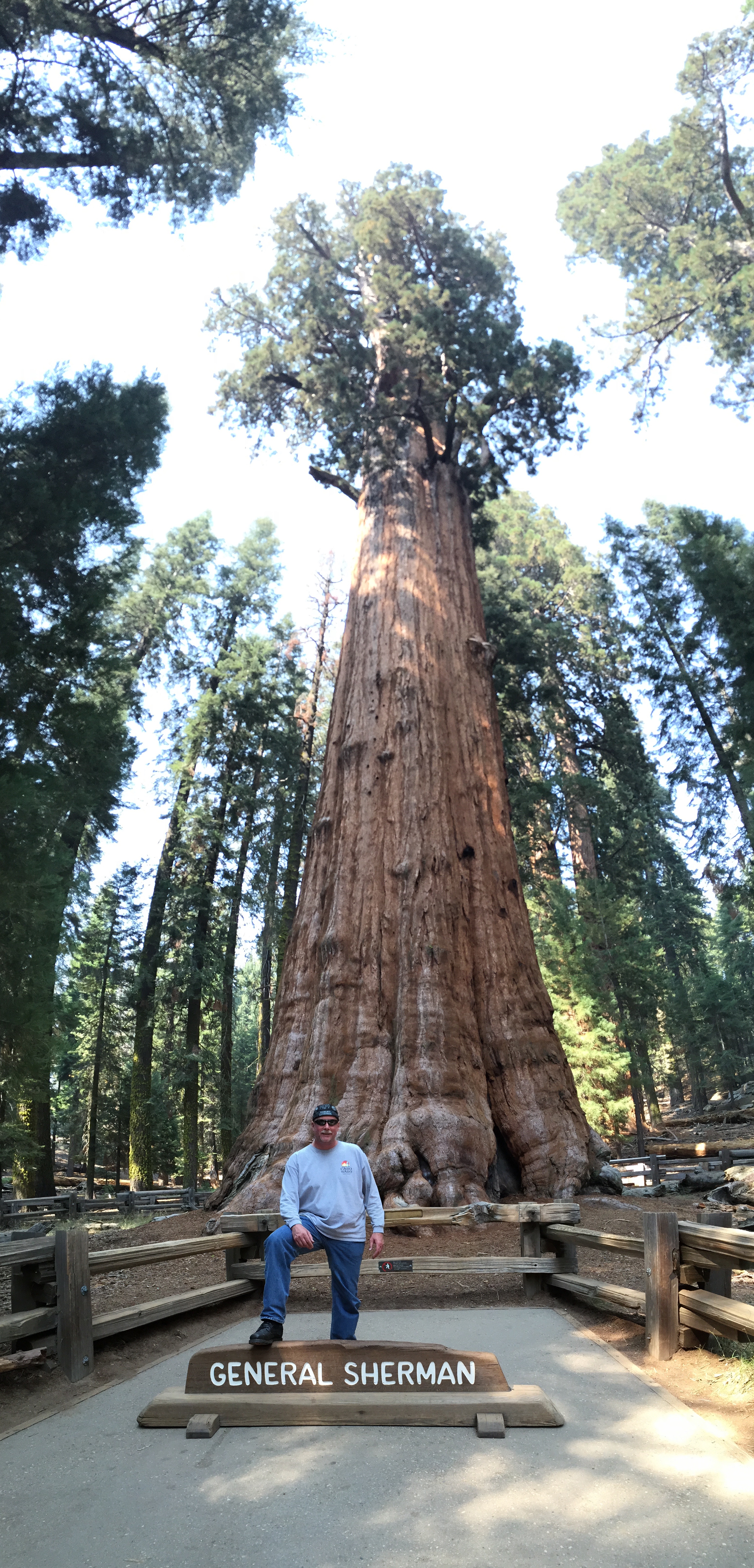
We turn off The Generals Highway and into the parking lot to view the General Sherman Tree. By volume, it’s the largest known living single stem tree on earth – estimated at 52,500 cubic feet.
The Sherman Tree is named after the Civil War general William Tecumseh Sherman. The tree was named by naturalist James Wolverton, who had served as a lieutenant under Sherman.
In 1931, following scientific comparisons with the General Grant tree, General Sherman was identified as the world’s largest. Size matters, especially to arborists.
Two miles down the road, we pass the Giant Forest Museum and come to the Moro Rock Trailhead. It’s a spectacular hike that ends with 352 stairs to a vista point on Moro Rock, where you can enjoy panoramic views of the western half of Sequoia National Park and the Great Western Divide.
It’s easily one of the most popular hikes in the park.
Moro Rock rises 6,725 feet above sea level. It is a prominent granite protrusion on the edge of the Giant Forest visible to everyone driving up the Generals Highway into Sequoia National Park from the south.
For the next 10 miles from Moro Rock south, the road is probably the twistiest, baddest, steepest alpine thrill ride I’ve ever been on. There are dozens of well-marked hairpin turns so tight that I get well acquainted with first gear all the way down. This marks my fourth trip on this road and my knuckles are still ashen white.
We descend all the way to 843 feet above sea level, landing in the town of Three Rivers, population 2,182. The town’s name comes from its location near the junction of the North, Middle, and South Forks of the Kaweah River.
Three Rivers bills itself as the gateway to Sequoia National Park. We exit the park and wonder what kind of two-fer tomorrow will bring.
***
To view today’s route from Oakhurst to Three Rivers, click here.
