Exactly one year from yesterday – on August 25, 2016 – the US National Park Service will celebrate its centennial. The Park Service was created by an act of Congress, and signed into law by President Woodrow Wilson. The bill mandated the Park Service conserve areas of natural and historic beauty – and leave them unimpaired for the enjoyment of future generations.
The US has 59 National Parks, ranging in size from 5,000 acres (Hot Springs, Arkansas) to 8 million acres (Wrangell – St. Elias, Alaska). Two Alaskan parks in the system (Gates of the Arctic and Lake Clark) host less than 13,000 visitors each year, while Great Smoky Mountains National Park in Tennessee and North Carolina attracts more than 9 million a year.
Joshua Tree National Park is only 30 miles from our front door in La Quinta. American Samoa National Park is 5,000 miles away.
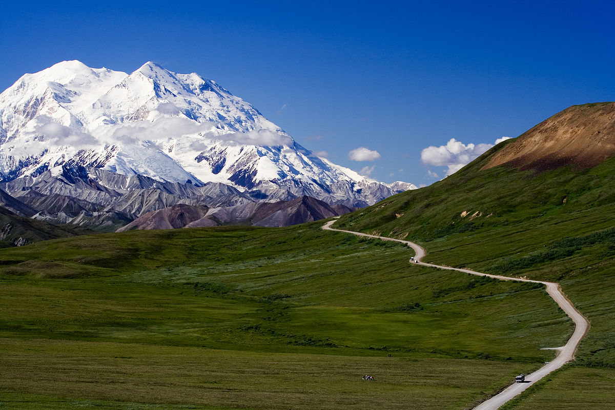
The highest is Denali, in Alaska – 20,268 feet. And the lowest (and toastiest) is in Death Valley, 282 feet below sea level.
The US National Park System is a study in extremes. Extreme isolation. Extreme beauty. Extreme spirituality. Extreme awesomeness.
Perhaps the two most extremely spectacular National parks, with geological features unmatched anywhere in the world, are Grand Canyon, in Arizona – and Yosemite National Park in California. Most of the National Parks are in the western US. We are extremely fortunate to live so close to so many of them.
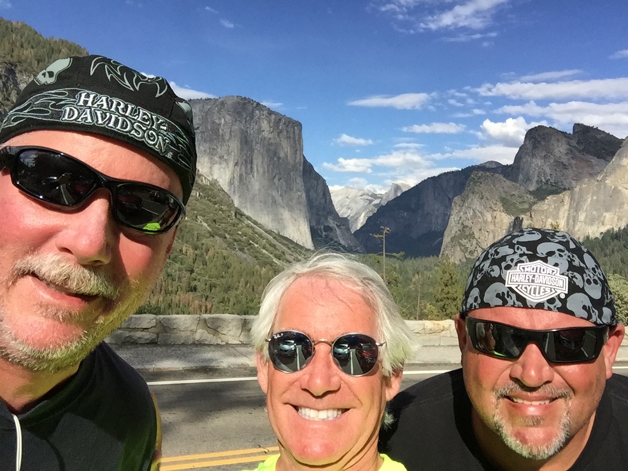
Yosemite is about 40 miles from Bridgeport, where we spent the night. The highlight of today’s journey will be our visit to Yosemite.
***
There’s much to see on the way to Yosemite.
We leave Bridgeport early – about 7:45 am – on our way to a mammoth family reunion. More on that in a minute.
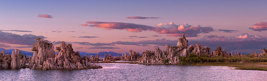
In 20 miles, US Highway 395 south takes us to Mono Lake, believed to be one of the oldest lakes in the western hemisphere. Scientists believe it was formed about 750,000 years ago.
Mono Lake, with about 70 square miles of surface area, has life that’s composed of algae, brine shrimp, and alkali flies. It’s one of the most productive ecosystems in the world. The lake is alkaline, with a salt content nearly three times as high as the ocean.
As you may recall from the first day of our ride last week, we traveled on Mulholland Drive, named after civil engineer William Mulholland, who was responsible for building the Los Angeles city water infrastructure. He designed and supervised the building of the Los Angeles Aqueduct, a 233-mile long system to move water from the Owens Valley to the San Fernando Valley.
It turns out his achievement had unintended consequences that have greatly affected Mono Lake. Mulholland’s project diverted Mono Lake’s tributary streams 350 miles south to meet the growing water demands of Los Angeles.
As a result, the volume of Mono Lake has dropped by half, and its salinity has doubled. Click here to learn more about the fragile ecology of Mono Lake and the effort to save it.
***
Ten miles down the road, we arrive in Lee Vining, a tiny community on the southwest shore of Mono Lake. The town was named after Leroy Vining, who founded it in in 1852 as a mining camp.
The economy of Lee Vining relies largely on tourism, since it is the closest town to the east entrance of Yosemite National Park. Tourism here is mostly confined to the summer months, because California Highway 120 through Yosemite is closed the rest of the year due to heavy snowfall. This year, after an unusually warm and dry winter, the highway opened on May 4.
From Lee Vining, we continue south on US-395 past June Lake and Wilson Butte, an 8,405-foot mountain peak that’s the 917th highest in California and the 8,320th highest in the US. No particular significance to Wilson Peak. Some people are just curious about these things.
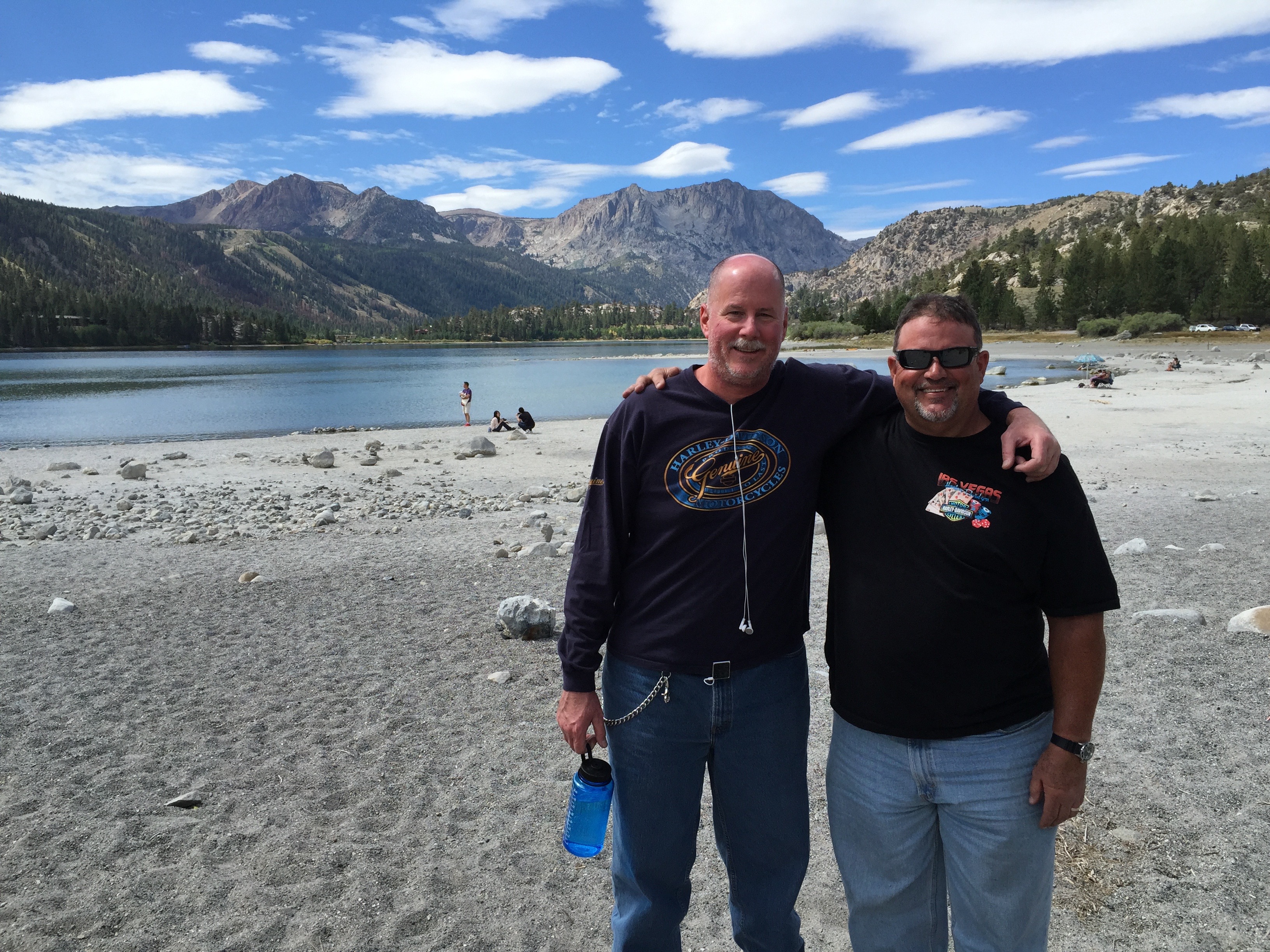
About 50 miles of Bridgeport, we turn west toward Mammoth Mountain Ski Area, founded in the 1940s by Dave McCoy, a hydrographer for the Los Angeles Department of Water and Power. As a member of the Eastern Sierra Ski Club, McCoy noticed that Mammoth Mountain consistently had more snow than other mountains in the Sierras. He bought a portable rope tow from the club in 1941, usually keeping it at Mammoth. In 1953, the US Forest Service awarded a permit to McCoy to operate the ski area, and he built it into one of the largest in California – comparable to Squaw Valley and Heavenly Valley in the Lake Tahoe area.
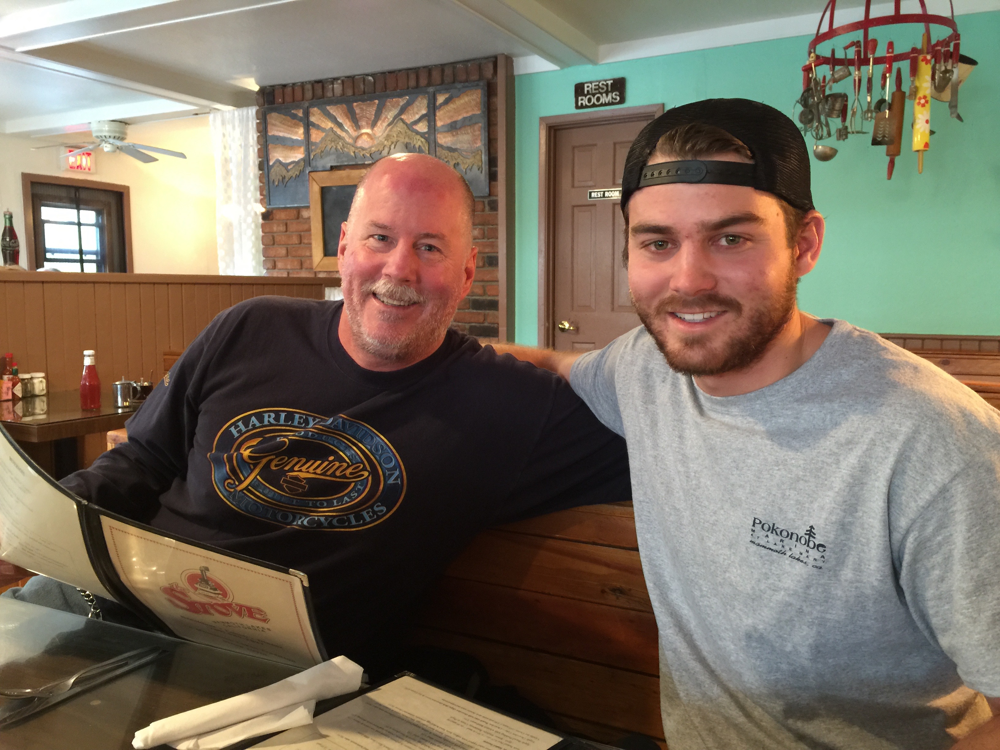
To get to Mammoth Mountain, you pass through Mammoth Lakes, the only incorporated town in Mono County. Mammoth Lakes is the site of today’s family reunion. We’re meeting Dave’s 23-year-old son, Nathan, for breakfast at The Stove, a popular hangout.
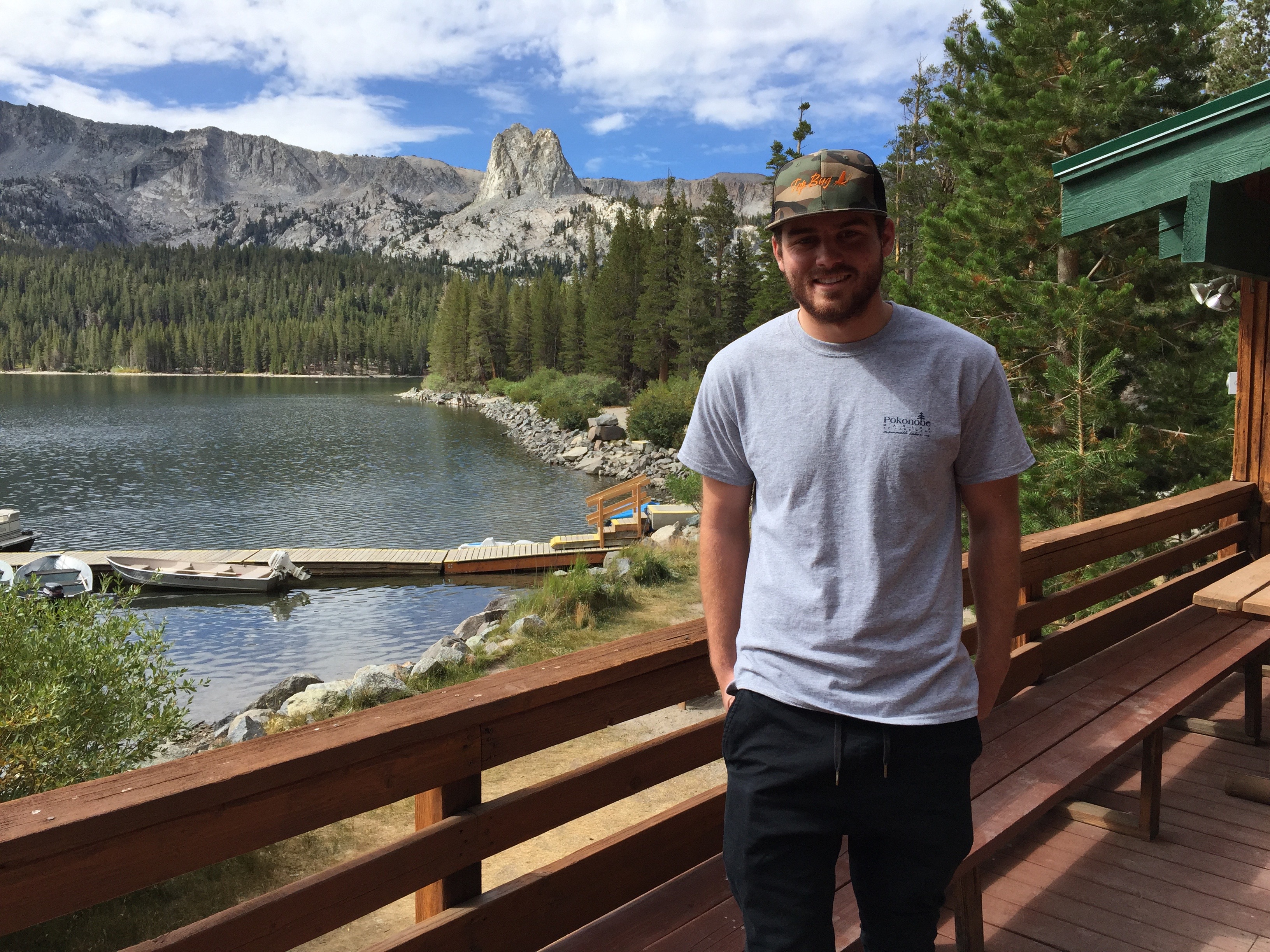
Nathan, an Orange County resident nearly his entire life (spent a couple of years in St. Louis, a million miles from here), is working in Mammoth Lakes for the summer. Lucky kid. Dave and Scott catch up on what Nathan’s been doing: renting and launching boats to summer tourists at the Pokonobe Resort and Marina on Lake Mary, just south of town. Lake Mary is the largest of the alpine lakes in the area; others include Horseshoe Lake, Lake Marnie, Lake George, McCloud Lake, Crystal Lake, TJ Lake and Twin Lakes. All are within a few hundred feet of one another.
It’s a great gig for a college student on summer break. The reunion of father, son and great uncle makes for a nice family moment. A Kodak moment adapted to modern times with an iPhone and GoPro camera.
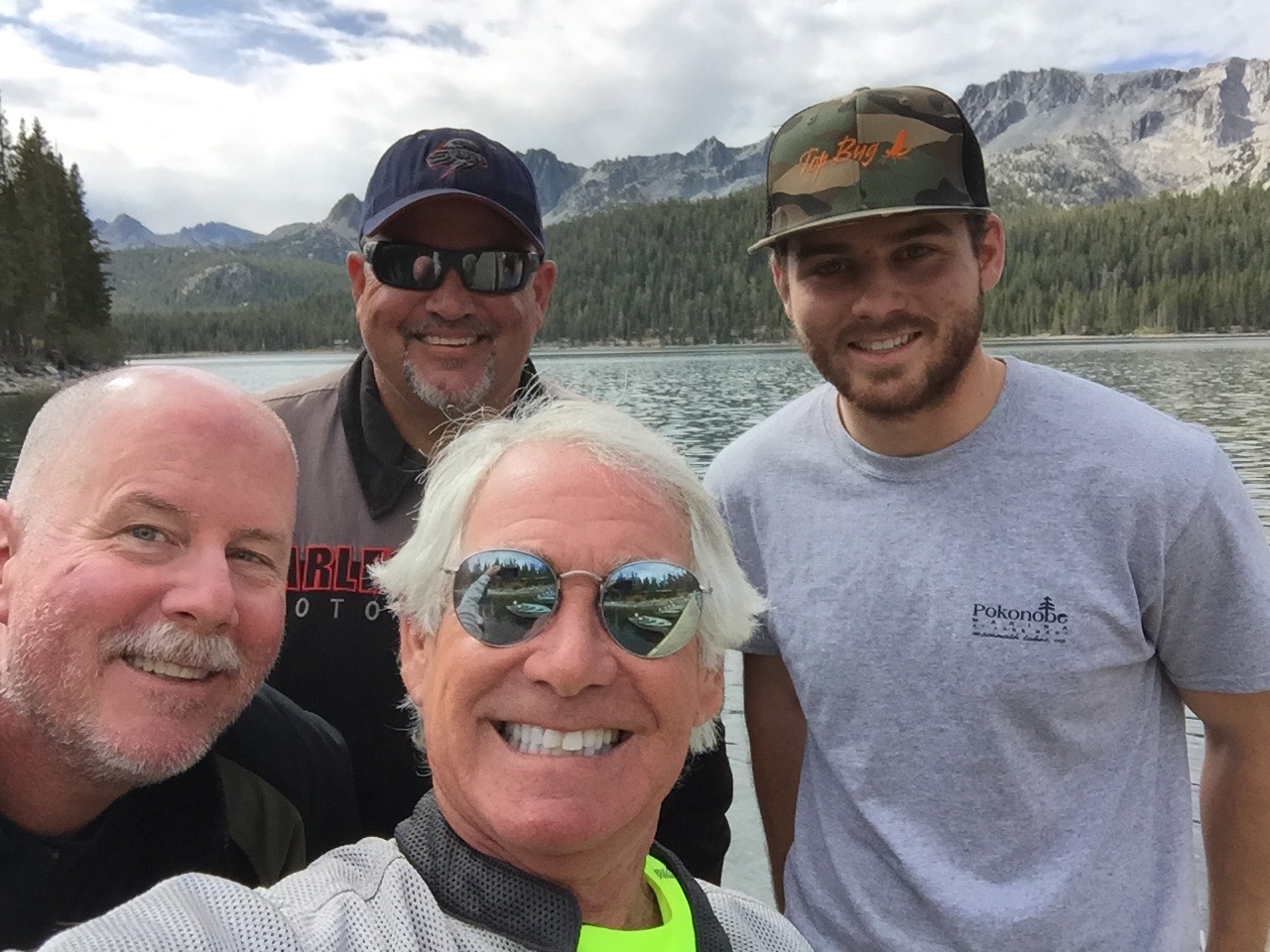
When summer’s over, Nathan will return home to Fullerton, where he’ll complete his studies in Human Development at Hope International University.
***
After breakfast, we head north on Highway 395, taking a scenic detour to ride the June Lake Loop, which takes us through the quaint town of June Lake and past the June Lake ski area. We pass by June Lake itself, which holds special meaning for Scott and Dave’s families, as they’ve camped together there many times. It’s a nostalgic visit evoking many good memories. After completing the June Lake Loop, we retrace our steps to Highway 395, and head north to Lee Vining, where we see signs for Yosemite National Park.
We turn west onto Highway 120, which will take us over Tioga Pass (9,943 feet) and into Yosemite. To our right is Tioga Peak, 11,526 feet. The road climbs steeply and, seemingly in no time, we are at the pass, which just happens to be at the Tioga Pass Entrance Station to the park.
Tioga Pass is named after Tioga Mine, like so many former mining areas in California, now a ghost town. The name “Tioga” originated in New York. It comes from an Iroquois and Mohawk term, meaning “where it forks.”
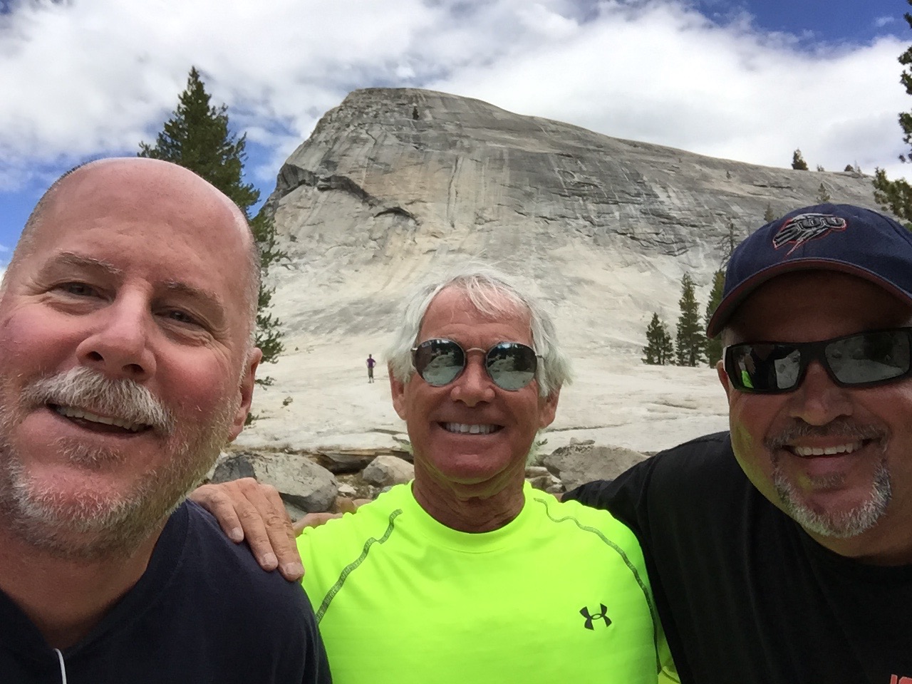
Our first fork in the road brings us to Lembert Dome, where we’ll hike to the top of this granite monolith. Lembert Dome dominates the eastern end of Tuolumne Meadows. It’s nearly three miles round trip, and the hike is the most challenging we’ll have on this trip. Lembert Dome tops out at 9,450 feet. We face a 700-foot vertical rise to get there. But the effort is well worth it, as the top of the dome provides expansive views of Tuolumne Meadows, and surrounding peaks and domes.
Tuolumne Meadows is studded with granite domes – Pothole Dome, Fairview Dome, Medicott Dome, and Lembert Dome.
***
Yosemite National Park has four visitor centers. Twenty-one miles into the park, we arrive at the easternmost one: Tuolumne Meadows Visitor Center. Here, we could learn about the many activities in the Park, including hikes all along Tioga Pass. There’s more hiking here than in any other part of Yosemite. Today seems to be a great day to combine riding and hiking.
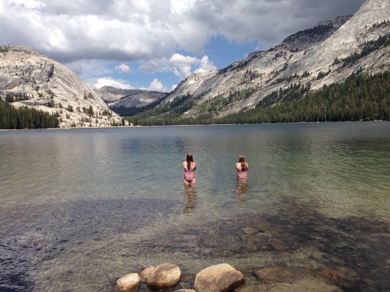
Our next point of interest is Tenaya Lake, at 8,150 feet. Highway 120 runs right along the lake. Tenaya Lake was created by the Tenaya Glacier, which flowed out of the vast Tuolumne Ice Sheet and down to the Yosemite Valey. The lake is named after Chief Tenaya, a Native American chief of the Ahwahnechee people. Hiking, fishing, canoeing and kayaking are all popular summer activities at the lake.
As we ride west, we arrive at Olmsted Point, about 10 miles from Tuolumne Meadows. It’s a viewing area that gives us a glimpse into Tenaya Canyon, and – off in the distance to the southwest – the northern side of Half Dome. The site is named after landscape architects Frederick Law Olmsted and his son, Frederick Law Olmsted, Jr.
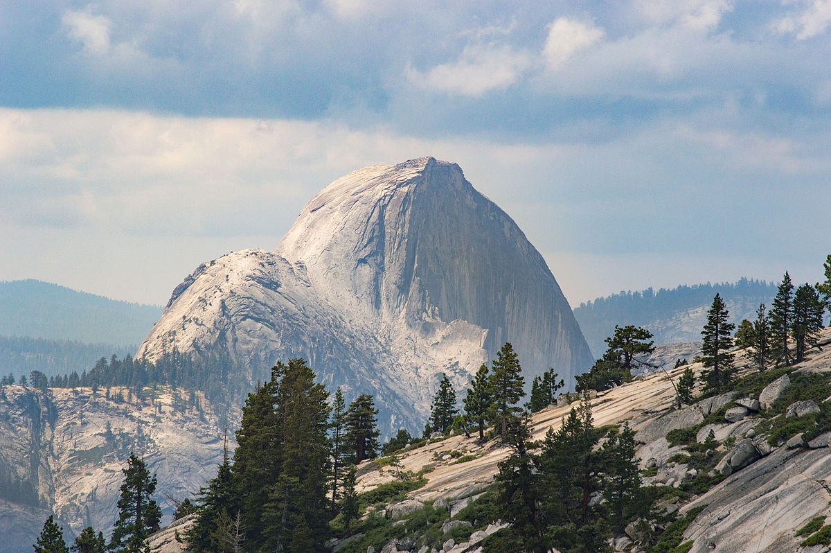
For anyone willing to hike a quarter of a mile up and back on the Olmsted Point Nature Trail, the view gets even better. It’s a 100-foot elevation rise from the 8,300-foot trailhead, and the views are spectacular. We have a clear view of Half Dome. Looking east, we see Tenaya Lake and the granite domes that envelop it. As short as this hike is, it may provide the best bang for the buck – best view for the least effort – along Tioga Pass.
If the Tioga Pass highway opens behind schedule next summer, you can probably blame Olmsted Point. The avalanche risk here makes this one of the most dangerous parts of the road to clear and usually one of the last areas to be passable.
Our 30-mile descent from Olmsted Point takes us to Crane Flat, elevation 6,200 feet. It’s a major campground with 271 campsites, just 16 miles from Yosemite Village, in the heart of Yosemite Valley.
***
At Crane Flat, we turn east onto Big Oak Flat Road for the ride into Yosemite Valley, home to many of the famous cliffs and waterfalls that make Yosemite National Park famous. Yosemite features towering granite faces, dramatic waterfalls, and old-growth forests at a unique intersection of geology and hydrology. Half Dome and El Capitan rise from the park’s centerpiece, the glacier-carved Yosemite Valley. From its vertical walls drop Yosemite North America’s tallest waterfall.
Yosemite’s natural beauty was the impetus for the first implementation of the National Park concept, as we know it today. Yosemite was made a National Park in 1890, and will celebrate its 125th anniversary on October 1.
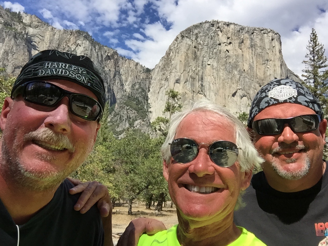
Riding through Yosemite Valley, we are stunned by the sight of El Capitan, the world’s largest granite monolith, towering more than 3,000 feet above the valley floor. It’s on any serious rock climber’s bucket list.
Once considered impossible to climb, El Capitan is now the standard for big-wall climbing.
Using ropes only for safety and not assistance, Tommy Caldwell and Kevin Jorgensen in January 2015 became the first climbers to successfully ascend The Dawn Wall of El Capitan. It took them 19 days, and their effort attracted worldwide media attention. Wanna watch?
Or better yet, wanna climb? Now, thanks to Google Maps and its Street View technology, you can actually put yourself squarely on El Capitan’s granite face. Armchair climbers can look around in all directions – down to the floor of Yosemite Valley, up the blank face to the top of the cliff, at the broad view of Yosemite’s other granite monoliths, and up close at the pebbled grain and crake of El Capitan itself. Check this out … not for the faint of heart, or for vertigo sufferers.
Another famous Yosemite climb that requires little skill but great nerve is Half Dome, a granite crest that rises more than 4,700 feet from the valley floor. If you’re in reasonably good shape, you can hike from the valley floor and then grab onto cables for the final 400 incredibly steep feet to the top of Half Dome. The hike is in great demand – and there’s limited supply – so you’ll need to get a permit from the Park Service. Think you’re a candidate to hike Half Dome? Click here to find out.
And, for you serious video voyeurs, here’s an absolutely incredible video of climbers scaling, then highlining the Totempole. Don’t try this at home! (guaranteed to be the best video you’ll watch on this blog all week).
Where’s the Totempole? Tasmania. A long way from Yosemite.
***
We arrive in Yosemite Village, the hub of the valley. It’s home to National Park Service staff, and has a variety of facilities, including the park’s main visitor center, museums, art galleries, a fire station, medical clinic, restaurants, gift shops and even a K-8 school. Well-heeled visitors can stay at the Ahwanee Hotel, where rooms go for around $500 a night. Thankfully, there’s no vacancy at the Ahwanee tonight.
After a bit of sightseeing in the village, we leave the valley floor and head south into the mountains, toward Glacier Point – about an hour’s ride. We turn onto California Highway 41, also called Wawona Road, and immediately arrive at Artist Point. Tourists stop and shoot photos, though few set up easels and a canvas.
In June 1855, 39-year-old artist Thomas Ayres did just that. He stood here and drew a picture of Yosemite Valley, the first ever by a professional artist. It was published in James Mason Hutchings’ California Magazine in 1856 and was a major contributor to the renown Yosemite Valley would soon begin to receive. Sadly, Ayres didn’t get long to enjoy it; he perished at sea in 1858.
From Artist Point, you have a partial view of Half Dome, and can see Bridalveil Meadow, Royal Arches, partial views of North Dome and Ribbon Falls, plus a few corners of the Merced River. If you’re a serious photographer, you’ll find this spot eminently tripod-worthy.
Another awesome photo op is just a mile up the road at Tunnel View. At this scenic overlook, you have a panoramic view of the valley that has been embraced by artists and photographers since it opened in 1933. The view includes the southwest face of El Capitan, Half Dome, and Bridalveil Falls. It’s the view of the valley you’ll see just before going through the Wawona Tunnel portal as you head south on Wawona Road.
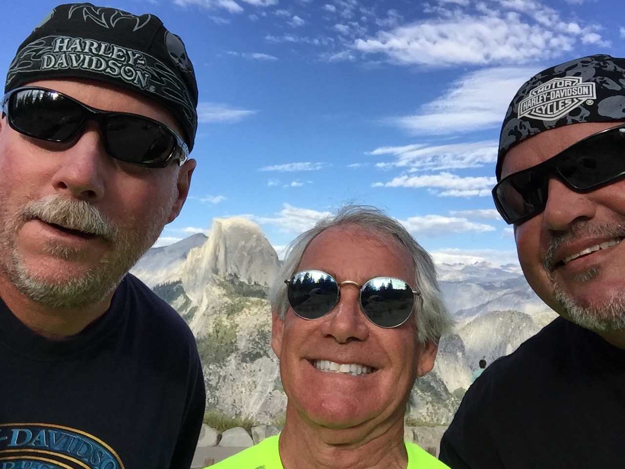
We continue south for seven miles, then turn sharply north on Glacier Point Road. Sixteen twisty miles later, we arrive at Glacier Point, a spectacular overlook at 7,214 feet with a superb view of the Yosemite Valley, including Half Dome.
The road to Glacier Point is usually open from June through October. In winter, Glacier Point Road closes due to snow. This year, Glacier Point Road opened on March 28, the earliest opening on record. Glacier Point’s primary activity: enjoying the view.
We leave Glacier Point, ride 13 miles south, and arrive at the Sentinel Dome parking lot, on the south wall of Yosemite Valley. California Hiking, a book we embraced to discover hikes for this trip, calls the Sentinel Dome hike one of the “Top 10 With a View” in California. Since the book evaluates and describes more than 1,000 hikes across the state, we’ll take that as a solid recommendation to scale Sentinel Dome.
The trail climbs vertically 400 feet to a final elevation of 8,100 feet. From the top of Sentinel Dome, you have a 360-degree view of Yosemite National Park. Looking west, we look down Yosemite Valley and beyond to the Merced River canyon. On exceptionally clear days, you can see all the way to Mt. Diablo in the Coastal Range. To the north, we see Yosemite Valley, including El Capitan and Yosemite Falls. To the east, we see Half Dome and an assortment of High Sierra peaks.
Wow. Just wow.
The hike back down to the trailhead is anti-climactic. We hop back on our bikes for the hour and a half ride to tonight’s destination: Oakhurst.
On our way back to Wawona Road, we notice the turnoff to Badger Pass Ski Area, just a few hundred yards off Glacier Point Road. Badger Pass is a small ski area located within Yosemite National Park, one of only three lift-serviced ski areas operating in a US National Park (Olympic National Park’s Hurricane Ridge is one of the others). From a base at 7,200 feet, Badger Pass offers 800 vertical feet of skiing, and every February, it hosts the annual Yosemite Nordic Holiday, a series of cross-country races.
***
Now back on Wawona Road, we ride south toward the village of Wawona. Wawona sits on the south fork of the Merced River, 27 miles south of Yosemite Village. At 3,999 feet, it has less than 200 residents and is the site of the historic Wawona Hotel, built in 1876. The hotel is designated a National Historic Landmark and is on the National Register of Historic Places.
Wawona feels very much unlike other areas of Yosemite we’ve been for most of the day. Across from the hotel is a nine-hole, par 35 golf course, one of the few within any US National Park. (There’s also a golf course at Furnace Creek Resort in Death Valley National Park.)
Yosemite is known for its massive Sequoia groves. About five miles south of Wawona, we see the turnoff for Mariposa Grove, which has about 500 mature sequoias, among the rarest, oldest and largest living organisms in the world.
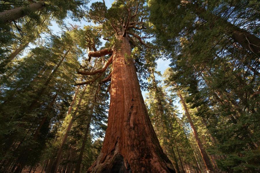
The grove includes the Columbia Tree, tallest in Yosemite at 285 feet, and the Grizzly Giant, estimated at 2,400 years old, the most mature in the grove. The Wawona Tree had a tunnel cut through it in the nineteenth century that was wide enough for horse-drawn carriages and early automobiles to drive through. Weakened by the large opening at its base, the tree fell down in a storm in 1969. Its collapse is seen as a turning point in the preservation program in America’s National Parks.
Much to our disappointment, Mariposa Grove closed for restoration in July and won’t re-open until summer 2017. The Park Service says the restoration project will prepare the Grove for its next 150 years of inspiring visitors. The Mariposa Grove restoration project is designed to restore dynamic ecological processes and increase the resiliency of the grove to withstand natural stressors such as climate change and altered fire patterns.
While Mariposa Grove will have to wait, we can look forward to seeing a lot more sequoias tomorrow, when we visit Sequoia National Park.
On the way to tonight’s destination, Oakhurst, we continue south on Highway 41. The road twists and descends past the tiny communities of Fish Camp, Sugar Pine, and Yosemite Forks.
After a 180-mile ride that began on the eastern side of the Sierras, we arrive in Oakhurst, formerly called Fresno Flats.
Oakhurst’s claim to fame: the pioneering computer game developer Sierra On-Line was based here from 1981 to 1999. The company achieved many industry firsts, including the development of the first 3D adventure game (King’s Quest) and one of the first online gaming networks.
Our only game tonight is dinner and writing this blog, which I’m now doing.
***
To view today’s route from Bridgeport to Oakhurst, click here.
