We’re making history today. At least, we’re following history.
For much of the morning, our route takes us to Mother Lode country, heart of California’s gold rush.
The gold rush began in earnest in 1948 when gold was found at Sutters Mill. The original fleck of gold discovered at the mill is currently on display at the Smithsonian Institution.
California’s Gold Rush brought an estimated 300,000 people to this area. About half arrived by sea from Asia, and half came overland from the eastern US. Because of the year they began arriving in droves (1849), the gold-seekers became known as forty-niners.
Today, we’ll travel Highway 49, known as the Gold Rush Trail. It’s also called the Golden Chain Highway.
The ’49ers established hundreds of instant mining towns along the western foothills of the Sierra Nevada. Many of these historic and picturesque towns still exist, linked by California Highway 49.
We leave Mariposa, home of California State Mining Museum, and head north.
Highway 49 twists and climbs past panoramic vistas. We pass through the old mining town of Coulterville. Angels Camp is just a few miles to the east, and nearby Murphys has on display the largest crystalline gold nugget in the world. At 44 pounds, it’s worth about $3.5 million. We roll through Chinese Camp – at one time home to an estimated 5,000 miners who emigrated from China to take part in the gold rush.
Sixty miles from Mariposa, we arrive in Copperopolis. Unlike most of the other mining towns in Calaveras County, Copperopolis’ claim to fame is not gold, but copper. Copperopolis is also famous for a shack on Jack Ass Hill, where Mark Twain is believed to have written one of his most famous works, The Celebrated Jumping Frog of Calaveras County.
Beyond Copperopolis, we pass through San Andreas, a California Historical Landmark that’s the county seat of Calaveras County. A few miles past Mokelumne Hill – once one of the richest gold mining towns in California – we arrive in Jackson, our last mining town before we turn east into the Sierra Nevada Mountains.
***
If you haven’t noticed by now, many California place names derive from either Spanish, or from Native American tribes who settled the land long before Europeans arrived.
Here in Jackson, we turn our focus eastward to the Sierra Nevada mountain range. Sierra Nevada is Spanish for “snowy range.” There’s generally snow in the Sierras during the winter and spring. None now.
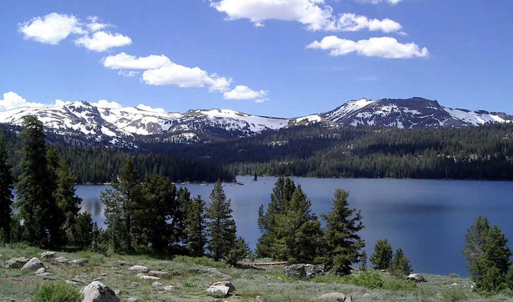
The Sierra Nevada range, where we will spend much of the remainder of our journey, runs 400 miles from north-to-south. Notable features include Lake Tahoe, the largest alpine lake in North America – and today’s destination. The Sierras are home to three National Parks – Yosemite, Sequoia, and Kings Canyon – all of which we will visit over the next few days.
In Jackson, temperatures are now in the ‘90s, and we look forward to riding into the Sierra foothills and then the higher elevations to cool off.
California Highway 88 takes us east, as we gradually twist and climb into the El Dorado National Forest. Highway 88 becomes Carson Pass, named for frontiersman Christopher Houston “Kit” Carson. He was a fur trapper, wilderness guide, Indian agent and US Army officer.
Carson Pass, at 8,574 feet, is marked by a California Historical Landmark. There’s a memorial where Carson carved his name into a tree. The historic pass was a point on the Carson Trail during the gold rush.
There are four major passes across the Sierra Nevada range: Carson Pass, Ebbetts Pass, Sonora Pass, and Tioga Pass – all of which we’ll cross later this week.
Unlike the other three, Carson Pass is generally open throughout the winter except during the worst snowstorms.
At Carson Pass, you can pull into the visitor information center parking lot, where you could leave your bikes for an hour while you hike to Frog Lake. It’s about two miles round trip, and not at all difficult. The Frog Lake hike is popular with families and children.
From Frog Lake, there’s a scenic view of Elephant Back, a mountain whose peak is at 9,585 feet. As it turns out, Elephant Back – a pile of volcanic rubble, looks just like its name. You may not be familiar with elephants, but you’ll know an elephant back when you see one.
***
Not far from Carson Pass, we descend to Kirkwood, home of the Kirkwood Mountain Resort – about 30 miles south of Lake Tahoe. With 15 lifts, a base elevation of 7,800 feet, and 2,000 vertical feet of skiing, Kirkwood is one of the region’s larger resorts. It’s owned by Vail Resorts, which also owns Heavenly Valley at South Lake Tahoe, and Northstar, near the north shore of Lake Tahoe.
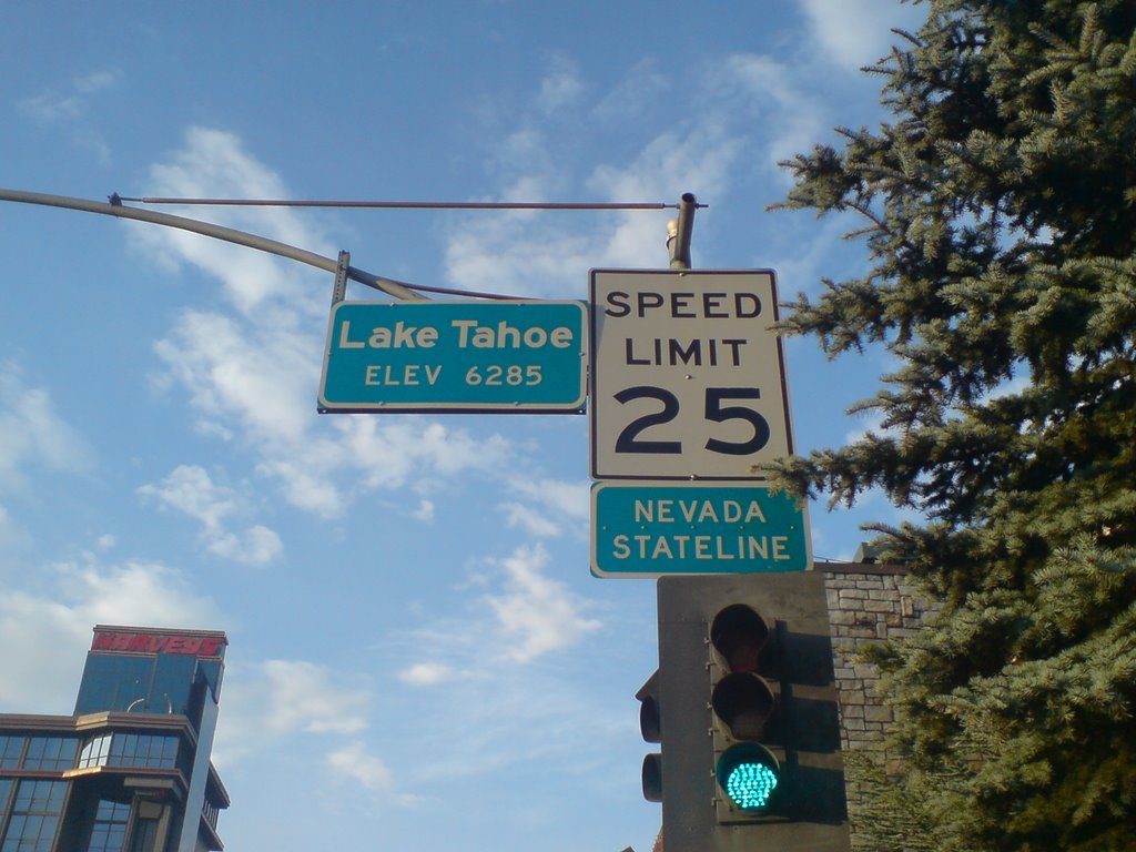
Near Sorensens, we turn off of Highway 88 and onto Highway 89, which will take us over 7,740-foot Luther Pass and into the Lake Tahoe area, a major tourist destination.
Lake Tahoe’s surface elevation is 6,225 feet. Its maximum depth is more than 1,645 feet. Among US lakes, only Oregon’s Crater Lake is deeper. One more stat: Lake Tahoe is the sixth-largest lake by volume in the US, behind only the five Great Lakes, and it’s the largest alpine lake in North America.
We pass through Meyers, a one-time stagecoach stop, trading post and Pony Express station. It’s now registered as California Historical Landmark #708.
To our right is the Lake Tahoe Airport, a general aviation facility that sits at 6,264 feet. The airport opened in 1959 with a 5,900-foot runway, and at one time had commercial jet service with Pacific Air Lines flying Boeing 727-100s from Los Angeles to San Jose to Lake Tahoe.
Other airlines followed – including Holiday Airlines, Pacific Southwest Airlines, Air California, Aspen Airways and Golden Gate Airlines. Boeing 737s, MD-80s and BAC-111s all showed up. Douglas DC-9s were the last jets to use this airport. Commercial air service has been gone since the end of the 20th century.
***
As a teenager, I often hung out with family and friends at Lake Tahoe, visiting perhaps a hundred times in the 1960s. It was mostly skiing in the winter, and an occasional summer vacation thrown in for good measure.
One thing I never did was travel all the way around the lake, non-stop. Today, we just might.
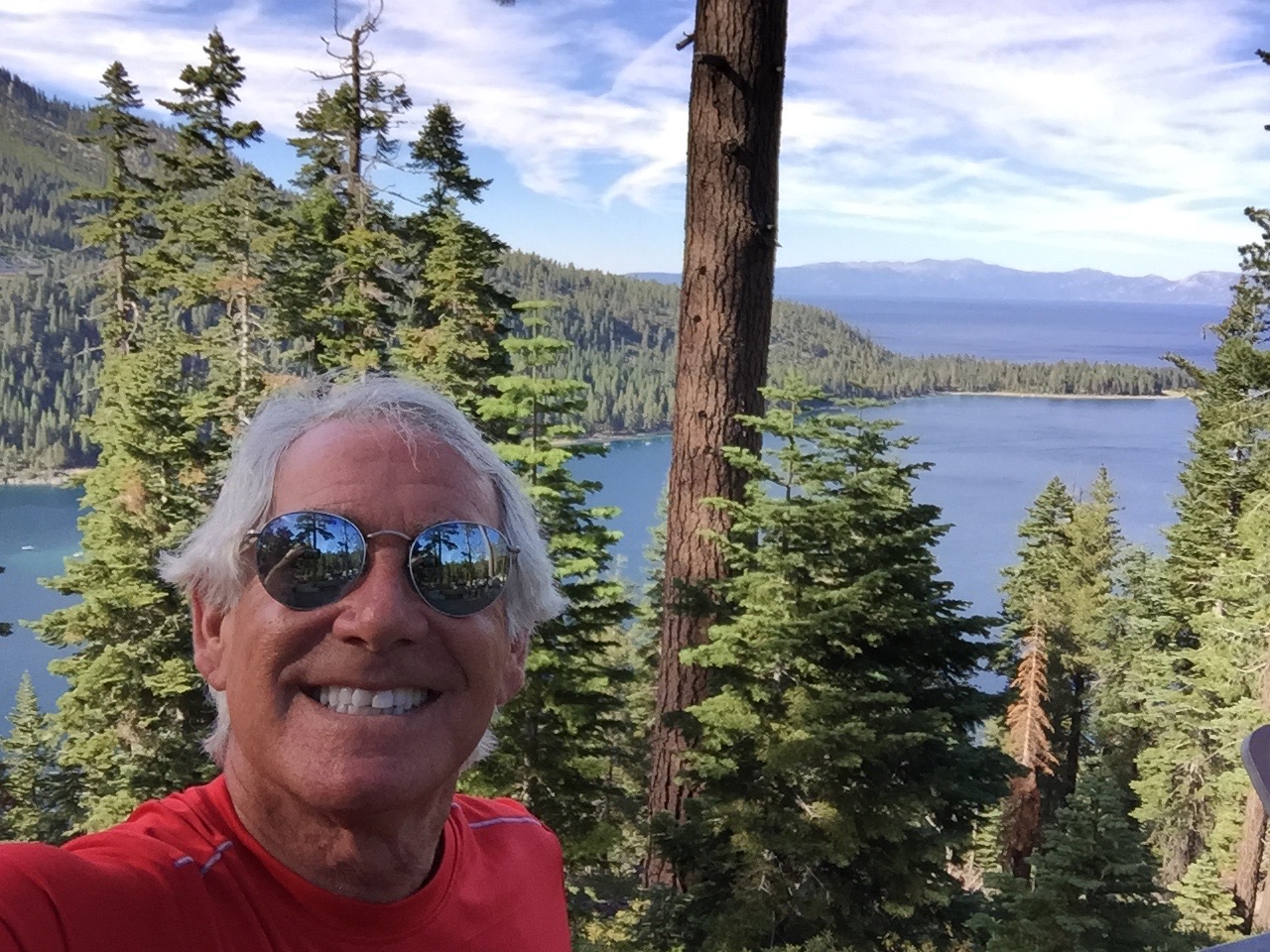
We begin by following Highway 89 North through Camp Richardson to Emerald Bay, where the views from Inspiration Point are breathtaking (see photos). Then, it’s on to Meeks Bay, and Homewood. Homewood is a small ski area on the west shore of Lake Tahoe. It’s owned by the same company that owns the more famous North Tahoe resorts – Squaw Valley and Alpine Meadows.
Homewood will be both the start and finish next month for the annual Tahoe 200, an ultra endurance race that takes runners on a 202.5-mile tour of Lake Tahoe and surrounding areas. The race starts on September 11 at 9 am, and competitors have until September 15 at 1 pm to complete the event – a 100-hour cut off. With an elevation gain of 39,800 feet, the Tahoe 200 is for serious athletes and true masochists (people who take pleasure in pain).
Entry fee is $950. To qualify, you must have completed at one 100-mile mountain race (defined as having more than 15,000 feet of climbing), or two 100 mile non-mountain races (defined as having less than 15,000 feet of climbing). Or, if like most of you, you haven’t met these requirements and still want to run in the event, the Race Director can approve you as a non-traditional entrant.
Last year’s winner, 36-year-old Ewan Horsburgh of Katoomba, Australia, finished the Tahoe 200 in 61 hours and 32 minutes. He edged out the second-place finisher by two hours and 11 minutes. The top woman in the race finished 14 hours behind the winner. Of the 90 runners, some coming from as far away as Japan, India, and Brooklyn, 30 did not finish. You slackers!
With no disrespect to these ultra-jocks, seems like it’s a whole lot simpler, and far less expensive, to just ride around the lake.
***
Soon, we pass by Tahoe City. If we continued on Highway 89, we’d end up at Squaw Valley – where I learned to ski – and which hosted the Winter Olympic Games, both in 1960.
It’s so much fun following the shoreline of the lake that we turn onto Highway 28 and continue along Dollar Point, Carnelian Bay, Kings Beach, and then cross the Nevada state line in Crystal Bay. This is where the famed Cal Neva Resort sits, straddling the border between California and Nevada.
Little-known fun fact: Cal Neva was the first place I ever gambled at a casino. Played roulette for hours in the late 1960s, placing dumb bets on red and black while being served free Harvey Wallbangers all night long. Full disclosure: I was 19 at the time.
I have rarely gambled since. I consider gambling a tax on stupidity.
Cal Neva, built in 1926 by a wealthy San Francisco businessman, attracted big-name entertainers in the 1960s. For a time, Frank Sinatra owned the resort. He built the Celebrity Room theater, which saw performances by Sinatra, Dean Martin, Sammy Davis Jr. and many others. Sinatra’s gambling license was temporarily lifted by the Nevada Gaming Control Board when Chicago mobster Sam Giancana was spotted there.
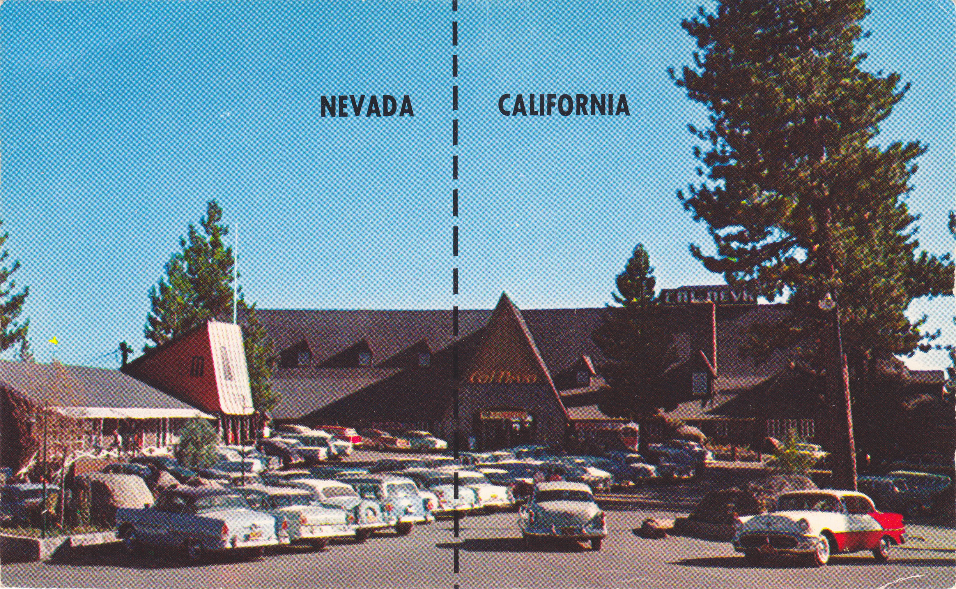
The casino/resort has been undergoing major renovations by its new owner for the past two years, and remains closed. Recent news reports at one time indicated the possibility of a December 12, 2015 re-opening date – to coincide with Frank Sinatra’s 100th birthday.
For you Southern Californians who just can’t get enough of all things Sinatra, a Frank Sinatra centennial exhibition will open at the Grammy Museum in downtown Los Angeles October 21. His career included 30 Grammy nominations and 11 wins, among them, “It Was a Very Good Year” and “Strangers in the Night.”
He still lives on, in video.
***
Next point of interest: Incline Village, Nevada. It’s known as a haven for wealthy individuals from California who want to unshackle themselves from California’s burdensome tax system. Incline Village is also home to Diamond Peak, a small ski resort with six chairlifts. In the summer, you can play golf at a Robert Trent Jones-designed course and stay at the nearby Hyatt Regency.
Too sedate? Reno is only a 45-minute drive north over the Mt. Rose Highway.
From here, continue south on Highway 28, which brings us along the eastern shore of Lake Tahoe, where there’s a merge onto US-Highway 50 to complete the circumnavigation of the lake.
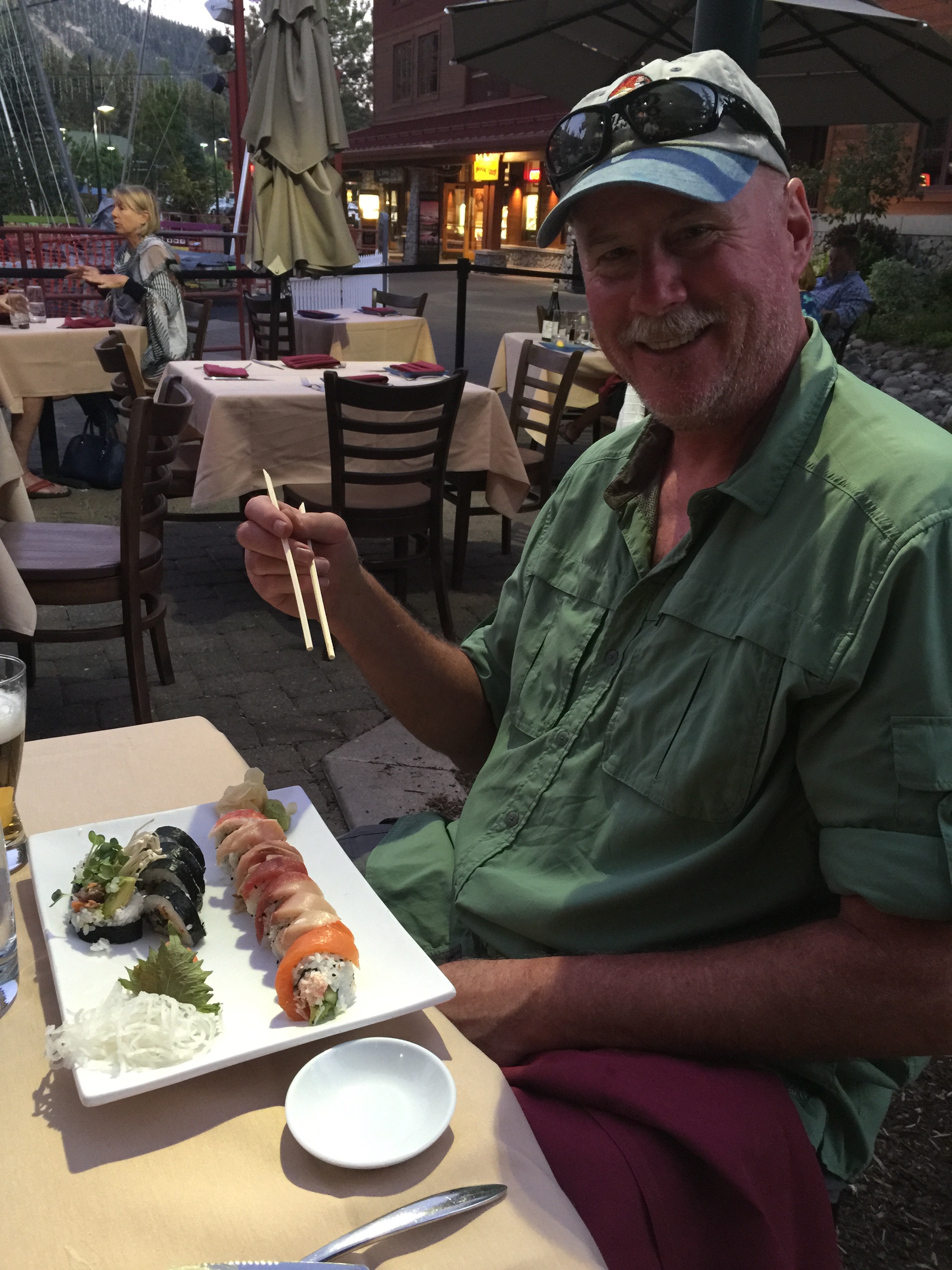
Just across the state line, with Harrah’s Hotel/Casino to our left and Harvey’s to our right, we enter California and arrive at tonight’s destination in South Lake Tahoe. It’s the end of a 250-mile ride that began in gold rush country, brought us over Kit Carson Pass, and evoked memories from a half-century ago.
How could tomorrow be any better?
***
To view today’s route from Mariposa to South Lake Tahoe, click here.