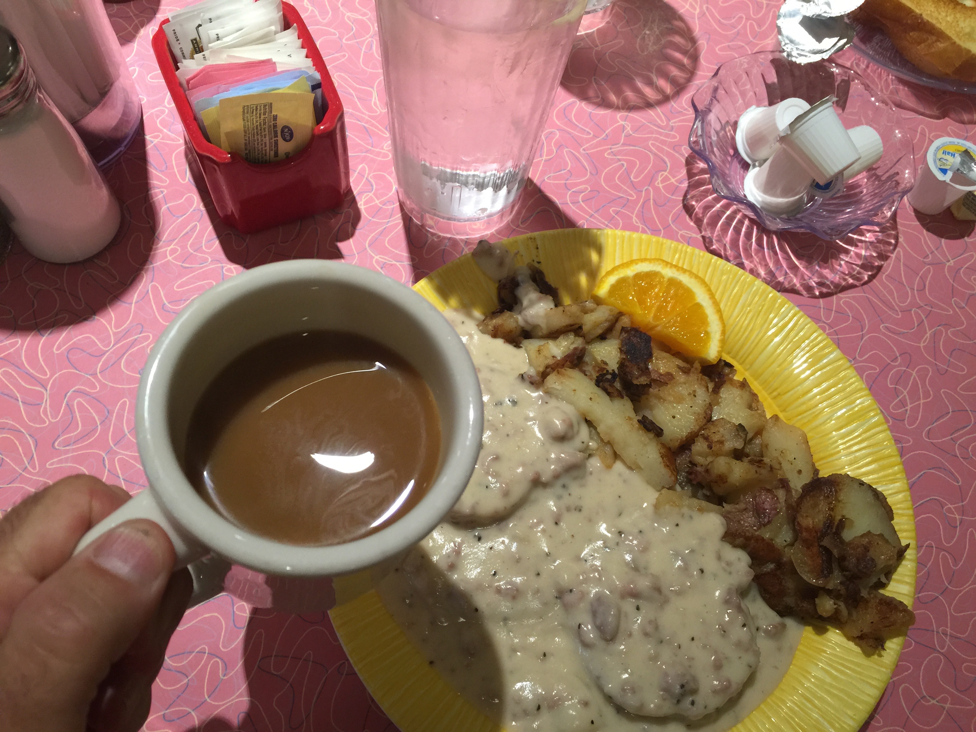
The day begins with a yummy breakfast at Bonnie Lu’s Country Cafe. Biscuits and Gravy for me. Healthier fare for Dave and Scott.
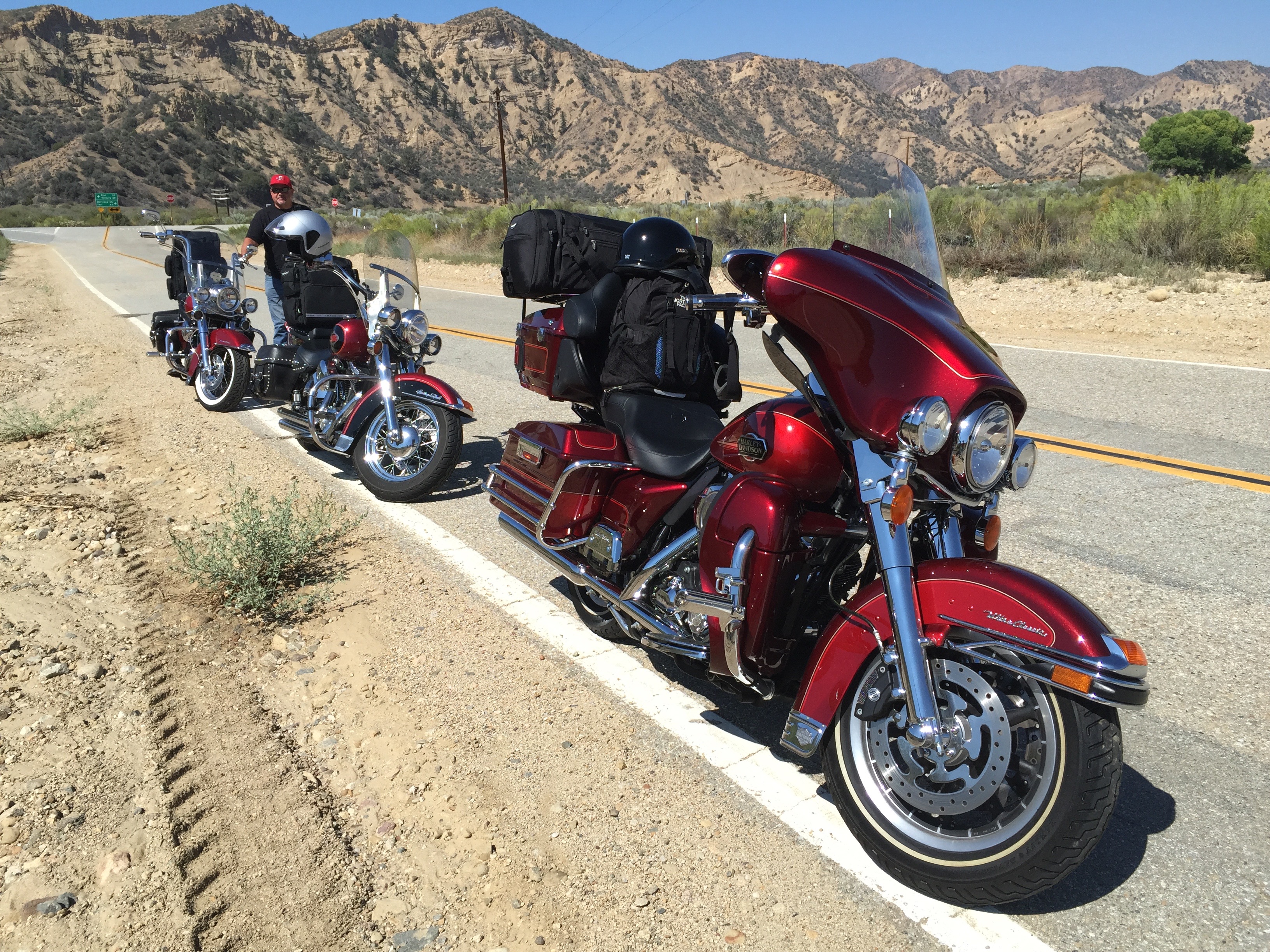
Best activity after a caloric overload: sit on your butt for the next six hours and enjoy the scenery.
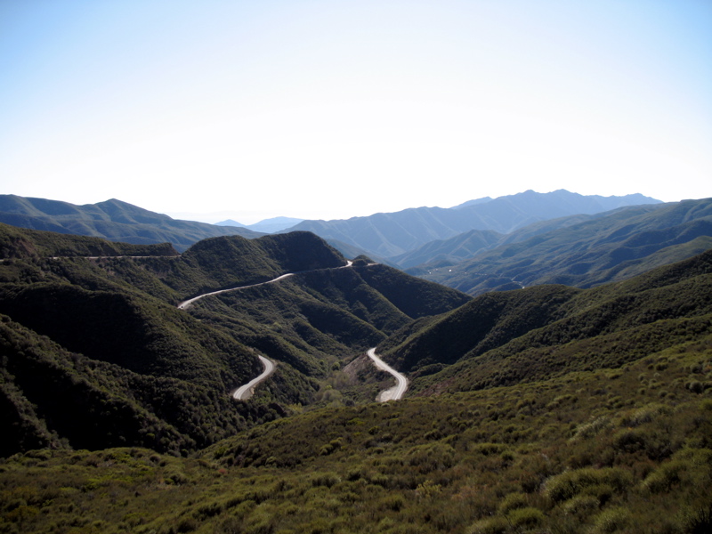
We head north from Ojai on Highway 33, the Maricopa Highway. Designated a National Scenic Highway, it’s a twisty road, following Matilija Canyon through the Santa Ynez Mountains. We climb to Pine Mountain Pass – at 5,080 feet, it’s more than 4,300 feet above Ojai.
From Pine Mountain Pass, we descend comfortably into a flat area that takes us to Lockwood Valley. We are now heading East on Lockwood Valley Road. There’s very little out here of note. Trees and mountains. And Harleys. Lockwood Valley sits at about 4,800 feet.
The only road ahead is the one that takes us to Lake of the Woods, a community of less than 1,000 residents in the Los Padres National Forest. Lake of the Woods was named for a mountain reservoir that has been dry since 1962, when its dam burst. Lake of the Woods is located in Cuddy Canyon of the San Emigdio Mountains.
In Lake of the Woods, we turn west on Cuddy Valley Road, and remain in the mountains. To our left is Mount Pinos, whose 8,847-foot summit is the highest point in Ventura County. We descend along the Bitter Creek National Wildlife Refuge, designed to protect the dwindling California condor foraging and roosting habit.
The Bitter Creek Refuge provides grassland, oak woodland, chaparral, pinion pine/juniper/oak woodland, and wetland habitat for endangered critters. Among those struggling species are San Joaquin kit fox, blunt-nosed leopard lizard, giant kangaroo rat, and species of Federal concern such as western spade foot toad, western horned lizard, and tri-colored blackbird. That’s information you’ll only find on this blog. Or on the Internet, if you care to look for it.
We reach Highway 166, the Cuyama Highway, and turn west. Cuyama, which lies ahead several miles, is derived from Chumash, meaning “To Rest, to Wait.” We will do neither, as there’s nowhere to rest and little to wait for. Cuyama is surrounded by apricot, peach and plum orchards.
Highway 166 takes us past family farms and fruit orchards before we meet US Highway 101, just north of Santa Maria. Until the Interstate Highway System was built, Highway 101 was the primary north-south route through California. It’s also known as El Camino Real (“The Royal Road”), where its route along the southern and central California coast approximates the old trail that linked the Spanish missions in the 18th and 19th centuries.
El Camino Real (pronounced ree-AL) meets the ocean in Pismo Beach, which was once known as the “Clam Capital of the World.” That moniker has disappeared, thanks to over-harvesting. Pismo clams were once so abundant they were harvested with plows on the beach. Clamming is still legal, but few remain to be found. They are a favorite meal of the protected sea otter, which pretty much wipes out what’s left of the local clam population.
This stretch of Highway 1 is called the Cabrillo Highway, named for Juan Rodriguez Cabrillo, a Portuguese explorer noted for his 16th century exploration of the west coast on behalf of the Spanish Empire. He was the first European explorer to navigate the coast of present-day California.
The Cabrillo Highway brings us to San Luis Obispo, where we turn north onto California Highway 1 – the Pacific Coast Highway. We will stay on this road for the next 155 miles, 32 of them today and the rest tomorrow.
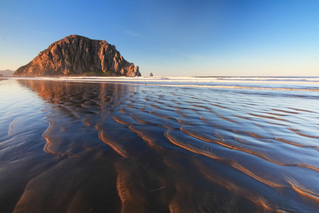
Still inland on a coastal highway, we soon reach the coastline in Morro Bay, whose most prominent physical feature is Morro Rock, a 576-foot high volcanic plug. Known to locals as “The Rock,” it was quarried from 1889 until 1969. There’s no public access to the rock, because it’s a reserve for the peregrine falcon. Morro Bay calls itself “The Gibraltar of the Pacific.”
Twenty more miles on Highway 1 and we arrive at Cambria, a seaside village doubling as an art colony. Cambria is roughly halfway between Los Angeles and San Francisco. And it’s 100 percent of the way to today’s destination.
Our ride finishes quietly as we pull into the motel and begin to think about dinner. In our rear-view mirror: a tidy 230 miles of mountain roads, valleys and a hint of ocean.
What’s cookin’?
***
Come to think of it, we’ve been sitting on our butts all day and could use some exercise. Might be nice to burn a few calories before dinner.
We’re very close to the Pacific Ocean. Why not a beach walk?
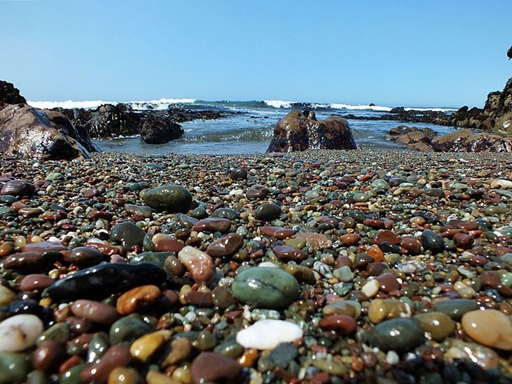
About a mile north of us is the Moonstone Beach Boardwalk, which runs north and south along the beach for about 1.5 miles. The boardwalk meanders along the Moonstone Beach. There are opportunities to jump off the boardwalk and put footprints in the sand.
If you are curious, a moonstone is not to be confused with a moon rock.
Moonstones, which are seen on this beach in abundance, are gemstones, whose name is derived from a visual effect caused by light diffraction. You probably knew this, but the moonstone is Florida’s state gem. Florida made that selection to commemorate the moon landings nearly a half-century ago, because the rockets to the moon were launched from Florida’s Kennedy Space Center. Here is Apollo 11 lifting off toward the Moon, on July 16, 1969.
Five days later, Neil Armstrong became the first human to step on the surface of the Moon.
We do our own exploring tonight, successfully foraging for food in Cambria. Dinner at Cambria Pub and Steakhouse.
***
To view today’s route from Ojai to Cambria, click here.