As I may have mentioned before, Ray has hundreds of thousands of motorcycle miles in the saddle. He’s ridden 356,000 miles in the U.S. and Canada. He’s been to the Arctic Circle, Europe, Australia. It’s hard to imagine somewhere Ray hasn’t been.
And for years, he’s told me that his favorite place of all is Rocky Mountain National Park, in Colorado. That’s today’s destination. It promises to be the highlight of our trip.
***
We leave Silverthorne and head north on CO-9, riding toward Green Mountain Reservoir, which sits at an elevation of 7,950 feet. The Green Mountain Dam was built between 1938 and 1942 by the Bureau of Reclamation. The dam and reservoir store water to benefit Colorado’s Western Slope, which is pretty much everything in the state west of the Continental Divide.
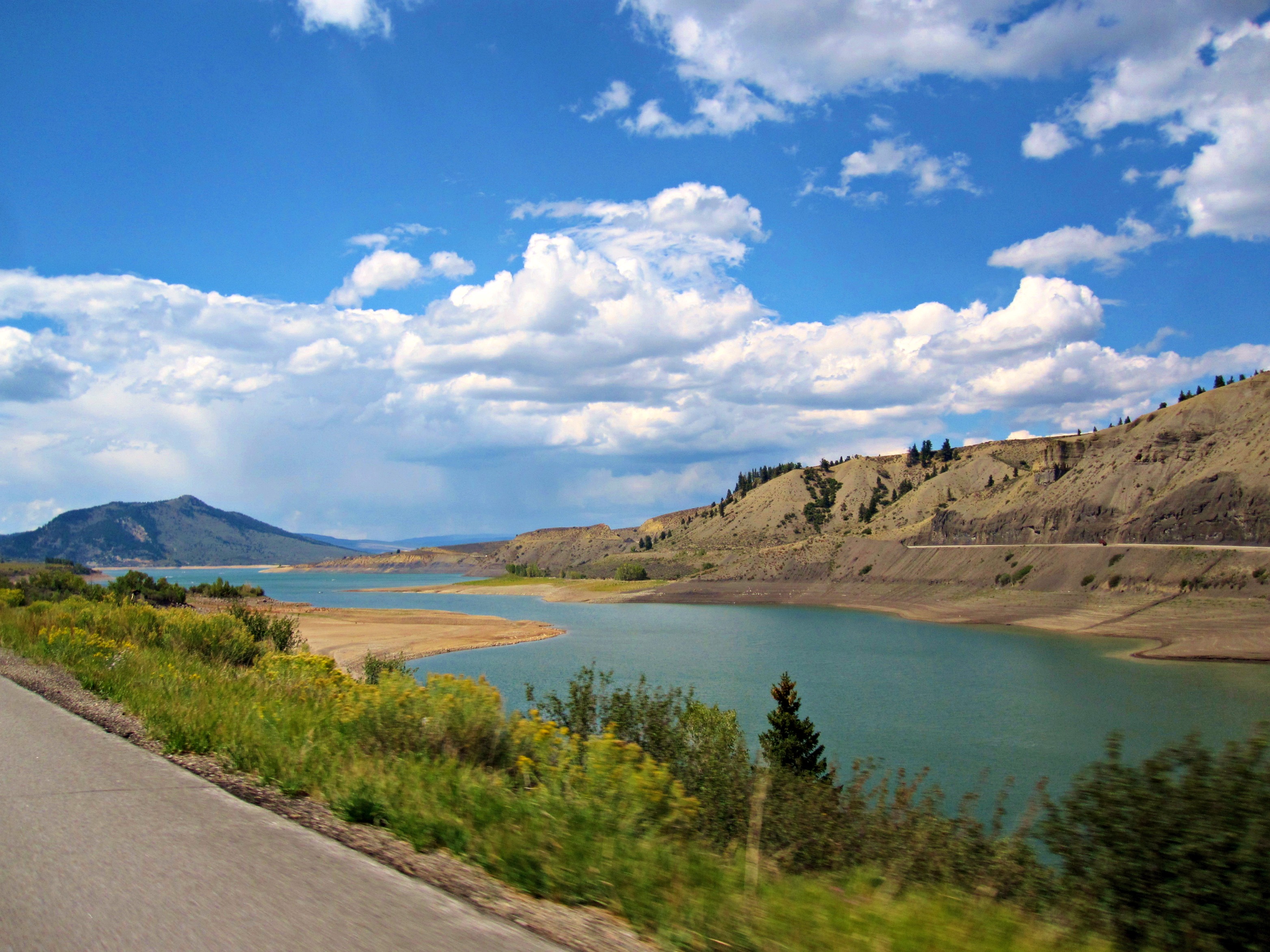
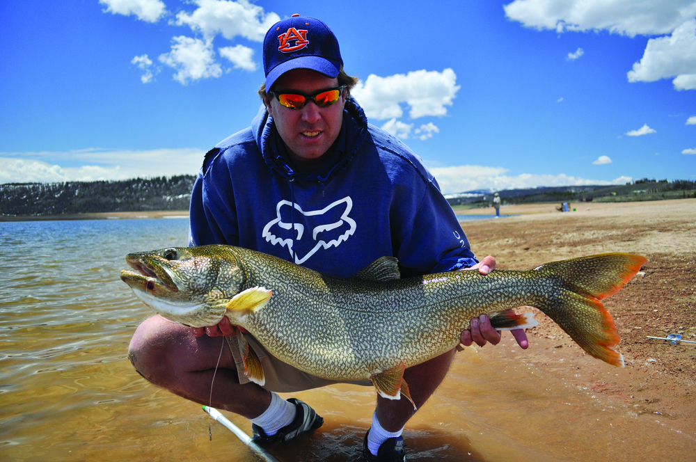
The reservoir’s lake is popular with fishermen, who catch rainbow trout, lake trout, brown trout, and kokanee. Green Mountain Reservoir empties into the Blue River, which we follow to the town of Kremmling, just north of the confluence of the Blue River and the Colorado River.
We arrive in Kremmling, elevation 7,313 feet, less than an hour after leaving Silverthorne. Like so many towns in the area, Kremmling was founded during the Colorado silver boom days. The original post office here was called Kinsey City, named after brothers Aaron and Kohn Kinsey, who had a local ranch. The Kinsey City postmaster was Rudolph Kremmling, who ran the town’s general store. In 1895, the town was officially re-named Kremmling.
Kremmling is at the intersection of CO-9 and US-40, once a main east-west route through Colorado. Before the Interstate Highway System, US-40 once traversed the entire country, from San Francisco to New Jersey. Today, US-40’s western terminus is in Utah, not far from Park City. The highway terminates in Atlantic City, two blocks from its famous Boardwalk.
We turn east in Kremmling onto US-40, which follows the Colorado River, running through the towns of Parshall and Hot Sulphur Springs.
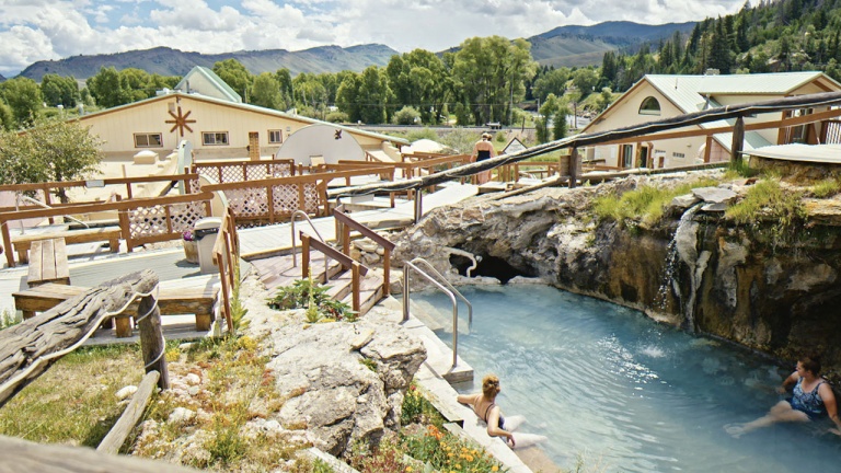
Hot Sulphur Springs was originally a winter campground for Native Americans who came to use the geothermally heated hot springs for medicinal purposes. If we had more time – and money – we’d stop at the Hot Sulphur Springs Resort & Spa for some soaking and relaxing. Click here to see what we are missing.
After luxuriating in the hot springs, or at least thinking about, we continue east on US-40, toward Granby, a mountain town 7,935 feet above sea level. Granby was founded in 1904, along the route of the Denver, Northwestern & Pacific Railway. It was named after Granby Hillyer, a Denver lawyer who later served as the U.S. Attorney for the area.
Granby might be best known for an incident in 2004, when welder and automobile muffler repair shop owner Marvin Heemeyer went on a rampage through the town in a modified bulldozer and trashed several buildings. Outraged over the outcome of a zoning dispute, Heemeyer armored a Komatsu D355A bulldozer with layers of steel and concrete, and used it to demolish the town hall, the former mayor’s house and other buildings. Afterward, Heemeyer died of a self-inflicted gunshot, ending the bizarre day. Click here to see some news helicopter footage of the Granby carnage.
***
We turn north in Granby on US-34, and continue riding past Lake Granby, the third-largest body of water in Colorado, and home to the Lake Granby Yacht Club. At 8,280 feet, it’s believed to be one of the world’s highest-elevation yacht clubs.
Not far from Lake Granby is Shadow Mountain Lake and Grand Lake. Grand Lake is Colorado’s largest and deepest natural lake, and is part of the headwaters of the Colorado River. This is where Trail Ridge Road begins.
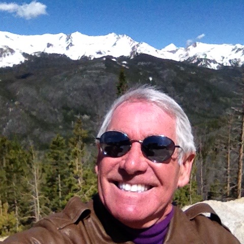
I should come clean at this point: I hate heights.
For as long as I can remember, I’ve had an overwhelming, irrational fear of heights. For all my seeming bravado about the high places we’re riding on this trip, truth be told – I’m terrified on mountain roads with steep drop-offs. That pretty much describes what’s ahead of us today.
But here we are, so I’ll suck it up and ride on. Or, hope for bad weather, a mechanical breakdown, or some other intervention that keeps me at reasonable elevations.
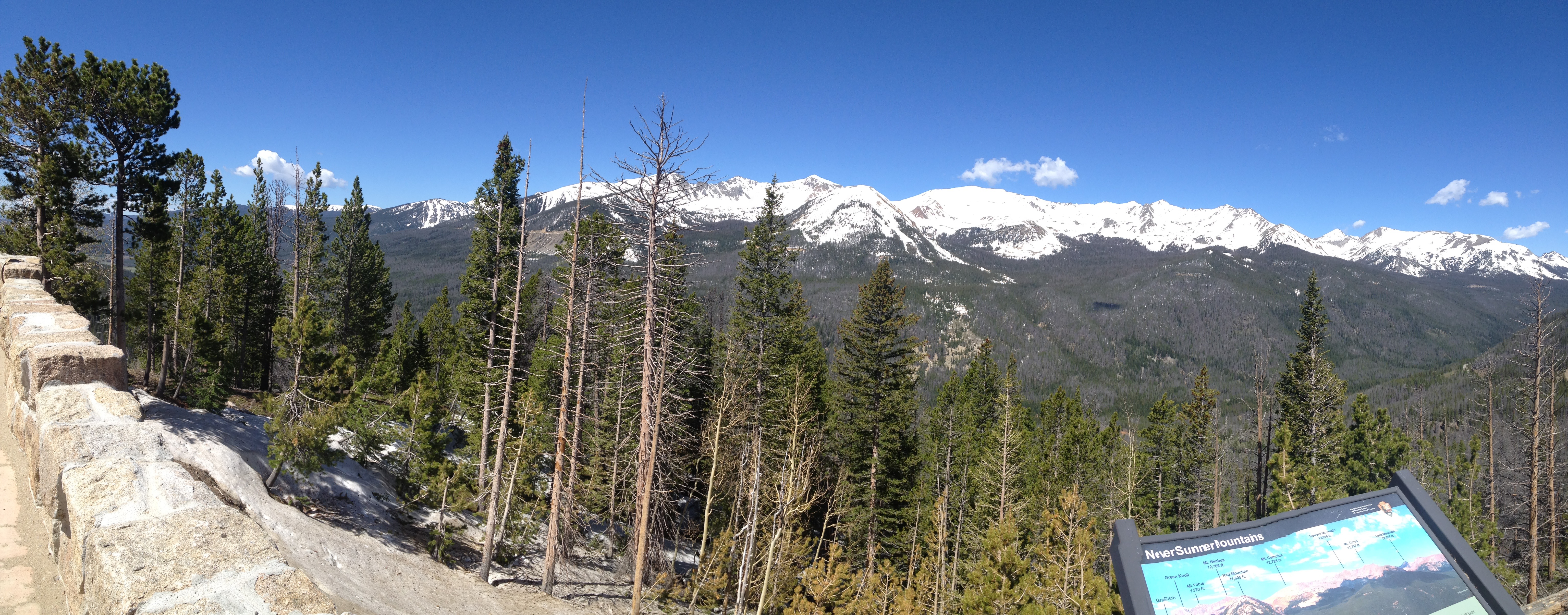
US-34, also known as Trail Ridge Road, takes us to dizzying heights. With a maximum elevation of 12,183 feet near Fall River Pass, Trail Ridge Road is the highest continuous paved road in the U.S. A continuous paved road is one that doesn’t simply doesn’t end at a summit, resulting in a turnaround to head back down. The road is considered continuous because it, um, continues.
For comparison purposes, the highest continuous paved road in the world is the Karakoram Highway, connecting China and Pakistan through the Khunjerab Pass in the Karakoram mountain range. The highway opened to the public in 1986; it reaches 15,397 feet in elevation. In recent years, the Karakoram Highway has become an adventure tourism destination, providing the pathway to expeditions for almost all peaks in Gilgit-Baltistan, including 28,251 foot K2, the Earth’s second highest mountain.
Because of its high elevation and extremely difficult construction, the Karakoram Highway is sometimes referred to as the Eighth Wonder of the World. The highway took 20 years to complete – and in the process, more than 800 Pakistanis and 200 Chinese workers lost their lives.
***
Let’s get back to the USA, in the state of Colorado, in Grand County, near the town of Grand Lake. That’s where we’re about to arrive at Rocky Mountain National Park’s western entrance.
From the Kawuneeche Visitor Center at the entrance to Rocky Mountain National Park, Trail Ridge Road follows the North Fork of the Colorado River through the Kawuneeche Valley.
Trail Ridge Road runs 48 miles from Grand Lake to Estes Park. The road crosses the Continental Divide at Milner Pass (10,758 feet). As you might guess, it is closed during the winter. Trail Ridge Road usually opens in late May.
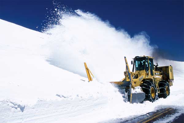
National Park Service plow operators normally begin clearing the snow in mid-April, with crews from the west side of the park and crews from the east side of the park eventually meeting at the Alpine Visitor Center – 11,796 feet above sea level. That Visitor Center is the highest in the National Park System. It’s not easy being a snowplow operator on this road; snowdrifts often are up to 22 feet deep.
The road takes us through Rocky Mountain National Park. The park headquarters, Beaver Meadows Visitor Center, is a National Historic Landmark, designed by the Frank Lloyd Wright School of Architecture at Taliesin West in Scottsdale, Arizona.
We arrive in Estes Park at the eastern end of Rocky Mountain National Park. The town is named after Missouri native Joel Estes, who founded the community in 1859, then moved his family there four years later.
To learn more about Rocky Mountain National Park, click here.
***
From Estes Park, we head south on CO-7 for about 20 miles. To our right, we can see Longs Peak, at 14,255 feet, the highest peak in Rocky Mountain National Park.
We turn south on CO-72, also known as the Peak to Peak Scenic Highway. Established in 1918, it’s Colorado’s oldest Scenic Byway. Its curvy road winds through the Arapaho National Forest, and the Indian Peaks Wilderness Area.
As we ride south, we pass through Nederland, which began as a trading post between Ute Indians and European settlers during the 1850s. Nederland hosts several major events each year, including the NedFest, the historical Miners Day celebration, and the annual Frozen Dead Guy Days festival. Frozen Dead Guy Days commemorates an attempt by Norwegian immigrant Trygve Bauge to practice cryonics on Bredo Morstoel, his deceased grandfather. Uff da!
From Nederland, it’s only a 15-mile drive east on Boulder Canyon Drive to Boulder, home of the University of Colorado. The last time I was in Boulder, in 1970, I had a burger, fries and a beer at a restaurant called The Sink. At the time, you could drink so-called 3.2 percent (by weight) beer in Colorado at age 18. The Sink is still there. President Obama dropped by in 2012, and noted foodie Anthony Bourdain checked it out in 2013. If you want to visit The Sink, click here.
***
Continuing south on CO-119 to Central City, we turn onto the Central City Parkway, which leads us to I-70. From here, it’s just a few miles on the Interstate to Idaho Springs, elevation 7,526.
Idaho Springs has several Hollywood connections. Scenes from the 2008 film, The Overbrook Brothers, were shot here. And, the 1970 film, Downhill Racer, portrayed an alpine ski racer from Idaho Springs, played by Robert Redford. A brief scene was shot on location here. Other Downhill Racer filming locations included Kitzbuhel, Austria; Wengen, Switzerland; Grenoble, France; and Boulder, Colorado. Click here to see the Downhill Racer trailer, including a much younger Redford, Gene Hackman and Camilla Sparv.
We don’t stay long in Idaho Springs. After just a few miles on I-70, we turn off onto CO-103, which takes us in the direction of one of Colorado’s 14ers – Mount Evans. The mountain is named after John Evans, second governor of the Colorado Territory from 1862 to 1865.
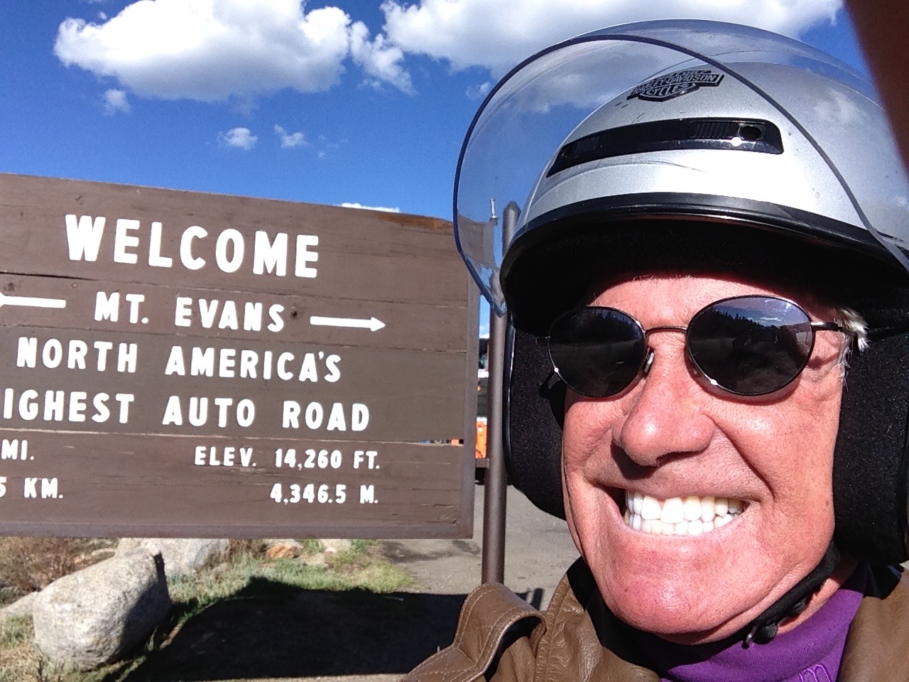
Mount Evans rises to 14,265 feet, and dominates the Denver metropolitan area skyline, rising more than 9,000 feet above the Mile-High City. Mount Evans is 31 miles west of Denver, as the crow flies. Trip Advisor identifies 135 attractions in the Denver area, and ranks Mount Evans at the very top of the list. Perhaps we should take a closer look.
As we approach the Mount Evans welcome center, I’m secretly hoping it’ll start snowing, or blowing ferociously, or otherwise keeping me down here where it’s safe, comfortable and not the least bit threatening.
We arrive at the welcome center, and the Forest Service ranger discourages us from going up. Yessss! “I’ve been waving off bikers all day,” he tells us. “It’s been blowing 30-40 miles an hour and I don’t recommend riding up the mountain in those conditions.”
All of a sudden, the wind calms and my excuse goes away. The skies are blue, the road is dry, and I no longer have a reasonable excuse for NOT going up Mount Evans.
So we fire up the Harleys and roar up the mountain.
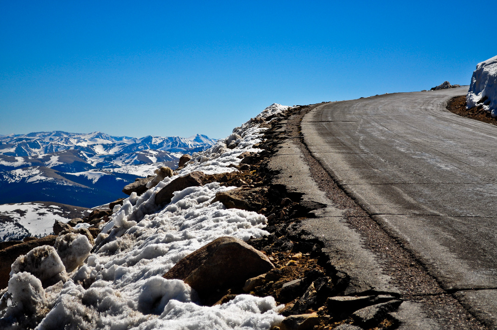
Thirteen miles of climbing on CO-103 takes us past Echo Lake Park, where we turn onto CO-5 for another 14 miles, as we appear to be riding directly into the sky.
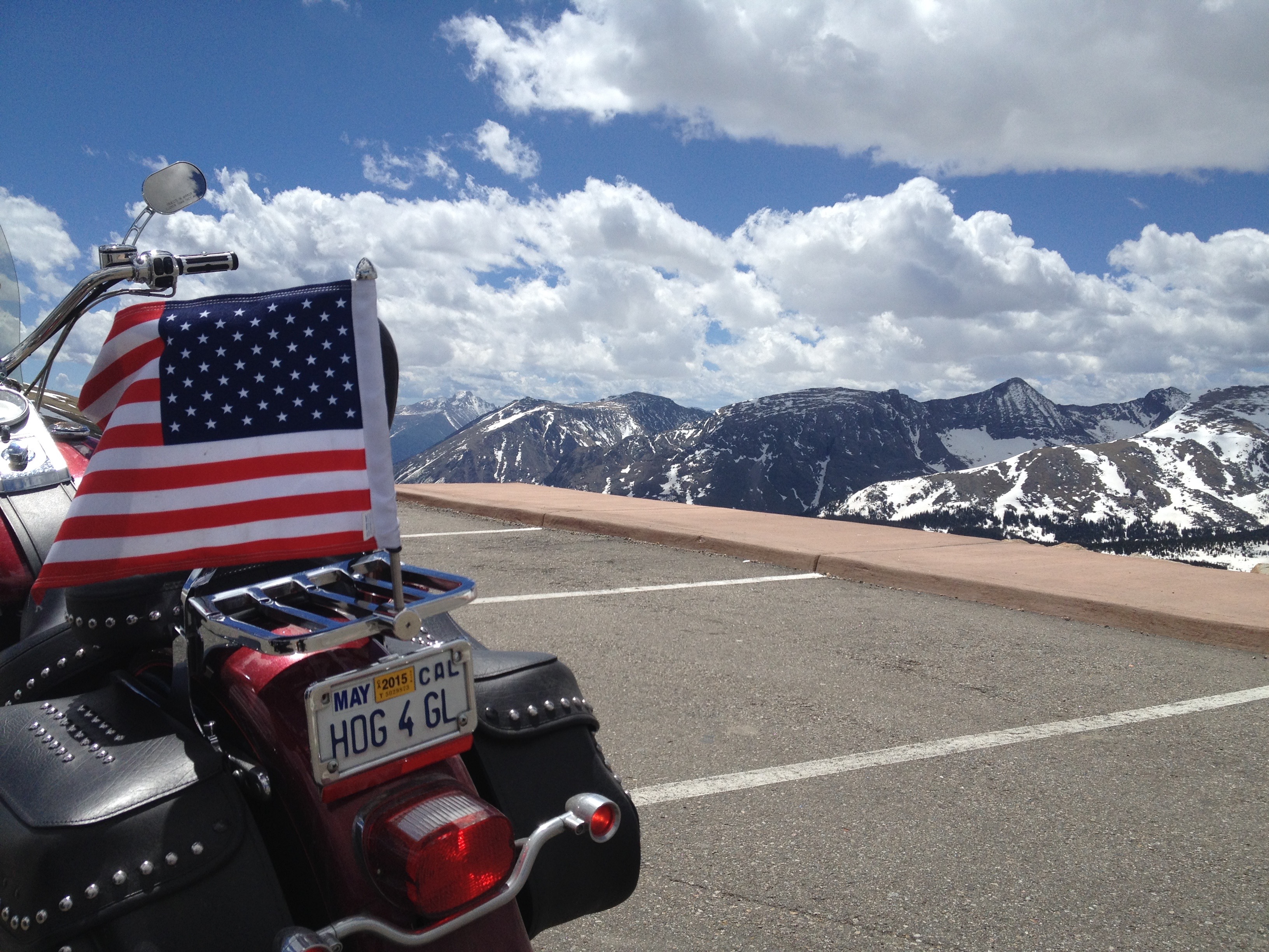
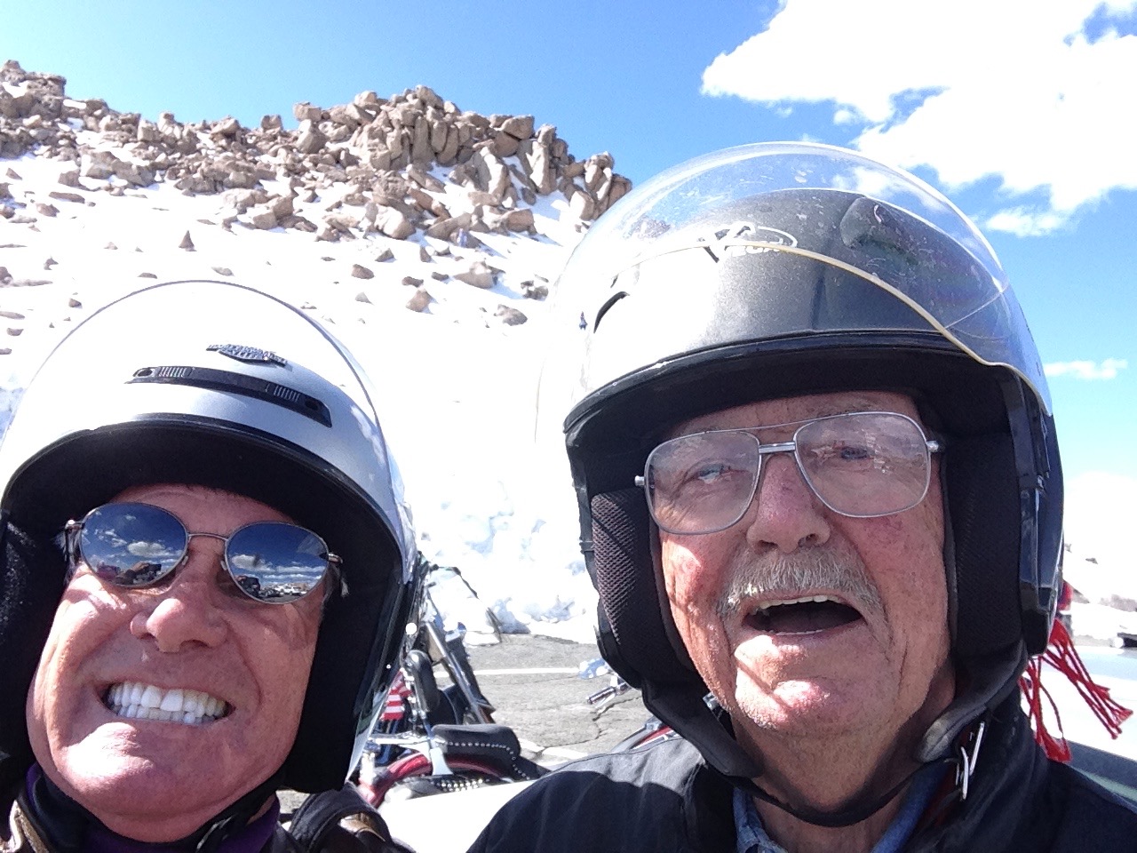
We are now on the Mount Evans Scenic Byway, riding toward the top of Mount Evans. Our Harleys climb this road to a final elevation of 14,130 feet – the highest paved road in North America! The road takes us within 135 vertical feet of the summit.
I am tense all the way to the summit, but feel a great sense of accomplishment and exhilaration once we reach the parking lot at 14,130 feet. Despite my misgivings, I’ll have to say the ride to the top was worth the stress. Who, among you, can say you’ve ridden to the top of Mount Evans?
We’re almost half as high as the summit of 29,029 foot Mount Everest. OK, to be precise, we’re 48.675%25 as high. Still, it feels like we’re at the top of the world. It’s as high as you can get on a Harley, if you’re riding from La Quinta, California.
Interesting aside: while riding a Harley to the top of Mount Everest is out of the question, a 46-year-old New York man two years ago attempted to take his bicycle to the top of the world. It’s a pretty strange idea, even more silly than riding a Harley up Mount Evans. Click here to read Outside magazine’s story of the bicycle-up-Everest journey.
***
As you might expect, the Mount Evans Scenic Byway is strictly a summer time ride. The road generally opens around Memorial Day; the Colorado Department of Transportation closes the top five miles after Labor Day, and shuts down the rest of the road after the first “significant snowfall,” or the first weekend in October – whichever comes first.
You may recall that earlier today, we rode Trail Ridge Road, the highest continuous paved road in the U.S, and now we’re on the absolute highest paved road in North America. That’s a pretty awesome daily double! We are truly as high as you can get without riding on dirt or snow – or being on drugs.
From Mount Evans, the view is breathtaking.
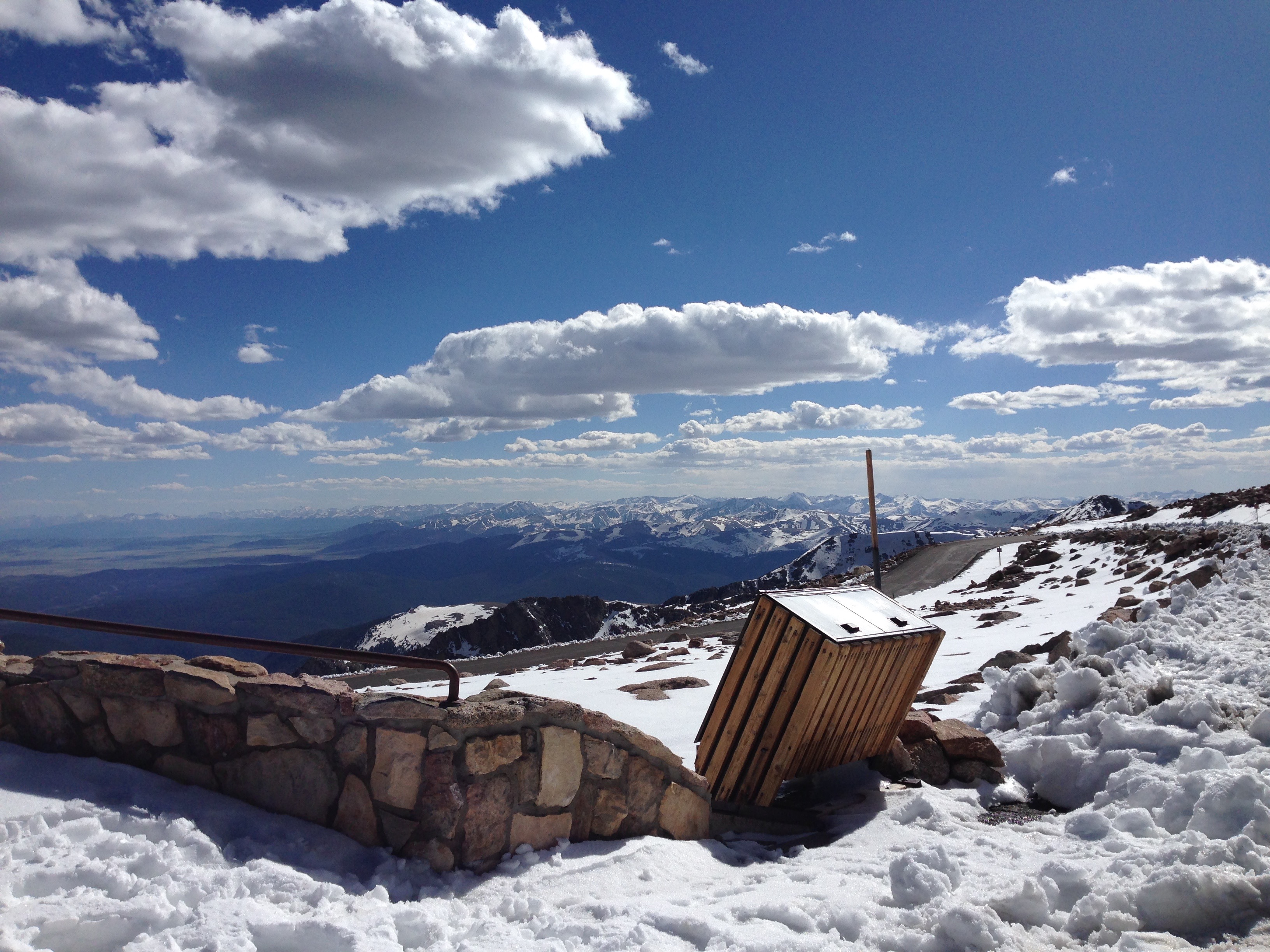
And the air is thin. There’s considerably less oxygen up here than most of us are accustomed to. About 20 percent of people will experience symptoms of altitude sickness above 8,000 feet. We are considerably higher than that. There’s a big sign near the summit of Mount Evans, warning of the risks of altitude sickness.
Acute Mountain Sickness is the most common unhealthy response to altitude. It’s a collection of signs that your body is becoming ill and has not adapted successfully to a higher altitude. Symptoms include fatigue, dizziness, loss of appetite, nausea or vomiting, confusion, and difficulty walking. The single most important factor in reducing forms of altitude sickness is descending toward sea level.
On that note, we should consider returning to a lower elevation, which seems rather obvious, since there is no higher possible elevation.
Other than the stress of riding to the summit, I feel fine. No mountain ill effects at all.
Even though we feel fine, we’ve been on the road since early this morning and we’re ready to call it a day. We head back toward Idaho Springs, 6,600 feet below us. It’s a 27-mile ride down the mountain to Idaho Springs, a one-hour descent. From there, it’s 35 miles to Silverthorne, mostly on I-70.
***
Today was another loop day, but so much more than that. I now understand why Rocky Mountain National Park is Ray’s all-time favorite ride. It takes your breath away, in every possible way.
Day Eleven Summary: Historic US-40, on a rampage in Granby, getting high on a Harley, Robert Redford makes a cameo appearance.
Click here to view today’s route from Silverthorne to Rocky Mountain National Park, Mount Evans, and back.
What will tomorrow bring?
