Our first National Park of the day is Capitol Reef, which we enter just eight miles east of our Torrey motel.
Capitol Reef National Park was established in 1971. It has 241,904 acres of colorful canyons, ridges, cliffs, towers, arches, buttes and monoliths. The area is named for a line of white domes and cliffs of Navajo Sandstone, each of which looks a bit like the U.S. Capitol building. The local word “reef” refers to any rocky barrier to travel.
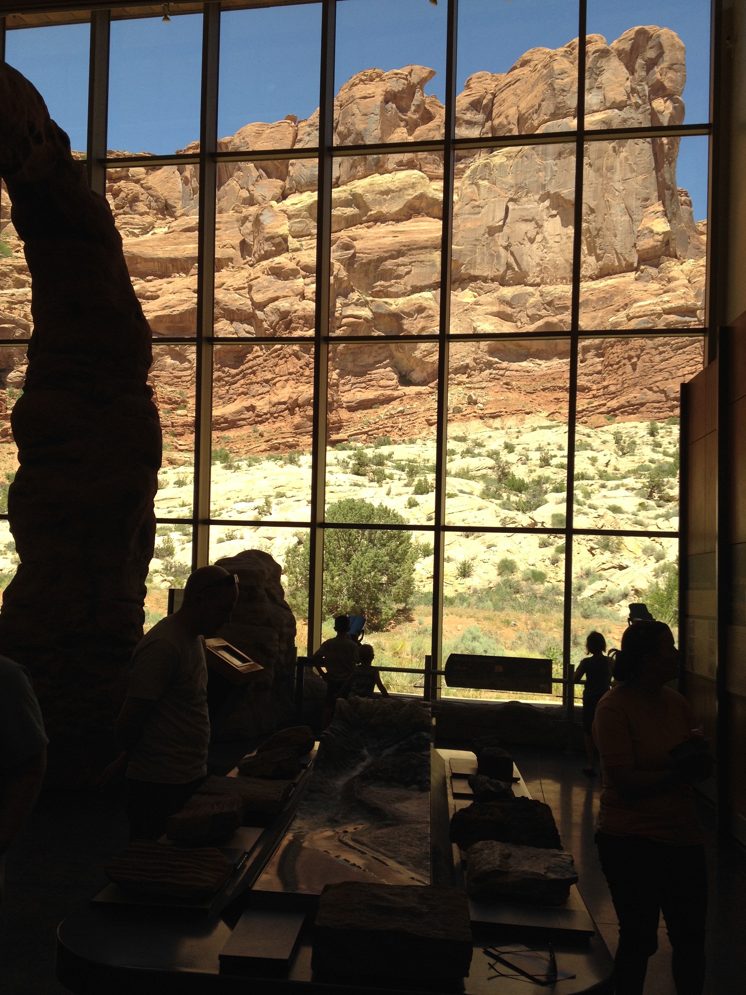
Capitol Reef is a beautiful landscape of multi-hued rock layers. You see geologic formations of the Waterpocket Fold and Cathedral Valley, archeological evidence of the ancient Fremont culture, vestiges of a historic Mormon settlement, and a range of habitats for plants and animals.
Because UT-24 is the main east-west road through the park, there’s no toll to ride through much of Capitol Reef – unless you’re traveling on Scenic Drive south of the Fruita Campground. We are just passing through.
We barely notice Fruita, the best-known settlement in Capitol Reef. Fruita, at the confluence of the Fremont River and Sulphur Creek, was established in 1880 under the name Junction. It became known as Fruita around 1902, in large part because of its productive fruit orchards. (In a few days, we’ll visit Fruita, Colorado, too.)
The town was abandoned in 1955 when the National Park Service purchased Fruita to be included in Capitol Reef National Park. Today, few buildings remain, except for a restored one-room schoolhouse. The orchards are still here, now under the ownership of the National Park Service, and have about 3,100 trees – including cherry, apricot, peach, pear, apple, plum, mulberry, almond and walnut. Visitors to the park are welcome to stroll in any unlocked orchard and consume ripe fruit.
Click here to learn more about Capitol Reef National Park:
***
We stay on UT-24 for 92 miles, following the Fremont River as it winds from Torrey toward Hanksville.
Hanksville, elevation 4,295 feet, is just south of the confluence of the Fremont River and Muddy Creek. Together, they form the Dirty Devil River, which then flows southeast to the Colorado River. There’s little in Hanksville today, except a few service stations and the Hanksville Inn — which has a “No Vacancy” sign in use.
Hanksville got its name in 1985, named after Ebenezer Hanks, leader of a group of Mormon pioneers who established a small settlement here. It may be best known as a supply post for Butch Cassidy and the Wild Bunch, who would hide out at Robbers Roost in the desert southeast of town. Butch and his bunch were popularized by the 1969 movie, Butch Cassidy and the Sundance Kid, starring Robert Redford, Paul Newman and Katharine Ross. Click here to see the trailer for one of the American West’s original buddy films.
We have no reason to hide from the law, so we continue on UT-24, past Goblin Valley State Park, which has thousands of hoodoos and hoodoo rocks. Hoodoo rocks! Or, grammatically speaking, should I say, hoodoos rock?
***
We continue on UT-24, with barely a curve in the road, until after an hour or so, it meets up with I-70. We jump on the Interstate for 33 miles, crossing the Green River, as well as its namesake city, Green River. The Green River is a tributary of the Colorado River.
And, as a musical aside – “Green River” is yet another John Fogerty song, originally released in 1969. Fogerty’s Green River was in California, and its real name was Putah Creek. Need another musical interlude? Click here to visit the Green River.
***
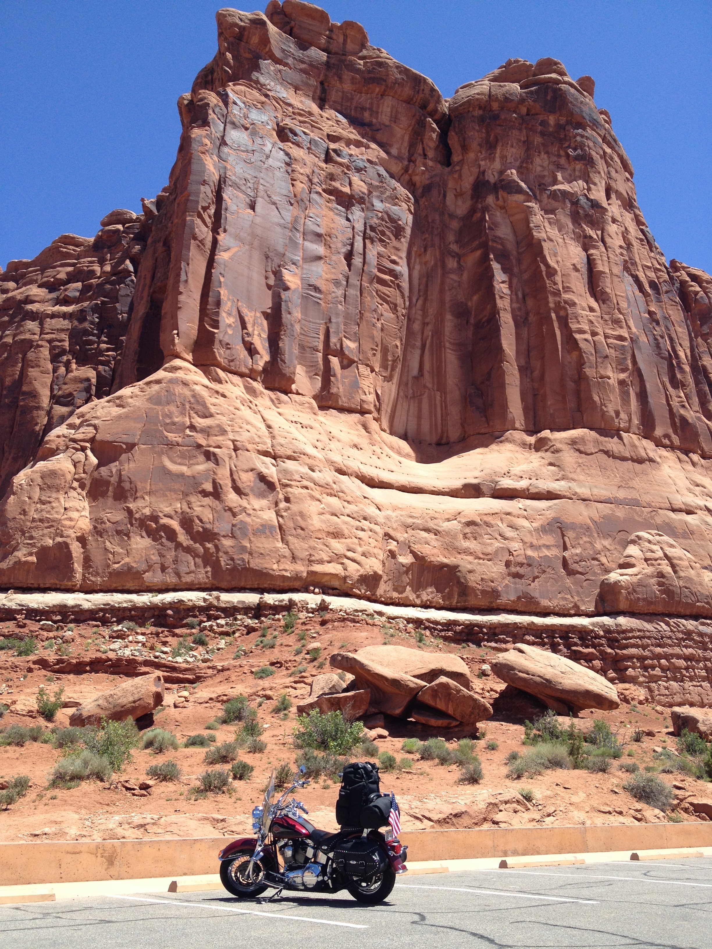
At the intersection of US-191, we turn south and ride the 31 remaining miles to Moab, Utah.
En route to Moab, we pass the turnoff to Canyonlands National Park, one of the few National Parks in the Mountain West we skip on this trip. As we near Moab, we also pass by the entrance to Arches National Park.
Moab is a Biblical name, referring to an area of land located on the eastern side of the Jordan River.
There are two schools of thought about how the city of Moab got its name. In one, historians think the city in Utah came to use the name because the postmaster believed that the biblical Moab and this part of Utah were both “the far country.” Others believe the name has Paiute origins, referring to the word “moapa,” meaning mosquito.
Either way, Moab is known for its outdoor recreation opportunities, including four-wheeling, whitewater rafting and kayaking on the Colorado River, canoeing on the Green River, mountain biking, rock climbing, BASE jumping and slacklining. If you can’t find something to do in Moab, you’re not trying very hard.
At 4,026 feet elevation, Moab is considered high desert. It has an arid climate, characterized by hot summers and cool winters.
Even if you haven’t been to Moab, you’ve probably seen it on TV, and in the movies. Here are some of the movies that were shot in or near Moab: Stagecoach, Indiana Jones and the Last Crusade, Thelma and Louise, City Slickers II, and Riders of the Purple Sage.
The world’s largest rope swing isn’t far from here, at the 105-foot Corona Arch. You gotta check it out, as about 23 million other YouTubers have. Click here to take a swing on Corona Arch.
Don’t try this at home.
It’s called “pendulum swinging,” and it can be quite dangerous. A 22-year-old Utah man died last year trying the rope swing, when he miscalculated the length of his rope. He made the rope too long, and when he jumped off Corona Arch, he ended up diving into the ground. Fatal face plant. Ouch.
***
Danger isn’t my thing.
As you may recall from previous blogs, I ride like Grandma, which explains, in part, why I’ve had 40 years of riding experience and tens of thousands of miles – with no mis-haps.
Five miles before Moab, we arrive at the Park entrance. Arches is home to Delicate Arch, the most recognized and photographed Arch in the park – and the artwork for Utah automobile license plates. Delicate Arch, formed of Entrada Sandstone, is a symbol for Utah.
Noted writer Edward Abbey was a park ranger at Arches National Monument, where he kept journals that became his book, Desert Solitaire. He said of Delicate Arch’s significance: “It lies in the power of the odd and unexpected to startle the senses and surprise the mind out of their ruts of habit, to compel us into a reawakened awareness of the wonderful – that which is full of wonder.”
Arches has the largest concentration of natural stone arches in the world — more than 2,000. To qualify as an official stone arch, a hole must have an opening at least three feet long in any one direction. There is no requirement for width, though. Quite a few of the arches in the park are so skinny you have to look carefully to see any light through them.
The park has arches, windows, bridges, hoodoos, spires and towers, all descriptive names given to sandstone features visible in the park.
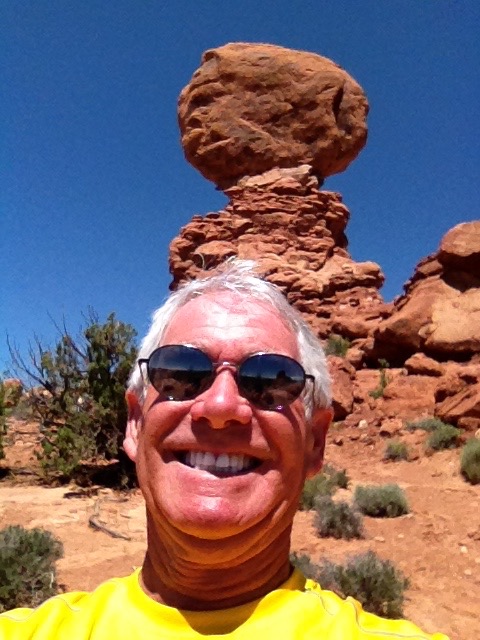
Among Arches’ many well-known rock features are Balanced Rock, Courthouse Towers, Double Arch, Landscape Arch and Wall Arch, and Skyline Arch. There are viewpoints to see many of these Arches. Ray and I check out as many as time allows.
The park was created as a National Monument in 1929, then re-designated as a National Park in 1971.
Click here to learn more about Arches National Park.
***
A quick aside about my writing/typing: several of you eagle-eyed blog readers have pointed out an occasional typo or non-sensical word, phrase or sentence construction.
OK, I’ll fess up. Pounding out blog posts and photo captions at the end of a long day is more fraught with error possibilities than I expected.
The ever-vigilant Eldon McBride noticed yesterday’s big boo-boo: “quacking aspens.” What I meant was “quaking aspens.” Who knew?
Apple’s autocorrect function sometimes has a way of out-thinking users like me. Aargh!
So apologies, in advance, for other egregious typographical errors that may pop up over the next 12 days. As some of you pride yourselves in finding these mistakes and notifying me of them, please don’t be shy about correcting me. As Hemingway (or some literary person) said, “every writer needs an editor.”
***
Day Six Summary: Riding in the shadow of Ebenezer Hanks, rope-swinging Corona Arch, Hollywood comes to Moab, rocking out in Arches National Park.
Click here to view today’s route from Torrey to Moab.
What will tomorrow bring?
