***
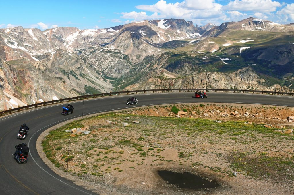
I’ve ridden the Beartooth Pass Scenic Highway three times. One year, I rode it each direction, same trip, two days in a row. Rained like crazy both days. Ugh. And yet, it is Number Two on my Top Ten list. It’s that awesome. (My third time was a charm: sunny skies.)
The name “Beartooth” comes from a Crow name, Na Piet Say, meaning “the bear’s tooth” and refers to a sharp spire that juts from the Beartooth plateau. The Beartooths are the location of Granite Peak, which at 12,807 feet, is the highest point in the state of Montana.
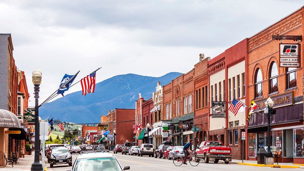
The ride over Beartooth Pass and onto Chief Joseph Scenic Byway begins in Red Lodge, Montana. Elevation here is 5,588 feet.
On September 17, 1851, the United States government signed a treaty with the Crow Nation, ceding the area that now contains Red Lodge, to the Crow Indians. An 1880 treaty between the US government and the Crow allowed the area to be settled, starting April 11, 1882.
For the Crow Indians, Red Lodge was a place of worship and hunting. They painted their council tepee with red clay. Folklore tells us this tradition gave Red Lodge its name.
In 2015, Red Lodge was named one of the top 10 ski towns in America (seven of the 10 are in Colorado!). Red Lodge is a great ski town — not because of the Beartooth Basin Summer Racing Camp — more on that below — but because of Red Lodge Mountain, just six miles from town.
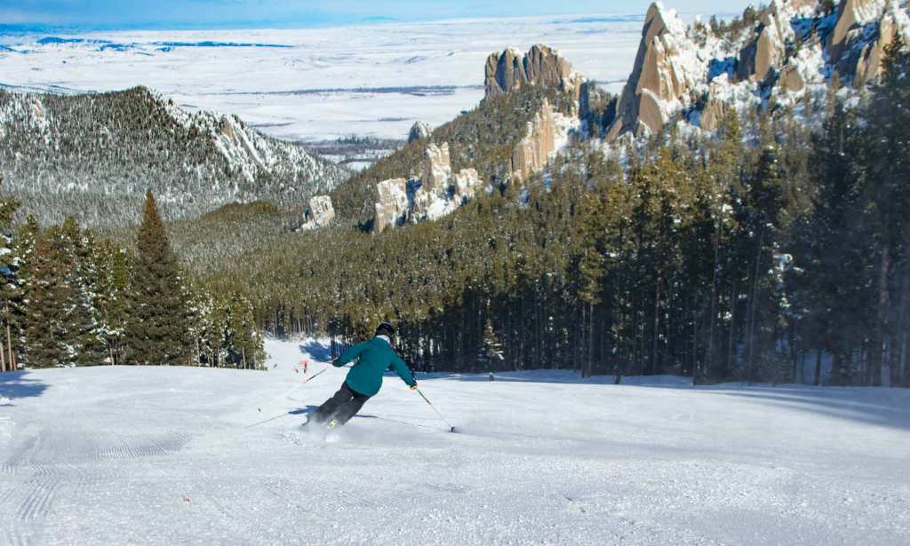
Red Lodge Mountain is well known for its friendly, small-town personality and its no-attitude approach to skiing.
Red Lodge Mountain officially opened in 1960 with one chairlift and three runs. It was then called Grizzly Peak. Today, it has six chairlifts and a vertical rise of about 2,000 feet to the summit of Grizzly Peak. You can get a full-day lift ticket for $69. It’s only $29 if you’re a child, between 6 and 12 years old. An all-day pass for Super Seniors (like me!) is $24.
Leaving Red Lodge, the road immediately climbs, and quite steeply. In 5,000 feet, we’ll be at Rock Creek Vista Point. Great spot to fire off some high elevation photos.
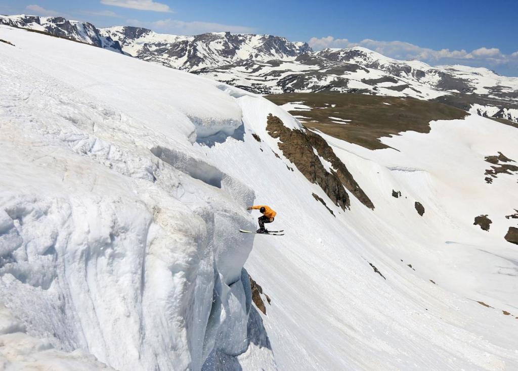
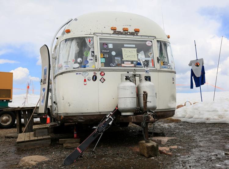
Then, after seven more miles of climbing, we pass the Beartooth Basin Summer Ski Area. Yes, summer ski area. It’s in Wyoming, just a few miles south of the Montana border.
Beartooth Basin is the lone ski area in North America that is open only in the summer. It’s generally skiable from late May through early July — a six-week season, if road conditions cooperate. Because the Bearthooth Highway is closed in the winter, you couldn’t access this ski area in winters, even if you wanted to.
Formerly known as Red Lodge International Summer Racing Camp, Beartooth Basin is one of North America’s oldest alpine ski training areas. Historically the Basin was a summer destination for alpine racing athletes, operated as a private camp.
The summer racing camp was established in the mid-1960s by Austrian ski racing legends Pepi Gramshammer, Erich Sailer and Anderl Molterer. For 25 summers here on the Beartooth Highway, the Austrians coached as many as eight thousand youngsters from all over the United States and around the world.
Ownership changed in 2003, when an adventurous group of locals from nearby Red Lodge invested in the race camp and opened the door to a younger generation of skiing enthusiasts.
Today, the ski area is staffed with professional ski patrol and lift attendants, like many other ski areas. Unlike most other ski areas, there is no lodge. No warming hut. No retail. You could call it backcountry skiing with a lift.
The summer-only ski area includes 600 acres of terrain that vary in pitch from 15 degrees to 50 degrees. That’s ridiculously steep! Anything over 45 degrees is considered a controlled free fall. Don’t try this at home.
The locally owned and operated Beartooth Basin Summer Ski Area is served by two platter lifts. Its isolation is both a blessing and a curse. The location keeps things local, obscure, and offers up some incredible views. It also causes access issues and creates increased costs.
Beartooth Basin faces steep economic challenges — aging infrastructure, high equipment costs, costly insurance policies, and major engineering inspections on top of the unique challenge of its remote location. To preserve this unique western skiing experience for future generations, the ski area’s owners in 2019 launched a crowdfunding campaign to raise funds in an effort to keep the place alive.
Said the resort management in a Facebook post: “We enjoy being owned and operated by local ski enthusiasts, and not some big corporate entity. We would rather measure success in smiles than the bottom line.” The Kickstarter campaign sought contributions to support lift maintenance, insurance costs, fuel, snow surface maintenance, and terrain expansion. Looking to buy a ski area? Bearooth Basin is currently for sale. Owners are looking for a buyers who share their vision for the ski area as an independent, community-based operation.
Sadly, due to lack of snow, the ski area cancelled its 2024 season. It was the second time in four years this has happened. Beartooth Basin has had a rough go of it in recent years. They experienced significant mechanical issues with their surface lifts in 2021, did not open in 2022 due to low snowfall, and were forced to close early in 2023 due uncooperative weather.
Beartooth Basin was back in business for the 2025 season, opening on May 28, and remaining open through June 15. #NeverSummer
Soon, you’ll see the Top of The World Store, one of the few reminders of civilization along the Beartooth Highway. Here, you can get groceries, gas, and most importantly, a Wyoming fishing license. Never know when you’re gonna have an insatiable desire to drop a line and catch a trout. Even at 9,400 feet above sea level.
Each year, the Wyoming Game and Fish department stocks nearby Beartooth Lake with nearly 6,000 trout – half rainbow and half cutthroat. The lake, which sits at 8,900 feet, is a [popular destination for fishing, boating, camping, hiking and backpacking.
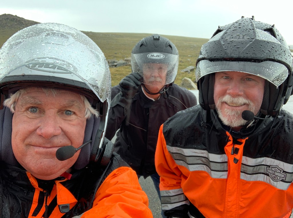
All along the Beartooth Highway, it’s not uncommon for August snowstorms to roll through. In the summer (now!), temperatures can range from the 70s on sunny days to below freezing during sudden snowstorms. Riders should be prepared for just about anything. Fingers crossed.
Thirty-nine miles from Red Lodge, you turn off of the Beartooth Highway and on to Wyoming Highway 296, which soon becomes the Chief Joseph Scenic Byway.
The scenic byway runs a total of 46 miles through magical Sunlight Basin, along the Clark’s Fork of Yellowstone River. The road closely follows the path taken by the Nez Perce as they fled the US Cavalry in 1877. Several historical and interpretative signs along the road provide more information about the flight of the Nez Perce.
The Chief Joseph Scenic Byway is named after the Native American chief of the Nez Perce Tribe. Following the Battle of the Big Hole in Montana in 1877, Chief Joseph fled east through Yellowstone. He and 1,000 members of his tribe ran from the US Cavalry, who were trying to force the tribe onto a reservation so that white ranchers could have their lands. The tribe was stopped only 30 miles from its destination, the Canadian border.
In his speech of surrender, Chief Joseph expressed dignity and defeat with his famous words, “Hear me, my chiefs; I am tired; my heart is sick and sad. From where the sun now stands, I will fight no more forever.”
Just past a view of 11,300-foot Sugarloaf Mountain, the road makes a series of tight switchbacks and hairpins, culminating at Dead Indian Summit.
Dead Indian Pass, at 8,071 feet, is the highest elevation on the Chief Joseph Highway. From here, the views of the higher peaks of the North Absaroka Mountains are spectacular. We can also see the deep canyon that the Clarks Fork Yellowstone River flows through.
From Dead Indian Pass, it’s 30 miles to Cody, which sits on the banks of the Shoshone River at the western edge of the Bighorn Basin. The city is named after William Frederick Cody — better known as Buffalo Bill — a scout, bison hunter and showman, and one of the most colorful figures of the American Old West.
At one time a 14-year-old rider for the Pony Express, he got the nickname “Buffalo Bill” when he had a contract to supply Kansas Pacific Railroad workers with buffalo meat. He’s purported to have killed 4,282 American bison (commonly known as buffalo) in an 18-month period in the late 1860s. Dude was lethal.
Cody is where the ride ends. From Red Lodge to Cody, the route is 113 miles. The two roads — Beartooth Pass and Chief Joseph Scenic Byway, seamlessly blend together, as if they were a single road.
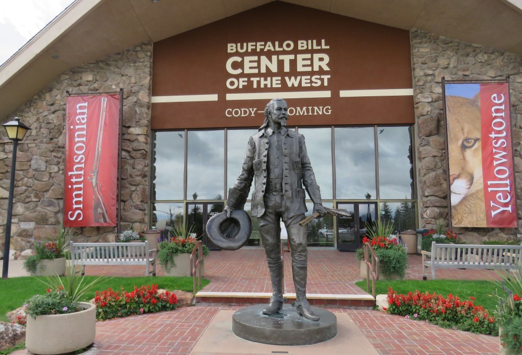
While in Cody, be sure to visit the Buffalo Bill Center of the West. Here, you’ll find the Buffalo Bill Museum, the Plains Indian Museum, the Cody Firearms Museum, the Draper Natural History Museum, and the Whitney Western Art Museum. All for $22. You may never leave.
To explore this route, click here.
